positioning in the pacific islands - unoosa · positioning in the pacific islands ... australia,...
TRANSCRIPT
Positioning in the
Pacific Islands
Andrick Lal
United Nations/Nepal Workshop on the Applications of Global
Navigation Satellite Systems
Kathmandu - Nepal
15th December 2016
• Introduction
• History
• Positioning in the Pacific Islands
• Importance
• Building Capacity & Resilience
• Future Directions
• Pacific Geospatial & Surveying Council
Presentation Outline

SPC Member Countries

SPC Geoscience Division Goal
“to apply geoscience and technology to realise
new opportunities for improving livelihoods of
Pacific communities.”
SPC Headquarters: Noumea. Regional Offices: Suva, Fiji Islands and Pohnpei, Federated States of Micronesia.
Country Office: Honiara, Solomon Islands.
For contact details – Website: www.spc.int Email: [email protected]

Global Geodetic Reference Frame
The UN-GGIM Roadmap…
In February 2015 the UN General Assembly adopted the resolution “A Global Geodetic
Reference Frame for Sustainable Development” - the first resolution recognizing the
importance of a globally-coordinated approach to geodesy.
As per UN Resolution A/69/L.53
In the Pacific…Australia, Fiji, New Zealand, Papua New Guinea, Samoa, Solomon
Islands, Tuvalu, Vanuatu

Postioning Infrastructure
underpins ALL Infrastructure

Topographical Maps and
Hydrographic Charts
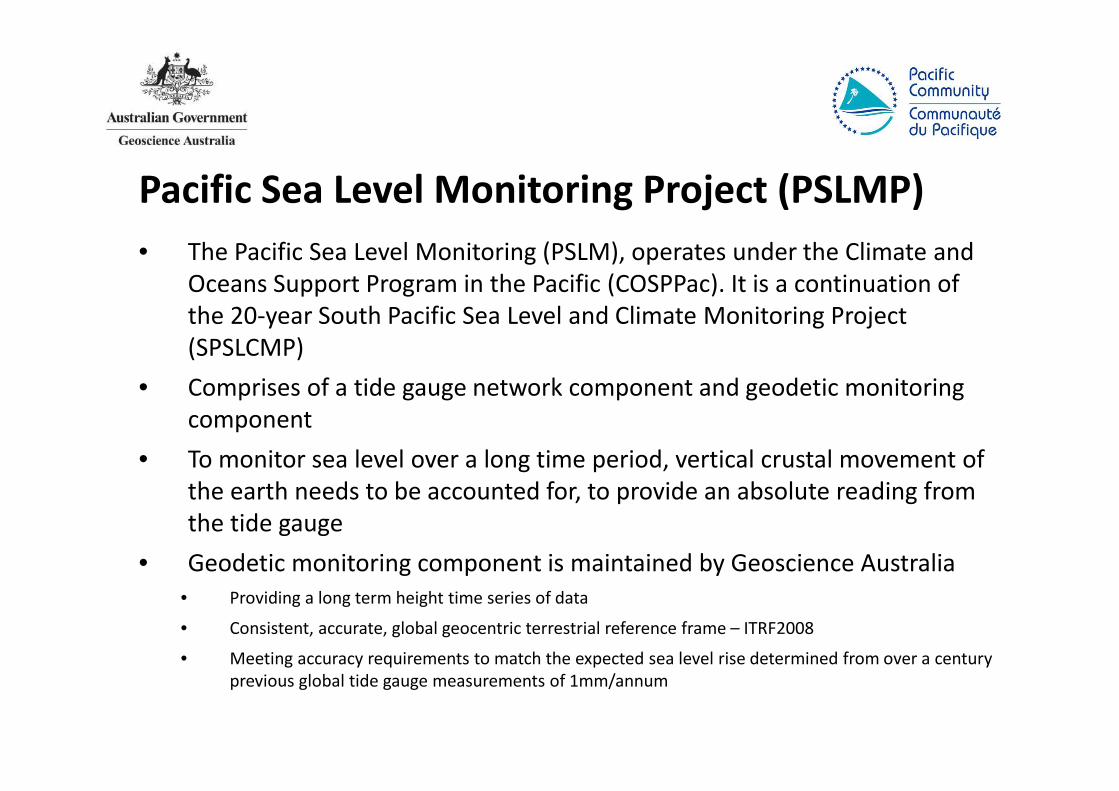
Pacific Sea Level Monitoring Project (PSLMP)
• The Pacific Sea Level Monitoring (PSLM), operates under the Climate and
Oceans Support Program in the Pacific (COSPPac). It is a continuation of
the 20-year South Pacific Sea Level and Climate Monitoring Project
(SPSLCMP)
• Comprises of a tide gauge network component and geodetic monitoring
component
• To monitor sea level over a long time period, vertical crustal movement of
the earth needs to be accounted for, to provide an absolute reading from
the tide gauge
• Geodetic monitoring component is maintained by Geoscience Australia
• Providing a long term height time series of data
• Consistent, accurate, global geocentric terrestrial reference frame – ITRF2008
• Meeting accuracy requirements to match the expected sea level rise determined from over a century
previous global tide gauge measurements of 1mm/annum

Pacific Sea Level Monitoring Project
Tide Gauge Stationhttp://www.bom.gov.au/pacific/projects/pslm/index.shtml
http://www.bom.gov.au/pacific/tuvalu/index.shtml

GNSS Station (CORS) – Lautoka, Fiji.• Established in November 2002; Supported by Survey Department - Fiji
ftp://ftp.ga.gov.au/geodesy-outgoing/gnss/data/
http://auscors.ga.gov.au/status/
http://www.ga.gov.au/scientific-topics/positioning-navigation/geodesy/gnss-networks

13 sites across the pacific
• 1 x permanent tide gauge at each, measuring local sea level
• 1 x Constant GNSS station at each, measuring local earth movement
in an absolute coordinate system
• Regular levelling survey between the tide gauge and CGNSS station
allow absolute determination of the vertical height of the tide
gauges that measure sea level
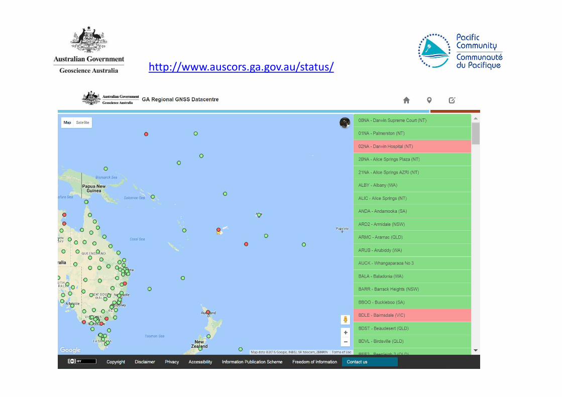
http://www.auscors.ga.gov.au/status/
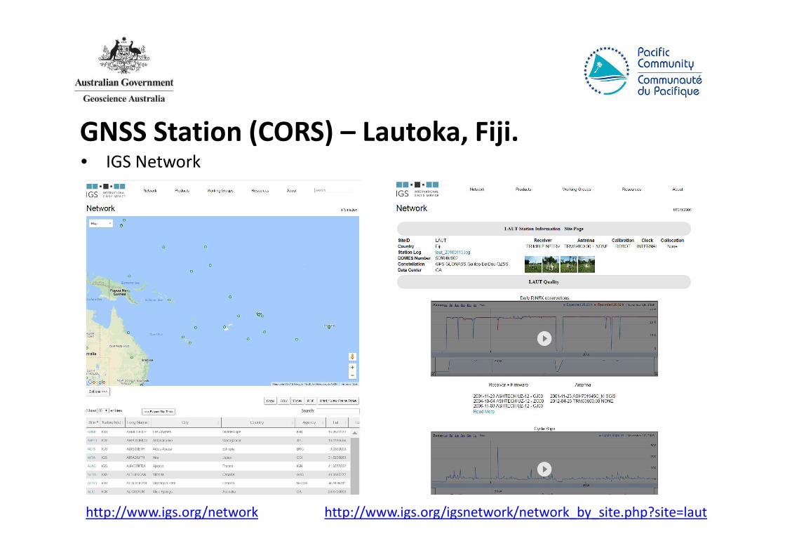
GNSS Station (CORS) – Lautoka, Fiji.• IGS Network
http://www.igs.org/network http://www.igs.org/igsnetwork/network_by_site.php?site=laut

Online GNSS Solutions• AUSPOS, OPUS, PositioNZ, Canadian PPP

July 2002
Maritime Boundaries of the Pacific
Island Countries
Dec 2016

Geodetic Reference Frame - Pacific
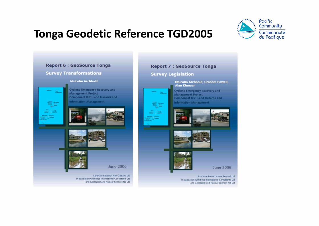
Tonga Geodetic Reference TGD2005
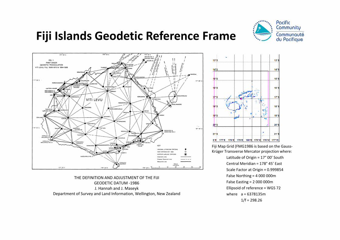
Fiji Islands Geodetic Reference Frame
THE DEFINITION AND ADJUSTMENT OF THE FIJI
GEODETIC DATUM -1986
J. Hannah and J. Maseyk
Department of Survey and Land Information, Wellington, New Zealand
Fiji Map Grid (FMG1986 is based on the Gauss-
Krüger Transverse Mercator projection where:
Latitude of Origin = 17° 00’ South
Central Meridian = 178° 45’ East
Scale Factor at Origin = 0.999854
False Northing = 4 000 000m
False Easting = 2 000 000m
Ellipsoid of reference = WGS 72
where a = 6378135m
1/f = 298.26

GNSS Surveys

Tide Gauge Installation & Tide Watch

Hydrographic Surveys

Topographical Surveys – RTK GNSS

Local Vertical Reference Frame
• A local Constant GNSS site can provide the opportunity to preform accurate baseline
measurements when the user only has 1 geodetic quality GNSS receiver available.
• Having observations from a CORS available will allow local Lands & Survey departments to
update their current network of survey control from a Local coordinate system onto the
International Terrestrial Reference Frame [currently ITRF2008].
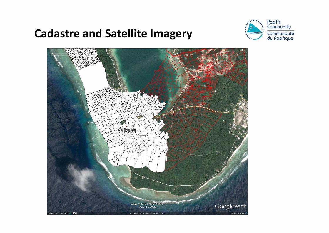
Cadastre and Satellite Imagery

GNSS Surveys – Reference Image Points

GNSS Surveys & Satellite Imagery
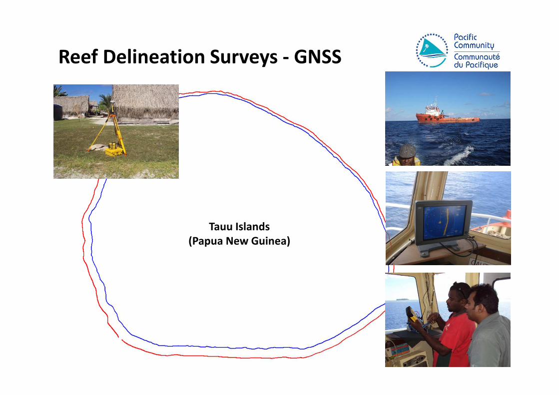
Reef Delineation Surveys - GNSS
Tauu Islands
(Papua New Guinea)

Why it is Important?
• Natural Disasters
• Climate Change
• Sea Level Changes
• Urban Development
• and etc.
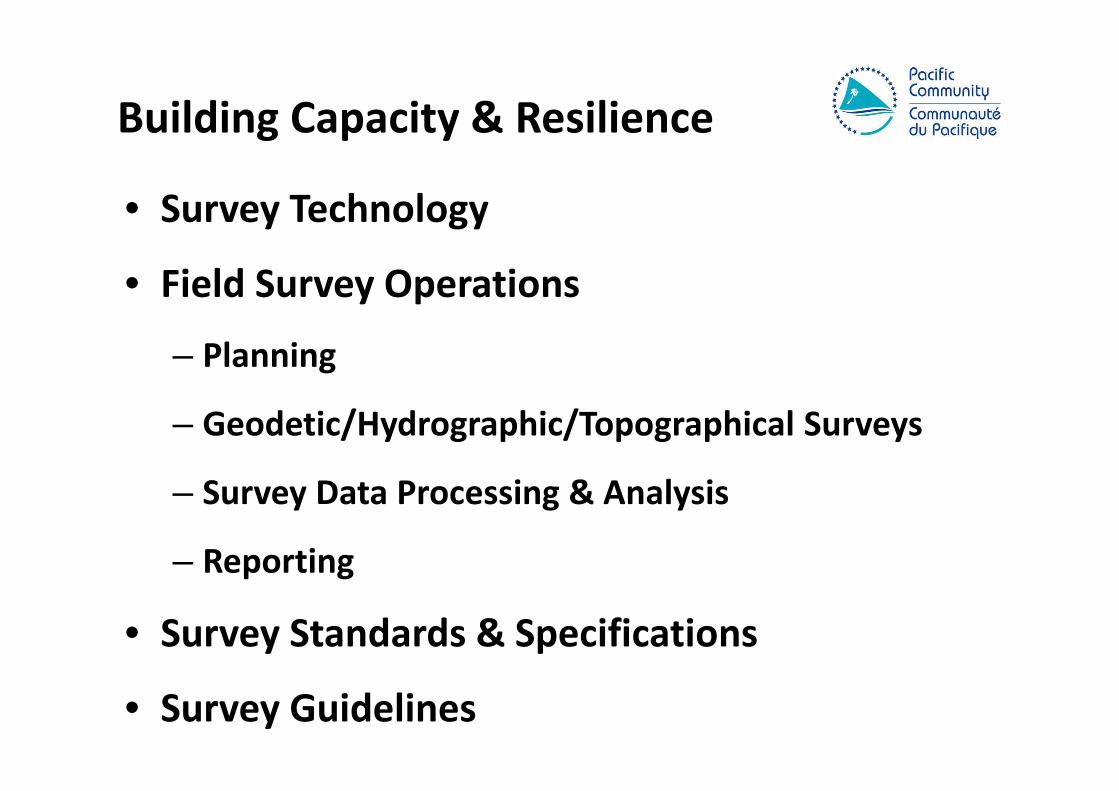
Building Capacity & Resilience
• Survey Technology
• Field Survey Operations
– Planning
– Geodetic/Hydrographic/Topographical Surveys
– Survey Data Processing & Analysis
– Reporting
• Survey Standards & Specifications
• Survey Guidelines

Future Directions
• Geodetic Infrastructure
• Global Geodetic Reference Frame
• Geodetic Registry (Spatial Database)
• Capacity Development for Pacific

• Independent regional body advancing geospatial and surveying standards and capacity
• Established in the margins of the GIS/RS User Conference in November 2014
• Governed by the PGSC Charter endorsed by 11 Pacific Island governments
• Supported by PGSC Partnership Desk (SPC)
For more info, visit: http://gsd.spc.int/pgsc/
Pacific Geospatial & Surveying Council

PGSC Vision
Sustainable development in the Pacific enabled by
world class geospatial information and surveying
services

PGSC Strategy
• 10-year regional plan for
developing geospatial
and surveying capacity
• Collaborative process
• Member ownership

Purpose1. To demonstrate the critical nature of geospatial and surveying information and services and the development and maintenance of these services in the Pacific region;
2. To articulate the collaborative aspirations of the region’s geospatial and surveying professionals in advancing capacity;
3. To guide the development of sustainable geospatial and surveying information and services in Pacific Island Countries & Territories, and;
4. To serve as an entry point for engagement with internal and external partners.
Purpose
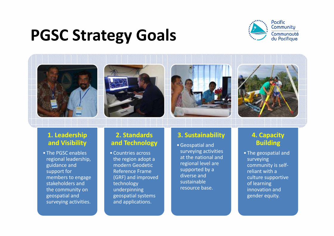
PGSC Strategy Goals
1. Leadership and Visibility
• The PGSC enables regional leadership, guidance and support for members to engage stakeholders and the community on geospatial and surveying activities.
2. Standards and Technology
• Countries across the region adopt a modern Geodetic Reference Frame (GRF) and improved technology underpinning geospatial systems and applications.
3. Sustainability
• Geospatial and surveying activities at the national and regional level are supported by a diverse and sustainable resource base.
4. Capacity Building
• The geospatial and surveying community is self-reliant with a culture supportive of learning innovation and gender equity.

Thank You