planning for pedestrian accessibility at level crossing ... level crossing report 9... · i | p a g...
TRANSCRIPT

i | P a g e
Planning for Pedestrian
Accessibility at Level Crossing
Removals and Railway Stations.
December 2016

ii | P a g e
This report was prepared by Dr David Mepham for Victoria Walks Inc. December 2016. The report analyses level crossing removal and railway station improvement projects, and concept designs for elevated rail on the Cranbourne/Pakenham Line, in Melbourne, to make recommendations to ensure pedestrian accessibility in future projects.
Notwithstanding the consultation undertaken with government agencies in preparing this report, it
is independent of any agency and represents the views of the author and Victoria Walks only.
Victoria Walks Inc. is a walking health promotion charity working to get more Victorians walking
every day. Our vision is for vibrant, supportive and strong neighbourhoods and communities where
people can and do choose to walk wherever possible. Victoria Walks is supported by VicHealth.
Dr David Mepham is the Director of DMC, a Melbourne based consultancy. Previously at the City of
Gold Coast he was 'City Building Manager' for the Gold Coast Light Rail Project, leading planning and
urban design outcomes. He was also the architect of the innovative Gold Coast City Council - City
Parking Plan as the Coordinator Transport Futures. In drafting this report he draws on his interest
and experience in walking, station access and the idea of transit oriented development with a view
to realising attractive station places and more accessible communities.
Email [email protected]
December 2016
© Victoria Walks Inc. Registration No A0052693U
Level &, 225 Bourke Street, Melbourne, Victoria, 3000
P: 03 9662 3975
www.victoriawalks.org.au
Recommended Citation
Mepham D. (2016). Planning for Pedestrian Accessibility at Level Crossings and Railway Stations,
Melbourne, Victoria Walks
Acknowledgements
The author thanks Duane Burtt from Victoria Walks for his invaluable assistance.

iii | P a g e
Table of Contents Executive Summary ............................................................................................................................. 1
1.0 Introduction .................................................................................................................................. 5
2.0 Review of Key Literature ............................................................................................................... 7
2.1 Improving Rail Station Access in Australia ............................................................................... 7
2.2 Victorian Railway Station Design Standard and Guidelines ...................................................... 7
2.3 Victorian Design Review Panel Report Level Crossing Removals – Lessons Learned ............... 8
2.4 Rail Level Crossing Removals – Learnings for Local Government Summary Report ................ 8
2.5 Benefits of Level Crossing Removals – Lessons from Melbourne’s Historical Experience ....... 9
2.6 Pedestrian Access Strategy - A strategy to increase walking for transport in Victoria .......... 10
2.7 Station Users Panel Report - Railway Station Useability Principles ........................................ 10
2.8 LXRA Consultation Outcomes and Submissions Report .......................................................... 11
2.9 LXRA Urban Design Framework ............................................................................................. 12
2.10 Conclusion on Key Literature ................................................................................................ 12
3.0 Accessibility Design Principles..................................................................................................... 13
3.1 Connectivity Analysis .............................................................................................................. 13
3.2 Safety Analysis ........................................................................................................................ 14
3.3 Pedestrian Level of Service Analysis and Footpath Experience .............................................. 14
3.4 Transit Supportive Environment Analysis ............................................................................... 17
4.0 Case Studies of Pedestrian Accessibility ..................................................................................... 19
4.1 Traditional Stations – Balaclava Station and Windsor Station ................................................ 19
4.2 Level Crossing Removal - Anderson Road ............................................................................... 24
4.3 Level Crossing Removal - Taylors Road, Keilor Plains ............................................................. 26
4.4 Trenched Station – Mitcham Station ...................................................................................... 29
4.5 Key Features of the Case Studies ............................................................................................ 31
5.0 Case Study – Carnegie Station .................................................................................................... 33
5.1 Carnegie Station Case Study ................................................................................................... 33
5.2 Carnegie Station and Elevated Rail Concept Design ............................................................... 35
5.3 Conclusion on Carnegie Station and Elevated Rail Concept Design ....................................... 38
6.0 Recommendations for future crossings and stations ................................................................. 39
7.0 Conclusion ................................................................................................................................... 40
References Used in this Report ......................................................................................................... 42

1 | P a g e
Executive Summary
Over the next eight years the Level Crossing Removal Authority (LXRA) will oversee the removal of
50 ‘dangerous and congested’ level crossings across Melbourne, see image E1.1 below. This is one of
the most significant programs of investment in Victoria ($2.4 billion in the 2015-16 budget alone)
and will have a major place-shaping effect across Melbourne. Victoria Walks welcomes this
important transport investment.
The removal of level crossings will involve elevation or trenching of the rail line and associated
stations. In either case there are positive and negative consequences for pedestrian accessibility in
the station precinct.
Victoria Walks commissioned this research report to understand the impact of these projects on
local pedestrian accessibility and to suggest improvements for the planning and design of major
urban rail and stations in the future. The Report is informed by consultations and feedback from a
number of government agencies including the LXRA.
Image E1.1 Level Crossings Proposed for Removal (Source LXRA Urban Design Framework 2016)

2 | P a g e
Literature Review
The key documentation dealing with planning and design for accessibility in station precincts notes
pedestrians as the most valuable but also the most vulnerable of public transport users. Walking to
transit and within the station precinct adds complementary value to local business and the
community. While walking is typically deemed the highest and most important access priority it
attracts minimal investment. This can be contrasted with the significant ‘investment’ in ‘free’ station
parking, favouring a few but often compromising station place quality and walking access.
Design Principles
The literature review informs the development of design principles to enable an evaluation of
pedestrian accessibility in the station precinct. Pedestrian access to transit is complex as the station
is a destination for pedestrians but the station, the rail line, interchange, parking and related traffic
are often impediments to safe and convenient pedestrian accessibility in and around the station.
The design principles selected to evaluate the station place are:
Connectivity – how is the station conveniently accessed by pedestrians?
Safety – does the station precinct contribute to a sense of personal safety?
Pedestrian Level of Service and the footpath experience – is the pedestrian infrastructure
appropriate to the type and level of pedestrian traffic?
Transit Supportive Environment – is the built environment complementary to the station?
Case Studies
The design principles enable an evaluation of pedestrian accessibility at a cross section of level
crossing removals and related station upgrades in Melbourne. These are not LXRA projects. A range
of sites were reviewed and the following were selected for evaluation for this report:
Balaclava and Windsor stations, elevated and trenched stations respectively, are indicative
of traditional stations, achieving a ‘hand in glove’ relationship with their urban
environments.
Anderson Road elevated rail, in Sunshine, has improved traffic flow and speed with a
substantial, albeit much longer, pedestrian crossing.
Taylors Road elevated rail at Keilor Plains, has improved traffic flow and speed but seems to
have compromised local pedestrian connectivity in the walk-up to the station.
Mitcham Station trenched rail has improved local traffic flow and provides a quality at-grade
rail crossing but the trenched corridor creates a barrier to walking beyond the station.
The case studies flag a range of pedestrian accessibility issues for level crossing removals and
associated station upgrades that could have been anticipated and avoided. Major urban rail projects
seem focussed on car access and station parking and this is unnecessarily achieved at the expense of
local pedestrian accessibility and opportunities for complementary features in the station precinct.

3 | P a g e
Elevated Rail and Carnegie Station Concept Design
The review of the LXRA elevated rail concepts, including those for Carnegie Station indicate some
improved urban planning outcomes with a number of benefits, including:
Removing the rail barrier to cross street connections and to connect local communities.
Plans for community and commercial uses in the station environment and rail corridor,
improving social activity and perceptions of safety near the station, especially after hours.
Placing car parking to one side of Carnegie Station rather than surrounding it.
It is notable that for every person currently arriving at Carnegie Station by car, four will have walked.
While the Carnegie Station LXRA concept designs indicate improvements to station access they also
raise concerns. Firstly, the proposed shared paths in the rail corridor are inconsistent with the idea
of the corridor as a significant cycling route and the provision of safe pedestrian amenity. Melbourne
is currently dealing with a legacy of shared paths that have become busy commuter cycling routes
and are correspondingly hostile to walkers. The elevated rail project is set to repeat that mistake.
Secondly, there is a tension between the objective of less road congestion and the provision of a
vibrant, pedestrian friendly ‘Main Street’ environment on the Koornang Road, a designated
‘Pedestrian Priority Area’.1 The removal of the at-grade level crossing is intended to remove
congestion implying increase traffic flow through the vibrant Koornang Road ‘Main Street’. This is
likely to be associated with limitations to formal and informal crossing rights to facilitate traffic flow.
These changes may compromise the ease of local pedestrian movement. Alternatively, the
potentially significant pedestrian and cycling traffic along the rail corridor creates a need for a formal
pedestrian/cycle crossing over Koornang Road on the pedestrian desire line, with reasonable
crossing rights. This may have the effect of slowing traffic and even be a catalyst for the calming of
local traffic and improved pedestrian accessibility in the ‘Main Street’ precinct. In the publicly
available information it is not clear what treatments are proposed, if any to facilitate pedestrians
crossing roads as they walk into the station precinct.
Recommendations
The Report makes five recommendations which may be applied to future projects:
1. Ensure that pedestrian accessibility, with complementary station place outcomes, is a consideration in the choice of viable options for rail projects, e.g. elevated or trenched rail.
2. Develop pedestrian accessibility plans for each project, engaging with local governments early in the project and in line with the accessibility design principles in this Report and the Victorian Government’s ‘Principal Pedestrian Network’ guidelines. The plans should include:
a) Provision of formal pedestrian crossings in the vicinity of stations.
b) Alignment of pedestrian desire lines and pedestrian crossings, including formal crossings where roads intersect with the walking paths along elevated rail corridors.
1 Vicroads - Smart Roads Priority Maps, https://www.vicroads.vic.gov.au/traffic-and-road-use/traffic-management/smartroads

4 | P a g e
c) Where elevated rail provides a new corridor, provide separate walking and cycling paths along the corridor (rather than shared paths) to maximise safety and amenity.
d) Prioritise pedestrian access over vehicles at entry points to stations.
3. Balance investment on station car parking with pedestrian access to station:
a) Provide an independent cost/benefit analysis of station parking.
b) Do not provide additional free car parking beyond existing supply.
c) Investigate options for paid parking at high demand car parks with income to be allocated to fund local place and accessibility planning and improvements.
d) Locate and design park and ride and access roads to avoid conflict with pedestrians.
4. Activate the station environment:
a) Prioritise station land use for commercial and/or community activities with public space.
b) Maximise day/night activating commercial and community uses.
5. Where an open space corridor is created beneath the railway in elevated rail projects:
a) Maximise passive surveillance sightlines into the corridor.
b) Utilise land acquisitions to improve local access and to enhance the corridor experience.
c) Landscape corridor to minimise poor ‘back of house’ – edge of corridor experience.
d) Provide strong walking path cross-connections to adjoining streets.
These recommendations are not only applicable to LXRA. The planning and development of urban
rail projects, which is undertaken by a range of government agencies and private service providers,
should clearly demonstrate the impact of the project on local pedestrian accessibility.
Conclusion
The recommendations seek changes in the planning and delivery of urban rail projects, including
LXRA projects to improve pedestrian accessibility outcomes. Firstly, any change of grade solution
should be clear about how it will enhance local pedestrian access and complementary station place
outcomes. Local pedestrian accessibility planning and infrastructure delivery should be achieved via
collaborative relationships with local councils. Projects should ensure that expenditure on station
accessibility is equitable for different modes, noting the cost/benefit of urban park and ride versus
infrastructure for walking. Responsibility for impacts on the wider station environment, ‘Main Street’
environments and new walk/cycle corridors should be included in the project scope to protect and
enhance pedestrian accessibility and complementary place qualities in the station precinct.
The recommendations in this Report point to a project scope that takes account of project impacts
in the affected community and includes resourcing for investigation, planning and investment in
infrastructure to protect and enhance accessibility for affected local communities along the rail line.

5 | P a g e
1.0 Introduction
The issue of rail level crossings on busy roads has been contentious with safety and congestion being
key concerns. Responding to these concerns, the Victorian Government has committed to the
removal of fifty level crossings over the next eight years. This represents one of the most significant
programs of investment in Victoria with $2.4 billion in the 2015-16 budget alone.
The project objective states:
Removing 50 dangerous and congested level crossings will transform the way people live, work
and travel across metropolitan Melbourne and improve safety for drivers and pedestrians.2
The Age article, “Friends in high places: transport groups back elevated rail plan”, on 7 March 2016,
quotes supporters of the project, including Victoria Walks, who stated "elevating the rail line
provides an opportunity to reconnect the suburbs on either side and allow people to walk between
neighbourhoods".3 Walking is strongly associated with public transport. Victoria Walks supports the
crossing removal program, which will enable greater service frequency into the future.
The elevated rail will provide an enjoyable and visual travel experience for passengers. These issues
are important but they are not the focus of this report, which is focused on pedestrian access issues.
The removal of level crossings is driven by a desire to remove congestion and to increase rail service
efficiency. The project also provides an opportunity to improve local pedestrian accessibility and
complementary station place outcomes. Previous rail upgrades highlight mixed outcomes and may
have unintended consequences which leave pedestrians with less local accessibility.
To minimise these ‘unintended consequences’ this Report considers how major urban rail projects,
such as the LXRA project, impact on the local walk-up environment and the critical ‘Main Street’
connections that often adjoin stations and complement the station and its patronage outcomes.
In summary, the methodology for developing this report involved:
A literature review, focused on the reports and guidelines most directly relevant to level
crossing removal and railway infrastructure improvements in Victoria
Establishing appropriate design principles for railway improvements based on the literature
review
Using those design principles to review a selection of case study stations and levels crossing
removal projects and an example LXRA concept design.
Preparing a series of recommendations to ensure local pedestrian accessibility in future
urban rail projects.
2 Level Crossing Removal Authority - http://levelcrossings.vic.gov.au/ 3 Adam Carey, The Age, ‘Friends in high places: transport groups back elevated rail plan.’ 7 March 2016 http://www.theage.com.au/victoria/sky-rail-on-a-high-as-transport-groups-back-elevated-rail-plan-20160307-gnccpt.html
6 | P a g e
The initial findings of this research were presented and discussed at a meeting of agencies including
LXRA, Public Transport Victoria, VicRoads, the Victorian Planning Authority, Metro Trains and the
Office of the Victorian Government Architect, on the 11th of August 2016. A draft report was
provided to the LXRA, who provided comment on the 25th of October 2016. This report has been
amended to reflect those comments.
A review of key literature highlights significant attention to accessible station design in Australia and
particularly in Melbourne. Typically the subject of accessibility extends well beyond the station to
consider the whole of journey experience but this is often at odds with the tendency to minimise
project scope to an area significantly smaller that the area of project impact.
Design principles for accessible station precincts range from a concern about the station itself to the
wider walk-up area. Four design principles are considered:
1. Connectivity considers the higher level urban form and the way in which it enables, or disables,
pedestrian access to the station.
2. Safety and the perception of safety are shaped by issues ranging from path design through to
the nature of the urban environment.
3. The footpath experience is shaped by the level of traffic relative to the width and condition of
the footpath.
4. The nature of the built environment, is the nature of surrounding land, such as car parking or
alternatively higher density, mixed use development adjoining the station impacting on the
station access experience.
The design principles enable an evaluation of previous level crossing removal projects. It should be
noted that these are not projects undertaken by LXRA. The evaluation serves to highlight some of
the issues that arise with such projects. The lessons from these reviews inform design principles for
level crossing removal and accessible station design which are applied to a review of the LXRA design
for the elevated rail concept design and associated Carnegie station upgrade. Victoria Walks was not
provided with detailed plans to evaluate, beyond the high level concept designs available publicly.
The Report concludes with a series of recommendations and actions to ensure an appropriate level
of pedestrian access in the station precinct for the benefit of the LXRA project, other urban rail
projects and for the benefit of the wider community.
Notwithstanding the consultation undertaken with government agencies, this work is independent
of any agency and the report represents the views of the author and Victoria Walks only.

7 | P a g e
2.0 Review of Key Literature
There is significant research affirming the economic, environmental and social and the health value
of walking.4 There is also research that informs our understanding of the value of pedestrian
accessibility in the station precinct. A summary of the most relevant literature is provided below.
2.1 Improving Rail Station Access in Australia
The Cooperative Research Centre (CRC) for Rail Innovation Report, “Improving Access to Urban
Passenger Rail Stations in Australia” considered Australian case studies. The CRC Report Steering
Committee included representatives from Public Transport Victoria and Metro Trains. The Report
notes that despite the importance of what occurs at the beginning and at the end of the trip, rail
station planning is often limited in scope to the immediate precinct.5
The Report finds half of all trips between home and station and the vast majority of trips between
the station and destination are made on foot. In relation to station access the CRC Report states:
Station access planning should be an integral part of the station development effort,
especially for improving existing facilities and for designing new facilities. Some rail agencies
plan for multi-modal access to their stations, but few have an organised or comprehensive
approach to incorporating the different access modes in their station area planning. In fact,
many agencies do little to actively measure and analyse access mode data. This is perhaps
surprising given the key role that access plays in attracting passengers and generating
ridership to rail at a particular location.6
In relation to this critical gap in the transit planning process the Report notes the work of transit
authorities in the UK (Network Rail), and in the USA (BART, WMATA), and a number of Australian
authorities working to address this critical transit planning issue.
2.2 Victorian Railway Station Design Standard and Guidelines (2011)
The purpose of this Station Design Standard is to ensure the station environment is as “accessible,
safe and enjoyable so far as practicable for passengers and staff”. The guidelines promote walking as
the highest access priority and provide principles to realise this objective.
‘Good Design Principles’ include the following themes - functional, safe, legible, seamless, universally
inclusive, sustainable, engaging, socially responsive, enjoyable and delightful. Walking is realised by
“Supported pedestrian links across transport corridors, pathways and usable public space around
major roads and railway reservations”.7
4 Examples include Victoria Transport Institute - http://www.vtpi.org/walkability.pdf or Heart Foundation https://heartfoundation.org.au/images/uploads/publications/Good-for-business.pdf 5 Improving Access to Urban Passenger Rail Stations in Australia, by Professor Phil Charles and Dr Ronald John Galiza, The University of Queensland, submitted for publication at World Congress on Rail Research 2013. https://www.humanrights.gov.au/sites/default/files/ATTACHMENT%201%20STATION%20ACCESS.pdf 6 Improving Access to Urban Passenger Rail Stations in Australia, P3. 7 Railway Station Design Standard and Guidelines, VRIOGS 002.1, Revision A, March 2011, p22. http://docplayer.net/11232649-Vriogs-002-1-railway-station-design-standard-and-guidelines.html

8 | P a g e
2.3 Victorian Design Review Panel Report Level Crossing Removals – Lessons Learned
(October 2014)
This Report by the Office of the Victorian State Government Architect reviewed five level crossing
removal projects, including reference designs and options. Their ‘Lessons Learned’ include the need
to “Analyse key pedestrian circulation paths and desire lines and consider pedestrian comfort,
legibility and safety”. They note the opportunities for urban renewal and the need to establish a
vision for the site and to consider the “long term opportunities for the place and community at a
broader scale than just the project”.8
2.4 Rail Level Crossing Removals – Learnings for Local Government and Key Agencies
Summary Report (March 2016)
This Report, commissioned by the Metropolitan Transport Forum (MTF), was created to explore and
summarise learnings from level crossing removal projects to assist member councils to best manage
their role in the ongoing roll out of these projects in Melbourne. The Report makes the following
findings on previous projects:
Improved public transport facilities and better accessibility generally were achieved for all
modes;
Traffic flows improved with reduced congestion, but in many cases a complex intersection
has remained with roads more difficult to cross, requiring new pedestrian crossings;
Car parking has generally been provided at stations according to a policy of ‘no net loss of
spaces’, but car parking compromises station amenity and access;
Only some projects facilitated increased housing density and commercial activity around
stations, and there was little change in adjoining land use around recent grade separations;
Projects varied in their degree of improved amenity and safety of public spaces, modal
interchange, landscaping and integration with adjoining activity centres;
There were detrimental impacts, including loss of vegetation, extensive at-grade car parking
compromising safety and amenity, and industrialisation of rail cuttings and station precincts;
There were relative benefits of ‘rail up’ and ‘rail under’ for accessibility and connectivity, and
implications for built form, landscape, open space and urban renewal. Examples of ‘rail
under’ through trenches formed lengthy unsightly barriers. Elevated rail offered
opportunities for better connectivity and open space but poorly designed and landscaped
undercroft spaces remain hostile environments and invite graffiti.9
Three key messages from the Report are as follows:
Governance and Coordination Recognise a key governance, coordination, planning and maintenance
role for LGA’s including an integrated whole of Council approach and interface with other agencies.
8 Level Crossing Removals – Lessons Learned. Office of the Victorian Government Architect, October 2014. http://www.ovga.vic.gov.au/news/100-lessons-learned-level-crossing-removals.html 9 Metropolitan Transport Forum (MTF), Rail Level Crossing Removals – Learnings for Local Government and Key Agencies, Urban Interface, March 2016. http://www.mtf.org.au/site/files/ul/data_text12/5138445.pdf

9 | P a g e
Collaboration Work with the transport agencies to seek site specific and context specific solutions
including the early development of strong Council, VicRoads and LXRA working relationships.
Planning and Design objectives Develop and embed design philosophy and principles in all agency
processes with early Council strategic and integrated planning, proactive seeking of development
opportunities and to integrate development opportunities into project planning and delivery.10
A key message here is the importance of collaboration with other parties to ensure a quality whole
of journey experience that includes the walk up to the station.
2.5 Benefits of Level Crossing Removals: Lessons from Melbourne’s Historical Experience
(2016)
This Report by RMIT reviewed eleven case studies of elevated or trenched rail in and around
Melbourne. It states:
We began … with an agnostic view on the relative merits of rail-under or rail-over options for
level crossing removals. However, after reviewing the work produced over three iterations of
our design research process, it became clear that elevated rail had some distinct advantages
over the typical ‘trenched rail’ designs being constructed around Melbourne.11
The RMIT Report noted the following benefits:
• Greater potential for economic and social development related to increased station activity;
• The restoration of rail’s prominent position in the urban fabric;
• Increased ground level connectivity;
• Creation of linear parks and connected quiet streets for safer walking and cycling;
• Opportunities for the fundamental re-organisation of Melbourne’s bus system and its
connection to the rail network. In fact, they concluded that without such re-organisation, it
is unlikely that the patronage growth expected from Melbourne Metro will ever occur.
• Improved passenger experience, views and wayfinding.12
The Report notes disadvantages to banked elevated rail, common to Melbourne. The pedestrian
tunnel under Huntingdale Station provided the only crossing in a 3.4 kilometre barrier created by the
line, “The combination of road and rail severance creates a number of divided communities and a
very low amenity pedestrian and cycling environment.”13
10 Metropolitan Transport Forum, p52. http://www.mtf.org.au/site/files/ul/data_text12/5138445.pdf 11 RMIT Report, The benefits of lessons from Melbourne's historical experience level crossing removals, 2016, p2.http://www.rmit.edu.au/research/research-institutes-centres-and-groups/research-centres/centre-for-urban-research/projects/current-projects/level-crossing-removals/ 12 RMIT, 2016, p3 https://msd.unimelb.edu.au/sites/default/files/docs/LXRA%20Report_low_resolution.pdf 13 RMIT Report, 2016.p61 http://www.rmit.edu.au/research/research-institutes-centres-and-groups/research-centres/centre-for-urban-research/projects/current-projects/level-crossing-removals/

10 | P a g e
Image 2.5.1 Grade separation time line for metropolitan Melbourne Rail.14
2.6 Pedestrian Access Strategy - A Strategy to Increase Walking for Transport in Victoria 2010
This document sets out a vision for a more pedestrian-friendly transport system.15 Strategy Five,
“Continue integrating walking with public transport”, seeks to “ensure more Victorians walk in
combination with public transport. Walkers need to find it easy to get to major public transport hubs
across Victoria and easy walking access should be provided at public transport stops”. The priority
actions include provision of safe and convenient walking access to public transport stops and
interchanges as a matter of course. Strategy Five states; “A coordinated approach is needed to
develop and maintain safe footpaths and shaded walk ways that link with public transport. Planning
for new health, educational, employment, shopping and recreational facilities should put integrated
planning for walking and public transport at a premium”.
2.7 Station Users Panel Report - Railway Station Useability Principles
The Station Users Panel was established in May 2011 to provide advice on how railway station
development and redevelopment projects can better reflect the expectations of users and
communities and enhance the places in which they are located.
The panel developed ‘Railway Station Useability Principles’ to guide the improvement of railway
station accessibility. The panel identified the following improvements:
Accessibility and equitable access, seamless connections between modes and with external
routes and destinations, and convenient station location close to key local activities and
destinations.
14RMIT, “The Benefits of Level Crossing Removals – Lessons from Melbourne’s Historical Experience (2016 15 Vic Government, “Pedestrian Access Strategy - A strategy to increase walking for transport in Victoria”, 2010. http://www.victoriawalks.org.au/Assets/Files/Pedestrian%20Access%20Strategy%20final%20WEB%20version.pdf

11 | P a g e
Ease of navigation, including simple station layout that is intuitive and promotes ease of
movement, with wayfinding to help people locate and connect to key routes and
destinations.
Comfort and amenity including convenient facilities, pleasant station design and ongoing
maintenance that ensures the station is clean and functional.
Information that helps users to plan their trips and make informed decisions, accessible and
comprehensive station information that is easy to find and follow, and a customer service
philosophy that helps everyone using the station.
Safe access to and within the station precinct, a sense of security that ensures users can see
and be seen, adding to their sense of safety, and help in an emergency that is available
through clear emergency procedures, information and assistance.
Local area integration and connectivity to the surrounding area, including connections to
and across the station and contribution to the sense of place which improves the liveability
of the local area.
Community ownership and activity, including active community engagement that is sought
during the design and delivery of the station, and ongoing community involvement once the
station is operational.16
It is worth noting that the Panel also considered the wider, non-transport function of the station in
the community and the importance of complementary facilities in and around the railway station,
including local shops, parks, community facilities, offices and residences. This is a holistic view of
planning and design of the station precinct rather than a limited view of the station in isolation.
2.8 LXRA Consultation Outcomes and Submissions Report (April 2016)
This Report by LXRA specifically relates to the Caulfield to Dandenong Project. It notes “the proposed
design presents an excellent opportunity to enhance public open spaces along the project
corridor”.17 The Report identifies traffic and transport, new public space and design amongst the top
themes of community interest.18 Local pedestrian safety and comfort is a key theme connecting
these concerns. The summary of key findings from the community consultation process finds the key
benefit of the project was an anticipated “Reduction in road congestion and improvements in road
user and pedestrian safety”.19
16 The Station Users Panel Report - Railway Station Useability Principles, December 2011. Melbourne. http://economicdevelopment.vic.gov.au/__data/assets/pdf_file/0017/1091015/Railway-station-useability-principles.pdf 17 LXRA Consultation Outcomes and Submissions Report, April 2016, P5. http://levelcrossings.vic.gov.au/__data/assets/pdf_file/0020/48080/LXRA-Caulfield-Dandenong-Consultation-Outcomes-and-Submissions-Report.pdf 18 LXRA Consultation Outcomes and Submissions Report, April 2016, P22. 19 LXRA Consultation Outcomes and Submissions Report, April 2016, P17.
12 | P a g e
2.9 LXRA Urban Design Framework 2016
The LXRA Urban Design Framework 201620 provides guidance on the LXRA concept design applying
State and Federal Government policy through to local initiatives.
The framework sets out eight desired urban design outcomes and associated principles. Principle 2
of the document is “Connectivity and Wayfinding” and is framed by the statement: “Well connected
and legible places contribute significantly to strong economies and health, inclusive communities”.
The stated objectives are connectivity, seamlessness, legibility and public transport.
One of the identified outcomes is “walkable” and the associated Principle 8 “Accessibility” is framed
by the statement: “Highly accessible and inclusive environments encourage positive activation and
contribute to prosperity, wellbeing and the perception of care within communities.” The stated
objectives are universally inclusive, walkable and active transport.
These principles underpin the various actions including a number of “measures and qualitative
benchmarks”. Of these, 6.8 refers to the pedestrian and cycle network, “with particular reference to
the strategic cycling corridor along the rail corridor.”
2.10 Conclusion on Key Literature
The key learnings from the literature review include the following:
1. A rail journey is determined by what occurs at the beginning of the trip (getting to the
station) and at the end of the trip (from station to end destination) but station planning
is more likely to be limited to the immediate station precinct.
2. The design principles highlight the importance of walking and complementary principles.
3. Planning for stations should include analysis of key pedestrian circulation paths and
desire lines and consider pedestrian comfort, legibility and safety in the station precinct.
4. Urban rail station patronage is primarily via non-car access, but land in the station
precinct is more often dedicated to car parking and vehicle access, which may be
difficult to remove as the precinct matures. Extensive parking contributes to unattractive
station places with lower comfort and poor perceptions of safety.
5. A longer term land use vision and opportunities for the station place beyond a narrow
focus on the station precinct, car access and car parking should be considered.
6. The documents here highlight the importance of the walk-up to and from the station
and the complementary opportunities for station place renewal, parks, views,
wayfinding, placemaking and improved pedestrian connectivity.
20 Level Crossing Removal Authority - Urban Design Framework 2016, Version 3 http://levelcrossings.vic.gov.au/__data/assets/pdf_file/0018/70083/Urban-Design-Framework.PDF

13 | P a g e
3.0 Accessibility Design Principles
The literature review highlights a considerable level of attention to station precinct design principles.
There are local policy documents such as the Victorian Government’s ‘Principal Pedestrian Networks’
guidelines21 which inform data collection and design. A proposed method is outlined here to assist in
the evaluation of station accessibility. The four components are: connectivity, safety, footpath level
of service and transit supportive land use.
3.1 Connectivity Analysis
How is the station accessed by pedestrians? Understanding the opportunities for pedestrian
movement should be key to understanding and evaluating urban transit projects.22 The permeability
of the urban environment and the directness of footpaths and street/road crossings on desire lines
should enable pedestrians to access the station in a safe, direct and convenient way. Existing short
cuts and informal paths may be clues to where improved connectivity needs to be addressed.
Method An analysis of the pedestrian network is shown at 3.1.1, below.
Image 3.1.1 - 1 & 2 km walking catchment from primary destination(s) along pedestrian network.23
21 Guidelines for Principle Pedestrian Networks http://economicdevelopment.vic.gov.au/transport/cycling-and-walking/walking/principal-pedestrian-networks 22 Schlossberg, M. Brown, N. Comparing Transit-Oriented Development Sites by Walkability Indicators, Transportation Research Record: Journal of the Transportation Research Board Jan 2004, Vol. 1887, pp. 34-42. http://trrjournalonline.trb.org/doi/pdf/10.3141/1887-05 23 http://economicdevelopment.vic.gov.au/transport/cycling-and-walking/walking/principal-pedestrian-networks

14 | P a g e
The guideline for developing a Principal Pedestrian Network notes studies that show pedestrian trips
for the purposes of transport are likely to extend up to 20 minutes (or approximately 2 kilometres)
to and from a destination. There are a number of factors that can reduce or increase this distance,
these include proximity of surrounding activity centres and primary destinations. Image 3.1.1
indicates a typical urban environment with significant road barriers impacting on walkability, notably
the time taken to complete local trips.
3.2 Safety Analysis
Does the urban environment support the need for personal safety? A key factor is the level of
passive surveillance related to local activities and the built environment, supported by lighting,
policing and the potential deterrence value of CCTV. The existing corridor is substantially inactive
and run down with poor edges offering little to no passive surveillance. There is a need for
significant works to remedy the state of the corridor. Safety is also affected by local traffic conditions
– speed, etc., road crossings and the sharing of paths with faster moving cyclists.
Method Crime Prevention through Environmental Design (CPTED) are principles based on the
concepts of activity support, maintenance of the public realm and the level of natural surveillance.
Activity support recognises the improved safety and enhanced natural surveillance that occurs in
busy places. Surveillance can be supported by building orientation onto the station place and
connections. Day/night activities contribute to surveillance with car park and walkway lighting.
A degraded and poorly maintained public realm can attract crime and anti-social behaviour.
Landscaping, artwork, lighting treatment and other features can assist in the prevention of crime.
The proposed shared paths for pedestrians and cyclists pose both an actual and perceived safety
concern for many people, especially vulnerable pedestrians. This issue is discussed below.
3.3 Pedestrian Level of Service (LOS) Analysis and Footpath Experience
Is the footpath width and condition appropriate to the level of type and level of pedestrian traffic?
Pedestrian Level of Service (LOS) analysis measures footpath conditions such as width relationship to
the level and type of traffic. The Austroads guidance also considers broader LOS issues such as
pavement conditions, comfort and convenience, security and aesthetics.24 Footpaths may be
physically widened or access improved by more careful dining, stalls, signage and street furniture,
bins, poles and landscaping. This might also include appropriate road crossings, crossing rights,
weather protection and footpath condition.
The footpath experience is also affected by the sharing of limited pathway with cyclists. This is an
issue of great concern to sections of the community, notably those vulnerable pedestrian such as
older people, visually impaired and those with mobility limitations. Shared paths may also be more
hazardous for cyclists than some other environments, such as on-road cycle lanes. 25
24 Austroads Guide to Traffic Management Part 4, Traffic Management, Level of Service Report (2016) 25 De Rome, L. Boufous, S. Georgeson, T. Sensorrick, T. Richardson, D. Ivers,R. (2014). 'Bicycle crashes in different riding environments in the Australian Capital Territory.' Traffic Injury Prevention 2014;15(1):81-8.

15 | P a g e
Major infrastructure projects should generally provide dedicated pathways for cyclists, separate
from pedestrians, who should also be provided with their own path. Shared paths would only be
appropriate where very low levels of patronage are expected.
Where observational studies of shared paths have been compared with surveys and/or focus groups
of users, the observational studies usually find minimal levels of conflict, but the user experience is
quite different.26 For example in one Sydney survey 8% of pedestrians reported being knocked over
by a cyclist and 33% reported being frightened by a cyclist travelling too fast.27
Walkers who are elderly or vision impaired are particularly vulnerable and uncomfortable sharing
with cyclists. A study of seniors and walking included a survey of 1,128 Victorians aged 60 or over.
“Bicycle riders on shared walking and cycling paths” was rated a moderate or major constraint to
walking by 39% of respondents. Better cyclist behaviour on shared paths and reduced cycling speed
on shared paths were the top responses for action that would make walking feel safer.28 In a survey
of 607 Victorians with vision impairment, 8% had been involved in a collision and 20% were in a near
collision as a pedestrian over the previous 5 years – 24% of these incidents were with bicycles.29
Cyclists strongly prefer segregated paths to shared paths, with 66% saying they ‘really like’ riding on
segregated paths compared to 3% to 8% for shared paths, depending on the context.30 The
requirement for cyclists to give way to pedestrians on shared paths is comparatively poorly
understood. Findings from the VicRoads Cycling Road Rules Survey indicate that this is one of three
rules that many people “are unaware of or unclear about,” compared to other rules.31
Method #1 – LOS. Peak period bus/rail patronage data can be used to model pedestrian LOS in the
station precinct. The method identifies footpaths in the station precinct which may need to be
widened, decluttered and priorities for improvements based on peak period traffic.
Typically footpaths are provided according to a minimum legal standard of 1.2 metres width. This
approach has no relationship to the LOS and where the traffic is high and may pose accessibility
problems for those with some level of disability, including those with prams, children or the elderly.
LOS is measured by comparing the average area of pedestrian occupancy with average flow volume.
LOS are rated from A to F (note 3.3.1 below). A pedestrian LOS of B or C is normally acceptable
however vulnerable pedestrians and steps, pathway pinch-points etc. may require higher LOS.
The LXRA planning should consider the peak pedestrian LOS in the key pathways to the station based
on peak conditions. This may require wider paths and/or removal of barriers in the pathway.
26 Victoria Walks (2015). Shared Paths – the issues. 27 Robinson (2011). 'What enables cycling and safe cycling behaviours,' www.enablingchange.com.au 28 Garrard, J (2013). Senior Victorians and Walking: obstacles and opportunities. Victoria Walks. 29 Oxley, J; Liu, S; Langford, J; Bleechmore, M; Guaglio; A (2012). Road Safety for Pedestrians' Who Are Blind or Have Low Vision. Monash University Accident Research Centre and Vision Australia. 30 CDM Research (2012a). ‘Cyclist Route Choice Survey,’ unpublished report to VicRoads. 31 Minister for Roads (2014). 'Be safer on Ride2Work Day by knowing the road rules,' media release issued 14 October 2014, Hon Terry Mulder MP.

16 | P a g e
Image 3.3.1 Illustration of Pedestrian Levels of Service (LOS) A to F
Image Source - adapted from FRUIN, 1971.
Method #2 – Shared Paths. The primary Austroads guidance for walking and cycling paths is the
Guide to Road Design Part 6A: Pedestrian and Cyclist Paths.32 This confirms that shared paths are not
suitable as strategic cycling routes. The decision making framework for determining what type of
path to build is summarised in the diagram below.
Shared paths are recommended when pedestrian and cyclist volumes are low (each less than 10 per
hour), or when either the pedestrian or the cyclist volume is low and cyclist speeds are below 20
km/h. Average cycling speed on shared paths typically range between 20 and 30 km/h – well above
the cycling speeds envisaged by Austroads for shared paths. Shared paths on main cycling routes
typically also have more users than anticipated in this guidance.
Image 3.3.2 Southbank Precinct – shared walking and cycling route
32 Austroads (2009). Guide to Road Design Part 6A: Pedestrian and Cyclist Paths. https://www.onlinepublications.austroads.com.au/items/AGRD06A-09

17 | P a g e
Image 3.3.3 Austroads guidance on choosing path type (Austroads 2009)33
3.4 Transit Supportive Environment Analysis
Is the built environment complementary to the station function? The land around the station has an
actual and potential value which should be maximised. Supporting complementary and activating
land uses enhances the attractiveness of the station place and surrounding land uses.
The funding of urban transit projects is increasingly tied to the development of land in the station
precinct and station air-rights which has an improved value due to increased accessibility. Station
development takes advantage of the significant pedestrian traffic associated with the station. This is
pedestrian traffic that animates the place and supports local business in their coming and going from
the station.
The idea of ‘Transit Oriented Development’ (or TOD) promotes station places with high quality
walking access supported by quality urban design, higher densities and attractive station places.
Typically these are high value places where parking plays a subordinate role to walking and transit.
TOD is at odds with at-grade park and ride which typically degrades and decreases station land value
to suit ‘free’ parking and the associated accessibility problems of station parking congestion.
33 Austroads (2009). Guide to Road Design Part 6A: Pedestrian and Cyclist Paths.
https://www.onlinepublications.austroads.com.au/items/AGRD06A-09

18 | P a g e
Major rail companies around the world are increasingly focussed on realising the significant part of
their profit from station land and air rights value and related real estate interests.34 A recent policy
paper by Infrastructure Victoria outlining value capture notes the significant benefits of land
development near stations and “Land value uplift can represent significant windfall gains for
landowners that are not captured by the current mix of taxes and value capture mechanisms
currently in place in Victoria.”35 The Commonwealth Government also has a growing interest in value
capture from the relationship between improved transport accessibility and increased property
prices.36
Method - Land use outcomes around Melbourne stations range from attractive and active higher
density places with mixed use development to stations located in acres of free car parking. Each of
these outcomes impacts on the ease of access, comfort, convenience and sense of safety in the
station precinct. An analysis of the land use in the immediate station precinct is necessary to inform
the highest and best use of land close to the station.
In the next chapter the accessibility design principles - connectivity, safety, footpath condition/level
of service and station environment/land use, are applied to understand local pedestrian accessibility
issues at a cross section of level crossing removals and upgraded stations across Melbourne.
34 Luca Bertolini and Paul Chorus, An application of the node place model to explore the spatial development dynamics of station areas in Tokyo, The Journal of Transport and Land Use, Spring 2011, pp. 45–58 https://jtlu.org/index.php/jtlu/article/viewFile/145/153 35 Value Capture – Options, Challenges and Opportunities for Victoria’ Policy Paper, October 2016. http://yoursay.infrastructurevictoria.com.au/30-year-strategy/application/files/8214/7630/8983/IV18_Value_Capture_Options_Final_web.pdf 36 Financing infrastructure by value capture, Parliamentary Library Briefing Book, Parliament of Australia. http://www.aph.gov.au/About_Parliament/Parliamentary_Departments/Parliamentary_Library/pubs/BriefingBook45p/ValueCapture

19 | P a g e
4.0 Case Studies of Pedestrian Accessibility
This preliminary evaluation will consider the quality of pedestrian accessibility at a sample of existing
level crossings and elevated and trenched stations in Melbourne. Pedestrian accessibility will be
evaluated against the themes of connectivity, safety, pedestrian level of service and land use. The
evaluation has been undertaken by desk top analysis supported by site visits, but does not include
detailed modelling of pedestrian activity. The case studies are selected to review a range of
conditions and outcomes.
The removal of level crossings to improve road and rail movements may raise new accessibility
problems. Improved traffic flow related to level crossing removal may create static and dynamic
barriers for pedestrians.
The station precinct with its higher level of accessibility tends to support local shopping strips and
associated commercial activities. Many trips to and from the station will involve other activities
along the ‘Main Street’ and in local shopping precincts. An evaluation of the station precinct should
consider these complementary activities. Case studies provide learnings which can be used for
future projects. The case studies are:
Balaclava Station, St Kilda – Traditional elevated.
Windsor Station, Prahran - Traditional trenched.
Anderson Road, Sunshine – Level Crossing Removal.
Taylors Road, St Albans – Level Crossing Removal.
Mitcham Station – Recently trenched.
These are not LXRA projects and do not reflect LXRA design objectives or performance.
4.1 Traditional Stations – Balaclava Station and Windsor Station
These two stations provide examples of traditional station planning and design. Balaclava as an
example of an elevated station and Windsor as an example of a trenched station. Both stations are
located in busy urban environments and while there may be some accessibility issues related to the
original design of the station their accessible locations offer lessons for future station planning and
design.
Balaclava Station
Balaclava Station is a traditional elevated station on the Sandringham Line. The station adjoins
Carlisle Street, St Kilda, in a dense urban environment. The station underwent a $13.3 million
upgrade in 2013/14. The works included wider platforms, improved stair and ramp access, signage,
booking office facilities, waiting rooms, provision of new station canopies to improve weather
protection, wheelchair shelters, toilets and CCTV cameras. No lifts were installed, but there is
provision for this in the future. Commuter walk-up constitutes 81.7 per cent patronage with another
10 per cent accessing the station by tram.

20 | P a g e
Image 4.1.1 Aerial view of the Balaclava Station Precinct
Connectivity – The local street pattern provides generally good pedestrian connectivity through the
Carlisle Street and station precinct although there are a number of north/south oriented ‘No
Through Roads’ off Carlisle Street in the area. Connectivity is supported by the animated nature of
Carlisle Street with its linear shopping precinct and tram route. The station is also supported by the
tram interchange. The nature of the Carlisle Street traffic flow enables relatively easy informal road
crossing near the station with low traffic speed and regular breaks in the traffic. Given that there are
some who may have difficulty with informal road crossing, it is desirable to locate a formal or
signalised pedestrian crossing of Carlisle Street near the station.
Image 4.1.2 Indicating types of connectivity at Balaclava Station
Safety – The activated nature of Carlisle Street provides a good sense of safety through the day and
evening. Safety may decline as one moves from the busy ‘Main Street’ environment to the more
isolated ramps up to the station. Artwork has been used to brighten the place and most likely
reduces the incidence of graffiti. The area is generally well maintained except for graffiti-tagging on
the bridge.

21 | P a g e
Image 4.1.3 Indicative of safety and perceptions of safety on Balaclava Station
Footpath Level of Service/Quality of Experience – The lack of a lift is problematic for passengers with
heavy luggage, prams or mobility problems. Carlisle Street provides a generally easy and
comfortable walking experience. The activated ‘Main Street’ connection is enhanced by weather
protection over footpaths. The rail-bridge and its artwork ensures good wayfinding. The level of
service on the Carlisle Street footpath may be reduced below comfortable levels in peak travel
times, in areas with pinch point at fixed footpath dining, footpath advertising signage and related
clutter including poorly located poles, bins, signs etc. and landscaping.
Image 4.1.4 Indicative of footpath condition and Level of Service at Balaclava Station
Transit Supportive Land Use – The station precinct is dominated by higher density – but not high rise,
mixed use commercial activity with complementary land uses such as child care, health, education,
shopping etc. The day and evening economy, cafes, restaurants etc. contribute to the sense of
ambience.
There is a relatively small car park adjoining the station and accessed from a side street. It is not
visible from Carlisle Street and is not a key pedestrian access point onto the platforms. It plays a
subordinate role in the precinct and does not detract from the pedestrian experience.
Image 4.1.5 Indicative of land use around Balaclava Station

22 | P a g e
Windsor Station
Windsor Station provides an example of a traditional trenched station on the Sandringham Rail Line.
The heritage listed station, built in 1859, services the southern end of the busy Prahran area and the
Chapel Street precinct and was the first Melbourne rail station to be grade separated. There are
quality placemaking improvements connecting the station to Chapel Street but no accessibility
improvements, lifts, escalators etc. in the station itself. Commuter walk-up constitutes 77.1 per cent
of patronage with another 15.7 per cent accessing the station by tram.
Image 4.1.6 – Aerial map of Windsor Station Precinct
Connectivity
The location of the station adjoining and below Chapel Street, with quality public spaces either side
ensures good line of sight to and from the station entry with easy and pleasant connectivity by foot.
There are a number of areas that require step access onto the platform. There are no lifts or
elevators and the pathway ramp to the station from Chapel Street may not fully comply with DDA
requirements. It follows that there may be a case for lifts at this station. The station is well located
for access to a range of goods and services including the 78 tram on Chapel Street and Dandenong
Road tram services. However Dandenong Road is an eight-lane highway and is likely to deter some
people from utilising that connection or from walking to the station from areas further south.
Image 4.1.7 Indicating types of connectivity at Windsor Station

23 | P a g e
Safety
The location of the station, below and adjoining Chapel Street, provides excellent passive
surveillance onto the pathways and platform from the Chapel Street footpath and adjoining
buildings. There is also evidence of electronic surveillance along the street. The vibrant street
business, including bars and restaurants, is active in the day and into the evening. The vehicle traffic
generally allows for safe informal pedestrian crossing which is common. A signalised crossing on
Chapel Street provides safe crossing directly to the station. The nature of the public space
improvements have provided an open and attractive walk down onto the platform. The closed
nature of the ramp and stairway may pose some perception of safety concerns.
Image 4.1.8 Indicative of safety and perceptions of safety on Windsor Station
Footpath Level of Service/Quality of Experience – Chapel Street provides a high quality experience
for pedestrians with cyclists and trams and car traffic. The Level of Service is reduced in points by
footpath dining, business stalls, utility poles, seating, public art and advertising signage – although it
seems better than other main street environments. Window shopping is frequent and may stall walk
flow. The activated ‘Main Street’ is complemented by weather protection further enhancing
walkability.
Image 4.1.9 Indicative of footpath condition and Level of Service at Windsor Station
Transit Supportive Land Use – The traditional trenched station in a dense urban environment has a
hand in glove relationship with the adjoining business precinct with excellent walking access to and
from the station. Limited parking adjoining the station is short stay or DDA priority. The local built
form is higher density. More recent residential development provides good passive surveillance onto
the station area. The Windsor Station environment is enhanced by the Chapel Street shopping
precinct which extends north to Prahran and South Yarra.
Image 4.1.10 Indicative of land use around Windsor Station

24 | P a g e
4.2 Level Crossing Removal - Anderson Road
The Anderson Road level crossing upgrade at Sunshine is located between the Sunshine and Albion
Stations on the Sunbury Rail Line. The road/rail grade separation was undertaken as part of the
Regional Rail project, completed in 2004. Anderson Road is a four lane arterial road catering for
some 25,000 vehicles per day. The project involved the reconstruction of Anderson Road in a trench
to run under the rail line and provides a link to a regional shopping and education precinct.
The nearby Sunshine Station provides 505 park and ride spaces with parking out of local streets. The
station is accessed by walking (38.6% of trips), car (37.2%) and bus (17.5%). Albion Station provides
673 park and ride spaces with parking out of local streets. The station is accessed by walking (37.3%
of trips), car (55.8%) and bus (6.9%).
Image 4.2.1 below indicates the extent of the new pedestrian crossing structure. This is a well-built
structure with quality landscaping, but a significantly more circuitous route for pedestrians with
evidence of short cutting through the landscaped areas to minimise the length of the journey.
Image 4.2.1 Indicating connectivity at Anderson Road (Sunshine)
The evaluation of accessibility at the Anderson Road Level Crossing is as follows:
Connectivity – The RMIT Report “Level crossing removals: learning from Melbourne’s experience”
found the “grade separation has created a much more complex crossing for pedestrians and cyclists,
who must travel much further to make the journey”.37 The Report notes the significant increase in
walking distance – from 170 metres ‘as the crow flies’ to 500m in an extended loop.
The Anderson Road level crossing removal replaced an at-grade crossing, described by one local as
the “Dash of Death”, reflecting the level of concern for safety as locals attempted to cross a fast,
wide and busy arterial road. The solution might now be called ‘the Long March’ reflecting a longer,
albeit safer journey. The new pathway seems ideal for cyclists but the longer, ramped walk requires
more time and effort by pedestrians. The creation of this crossing represents a decline in
convenience for those pedestrians needing to cross a relatively narrow section of road, although it
arguably provides improved quality and comfort, at least during the day.
37 RMIT Report, p73. http://mams.rmit.edu.au/51zakugpfi4ez.pdf

25 | P a g e
There is evidence of short cutting on the pedestrian desire lines indicating a need for steps to
improve connectivity. There is a need for better wayfinding and connectivity into the shopping area
which is wrapped in car-parking, posing an uncomfortable and unsafe walking experience.
Image 4.2.2 Indicating pedestrian short cuts on Anderson Road crossing
Safety Analysis – Assuming that pedestrians are not taking shortcuts to cross Anderson Road, the
removal of the level crossing has removed the risk of being run over at this point on the road and
has most likely increased safety for pedestrians. On the other hand the removal of the at-grade
crossing has increased traffic flow/speed and the need for segregation of the road from pedestrians.
The pathway itself provides a relatively pleasant environment in the day time with a pathway section
lined with artwork. Part of the path, under the railway adjoining the road, was dark and may pose
entrapment issues.
There is no active frontage from the built environment onto the path and therefore little to no
passive surveillance. While the pathway was generally maintained there was evidence of alcohol
consumption indicating possible loitering, anti-social behaviour and actual or perceived risks to
pedestrians.
Image 4.2.3 Indicative of safety and perceptions of safety on Anderson Road crossing
Footpath Level of Service/quality – The pathway provides shared access for pedestrians and cyclists
although sections of the path allow higher speed for cyclists, especially on downhill sections. The
length and gradient of the ramp may be a problem for less abled people and those with prams or
wheelchairs.
Several informal short cuts through steep and unsealed landscaped areas indicate problems with the
path length and layout. The intersection of paths in a tight T Section ignores the way in which people
actually walk and allow for a splaying of the footpath at these points. The pedestrian desire lines
need to be noted for further planning – most likely steps. The complex crossing arrangement does

26 | P a g e
not have strong legibility and there is a need for improved way finding to the station and local
destinations. The footpath adjoining Anderson Road is higher than the road which increases visibility
for pedestrians and minimising the gradient. During the site inspection one person in a motorised
wheel chair passed through the crossing with ease. Footpath marking and or signage may instruct
cyclists to travel at lower speeds, especially in enclosed or ramped footpaths.
Image 4.2.4 Footpath condition/quality on Anderson Road crossing
Transit Supportive Land Use Analysis – The RMIT Report finds “Anderson Road was not a retail strip
prior to grade separation, and its chances of becoming one have not been enhanced since.
Pedestrian access between the residential areas to the west and the retail and commercial centre of
Sunshine has not been improved by the grade separation, with some routes becoming far more
circuitous.”38
The crossing location connects two different and separate urban areas. Minimal land use activity and
low amenity in some areas contributes to a poor sense of place and a higher sense of unease,
especially after hours. The path way from the crossing leads to the edge of a shopping centre car
park. Adjoining development is back of house onto the path.
Image 4.2.5 Indicative of wider land uses around the Anderson Road crossing
4.3 Level Crossing Removal - Taylors Road, Keilor Plains
The Taylors Road level crossing removal involved the creation of a rail bridge for the Melbourne to
Sunbury/Bendigo rail line and the lowering of Taylors Road into a trench. The rail bridge was opened
in 2008. Note Image 4.2.1 below which shows the Taylors Road crossing and Keilor Plains Station
environment.
38 RMIT Report, p74 http://mams.rmit.edu.au/51zakugpfi4ez.pdf

27 | P a g e
The nearby Keilor Plains Station provides 450 park and ride spaces with parking out of local streets.
The station is accessed by walking (32.1% of trips), car (39.3%) and bus (23.1%).
Image 4.3.1 Taylors Road with Keilor Plains Station to the south
The original Taylors Road/rail crossing provided a north/south pedestrian access, albeit on a
complicated five leg roundabout. This crossing enabled access to the wider St Albans area including a
number of local schools and shopping centre to the north.
Connectivity – The new rail bridge only provides pedestrian access for ‘authorised persons’. No road
crossing on the rail alignment is provided on Taylors Road – the nearest crossing of Taylors Road is
approximately 300 metres from the Esplanade at Carbine Way.
The Keilor Plains station is lined with car parking, east and west of the line, with indirect pedestrian
access through the parking area. Intersections near the station feature roundabouts providing good
traffic flow but poor crossing opportunities for pedestrians. Worn tracks through landscaping
indicate poorly aligned paths. Pathways, crossings, ramps and TGSI are often not aligned. Taken
together these problems indicate a lack of planning for pedestrians coming to and from the station.
The residential area to the north-east of Taylors Road is laid out in a non-permeable cul-de-sac form
and without a direct pedestrian connection to the station, although there is a potential connection
further north onto Carbine Way. There is a very large vacant land area north-west of the crossing
with the potential for future development. The provision of pedestrian access on the rail crossing of
Taylors Road only for authorised railway staff seems like a missed opportunity to provide the
capacity for public pedestrian access and future proof the project.

28 | P a g e
Image 4.3.2 Indicating types of connectivity at Taylors Road level crossing
Safety – The station area is focussed on transit, interchange and car parking. It provides poor place
qualities with little or no likelihood of attracting or holding people. Local access is focussed on
moving and parking cars at the expense of other modes. A lack of accessibility with higher speed
traffic creates a fairly poor environment for pedestrians. The pedestrian crossing on the Esplanade
adjoining the station requires pedestrians to cross mid-block rather than crossing on the desire line
at the roundabouts where local streets connect to the station. The walk from the station to the
crossing features graffiti, rubbish, abandoned shopping trolleys and vandalism that indicates anti-
social behaviour and poor safety perceptions, note image 4.2.3 below. The urban environment
becomes increasingly stark as one approaches Taylors Road with limited movement options and no
crossing over Taylors Road. Extensive fencing enables potential entrapment.
Image 4.3.3 Indicative of safety and perceptions of safety at railway station and on Taylors Road
Footpath Level of Service/quality
The site inspection noted low pedestrian activity between the station and Taylors Road despite the
significant residential development to the north-east. The walk-up to the station from Taylors Road
is characterised by a combination of pre and post level crossing removal paths creating a confusing
level of duplication and pathways to nowhere. Closer to the station worn tracks are common
through landscaping indicating a disconnected and fragmented footpath system.
Image 4.3.4 Indicative of footpath condition and Level of Service at Taylors Road
29 | P a g e
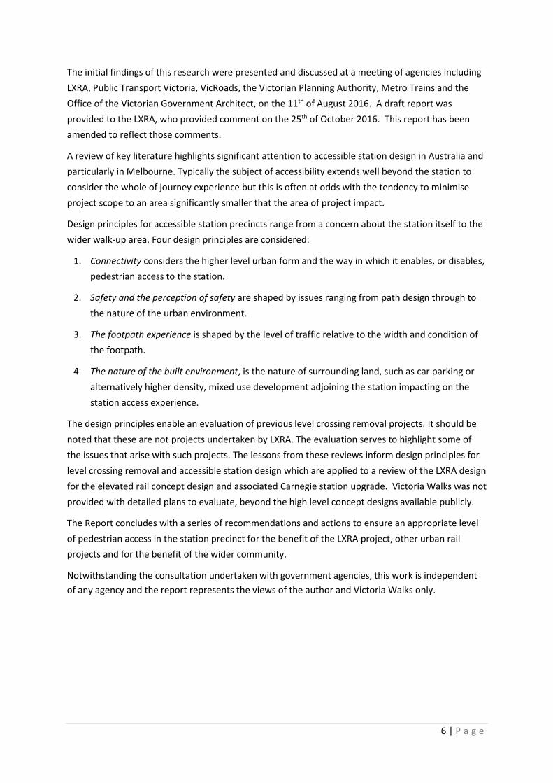
Transit Supportive Land Use Analysis – Land use in the station precinct is primarily low density
residential with some medium density townhouse development near the station. There is little land
use activity that enhances the attractiveness of the station and no commercial activity to animate
the place, note Image 4.2.5 below. However adjoining houses do front the station, providing some
degree of passive surveillance. There is extensive car parking ‘sleeving’ the station and railway line
for some distance further south, although this takes the form of a fairly narrow strip, so does not
constitute a substantial obstacle to pedestrians approaching from east or west.
The area to the north of Taylors Road is largely laid out in a cul-de-sac street design. The area to the
south of Taylors Road and east of the rail line is in a more permeable grid pattern. There is evidence
of new development closer to the station. The dynamic and static barrier of Taylors Road creates
two very separate locations, one that is potentially a comfortable walk-up to the station with some
improvements to local land use and connectivity, the other dependent on drive up access, increasing
the level of local traffic in the station precinct and the need for more land for car parking.
Image 4.3.5 Indicative of land use in Taylors Road precinct
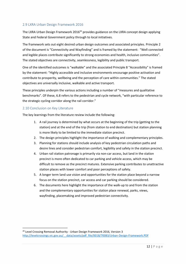
4.4 Trenched Station – Mitcham Station
While the focus of this Report is on elevated stations there are lessons to be learned from recently
completed trenched stations and Mitcham Station provides such an example. Located on the Lilydale
and Belgrave lines the station was upgraded to a Premium station in 1996. The trenched Mitcham
Station opened in January 2014. The work was undertaken as part of the grade separation project to
replace the Mitcham Road and Rooks Road level crossings.
Mitcham Station provides 1033 park and ride spaces. The station is accessed by walking (24.0% of
trips), car (53.0%) and bus (19.1%). Recent media has reported on demands for timed on-street
parking to deal with station related parking in local streets.
Connectivity – The station straddles the trenched rail line and provides a key crossing point from the
residential area through to the commercial precinct on Whitehorse Road. The design of the new
station also provides an improved interface with Calcutta Street and associated low density housing.
There is a bus interchange adjoining the station and secure bike storage. The significant car parking
30 | P a g e
in the station area and adjoining the rail line create a barrier along the northern alignment. Crossings
on Mitcham Road and from the western car park provide north/south connections over the line.
Mitcham Station provides good pedestrian accessibility at that point on the rail line. However, the
extensive rail trench creates an impermeable barrier in the urban environment compared to the
original at grade rail line which provided a number of at grade rail crossings for pedestrians.
Image 4.4.1 Indicating types of connectivity at Mitcham Station
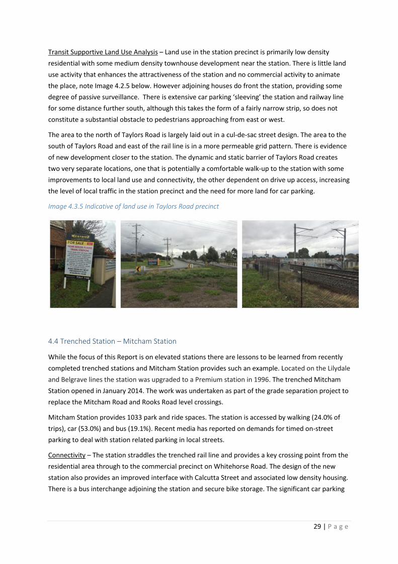
Safety – The station precinct supports a range of transport activities: parking, kiss and ride, drop
off/pick up, cycling, bus and rail. While the station is a key destination a lack of attractive and
activating place features create a reliance on CCTV rather than people activity and this may be a
problem for after-hours personal safety.
Image 4.4.2 Indicative of safety and perceptions of safety at Mitcham Station
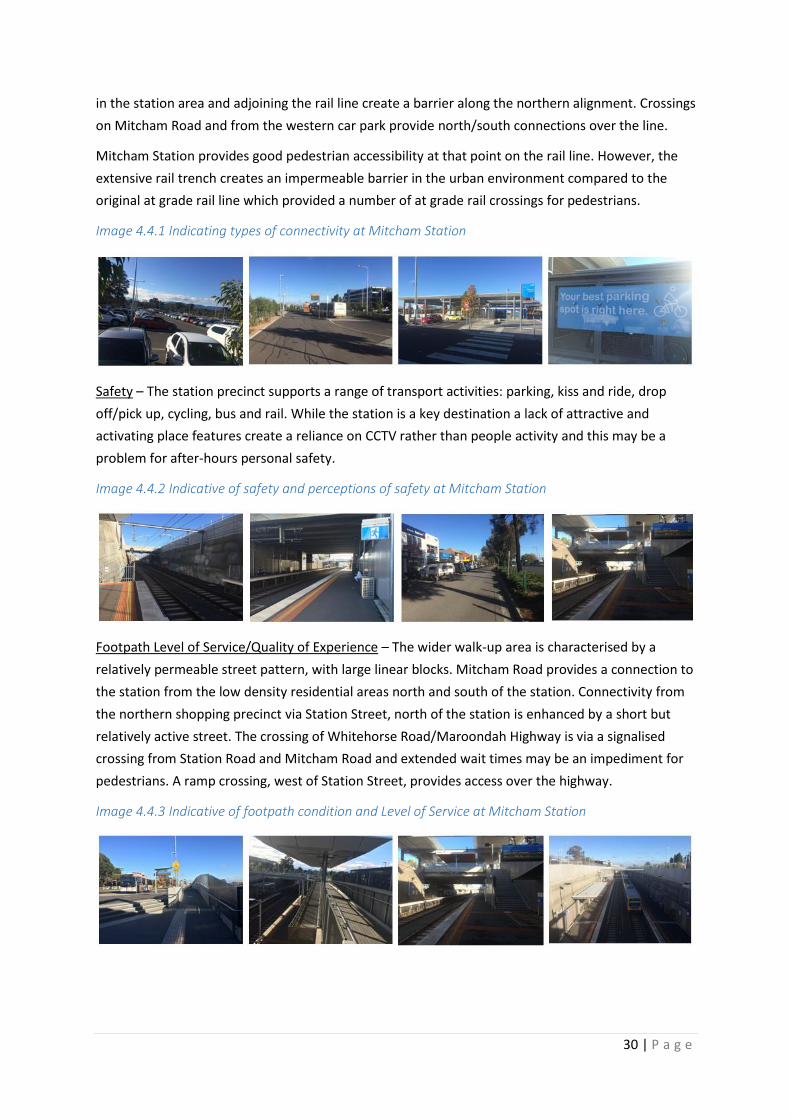
Footpath Level of Service/Quality of Experience – The wider walk-up area is characterised by a
relatively permeable street pattern, with large linear blocks. Mitcham Road provides a connection to
the station from the low density residential areas north and south of the station. Connectivity from
the northern shopping precinct via Station Street, north of the station is enhanced by a short but
relatively active street. The crossing of Whitehorse Road/Maroondah Highway is via a signalised
crossing from Station Road and Mitcham Road and extended wait times may be an impediment for
pedestrians. A ramp crossing, west of Station Street, provides access over the highway.
Image 4.4.3 Indicative of footpath condition and Level of Service at Mitcham Station

31 | P a g e
Transit Supportive Land Use – The wider walk-up area is substantially low density. Commercial
activity is concentrated to the north of the station, mainly between the rail line and the highway.
Industrial land use is established west of the station.
The new station may have been a catalyst to create new commercial activity in the station precinct,
note the example of Subiaco Station in Perth. Mitcham Station does not realise this opportunity.
Instead the new station is oriented to significant park and ride with the associated traffic. This could
be seen as a missed opportunity to activate the station area and enhance the station place qualities.
Image 4.4.4 Indicative of land use around Mitcham Station
4.5 Key Features of the Case Studies
The case studies highlight a range of desirable or undesirable and avoidable outcomes for elevated
or trenched stations and level crossing removals.
The Anderson Road project has enabled improved traffic speed and flow. The pedestrian link, while
of a high quality in its construction, is now much longer, requiring more time and effort to cross the
road. This is a particular problem for those with less mobility – disabled, frail, those with prams,
children etc. although it does provide a crossing entirely separated from traffic. There may be
problems with the lack of passive surveillance and for those who use this crossing afterhours.
The Taylors Road crossing removal highlights a car first approach with poor pedestrian connectivity
and no crossing provided for pedestrians over Taylors Road. This project represents a highly
inadequate solution to pedestrian access over the road and to the station, notwithstanding the
limited existing development to the north. The problem should be addressed if future development
occurs to the north of Taylors Road. Like Anderson Road this is an outer area with higher car access
to the station. Nonetheless walk-up is significant albeit poorly supported in the station precincts.
The examples of Windsor and Balaclava Station, reflect a traditional elevated design and show how
stations can have a ‘hand in glove’ relationship with their urban environment. This is achieved
substantially by disconnecting parking from the station function. Walk up access to the station is well

32 | P a g e
supported and consequently high. Local parking tends to be short term free or longer term paid but
plays a subordinate role in the station precinct. These areas are interesting and active, providing
excellent pedestrian accessibility and weather protection along a walkable ‘Main Street’ connection.
However, the stations are problematic for people with a disability without lift access to the platform.
The Mitcham Station straddles the trenched rail and provides a quality at-grade rail crossing.
However, away from the station the rail trench creates an extensive and impermeable barrier in the
local environment. The original at-grade line provided a number of crossing points for pedestrians
that are no longer in place. The extensive park and ride diminishes the place quality around the
station and is a missed opportunity to create new commercial activity in the station precinct and
better integrate with the existing commercial centre.
The case studies highlight different approaches in time and place to pedestrian accessibility in the
station precinct. Outer stations in spite of typically poor walk-up conditions, have a significant
proportion of passengers accessing the station by foot. Large park and ride areas dominate these
station places, often creating a barrier to walk up passengers and causing significant peak period
traffic congestion in the station precinct. Traditional urban stations typically rely heavily on walk up
and interchange patronage and support higher quality place and pedestrian access outcomes. The
tendency towards significant ‘investment’ in free or subsidised car parking and enabling traffic
planning around the station is a growing source of local congestion in peak times, impacting
negatively on local pedestrian safety, access and station place quality.

33 | P a g e
5.0 Case Study – Carnegie Station and elevated rail
This section considers both the existing Carnegie Station and the proposed LXRA elevated rail and
station concept with a focus on local access issues. The station and adjoining level crossing is located
on the Pakenham/Cranbourne rail line and anchors a vibrant ‘Main Street’ environment. The new
station will be elevated above the existing rail corridor. The proposal raises new local access issues
and opportunities including access to the station foyer, along the new ‘green’ corridor and across
Koornang Road and crossing of roads providing access to new a park and ride car park.
5.1 Carnegie Station Case Study
Carnegie Station is mainly accessed by foot with 71.5% of rail passenger walking from home to the
station, 18.4% by arriving by car, 8.6% arriving by bus, and 0.5% arriving by bicycle.39
The images shown at 5.1.1, below, indicate the urban environment around the station as well as the
rail corridor environment that will frame the future walk/cycle corridor.
Image 5.1.1 Images of Carnegie Station Precinct.
39 PTV Station Patronage – Average of FY2013/14

34 | P a g e
Image 5.1.2, below, indicates the five-minute walk catchment around the station entry point on
Koornang Road. The five-minute walk has a high level of match to the 400 metre lines indicating
good permeability in the wider walk-up area. The exception is to the north of the station where the
catchment is impacted by extended wait times to cross the Princes Highway. The next crossing on
the highway to the east and west is one kilometre from Koornang Road. Further from the station the
railway creates a north/south barrier in the urban environment. Pedestrian crossings over the
railway are provided one kilometre to the west of the station at Grange Road and one kilometre to
the east at Murrumbeena Road.
Image 5.1.2 – Five-minute walk catchment with 400 and 800 metre radius from Station entry

35 | P a g e
The Koornang Road ‘Main Street’ provides the key north/south walk route into the station precinct.
The route is particularly attractive south of the station with good weather protection and active
commercial activity. The footpath ‘Level of Service’ and condition of the footpath could be improved
with less footpath clutter. Closer to the station a short pedestrian underpass beside Koornang Road,
to the west of the station and at-grade pedestrian crossing to the east of the station enable
relatively safe and convenient access across the rail line and to Carnegie Station.
The perception of safety is enhanced by the level of activity and day/night economy. The Koornang
Road ‘Main Street’, with its slow traffic speed and regular breaks in the flow, enables easy crossing.
There is evidence of increasing density closer to the station and likelihood of increased passive
surveillance onto the station but significant land dedicated to at grade, off street car parking. Parking
is accessed from back streets. Vehicle access to parking is a potential conflict with pedestrian safety,
especially in wet weather where demand for parking near the station may be higher. Pedestrian
safety and access to and from parking areas should be addressed.
5.2 Carnegie Station and Elevated Rail Concept Design
The concept designs for the elevated rail project including Carnegie Station, exhibited during the
public consultation for the project in early 2016, are analysed and assessed below. It is possible that
some of the issues identified below may be appropriately addressed in more detailed design plans.
However, Victoria Walks was not provided with detailed plans to evaluate, beyond the high level
concept designs available publicly.
Connectivity
The concept design provides improved access to platforms as pedestrians do not have to negotiate
car parking barrier. However, there may be wider impacts and unintended consequences from the
removal of the level crossings due to increased traffic flow and potential speed increase in the ‘Main
Street’ area. There is a need to ensure safe and convenient ‘Main Street’ crossing, where pedestrians
currently cross with ease. In the publicly available information it is not clear what treatments are
proposed, if any, to facilitate pedestrians crossing roads as they walk into the station precinct.
There is a need for careful regard to the location of parking and traffic access to parking. If parking
road access must cross pedestrian desire lines then measures to support pedestrian movement, such
as raised thresholds at car park entrances, are necessary.
Removing the railway barrier enables new connections for intersecting streets, so adjoining
neighbourhoods become more connected and walkable. This is one of the great advantages of
elevating the railway line (although it is theoretically also possible with a trenched option). The
concept design indicates that all of the relevant connections will be provided.
The new corridor may become a popular route for pedestrians and cyclists. This is new traffic which
needs to cross Koornang Road at the level crossing location. It is important to ensure that crossing
conditions are suitable for this traffic and equitable crossing time is programmed into the signalling.

36 | P a g e
Safety
The design should address the level of passive surveillance into the station area and local pathways.
Particular regard should be given to the actual and perceived night time safety and the nature and
orientation of new development and new activities in the station precinct and along the corridor.
The corridor sitting under the elevated rail presents significant risks and design challenges. There is
generally little passive surveillance from neighbouring properties, which typically present a back
fence to the space. The elevated rail structure will dominate the space. Unless it is exceptionally
well designed, constructed and maintained, there is a substantial risk that this space will be
unattractive and perceived as (if not actually) unsafe. Innovative use of landscaping and design will
be critical in order to activate the space. Careful consideration of sightlines will also be necessary to
provide passive surveillance from adjoining streets. The concept designs do not include this level of
detail, but they do indicate that path connections will be provided to adjoining streets and this is an
important step in activating the corridor space. It is likely that pedestrian movement across the
corridor will be just as important as movement along it.
A Community Open Space Expert Panel: Caulfield to Dandenong Level Crossing Removal Project
(COSEP) has been established to review and provide advice to LXRA on the:
“Proposed seven ‘community spaces’ and their final design (Koornang Road, Riley Reserve,
Clayton Road, Carinish/Haughton Road, Ross Reserve, Heatherton Road and Chandler Road);
Landscape design and planting;
Pedestrian and shared pathways along the new elevated sections; and
General public space in the Station Precincts.”
It will be important for this group and the LXRA to address the issues discussed in this report and for
appropriate solutions to be identified and resourced.
Developing the corridor as a convenient cycle route is important to activate the space, in addition to
facilitating cycling. To that end, it is critical to provide separate walking and cycling paths and
provide direct and convenient crossing opportunities where the paths cross any roads.
Footpath Level of Service/Quality of the Pedestrian Experience
In peak travel times footpaths close to the station will have heavy pedestrian traffic. Highly trafficked
footpaths may need to be widened or improved. Modelling the footpath LOS, both now and for
anticipated future public transport patronage, would ensure that footpath width is appropriate.
The Koornang Road footpath is a critical pedestrian connection to the station providing activation
and weather protection. Accessibility is generally good, albeit some obstacles related to commercial
activities. The Level of Service is in the B to C range. The level of usage suggests a need to improve
the footpath surface, landscaping, furniture and public art. Closer to the station peak hour flows can
be better accommodated with wider pedestrian access/egress points. The concept design is positive
in that it provides ample public space for movement around the station building itself.
The rail corridor ‘shared paths’ concept potentially creates a hostile environment to walkers,
especially for children, seniors and others with limited mobility. The path is designed as a “strategic

37 | P a g e
cycling corridor” along the rail line40, where cyclists are likely to travel at a higher speed unsafe for
pedestrians. Separated walking and cycling paths are needed, and there is ample room to provide
them in the corridor. The risk is higher in the immediate station environment where there are high
numbers of pedestrians (and vehicles) crossing the cycling path to access the station. Most cyclists
will presumably be passing through rather than stopping at the station. Measures to manage these
movement conflicts will be necessary, irrespective of whether there is a shared path or separated
paths.
Transit Supportive Land Use
The design concept indicates an improved parking arrangement for the station precinct, with the car
parking positioned to one side of the station rather than ‘sleeving’ it. This means that people walking
to the station from the west, north or south do not need to walk through the car park. Positively,
space immediately adjoining the station building is allocated to a future development opportunity.
Nonetheless, the substantial area of parking to the east of the station will dominate that approach
(along with the elevated railway line) and undermine placemaking outcomes. This is something of a
missed opportunity to improve the built environment and provide transit oriented development.
There is a need to quantify and critically consider the cost/benefit of the parking provided both in
and round the station and consider whether the land could be better utilised for other purposes.
The station concept design might flag how land use in the station precinct could activate the site and
maximise local economic benefit to complement the station precinct. The idea of ‘Transit Oriented
Development’ (TOD) discussed earlier is appropriate to the Carnegie Station precinct.
Image 5.2.1 Proposed Carnegie station layout.
Image Source - your.levelcrossings.vic.gov.au
40 LXRA Urban Design Framework 2016, s6.8 Pedestrian and Bicycle Connections.

38 | P a g e
5.3 Conclusion on Carnegie Station and Elevated Rail Concept Design
Carnegie Station is one of several stations to be involved in the elevation of the Cranbourne-
Pakenham rail line and like many stations on this line there is an adjoining level crossing and an
active ‘Main Street’ environment. The LXRA concept design is relatively typical of the treatment for
these stations and the issues and opportunities can be generalised to some extent to other stations.
Carnegie Station adjoins the Koornang Road ‘Main Street’ which contributes to its high level of walk
access, on average 71.5% of rail passengers walked all the way to the station. In short, the station
has better than average pedestrian access and this may be a consequence of the permeability of the
wider station precinct and attractive ‘Main Street’ experience.
LXRA Concept Design Positives:
Potential for walking along the rail corridor (although this is compromised by the plans for a
shared path rather than separated walking and cycling paths).
Rail corridor path cross-connections into surrounding streets, removing the railway line as a
barrier and connecting neighbourhoods on either side.
Improved connectivity to the station with good access to the station foyer and escalator to
platforms via Koornang Road.
New opportunities to improve social activity in the station precinct improving the
perceptions of safety near the station, especially after hours.
LXRA Concept Design Negatives:
There is a real concern about the provision of shared paths when the corridor is seen as a
significant cycling route. Separated walking and cycling paths need to be provided.
There is the likelihood of increased traffic flow on Koornang Road ‘Main Street’ environment
impacting negatively on pedestrian movement in that precinct, especially if traffic flow
increases and this needs closer examination. This may damage the feel of the precinct.
The increased pedestrian and cycling traffic along the corridor raises the need for a formal
pedestrian/cycle crossing over Koornang Road, even if it impacts on traffic congestion.
The condition of the corridor edges beneath the elevated railway line presents a significant
challenge for the perception of safety. It will be important for appropriate solutions to be
identified and resourced.
Park and ride (with park and hide in local streets) is a significant cause of local congestion.
Pedestrian access to the station involves crossing of parking access roads which require
traffic calming, to ensure pedestrian right of way.
The elevated rail concept provides a significant opportunity to eliminate the barrier effect of the
existing railway line and reconnect the neighbourhoods on either side. However, looking at the
available LXRA concept designs from a higher level, it is not clear what evaluation factors have been
applied to support elevated rail over other options. It is important that evaluation factors include
local land use, density and local pedestrian access to the station.

39 | P a g e
6.0 Recommendations for future crossings and stations
The literature review, case studies and review of the Carnegie Station concept design inform a range
of recommendations for transit projects, including the LXRA projects, these are as follows:
1. Ensure that pedestrian accessibility, with complementary station place outcomes, is a consideration in the choice of viable options for rail projects, e.g. elevated or trenched rail.
2. Develop pedestrian accessibility plans for each project, engaging with local governments early in the project and in line with the accessibility design principles in this Report and the Victorian Government’s ‘Principal Pedestrian Network’ guidelines. The plans should include:
a) Provision of formal pedestrian crossings in the vicinity of stations.
b) Alignment of pedestrian desire lines and pedestrian crossings, including formal crossings where roads intersect with the walking paths along elevated rail corridors.
c) Where elevated rail provides a new corridor, provide separate walking and cycling paths along the corridor (rather than shared paths) to maximise safety and amenity.
d) Prioritise pedestrian access over vehicles at entry points to stations.
3. Balance investment on station car parking with pedestrian access to station:
a) Provide an independent cost/benefit analysis of station parking.
b) Do not provide additional free car parking beyond existing supply.
c) Investigate options for paid parking at high demand car parks with income to be allocated to fund local place and accessibility planning and improvements.
d) Locate and design park and ride and access roads to avoid conflict with pedestrians.
4. Activate the station environment:
a) Prioritise station land use for commercial and/or community activities with public space.
b) Maximise day/night activating commercial and community uses.
5. Where an open space corridor is created beneath the railway in elevated rail projects:
a) Maximise passive surveillance sightlines into the corridor.
b) Utilise land acquisitions to improve local access and to enhance the corridor experience.
c) Landscape corridor to minimise poor ‘back of house’ – edge of corridor experience.
d) Provide strong walking path cross-connections to adjoining streets.
The planning and development of railway infrastructure is undertaken by a range of government
agencies (including PTV and Transport for Victoria) and private service providers, primarily Metro
Trains Melbourne. Management of roads affected by level crossing removal is the responsibility of
VicRoads and/or local councils. The relative responsibilities of each agency are complex, and the
recommendations should be seen as broadly applicable, so we have not sought to allocate
responsibility for implementing them to particular agencies.
40 | P a g e
7.0 Conclusion
This Report has been produced in response to the recent commitment of the Victorian State
Government to remove some fifty rail level crossings across Melbourne. This is a project with
potential to create significant new opportunities for improved pedestrian accessibility and
complementary station place and local economic outcomes, but there are also risks.
Urban stations are typically animated and activated by pedestrians who, in accessing rail stations,
support local place and economic benefits. Recent ideas, such as transit oriented development, are
focused on the realisation of station land value capture and the creation of vibrant, mixed use,
pedestrian friendly environments. The recent discussion about ‘value capture’ in Australian
transport projects is cognizant of this opportunity. The outcomes may vary according to the station,
but the opportunities are real, mainly untapped and rely on investment in improved station places.
The selection of level crossing removal case studies discussed in this Report reflect a mix of
accessibility outcomes. The traditional urban stations tend to have some onsite access issues, i.e. no
lifts/escalators, but are more likely to sit ‘hand in glove’ in vibrant ‘Main Street’ environments,
providing excellent walk access to the surrounding environment. Recent government investment in
level crossing removals and station upgrades typically reflect a concern to prioritise car access with
wider, faster roads and the provision of substantial areas of station parking. The subsidising of free
parking can be contrasted with the poor planning and associated investment in the station walk-up
environment. This approach misses the benefits of active people, vibrant place and local economy.
The LXRA Carnegie Station and level crossing concept design indicates improved urban planning
outcomes with a number of important benefits, including:
Potential for walking along the rail corridor (although this is compromised by the plans for a
shared path rather than separated walking and cycling paths);
Rail corridor path cross-connections into surrounding streets, removing the railway line as a
barrier and connecting neighbourhoods on either side;
Plans for activating community and commercial uses in the station precinct and rail corridor;
Improved location of car parking to minimise conflict with pedestrians.
Despite these improvements there may also be unintended consequences for local accessibility. The
improved traffic flow and reduced congestion may conflict with the objective of pedestrian safety
and local amenity. The vibrant Koornang Road ‘Main Street’ environment provides the key walking
route to Carnegie Station. The ‘Main Street’ is active and permeable providing easy formal and
informal crossing. The removal of the level crossing with associated changes may increase traffic
flow and speed and reduce the comfort, convenience and safety of pedestrians in the precinct.
The creation of a new corridor dedicated to walking and cycling is a superb asset for the community
but this also poses challenges. There is the need to balance the rights of pedestrians and cyclists on
this corridor with motorists who have been led to expect less congestion at the level crossing point.

41 | P a g e
The provision of shared paths in the corridor rather than dedicated pedestrian and cycling paths is
highly problematic, especially when it is anticipated that the cycle paths are likely to be popular with
larger numbers of faster commuter cyclists. Melbourne is currently dealing with a legacy of shared
paths, constructed as recreational routes, that are now highly trafficked commuter cycling routes
and correspondingly hostile to walkers. The elevated rail project is set to repeat that mistake.
Pedestrian access is critical to the station functionality and should be a key element of the project
scope with resourcing and processes to remediate these impacts. Potential and actual barriers to
local pedestrian accessibility related to the project should be addressed through a ‘Pedestrian Access
Plan’ for each station upgrade and level crossing removal. This is a modest investment for the
project compared to the very significant ‘investment’ in free park and ride facilities.
A dense urban environment where local walking trips are high seems to suit the elevated rail
solution which replaces an impermeable rail barrier with an active, green corridor, new public spaces
and connections. The respective risks and benefits of elevated or trenched rail should be clear to the
community.
The second recommendation to develop local pedestrian accessibility plans for each project requires
a collaborative approach. The LXRA community consultation process indicates good progress here.
Resourcing and processes to deal with accessibility impacts should be detailed in the project scope.
The third recommendation is concerned with the significant ‘investment’ in free station car parking.
This can be contrasted with little apparent planning and investment in station walk access. Extensive
car parking diminishes the station place quality and misses the opportunity to create new
commercial or community activity. Ironically for a public transport project, it entrenches private
vehicle use. There is a need to demonstrate the cost/benefit of ‘free’ station car parking before
providing it wherever the land is available, as if that land has no value. Melbourne provides many
examples of successful train stations with little or no car parking or local all-day paid parking options.
The fourth recommendation seeks to ensure that the station environment is activated with highest
and best uses for the site. Station land is high access land and therefore has an enhanced value. A
cost/benefit analysis can be expected to establish land uses, such as housing, community or
commercial uses, that are complementary to the station function and contribute to the activation of
the station precinct.
The fifth recommendation considers the need to improve the new ‘green’ corridor environment,
notably the run down back of property areas that form the corridor edges. Planning and resourcing
is required to achieve a desirable standard, one that improves the aesthetics and gives users some
sense of safety. The Government has sought to address this through the Community Open Space
Expert Panel, but it will be important for appropriate solutions to be properly resourced.
As the city invests in new rail and stations we also have a once in a century opportunity to provide
an enhanced whole of journey experience for pedestrians. In this we can harness the significant local
place, people and economic benefits associated with this. This approach requires a more holistic
approach to rail transit planning, one where transit projects take full responsibility for their impacts.

42 | P a g e
References Used in this Report
Austroads Guide to Traffic Management, Part 4: Level of Service Metrics for Network
Operations Planning. Publication no: AP-R475-15, January 2015.
https://www.onlinepublications.austroads.com.au/items/AP-R475-15
Austroads (2009). ‘Guide to Road Design’, Part 6A: Pedestrian and Cyclist Paths.
https://www.onlinepublications.austroads.com.au/items/AGRD06A-09
Bertolini. L, and Chorus. P, ‘An application of the node place model to explore the spatial
development dynamics of station areas in Tokyo’, The Journal of Transport and Land Use,
Spring 2011. https://jtlu.org/index.php/jtlu/article/viewFile/145/153
CDM Research (2012a). ‘Cyclist Route Choice Survey,’ unpublished report to VicRoads.
Charles. P, and Galiza. R.J, Improving Access to Urban Passenger Rail Stations in Australia,
CRC for Rail Innovation, Brisbane, September 2013.
https://www.humanrights.gov.au/sites/default/files/ATTACHMENT%201%20STATION%20AC
CESS.pdf
De Rome, L. Boufous, S. Georgeson, T. Sensorrick, T. Richardson, D. Ivers,R. (2014). ‘Bicycle
crashes in different riding environments in the Australian Capital Territory.’ Traffic Injury
Prevention 2014;15(1):81-8.
Garrard, J. 2013. ‘Senior Victorians and Walking: obstacles and opportunities’. Victoria
Walks.
Heart Foundation of Australia, 2011, ‘Good for Business - The benefits of making streets
more walking and cycling friendly’, Discussion paper.
https://heartfoundation.org.au/images/uploads/publications/Good-for-business.pdf
Infrastructure Victoria, ‘Value Capture – Options, Challenges and Opportunities for Victoria’
Policy Paper, Oct 2016. http://yoursay.infrastructurevictoria.com.au/30-year-
strategy/application/files/8214/7630/8983/IV18_Value_Capture_Options_Final_web.pdf
Metropolitan Transport Forum (MTF), ‘Rail Level Crossing Removals – Learnings for Local
Government and Key Agencies’, Summary Report by Urban Interface, March 2016.
http://www.mtf.org.au/site/files/ul/data_text12/5138445.pdf
Minister for Roads (2014). 'Be safer on Ride2Work Day by knowing the road rules,' media
release issued 14 October 2014, Hon Terry Mulder MP.
Office of the Victorian Government Architect, ‘Level Crossing Removals – Lessons Learned’,
October 2014. http://www.ovga.vic.gov.au/news/100-lessons-learned-level-crossing-
removals.html
Oxley, J; Liu, S; Langford, J; Bleechmore, M; Guaglio; A. 2012. ‘Road Safety for Pedestrians'
Who Are Blind or Have Low Vision’. Monash University Accident Research Centre and Vision
Australia.

43 | P a g e
Parliament of Australia, ‘Financing infrastructure by value capture’, Parliamentary Library
Briefing Book.
http://www.aph.gov.au/About_Parliament/Parliamentary_Departments/Parliamentary_Libr
ary/pubs/BriefingBook45p/ValueCapture
‘Railway Station Design Standard and Guidelines’, VRIOGS 002.1, Revision A, March 2011.
http://docplayer.net/11232649-Vriogs-002-1-railway-station-design-standard-and-
guidelines.html
Robinson, L. 2011. 'What enables cycling and safe cycling behaviours,'
www.enablingchange.com.au
Schlossberg, M. Brown, N. ‘Comparing Transit-Oriented Development Sites by Walkability
Indicators’, Transportation Research Record: Journal of the Transportation Research Board,
Jan 2004, Vol. 1887. http://trrjournalonline.trb.org/doi/pdf/10.3141/1887-05
‘The Benefits of Level Crossing Removals: Lessons from Melbourne’s Historical Experience’,
RMIT University, 2016. http://www.rmit.edu.au/research/research-institutes-centres-and-
groups/research-centres/centre-for-urban-research/projects/current-projects/level-
crossing-removals/
Victorian Government, ‘The Station Users Panel Report - Railway Station Useability
Principles’, December 2011, Melbourne.
http://economicdevelopment.vic.gov.au/__data/assets/pdf_file/0017/1091015/Railway-
station-useability-principles.pdf
Victorian Government, ‘Pedestrian Access Strategy - A strategy to increase walking for
transport in Victoria’, 2010.
http://www.victoriawalks.org.au/Assets/Files/Pedestrian%20Access%20Strategy%20final%2
0WEB%20version.pdf
Victorian Government, Department of Economic Development, Jobs, Transport and
Resources, ‘Guidelines for developing Principal Pedestrian Networks’.
http://economicdevelopment.vic.gov.au/transport/cycling-and-walking/walking/principal-
pedestrian-networks
Victorian Government, ‘Level Crossing Removal Authority - Consultation Outcomes and
Submissions Report’, April 2016.
http://levelcrossings.vic.gov.au/__data/assets/pdf_file/0020/48080/LXRA-Caulfield-
Dandenong-Consultation-Outcomes-and-Submissions-Report.pdf
Level Crossing Removal Authority - Urban Design Framework 2016, Version 3.
http://levelcrossings.vic.gov.au/__data/assets/pdf_file/0018/70083/Urban-Design-
Framework.PDF
Victoria Walks, ‘Shared Paths – The Issues’, Position Statement,
http://www.victoriawalks.org.au/position_statements/
Victoria Transport Institute - http://www.vtpi.org/walkability.pdf