planning committee wednesday, june 14, 2017, at … · meeting held on wednesday, june 14, 2017, at...
TRANSCRIPT

Corporation of the Town of Huntsville
PLANNING COMMITTEE
Meeting held on Wednesday, June 14, 2017, at 9:30 a.m.
in the Huntsville Civic Centre, Municipal Council Chambers
______________________________________________________________________________
Attendance Chair: Councillor Bob Stone
Members: Councillor Nancy Alcock
Councillor Jason FitzGerald
Councillor Jonathan Wiebe
Absent: Deputy Mayor Karin Terziano
Staff: Denise Corry Chief Administrative Officer
Derrick Hammond Director of Development Services Jasmine Last Planning Customer Service Rep. (Recording Secretary)
Kirstin Maxwell Manager of Planning Christopher Nagy Chief Building Official
Elizabeth Reimer Senior Planner
1. CONVENE
Moved by Bob Stone PC100-17
IT IS RECOMMENDED THAT: We do now convene as a Planning Committee at 9:37
a.m.
Carried.
2. ADOPTION OF AGENDA
Moved by Bob Stone PC101-17
IT IS RECOMMENDED THAT: The Planning Committee Agenda dated June 14, 2017,
be adopted as printed and circulated. Carried.
3. DISCLOSURE OF PECUNIARY INTEREST
-Nil-
4. INVITED AND CEREMONIAL PRESENTATIONS
4.1 Steve Scholten, Ministry of Natural Resources and Forestry
Mr. Scholten outlined a visual presentation regarding the impact of development on fish
habitat (attached as Appendix “A”).
5. REPORTS
5.1 CONCURRENT OFFICIAL PLAN AMENDMENT / ZONING
a) OPA#13 & Z/22/2017/HTE Langford/Lalor – Island No. 2, Lake of Bays
Application was deferred at the request of the applicant and will be re-advertised when
a new public meeting has been scheduled.

Planning Committee Meeting Minutes – June 14, 2017 - 2 -
5.2 ZONING AMENDMENTS
a) Report DEV-2017-105 – Z/01/2017/HTE MacLennan – 77 Vernon Reach Road
Elizabeth Reimer outlined the report.
Chair Alcock called upon the applicant or their representative to provide additional
comments.
Lanny Dennis, representing the applicant, concurred with staff’s recommendation. Mr.
Dennis stated that an engineer’s report had identified that the subject lands are outside the limits of the Big East River delta, and further explained that the lot is located on an
open stretch of water, rather than on a river system where the flow velocities and catchment area would have greater impact. Mr. Dennis noted that the lot is not
characteristic of a floodway due to the steep slopes. Mr. Dennis outlined similar
development in proximity, and stated that the flood elevation is consistent with other shoreline development on Lake Vernon.
Mr. Dennis stated that the applicant proposed to install a floating boathouse and that
the design would be dealt with at the site plan approval and building permit stage. Mr. Dennis stated that a floating boathouse could be constructed with no zoning
amendment required.
Chair Alcock asked if there was anyone present that wished to provide comments or ask
questions regarding the application.
-Nil-
Chair Alcock asked if there were any questions or comments from Committee Members.
Committee requested clarification on the design of a floating boathouse.
Mr. Dennis clarified that the boathouse would be designed to rise and fall with the water level.
Moved by Bob Stone PC102-17
IT IS RECOMMENDED THAT: Planning Committee recommend to Council that Zoning By-law amendment Z/01/2017/HTE be APPROVED, changing the
zoning from a Natural Resource Floodway (NR1) Zone to a Natural Resource
(NR) Zone. Carried.
b) Report DEV-2017-106 – Z/26/2017/HTE Strongman – 410 Highview Drive
Elizabeth Reimer outlined the report.
Chair Alcock called upon the applicant or their representative to provide additional comments.
Graeme Huzinga, representing the applicant, explained that the application would allow
the owner to eventually build a dwelling on the lot. Mr. Huzinga stated that the property
has unique topography but that the owner had identified an area suitable for development on the lot. Mr. Huzinga explained that the zoning by-law permits
development when only water services are available, and that the application was proposing the inverse, where only sewer services are available, and stated that his client
would connect to water services when available.

Planning Committee Meeting Minutes – June 14, 2017 - 3 -
Chair Alcock asked if there was anyone present that wished to provide comments or ask questions regarding the application.
-Nil-
Chair Alcock asked if there were any questions or comments from Committee Members.
Committee questioned if the property owner intended to drill a well.
Mr. Huzinga responded affirmatively but clarified that if the water connection were to
become available before construction begins, a well would not be necessary.
Moved by Bob Stone PC103-17
IT IS RECOMMENDED THAT: Planning Committee recommend to Council that
Zoning By-law amendment Z/26/2017/HTE be APPROVED, changing the
zoning from a Rural One (RU1) Zone to a Rural One (RU1) Zone with the following exception:
to permit the construction of a single family dwelling on a single service;
that the subject lands will be subject to site plan control.
Carried.
5.3 CONCURRENT CONSENT / ZONING
a) Report DEV-2017-107 – Z/27/2017/HTE & B/23-26/2017/HTE Monkman/Whyte –
3095 & 3177 South Portage Rd
Elizabeth Reimer outlined the report.
Chair Alcock called upon the applicant or their representative to provide additional
comments.
Nicholas Hiley, representing the applicant, concurred with staff’s recommendation and stated that he was present to answer any questions.
Chair Alcock asked if there was anyone present that wished to provide comments or ask
questions regarding the application.
-Nil-
Chair Alcock asked if there were any questions or comments from Committee Members.
Committee questioned the need for the shared driveway when the proposed lots abut South Portage Road.
Ms. Reimer clarified that a driveway already exists and the rights-of-ways would tie into the existing driveway to maintain a single access off South Portage Road.
Committee discussed the request for an increase in the permitted shoreline structure
width.
Ms. Reimer stated that a 25% amenity area, to a maximum width of 15 metres, would
be currently permitted and that the applicant was requesting an additional 2.7 metres of shoreline amenity area. Ms. Reimer explained that due to the amount of proposed
frontage on the lot, staff felt the increase was an appropriate request.

Planning Committee Meeting Minutes – June 14, 2017 - 4 -
Moved by Bob Stone PC104-17
BE IT RESOLVED THAT: Planning Committee APPROVE Consent Applications
B/23/24/25/26/2017/HTE for the creation of three new shoreline residential lots and
right-of-ways;
CONDITIONAL ON: 1. A registerable description of the severed lot being submitted to the Clerk, (including
all rights-of-ways and easements), along with a registered copy of the reference plan;
2. The Owners’ taxes being in good standing;
3. A site inspection fee of $225.00 being paid to the Town of Huntsville per lot; 4. A consent finalization fee in the amount of $170.00 being paid to the Town of
Huntsville per lot; 5. The lands being rezoned for their intended use, where applicable;
6. 5% Cash-in-lieu of parkland being paid to the Town of Huntsville on the severed
lands; 7. The Original Shore Road Allowance being stopped up, closed, and purchased by the
owner. Carried.
Moved by Bob Stone PC105-17
IT IS RECOMMENDED THAT: Planning Committee recommend to Council that
Zoning By-law amendment Z/27/2017/HTE be APPROVED, changing the zoning from a Shoreline Residential Four (SR4) Zone to:
• a Shoreline Residential Two (SR2) Zone for the Retained and B/24 lands; • a Shoreline Residential Two (SR2) Zone with exception to permit a lot
area of 0.9396 hectares for B/25;
• and a Shoreline Residential Two (SR2) Zone with exception to permit an increase in shoreline structure width to 17.7 meters and increased
boathouse width to 11 meters for B/23. Carried.
b) Report DEV-2017-108 – Z/28/2017/HTE & B/27/2017/HTE Chipperfield – 591 Ravenscliffe Road
Elizabeth Reimer outlined the report.
Chair Alcock called upon the applicant or their representative to provide additional
comments.
Peter Cotterchio, representing the applicant, stated that he was present to answer
questions.
Chair Alcock asked if there was anyone present that wished to provide comments or ask
questions regarding the application.
-Nil-
Chair Alcock asked if there were any questions or comments from Committee Members.
-Nil-

Planning Committee Meeting Minutes – June 14, 2017 - 5 -
Moved by Jonathan Wiebe PC106-17
BE IT RESOLVED THAT: Planning Committee APPROVE Consent Application
B/27/2017/HTE for an access easement in favour of, and a lot addition to, 653
Ravenscliffe Road;
CONDITIONAL ON: 1. A registerable description of the severed lot being submitted to the Clerk, (including
all rights-of-ways and easements), along with a registered copy of the reference plan.
2. The Owners’ taxes being in good standing.
3. A site inspection fee of $225.00 being paid to the Town of Huntsville. 4. A consent finalization fee in the amount of $170.00 being paid to the Town of
Huntsville. 5. An undertaking is to be provided from the solicitor acting for the parties indicating
that the severed land and the abutting property to the west will be consolidated into
one PIN under the Land Titles System.
The severed lands are to join in title to the lands to which they are being added. Section 50(3) or (5) of the Planning Act, R.S.O. 1990, as amended, applies to any
subsequent conveyance or transaction in relation to the land subject to this consent.
Carried.
Moved by Jonathan Wiebe PC107-17
IT IS RECOMMENDED THAT: Planning Committee recommend to Council that Zoning By-law amendment Z/28/2017/HTE be APPROVED, changing the
zoning of the lot addition lands from a Rural Two (RU2) Zone with exception
0121 to a Rural Residential (RR) Zone. Carried.
5.4 CONSENTS
a) Report DEV-2017-109 – B/28-32/2017/HTE Claudex – 731 Etwell Road
Kirstin Maxwell outlined the report.
Chair Alcock called upon the applicant or their representative to provide additional comments.
Wayne Simpson, representing the applicant, explained that the consent applications were required to be registered prior to the condominium road.
Chair Alcock asked if there was anyone present that wished to provide comments or ask
questions regarding the application.
-Nil-
Chair Alcock asked if there were any questions or comments from Committee Members.
-Nil-
Moved by Jonathan Wiebe PC108-17
BE IT RESOLVED THAT: Planning Committee APPROVE Consent Applications B/28-
32/2017/HTE for the creation of 5 new rural lots;

Planning Committee Meeting Minutes – June 14, 2017 - 6 -
CONDITIONAL ON:
1. A registerable description of the severed lands being submitted to the Clerk,
(including all rights-of-ways and easements), along with a registered copy of the reference plan;
2. The Owners’ taxes being in good standing; 3. A consent finalization fee in the amount of $170.00 being paid to the Town of
Huntsville; 4. 5% cash in lieu of parkland being paid on the severed lands.
Carried.
6. REPORTS FROM MUNICIPAL OFFICERS
6.1 Report DEV-2017-110 – RC/10/2017/HTE Barkey – 63 Europe Lane
Elizabeth Reimer outlined the report.
Moved by Jason FitzGerald PC109-17
IT IS RECOMMENDED THAT: Application RC/10/2017/HTE be approved in accordance with the Road and Shore Road Allowance Closing Policy and
Procedure;
CONDITIONAL ON:
1. The Applicant pay all survey, legal and associated expenses;
2. The sale price for the land proposed to be closed be in accordance with
the Fees and Charges By-law, as amended; 3. The applicable fee, in accordance with the Town’s “Shore Road Allowance
Closure as a Requirement of Planning Applications” policy, as amended, be provided;
4. A survey, in duplicate, be provided showing the road allowance as a
specific part on the Plan; 5. A registered Transfer/Deed of Land for the road allowance be filed with
the Municipality within one year from the date of the motion approving the application or the motion will be considered null and void and a new
application will be required; 6. That any utility plant located on the property proposed to be closed be
given an easement;
7. The shore road allowance is hereby declared as surplus to the Town’s needs;
8. The portion of the shore road allowance being closed merge in title with the lot to which it is being added;
9. That the Mayor and Clerk are hereby authorized to sign the necessary
documentation pertaining to the closure and sale of said shore road allowance.
Carried.
6.2 Report DEV-2017-112 – Official Plan Review – Policy Background Papers
Kirstin Maxwell outlined the report.
Moved by Jason FitzGerald PC110-17
IT IS RECOMMENDED THAT: Planning Committee ENDORSE the policy
background papers for Healthy Communities and a Sustainable Natural
Environment.
Planning Committee Meeting Minutes – June 14, 2017 - 7 -
Carried.
6.3 Report DEV-2017-111 – Ontario Municipal Board Appeals
Kirstin Maxwell outlined the report.
Committee directed staff to bring forward information to the July meeting regarding
changes to the Ontario Municipal Board.
Moved by Jason FitzGerald PC111-17
IT IS RECOMMENDED THAT: Staff be directed to advise the Ontario Municipal
Board that the Town will not participate in any of its current outstanding appeals.
Carried.
7. NEW BUSINESS
Pioneer Camp Road Allowance Closures
A discussion occurred regarding the previously-approved application to close the road
allowances surrounding Pioneer Camp. Committee directed staff to advise a
neighbouring property owner to Pine Road to submit a deputation request for the JulyPlanning Committee meeting.
Hyundai Dealership
A discussion occurred regarding the dealership’s compliance with dark-sky friendlylighting by-law.
Sign By-law
Christopher Nagy outlined an application for a sign permit at 234 Main Street West.
8. ADJOURNMENT
Moved by Jason FitzGerald PC112-17
IT IS RECOMMENDED THAT: We do hereby adjourn at 11:18 a.m. to meet again on
Wednesday, July 12, 2017, or at the call of the Chair.Carried.
________________________________ Chair, Councillor Nancy Alcock
SIGNED

Protection of Fish Habitat through
Municipal Planning
June 14, 2017
Appendix "A"

2
Outline
• Importance of fish habitat
• Impact of development on fish habitat
• municipal, federal and provincial roles and PPS
• Habitat Mapping
• Fish habitat assessments
• Cumulative effects

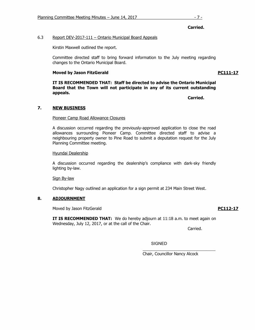
Importance of Fish Habitat
3
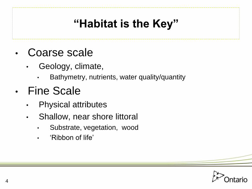
“Habitat is the Key”
• Coarse scale • Geology, climate,
• Bathymetry, nutrients, water quality/quantity
• Fine Scale • Physical attributes
• Shallow, near shore littoral
• Substrate, vegetation, wood
• ‘Ribbon of life’
4
5

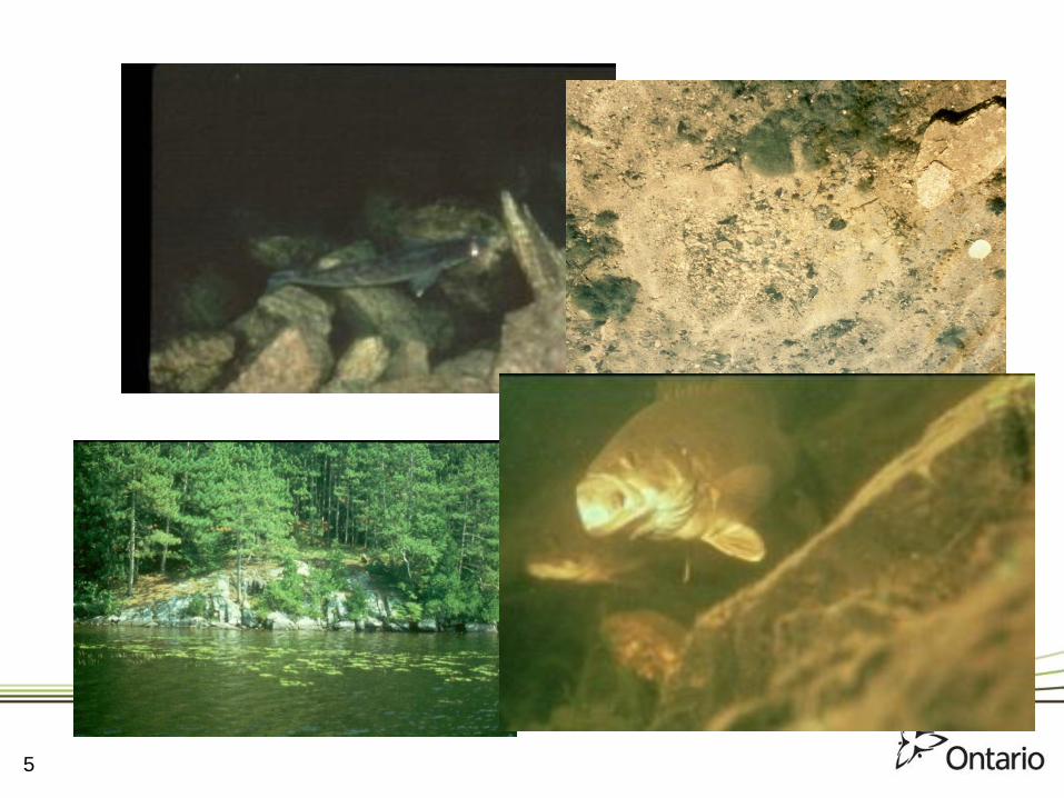
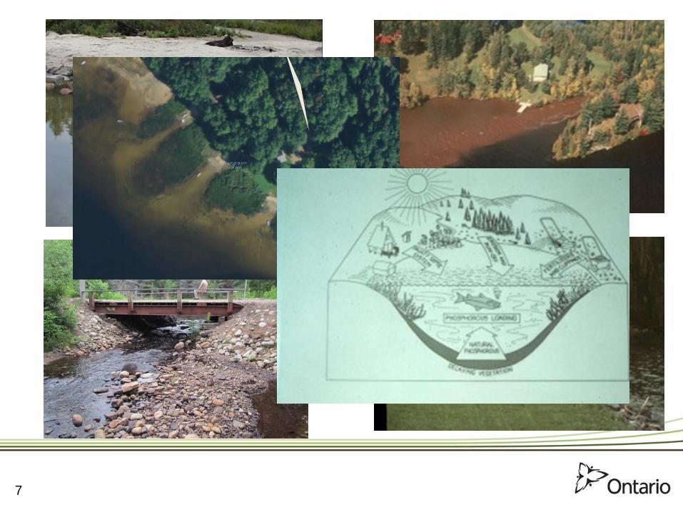
Impact of Development
• Direct• Physical change
• vegetation, rocks, woody debris, sediment
• Indirect• water quality (temperature, nutrients), quantity
• Associated uses
• Cumulative
6
7
A R M O U RA R M O U R
T W PT W P
KE
NT
RD

History
• Prior to 1997• MNR administered fish habitat sections of Fisheries
Act on behalf of DFO,
• MNR commented directly on municipal planning
matters
• Since 1997• Admin. of habitat sections of FA returned to DFO
– Site-specific project review
• Planning review transferred to municipalities
– MNR provided lake summary sheets and habitat mapping to
municipalities, with advice on application
8
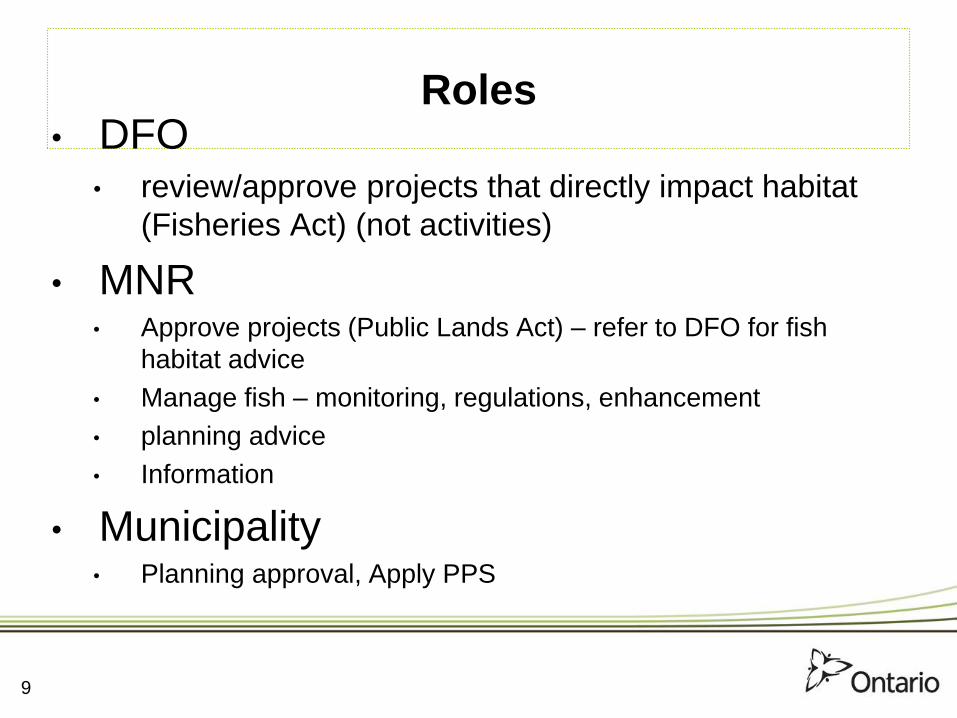
Roles • DFO
• review/approve projects that directly impact habitat
(Fisheries Act) (not activities)
• MNR • Approve projects (Public Lands Act) – refer to DFO for fish
habitat advice
• Manage fish – monitoring, regulations, enhancement
• planning advice
• Information
• Municipality • Planning approval, Apply PPS
9

Habitat Mapping
• Variety of sources• Quality varies
• Broad-scale, generalized (Type 1, 2,
unknown)
• Sensitivity varies (even within Type 1)
• Consider Type 1 a ‘flag’
• Map, with tabular data
10

11
C H A F F E YC H A F F E Y
T W PT W P
S I N C L A I RS I N C L A I R
T W PT W P
Harp
Lake
HARP LAKE RD
ENADR
SYD
NEY
TR
AIL
MCLEAN DR
SHARON
DR
Type 2
Coldwater Stream
Coldwater LakeLake Trout LakeAt Capacity
Stream Mouth
Aquatic Vegetation
Lake Trout Spawning AreaUnknown Habitat/Thermal Regime
C H A F F E YC H A F F E Y
T W PT W P
S I N C L A I RS I N C L A I R
T W PT W PHarp
Lake
HARP LAKE RD
ENADR
SYD
NEY
TR
AIL
MCLEAN DR
SHARON
DR

PPS
2.1.6 Development and site alteration shall not be permitted in
fish habitat except in accordance with provincial and federal
requirements.
2.1.8 Development and site alteration shall not be permitted on
adjacent lands to the natural heritage features and areas identified
in policies 2.1.4, 2.1.5, and 2.1.6 unless the ecological function of
the adjacent lands has been evaluated and it has been
demonstrated that there will be no negative impacts on the natural
features or on their ecological functions.
12

MNR Advice
Type 1 (Critical) Habitats are those, which have high productive
capacity, are rare, highly sensitive to development, or have a critical
role in sustaining fisheries (e.g. spawning and nursery areas for
some species, and ground water discharge areas).
Type 2 (Important) Habitats are moderately sensitive to development
and although important to fish populations, are not considered
critical (e.g. feeding areas and open water habitats of lakes).
Unknown habitat refers to areas where no information currently exists.
Until specific information is generated, these areas should be
treated in the same manner as Type 1 Habitats.
13

MNR Advice
• new shoreline lots should have sufficient suitable areas
for shoreline use (docks, swimming, etc.) that are not
within critical fish habitat
• new shoreline structures be located outside areas of
critical fish habitat
• studies should be required when development is
proposed in critical and Type 1 or unknown fish habitat,
or on adjacent lands.
14

Site Assessments
• preliminary ecological site assessment
• Identify values
• a qualified biologist
• If site assessment reveals a likelihood of a natural heritage value
• site-specific impact assessment,
• identify values,
• assess potential impacts
• proposed mitigation measures
15
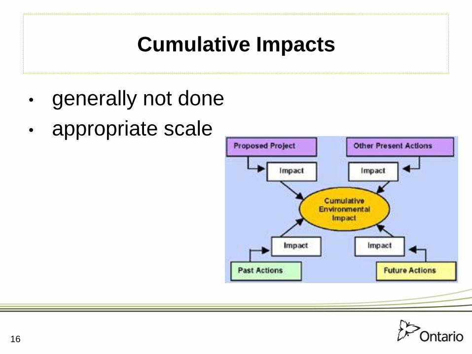
Cumulative Impacts
• generally not done
• appropriate scale
16