planning committee comitÉ de …ottawa.ca/calendar/ottawa/citycouncil/occ/2012/11-14/pec...planning...
TRANSCRIPT

PLANNING COMMITTEE REPORT 39A 14 NOVEMBER 2012
25 COMITÉ DE L’URBANISME RAPPORT 39A
LE 14 NOVEMBRE 2012
4. TRANSIT ORIENTED DEVELOPMENT PLANS, OFFICIAL PLAN
AMENDMENT AND ZONING BY-LAW AMENDMENT FOR TRAIN, ST. LAURENT AND CYRVILLE AREAS
PLANS D’AMÉNAGEMENT AXÉS SUR LE TRANSPORT EN COMMUN,
MODIFICATION AU PLAN OFFICIEL ET MODIFICATION AU RÈGLEMENT DE ZONAGE VISANT LES SECTEURS TRAIN, ST- LAURENT ET CYRVILLE
COMMITTEE RECOMMENDATIONS AS AMENDED
That Council:
1. Approve the Transit Oriented Development Plans for Train, St.
Laurent and Cyrville areas (distributed separately and on file with the City Clerk – Document 12), and as shown in Document 1;
2. Approve Amendment No. XX to the Official Plan, as detailed in
Document 2, to implement the Transit Oriented Development Plans;
3. Approve an amendment to Zoning By-law 2008-250 as shown on
the maps in Documents 3 to 8, and as detailed in Document 9; 4. Approve that staff bring forward for consideration as part of the
annual Capital Budget process requests for funding in years 2015 to 2017 to undertake design and implementation of cycling and pedestrian facilities.
5. That Document 3 be amended to change Map 1 for the following
properties: a. 250 Tremblay Road be rezoned from MC7 F(3.5) to TD3 with a
site specific exception zone; b. 550 Belfast be rezoned from IG3[263] to TD2 with a site
specific exception zone; c. 330 Coventry Road be rezoned from TD3[aaaa] to TD2[aaaa]
6. That Document 7 be amended to change Map 5 for the following
property: a. 1250 Cyrville Road, (city-owned property on both sides of
Cyrville Road) from MC F(2.0) H(48) and MC[1353] H(48) to TD3

PLANNING COMMITTEE REPORT 39A 14 NOVEMBER 2012
26 COMITÉ DE L’URBANISME RAPPORT 39A
LE 14 NOVEMBRE 2012
7. That Document 9 – Details of Recommended Zoning, Item 1.dd. be replaced with the following:
“For the properties being rezoned as shown on Documents 3, 5 and 7 of this report, the TD Zone and its corresponding subzone only applies when a new permitted use, accommodated in a new building, is introduced to the site. Uses that legally exist or have an approval through site plan as of the date of passing of the By-law or are identified under “Additional Land Uses Permitted” are permitted to remain and expand using the TD Zone and provisions outlined in Tables 1, 2 and 3 below as long as they do not exceed the maximum building heights and floor area ratios noted in Tables 1, 2 and 3 below. When the building heights and floor area ratios are exceeded the development must proceed based on the full TD zone regulations. Uses that are permitted in the TD Zone may be introduced to an existing building without triggering the regulations outlined in the TD Zone. Once the TD Zone has been triggered, the exceptions outlined in the chart below no longer apply.”
8. That there be no further notice pursuant to Section 34 (17) of the
Planning Act. CARRIED as amended
RECOMMANDATIONS MODIFIÉES DU COMITÉ
Que le Conseil :
1. Approuver les plans d’aménagement axés sur le transport en commun visant les secteurs Train, St-Laurent et Cyrville (distribués séparément, remis au Greffier municipal - document 12) et illustrés en tant que document 1;
2. Approuver la modification no XX au Plan officiel, telle qu’exposée
en détail dans le document 2, en vue de mettre en œuvre les plans d’aménagement axés sur le transport en commun;
3. Approuver une modification au Règlement de zonage 2008-250,
illustrée sur les cartes des documents 3 à 8, et exposée en détail dans le document 9; et
4. Approuver la présentation par le personnel, aux fins d’examen dans
le cadre du processus du budget annuel d’immobilisation, des

PLANNING COMMITTEE REPORT 39A 14 NOVEMBER 2012
27 COMITÉ DE L’URBANISME RAPPORT 39A
LE 14 NOVEMBRE 2012
demandes de financement pour les années 2015 à 2017, afin d’entreprendre la conception et la construction d’installations cyclables et piétonnières.
5. Que le document 3 soit modifié par le changement de la zone des trois propriétés suivantes sur la carte 1 : a. 250, chemin Tremblay : de MC7 F(3.5) à TD3; indiquer une zone
d’exception propre à cet emplacement; b. 550, chemin Belfast : de IG3[263] à TD2; indiquer une zone
d’exception propre à cet emplacement; c. 330, chemin Coventry : de TD3[aaaa] à TD2[aaaa];
6. Que le document 7 soit modifié par le changement de la zone de la
propriété suivante sur la carte 5 : a. 1250, chemin Cyrville (propriété de la Ville, de part et d’autre du
chemin Cyrville) : de MC F(2.0) H(48) et MC[1353] H(48) à TD3;
7. Que dans le document 9 – détails du zonage recommandé, le point 1.dd soit remplacé par ce qui suit :
« Dans le cas des propriétés dont la zone change, comme l’indiquent les documents 3, 5 et 7 de ce rapport, la zone TD et la sous-zone correspondante ne s’appliquent que pour l’ajout d’une nouvelle utilisation permise dans un nouveau bâtiment de l’emplacement. Les utilisations légales, approuvées par le plan d’implantation au moment de l’adoption du règlement municipal ou faisant partie des « Utilisations du sol additionnelles permises » peuvent être maintenues et étendues conformément à la zone TD et à ses dispositions (tableaux 1, 2 et 3 ci-dessous), à condition qu’elles ne dépassent pas les maximums de hauteur de bâtiment et rapport plancher-sol (tableaux 1, 2 et 3 ci-dessous). Si ces maximums sont dépassés, l’aménagement doit par la suite se conformer à la totalité des règlements de la zone TD. Les utilisations permises dans la zone TD peuvent être ajoutées à un bâtiment existant sans que soit déclenchée l’entrée en vigueur des règlements de la zone TD. Dès qu’une propriété passe en zone TD, les exceptions indiquées dans le tableau ci-dessous ne s’y appliquent plus. »;
8. Qu’aucun autre avis ne soit donné en vertu du paragraphe 34(17) de la Loi sur l’aménagement du territoire.

PLANNING COMMITTEE REPORT 39A 14 NOVEMBER 2012
28 COMITÉ DE L’URBANISME RAPPORT 39A
LE 14 NOVEMBRE 2012 DOCUMENTATION / DOCUMENTATION 1. Deputy City Manager's report, Planning and Infrastructure, dated 3 October 2012
(ACS2012-PAI-PGM-0183). Rapport de la Directrice municipale adjointe, Urbanisme et Infrastructure, le 3 octobre 2012 (ACS2012-PAI-PGM-0183).
2. Extract of Draft Minutes, 23 October 2012.
Extrait de l‟ébauche du procès-verbal, le 23 octobre 2012.

PLANNING COMMITTEE REPORT 39A 14 NOVEMBER 2012
29 COMITÉ DE L’URBANISME RAPPORT 39A
LE 14 NOVEMBRE 2012
Report to/Rapport au:
Planning Committee Comité de l'urbanisme
and Council / et au Conseil
October 3, 2012 3 octobre 2012
Submitted by/Soumis par : Nancy Schepers, Deputy City Manager/Directrice municipale adjointe, Planning and Infrastructure/Urbanisme et infrastructure
Contact Person / Personne ressource: Lee Ann Snedden, Manager/Gestionnaire, Policy
Development and Urban Design/Élaboration de la politique et conception urbaine, Planning and Growth Management/Urbanisme et Gestion de la croissance Élaboration
de la politique et conception urbaine (613) 580-2424, 25779 [email protected]
Beacon Hill – Cyrville (11), Rideau-Rockcliffe (13), Alta Vista (18)
Ref N°: ACS2012-PAI-PGM-0183
SUBJECT: TRANSIT ORIENTED DEVELOPMENT PLANS, OFFICIAL PLAN
AMENDMENT AND ZONING BY-LAW AMENDMENT FOR TRAIN, ST. LAURENT AND CYRVILLE AREAS
OBJET : PLANS D’AMÉNAGEMENT AXÉS SUR LE TRANSPORT EN
COMMUN, MODIFICATION AU PLAN OFFICIEL ET MODIFICATION AU RÈGLEMENT DE ZONAGE VISANT LES SECTEURS TRAIN, ST- LAURENT ET CYRVILLE
REPORT RECOMMENDATIONS That the Planning Committee recommend Council: 1. Approve the Transit Oriented Development Plans for Train, St. Laurent and
Cyrville areas (distributed separately and on file with the City Clerk – Document 12), and as shown in Document 1;
2. Approve Amendment No. XX to the Official Plan, as detailed in Document 2,
to implement the Transit Oriented Development Plans;

PLANNING COMMITTEE REPORT 39A 14 NOVEMBER 2012
30 COMITÉ DE L’URBANISME RAPPORT 39A
LE 14 NOVEMBRE 2012 3. Approve an amendment to Zoning By-law 2008-250 as shown on the maps
in Documents 3 to 8, and as detailed in Document 9; and 4. Approve that staff bring forward for consideration as part of the annual
Capital Budget process requests for funding in years 2015 to 2017 to undertake design and implementation of cycling and pedestrian facilities as detailed in Document 12.
RECOMMANDATIONS DU RAPPORT Que le Comité de l’urbanisme recommande ce qui suit au Conseil : 1. Approuver les plans d’aménagement axés sur le transport en commun visant
les secteurs Train, St-Laurent et Cyrville (distribués séparément, remis au Greffier municipal - document 12 ) et illustrés en tant que document 1;
2. Approuver la modification no XX au Plan officiel, telle qu’exposée en détail
dans le document 2, en vue de mettre en œuvre les plans d’aménagement axés sur le transport en commun;
3. Approuver une modification au Règlement de zonage 2008-250, illustrée sur
les cartes des documents 3 à 8, et exposée en détail dans le document 9; et 4. Approuver la présentation par le personnel, aux fins d’examen dans le cadre
du processus du budget annuel d’immobilisation, des demandes de financement pour les années 2015 à 2017, afin d’entreprendre la conception et la construction d’installations cyclables et piétonnières, comme l’explique en détail le document 12.
EXECUTIVE SUMMARY
In January 2010, City Council approved the functional design for Ottawa‟s Light Rail Transit (OLRT) corridor from Tunney's Pasture to Blair Station. At that time, City Council also approved the $2.1 billion cost estimate for the project and directed staff to commence the proper studies, assessments and processes necessary to advance the OLRT. The phase one Light Rail Transit (LRT) project runs east-west from Tunney‟s Pasture to Blair Road and includes 13 stations with a tunnel through the downtown core. The final design phase for the LRT project is underway with system opening day scheduled for 2018. In anticipation of land development pressure in proximity to the LRT stations, Council directed staff to prepare transit-oriented development (TOD) plans. The first three TOD Studies affect properties surrounding three existing bus rapid transit stations (future

PLANNING COMMITTEE REPORT 39A 14 NOVEMBER 2012
31 COMITÉ DE L’URBANISME RAPPORT 39A
LE 14 NOVEMBRE 2012 LRT stations) located at the Ottawa VIA Rail station, St. Laurent shopping centre and at Cyrville Road. These studies commenced in September 2011. The TOD plans set the stage for future transit-supportive, or “intensified” development within 800 metres (10-minute walk) of LRT stations by providing for a broad range of land use types, enhanced pedestrian and cycling access to stations and providing urban design direction for future development. The TOD Plans are supported by a Servicing Overview which analyses at a high-level existing infrastructure capacities and makes recommendations for phased improvements needed to support development intensification. Amendments to the Official Plan and the creation of a new “TOD” zone in the Zoning By-law are required as part of TOD Plan approval to provide the policy basis and regulatory framework for implementation of the TOD Plans. The TOD Plans are being brought forward for approval at this time to meet the term of Council priorities within the 2011 – 2014 City Strategic Plan to complete the first series of TOD plans prior to the end of 2012. Public Consultation The preparation of the TOD Plans was guided by a Technical Advisory Committee and a Study Area Landowner Group. Preliminary study results were presented to area Community Associations and City advisory committees including the Roads and Cycling Advisory Committee, Pedestrian and Transit Advisory Committee and Environmental Advisory Committee. The public-at-large was consulted at a public open house meeting held on June 14, 2012. A summary of the public consultation process is outlined in Document 10. Other than one objection related to side and rear yard setbacks, the proposed TOD Plans, Official Plan Amendment and Zoning By-law Amendment were all well received. RÉSUMÉ
En janvier 2010, le Conseil municipal approuvait la conception fonctionnelle du couloir de train léger d‟Ottawa (TLR) entre le pré Tunney et la station Blair. Par la même occasion, le Conseil avait également approuvé une estimation de 2,1 milliards de dollars pour le projet et avait chargé le personnel d‟entamer les études, les évaluations et les procédures nécessaires à la mise en place du projet de TLR. La première phase du projet de TLR, réalisée dans l‟axe est-ouest entre le pré Tunney et le chemin Blair, comprend treize stations et le creusement d‟un tunnel au centre-ville. La dernière phase de conception du projet est en cours et le réseau devrait être inauguré en 2018. En prévision des pressions d‟aménagement du territoire près des stations du TLR, le Conseil a chargé le personnel de préparer des plans d‟aménagement axés sur le transport en commun (AATC). Les trois premières études d‟AATC concernent des propriétés entourant trois stations existantes de transport en commun rapide par autobus (futures stations de TLR), situées à la station VIA Rail d‟Ottawa, au centre

PLANNING COMMITTEE REPORT 39A 14 NOVEMBER 2012
32 COMITÉ DE L’URBANISME RAPPORT 39A
LE 14 NOVEMBRE 2012 commercial Saint-Laurent et à la hauteur du chemin Cyrville. Ces études ont été entamées en septembre 2011. Les plans d‟AATC préparent le terrain pour de futurs aménagements favorables au transport en commun, ou « densifiés », à moins de 800 mètres (10 minutes de marche) des stations de TLR, en offrant une vaste gamme de types d‟utilisation du sol, un meilleur accès à pied et à vélo aux stations, et en proposant une orientation de design urbain pour les aménagements futurs. Les plans d‟AATC sont appuyés par une étude de viabilisation qui analyse en profondeur les capacités des infrastructures existantes et qui propose des recommandations d‟améliorations progressives nécessaires à la densification des aménagements. Les modifications au Plan officiel et la création d‟une nouvelle zone d‟AATC dans le Règlement de zonage sont exigées dans le cadre de l‟approbation des plans d‟AATC, afin de fournir une base stratégique et un cadre réglementaire pour la mise en œuvre des plans d‟AATC. Les plans d‟AATC sont actuellement soumis à approbation afin de tenir compte des priorités du mandat du Conseil, énoncées dans le Plan stratégique 2011-2014 de la Ville, et ainsi achever la première série de plans d‟AATC avant la fin de 2012. Consultation publique La préparation des plans d‟AATC a été orientée par un Comité consultatif technique et un groupe de propriétaires du secteur à l‟étude. Les résultats de l‟étude préliminaire ont été présentés aux associations communautaires du secteur et à des comités consultatifs de la Ville, notamment le Comité consultatif sur les routes et le cyclisme, le Comité consultatif sur les piétons et le transport en commun et le Comité consultatif sur l‟environnement. Les membres du public ont été consultés à l‟occasion d‟une réunion portes ouvertes organisée le 14 juin 2012. Un résumé du processus de consultation publique figure dans le document 10. À part une objection liée aux marges de recul des cours latérale et arrière, la modification au Plan de zonage, la modification au Règlement de zonage et les plans d‟AATC proposés ont tous été bien reçus. BACKGROUND
In January 2010, City Council approved the functional design for the Light Rail Transit (LRT) corridor from Tunney's Pasture to Blair Station. At that time, City Council also approved the $2.1 billion cost estimate for the project and directed staff to commence the proper studies, assessments and processes necessary to advance the LRT. The LRT will run from Tunney‟s Pasture in the west to Blair Road in the east. The system includes 12.5 km of new rail, 13 stations and a tunnel through the downtown core. Ten of the stations are a conversion or reconstruction of existing bus rapid transit stations to accommodate light rail and the other three stations are new underground stations in the downtown area.

PLANNING COMMITTEE REPORT 39A 14 NOVEMBER 2012
33 COMITÉ DE L’URBANISME RAPPORT 39A
LE 14 NOVEMBRE 2012 The project‟s preliminary engineering concluded in the fall of 2011, and the final design phase will be undertaken over the next few years with system opening day scheduled for the spring of 2018. In anticipation of land development pressure in proximity to the LRT stations, City Council has established priority areas for the creation of transit-oriented development (TOD) plans. The planning for these priority areas will result in the development of well-designed, compact neighbourhoods where residents can live, work, shop and play close by, complete daily activities easily, access viable transit, and support local businesses. This report presents three TOD plans for land surrounding the OC Transpo bus rapid transit stations at the Ottawa VIA Rail station, St. Laurent shopping centre and Cyrville Road. In addition to the downtown tunnel, these and seven other bus rapid transit stations are to be converted to LRT stations by 2018 as part of the City‟s first phase of LRT construction. Additional TOD plans will be developed by the Planning and Growth Management Department for the end of 2014, to satisfy Council‟s direction. Further to this, the City was awarded the IBM Smarter Cities Challenge grant in 2012 to review the proposed TOD Plans and recommend an implementation strategy to ensure the success of TOD. IBM, over a three week period in September, conducted over 70 stakeholder interviews with members of Council, Senior Management, Developers, Landowners and community Stakeholders to assess the best way forward to encourage development in the TOD study areas. A final report is expected later this month outlining marketing and communications strategies to support and encourage residents to want to live, work and play within these three transit-oriented destinations as one way to ensure the overall success of OLRT. DISCUSSION
RECOMMENDATION 1: Approve the Transit Oriented Development Plans for Train, St. Laurent and Cyrville areas. The TOD Plans have been prepared in anticipation of achieving light rail transit-supportable land use densities in the communities surrounding new LRT stations over the long term. They describe anticipated development intensification under estimated build-out conditions within the shorter-term, or over approximately the next 20 years. The TOD Plans also set out comprehensive urban design requirements to guide the optimum locations for future residential and employment density and the creation of high-quality living environments. Guiding Principles The TOD plans establish a broad growth strategy for achieving transit supportive communities surrounding the future LRT stations over the long term. A primary goal of the TOD Plans is to promote public transit usage by employing effective urban design techniques in the planning and design of the communities surrounding the stations.

PLANNING COMMITTEE REPORT 39A 14 NOVEMBER 2012
34 COMITÉ DE L’URBANISME RAPPORT 39A
LE 14 NOVEMBRE 2012 Pedestrian and cycling access to transit along with high urban design standards for public and private spaces was given highest priority in the preparation of the TOD Plans. The TOD plans shift the traditional prioritization of travel modes away from cars to walking, cycling and transit use. The comprehensive active transportation (walking and cycling) network proposed for the TOD areas has a three-pronged effect with respect to transportation: promoting sustainability by supporting multiple modes of transportation, discouraging the introduction of cars on the roadway network, and supporting the City‟s new LRT investment. The guiding principles used in the preparation of the TOD Plans include:
1. Creating complete, mixed-use communities. 2. Accommodating population densities in compact built form. 3. Establishing context-sensitive development that respects existing
neighbourhoods. 4. Promoting choices in mobility and reprioritizing pedestrians, cyclists and transit
users over single occupant automobiles. 5. Creating green spaces and urban places. 6. Creating an attractive, well-designed urban environment. 7. Managing parking.
The TOD plans include maps and drawings that illustrate existing and future pedestrian and cycling circulation routes to transit, the street network, and the development of the public realm as well as opportunities for intensified and varied land use on select properties. The Plans also include conceptual illustrations to demonstrate one scenario for potential built form, location and building massing. The TOD Plans were prepared considering the expected densification will evolve over the long term around the LRT stations and will eventually function like small downtown areas. The TOD Plans are supported by a Servicing Overview (appended to Document 12) which analyses existing infrastructure capacities, estimates the servicing requirements and related costs, and recommends phasing of improvements based on levels of development estimated to occur in short term (approximately 20 years) and long term development timeframes. Best Practices The TOD Plans establish the land use planning context to respond to future growth pressure around the light rail stations. Literature research of several Canadian and American municipalities with light rail transit systems showed that there are common themes, but varying approaches to TOD planning. In particular, acceptable walking distance to rapid transit ranged from 400 to 800 metres (5 to 10 minutes) and the population, or “people density” targets, needed to support transit within those walking distances varied. Some common and essential TOD planning elements are:

PLANNING COMMITTEE REPORT 39A 14 NOVEMBER 2012
35 COMITÉ DE L’URBANISME RAPPORT 39A
LE 14 NOVEMBRE 2012
Priority of pedestrian and cyclist movement through the surrounding community leading to/from rapid transit stations.
Proximity of higher density land use to rapid transit stations.
Flexible planning to permit a variety of land use types.
Enhanced public realm. The TOD Plans were prepared combining these essential elements with „made-in-Ottawa‟ planning and urban design solutions, i.e., solutions that are relevant and contextual to each of the three TOD areas. The approach that was selected to establish the Ottawa TOD Plan boundaries is based on an approximate 10 minute (800 metre) walking distance from the transit stations over public sidewalks and walkways and in consideration of existing land use patterns and physical elements. For certain parts of the TOD Plan areas, planned pedestrian and cycling connections play an important role in providing acceptable travel distances to/from the LRT stations. The transit-supportive “people density” range selected for the Ottawa TOD Plans, to be achieved over the long term, is 200 to 400 people per gross hectare. Planning Strategy The TOD Plans guide the creation of attractive and liveable urban communities at transit-supportive densities. The TOD Plans each have a series of maps that will guide the establishment of convenient access routes to LRT stations for pedestrians and cyclists, establish public and private green spaces, guide land use location and density and create new “active frontage street” (main street) locations. The TOD study process resulted in the preparation of the recommended TOD Plans, amendments to the Official Plan to align policy with a TOD planning approach and the creation of new transit-oriented development (“TD”) zones. The recommended Official Plan amendments (outlined in Document 2) and new TD zones provide opportunity for the establishment of a broad range of land uses at transit-supportive development densities and require improved urban design approaches. Although some parts of the TOD Plan areas will be developed at relatively lower densities, the amount of land available for development and redevelopment is estimated to result in achieving transit-supportive people densities over the long term. Each of the TOD Plan areas is about 100 hectares in size. Train and St. Laurent Plan areas each have approximately 6 000 existing combined residents and jobs; while the Cyrville area has about 5 000 residents and jobs. If the upper end of the transit-supportive range of “people” is achieved (400 people per hectare), it is estimated that there will be around 40 000 people living / working in each TOD area over the long term. It is estimated that there is sufficient land available for development or redevelopment to provide for this level of growth, provided that certain density thresholds are achieved in accordance with the TOD Plans. The majority of the properties within the TOD Plan areas already are developed; however, many of the existing buildings contain very low

PLANNING COMMITTEE REPORT 39A 14 NOVEMBER 2012
36 COMITÉ DE L’URBANISME RAPPORT 39A
LE 14 NOVEMBRE 2012 “people” densities in terms of transit supportability. The existing average density in the TOD Plan areas ranges from 50 to 60 people per gross hectare. Estimates of the amount of development that could be accommodated in each TOD Plan area were prepared in a design exercise using a range of building types, density locations and reduced rates of parking. The mix of land use assumed for the calculation was based on analysis of existing land use patterns, surrounding community context and urban design considerations. Densities in the TOD areas were estimated in two design exercises. The first design exercise used existing zoning permissions. The second design exercise located density with improved proximity to the LRT stations and with a broader land use mix. The design using existing zoning demonstrated that transit-supportive density could potentially be achieved without changes to the existing regulatory structure. However, the analysis also showed that the density permitted under the existing zones was not always located in proximity to the LRT stations, nor in optimum locations based on surrounding community context, and in some zones, did not permit a broad range of land use types (primarily the absence of residential). The building density estimates resulting from the TOD zone design exercise are set out below. The design exercise demonstrated that the upper end of the transit-supportable density range was possible with buildings ranging from four to 30-storeys in height and at densities typical in the Ottawa urban context. Illustrations in the TOD Plan document show the result of the design exercise and provide conceptual images of one scenario of the “look” of density at around 400 people per gross hectare. The development estimates were used to determine estimated 20-year and long-term infrastructure requirements in the TOD Servicing Overview. It is important to note that the actual densities and land use mix will vary from the estimates since the proposed TOD zoning allows for a wide range of densities and land use types.
TOD Plan Area Approx. No. high density units (towns / stacked/ apartments)/
Approx. No. square metres non-residential uses
Train 4,700 672,000 m2
St. Laurent 8,000 674,000 m2
Cyrville 6,500 612,000 m2
Total 19,200 1,958,000 m2
The estimated market demand for development over the next 20 years is expected to provide an additional 10 000 combined residents and jobs in each TOD Plan area. There is sufficient short-term land (vacant, infill and underdeveloped properties) to accommodate this estimated rate of growth. The combination of existing people plus estimated increase in short-term people densities achieves approximately 150 people per gross hectare on average in the three TOD Plan areas. This is less than the target minimum of transit-supportive density of 200 people per hectare. There is however additional short-term land available to accommodate additional development demand, if it occurs, bringing the average people density of the three TOD Plan areas to
PLANNING COMMITTEE REPORT 39A 14 NOVEMBER 2012
37 COMITÉ DE L’URBANISME RAPPORT 39A
LE 14 NOVEMBRE 2012 approximately the lower end of the transit-supportive density range. It is estimated that growth will be gradual and occur over many years; however, some of the properties thought to be longer-term sites may be redeveloped sooner in response to accelerated market demand, adding to transit-supportive density in the short-term. A key approach to realising TOD intensification is to provide flexibility by permitting existing development in the TOD Plan areas to remain, expand and densify when desired, but have in place a regulatory framework that permits a broader range of land use and requires higher density redevelopment over time when land use changes in response to market pressure. Another key approach to encourage development is to permit future land use type for most locations in the TOD Plan areas to establish in response to the market requirements of the day. This flexibility combined with urban design requirements such as building step-backs, tall building separation, creation of active frontage streets, reduced parking and control of parking structure locations will ensure a high quality living environment. The recommended new TOD zoning (outlined in Document 9) implements this flexible planning approach and required urban design measures. Sustainable Approach to Transportation The approach to transportation in the TOD Plan areas focuses on increasing, over time, the modal share of sustainable modes including public transit, cycling and walking. Correspondingly, this will reduce the need to increase the capacity to the road network within and surrounding the TOD areas. To support sustainability, the majority of future residents and employees of the TOD Plan Areas will commute by using public transit, cycling and walking. This approach recognizes the need to reduce trips made by motor vehicle in the future as redevelopment of the area occurs, and will result over the long term in travel patterns for the TOD areas which are similar to Ottawa‟s downtown area.
The sustainable modal share targets for the busiest peak periods of the day in the TOD area assumes that public transit will account for at least 65 per cent of all trips with an additional 15 per cent made by “active” transportation modes, which includes cycling and walking and 20 per cent by private automobiles (15 per cent driver / 5 per cent passenger). A key element to the success of the TOD Plan areas is to ensure convenient, direct and safe routes to transit are in place. Within the TOD areas there are established walking and cycling routes, some of which lead to the existing bus rapid transit stations. The TOD Plans have a series of maps that illustrate the existing as well as future (recommended) walking and cycling facilities to support access to the LRT stations. The TOD Plan identifies a cycling capture area boundary for the LRT stations. This capture area was estimated by the City as being the approximate area that “non-commuter” cyclists (those not usually commuting longer distances to work by bicycle) may cycle to and park at the LRT stations. People who live beyond the 10 minute (800 metres) walk and up to approximately 1.5 to 2 kilometres away may choose to take a

PLANNING COMMITTEE REPORT 39A 14 NOVEMBER 2012
38 COMITÉ DE L’URBANISME RAPPORT 39A
LE 14 NOVEMBRE 2012 short bike ride to the stations rather than choose a longer walk. Cycling connection improvements within this area will benefit the community and increase transit ridership numbers. Most of the improvements to the cycling and walking infrastructure in the TOD areas to support trips made by active transportation modes are recommended to be undertaken over the next few years prior to opening day of phase one of the LRT system. This is discussed in greater detail later in the report in the section for “Recommendation #4 and Future Capital Projects”. To further encourage walking and cycling within the TOD Plan areas, opportunities to reduce motor vehicle design, particularly along Coventry, Tremblay and Cyrville Roads will be pursued, subject to the City‟s speed zone policy (ACS2009-COS-PWS-0021) with an aim to reduce the speed limits along these roads from their current 60 km/hr posted limits. The City will continue to endeavour to maintain a maximum 90 per cent volume-to-capacity ratio for mixed traffic at signalized intersections during weekday peak hours, where feasible, although similar to the Central Area, a 100 per cent ratio will be considered acceptable in the TOD Plan areas. An amendment to the Transportation Master Plan to implement this change for TOD Plan areas is recommended as part of this report. The intent of this is to encourage more pedestrian and cycle-friendly intersections that do not have multiple motor vehicle turning lanes in an effort to maximize the quality of service and minimize delay for active modes. The transportation assessment in the Servicing Overview identifies the need for protecting increased road right-of-way allowances for Coventry Road, Tremblay Road, and Cyrville Road within the TOD areas. The increased right-of-way allowances will give the City sufficient space to provide various design elements that promote sustainable forms of transportation such as bicycle lanes, wide sidewalks, on-street parking and/or vehicle travel lanes. The recommended widening is based on achievement of the sustainable mode share targets discussed above. If standard mode shares and levels of service were applied to the TOD areas, significant increases in the number of vehicle travel lanes on many of the roads that pass through the TOD areas would be required. In addition to prohibitive costs of adding multiple vehicle lanes, significant land acquisition to widen the rights-of-way would be required to undertake the construction. Importantly, the option of undertaking significant road-building to increase capacity for motor vehicles is counter to the objective of achieving sustainable use of public transit in the TOD Plan areas. RECOMMENDATION 2: Approve Amendment Number XX to the Official Plan, as detailed in Document 2, to implement the Transit Oriented Development Plans. In general, the amendment formally recognizes the new TOD plans and establishes the policy direction needed to ensure these areas develop at appropriate densities, with a broad mix of land uses, in an environment that is well-designed and that supports the

PLANNING COMMITTEE REPORT 39A 14 NOVEMBER 2012
39 COMITÉ DE L’URBANISME RAPPORT 39A
LE 14 NOVEMBRE 2012 use of multiple modes of transportation. The purpose of the amendment is to add policy to various sections of the Official Plan for Transit-Oriented Development Areas (TOD) at future LRT stations. The amendment makes changes to the Mixed-use Centre designation on Schedule B – Urban Policy Plan and to the rights-of-way table in Annex 1 – Road Classification and Rights-of-Way. Schedule E and Annex 6 are updated to show re-designated sections of two collector roads and the Transit-Oriented Development Areas, respectively; however, changes to Schedule E and Annex 6 are not formally part of the Official Plan Amendment. In Section 2.0 Strategic Directions of the Official Plan, the amendment makes reference to “Transit-Oriented Development Areas” and their associated density targets, and identifies the ranges of people densities required to support higher-order transit systems such as LRT. A site specific policy for 530 Tremblay Road is added to Section 3.6.2 Mixed-Use Centres to establish a minimum amount of floor area for employment uses and its implementation through the Zoning By-law. The amendment increases the amount of land that can be taken for right-of-way protection for key roadways in the TOD study areas for Cyrville Road and Tremblay Road. The purpose of increasing rights-of-way protection is to ensure adequate space for wider sidewalks, new cycling lanes, off-peak on-street parking and landscaping, at the time of roadway reconstruction or property redevelopment. The amendment also re-designates Cyrville Road from “local” to “collector”, and the remainder of Tremblay Road, from “collector” to “major collector”. The amendment specifies some exceptions to meeting density targets where the proposed development is providing a transition within a Mixed-Use Centre adjacent to a low density residential community, or the land is identified as a „Stable Residential Area‟ in an approved TOD Plan, or it has a lot area of less than 1 250 square metres. The amendment deletes certain policies in the former City of Gloucester Site Specific Policies in Volume 2 as these policies have been, or will be, superseded by the Official Plan Volume 1 and the Transit-Oriented Development Plans, respectively. RECOMMENDATION 3: Approve an amendment to Zoning By-law 2008-250, as detailed in Document 9, to implement the zoning recommendations of the TOD Plans for the Train, St. Laurent and Cyrville station areas. New TOD zoning was created to regulate key development factors needed in achieving transit-supportive density and creating “liveable” communities. The TOD zoning establishes minimum building densities and maximum building heights, generally locating buildings of higher density and height closest to the LRT stations, forming a “pyramid” of higher density nearest to the stations and lower on the periphery. Most properties fall into the medium to high density zoning, which establishes a minimum density of 1.0 FSI or 250 units per hectare, and 1.5 FSI or 350 units per hectare, respectively. The TOD zoning minimum density ranges would achieve transit-supportive density in the TOD Plan areas even if all properties were developed at the minimum permitted density amount.

PLANNING COMMITTEE REPORT 39A 14 NOVEMBER 2012
40 COMITÉ DE L’URBANISME RAPPORT 39A
LE 14 NOVEMBRE 2012 The maximum building heights regulated by the TOD zoning range from six storeys for areas located close to existing residential neighbourhoods, to 30 storeys for areas generally located closest to transit stations. To enhance liveability, the TOD zoning regulates key development factors such as the minimum amount of amenity space required at-grade and outdoors; a minimum separation distance between towers to allow sunlight to penetrate the street and enhance privacy of building occupants and neighbours; and built form design so that the lower-floors of buildings are human-scaled and engaging to pedestrians. The TOD Plans define two basic timeframes for anticipated redevelopment opportunities: short-term and long-term. These time frames were used to assess the density potential of the Plan Areas and to ensure transit-supportive densities could be achieved. Properties identified in the proposed Zoning Amendment Maps of Documents 3, 5 and 7 represent “short-term” redevelopment opportunities, having an estimated timing for change within the next 20 years. Short-term development areas are easiest to develop and include vacant properties, large parking lots, lower density areas and areas identified by affected landowners. Properties considered “long-term” development opportunites in the TOD Plans may still undergo zoning change as the market dictates. The short and long-term development areas are not prescriptive in guiding when redevelopment is permitted to occur. Properties identified in the proposed Zoning Amendment Maps of Documents 3, 5 and 7 were given an exception for the TOD zoning that permits existing development to legally remain, expand and/or build new under most of the original zoning regulations for the existing land use(s). The purpose of the exceptions is to provide flexibility for landowners who wish to maintain or expand their existing development. In general, the properties identified in Documents 3, 5 and 7 for rezonings represent underdeveloped parcels that have short-term redevelopment potential (e.g. parking lots and vacant properties) or parcels whose landowners requested inclusion in the rezoning. For landowners of properties in Plan Areas that may apply for rezonings in the future, the TOD Plans provide direction indicating which TOD zone should be applied. RECOMMENDATION 4: Approve that staff bring forward for consideration as part of the annual Capital Budget process requests for funding in years 2015 to 2017 to undertake design and implementation of cycling and pedestrian facilities. The ability to walk and cycle in safe and reasonably direct routes to/from the future LRT stations is critical to the success of the TOD areas. These improvements will help to encourage the establishment of new businesses and residents prior to and following opening day. Appendix E and F of the TOD Plans set out the detailed costs for all improvements to walking and cycling facilities as well as those projects recommended being undertaken prior to opening day of the LRT system in 2018. A summary of the project costs is below.

PLANNING COMMITTEE REPORT 39A 14 NOVEMBER 2012
41 COMITÉ DE L’URBANISME RAPPORT 39A
LE 14 NOVEMBRE 2012 The Servicing Overview has estimated costs for improvements to the local pedestrian and cycling facilities as identified on the maps for each TOD Plan area. These costs assume that the sidewalk and cycling improvements are carried out as part of future scheduled road reconstruction projects. The City also has prepared a list and costs for capital improvements to support walking and cycling access to transit that includes works within and adjacent to the TOD Plan areas. These costs include, for example, the cost of improvements to cycling facilities within the Cycling Capture Area, which extends approximately 1.5 to 2.0 kilometers from the LRT stations, and are included in the City estimate (refer to map Appendix G of the TOD Plan, Document 12). Improvements to local pedestrian and cycling facilities that will be undertaken as part of future road construction and reconstruction projects, as well as those that are part of stand-alone capital projects, such as the Coventry Footbridge project, are priced separately. Other improvements will be undertaken as part of private development projects including for example walkway links (mixed-use pathways) and roads that are dedicated to the City post-construction. Select other improvements to the local pedestrian and cycling facilities have been identified and prioritized as necessary works to be undertaken as stand-alone capital projects by the City prior to opening day of the LRT system in 2018. Summary of Walking / Cycling Priority Projects:
TOD Plan Area Sidewalks* Cycling Total
TRAIN 1,850,000 660,000 2,510,000
ST.LAURENT 1,800,000 1,785,000 3,585,000
CYRVILLE 2,350,000 1,580,000 3,930,000
Total 6,000,000 4,025,000 10,025,000
*Note these figures are rounded and exact dollar figures are provided in Appendix E of the TOD Plan, Document 12. All estimates are provided in 2012 dollars.
TOD Servicing Analysis The TOD Servicing Overview is a high-level assessment of the capacities of major infrastructure services within and adjacent to the TOD Plan areas. It analyses existing capacity conditions, future capacity requirements and upgrades required for municipal water supply, sanitary sewers, storm water sewers, hydro and roadway transportation. Potential noise and vibration impacts of development in proximity to major transportation corridors were also evaluated at a high level. The various TOD Plan maps (street network, pedestrian network, cycling network, etc.) were prepared in keeping with the Servicing Overview recommendations. The main objectives of the Servicing Overview are to determine the current state of the major infrastructure system capacities and determine improvements necessary to support short term and long term ultimate projected development density conditions in

PLANNING COMMITTEE REPORT 39A 14 NOVEMBER 2012
42 COMITÉ DE L’URBANISME RAPPORT 39A
LE 14 NOVEMBRE 2012 the TOD Plan areas. The analysis also establishes new transportation capacity standards commensurate with TOD Plan areas functioning as small downtown areas as they densify over the long term. The Servicing Overview estimates the costs of related improvements and recommends the timing and phasing of works needed to support eventual increasing development densities. The Study analyses the infrastructure works required for the ultimate long-term development of the TOD Plan areas as well as for the development expected over the next 20 years. In general, most services are required to be upgraded within the next 20 years to handle both the short and long term levels of development. Phasing details are contained in the Study. The Servicing Overview analysis and recommendations are to be used in the future to:
Provide initial guidance in the preparation of the necessary detailed infrastructure studies required by the City at the time of development approval.
Guide the City in establishing appropriate capital budgets to carry out future transit-supportive works within the TOD Plan areas.
Assist in establishing funding sources necessary to pay for the growth component of infrastructure needed for TOD areas.
Future Capital Projects Key capital projects and major infrastructure upgrades required to support growth, mobility options and access to transit are identified in the TOD Plans and in the accompanying Servicing Overview. The TOD Plans also assume some infrastructure upgrades from private developers. Many are contingent on the location, timing and intensity of development in the TOD areas which is unknown at this time, and therefore is subject to monitoring by the City to determine optimum timing of the necessary upgrades. The Servicing Overview describes the trunk infrastructure requirements and estimated timing of improvements to support anticipated development in the TOD Plan areas. These include phased upgrades to water services, sanitary sewers, storm sewers, hydro and transportation. The transportation improvements include road upgrades internal to the TOD areas to support streetscape improvements, parking and off-peak use vehicle lanes and walking and cycling facilities. A summary of infrastructure projects is set out below. The detailed costs of major piped and road infrastructure works are in the Servicing Overview.

PLANNING COMMITTEE REPORT 39A 14 NOVEMBER 2012
43 COMITÉ DE L’URBANISME RAPPORT 39A
LE 14 NOVEMBRE 2012 Summary of TOD Infrastructure Costs:
ITEM TRAIN ST.LAURENT CYRVILLE Totals
Water 640,000 950,000 860,000 2,450,000
Sanitary 2,580,000 1,160,000 0 3,740,000
Stormwater 0 0 12,500,000 12,500,000
Hydro 5,200,000 1,000,000 1,500,000 7,700,000
Roads 4,114,500 14,754,500 10,030,000 28,899,000
Totals 12,534,500 17,864,500 24,890,000 55,289,000
The financing mechanism(s) for the trunk infrastructure work is to be established as part of the City‟s Development Charges By-law update process commencing in 2013. The improvements to walking and cycling facilities within and in proximity to the TOD Plan areas require the establishment of a new capital budget funding envelope to be managed by the Planning and Growth Management Department. The new capital budget would fund works including phased construction of facilities such as new sidewalks, multi-use pathways and on-road cycling lanes or facilities that are included in future road reconstruction capital budgets. The costs for these improvements will be brought forward as a budget pressure for consideration by Council for capital projects in 2015, and then annually for works the following year until 2017. RURAL IMPLICATIONS
There are no rural implications associated with this report.
CONSULTATION
Notice of the Transit Oriented Development (TOD) Plan and proposed Official Plan Amendment and Zoning By-law Amendment were carried out in accordance with the City‟s Public Notification and Consultation Policy. Other than one objection, the proposed TOD plans, Official Plan Amendment and Zoning Bylaw Amendment were all well received. Comments of clarification or concern are noted with staff responses in Document 10, Consultation Details. A brief summary of the public consultation process is also outlined in Document 10. The Public Works Department is supportive of the report recommendations with additional comments. The reduction in level of service will not be limited to the Transit Oriented Development (TOD) areas alone but rather will impact the entire network that connects to it. This is important to note as the locations of the TOD areas are connected to major commuting corridors for both east-west and north-south movements across the city. In addition, the Roads and Traffic Operations and Maintenance Branch will need to review the detailed design drawings to identify the impacts to road maintenance.

PLANNING COMMITTEE REPORT 39A 14 NOVEMBER 2012
44 COMITÉ DE L’URBANISME RAPPORT 39A
LE 14 NOVEMBRE 2012 COMMENTS BY THE WARD COUNCILLORS
The affected Councillors of Ward 11 Beacon Hill-Cyrville, Ward 13 Rideau-Rockcliffe and Ward 18 Alta Vista have been notified and have not expressed concerns with the proposed TOD Plans for Train, St. Laurent and Cyrville, or the associated Official Plan and Zoning By-law Amendments. Comments from Councillor Hume: “I support the staff recommendations”. LEGAL IMPLICATIONS
If this matter is appealed to the Ontario Municipal Board, it is anticipated that a three to four day hearing would result. Should the recommendations be adopted, the hearing could be conducted within staff resources. If the application is refused, reasons must be provided and, in the event of an appeal, it would be necessary to retain an external planner and a transportation consultant. The costs would range from approximately $50,000-$70,000 for outside consultants. RISK MANAGEMENT IMPLICATIONS
There are no risk implications. FINANCIAL IMPLICATIONS
The TOD Plans are an important strategic component to the City‟s long term financial plans. They allow for the City to maximize capacity of new assets such as the LRT system, and leverage other existing assets such as water services, sanitary sewers, storm sewers and transportation in order to service residents and meet growth needs at an lower initial capital cost, reduced level of future capital renewal requirements, and at lesser incremental operating costs. The $55M in upgrades that are required to meet short to medium term needs will be included in the forthcoming 2014 DC Bylaw update, which will provide a source of funding for these assets. Longer term increased capacity requirements will be considered in line with the terms of the assets‟ life cycle renewal requirements. New requirements for cycling and pedestrian facilities related to TOD in the period 2015 -2017 will also need to be included in the forthcoming 2014 DC Bylaw update.
The city portion of growth projects, including the above, will be identified in the next DC study along with strategies to fund any shortfall identified.

PLANNING COMMITTEE REPORT 39A 14 NOVEMBER 2012
45 COMITÉ DE L’URBANISME RAPPORT 39A
LE 14 NOVEMBRE 2012 ACCESSIBILITY IMPACTS
The Transit Oriented Development (TOD) Plans will improve conditions in study areas for people with disabilities. The TOD Plans promote an environment around future Light Rail Transit stations that supports barrier-free choices in mobility for pedestrians, cyclists and transit users. The mobility success of TOD areas depends on the availability, ease and appeal of all people walking, cycling and accessing transit in their daily lives. The mobility network shall be well-connected and provide routes that are safe, attractive and accessible for the community. For example, gaps in the mobility network will be filled-in over time; new pathways will be designed using principles for universal accessibility and Crime Prevention Through Environmental Design; sidewalks will be wide, approximately 2.0 metres; and key intersections will incorporate depressed curbs, shorter crossing distances and more visible pavement markings. ENVIRONMENTAL IMPLICATIONS
The Official Plan identifies two Major Open Spaces located near the TOD Plan Areas for Train and Cyrville. The Open Spaces are just outside or on the periphery of the TOD plan boundaries and are found along the Rideau River and Aviation Parkway. The TOD Plans do not propose any changes to, or negatively impact, these spaces. In general the Plans aim to make these spaces more accessible to the public by improving the pathway system that crosses them or, in the case of the Aviation Parkway space, by proposing a future connection through the land. The purpose of improving or adding pathways to these spaces is to make the TOD Plan Areas more connected, provide opportunities for recreation, and promote modes of transportation like walking and cycling. The TOD Plans also guide the development of future green spaces as well as landscaping in the public realm to enhance liveability in TOD communities. Future green spaces in TOD Plan Areas may be either public or private and will be acquired upon redevelopment of private land. These spaces shall be more urban and provide opportunity for people living and working in TOD Plan Areas to gather, socialize or rest, contributing to the overall health and vibrancy of the community. TECHNOLOGY IMPLICATIONS
ITS will work closely with the Planning & Growth Management department to develop a detailed work plan and business cases for technology initiatives that may be required to support these proposals. This work plan and business cases where required, would be evaluated and approved through the City of Ottawa ITS intake process for all new technology requests.

PLANNING COMMITTEE REPORT 39A 14 NOVEMBER 2012
46 COMITÉ DE L’URBANISME RAPPORT 39A
LE 14 NOVEMBRE 2012 TERM OF COUNCIL PRIORITIES
Council’s strategic priorities related to the TOD Plans are:
TM2 - Maximize density in and around transit stations (Plan well-designed, compact neighbourhoods where residents can live, work, shop and play close by, complete daily activities easily, access viable transit, and support local businesses.)
TM3 - Provide infrastructure to support mobility choices (Improve residents’ mobility choices by supporting a variety of initiatives related to routes, rapid transit, walking, and cycling.)
SUPPORTING DOCUMENTATION
Document 1 Location Map Document 2 Proposed Official Plan Amendment Document 3 Proposed Zoning Amendment Map 1: Train Document 4 Proposed Zoning Amendment Map 2: Train Document 5 Proposed Zoning Amendment Map 3: St. Laurent Document 6 Proposed Zoning Amendment Map 4: St. Laurent Document 7 Proposed Zoning Amendment Map 5: Cyrville Document 8 Proposed Zoning Amendment Map 6: Cyrville Document 9 Details of Recommended Zoning Document 10 Consultation Details Document 11 Potential Capital Budget Implications Document 12 Transit Oriented Development Plan (distributed separately and on file
with the City Clerk) Appendix C Appendix I Document 13 TOD “People Density” Estimates DISPOSITION
Planning and Growth Management Department to notify the affected City Departments of Council‟s decision regarding the TOD Plan recommendations with respect to capital projects. Planning and Growth Management to prepare the implementing by-laws adopting the Official Plan Amendment and the Zoning By-law amendment, forward to Legal Services and undertake the statutory notification. Legal Services to forward the implementing by-laws to City Council.

PLANNING COMMITTEE REPORT 39A 14 NOVEMBER 2012
47 COMITÉ DE L’URBANISME RAPPORT 39A
LE 14 NOVEMBRE 2012 City Clerk and Solicitor Department, Legislative Services to notify persons who made oral or written submissions at the Planning and Environment Committee meeting, as well as all persons who requested to be notified of the adoption of the Official Plan amendment and Zoning By-law amendment. Planning and Growth Management Department staff to update the existing Transit-Oriented Development Guidelines (Sept. 2007) to guide transit-supportive measures within an 800 metre, rather than 600 metre, walking distance from rapid transit stations. Planning and Growth Management Department staff to update the 2008 Transportation Master Plan, Section 3.4 to identify that approved TOD Plan areas are permitted to have the same volume to capacity ratio as the Central Area.
PLANNING COMMITTEE REPORT 39A 14 NOVEMBER 2012
48 COMITÉ DE L’URBANISME RAPPORT 39A
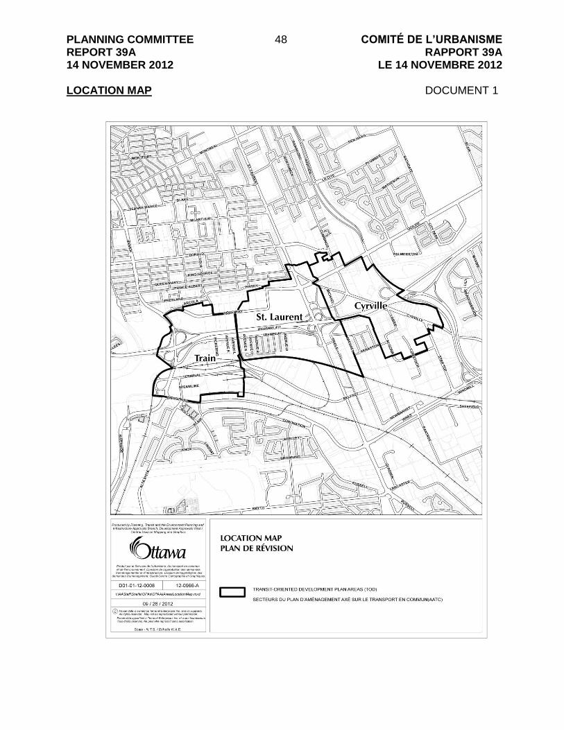
LE 14 NOVEMBRE 2012 LOCATION MAP DOCUMENT 1

PLANNING COMMITTEE REPORT 39A 14 NOVEMBER 2012
49 COMITÉ DE L’URBANISME RAPPORT 39A
LE 14 NOVEMBRE 2012 PROPOSED OFFICIAL PLAN DOCUMENT 2
Official Plan Amendment XX to the
Official Plan for the City of Ottawa
PLANNING COMMITTEE REPORT 39A 14 NOVEMBER 2012
50 COMITÉ DE L’URBANISME RAPPORT 39A
LE 14 NOVEMBRE 2012
INDEX
THE STATEMENT OF COMPONENTS PART A – THE PREAMBLE PAGE Purpose …………………………………………………………………………… 3 Location …………………………………………………………………………… 3 Basis ………………………………………………………………………………. 3 PART B – THE AMENDMENT Introduction ……………………………………………………………………….. 7 Details of the Amendment ………………………………………………………. 7 Implementation and Interpretation ……………………………………………… 7 Schedule 1 of Amendment XX – Official Plan for the City of Ottawa………. 10 PART C – THE APPENDIX Changes to Annex 6 – Secondary Plans and Site-Specific Policies………… 12 Changes to Schedule E – Urban Road Network……………………………….. 13

PLANNING COMMITTEE REPORT 39A 14 NOVEMBER 2012
51 COMITÉ DE L’URBANISME RAPPORT 39A
LE 14 NOVEMBRE 2012 PART A – THE PREAMBLE PART A – THE PREAMBLE introduces the actual amendment but does not constitute part of Amendment No. XX to the Official Plan for the City of Ottawa. PART B – THE AMENDMENT constitutes Amendment XX to the Official Plan for the City of Ottawa. 1. Purpose The purpose of this amendment is to add policy to various sections of the Official Plan for Transit-Oriented Development Areas (TOD) at future Light Rail Transit Stations. The amendment will also amend Schedule B – Urban Policy Plan to reflect changes to the Mixed-use Centre designation; make amendments to Schedule E to update road classifications; and make adjustments to the rights-of-way table in Annex 1 – Road Classification and Rights-of-Way. Schedule E and Annex 6 will be updated to show re-designated sections of two collector roads and the Transit-Oriented Development Areas, respectively; however, changes to the schedule and annex are not formally part of the Official Plan Amendment. In Section 2.0 Strategic Directions of the Official Plan, the amendment will make new reference to “Transit-Oriented Development Areas” and their associated density targets, as well as identify the ranges of people densities required to support higher-order transit systems such as LRT. A site specific policy for 530 Tremblay Road is added to Section 3.6.2 Mixed-Use Centres to establish a minimum amount of floor area for employment uses and its implementation through the Zoning By-law. The amendment will also increase the amount of land that can be taken for right-of-way protection for key roadways in the TOD study areas for Cyrville Road and Tremblay Road. The purpose of increasing rights-of-way protection is to ensure adequate space for wider sidewalks, new cycling lanes, off-peak on-street parking and landscaping, at the time of roadway reconstruction or property redevelopment. The amendment will also re-designate Cyrville Road from “local” to “collector”, and the remainder of Tremblay Road, from “collector” to “major collector”. 2. Location This amendment proposes Transit-Oriented Development Areas for three future Light Rail Transit (LRT) Stations. These three areas are located around the “Train”, “St. Laurent” and “Cyrville” stations, as shown on Annex 6. 3. Basis This section of the preamble to the proposed Official Plan Amendment explains why the amendments are proposed, whereas Part B includes the actual amendments that will be applied to the Official Plan, if approved.

PLANNING COMMITTEE REPORT 39A 14 NOVEMBER 2012
52 COMITÉ DE L’URBANISME RAPPORT 39A
LE 14 NOVEMBRE 2012 Background As per the direction of Council, the Planning and Growth Management Department‟s workplan within the mandate of Planning Committee, and the number one priority within the mandate of Planning Committee is Advancing the Transportation Agenda to connect the Transportation System to Neighbourhoods. Under this direction, the Department is undertaking a series of planning studies with the aim of maximizing economic development and neighbourhood connectivity opportunities along the Tunney‟s Station to Blair Station Light Rail Transit Corridor in advance of 2017. These planning studies are referred to as “Transit-Oriented Development” studies. The first three of these studies include the areas around three future LRT stations at “Train”, “St. Laurent” and “Cyrville”. While the Official Plan currently contains provisions regarding intensification and minimum density targets, additional policy is required for those areas of the City that are included within “Transit-Oriented Development Areas”. These areas can include designations such as Mixed Use Centres, Employment Areas, Arterial Mainstreets and General Urban Areas. The intent of TOD areas is to promote intensification for people and jobs, active modes of transportation, and excellence in urban design for future development. Rationale The proposed amendment is to support new TOD Plans being brought forward by the City of Ottawa. In general, the amendment will formally recognize the new TOD plans and establish the policy direction needed to ensure these areas develop at appropriate densities, with a broad mix of land uses, in an environment that is well-designed and that supports the use of multiple modes of transportation. Section 2.2.2 Managing Growth in the Urban Area The proposed amendment to the preamble in this section recommends that Plans for Transit-Oriented Development Areas may be prepared to provide direction for growth around transit stations, and how it will be implemented through the Zoning By-law. The proposed amendment to policy 4(a) recommends additional wording to reference Transit-Oriented Development Areas and indicates that the areas are illustrated on Annex 6. The proposed amendment to policy 6 recommends a change to add Train, St. Laurent and Cyrville under a new category for Transit-Oriented Development Areas to the list of target areas and to assign density targets for each of the TOD areas. By virtue of adding St. Laurent, Cyrville and Train under a new TOD category, modification is made to the existing row describing the Industrial Mixed-Use Centre to exclude that portion now represented by the Train TOD area, and to the row describing the St. Laurent Arterial Mainstreet to adjust the 2006 density number.

PLANNING COMMITTEE REPORT 39A 14 NOVEMBER 2012
53 COMITÉ DE L’URBANISME RAPPORT 39A
LE 14 NOVEMBRE 2012 The proposed amendment to policy 7 recommends a change to add a new policy to reference Transit-Oriented Development Areas listed in Figure 2.3 and ties the implementation of these policies to the Zoning By-law. It also recognizes exemptions from minimum density targets. The proposed amendment to policy 12(i) [new policy 13(i)] recommends a change to add Transit-Oriented Development Areas so that this policy also applies to these areas. The proposed amendment to policy 12(m) [new policy 13(m)] recommends a change to add plans for Transit-Oriented Development Areas as approved by Council so that this policy also applies to these areas. The proposed amendment to policy 21 [new policy 22] recommends a change to add plans for Transit-Oriented Development Areas as approved by Council so that this policy also applies to these areas. The proposed amendment to policy 23 [new policy 24] recommends a change to reference policy 25 below instead of policy 24 below to reflect the new numbering created by this amendment. The proposed amendment to policy 25 [new policy 26] recommends a change to reference policy 25 above instead of policy 24 above to reflect the new numbering created by this amendment. The proposed new policy 28 will recognize that the redesignation of lands from Employment Area to Mixed-Use Centre is tied to a site specific policy which sets a minimum density of employment to be implemented through the Zoning By-law. Section 2.5.1, policy 5, Urban Design and Compatibility, Design Priority Areas The proposed amendment to policy 5 recommends a change to add Transit-Oriented Development Areas to the list of Design Priority Areas as identified on Annex 6. Section 2.5.6, policy 6, Collaborative Community Building and Community Design Plans The proposed amendment to policy 6 recommends a change to add Plans for Transit-Oriented Development Areas as approved by Council so that this policy applies to these areas.
PLANNING COMMITTEE REPORT 39A 14 NOVEMBER 2012
54 COMITÉ DE L’URBANISME RAPPORT 39A
LE 14 NOVEMBRE 2012 Section 3.6.2 – Mixed-Use Centres The proposed amendment recommends a new policy to ensure a minimum number of jobs is created by establishing a minimum amount of gross floor area, which is to be implemented through the Zoning By-law. This policy supports the clear intent of the Provincial Policy Statement for protecting employment uses. Section 4.11 – Urban Design and Compatibility The proposed amendment recommends a change to include Plans for Transit-Oriented Development Areas as approved by Council so that this policy will apply to these areas. Schedule B - Urban Policy Plan The proposed amendment recommends changes to Schedule B to remove the Arterial Mainstreet designation along that portion of St. Laurent Boulevard within the St. Laurent Transit-Oriented Development Plan; and to redesignate some lands from General Urban Area and Employment Area to Mixed Use Centre for lands included within the St. Laurent Shopping Centre lands and for lands on both the east and west sides of St. Laurent Boulevard south of Highway 417. Volume 2B – Site-Specific Policies Remove reference to St. Laurent and Cyrville in the Site-Specific Policies for Gloucester as these policies are superseded by the Official Plan Volume 1 and the Transit-Oriented Development Plan. Annex 1- Road Classification and Rights-of-Way The proposed amendment revises Table 1 – Road Right of Way Protection to reintroduce the ROW widening requirements for two roads. These widenings are to ensure adequate space for wider sidewalks, new cycling lanes, off-peak on-street parking and landscaping, at the time of roadway reconstruction or property redevelopment. The amendment will also designate a portion of Cyrville Road as a “collector” road, and re-designate a portion of Tremblay Road from “collector” to “major collector”. The widening for Tremblay Road will be subject to an unequal widening, with 6 metres to be taken from the north side, and any additional lands from both the north and south side as required for a proposed roundabout. PART C – THE APPENDIX does not constitute part of Amendment XX to the Official Plan for the City of Ottawa, but is provided here to help illustrate the lands and roads affected by the Amendment on Annex 6 and on Schedule E, respectively.

PLANNING COMMITTEE REPORT 39A 14 NOVEMBER 2012
55 COMITÉ DE L’URBANISME RAPPORT 39A
LE 14 NOVEMBRE 2012 PART B – THE AMENDMENT 1. Introduction All of this part of the document entitled Part B - The Amendment, consisting of the following text and the attached map designated as Schedule “1” to Amendment No. XX, constitutes Amendment XX to the Official Plan of the City of Ottawa. 2. Details The Official Plan for the City of Ottawa is hereby amended as follows:
1. Section 2.2.2 Managing Growth in the Urban Area is hereby amended: (a) in the preamble, by adding to the end of the second paragraph the phrase
“Plans for Transit-Oriented Development Areas may be prepared to provide direction for growth in areas around transit stations, which will be implemented through such means as the Zoning By-law, Development review and improvements to municipal infrastructure.”
(b) in policy 4(a) by: a. deleting the words “and the Community Core in Riverside South” and
inserting the words “, the Community Core in Riverside South, and Transit-Oriented Development Areas defined on Annex 6, which may include more than one land use designation.”
(c) in policy 6, in Figure 2.3 – Density Targets by:
a. deleting the row “Cyrville” and the numbers “45” and “120”; b. adding the words “(excluding Train TOD Area)” after the word
“industrial” c. replacing the number “92” with “118” in the second column of the “St.
Laurent” Arterial Mainstreet row; and d. inserting the following rows at the end of the table:
Transit-Oriented Development Areas identified on Annex 6
Train 60 120*
St. Laurent 51 120*
Cyrville 53 120*
(d) in policy 7 by deleting the existing text and replacing with the following:
“For those locations identified in Figure 2.3, all new development within the boundary of the designation or Transit-Oriented Development Area will be required to meet these density targets. Where the minimum density is in square brackets [], an approved plan for a Transit-Oriented Development

PLANNING COMMITTEE REPORT 39A 14 NOVEMBER 2012
56 COMITÉ DE L’URBANISME RAPPORT 39A
LE 14 NOVEMBRE 2012
Area may assign a higher minimum density to specific parcels of land which will be implemented through the Zoning By-law.”
(e) by adding the following new policy after policy 7 and renumbering subsequent policies accordingly:
“8. Exceptions to policy 2.2.2(7) above for the density targets included in
Figure 2.3 may be considered where: a. a proposed development is providing a transition within the Mixed-Use
Centre adjacent to a low density residential community; or b. the land is in an approved plan for a Transit-Oriented Development
Area, identified on Annex 6, and: i. it is identified as a `Stable Residential Area‟ in an approved plan
for a Transit-Oriented Development; or ii. it has a lot area of less than 0.125 hectares.”
(f) in policy 12(i) [new policy 13(i)] by replacing the words “Centres and Mainstreets” with the following words “Centres, Mainstreets and Transit-Oriented Development Areas”;
(g) in policy 12(m) [new policy 13(m)] by adding the words “and plans for Transit-Oriented Development Areas as approved by City Council” after the words “community design plans”;
(h) in policy 21 [new policy 22] by adding the following new sub-policy: “f. Other areas in plans for Transit-Oriented Development Areas as
approved by City Council.”
(i) in policy 23 [new policy 24] by changing the reference from “policy 24 below” to “policy 25 below”;
(j) in policy 25 [new policy 26] by changing the reference from “Policy 24 above”
to “Policy 25 above”;
(k) by adding at the end the following new policy: “28. Policy 24 above will not apply to the re-designation of land from an
Employment Area to a Mixed-Use Centre where: a. the designation is recommended by a Council approved plan
for a Transit-Oriented Development Area included on Annex 6, that is at a station on the Primary Rapid Transit Network included on Schedule D; and
b. the existing permitted density of employment uses is maintained for the lands by a site-specific Official Plan policy, which is implemented through appropriate means in the Zoning By-law;

PLANNING COMMITTEE REPORT 39A 14 NOVEMBER 2012
57 COMITÉ DE L’URBANISME RAPPORT 39A
LE 14 NOVEMBRE 2012
2. Section 2.5.1 Urban Design and Compatibility, Design Priority Areas is hereby amended by deleting the word “and” at the end of clause “5.f.” and inserting new clause “5.g.”, “Transit-Oriented Development Areas as identified on Annex 6; and” and renumbering accordingly.
3. Section 2.5.6 Collaborative Community Building and Community Design Plans is hereby amended in policy 6 by replacing the word “and” between the words “Secondary Plans” and the words “Community Design Plans” with a “comma” and adding the phrase “, and Plans for Transit-Oriented Development Areas approved by City Council” immediately after the word “Plans” in the last sentence.
4. Section 3.6.2 Mixed-Use Centres is amended by adding at the end a new heading and policy as follows: “Site-Specific Exceptions”
12. The Mixed Use Centre at the southwest corner of Tremblay Road and St. Laurent Boulevard (municipally known as 530 Tremblay Road) shall provide for a minimum floor area of 40,000m2 for employment uses, which will be implemented through the Zoning By-law.”
5. Section 4.11 Urban Design and Compatibility is hereby amended by adding
the words “Plans for Transit-Oriented Development Areas approved by Council,” immediately after the words “Secondary Plans” and before the words “or site specific policies”.
6. Schedule B Urban Policy Plan is hereby amended as shown on Schedule “1” of
this Official Plan Amendment.
7. Volume 2B – Site-Specific Policies for the Former City of Gloucester is hereby amended
a. by deleting Policy 7.2.1.1.3 (c)(iii), and Policy 7.2.1.1.3 (w) in their entirety; b. in Policy 7.2.1.1.3 (f) by deleting the words “and for the St. Laurent/Cyrville
Core Activity Area”. 8. Annex 1 Road Classification and Rights-of-Way, Table 1 – Road Right of-Way Protection is amended to add new rows and text as shown below and in the correct alphabetical order:

PLANNING COMMITTEE REPORT 39A 14 NOVEMBER 2012
58 COMITÉ DE L’URBANISME RAPPORT 39A
LE 14 NOVEMBRE 2012
Road From To ROW to be Protected Classification Sector
Cyrville St. Laurent Cummings 26 collector urban
Tremblay Riverside St. Laurent 26 Note: Subject to unequal widening: 26 m, measured from the existing south ROW limit. Note: For the proposed roundabout located between Belfast and St. Laurent, more lands on either side of Tremblay, in addition to the 26 m unequal widening may be required.
major collector urban
3. Implementation and Interpretation Implementation and interpretation of this Amendment shall be in accordance with the
policies of the City of Ottawa Official Plan. At such time that the amendment is in full force and effect, Annex 6 of the Official Plan will be updated to reflect the boundaries of the TOD areas and Schedule E – Urban Road Network will be updated to reflect the classification of Cyrville Road and Tremblay Road, as shown in Appendix C to this amendment.
4. Schedule 1 of Amendment XX – Official Plan for the City of Ottawa

PLANNING COMMITTEE REPORT 39A 14 NOVEMBER 2012
59 COMITÉ DE L’URBANISME RAPPORT 39A
LE 14 NOVEMBRE 2012

PLANNING COMMITTEE REPORT 39A 14 NOVEMBER 2012
60 COMITÉ DE L’URBANISME RAPPORT 39A
LE 14 NOVEMBRE 2012 PART C - THE APPENDIX Appendix C is provided to help illustrate the lands affected by the proposed amendment. Changes to Annex 6 – Secondary Plans and Site-Specific Policies are reflected on Map 1 to illustrate the areas included in the Transit-Oriented Development Areas for “Train”, “St. Laurent” and “Cyrville”. Changes to Schedule E - Urban Road Network are reflected on Map 2 to illustrate those sections of the roads that are changing designations. Cyrville Road will be redesignated from “local” to “collector” between St. Laurent Boulevard and Cummings Avenue, and Tremblay Road will be redesignated from “collector” to “major collector” from Belfast Road to St. Laurent Boulevard.

PLANNING COMMITTEE REPORT 39A 14 NOVEMBER 2012
61 COMITÉ DE L’URBANISME RAPPORT 39A
LE 14 NOVEMBRE 2012

PLANNING COMMITTEE REPORT 39A 14 NOVEMBER 2012
62 COMITÉ DE L’URBANISME RAPPORT 39A
LE 14 NOVEMBRE 2012

PLANNING COMMITTEE REPORT 39A 14 NOVEMBER 2012
63 COMITÉ DE L’URBANISME RAPPORT 39A
LE 14 NOVEMBRE 2012 PROPOSED ZONING AMENDMENT MAP 1: TRAIN DOCUMENT 3

PLANNING COMMITTEE REPORT 39A 14 NOVEMBER 2012
64 COMITÉ DE L’URBANISME RAPPORT 39A
LE 14 NOVEMBRE 2012 PROPOSED ZONING AMENDMENT MAP 2: TRAIN DOCUMENT 4

PLANNING COMMITTEE REPORT 39A 14 NOVEMBER 2012
65 COMITÉ DE L’URBANISME RAPPORT 39A
LE 14 NOVEMBRE 2012 PROPOSED ZONING AMENDMENT MAP 3: ST. LAURENT DOCUMENT 5

PLANNING COMMITTEE REPORT 39A 14 NOVEMBER 2012
66 COMITÉ DE L’URBANISME RAPPORT 39A
LE 14 NOVEMBRE 2012 PROPOSED ZONING AMENDMENT MAP 4: ST. LAURENT DOCUMENT 6

PLANNING COMMITTEE REPORT 39A 14 NOVEMBER 2012
67 COMITÉ DE L’URBANISME RAPPORT 39A
LE 14 NOVEMBRE 2012 PROPOSED ZONING AMENDMENT MAP 5: CYRVILLE DOCUMENT 7

PLANNING COMMITTEE REPORT 39A 14 NOVEMBER 2012
68 COMITÉ DE L’URBANISME RAPPORT 39A
LE 14 NOVEMBRE 2012 PROPOSED ZONING AMENDMENT MAP 6: CYRVILLE DOCUMENT 8

PLANNING COMMITTEE REPORT 39A 14 NOVEMBER 2012
69 COMITÉ DE L’URBANISME RAPPORT 39A
LE 14 NOVEMBRE 2012 DETAILS OF RECOMMENDED ZONING DOCUMENT 9 Proposed changes to Zoning By-law 2008-250: 1. Add a new zone titled “TD – Transit Oriented Development Zone”. The purpose of
the TD Zone is: to establish minimum density targets needed to support Light Rail Transit (LRT) use for lands within Council-approved Transit-Oriented Development Plan areas; to accommodate a wide range of transit-supportive land uses such as residential, office, commercial, retail, arts and culture, entertainment, service uses and institutional in a compact pedestrian-oriented built form at medium to high densities; to locate higher densities in proximity to LRT stations to create focal points of activity and promote the use of multiple modes of transportation; and, to impose development standards that ensure the development of attractive urban environments that exhibit high-quality urban design and that establish priority streets for active use frontages and streetscaping investment. The following provisions are included in the TD Zone:
a. The following uses are permitted: amusement centre, animal care
establishment, animal hospital, artist studio, bank, bank machine, bar, broadcasting studio, cinema, community centre, community garden, community health and resource centre, convenience store, court house, day care, diplomatic mission, drive-through facility, emergency service, group home, home-based business, home-based day care, hospital, hotel, instructional facility, library, medical facility, municipal service centre, museum, nightclub, office, personal service business, place of assembly, place of worship, post office, post-secondary educational institution, production studio, recreational or athletic facility, research and development centre, residential care facility, restaurant, retail food store, retail store, retirement home, retirement home, converted, rooming house, rooming house, converted, school, service and repair shop, shelter, small batch brewery, sports arena, stacked dwelling, technology industry, theatre, training centre, apartment dwelling, low rise, apartment dwelling, mid-high rise, dwelling units, multiple attached dwelling , planned unit development, stacked dwelling;
b. Parking garages are permitted only in the same building or on the same lot as
a use or uses listed above; c. There is no minimum lot area; d. There is no minimum lot width; e. Minimum front yard and corner side yard setback abutting a lot in a residential
zone is 3 metres;

PLANNING COMMITTEE REPORT 39A 14 NOVEMBER 2012
70 COMITÉ DE L’URBANISME RAPPORT 39A
LE 14 NOVEMBRE 2012
f. Minimum front yard and corner side yard setback abutting the rapid transit corridor is 2 metres;
g. Minimum front yard and corner side yard setback for a parking garage that is
not incorporated into another building is 10 metres; h. The minimum front yard and corner side yard setback for a residential use
building is 3.0 metres; and in all other cases, the minimum front yard and corner side yard setback is 0.5 metres;
i. Minimum interior side yard setback abutting a lot in a residential zone is 3
metres; j. Minimum interior side yard setback abutting the rapid transit corridor is 2
metres; k. Minimum interior side yard setback for that part of a building more than
six-storeys is 12 metres; l. There is no minimum interior side yard setback for all other cases;
m. Minimum rear yard setback for rear lot line abutting a lot in a residential zone
is 6 metres; n. Minimum rear yard setback for rear lot line abutting the rapid transit corridor is
2 metres; o. Minimum rear yard setback for that part of a building over six-storeys in height
is 12 metres; p. There is no minimum rear yard setback for all other cases; q. Minimum building height is 6.7 metres and two-storeys; r. Buildings in any area up to and including 15 metres from a property line
abutting a R1, R2 or R3 zone have a maximum height of 14.5 metres; s. Building heights in all other cases are specified by the applicable TD subzone; t. There is no minimum width of landscaped area except, where a yard is
provided and not used for required driveways, aisles, parking, loading spaces or outdoor commercial patio, the whole yard must be landscaped;
u. Outdoor storage is prohibited;

PLANNING COMMITTEE REPORT 39A 14 NOVEMBER 2012
71 COMITÉ DE L’URBANISME RAPPORT 39A
LE 14 NOVEMBRE 2012
v. Maximum parking space rates are calculated using Table 103, column III, Area B;
w. Minimum parking space rates are calculated using Table 101, column II, Area
A; x. Required parking spaces may be available for use by any other land use
located either on or off site, but these spaces are not intended to serve as the required parking for these other land uses;
y. The front wall of either the 2nd, 3rd or 4th storey of buildings more than
four-storeys in height within 10 metres of a lot line abutting a public street must be stepped back a further 2.5 metres from the wall of the storey below;
z. Where two buildings on the same lot each have more than six-storeys those
parts of the buildings greater than 6 storeys must be a minimum of 24 metres away from each other;
aa. Lots greater than 1,250 m2 must provide 2 per cent of the total lot area as
outdoor communal space and at grade, and such area provided can also be used to comply with the amenity area requirements of the City of Ottawa Zoning By-law;
bb. Lots abutting active frontage streets as shown on Document 4, “Proposed
Zoning Amendment Map 2: TRAIN” shall have: a minimum building setback from the active frontage street of 3.0 metres for residential use buildings, and a minimum building setback from the active frontage street of 1.5 metres for non-residential and mixed-use buildings; and a maximum building setback from the active frontage street of 6.0 metres for residential, non-residential and mixed-use buildings; and at least 50 per cent of the lot width measured at the building setback along the active frontage street must be occupied by one or more building walls; a minimum of 50 per cent of the surface area of the ground floor façade of a non-residential use and mixed-use building must be comprised of transparent glazing including a customer entrance access door from each individual occupancy to the active frontage street; and no person may park a motor vehicle in a required and provided yard abutting an active frontage street;
cc. Lots abutting active frontage streets as shown on Documents 6 and 8, “Proposed Zoning Amendment Maps 4 and 6 for ST. LAURENT and CYRVILLE”, respectively, shall have: a minimum building setback from the active frontage street of 3.0 metres for residential use buildings, and a minimum building setback from the active frontage street of 0.5 metres for non-residential and mixed-use buildings; a maximum building setback from the active frontage street of 6.0 metres for residential use buildings or a maximum
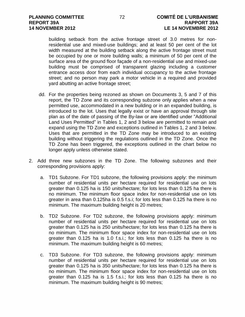
PLANNING COMMITTEE REPORT 39A 14 NOVEMBER 2012
72 COMITÉ DE L’URBANISME RAPPORT 39A
LE 14 NOVEMBRE 2012
building setback from the active frontage street of 3.0 metres for non-residential use and mixed-use buildings; and at least 50 per cent of the lot width measured at the building setback along the active frontage street must be occupied by one or more building walls; a minimum of 50 per cent of the surface area of the ground floor façade of a non-residential use and mixed-use building must be comprised of transparent glazing including a customer entrance access door from each individual occupancy to the active frontage street; and no person may park a motor vehicle in a required and provided yard abutting an active frontage street;
dd. For the properties being rezoned as shown on Documents 3, 5 and 7 of this
report, the TD Zone and its corresponding subzone only applies when a new permitted use, accommodated in a new building or in an expanded building, is introduced to the lot. Uses that legally exist or have an approval through site plan as of the date of passing of the By-law or are identified under “Additional Land Uses Permitted” in Tables 1, 2 and 3 below are permitted to remain and expand using the TD Zone and exceptions outlined in Tables 1, 2 and 3 below. Uses that are permitted in the TD Zone may be introduced to an existing building without triggering the regulations outlined in the TD Zone. Once the TD Zone has been triggered, the exceptions outlined in the chart below no longer apply unless otherwise stated.
2. Add three new subzones in the TD Zone. The following subzones and their
corresponding provisions apply:
a. TD1 Subzone. For TD1 subzone, the following provisions apply: the minimum number of residential units per hectare required for residential use on lots greater than 0.125 ha is 150 units/hectare; for lots less than 0.125 ha there is no minimum. The minimum floor space index for non-residential use on lots greater in area than 0.125ha is 0.5 f.s.i; for lots less than 0.125 ha there is no minimum. The maximum building height is 20 metres;
b. TD2 Subzone. For TD2 subzone, the following provisions apply: minimum
number of residential units per hectare required for residential use on lots greater than 0.125 ha is 250 units/hectare; for lots less than 0.125 ha there is no minimum. The minimum floor space index for non-residential use on lots greater than 0.125 ha is 1.0 f.s.i.; for lots less than 0.125 ha there is no minimum. The maximum building height is 60 metres;
c. TD3 Subzone. For TD3 subzone, the following provisions apply: minimum
number of residential units per hectare required for residential use on lots greater than 0.125 ha is 350 units/hectare; for lots less than 0.125 ha there is no minimum. The minimum floor space index for non-residential use on lots greater than 0.125 ha is 1.5 f.s.i.; for lots less than 0.125 ha there is no minimum. The maximum building height is 90 metres;

PLANNING COMMITTEE REPORT 39A 14 NOVEMBER 2012
73 COMITÉ DE L’URBANISME RAPPORT 39A
LE 14 NOVEMBRE 2012 3. For all TD subzones, the following provisions also apply:
a. For mixed use buildings, determining whether the building is residential use or non-residential use is determined by the use that occupies the larger portion of the gross floor area of the building. The smaller use, either residential or non-residential, is not calculated.
b. For phased development where all phases are shown each phase must
comply with the minimum densities or F.S.I.s in the corresponding subzone and the minimum outdoor communal space requirements in the TD zone.
4. Rezone the subject properties shown on Document 3 as follows:
Area A is rezoned from GM6 H(34) to TD2[aaaa] Area B is rezoned from GM6 H(34) to TD3[aaaa] Area C is rezoned from GM6 H(34) to GM6 H(91) Area D is rezoned from T2B to TD3[bbbb] Area E is rezoned from IG3[263] to TD3[cccc] Area F is rezoned from IG3[263] to TD2[dddd] Area G is rezoned from IG3 to TD3 Area H is rezoned from IG3[263] to TD3[eeee] Area I is rezoned from MC[135] to TD3[ffff] Area J is rezoned from MC[135] to TD3 Area K is rezoned from MC[135] to TD3[gggg] Area L is rezoned from IG3[263] to TD2 Area M is rezoned from I1A to TD3[hhhh] Area N is rezoned from IG3 to TD3[iiii] Area O is rezoned from MC[136] to TD3[jjjj] Area P is rezoned from MC7[1387]-h to TD3[kkkk] Area Q is rezoned from MC7[1387]-h to TD2[llll] Area R is rezoned from IG3 to TD1[mmmm]
5. Rezone the subject properties shown on Document 5 as follows:
Area A is rezoned from AM to TD2[nnnn] Area B is rezoned from AM H(20) to TD2[oooo] Area C is rezoned from R4N[972] to TD1[pppp] Area D is rezoned from GM[1342] to TD2[qqqq] Area E is rezoned from GM[52] to TD2[rrrr] Area F is rezoned from MC F(2.0) H(48) to TD3[ssss] Area G is rezoned from GM24[1787] F(1.0) S263-h1 to TD3[tttt]-h1 Area H is rezoned from GM24[1787] F(1.0) S263-h2 to TD2[uuuu]-h2 Area I is rezoned from IL to TD3[vvvv] Area J is rezoned from L1 to TD3

PLANNING COMMITTEE REPORT 39A 14 NOVEMBER 2012
74 COMITÉ DE L’URBANISME RAPPORT 39A
LE 14 NOVEMBRE 2012
Area K is rezoned from MC[205] F(1.1) H(22) to TD3[wwww] Area L is rezoned from GM24[1787] F(1.0) S263 to TD3[xxxx] Area M is rezoned from IL to TD1 Area N is rezoned from IL to TD3 Area O is rezoned from IL to TD1[yyyy] Area P is rezoned from AM to TD3[zzzz] Area Q is rezoned from AM to TD3 Area R is rezoned from IL to TD3 Area S is rezoned from IL to TD3
6. Rezone the subject properties shown on Document 7 as follows:
Area A is rezoned from MC[1353] H(48) to TD3[zaaa] Area B is rezoned from MC F(2.0) H(48) to TD3[zbbb] Area C is rezoned from MC[1301] F(2.0) H(48) to TD3[zccc] Area D is rezoned from MC F(2.0) H(48) to TD3[ssss] Area E is rezoned from IL2 F(0.7) H(14) to TD1[zeee] Area F is rezoned from IL2[1355] F(0.7) H(14) to TD3[zfff] Area G is rezoned from IL2 F(0.7) H(14) to TD3[zggg] Area H is rezoned from MC F(2.0) H(48) to TD2
7. Rezone all active frontage street properties with the appropriate schedule number.
8. Add, amend or replace, where applicable, the following exceptions from Tables 1, 2 and 3 to Section 239 of Zoning By-law 2008-250:
Table 1: Applying to Train TOD Area Areas in Document 3 (Train)
From
To Additional Land Uses Permitted
Land Uses Prohibited
Provisions
A From GM6 H(34)
To TD2[aaaa]
- Properties are exempt from meeting provisions in 1. b, g, k, o, q, s, w, y, z, aa and 2. above.
- Maximum building height is 34 m
- Maximum F.S.I. is 2 - The cumulative total gross
floor area of all retail store and retail food store must not exceed 23,225 square metres, and must be distributed proportionally, on a lot by lot basis, in accordance with the following formula: (lot area ÷ zone area) x 23,255 square metres

PLANNING COMMITTEE REPORT 39A 14 NOVEMBER 2012
75 COMITÉ DE L’URBANISME RAPPORT 39A
LE 14 NOVEMBRE 2012 Areas in Document 3 (Train)
From
To Additional Land Uses Permitted
Land Uses Prohibited
Provisions
- A parking structure is permitted if it is located on a lot with a principal use and it is located in a rear yard not abutting a street
B From GM6 H(34)
To TD3[aaaa]
- The Provisions outlined in Area A above apply for TD3[aaaa].
D From T2B
To TD3[bbbb]
- Properties are exempt from meeting provisions in 1. b, g, k, o, q, s, w, y, z, aa and 2. above.
- Maximum building height is 18 m
- Maximum F.S.I. is 3
E From IG3[263]
To TD3[cccc]
-adult entertainment parlour
- Properties are exempt from meeting provisions in 1. b, g, k, o, q, s, u, w, y, z, aa and 2. above.
- Maximum building height is 22 m
- Maximum F.S.I. is 2 - Outdoor storage must: i) not
exceed 50 per cent of the lot area; and, ii) be located in the rear yard only.
- Overnight outdoor storage of automobile parts and accessories is prohibited.
- Parking, storage or salvaging of derelict motor vehicles on the property is prohibited.
F From IG3[263]
To TD2[dddd]
-adult entertainment parlour
- Properties are exempt from meeting provisions in 1. b, g, k, o, q, s, u, w, y, z, aa and 2. above.
- Maximum building height is 22 m
- Maximum F.S.I. is 2 - Outdoor storage must: i) not
exceed 50 per cent of the lot area; and, ii) be located in the rear yard only.
- Overnight outdoor storage of automobile parts and accessories is prohibited.
- Parking, storage or salvaging of derelict motor vehicles on the property is prohibited.
H From IG3[263]
To TD3[eeee]
- parking lot - adult

PLANNING COMMITTEE REPORT 39A 14 NOVEMBER 2012
76 COMITÉ DE L’URBANISME RAPPORT 39A
LE 14 NOVEMBRE 2012 Areas in Document 3 (Train)
From
To Additional Land Uses Permitted
Land Uses Prohibited
Provisions
entertainment parlour
I From MC[135]
To TD3[ffff]
- parking lot
K From MC[135]
To TD3[gggg]
- Properties are exempt from meeting provisions in 1. b, g, k, o, s, w, y, z, aa, bb and 2. above.
- Maximum building height is: no maximum
- Maximum F.S.I. is: no maximum
- The following provisions apply to commercial uses only: i) the maximum gross leasable area must not exceed 52,400 m2, and ii) the maximum parking rate is two spaces per 100 m2
M From I1A
To TD3[hhhh]
- place of worship and ancillary rooming units
- community centre
- Properties are exempt from meeting provisions in 1. b, g, k, o, q, s, w, y, z, aa, bb and 2. above.
- a maximum of three ancillary rooming units are permitted in a place of worship
- Maximum building height is 15 m
N From IG3
To TD3[iiii]
- Properties are exempt from meeting provisions in 1. b, g, k, o, q, s, u, w, y, z, aa, bb and 2. above.
- Maximum building height is 22 m
- Maximum F.S.I. is 2 - Outdoor storage must: i) not
exceed 50 per cent of the lot area; and, ii) be located in the rear yard only.
- Overnight outdoor storage of automobile parts and accessories is prohibited.
- Parking, storage or salvaging of derelict motor vehicles on the property is prohibited.
O From MC[136]
To TD3[jjjj]
- Properties are exempt from meeting provisions in 1. b, g, k, o, s, w, y, z, aa, bb and 2. above.
- Maximum building height is: no maximum

PLANNING COMMITTEE REPORT 39A 14 NOVEMBER 2012
77 COMITÉ DE L’URBANISME RAPPORT 39A
LE 14 NOVEMBRE 2012 Areas in Document 3 (Train)
From
To Additional Land Uses Permitted
Land Uses Prohibited
Provisions
- Maximum F.S.I. is: no maximum
- The following provisions apply to commercial uses only: i) the maximum gross leasable area must not exceed 50,100 m2, and ii) the maximum parking rate is two spaces per 100 m2
P From MC7[1387]-h
To TD3[kkkk]-h
- new stand alone retail or restaurant uses in excess of 900 m2 in area
- Properties are exempt from meeting provisions in 1. b, g, k, o, s, w, y, z, aa, bb and 2. above.
- Maximum building height is: no maximum
- Maximum F.S.I. is: no maximum
- Surface parking is limited to the rate of 5.0 spaces per 100 square metres of gross leasable area plus 15per cent
- For any yard that abuts Trainyards Drive, Industrial Avenue or Belfast Road, a maximum setback of 4.5 m is permitted for a building and the yard provided must be landscaped,
- No more than 45per cent of the frontage along Industrial Avenue and Belfast Road can be occupied by parking,
- New, after December 14, 2011, stand alone retail and restaurant uses that are in excess of 900 m2 in area are prohibited until such time as the holding symbol is removed.
- The holding symbol can only be removed, in whole or in part, upon the completion of required studies to the satisfaction of the General Manager of Planning and Growth Management, to determine environmental remediation required, if there is adequate sewer, water and road capacity to accommodate the

PLANNING COMMITTEE REPORT 39A 14 NOVEMBER 2012
78 COMITÉ DE L’URBANISME RAPPORT 39A
LE 14 NOVEMBRE 2012 Areas in Document 3 (Train)
From
To Additional Land Uses Permitted
Land Uses Prohibited
Provisions
development and if not, what measures or improvements have to be completed to provide for this capacity.
Q From MC7[1387]-h
To TD2[llll]-h
- Properties are exempt from meeting provisions in 1. b, g, k, o, s, w, y, z, aa, bb and 2. above.
- Maximum building height is: no maximum
- Maximum F.S.I. is: no maximum
- Surface parking is limited to the rate of 5.0 spaces per 100 square metres of gross leasable area plus 15per cent
- For any yard that abuts Trainyards Drive, Industrial Avenue or Belfast Road, a maximum setback of 4.5 m is permitted for a building and the yard provided must be landscaped,
- No more than 45per cent of the frontage along Industrial Avenue and Belfast Road can be occupied by parking,
- New, after December 14, 2011, stand alone retail and restaurant uses that are in excess of 900 m2 in area are prohibited until such time as the holding symbol is removed. The holding symbol can only be removed, in whole or in part, upon the completion of required studies to the satisfaction of the General Manager of Planning and Growth Management, to determine environmental remediation required, if there is adequate sewer, water and road capacity to accommodate the development and if not, what measures or improvements have to be completed to provide for this capacity.
R From To - Properties are exempt from

PLANNING COMMITTEE REPORT 39A 14 NOVEMBER 2012
79 COMITÉ DE L’URBANISME RAPPORT 39A
LE 14 NOVEMBRE 2012 Areas in Document 3 (Train)
From
To Additional Land Uses Permitted
Land Uses Prohibited
Provisions
IG3 TD1[mmmm]
meeting provisions in 1. b, g, k, o, q, s, u, w, y, z, aa and 2. above.
- Maximum building height is 22 m
- Maximum F.S.I. is 2 - Outdoor storage must: i) not
exceed 50per cent of the lot area; and, ii) be located in the rear yard only.
- Overnight outdoor storage of automobile parts and accessories is prohibited.
- Parking, storage or salvaging of derelict motor vehicles on the property is prohibited.
Table 2: Applying to St. Laurent TOD Area Areas in Document 5 (St. Laurent)
From
To Additional Land Uses Permitted
Land Uses Prohibited
Provisions
A AM TD2[nnnn] - Properties are exempt from meeting provisions in 1. b, g, k, o, q, s, u, w, y, z, aa, cc and 2. above.
- Maximum building height is 25 m
- Maximum F.S.I. is 3.5 if 80per cent of required parking is provided below grade, or is 2 in all other cases.
- Outdoor storage is permitted for existing automobile dealerships and must be located in an interior side yard or rear yard.
B AM H(20) TD2[oooo] - Properties are exempt from meeting provisions in 1. b, g, k, o, q, s, u, w, z, aa, cc and 2. above.
- Maximum building height is 20 m
- Maximum F.S.I. is 3.5 if 80per cent of required parking is provided below grade, or is 2 in all other cases.
- Outdoor storage is permitted and must be located in an interior side yard or rear yard,

PLANNING COMMITTEE REPORT 39A 14 NOVEMBER 2012
80 COMITÉ DE L’URBANISME RAPPORT 39A
LE 14 NOVEMBRE 2012 Areas in Document 5 (St. Laurent)
From
To Additional Land Uses Permitted
Land Uses Prohibited
Provisions
and completely enclosed and screened from a public street, residential zone or institutional zone.
C R4N[972] TD1[pppp] - Properties are exempt from meeting provisions in 1. b, e, g, i, k, o, q, w, y, z, and aa.
- Front yard setback of at least 10.5 m from Bernard Street
- Side yard setback of at least 7.6 m from the north property line
- Side yard setback of at least 6.2 m from the south property line
- Rear yard setback of at least 7.6 m from the east property line
D GM[1342] TD2[qqqq] - parking garage
- parking lot
- all residential use buildings
- Properties are exempt from meeting provisions in 1. b, g, k, o, q, r, s, w, y, z, aa, cc and in 2. above.
- Maximum F.S.I. is 2. - Maximum building height is 18
m.
E GM[52] TD2[rrrr] - all uses except a parking lot
- parking lot use to serve the shopping centre use located to the south
F MC F(2.0) H(48)
TD3[ssss] - Properties are exempt from meeting provisions in 1. b, g, k, o, s, v, w, y, z, aa and in 2. above.
- Maximum F.S.I. is 2. - Maximum building height is 48
m. - The following provision to
apply now and once the TD zoning is triggered: Properties zoned within this exception are considered one lot for the purposes of calculating parking.
G GM24 [1787] F(1.0) S263-h1
TD3[tttt] S263-h1
- Properties are exempt from meeting provisions in 1. b, g, k, o, q, s, w, z, aa, cc and in 2. above.
- Maximum F.S.I. is 1. a. Required parking may be
located in the adjacent TD2[rrrr] zone;
b. Minimum required number
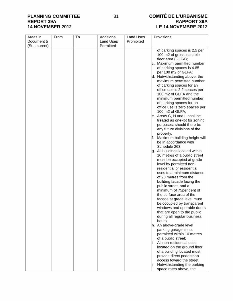
PLANNING COMMITTEE REPORT 39A 14 NOVEMBER 2012
81 COMITÉ DE L’URBANISME RAPPORT 39A
LE 14 NOVEMBRE 2012 Areas in Document 5 (St. Laurent)
From
To Additional Land Uses Permitted
Land Uses Prohibited
Provisions
of parking spaces is 2.5 per 100 m2 of gross leasable floor area (GLFA);
c. Maximum permitted number of parking spaces is 4.85 per 100 m2 of GLFA;
d. Notwithstanding above, the maximum permitted number of parking spaces for an office use is 2.2 spaces per 100 m2 of GLFA and the minimum permitted number of parking spaces for an office use is zero spaces per 100 m2 of GLFA;
e. Areas G, H and L shall be treated as one-lot for zoning purposes, should there be any future divisions of the property;
f. Maximum building height will be in accordance with Schedule 263;
g. All buildings located within 10 metres of a public street must be occupied at grade level by permitted non-residential or residential uses to a minimum distance of 20 metres from the building facade facing the public street, and a minimum of 75per cent of the surface area of the facade at grade level must be occupied by transparent windows and operable doors that are open to the public during all regular business hours;
h. An above-grade level parking garage is not permitted within 10 metres of a public street;
i. All non-residential uses located on the ground floor of a building located must provide direct pedestrian access toward the street
j. Notwithstanding the parking space rates above, the

PLANNING COMMITTEE REPORT 39A 14 NOVEMBER 2012
82 COMITÉ DE L’URBANISME RAPPORT 39A
LE 14 NOVEMBRE 2012 Areas in Document 5 (St. Laurent)
From
To Additional Land Uses Permitted
Land Uses Prohibited
Provisions
provisions set out below apply to all residential uses.
- The “h1” holding symbol will
not be lifted until all agreements required outlining the details of the relocation of Coventry Road to the north and west sides of 525 and 535 Coventry Road have been executed;
- The following additional zone
provisions will apply to the property after the lifting of the -h1 holding symbol:
- The maximum permitted
GLFA for all retail uses is 139,000 m2
- Notwithstanding the provision directly above, the maximum GLFA for all retail uses may exceed 139,000 m2 when building(s) are provided along the easterly edge of the property, that contain at grade level permitted non-residential uses with direct pedestrian access to St. Laurent Boulevard, covering a minimum of 20 metres of the buildable area measured westerly from the lot line abutting St. Laurent Blvd. and for a minimum distance of equal to 65per cent of the frontage along St. Laurent Blvd., and of 65per cent, a minimum of 30 metres measured southerly along St. Laurent Blvd. from Coventry Road must be occupied by building(s);
- The maximum total combination of GLFA for all non-residential uses plus Gross Floor Area for all residential uses is 170,000 m2 ;
- Notwithstanding the provision

PLANNING COMMITTEE REPORT 39A 14 NOVEMBER 2012
83 COMITÉ DE L’URBANISME RAPPORT 39A
LE 14 NOVEMBRE 2012 Areas in Document 5 (St. Laurent)
From
To Additional Land Uses Permitted
Land Uses Prohibited
Provisions
directly above, the maximum total combination of GLFA for all non-residential uses plus Gross Floor Area for all residential uses GLFA may exceed 170,000 m2 when building(s) are provided along the easterly edge of the property, that contain at grade level permitted non-residential uses with direct pedestrian access to St. Laurent Boulevard, covering a minimum of 20 metres of the buildable area measured westerly from the lot line abutting St. Laurent Boulevard and for a minimum distance equal to 65per cent of the frontage along St. Laurent Blvd., and of that 65per cent a minimum of 30 metres measured southerly along St. Laurent Blvd. from Coventry Road must be occupied by building(s).
H GM24 [1787] F(1.0) S263-h2
TD2[uuuu] S263-h2
- Properties are exempt from meeting provisions in 1. b, g, k, o, q, s, w, z, aa, cc and in 2. above.
- Maximum F.S.I. is 1. a. Required parking may be
located in the adjacent TD2[rrrr] zone;
b. Minimum required number of parking spaces is 2.5 per 100 m2 of gross leasable floor area (GLFA);
c. Maximum permitted number of parking spaces is 4.85 per 100 m2 of GLFA;
d. Notwithstanding above, the maximum permitted number of parking spaces for an office use is 2.2 spaces per 100 m2 of GLFA and the minimum permitted number of parking spaces for an office use is zero spaces per 100 m2 of GLFA;
e. Areas G, H and L shall be

PLANNING COMMITTEE REPORT 39A 14 NOVEMBER 2012
84 COMITÉ DE L’URBANISME RAPPORT 39A
LE 14 NOVEMBRE 2012 Areas in Document 5 (St. Laurent)
From
To Additional Land Uses Permitted
Land Uses Prohibited
Provisions
treated as one-lot for zoning purposes, should there be any future divisions of the property;
f. Maximum building height will be in accordance with Schedule 263;
g. All buildings located within 10 metres of a public street must be occupied at grade level by permitted non-residential or residential uses to a minimum distance of 20 metres from the building facade facing the public street, and a minimum of 75per cent of the surface area of the facade at grade level must be occupied by transparent windows and operable doors that are open to the public during all regular business hours;
h. An above-grade level parking garage is not permitted within 10 metres of a public street;
i. All non-residential uses located on the ground floor of a building located must provide direct pedestrian access toward the street
j. Notwithstanding the parking space rates above, the provisions set out below apply to all residential uses.
- The “h2” holding symbol will
not be lifted until Coventry Road has been relocated and constructed to City standards to the north and west sides of 525 and 535 Coventry Road.
- The following additional zone provisions will apply to the property after the lifting of the –h2 holding symbol:
- The maximum permitted GLFA for all retail uses is

PLANNING COMMITTEE REPORT 39A 14 NOVEMBER 2012
85 COMITÉ DE L’URBANISME RAPPORT 39A
LE 14 NOVEMBRE 2012 Areas in Document 5 (St. Laurent)
From
To Additional Land Uses Permitted
Land Uses Prohibited
Provisions
139,000 m2 - Notwithstanding the provision
directly above, the maximum GLFA for all retail uses may exceed 139,000 m2 when building(s) are provided along the easterly edge of the property, that contain at grade level permitted non-residential uses with direct pedestrian access to St. Laurent Boulevard, covering a minimum of 20 metres of the buildable area measured westerly from the lot line abutting St. Laurent Blvd. and for a minimum distance of equal to 65per cent of the frontage along St. Laurent Blvd., and of 65per cent, a minimum of 30 metres measured southerly along St. Laurent Blvd. from Coventry Road must be occupied by building(s);
- The maximum total combination of GLFA for all non-residential uses plus Gross Floor Area for all residential uses is 170,000 m2 ;
- Notwithstanding the provision directly above, the maximum total combination of GLFA for all non-residential uses plus Gross Floor Area for all residential uses GLFA may exceed 170,000 m2 when building(s) are provided along the easterly edge of the property, that contain at grade level permitted non-residential uses with direct pedestrian access to St. Laurent Boulevard, covering a minimum of 20 metres of the buildable area measured westerly from the lot line abutting St. Laurent Boulevard and for a minimum distance equal to 65per cent

PLANNING COMMITTEE REPORT 39A 14 NOVEMBER 2012
86 COMITÉ DE L’URBANISME RAPPORT 39A
LE 14 NOVEMBRE 2012 Areas in Document 5 (St. Laurent)
From
To Additional Land Uses Permitted
Land Uses Prohibited
Provisions
of the frontage along St. Laurent Blvd., and of that 65per cent a minimum of 30 metres measured southerly along St. Laurent Blvd. from Coventry Road must be occupied by building(s).
I IL TD3[vvvv] The following provision applies now and once the TD zoning is triggered:
- Residential uses and residential buildings are prohibited until a minimum F.S.I. of 1.5 is achieved for any non-residential or mixed use buildings on the site; or until the gross floor area of all non-residential buildings is at least 40,000 m2.
- The following provision to apply now and once the TD zoning is triggered: Federal government lands zoned TD3[vvvv] are considered one lot for the purposes of calculating parking requirements.
K MC[205] F(1.1) H(22)
TD3[wwww]
- automobile dealership
- Properties are exempt from meeting provisions in 1. b, g, k, o, s, v, w, y, z, aa, cc and in 2. above.
- Maximum F.S.I. is 1.1. - Maximum building height is 22
m.
L GM24 [1787] F(1.0) S263
TD3[xxxx] S263
- Properties are exempt from meeting provisions in 1. b, g, k, o, q, s, w, z, aa, cc and in 2. above.
- Maximum F.S.I. is 1. a. Required parking may be
located in the adjacent TD2[rrrr] zone;
b. Minimum required building setback from St. Laurent Boulevard is 3.5 metres;
c. Maximum permitted setback from St. Laurent Boulevard is 4.5 m;
d. Minimum required number of parking spaces is 2.5 per 100 m2 of gross leasable

PLANNING COMMITTEE REPORT 39A 14 NOVEMBER 2012
87 COMITÉ DE L’URBANISME RAPPORT 39A
LE 14 NOVEMBRE 2012 Areas in Document 5 (St. Laurent)
From
To Additional Land Uses Permitted
Land Uses Prohibited
Provisions
floor area (GLFA); e. Maximum permitted number
of parking spaces is 4.85 per 100 m2 of GLFA;
f. Notwithstanding “e”, the maximum permitted number of parking spaces for an office use is 2.2 spaces per 100 m2 of GLFA;
g. Notwithstanding “d”, the minimum permitted number of parking spaces for an office use is zero spaces per 100 m2 of GLFA;
h. Areas L, H and G shall be treated as one-lot for zoning purposes, should there be any future divisions of the property;
i. Maximum building height will be in accordance with Schedule 263;
j. All buildings located within 10 metres of a public street must be occupied at grade level by permitted non-residential or residential uses to a minimum distance of 20 metres from the building facade facing the public street, and a minimum of 75per cent of the surface area of the facade at grade level must be occupied by transparent windows and operable doors that are open to the public during all regular business hours;
k. An above-grade level parking garage is not permitted within 10 metres of a public street;
l. All non-residential uses located on the ground floor of a building located as per “k” must provide direct pedestrian access toward the street
m. Notwithstanding “d” and “e” above, the provisions set out

PLANNING COMMITTEE REPORT 39A 14 NOVEMBER 2012
88 COMITÉ DE L’URBANISME RAPPORT 39A
LE 14 NOVEMBRE 2012 Areas in Document 5 (St. Laurent)
From
To Additional Land Uses Permitted
Land Uses Prohibited
Provisions
in point 1 below apply to all residential uses.
1. 500 Coventry Road zoned TD3[tttt]S263-h1: the “h1” holding symbol will not be lifted until all agreements required outlining the details of the relocation of Coventry Road to the north and west sides of 525 and 535 Coventry Road have been executed; and, 525 and 535 Coventry Road zoned TD2[uuuu]S263-h2: the “h2” holding symbol will not be lifted until Coventry Road has been relocated and constructed to City standards to the north and west sides of 525 and 535 Coventry Road.
O IL TD1[yyyy] - Properties are exempt from meeting provisions in 1. b, g, k, o, q, r, s, w, y, z, aa, cc and in 2. above.
- Maximum building height is 11 m within 20 m of a residential zone. In all other cases the maximum building height is 18 m.
- Maximum F.S.I. is 2.
P AM TD3[zzzz] - Properties are exempt from meeting provisions in 1. b, g, k, o, q, s, u, v, w, y, z, aa, cc and 2. above.
- Maximum building height is 25 m
- Maximum F.S.I. is 3.5 if 80per cent of required parking is provided below grade, or is 2 in all other cases.
- Outdoor storage is permitted and must be located in an interior side yard or rear yard for existing automobile dealerships.

PLANNING COMMITTEE REPORT 39A 14 NOVEMBER 2012
89 COMITÉ DE L’URBANISME RAPPORT 39A
LE 14 NOVEMBRE 2012 Table 3: Applying to Cyrville TOD Area Areas in Document 7 (Cyrville)
To
From Additional Land Uses Permitted
Land Uses Prohibited
Provisions
A MC[1353] H(48)
TD3[zaaa] - Properties are exempt from meeting provisions in 1. b, g, k, o, s, v, w, y, z, aa, cc and in 2. above.
- Maximum F.S.I. for commercial uses is 1.2
- There is no maximum F.S.I. for all other uses.
- Maximum building height is 48 m.
B MC F(2.0) H(48)
TD3[zbbb] - Properties are exempt from meeting provisions in 1. b, g, k, o, s, v, w, y, z, aa, cc and in 2. above.
- Maximum F.S.I. is 2.0. - Maximum building height is 48
m. The following provision applies now and once the TD zoning is triggered:
- Properties zoned within this exception are considered one lot for the purposes of calculating parking.
C MC[1301] F(2.0) H(48)
TD3[zccc] - automobile dealership
- warehouse
- Properties are exempt from meeting provisions in 1. b, g, k, o, s, v, w, y, z, aa, cc and in 2. above.
- Maximum F.S.I. is 2.0. - Maximum building height is 48
m.
D MC F(2.0) H(48)
TD3[ssss] - The Provisions outlined in Area F from the St. Laurent TOD Area apply for TD3[ssss].
E IL2 F(0.7) H(14)
TD1[zeee] - Properties are exempt from meeting provisions in 1. b, g, k, o, q, s, v, w, y, z, aa and in 2. above.
- Maximum F.S.I. is 0.7. - Maximum building height is 14
m. - Maximum lot coverage is
65per cent
F IL[1355] F(0.7) H(14)
TD3 [zfff] - automobile dealership
- Properties are exempt from meeting provisions in 1. b, g, k, o, q, s, v, w, y, z, aa and in

PLANNING COMMITTEE REPORT 39A 14 NOVEMBER 2012
90 COMITÉ DE L’URBANISME RAPPORT 39A
LE 14 NOVEMBRE 2012 Areas in Document 7 (Cyrville)
To
From Additional Land Uses Permitted
Land Uses Prohibited
Provisions
2. above. - Maximum F.S.I. is 0.7. - Maximum building height is 14
m. - Maximum lot coverage is
65per cent
G IL2 F(0.7) H(14)
TD3[zggg] - Properties are exempt from meeting provisions in 1. b, g, k, o, q, s, v, w, y, z, aa and in 2. above.
- Maximum F.S.I. is 0.7. - Maximum building height is 14
m. - Maximum lot coverage is
65per cent

PLANNING COMMITTEE REPORT 39A 14 NOVEMBER 2012
91 COMITÉ DE L’URBANISME RAPPORT 39A
LE 14 NOVEMBRE 2012 CONSULTATION DETAILS DOCUMENT 10 The consultation for the TOD plan involved a collaborative effort among many different stakeholders across an expedited timeline. Stakeholder groups were engaged at key junctures throughout the TOD planning process, and included representation from affected Ward Councillors (Wards 11, 13 and 18), area landowners and a Technical Advisory Committee (TAC) comprised of City staff, the National Capital Commission, Hydro Ottawa and Rideau Valley Conservation Authority. Community groups, municipal Advisory Committees and other stakeholders were also consulted during the study, and included representation from the Overbrook Community Association, Eastway Gardens, Alta Vista Community Association (Ward 18), Pedestrian and Transit Advisory Committee, Roads and Cycling Advisory Committee, Environmental Advisory Committee, Ottawa Carleton District School Board, Ottawa Catholic School Board and French Catholic School Board. Stakeholders assisted in analysis of data gathering, the review of preliminary development concepts, and the review of final TOD plans. Public feedback was gathered throughout the process using comment sheets, email, telephone, fax and face-to-face conversations. The consultation process was carried out from November 2011 to August 2012 and involved various strategies to engage stakeholders, including a mail-out to all property owners (consisting of approximately 300 owners), a project webpage (Ottawa.ca/tod), a project email list (consisting of over 100 people), conducting individual meetings and presentations, and a public open house. Notification for the open house was advertised in local and daily newspapers at least two weeks in advance of the meeting. The public open house was held on June 14, 2012. Attendees of the open house had the opportunity to review the proposed plans for the Train, St. Laurent and Cyrville TOD areas. The plans included information on proposed networks for roadways, pedestrians, cycling, land use framework, and maximum building heights and minimum people density. Information about the process, existing transit network, servicing analysis, target densities, etc. was also presented. Approximately 34 people attended the open house. SUMMARY OF PUBLIC INPUT The table below provides a summary of consolidated comments received during the consultation period including from the public open house of June 14th, 2012. Staff responses are provided.
Comment Staff Response
Connectivity
1 Maintain the existing pedestrian tunnel that connects Eastway Gardens and the St. Laurent Shopping Mall.
The City‟s Light Rail Office is responsible for managing the future of the existing pedestrian tunnel. The Light Rail Office advises that the preliminary
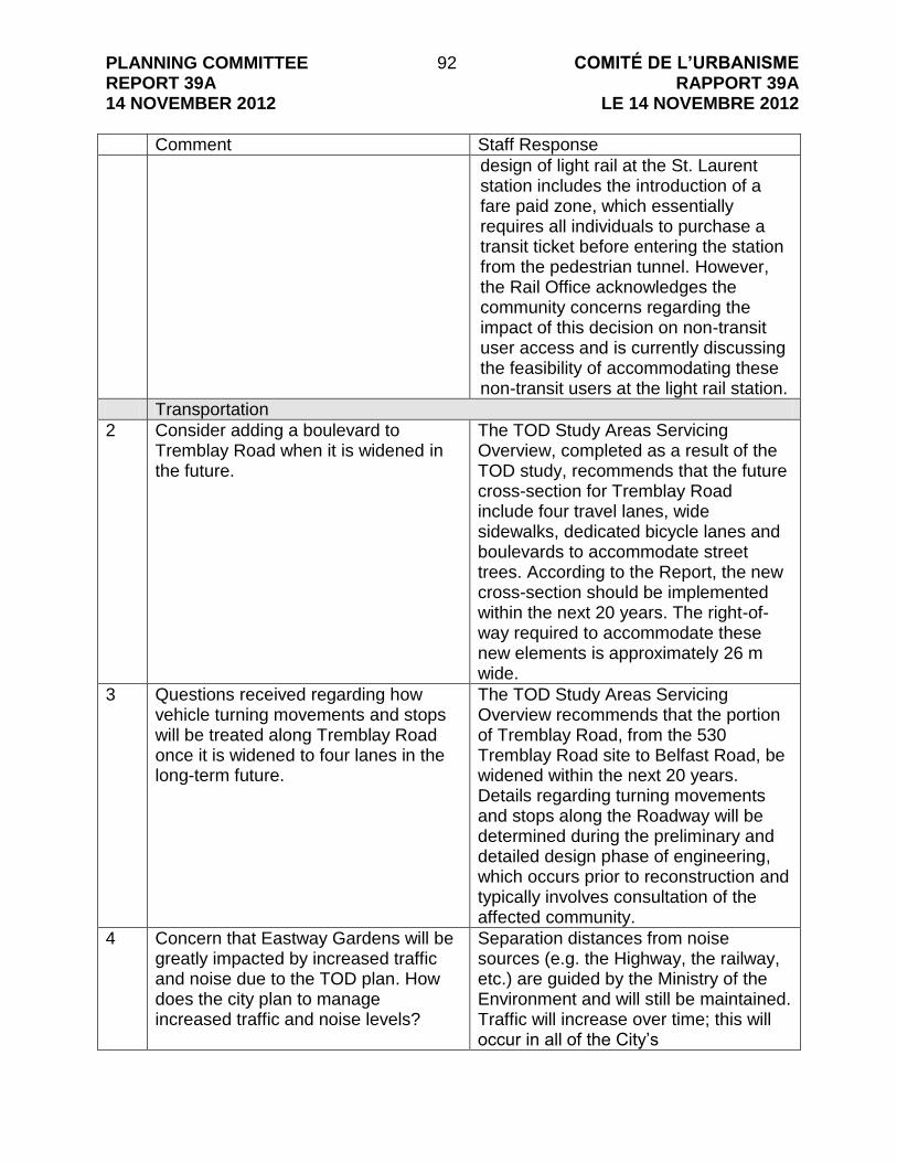
PLANNING COMMITTEE REPORT 39A 14 NOVEMBER 2012
92 COMITÉ DE L’URBANISME RAPPORT 39A
LE 14 NOVEMBRE 2012
Comment Staff Response
design of light rail at the St. Laurent station includes the introduction of a fare paid zone, which essentially requires all individuals to purchase a transit ticket before entering the station from the pedestrian tunnel. However, the Rail Office acknowledges the community concerns regarding the impact of this decision on non-transit user access and is currently discussing the feasibility of accommodating these non-transit users at the light rail station.
Transportation
2 Consider adding a boulevard to Tremblay Road when it is widened in the future.
The TOD Study Areas Servicing Overview, completed as a result of the TOD study, recommends that the future cross-section for Tremblay Road include four travel lanes, wide sidewalks, dedicated bicycle lanes and boulevards to accommodate street trees. According to the Report, the new cross-section should be implemented within the next 20 years. The right-of-way required to accommodate these new elements is approximately 26 m wide.
3 Questions received regarding how vehicle turning movements and stops will be treated along Tremblay Road once it is widened to four lanes in the long-term future.
The TOD Study Areas Servicing Overview recommends that the portion of Tremblay Road, from the 530 Tremblay Road site to Belfast Road, be widened within the next 20 years. Details regarding turning movements and stops along the Roadway will be determined during the preliminary and detailed design phase of engineering, which occurs prior to reconstruction and typically involves consultation of the affected community.
4 Concern that Eastway Gardens will be greatly impacted by increased traffic and noise due to the TOD plan. How does the city plan to manage increased traffic and noise levels?
Separation distances from noise sources (e.g. the Highway, the railway, etc.) are guided by the Ministry of the Environment and will still be maintained. Traffic will increase over time; this will occur in all of the City‟s

PLANNING COMMITTEE REPORT 39A 14 NOVEMBER 2012
93 COMITÉ DE L’URBANISME RAPPORT 39A
LE 14 NOVEMBRE 2012
Comment Staff Response
intensification/growth areas. However, the introduction of the LRT along with enhanced facilities for cyclists, pedestrians and transit users means that more people will choose alternative modes of transportation over their car. This is a priority of City Council and the TOD plans will set the stage to make sure people who live in intensification areas have travel options other than driving their cars.
5 Suggestion that Belfast Bridge should be widened to four lanes now rather than in the future due to the current traffic from the Trainyards Shopping district and the future widening of Tremblay Road.
The TOD study recommends that Belfast Bridge be widened to four lanes within the next 20 years. The Bridge is currently being replaced as part of the Highway 417 widening project using a rapid replacement process. The proposed bridge cross-section shows two travel lanes and sidewalks. The planning and design process for the bridge replacement is already complete.
Parking
6 Concern that lower parking rates in TOD areas will result in an overflow of on-street parking in nearby residential areas.
The TOD plans promote the use of transit, walking and cycling. As a result, various strategies are used to discourage the use of automobiles; this includes establishing minimum parking rates for TOD areas that are similar to downtown Ottawa. With the expense and limitation of parking, many people will have to choose other means of travel. If legitimate parking issues arise in adjacent neighbourhoods, then City by-law enforcement is the means established to deal with these matters.
Economics and Property Value
7 Concern that low rental units or commercial property could be built in close proximity to Eastway Gardens.
The City does not zone for housing tenure; therefore, we have no ability to prohibit the development of “rental” units. Regarding commercial development, it shall be prohibited in the vacant land area that is located along Avenue P in Eastway Gardens.
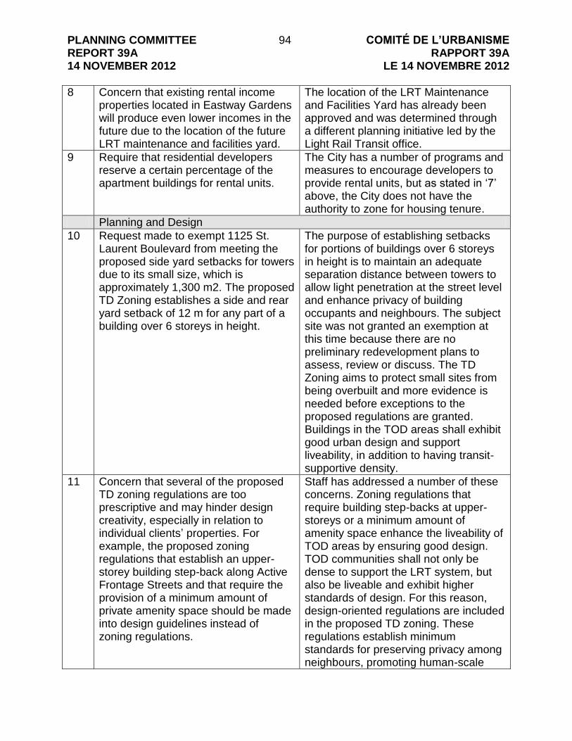
PLANNING COMMITTEE REPORT 39A 14 NOVEMBER 2012
94 COMITÉ DE L’URBANISME RAPPORT 39A
LE 14 NOVEMBRE 2012
8 Concern that existing rental income properties located in Eastway Gardens will produce even lower incomes in the future due to the location of the future LRT maintenance and facilities yard.
The location of the LRT Maintenance and Facilities Yard has already been approved and was determined through a different planning initiative led by the Light Rail Transit office.
9 Require that residential developers reserve a certain percentage of the apartment buildings for rental units.
The City has a number of programs and measures to encourage developers to provide rental units, but as stated in „7‟ above, the City does not have the authority to zone for housing tenure.
Planning and Design
10 Request made to exempt 1125 St. Laurent Boulevard from meeting the proposed side yard setbacks for towers due to its small size, which is approximately 1,300 m2. The proposed TD Zoning establishes a side and rear yard setback of 12 m for any part of a building over 6 storeys in height.
The purpose of establishing setbacks for portions of buildings over 6 storeys in height is to maintain an adequate separation distance between towers to allow light penetration at the street level and enhance privacy of building occupants and neighbours. The subject site was not granted an exemption at this time because there are no preliminary redevelopment plans to assess, review or discuss. The TD Zoning aims to protect small sites from being overbuilt and more evidence is needed before exceptions to the proposed regulations are granted. Buildings in the TOD areas shall exhibit good urban design and support liveability, in addition to having transit-supportive density.
11 Concern that several of the proposed TD zoning regulations are too prescriptive and may hinder design creativity, especially in relation to individual clients‟ properties. For example, the proposed zoning regulations that establish an upper-storey building step-back along Active Frontage Streets and that require the provision of a minimum amount of private amenity space should be made into design guidelines instead of zoning regulations.
Staff has addressed a number of these concerns. Zoning regulations that require building step-backs at upper-storeys or a minimum amount of amenity space enhance the liveability of TOD areas by ensuring good design. TOD communities shall not only be dense to support the LRT system, but also be liveable and exhibit higher standards of design. For this reason, design-oriented regulations are included in the proposed TD zoning. These regulations establish minimum standards for preserving privacy among neighbours, promoting human-scale
PLANNING COMMITTEE REPORT 39A 14 NOVEMBER 2012
95 COMITÉ DE L’URBANISME RAPPORT 39A
LE 14 NOVEMBRE 2012
development along special streets and creating amenity spaces for people to enjoy. In most cases, these minimum standards are already negotiated through the site plan control process; the proposed TD zoning simply formalizes these important requirements for some of the City‟s most important people places, the TOD Plan Areas. Since completion of the staff report, another meeting has been scheduled to discuss the proposed zoning details with interested landowners and their agents to address any outstanding matters.
12 Concern that the proposed TD regulation requiring a minimum of 2 per cent of site area towards outdoor amenity space duplicates a zoning regulation that already exists in Section 137 of Zoning By-law 2008-250.
The regulation that exists in Section 137 of Zoning By-law 2008-250 requires a certain amount of “communal amenity area” be provided with residential developments. This amenity space may be provided in various forms including indoor or outdoor, or above- or below-grade. There is no design guidance on how these spaces are developed; they can be completely inaccessible to the general public and community. The proposed regulation in the TD zoning requires a small amount of amenity space to be provided outdoors and at-grade for residential, commercial and mixed-use developments. This regulation ensures that areas for passive recreation are developed and are visually, if not physically, accessible by the general public of TOD Plan Areas. To enhance the liveability of TOD Areas, regulations that help establish additional outdoor spaces for respite are seen as necessary. To clarify, where a proposed residential development provides outdoor communal amenity space to meet the requirements of Section 137, the additional 2 per cent amenity space will not be applied.

PLANNING COMMITTEE REPORT 39A 14 NOVEMBER 2012
96 COMITÉ DE L’URBANISME RAPPORT 39A
LE 14 NOVEMBRE 2012
13 Concerns expressed with the proposed regulations for stepback and separation distances for tall buildings – they may impact the form of development or make it impossible to achieve towers on some sites.
The proposed regulations concerning tall buildings were included to ensure that towers are appropriately spaced – our experience with tower development in other parts of the city has shown that these forms of control are required and that the Tall Building Design Guidelines are not sufficient on their own to control the appropriate placement of towers in an area experiencing significant development interest.
14 NCC Comments:
Overall support for the studies and recommendations
Regard to be given to Section6.1 of the Plan for Canada‟s Capital:
Capital Arrivals and Scenic Entries
NCC will continue to work with the City to achieve high quality design standards worthy of a national capital
Regard to be given to the Pathway Network for Canada‟s Capital Region
Provided property information regarding NCC land holdings.
The City has no objections or concerns with the comments provided by the NCC.

PLANNING COMMITTEE REPORT 39A 14 NOVEMBER 2012
97 COMITÉ DE L’URBANISME RAPPORT 39A
LE 14 NOVEMBRE 2012 POTENTIAL CAPITAL BUDGET IMPLICATIONS DOCUMENT 11 The following table outlines the potential Capital Budget implications for 2018, to ensure the pedestrian and cycling facilities proposed by the Transit-Oriented Development (TOD) Plans for Train, St. Laurent and Cyrville Areas are in-place for system opening day of the LRT. The table highlights the estimated costs associated with undertaking the design and implementation of the recommended cycling and pedestrian facilities for the three TOD areas. Estimated Costs for Pedestrian Facilities in Train, St. Laurent and Cyrville TOD Areas:
Year for Capital Budget Request Amount required for pedestrian facilities in the Train, St. Laurent and Cyrville Areas*
2015 $1,750,000
2016 $2,450,000
2017 $1,800,000
Total $6,000,000
Estimated Costs for Cycling Facilities in Train, St. Laurent and Cyrville TOD Areas:
Year for Capital Budget Request Amount required for cycling facilities in the Train, St. Laurent and Cyrville Areas*
2015 $ 735,000
2016 $1,110,000
2017 $2,180,000
Total $4,025,000
*For a detailed breakdown of the estimated costs of pedestrian and cycling facilities in the Train, St. Laurent and Cyrville Areas, refer to Appendices E and F, respectively, outlined in Document 1 (distributed under separate cover to this Report).

PLANNING COMMITTEE REPORT 39A 14 NOVEMBER 2012
98 COMITÉ DE L’URBANISME RAPPORT 39A
LE 14 NOVEMBRE 2012 TOD “PEOPLE DENSITY” ESTIMATES DOCUMENT 13 The table below demonstrates that for all TOD Plan areas it is estimated that the upper end of the 200 to 400 people per gross hectare transit-supportable density range can be achieved over the long term. Also, there is sufficient short term (vacant, infill and underdeveloped) land available to accommodate anticipated growth of an additional 10,000 people in each TOD Plan area over approximately the next 20 years. In addition, unless the estimated rate of market uptake for development increases, the TOD Plan areas are not projected to achieve the target minimum transit-supportive density of 200 people per gross hectare in the next 20 years. It is important to remember that although it is easier for certain properties to redevelop in the shorter term because they are currently vacant or underutilized, it is estimated that growth will be gradual and occur over many years.
TOD Plan
Area
Estimated Existing
Population 2012
(Density)
Estimated
Population Increase Short-Term ~2031
Estimated
Population Total Short-Term
~2031 (Density)
Estimated Population
Capacity Short-Term Sites (Density)
Estimated
Population Total Long-Term (Density)
Train 6,100
(= 60 people/ha)
10,000
= 25 % of long-term population estimate
16,100
= 41% of long term population
estimate (=160 people/ha)
25,500
= 65% of long term population
estimate (= 255 people/ha)
39,500
(= 390 people/ha)
St.
Laurent
6,160
(= 50 people/ha)
10,000
= 24 % of long-term population estimate
16,160
= 39% of long term population
estimate
(=135 people/ha)
23,300
= 54 % of long term population
estimate
(=195 people/ha)
42,800
(= 355 people/ha)
Cyrville
5,190
(= 55 people/ha)
10,000
= 25 % of long-term population estimate
15,190
= 38% of long-term population
estimate
(=155 people/ha)
14,100
= 35% of long term population
estimate
(=145 people/ha)
40,500
(= 410 people/ha)

PLANNING COMMITTEE REPORT 39A 14 NOVEMBER 2012
99 COMITÉ DE L’URBANISME RAPPORT 39A
LE 14 NOVEMBRE 2012
EXTRACT OF DRAFT PLANNING COMMITTEE MINUTES 43 23 OCTOBER 2012
EXTRAIT DE L’ÉBAUCHE DU PROCÈS-VERBAL 43
COMITÉ DE L’URBANISME LE 23 OCTOBRE 2012
TRANSIT ORIENTED DEVELOPMENT PLANS, OFFICIAL PLAN AMENDMENT AND ZONING BY-LAW AMENDMENT FOR TRAIN, ST. LAURENT AND CYRVILLE AREAS PLANS D‟AMÉNAGEMENT AXÉS SUR LE TRANSPORT EN COMMUN, MODIFICATION AU PLAN OFFICIEL ET MODIFICATION AU RÈGLEMENT DE ZONAGE VISANT LES SECTEURS TRAIN, ST- LAURENT ET CYRVILLE ACS2012-PAI-PGM-0183 BEACON HILL – CYRVILLE (11) RIDEAU-ROCKCLIFFE (13), ALTA VISTA (18)
REPORT RECOMMENDATIONS: That Planning Committee recommend Council: 1. Approve the Transit Oriented Development Plans for Train, St.
Laurent and Cyrville areas (distributed separately and on file with the City Clerk – Document 12), and as shown in Document 1;
2. Approve Amendment No. XX to the Official Plan, as detailed in
Document 2, to implement the Transit Oriented Development Plans; 3. Approve an amendment to Zoning By-law 2008-250 as shown on the
maps in Documents 3 to 8, and as detailed in Document 9; and 4. Approve that staff bring forward for consideration as part of the
annual Capital Budget process requests for funding in years 2015 to 2017 to undertake design and implementation of cycling and pedestrian facilities as detailed in Document 12.
The Committee received a detailed PowerPoint slide presentation overview of the report (held on file with the City Clerk) from Ms. Cheryl Brouillard, Planner, Community Planning and Urban Design Unit, Policy Development and Urban Design Branch, PGM. Messrs. Dana Collings, Program Manager, also within the same unit and Branch, PGM, and Gary Baker, Program Coordinator, Development Charges, Business Support and Evaluation Unit, Business Services Branch, PGM, were also present to respond to questions.
PLANNING COMMITTEE REPORT 39A 14 NOVEMBER 2012
100 COMITÉ DE L’URBANISME RAPPORT 39A
LE 14 NOVEMBRE 2012
EXTRACT OF DRAFT PLANNING COMMITTEE MINUTES 43 23 OCTOBER 2012
EXTRAIT DE L’ÉBAUCHE DU PROCÈS-VERBAL 43
COMITÉ DE L’URBANISME LE 23 OCTOBRE 2012
Committee discussions encompassed matters dealing with:
the burial of overhead wires as part of infrastructure works during construction phases;
committing to pre-approved funding for specific uses;
eligibility for infrastructure funding from development charges;
cycling connections, and;
asking that staff consider overlapping issues for future updates to the City‟s Official Plan, Transportation Master Plan, Infrastructure Master Plan.
Mr. John Moser, General Manager, PGM, explained that the wording of the recommendations had been carefully chosen, and was not meant to speak to a pre-commitment of funds for specific works, but a request was made to remove the reference to “as detailed in Document 12.” for Recommendation 4, to provide a greater level of comfort. The Committee heard from the following public delegations, speaking to various issues including limits on FSI (Floor Space Index) and height; zoning rationale; traffic volumes and cycling safety issues; clarification regarding the continuation of uses allowed under existing zoning; concerns with phased development; continued pedestrian accessibility and an emphasis on liveable communities.
Mr. Fred Cogan (seeking points of clarification);
Ms. Sheila Perry*, on behalf of the Overbrook Community Association (expressing overall support, but suggesting caution in certain areas);
Ms. Julie Carrara, FoTenn Consultants on behalf of Morguard Investments (St. Laurent Centre lands), and Colonnade Developments (250 and 280 Tremblay Road and 550 Belfast Road) (in support);
Mr. Marty Koshman (in support, indicating he did not need to speak);
Ms. Pam Whyte, Delcan, on behalf of Canadian Tire Corporation (Coventry Road lands) (in opposition, but indicating a desire to work with staff to resolve certain minor issues), and;
Ms. Lola Causyn (in support).
Written correspondence was also received from the following, requesting refusal of the applications, instead requesting that they be dealt with as a part of the Official Plan and Comprehensive Zoning By-law reviews:
Ms. Faith Blacquiere*.

PLANNING COMMITTEE REPORT 39A 14 NOVEMBER 2012
101 COMITÉ DE L’URBANISME RAPPORT 39A
LE 14 NOVEMBRE 2012
EXTRACT OF DRAFT PLANNING COMMITTEE MINUTES 43 23 OCTOBER 2012
EXTRAIT DE L’ÉBAUCHE DU PROCÈS-VERBAL 43
COMITÉ DE L’URBANISME LE 23 OCTOBRE 2012
[ * All individuals marked with an asterisk either provided their comments in
writing or by email; all such comments are held on file with the City Clerk. ] Mr. Dan Paquette, Paquette Planning Associates, was present in support of the report recommendation, but did not speak. Councillor Harder then introduced the following:
MOTION NO. PLC 43/1 Moved by Councillor J. Harder: That Recommendation 4 be amended to remove the reference to “as detailed in Document 12.” CARRIED Staff also requested that Committee consider the following staff-initiated Motion for approval, to amends certain zoning provisions for certain properties in the Train and Cyrville TOD areas:
MOTION NO. PLC 43/2
Moved by Councillor J. Harder: 1. That Document 3 be amended to change Map 1 for the following
properties: a. 250 Tremblay Road be rezoned from MC7 F(3.5) to TD3 with a
site specific exception zone; b. 550 Belfast be rezoned from IG3[263] to TD2 with a site
specific exception zone; c. 330 Coventry Road be rezoned from TD3[aaaa] to TD2[aaaa]
2. That Document 7 be amended to change Map 5 for the following
property: a. 1250 Cyrville Road, (city-owned property on both sides of
Cyrville Road) from MC F(2.0) H(48) and MC[1353] H(48) to TD3 3. That Document 9 – Details of Recommended Zoning, Item 1.dd. be
replaced with the following:

PLANNING COMMITTEE REPORT 39A 14 NOVEMBER 2012
102 COMITÉ DE L’URBANISME RAPPORT 39A
LE 14 NOVEMBRE 2012
EXTRACT OF DRAFT PLANNING COMMITTEE MINUTES 43 23 OCTOBER 2012
EXTRAIT DE L’ÉBAUCHE DU PROCÈS-VERBAL 43
COMITÉ DE L’URBANISME LE 23 OCTOBRE 2012
“For the properties being rezoned as shown on Documents 3, 5 and 7 of this report, the TD Zone and its corresponding subzone only applies when a new permitted use, accommodated in a new building, is introduced to the site. Uses that legally exist or have an approval through site plan as of the date of passing of the By-law or are identified under “Additional Land Uses Permitted” are permitted to remain and expand using the TD Zone and provisions outlined in Tables 1, 2 and 3 below as long as they do not exceed the maximum building heights and floor area ratios noted in Tables 1, 2 and 3 below. When the building heights and floor area ratios are exceeded the development must proceed based on the full TD zone regulations. Uses that are permitted in the TD Zone may be introduced to an existing building without triggering the regulations outlined in the TD Zone. Once the TD Zone has been triggered, the exceptions outlined in the chart below no longer apply.”
4. That there be no further notice pursuant to Section 34 (17) of the
Planning Act. CARRIED Discussions having concluded, the report recommendations were put before Committee and were CARRIED as amended by Motions Nos. PLC 43/1 and PLC 43/2. That Planning Committee recommend Council: 1. Approve the Transit Oriented Development Plans for Train, St.
Laurent and Cyrville areas (distributed separately and on file with the City Clerk – Document 12), and as shown in Document 1;
2. Approve Amendment No. XX to the Official Plan, as detailed in
Document 2, to implement the Transit Oriented Development Plans; 3. Approve an amendment to Zoning By-law 2008-250 as shown on the
maps in Documents 3 to 8, and as detailed in Document 9; 4. Approve that staff bring forward for consideration as part of the
annual Capital Budget process requests for funding in years 2015 to
PLANNING COMMITTEE REPORT 39A 14 NOVEMBER 2012
103 COMITÉ DE L’URBANISME RAPPORT 39A
LE 14 NOVEMBRE 2012
EXTRACT OF DRAFT PLANNING COMMITTEE MINUTES 43 23 OCTOBER 2012
EXTRAIT DE L’ÉBAUCHE DU PROCÈS-VERBAL 43
COMITÉ DE L’URBANISME LE 23 OCTOBRE 2012
2017 to undertake design and implementation of cycling and pedestrian facilities;
5. That Document 3 be amended to change Map 1 for the following
properties: a. 250 Tremblay Road be rezoned from MC7 F(3.5) to TD3 with a
site specific exception zone; b. 550 Belfast be rezoned from IG3[263] to TD2 with a site
specific exception zone; c. 330 Coventry Road be rezoned from TD3[aaaa] to TD2[aaaa];
6. That Document 7 be amended to change Map 5 for the following
property: a. 1250 Cyrville Road, (city-owned property on both sides of
Cyrville Road) from MC F(2.0) H(48) and MC[1353] H(48) to TD3;
7. That Document 9 – Details of Recommended Zoning, Item 1.dd. be
replaced with the following:
“For the properties being rezoned as shown on Documents 3, 5 and 7 of this report, the TD Zone and its corresponding subzone only applies when a new permitted use, accommodated in a new building, is introduced to the site. Uses that legally exist or have an approval through site plan as of the date of passing of the By-law or are identified under “Additional Land Uses Permitted” are permitted to remain and expand using the TD Zone and provisions outlined in Tables 1, 2 and 3 below as long as they do not exceed the maximum building heights and floor area ratios noted in Tables 1, 2 and 3 below. When the building heights and floor area ratios are exceeded the development must proceed based on the full TD zone regulations. Uses that are permitted in the TD Zone may be introduced to an existing building without triggering the regulations outlined in the TD Zone. Once the TD Zone has been triggered, the exceptions outlined in the chart below no longer apply.”, and;
8. That there be no further notice pursuant to Section 34 (17) of the
Planning Act. CARRIED as amended

PLANNING COMMITTEE REPORT 39A 14 NOVEMBER 2012
104 COMITÉ DE L’URBANISME RAPPORT 39A
LE 14 NOVEMBRE 2012
EXTRACT OF DRAFT PLANNING COMMITTEE MINUTES 43 23 OCTOBER 2012
EXTRAIT DE L’ÉBAUCHE DU PROCÈS-VERBAL 43
COMITÉ DE L’URBANISME LE 23 OCTOBRE 2012
Councillor Blais also submitted the following, originally proposed as a Motion during discussions (noted earlier, above), and amended to be taken as a Direction to Staff, to form part of a suite of works on updates to the City‟s Official Plan and related Master Plans: Direction to Staff: That staff investigate, as part of its ongoing work on the Official Plan update, the feasibility of burying all overhead wires within all Transit Oriented Development Plan areas as part of any infrastructure investments, to include possible areas of funding for same, i.e., special area levies on development areas; and report back as part of the Official Plan update.