photo points crp-12 route analysis alternative e-map 3 · route analysis form crp-12 for...
TRANSCRIPT
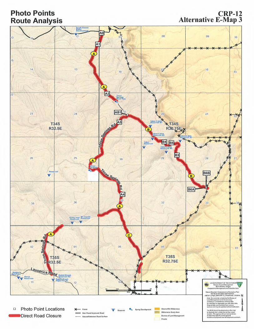
Photo Points CRP-12 Route Analysis Alternative E-Map 3
10
15
22
14
23
26
35
T34S R3Q.5E
Rc$ervolr
24
25 30
36
12
08
29
T35S R32.75E
09 10
16 15
04 03
s•~• Mounllh Cotnp.~Re«.a\.011 PW\ 001-8lM·OR·B060·2009.00SS·EA
A.ltE&t ii_M.,_AAFCRP· I2_PhokiPCMI:I :Jilll(ll4 NINo' • : No w.,rantt It 11\ade by U"' eu..au of LMdMMUQ~'t!"fiiiS io"-I~Ky. re~lltll~t)l Ot t omp...,_n of "-••d.ra b'inct.Vidu.. Of~ogt,.gflleVM'Iritl oUoor U:a. Ongon-' da"wn~~hm vflloustout"• al'ld nu~M upda~ l'l11'10ul1'101knon.
Steens Mtn W ilderness o Photo Point Locations )E-- Fenee ~ Rttotrvoir ~ Spring Development 1 M BUA ~dl~tlop,...flltottfMomi!C) toit..sllllelheilv'c:htttlvt notlhweu~'Midernns Study AluNon· Pa11ed lmp!'oved Road lout.on.Thl~y'MiuMbnlptld.<:et lo~......... 'f*i'c:Oft· l\ti-QI'OI.ItldBweau o f Land ManagementNaluraiAJnknown Road Surface- Direct Road Closure to<;a t.ont of pt()j)OWd • .._ H ve!OpiMM& at~d IIl is.
Private
ROUTE ANALYSIS FORM CRP-12
For ONDA's Proposed CRP Alternative
Map Referenced: Alt E Map 3
Proposed Route Closures Segments/Road Name Legal A. Three Springs Rd (Way) T.34S., R.32.5E., Sec 12, 13, 25;
T.34S., R.32.75E., Sec 7,18, 19, 30, 31; T.35S., R.32.5 E., Sec 1, 2, 11.
B. unnamed segment T.34S., R.32.75E., Sec 19, 20, 28, 29, 33. C. unnamed segment T.34S., R.32.75E., Sec 31;
T.35S., R.32.75E., sec 6, 7
Indirect Route Closures Segments/Road Name Legal D. existing closed ways T.34S., R.32.5E., Sec 36
T.34S., R.32.75E., Sec 20 T.34S., R.32.75., Sec 29 T.34S., R.32.75E., Sec 33 T.35S., R.32.75E., sec 6, 7
1) Is a right-of-way or easement associated with the road? Y /N N____ a) If yes, what is the right-of-way or easement serial number: ______
2) What is the primary purpose of the roads?
a) Does it facilitate travel, recreation (e.g. hunting, horseback riding, camp site), or other access? Explain(type)
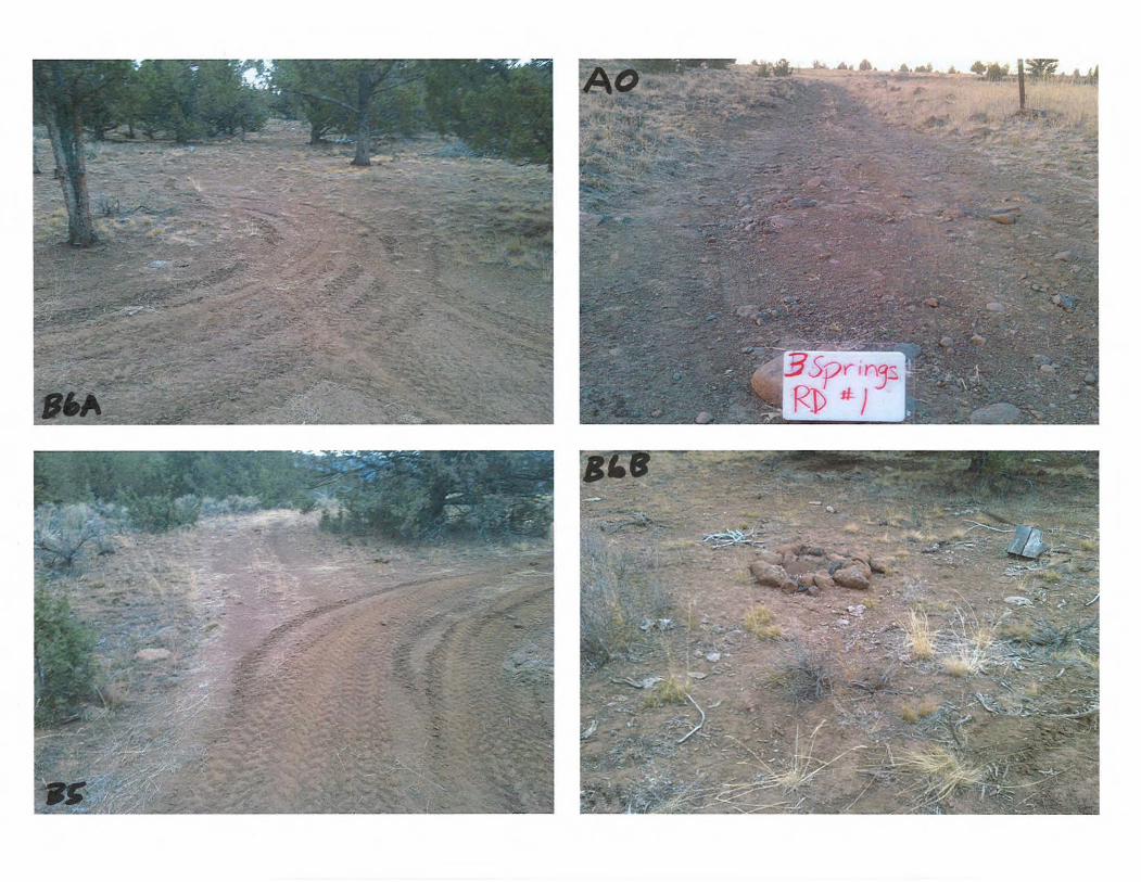
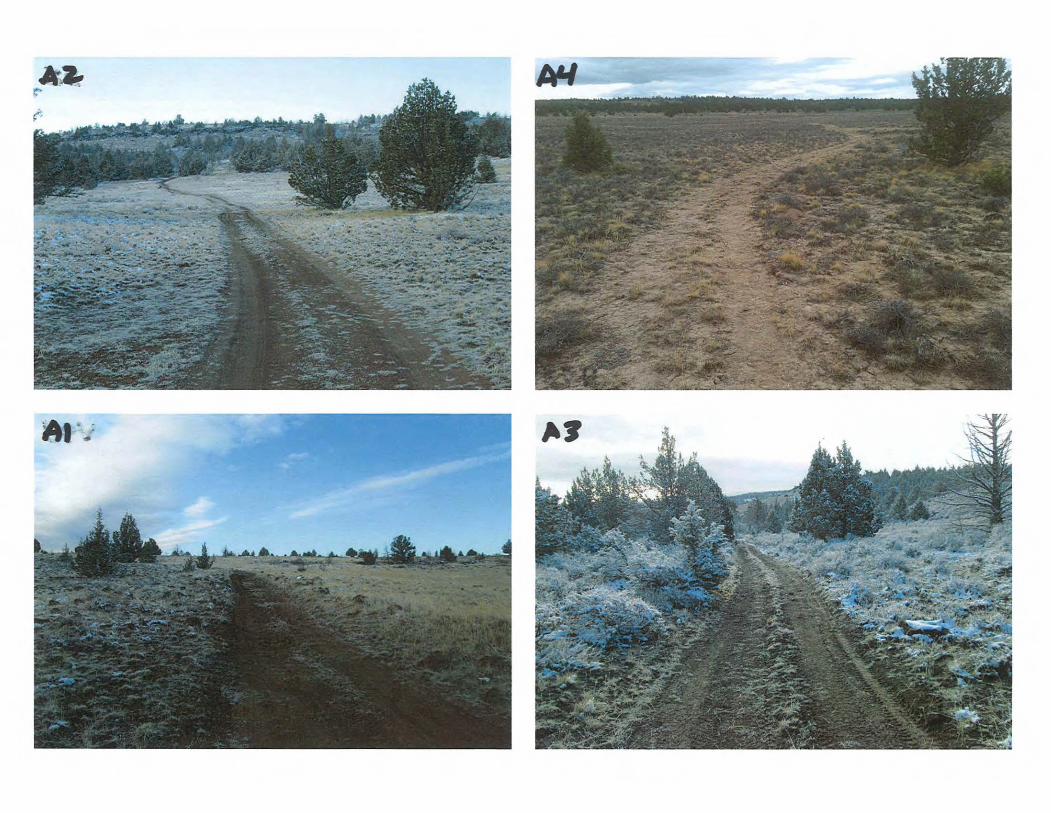
All of these routes are Ways within the South Fork Donner und Blitzen WSA. All segments of these routes are utilized for grazing management (monitoring: utilization, supervision). These routes are the only access to monitor the east side of the pasture. The routes provide access to private lands.
These routes are exceptional motorized recreational opportunities (OHVing, hunting: antelope, deer), wild horse viewing, dispersed motorized camping. This area is a well traveled by motorized vehicles, especially during the deer and antelope seasons.
b) Does it provide access to a communication site, power line, or other ROW permits? Explain
c) Does it provide access to a range improvement or pasture? Explain
Road Segment Range Improvements A. Three Springs Rd Spring
Three Springs private lands Porky Trail Reservoir Mr. Coyote Reservoir
July 13, 2011

B. Taber Cabin Reservoir #1 Taber Cabin Reservoir #2
Taber Cabin Reservoir #3 Taber Cabin Reservoir #4 Historic Bill Taber Cabin
d) Does it provide reasonable access to private land or private interests in lands?
The routes provide access to private lands (private lands referred to as Three Springs and
Huffman Camp).
e) Does it provide access to existing weed sites or suspected areas and trend or other monitoring locations? Explain
The routes are used for contro lling the following weeds in the area: bull thistle, Canada thistle and spotted knapweed.
Use supervision, monitoring points, trend plots, utilization and WSA monitoring, WSR monitoring, wilderness monitoring and wild horse monitoring. The routes could be used for soil crust monitoring if funding is received as part of N. Steens Ecosystem Project Sept 2007. Potential for SSS pond weed/monitoring. PODI
3) Is the route needed for safe access, e.g. firefighting and rescue personnel, and safety of all users (e.g. public, grazing permittees, landowners, ROW holders, BLM staff)?
Yes, Control line for the North Steens Ecosystem Restoration Project. These are the only access routes to the area (20 plus square miles).
4) Cou ld the road be used as a successful fire break if maintained? Explain
Yes, these routes maybe used in the N. Steens Ecosystem Project Sept 2007.
5) Is the road needed to implement an on-going or reasonably foreseeable future project? Explain
Yes, these routes maybe used in theN. Steens Ecosystem Project Sept 2007.
G) Does the route provide an additional evacuation route in case of an emergency (e.g. wildfire or injuries)? Explain
Maybe if emergency evacuations are from the Steens Mountain Wildemess.
Prepared by:
~ iJM~ p 3-13-1.3 Eric H~akenson Date
July 13, 2011

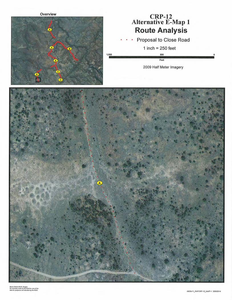
Overview CRP-12 Alternative E-Map 1 Route Analysis
· • • Proposal to Close Road
1 inch =250 feet
1,0.00·--------11!160.0________....0 Feet
2009 Half Meter Imagery
Blltfl& Ohtrkt 8U.4, Of• eon NOW~Iftnt)'m10. by tit BlM IOfUMOitt.. dllll ,., II'M'P"H MC h ..nciHI by 1M 8lM
AIIE8x11_ RAFCRP·12_NAIP·1 2fl612014
0
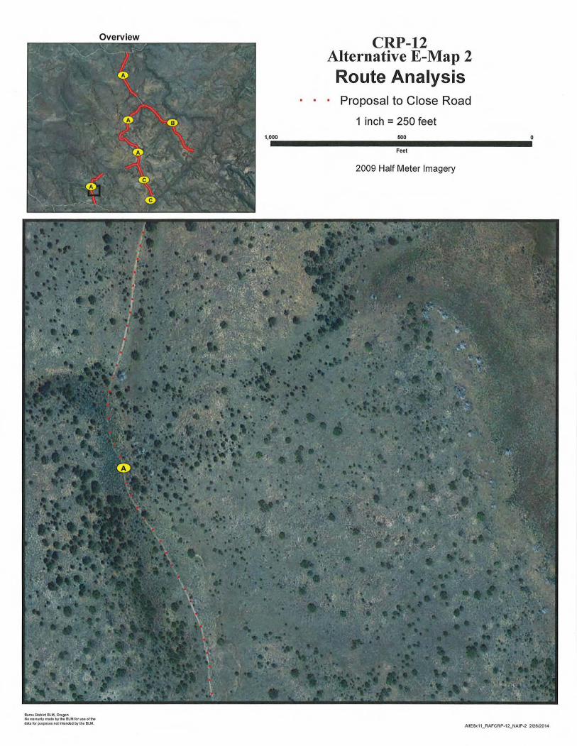
Overview CRP-12 Alternative E-Map 2 Route Analysis
· · · Proposal to Close Road
1 inch = 250 feet 1,000 500
Feet
2009 Half Meter Imagery
Bum1 Ofl.-kt 8UA. Ot.90n Nowtrll l'lty ll'lldtby,_ BlM IOf us- ollht d.t.ta fM putpo,1oot not ..... ~ by eM 8LM.
AltE8x11_RAFCRP·12_NAJP·2 212612014

0
Overview CRP-12 Alternative E-Map 3 Route Analysis
· · • Proposal to Close Road
1 inch =250 feet 1,000 600
Feet
2009 Half Meter Imagery
Burn• Dit..-kt BlM. Ol'egon NoWirflntyll'llcM by h BlMior uuol tlw liMII !of pwpos..nol ~..nded by h Blt.l.
AJtE8x11_RAFCRP-12_NAIP-3 2126/2014
0
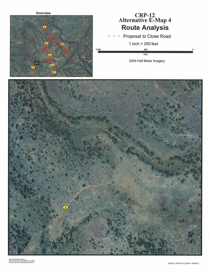
Overview CRP-12 Alternative E-Map 4 Route Analysis
· · · Proposal to Close Road
1 inch =250 feet 1,000 500
Feet
2009 Half Meter Imagery
Bufnt Oit~ki BU.!. Ott~ Nowttftnty,...dtbylhe SlMkH uMoiiM data ... putpottl not ~leMM by h BlM.
AIIE8K11_RAFCRP-12_NAIP-4 2126/201-4
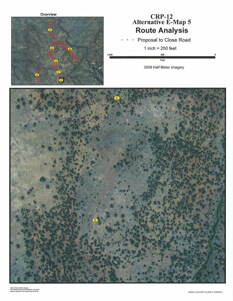
Overview CRP-12 Alternative E-Map 5 Route Analysis
· · · Proposal to Close Road
1 inch = 250 feet 1,000 500
Feet
2009 Half Meter Imagery
S..nlOillr1ct BLM. Ort~n ~IOWirt.nly ,.. bytMI BLMforuHoftN dlt.t lot pr,~rpon•l'\04 kl•1'16t- by~ BtM.
0
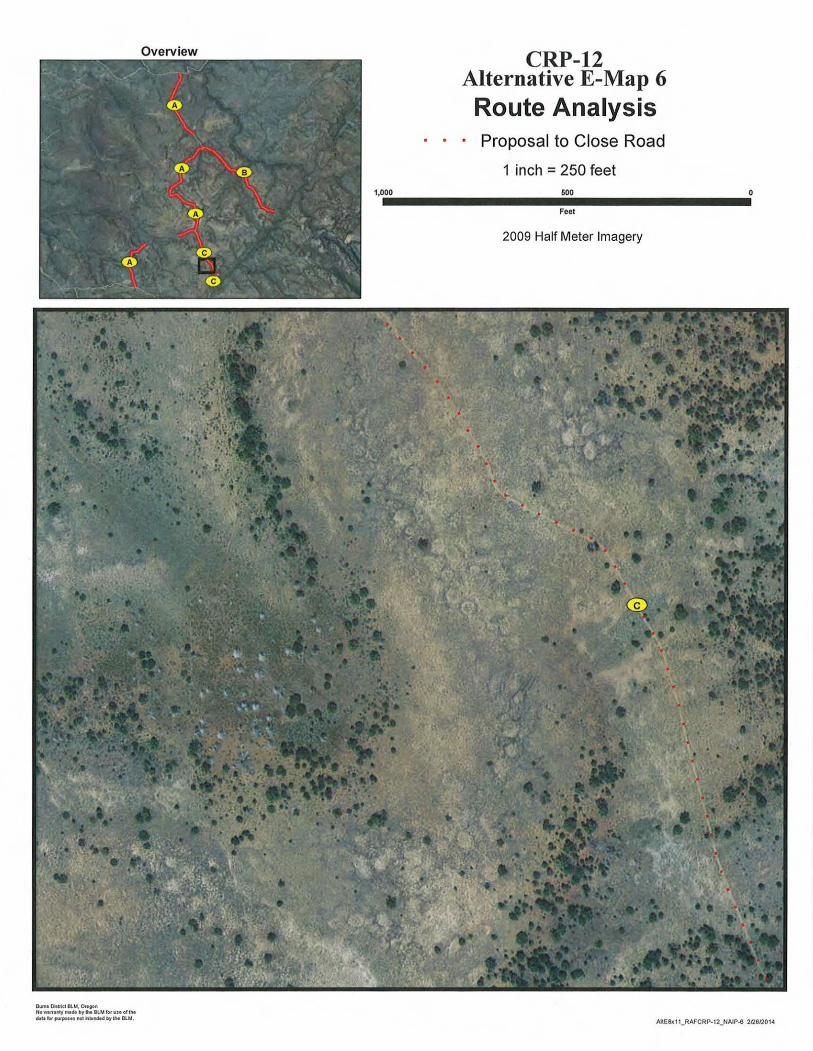
Overview CRP-12 Alternative E-Map 6 Route Analysis
· · · Proposal to Close Road
1 inch =250 feet 1,000 500
Feet
2009 Half Meter Imagery
Bwn1 D'ill'1ct BU.ol, O.tgon NOWIII•ntymedebylhe BLMiotvseoftl-. dlltlol' pufpolnnot~..MMbyh BLM. AltE8x11_RAFCRP-12_NAIP-6 2/26120141

Overview CRP-12 Alternative E-Map 7 Route Analysis
· · · Proposal to Close Road
1 inch =250 feet
1,0.00·---------60.0Feet ---------·0 2009 Half Meter Imagery
ButntOialrletBlM.Ottton Nowt,•fiiY-ckb~IN BlUforuM oftht 6.1U '<M pu1po1n not h ..nded by liM 8Ut
AIIE8k11_RAFCRP·12_NAIP-7 2/2612014
0
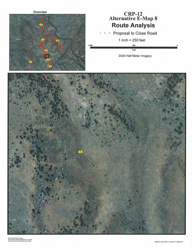
Overview CRP-12 Alternative E-Map 8 Route Analysis
· · · Proposal to Close Road
1 inch =250 feet 1,000 500
Feet
2009 Half Meter Imagery
&11'1\1 OillflctBlM, Ottgon No-Nttltyll'lldt byfMI BlMioruseottM d.ltt fof pul'poiH not h ..MM b11M BlM.
AltE8x11_RAFCRP·12_NAIP-8 2126/20U
0
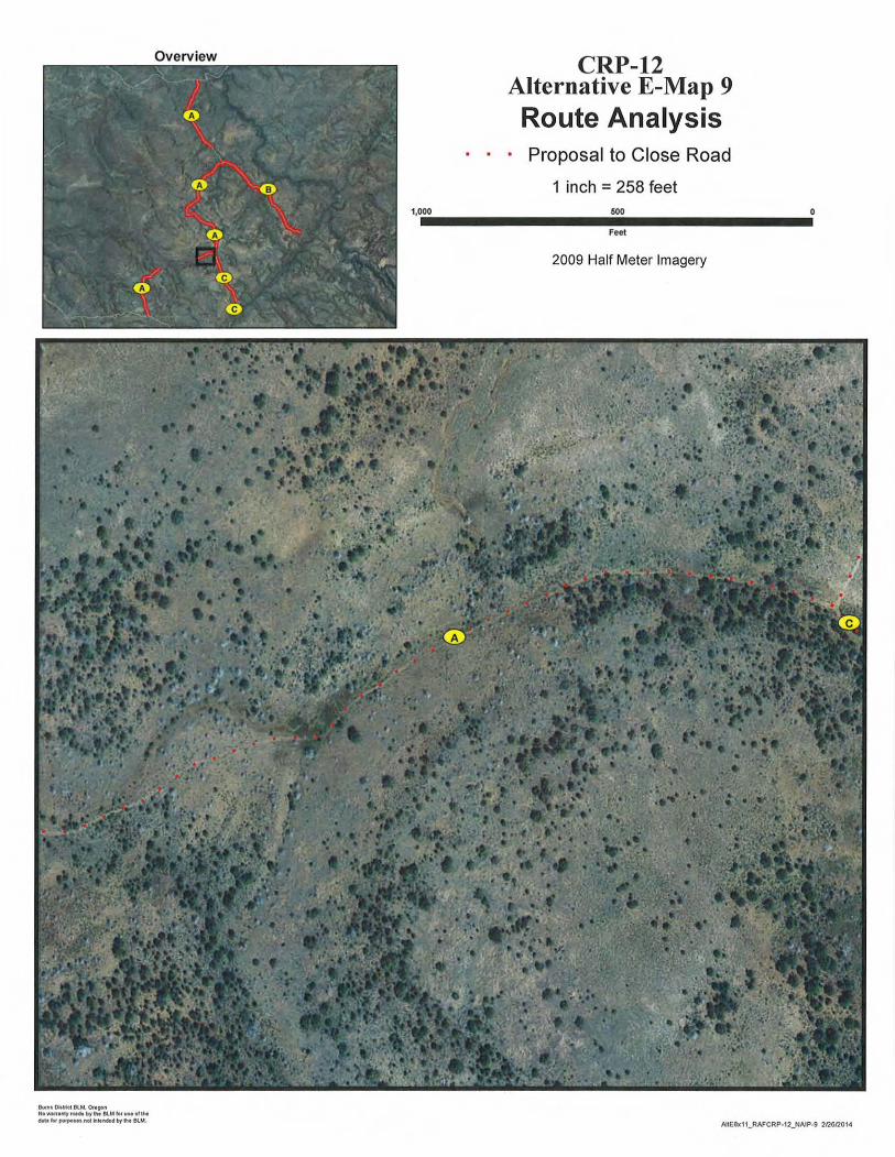
Overview CRP-12 Alternative E-Map 9 Route Analysis
· · · Proposal to Close Road
1 inch =258 feet 1,000 600
Feet
2009 Half Meter Imagery
&.m• Dklrld atM. Or•oon NOWIIU•fltymt6ebyfle BlMfotuMofll• dlt• teN purpo..s noc ~..ndH by 1M BI..M.
AltE8x11_RAFCRP·12_NAIP-9 2126/201-4

0
Overview CRP-12 Alternative E-Map 10
Route Analysis · · · Proposal to Close Road
1 inch= 250 feet 1,000 600
Feet
2009 Half Meter Imagery
Bufl'lt DitWct 8lM. O..ttoft NoMtTINy fNM by h BlM 1M us. 61 IM Gala Jot putpoSH Mt ., .. n.Md by h BU.!
AJtE$x11_RAFCRP-12_NAIP-10 21261201 4

Overview CRP-12 Alternative E-Map 11
Route Analysis · · · Proposal to Close Road
1 inch =250 feet
00·--------~50~~1,0u. 0 ---------·0Feet
2009 Half Meter Imagery
&.mt Dlltrkt 8LM, ONgon No-"•ntyrn16e byh BLMforwM olthe O.te lof pr.11po..• noc ~llfnMd b)' 1M BU.t.
AltE8xtt_RAFCRP-12_NAIP-11 2/l6!l014
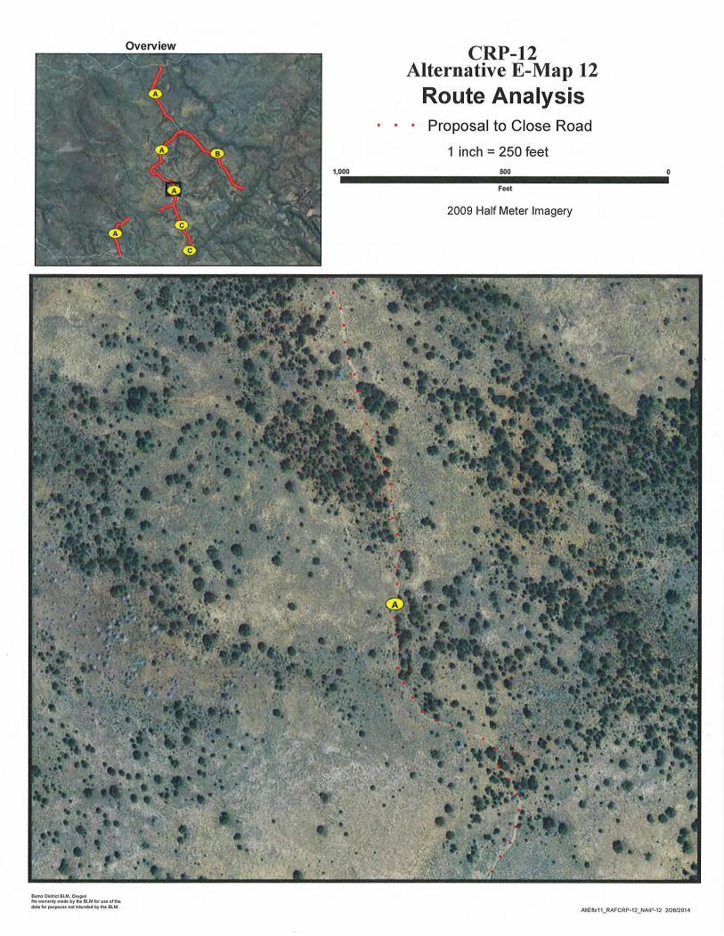
Overview CRP-12 Alternative E-Map 12
Route Analysis · · · Proposal to Close Road
1 inch =250 feet 1,000 500
Feet
2009 Half Meter Imagery
~-Dil"kt BLM. ONgon Nowtnlol'lty_.byh 8lM lotUMOf iM dlUI tot pwpo•••not"-ten6H by tiM BlM.
AltE8x11_RAFCRP·12_NAIP·12 21261201 4
0
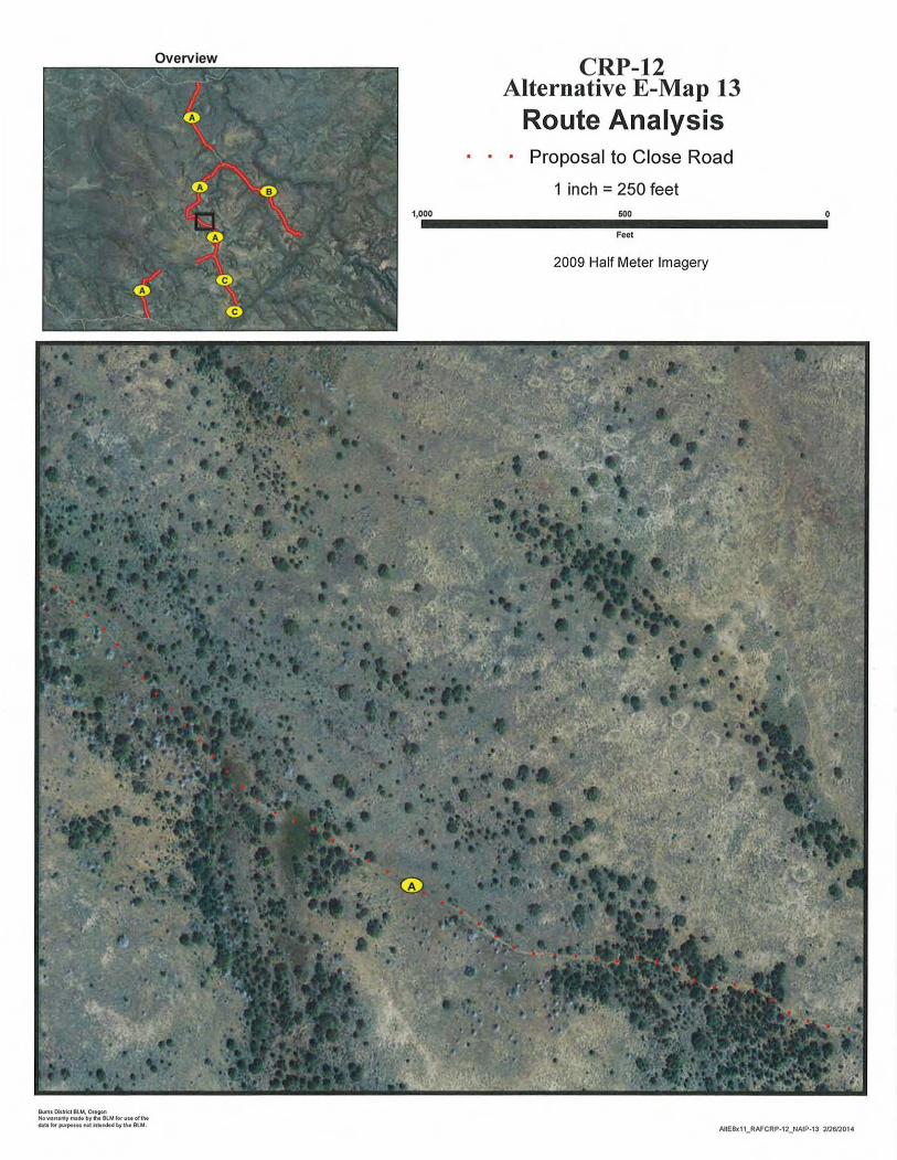
Overview CRP-12 Alternative E-Map 13
Route Analysis · · · Proposal to Close Road
1 inch =250 feet 1,000 600
Feet
2009 Half Meter Imagery
Bwft1 Oll..a BUol. Of•oon No-lltl'lty~NdtbyN 8LM lotvuoftM dill,... pifpotHf'IOt~tendH bytlw BlM.
AIIE8x11_RAFCRP·12_NAIP-13 212612014

0
Overview CRP-12 Alternative E-Map 14
Route Analysis · · · Proposal to Close Road
1 inch =250 feet 1,000 500
Feet
2009 Half Meter Imagery
Bwns OitMct BlM.. 0..90ft NO- Ifll'ltymt. bylhe BlM lotvMefiM•u ,., purposuMt.,_.MM by V.. etU,
0
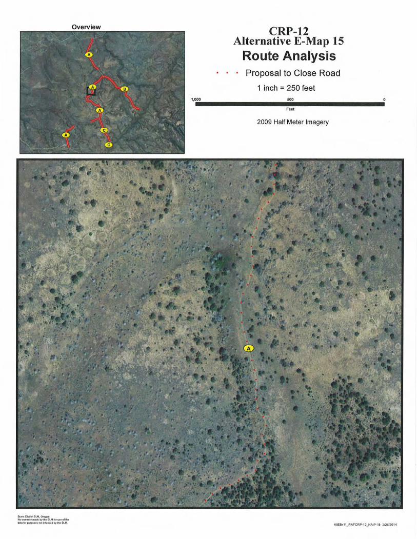
Overview CRP-12 Alternative E-Map 15
Route Analysis · · · Proposal to Close Road
1 inch =250 feet 1,000 500
Feet
2009 Half Meter Imagery
Own• DillMet 8UA, Ot'• gon Howt111nty fN4e by h BUA IM use of IM c»a. "" pul'pou• not n•MH t.ro'"' BlM. AIIE8x 11_RAFCRP·12_NAIP-15 2/2612014
0
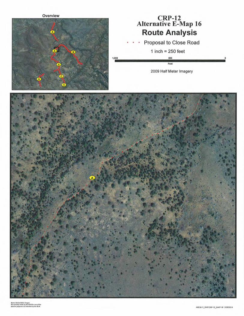
Overview CRP-12 Alternative E-Map 16
Route Analysis · · · Proposal to Close Road
1 inch =250 feet 1,000 500
Feet
2009 Half Meter Imagery
Bufnl Dhlrlct BLM, Ottgol'l HOWIIUntytN6t bylht BlMIOIUMOIIht daU ~ po~tpoU$ I'IOt lri..Mtd by 1M 8lM, AltE8x11_RAFCRP-12_NAIP-16 212612014
0
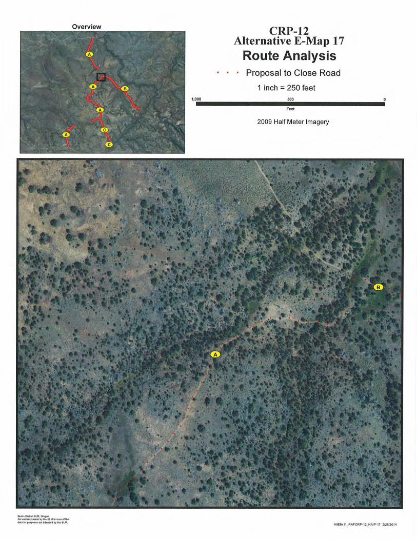
Overview CRP-12 Alternative E-Map 17
Route Analysis · · · Proposal to Close Road
1 inch =250 feet 1,000 500
Feet
2009 Half Meter Imagery
.,,., O..llkt 8lM. Or•,on NoWitt•MY~~"~~• trllht eu" fiH~o~Moflhe d.ltl .., purpotu !tot friMMM by the BUI.
0
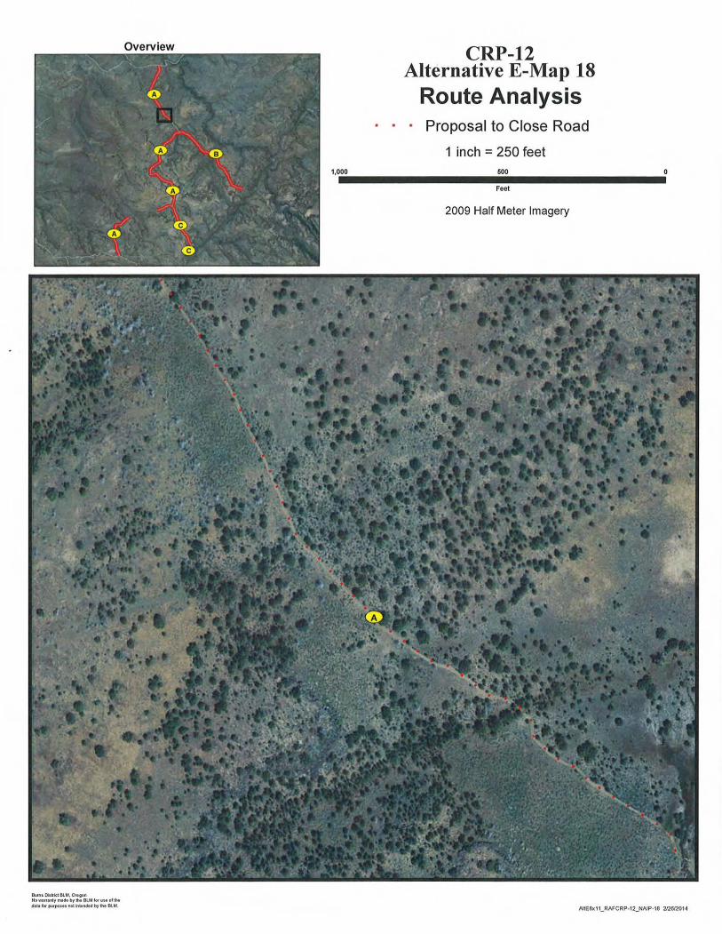
Overview CRP-12 Alternative E-Map 18
Route Analysis · · · Proposal to Close Road
1 inch = 250 feet 1,000 600
Feet
2009 Half Meter Imagery
BIHM Oillrkt BLM, Ottgon NOW11nanlyma6e bylfte BlM fOri/M of the tJ.aUI lor p!Hpot.. n04 ., .. ndH by IM BU.I, AIIE8x11_RAFCRP·12_NAIP-18 212612014

0
Overview CRP-12 Alternative E-Map 19
Route Analysis · · · Proposal to Close Road
1 inch = 250 feet 1,000 600
Feet
2009 Half Meter Imagery
Butn• Oil~ au.-.Of•OIHI No _lf,nl:y INd. by fit Bl.M for UM of the ~t.litof J11MpotnM4~1itnct.dtay,..8U.I.
AltE8x11_RAFCRP·12_NAIP-19 212612014

Overview CRP-12 Alternative E-Map 20
Route Analysis · · · Proposal to Close Road
1 inch =250 feet 1,0 ••00_________50_0_________0
Feet
2009 Half Meter Imagery
BwntOll~tBLM. Oregon No-"•rlyrnlde bytw BI..MfofuMol'lhe d.ltalof putpoiOI nM ~~~ by 1M BU.I.
AltEix11_RAFCRP-12_NAIP-20 21261'20 1-4

0
Overview CRP-12 Alternative E-Map 21
Route Analysis · Proposal to Close Road
1 inch =250 feet 1,000 500
Feet
2009 Half Meter Imagery
Bwm• Oitwtc:IBLM. O..von Nowuanly mtM byh Bli.A iorvwoft~
dtlefof putpoiHnoli'ltll~bylht BUA. ME8x11_RAFCRP-12_NAIP·21 21261201-4

Overview CRP-12 Alternative E-Map 22
Route Analysis · · · Proposal to Close Road
1 inch =250 feet 1,0.00_________60_0________....0
Feet
2009 Half Meter Imagery
Bwnt Oiatrlct BUI, Onfl)ft t,o_,.,,.r,.•brh BlMfofuwottht dl\llof pvfpotH M4 nt.Med by 11M 8U.l. AIIE8x11_RAFCRP·12_NAIP·22 212612014

0
Overview CRP-12 Alternative E-Map 23
Route Analysis · · · Proposal to Close Road
1 inch =250 feet 1,000 600
Feet
2009 Half Meter Imagery
O...n1 Oit~kl BUt Ortton No wttrel'l(y INch by ... BlM fo, "'"' olthe d.lt.. ro.. purposes not hlendtd by tM BlM.
AltE8x11_RAFCRP·12_NAIP-23 212612014

Overview CRP-12 Alternative E-Map 24
Route Analysis · · · Proposal to Close Road
1 inch =250 feet 1,0 ••__________ 0 _________000 60
Feet
2009 Half Meter Imagery
Bums O.lrld BlM, Qn;got~
No Wllf.tnly INIO. bW' flit BlM !Of"" of U. 1S.U.t b pu1~UtMt h"ncs.d by'"' Bllol.
AltE8x11_RAFCRP·12_NAIP·2<1 2n.6/20141

0
Overview CRP-12 Alternative E-Map 25
Route Analysis · · · Proposal to Close Road
1 inch = 250 feet 1,000 600
Feet
2009 Half Meter Imagery
Burns Diltrlel BU.!, Ot•gon NO'It'llflntyrrw6tbylht BI..M iorYMoi iM cbtllof putpout not ~tei'ICIM by 1M BU.!. AIIE8K11_RAFCRP·12_NAIP·25 212612014
0
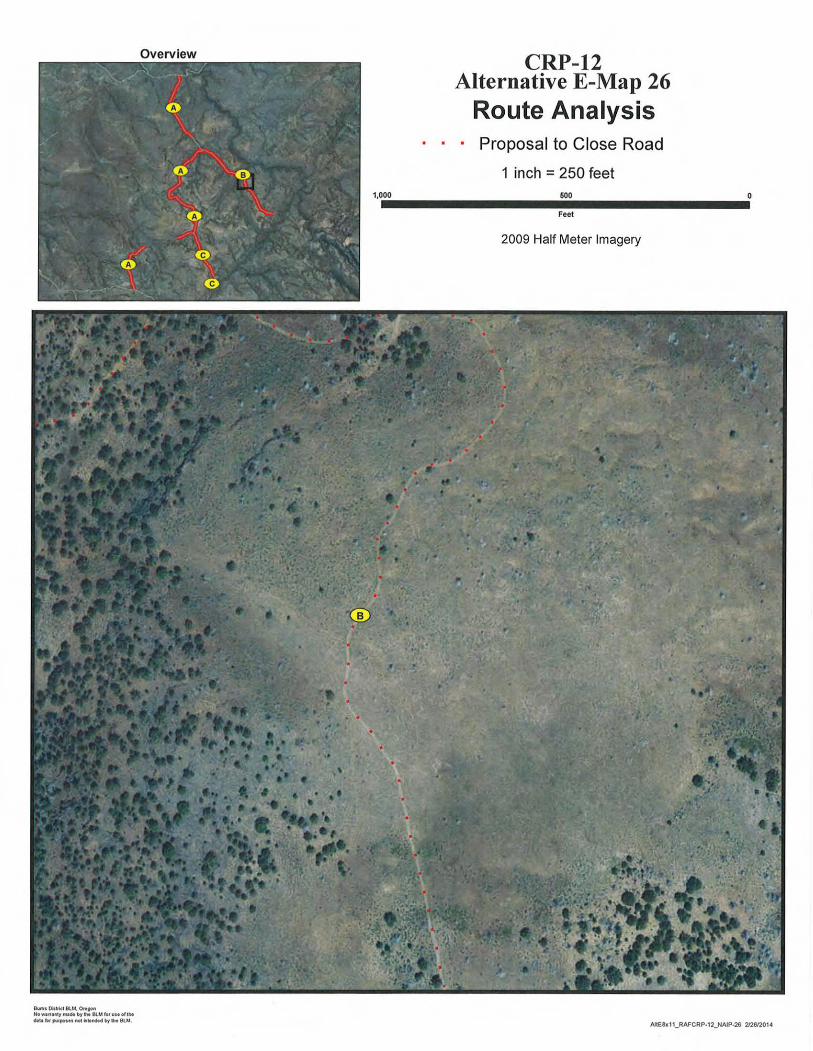
Overview CRP-12 Alternative E-Map 26
Route Analysis · · · Proposal to Close Road
1 inch =250 feet 1,000 600
Feet
2009 Half Meter Imagery
Bums O.lrkt 81.M. Ottton No -n•t~~y m~• by h BUd lor vM o( 1M dall toe pw!pol.. M1 h ..ndMb'f the BLM.
AJtE8x11_RAFCRP·12_NAJP·26 212612014
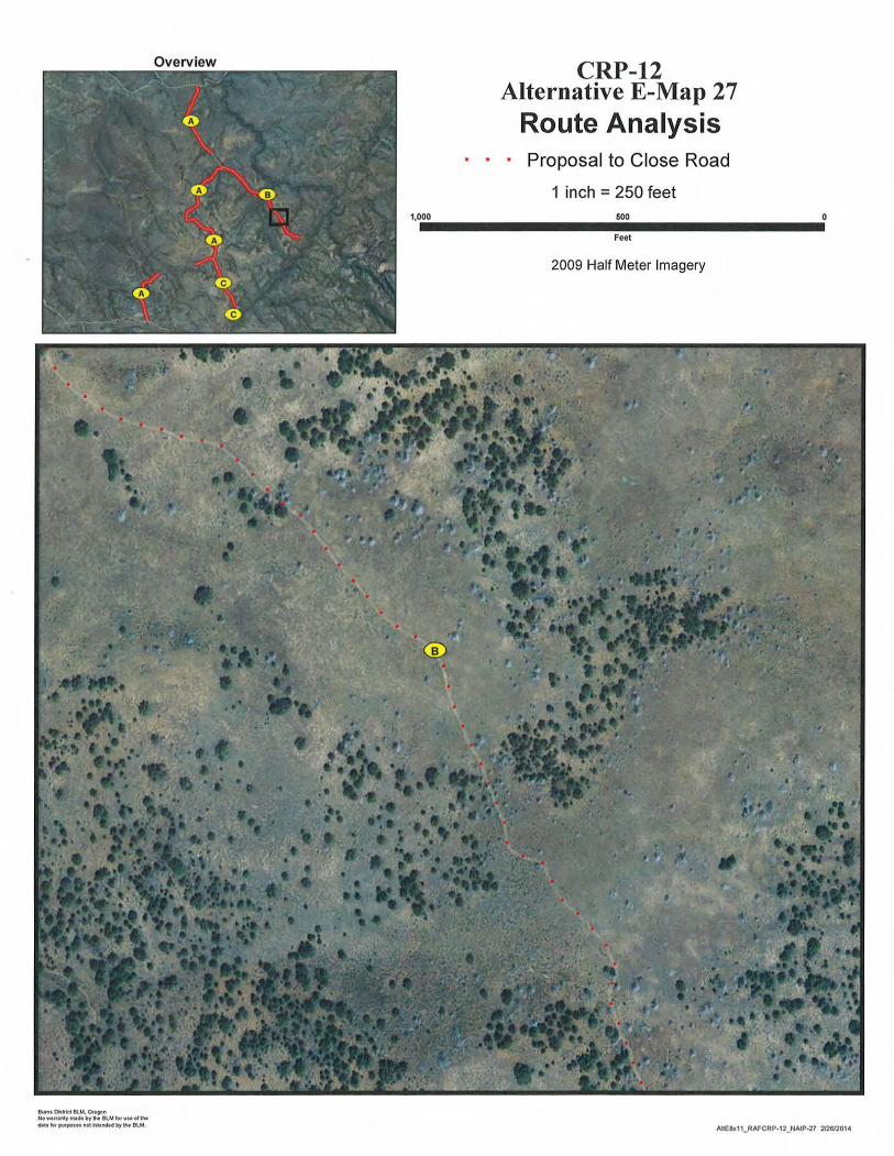
Overview CRP-12 Alternative E-Map 27
Route Analysis Proposal to Close Road
1 inch =250 feet 1,000 500
Feet
2009 Half Meter Imagery
Bums [MI~ BU.t. O.egon No-nal'lly fN.byh BlMIMuMol l t. cNt.l"" ~"Mlh..Med by the Bl.J.I. AltE&c1t_RAFCRP-12_NAIP-27 21261201-4

Overview CRP-12 Alternative E-Map 28
Route Analysis · · · Proposal to Close Road
1 inch =250 feet 1,0••00_________50_0_________0
Feet
2009 Half Meter Imagery
Bums '*~BU-'. Ottoon Hu~urtnl:yMtdt by 1M BUA ,.,uMolthe dltllof putposni'I04 k'!"l'ldrtd by h BU.I.
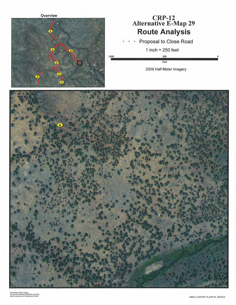
Overview CRP-12 Alternative E-Map 29
Route Analysis • Proposal to Close Road
1 inch = 250 feet
1,0.00--------1111!160.0Feet ---------0 2009 Half Meter Imagery
Bwft1 District BL M, Ott~ No-lftntytnlde bylftt BlMiotUM of lhe d.IU fol' pufpo"l not ~..ndH by 1M BlM. AltE.8x11_RAFCRP-12_NAIP-29 212612014