peabody trout creek reservoir project proposed study …€¦ · peabody trout creek reservoir...
TRANSCRIPT

Peabody Trout Creek Reservoir Project
Proposed Study Plan Meeting
February 12 and 13, 2013

David Merritt, URS Corporation
Project website:
http://peabodytroutcreekreservoir.com/
2

http://www.peabodytroutcreekreservoir.co
m/
3

Brian Yansen, Peabody Trout Creek
Reservoir LLC (PTCR)

Trout Creek Reservoir Offers Long-Term Benefits Creates 390-acre lake with
enhanced wildlife habitat
Provides long-term supply of water for Peabody’s future Colorado mining activities
Includes micro hydroelectric power plant producing electricity to upload to GRI
Potential lakeside residential development with fishing and boating opportunities
5

6

7

FERC Pre-Application Document (PAD) submitted in August 2012
Public and Agency Scoping Meetings and Site Visit held in Steamboat Springs, CO on October 24 and 25, 2012
Application for Preliminary Permit filed on November 30, 2012
Proposed Study Plan submitted on January 18, 2013
8

Environmental studies and baseline analysis under way
Surveying and field assessments continuing
Engineering for preliminary dam classification and facility layout
Analysis of electrical transmission lines and relationship to proposed site layouts
9
Shana Murray, Federal Energy Regulatory
Commission
10

1 year 2-3 years
1.5 years
Pre
filing
Post
filing
Initial
Proposal &
Information
Document
Scoping
Meetings &
Public
Comment
Study Plan
Development
Conduct
Studies &
Prepare
Application
Application:
Proposal,
Effects &
Mitigation
Measures
FERC Review
& Public
Comment
FERC
Environmental
Document &
Public
Comment
FERC
Authorization
(License Order)
11

1 year 2-3 years
Pre
filing Initial
Proposal &
Information
Document
Scoping
Meetings &
Public
Comment
Study Plan
Development
Conduct
Studies &
Prepare
Application
12

Study Requests
Proposed Study Plan
Study Plan Meetings
Revised Study Plan
OEP Director’s Study Plan Determination
45 days
90 days
30 days
30 days
13

Lesley McWhirter and Steve Moore,
USACE’s Colorado West Regulatory Branch
14

Please define and clarify the basic or fundamental need for this Project.
Discuss the rationale for processing an Environmental Impact Statement (EIS).
Discuss the timeline and processing of a USACE Department of the Army permit application.
15

An Alternative Analysis will be critical to your Project and needs to be discussed early in the planning process. [Note: Our 404(b)(l) guidelines require that we examine other sites and methods for meeting Project need that may have less impact on the aquatic environment. An alternative analysis must be prepared for each separate Project need (if multiple needs are appropriate) and thoroughly evaluated to select the LEDPA.]
How will water from the proposed reservoir be delivered to various coal mining operations? The conveyance of this water (surface waterways, pipelines, etc.) should be included in the Project description and evaluation, and may increase the Project scope.
16

What is the proposed end-use for the electrical power generated by the hydropower station, and how and to where will that power be distributed?
It appears that both the State of Colorado and the Bureau of Land Management administer real estate which will be directly impacted by the proposed Project. Please describe the involvement of these agencies and their anticipated role in the licensing/permitting process.
17

We understand that a revised wetland delineation for the Project area will be submitted to us for verification in the summer of 2013, possibly in August. This delineation should incorporate a FACWet analysis as well as the previous recommendations made by Mr. Nathan Green of our office.
We request that your wetland consultant coordinate with us to
schedule a site visit once this new delineation report is finalized and the wetland boundaries flagged in accordance with the Minimum Standards and the Final Map and Drawing Standards for the South Pacific Division Regulatory Program. As discussed in the past, you also need to be aware that alternative Project sites may require jurisdictional delineations to fully analyze each alternative's potential aquatic impacts (again, for alternative analysis comparison).
18

David Merritt, URS Corporation Geotechnical Investigation
Existing Channel Conditions and Sediment Supply Study
Channel Morphology
Review and Analysis of the Results from Groundwater Monitoring
Wells
Hydrology and Stream Flow Assessment
Cumulative Hydrologic Effects Analysis of the Proposed Trout Creek
Reservoir and Related Diversions on Flows in the Yampa River
Ongoing Temperature and Dissolved Oxygen Monitoring of Trout
Creek
Hydrology Assessment and Reservoir Operations Model
19

Flow/Habitat Effects Evaluation on Existing Fishery Resources
in Trout Creek and the Yampa River
Fish Species and Longitudinal Habitat Utilization Study
Fish Entrainment Study
Whirling Disease Study
Migratory Bird and Raptor Survey
Downstream Riparian, Wetlands, and Littoral Habitat Study
Wetland Delineation for Entire Project
Noxious Weed Survey
Transportation System Assessment
Recreation Study
Class III (Intensive Pedestrian) Cultural Resources Survey
20

Brian Len/Hal Schlicht, Northwest
Colorado Consultants, Inc. (NWCC)
21

Geologic Literature Search Existing Geologic Mapping
Existing Geologic Studies
Seismic History
Subsurface Mining History
Field Investigation Field Reconnaissance – Identify
unstable (US) and potentially unstable (PUS) areas for subsurface investigation
Subsurface Investigation – Exploratory test holes (4-6” diameter) using standard geotechnical methodology (i.e. continuous flight augers, hollow stem augers, NX wireline coring and standard penetration testing [SPT])
Dam Site, Spillway, and Borrow Areas Evaluate need based on existing
data (NWCC 2012)
Provide additional test holes as needed based on final alignments and plans
Unstable and Potentially Unstable Areas – Drill in areas identified during field reconnaissance and literature search
Bedrock Coring at Dam Site Rock Quality Designation (RQD)
Evaluation to evaluate bedrock competency
Packer testing to evaluate bedrock permeability
22

23
Surficial Geologic Map (USGS)
Geologic Hazard Map

Laboratory Investigation Standard Index Properties
• Natural Moisture Content
• Natural In-Situ Density
• Atterberg Limits
Strength Testing • Unconfined Compressive
Strength
• TriAxial Shear Strength
• Direct Shear Strength
Permeability Testing • Remolded Samples
• Undisturbed Samples
Corrosion Testing • pH Analysis
• Sulfate Analysis
• Chloride Analysis
• Resistivity
Compaction Testing • Standard Proctor
• Modified Proctor
• Relative Density
Consolidation Testing • Time Consolidation
• Swell/Consolidation
Pin Hole Dispersion Testing
24

25

Engineering Slope Stability Analysis – At
areas of concern in US and PUS Areas
Geotechnical Analysis – For Dam, Spillway, and Other Structures
• Settlement Evaluation of the dam embankment materials
• Seepage Evaluation of dam, reservoir and abutments
• Slope Stability Evaluation of dam embankment and spillway slopes
Mitigation Measures • Seismic
• Slope Stability – Rock Buttressing
– Soil Nails and Anchors
26

Troy Thompson, Ecological Resource
Consultants, Inc. (ERC)
27

Coarse Level
Stream
Classification
Historic Aerial
Photo
Interpretation
Sediment Sources
Published
Information on
Sediment Supply
Dam Impacts
28

Troy Thompson, Ecological Resource
Consultants, Inc. (ERC)
29

Cross-Section and Longitude Surveys
Provides channel geometry for modeling
Include channel, water surface, and flood
prone areas
Multiple sections downstream of dam; single
sections elsewhere
Flow Measurements
Calibrate hydraulic modeling
30

Substrate Assessment (Pebble Counts)
Bulk Sediment Sampling
Bedload Sampling
Range of flows including peak runoff
Use limited field data to validate/verify
range of published information
31

Bedload Modeling
Change in Transport
Capacity
Supply vs. Transport
Limitations
Phase 2 Transport
Frequency
Effective Discharge
32

Time Integrated
Modeling
Stream response
below dam
Magnitude and
likely time frame
for downcutting
33
Clint Henke, ERO Resources Corporation
34

Purpose of Study
To determine if supportive wetland hydrology
is present for previously irrigated wetlands
within the Peabody Trout Creek Reservoir
Study Area
35

Background
Irrigation removed from site in 2010
Wetlands delineated in 2011
36 groundwater wells with automated
dataloggers installed in October 2011
Data downloaded in May and October
2012
36

37

Analysis and Interpretation
Currently, data from October 2011 to October 2012 is being analyzed
Analysis will show depth of groundwater from ground surface over time
Study follows the Corps’ Technical Standard for Water-Table Monitoring of Potential Wetland Sites
Groundwater monitoring could continue for an additional year, if needed
38

Wetland hydrology is considered to be
present if:
The site is inundated (flooded or ponded) or
the water table is ≤12 inches below the soil
surface for ≥14 consecutive days during the
growing season at a minimum frequency of 5
years in 10
39

After multiple years of monitoring, wetland hydrology can be evaluated by applying the following procedures:
1. For each year, determine the maximum number of consecutive days that the site was either inundated or the water table was ≤12 inches from the ground surface during the growing season. Wetland hydrology occurs in a given year if the number of consecutive days of inundation or shallow water table was ≥14 days.
2. The Technical Standard for Wetland Hydrology is met if wetland hydrology occurs in at least 50 percent of years.
40

Heather Thompson, Ecological Resource
Consultants, Inc. (ERC)
41

Due to the lack of published USGS stream gage
records for Trout Creek, an approach was
developed by TZA to estimate virgin flows in
Trout Creek based on the Elk River at Clark gage.
To verify this approach, flow measurements will
be collected at the proposed reservoir site for
one year.
Flow measurements will be used to verify the TZA
methodology accurately predicts flows in Trout
Creek.
42

The Colorado Decision Support System (CDSS) Yampa River
Model is a water allocation model used to simulate stream
flows, reservoir operations, and water supply availability.
The model extends downstream to the confluence with the
Yampa River and Green River.
The Yampa River Model incorporates the TZA methodology to
estimate virgin flows in Trout Creek.
The Yampa River Model will be revised if necessary to
incorporate changes to the TZA methodology based on the
evaluation of measured flows.
The Yampa River Model will be used to estimate the effects
on stream flows in Trout Creek and the Yampa River due to
operations of the proposed reservoir.
43

The Yampa River Model will be converted from
a monthly time step model to a daily time step.
The Yampa River Model will be used to simulate
operations of the proposed Project and
estimate daily stream flows downstream of the
Project in Trout Creek and the Yampa River.
Simulated pre- and post-Project stream flows
will be analyzed to determine Project-related
depletions.
44

Model output will be used to quantify flow
reductions at locations on Trout Creek and the
Yampa River.
Pre- and post-Project stream flow duration
curves and tables showing percentage flow
reductions will be generated for various
locations on Trout Creek and the Yampa River.
Pre- and post-Project simulated stream flows
will be used to inform other flow-dependent
studies and analyses.
45

0.0
2.0
4.0
6.0
8.0
10.0
12.0
14.0
0 10 20 30 40 50 60 70 80 90 100
Av
era
ge
Mo
nth
ly F
low
(C
FS
)
PERCENT EXCEEDANCE
EXAMPLE FIGURE JANUARY FLOW DURATION CURVE INFLOW TO TROUT CREEK RESERVOIR
YAMPA RIVER MODEL OUTPUT (1949 - 2005)
46

Heather Thompson, Ecological Resource
Consultants, Inc. (ERC)
47
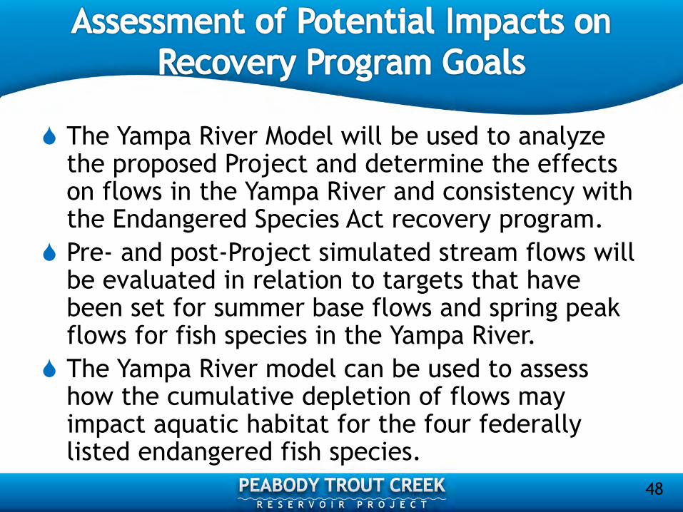
The Yampa River Model will be used to analyze the proposed Project and determine the effects on flows in the Yampa River and consistency with the Endangered Species Act recovery program.
Pre- and post-Project simulated stream flows will be evaluated in relation to targets that have been set for summer base flows and spring peak flows for fish species in the Yampa River.
The Yampa River model can be used to assess how the cumulative depletion of flows may impact aquatic habitat for the four federally listed endangered fish species.
48

The CWCB is responsible for conducting an
assessment of the cumulative depletions in the
Yampa River Basin every five years.
An assessment for the period 2005-2010 is
currently in process by CWCB.
The CDSS Model will be updated to include new
projects that have been identified and
consulted on.
49
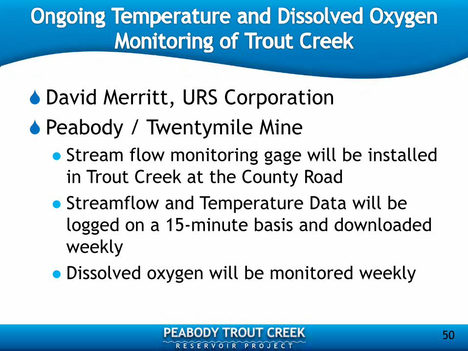
David Merritt, URS Corporation
Peabody / Twentymile Mine
Stream flow monitoring gage will be installed
in Trout Creek at the County Road
Streamflow and Temperature Data will be
logged on a 15-minute basis and downloaded
weekly
Dissolved oxygen will be monitored weekly
50

David Merritt, URS Corporation
Work will be conducted by Twenty Mile
Environmental Staff, as they have collected
data over the last 15 years
51

Parameters to be collected monthly
TEMPERATURE FIELD DEGREES C
CONDUCTIVITY FIELD UMHOS/CM
LAB UMHOS/CM
PH FIELD PH
LAB PH
SOLIDS SUSPENDED MG/L
TOTAL-DISS MG/L
CALCIUM DISSOLVED MG/L
MAGNESIUM DISSOLVED MG/L
SODIUM DISSOLVED MG/L
SAR NOT APPLICABLE UNDEFINED
BICARBONATE AS HCO3 MG/L
CARBONATE AS CO3 MG/L
SULFATE NOT APPLICABLE MG/L
CADMIUM TOTAL RECOV UG/L
MERCURY TOTAL RECOV UG/L
SELENIUM TOTAL RECOV UG/L
SILVER TOTAL RECOV UG/L
ZINC TOTAL RECOV UG/L
IRON TOTAL RECOV UG/L
MANGANESE TOTAL RECOV UG/L
MOLYBDENUM TOTAL RECOV UG/L
NITROGEN AMMIA-FREE MG/L
NITRATE MG/L
NITRITE MG/L
NO3+NO2 MG/L
PHOSPHATE ORTHO-DISS MG/L
52

(AKA Hydrology Assessment and Reservoir
Operations Model)
Jean Marie Boyer, PhD, PE and Taylor
Adams, Hydros Consulting Inc.
53

Impoundment of Water and Change to Seasonal Flow Patterns Change to seasonal flow patterns downstream
Reservoir likely to stratify • Water temperatures downstream
• Dissolved oxygen downstream
Relevant Management Variables Selective withdrawal
Release rates and timing
Proposed Approach 1. Collect additional data in 2013
2. Develop and apply models to simulate water quality response
54

WQ Parameters: • TOC, DOC, BOD
• TSS
• TKN, NO3, NH4
• TP and PO4
• Field Parameters
(pH, DO, Sp. Cond., Temp.)
Soil Samples
Flow Gages X
Proposed
Reservoir
Middle
Creek
Continuous
Temperature
Gages
WQ Monitoring
(Weekly Grabs)
Cross Sections
N

2D Dynamic Reservoir Model
1D Dynamic Stream Model
Hourly/Long./Vert.
• Stratification
• Dissolved Oxygen
• Temperature
• Selective
Withdrawal
Hourly/Long.
• Dissolved Oxygen
• Temperature
Heat Balance Calc. at
Confluence w/ Yampa
Hourly
• Temperature
PTCR
Trout Creek
56

57
Construct
Reservoir
Model
Construct
Trout
Creek
Model
6/2014 4/2014 2/2014 12/2013 10/2013 8/2013 6/2013 4/2013
Data Collection
Calibrate
Models to
2013 Data
Model
Runs
Final
Report
Data Analysis and Workup
Bathy
Data X-
Sections
WQ and
Flow Data Input on
Simulations

1. Nutrients - concern about effects on nutrient concentrations Propose Including Nutrients in Reservoir and Trout
Creek Models • External loading
• Internal loading
• Nutrient dynamics
Required Data Collection • Upstream nutrient sampling already proposed
• Add three WQ sites below reservoir site
• Add one WQ site on Yampa (u/s of Trout Creek)
Uncertainty • No observed data to match in-reservoir
Schedule and Budget Impacts
58

2. Water Quality Effects on Yampa to Green River – concern
about effects of reduced flow rates on temperature…
2006 M&E Listing on Yampa for Temperature (Oak Creek to
Elkhead Creek)
• Questionable data in this reach
59
Avg. % Change in Flow on
Yampa below Trout Creek
Avg. % Change in Flow on
Yampa below Sage Coal Diversion

Modeling Option
• Steady-state model of Yampa River from Trout
Creek to Elkhead Creek
• Additional temperature and flow gages in 2013
• Schedule and budget impacts
60

Don Conklin, GEI Consultants, Inc.
61

Effects Evaluation for “Aquatic Resources” for Project Fish populations and habitat and migration
Macroinvertebrate populations and habitat
Invasive and non-native species
Threatened and Endangered species
Others?
Spatial Scope Trout Creek upstream and
downstream of reservoir
Middle Creek
Yampa River downstream to Green River?
62

Incorporate Other, Interrelated Team Resources
Hydrology and Stream Flow
Cumulative Hydrology Effects
Water Quality, especially Temperature and DO
Channel Morphology
Reservoir Operations Model
Fishery Management Plan
Downstream Riparian, Wetlands,
and Littoral Habitat
Recreation
63

Data Collection-New PHABSIM high flow data
Refine PHABSIM modeling
Other proposed aquatic studies (see subsequent slides)
• Species and Longitudinal Study
• Entrainment Study
• Whirling Disease
Existing Information Fish and Macroinvertebrates
• Contact agencies
64

Effects Evaluation
Incorporate information from other resources
Incorporate information from
other aquatic studies
PHABSIM fish habitat
modeling
Assessment of key hydrologic
variables
65
Don Conklin, GEI Consultants, Inc.
66

Refine Species Composition and Longitudinal Use
Downstream of the Reservoir Site
GEI data collection in 2011 and 2012 near reservoir site
May be seasonal use by other species downstream of reservoir
Any potential migration through reservoir site
Species in Yampa River may spawn in Trout Creek
67

Supplemental Data Collection
Sample fish at three sites between reservoir site and Yampa River
Qualitative electrofishing to maximize area and chance of finding
uncommon species
Seasonal sampling to capture fish
movements
• Sucker species and rainbow trout spawn in
spring
• Whitefish and brown trout spawn in fall
• Others?
Sample spring, summer, fall
Coordinate timing of sampling with agencies
Use information for effects evaluation and mitigation
68

Don Conklin, GEI Consultants, Inc.
69

Assess fish entrainment by reservoir intake
and outlet structures
Effects to reservoir fishery
Effects to downstream fishery • Source for non-native species to be maintained in Trout
Creek
• Recreationally important species
(trout?)
• Less desirable non-native
species (white suckers)
70

Identify fish that will be maintained in reservoir
Fishery Management Plan
Reservoir modeling (especially temperature)
Assess swimming speed
Literature search for target species
Compare to design specifications
for reservoir structures
Assess effects to reservoir and
stream fishery
71
Don Conklin, GEI Consultants, Inc.
72

Establish baseline conditions
Whirling disease is already present in Trout Creek
Document current level of infection near reservoir site
2-hosts for parasite, trout and Tubifex worms
Rainbow trout most sensitive to infection
Evaluate effects of reservoir
Reservoir and Trout Creek
may provide habitat for worms
Sedimentation could increase
habitat for worms
73

Data collection - sample fish and worms
Collect trout, preferably rainbow trout, for testing
Sample near reservoir site
• Few trout here in 2001, 2012
• May have to move upstream-
landowner access required
Test for current level of
infection
Sample worms
• Test for current level of infection
• Test for genetic lineage
74

Evaluation of Effects
Assess current infection conditions
Assess current habitat for worms (sedimentation)
Evaluate effects of Project
May have implications for
reservoir management
• Sediment in reservoir and
Trout Creek
• Fish species in reservoir
• Downstream effects to fishery in
Trout Creek
75

12:30 p.m. to 1:30 p.m.
76

Clint Henke, ERO Resources Corporation
77

Migratory Bird Treaty Act (MBTA) Protects migratory birds, eggs, and nests
Does not prohibit destruction of non-active nests (i.e., nests remaining after breeding and migration has ended for the season)
Nest destruction that results in the unpermitted take of migratory birds or their eggs is illegal and fully prosecutable
Take – defined as “to actively or attempt to pursue, hunt, shoot, wound, kill, trap, capture, or collect”
78

79

To determine location of existing active
raptor nests that could be affected by
reservoir construction or operation
To determine breeding migratory bird
activity
To assess potential effects on migratory
birds, including raptors
80
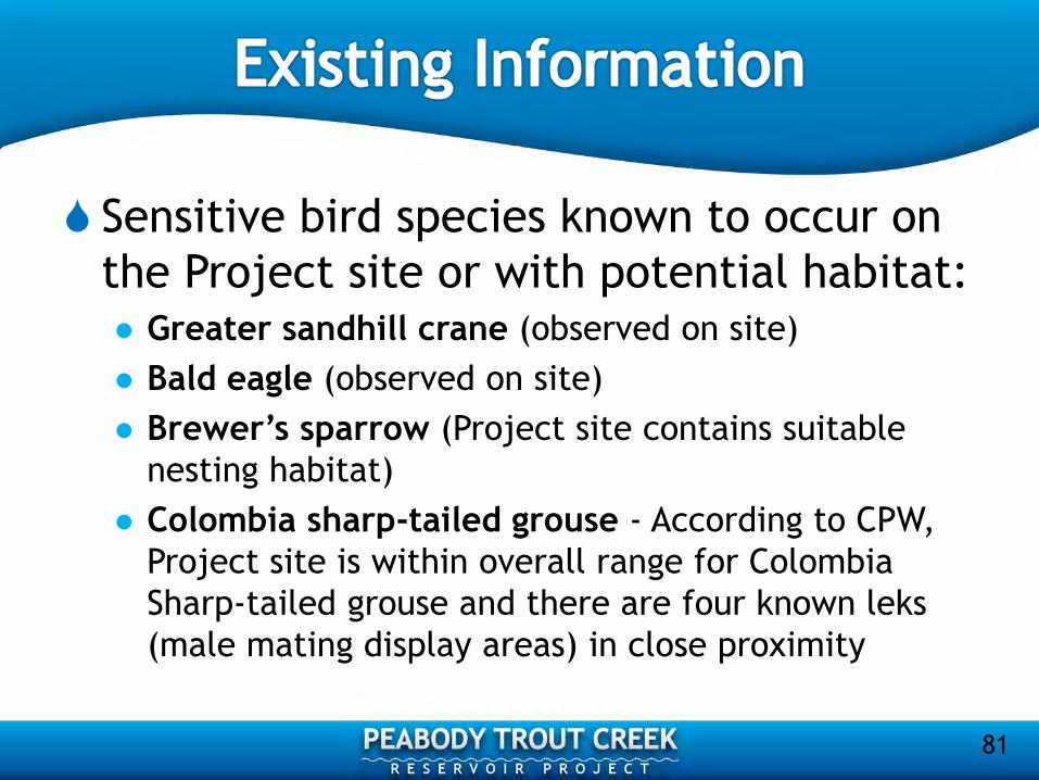
Sensitive bird species known to occur on
the Project site or with potential habitat: Greater sandhill crane (observed on site)
Bald eagle (observed on site)
Brewer’s sparrow (Project site contains suitable
nesting habitat)
Colombia sharp-tailed grouse - According to CPW,
Project site is within overall range for Colombia
Sharp-tailed grouse and there are four known leks
(male mating display areas) in close proximity
81

Methods Raptor Surveys
Conduct initial site visit in early spring to locate any existing
raptor nests prior to trees leafing out
Conduct second survey in late spring to determine nest activity
in previously identified nests and identify any new nests
Surveys will be conducted using a combination of binoculars,
spotting scopes, mirror poles, and playback calls as needed
Active nests will be mapped on aerial photography
A survey report with recommendations will be prepared
82

Methods Migratory Bird Surveys
Conduct surveys in early June and mid-July to identify breeding
bird activity in all habitats in the study area
Surveys will be consistent with Colorado Bird Breeding Atlas
(COBBA) methods
Biologists will record the presence and activity of all birds
observed on the COBBA II field card using the COBBA II habitat,
activity, and abundance codes
A survey report will be prepared
83

Other sensitive species known to occur
on the Project site
Northern leopard frog (observed)
River otter (observed)
Effects will be assessed based on
habitat loss
84

Clint Henke, ERO Resources Corporation
85

Purpose of Study To map wetland and riparian habitat on Trout Creek
downstream of the proposed dam to qualitatively
assess indirect impacts from changes in hydrology
86

Methods
Map wetland and riparian vegetation on Trout Creek from the proposed dam to the confluence with the Yampa River using aerial photo interpretation
Ground-truth mapping from public roads and lands
Assess indirect impacts using changes in stream stage and flooding frequency from Project hydrology modeling
87

Clint Henke, ERO Resources Corporation
88

Wetland Definition
Those areas that are inundated or saturated by
surface or groundwater at a frequency and duration
sufficient to support, and that under normal
circumstances do support, a prevalence of
vegetation typically adapted for life in saturated
soil conditions. Wetlands generally include swamps,
marshes, bogs, and similar areas (33 CFR 328.3 (b)).
Wetlands must have indicators for hydrophytic
vegetation, hydric soils, and wetland hydrology to
meet the Corps’ definition of a wetland
89

90

91

92

Background
2011 - Wetlands delineated within 2011 study
area according to Corps guidelines; two areas
excluded because of lack of access
2013 – Wetland study area expanded to match
cultural resources area of potential effects
(APE) for direct effects
93

94

Methods
Delineate wetlands in expanded study area
following Corps’ guidelines
Review mapping with Corps’ representative
Assess Project impacts using revised mapping
and GIS analysis
95

Future Activities
Adjust wetland mapping based on results of
groundwater monitoring
Request approval of revised mapping from the
Corps
Assess impacts using revised mapping for final
Project wetland impacts
96

Peabody / Twentymile Mine
This survey will be conducted by the
Twentymile Mine Permitting and
Environmental Support Group according to
Routt County weed control standards
Twentymile Mine has been doing this for the
life of the mine and will continue to do
noxious weed control in the future
97

John Hausman, URS Corporation
98

County Roads (CRs)
27, 33 and 179
99

Assessment of Existing Roadway
Structures
CRs 27, 33, and 179
Identify any special design requirements
to support Project construction and
operation
Address spring/fall unpaved roadway
conditions
100

Existing Traffic
Counts/Volumes
CRs 27, 33, and 179
Construction Assessment
Operations Assessment
Master Plan and recreation
traffic forecast
Traffic control and
intersection improvements
101

Second Year Effort
Up to one mile of unpaved
roadway relocation
Identify roadways impacted
Determine necessary right-
of-way requirements
Design roadway alignments
102

Kevin Young, Young Energy Services (YES)
103

Document existing recreational uses and
opportunities in the region and Project
area
Present effects of Project existence and
operations on recreational activity in the
Project area
104

105
YAMPA RIVER STATE PARK DESIGNATED PUBLIC ACCESS SITES
FLAT TOPS WILDERNESS AREA
SARVIS CREEK WILDERNESS AREA
MT. ZIRKEL WILDERNESS AREA
Recreation Study: Map of Project Region
TROUT CREEK
PROJECT SITE

Existing information will be gathered about
important recreation areas near the Project
Steamboat State Park
Stagecoach State Park
Yampa River State Park
Medicine-Bow Routt National Forest
Information will include use and
opportunities for recreational activities such
as boating, fishing, camping, and hunting
106

Recreational Use/Opportunities
Downstream
Trout Creek
Along the Yampa River
Within Yampa River State Park
Steamboat Springs downriver to the
confluence with the Green River
107
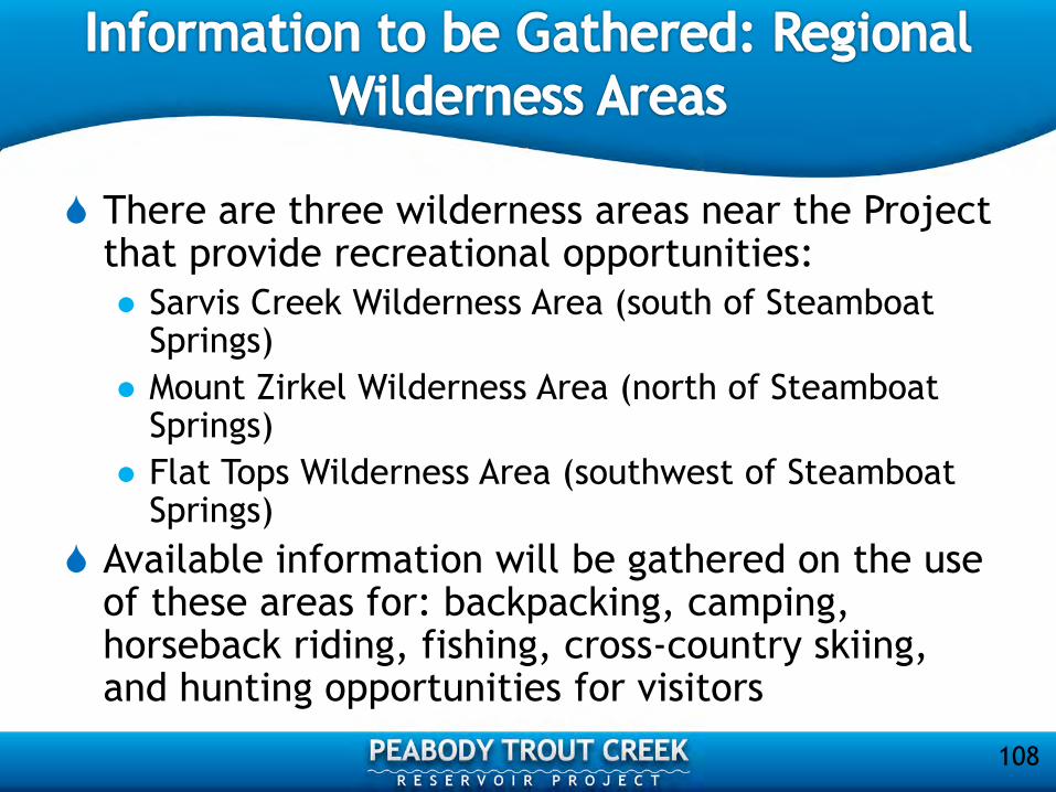
There are three wilderness areas near the Project that provide recreational opportunities:
Sarvis Creek Wilderness Area (south of Steamboat Springs)
Mount Zirkel Wilderness Area (north of Steamboat Springs)
Flat Tops Wilderness Area (southwest of Steamboat Springs)
Available information will be gathered on the use of these areas for: backpacking, camping, horseback riding, fishing, cross-country skiing, and hunting opportunities for visitors
108
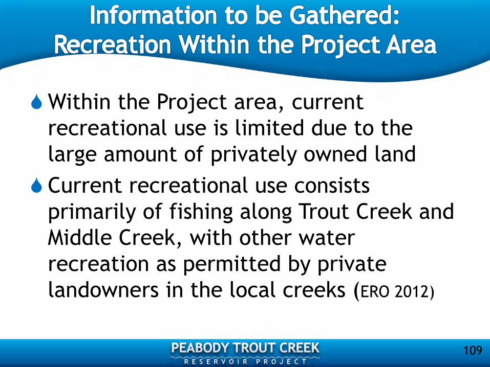
Within the Project area, current
recreational use is limited due to the
large amount of privately owned land
Current recreational use consists
primarily of fishing along Trout Creek and
Middle Creek, with other water
recreation as permitted by private
landowners in the local creeks (ERO 2012)
109
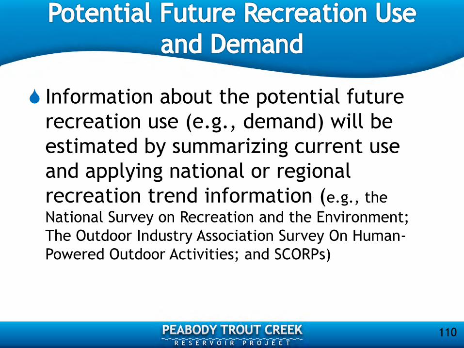
Information about the potential future
recreation use (e.g., demand) will be
estimated by summarizing current use
and applying national or regional
recreation trend information (e.g., the
National Survey on Recreation and the Environment;
The Outdoor Industry Association Survey On Human-
Powered Outdoor Activities; and SCORPs)
110

The Recreation Study will assess to what degree proposed development and operation of the Project will affect the availability and quality of the recreation activities on Trout Creek and in the surrounding area
Provide input to the recreational and shoreline management plans that will subsequently be developed
111

These plans will include a list of potential
management measures (actions) and a
description of how they might change
recreation opportunities and quality
Management plans will be included in the
draft license application addressing costs,
implementation constraints, and effects of
creating new opportunities, and discuss
trade-offs
112
Gordon Tucker, URS Corporation
113

National Historic Preservation Act (NHPA)of 1966, as amended 2006 (16 U.S.C. 470 et seq.)
Section 106 of NHPA: “The head of any Federal agency having direct or indirect jurisdiction over a proposed Federal or federally assisted undertaking in any State and the head of any Federal department or independent agency having authority to license any undertaking shall, prior to the approval of the expenditure of any Federal funds on the undertaking or prior to the issuance of any license, as the case may be, take into account the effect of the undertaking on any district, site, building, structure, or object that is included in or eligible for inclusion in the National Register [of Historic Places]. The head of any such Federal agency shall afford the Advisory Council on Historic Preservation established under Title II of this Act a reasonable opportunity to comment with regard to such undertaking.”
114

Key elements of the Section 106 process:
Identify the participants
Involve the public
Consult
Document
Implementing regulations found at 36 CFR
800
115

Step 1 – Initiate Section 106 Process Establish undertaking
Identify appropriate SHPO/THPO
Plan to involve the public
Identify other consulting parties
Step 2 - Identify Historic Properties Determine scope of efforts
• Determine and document the area of potential effects (APE)
• Review existing information about historic properties
• Seek information from parties likely to have knowledge of or concerns about the
area
• Gather information from Indian tribes about properties to which they attach
religious and cultural significance, while remaining sensitive to any concerns
they may have about the confidentiality of this information
Identify historic properties (“reasonable and good faith effort”)
Evaluate historic significance – apply NRHP criteria
116

Step 3 – Assess Adverse Effects Apply criteria of adverse effects
• Adverse effects occur when an undertaking may directly or indirectly
alter characteristics of a historic property that qualify it for inclusion
in the NRHP
• Reasonably foreseeable effects caused by the undertaking that may
occur later in time, be farther removed in distance, or be cumulative
also need to be considered
Possible outcomes: • “No historic properties adversely affected”
• “Historic properties adversely affected”
Step 4 – Resolve Adverse Effects Develop Memorandum of Agreement (MOA)
Execute MOA with agency, SHPO/THPO, and other consulting parties
Filing of MOA concludes the Section 106 process
117

118

119

120

David Merritt, URS Corporation
121

Shana Murray, FERC
122

Thank you for your
participation in the
Integrated Licensing Process
Peabody Trout Creek
Reservoir Project!
123