pcraster modelling platform
TRANSCRIPT

PCRaster modelling platform
PCRaster research team, Derek Karssenberg
Department of Physical Geography, Faculty of Geosciences,
Utrecht University, the Netherlands ([email protected])

Outline
1) Static Modelling
2) Dynamic Modelling
3) Visualisation
4) Technical information

Design considerations
People constructing models are domain specialists, not programmers
Tool provides ‘simple’ building blocks for models
Modellers construct models by combining the building blocks

Building blocks: standard functions on maps and blocks
point functions
direct neighbourhood
functions
entire neighbourhood
functions
neighbourhood defined by
topology

Static models (raster based GIS analysis)
All raster based operations
Particularly strong at analysis of digital terrain models and hydrology
Two scripting languages
PCRcalc: dedicated language
PCRaster Python: PCRaster functions as a Python module
Routines for prompt visualisation

Dynamic models
for each t
set of variables representing state of the model
at time index t
set of functionals representing processes over time step
represented by combining building blocks
xt = f xt -1( )
xt
f

Dynamic models
initial
# sequence of functions
dynamic (nrtimesteps=…)
# sequence of functions

Applications
Hydrological models (PCRGLOB-WB)
Ecological models
Land use change models
Landscape evolution models (erosional and denudational)
Geomorphology and degradation models (mass movements, debris flows)
River sediment
transport
Cellular automata
Catchment hydrology

Selection of other point
Interactive visualisation

Dynamic models
Raster based operations are building blocks
Frameworks in Python for:
Dynamic modelling (iterations over time)
Stochastic modelling / uncertainty (Monte Carlo simulation)
Routines for prompt visualisation of multi-dimensional data
Geographic dimension
Time dimension
Uncertainty dimension (Monte Carlo samples)

eWaterCycle project
• Create a realistic, high-resolution global hydrological model of all the
fresh water in the world
• Applications:
– Flood forecasting
– Groundwater depletion prediction
– Water protection measures
decision making support

eWaterCycle Model Requirements
• Ultra high resolution (100x100 meter)
• Data assimilation of remote sensing data

eWaterCylce model
‘Standard’ PCRaster model (PCRaster Python)
Dynamic model
Assimilation of remotely sensed soil moisture
Runs on a supercomputer (Cartesius at SURFSara)
Distributed computing (multiple nodes)
OpenCL (at a node)

eWaterCycle animation
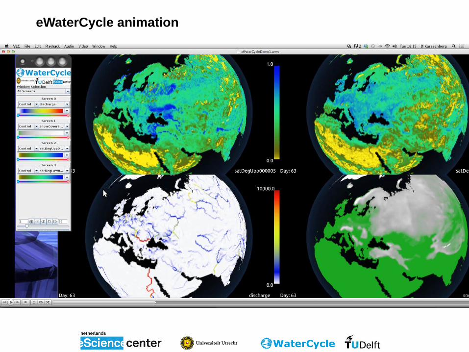
eWaterCycle animation
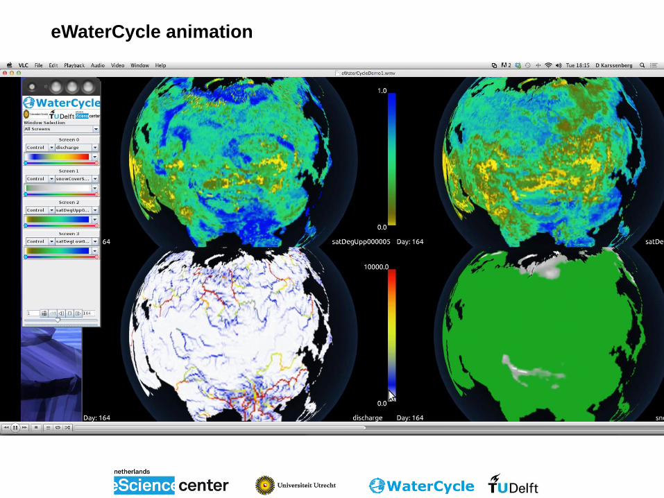
eWaterCycle animation

PCRaster team & info
Cooperation between Utrecht University & Carthago Consultancy
Key partners:
ECMWF
Deltares
Joint Research Centre – European Commission
Dutch eScience Centre
Universities worldwide
Software engineers, modellers
Open source (GPL)
Programmed in C++
Info, courses and downloads at http://www.pcraster.eu
THANK YOU FOR YOUR ATTENTION