paraguay - deforestation monitoring a key issue for...
TRANSCRIPT
Deforestation monitoringA key issue for the REDD
processParaguay experience
UNFCCC REDD WORKSHOP
Tokyo – JUNE 2008
Presentation outline
• Paraguay situation• Deforestation process• Mechanism to address deforestation• Implications for REDD
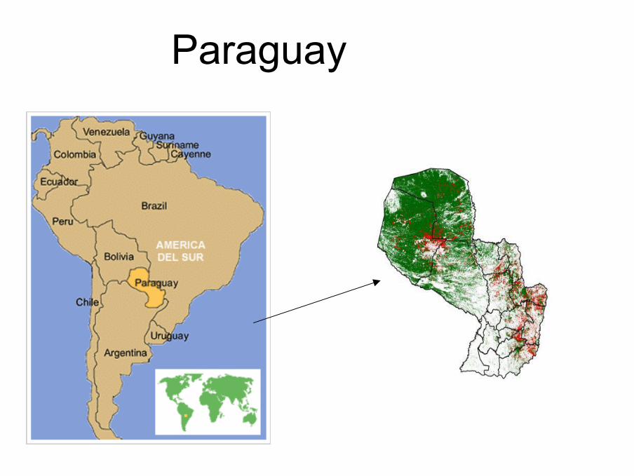
Paraguay
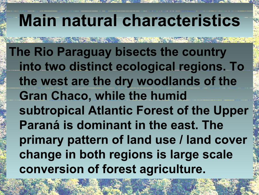
Main natural characteristics
The Rio Paraguay bisects the country into two distinct ecological regions. To the west are the dry woodlands of the Gran Chaco, while the humid subtropical Atlantic Forest of the Upper Paraná is dominant in the east. The primary pattern of land use / land cover change in both regions is large scale conversion of forest agriculture.
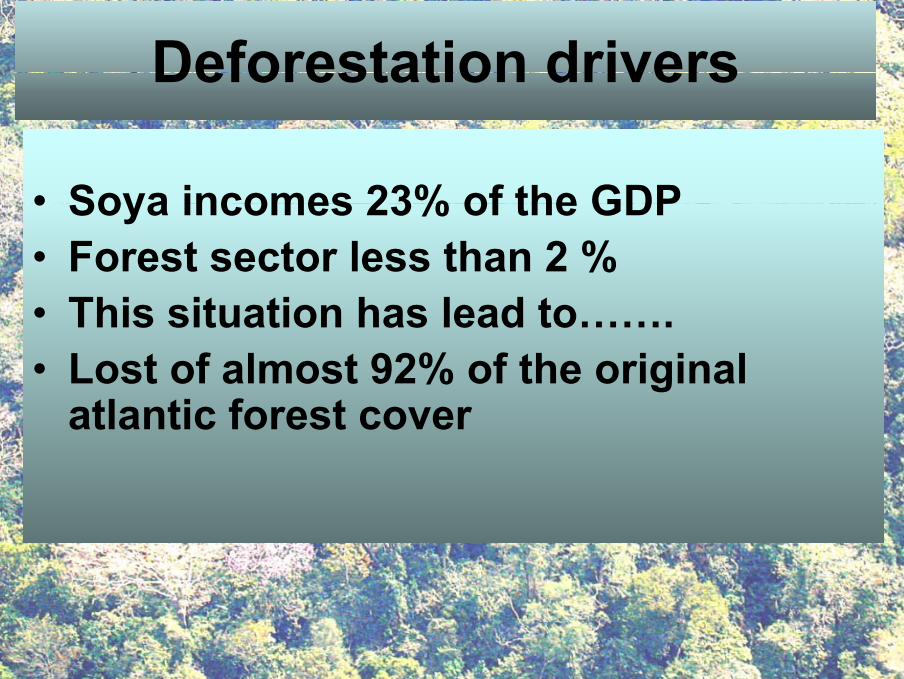
Deforestation drivers
• Soya incomes 23% of the GDP• Forest sector less than 2 %• This situation has lead to…….• Lost of almost 92% of the original
atlantic forest cover
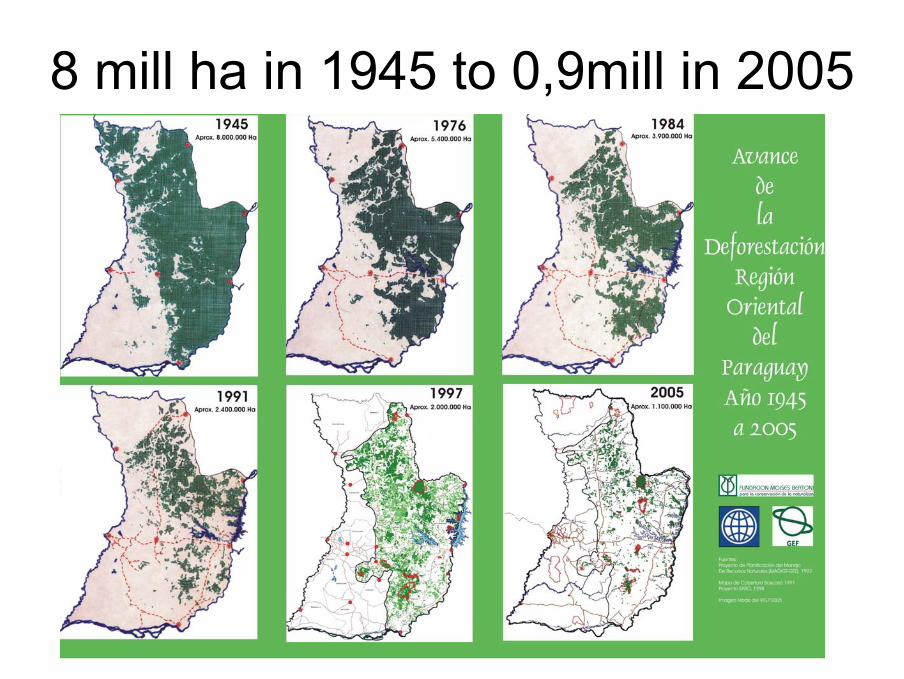
8 mill ha in 1945 to 0,9mill in 2005
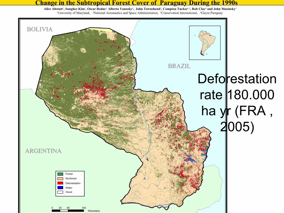
The Global Land Cover FacilityThe Global Land Cover FacilityChange in the Subtropical Forest Cover of Paraguay During the 1990s
Alice Altstatt1, Sunghee Kim1, Oscar Rodas4, Alberto Yanosky4, John Townshend1, Compton Tucker1,2, Rob Clay4 and John Musinsky3
1University of Maryland, 2National Aeronautics and Space Administration, 3Conservation International, 4Guyra Paraguay
Forest
Nonforest
Deforestation
Water
Cloud
BRAZILBRAZIL
ARGENTINAARGENTINA
0 50 10025Kilometers
BOLIVIABOLIVIA
Deforestationrate 180.000 ha yr (FRA ,
2005)
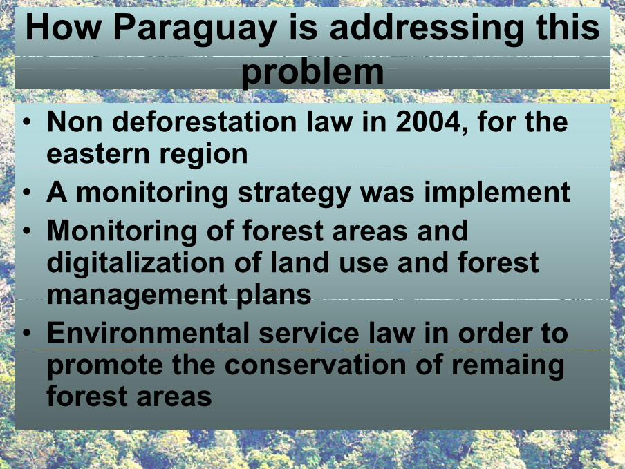
How Paraguay is addressing this problem
• Non deforestation law in 2004, for the eastern region
• A monitoring strategy was implement• Monitoring of forest areas and
digitalization of land use and forest management plans
• Environmental service law in order to promote the conservation of remaing forest areas
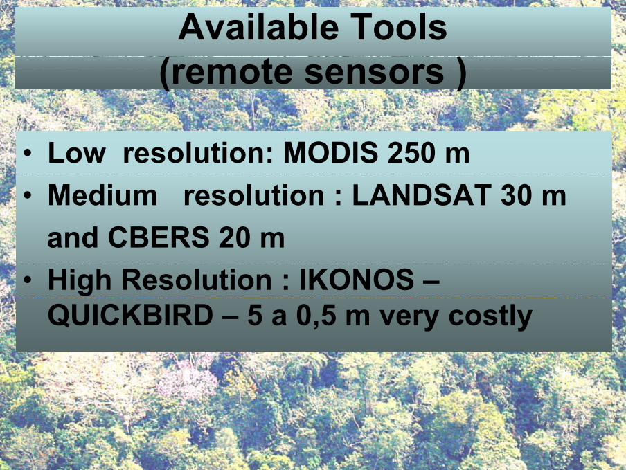
Available Tools(remote sensors )
• Low resolution: MODIS 250 m• Medium resolution : LANDSAT 30 m
and CBERS 20 m• High Resolution : IKONOS –
QUICKBIRD – 5 a 0,5 m very costly
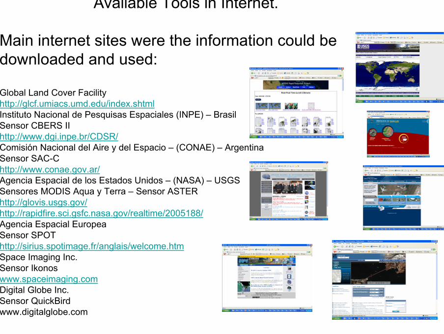
Available Tools in Internet.
Main internet sites were the information could be downloaded and used:
Global Land Cover Facilityhttp://glcf.umiacs.umd.edu/index.shtmlInstituto Nacional de Pesquisas Espaciales (INPE) – BrasilSensor CBERS IIhttp://www.dgi.inpe.br/CDSR/Comisión Nacional del Aire y del Espacio – (CONAE) – ArgentinaSensor SAC-Chttp://www.conae.gov.ar/Agencia Espacial de los Estados Unidos – (NASA) – USGSSensores MODIS Aqua y Terra – Sensor ASTERhttp://glovis.usgs.gov/http://rapidfire.sci.gsfc.nasa.gov/realtime/2005188/Agencia Espacial EuropeaSensor SPOThttp://sirius.spotimage.fr/anglais/welcome.htmSpace Imaging Inc.Sensor Ikonoswww.spaceimaging.comDigital Globe Inc.Sensor QuickBirdwww.digitalglobe.com
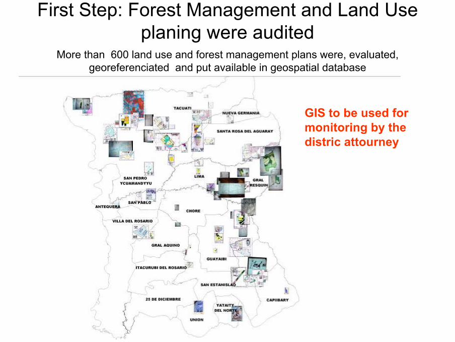
First Step: Forest Management and Land Use planing were audited
More than 600 land use and forest management plans were, evaluated, georeferenciated and put available in geospatial database
GIS to be used formonitoring by thedistric attourney
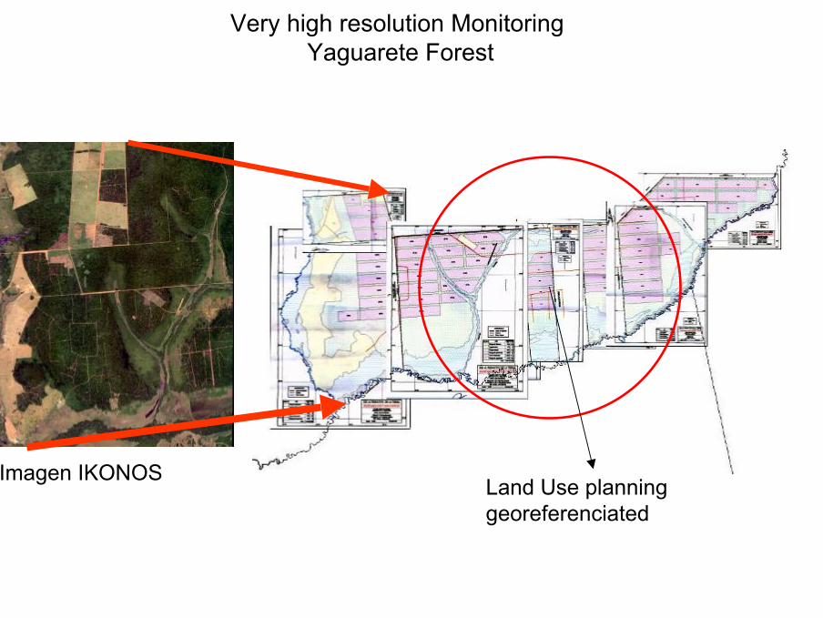
Very high resolution MonitoringYaguarete Forest
Imagen IKONOSLand Use planning georeferenciated
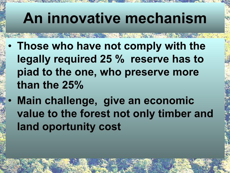
An innovative mechanism
• Those who have not comply with thelegally required 25 % reserve has topiad to the one, who preserve more than the 25%
• Main challenge, give an economicvalue to the forest not only timber andland oportunity cost
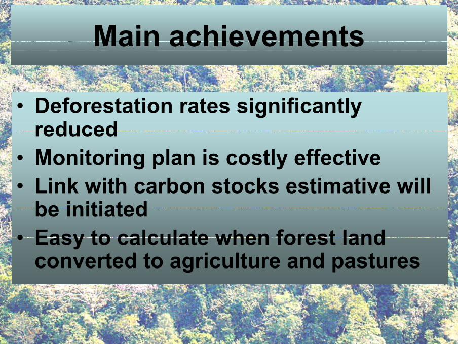
Main achievements
• Deforestation rates significantly reduced
• Monitoring plan is costly effective • Link with carbon stocks estimative will
be initiated • Easy to calculate when forest land
converted to agriculture and pastures
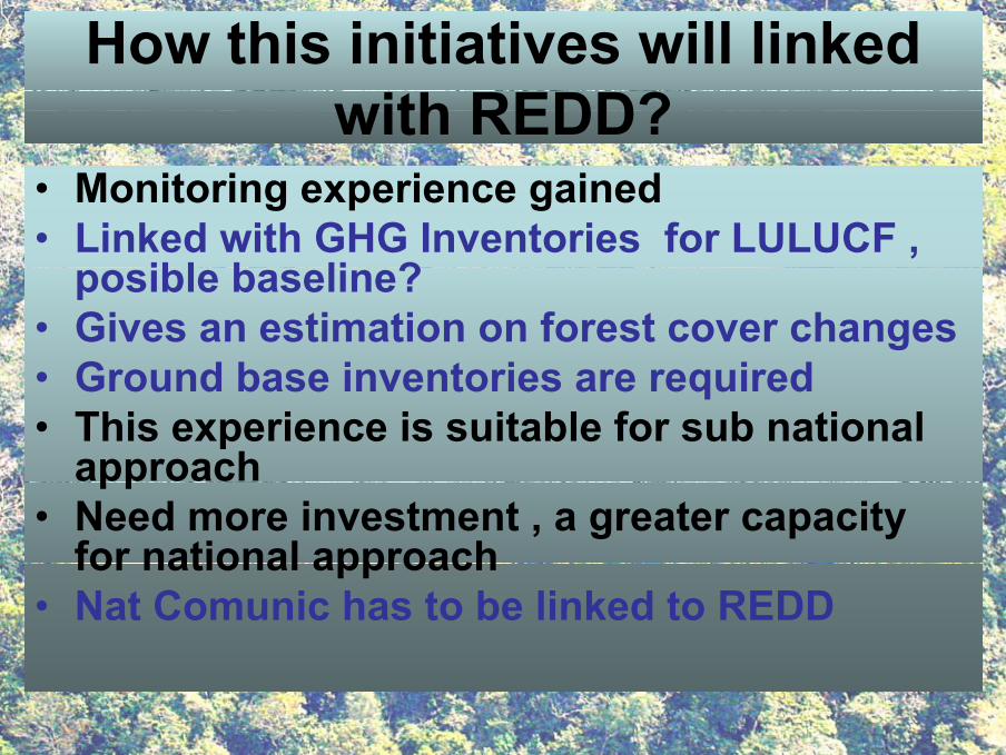
How this initiatives will linked with REDD?
• Monitoring experience gained• Linked with GHG Inventories for LULUCF ,
posible baseline?• Gives an estimation on forest cover changes • Ground base inventories are required • This experience is suitable for sub national
approach • Need more investment , a greater capacity
for national approach• Nat Comunic has to be linked to REDD
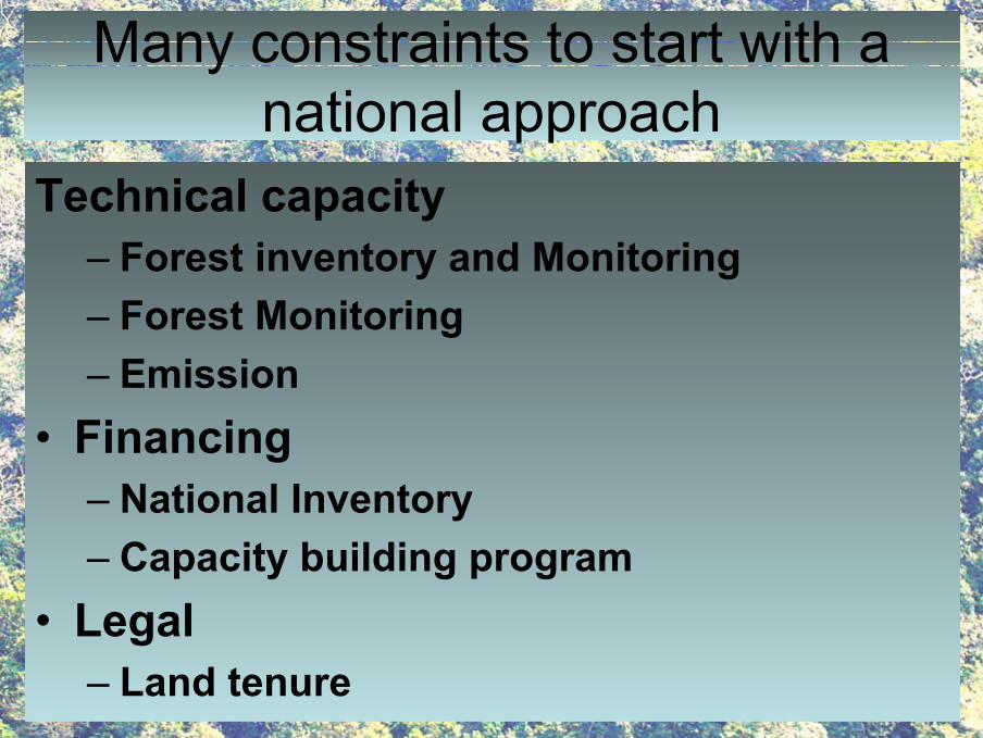
Many constraints to start with a national approach
Technical capacity– Forest inventory and Monitoring– Forest Monitoring– Emission
• Financing– National Inventory– Capacity building program
• Legal– Land tenure
Thank you