outreach for digital flood insurance rate map - … county post lfd outreach presentatio… ·...
TRANSCRIPT

Outreach for Digital Flood Insurance Rate Map
June 6, 2013
Maricopa County, AZ
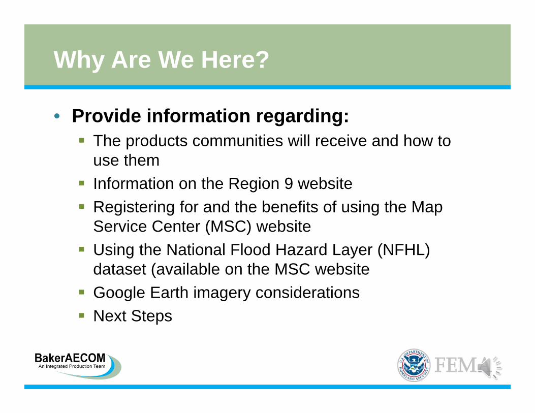
Why Are We Here?
• Provide information regarding: The products communities will receive and how to
use them Information on the Region 9 website Registering for and the benefits of using the Map
Service Center (MSC) website Using the National Flood Hazard Layer (NFHL)
dataset (available on the MSC website Google Earth imagery considerations Next Steps

Project History – Maricopa Countywide
Project Milestones Dates
Data Development Phases From 2008 to December 2010
Preliminary Distribution December 3, 2010
Appeal/Comment Resolution From October 2011 to August 2012
Letter of Final Determination/Final SOMA April 16, 2013
Ordinance Compliance and Adoption Period April 16, 2013 to October 16, 2013
Planned Outreach Activities April 16, 2013 to October 16, 2013
Effective Date October 16, 2013
Revalidation Letters are Effective October 17, 2013

Changes to the FIS and FIRMs
• County-wide format 337 Flood Insurance Rate Map (FIRM) Panels &
23 Volumes of the Flood Insurance Study (FIS) • Vertical datum conversion Elevations converted from NGVD 1929 to NAVD 1988
• Effective Letters of Map Change (LOMCs) incorporated
• Multiple new/revised H&H analyses• Updated base map – 2009 imagery• Panel re-numbering

FEMA Product Delivery
• Community CEO’s receive data
• One paper copy of the FIRM panels and FIS
• One (may be multiple) CD with GIS shape files, .png and .pgwfiles of the FIRM panels, and .pdf files of the FIS report.

FEMA Product Delivery
• CD/DVD File Structure for FIS and FIRMs

FEMA Product Delivery
• CD/DVD File Structure for FIS and FIRMs
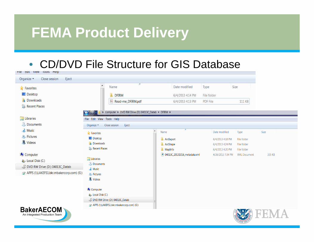
FEMA Product Delivery
• CD/DVD File Structure for GIS Database

FEMA Product Delivery

FEMA Product Delivery
• To convert the FIRM panels from .png files to .pdf files you can use Adobe Acrobat Pro or a “Print to Adobe” Option Under “File” to go
“Create .pdf from file and then you can select the file to save as pdf.

Other Mapping Resources
• FEMA Region IX Website (project website) http://www.r9map.org/Pages/default.aspx.
• Map Service Center Website http://msc.fema.gov

FEMA Region IX Website
• http://www.r9map.org/Pages/default.aspx.

FEMA Region IX Website

FEMA Region IX Websitehttp://www.r9map.org/Pages/ProjectDetailsPage.aspx?choLoco=66&choProj=224

FEMA Region IX Websitehttp://www.r9map.org/Pages/ProjectDetailsPage.aspx?choLoco=66&choProj=224
FEMA Region IX Website
• Supplemental Project Information Letters of Final Determination (LFDs) and
Final Summary of Map Action lists (SOMAs) are posted. 2013 to 2005 FIRM panel translation table Levee/Non-levee embankment spreadsheets
and GIS shape files Changes Since Last FIRM (CSLF) .kml file
and GIS shape files

FEMA Region IX Website
• CSLF .kml file

FEMA Region IX Website

Map Service Center Website
• http://msc.fema.gov• Product fees are
waived for NFIP community officials
• FIRM panels and FIS are not guaranteed to be posted to the MSC website until 2 months prior to effective date.

Map Service Center Website
• Prior to the effective date, the MSC posts the FIRM panels to the “Future FIRMs” website & the FIS volumes to the “Future FIS” website.
• After effective date October 16, 2013, the products are moved to the “Effective” sub-headings.

Map Service Center Website
• Registering for the MSC Website One NFIP community
official can register. Call the MSC (1-877-
336-2627) and register on-line.

MSC Website Features
• FIRMette-Desktopsoftware can be downloaded to produce FIRMetteslocally instead of from the MSC Website.
• Instructions for download and setup are located on the MSC main website page.

National Flood Hazard Layer (NFHL)
• NFHL data is continuously updated with: Letters of Map Revision (LOMRs) as they become
effective.• Indicated by box and LOMR case number.
Letters of Map Amendment (LOMA) and Letters of Map Revision Based on Fill (LOMR-Fs)
• Noted with a symbol and case number.
NFHL will be off-line from April 24 to June 21 due to maintenance activities.
NFHL will be updated with revised Maricopa County data soon after the effective date.

National Flood Hazard Layer (NFHL) Products• Online MapViewer –
Web• NFHL GIS Datasets Ordered through the
MSC• GIS &/or Google
Earth Applications–Web Map Service
Base Map Reminder
• Google Earth is popular way to view SFHA data BUT FIRM imagery is the official base map and should
be used for flood determinations. Google Earth can be used as a tool, but you should
always check against the FIRMs. Google Earth provides users with multiple years of
aerial photos which can create issues.

Imagery dated 3/3/2008

Imagery dated 8/16/2005

Next Steps – Final Mapping Tasks
• Final Products are mailed and posted to MSC website
• Re-issued LOMRs – effective soon after 10/16/2013
• Revalidation Letters – effective 10/17/2013

Next Steps - Outreach
• While you are reviewing the effective products, please consider the following: Are there any issues with the FIRMs and/or FIS? Do you anticipate issues with meeting the ordinance
compliance deadline of October 16, 2013? What is the impact of SFHA revisions in your
community? Is additional outreach needed for your community? How extensive should the outreach activities be? What messages do you want to convey to the public
(Risk, Insurance, etc.)?
Next Steps - Outreach
• An Outreach Web Meeting is planned for June 25, 2013, to assess what level of outreach efforts will be required for communities
• FEMA plans to be in Maricopa County either the week of September 9th or September 16th

Contacts
• FEMA Region IX Robert Bezek – Regional Engineer
([email protected], 510-627-7274) Patricia Rippe – Natural Hazards Program Specialist
([email protected], 510-627-7015)
• ADWR Maureen Towne – State Risk MAP Coordinator
([email protected], 602-771-8662)
• BakerAECOM Sarah Houghland – Project Manager
([email protected] - 720-514-1129) Alisa Sauvageot – Area Lead for AZ Projects
[email protected], 602-798-7530)

Questions and Comments