ordinance number of the city of ... - city of hattiesburg€¦ · 2 be it ordained by the mayor and...
TRANSCRIPT

1
Prepared by: City of Hattiesburg Return to: City of Hattiesburg City Clerk’s Office City Clerk’s Office P.O. Box 1898 P.O. Box 1898 Hattiesburg, MS 39403-1898 Hattiesburg, MS 39403 (601)545-4550 (601)545-4550
INDEXING INSTRUCTIONS: ORDINANCE NUMBER ______
OF THE
CITY OF HATTIESBURG, MISSISSIPPI
AN ORDINANCE ADOPTING CHAPTER 10 OF THE CODE OF ORDINANCES, WHICH ESTABLISHED
THE FLOOD DAMAGE PREVENTION ORDINANCE FOR THE CITY OF HATTIESBURG , REPEALING
ORDINANCE NUMBER 3152, ADOPTED March 3, 2015, AND ANY OTHER
ORDINANCES IN CONFLICT HEREWITH.
2
BE IT ORDAINED BY THE MAYOR AND COUNCIL OF THE CITY OF HATTIESBURG, MISSISSIPPI:
SECTION 1. That Chapter 10 of the Code of Ordinances, be and the same is hereby
amended to read as follows, to wit:
“ARTICLE 1. STATUTORY AUTHORIZATION, FINDINGS OF FACT, PURPOSE AND OBJECTIVES. SECTION A. STATUTORY AUTHORIZATION.
The Legislature of the State of Mississippi has in Title 17, Chapter 1, Mississippi Code 1972 Annotated delegated the responsibility to local government units to adopt regulations designed to promote the public health, safety, and general welfare of its citizenry. Therefore, the governing body of the City of Hattiesburg does hereby adopt the following floodplain management regulations. SECTION B. FINDINGS OF FACT.
1. The City of Hattiesburg is subject to periodic inundation, which results in loss of life and property, health and safety hazards, disruption of commerce and governmental services, extraordinary public expenditures for flood protection and relief, and impairment of the tax base, all of which adversely affect the public health, safety and general welfare.
2. These flood losses are caused by the cumulative effect of obstructions, both inside and
outside the identified Special Flood Hazard Areas, causing increases in flood heights and velocities, and by the occupancy in flood hazard areas by uses vulnerable to floods or hazardous to other lands which are inadequately elevated, floodproofed, or otherwise unprotected from flood damages.
SECTION C. STATEMENT OF PURPOSE.
It is the purpose of this ordinance to promote the public health, safety, and general welfare and to minimize public and private losses due to flood conditions in specific areas by provisions designed to: 1. Restrict or prohibit uses which are dangerous to health, safety, and property due to water
or erosion hazards, which result in damaging increases in erosion or in flood heights or velocities;
2. Require that uses vulnerable to floods, including facilities which serve such uses, be
protected against flood damage at the time of initial construction; 3. Control the alteration of natural floodplains, stream channels, and natural protective
barriers which are involved in the accommodation of flood waters; 4. Control filling, grading, dredging, and other development which may increase erosion or
flood damage, and; 5. Prevent or regulate the construction of flood barriers which will unnaturally divert
floodwaters or which may increase flood hazards to other lands. SECTION D. OBJECTIVES.
The objectives of this ordinance are: 1. To protect human life and health; 2. To minimize expenditure of public money for costly flood control projects;

3
3. To minimize the need for rescue and relief efforts associated with flooding and generally undertaken at the expense of the general public;
4. To minimize prolonged business interruptions; 5. To minimize damage to public facilities and utilities such as water and gas mains, electric,
telephone and sewer lines, streets and bridges located in floodplains; 6. To help maintain a stable tax base by providing for the sound use and development of flood
prone areas in such a manner as to minimize flood blight areas, and; 7. To ensure that potential homebuyers are notified that property is in a flood prone area. SECTION E. METHODS OF REDUCING FLOOD LOSSES.
In order to accomplish its purposes, this ordinance includes methods and provisions for: 1. Restricting or prohibiting uses which are dangerous to health, safety, and property due to
water or erosion hazards, or which result in damaging increases in erosion or in flood heights or velocities;
2. Requiring that uses vulnerable to floods, including facilities which serve such uses, be
protected against flood damage at the time of initial construction; 3. Controlling the alteration of natural floodplains, stream channels, and natural protective
barriers, which help accommodate or channel flood waters; 4. Controlling filling, grading, dredging, and other development which may increase flood
damage, and; 5. Preventing or regulating the construction of flood barriers that will unnaturally divert
floodwaters or may increase flood hazards in other areas. ARTICLE 2. DEFINITIONS.
Unless specifically defined below, words or phrases used in this ordinance shall be interpreted so as to give them the meaning they have in common usage and to give this ordinance it’s most reasonable application. Accessory structure (Appurtenant structure) means a structure, which is located on the same parcel of property as the principal structure, and the use of which is incidental to the use of the principal structure. Accessory structures should constitute a minimal initial investment, may not be used for human habitation, and be designed to have minimal flood damage potential. Examples of accessory structures are detached garages, carports, storage sheds, pole barns, and hay sheds. Addition (to an existing building) means any walled and roofed expansion to the perimeter or height of a building. Any addition shall be considered new construction. If the addition is more than 50% of the market value of the structure, then the addition and the existing structure are now new construction. Appeal means a request for a review of the Floodplain Administrator’s interpretation of any provision of this ordinance or a request for a variance. Area of special flood hazard is the land in the floodplain within a community subject to a one percent (1%) or greater chance of flooding in any given year. This area is also referred to as the Special Flood Hazard Area (SFHA). Base flood means the flood having a one percent (1%) chance of being equaled or exceeded in any given year (also called the “one percent (1%) chance flood”).

4
Base Flood Elevation (BFE) is the elevation shown in the Flood Insurance Study (FIS) for Zones AE, AR, AR/A, and AR/AE, that indicates the water surface elevation resulting from a flood that has a one percent (1%) or greater chance of being equaled or exceeded in any given year. Basement means any portion of a building having its floor sub‐grade (below ground level) on all sides. Buildings ‐see Structure. Community is a political entity and/or its authorized agents or representatives that have the authority to adopt and enforce floodplain ordinances for the area under its jurisdiction. Community Floodplain Management Map means any map produced by the community utilizing best available base flood elevation and floodway data that is from a federal, state, or other accepted technical source. Community Rating System (CRS) is a program developed by the Federal Insurance Administration to provide incentives for those communities in the Regular Program that have gone beyond the minimum floodplain management requirements to develop extra measures to provide protection from flooding. Community Flood Hazard Area (CFHA) is an area that has been determined by the Floodplain Administrator (or other delegated, designated, or qualified community official) from available technical studies, historical information, and other available and reliable sources, which may be subject to periodic inundation by floodwaters that can adversely affect the public health, safety and general welfare. This includes areas downstream from dams. Conditional Letter of Map Revision (CLOMR) see Map Amendment. Critical facility (also called critical action) means facilities for which the effects of even a slight chance of flooding would be too great. The minimum floodplain of concern for critical facilities is the point 2 percent (0.2%) chance flood level. Critical facilities include, but are not limited, to facilities critical to the health and safety of the public such as: emergency operations centers, designated public shelters, schools, nursing homes, hospitals, police, fire and emergency response installations, vital data storage centers, power generation, water and other utilities (including related infrastructure such as principal points of utility systems) and installations which produce, use or store hazardous materials or hazardous waste (as defined under the Clean Water Act and other Federal statutes and regulations). Dam is any artificial barrier, including appurtenant works, constructed to impound or divert water, waste water, liquid borne materials, or solids that may flow if saturated. All structures necessary to maintain the water level in an impoundment or to divert a stream from its course will be considered a dam including:
High hazard dam means a class of dam in which failure may cause loss of life, serious damage to residential, industrial, or commercial buildings; or damage to, or disruption of, important public utilities or transportation facilities such as major highways or railroads. Dams which meet the statutory thresholds for regulation that are proposed for construction in established or proposed residential, commercial, or industrial areas will be assigned this classification, unless the applicant provides convincing evidence to the contrary. A development permit is required for a structure and any associated fill downstream from a dam at any location where flooding can be reasonably anticipated from principal or emergency spillway discharges, or from overtopping and failure of the dam.
Low hazard dam means a class of dam in which failure would at the most result in damage to agricultural land, farm buildings (excluding residences), or minor roads.

5
Significant hazard dam means a dam assigned the significant hazard potential classification where failure may cause damage to main roads, minor railroads, or cause interruption of use, or service of relatively important public utilities.
Development means any man‐made change to improved or unimproved real estate, including, but not limited to, buildings or other structures, mining, dredging, filling, grading, paving, excavating, drilling operations, or storage of materials or equipment. Elevated building means for insurance purposes, a non‐basement building which has its lowest elevated floor raised above ground level by foundation walls, shear walls, posts, pilings, columns, or piers. Elevation Certificate is a FEMA form used as a certified statement that verifies a building’s elevation information. Emergency Program means the first phase under which a community participates in the NFIP. It is intended to provide a first layer amount of insurance coverage for all insurable buildings in that community before the effective date of the initial FIRM dated April 3, 1970. Enclosure Below the Lowest Floor see “Lowest Floor.” Encroachment means the advance or infringement of uses, plant growth, fill, excavation, buildings, structures or development into a floodplain, which may impede or alter the flow capacity of a floodplain. Executive Order 11988 (Floodplain Management) this order requires that no federally assisted activities be conducted in or have the potential to affect identified Special Flood Hazard Areas, unless there is no practicable alternative. Executive Order 11990 (Wetlands Protection) this order requires the avoidance of adverse impacts associated with the destruction or modification of wetlands. Existing Construction means structures for which the “start of construction” commenced before January 1, 1975. Existing construction may also be referred to as existing structures. Existing manufactured home park or subdivision means a manufactured home park or subdivision for which the construction of facilities for servicing the lots on which the manufactured homes are to be affixed (including at a minimum the installation of utilities, the construction of streets, and either final site grading or the pouring of concrete pads) is completed before the effective date of the floodplain management regulations adopted by a community. Expansion to an existing manufactured home park or subdivision includes the preparation of additional sites by the construction of facilities for servicing the lots on which the manufactured homes are to be affixed (including the installation of utilities, the construction of streets, and either final site grading or the pouring of concrete pads). Fill means a deposit of earthen materials placed by artificial means. Five‐Hundred (500) Year Flood means the flood that has a point 2 percent (0.2%) chance of being equaled or exceeded in any year. Areas subject to the point 2 percent (0.2%) chance flood have a moderate risk of flooding. Flood or flooding means a general and temporary condition of partial or complete inundation of normally dry land areas from:
a. The overflow of inland or tidal waters. b. The unusual and rapid accumulation or runoff of surface waters from any source.

6
c. Mudslides which are proximately caused by flooding and are akin to a river of liquid and flowing mud on the surfaces of normally dry land areas, as when earth is carried by a current of water and deposited along the path of the current.
d. The collapse or subsidence of land along the shore of a lake or other body of water as a
result of erosion or undermining caused by waves or currents of water exceeding anticipated cyclical levels or suddenly caused by an unusually high water level in a natural body of water, accompanied by a severe storm, or by an unanticipated force of nature, such as flash flood or an abnormal tidal surge, or by some similarly unusual and unforeseeable event which results in flooding.
Flood (insurance definition) means a general and temporary condition of partial or complete inundation of two or more acres of normally dry land areas or of two or more properties (e.g. a building and a public street) from (1) overflow of inland or tidal waters (2) unusual and rapid accumulation or runoff of surface waters (3) mudflows caused by flooding. Flood Insurance Rate Map (FIRM) means an official map of a community, on which FEMA has delineated both the areas of special flood hazard and the risk premium zones applicable to the community. Flood Insurance Study (FIS) is the document which provides an examination, evaluation, and determination of flood hazards and, if appropriate, corresponding water surface elevations, or an examination, evaluation, and determination of mudslide and/or flood‐related erosion hazards. Flood Protection Elevation is the base flood elevation plus one (1) foot of freeboard. In areas where no base flood elevations exist from any authoritative source, the flood protection elevation can be historical flood elevations, or base flood elevations determined and/or approved by the floodplain administrator plus freeboard. Floodplain means any land area susceptible to being inundated by flood waters from any source. Floodplain Administrator is the individual appointed to administer and enforce the floodplain management regulations. Floodplain management means the operation of an overall program of corrective and preventive measures for reducing flood damage and preserving and enhancing, where possible, natural resources in the floodplain, including but not limited to emergency preparedness plans, flood control works, floodplain management regulations, and open space plans. Floodplain management regulations means this ordinance and other zoning ordinances, subdivision regulations, building codes, health regulations, special purpose ordinances, and other applications of police power which control development in flood‐prone areas. This term describes federal, state, or local regulations in any combination thereof, which provide standards for preventing and reducing flood loss and damage. Floodproofing Certificate is an official FEMA form used to certify compliance for non‐residential structures, as an alternative to elevating buildings to or above the base flood elevation. Floodproofing Methods:
Dry Floodproofing means any combination of structural and nonstructural additions, changes, or adjustments to structures, which reduce or eliminate flood damages to real estate or improved real estate property, water, and sanitary facilities, structures, and their contents. Structures shall be floodproofed with a minimum of 12 inches of freeboard (more is recommended) in relation to the base flood elevation. Dry floodproofing of a pre‐FIRM residential structure that has not been substantially damaged or improved is allowed. Dry floodproofing of a post‐ FIRM residential building is not allowed. Wet floodproofing means a method of construction which allows water to enter a structure

7
in such a way that will minimize damage to the structure and its contents. Wet floodproofing is appropriate for functionally dependent use and uses that facilitate open space use by variance only, structures utilized for parking or limited storage, or when all other techniques are not technically feasible. Wet floodproofing shall not be utilized as a method to satisfy the requirements of this ordinance for bringing substantially damaged or improved structures into compliance. Wet floodproofing is not allowed in lieu of complying with the lowest floor elevation requirements for new residential buildings.
Floodway, Regulatory means the channel of a river or other watercourse and the adjacent land areas that must be reserved in order to discharge the base flood without cumulatively increasing the water surface elevation more than one foot (1’). Floodway fringe means that area of the special flood hazard area on either side of the regulatory floodway. Freeboard means a factor of safety, usually expressed in feet above the BFE, which is applied for the purposes of floodplain management. The City of Hattiesburg’s freeboard is one (1) foot above BFE. Functionally dependent use means a use which cannot perform its intended purpose unless it is located or carried out in close proximity to water. The term includes only docking facilities, port facilities that are necessary for the loading and unloading of cargo or passengers, ship building and ship repair facilities and seafood offloading facilities. The term does not include long‐term storage, manufacture, processing functions, sales, administrative functions, or service facilities. Hazard potential means the possible adverse incremental consequences that result from the release of water or stored contents due to failure of a dam or mis‐operation of a dam or appurtenances. The hazard potential classification of a dam does not reflect in any way on the current condition of a dam and its appurtenant structures (e.g. safety, structural integrity, and flood routing capacity). Highest adjacent grade means the highest natural elevation of the ground surface, prior to construction, next to the proposed walls of a building. Historic Structure means any structure that is:
a. Listed individually in the National Register of Historic Places (a listing maintained by the Department of Interior) or preliminarily determined by the Secretary of the Interior as meeting the requirements for individual listing on the National Register;
b. Certified or preliminarily determined by the Secretary of the Interior as contributing to
the historical significance of a registered historic or a district preliminarily determined by the Secretary to qualify as a registered historic district;
c. Individually listed on the State of Mississippi inventory of historic structures (Mississippi
Landmarks), or; d. Individually listed on a local inventory of historic places in communities with historic
preservation programs that have been certified by an approved state program as determined by the Secretary of the Interior.
Hydrologic and hydraulic engineering analyses means the analyses performed by a professional engineer, registered in the State of Mississippi, in accordance with standard engineering practices as accepted by FEMA, used to determine flood elevations and/or floodway boundaries. Increased Cost of Compliance (ICC) coverage means under the standard flood insurance policy the cost to repair a substantially flood damaged building that exceeds the minimal repair cost

8
and that is required to bring a substantially damaged building into compliance with the local flood damage prevention ordinance. Acceptable mitigation measures are floodproofing (nonresidential), relocation, elevation, demolition, or any combination thereof. All renewal and new policies with effective dates on or after June 1, 1997, include ICC coverage. Letter of Map Revision types see Map Amendment. Levee means a man‐made structure; usually an earthen embankment, designed and constructed in accordance with sound engineering practices, to contain, control, or divert the flow of water so as to provide protection from temporary flooding. Levee system means a flood protection system which consists of a levee, or levees, and associated structures, such as closure and drainage devices, which are constructed and operated in accordance with sound engineering practices. For a levee system to be recognized, the following criteria must be met. All closure devices or mechanical systems for internal drainage, whether manual or automatic, must be operated in accordance with an officially adopted operation manual (a copy of which must be provided to FEMA by the operator when levee or drainage system recognition is being sought or revised). All operations must be under the jurisdiction of a Federal or State agency, an agency created by Federal or State law, or an agency of a community participating in the NFIP. Lowest adjacent grade means the elevation of the sidewalk, patio, deck support, or basement entryway immediately next to the structure and after the completion of construction. It does not include earth that is placed for aesthetic or landscape reasons around a foundation wall. It does include natural ground or properly compacted fill that comprises a component of a building’s foundation system. Lowest floor means the lowest floor of the lowest enclosed area (including basement). An unfinished or flood resistant enclosure, used solely for parking of vehicles, building access, or storage, in an area other than a basement, is not considered a building’s lowest floor, provided that such enclosure is not built so as to render the structure in violation of the non‐elevation provisions of this code. Manufactured home (44 CFR 59.1 definition / FEMA) means a structure, transportable in one or more sections, which is built on a permanent chassis and designed to be used with or without a permanent foundation when attached to the required utilities. The term manufactured home does not include a “recreational vehicle.” Manufactured housing (24 CFR 3280.3 and 3285.5 definitions / HUD) means “…a structure, transportable in one or more sections, which in the traveling mode is 8 body feet or more in width or 40 body feet in length or which when erected on‐site is 320 or more square feet, and which is built on a permanent chassis and designed to be used as a dwelling with or without a permanent foundation when connected to the required utilities.” Manufactured home park or subdivision means a parcel (or contiguous parcels) of land divided into two or more manufactured home lots for rent or sale. Map Amendment means a change to an effective NFIP map that results in the exclusion from the SFHA or an individual structure or a legally described parcel of land that has been inadvertently included in the SFHA (i.e., no alterations of topography have occurred since the date of the first NFIP map that showed the structure or parcel to be within the SFHA. This can be achieved through the appropriate method below:
Letter of Map Amendment (LOMA) An amendment based on technical data showing that a property was incorrectly included in a designated SFHA was not elevated by fill (only by a natural grade elevation), and will not be inundated by the one percent (1%) chance flood. A LOMA amends the current effective FIRM and establishes that a specific property is not located in a SFHA.

9
Letter of Map Change (LOMC) is an official FEMA determination, by letter, to amend or revise effective Flood Insurance Rate Maps, Flood Boundary and Floodway Maps, and Flood Insurance Studies. LOMC’s are broken down into the following categories: Letter of Map Revision (LOMR) A revision based on technical data that, usually due to manmade changes, shows changes to flood zones, flood elevations, floodplain and floodway delineations, and planimetric features. One common type of LOMR, a LOMR‐F, is a determination concerning whether a structure or parcel has been elevated by fill above the BFE and is, therefore, excluded from the SFHA. Letter of Map Revision, Conditional (CLOMR) A formal review and comment by FEMA as to whether a proposed project complies with the minimum NFIP floodplain management criteria. A CLOMR does not revise effective Flood Insurance Rate Maps, Flood Boundary and Floodway Maps, or Flood Insurance Studies.
Map Panel Number means the four‐digit number followed by a letter suffix assigned by FEMA on a FIRM. The first four digits represent the map panel, and the letter suffix represents the number of times the map panel has been revised. Market value means the building value, which is the property value less the land value (as agreed between a willing buyer and seller); as established by what the local real estate market will bear. Market value can be established by independent certified appraisal; replacement cost depreciated by age of building (Actual Cash Value); or adjusted assessed values. Mean Sea Level means, for the purposes of the National Flood Insurance Program, the National Geodetic Vertical Datum (NGVD) of 1929, North American Vertical Datum (NAVD) of 1988, or other datum, to which base flood elevations shown on a community’s Flood Insurance Rate Map (FIRM) are referenced. National Flood Insurance Program (NFIP) is the federal program that makes flood insurance available to owners of property in participating communities nationwide through the cooperative efforts of the Federal Government and the private insurance industry. National Geodetic Vertical Datum (NGVD) means a vertical control, corrected in 1929, used as a reference for establishing varying elevations within the floodplain. New Construction means a structure or an addition to an existing structure for which the start of construction commenced on or after the effective date of a floodplain management regulation adopted by a community and any subsequent improvements to such structure or the addition. New manufactured home park or subdivision means a manufactured home park or subdivision for which the construction of facilities for servicing the lots on which the manufactured homes are to be affixed (including at a minimum, the installation of utilities, the construction of streets, and either final site grading or the pouring of concrete pads) is completed on or after the effective date of floodplain regulations adopted by a community. Non‐Residential means, but is not limited to; small business concerns, churches, schools, farm buildings (including grain bins and silos), poolhouses, clubhouses, recreational buildings, mercantile structures, agricultural and industrial structures, warehouses, and hotels or motels with normal room rentals for less than 6 months duration. North American Vertical Datum (NAVD) of 1988 means a vertical control, corrected in 1988, used as a reference for establishing varying elevations within the floodplain. Obstruction means, but is not limited to, any dam, wall, wharf, embankment, levee, dike, pile, abutment, protection, excavation, channel construction, bridge, conduit, culvert, building, wire, fence, rock, gravel, refuse, fill, structure, vegetation or other material in, along, across or

10
projecting into any watercourse which may alter, impede, retard or change the direction and/or velocity of the flow of water, or due to its location, its propensity to snare or collect debris carried by the flow of water, or its likelihood of being carried downstream. One Percent (1%) Flood (aka 100‐Year Flood) is the flood that has a one percent (1%) chance of being equaled or exceeded in any given year. Any flood zone that begins with the letter A is subject to inundation by the one percent (1%) chance flood. Over the life of a 30‐year loan, there is a 26‐percent chance of experiencing such a flood within the SFHA. Participating Community is any community that voluntarily elects to participate in the NFIP by adopting and enforcing floodplain management regulations that are consistent with the standards of the NFIP. Post‐FIRM Construction means new construction and substantial improvements for which start of construction occurred after December 31, 1974. Pre‐FIRM Construction means new construction and substantial improvements for which start of construction occurred on or before December 31, 1974. Probation is a means of FEMA formally notifying participating communities of the first of the two NFIP sanctions due to their failure to correct violations and deficiencies in the administration and enforcement of the local floodplain management regulations. Public safety and nuisance means anything which is injurious to the safety or health of an entire community or neighborhood, or any considerable number of persons, or unlawfully obstructs the free passage or use, in the customary manner, of any navigable lake, or river, bay, stream, canal, or basin. Recreational vehicle means a vehicle that is:
a. Licensed and titled as an RV or park model (not a permanent residence);
b. Built on a single chassis, without permanent foundation;
c. 400 square feet or less when measured at the largest horizontal projection;
d. Has no attached deck, porch, or shed;
e. Has quick‐disconnect sewage, water, and electrical connectors;
f. Designed to be self‐propelled or permanently towable by a light duty truck, and;
g. Designed primarily not for use as a permanent dwelling but as temporary living quarters for recreational, camping, travel, or seasonal use.
Regular Program means the second phase of the community’s participation in the NFIP in which second layer coverage is available based upon risk premium rates only after FEMA has completed a risk study for the community. Repair means the reconstruction or renewal of any part of an existing building for which the start of construction commenced on or after the effective date of a floodplain management regulation adopted by a community, and all such regulations effective at the time of permitting must be met. Repetitive Loss means flood‐related damages sustained by a structure on two separate occasions during a 10‐year period for which the cost of repairs at the time of each such flood event, on the average, equals or exceeds 25 percent of the market value of the structure before the damage occurred. Repetitive Loss Property is any insurable building for which two or more claims of more than $1,000 were paid by the National Flood Insurance Program (NFIP) within any rolling 10‐year period, since 1978. At least two of the claims must be more than ten days apart but, within ten years of each other. A RL property may or may not be currently insured by the NFIP.

11
Residential Structure is a building or portion thereof designed or used for residential occupancy but not including hotels, motels, and motor lodges. Section 1316 means that section of the National Flood Insurance Act of 1968, as amended, which states that no new flood insurance coverage shall be provided for any property that FEMA finds has been declared by a duly constituted state or local zoning authority or other authorized public body to be in violation of state or local laws, regulations, or ordinances that are intended to discourage or otherwise restrict land development or occupancy in flood‐prone areas. Severe Repetitive Loss Structure means any insured property that has met at least one of the
following paid flood loss criteria since 1978, regardless of ownership:
a. Four or more separate claim payments of more than $5,000 each (including building and contents payments); or
b. Two or more separate claim payments (building payments only) where the total of the
payments exceeds the current market value of the property.
In either case, two of the claim payments must have occurred within ten years of each other. Multiple losses at the same location within ten days of each other are counted as one loss, with the payment amounts added together.
Special flood hazard area (SFHA) means that portion of the floodplain subject to inundation by the base flood and/or flood‐related erosion hazards as shown on a FHBM or FIRM as Zones A, AE, AR, AR/AE, and AR/A. Start of construction means the date the building permit was issued, provided the actual start of construction, repair, reconstruction, or substantial improvement was within 180 days of the permit date. The actual start means the first placement of permanent construction of a building (including a manufactured home) on a site, such as the pouring of slabs or footings, installation of piles, construction of columns, or any work beyond the stage of excavation or placement of a manufactured home on a foundation. Permanent construction does not include land preparation, such as clearing, grading and filling; the installation of streets and/or walkways; excavation for a basement, footings, piers or foundations or the erection of temporary forms; nor does it include the installation on the property of accessory buildings, such as garages or sheds not occupied as dwelling units or not part of the main building. For substantial improvement, the actual start of construction means the first alteration of any wall, ceiling, floor, or other structural part of a building, whether or not that alteration affects the external dimensions of the building. Structure (for floodplain management purposes), means a walled and roofed building, including a gas or liquid storage tank that is principally above ground, as well as a manufactured home. Structure (for insurance purposes), means a building with two or more outside rigid walls and a fully secured roof, that is affixed to a permanent site; a manufactured home built on a permanent chassis, transported to it site in one or more sections, and affixed to a permanent foundation; or a travel trailer without wheels, built on a chassis and affixed to a permanent foundation, that is regulated under the community’s floodplain management and building ordinances or laws. The term does not include a recreational vehicle or a park trailer or other similar vehicle, except as described in the last part of this definition, or a gas, or a liquid storage tank. _________________ See also: Accessory structure, Elevated building, Historic structure, New Construction, Manufactured home park or subdivision, Manufactured housing, New Manufactured home park or subdivision, Non‐Residential, or Residential

12
Subrogation means an action brought by FEMA when flood damages have occurred, a flood insurance claim has been paid, and all or part of the damage can be attributed to acts or omissions by a community or other third party. Substantial Damage means damage of any origin sustained by a structure whereby the cost of restoring the structure to its before damaged condition would equal or exceed 50 percent of the market value of the structure before the damage occurred. Substantial damage also means flood‐related damages sustained by a structure on two separate occasions during a 10‐year period for which the cost of repairs at the time of each flood event, on the average, equals or exceeds 25 percent of the market value of the structure before the damage occurred. Substantial Improvement means any combination of reconstruction, rehabilitation, or other improvement of a structure taking place over a designated five (5) year period in which the cumulative percentage of improvement equals or exceeds 50 percent of the current market value of the structure before the “start of construction” of the improvement. The designated five (5) year period begins at the date of the initial improvement to the structure. The costs for determining substantial improvement include the costs of additions. This term includes structures which have incurred repetitive loss or substantial damage, regardless of the actual repair work performed. The term does not apply to:
a. Any project for improvement of a building required to comply with existing health, sanitary, or safety code specifications which have been identified by the Code Enforcement Official and which are solely necessary to assure safe living conditions.
b. Any alteration of a “historic structure” provided that the alteration will not preclude the
structure’s continued designation as a “historic structure.”
Substantially improved existing manufactured home parks or subdivisions means manufactured home parks or subdivisions where the repair, reconstruction, rehabilitation or improvement of the streets, utilities and pads equals or exceeds 50 percent of the value of the streets, utilities and pads before the repair, reconstruction or improvement commenced. Suspension means the removal, with or without probation, of a participating community from the NFIP because the community failed to adopt and enforce the compliant floodplain management regulations required for participation in the NFIP. Variance is a grant of relief from certain requirements of this ordinance, as outlined in Article 6, Variance Procedures Violation means the failure of a structure or other development to be fully compliant with this ordinance. A structure or other development without the elevation certificate, other certifications, or other evidence of compliance required in this ordinance is presumed to be in violation until such time as that documentation is provided. Watercourse means any flowing body of water including a river, creek, stream, or a branch. Water surface elevation means the height, in relation to the National Geodetic Vertical Datum (NGVD) of 1929, the North American Vertical Datum (NAVD) of 1988, (or other datum, where specified) of floods of various magnitudes and frequencies in the floodplains of coastal or riverine areas. Zone means a geographical area shown on a Flood Hazard Boundary Map or a Flood Insurance Rate Map that reflects the severity or type of flooding in the area. The following zones are applicable in the City of Hattiesburg:
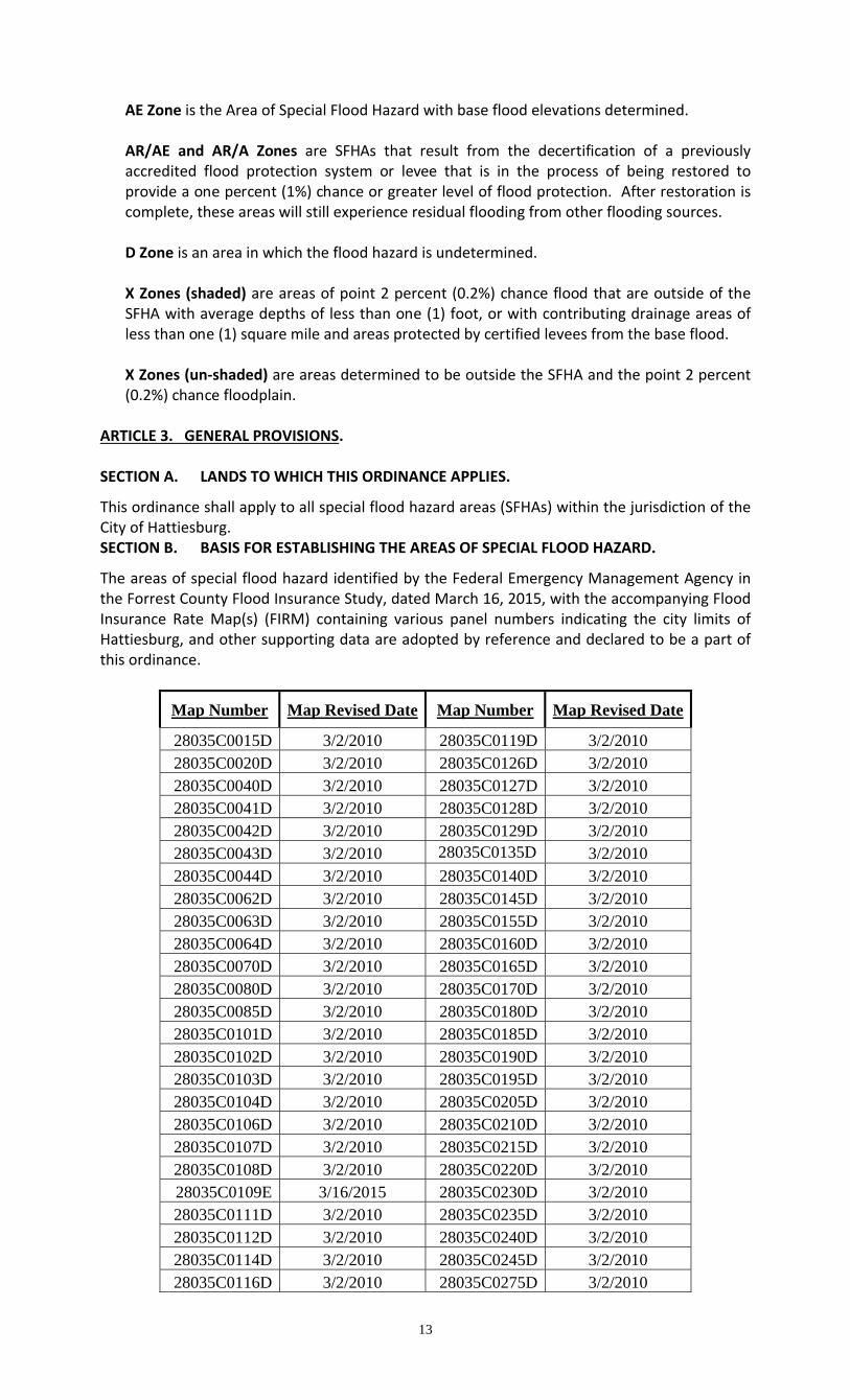
A Zone is the Area of Special Flood Hazard without base flood elevations determined.
13
AE Zone is the Area of Special Flood Hazard with base flood elevations determined. AR/AE and AR/A Zones are SFHAs that result from the decertification of a previously accredited flood protection system or levee that is in the process of being restored to provide a one percent (1%) chance or greater level of flood protection. After restoration is complete, these areas will still experience residual flooding from other flooding sources. D Zone is an area in which the flood hazard is undetermined. X Zones (shaded) are areas of point 2 percent (0.2%) chance flood that are outside of the SFHA with average depths of less than one (1) foot, or with contributing drainage areas of less than one (1) square mile and areas protected by certified levees from the base flood. X Zones (un‐shaded) are areas determined to be outside the SFHA and the point 2 percent (0.2%) chance floodplain.
ARTICLE 3. GENERAL PROVISIONS. SECTION A. LANDS TO WHICH THIS ORDINANCE APPLIES.
This ordinance shall apply to all special flood hazard areas (SFHAs) within the jurisdiction of the City of Hattiesburg. SECTION B. BASIS FOR ESTABLISHING THE AREAS OF SPECIAL FLOOD HAZARD.
The areas of special flood hazard identified by the Federal Emergency Management Agency in the Forrest County Flood Insurance Study, dated March 16, 2015, with the accompanying Flood Insurance Rate Map(s) (FIRM) containing various panel numbers indicating the city limits of Hattiesburg, and other supporting data are adopted by reference and declared to be a part of this ordinance.
Map Number Map Revised Date Map Number Map Revised Date
28035C0015D 3/2/2010 28035C0119D 3/2/2010 28035C0020D 3/2/2010 28035C0126D 3/2/2010 28035C0040D 3/2/2010 28035C0127D 3/2/2010 28035C0041D 3/2/2010 28035C0128D 3/2/2010 28035C0042D 3/2/2010 28035C0129D 3/2/2010 28035C0043D 3/2/2010 28035C0135D 3/2/2010 28035C0044D 3/2/2010 28035C0140D 3/2/2010 28035C0062D 3/2/2010 28035C0145D 3/2/2010 28035C0063D 3/2/2010 28035C0155D 3/2/2010 28035C0064D 3/2/2010 28035C0160D 3/2/2010 28035C0070D 3/2/2010 28035C0165D 3/2/2010 28035C0080D 3/2/2010 28035C0170D 3/2/2010 28035C0085D 3/2/2010 28035C0180D 3/2/2010 28035C0101D 3/2/2010 28035C0185D 3/2/2010 28035C0102D 3/2/2010 28035C0190D 3/2/2010 28035C0103D 3/2/2010 28035C0195D 3/2/2010 28035C0104D 3/2/2010 28035C0205D 3/2/2010 28035C0106D 3/2/2010 28035C0210D 3/2/2010 28035C0107D 3/2/2010 28035C0215D 3/2/2010 28035C0108D 3/2/2010 28035C0220D 3/2/2010 28035C0109E 3/16/2015 28035C0230D 3/2/2010 28035C0111D 3/2/2010 28035C0235D 3/2/2010 28035C0112D 3/2/2010 28035C0240D 3/2/2010 28035C0114D 3/2/2010 28035C0245D 3/2/2010 28035C0116D 3/2/2010 28035C0275D 3/2/2010

14
28035C0117E 3/16/2015 28035C0300D 3/2/2010 28035C0118D 3/2/2010
The Flood Insurance Study and maps are on file in the Planning Office of the Department of Urban Development, located in the City Hall Building. SECTION C. USE OF PRELIMINARY FLOOD HAZARD DATA.
When Flood Insurance Studies and Preliminary Flood Insurance Rate Maps have been provided by FEMA: 1. Prior to the issuance of a Letter of Final Determination (LFD) by FEMA, the use of the
preliminary flood hazard data shall only be required where no base flood elevations and/or floodway areas exist or where the preliminary base flood elevations or floodway area exceed the base flood elevations and/or floodway widths in the effective flood hazard data provided by FEMA. Such preliminary data may be subject to revision through valid appeals.
2. Upon the issuance of a Letter of Final Determination (LFD) by FEMA, the revised flood
hazard data shall be used and replace all previously effective flood hazard data provided by FEMA for the purposes of administrating these regulations.
Where adopted regulatory standards conflict, the more stringent base flood elevation shall prevail. Preliminary FIS data may be subject to change by a valid appeal. SECTION D. ESTABLISHMENT OF FLOODPLAIN DEVELOPMENT PERMIT.
A development permit shall be required in conformance with the provision of this ordinance prior to the commencement of any development activities in identified areas of special flood hazard. SECTION E. COMPLIANCE.
No structure or land shall hereafter be located, extended, converted or structurally altered without full compliance with the terms of this ordinance and other applicable regulations. SECTION F. ABROGATION AND GREATER RESTRICTIONS.
This ordinance is not intended to repeal, abrogate, or impair any existing easements, covenants, or deed restrictions. However, where this ordinance and another conflict or overlap, whichever imposes the more stringent restrictions shall prevail. SECTION G. INTERPRETATION.
In the interpretation and application of this ordinance all provisions shall be:
1. Considered as minimum requirements;
2. Liberally construed in favor of the governing body, and;
3. Deemed neither to limit nor repeal any other powers granted under state statutes. SECTION H: REPETITIVE LOSS STRUCTURES.
The community may declare any existing structure as a repetitive loss structure as required to qualify the structure for increased cost of compliance (ICC) benefits allowed by a National Flood Insurance Program flood policy claim. To be declared a repetitive loss structure, the following conditions must be met: 1. The structure must have a flood insurance policy that includes the increased cost of
compliance coverage and;

15
2. The structure must have been flooded twice during a ten‐year period with each flood event causing damage for which the repair cost equaled or exceeded 25% of the market value of the structure.
SECTION I. WARNING AND DISCLAIMER OF LIABILITY.
The degree of flood protection required by this ordinance is considered reasonable for regulatory purposes and is based on scientific and engineering consideration. Larger floods can and will occur on rare occasions. Flood heights may be increased by man‐made or natural causes. This ordinance does not imply that land outside the areas of special flood hazard or uses permitted within such areas will be free from flooding or flood damages. This ordinance shall not create liability on the part of governing body of the City of Hattiesburg or by any officer or employee thereof for any flood damages that result from reliance on this ordinance or any administrative decision lawfully made hereunder. SECTION J. ENFORCEMENT, PENALTIES, AND VIOLATIONS.
1. Any action or inaction which violates the provisions of this ordinance or permit shall
constitute a misdemeanor. 2. Violation of the provisions of this ordinance or failure to comply with any of its
requirements, including violation of conditions and safeguards established in connection with grants of variance or special exceptions, shall constitute a misdemeanor. Any person who violates this ordinance or fails to comply with any of its requirements shall, upon conviction thereof, be fined not exceeding one thousand dollars ($1,000.00) or imprisonment for a term not exceeding ninety (90) days, or by both such fine and imprisonment in the discretion of the municipal judge, and in addition, shall pay all costs and expenses involved in the case. Each act of violation and each day such violation continues shall be considered a separate offense. Nothing herein contained shall prevent the Floodplain Administrator from taking such other lawful actions as are necessary to prevent or remedy any violation.
ARTICLE 4. ADMINISTRATION. SECTION A. DESIGNATION OF FLOOD DAMAGE PREVENTION ORDINANCE ADMINISTRATOR.
The governing body of the City of Hattiesburg hereby appoints the Planning Administrator, or their designee, to administer and implement the provisions of this ordinance and is herein referred to as the Floodplain Administrator and/or the administrator. SECTION B. PERMIT PROCEDURES.
Application for a Development Permit shall be made to the Floodplain Administrator on forms furnished by him or her prior to any development activities, and may include, but not be limited to, the following plans in duplicate drawn to scale showing the nature, location, dimensions, and elevations of the area in question; existing or proposed structures, earthen fill, storage of materials or equipment, drainage facilities, and the location of the foregoing. Specifically, the following information is required: 1. Application Stage.
a. Elevation in relation to mean sea level of the proposed lowest floor (including basement) of all buildings, which will be submitted on a FEMA Elevation Certificate by a State of Mississippi registered engineer or surveyor;
b. Elevation in relation to mean sea level to which any non‐residential building in an A or
AE Zone will be floodproofed;

16
c. Certificate from a State of Mississippi registered professional engineer or architect that the non‐residential floodproofed building will meet the floodproofing criteria in Article 4, Section B‐2 and Article 5, Section C‐2;
d. No floodplain development permit can be issued to any mobile, modular, or
permanently constructed residence, building or facility unless the owner, lessee, or developer obtains a Notice of Intent from the Mississippi State Health Department, pursuant to the MS Individual On‐Site Wastewater Disposal System Law (2009), for un‐sewered areas of the City.
e. Description of the extent to which any watercourse will be altered or relocated as result
of proposed development.
2. Construction Stage:
Upon establishment/placement of the lowest floor, before framing continues, including any approved floodproofing method, by whatever construction means, it shall be the duty of the permit holder to submit to the Floodplain Administrator a certification of the NAVD or NGVD elevation of the lowest floor or floodproofed elevation, as built, in relation to mean sea level. Said certification shall be prepared by or under the direct supervision of a registered land surveyor or professional engineer, who is authorized by the state of Mississippi to certify such information, and certified by same. When floodproofing is utilized for a particular building said certification shall be prepared by or under the direct supervision of a professional engineer or architect, who is authorized by the state of Mississippi to certify such information, and certified by same. Floodproofing shall be required to be one (1) foot above the base flood elevation. Any work undertaken prior to submission of the certification shall be at the permit holder’s risk. The Floodplain Administrator shall review the lowest floor & floodproofing elevation survey data submitted. The permit holder immediately and prior to further progressive work being permitted to proceed shall correct deficiencies detected by such review. Failure to submit the survey or failure to make said corrections required hereby shall be cause to issue a stop‐work order for the project. In any lot or lots/areas that have been removed from the special flood hazard area via a Letter of Map Revision Based on Fill, and if the top of fill level is below the freeboard elevation, all new structures, additions to existing buildings or substantial improvement must meet the required community freeboard elevation. 3. Finished Construction:
Upon completion of construction, a FEMA elevation certificate which depicts all finished construction elevations is required to be submitted to the Floodplain Administrator. If the project includes a floodproofing measure, a FEMA floodproofing certificate is required to be submitted by the permit holder to the Floodplain Administrator. SECTION C. POWERS, DUTIES, AND RESPONSIBILITIES OF THE FLOODPLAIN
ADMINISTRATOR. The Floodplain Administrator and his or her designated staff is hereby authorized and directed to enforce the provisions of this ordinance. The Administrator is further authorized to render interpretations of this ordinance, which are consistent with its spirit and purpose. 1. Right of Entry
a. Whenever necessary to make an inspection to enforce any of the provisions of this ordinance, or whenever the Administrator has reasonable cause to believe that there exists in any building or upon any premises any condition or ordinance violation which makes such building, structure or premises unsafe, dangerous or hazardous, the Administrator may enter such building, structure or premises at all reasonable times to inspect the same or perform any duty imposed upon the Administrator by this
17
ordinance. b. If such building or premises are occupied, the Administrator shall first present proper
credentials and request entry. If such building, structure, or premises are unoccupied, he shall first make a reasonable effort to locate the owner or other persons having charge or control of such building or premises.
c. If entry is refused, the Administrator shall have recourse to every remedy provided by
law to secure entry. d. When the Administrator shall have first obtained a proper inspection warrant or other
remedy provided by law to secure entry, no owner or occupant or any other persons having charge, care or control of any building, structure, or premises shall fail or neglect, after proper request is made as herein provided, to promptly permit entry therein by the Administrator for the purpose of inspection and examination pursuant to this ordinance.
2. Duties of the administrator shall include, but not be limited to:
a. Review all development permits to assure that the permit requirements of this ordinance have been satisfied.
b. Review proposed development to assure that all necessary permits have been received
from those governmental agencies from which approval is required by Federal or State law, including section 404 of the Federal Water Pollution Control Act Amendments of 1972, 33 U.S.C. 1334. Additionally, require the permittee to obtain and submit copies of any required federal or state permits and maintain them on file with the development permit.
c. Perform a minimum of three inspections to ensure that all applicable ordinance and
floodplain development requirements have been satisfied. The first inspection upon the establishment of the Base Flood Elevation reference mark at the development site; the second upon the establishment of the structure’s footprint prior to pouring the slab or the establishment of the lowest floor in an elevated foundation system; and the final inspection upon completion and submission of the required finished construction elevation certificate.
d. Verify any required setback distances. e. Verify that all placement of fill or grading is according to certified plans. Assure that any
fill being used as part of the structure’s foundation system is both clean material and properly compacted and placed. A professional certification that the foundation footings of any structure built on fill was engineered and is reasonably safe from flooding must be requested of the builder/developer, and the owner/contractor must provide density reports from a licensed testing agency showing that the fill meets a 95% compaction ratio.
f. Verify adequate placement and size of any required flood vents in regard to the number
of openings, their location, size, and height above ground level. g. Ensure that a crawlspace has adequate vents or openings and that the interior grade is at
or above the exterior grade. The foundation must be vented to comply with the floodplain ordinance as well as the currently adopted building code.
h. Verify that the structure’s utilities, duct work, and HVAC systems are at or above the
base flood elevation. i. Notify adjacent communities, the NFIP State Coordinator, and other federal and/or state
agencies with statutory or regulatory authority prior to any alteration or relocation of a watercourse.

18
j. Assure that maintenance is provided within the altered or relocated portion of said
watercourse so that the flood‐carrying capacity is maintained. k. Verify and record the actual elevation (in relation to mean sea level) of the lowest floor
(including basement) of all new construction and substantially improved buildings, in accordance with Article 4, Section 2‐B). Information must be recorded on the FEMA Elevation Certificate.
l. Verify and record the actual elevation (in relation to mean sea level) to which the new
construction and substantially improved buildings have been floodproofed, in accordance with Article 4, Section 2‐B). Information must be recorded on the FEMA Elevation Certificate.
m. Review certified plans and specifications for compliance. n. Make the necessary interpretation where interpretation is needed as to the exact
location of boundaries of the areas of special flood hazard (for example, where there appears to be a conflict between a mapped boundary and actual field conditions). The person contesting the location of the boundary shall be given a reasonable opportunity to appeal the interpretation as provided in this Article.
o. Obtain, review and reasonably utilize any base flood elevation and floodway data
available from a federal, state or other source when base flood elevation data or floodway data have not been provided in accordance with Article 3, Section B, in order to administer the provisions of Article 5.
p. Provide information, testimony, or other evidence, as needed during variance request
hearings. q. Conduct the following actions when damage occurs to a building or buildings:
1. Determine whether damaged structures are located within the Special Flood Hazard Area;
2. Conduct damage assessments for those damaged structures located in the SFHA,
and; 3. Make a reasonable attempt to notify owner(s) of damaged structure(s) of the
requirement to obtain a building permit / floodplain development permit prior to repair, rehabilitation, or reconstruction.
r. Perform such other inspections as may be required to insure compliance with the other
provisions of this ordinance. ARTICLE 5. PROVISIONS FOR FLOOD HAZARD REDUCTION. SECTION A. GENERAL STANDARDS.
In all areas of special flood hazard the following provisions are required: 1. New construction and substantial improvements shall be anchored to prevent flotation,
collapse and lateral movement of the structure. 2. Manufactured homes shall be anchored to prevent flotation, collapse, and lateral
movement. Methods of anchoring may include, but are not limited to, use of over‐the‐top or frame ties to ground anchors. Dry stacked blocks/piers (stacked without the use of mortar or cement to bond them together) are not acceptable as an anchor/elevation method. Only reinforced blocks/piers (with concrete and metal dowels) are allowed as an

19
approved anchor/elevation method. This standard shall be in addition to and consistent with applicable state requirements for resisting wind forces.
3. New construction and substantial improvements shall be constructed with materials and
utility equipment resistant to flood damage. 4. New construction or substantial improvements shall be constructed by methods and
practices that minimize flood damage. 5. Electrical, heating, ventilation, plumbing, air conditioning equipment and other service
facilities, including ductwork, shall be designed and/or located so as to prevent water from entering or accumulating within the components during conditions of flooding, such facilities shall be located a minimum of one foot (1’) above the Base Flood Elevation.
6. New and replacement water supply systems shall be designed to minimize or eliminate
infiltration of flood waters into the system. 7. New and replacement sanitary sewage systems shall be designed to minimize or eliminate
infiltration of flood waters into the systems and discharges from the systems into flood waters.
8. On‐site waste disposal systems shall be located and constructed to avoid impairment to
them or contamination from them during flooding. 9. Any alteration, repair, reconstruction or improvements to a building that is in compliance
with the provisions of this ordinance shall meet the requirements of “new construction” as contained in this ordinance.
10. Any alteration, repair, reconstruction or improvements to a building that is not in
compliance with the provisions of this ordinance, shall be undertaken only if said non‐conformity shall meet the requirements of “new construction” as contained in this ordinance.
11. All gas and liquid storage tanks (both above and below ground) shall be adequately anchored to prevent floatation, lateral movement resulting from hydrodynamic forces, and the effects of buoyancy.
12. When new construction and substantial improvements are located in multiple flood zones or
in a flood zone with multiple base flood elevations, they shall meet the requirement for the more stringent flood zone and the highest base flood elevation.
13. New construction and substantial improvement of any building inside the SFHA, shall have
the lowest floor (including basement) at least one (1) foot above the base flood elevation or at least one foot above the centerline of the designated street, whichever is greater. Areas outside the SFHA shall be elevated in accordance with Article 5, Section B.
14. All new horizontal additions must have the lowest floor and all HVAC, including ductwork,
elevated to the regulatory base flood elevation. 15. New construction and substantial improvements of structures built on fill shall be
constructed on properly designed and compacted fill that extends 10 feet to 15 feet beyond the building walls before dropping below the base flood elevation, and shall have appropriate protection from erosion and scour as follows:
a. Fill sites, upon which structures will be constructed or placed, must be compacted to 95
percent of the maximum density obtainable with the Standard Proctor Test method or an acceptable equivalent method.
b. Fill slopes shall be no steeper than one (1) foot vertical to two feet horizontal.

20
c. Adequate protection against erosion is must be provided for fill slopes. When expected velocities during the occurrence of the base flood are greater than five feet per second, armoring with stone or rock protection or material that will provide equivalent resistance will be provided. When expected velocities during the base flood are five feet per second or appropriate protection shall be provided by covering them with vegetative cover at a minimum.
d. Fill shall be composed of clean granular or earthen material.
16. Storage or processing of materials that are hazardous, flammable, explosive, or in time of
flooding could become buoyant and pose an obstruction to flow, are prohibited within the community special flood hazard areas, to include identified floodways. Storage of material or equipment not otherwise prohibited shall be firmly anchored to prevent flotation.
SECTION B. STANDARDS FOR X ZONES (SHADED/UN‐SHADED).
Any area outside the FEMA studied areas lying along blue line streams shown on the United States Department of the Interior Geological Survey quadrants of which the City of Hattiesburg is contained and/or areas with flood prone soils which are contiguous to blue line streams as shown on the City of Hattiesburg Flood Prone Soils Map shall also be considered community flood hazard areas. 1. Compliance with the City of Hattiesburg’s Land Development Code, Ordinance Number
2330, as amended, specifically the section for Natural Stream Buffers, Protection during Land Disturbance Activities and Detention/Retention Areas for all zones, both inside and outside the SFHA.
2. Compliance with the City of Hattiesburg Code of Ordinances, specifically Section 22‐6
regulations for first floor elevation of all structures erected in all zones of the City. 3. The X Zones (shaded/un‐shaded) are considered to be low to moderate risk flood zones and
are located outside the community’s delineated special flood hazard area and include the following:
a. Areas outside the one percent (1%) chance flood zone, but within the point 2 percent
(0.2%) chance flood zone, as determined by a detailed study; b. Areas outside the point 2 percent (0.2%) chance flood zone as determined by a detailed
study, and; c. Areas that have not yet been studied.
4. The community reserves the right to require further studies for any development within its
jurisdiction, if there is evidence that a potential flood hazard exists. Studies can be used to designate community flood hazard areas. Such evidence may include but shall not be limited to:
a. Eyewitness reports of historic flooding or other reports of historic flooding deemed
credible by the community; b. Geologic features observed that resemble floodplains (such as flat areas along streams); c. Proximity to manmade or natural constrictions such as road crossings that can cause
backwater effects, and; d. Drainage basin characteristics such as drainage area, slope, percent impervious cover,
land use, etc.
21
SECTION C. SPECIFIC STANDARDS FOR AREAS WITH BASE FLOOD ELEVATIONS AND/OR FLOODWAYS (aka AE ZONES). In all areas of special flood hazard designated on the community’s FIRM, where base flood elevation data have been provided, as set forth in Article 3, Section B, the following provisions, in addition to the general standards of Article 5, Section A, are required: 1. Residential Construction. New construction and substantial improvement of any residential
building (including manufactured home) shall have the lowest floor, including basement, elevated to no lower than one foot (1’) above the base flood elevation. Should solid foundation perimeter walls be used to elevate a structure, flood openings sufficient to automatically equalize hydrostatic flood forces on exterior walls of enclosures that are subject to flooding, shall be provided in accordance with standards of Article 5, Section C‐3. New development proposals will be designed, to the maximum extent practicable, so residential building sites, walkways, driveways, and roadways are located at natural grade with elevation not less than the base flood elevation and with evacuation routes leading directly out of the special flood hazard area.
2. Non‐Residential Construction. New construction and substantial improvement of any
commercial, industrial, or non‐residential building (including manufactured building) shall have the lowest floor, including basement, elevated to no lower than one foot (1’) above the base flood elevation. Buildings located in all A Zones may, together with attendant utility and sanitary facilities, be floodproofed in lieu of being elevated provided that all areas of the building below the base flood elevation (plus a minimum of one foot (1’) of freeboard) are water tight with walls substantially impermeable to the passage of water, and use structural components having the capability of resisting hydrostatic and hydrodynamic loads and the effect of buoyancy. Dry floodproofing is allowed only where flood velocities are less than or equal to five feet per second. A registered professional engineer or architect shall certify that the standards of this subsection are satisfied. A Flood Emergency Operation Plan and an Inspection and Maintenance Plan must be provided by the design professional for the building. Such certification shall be provided to the Floodplain Administrator. New development proposals will be designed, to the maximum extent practicable, so non‐residential building sites, walkways, driveways, and roadways are located at natural grade with elevation not less than the base flood elevation and with evacuation routes leading directly out of the special flood hazard area
3. In special flood hazard areas with base flood elevations (AE Zones) but without floodways, no
encroachments, including fill material or structures, shall be permitted unless certification by a registered professional engineer is provided demonstrating that the cumulative effect of the proposed development, when combined with all other existing and anticipated development, will not increase the water surface elevation of the base flood more than one foot at any point within the community. The engineering certification must be supported by technical data that conforms to standard hydraulic engineering principles.
4. Enclosures. New construction and substantial improvements that include fully enclosed
areas formed by foundation and other exterior walls below the lowest floor shall be designed to preclude finished living space and designed to allow for the entry and exit of floodwaters to automatically equalize hydrostatic flood forces on exterior walls. Total enclosed areas will be limited to three hundred (300) feet. Enclosed areas, including crawl spaces, shall be used solely for parking of vehicles, building access, and storage.
a. Designs for complying with this requirement must either be certified by a professional
engineer or architect or meet or exceed the following criteria:
(i) Provide a minimum of two openings, on different sides of each enclosed area; if a structure has more than one (1) enclosed area below the base flood elevation, each shall have openings on exterior walls;
(ii) The total net area of all openings shall be at least one (1) square inch for each square

22
foot of enclosed area, or the openings shall be designed and the construction documents shall include a statement that the design and installation will provide for equalization of hydrostatic flood forces on exterior walls by allowing for the automatic entry and exit of floodwaters;
(iii) The bottom of all openings shall be no higher than one (1) foot above interior grade
(which must be equal to in elevation or higher than the exterior grade); (iv) Openings shall allow the passage of a three inch sphere. (v) Openings may be equipped with screens, louvers, valves or other coverings or
devices provided they permit the automatic flow of floodwaters in both directions and automatically equalize hydrostatic flood loads on exterior walls, and;
b. Access to the enclosed area shall be minimum necessary to allow for parking of vehicles
(garage door) or limited storage of maintenance equipment used in connection with the premises (standard exterior door) or entry to the living area (stairway or elevator); and,
c. The interior portion of such enclosed area shall not be finished or partitioned into
separate rooms. d. Property owners shall be required to execute a flood openings/venting affidavit
acknowledging that all openings will be maintained as flood vents, and that the elimination or alteration of the openings in any way will violate the requirements of Article 5, Section C. Periodic inspections will be conducted by the Floodplain Administrator to ensure compliance.
5. Detached storage buildings, sheds, or other like accessory improvements, excluding
detached garages, carports, and boat houses, shall solely be used for parking of vehicles and storage, and will be allowed up to no more than three hundred (300) square feet of unfinished, non‐partitioned and enclosed storage space. Such storage space shall not be
used for human habitation and shall be limited to storage of items that can withstand exposure to the elements and have low flood damage potential. The storage space shall be constructed of flood resistant or breakaway materials, and equipment and service utilities, such as electrical outlets, shall be limited to essential lighting and other incidental uses, and must be elevated or floodproofed. Flood openings in accordance with the standards of Article 5 Section C‐3 shall also be required. These accessory structures shall be constructed and placed on the building site so as to offer the minimum resistance to the flow of floodwaters. Accessory improvements and other apparent structures shall be firmly anchored to prevent flotation that may result in damage to other structures.
6. Property owners shall be required to execute and record with the structure’s deed a non‐
conversion agreement declaring that the area below the lowest floor of the structure or the detached accessory building shall not be improved, finished or otherwise converted; the community will have the right to inspect the enclosed area.
7. Standards for Manufactured Homes and Recreational Vehicles.
a. All manufactured homes placed, or substantially improved, on individual lots or parcels, in existing manufactured home parks or subdivisions, in expansions to existing manufactured home parks or subdivisions, in new manufactured home parks or subdivisions or in substantially improved manufactured home parks or subdivisions, must meet all the requirements for new construction, including elevation and anchoring and the flood openings requirements of Article 5 Section C‐4. Manufactured homes must be:
(i) Elevated on a permanent foundation to have its lowest floor elevated to no lower
than one foot (1’) above the base flood elevation, and;

23
(ii) Securely anchored to an adequately anchored foundation system to resist flotation, collapse, and lateral movement.
b. All manufactured homes placed or substantially improved, excepting manufactured
homes that have incurred substantial damage as a result of a flood, in an existing manufactured home park or subdivision must be elevated so that:
(i) The lowest floor of the manufactured home is elevated to no lower than one foot
(1’) above the base flood elevation and be securely anchored to an adequately anchored foundation support system to resist floatation, collapse, and lateral movement.
c. All recreational vehicles placed on sites must either:
(i) Be on site for fewer than 180 consecutive days and shall leave the site for at least
seven consecutive days and obtain a new permit before returning to the same site,
(ii) Be fully licensed and ready for highway use, or (iii) Must meet all the requirements for new construction, including anchoring and
elevation requirements of this Article 5, Section C 7 a. or Article 5, Section C 7 b. (i) above.
A recreational vehicle is ready for highway use if it is licensed and insured in accordance with the State of Mississippi motor vehicle regulations, is on its wheels or jacking system, is attached to the site only by quick disconnect type utilities and security devices and has no permanently attached additions.
8. Floodways. Located within areas of special flood hazard adopted by reference in Article 3,
Section B, are areas designated as floodways. Since the floodway is an extremely hazardous area due to the velocity of flood waters which carry debris, potential projectiles and has erosion potential, the following provisions shall apply:
a. Prohibit encroachments, including fill, new construction, substantial improvements, and
other developments unless certification (with supporting technical data) by a registered professional engineer is provided demonstrating that encroachments shall not result in any increase in flood levels during occurrence of the base flood discharge;
b. If Article 5, Section C‐8a above is satisfied, all new construction and substantial
improvements shall comply with all applicable flood damage prevention standards of Article 5.
c. Prohibit the placement of manufactured homes (mobile homes), except in an existing
manufactured homes (mobile homes) park or subdivision. A replacement manufactured home may be placed on a lot in an existing manufactured home park or subdivision provided the anchoring standards of Article 5, Section A (2), and the standards of Article 5, Section C‐1 through C‐2 and the encroachment standards of this Article 5, Section C‐7a, are met.
d. Encouraged uses within the floodway may include: general farming, pasture, outdoor
plant nurseries, horticulture, forestry, wildlife sanctuary, game farm, and other similar agricultural, wildlife, and related uses. Also lawns, gardens, athletic fields, play areas, picnic grounds, and hiking, horseback riding trails and driveways are acceptable uses, provided that they do not employ structures or fill. These encouraged uses require certification (with supporting technical data) by a registered professional engineer demonstrating that encroachments shall not result in any increase in flood levels during occurrence of the base flood discharge. The uses in this subsection are permissible only if and to the extent that they do not cause any increase in flood levels during the base flood discharge.

24
SECTION D. STANDARDS FOR AREAS WITHOUT BASE FLOOD ELEVATIONS AND FLOODWAYS (aka A Zone). When base flood elevation data and floodway data are not available in accordance with Article 3, Section A, in Special Flood Hazard Areas without base flood elevation data, new construction and substantial improvements shall be elevated or floodproofed to elevations established by the community. The following provisions in addition to the standards of Article 5 Section A and the enclosure standards of Article 5 Section C‐3 shall apply: 1. Require that all new subdivision proposals and other proposed developments (including
proposals for manufactured home parks and subdivisions) greater than five lots or one and one half (1 ½) acres, whichever is lesser; include within such proposals base flood elevation data;
2. The Floodplain Administrator shall obtain, review, and reasonably utilize any base flood
elevation and floodway data available from a federal, state, or other source, in order to administer the provisions of Article 5. When such data are available, standards of Article 5, Section C, shall apply. If data is not available from Article 5 Section D‐1 or outside sources, then the following provisions shall apply.
3. No encroachments, including fill material or other development, shall be located within a
distance of the stream bank equal to five times the width of the stream at the top of the bank or twenty feet each side from the top of the bank, whichever is greater, unless certification by a registered professional engineer is provided demonstrating that such encroachment shall not result in any increase in flood levels during the occurrence of the base flood discharge. The enclosure standards of Article 5, Section C (4) shall apply.
4. The Floodplain Administrator shall require that a single lot applicant develop the base flood
elevation for the development site, utilizing accepted engineering practices and procedures. Upon review of the submitted data, the Administrator may accept or reject the proposed base flood elevation. When such data is accepted, standards of Article 5, Section C, shall apply.
5. Fill within the area of special flood hazard shall result in no net loss of natural floodplain storage. The volume of loss of floodwater storage due to filling in the special flood hazard area shall be offset by providing an equal volume of flood storage by excavation or other compensatory measures at or adjacent to the development site.
6. Notify, in riverine situations, adjacent communities and the State Coordinating Office prior
to any alteration or relocation of a watercourse, and submit copies of such notifications to FEMA. Assure that the flood carrying capacity within the altered or relocated portion of any watercourse is maintained.
7. Require that all manufactured homes be placed or installed using methods and practices
which minimize flood damage. Manufactured homes must be elevated and anchored to resist flotation, collapse, or lateral movement. Dry stacked blocks/piers (stacked without the use of mortar or cement to bond them together) are not acceptable as an anchor/elevation method. Only reinforced blocks/piers (with concrete and metal dowels) are allowed as an approved anchor/elevation method, within the Special Flood Hazard Area.
SECTION E. STANDARDS FOR SUBDIVISION PROPOSALS AND OTHER PROPOSED DEVELOPMENT WITHIN A SPECIAL FLOOD HAZARD AREA. 1. All subdivision proposals shall be consistent with the need to minimize flood damage; 2. All subdivision proposals shall have public utilities and facilities such as sewer, gas, electrical
and water systems located and constructed to minimize flood damage;

25
3. All subdivision proposals shall have adequate drainage provided to reduce exposure to flood hazards, and;
4. Base flood elevation data shall be provided for all new subdivision proposals and other
proposed development (including manufactured home parks and subdivisions), which is greater than five (5) lots or one and one‐half (1 ½) acres, whichever is the lesser.
5. All subdivision and other development proposals which involve disturbing more than one (1)
acre of land shall include a stormwater management plan which is designed to limit peak runoff from the site to predevelopment levels for the one (1), ten (10), and twenty‐five (25)‐year rainfall event. These plans shall be designed to limit adverse impacts to downstream channels and floodplains. Single residential lots involving less than one (1) acre of land disturbance are not subject to this regulation.
6. All preliminary plans for platted subdivisions shall identify the flood hazard area and the
elevation of the base flood. 7. All final subdivision plats will provide the boundary of the special flood hazard area, the
floodway boundary, and the base flood elevations. 8. In platted subdivisions, all proposed lots or parcels that will be future building sites shall
have a minimum buildable area, as defined in the Land Development Code, outside the natural (non‐filled) one percent (1%) chance annual floodplain. The buildable area shall be large enough to accommodate any primary structure and associated structures.
9. Approval shall not be given for streets within a subdivision, which would be subject to
flooding in the base flood. All street surfaces must be located at or above the base flood elevation.
10. Each proposed parcel must have a designated buildable pad or site above the one percent
(1%) chance floodplain. The distance of the buildable pad or site above the one percent (1%) chance floodplain shall depend on the slope of the ground and in accordance with the following table:
Distance in feet from A Zone [one percent (1%) chance
floodplain]
Minimum Slope from A Zone – one percent (1%) flood plain to ground
level at pad
20 5%
30 3.33%
40 2.50%
50 2.0%
60 1.67%
70 1.43%
80 1.25%
90 1.11%
100 1.0%
Residential and non‐residential structures finished floor elevation also must be elevated one and one‐half feet (1.5’) above the adjacent average grade or one foot (1') above highest adjacent street centerline as per the existing regulation, whichever is higher.
11. The subdivider/applicant must comply with the following:
a. File restrictive covenants on the lot or lots prohibiting construction within the designated special flood hazard area and requirement for lowest floor elevation.
b. Place a statement on the face of the final plat prohibiting construction in the designated
area of special flood hazard.

26
SECTION F. CRITICAL FACILITIES.
Construction of new and substantially improved critical facilities shall be located outside the limits of the special flood hazard area (one percent (1%) chance floodplain). Construction of new critical facilities shall be permissible within the SFHA only if no feasible alternative site is available and access to the facilities remains available during a point 2 percent (0.2%) chance flood. Critical facilities constructed within the SFHA shall have the lowest floor elevated three feet six inches above the base flood elevation at the site (or to the point 2 percent (0.2%) chance flood elevation whichever is greater). Floodproofing and sealing measures must be implemented to ensure that toxic substances will not be displaced by or released into floodwaters. Multiple access routes, elevated to or above the point 2 percent (0.2%) flood elevation, shall be provided to all critical facilities to the maximum extent possible. Critical facilities must not only be protected to or above the point 2 percent (0.2%) chance flood, but must remain operable during such an event. The community’s flood response plan must list facilities considered critical in a flood, since loss of access can cause a critical situation. Other facilities in low risk flood zones that may also be needed to support flood response efforts must be included on the critical facility list. The use of any structure shall not be changed to a critical facility, where such a change in use will render the new critical facility out of conformance with this section. The list of the operators of the critical facilities affected by flooding must be updated at least annually, as part of the community critical facility planning procedures. ARTICLE 6. VARIANCE PROCEDURES. SECTION A. DESIGNATION AND DUTIES OF VARIANCE AND APPEALS BOARD.
1. When it is alleged an error in any requirement, decision, or determination is made by the Floodplain Administrator in the enforcement or administration of this ordinance or a request for a variance with any requirement of this ordinance the Hattiesburg Planning Commission, hereafter known as the “HPC”, as established by the City Council of the City of Hattiesburg, shall hear and decide appeals and requests for variances from requirements of this ordinance.
2. Any person aggrieved by the recommendation of “HPC” may appeal such decision to the
City Council. 3. Any person aggrieved by the decision of the City Council may appeal such decision to the
Circuit Court, as provided in Mississippi Code Annotated, § 11‐51‐75 (1972). 4. Variances from the requirements of this code will not be issued except for:
a. contributing historic structures which meet all criteria in Article 6, Section E of this ordinance,
b. subdivision studies for properties in an A zone as outlined in Article, 5, Section E, Section
10 & 11 of this ordinance, or c. properties that are fully compliant with wet‐floodproofing methods as outlined in the
definitions. SECTION B. VARIANCE PROCEDURES. In passing upon such applications, the “HPC” shall consider all technical evaluations, relevant factors, and standards specified in other sections of this ordinance, and: 1. The evaluation must be based on the characteristics unique to that property and not be
shared by adjacent parcels. The characteristics must pertain to the land itself, not to the structure, its inhabitants, or its owners;
2. Variances should never be granted for multiple lots, phases of subdivisions, or entire
subdivisions;

27
3. The danger that materials may be swept onto other lands to the injury of others; 4. The danger of life and property due to flooding or erosion damage; 5. The susceptibility of the proposed facility and its contents to flood damage and the effect of
such damage on the individual owner and the community; 6. The importance of the services provided by the proposed facility to the community; 7. The necessity of the facility to be at a waterfront location, where applicable; 8. The availability of alternative locations for the proposed use which are not subject to
flooding or erosion damage; 9. The compatibility of the proposed use with existing and anticipated development; 10. The relationship of the proposed use to the comprehensive plan and floodplain
management program for that area; 11. The safety of access to the property in times of flood for ordinary and emergency vehicles; 12. The expected heights, velocity, duration, rate of rise, and sediment transport of the
floodwaters and the effects of wave action, if applicable, expected at the site, and; 13. The costs of providing governmental services during and after flood conditions, including
maintenance and repair of public utilities and facilities such as sewer, gas, electrical, and water systems, and streets and bridges and culverts.
14. Upon consideration of factors listed above, and the purpose of this ordinance, the “HPC”
may attach such conditions to the granting of variances as it deems necessary to further the purposes of this ordinance.
15. Variances shall not be issued within any designated floodway if any increase in flood levels
during the base flood discharge would result.
SECTION C. CONDITIONS FOR SPECIFIED VARIANCE TYPES.
1. Variances shall only be issued when there is:
a. A showing of good and sufficient cause;
b. A determination that failure to grant the variance would result in exceptional hardship, and;
c. A determination that the granting of a variance will not result in increased flood
heights, additional threats to public expense, create nuisance, cause fraud on or victimization of the public, or conflict with existing local laws or ordinances.
2. The provisions of this ordinance are minimum standards for flood loss reduction; therefore
any deviation from the standards must be weighed carefully. Variances shall only be issued upon a determination that the variance is the minimum necessary deviation from the requirements of this ordinance, considering the flood hazard, to afford relief. In the instance of a Historic Structure, a determination that the variance is the minimum necessary so as not to destroy the historic character and design of the building. (See Article 6, Section E.)
3. Any applicant to whom a variance is granted shall be given written notice specifying the
difference between the base flood elevation and the elevation to which the lowest floor is to be built and stating that the cost of flood insurance will be commensurate with the increased risk resulting from the reduced lowest floor elevation.
4. The Floodplain Administrator shall maintain the records of all appeal actions and report any
28
variances to the Federal Emergency Management Agency and Mississippi Emergency Management Agency upon request. (See Article 6 Section D‐3.)
5. Upon consideration of the factors listed above and the purposes of this ordinance, the
“HPC” may attach such conditions to the granting of variances as it deems necessary to further the purposes of this ordinance.
6. Variances shall not be issued “after the fact.”
SECTION D. VARIANCE NOTIFICATION.
Any applicant to whom a variance is granted shall be given written notice over the signature of a community official that:
1. The issuance of a variance to construct a structure below the base flood elevation will result
in increased premium rates for flood insurance up to amounts as high as $25 for $100 of insurance coverage, and;
2. Such construction below the base flood level increases risks to life and property. A copy of
the notice shall be recorded by the Floodplain Administrator in the Office of the City of Hattiesburg Recorder and shall be recorded in a manner so that it appears in the chain of title of the affected parcel of land.
The Floodplain Administrator will maintain a record of all variance actions, including justification for their issuance, and report such variances issued in the community’s biennial report submission to the Federal Emergency Management Agency.
SECTION E. HISTORIC STRUCTURES.
Historic structures may apply for a variance. If the repair or rehabilitation to a historic structure meet the following three criteria, the buildings will not have to be elevated or flood proofed. 1. The building must be a bona‐fide “historic structure.” As followed by definition. 2. The project must maintain the historic status of the structure. If the proposed
improvements to the structure will result in it being removed from or ineligible for the National Register or federally‐certified state or local inventory, then the proposal cannot be granted an exemption from the substantial improvement rule. a. Written review and approval of proposed plans by the local historic preservation board
and/or the Historic Planner, if it is federally‐certified, or by the state historic preservation office. If the plans are approved, you can grant the exemption. If no, no exemption can be permitted.
3. Take all possible flood damage reduction measures. Even though the exemption to the
substantial improvement rule means the building does not have to be elevated to or above BFE, or be renovated with flood‐resistant materials that are not historically sensitive, many things can and should be done to reduce the flood damage potential. Examples include:
Locating mechanical and electrical equipment above the BFE or floodproofing it.
Elevating the lowest floor of an addition to or above the BFE with the change in floor
elevation disguised externally.
Building the lowest floor of an addition with flood‐resistant materials and providing hydrostatic openings.
SECTION F. SPECIAL CONDITIONS.
29
Upon consideration of the factors listed in Article 6, and the purposes of this ordinance, the Hattiesburg Planning Commission may attach such conditions to the granting of variances, as it deems necessary to further the purposes of this ordinance. SECTION G. FLOODWAY. Variances shall not be issued within any designated regulatory floodway if any increase in flood levels during the base flood discharge would result. ARTICLE 7. SEVERABILITY.
If any section, clause, sentence, or phrase of the Ordinance is held to be invalid or
unconstitutional by any court of competent jurisdiction, then said holding shall in no way effect
the validity of the remaining portions of this Ordinance.”
SECTION 2. That Ordinance Number 3152, adopted March 3, 2015 at Minute Book 2015
page 56, and any other ordinances in conflict thereof are hereby repealed.
SECTION 3. This Ordinance shall take effect and be in force from and after passage as
provided by law.
The foregoing ordinance having been reduced to writing was introduced by Councilman
_______________, seconded by Councilman and was adopted by the following
vote, to wit:
Yeas: Nays:
The president hereby declared the motion carried and the Ordinance adopted and
approved on this, the , day of , A.D., 2015.
(SEAL)
ATTEST: ADOPTED: ___________________________ CLERK OF COUNCIL PRESIDENT
The above and foregoing Ordinance having been submitted to and approved by the Mayor
this, the day of , A.D., 2015.
ATTEST: APPROVED: _____________________________ CITY CLERK MAYOR