openwebgis - university of colorado denver
TRANSCRIPT

OpenWebGISPresented by: Rob Fitzgerald
Spring 2017
1
http://opengis.dlinkddns.com/gis/opengis_eng.html

Project Status
! Open Source, Browser-Based GIS Utility
! GitHub Repo: https://github.com/openwebgisystem/OpenWebGIS
! Also: https://github.com/openwebgisystem/OpenWebGIS2 (in development)
! GitHub project for OpenWebGIS 1 began October 2015
! Currently in development
! News at http://openwebgisystem.blogspot.com/
! latest post Dec 20 2016
! Latest modification to GitHub 1 month ago
! Open Source?
! “Feels” like a late alpha product
2
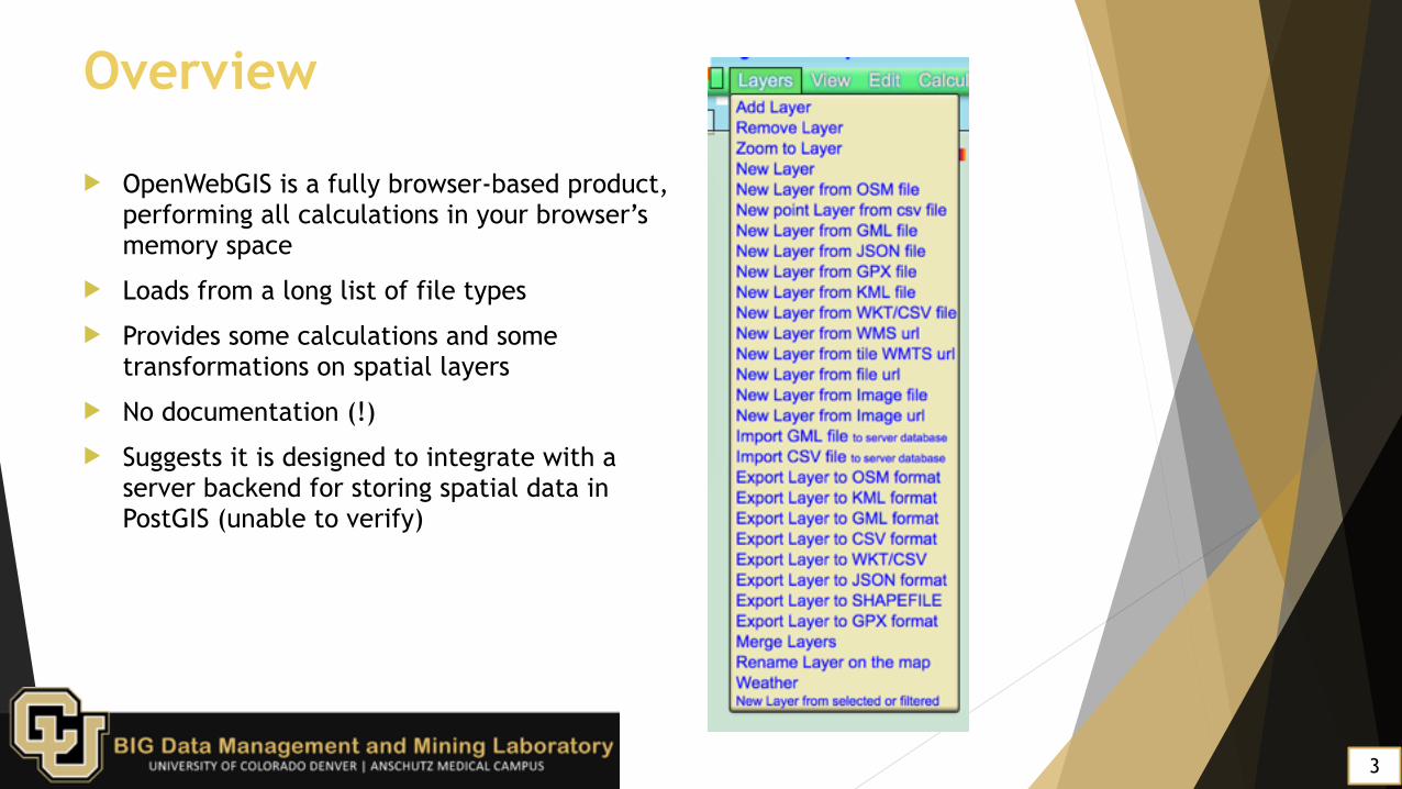
Overview
! OpenWebGIS is a fully browser-based product, performing all calculations in your browser’s memory space
! Loads from a long list of file types
! Provides some calculations and some transformations on spatial layers
! No documentation (!)
! Suggests it is designed to integrate with a server backend for storing spatial data in PostGIS (unable to verify)
3

Overview
! Support for Shapefile and some additional formats via the Edit menu
4
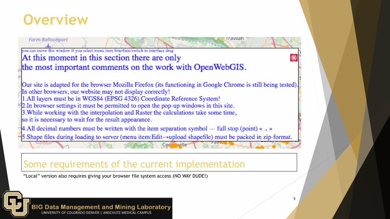
Some requirements of the current implementation“Local” version also requires giving your browser file system access (NO WAY DUDE!)
5
Overview

Features
! Built-in calculations and transformations
! transformations produce a new layer
! “Interpolate” menu includes a heat map
! Results for calculations appear in popup windows
6

Loading data layer in OpenWebGISData from https://catalog.data.gov/dataset/shopping-centers - a list of shopping centers in Fairfax County, VA. Loaded via .csv and .json (http://geojson.org/).
7
Features

Heatmap of dataA few mouse clicks from the previous slide and a heat map was generated based on the data column that was selected.
8
Features

Features
! Interesting list of add-on databases with built-in menus to quickly produce visualizations of known large data sets
! Localized in English, Russian, and French language interfaces
9

Issues
! Some operations, such as hotspot transformation and project export, typically results in a “browser not responding” warning on MacBook Pro quad core i7 2.5GHz with 16GB ram, and can take minutes to render
! No spinners/alerts to notify that processing is occurring or is completed
! No explanation for some parameters to features
! Entirely mouse-operated workflow
10

Issues
! Many awkward “classic” web interfaces
! Drop menus with a hundred elements
! Popup windows must be activated in the browser
! Sparse and unclear/undocumented/unlabelled user interface elements
11

Issues
! The Javascript code base is mostly written directly into the html file in a <script> tag (unclear project structure / code modularity)
! This project does not follow safe JS coding practices, has no tests, no description of available work, and has no comments
! The project has one contributor on GitHub, and it will likely stay that way - not approached as an open-source project, but as a pet project
12

Conclusion
! OpenWebGIS is an open-source alternative to QGIS, built in JavaScript
! This design choice may help future-proof it in ways that QGIS does not have (compiled vs interpreted)
! It does not have the support of an open source community (pretty necessary to survive as a free tool)
! Real hard data size limit (browser memory allocation) and computation limits (unmanaged worker processing prone to performance issues)
! Not suitable for truly large data sets, and difficult to use
13