opengis background and concepts uniphorm - unigis josef strobl department of geography - salzburg...
TRANSCRIPT

OpenGISbackground and
conceptsUniPHORM - UNIGIS
Josef STROBLDepartment of Geography - Salzburg University
Parts based on a presentation by Kurt Buehler
Open GIS Consortium, Inc.
© 1998 UNIGIS, portions © 1997 OGC Inc.
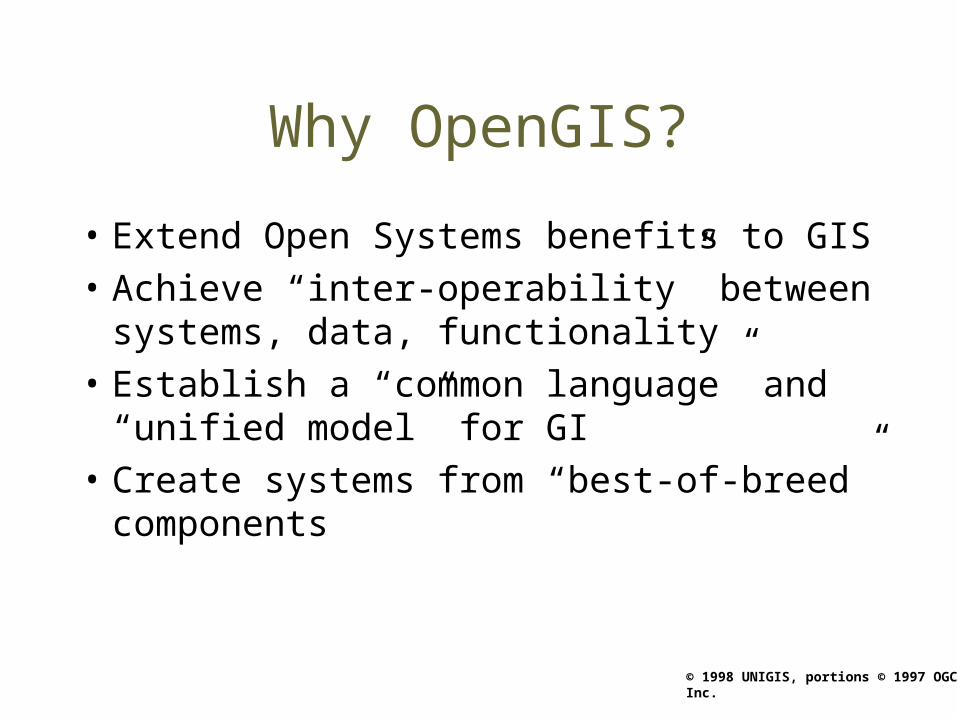
Why OpenGIS?
• Extend Open Systems benefits to GIS
• Achieve “inter-operability” between systems, data, functionality
• Establish a “common language” and “unified model” for GI
• Create systems from “best-of-breed” components

© 1998 UNIGIS, portions © 1997 OGC Inc.
OpenGIS benefits
• Integration with component computing standards
• Quick and efficient development cycles
• Avoid data transfers and redundancies
• Protect investments - future proofing
© 1998 UNIGIS, portions © 1997 OGC Inc.
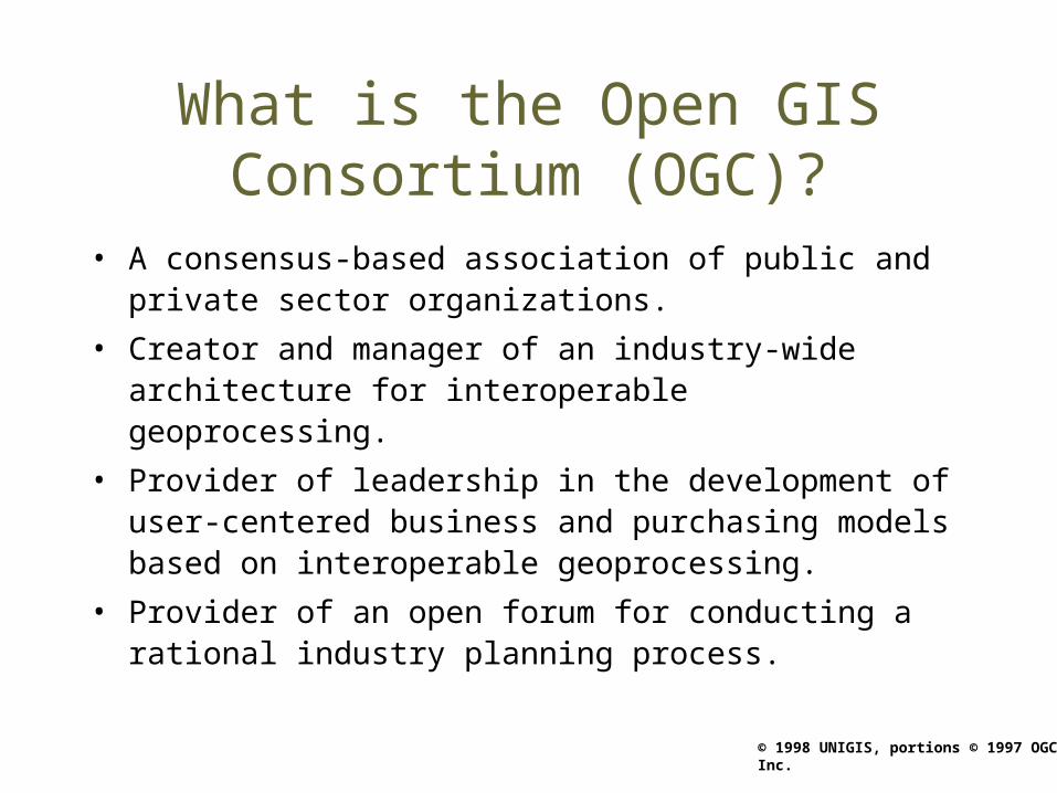
What is the Open GIS Consortium (OGC)?
• A consensus-based association of public and private sector organizations.
• Creator and manager of an industry-wide architecture for interoperable geoprocessing.
• Provider of leadership in the development of user-centered business and purchasing models based on interoperable geoprocessing.
• Provider of an open forum for conducting a rational industry planning process.

© 1998 UNIGIS, portions © 1997 OGC Inc.
OGC’s Vision
OGC envisions the full integration of geospatial data and geoprocessing resources into
mainstream computing and the widespread use of interoperable, commercial
geoprocessing software throughout the information infrastructure.

© 1998 UNIGIS, portions © 1997 OGC Inc.
OGC Mission
• Involve developers and users of geographic information resources -- including vendors, integrators, academia, government agencies, and standards organizations -- in collaborative development of interoperable geoprocessing technology specifications, and work to promote the delivery of certifiably interoperable products.
• Synchronize geoprocessing technology with current and emerging information technology standards based on open systems, distributed processing and componentware frameworks.
• Provide an industry forum that promotes cooperative business development initiatives related to distributed geoprocessing.
© 1998 UNIGIS, portions © 1997 OGC Inc.
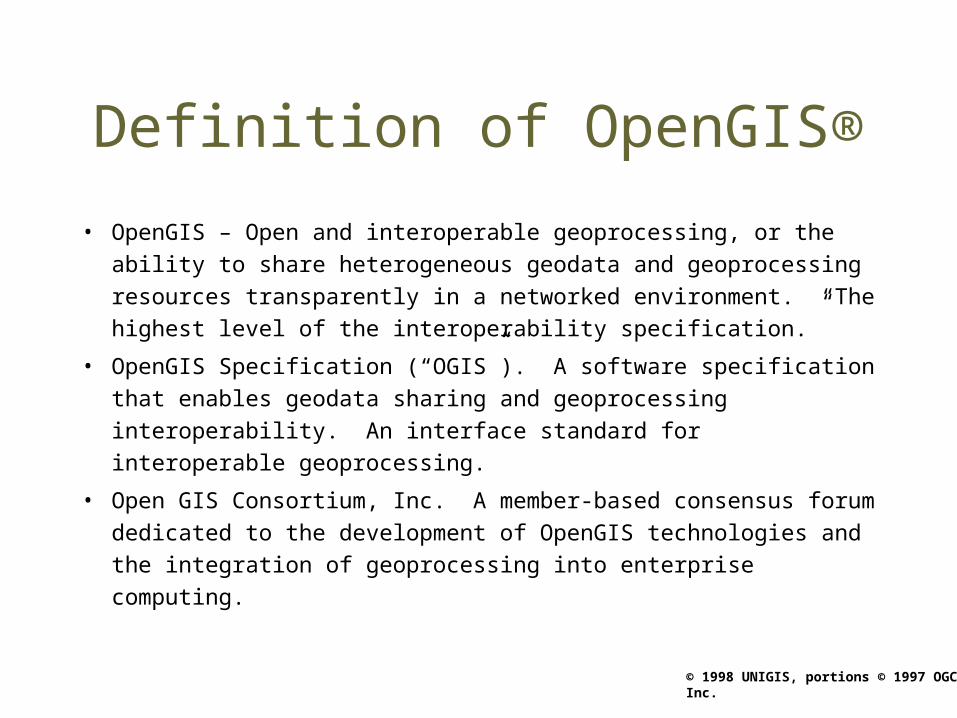
Definition of OpenGIS®
• OpenGIS – Open and interoperable geoprocessing, or the
ability to share heterogeneous geodata and geoprocessing
resources transparently in a networked environment. “The
highest level of the interoperability specification.”
• OpenGIS Specification (“OGIS”). A software specification that
enables geodata sharing and geoprocessing interoperability.
An interface standard for interoperable geoprocessing.
• Open GIS Consortium, Inc. A member-based consensus forum
dedicated to the development of OpenGIS technologies and the
integration of geoprocessing into enterprise computing.

© 1998 UNIGIS, portions © 1997 OGC Inc.
Technology Development Overview
• Develop technical specifications for interoperable geoprocessing– Develop an Abstract Specification that is
independent of computing platforms• Becomes more comprehensive over time
– Map this one specification to Implementation Specifications particular to computing platforms
• Completed in stages, by functional capability• May introduce Abstract Specification changes
– Maintain and revise specifications as needed
© 1998 UNIGIS, portions © 1997 OGC Inc.
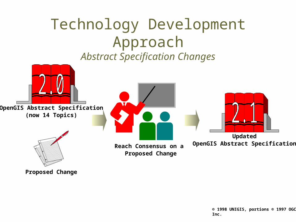
Technology Development ApproachAbstract Specification Changes
Reach Consensus on a Proposed Change
UpdatedOpenGIS Abstract Specification
OpenGIS Abstract Specification(now 14 Topics)
Proposed Change

© 1998 UNIGIS, portions © 1997 OGC Inc.
ImplementationSpecification
Technology Development ApproachImplementation Specification Development
OpenGIS Abstract Specification
Schedule of developments
© 1998 UNIGIS, portions © 1997 OGC Inc.
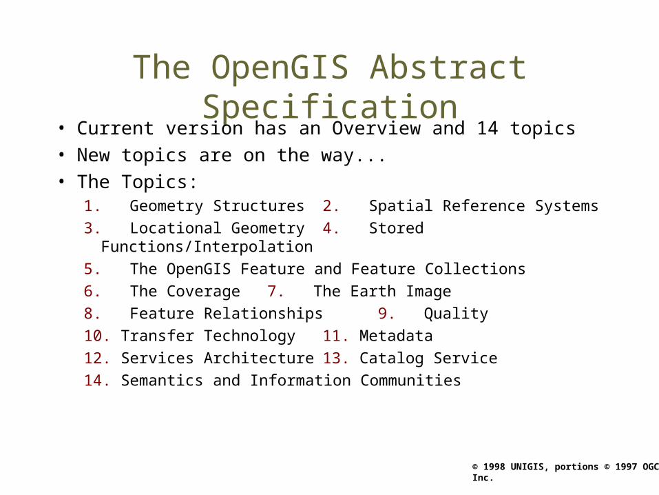
The OpenGIS Abstract Specification• Current version has an Overview and 14 topics • New topics are on the way...• The Topics:
1. Geometry Structures 2. Spatial Reference Systems
3. Locational Geometry 4. Stored Functions/Interpolation
5. The OpenGIS Feature and Feature Collections
6. The Coverage 7. The Earth Image
8. Feature Relationships 9. Quality
10. Transfer Technology 11. Metadata
12. Services Architecture 13. Catalog Service
14. Semantics and Information Communities
© 1998 UNIGIS, portions © 1997 OGC Inc.
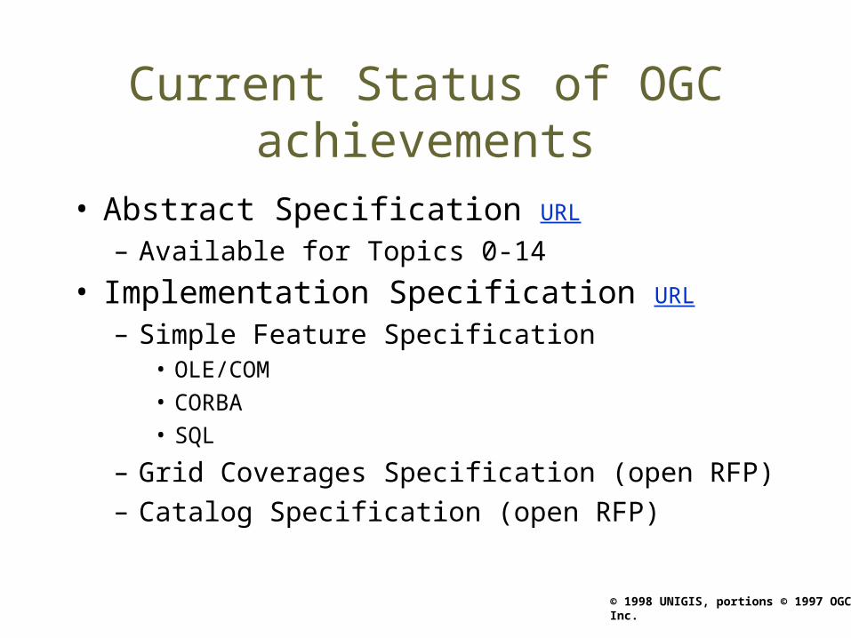
Current Status of OGC achievements
• Abstract Specification URL
– Available for Topics 0-14
• Implementation Specification URL
– Simple Feature Specification• OLE/COM• CORBA• SQL
– Grid Coverages Specification (open RFP)– Catalog Specification (open RFP)
© 1998 UNIGIS, portions © 1997 OGC Inc.
ISO TC 211 “Geographic Information”
• ISO (International Standards Organisation) has been working towards the Standardisation of “Geographic Information” for several years through its Technical Committee 211.
• As an industry association, OGC obviously was able to draw on more resources and proceed much faster than ISO TC 211
• ISO TC 211’s ambitions were aiming at establishing a solid foundation for data transfer - OGC then went beyond that target with a clear aim at full interoperability.
• Cooperation between OGC and ISO has now been formally established (“class A liaison”)

© 1998 UNIGIS, portions © 1997 OGC Inc.
Evolution of Service Layers and Interfaces
Hardware platform and/or network services
Application
ProprietarySpatial Database
Presentation (UI)
Hardware platform
MonolithicGeoprocessing
System
Spatial Data Access Provider
DCP
Application
GenericDatabases
Presentation (UI)
DCP
Presentation (UI)
DCP Scenario 1 DCP Scenario 2 DCP Scenario 3
. . . toward distributed object computing
ApplicationServers
DCP
Applications(tools & applets)
Data: “ObjectsEverywhere”
Presentation (UI)
ApplicationServers
Applications
Spatial DataAccess Providers
Spatial DataAccess Providers
GenericDatabasesor Generic
Data Stores
ApplicationServers
© 1998 UNIGIS, portions © 1997 OGC Inc.
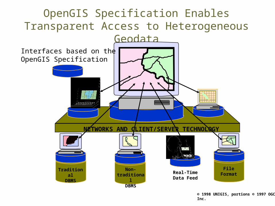
OpenGIS Specification Enables Transparent Access to Heterogeneous Geodata
File FormatFile FormatFile Format
File Format
Real-TimeData Feed
File Format
TraditionalDBMS
File Format
File FormatNon-
traditionalDBMS
File Format
NETWORKS AND CLIENT/SERVER TECHNOLOGY
File FormatFileFormat
File Format
File Format
Interfaces based on the OpenGIS Specification
© 1998 UNIGIS, portions © 1997 OGC Inc.
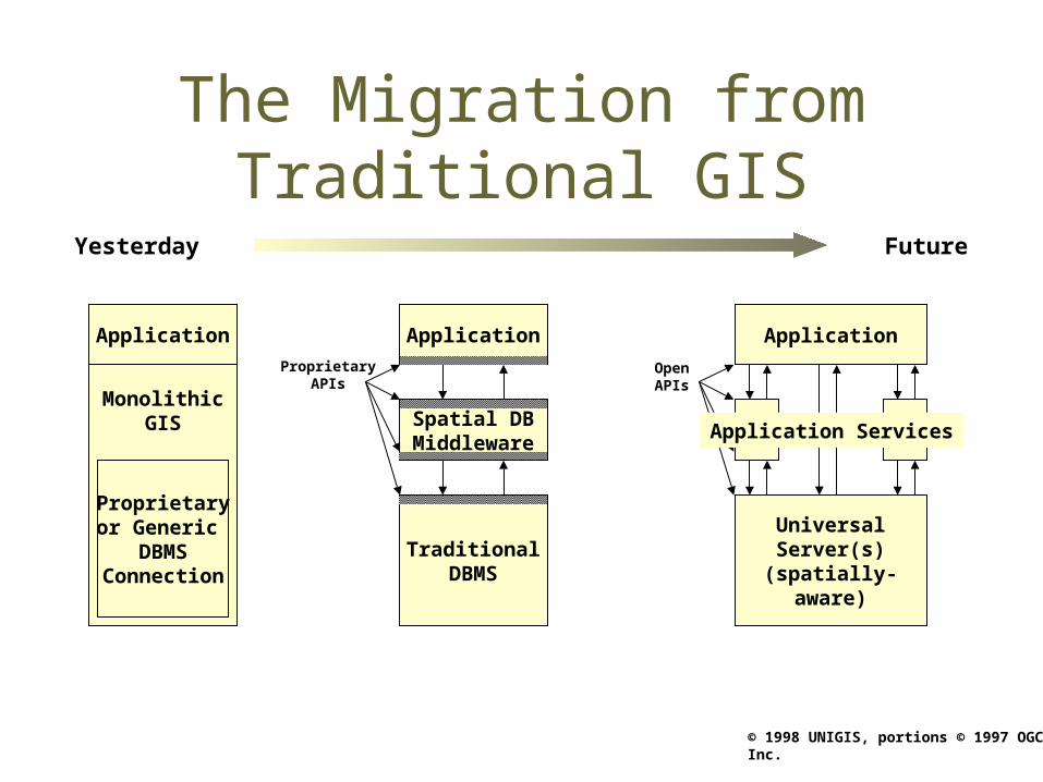
The Migration from Traditional GIS
Yesterday Future
Application
MonolithicGIS
Proprietaryor Generic
DBMSConnection
Application
Spatial DBMiddleware
TraditionalDBMS
OpenAPIs
ProprietaryAPIs
UniversalServer(s)(spatially-
aware)
Application
Application Services

© 1998 UNIGIS, portions © 1997 OGC Inc.
USERSDATA
RESOURCES
Industry Markets Utility Companies Telecom Civil Engineering Niche Integrators Petroleum Intelligent TransportPublic Markets Environment Resources Mgmt Infrastructure Urban Planning Disaster Relief Public Safety IVHSBusiness Markets Real Estate Insurance Banking
CadastralWater resourcesLand UseZoningHighwayTrafficTransitWater supplySewerStorm drainsGas & electricTelecom. linesPoliticalSurface geologyHazardsPublic safetyPopulationReal-time feedsEarth imagery
GISEarth ImagingCAD MappingGPSNavigationFacilities Mgmt.Database software OODBMS RDBMS Universal server . . .Desktop publishingDocument imagingWorkflowDecision support
PROCESSINGRESOURCES
The Goal of Open Geoprocessing

© 1998 UNIGIS, portions © 1997 OGC Inc.
USERSDATA
Industry Markets Utility Companies Telecom Civil Engineering Niche Integrators Petroleum Intelligent TransportPublic Markets Environment Resources Mgmt Infrastructure Urban Planning Disaster Relief Public Safety IVHSBusiness Markets Real Estate Insurance Banking
CadastralWater resourcesLand UseZoningHighwayTrafficTransitWater supplySewerStorm drainsGas & electricTelecom. linesPoliticalSurface geologyHazardsPublic safetyPopulationReal-time feedsEarth imagery . . .
Client-Server/DCP
Telecommunications
DatabaseGeoprocessing
OpenGIS Spec.
Geoprocessing: Applications Vendor tools Components Open Platforms
OGC Members: Oracle, Informix, IBM, etc.
Layers of the Open Geoprocessing Infrastructure

© 1998 UNIGIS, portions © 1997 OGC Inc.
Geoprocessing Market ChannelsUSERSDATA
Industry Markets Utility Companies Telecom Civil Engineering Niche Integrators Petroleum Intelligent TransportPublic Markets Environment Resources Mgmt Infrastructure Urban Planning Disaster Relief Public Safety IVHSBusiness Markets Real Estate Insurance Banking
CadastralWater resourcesLand UseZoningHighwayTrafficTransitWater supplySewerStorm drainsGas & electricTelecom. linesPoliticalSurface geologyHazardsPublic safetyPopulationReal-time feedsEarth imagery . . .
Client-Server/DCP
Telecommunications
Database
OpenGIS Spec.
Geoprocessing: Applications Vendor tools Components Open Platforms
OGC Members: Oracle, Informix, IBM, etc.
ApplicationIntegration
ConsumerModel
EnterpriseModel
AgencyPrograms

© 1998 UNIGIS, portions © 1997 OGC Inc.
Old Paradigm:Static Data Transfer
Manifest
catalogsschemacoord system...
Dataset
spatial objectsattributescomposites...
Encode from GIS
Decode to GIS
Data Transfer

© 1998 UNIGIS, portions © 1997 OGC Inc.
OpenGIS: Dynamic Interoperability
Database Server
catalogsschemacoord systemgeodata
Database Client
schemacoord systemgeodata representation
CORBA - OLE/COM
Requests, Features, & Collections
© 1998 UNIGIS, portions © 1997 OGC Inc.
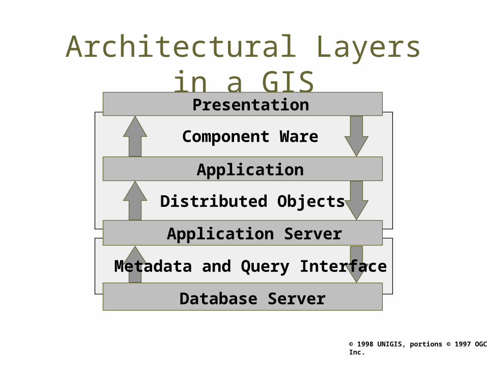
Architectural Layers in a GIS
Component Ware
Application
Distributed Objects
Application Server
Database Server
Presentation
Metadata and Query Interface
© 1998 UNIGIS, portions © 1997 OGC Inc.
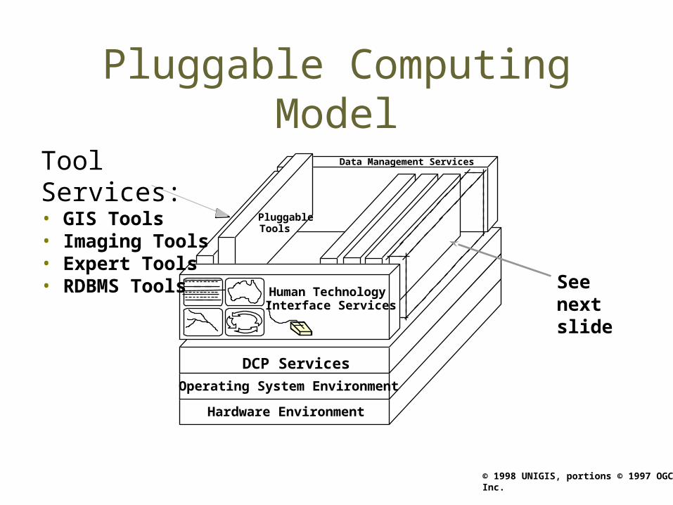
Pluggable Computing Model
Hardware Environment
DCP Services
Operating System Environment
Data Management Services
PluggableTools
See next slide
Human TechnologyInterface Services
Tool Services:• GIS Tools• Imaging Tools• Expert Tools• RDBMS Tools

© 1998 UNIGIS, portions © 1997 OGC Inc.
Pluggable Tools
Data management interface
Private algorithms
Private data
DCP interface
Human-technology interface
© 1998 UNIGIS, portions © 1997 OGC Inc.
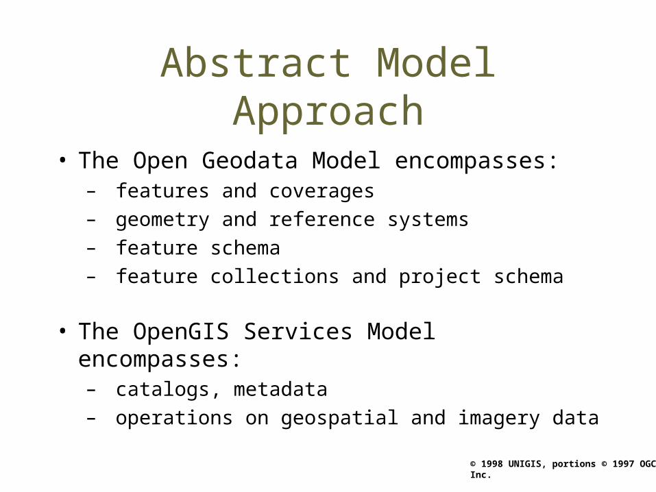
Abstract Model Approach
• The Open Geodata Model encompasses: – features and coverages– geometry and reference systems– feature schema– feature collections and project schema
• The OpenGIS Services Model encompasses:– catalogs, metadata– operations on geospatial and imagery data

© 1998 UNIGIS, portions © 1997 OGC Inc.
Model of Location and Geometry
where: placewhen: time
LocationSpatial/TemporalReference System
CoordinateGeometry
© 1998 UNIGIS, portions © 1997 OGC Inc.
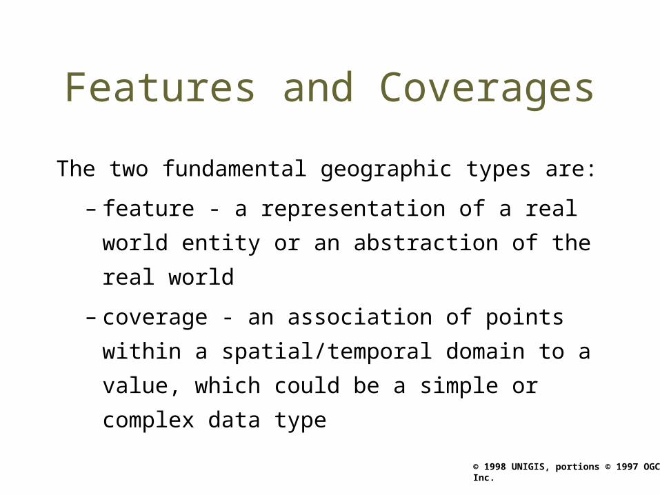
Features and Coverages
The two fundamental geographic types are:
– feature - a representation of a real world
entity or an abstraction of the real world
– coverage - an association of points within a
spatial/temporal domain to a value, which
could be a simple or complex data type
© 1998 UNIGIS, portions © 1997 OGC Inc.
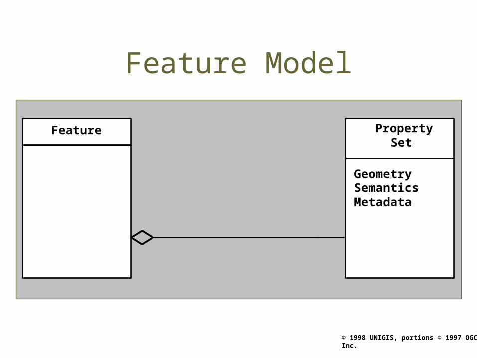
Feature Model
Feature PropertySet
GeometrySemanticsMetadata

© 1998 UNIGIS, portions © 1997 OGC Inc.
Coverage Model
Abstract
Coverage
GeometryProperty Set
value(point): T
Abstract
Stored Function
Abstract
AnyType T
Feature
range
domain
name()

© 1998 UNIGIS, portions © 1997 OGC Inc.
OpenGIS is an Interface Standard
• Features and coverages can be implemented by relational or object-based GIS software
• Common set of requests can be understood by all OpenGIS-compliant services:– Set or get geodetic datum and projection– Create, modify, delete features in the database– Select features from the database by query– And many others...
© 1998 UNIGIS, portions © 1997 OGC Inc.
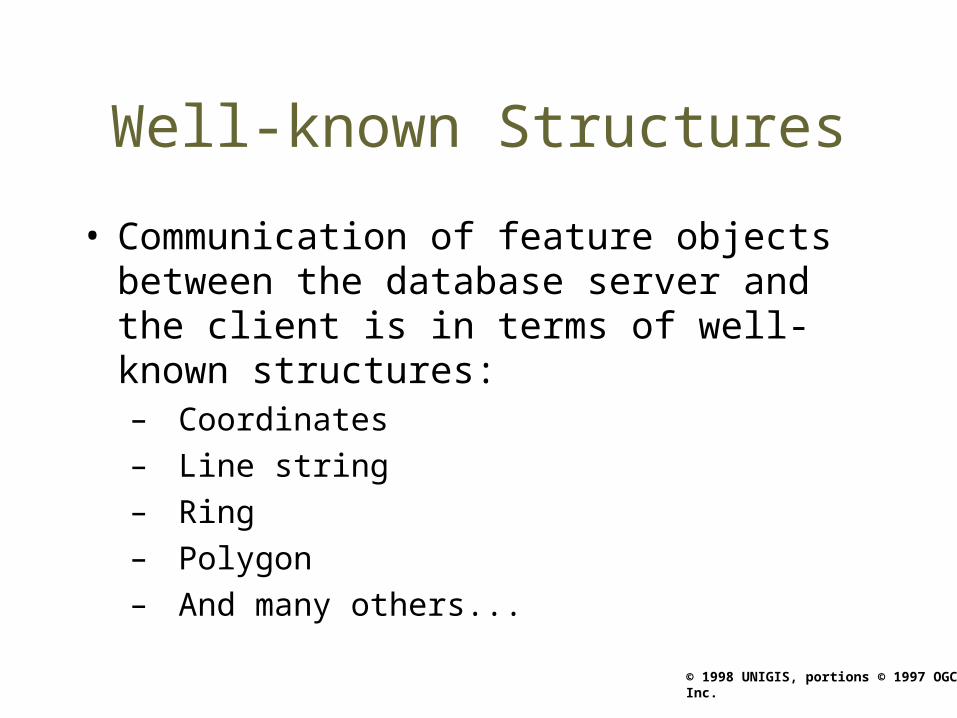
Well-known Structures
• Communication of feature objects between the database server and the client is in terms of well-known structures:– Coordinates– Line string– Ring– Polygon– And many others...

© 1998 UNIGIS, portions © 1997 OGC Inc.
The Big Picture
External Entities
Platform Services
Object ServicesDistributed Computing Services
Common FacilitiesCommon Support Applications
Users
InformationInterchange
Communications
Har
dwar
e
Geographic Community Domain Databases and Applications
Topographic Maritime Hydrology CadastralTransp Defense

© 1998 UNIGIS, portions © 1997 OGC Inc.
The OGC Services Architecture
External Entities
CO
E
CO
E
Platform Services
O bj ect Servi ces
Di st ri buted Comput i ng Servi ces
Common Faci l i t i esCommon Support Appl i cat i ons
Users
I nformat i onI nterchange
Communi cat i ons
Hard
war
e
Mission Specific Applications
USI G S Mari t i me LandJoi nt /CI NC
Ai r In te llige nc e
Common Support Applications
Alerts
Developer's KitMessage
Processing
On-Line Help Presentation Correlation
OfficeAutomation
Open GeospatialExchange (OGE)
Services
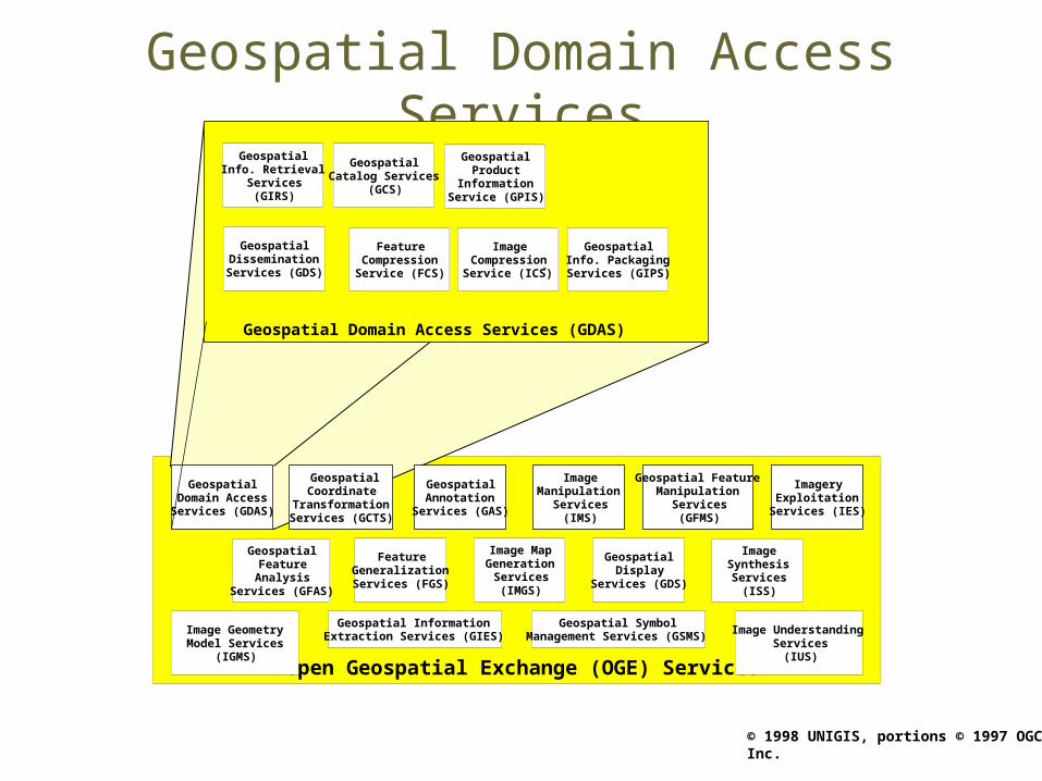
Open Geospatial Exchange (OGE) Services
GeospatialDomain Access
Services (GDAS)
ImageryExploitation
Services (IES)
GeospatialCoordinate
TransformationServices (GCTS)
GeospatialAnnotation
Services (GAS)
Geospatial FeatureManipulation
Services(GFMS)
ImageManipulation
Services(IMS)
FeatureGeneralizationServices (FGS)
GeospatialFeatureAnalysis
Services (GFAS)
Image MapGeneration
Services(IMGS)
ImageSynthesisServices
(ISS)
GeospatialDisplay
Services (GDS)
Geospatial InformationExtraction Services (GIES)
Geospatial SymbolManagement Services (GSMS)
Image UnderstandingServices
(IUS)
Image GeometryModel Services
(IGMS)
© 1998 UNIGIS, portions © 1997 OGC Inc.
Geospatial Domain Access Services
Open Geospatial Exchange (OGE) Services
ImageryExploitation
Services (IES)
GeospatialCoordinate
TransformationServices (GCTS)
GeospatialAnnotation
Services (GAS)
Geospatial FeatureManipulation
Services(GFMS)
ImageManipulation
Services(IMS)
FeatureGeneralizationServices (FGS)
GeospatialFeature
AnalysisServices (GFAS)
Image MapGeneration
Services(IMGS)
ImageSynthesisServices
(ISS)
GeospatialDisplay
Services (GDS)
Geospatial InformationExtraction Services (GIES)
Geospatial SymbolManagement Services (GSMS)
Image UnderstandingServices
(IUS)
Image GeometryModel Services
(IGMS)
Geospatial Domain Access Services (GDAS)
GeospatialCatalog Services
(GCS)
GeospatialDisseminationServices (GDS)
GeospatialInfo. Retrieval
Services(GIRS)
GeospatialProduct
InformationService (GPIS)
FeatureCompressionService (FCS)
ImageCompressionService (ICS)*
GeospatialDomain AccessServices (GDAS)
GeospatialInfo. PackagingServices (GIPS)

© 1998 UNIGIS, portions © 1997 OGC Inc.
Vendor System = Monolith
Data DataData Data
© 1998 UNIGIS, portions © 1997 OGC Inc.
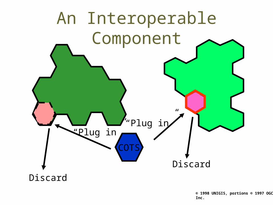
An Interoperable Component
COTS
“Plug in”“Plug in”
Discard
Discard
© 1998 UNIGIS, portions © 1997 OGC Inc.
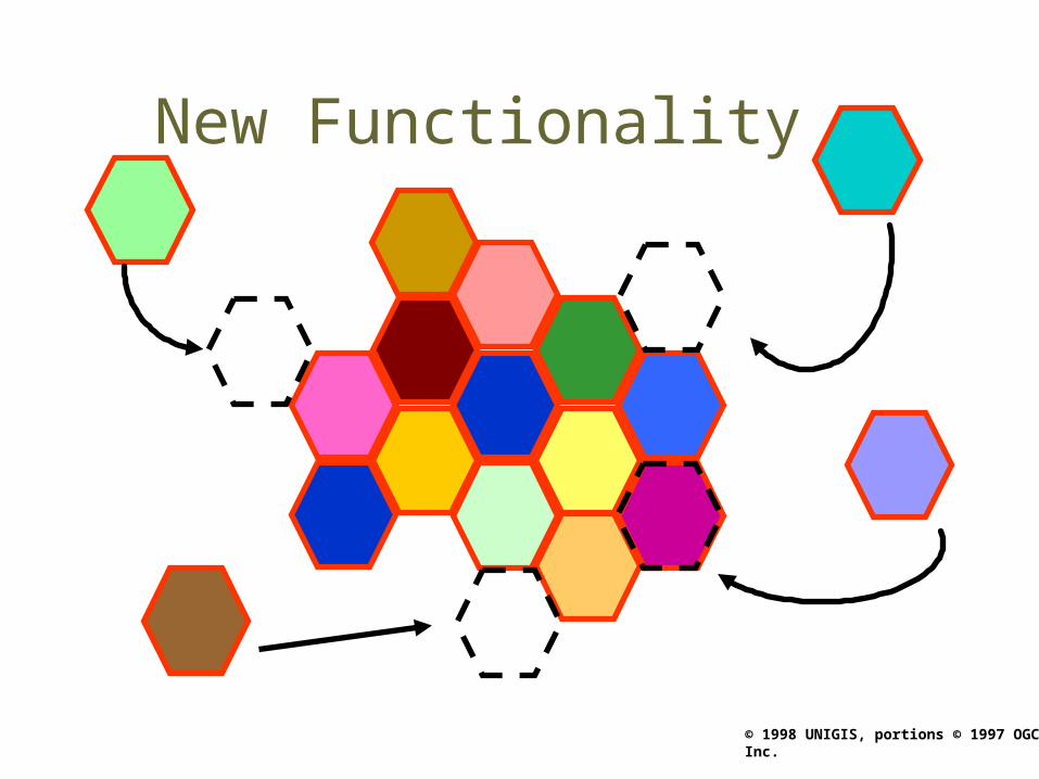
New Functionality
© 1998 UNIGIS, portions © 1997 OGC Inc.
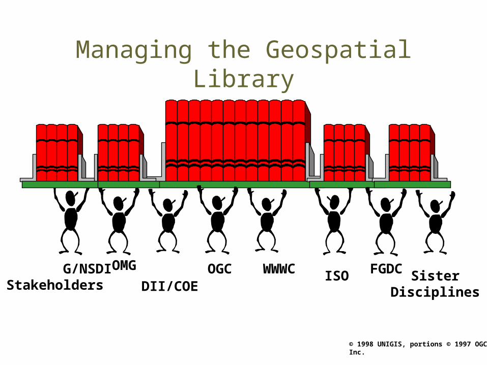
Managing the Geospatial Library
G/NSDIStakeholders
FGDCDII/COE
OGCOMG WWWC ISO SisterDisciplines
© 1998 UNIGIS, portions © 1997 OGC Inc.
Review questionnaire
To start the review questionnaire please click to the following address:
http://www.geo.sbg.ac.at/projects/UniPhorm/quiz/quiz_opengis.htm