ocean color observations and their applications to climate studies alex gilerson, soe hlaing,...
TRANSCRIPT

Ocean Color Observations and Their Applications to Climate Studies
Alex Gilerson, Soe Hlaing, Ioannis Ioannou, Sam Ahmed
Optical Remote Sensing Laboratory, The City College of the City University of New York,
NOAA CREST
CREST Symposium, June 5, 2013

Melin, 2013

Water Composition for the Open Ocean and Coastal Waters
Algae CDOM* Minerals
*CDOM is the colored dissolved organic matter mostly of terrestrial origin
In the open ocean algae are the main component
In coastal waters algae are mixed with CDOM and minerals

Reflectance of Various Surfaces
Signal from water is small in comparison with reflectance from other surfaces and atmosphere

Lw -Total water-leaving radiance. Ls - Radiance above the sea surface due to all surface reflection effects within the IFOV. Lp - Atmospheric path radiance.
Total Radiance Signal at the Top of Atmosphere
Ls Lw
Lp
Signal from the atmospheric scattering is about 10 times stronger than from water.
Atmospheric correction utilizes NIR bands (748, 865 nm)

Outline
Introduction System requirements Vicarious calibration Chl time series Our applications to climate studies
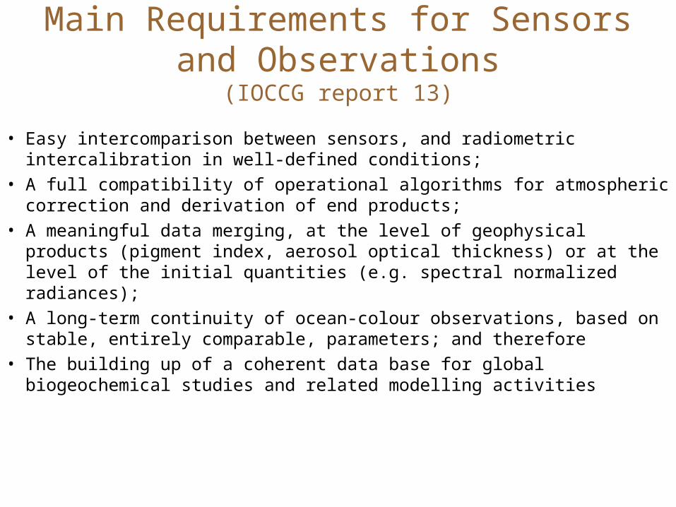
Main Requirements for Sensors and Observations(IOCCG report 13)
• Easy intercomparison between sensors, and radiometric intercalibration in well-defined conditions;
• A full compatibility of operational algorithms for atmospheric correction and derivation of end products;
• A meaningful data merging, at the level of geophysical products (pigment index, aerosol optical thickness) or at the level of the initial quantities (e.g. spectral normalized radiances);
• A long-term continuity of ocean-colour observations, based on stable, entirely comparable, parameters; and therefore
• The building up of a coherent data base for global biogeochemical studies and related modelling activities

Main Requirements for Climatic Data Records
To gain insight into climate variability and change the requirement is continuous time series of observations to estimate ocean properties such as phytoplankton chlorophyll-a with the radiometric accuracy of current sensors or better (IOCCG report 13)
Length: relevant for climate time scales (referred to as “long-term”) need for multiple decades of data (>~50 years) - Melin, 2013
- Water leaving radiance / Remote sensing reflectance (Rrs) – highly accurate measurements by well calibrated sensors and consistency through various missions- Chlorophyll-a concentration (Chla) – main ocean color product – continuous time series
Two levels of products

Remote Sensing of the Ocean
Phytoplankton are very important part of ocean life: Phytoplankton are the first link in the food chain. Phytoplankton convert nutrients into plant
material by using sunlight through photosynthesis and convert carbon dioxide from sea water into organic carbon and oxygen as a by-product and thus affect carbon balance. Amount of phytoplankton in the
ocean can be traced by the concentration of the optically active pigment chlorophyll [Chl]
RS of water areas provides an efficient way of monitoring water quality, biomass in the ocean, sediment plumes, spatial and temporal scales of the water structures, sea surface temperature, etc.

Reflectance spectra for the open ocean
SeaWiFS Blue-Green Ratio Algorithm
Carder, et al. ,2003
400 500 600 700 800
0.00
0.01
0.02
0.03
0.04
[Chl]=10 mg/m3
[Chl]=1.0 mg/m3
Ref
lect
ance
Wavelength, nm
[Chl]=0.2 mg/m3
[Chl] can be well characterized by blue-green ratio
With increasing [Chl] water changes its color from blue to
green

Chlorophyll Global and Regional Maps
MODIS, NE and Florida coasts
SeaWiFS, July 2006

Ocean Color Satellite Sensors
NASA Coastal Zone Color Scanner (CZCS) – 1978 - 1986
Seaviewing Wide Field-of-view Sensor(SeaWiFS) – 1997 - 2011
NASA Moderate Resolution Imaging Spectroradiometer (MODIS) on Terra satellite -1999-present
NASA Moderate Resolution Imaging Spectroradiometer (MODIS) on Aqua satellite -2002-present
MEdium Resolution Imaging Spectrometer (MERIS), European Space Agency (ESA) on ENVISAT satellite – 2002-2012
Suomi National Polar-orbiting Partnership - Visible Infrared Imaging Radiometer Suite (VIIRS) NOAA- NASA -2011-present

MODIS Spectral Bands for Ocean Color and Atmospheric Correction (Terra,1999; Aqua, 2002)


Vicarious calibrationSystem Vicarious Calibration (e.g., calibration relying on the use of highly accurate in situ measurements of Lw and the application of the RT code embedded in the atmospheric correction scheme, thus leading to the calibration of the entire system, i.e., the sensor plus the algorithms (Gordon 1998)) specifically applied to perform (absolute) radiometric calibrations. Expected top-of-atmosphere calibration uncertainties are 0.3-0.5%, leading to uncertainties of 3-5% in Lw.
This suggests that in situ data sources for vicarious calibration of satellite ocean color sensors need to be carefully evaluated accounting for the actual application of satellite data products recognizing that the creation of CDRs imposes the most stringent conditions.
Early indications on the appropriateness of in situ data/sites included (Gordon 1998): 1. Cloud free, very clear, maritime atmosphere (τa<0.1 in the visible); 2. Horizontally uniform Lw over spatial scales of a few kms; 3. Oligotrophic-mesotrophic waters (to minimize in situ measurement errors of Lw in the blue); 4. Coincident aerosol measurements.
Zibordi, 2013

McClain, 2013
MOBY – Marine Optical Buoy
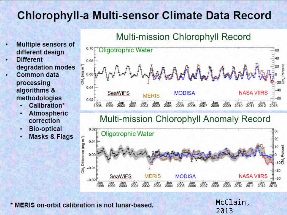
McClain, 2013

McClain, 2013

Regional trends
Melin, 2010, 2013
Decomposition of the signal into seasonal, trend and irregular terms

[Chl] Algorithms1) OC3
2) Rrs NN (NN [Chl])
3) IOP+Rrs NN (IOP NN [Chl])
NN [Chl] and IOP NN [Chl] are trained based on the NOMAD
Ioannou et al, 2011, 2013
Alternative Ocean Color Algorithms - NN

Algorithm Implementation on Satellite Data- OC3-[Chl], mg m-3
Sample Seasonal [Chl], Spring 2003
Alternative Ocean Color Algorithms - NN

Algorithm Implementation on Satellite Data- NN-[Chl], mg m-3
Sample Seasonal [Chl], Spring 2003
Alternative Ocean Color Algorithms - NN

Global Distributions of [Chl], as derived from the three algorithms for Spring 2003
Alternative Ocean Color Algorithms - NN

[Ch
l]m
g/m
3
Global seasonal variation of [Chl]mg/m3
Alternative Ocean Color Algorithms - NN

Polarization measurements with the hyperspectral multi-angular polarimeter + full
Stokes vector imaging camera

Addition of polarization sensitive channels to the future satellite instruments
Polarization sensitive instruments are used to measure aerosols. We show that they are useful in the retrieval of additional water parameters: attenuation coefficient, particle characteristics
In collaboration with NASA-GISS and Raytheon we are working on a potential new sensor with polarization sensitivity, 3 observational angles for retrieval of aerosols and water parameters
400 450 500 550 600 650 700 750 800
0.0
0.5
1.0
1.5
2.0
2.5
3.0
3.5
[Chl] = 22.5 mg/m3
Lw
, W
m-2sr
-1u
m-1
Wavelength, nm
[Chl] = 5.9 mg/m3
440665
865 680
710
Polarization channels
750
Japan will launch an instrument with 665 and 865nm polarization channels, 3 viewing angles, 250m resolution in 2016

Algal Blooms - Progression of K. Brevis bloom using MODIS data and our algorithm

GloboLakes Project
Tyler, 2012

GloboLakes Project
Tyler, 2012

Conclusions• Climate Ocean Color observations are challenging but possible
for observation of global and regional trends• Require:
- highly precise sensors
- vicarious calibration;
- accurate atmospheric correction algorithms
- accurate and well established algorithms for ocean operational products
- continuity between missions
This work is partially supported by grants from NOAA, NASA and the Office of Naval Research