nsw detailed weir review
TRANSCRIPT

REDUCING THE IMPACT OF WEIRS ON AQUATIC HABITAT
NSW DETAILED WEIR REVIEW
REPORT TO THE NEW SOUTH WALES ENVIRONMENTAL TRUST
SOUTHERN RIVERS CMA REGION

Published by NSW Department of Primary Industries. © State of New South Wales 2006. This publication is copyright. You may download, display, print and reproduce this material in an unaltered form only (retaining this notice) for your personal use or for non-commercial use within your organisation provided due credit is given to the author and publisher. To copy, adapt, publish, distribute or commercialise any of this publication you will need to seek permission from the Manager Publishing, NSW Department of Primary Industries, Orange, NSW. DISCLAIMER The information contained in this publication is based on knowledge and understanding at the time of writing (July 2006). However, because of advances in knowledge, users are reminded of the need to ensure that information upon which they rely is up to date and to check the currency of the information with the appropriate officer of NSW Department of Primary Industries or the user‘s independent adviser. This report should be cited as: NSW Department of Primary Industries (2006). Reducing the Impact of Weirs on Aquatic Habitat - New South Wales Detailed Weir Review. Southern Rivers CMA region. Report to the New South Wales Environmental Trust. NSW Departmentof Primary Industries, Flemington, NSW. ISBN: 0 7347 1753 9 (New South Wales Detailed Weir Review)ISBN: 978 0 7347 1832 7 (Southern Rivers CMA region) Cover photos: Cob-o-corn Weir, Cob-o-corn Creek, Northern Rivers CMA (upper left); Stroud Weir, Karuah River, Hunter/Central Rivers CMA (upper right); Mollee Weir, Namoi River, Namoi CMA (lower left); and Hartwood Weir, Billabong Creek, Murray CMA (lower right).
i
EXECUTIVE SUMMARY The highly modified nature of catchments in NSW presents many challenges in the way we protect the environment and manage its natural resources. In particular, setting goals and targets for aquatic habitat conservation in the region requires clear understanding of the extent of aquatic habitat degradation and where the best outcomes can be achieved. Within lotic systems, native Australian fish have evolved to be reliant on a variety of habitat types to complete their life cycle, thus requiring free movement within rivers and streams and between estuarine and freshwater environments. Unfortunately, riverine connectivity has been severely disrupted within Australia through the installation of numerous instream structures that impede the natural flow regime and act as physical, hydrological, and behavioural barriers to fish movement. In NSW alone, several thousand weirs, dams and poorly designed road crossings exist on waterways, with the majority of these structures impeding fish passage and impacting on aquatic health. In 1999, NSW Fisheries and the Department of Land and Water Conservation undertook the NSW Initial Weir Review (2002). The Initial Weir Review (2002) was commissioned by the State Weir Review Committee to provide a preliminary overview of the impact of weirs across the State. Due to the sheer number of weirs and dams in NSW, detailed assessments of each structure were not feasible. Therefore, the Initial Weir Review (2002) incorporated a rapid assessment of weirs in the State for the purpose of providing a ‘snap shot’ view of environmental considerations at each site, as well as to identify and shortlist priority structures that warranted further attention. It is under this premise that the Detailed Weir Review was conducted to provide a comprehensive assessment of the impacts and remediation options available for improving fish passage and waterway health at priority structures highlighted in the Initial Weir Review (2002). A total of 109 weir structures within the 13 CMA regions of NSW were selected for Detailed Weir Reviews, with a thorough assessment of each structure undertaken. The individual detailed review reports presented in this project provide a comprehensive overview of each structure including operational details, system hydrology, ecological considerations, and the preferred remediation option of NSW DPI for improving fish passage at the weir. As a primary recommendation, NSW DPI encourages the removal of redundant structures from waterways, with weir removal providing the greatest benefit to the health of the waterway by enabling unrestricted fish passage and reinstatement of natural sediment fluxes within a system. However, due to the requirement for regulation of flows and impoundment of water for irrigation purposes in many areas of NSW, removal of certain structures cannot be proposed as a primary remediation option. Recommendations put forth by NSW DPI to remediate or remove the weirs inspected throughout the NSW catchments as part of the Detailed Weir Review Project are supported by the NSW State Weirs Policy.

ii
ACKNOWLEDGEMENTS This project was funded through the Environmental Trust Program and managed by the NSW Department of Primary Industries. The NSW DPI Aquatic Habitat Rehabilitation Program Team managed the project including research, fieldwork, and report preparation. Personnel involved in data collection and report preparation were: Milly Hobson, Shaun Morris, Matthew Gordos, Charlotte Grove, Scott Nichols, Cameron Lay, Sharon Molloy, Sam Davis, Adam Vey, and Anthony Townsend, with maps produced by Ben Maddox. In addition, valuable assistance was provided by regional DPI Fisheries Conservation Mangers including Allan Lugg, David Ward, Trevor Daly, Scott Carter, and Pat Dwyer. Representatives of all NSW Catchment Management Authorities, Department of Natural Resources, State Water, and local government authorities provided extensive advice and assistance toward the project for which we are grateful.

iii
TABLE OF CONTENTS 1. INTRODUCTION ......................................................................................... 1
1.1 Project scope and setting....................................................................... 11.2 Study aims and objectives...................................................................... 12.1 Fish passage in NSW............................................................................. 22.2 Barriers to fish passage ......................................................................... 32.3 Ecological impacts of weirs .................................................................... 42.4 Policies and Legislation.......................................................................... 63.1 Initial Weir Review.................................................................................. 73.2 Selection of weirs for detailed review ..................................................... 73.3 Desktop assessment and consultation................................................... 83.4 Field assessment ................................................................................... 83.5 Prioritisation process.............................................................................. 9
4. INDIVIDUAL DETAILED WEIR REVIEW REPORTS ................................ 105. SOUTHERN RIVERS CMA REGION ...................................................... ..116. REFERENCES .......................................................................................... 467. APPENDICES............................................................................................ 48

1
1. INTRODUCTION The following report outlines the results of the “Impact of Weirs on Environmental Flows, Water Quality and Fish Passage” (herein the “NSW Detailed Weir Review Project”) for the catchments of NSW. The project was funded in November 2003 through the NSW Environmental Trust and was managed by the NSW Department of Primary Industries (now incorporating NSW Fisheries). 1.1 Project scope and setting In 1999, NSW Fisheries1 and the Department of Land and Water Conservation2 undertook the NSW Initial Weir Review. The process aimed to make a provisional assessment of all licensed dams and weirs within NSW, evaluating their impact on fish passage for the purpose of identifying priority sites for remediation. Catchment-based summary reports were prepared (in accordance with the former Catchment Management Board boundaries) recommending remediation options for priority sites. Following the production of the initial weir reviews, the State Weir Review Committee acknowledged that more comprehensive weir reviews were required to assess additional social, cultural, ecological, and logistical issues pertaining to highlighted priority sites prior to the implementation of on-ground works. NSW DPI therefore initiated the NSW Detailed Weir Review project through funding provided by the NSW Environmental Trust that aimed to conduct thorough investigations into 80 high priority structures across NSW to better determine appropriate remediation actions. 1.2 Study aims and objectives The current project builds on the outcomes of the NSW Initial Weir Review (NSW, Fisheries, 2002) by undertaking detailed reviews for high-priority structures within the thirteen catchments of NSW. The reviews aim to facilitate future on-ground works by addressing the social, ecological, cultural and logistical issues that surround the modification of existing barriers. This will provide a clear process towards mitigating a structure’s environmental impact once funding is secured, with the Detailed Weir Review project also serving to identify those structures where remedial works can achieve the greatest ecological benefit. As a result, these reviews will allow external-funding bodies to have greater confidence in proposed works given that a comprehensive assessment and consultation process has already been undertaken. The primary objectives of the project were to:
• Identify high priority weir structures within each CMA region that have a major impact on fish passage and aquatic habitat condition;
• Assess high priority weirs by reviewing social, ecological, cultural and logistical issues that are associated with each structure;
• Prioritise high priority weirs within each CMA region, and;
• Recommend remediation options to improve fish passage at each weir structure.
1 Now NSW Department of Primary Industries 2 Now NSW Department of Natural Resources

2
2. BACKGROUND 2.1 Fish passage in NSW Stream connectivity and habitat diversity are critical components of healthy rivers. Within these systems, native fish have evolved to be reliant on a variety of habitat types to complete their life cycle, thus requiring free movement within rivers and streams and between estuarine and freshwater environments. In south-eastern Australia, approximately half of all freshwater fish species migrate as part of their life cycle (Fairfull and Witheridge 2003) including key species such as Murray cod, golden perch, silver perch, Australian bass, sea mullet, short finned and long-finned eels, freshwater mullet and freshwater herring. Migration distances can vary from a few metres during a fish’s lifespan, to over a 1000km on an annual scale for species such as the iconic Murray cod and golden perch. Impeding fish passage through the construction of dams, weirs, floodgates and waterway crossings can negatively impact native fish by:
• Interrupting spawning or seasonal migrations;
• Restricting access to preferred habitat, available food resources and breeding partners;
• Reducing genetic flow between populations;
• Increasing susceptibility to predation and disease through aggregation below barriers;
• Fragmenting previously continuous communities, and;
• Disrupting downstream movement of adults and impeding larval drift through the creation of still water (lentic) environments.
Natural flow regimes are essential in maintaining connectivity between upstream and downstream reaches (longitudinal connectivity), and adjacent riparian and floodplain habitats (lateral connectivity). Instream structures that span the whole channel (e.g. weirs and causeways) can impede natural flows, acting as physical and hydrological barriers to fish movement and isolating upstream and downstream habitats (Williams et al. 1996; Pethebridge et al. 1998; Thorncraft and Harris 2000; Fairfull and Witheridge 2003). Additionally, levees, floodgates and other off-stream structures (e.g. gross pollutant traps) can disrupt lateral connectivity by isolating seasonal or ephemeral habitats on floodplains and wetlands. For fish that have large-scale migrations in their life cycles, particularly anadromous (marine-to-freshwater) and catadromous (freshwater-to-marine) species, preventing passage can cause local extinctions above barriers and reduce population numbers downstream (Thorncraft and Harris 2000). The installation and operation of in-stream structures and other mechanisms that alter natural flow regimes of rivers and streams has been listed as a Key Threatening Process under the Fisheries Management Act 1994 and the Threatened Species Conservation Act 1995. Recommendations put forward by the Acts specifically note the impact of in-stream structures on the life histories of threatened freshwater fish species including silver perch (Bidyanus bidyanus), Macquarie perch (Macquaria australasica), purple spotted gudgeon (Mogurnda adspersa), olive perchlet (Ambassis agassizii), Murray hardyhead (Craterocephalus fluviatilis), southern pygmy perch (Nannoperca australis), Murray cod (Maccullochella peelii peelii), and trout cod (Maccullochella macquariensis).

3
2.2 Barriers to fish passage All native fish need to move between habitat areas at some stage in their life cycle to spawn, seek food, or find shelter; and for many species migrations over long extended distances are required to complete their life cycle (Thorncraft and Harris 1996; Smith and Pollard 1998). Man-made structures that span the width of the waterway can act as barriers to fish passage by creating a physical blockage, a hydrological barrier, or by forming artificial conditions that act as behavioural barriers to fish. The impact of such barriers on fish passage will vary depending on the design of the structure; the nature of flow, debris and sediment movement in the waterway; and the swimming capabilities of resident fish. In NSW alone, there exist over 4,000 licensed weirs and dams on rivers and streams (NSW Weir Inventory database). Water impoundment structures are classified as being either fixed crest or adjustable release in design. Fixed crest weirs (also known as run-of-the river weirs) have a set height that water is impounded at, with water generally cascading over the crest of the weir at a natural flow rate barring extensive water extraction from the weir pool. As a result, fixed crest structures generally have only a minor impact on a the hydrological flow patterns of a waterway, with the main impact of such structures being the creation of a physical barrier to fish passage and the loss of upstream lotic habitat. Alternatively, adjustable release weirs and dams incorporate gates, valves, removable drop boards, and spillways that allow the flow of water in the system to be regulated to match stakeholder demands. Unlike fixed crest structures, adjustable release weirs can have much more far ranging effects on the ecology of a waterway including altered hydrological flow patterns and reduced water quality parameters (e.g. water temperature and dissolved oxygen). As with fixed crest weirs however, adjustable release structures also impinge upon fish migration either as physical (excessive headloss) or hydrological barriers (high flow velocity). Until recently, management of fish passage barriers has centred on the effects of weirs and dams while little attention has been given to the extent of the impact of poorly designed road crossings. Similar to weirs: bridges, arch structures, culverts, causeways, and fords can impinge upon fish migration patterns by acting as physical, hydrological, and behavioural barriers. NSW DPI recently completed a detailed audit of road crossings in coastal catchments (NSW DPI 2006), which highlighted in excess of 1,700 barriers to migrating fish in the coastal waterways of NSW. In tidal reaches, waterway crossings (especially those over irrigation/agricultural drains) commonly incorporate floodgates that restrict fish passage between flood events. Floodgates include hinge-flap, winch, sluice, and auto-tidal designs; with most of these structures acting as passive one-way valves that aid in draining water from low-lying land behind the gate while excluding tidal ingress. When water levels behind the floodgate are higher than the downstream levels, the gates open and the floodwaters discharge into the estuary. When water levels are elevated on the downstream side of the floodgate however, the structure is forced into the closed position, thus restricting the movement of water and fish into the drain. The vertical walls of dams, weirs, causeways, and floodgates are the most commonly perceived barriers to migrating fish. However, hydrological barriers including excessive water velocity and turbulence that result from poorly designed fishways and culvert structures can further impede fish passage (Mallen-Cooper 1994). The degree to which a structure acts as a hydrological barrier will also be dependent upon the distance over which fish have to swim to negotiate the structure (Videler and Wardle 1991). Fish generally use two different swimming modes: fast burst

4
swimming for covering short distance and a cruising speed for longer journeys. Depending upon the design of the crossing, fish may be able to ascend part way up barriers or poorly designed fishways, only to be washed back downstream after their energy has been expended (subsequently predisposing them to predation or disease through fatigue). Changes in habitat features associated with in-stream structures may also present behavioural barriers to migrating fish. Species that are able to pass into weir reservoirs may find the pooled lentic (still water) system unsuitable due to the loss of critical lotic (riverine) habitat features such as riparian vegetation cover, aquatic macrophytes, and large woody debris. Similarly, altered water temperature and aquatic dissolved oxygen regimes within and below weirs, in addition to lowered pH levels behind floodgates, can also deter migrating fish (Gehrke et al. 2001). The location of instream structures within the catchment is another factor determining the impact of barriers on fish. Obstructions located lower in the catchment often drown out several times a year when rising water levels overcome headloss barriers (the difference in water level across the structure), thereby enabling fish to periodically pass (Harris et al. 1992). Alternatively, barriers located higher up the catchment generally drown out less frequently due to the steeper topography and comparatively smaller drainage areas present behind the structure. 2.3 Ecological impacts of weirs The environmental impact of dams and weirs is widely recognised as one of the key contributors to riverine degradation. The impact from alterations to natural hydrology, changes to stream geomorphology, disruption of localised erosion and sedimentation processes, evaporative water loss, creation of still water environments, impediment of larval drift, and extractive water use have had a severe impact on the abundance and diversity of native fish populations and the quality of aquatic habitats throughout the world. They affect fish in a variety of ways, including: disrupting life-cycles, reducing gene pools, and creating conditions where fish become more susceptible to disease and predation. Moreover, exotic species such as carp (Cyprinus carpio), goldfish (Carassius auratus), gambusia (Gambusia holbrooki), and redfin perch (Perca fluviatilis) that are considered habitat generalists, thrive in disturbed habitats compared to native fish, which are habitat specialists. As a consequence, flow-modified waterways possess reduced native fish fauna diversity, abundance, breeding success and ratio to introduced species when compared to unregulated streams (Gehrke and Harris 2001). Water quality in reservoirs pose many problems not only for the supply of water to humans, but also to the survival of native flora and fauna within and along the watercourse. Larger weirs (> 10 metres) can alter temperature regimes within their impoundments through stratification where a warm surface layer forms over a colder, denser layer near the bottom of the reservoir. Given that most regulated weirs and dams release stored water from the bottom of the structure, cold-water pollution results, which can impact upon waterways kilometres downstream. Cold-water pollution significantly decreases an animal’s growth rate while also delaying seasonal spawning runs of fish by depressing temperature sensitive metabolic rates. Thermal stratification in reservoirs also impacts upon aquatic oxygen levels by producing an anoxic bottom layer that forms when organic material settles on the bed and is broken down by oxygen-depleting bacteria. Diffusion of oxygen into these bottom layers is prevented by the existing thermal stratification, resulting in the release of hypoxic water below the weir, which can affect the distribution of oxygen-sensitive macroinvertebrates and fish species.

5
The construction of weirs and dams also results in the inundation of streamside habitat. The drown-out of adjacent riparian zones detrimentally effects the survival of bank-side vegetation communities, resulting in the mortality of riparian flora. Deleterious impacts associated with vegetation dieback along reservoir banks include increased erosion and sedimentation, along with associated water quality reduction, proliferation of weed species, reduced macrophyte growth, especially within the littoral zone, and loss of vegetative shade cover. Additionally, the re-establishment of riparian communities at regulated reservoirs is problematic due to widely fluctuating water levels. Weirs and floodgates can also alter the way a river channel interacts with its neighbouring floodplain. The design of such structures generally entails flood containment, which can isolate floodplains and wetlands while simultaneously reducing the carbon input entering from lowland rivers (and vice versa). Additionally, access to floodplains is essential to the reproduction of numerous species including silver perch and golden perch (Macquaria ambigua) that spawn in such habitats when food resources are abundant. Effective management of floodplain barriers is required to ensure that ecological functioning is maintained. Weirs and dams also impact on channel geomorphology by trapping sediments from upstream and inadvertently storing them in the reservoir. Without a supply of sediment to replenish areas that have been eroded downstream by increased flow velocities and turbulence below the structure (otherwise known as clearwater erosion), the natural sediment balance is disrupted. Additionally, the manipulation of flows and the associated increased flow velocities below a weir or dam can result in the alteration of natural stream morphology by increasing erosion rates, which can result in the deepening and widening of rivers. The sedimentation that occurs within weir pools further affects organisms within the stream by filling in fish habitat holes, smothering benthic organisms, and in some cases affecting fish respiration. The reduction in stream depth allows a greater surface area of the waterway to be subjected to sunlight penetration and evaporation, increasing water temperature particularly during the summer months. Turbid conditions resulting from sediments in the weir pool or increased erosion downstream can decrease light penetration into the water column and limit photosynthesis, thereby reducing the overall productivity of the system. The significance of addressing the environmental impact of dams and weirs is reflected in the attention received across all levels of government and within Natural Resource Management forums. For the Murray Darling Basin Commission’s Native Fish Management Strategy, over half of the objectives are directly related to mitigating the impact of weirs on fish habitat through structural modification or improved storage management. The Murray Darling Basin Commission is implementing the strategy by committing funds to improving fish passage along the length of the Murray River as part of the Living Murray Initiative. Additionally, the Commission is seeking ways to improve the management of available resources and maximise the delivery of water to the environment to restore critical variability in the flow regime for major inland rivers.

6
2.4 Policies and Legislation The NSW Government recognises the significant impact that barriers present to aquatic biota within estuarine and riverine ecosystems. As part of this approach, the Government released the State Weirs Policy in 1997, which aims to mitigate or prevent the environmental impacts of weirs, road crossings, and floodgates in NSW. This goal is supported by the adoption of the following management principles:
1. The construction of new weirs, or enlargement of existing weirs, shall be discouraged;
2. Weirs that are no longer providing significant benefits to the owner or user shall be removed, taking into consideration the environmental impact of removal;
3. Where retained, owners shall be encouraged to undertake structural changes to reduce their impact on the environment (e.g. installation of fishway);
4. Where retained, owners of weirs with regulatory works shall prepare and adhere to operational plans to reduce the environmental impact of weirs;
5. Where retained, gated off-take structures and fishways on all weirs shall be maintained in good working order;
6. Wetlands and riparian vegetation adjacent to weirs should be protected from permanent inundation;
7. Areas of environmental degradation caused by the impacts of weirs upstream and downstream of the weir pools, should where possible be rehabilitated; and
8. A respect for the environmental impact of weirs should be encouraged in all agencies and individuals that own, manage, or derive benefits from weirs.
The State Weirs Policy is a component of the NSW water reforms initiated by the NSW Government in 1995. Implementation of the State Weirs Policy is a whole-of-government responsibility with the Department of Natural Resources (DNR) as the lead agency. DNR licences weirs under the Water Management Act 2000 and Water Management Amendment Bill 2005. The Act aims to provide a mechanism for protecting and restoring water sources and their ecosystems, giving priority to environmental water, whilst still allowing improved access rights to watercourses and aiding in the arrangement of water management partnerships between local communities and the government. NSW DPI plays a significant role in the administration of the policy by protecting the interests and aquatic biodiversity of native fish. In 1994, the Fisheries Management Act came into effect and specifically addressed the issue of fish passage. Under Sections 218-220 of the Act (1994), NSW DPI has the responsibility to ensure that the construction of any new weir or the modification of an existing structure does not deleteriously impact upon resident fish populations. Fairfull and Witheridge (2003) and NSW Fisheries (2003) provide a comprehensive overview of the legislative and policy requirements that must be observed during the planning, design, and construction of waterway crossings in NSW. Together these legislative tools, and associated NSW Government policies on fish passage, act to regulate the construction of structures that can impede fish passage. In addition, reinstating connectivity between upstream and downstream habitats and adjacent riparian and floodplain areas through the remediation of fish passage barriers has become an essential part of aquatic habitat management and rehabilitation programs in NSW.

7
3. PROJECT METHODOLOGY 3.1 Initial Weir Review The Initial NSW Weir Review (2002) was commissioned by the State Weir Review Committee to provide a preliminary overview of the impact of weirs across the State, and to identify and shortlist priority structures that warranted further attention. The review consisted of a desktop database assessment followed by a subsequent field investigation of all identified weirs. The desktop assessment initially involved accessing the Licensing Administration Database System (LAS) created by the Department of Land and Water Conservation to identify the location and contact details for licensed weirs on named waterways. Adjacent landholders and structural owners were subsequently contacted and informed of the Weir Review Program, upon which permission was gained to inspect the structures. Where possible, meetings were arranged on-site with the relevant stakeholders to discuss the social, ecological, and hydrological issues associated with the weir/dam. Following desktop and field data collection, weirs were prioritised and ranked on a catchment scale using criteria developed by Pethebridge et al. (1998) that included such factors as: river size, location in catchment, presence of threatened species, available upstream habitat, number of downstream obstructions, presence of a fishway, and whether anthropogenic impacts such as thermal pollution were present. It should be noted that the initial ranking of barriers was based only on fish passage considerations for the purpose of highlighting high priority weirs that have a significant, deleterious impact upon NSW native fish species. Although not included in the initial prioritisation process, socio-economic issues were investigated and reported upon in the initial weir review to provide guidance in future assessments. The outcomes of the prioritisation process were subsequently presented, reviewed, and accepted with comment by the relevant River Management Committees. 3.2 Selection of weirs for detailed review Due to the sheer number of weirs and dams in NSW, detailed assessment of every structure was not feasible. As a result, the Initial Weir Review incorporated a rapid assessment of weirs in the State for the purpose of providing a ‘snap shot’ view of environmental considerations at each site relative to fish passage. The application of a rapid assessment technique was a simple and effective way of highlighting the extent of the problem and determining broad regional priorities to aid in informing future planning directives. However numerous environmental, social, cultural, and economic considerations need to be considered by natural resource managers when reviewing the operational status of water impoundment structures. It is under this premise that the Detailed Weir Review was conducted to provide a comprehensive assessment of the impacts and remediation options available for improving fish passage and waterway health at priority structures highlighted in the Initial Weir Review (2002). A total of 1,163 weirs were inspected and assessed in the thirteen NSW catchments as part of the Initial Weir Review (2002), of which 355 were designated as structures requiring further investigation. Of these 355 identified weirs, 109 structures were selected for detailed reviews for this study. Information gathered during the initial reviews pertaining to environmental, social, cultural, and economic factors was considered in the selection of structures to incorporate into the Detailed Weir Review.

8
Additionally, consultation occurred with regional NSW DPI Conservation Managers, State Water representatives, and regional staff from the Department of Natural Resources, to further highlight regional issues that would influence the selection of priority structures. Following the selection of structures, detailed assessments were performed on priority weirs to supplement and augment information previously obtained in the Initial Weir Review (2002). Detailed analysis involved field and desktop assessment, which required consultation with structure owners, local community members, adjacent landholders, and fishing groups that held a vested interest in the weir and adjoining reaches. 3.3 Desktop assessment and consultation Prior to the site visit, a detailed desktop investigation was conducted to determine location information (e.g. section of the catchment), structural details (e.g. required uses and interested stakeholders, available upstream habitat), hydrological patterns, and further environmental considerations (ranges of threatened and protected species and archived water quality information). Structure owners, respective state government departments, fishing clubs, and community groups were consulted during this process to ascertain: construction dates, average flows, frequency of structural drown out3 events, previous occurrence of blue-green algae in the weir pool, fish caught or observed in the vicinity of the weir, licensing information, and water extraction devices linked to the works of each weir. Where possible, volume of water discharged (ML/day) on the date of the field assessment, average yearly flows, and drown out event data were acquired from the nearest Department of Natural Resources river gauge. 3.4 Field assessment Fieldwork in the region was conducted from April 2004 – May 2005. On-site visits were conducted where feasible with structure owners (e.g. State Water), which allowed queries to be answered and sites normally inaccessible to the public to be entered. A detailed assessment proforma (Appendix A) was completed for each structure, with location details and digital photographs also recorded. Information obtained in addition to fields previously recorded during the Initial Weir Review included: extent of barrier impact (e.g. headloss); structural stability; position of the weir relative to upstream and downstream man-made barriers; hydrological information (including the length of the weir pool and depth behind the structure); evidence of siltation behind the structure; adjacent bank stability; occurrence of riparian fencing or stock access; riparian vegetation condition; presence of aquatic and riparian weeds; and class of waterway on which the weir was located (Table 3.1). NSW DPI applies a ‘Class’ system to assign aquatic habitat values to waterways, as outlined in Table 3.1 (Fairfull and Witheridge 2003). Due to the previous prioritisation of weirs in the initial review the majority of structures assessed during this study were located on Class 1 waterways or high quality Class 2 systems.
3 Drown out refers to when a structure is no longer having an impact on the passage of fish within a waterway. At this time, water levels are higher than the structure itself, allowing minimal disruption to water movement, and providing free passage of fish within a system. Compare with over topped, which refers to when a structure has water flowing over the top of the weir crest.

9
All data recorded in the Detailed Weir Review Project was downloaded into the NSW Department of Primary Industries Fish Habitat Database prior to comparative analysis to determine regional remediation priorities for each catchment. Table 3.1. Classification of fish habitat in NSW waterways (Fairfull and Witheridge 2003). Classification Characteristics of Waterway Type
CLASS 1 Major fish
habitat Major permanently or intermittently flowing waterway (e.g. river or major creek), habitat of a threatened fish species.
CLASS 2 Moderate fish
habitat
Named permanent or intermittent stream, creek or waterway with clearly defined bed and banks with semi-permanent to permanent waters in pools or in connected wetland areas. Marine or freshwater aquatic vegetation is present. Known fish habitat and/or fish observed inhabiting the area.
CLASS 3 Minimal fish
habitat
Named or unnamed waterway with intermittent flow and potential refuge, breeding or feeding areas for some aquatic fauna (e.g. fish, yabbies). Semi-permanent pools form within the waterway or adjacent wetlands after a rain event. Otherwise, any minor waterway that interconnects with wetlands or recognised aquatic habitats.
CLASS 4 Unlikely fish
habitat
Named or unnamed waterway with intermittent flow following rain events only, little or no defined drainage channel, little or no flow or free standing water or pools after rain events (e.g. dry gullies or shallow floodplain depressions with no permanent aquatic flora present).
3.5 Prioritisation process A weir prioritisation scheme was developed to assist in ranking priority structures requiring remediation in NSW (Appendix B). Although weirs included in the Detailed Weir Review Project had previously been assessed and prioritised as a component of the Initial Weir Review, it was deemed necessary to further rank these priority structures to incorporate the additional data collected, thereby providing regional CMAs with targeted, informed data when selecting structures for remediation. The prioritisation scheme was developed to determine regional priorities by ranking weirs based on the following categories: a) stream habitat value; b) structural impact; c) environmental criteria; and d) modification criteria. An initial prioritisation was conducted based on stream habitat and structural impact criteria, which were viewed as the primary variables affecting fish passage. Stream habitat criteria were based on habitat class, location of the barrier in the catchment, number of downstream obstructions, and the amount of habitat (i.e. stream length in kilometres) opened to unimpeded fish passage. Table 3.1 outlines the characteristics of each waterway class that was used in the weir prioritisation scheme, with Class 1 systems receiving a high ranking while Class 4 systems recorded the lowest score. Location of the barrier in the catchment (e.g. tidal / lower / middle / upper) was determined by geomorphological and hydrological characteristics of the system, in addition to stream order and elevation. Barriers located within the tidal or lower reaches of the catchment with few-to-no obstructions downstream were ranked higher than weirs positioned in the upper headwaters. Moreover, a higher weighting was placed on weirs that, if remediated, would provide longer sections of unimpeded fish passage. Structural impact criteria assessed whether the weir was a physical or hydrological barrier to migrating fish. Headloss over a structure, otherwise known as the ‘waterfall effect’, was the only major physical barrier recorded during the project. This parameter was measured under low flow conditions, with larger values representing a greater fish passage barrier and receiving a higher weighting. Hydrological barriers were categorised as displaying excessive water velocity and were assessed in association with the drown out occurrence of the structure.

10
Drown out values for structures were calculated from relevant time weighted flow duration data, with structures that rarely drowned out receiving a higher weighting than those structures that readily drowned out. In association with the structural impacts assessed during the review, it was also noted if the weir was an undershot structure where the water is released from below the weir. These types of structures are known to have negative impacts on fish larvae (Marttin and Graaf 2002; Baumgartner 2005), and were given a higher weighting value during the prioritisation process. Following the initial prioritisation, a secondary prioritisation incorporating environmental and structural modification criteria was conducted to further delineate rankings. Environmental criteria incorporated aquatic and riparian habitat condition (i.e. good / fair / poor), sedimentation in the weir pool, and threatened species habitat. Within the known ranges of species of conservation concern, priority rankings were determined by the quality of the surrounding aquatic habitat based on habitat class (Class 1-2: high ranking; Class 3: low ranking; Class 4: no ranking). Modification criteria assessed structural use and the ease of remediating the weir. Occasionally structures were recorded during the Detailed Weir Review that were no longer used by the licensee or adjacent property owners. These obsolete weirs received a higher priority score due to the ease (e.g. low costs and short timescales) associated with remediation. Additionally, weir inspections noted that a number of structures required immediate maintenance that would enact the Fisheries Management Act 1994, which stipulates for the remediation of fish passage if repair works are undertaken. Weirs that were noted as candidates for removal received a higher ranking than weirs requiring fishways or structural modification to remediate fish passage due to the reduced costs and short timescales associated with the former option. The weir prioritisation scheme was applied to all structures investigated, with results for each catchment displayed in their respective summary tables. Included in the summary tables are details of priority structures where remediation works have been completed or commenced. These structures have not been reviewed in this report, however information has been included in the tables to highlight the number of priority structures within each catchment. It should also be noted that the prioritisation of barriers carried out in this investigation is provisional in nature. Although social, cultural, and economic issues were considered during the Detailed Weir Reviews in order to provide an objective outcome, a degree of subjectivity is still required when assessing structures prior to the allocation of funding for remediation.
4. INDIVIDUAL DETAILED WEIR REVIEW REPORTS Information used to prioritise each weir is detailed in the Individual Detail Weir Review reports for each catchment that appear in the following sections. Individual weir reports provide comprehensive accounts of the structures operational details, system hydrology, ecological considerations, proposed remediation options (along with projected costs), and preferred NSW DPI option for improving fish passage at the weir. A complete data set for each weir is stored in the NSW Department of Primary Industries Fish Habitat Database – this data can be accessed by contacting NSW DPI staff.

11

12
Southern Rivers CMA Summary Table
Rank Barrier Name Latitude Longitude Structure Type Watercourse Ownership Operational Fishway Recommendation
Estimated Cost of
preferred option ($)
Estimated Cost of
alternative option ($)
Potential Increase in
Habitat Area (km)
1 Mongarlowe Gauging Station -35.423130 149.931840
Fixed crest v-notch water gauging station
(concrete) Mongarlowe River Sydney Catchment
Authority No Rock Ramp Fishway 50 - 150K <50K 50
2 Mullet Creek Weir -34.427930 150.804830 Fixed crest (concrete) Mullet Creek Mixed No Partial Width Rock Ramp
Fishway 50 - 150K <50K 10
3a Kangaroo River Gauging Station -34.726470 150.523070 Fixed crest v-notch
(concrete) Kangaroo River Sydney Catchment Authority No Rock Ramp Fishway 150 - 250K <50K 50
3b Delegate River Town Water Supply Weir -37.036600 148.927290 Fixed crest
(concrete) Delegate River Bombala Council No Partial Width Rock Ramp Fishway 150 - 250K <50K 100
5 Dalgety Weir -33.502470 148.828970 Fixed crest (concrete) Snowy River Department of
Natural Resources
Yes (Vertical Slot
Fishway present)
Maintenance and Monitoring Regime <50K N/A 95
7a Croobyar Weir No.6 -35.285170 150.431600 Fixed crest (concrete) Croobyar Creek Private No Partial Width Rock Ramp
Fishway 50 - 150K <50K 8
7b Braidwood Town Water Supply -35.456651 149.720149 Fixed crest
(concrete) Shoalhaven River Tallagandra Council No Partial Width Rock Ramp
Fishway 50 - 150K <50K 200

13
MONGARLOWE RIVER GAUGING STATION, MONGARLOWE RIVER
Figure 1. Mongarlowe River Gauging Station, Mongarlowe River (30/3/05, ~34ML/day).
Description and Setting Mongarlowe River Gauging Station (Figure 1) is located in the township of Mongarlowe in the Shoalhaven catchment and is owned by Sydney Catchment Authority. Mongarlowe River is a tributary of the upper Shoalhaven River, the confluence of which is approximately 30km downstream of this site, near the township of Charleyong. The structure is a concrete shallow notched, fixed crest weir, approximately 0.45 metres high and 10 metres across. During low to medium flow conditions the weir restricts fish passage due to excessive head loss (400mm). The Mongarlowe River Gauging Station is ranked as a high remediation priority within the Southern Rivers CMA region due to the following factors:
• Class 1 fish habitat (major permanently flowing waterway and presence of a threatened fish species, Macquarie perch (Macquaria australasica);
• Although the site is located in the mid to upper end of the catchment the upstream catchment area is roughly 300km²;
• Diverse range of native fish;
• Healthy instream and riparian habitat condition; and
• Fish passage is currently blocked by Tallowa Dam on the Shoalhaven River approximately 130km downstream, with fish passage soon to be possible past this site due to a proposed fishway (in final stages of design). Once complete, barriers upstream of Tallowa Dam will rise in priority level (including Mongarlowe River Gauging Station). There are no other weirs on the Mongarlowe River, however there is one road crossing regarded as a medium priority for

14
remediation on Mongarlowe River, and a high priority causeway on the Shoalhaven River downstream of this site.
Hydrology Mongarlowe River hydrological data were determined from this gauging station (215007). Information was sourced from the DNR office in Bega using data acquired between 1/1/1950 and 1/7/1982. For the majority of time (80%) flows are equal to or exceed 22ML/day, while daily flows that equal or exceed 200ML/day occur less than 20% of the time. Flows of up to 66ML/day occur 50% of the time. Overall, moderate sized flow events over 400ML/day or more occur less than 10% of the time. Highest flows occur in late summer, early autumn and winter while the lowest flows are experienced in early to mid summer. Operational Details The Mongarlowe control point structure was constructed in the mid 1950’s for gauging flows in the Mongarlowe River. The structure is owned by Sydney Catchment Authority and continues to be used for gauging flows in addition to providing access to the gauging station’s technical data stores. Currently, eight licensed water extractors draw from the weir pool, with up to 191ML per annum being licensed for removal. At the time of inspection the gauging station control point structure was in working condition. Ecological Considerations A fishway design for Tallowa Dam is in its final stages of production and would allow unimpeded fish passage up to the Mongarlowe River Gauging Station. Although fish passage over Mongarlowe River Gauging Station is possible during minor river rises following flooding events, the timing of these adequate flows may not necessarily coincide with spawning migrations of resident fish species within the Mongarlowe River system. Macquarie perch from the western drainage undertake spawning migrations usually between October and November when water temperatures reach 16ºC. If migration is impeded during this time, the number of potential spawning grounds can be dramatically reduced. The Mongarlowe River supports a diverse range of native fish species. Native freshwater fish species that undergo significant migrations and are known to occur in the Mongarlowe River include: Macquarie perch, long finned eel, short finned eel, Australian smelt, common jollytail, mountain galaxias, climbing galaxies, and striped gudgeon. Introduced species including brown trout and gambusia are also known to occur in this river (Creese and Hartley 2004). The river contains important fish habitat components including riffles, deep pools, and cobble beds. The site has well vegetated banks with some erosion at fixed points adjacent to structure frequented by user groups. Aquatic vegetation in the weir pool is dominated by Triglochin spp., spike rush (Schoenoplectus spp.), and another unidentified species. Riparian vegetation is dominated by matt rush, small stands of Ficus spp., and eucalypts (Figures 2 and 3).

15
It should be noted that the Mongarlowe Mallee (Eucalyptus recurva), a local endemic eucalypt, is found only in Casuarina nana heath along the Mongarlowe River, and should be considered during remediation works for this site.
Figure 2. Mongarlowe River downstream of Mongarlowe River Control Point Structure
(30/3/2005, ~34ML/day).
Figure 3. Mongarlowe River upstream of Mongarlowe River Control Point Structure
(30/3/2005, ~34ML/day).

16
Proposed Remediation Actions
• Option 1 – Partial width rock ramp fishway A partial width rock ramp fishway (or modified form) could be installed at this site to provide fish passage within Mongarlowe River. Partial width rock ramp fishways aim to provide a series of pools, separated by small steps (or riffles) that allow for a gradual increase in elevation at an overall slope of 1:20. Ideally the location of the structure would be on the left bank, although due to its use as a flow gauging station, the upstream fishway exit may need to remain near the centre of the structure. Due to the low structure height, the overall cost of installing the fishway could be minimised, although access to building materials and equipment may elevate costs due to the relatively isolated nature of the site. As this site is a control point for gauging flows in the Mongarlowe River, any fishway design must ensure that current and past flow data is not compromised. Following (and possibly during) construction, calibration with the current flow regime data would be required in order to preserve data dating back to the 1950’s. Flow gauging results following the recent addition of a vertical slot fishway on Dalgety Weir (a control point for gauging flows in the Snowy River) could be used to help understand the impacts of modifying flow control point structures at other sites. Further discussions between NSW DPI and Sydney Catchment Authority will be required in order to determine the viability of this option, and to develop a remediation plan that incorporates the needs of all stakeholders.
• Option 2 – Removal The complete removal of this structure would provide the greatest benefit to the health of Mongarlowe River and provide improvements in the availability of aquatic and riparian habitat, with much of the structure’s current function as a flow control point and source of irrigation, stock, and domestic water, potentially being able to be met through alternative means. In addition, it is understood that flow control structures such as Mongarlowe River Gauging Station can be replaced by natural control points, with little compromise in the data collected. However, as this is the only gauging station in the Mongarlowe River the Sydney Catchment Authority wish to maintain this site as a control point structure. It is recommended that further discussions between Sydney Catchment Authority and NSW DPI explore the possibility of modernising the flow gauging technology in the Mongarlowe River, with the aim to remove/remediate this structure and allow fish passage past this site. In addition to retaining the ability to monitor flows in Mongarlowe River, the needs of upstream diverters should also be considered, with a survey of the water and bed levels upstream of the weir required to determine if removing the structure would affect water storage capabilities.

17
Projected Remediation Costs Projected cost < $50K $50K - $150K $150K - $250K $250K - $500K > $500K Option 1 b Option 2 a Recommendation Should it be determined that the structure is still required for its original purpose, and/or the effect on upstream extractors is too great, the installation of a partial width rock ramp fishway is the recommended option (Option 1). Following successful determination that the structure is no longer required and that removal of the structure would not impact on the upstream diverters, the recommended remedial action for this site is removal of the structure (Option 2). Benefits Associated with Remediation The Mongarlowe River system provides important fish habitat that should be protected. The reinstatement of fish passage along the entire system would generate substantial benefits to the ecology of the catchment. By reinstating fish passage at the Mongarlowe River Gauging Station, in excess of 50km of habitat would again become accessible to fish and other aquatic organisms.
18
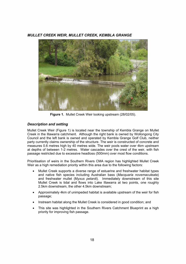
MULLET CREEK WEIR, MULLET CREEK, KEMBLA GRANGE
Figure 1. Mullet Creek Weir looking upstream (28/02/05).
Description and setting Mullet Creek Weir (Figure 1) is located near the township of Kembla Grange on Mullet Creek in the Illawarra catchment. Although the right bank is owned by Wollongong City Council and the left bank is owned and operated by Kembla Grange Golf Club, neither party currently claims ownership of the structure. The weir is constructed of concrete and measures 0.6 metres high by 40 metres wide. The weir pools water over 4km upstream at depths of between 1-2 metres. Water cascades over the crest of the weir, with fish passage restricted due to excessive headloss (500mm) over most flow conditions. Prioritisation of weirs in the Southern Rivers CMA region has highlighted Mullet Creek Weir as a high remediation priority within this area due to the following factors:
• Mullet Creek supports a diverse range of estuarine and freshwater habitat types and native fish species including Australian bass (Macquaria novemaculeata) and freshwater mullet (Myxus petardi). Immediately downstream of this site Mullet Creek is tidal and flows into Lake Illawarra at two points, one roughly 2.5km downstream, the other 4.5km downstream;
• Approximately 4km of unimpeded habitat is available upstream of the weir for fish passage;
• Instream habitat along the Mullet Creek is considered in good condition; and
• This site was highlighted in the Southern Rivers Catchment Blueprint as a high priority for improving fish passage.

19
Hydrology Mullet Creek Weir is located within the lower reaches of the perennial flowing Mullet Creek, and forms the tidal barrier to Lake Illawarra. Upstream of the weir pool, Mullet Creek ranges from 5-15 metres wide, with depth generally between 1-1.5 metres. No hydrological flow data has been recorded for Mullet Creek. Anecdotal evidence suggest that drown out occurs roughly 1-2 times per year, however this frequency has been inconsistent in the last 3-5 years. Operational Details Mullet Creek Weir was constructed in the late 19th century to prevent saltwater intrusion, provide a source of freshwater, and act as a horse and cart crossing prior to the construction of the Princess Highway. The structure has no formal ownership, although there are 7 water extraction licenses currently removing 335ML per annum from the weir pool for irrigation, stock, and domestic use. Diverters include the Kembla Grange Golf Club, which is the largest user at 199ML per annum. Additionally, most adjacent landholders use the weir pool for stock and domestic purposes (unlicensed). The weir is considered to be in relatively poor condition, with some large cracks allowing water to escape both under and through the weir wall. Ecological Considerations Mullet Creek Weir is the only barrier that restricts fish passage on the main stem of Mullet Creek. Remediation of fish passage at Mullet Creek Weir would restore natural connectivity between freshwater and marine habitats, an essential requirement for many native migratory fish species, including Australian bass, long finned, and short finned eel. Native freshwater fish species that undergo significant migrations and are expected to occur in the Wollongong Coast basin include: Australian bass, long finned eel, short finned eel, freshwater mullet, Australian smelt, Australian grayling, congolli, striped gudgeon, Cox’s gudgeon, freshwater catfish, freshwater herring, shortheaded lamprey, non-parasitic lamprey, and common jollytail. Introduced species including common carp, goldfish, and eastern gambusia are also expected to occur in this river (Creese and Hartley 2004). Water quality in Mullet Creek can vary according to rainfall and subsequent surface runoff, with upstream sources of pollution including a coal mine and waste treatment facility. Local Council maintains historical and up to date records of water quality results for Mullet Creek. Banks adjacent to the weir wall display moderately to poorly vegetated banks with minor erosion present downstream of the structure - presumably due to recreational fisher and boat access. Riparian vegetation is primarily composed of casuarinas, willows, and a mixture of exotic weed species (Figures 2 and 3). Instream vegetation in the weir pool is dominated by Cabomba spp. Siltation is present within the weir pool, with the difference in bed level reported to be approximately 0.5 metres higher on the upstream side of the weir.

20
Figure 2. Aquatic habitat immediately downstream of Mullet Creek Weir (28/02/05).
Figure 3. View of aquatic habitat upstream of Mullet Creek Weir (28/02/05).
Proposed Remediation Actions
• Option 1 – Removal of Mullet Creek Weir The complete removal of the structure would provide the greatest benefit to the health of the Mullet Creek by providing unrestricted fish passage and natural sediment fluxes. However, as the only source of irrigation water for the adjacent Golf course, and possibly for those diverting from upper sections of the weir pool, user groups do not currently support this option. Further investigation is required to determine alternative water sources that could be utilised by the limited number of weir pool users.

21
Consultation with Kembla Grange Golf Course has revealed that an on-course dam may be a viable alternative to extracting water from Mullet Creek weir pool. Prior to undertaking any removal works at this site, it is recommended that the sediment behind the weir be tested for heavy metals and other contaminants, as these may need to be removed and disposed of as part of the weir removal process.
• Option 2 – Partial width rock ramp fishway A partial width rock ramp fishway could be installed at this site to provide fish passage within Mullet Creek. Partial width rock ramp fishways aim to provide a series of pools, separated by small steps (or riffles) that allow for a gradual increase in elevation at an overall slope of 1:20 or 1:30 when in the lower end of a catchment (where juvenile fish with poorer swimming abilities are likely to be wanting to move). A partial width rock ramp fishway could be constructed on the right abutment of the weir at a slope of 1:30. In order to provide attractant flows, water will need to be directed to this side of the structure and down the fishway. Two options are available to enable this to occur: notching the weir crest at the site of the upstream fishway exit; or slightly raising the height of the weir wall using “cheater boards” to direct flow down the fishway. A rock ramp fishway would retain the stable pool heights above Mullet Creek Weir, maintaining the needs of weir pool users, however notching the weir crest to provide for attraction flows may lower the weir pool slightly. Further investigation will be required to determine to what level the upstream weir pool can be decreased before diverters are affected. Projected Remediation Costs Projected cost < $50K $50K - $150K $150K - $250K $250K - $500K > $500K Option 1 b Option 2 a Recommendation The preferred remedial action for this site is the removal of the structure (Option 1), however, further investigations are required to determine if alternative water sources (e.g. off-stream dams or bores) could be constructed, or whether licensed landholders could be compensated for the redesign of their existing water extraction equipment. If these alternatives prove unsatisfactory, the design and installation of a rock ramp fishway (Option 2) should be initiated. Benefits Associated with Remediation NSW DPI staff agree that Mullet Creek provides important fish habitat that should be protected, and that the reinstatement of fish passage along the entire system would bring about substantial benefits to the ecology of the catchment. Reinstating fish passage at Mullet Creek Weir would provide unimpeded access for fish and other aquatic organisms to habitat in excess of 10km, and reinstate the connection between estuarine and freshwater environments.
22
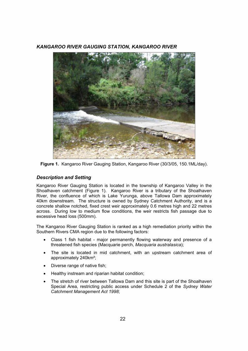
KANGAROO RIVER GAUGING STATION, KANGAROO RIVER
Figure 1. Kangaroo River Gauging Station, Kangaroo River (30/3/05, 150.1ML/day).
Description and Setting Kangaroo River Gauging Station is located in the township of Kangaroo Valley in the Shoalhaven catchment (Figure 1). Kangaroo River is a tributary of the Shoalhaven River, the confluence of which is Lake Yurunga, above Tallowa Dam approximately 40km downstream. The structure is owned by Sydney Catchment Authority, and is a concrete shallow notched, fixed crest weir approximately 0.6 metres high and 22 metres across. During low to medium flow conditions, the weir restricts fish passage due to excessive head loss (500mm). The Kangaroo River Gauging Station is ranked as a high remediation priority within the Southern Rivers CMA region due to the following factors:
• Class 1 fish habitat - major permanently flowing waterway and presence of a threatened fish species (Macquarie perch, Macquaria australasica);
• The site is located in mid catchment, with an upstream catchment area of approximately 240km²;
• Diverse range of native fish;
• Healthy instream and riparian habitat condition;
• The stretch of river between Tallowa Dam and this site is part of the Shoalhaven Special Area, restricting public access under Schedule 2 of the Sydney Water Catchment Management Act 1998;

23
• Fish passage is blocked by Tallowa Dam on Shoalhaven River approximately 40km downstream, however fish passage will soon be possible past this site due to a proposed fishway which is currently in its final stages of design. There are two other known man made barriers on the Kangaroo River – both upstream of this site (the first being approximately 12km upstream). Both barriers are wet causeways creating an impassable or difficult to pass headloss during normal flow conditions. These sites have been identified as medium priority for remediation works in a NSW DPI road crossing survey, with their priority likely to increase following the proposed works on Tallowa Dam; and
• This site was recognised in the Southern Rivers Catchment Blueprint as a high priority for improving fish passage.
Hydrology Kangaroo River hydrological data was determined from this gauging station (DNR site number 215010 and SCA site number 215220). Information was sourced from the DNR office in Bega using data acquired between 1/7/1954 and 1/3/1975 and from the SCA office in Penrith using data between 07/11/1973 and 21/10/2005. For the majority of time (10% - 75%) flows occurred within the range of 70 to 1,000ML/day, while over this period daily flows exceeded 1,000ML/day less than 10% of the time. Small sized flows of between 160 and 180ML/day occur roughly 50% of the time. Medium sized flows of up to 10,000ML/day occur more or less on an annual basis, while large flow events of around 30,000 - 40,000ML/day were experienced every two years on average. Highest flows occur from late summer to early winter, while the lowest flows are experienced in late spring and early summer. Drown out has been predicted to occur during flows in excess of 1848ML/day which occurs approximately 5% of the time based upon flow duration curves for Kangaroo River. It is assumed that fish passage is possible during this time. Operational Details The gauging station and control point structure were constructed in 1966 for gauging flows in the Kangaroo River, which continues to be its main purpose today. Currently no licensed water extractors draws from the weir pool. At the time of inspection the condition of the gauging station was relatively good. Ecological Considerations A fishway design for Tallowa Dam is in its final stages of production and will allow unimpeded fish passage up to the Kangaroo River Gauging Station. Although fish passage over Kangaroo River Gauging Station is possible during 5% of flow events, the timing of these flows may not necessarily coincide with spawning migrations of resident fish species within the Kangaroo River system.

24
Figure 2. Riffle zone on the Kangaroo River downstream of Kangaroo River Gauging
Station (30/3/2005, 150.1ML/day).
Figure 3. Kangaroo River upstream of Kangaroo River Gauging Station
(30/3/2005, 150.1ML/day).

25
Macquarie perch from the western drainage undertake spawning migrations usually between October and November when water temperatures reach 16ºC. If migration is impeded during this time, the number of potential spawning grounds can be dramatically reduced. In the case of the Kangaroo River population of Macquarie perch, a lack of drown out flows during October and November would restrict access to spawning sites above the river gauge. The Kangaroo River catchment supports a diverse range of native fish species. Native freshwater fish species that undergo significant migrations and are known to occur in the Kangaroo River include: Australian bass, long finned eel, short finned eel, Australian smelt, and striped gudgeon. Introduced species including common carp and goldfish are also known to occur in this river (Creese and Hartley 2004). Additionally, the river provides refuge for various waterbirds and the common platypus. The river contains important fish habitat components including riffles, large deep pools and cobble beds (Figures 2 and 3). The site has well vegetated banks with some erosion at fixed points adjacent to the structure which are frequented by user groups. Aquatic vegetation was not present within Kangaroo River at this site. Riparian vegetation was dominated by casuarinas, small stands of Ficus spp. and eucalypts. Proposed Remediation Actions The Kangaroo River Gauging Station is currently acting as a fish passage barrier at low to medium flows. It is therefore recommended that remedial activities be undertaken at this site to provide for fish passage at these flows.
• Option 1 – Partial width rock ramp fishway A partial width rock ramp fishway (or a modified form) could be installed at this site to provide fish passage within the Kangaroo River. The premise behind rock ramp and vertical slot fishways is to provide a series of pools connected by short steps or “riffles” on a slope of 1:20 to enable fish to traverse the structure. Ideally the location of the structure would be on the right bank, although due to its use as a flow gauging station, the upstream fishway exit may need to remain nearer the centre of the structure (the current low point). Due to the low structure height, the overall cost of installing the fishway could be minimised, although site access, and location of building materials and equipment may elevate costs slightly. As this site is a control point for gauging flows any fishway design must ensure that current and past flow data is not compromised. Following (and possibly during) construction, calibration with the current flow regime data will be required in order to preserve flow data dating back to 1966. Flow gauging results following the recent addition of a vertical slot fishway on Dalgety Weir (a control point for gauging flows in the Snowy River) could be used to help understand the impacts of modifying flow control point structures. Further discussions between NSW DPI and Sydney Catchment Authority will be required in order to determine the viability of this option, and to develop a remediation plan that incorporates the needs of all stakeholders.

26
• Option 2 – Removal The complete removal of this structure would provide the greatest benefit to the health of Kangaroo River and provide improvements in the availability of aquatic and riparian habitat to fish and other aquatic organisms. Much of the structure’s current function as a flow control point could potentially be met through alternative means. It is understood that new technologies can now allow natural control points to replace flow control structures such as this, with little compromise in the data collected. Projected Remediation Costs Projected cost < $50K $50K - $150K $150K - $250K $250K - $500K > $500K Option 1 a Option 2 b Recommendation As this structure is still required by the Sydney Catchment Authority, the construction of a partial width rock ramp fishway or modified form (Option 1) is the preferred remedial action for this site. If alternative gauging methods can be utilised, then removal (Option 2) is recommended to reinstate fish passage at this location. Benefits Associated with Remediation NSW DPI staff agree that the Kangaroo River system is important fish habitat that should be protected. Reinstatement of fish passage along the entire system would generate substantial benefits to the ecology of the catchment. By reinstating fish passage at the Kangaroo River Gauging Station, in excess of 50km of habitat would again become accessible to fish and other aquatic organisms.

27
DELEGATE TOWN WATER SUPPLY WEIR, DELEGATE RIVER, DELEGATE
Figure 1. Delegate River Town Water Supply Weir (2/3/05, <122.570ML/day).
Description and setting Delegate River Weir (Figure 1) is located approximately 1km from the township of Delegate on the mainstem of Delegate River. The weir is constructed of five concrete blocks approximately 2.2 metres in length and 400mm in depth. The weir wall measures 0.4 metres high by 12 metres wide, and pools water over 4km upstream at depths 1-1.5 metres. Water cascades over the crest of the weir and between the concrete blocks, with fish passage being restricted due to excessive headloss (200 - 500mm) during low-flow conditions. Prioritisation of weirs in the Southern CMA region has highlighted Delegate Weir as a high remediation priority within this region due to the following factors:
• The Delegate River is a major waterway in the Snowy River catchment, supporting a diverse range of montane habitat types and native fish species;
• The potentially threatened river blackfish (Gadopsis marmoratus) is found within the Delegate River;
• Approximately 11 km of unimpeded habitat is available upstream of the weir for fish passage; and
• Instream habitat along Delegate River is considered to be in excellent condition.

28
Hydrology Delegate Weir is located within the middle reaches of Delegate River. Water flow is perennial. Upstream of the weir pool, Delegate River ranges from 2-5 metres wide, with depth generally between 1-2 metres. Hydrological data was determined from the Delegate River gauging station (222014), which was removed around 1986/7. Information was sourced from the DNR office in Bega using data acquired between 1/01/1975 and 1/1/1986. Daily flow rate for the 30/3/05 was sourced from the Gauging Station at Quidong located approximately 13km downstream on the Delegate River. The Quidong gauging station has a number of creeks and major tributaries located upstream of this site which influence the flow rate, it is therefore assumed that the mean daily flow rate at Delegate Town Water Supply Weir was considerably less than 122ML/day. Between 1975 and 1986, for the majority of time (80%) flows were equal to or more than 39ML/day, while daily flows that were equal to or exceeded 196ML/day occurred less than 20% of the time. Moderate sized flows of up to 74ML/day occurred 50% of the time, whilst medium to large sized flow events over 800ML/day or more occurred less than 2% of the time. Highest flows took place in late winter and early spring, while the lowest flows were experienced in late summer and autumn. Although the timing of flows is unlikely to have changed significantly since 1986, flow volumes may have changed in the years since the Delegate River Gauging Station was removed. Drown out has been difficult to predict given the isolated nature of this site and the low flow conditions prevalent in this river over the last 5-10 years, however it is assumed that this structure would easily drown out during minor river rises following flooding events. Operational Details Delegate Weir was constructed in the 1950’s to provide the township of Delegate with a domestic water supply. The structure is now owned and managed by Bombala Council and continues to be used for its original purpose. Traditionally, irrigators have extracted water upstream of the weir pool however no licensed extractors are on file with DNR. The weir is considered to be in a working condition however the unfastened arrangement of concrete blocks allows a significant amount of water to be lost through a number of gaps in the structure. Prior to any remedial works being undertaken at this site (other than removal), the weir wall may require stabilisation and sealing to ensure that minimal flow is not lost. Ecological Considerations The Delegate River supports a diverse range of native fish species. Native freshwater fish species that undergo significant migrations and are known to occur in the Delegate River include: river blackfish, long finned eel, short finned eel, climbing galaxies, and common jollytail. Introduced species including brown trout and redfin perch are also known to occur in this river. Native freshwater fish species that undergo significant migrations and are expected to occur in the Snowy River basin include: freshwater herring, Australian smelt, Australian grayling, congolli, striped gudgeon, Cox’s gudgeon, shortheaded lamprey, and non-parasitic lamprey.

29
Introduced species including common carp, goldfish, brook char, Atlantic salmon, and eastern gambusia are also expected to occur in this river (Creese and Hartley 2004). Additionally, the river provides refuge for various waterbirds and the common platypus.
Figure 2. Riparian and instream habitat immediately downstream of Delegate Weir,
Delegate River (2/3/05, <122.570ML/day).
Figure 3. Riparian and instream habitat immediately upstream of Delegate Weir,
Delegate River (2/3/05, <122.570ML/day).

30
Water quality at Delegate is described as good, except during drought periods when stagnant pools form. The area surrounding the weir displays moderately to poorly vegetated banks with minor erosion present either side of the structure, presumably due to cattle access. Riparian vegetation is primarily composed of willows and a mixture of native grass species; instream vegetation is primarily composed of spike-rush (Schoenoplectus spp.) (Figures 2 and 3). Overall creek health would be improved by maintaining riparian fencing, removing willows, and revegetating disturbed banks that can be up to 10 metres above the average water level. Siltation, if present, is minor within the weir pool, with no difference in bed level being recorded either side of the weir. Proposed Remediation Actions
• Option 1 – Removal of Delegate River Weir The complete removal of the structure would provide the greatest benefit to the health of the Delegate River by providing unrestricted fish passage and restoring a more natural flow regime. Removal is not currently considered a viable alternative, however, as there are no alternative water supplies available for the township of Delegate, and the construction of an off-river structure exclusively as a town water supply would be an expensive alternative.
• Option 2 – Partial width rock ramp fishway A partial or full width rock ramp fishway could be installed at this site to provide fish passage within the Delegate River. A fishway is designed to form a series of pools, connected by small steps, or short riffles, so that an overall slope of 1:20 is created, allowing fish to traverse a structure. A full width rock ramp fishway extends across the entire width of the river, with a low flow channel present to allow fish passage during low flows. As the name suggests, a partial width rock ramp fishway only extends part way across the river channel, with water directed down a series of pools that are connected by small steps. Given that the weir wall is unstable, it will be necessary to refasten the concrete blocks and seal the wall to prevent leaks and direct flow solely down the fishway, prior to constructing the fishway itself. A greater volume of water is required for the operation of a full width rock ramp fishway. Due to the overall low flow conditions present in the Delegate River over the last 5-10 years, flows within the system may not be enough to allow a full width rock ramp fishway to operate effectively. Construction of a partial width rock ramp fishway is therefore recommended for this site. The location of the partial width fishway would be dependant on the surrounding base material (ideally positioned where bedrock is present), and where the water is currently directed, or could be directed to provide attractant flows (that will guide fish to the downstream fishway entrance).

31
A partial width rock ramp fishway is considered to be the most viable option, as it will improve water retention in the weir pool (through remediation of structure leaks), and provide adequate fish passage over a greater range of flow conditions than is currently possible. Bombala Council supports the concept of improving fish passage at this site in conjunction with improvements to the structural integrity of the weir wall, as this will improve water retention during low flow and drought periods, in addition to securing the weir wall in the event of a large flood. Projected Remediation Costs Projected cost < $50K $50K - $150K $150K - $250K $250K - $500K > $500K
Option 2 b Option 1 a
Recommendation Given the need to retain the structure to provide a water supply for the township of Delegate, and its current condition, the preferred remediation action for this site is the installation of a partial width rock ramp fishway in conjunction with enhancements to the weir wall (Option 2). This option will therefore provide both environmental and social benefits to the township of Delegate, and the Delegate River itself. Benefits Associated with Remediation NSW DPI staff agree that the Delegate River provides important montane fish habitat that should be protected, and that the reinstatement of fish passage along the entire system would generate substantial benefits to the ecology of the catchment. Reinstating fish passage at Delegate Weir would provide unimpeded access for fish and other aquatic organisms to habitat in excess of 100km.

32
DALGETY WEIR, SNOWY RIVER, DALGETY
Figure 1. Dalgety Weir and fishway (3/03/05, 98ML/day).
Figure 2. Vertical slot fishway on right abutment of Dalgety Weir. Note wood debris blocking downstream rock ramp fishway approach and vertical slot fishway entrance
(3/03/05, 98ML/day).

33
Description and setting Dalgety Weir (Figure 1) is located approximately adjacent the township of Dalgety in the middle to upper reaches of the mainstem of the Snowy River. Dalgety Weir is owned and operated by the Department of Natural Resources (DNR). The weir and vertical slot fishway (Figure 2) are constructed of concrete, with the weir measuring 1 metre high by 40 metres wide, and pooling water over 5km upstream at depths 1-2 metres. Water cascades over the crest of the weir, with fish passage previously being restricted due to excessive headloss (950mm) during low to medium flow conditions. Fish passage is now possible at the site due to the construction of a vertical slot fishway with rock ramp fishway approach at the downstream end, however the effectiveness of the vertical slot fishway is being compromised by woody debris blocking the downstream entrance and the rock ramp part of the structure. Prioritisation of weirs in the Southern CMA region has highlighted Dalgety Weir as a high remediation priority within the region due to the following factors:
• The Dalgety River is a major river within the Snowy River catchment supporting a diverse range of montane habitat types and native fish species;
• The potentially threatened river blackfish (Gadopsis marmoratus) is found within the Snowy River;
• Approximately 40km of unimpeded habitat is available upstream of the weir for fish passage; and
• Instream habitat along the Snowy River is considered to be in good condition with willow and bank rehabilitation conducted on a regular basis.
Hydrology Snowy River hydrological data was determined from this gauging station (222026). Information was sourced from the DNR office in Bega using data acquired between 1/1/1997 and 1/1/2006. For the majority of time (80%) flows are equal to or exceed 37ML/day, while daily flows that equal or exceed 124ML/day occur less than 10% of the time. Moderate sized flows of up to 47ML/day occur 50% of the time. Overall, significant flow events over 200 ML/day or more occur less than 4% of the time. Highest flows occur in late winter and spring, while the lowest flows are experienced in autumn. Drown out of the weir is predicted to occur during flows greater than 480ML/day which occur less than 2% of the time. Flows are dictated by both rainfall levels and environmental flow releases from Jindabyne Dam in the upper reaches of the catchment. Following the decommissioning of the Mowamba Aquaduct in 2002, 38GL per year has been added to flows in the Snowy River. The average flow at this site has increased from 50ML/day to 100ML/day. Operational Details Dalgety Weir was constructed during the late 1960’s (following construction of Jindabyne Dam) to provide the township of Dalgety with a domestic water supply.

34
Figure 3. Riparian and instream habitat immediately downstream of Dalgety Weir
(3/03/05, 98ML/day).
Figure 4. Riparian and instream habitat immediately upstream of Dalgety Weir
(3/03/05, 98ML/day).

35
Currently the weir also provides DNR with a control point from which stream flows can be measured to allow the effective management of the catchment and its associated flow regime. It also provides a weir pool for stock and domestic water supply. Since 1997, a vertical slot fishway, with a partial width rock ramp fishway approach at the downstream end has been in operation providing fish passage past the site for the majority of the time (except when the structure is blocked with debris – refer Figure 2). Ecological Considerations The Snowy River supports a diverse range of native fish species. Native freshwater fish species that undergo significant migrations and are known to occur in the Snowy River include: Australian bass, long finned eel, short finned eel, freshwater mullet, Australian smelt, Australian grayling, congolli, striped gudgeon, shortheaded lamprey, non-parasitic lamprey, and common jollytail. Introduced species including common carp, brown trout, redfin perch, goldfish, and eastern gambusia are also known to occur in this river (Creese and Hartley 2004). Additionally, the river provides refuge for various waterbirds and the common platypus. Water quality at Dalgety is described as good to excellent since the environmental flows were initiated. The weir site displays moderately to poorly vegetated banks with minor erosion present either side of the structure, presumably due to recreational fisher and cattle access. Riparian vegetation is primarily composed of willows and native grass species, with instream vegetation primarily composed of spike-rush (Schoenoplectus spp.) (Figures 3 and 4). Overall river health would be improved by maintaining riparian fencing, removing willows, and revegetating disturbed banks, which reach up to 10 metres above the water level. Siltation, if present, is minor within the weir pool; with no difference in bed level being recorded either side of the weir. Upstream of the weir pool, the Snowy River ranges from 15-40 metres wide, with depth generally between 1-2 metres (Figure 4). Proposed Remediation Action
• Option 1 – Maintenance and monitoring regime In order to maintain an effective, working vertical slot fishway and stream flow gauging station immediately downstream of the weir, a maintenance and debris removal regime is required. At the time of inspection, large woody debris was deposited at the downstream entrance of the vertical slot fishway following medium sized flooding events, which has compromised the functionality of the fishway. Maintenance priority should be given to the fishway’s upstream trash rack, the downstream partial width rock ramp fishway that leads to the vertical slot fishway entrance, and the downstream entrance to the vertical slot fishway itself. Maintenance should be undertaken either be on a 3-4 month periodical basis, or following medium or large flood events. A monitoring program should also be established to gauge the effectiveness of the fishway.

36
The program should identify what fish and invertebrate species are utilising the fishway, their size class, and the preferred hydrological conditions for effective negotiation through the fishway. Projected Remediation Cost Projected cost < $50K $50K - $150K $150K - $250K $250K - $500K > $500K Option 1 b Recommendation The only recommendation for this site is to establish a maintenance program that will ensure unimpeded fish passage through the partial width rock ramp fishway entrance, and through the vertical slot fishway itself. Regular maintenance of the fishway will also ensure the effective operation of the downstream gauging station. Benefits Associated with Remediation NSW DPI staff agree that the Snowy River provides important montane fish habitat that should be protected, and that the reinstatement of fish passage along the entire system would generate substantial benefits to the ecology of the catchment. The establishment of a maintenance regime would sustain effective fish passage at Dalgety Weir and continue to provide unimpeded access for fish and other aquatic organisms to habitat in excess of 95km.

37
CROOBYAR CREEK WEIR No. 6, CROOBYAR CREEK, MILTON
Figure 1. Croobyar Creek Weir No. 6 (28/2/05).
Description and setting Croobyar Creek Weir No. 6 (Figure 1) is located approximately 3km from Milton on the mainstem of Croobyar Creek. The weir is constructed of concrete and measures 0.75 metres high by 10 metres wide. The weir pool extends over 200 metres upstream at depths between 1-1.5 metres. Water cascades over the crest of the weir, with fish passage being restricted due to excessive headloss (750mm) during most flow conditions. The Croobyar Creek Weir No. 6 is ranked as a high remediation priority within the Southern Rivers CMA region due to the following factors:
• Fish passage remediation works are expected to occur on the five weirs upstream of this site on Croobyar Creek following assessements by State Water;
• Croobyar Creek supports a diverse range of marine and freshwater habitat types and native fish species including Australian bass (Macquaria novemaculeata) and Freshwater mullet (Myxus petardi). Immediately downstream of this site Croobyar Creek is brackish, joining the ocean roughly 6km downstream via Narrawallee Inlet;
• This site has been noted by NSW DPI research staff as having extraordinarily large numbers of juvenile Australian bass (Macquaria novemaculeata) and long finned eel (Anguilla reinhardtii) aggregating below this structure; and
• Approximately 2km of unimpeded habitat is available upstream of the weir for fish habitat with plans to extend this via the installation of fishways on upstream weirs.

38
Hydrology No hydrological flow data has been recorded for Croobyar Creek. Croobyar Creek Weir is located within the lower reaches of Croobyar Creek. Waterflow is perennial except when water extraction exceeds environmental flows during dry periods. Upstream of the weir pool, Croobyar Creek ranges from 3-10 metres wide, with depth generally between 1-1.5 metres. Operational Details Croobyar Creek Weir was constructed in 1903 to provide freshwater for irrigation, stock, and domestic use through the prevention of saline intrusion upstream of the site. The structure is now jointly owned by the two adjacent landholders and continues to be used for its original purpose. Over 12 extraction licenses exist on Croobyar Creek totalling 223ML per annum. The weir is considered to be in a working condition. Ecological Considerations Croobyar Creek Weir No. 6 is the first of six anthropogenic barriers that restrict fish passage on Croobyar Creek. Remediation of fish passage at this site would address the tidal barrier and aid in restoring fish passage on Croobyar Creek. A number fish species require access to marine and freshwater habitats in order to complete certain stages of their life cycles. The lower section of the catchment supports a diverse range of native fish species including migratory species such as the Australian bass and freshwater mullet. Native freshwater fish species that undergo significant migrations and are expected to occur in the Clyde River-Jervis Bay drainage basin include: Australian bass, long finned eel, short finned eel, freshwater mullet, Australian smelt, Australian grayling, congolli, striped gudgeon, Cox’s gudgeon, freshwater herring, short headed lamprey, non-parasitic lamprey, and common jollytail. Introduced species including common carp, goldfish, and eastern gambusia are also expected to occur in this river (Creese and Hartley 2004). Water quality above this site is described as good except during drought periods when stagnant pools form. The weir displays moderately to poorly vegetated banks with minor erosion present both upstream and downstream of the structure presumably due to cattle access. Riparian vegetation is primarily composed of casuarinas, tea tree (Leptospermum spp.), and a mix of eucalypt species. Groundcover is dominated by pasture grasses and introduced weeds. There is no fencing on either side of the creek with cattle able to gain regular access to the waterway. Overall creek health therefore would be improved by enhancing riparian vegetation through strategically fencing sections of the bank. Minor siltation is present within the weir pool, however no difference in bed level was recorded either side of the weir.

39
Figure 2. View of rock platform adjacent to Croobyar Creek Weir (28/2/05).
Figure 3. Riparian and instream habitat immediately downstream of
Croobyar Creek Weir (28/2/05).

40
Proposed Remediation Actions
• Option 1 – Removal The complete removal of the structure would provide the greatest benefit to the health of the Croobyar Creek by providing unrestricted passage to fish and other aquatic organisms, and reinstating natural sediment fluxes. However the present owners require the weir to maintain the freshwater/saline interface, and provide a consistent freshwater source for stock, irrigation, and domestic needs. This option is therefore considered to be untenable at present, although could be revisited if alternative water sources for the properties become available.
• Option 2 – Partial width rock ramp fishway A partial width rock ramp fishway could be constructed on the left downstream bank, utilising the natural rock platform present. A partial width rock ramp fishway is constructed to form a series of pools separated by short steps of riffles, with an overall slope of 1:20 created. To provide attraction flows and enable flows to be directed down the fishway, a notch could be cut into the weir crest. The notch itself may only need be as small as 200mm to direct flows down the fishway, although any lowering of the weir crest may slightly impact on the volume of the upstream weir pool. Alternatively a small increase in the height of the remaining weir crest (capping – either with concrete, or with wood beams) could be used to concentrate attraction flow towards the left bank and the rock ramp fishway. It should be noted that any lowering of the weir crest height will decrease the cost of fishway construction, with an increase in weir crest height adding to the overall cost of construction. Investigation into the weir pool volume should be undertaken to determine extractor requirements and therefore leeway for changes to the weir crest height. Projected Remediation Costs Projected cost < $50K $50K - $150K $150K - $250K $250K - $500K > $500K Option 1 b Option 2 a Recommendation The preferred remediation action for this site is the installation of a partial width rock ramp fishway (Option 2). Investigations will be required to determine the effect of fishway construction and operation on weir pool height fluctuations and existing licensed landholders utilising the upstream weir pool. Benefits Associated with Remediation Croobyar Creek provides important fish habitat that should be protected. Reinstatement of fish passage along the entire system would generate substantial benefits for the ecology of the catchment. Reinstating fish passage at Croobyar Creek Weir would provide unimpeded access for fish and other aquatic organisms to both freshwater and marine habitat in excess of 8km.

41
BRAIDWOOD TOWN WATER SUPPLY OFF-TAKE WEIR, SHOALHAVEN RIVER
Figure 1. Braidwood Town Water Supply Off-Take Weir, Shoalhaven River
(30/3/05, 53.5ML/day).
Description and Setting Braidwood town water supply off-take weir is located in the near the township of Braidwood in the Shoalhaven catchment and is owned by Palarang Council (previously the Eastern Capital City Regional Council). The structure is a concrete fixed crest weir approximately 1-1.5 metres high and 30 metres across. The weir is L-shaped, with both sides roughly 15 metres in length. During low to medium flow conditions, the weir restricts fish passage due to excessive head loss (~1000mm). The Braidwood town water supply off-take weir is ranked as a high remediation priority within the Southern Rivers CMA region due to the following factors:
• Class 1 fish habitat (major permanently flowing waterway and presence of a threatened fish species, Macquarie perch (Macquarie australasica);
• Although the site is located in the upper end of the catchment the upstream catchment area is approximately 1400km²;
• The middle to upper sections of the Shoalhaven catchment possess a diverse range of native fish including unique, isolated populations of freshwater catfish and western carp gudgeon;
• Healthy instream and riparian habitat condition; and
• Fish passage is blocked by Tallowa Dam on Shoalhaven River approximately 140km downstream, however fish passage will soon be possible past this site due to a proposed fishway which is currently is in its final stages of design. There are no other known weirs on the Shoalhaven River, although there several causeway road crossings that may prevent fish passage at low flows.
Hydrology Information was sourced from the DNR office in Bega using data acquired between 1/9/1914 and 1/1/2006.
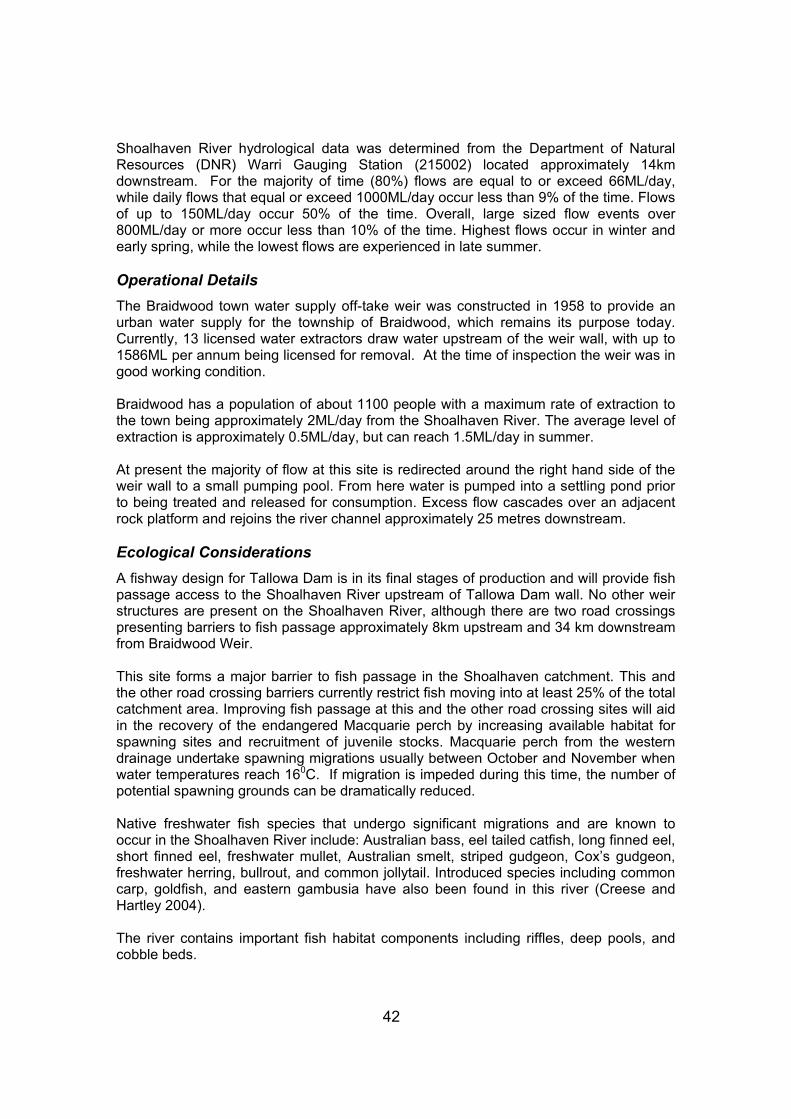
42
Shoalhaven River hydrological data was determined from the Department of Natural Resources (DNR) Warri Gauging Station (215002) located approximately 14km downstream. For the majority of time (80%) flows are equal to or exceed 66ML/day, while daily flows that equal or exceed 1000ML/day occur less than 9% of the time. Flows of up to 150ML/day occur 50% of the time. Overall, large sized flow events over 800ML/day or more occur less than 10% of the time. Highest flows occur in winter and early spring, while the lowest flows are experienced in late summer. Operational Details The Braidwood town water supply off-take weir was constructed in 1958 to provide an urban water supply for the township of Braidwood, which remains its purpose today. Currently, 13 licensed water extractors draw water upstream of the weir wall, with up to 1586ML per annum being licensed for removal. At the time of inspection the weir was in good working condition. Braidwood has a population of about 1100 people with a maximum rate of extraction to the town being approximately 2ML/day from the Shoalhaven River. The average level of extraction is approximately 0.5ML/day, but can reach 1.5ML/day in summer. At present the majority of flow at this site is redirected around the right hand side of the weir wall to a small pumping pool. From here water is pumped into a settling pond prior to being treated and released for consumption. Excess flow cascades over an adjacent rock platform and rejoins the river channel approximately 25 metres downstream. Ecological Considerations A fishway design for Tallowa Dam is in its final stages of production and will provide fish passage access to the Shoalhaven River upstream of Tallowa Dam wall. No other weir structures are present on the Shoalhaven River, although there are two road crossings presenting barriers to fish passage approximately 8km upstream and 34 km downstream from Braidwood Weir. This site forms a major barrier to fish passage in the Shoalhaven catchment. This and the other road crossing barriers currently restrict fish moving into at least 25% of the total catchment area. Improving fish passage at this and the other road crossing sites will aid in the recovery of the endangered Macquarie perch by increasing available habitat for spawning sites and recruitment of juvenile stocks. Macquarie perch from the western drainage undertake spawning migrations usually between October and November when water temperatures reach 160C. If migration is impeded during this time, the number of potential spawning grounds can be dramatically reduced. Native freshwater fish species that undergo significant migrations and are known to occur in the Shoalhaven River include: Australian bass, eel tailed catfish, long finned eel, short finned eel, freshwater mullet, Australian smelt, striped gudgeon, Cox’s gudgeon, freshwater herring, bullrout, and common jollytail. Introduced species including common carp, goldfish, and eastern gambusia have also been found in this river (Creese and Hartley 2004). The river contains important fish habitat components including riffles, deep pools, and cobble beds.

43
The site has well vegetated banks with some erosion at fixed points upstream and downstream of the structure, presumably from cattle accessing watering points. Aquatic vegetation in the weir pool is dominated by spike rush. Riparian vegetation is dominated by matt rush, with small stands of Ficus spp. and eucalypts (Figures 2 and 3).
Figure 2. Shoalhaven River downstream of Braidwood Town Water Supply Weir
(30/3/05, 53.5ML/day).
Figure 3. Shoalhaven River upstream of Braidwood Town Water Supply Weir
(30/3/05, 53.5ML/day).

44
Historically significant Chinese ‘rock runs’ are scattered along the bank adjacent to the site but would not be affected by any recommended works due to their high position along the river bank. Proposed Remediation Actions
• Option 1 – Partial width rock ramp fishway Uneven rocky platforms surround this site, making construction of a vertical slot fishway difficult and costly. However a partial width rock ramp could utilise the rock platform immediately below and adjacent to the weir wall as a foundation or base. A partial width rock ramp fishway is formed by a series of pools and short steps or riffles that allow fish to pass the structure on an overall slope of 1:20. Coincidentally, the rock platform present below the weir wall has a slope of approximately 1:20, lending itself as the base of the fishway. In addition, the original flow path has formed a natural channel downstream of the weir, which could also potentially be used to form a fishway. Modifications to the weir may be required in order to provide sufficient flow through the proposed fishway, and maintain water diversion activities. It is recommended that a 200mm recess be cut into the weir crest where the upstream entrance of the fishway will be located to direct flows down the fishway. In addition, it may be necessary to seal parts of the downstream rock platform to minimise flow escaping downstream past the pumping pool. Further discussions with the structure owners and NSW DPI is required in order to identify the viability of this option, and the most suitable location for the rock ramp fishway.
• Option 2 – Removal The complete removal of this structure would provide the greatest benefit to the health of Shoalhaven River and provide improvements in the availability of aquatic and riparian habitat. However there are presently no viable alternatives for supplying town water to Braidwood, making this option not a viable alternative at this time. Projected Remediation Costs Projected cost < $50K $50K - $150K $150K - $250K $250K - $500K > $500K Option 1 b Option 2 a Recommendation The construction of a partial width rock ramp fishway (Option 1) is the preferred remedial action for this site. The abundance of local rock, and the presence of the rock platform with a natural 1:20 slope, ensures some costs associated with construction of the fishway will be minimised. Due to the continued use of the weir pool as a water supply for Braidwood, removal of the structure is currently not a viable option.

45
Benefits Associated with Remediation NSW DPI staff agree that the Shoalhaven River system possesses important fish habitat that should be protected. Reinstatement of fish passage throughout the system would generate substantial benefits to the ecology of the catchment. Reinstatement of fish passage at the Braidwood Town Water Supply Off-Take Weir would allow for in excess of 200km of habitat to again become accessible to fish and other aquatic organisms.

46
6. REFERENCES Baumgartner, L.J. (2005). Effects of Weirs on Fish Movements in the Murray – Darling Basin. Thesis Submitted for the Degree of Doctor of Philosophy. University of Canberra, Canberra, Australia. Creese and Hartley (2004). NSW DPI Freshwater Fish Research Database. Port Stephens Fisheries Centre, Nelson Bay, NSW. Fairfull, S. and Witheridge, G. (2003). Why do fish need to cross the road? Fish passage requirements for waterway crossings. NSW Fisheries, Cronulla, 16pp. Gehrke, P.C. and Harris, J.H. (2001). Regional-scale effects of flow regulation on lowland riverine fish communities in New South Wales, Australia. Regulated Rivers: Resource Management. 17: 369-391. Gehrke, P.C., Gilligan, D.M., and Barwick, M. (2001). Fish communities and migration into the Shoalhaven River: before construction of a fishway. NSW Fisheries Final Report Series, no. 26. Harris, J., Edwards, E., and Curran, S. (1992). Bourke Weir fish passage study. NSW Fisheries Research Institute unpublished report, Sydney. Mallen-Cooper, M. (1994). Swimming ability of adult golden perch, Macquaria ambigua (Percicthyidae), and adult silver perch, Bidyanus bidyanus (Teraponidae), in an experimental vertical slot fishway. Australian Journal of Marine and Freshwater Research. 45: 191-198. Marttin and Graaf (2002). The effect of a sluice gate and its mode of operation on mortality of drifting fish larvae in Bangladesh. Management and Ecological Note. In: Fisheries Management and Ecology. 9: 123 – 125. NSW Fisheries (2002). Initial weir and floodgate review. Report for the State Weir Review Committee. NSW Fisheries, Ballina. NSW Fisheries (2003). Policy and guidelines for fish friendly waterway crossings. Fishnote Series NSWF1181, NSW Fisheries, Cronulla NSW. Pethebridge, R., Lugg, A., and Harris, J. (1998). Obstructions to fish passage in New South Wales south coast streams. Final Report Series 4, Cooperative Research Centre for Freshwater Ecology and NSW Fisheries, Cronulla, NSW. Smith, A.K, and Pollard, D.A. (1998). Policy and guidelines. NSW Fisheries Office of Conservation, Sydney. 76 pp. Thorncraft G.A. and Harris J.H. (1996). Assessment of rock-ramp fishways. Report for the Environmental Trusts, NSW Environmental Protection Authority, Border Rivers Commission, Department of Land and Water Resources, and Wyong Council. Fisheries Research Institute, Cronulla. Thorncraft, G. and Harris, J.H. (2000). Fish passage and fishways in NSW: A status report. Cooperative Research Centre for Freshwater Ecology Technical Report 1/2000.

47
Williams, R.J., Watford, F.A. and M.A. Taylor (1996). A summary of aspects of FRDC project 94/041 “Restoration of estuarine fisheries habitat” relevant to tidal obstructions in New South Wales estuaries. NSW Fisheries Research Institute, Cronulla, NSW, 109pp.

48
7. APPENDICES Appendix A: Detailed Weir Assessment Proforma Please note: It is important to complete as much of this form as possible in the office to avoid unnecessary delays in the field. PRELIMINARY QUESTIONS Fish Passage 1. Is the structure a barrier to fish passage (a drop of 10cm can create a barrier, as can high velocities through
round piped culverts) YES/ NO. (i) Please describe (eg. Drop >10cm, Slope >1:20, Increased velocity, Increased turbulence, Debris, Minimum
Flow depth (<200mm)……………………………………………………………………………………………. (ii) Significance of the structure as a barrier to fish passage: headloss (height of fall from headwater to
tailwater)……………………..cm
(iii) Description of water flow over structure Vertical fall/ steep cascade/ moderate cascade/ gentle incline/ high velocity through pipe/ Moderate velocity through pipe/ other……………….. Date of review:
Name of Reviewer: Contact phone No: SECTION 1 OWNERSHIP AND LICENCE INFORMATION 1a Barrier/ Structure location information: Name of weir: General directions, landmarks etc:
Name of nearest town: Grid Reference: Name of Watercourse:
Catchment Management Area: Local Government Area:
(it is essential that a topographic map be attached for the location of each weir) 1b Structure Ownership details:
Type (eg. private, local Govt., state Govt): Owner Name: ..................................................................................................….........
1c Land Ownership details:
Owner of land on which structure is built DIPNR/ State Water/ Crown Land/ Private / Other…………………………………………………………….. Is access to the structure via Easement / Public road / Other………………………………………
Property Boundaries on which structure is located Lot………………….Dp………………………… Plan Number………………………………………………………………………………………. 1d Contact person for weir assessment details: Position Title: Owner name: Office Address: Phone: Mobile:

49
1e Weir Licence details (if applicable): Licence No: .................................................................................................................... Date of issue: .......................................... Date of expiry: ............................................. Licensing Office: .................................................................................................................... License Type (stock/domestic/irrigation/other):…………………………………………………….. SECTION 2 STRUCTURAL AND OPERATIONAL DETAILS 2a (i) Type of Structure (Please describe): (ii) Barrier Construction material: Concrete Earth & rock Sheet piling with rock fill or other ………………………… Cribwork or gabion modules with rock fill or other …………………………
(cribwork type/material eg. steel or timber)……………………… 2b Structure dimensions: ………………….. (m) crest length (length in metres at the weir crest) ………………….. (m) vertical height (from the downstream toe to weir crest)
2c (i) Barrier type (eg. fixed or adjustable release structure): Fixed Crest Structure Adjustable release structure (ii) Release operations (if gated or regulated):
………………….. mechanism (eg. Gates, valves, removable boards, spillway etc.) ........................... release frequency ........................... duration ........................... season of opening (iii) Additional features of structure (eg. Bottom release valve, skimmer box or siphon outlet configuration –
for surface release, existing fishway, navigation lock, spillway, automated operation etc.): 2d (i) Is the structure critical to the operations of the property or land use adjacent? Yes / No Please provide brief details:
.......................................................................................................................................................................... 2d (ii) Could the current operation of the structure be modified to improve environmental conditions? ..................................................................................................................................................... 2e (i) What is the current condition of the structure? working unserviceable decommissioned (ii) In terms of structural stability, does the structure require any of the following? Yes / No immediate modification replacement maintenance
Please provide details:

50
SECTION 3 WEIR/BARRIER USE 3a (i) Date of construction: (ii) Original use or purpose/s (if known): 3b (i) Current purpose/s of the structure (eg. Irrigation, flood control, town water supply, re regulation,
domestic, stock, industrial, drought water storage, recreation, river crossing, access). Please comment. (ii) Additional uses (eg. Recreation, aesthetic, road crossing, environment, boundary fence).
Please comment.
3c (i) Number of direct weir pool users (eg. Pumping licences upstream & downstream licenses served) List Users; 1 ……………………………………….. 2 ……………………………………………… 3 ……………………………………….. 4 ……………………………………………… 4 ……………………………………….. 6 ……………………………………………… (For more users please use separate sheet) (ii) Number of licensed customers using weir pool (Please fill out attached sheet – Appendix 1 to provide details of these customers) (iii) Number of Riparian Stock and Domestic pumps using weir pool (iv) Additional beneficiaries of structures (eg. Local community water supply, fishing groups) 3d (i) List any recognised Heritage or cultural values associated with the structure. (Check heritage list)
See Austral & ERM (2003) for details and also check the heritage resister at http://www.heritage.nsw.gov.au.
….................................................................................................................................................. (ii) List any areas of Aboriginal Heritage significance associated with the structure. (Contact should be
made with local Aboriginal Lands Council & Department Environment & Conservation office to discuss aboriginal issues).
….................................................................................................................................................. 3e What types of land use operates in the riparian and floodplain zones adjacent to the weir pool? ….................................................................................................................................................. ….................................................................................................................................................. SECTION 4 WEIR SETTING 4a (i) What is the stream classification of the watercourse at the weir location? (please refer to appendix 2) (ii) How wide is the watercourse upstream of the weir pool (beyond the influence of the weir)?
(m) (iii) Is the watercourse a tributary, anabranch, or floodrunner? 4b (i) What is the total catchment area upstream of the weir? ….......... (sq. km) (ii) What is the proportion of the catchment controlled by the weir (upstream to the next river bed
obstruction include natural and artificial). ….......... %

51
4c (i) What is the distance upstream of the weir to the next major river bed obstruction (eg. Weir or other barrier)? Please name structure.
(km) Structure name and/or type
(ii) What is the distance downstream of the barrier to the next major river bed obstruction (including natural)?
(km) Structure name and/or type (iii) Is the barrier a Coastal River? Yes / No
If Yes is the barrier a tidal barrage or located in the tidal zone or immediately upstream of the estuary? Please provide details: …………………………………………………………………………………………………………………..
(iv) Do upstream water users pump freshwater from weir pool? If yes how may they be affected by removal of the structure?(Obtain advise as necessary eg hydrologist) ……………………………………………………
4d What section of the catchment is the structure located (circle one)? Upper Middle Lower SECTION 5 HYDROLOGY INFORMATION 5a (i) What is the average depth of water in the pool immediately upstream of the barrier? …........... (m) 5a (ii) What is the height of the stream banks above the crest of the structure? …………(m) 5b Is there a defined weir pool? If yes, how long is it? Yes / No (m) 5c (i) Is there a continuous flow across the crest of the barrier? Or through a pipe, gate or other
regulator? Yes / No Yes / No (ii) Is the stream regulated or unregulated Regulated / Unregulated (iii) How does the flow vary? (eg daily, seasonally, flood, rainfall)
Comments:
…...................................................................................................................................................
5d How frequently does drownout occur? ….......... (per year) OR don’t know 5e (i) Is there information on the water quality in the weir pool or releases? Yes / No If yes where is the information held or located? ….................................................................................................................................................. (ii) Is there evidence of salinity, acid sulphate soils, scalding, or other soil problems in the vicinity of
the weir pool? Yes / No / don’t know Please describe:
….................................................................................................................................................. (iii) Has there been any changes to groundwater levels in the vicinity of the weir pool? Yes / No / don’t know

52
SECTION 6 GEOMORPHIC INFORMATION 6a Are there any signs of bed erosion downstream of the barrier? Yes / No / don’t know Comments: 6b (i) What is the condition of the stream banks adjacent to the barrier? Intact minor erosion extensive erosion Please describe:
(ii) What is the condition of the stream banks upstream of the barrier? Intact minor erosion extensive erosion Please describe: 6b (iii) What is the condition of the stream banks downstream of the barrier? Intact minor erosion extensive erosion Please describe: 6c (i) Is there any evidence of siltation in the weir pool? Yes / No / don’t know
Please describe:…………………………………………………………………………………………. (ii) If yes, what is the difference in bed level on the upstream and downstream side of the barrier wall?
…............ (m)
(iii) Has any mining or other associated activities taken place in the catchment upstream of the
structure?
Is there any chance of contaminated sediment behind structure ie. Heavy metals etc? (Please provide details……………………………………………………………………………………….
6d (i) Is there an accumulation of debris around the structure? (eg LWD, sediment, gross pollutants etc) Yes / No Please describe (ii) If yes, is it causing problems to the structure or operation of gates, spillways or fish ladders
associated with the weir? Yes / No
Please describe: ………………………………………………………………………………………………………………. 6e (iii) Is desnagging carried out upstream of the structure? Yes / No / don’t know
SECTION 7 ECOLOGICAL CONSIDERATIONS 7a (i) Does the structure have a fishladder, rock ramp, or some other allowance for fish passage? Yes / No structure type: ….................................................. (ii) If yes, has there been fish monitoring and/or an inspection to support fish passage?
Yes / No / don’t know
Comments:

53
(iv) What native fish species are present or are expected to occur at this site (ie. Refer to guidelines + local knowledge if available).
…………………………………………………………………………………………………………………………………………………………………………………………………………………………………………………………
(v) What introduced fish species are present or are expected to occur at this site (ie. Refer to
guidelines + local knowledge).
…………………………………………………………………………………………………………………………………………………………………………………………………………………………………………………………
7b (i) Has there been any outbreak of nuisance aquatic/riparian weeds within the weir pool area eg. lippia, water hyacinth, willows ?
Yes / No Comments:
.................................................................................................................................................. (ii) Have there been any outbreaks of blue-green algae?
Yes / No/ don’t know If yes, what time of year and how frequently do outbreaks occur? …........................... season ….................. (frequency)
7c (i) How extensive is the vegetation cover on the banks of the river? (<50m from water line). Well vegetated moderately vegetated poorly vegetated Dominant species present (including native and introduced): …................................................................................................................................................... Please comment on native riparian vegetation and introduced plant species: …................................................................................................................................................... (ii) Is there any evidence of dieback occurring near the weir pool? Yes / No Comments: ….................................................................................................................................................. ….................................................................................................................................................. 7d What percent of the weir pool area is colonised by aquatic vegetation eg. Phragmites, cumbungi? <5% 5-10% 10-30% <30% Dominant species present (including native and introduced): …................................................................................................................................................... 7e Are there any rare and threatened flora and fauna species, populations or communities known to
occur in the area? Yes / No / Don’t know Comments ……………………………………………………………………………………………………………………………
…………………………………………………………………………………………………………………………… 7f (i) Is the river bank along the weir pool fenced?
Yes / No / partial one side / both sides Comments: …..................................................................................................................................................

54
(ii) Do stock have access to the river?
Yes / No / partial one side / both sides Comments: …..................................................................................................................................................
SECTION 8 RECOMMENDATIONS 8a Removal Option YES / NA (please circle) (i) Is the structure required by the adjacent Landholders? Yes / No.
Comments:
…...................................................................................................................................................................
(ii) Is the structure required by the Community, fishing club, access, aesthetics? Yes / No.
Comments:
…..................................................................................................................................................................
(iii) Is the structure acting as a bed control structure? (Seek advice from DIPNR if unsure) ……………………………………………………………………………………………………………………….…… If the Answer to Question 8 (i)-(iii) is No Is demolition of the structure supported by owner? Yes / No
Comments:
….............................................................................................................. Would any person or group object to the weir being demolished? Please describe:
….................................................................................................................................................................
…........................................................................................................................................……………........ (vi) Is the weir remote/difficult to access? Yes / No
If Yes, please describe access/location (Is there all weather access?) …………………………………………………………………………………………………………………………… ……………………………………………………………………………………………………………………………
(VI) ESTIMATED COST OF REMOVAL/PARTIAL (USE COST MATRIX- APPENDIX 3) OR CONTRACTOR QUOTE? 8b Fishway options YES/NA (please circle)
(i) Does the structure lend itself to the addition of a fishway? YES/NO (ii) Fishway type best suited to the structure (Please take into account habitat, fish species, hydrology of
watercourse)? Vertical slot / Full Width Rock Ramp / Partial Width Rock Ramp / Denil Insert/
Lock/ Other
(III) ESTIMATED COST OF FISHWAY BASED ON APPROX. $150 000 PER VERTICAL METER? = Comments (Include supporting literature and any correspondence with fishway experts):
………………………………………………………………………………………………………………………………………
………………………………………………………………………………………………………………………………………
……………………………………………………………………………………………………………………………………… 8c Modification of Structure to allow for fish passage (i) Please describe proposed works (eg. Box culverts etc)? ………………………………………………………………………………………………………………………………………
………………………………………………………………………………………………………………………………………

55
(II) ESTIMATED COST OF PROPOSED WORKS 8d Suggested management action (eg removal of drop boards, gated weir opening, removal of debris)
Comments (Include supporting literature and correspondence)
………………………………………………………………………………………………………………………………………
………………………………………………………………………………………………………………………………………
………………………………………………………………………………………………………………………………………
………………………………………………………………………………………………………………………………………. 8e No action recommended Comments (Include supporting literature and correspondence)
………………………………………………………………………………………………………………………………………
………………………………………………………………………………………………………………………………………
………………………………………………………………………………………………………………………………………
……………………………………………………………………………………………………………………………………….
SECTION 9 ADDITIONAL INFORMATION For further information:
• Austral Archaeology Pty Ltd & ERM Australia Pty Ltd, (2003), Heritage Assessment of 206 River Structures, Coastal and Central Regions, NSW, (Final Report and Appendix A: Group Two, Volume One).
• NSW DPI (Fisheries) Aquatic Habitat Rehabilitation database
• Pethebridge, Lugg and Harris (1998) Obstructions to fish passage in New South Wales south coast streams.
NSW Fisheries final report series No 4 ISSN 1440-3544
• Williams RJ, Watford FA (1996) An inventory of impediments to tidal flow in NSW estuarine fish habitats
Wetlands (Australia) 15, 44-54.

56
Appendix B: Weir Prioritisation Scheme for NSW Coastal CMAs
INITIAL PRIORITISATION A) STREAM HABITAT VALUE SCORE Primary aquatic habitat rating Habitat Class 1 2 3 4 Location in the system Tidal Lower Middle Upper Downstream obstructions 0 1-2 3 - 5 > 5 Habitat opened if remediated > 100 km 50 – 100 km 20 - 50 km 10 - 20 km < 10 km B) STRUCTURE IMPACT CRITERIA Environmental effect rating Physical barrier: Headloss > 2000 mm 1000 - 2000 mm 500 – 1000 mm 100 - 500 mm Drown out frequency per annum > 4 2 - 4 1 SECONDARY PRIORITISATION C) ENVIRONMENTAL CRITERIA Secondary aquatic habitat rating Instream habitat condition Good Fair Poor Riparian condition Good Fair Poor Siltation None Minor Major Threatened species Habitat Class 1-2 Habitat Class 3 None D) MODIFICATION CRITERIA Structure use and remediation cost Maintenance Required Yes No Redundant Weir Yes No Ease of Remediation Removal Modification Fishway installation Ancillary uses Flood mitigation Bed Control Recreation TOTAL

57
Appendix C: Weir Prioritisation Scheme for NSW Inland CMAs
INITIAL PRIORITISATION A) STREAM HABITAT VALUE SCORE Primary aquatic habitat rating Habitat Class 1 2 3 4 Location in the system Lower Middle Upper Downstream obstructions 0 1-5 5-10 >10 Habitat opened if remediated >150 km 100 – 150 km 50 - 100 km 20 - 50 km <20 km B) STRUCTURE IMPACT CRITERIA Environmental effect rating Physical barrier: Headloss >3000 mm 2000 - 3000 mm 1000 – 2000 mm 200 - 1000 mm Drown out frequency per annum >5% 1-5% 0% Undershot Structure Yes No SECONDARY PRIORITISATION C) ENVIRONMENTAL CRITERIA Secondary aquatic habitat rating Instream habitat condition Good Fair Poor Riparian condition Good Fair Poor Threatened species Habitat Class 1-2 Habitat Class 3 None D) MODIFICATION CRITERIA Structure use and remediation cost Redundant Weir Yes No Ease of Remediation Removal Modification Fishway installation TOTAL
