nr 322: organizing data jim graham fall 2008. gis data flow project, resample processing processed...
TRANSCRIPT

GIS Data Flow
Project, resample
ProcessingProcessed
Data
OriginalData
Final dataAnd maps

GIS Data Organization
• One project– Original Data– Processing– Final data
• Multiple projects– Each projects data– Reused data

GIS Data
• Attributes (dbf)
• Spatial Data (shp)
• Metadata (xml)
• Projection (prj)
• Joins and Relationships
• Processing Models
• Layer files: Symbology
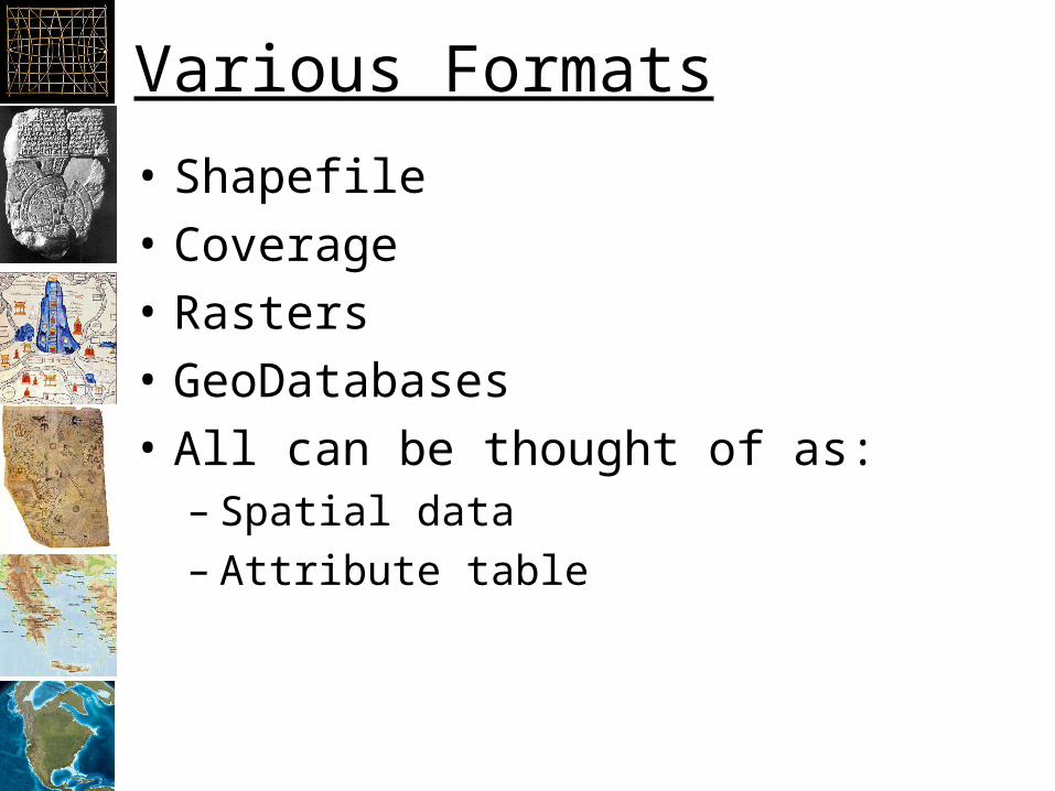
Various Formats
• Shapefile
• Coverage
• Rasters
• GeoDatabases
• All can be thought of as:– Spatial data – Attribute table
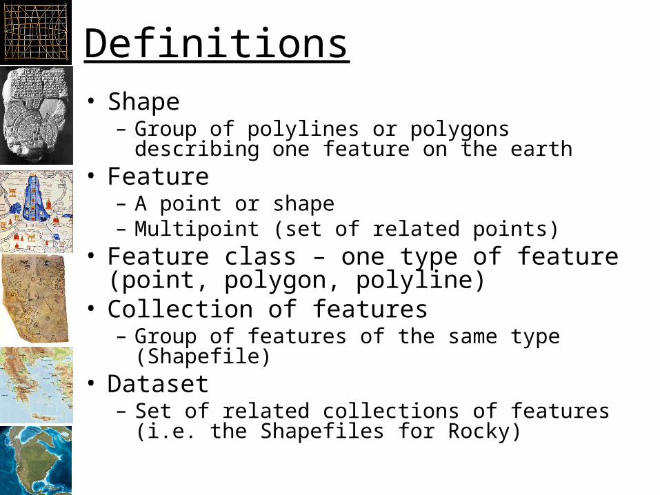
Definitions• Shape
– Group of polylines or polygons describing one feature on the earth
• Feature– A point or shape– Multipoint (set of related points)
• Feature class – one type of feature (point, polygon, polyline)
• Collection of features– Group of features of the same type (Shapefile)
• Dataset– Set of related collections of features (i.e. the
Shapefiles for Rocky)
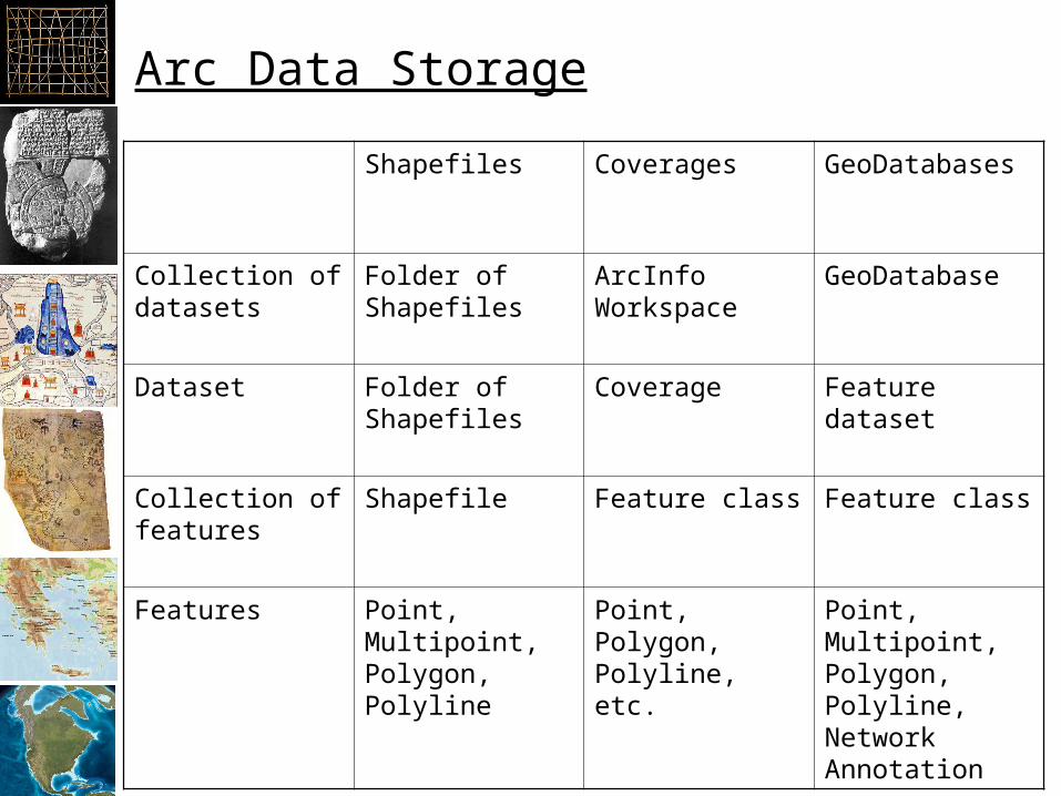
Arc Data Storage
Shapefiles Coverages GeoDatabases
Collection of datasets
Folder of Shapefiles
ArcInfo Workspace
GeoDatabase
Dataset Folder of Shapefiles
Coverage Feature dataset
Collection of features
Shapefile Feature class Feature class
Features Point, Multipoint, Polygon, Polyline
Point, Polygon, Polyline, etc.
Point, Multipoint, Polygon, Polyline, Network Annotation

Introduction to Databases
• Tables like Excel• Relationships between the tables
X Y DBH Type
-105.34210 40.32450 1.2 PP
-105.30345 39.93954 .92 LP
-105.23210 40.02132 .82 LP
-105.34292 40.12843 1.1 LP
Abrve Name BFCost
PP Ponderosa Pine .98
LP Lodge Pole 1.10

Joins and Relates
• Joins shows the table as being joined
• Relates just relates them together

Project Organization
• Project– Original Data
• Workspace for Coverages (folder)• Folder for Shapefiles• Folder for rasters• Folder for GeoDatabases
– Processing Data– Final Data
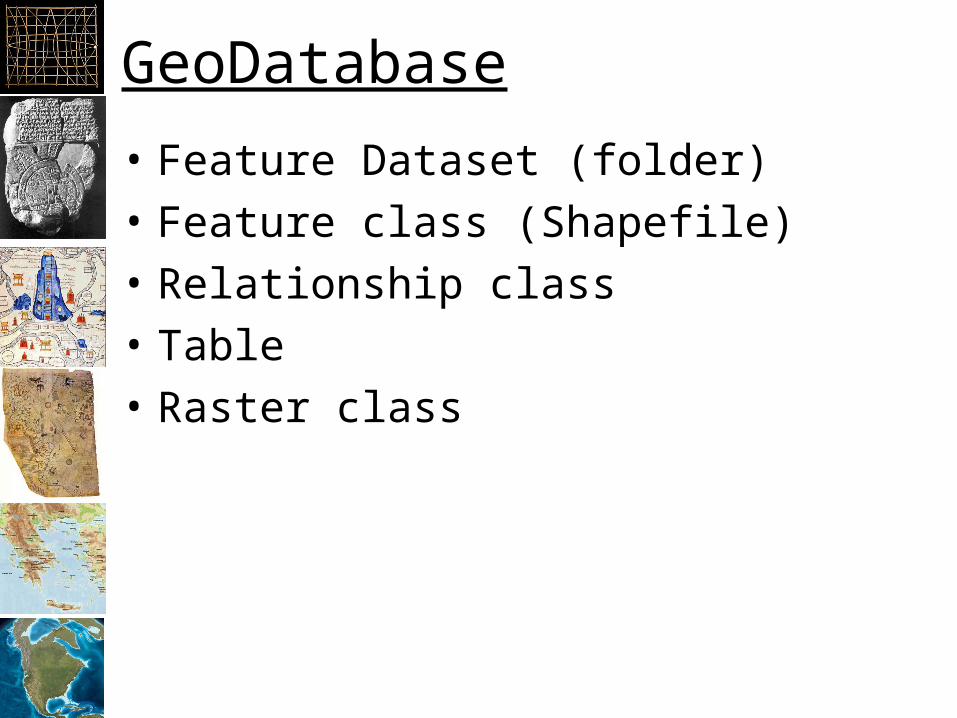
GeoDatabase
• Feature Dataset (folder)
• Feature class (Shapefile)
• Relationship class
• Table
• Raster class

GIS Databases
• Spatial data in a binary large object (blob)