ninepin point - tasmania parks and wildlife service
TRANSCRIPT

Depar tment of Pr imar y Industr ies, Par ks, Water and Environment
Ninepin Point Marine Reserve protects an unusual marine environment. Here the saltwater is overlain by tannin-rich freshwater from the nearby Huon River. The tea-coloured tannin layer restricts light penetration to the top few metres. This restricts light-loving brown and green algae
to the very shallowest water. Many species normally only encountered in much deeper, darker waters – such as sea fans and sea whips, jackass morwong and red algae – are seen here in shallow water. Ninepin Point is one of the few places in the world where this phenomenon occurs.
The reserve extends from the eastern end of Verona Sands Beach to approximately 1.8km south-west of the Gordon boat ramp, and out to sea approximately 400m south of Arch Rock. The entire marine reserve is a fully protected ‘no-take’ area. Fishing and other extractive activities are prohibited.
Getting thereNinepin Point Marine Reserve is located one hour’s drive south of Hobart along the Channel Highway, between the small towns of Gordon and Verona Sands. The reserve can be accessed at several points along the Channel Highway, including at White Cliff and the headland of Ninepin Point, where access is via a short track from the carpark.
Things to doNinepin Point provides a unique opportunity to see deepwater species within diveable depths. You will need a torch, regardless of the time of day, as the tannin-rich freshwater surface layer creates night dive conditions in the clear saltwater beneath. With a torch visibility can be up to 15 metres, however strong winds reduce visibility by mixing the tannin layer with the saltwater. The best time of year to dive is during summer or autumn, or when the rainfall is low and flow from the Huon River is at a minimum. Water temperatures range from 8°C in winter to 20°C in summer.
Kayaking is a great way to explore Arch Rock and enjoy the spectacular views of the D’Entrecasteaux Channel with Hartz Mountains in the distance. Launch from the boat ramps at Gordon or Charlotte Cove, or from the western end of the sandy Verona Sands beach, or from the rocky cobble beach at White Cliff.
Ninepin PointMARINE RESERVE
V I S I T I N G R E S E RV E S
June 2013 © State of Tasmania
Vermilion biscuit stars are commonly seen in the reserve. Although highly variable in colour, they are easily recognised by their yellow, orange or red plates separated by thin white lines. Photo: Neville Barrett
CH
AN
NEL HIGHWAY
C H A N N E L H
IG H
WAY
Gordon
NINEPIN POINT MARINE RESERVE
D’Entr
ecas teau
x C
hann
el
HuonIsland
CH
AN
NEL H
IGH
WA
Y
Verona Sands
GardenIsland
0Kms
2 4Woodbridge
to H
obar
t
36 k
ms
Cygnet
Middleton
Gordon
BRUNYISLAND
Simpsons Point
Verona Sands
For detailed map see next page
NSt Helens
Hobart
Launceston
Page 2 Vis it ing Reser ves – Ninepin Point Mar ine Reser ve
Help our marine environmentKnow the boundaries. If fishing, ensure you’re not in the marine reserve.
Take your rubbish home. Ropes, plastics and fishing line can harm wildlife.
Anchoring. Avoid anchoring on sensitive habitats such as seagrass beds and sponge gardens. Sandy seafloors are preferred; alternatively kelp-covered reefs.
Divers. Avoid damaging fragile marine life. Secure your gauges and equipment close to your body, ensure you have good buoyancy control, do not grip objects for support, and be careful not to cause damage with your fins.
Marine pests and diseases. To avoid their spread, after every trip clean and dry your fishing/dive/boating gear. Periodically and at least annually clean your boat hull.
Fish for the future. Where fishing is permitted, observe size, bag and possession limits. Only take enough for a feed. Get a copy of the latest Recreational Sea Fishing Guide or go to www.fishing.tas.gov.au for fishing information.
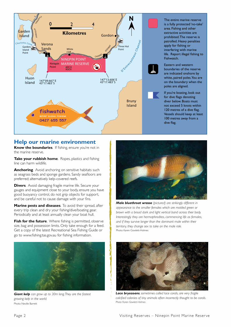
Lace bryozoans, sometimes called lace corals, are very fragile calcified colonies of tiny animals often incorrectly thought to be corals. Photo: Karen Gowlett-Holmes
Male bluethroat wrasse (pictured) are strikingly different in appearance to the smaller females which are mottled green or brown with a broad dark and light vertical band across their body. Interestingly they are hermaphrodites, commencing life as females, and if they survive longer than the dominant male within their territory, they change sex to take on the male role. Photo: Karen Gowlett-Holmes
Giant kelp can grow up to 30m long. They are the fastest growing kelp in the world. Photo: Neville Barrett
CH
AN
NEL HIGH
WA
Y
C H A N N E L HIGH WAY Three Hut
Point
Garden Island Creek
Bruny Island
Gordon
NINEPIN POINT MARINE RESERVENinepin
Point
D’Entr
ec astea
ux C
han
nel
HuonIsland
ARCHROCK
147°09.667’ E43°17.483’ S
147°13.606’ E43°17.483’ S
CH
AN
NE
L HIG
HW
AY
GardenIslandPoint
Charlotte Cove Verona Sands White
Cli�
GardenIsland
0
Kilometres
2 4N
fishwatchREPORT ILLEGAL FISHING
0427 655 557
poster
sticker
fishwatchREPORT ILLEGAL FISHING
0427 655 557Funded by the Marine Recreational Fishing Trust Fund
The entire marine reserve is a fully protected ‘no-take’ area. Fishing and other extractive activities are prohibited. The reserve is patrolled. Heavy penalties apply for fishing or interfering with marine life. Report illegal fishing to Fishwatch.
Eastern and western boundaries of the reserve are indicated onshore by white, paired poles. You are on the boundary when the poles are aligned.
If you’re boating, look out for dive flags denoting diver below. Boats must not exceed 5 knots within 120 metres of a dive flag. Vessels should keep at least 100 metres away from a dive flag.

Visit ing Reser ves – Ninepin Point Mar ine Reser ve Page 3
Special featuresThe unusual water conditions – saltwater overlain by dark-coloured, tannin-rich freshwater from the Huon River – result in unexpected marine life. The dark freshwater restricts light penetration, so the typical light-loving brown and green algae, which commonly occur to depths of up to 15m, are restricted to just a few metres. In their place a flourishing and diverse community of red algae and invertebrates occur. These are usually found in much deeper waters. The diversity and rarity of many of these species is so great, that many are still poorly understood by scientists.
The seafloor at Ninepin consists of a large and spectacular offshore rocky reef, deeply fissured and adorned in a great variety of colourful sponges, delicate feather stars, lace bryozoans, tangerine-coloured sea tulips, sea whips, vermilion biscuit stars and beautiful and diverse red algae. Closer to shore is a series of large dolerite boulders. At low tide their rounded tops are exposed, bearing resemblance to rounded pins from the British game ‘ninepins’ – after which the reserve receives its name.
More than 200 algal species have been recorded at Ninepin Point, which is highly diverse by world standards. The reserve is especially renowned for its red algae, with over 80 species recorded, several of which are only recorded from here.
A patch of giant kelp is present off the Ninepin Point headland in depths of 2-6 metres. Like trees in a rainforest, kelp provides a structure that supports a great diversity of marine animals. Instead of tree-like roots that extend into the sediment, kelp has ‘anchors’ called holdfasts that grip onto the rock. From these holdfasts the kelp grows towards the water surface. Gas bladders, found at the
base of each blade, keep the upper portions of the algae afloat making the beds of giant kelp often visible on the surface. Giant kelp prefers cool, nutrient-rich waters so the kelp beds often deteriorate in condition and decrease in size during late summer and autumn. There are fewer opportunities to see giant kelp than there used to be. Changing ocean conditions are resulting in warmer, nutrient-poor waters extending further south along Tasmania’s coast. This has resulted in the progressive loss of kelp beds from their historical range over the last 40 years.
When originally declared in 1991 the reserve included 60 hectares around the Ninepin Point headland, with the boundary midway along the reef. In December 2009 the reserve was extended to incorporate the entire reef and now covers 732 hectares. Following this extension, the population of bastard trumpeter – a reef species susceptible to gill netting – has increased and the species is now commonly seen in the reserve.
This red algae (Sonderopeltis corriacea) is generally entirely red, but in the Ninepin Point area is commonly a striking combination of yellow and red. Photo: Neville Barrett
bull kelp
long�n pike
caulerpa
bluethroat wrasse
common gurnardperch
sea tulip
senator wrasse
eleven-armedseastar
giant kelp crayweed
commonkelp
plate spongerock lobster feather star
red algae
pencil urchin
brownstriped leatherjacket
abalone
vermilion biscuit star
lacebryozoan
plumed gorgonian
5m
10m
0m
Example of marine life found at Ninepin Point Marine Reserve
Depar tment of Pr imar y Industr ies , Par ks , Water and Env i ronment
This red algae (Kallymenia cribrosa) is easily recognised by its distinctive perforated (‘holey’) blades. Photo: Neville Barrett
To help promote and care for reserves, join a community volunteer group. Contact Wildcare Inc: (03) 6233 2852 www.wildcare.tas.gov.au
Securing the future Tasmania has one of the most biologically diverse and unique marine environments in the world. Over 80% of the plants and animals living in Australia’s southern waters are found nowhere else on earth.
Tasmanians are heavily reliant on a healthy, well-functioning marine environment. The benefits and enjoyment we get from our marine and coastal environments are central to our lifestyles and livelihoods.
Like marine environments world-wide, Tasmania’s marine environment is under increasing pressure. Human activities have caused observable changes to the marine environment. Perhaps you have witnessed some of these changes in your lifetime along your favourite part of the coast.
Marine reserves – the ocean equivalent of national parks – provide a safe haven for marine life. Like national parks, they are places set aside for everyone to enjoy. These protected areas, which are under less stress than non-protected marine environments, are more likely to cope with pressures of climate change or invasive species than ecosystems weakened by many years of human impact.
Marine reserves also provide scientists with opportunities to learn about our impacts on the marine environment by comparing changes in protected areas with non-protected areas, which helps improve management of our coastal waters.
Approximately 2.7% of immediate state coastal waters (i.e. excluding subantarctic Macquarie Island) are in marine protected areas (either marine reserves or marine conservation areas), of which 1.1% of state coastal waters are highly protected in ‘no-take’ sanctuary zones.
The conservation and sustainable use of Tasmania’s marine environment is everyone’s responsibility. By supporting marine reserves, you’ll be helping protect our extraovrdinary marine environment for future generations.
More InformationTasmania Parks and Wildlife Service www.parks.tas.gov.au/marinereserves Huonville office: (03) 6264 8460
Weather Boating forecast: (03) 6376 0555 or (03) 6233 9955 www.bom.gov.au/tas/forecasts
A brownstriped leatherjacket swims amongst a variety of colourful sponges near Arch Rock. Photo: Neville Barrett
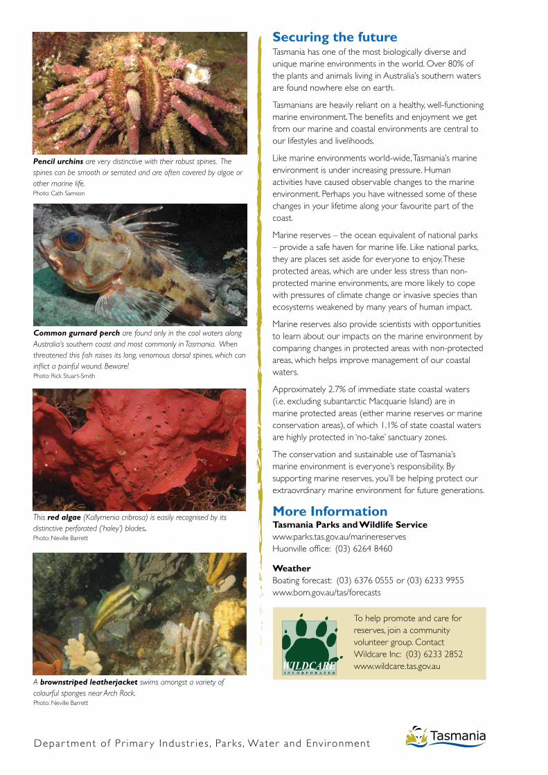
Common gurnard perch are found only in the cool waters along Australia’s southern coast and most commonly in Tasmania. When threatened this fish raises its long, venomous dorsal spines, which can inflict a painful wound. Beware! Photo: Rick Stuart-Smith
Pencil urchins are very distinctive with their robust spines. The spines can be smooth or serrated and are often covered by algae or other marine life. Photo: Cath Samson