near real-time s-ais: recent developments and ... · include satellite revisit times, message...
TRANSCRIPT

211Scientific Journal of Maritime Research 32 (2018) 211-218 © Faculty of Maritime Studies Rijeka, 2018
Multidisciplinary SCIENTIFIC JOURNAL OF
MARITIME RESEARCH
Multidisciplinarni znanstveni časopis
POMORSTVO
Near Real-time S-AIS: Recent Developments and Implementation Possibilities for Global Maritime StakeholdersDavor Šakan, Igor Rudan, Srđan Žuškin, David BrčićUniversity of Rijeka, Faculty of Maritime Studies, Studentska 2, 51000 Rijeka, Croatia, e-mail: [email protected]; [email protected]
ARTICLE INFO
Review articleReceived 16 November 2018Accepted 6 December 2018
Key words:Near real-time data Satellite AIS (S-AIS) Medium-range ETA prediction
ABSTRACT
The Automatic identification System (AIS) has been mainly designed to improve safety and efficiency of navigation, environmental protection, coastal traffic monitoring simplifying identification and communication. Additionally, historical AIS data have been used in many other areas of maritime safety, economic and environmental research. The probability of the detection of terrestrial AIS signals from space was presented in 2003, following the advancements in micro satellite technology. Through constant development, research and cooperation between governmental and private sectors, Satellite AIS (S-AIS) has been continuously evolving. Advancements in signal and data processing techniques have resulted in an improved detection over vast areas outside of terrestrial range. Some of the challenges of S-AIS technology include satellite revisit times, message collision and ship detection probability. Data processing latency and lacking the continuous real-time coverage made it less reliable for end user in certain aspects of monitoring and data analysis. Recent developments and improvements by leading S-AIS service providers have reduced latency issues. Complementing with terrestrial AIS and other technologies, near real-time S-AIS can further enhance all areas of the global maritime monitoring domain with emerging possibilities for maritime industry. A brief historical overview of the S-AIS system with recent developments of near real-time S-AIS technology and its current applications has been presented in this paper. Potential usage in cargo monitoring, terminal and port operations has been analyzed as well. Management of near real-time and historical S-AIS data can further improve analysis, planning organization and performance for global maritime supply chain stakeholders especially in liner schedule reliability. Algorithm for a dynamic near real-time organizational planning has also been analyzed in this paper. The proposed algorithm defines interdependence of the maritime shore stakeholders in the transport process as well as the actions undertaken in the following vessel arrival data.
1 Introduction
The Automatic Identification System (AIS) is a dig-ital, terrestrial, short range automatic data exchange system operating at a very high frequency (VHF) band. It is mandatory for all ships under the requirements of the International Convention for the Safety of Life at Sea (SOLAS), by the International Maritime Organization (IMO) and used by coastal and other stations. The infor-mation obtained from AIS stations are mostly used as a supplement in collision avoidance, VTS services traffic monitoring, search and rescue operations and safety and security operations. Furthermore, AIS system has im-proved safety and efficiency of navigation, environmental
protection, traffic and coastal areas monitoring. However, outside its terrestrial range vessels could not be tracked, resulting in coverage gaps.
Advancements in micro and nano-satellite technology resulted in considering detection of AIS terrestrial signals with receivers on board Low Earth Orbit (LEO) satellites. Space based AIS or Satellite AIS (S-AIS) proposition was presented on the 4th IAA Symposium on Small Satellites for Earth Observation in 2003 [10]. Testing and develop-ment continued in the following years in academic, gov-ernmental and commercial sectors, often collaboratively [14].
Both terrestrial and satellite AIS historical and near real-time data have been used in various areas of research.
https://doi.org/10.31217/p.32.2.6

212 D. Šakan et al. / Scientific Journal of Maritime Research 32 (2018) 211-218
Complementing with terrestrial data, S-AIS data have been used for a variety of purposes: fishing activity monitoring [15], generating seaborne trade patterns [12], assessment of global shipping emissions [9] and vessel speed analytics [1].
The usage of S-AIS for Long-Range Identification and Tracking (LRIT) with the detection probability has also been studied through years. The comparison of S-AIS and LRIT and the anticipated extensive usage of S-AIS data have been considered as well [4].
Inherent limitations of the S-AIS technology mostly lie on low signal power, message collision and detection probability. In addition, there have been several factors preventing persistent global coverage. One of the main problems is latency resulting from message detection and processing time. Furthermore, satellite revisit times and number of satellites should be considered in the respec-tive constellation. Consequently, the vessel position update intervals have been reported ranging from several seconds to 15 minutes or even few hours [2]. Regardless the delay, such systems offer improved tracking possibilities for ves-sel economic, traffic and remote area monitoring.
S-AIS can be implemented in different fields of technol-ogy. Further development has been considered for counter piracy, narcotic and anomaly detection and fisheries pro-tection [14]. An active research and development in cor-relation of S-AIS with other data sources such as Synthetic Aperture Radar (SAR) and high-resolution satellite image-ry [30] has also been carried out.
Recently, S-AIS data have been considered for early delay detection [13] and Estimated Time of Arrival (ETA) prediction. Low punctuality and schedule reliability are causing delays and disruption for terminal and hinter-land operations [6] [29]. However, the usage of S-AIS data has still been rarely considered in the research of arrival planning, delay detection and terminal organiza-tion. Nevertheless, ongoing projects address integration of services and optimized operations such as Sea Traffic management (STM) [17] and Big Data Analytics for Time Critical Mobility Forecasting (datAcron) [28].
Before considering S-AIS implementation possibilities, recent development and current stage of the system will be analyzed first. Recent developments include improved signal detection and tracking methods together with major service providers system upgrade activities. The proposed application areas and the implementation possibilities of the S-AIS for global maritime stakeholders will be also considered.
2 Overview of Recent S – AIS Activities
According to NASA [20], space detection of AIS started on 16th December 2006 when TacSat-2 satellite with AIS payload by the US Air Force Research Laboratory (AFL) was launched. Subsequently, there were numerous launch-es between 2007 and 2013 by private companies such as USA’s Orbcomm, Luxembourg’s LuxSpace, Canadian COM DEV with its subsidiary exactEarth and South African’s
SunSpace. Those were mostly test launches often devel-oped in collaboration with academic institutions or re-search or defense facilities.
In 2010, AISSat-1 was launched, funded by the Norwegian Space Centre and managed by the Norwegian Defense Research Establishments. It was followed by AISSat2 launched in 2014 and by an unsuccessful launch of AISSat3 in 2017. In 2017, Norsat-1 and Norsat-2 were launched with NAIS (Novel SAT-AIS) receivers and ad-ditional research instruments. They detected more ships and received up to 2.5-3 times more AIS messages per day than the previous AIS equipped satellites did [22]. Furthermore, Norsat-2 was equipped with VDES (VHF Data Exchange Service) transceiver for testing purposes. VDES is a higher capacity data exchange system which integrates AIS and several other VHF data exchange func-tions. In the future, the VDES could have a significant positive impact on the provision of maritime informa-tion services, such as maritime safety information (MSI), general data communications at high data rates, locating, vessel traffic management, satellite communications, etc. [26]. Meanwhile, the European Space Agency’s (ESA) S-AIS initiative through the ESA ARTES programme started in 2011, currently being in its second phase.
2.1 Signal Detection Methods and Tracking
Terrestrial AIS sole cell coverage is approximately 20-30 NM and the range is limited to the VHF line of sight propagation. The possibility of collision with messages originating from other cells and vessels is low. Therefore, message conflict is not an issue for terrestrial AIS commu-nications. However, satellites in Low Earth Orbit can have a large field of view and receive messages from multiple cells simultaneously. The vessel detection and tracking quality depends on the detection method and algorithms, satellite revisit times, processing latencies and downlink speeds. Recently, major S-AIS service providers have in-creased the numbers of satellites resulting in reduced la-tencies and higher detection rates.
Several methods of signal detection have been used: On Board Processing (OBP), Spectrum Decollision Processing (SDP) and Spectrum Decollision Processing on Board (SDPOB). In the OBP method the signals are received and processed on satellites. This method is usable for the de-tection over very low-density areas. Meanwhile, when density approaches 1000 ships, detection probability becomes low. Furthermore, in the Spectrum Decollision Processing method, raw spectrum data are received and sent to the ground stations for processing. According to [19], the SDP method has much better average first pass detection than the OBP. In the SDPOB, the received AIS data are processed on board satellites using spectrum de-collision. For example, Orbcomm’s next generation OG2 satellites utilize this method for signal detection.
Propositions intended to improve satellite detec-tion of AIS signals included two new AIS frequencies and an additional AIS message. At the International

213D. Šakan et al. / Scientific Journal of Maritime Research 32 (2018) 211-218
Telecommunications Union World Radio Conference in 2012 (WRC-12), additional channels 75 (156.775 MHz) and 76 (156.825 MHz) were designated as uplinks for receiving AIS messages by satellite(s) with proposed Message 27. At the 2015 World Radio Conference (WRC-15), the revised table of transmitting frequencies was adopted. Message 27 is sent on the dedicated long-range frequencies interchangeably every 3 minutes. It is time-stamped when received on board a satellite from Class A and Class B Self Organizing (SO) devices which use the same organizing and access scheme, consequently reduc-ing the possibility of message collision. The improved ves-sel detection by using Message 27 has been confirmed with AIS receivers on board NorSat-1 and NorSat-2 sat-ellites. They detected 20% more vessels transmitting Message 27, regardless that they present only 3% of all de-tected messages [22].
Launched in September 2015, China’s TianTuo-3 mi-crosatellite with AIS payload collected AIS data from the end of September 2015 to the end of April 2016. A steadily increase of Message 27 usage was observed. It accounted up to 5.56% of the total number of vessels observed at the end of the observation period. A monthly increase of approximately 300 vessels that use Message 27 was ob-served [16].
Additionally, there are technologies such as SAT-Trak by SRT Company designed for improved satellite detection of Class B products. Orbcomm has a similar product called HALI, the Tri-mode small craft tracker which combines terrestrial and satellite AIS data capability, with two-way satellite Orbcomm’s proprietary communication technol-ogy. It is aimed primarily for additional fleet monitoring and fishing fleets. Such technology could be further adapt-ed for objects tracking utilizing satellite AIS detection.
2.2 Overview of S-AIS Major Service Provider Activities
Orbcomm
In October 2012, the OG2 prototype satellite was launched but with failure. Furthermore, Orbcomm’s first six OG2 next-generation satellites were launched in July 2014 and remaining eleven satellites in December 2015. Five satellites malfunctioned, leaving constella-tion to twelve satellites. In November 2013, Inmarsat and Orbcomm announced a strategic alliance in both service and coverage complementary and hardware development. With a new constellation and increased detection rates, Orbcomm claimed that its near real-time vessel monitor-ing was processing 28 million AIS messages daily with 86% of average latency less than one minute [24].
ExactEarth
The first-generation satellite launches started in 2008, continuing in the following years. The equatorial EV-9 sat-ellite was launched in 2015. This launch was important because, besides its primary detection of stronger AIS
Class A signals, it had the possibility to receive weaker class B signals from vessels equipped with Advanced Class B Satellite Enabled AIS (ABSEA) patented technolo-gy [7]. Finally, in February 2018, high-performance EV-8 payload was hosted on board the Spanish PAZ radar sat-ellite completing first generation constellation. In June 2015, exactEarth announced partnership with the Harris corporation for the next AIS payloads generation. Hosted on Iridium NEXT satellites proposed operational con-stellation will consist of more than LEO 60 cross-linked satellites distributed in six orbital planes. The service is termed real-time stating that global revisit times and cus-tomer latency will be less than one minute [7]. Iridium’s 3-billion-dollar investment will finally have 66 active sat-ellites with orbit and ground spares launched on 8 dif-ferent launches. The completion is planned for the end of 2018. Satellites will also carry Automatic Dependent Surveillance-Broadcast (ADS-B) receivers for aircraft tracking [11]. Additionally, in May 2018, IMO recognized Iridium as a GMDSS provider. With the planned start in 2020, it will end INMARSAT’s monopoly as a sole service provider. Finally, exactEarth and Information Handling Services (IHS) Markit, a global business information pro-vider, made a strategic alliance in June 2018 as a part of AIS Platinum service. It will use exactEarth’s RealTime (RT) powered by Harris service and IHS network of AIS ground stations [8].
Spire
Spire Global was founded in 2012 and the first prod-ucts were crowdfunded ArduSat satellites based on Arduino technology and launched in November 2013. In 2014, Lemur-1 prototype satellite was launched and used for testing the satellite and support systems of the planned Lemur constellation. The launching of the Lemur-2 nano-satellites started in September 2015. Lemur-2 carried SENSE AIS vessel tracking and GPS radio occultation pay-loads. The planned constellation will have more than 100 nanosatellites. Compared to other major S-AIS service providers, Spire uses low-cost nanosatellites using the lat-est customized Commercial Off the Shelf (COTS) technol-ogy. Satellites have a lifespan from 2 to 5 years and are launched frequently. Furthermore, the latest launched satellites will have ADS-B receivers. Spire states that their S-AIS average latency is about 27 seconds [27].
3 Application of Near Real-time S-AIS Technology
The usage of near real-time and historical data could be beneficial for the prediction of delays, terminal planning, management and optimization of fleets and advanced business analysis. S-AIS elements are divided into relevant near real time data for cargo tracking system technologies and usage of historical data. The implementation possibili-ties of S-AIS data for global maritime stakeholders in port operations with liner reliability have been analyzed.

214 D. Šakan et al. / Scientific Journal of Maritime Research 32 (2018) 211-218
3.1 S-AIS as an Element for Cargo Tracking System Technologies
Dedicated tracking units are usually installed for high value containerized cargo such as refrigerated goods or pharmaceutical products. For some, a remote control of settings is possible. Such units are dependent on sat-ellite service providers, GSM technology and GNSS for positioning.
According to [3], the possibility of using S-AIS for glo-bal container tracking was proposed in 2014 as an alter-native to available and proposed tracking solutions. The shortcoming of available systems or proposed tracking solutions is that they are dependent on coastal stations range. The limited range and coverage, especially outside coastal areas, result in the reduced visibility and high cost for large number of tracked assets. On board container vessels, where containers are stacked one on another, there is a possibility of signal blockage or poor reception.
Therefore, by using S-AIS tracking data, the vessel could be tracked rather than the container itself. In Figure 1, the S-AIS Container tracking has been presented. This system would be based on the adapted class B devices without GPS with two additional units. Firstly, a comput-ing unit for the position estimation and secondly, an in-ertial measurement unit used for the detection of the current container status, such as loading operations in the port or when the vessel is underway. While on board, the unit would be associated with the vessel to reduce the number of excessive messages.
According to the European Space Agency RTICM – Real Time Intelligent Cargo Monitoring demonstration project, the usage of satellite AIS data has been considered for cost effective integrated and centralized platform of multimo-dal transport supply chain of high value containers and other cargoes. S-AIS could be a part of the system’s space assets. The vessel and the tracked containers could be monitored by using S-AIS data fed to the dedicated serv-
er. In 2018, the consortium by Megatel, LuxSpace, OHB and Arviem offered affordable Visioboxx and high-end MobilBox container tracking unit [23].
Regarding the project outcomes, the dynamic dispos-al of elements in the transport chain is set. An improved transparency should result in value added services for the business stakeholders. Such integrated approach enables visibility through the whole supply chain, opening possi-bilities for an improved planning of container usage and repositioning.
3.2 S-AIS Data Functionality
Nowadays, gathering historical AIS data has a strong impact on the ship maritime statistics used for vessel traffic management, port information, risk assessment, marine accident investigation and many more. Resolving terrestrial AIS’s short range limitations by using it to-gether with the S-AIS data will have a significant impact on the maritime industry. An increased gathering of S-AIS data could improve application, extending its impact on a global scale.
Furthermore, significant impact of near real-time data gathering could be seen in their usage as part of various algorithms used for timely decision-making processes. Weather forecast predictions in the ocean area, influence of significant waves, sea condition and currents detected, could be confirmed by monitoring the voyage route plan against the actual ocean route. Algorithms using gathered near real-time and analyzed historical data could be us-able for the prediction of future vessel actions and devis-ing new and adaptable ocean-going routes.
The analyses of oceangoing ship routes are also impor-tant in the function of the environmental protection. The analyses of the ship routes in the mentioned oceanic areas covered by S-AIS could be very important to estimate air pollution emissions from ships, seeking to minimize their negative impact. Gathering information on the large-scale
Figure 1 S-AIS Container TrackingSource: [3]
215D. Šakan et al. / Scientific Journal of Maritime Research 32 (2018) 211-218
supports mandatory IMO measures to increase energy ef-ficiency and to reduce greenhouse gas (GHG) emissions from international shipping.
One of the projects dealing with current fragmenta-tion of planning and information sharing is the Sea Traffic Management (STM) project funded by the EU. It is the suc-cessor of the Monalisa 2.0 project. The goals are to create safer, more efficient and environmentally friendlier mari-time sector. Some of the services developed in the project are route optimization, ship to ship route exchange, en-hanced monitoring, port call synchronization and winter navigation. The goal is to implement STM up till the year 2030. Currently, there are about 300 vessels included, with 13 ports, 5 shore and 12 simulator centers involved [25]. Although this is so far a regional project, primarily designed for the Baltic Sea, the technology and planned services could be extended globally and near-real time on the ocean routes by using S-AIS data.
Furthermore, medium-range ETA predictions for container vessels were also considered in the port of Rotterdam study by using historical AIS and meteorologi-cal data with machine learning. The predicted time-hori-zon was 120 hours. The results predicted by the models were better than the ETA sent by the ship’s agent [21]. Furthermore, one of the proposed methods for delay de-tection is the data-driven Case Based Reasoning (CBR) which uses only AIS historical data [13]. This revised case-based method differs from the previous one by using also the near real-time data. It uses Bills of Lading (BOL) with 85 variables as case base for historical shipping data. Firstly, near real-time distance is compared with the aver-age travel distance of vessels arrived on time. Using rel-evant data, the risk and the delay duration is determined. In the case of delay being more than one day, refinement is made by comparing a new case with cases from the set of similar historical shipping data cases [13]. The model potential lies in the gathering of S-AIS data for long range vessel delay and arrival prediction. In [5], a new maritime
route prediction algorithm was proposed regarding the in-fluence of the presented uncertainties on other actors in the supply chain in case of ship’s delay.
They identified influence of uncertainty of deep sea vessels arrival on barge and truck transport organization in intermodal transport. The proposed areas for research and improvement were data quality issues, data volume and distributed data mining, discovery and inclusion of behavioral patterns, and fusion of weather and AIS data [5]. Meanwhile, long term arrival predictions and marine routes patterns extraction could be considered by using historical and near real real-time S-AIS data for larger wa-terway areas for future decisions. The usage of S-AIS data has a significant advantage in decision-making processes as compared to systems, such as LRIT, which update less frequently.
4 Implementation Possibilities of S-AIS Data for Global Maritime Stakeholders in Port Operations with Liner Reliability
Planning and operation of terminals is influenced among other factors by vessel delays and discrepancy be-tween ETA and Actual Time of Arrival (ATA). This is espe-cially notable in container liner shipping where vessels are berthed, and cargo operations planned upon available berthing windows at the terminal. The vessel’s ETA is sent and updated regularly to the vessel’s agent and other mar-itime stakeholders. Still, vessel delays occur frequently re-sulting in the changes of arrival times, berthing windows or port rotations in subsequent ports. Many reasons can contribute to port and terminal delays and it is vital to predict their duration to adopt the vessel speed strategies for the required vessel arrival [31].
Terminal organization and decision making is made on several levels of planning. Operational plans are usually made for daily, weekly, ten days and monthly operations. Daily operations include berth and quay cranes allocation.
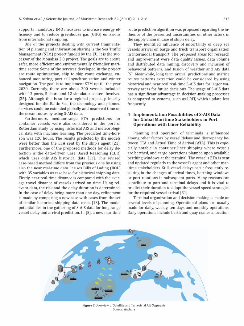
Figure 2 Overview of Satellite and Terrestrial AIS SegmentsSource: Authors

216 D. Šakan et al. / Scientific Journal of Maritime Research 32 (2018) 211-218
It has been observed that only 20% of the ships arrived on time and the rest arrived either early or late [29]. The obtained results have shown that incorporating prediction into daily terminal operation planning improved the per-formance of daily terminal operations.
Using S-AIS data for medium-range ETA predictions for container vessels could have a significant importance in the supply chain. Accurate ETA and delay prediction are crucial for effective short and mid-term planning, espe-cially in liner services. In Figure 2, the overview of satellite and terrestrial AIS segments has been presented. The rel-evant near real-time data together with the historical data from satellite and terrestrial AIS sources could be incorpo-rated in the decision making algorithm.
Liner service is planned according to service frequen-cy, fleet size, vessel size with fleet mix and finally, number of port calls [18]. Furthermore, planning service should include enough buffering time for dealing with delays and schedule reliability. The major source of schedule unreli-ability lies in port/terminal performance and congestion, respectively. Near real-time S-AIS data could be used for timely and accurate congestion detection which is prereq-
uisite for a new and improved schedule organization. The Dynamic Organizational Planning Algorithm – using near real time S-AIS data is shown in Figure 3.
In the concept of synchromodality [6] usage of AIS data has been considered. Consequently, both terrestrial and S-AIS near real-time data can be used for the crea-tion of input values in dynamic planning. The combination of these data together with other sources, such as mete-orological data, enables further development and imple-mentation of more accurate predictive models. New near real-time S-AIS services could be accommodated in such concepts and used for medium range prediction and plan-ning. Development of dynamic organizational planning using near real time S-AIS data is based on the coordina-tion of all maritime stakeholders of the transport process through the suggested Single Window Access Platform (SWAP). The SWAP platform is the link between the vessel environment and maritime stakeholders. Numerous par-ties having specialized and defined tasks participate in the complex port services organization. Maritime stakehold-ers could be divided into port government institutions and business entities performing port activities.
Arrival on time
Maritime stakeholders
Port government institutionsBusiness entities performing port
activities
Near real -time
S AIS data-
Other data sources
(Meteorological data )
Single Window Access Platform
HistoricalAIS data
YES
Review condition
Dynamic speed and ETA
adjustment
NO
Vessel environment
ETA and speed monitoring
ETA & speedCon�irmation
End of procees and information exchange
Figure 3 Dynamic Organizational Planning Algorithm Using Near Real Time S-AIS DataSource: Authors

217D. Šakan et al. / Scientific Journal of Maritime Research 32 (2018) 211-218
Furthermore, if the ship berth at the port of discharge (POD) is occupied, it is necessary to review the condition with a new ETA adjustment. The estimated time of arrival will be replaced by the new required time through the SWAP platform. The significant effect is a speed reduction which will result in the fuel consumption optimization and in decreasing the emission of harmful gases. Near real time S-AIS data with timely and proper information is crucial for medium-range ETA prediction and the vessel organization strategy. Additionally, if the ship delay is known according to the scheduled ETA due to poor environment condition, the POD environment has the possibility for future organi-zational planning of the chain supply in function of a con-stant cargo flow especially in liner service. Near real-time S-AIS data has a strong advantage to deliver timely informa-tion regardless of whether the vessel is in the ocean regions without terrestrial AIS coverage. Moreover, the availability of near real-time data for the vessel tracking throughout all voyage legs opens the possibility for improved delay predic-tion and ETA monitoring in near real-time, regardless the ship’s position. Such services embedded in adaptive and dynamic resource allocation planning systems should facili-tate ports and terminal planning and operations. As it has been presented, port congestion and terminal operations have been identified as major contributors to service unreli-ability. Improved monitoring, planning and decision making should reflect also on service reliability. Using historical ter-restrial and near real-time satellite AIS data combined with schedule reverting strategies should enable efficient and re-liable liner services.
5 Conclusion
Recently, all major S-AIS service providers have in-vested in the next generation of satellites and constella-tions. New or improved detection methods and devices have been developed, resolving in this way certain tech-nology limitations. S-AIS data have been used in various research areas. S-AIS services primarily developed for governmental bodies are increasingly being designed and offered for commercial sector. Near real-time S-AIS services can be applied to various areas of maritime transport, including improvements of ETA and delay pre-diction, referring especially to liner services. Arrival relia-bility reflects on port, terminal and hinterland operations and it must be improved to cope with future require-ments of sustainable and effective maritime transport. S-AIS technology should complement with other systems and services for tracking and monitoring. Benefits for in-stitutional and governmental services have already been presented but extensive usage in commercial sector is just emerging. Combining near-real time and historical AIS data with other sources such as meteorological data enables further development and implementation of bet-ter predictive models. Visibility and information sharing throughout the whole supply chain opens the possibility for integrated and dynamic cargo operations. Integrating tracking and monitoring from terrestrial and satellite
AIS data should be extended in adaptive concepts such as synchromodality. The contribution is in the proposed Dynamic Organizational Planning Algorithm – in function of maritime shore stakeholder’s interdependence in the transport process, as well as the actions undertaken in the next vessel arrival data. However, it is important to be aware of technology inherent limitations, both for the terrestrial and the satellite component. Further research should focus on the implementation of S-AIS technology in the integrated and dynamic transport and monitoring services.
References
[1] Adland, RO & Jia, H, 2016, “Vessel speed analytics using satellite-based ship position data”, IEEE International Con-ference on Industrial Engineering and Engineering Manage-ment (IEEM), pp. 1299–1303.
[2] Fujii, M, Hashimoto, H & Taniguchi, Y, 2017, “Analysis of Sat-ellite AIS Data to Derive Weather Judging Criteria for Voy-age Route Selection”, TransNav: International Journal on Marine Navigation & Safety of Sea Transportation, vol. 11, no. 2, pp. 271–277.
[3] Bretschneider, T & Thai Dung, N, 2014, “Container tracking via AIS satellites”, Asian Conference on Remote Sensing, My-anmar.
[4] Chen, Y, 2014, “Satellite-based AIS and its Comparison with LRIT”, TransNav, the International Journal on Marine Navi-gation and Safety of Sea Transportation, vol. 8, no. 2, pp. 183–187.
[5] Dobrkovic, A, Iacob, ME & Hillegersberg, J, 2018, “Maritime pattern extraction and route reconstruction from incom-plete AIS data,” International Journal of Data Science and Analytics, vol. 5, no. 2–3, pp. 111–136.
[6] Dobrkovic, A, Iacob, ME, Hillegersberg, J, Mes, MRK & Glan-drup, M, 2016, “Towards an Approach for Long Term AIS-Based Prediction of Vessel Arrival Times”, Logistics and Supply Chain Innovation, Springer, Cham, pp. 281–294.
[7] ExactAIS TraxTM, online: http://wiredengine.com/exact-earth/joomla/products/exactais-trax (Accessed: 27thJun 2018).
[8] ExactEarth and IHS Markit to Deliver Real-time Vessel Tracking Solution, 2018, online: https://www.exactearth.com/media-centre/recent-news/363-exactearth-and-ihs-markit-to-deliver-real-time-vessel-tracking-solution (Accessed: 28th Jun 2018].
[9] Johansson, L., Jalkanen, J.-P., Kukkonen, J., 2017. Global as-sessment of shipping emissions in 2015 on a high spatial and temporal resolution. Atmospheric Environment 167, 403–415.
[10] Høye, GK, Eriksen, T, Meland, BJ & Narheim, BT, 2008, “Space-based AIS for global maritime traffic monitoring”, Acta Astronautica, vol. 62, no. 2–3, pp. 240–245.
[11] Iridium Communications Inc., 2018, “QUARTERLY REPORT PURSUANT TO SECTION 13 OR 15(d) OF THE SECURITIES EXCHANGE ACT OF 1934” For the Quarterly Period Ended June 2018.
[12] Jia, H, Lampe, OD, Solteszova, V & Strandenes, SP, 2017, “An automatic algorithm for generating seaborne transport pat-tern maps based on AIS”, Marit Econ Logist, vol. 19, no. 4, pp. 619–63.

218 D. Šakan et al. / Scientific Journal of Maritime Research 32 (2018) 211-218
[13] Kim, S, Kim, H & Park, Y, 2017, “Early detection of vessel de-lays using combined historical and real-time information”, Journal of the Operational Research Society, vol. 68, no. 2, pp. 182–191.
[14] Kocak DM & Browning, P, 2015, “Real-time AIS tracking from space expands opportunities for global ocean ob-serving and maritime domain awareness”, OCEANS 2015 – MTS/IEEE Washington, pp. 1–7.
[15] Kroodsma, DA, 2018, “Tracking the global footprint of fish-eries”, Science, vol. 359, no. 6378, pp. 904–908.
[16] Li, S, Chen, L, Chen, X, Zhao, Y & Bai, Y, 2017, “Long-range AIS message analysis based on the TianTuo-3 micro satel-lite”, Acta Astronautica, vol. 136, pp. 159–165.
[17] Lind, M, Hägg, M, Siwe, U & Haraldson, S, 2016 “Sea Traf-fic Management – Beneficial for all Maritime Stakeholders,” Transportation Research Procedia, vol. 14, pp. 183–192.
[18] Notteboom, T.E., 2006, The Time factor in liner shipping services. Maritime Economics and Logistics 8, 19–39.
[19] Macikunas, A & Randhawa, B, 2012, “Space-based Automated Identification System (AIS) Detection Performance and Ap-plication to World-wide Maritime Safety”, 30th AIAA Interna-tional Communications Satellite System Conference (ICSSC), American Institute of Aeronautics and Astronautics.
[20] NASA – TacSat-2, 2018, online: https://www.nasa.gov/mis-sion_pages/tacsat-2/main (Accessed: 26th Jun 2018).
[21] Parolas, I, 2016, “ETA prediction for containerships at the Port of Rotterdam using Machine Learning Techniques”, Port Rotterdam Authority.
[22] Romsenter, N, 2018, “Norwegian AIS-satellites see far more ships”, Norwegian Space Centre, Online: https://romsenter.no/eng/News/News/Norwegian-AIS-satellites-see-far-more-ships2 (Accessed: 27th Apr 2018).
[23] RTICM – Real Time Intelligent Cargo Monitoring | ESA Busi-ness Applications [WWW Document], n.d. URL https://business.esa.int/projects/rticm (Accessed 9.11.18).
[24] Satellite AIS (Automatic Identification System) ORBCOMM, 2018, online: https://www.orbcomm.com/en/networks/satellite-ais (Accessed: 27th Jun 2018).
[25] Sea Traffic Management Validation Project – STM, 2015, Eu-ropean Union project, Interreg Central Baltic, EU.
[26] Valcic, S, Zuskin, S & Brcic, D, 2018, “VHF Maritime Mobile Band – A New System to Declutter AIS Channels”, Sea tech-nology, vol. 59, pp. 24–27.
[27] Ventures, Q, 2018, “Spire’s Nanosatellites are Collecting Data Where No One Else Can,” The Idea Lab, online: https://insights.qualcommventures.com/spires-nanosatellites-are-collecting-data-where-no-one-else-can-353e66aed1da (Ac-cessed: 29th Apr 2018).
[28] Vouros, GA, 2018, “Increasing Maritime Situation Aware-ness via Trajectory Detection, Enrichment and Recognition of Events,” Web and Wireless Geographical Information Sys-tems, vol. 10819, Cham: Springer International Publishing, pp. 130–140.
[29] Yu, J, 2018, “Ship arrival prediction and its value on daily container terminal operation”, Ocean Engineering, vol. 157, pp. 73–86.
[30] Zhang, H, Liu, Y, Ji, Y, Wang, L & Zhang, J, 2017, “Multi-Fea-ture Maximum Likelihood Association with Space-borne SAR, HFSWR and AIS” The Journal of Navigation, vol. 70, no. 2, pp. 359–378.
[31] Zuskin, S, Grubisic, N, Sumner, M, 2015, “Shipowner man-agement in accordance with mutual agreement”, Scientific Journal of Maritime Research – Pomorstvo, vol. 29, no. 1, pp. 69–74.