ne socg appendix 9 review of ceh study on displacement · pdf filereview of ceh breeding...
TRANSCRIPT

August 2014
NE SoCG Appendix 9 – Review of CEH study on displacement

DOGGER BANK TEESSIDE A & B
F-EXL-CG-031_NE OF_A9 © 2014 Forewind

Review of CEH breeding seabird displacement model and
implications for displacement assessments at other sites
Prepared by: Prof. Bob Furness
Reviewed by: Dr. Mark Trinder
Date: 19/06/2014
Tel: 0141 342 5404
Email: [email protected]
Web: www.macarthurgreen.com
Address: 95 South Woodside Road | Glasgow | G20 6NT

Document Quality Record.
Version Status Authorised by Date
1.0 DRAFT Bob Furness 18/06/2014
1.1 Reviewed Mark Trinder 18/06/2014
1.2 FINAL Bob Furness 19/06/2014

Review of CEH Breeding Seabirds Displacement Model and Implications
MGL/MT/18-06-2014/1.4
CONTENTS
1. Introduction .............................................................................................................................. 4
2. The CEH Model .......................................................................................................................... 4
3. Modelling results ....................................................................................................................... 4
4. Conclusions from the modelling ................................................................................................. 5
5. General interpretations ............................................................................................................. 5
6. Implications for assessments of displacement at other sites ...................................................... 6
7. References ................................................................................................................................. 6
Review of CEH Breeding Seabirds Displacement Model and Implications
4 | P a g e
1. Introduction
This report provides a brief review of the modelling by CEH (Searle et al. 2014) of population-level
impacts on breeding seabirds in SPA colonies in east Scotland, of offshore wind farms off east
Scotland. It also outlines implications of results from this modelling for assessments of population-
level displacement effects on seabirds at other sites.
2. The CEH Model
Searle et al. (2014) developed a simulation model that modelled energy budgets of breeding
seabirds during the chick-rearing period. The model was parameterised from the literature, or where
published data were not available, from expert judgment. The model simulated foraging decisions of
individual seabirds assuming accordance with optimal foraging theory. Model breeding birds
randomly selected a suitable location for feeding during each foraging trip, based on local bird
density maps at sea during breeding for each species derived from tracking studies. Subsequent
behaviour of birds was then simulated assuming that the foraging behaviour of individual seabirds
was driven by prey availability, travel costs, provisioning requirements for offspring, and behaviour
of conspecifics. Because prey distribution and abundance were not known, two scenarios were
considered. In the first scenario prey were distributed uniformly throughout the foraging range. In
the second scenario, prey were distributed proportionally to the estimated distribution of birds (i.e.
assuming that bird distribution provided a proxy for prey distribution). Baseline simulations, in the
absence of wind farms, were parameterised using estimated values for foraging time, flight time,
adult body mass and chick survival from studies on the Isle of May where possible. Simulations
assessing impacts of barrier effects/displacement by offshore wind farms considered five seabird
species at four SPA colonies: northern gannet (55,482 pairs Forth Islands 2009), black-legged
kittiwake (3,100 pairs Forth Islands 2013, 3,403 pairs St Abbs 2013, 9,337 pairs Fowlsheugh 2012,
12,542 pairs Buchan Ness 2007), common guillemot (14,674 pairs Forth Islands 2011, 22,103 pairs St
Abbs 2013, 30,100 pairs Fowlsheugh 2012, 12,928 pairs Buchan Ness 2007), razorbill (2,625 pairs
Forth Islands 2012, 1,219 pairs St Abbs 2013, 3,524 pairs Fowlsheugh 2012)and Atlantic puffin
(62,231 pairs Forth Islands 2008-2010). The individual, and cumulative impacts of Neart na Gaoithe,
Inch Cape, and Seagreen A & B OWFs on seabirds were modelled. Cumulative impacts were
approximately equal to the sum of impacts from individual wind farms. The CEH model is therefore a
site-specific model for breeding seabirds at selected SPA colonies. It is not intended to be directly
applicable to other populations or development sites, or for assessing impacts on populations during
the non-breeding season.
3. Modelling results
The modelling suggested that displacement/barrier impacts on adult survival would be less than
0.5% additional mortality for breeding gannets, razorbills (all three SPA populations), guillemots (all
four SPA populations) and for kittiwakes at St Abbs and at Buchan Ness. Impacts exceeding a 0.5%
reduction in adult survival were suggested only for kittiwakes at Forth Islands and Fowlsheugh and
for puffins at Forth Islands. The results for breeding success were qualitatively similar, but were
generally of lower magnitude in terms of their influence on population trend. Breeding success
results were also harder to detect in the presence of high natural variation. Only cumulative
estimates for Forth Island puffins with homogeneous prey showed a decrease in chick survival of

Review of CEH Breeding Seabirds Displacement Model and Implications
5 | P a g e
more than 2.5% compared to baseline, but the impact was much smaller under the more realistic
scenario with heterogeneous prey distribution.
4. Conclusions from the modelling
The authors concluded that the model had to make a number of assumptions that would benefit
from parameterisation with local data, in particular prey distribution, behaviour of seabirds in
response to wind farms, and effects of adult body mass change on subsequent survival. For example,
the relationship between body mass and subsequent survival of kittiwakes was derived from a study
by Oro and Furness carried out in Shetland where predation by great skuas strongly influenced
survival rate in addition to impacts of reduced abundance of sandeels. The relationship for east
Scotland, where kittiwakes are smaller in body size than kittiwakes in Shetland and are not exposed
to great skuas, may be somewhat different. The authors therefore urged caution in interpreting the
modelling results, but point out that a number of the assumptions they have made have been
precautionary (for example assuming that birds do not habituate to the presence of OWFs, making
no allowance for the fact that shorter foraging trips were underrepresented in the tracking data, and
that birds may learn to avoid OWFs by taking shorter routes to foraging areas rather than modifying
flight lines each time they encounter an OWF). However, the broad conclusion is that even in the
presence of three very large OWF developments close to seabird breeding SPA populations in east
Scotland, displacement/barrier effects on adult survival and breeding success were predicted to be
minor for gannet, guillemot and razorbill, minor for kittiwake at two of the four SPA colonies, but of
concern at two kittiwake colonies and at the puffin colony.
The authors point out that the magnitude of the impact depended on the exact location of
the OWF development in relation to the seabird foraging area from each SPA. For gannets, although
the proportion of birds interacting with wind farms in the model was comparatively high, associated
costs were small relative to the overall cost of foraging trips, so overall effects were negligible. That
conclusion seems likely to apply more generally at other sites. For guillemots and razorbills, most
foraging from the SPA colonies occurred closer to the colony than the OWF sites, so overall effects
were negligible. That conclusion is likely to be site-specific. For puffin, due to high overlap between
tracked foraging distribution and OWF sites, modelled displacement resulted in a higher impact than
for the other species. Again, that conclusion is likely to be site-specific. For kittiwake, barrier effects
increased foraging flight costs for birds from SPA colonies that had to travel past OWF sites (Forth
Islands, Fowlsheugh) but had negligible impact for kittiwakes from SPA colonies that were located in
places where the barrier effect was smaller (St Abbs, Buchan Ness). That indicates the site-specific
nature of conclusions for that species.
5. General interpretations
Population level impact depends on seabird species’ ecology, colony site location relative to the
development site, and on prey distribution pattern. This makes it difficult to generalise results from
this site-specific analysis to other breeding colonies, and also provides little to inform on possible
impacts of displacement outside of the breeding season. However, the high-level conclusion is that
the modelled impact of displacement for breeding seabirds was generally rather small, negligible in
terms of population consequence for most species and site combinations in the east Scottish study,

Review of CEH Breeding Seabirds Displacement Model and Implications
6 | P a g e
but may increase adult mortality by up to 1% above baseline for puffin, and for kittiwake in two of
the four SPA populations studied.
6. Implications for assessments of displacement at other sites
Despite its precautionary assumptions, the CEH modelling suggests that, where OWF sites are far
from SPA colonies (i.e. close to or beyond mean maximum foraging range), any population-level
impact during the breeding season due to displacement/barrier effects is extremely unlikely.
Modelling results also suggest that seabird species differ in resilience to consequences of
displacement, due to differences in their ecology and energy budgets. Gannets appear to be
considerably more resilient to displacement than the other species being modelled (because their
flight cost is low and the extra flight distance to avoid OWFs represents a trivial addition to their
normal foraging costs), and this inter-specific pattern is likely to apply generally for other breeding
populations of these species (because, for example, flight costs are high for auks and the additional
cost of avoiding OWFs represents a significant addition to their normal foraging costs).
Although the units being used are different between the CEH modelling (impact on survival
of breeding adults and impact on survival of chicks averaged across the SPA adult and chick
population) and NE assessment for impacts of displacement on offshore windfarm sites (impact on
survival of all seabirds including immatures as well as adults displaced by the development, with
subsequent apportioning to SPA populations where appropriate) the CEH modelling work suggests
that a precautionary assessment allowing up to 10% additional mortality to be imposed by
displacement of seabirds is inconsistent with the evidence in this case study and over-precautionary,
even for sites as in Firth of Forth where OWFs are close to SPA colonies and so have the greatest
potential to affect foraging breeding seabirds.
7. References
Searle, K., Mobbs, D., Butler, A., Bogdanova, M., Freeman, S., Wanless, S. and Daunt, F. 2014.
Population consequences of displacement from proposed offshore wind energy developments
for seabirds breeding at Scottish SPAs. Marine Scotland Science, Edinburgh.

August 2014
Appendix 10 – Forewind and JNCC and Natural England – 7 October 2013 Creyke Beck Ornithology and Benthic Minutes

DOGGER BANK TEESSIDE A & B
F-EXL-CG-031_NE OF_A9 © 2014 Forewind
CONFIDENTIAL Meeting record
Page 1 of 7
Appendix 07 - 7 October 2013 Creyke Beck Ornithology and Benthic Application Minutes
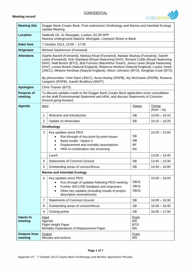
Meeting title Dogger Bank Creyke Beck: Post-submission Ornithology and Marine and Intertidal Ecology Update Meeting
Location Statkraft UK, 41 Moorgate, London, EC2R 6PP Nearest underground stations: Moorgate, Liverpool Street or Bank
Date/ time 7 October 2013, 10:00 – 17:00
Originator Michael Stephenson (Forewind)
Attendees Sophie Barrell (Forewind), Melissa Read (Forewind), Alastair Mackay (Forewind), Gareth Lewis (Forewind), Rob Staniland (Royal Haskoning DHV), Richard Cottle (Royal Haskoning DHV), Niall Burton (BTO), Bob Furness (MacArthur Green), Jonny Lewis (Royal Haskoning DHV), Louise Burton (Natural England), Rebecca Herdson (Natural England), Louise Jones (JNCC), Melanie Kershaw (Natural England), Alison Johnston (BTO), Aonghais Cook (BTO) By phone/video: Vicki Saint (JNCC), Anna Heslop (RSPB), Aly McCluskie (RSPB), Rowena Langston (RSPB), Gareth Bradbury (WWT)
Apologies Chris Thaxter (BTO)
Purpose of meeting
To discuss updates made to the Dogger Bank Creyke Beck application since consultation on the draft Environmental Statement and HRA, and discuss Statements of Common Ground going forward.
Agenda Item: Owner Timing (from – to)
1 Welcome and Introduction SB 10:00 – 10:10
2 Update on timescales SB 10:10 – 10:20
Ornithology
3 Key updates since PEI3
Run through of key point by point issues
Band model - Option 3 Displacement and mortality assumptions
HRA in-combination site screening
SB
NB
BF
RC
10:20 – 13:00
Lunch 13:00 – 13:45
4 Statements of Common Ground SB 13:45 – 14:30
5 Outstanding areas of concern/focus SB 14:30 – 15:00
Marine and Intertidal Ecology
6 Key updates since PEI3
Run through of updates following PEI3 meeting
Further JNCC/NE feedback and responses
Other key updates (including results of project description amendments)
SB/JL
SB/JL
SB/JL
15:00 – 16:00
7 Statements of Common Ground SB 16:00 – 16:30
8 Outstanding areas of concern/focus SB 16:30 – 16:45
9 Closing points SB 16:45 – 17:00
Inputs to meeting
Input Agenda Flight Height Paper Mortality Implications of Displacement Paper
From MS BTO MS
Outputs from meeting
Output Minutes and actions
From MS

CONFIDENTIAL Meeting record
Page 2 of 7
Appendix 07 - 7 October 2013 Creyke Beck Ornithology and Benthic Application Minutes
Date of next meeting
Forewind Meeting Protocol
Distribute agenda before meeting Fix responsibilities for each item
Start on time Finish on time
Set out your ground rules Publish minutes / actions
Stick to the agenda Continuous improvement

CONFIDENTIAL Meeting record
Page 3 of 7
Appendix 07 - 7 October 2013 Creyke Beck Ornithology and Benthic Application Minutes
KEY NOTES
Ornithology 1 – Welcome and introduction 2 – Update on timescales Sophie Barrell (SB) presented an update on Forewind’s work since the last meeting in June, and the anticipated timeline going forward. Anna Heslop (AH) – When does the consultation on the ornithology addendum end? SB – The 8
th November, it is running in parallel with the relevant representations period.
AH – Whilst it is appreciated that the information is released as soon as possible, there may be some confusion with the public over whom to send responses to. Does the Planning Inspectorate know about the addendum? Melissa Read (MR) – Yes, we have informed them of the timescales but they cannot formally accept anything until the preliminary meeting. Forewind has also previously run a similar process with PEI1 consultation in parallel with scoping without any major problems. 3 – Key updates since PEI3
Run through of key point by point issues Forewind’s point-by-point response to the JNCC and Natural England’s PEI3 consultation comments were passed around the room for reference. SB – Paragraph number 9.2.11 – regarding mortality and the view that it is an on-going effect felt year-on-year – this has been assessed for collision but the mortality rates for displacement represent the proportion of those birds predicted to be displaced that might be lost to the population in the long-term. Can any of the stakeholders comment on whether this eases concerns as when discussed at the previous meeting, it was agreed that this would be taken away for further thought? Vicki Saint (VS) – This is something we will need to review in the documentation. Rebecca Herdson (RH) – We are not in a position to comment today. Rowena Langston (RL) – We will rethink in light of Bob Furness’ report. SB – Paragraph number 9.2.27 – regarding boat traffic and whether we could provide evidence to support the assumption that construction phase displacement can be assessed as 50% of operational displacement – we have added further clarification and justification in the text which we hope should ease concerns. SB – Paragraph number 9.2.37 – regarding the correction factors for diving birds – we have responded to clarify our position on this within the point by point responses and the BTO report itself. Alastair Mackay (AM) – HiDef have undertaken a quick study to look at the amount of juvenile guillemots without adults, to estimate the correction factors – this indicated that birds were diving approx. 10% of the time which is less precautionary than the figure used in the assessment. This is not necessarily scientifically robust but gives a good indication as to the figure for correction factors. SB – Paragraph number 9.3.1 – regarding migratory birds – we have reviewed other offshore wind farm ESs
ACTIONS
Action No
Action description Owner Date set Target date
Update Update details
0710-01
Aly to provide Niall with contact details for members of the Marine Renewables Ornithologists’ Group and Niall to circulate the BTO paper on flight heights once received
NB/AMc 07/10/13 21/10/13
Update
CONFIDENTIAL Meeting record
Page 4 of 7
Appendix 07 - 7 October 2013 Creyke Beck Ornithology and Benthic Application Minutes
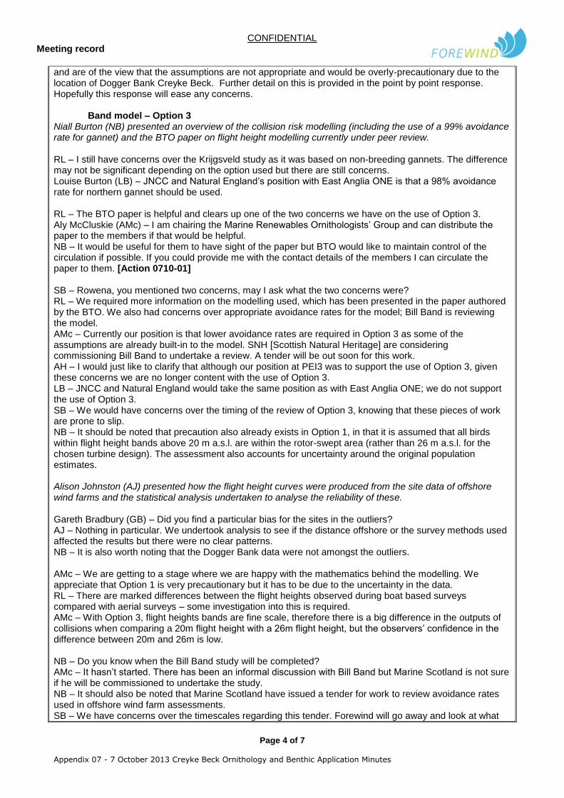
and are of the view that the assumptions are not appropriate and would be overly-precautionary due to the location of Dogger Bank Creyke Beck. Further detail on this is provided in the point by point response. Hopefully this response will ease any concerns.
Band model – Option 3 Niall Burton (NB) presented an overview of the collision risk modelling (including the use of a 99% avoidance rate for gannet) and the BTO paper on flight height modelling currently under peer review. RL – I still have concerns over the Krijgsveld study as it was based on non-breeding gannets. The difference may not be significant depending on the option used but there are still concerns. Louise Burton (LB) – JNCC and Natural England’s position with East Anglia ONE is that a 98% avoidance rate for northern gannet should be used. RL – The BTO paper is helpful and clears up one of the two concerns we have on the use of Option 3. Aly McCluskie (AMc) – I am chairing the Marine Renewables Ornithologists’ Group and can distribute the paper to the members if that would be helpful. NB – It would be useful for them to have sight of the paper but BTO would like to maintain control of the circulation if possible. If you could provide me with the contact details of the members I can circulate the paper to them. [Action 0710-01] SB – Rowena, you mentioned two concerns, may I ask what the two concerns were? RL – We required more information on the modelling used, which has been presented in the paper authored by the BTO. We also had concerns over appropriate avoidance rates for the model; Bill Band is reviewing the model. AMc – Currently our position is that lower avoidance rates are required in Option 3 as some of the assumptions are already built-in to the model. SNH [Scottish Natural Heritage] are considering commissioning Bill Band to undertake a review. A tender will be out soon for this work. AH – I would just like to clarify that although our position at PEI3 was to support the use of Option 3, given these concerns we are no longer content with the use of Option 3. LB – JNCC and Natural England would take the same position as with East Anglia ONE; we do not support the use of Option 3. SB – We would have concerns over the timing of the review of Option 3, knowing that these pieces of work are prone to slip. NB – It should be noted that precaution also already exists in Option 1, in that it is assumed that all birds within flight height bands above 20 m a.s.l. are within the rotor-swept area (rather than 26 m a.s.l. for the chosen turbine design). The assessment also accounts for uncertainty around the original population estimates. Alison Johnston (AJ) presented how the flight height curves were produced from the site data of offshore wind farms and the statistical analysis undertaken to analyse the reliability of these. Gareth Bradbury (GB) – Did you find a particular bias for the sites in the outliers? AJ – Nothing in particular. We undertook analysis to see if the distance offshore or the survey methods used affected the results but there were no clear patterns. NB – It is also worth noting that the Dogger Bank data were not amongst the outliers. AMc – We are getting to a stage where we are happy with the mathematics behind the modelling. We appreciate that Option 1 is very precautionary but it has to be due to the uncertainty in the data. RL – There are marked differences between the flight heights observed during boat based surveys compared with aerial surveys – some investigation into this is required. AMc – With Option 3, flight heights bands are fine scale, therefore there is a big difference in the outputs of collisions when comparing a 20m flight height with a 26m flight height, but the observers’ confidence in the difference between 20m and 26m is low. NB – Do you know when the Bill Band study will be completed? AMc – It hasn’t started. There has been an informal discussion with Bill Band but Marine Scotland is not sure if he will be commissioned to undertake the study. NB – It should also be noted that Marine Scotland have issued a tender for work to review avoidance rates used in offshore wind farm assessments. SB – We have concerns over the timescales regarding this tender. Forewind will go away and look at what
CONFIDENTIAL Meeting record
Page 5 of 7
Appendix 07 - 7 October 2013 Creyke Beck Ornithology and Benthic Application Minutes
we can do to assist. GL – It is worth mentioning that the mitigation to 200 turbines and a 26m lower tip height would be better presented in Option 3. Using Option 1 would negate the mitigation of the increase in lower tip height which would be a shame given it has been recognised as beneficial. SB – Can we clarify the position of the handover from JNCC to Natural England? RH – The handover has not been fully signed off yet, but Gareth at WWT will provide support for the relevant representations period, and Melanie Kershaw will support during the written representations stage. Vicki Saint will support during the relevant representations stage and will still be used internally for specialist advice after this period.
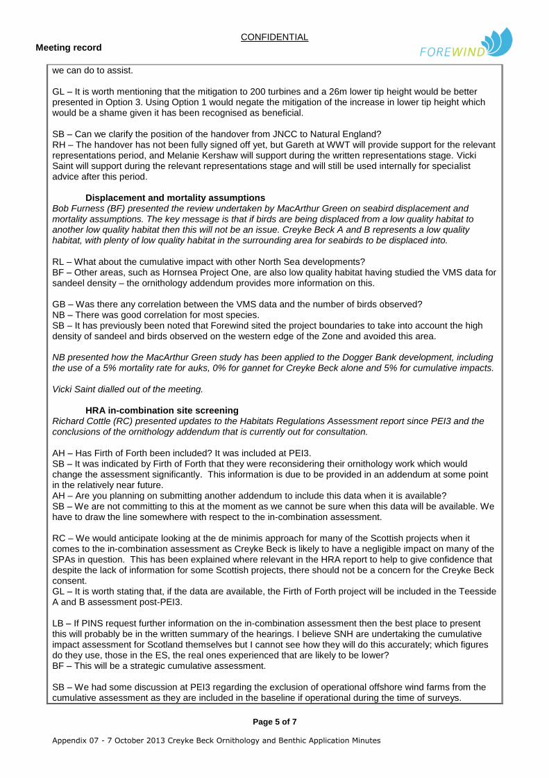
Displacement and mortality assumptions Bob Furness (BF) presented the review undertaken by MacArthur Green on seabird displacement and mortality assumptions. The key message is that if birds are being displaced from a low quality habitat to another low quality habitat then this will not be an issue. Creyke Beck A and B represents a low quality habitat, with plenty of low quality habitat in the surrounding area for seabirds to be displaced into.
RL – What about the cumulative impact with other North Sea developments? BF – Other areas, such as Hornsea Project One, are also low quality habitat having studied the VMS data for sandeel density – the ornithology addendum provides more information on this. GB – Was there any correlation between the VMS data and the number of birds observed? NB – There was good correlation for most species. SB – It has previously been noted that Forewind sited the project boundaries to take into account the high density of sandeel and birds observed on the western edge of the Zone and avoided this area. NB presented how the MacArthur Green study has been applied to the Dogger Bank development, including the use of a 5% mortality rate for auks, 0% for gannet for Creyke Beck alone and 5% for cumulative impacts. Vicki Saint dialled out of the meeting.
HRA in-combination site screening Richard Cottle (RC) presented updates to the Habitats Regulations Assessment report since PEI3 and the conclusions of the ornithology addendum that is currently out for consultation. AH – Has Firth of Forth been included? It was included at PEI3. SB – It was indicated by Firth of Forth that they were reconsidering their ornithology work which would change the assessment significantly. This information is due to be provided in an addendum at some point in the relatively near future. AH – Are you planning on submitting another addendum to include this data when it is available? SB – We are not committing to this at the moment as we cannot be sure when this data will be available. We have to draw the line somewhere with respect to the in-combination assessment. RC – We would anticipate looking at the de minimis approach for many of the Scottish projects when it comes to the in-combination assessment as Creyke Beck is likely to have a negligible impact on many of the SPAs in question. This has been explained where relevant in the HRA report to help to give confidence that despite the lack of information for some Scottish projects, there should not be a concern for the Creyke Beck consent. GL – It is worth stating that, if the data are available, the Firth of Forth project will be included in the Teesside A and B assessment post-PEI3. LB – If PINS request further information on the in-combination assessment then the best place to present this will probably be in the written summary of the hearings. I believe SNH are undertaking the cumulative impact assessment for Scotland themselves but I cannot see how they will do this accurately; which figures do they use, those in the ES, the real ones experienced that are likely to be lower? BF – This will be a strategic cumulative assessment. SB – We had some discussion at PEI3 regarding the exclusion of operational offshore wind farms from the cumulative assessment as they are included in the baseline if operational during the time of surveys.

CONFIDENTIAL Meeting record
Page 6 of 7
Appendix 07 - 7 October 2013 Creyke Beck Ornithology and Benthic Application Minutes
LB – I was not privy to the previous discussions but the JNCC and NE position on operational wind farms is that if they were operational during the surveys, effects are accounted for in the baseline therefore we are content if this has been done for Creyke Beck. Anna Heslop, Aly McCluskie and Rowena Langston dialled out of the meeting. 4 – Statements of Common Ground SB – We wanted to gather thoughts on the format for Statements of Common Ground and process going forward. Were there examples from other developers that you particularly liked? LB – Other developers have largely used a table format. It may be easier to draft this after you have seen our relevant representation. It is useful to have a separate table underneath the common ground to detail the uncommon ground. We would not need to see a draft before we have submitted our relevant representation and then we would envisage using the time between the relevant reps period and the preliminary meeting to discuss them. It appears that Bond Dickinson have been assisting with other developers’ documents and we have found that often the Statements of Common Ground feature unnecessary statements that are a bit too obvious. SB – This is noted and we will take this into account during drafting. MR – Eversheds will be representing us during the examination period. We are also mindful of the fact that there is a short time between relevant reps and the preliminary meeting. LB – This is acknowledged. If you can propose key dates early on then we can see what we can do and negotiate time and resource from there. Teleconferences and emails are preferred where possible as they save time travelling that could otherwise be spent reviewing. 5 – Outstanding areas of focus/concern LB – It is worth noting that JNCC will still support NE after the delegation has gone through. Natural England will attend meetings and consultation but JNCC specialists will still be called upon when drafting responses and reviewing documents. SB – Do you have an update on the infraction procedures? LB – It is currently more relevant to Atlantic Array. The timeframes are probably too far away to be relevant for Creyke Beck. Niall Burton, Alison Johnston, Aonghais Cook, Bob Furness and Melanie Kershaw left the meeting. Jonny Lewis entered the meeting. Marine and Intertidal Ecology 6 – Key updates since PEI3
Run through of updates following PEI3 meeting Jonny Lewis (JL) gave an update on the changes to the marine and intertidal ecology assessment since PEI3.
SB – Will the delegation of marine renewables casework from JNCC to Natural England have an effect on the marine and intertidal ecology assessment? LJ – JNCC will still lead on matters relating to benthic ecology due to the designation of the Dogger Bank candidate Special Area of Conservation. We still plan to submit advice on the conclusion regarding adverse impact on integrity at the written representations stage. LB – Natural England will still lead on the inshore cables and the potential area of mussel bed.
Further JNCC/NE feedback and responses JL presented an update on the current status of the methodology in light of further comments from JNCC and NE, after PEI3. LJ –We are content that you do not need to redo the assessment looking at each individual biotope now that you have clarified that you have assessed the most sensitive receptor in each VER group. We still have concerns regarding the use of ‘value/importance’. It is JNCC’s view that this should be the last step and that the protected site sensitivity consideration has happened too soon. JL – Other offshore wind farms have applied this consideration at different times and these have been accepted by stakeholders. Ultimately, the important point is to accept that value/importance is considered at some point in the overall assessment process. JL also clarified that irrespective of where/when considered,
CONFIDENTIAL Meeting record
Page 7 of 7
Appendix 07 - 7 October 2013 Creyke Beck Ornithology and Benthic Application Minutes
the conclusions of the assessment remain unaltered. LJ – It is a methodological point, we do not have an issue with the final conclusions. JL – I acknowledge the error with regard to the “substratum loss” MarLIN sensitivity presented for VERs B, D, E, F & G in the “Dogger Bank Creyke Beck: VER Groups and Biotope Sensitivity as defined by MarLIN” table issued to JNCC/NE on 18
th July 2013. This results in the impact significance of “Permanent Habitat
Loss” in the operational phase increasing from negligible to minor adverse for these 5 VER’s. LB – The best place to capture this will be in the Statement of Common Ground. SB – We will add this to the draft we produce.
Other key updates (including results of project description amendments) JL presented other key updates made to the marine and intertidal ecology assessment. 7 – Statements of Common Ground This was covered earlier in Agenda Item 4. 8 – Outstanding areas of concern/focus LJ – Have you resolved the issue regarding seabed preparation and the removal and deposition of sediment? SB – We have produced a new appendix (Chapter 12 Appendix B) – Dogger Bank Creyke Beck Site Characterisation Study. We have written into the DCO the provision to make the project areas disposal sites for this purpose. The final ES chapter also included assessment of the impact of seabed preparation/drill arisings that will form residual deposits on the seabed adjacent to the foundations on seabed habitats. Information on the scale and nature of these deposits was provided via input from the authors of the Marine Physical Processes ES chapter following review of relevant PSA and borehole data. LJ – Have you included the met masts in your worst case table? JL – Platforms, met masts and mooring buoys have all been included and assessed. SB – I would like to mention at this point that we have considered Natural England’s concerns regarding nearshore cable protection and asked our engineers to consider the data to see if we could reduce our envelope in this area. In our final application you will see that we have now committed to burying our export cables from shore up to 300m seaward of mean low water springs. We have also committed to a maximum of 10% of cable protection on the export cable length out to the 10m water depth contour. LJ – We are undertaking a review of our position regarding adverse effect on integrity in relation to the Dogger Bank cSAC. This will not be a threshold as we feel this is inappropriate, but will be based on the risk to site integrity. We will look at the risk to site integrity under different scenarios. We hope to put this in at the relevant representations stage. SB – We would have concerns about the Planning Inspectorate looking at this and asking us to rule out gravity base foundations completely, for example, when we do have other designs of gravity base in our envelope that are not the worst case. It would be good if your review could be framed in such a way as to try and avoid this. LB – We recognise you may want a combination of different foundations. It may be that we can acknowledge that we have questions in the relevant representation and then send the questions directly to Forewind. 9 – Closing points There were no further outstanding points. ENDS

August 2014
Appendix 11 – Natural England Relevant Representation Dogger Bank Teesside A & B

DOGGER BANK TEESSIDE A & B
F-EXL-CG-031_NE OF_A9 © 2014 Forewind
NATURAL ENGLAND’S RELEVANT REPRESENTATIONS IN RESPECT OF DOGGER BANK (TEESSIDE A & B) OFFSHORE WIND FARM Planning Inspectorate Reference: EN010051
1. Introduction
1.1. Natural England is a non-departmental public body established under the Natural Environment
and Rural Communities Act 2006 (“NERC” Act). Natural England is the statutory adviser to Government on nature conservation in England and promotes the conservation of England’s wildlife and natural features. Under section 1(3) of the NERC Act Natural England’s functions are exercisable in relation to England and the territorial sea adjacent to England up to 12 nautical miles.
Legislative Framework
1.2. Natural England is a statutory consultee:
1.2.1. In respect of plans or projects that are subject to the requirements of the Conservation of Habitats and Species Regulations 2010 (as amended) (the “Habitats Regulations”) which are likely to have a significant effect on European sites and European marine sites including; Special Areas of Conservation (“SAC”) (and candidate SACs (“cSACs”), Sites of Community Importance (SCI), Special Protection Areas (“SPA”) and potential SPAs (“pSPAs”), and, by way of Government policy, sites listed under the 1971 Convention on Wetlands of International Importance (“Ramsar site”) which lie within 12 nautical miles from the English coastline; and
1.2.2. In relation to the Wildlife and Countryside Act 1981 (as amended) (the “1981 Act”),
proposals likely to damage or disturb any of the flora, fauna, geological or physiographical features for which a Site of Special Scientific Interest (“SSSI”) has been notified.
1.2.3. Pursuant to the Offshore Marine Conservation (Natural Habitats, &c.) Regulations 2007 (the “2007 Regulations”). Under regulation 25(3)(a) of the 2007 Regulations, where the assessment relates to a European offshore marine site, the competent authority must consult the JNCC (Joint Nature Conservation Committee). Where the assessment relates to a European site (including a European marine site), then the competent authority must consult Natural England, in accordance with regulation 25(3)(b) of the 2007 Regulations.
1.3. The Examination Authority should note that pursuant to an authorisation made on the 9th
December 2013 by the JNCC under paragraph 17(c) of Schedule 4 to the Natural Environment
and Rural Communities Act 2006, Natural England is authorised to exercise the JNCC‘s
functions as a statutory consultee in respect of applications for offshore renewable energy
installations in offshore waters (0-200nm) adjacent to England. This application was included in
that authorisation and therefore Natural England will be providing statutory advice in respect of
that delegated authority. However, JNCC retains responsibility as the statutory advisors for
European Protected sites that are located outside the territorial sea and UK internal waters (i.e.
more than 12 nautical miles offshore), in this instance the Dogger Bank SCI and as such
continues to provide advice to Natural England on the significance of any potential impacts on
interest features of the site.

1.4. In determining this application, the Secretary of State will be acting as the competent authority for the purposes of the Habitats Regulations and the 2007 Regulations. The Secretary of State is also a section 28G authority with specific duties under the 1981 Act in respect of SSSIs.
1.5. Natural England’s advice in these Relevant Representations is based on information submitted by Forewind, a consortium comprising four partner companies; RWE npower renewable (an RWE Innogy company), SSE plc (SSE), Statoil and Statkraft (‘the Applicants’) in support of its application for a Development Consent Order (‘DCO’) in relation to Dogger Bank Teesside projects A & B (known as, ‘the project’). The project refers to the construction and operation of a 2.4GW offshore wind farm and associated infrastructure. Teesside A covers an area of 560km2 and is located within the south west part of the Dogger Bank Zone whilst Teesside B covers 593km2 and is located within the south east part of the zone. The export cable route makes landfall along the Teesside Coastline, between Redcar and Marske-by-the-Sea, and the grid connection is at Lackenby substation, near Eston.
1.6. Natural England has been working closely with the Applicants to provide advice and guidance since 2010. Natural England has also been working with the Centre for Environment, Fisheries and Aquaculture Science (CEFAS), JNCC and the Marine Management Organisation (MMO) to provide coordinated advice.
1.7. These Relevant Representations contain a summary of what Natural England considers to be the
main nature conservation and related issues in relation to the DCO application, as well as the Deemed Marine Licences (DML) contained therein, and indicate the principal submissions for consideration at this point. Natural England will develop these points further as appropriate during the examination process. There may be additional points to make, particularly if further information about the project becomes available.
1.8. Part I of these representations provides an overview of the issues and a summary of Natural
England’s advice at this point. Section 2 identifies the natural features relevant to this application. Section 3 summarises Natural England’s overall view of the application. Section 4 sets out the main issues which we consider need to be addressed by the Secretary of State.
1.9. Part II of these representations sets out all the significant issues which remain outstanding, and
which Natural England advise should be addressed by the Applicants and the Examining Authority as part of the examination process in order to ensure that the project can be consented. These are primarily issues on which further information would be required in order to allow the Examining Authority properly to undertake its task or where further work is required to determine the effects of the project and/or to scope out mitigation proposals to provide a sufficient degree of confidence as to their efficacy. Accordingly, section 5 identifies the matters for which further details about the project are required in order to enable assessment. Section 6 identifies issues for which further information would improve the assessment. And section 7 identifies those issues that should be dealt with by way of DCO requirements and the Deemed Marine Licenses (DMLs). Section 8 identifies a number of other relevant matters which Natural England considers prudent to raise at this time.
1.10. Natural England intends to continue discussions with the Applicant to seek to resolve these
concerns. To this end, we expect to schedule joint meetings to discuss the matters raised in these representations and to develop Statements of Common Ground. Failing satisfactory agreement, Natural England would highlight outstanding matters in our written representations.
1.11. The Examining Authority may wish to ensure that the matters set out in these Relevant Representations are addressed as part of the Examining Authority’s first set of questions to ensure the provision of information early in the examination process.
PART I: OUTLINE OF NATURAL ENGLAND’S PRINCIPAL SUBMISSIONS
2. The natural features potentially affected by this application
2.1. The project is located in the North Sea off the East coast of Yorkshire and affects the countryside between the onshore substation at Lackenby and the landfall on the Teesside coastline, between Redcar and Marske-by-the-Sea.
2.2. The designated sites relevant to this application are:
2.3. Special Protection Areas (SPAs) in England - The following interest features are those which may be affected by the proposed project and for which Natural England has outstanding concerns as a result of which Natural England cannot as yet either;
i. Agree with the Applicant’s conclusion of the absence of a likely significant effect; or
ii. Advise that an adverse impact on integrity can be ruled out beyond all reasonable scientific doubt
This list is based on the species’ presence during site surveys for their respective breeding seasons AND considers only those designated sites for which the development site lies within the maximum foraging range of those species from those sites during that season.
Site Name Distance from project
sites (indicative)
Features for which outstanding concerns remain
Flamborough and Filey Coast pSPA
180km Northern gannet (Morus bassanus) (breeding – as an individual feature and as part of the overall assemblage); Black- legged kittiwake (Rissa tridacyla) (breeding – as an individual feature and as part of the overall assemblage); Common guillemot (Uria aalge) (breeding – as an individual feature and as part of the overall assemblage); Razorbill (Alca torda) (breeding – as an individual feature and as part of the overall assemblage); and Puffin (Fratercula artica) (breeding as part of the overall assemblage)
Flamborough Head and Bempton Cliff SPA
1
180km Northern gannet (Morus bassanus) (breeding as part of the overall assemblage);
1 Please note that in July 2013 the Minister for the Department of Environment, Food and Rural Affairs (Defra) gave approval for Natural
England to initiate formal consultation on the extension of the Flamborough and Bempton Cliff SPA. At that stage the extension became a
potential SPA, in accordance with the guidance contained in footnote 26 of the NPPF, and was renamed Flamborough and Filey Coast pSPA.
The pSPA is based on a revised site boundary, revised interest features and new reference populations. During the pre-application stages of
this application Natural England advised the Applicants of the proposed site alterations which they have subsequently included in their

Black- legged kittiwake (Rissa tridacyla) (breeding – as an individual feature and as part of the overall assemblage); Common guillemot (Uria aalge) (breeding – as part of the overall assemblage); Razorbill (Alca torda) (breeding - as part of the overall assemblage); and Puffin (Fratercula artica) (breeding as part of the overall assemblage)
Farne Islands SPA 252km Black- legged kittiwake (Rissa tridacyla) (breeding as part of the overall assemblage); and Common guillemot (Uria aalge) (breeding – as an individual feature and as part of the overall assemblage breeding / assemblage) Puffin (Fratercula artica) (breeding as part of the overall seabird assemblage)
2.4. Potential effects of the development on seabirds outside the breeding season should also be considered. In cases in which the non-breeding season is the only likely period of potential effect there may be SPAs which lie beyond maximum foraging range of the development site and hence are not listed above but which nonetheless also require consideration. Natural England does not consider there to be any such SPAs in England. However, such sites may fall outside of the remit of Natural England (i.e. Scottish SPA sites) in which case, Natural England advises that significant negative impacts would be brought to the attention of appropriate statutory agencies (i.e. Scottish Natural Heritage).
2.5. Special Areas of Conservation (SACs) - The following interest features are those for which Natural England and JNCC have outstanding concerns:
Site Name Distance from project sites
(indicative)
Features for which outstanding
concerns remain
Dogger Bank cSAC /
SCI2
The project boundaries
(including part of the export
cable route) lie entirely within
the SAC boundary
Sandbanks which are slightly covered by
seawater all the time
2.6. Ramsar sites - There are no Ramsar sites that are potentially affected by the project.
assessments. Information is provided above regarding the conservation objectives of the existing Flamborough Head and Bempton Cliff SPA for
reference. However, the conservation objectives of the pSPA supersede the conservation objectives of the existing SPA.
2 Dogger Bank is currently both a cSAC and a SCI (following approval as a Site of Community Importance (SCI) by the European Commission
(EC)) and this will be the case until the site has been formally designated as a SAC by UK Government.

2.7. European Protected Species (EPS) - Natural England has identified that the following EPS may be affected by the proposed project:
Harbour Porpoise (Phoca vitulina)
Minke Whale (Balaenoptera acutorostrata)
White beaked dolphin (Lagenorhynchus albirostris)
Bats
Great Crested Newt (Triturus cristatus)
Common Otter (Lutra lutra)
Any other EPS whose presence is identified by pre-construction surveys or from verified evidence provided by third parties.
2.8. Sites of Special Scientific Interest (SSSI) – The following notified features are those for which Natural England has outstanding concerns:
Site Name Distance from project
sites (indicative)
Features for which outstanding concerns remain
Durham Coast SSSI 227km Aggregations of breeding birds – Black- legged kittiwake;
Farne Islands SSSI 252km Aggregations of breeding birds – Black-legged kittiwake; Aggregations of breeding birds – Common guillemot; and Aggregations of breeding birds – Razorbill.
Flamborough Head SSSI
180km Aggregations of breeding birds – Back-legged kittiwake; Aggregations of breeding birds – Northern gannet; Aggregations of breeding birds – Common guillemot; and Aggregations of breeding birds –Razorbill.
2.9. The following areas of non-designated but valuable and sensitive habitat/countryside are affected: Redcar top Saltburn Local Wildlife Site (LWS).
2.10. Marine Conservation Zones (“MCZ”) – Natural England will be providing conservation advice for MCZs once they have been designated. However, the Compass Rose and Runswick Bay recommended MCZs (“rMCZs”) may potentially be impacted within the lifetime of the project and therefore we believe it prudent to future proof any consent and consider any potential impacts as part of the consenting process.
Site Name Distance from project
sites (indicative)
Features
Compass Rose (Amber
rMCZ)
105km+ (Dogger Bank
Teesside projects A & B)
10km+ (cable corridor)
Broad Scale Habitat:
Moderate energy circalittoral rock; and
Subtidal sand. Habitat of Conservation Importance:
Subtidal sands and gravels (modelled).

Runswick Bay (Amber rMCZ)
105km+ (Dogger Bank
Teesside projects A & B)
10km+ (cable corridor)
Broad Scale Habitat:
High energy infralittoral rock;
Moderate energy infralittoral rock;
High energy circalittoral rock;
Subtidal coarse sediment;
Subtidal sand; and
Subtidal mixed sediment. Species of Conservation Importance:
Ocean qauhog (Arctica islandica).
2.11. Nationally Protected Species (NPS) - Natural England has identified that the following NPS may be affected by the proposed project:
Grey Seal (Halichoerus grypus)
Harbour Seal (Phoca vitulina)
Water Vole (Arvicola amphibious)
Lapwing (Vanellus vanellus)
Golden Plover (Pluvialis apricaria)
Any other NPS that has been identified as present within the zonal envelope by
pre-construction surveys or from verified evidence provided by third parties.
2.12. Species listed on the OSPAR List of Threatened Species – Natural England has identified that the following species listed on the OSPAR List of Threatened Species may be affected by the proposed project:
Ocean Quahog (Artica islandica)
Seapen and Burrowing Megafauna
Any other species listed on the OSPAR List of Threatened Species that has been
identified as present within the zonal envelope by pre-construction surveys or from
verified evidence provided by third parties.
2.13. BAP priority species and habitats – In addition to BAP priority species and habitats whose presence is identified by pre-construction surveys or from verified evidence provided by third parties, Natural England has identified that the following BAP priority species and habitats may be affected by the proposed project:
Sabellaria spinulosa reef
Mytilus edulis
Any other BAP priority species or habitat that has been identified as present within
the zonal envelope by pre-construction surveys or from verified evidence provided
by third parties.
2.14. Species of Conservation Interest – Natural England has identified that the following Species of Conservation Interest may be affected by the proposed project:
Brittlestars
Any other species of conservation interest that has been identified as present within the zonal envelope by pre-construction surveys or from verified evidence provided by third parties.

3. The overall position of Natural England
3.1. On the basis of information submitted, Natural England is not satisfied that it can be concluded beyond all reasonable scientific doubt that the project would not have an adverse effect on the integrity of the: Dogger Bank SCI; Flamborough Head SAC; Flamborough and Filey Coast pSPA / Flamborough Head and Bempton Cliffs SPA and Farne Islands SPA.
3.2. Natural England is not satisfied that the project is not likely to damage features of interest of: Durham Coast SSSI; Farne Islands SSSI; and Flamborough Head SSSI.
3.3. Natural England identifies the following species which raise concerns in the context of Environmental Impact Assessment (EIA): black-legged kittiwake; common guillemot; great black-backed gull; lesser black-backed gull; Northern gannet; and razorbill.
3.4. The positions set out above reflect Natural England’s concerns about the information provided by the Applicant with regards to ornithology. These concerns should be addressed as they undermine conclusions reached regarding the ornithological assessment and may lead to further issues being raised. It should be noted that ornithological assessment discussions between the Applicant and Natural England are currently ongoing for Dogger Bank Creyke Beck project. These discussions will have a bearing on how the Dogger Bank Teesside projects A & B ornithological assessment is taken forward.
3.5. Natural England is currently reviewing the wording within the draft DCO and will provide further details of any concerns within their Written Representations or will agree to wording directly with the Applicants through the Statement of Common Ground process. Similarly Natural England recommends that discussions and agreements in relation to the Dogger Bank Creyke Bank projects A & B DCO/DML are reflected in the Dogger Bank Teesside projects A & B DCO/DML.
3.6. Natural England advises that, if approved, the project must be subject to all necessary and appropriate requirements which ensure that unacceptable environmental impacts either do not occur or are sufficiently mitigated.
3.7. Natural England’s advice is that there are a number of other matters which we consider must be addressed by the Applicants and the Examining Authority as part of the examination and consenting process. The specific concerns in relation to each are outlined below. The matters set out in section 5 require further details in order to enable assessment and the matters discussed in section 6 are those for which further information would improve the assessment.
3.8. Natural England’s advice has been developed alongside our advice given for the Dogger Bank Creyke Beck project. We will provide reference to this advice, where relevant, within this Relevant Representation.
4. Main issues
Natural England has identified some data and methodological uncertainties that underpin
the ornithological assessments within the HRA and EIA3
4.1. Collision Risk Modelling (CRM) outputs are from the Band (2012) guidance, recommended by the Statutory Nature Conservation Bodies (SNCBs) including Natural England. However, within this guidance, there are two model types (“basic” and “extended”) and several options (usually referred to as 1, 2 and 3) which represent bird flight distribution in different ways. While the Applicant has presented potential collision risk impacts from the project against a range of CRM model options (in Appendix 6 and 7 of the Technical Appendix), following Band (2012), the Applicant has used Option 3 outputs as the sole basis on which the assessment of impacts are made. The use of Option 3 to inform the impact assessment results in significantly lower predicted mortalities when compared with Option 1 results. Table 1 summarises collision mortality figures for all three Options, taken from the Applicants Environmental Statement (ES) and from Appendices 6 and 7 of the Technical Appendix.
4.2. The use of modelled proportions of birds at collision risk height, taken from the Strategic Ornithological Support Service SOSS(02) project (Cook et al 2012) for use in Option 2 is in line with the recommendations of Natural England when there is a lack of sufficient site specific flight height data to merit the use of Option 1 for a given species. The proportions of birds at collision risk height are presented in Cook et al (2012) with upper and lower confidence limits around the mean estimate for each species. While the Applicant has presented the results of their collision risk modelling under Option 3 as a predicted number of collisions with accompanying 95% confidence intervals, it is not clear if these confidence limits around the predicted number of collisions reflect the full range of possible proportions at collision risk height presented within Cook et al (2012). It is recommended that the Applicant clarifies this matter and/or presents assessments, based on this full range, particularly for species such as Northern gannet, black-legged kittiwake and gulls, for which there are concerns over collision risk.
4.3. Natural England currently recommends the use of the “basic” Band model (i.e. Option 1 or 2 depending on whether site specific data is appropriate, see Band 2012), not the “extended” Band model used in Option 3. This advice is based on issues regarding some of the assumptions underpinning these options, and in particular from the uncertainty around the appropriateness of applying Avoidance Rates (ARs) derived using the ‘basic’ Band model to the ’extended’ Band model. Furthermore, use of the basic Band model allows comparison of cumulative impacts to be made with earlier assessments where the basic model (or a variation thereof) has been used.
3 The methodological uncertainties for HRA and EIA are largely the same and so have been consolidated under the one section where possible
to avoid repetition.
Table 1 – Summary of collision risk modelling results for Options 1, 2 and 3
Option 1 Collisions (Teesside A+B)
Option 2 Collisions (Teesside A+B)*
Option 3 Collisions (Teesside A+B)
Avoidance Rate 98% 99% 99.50% 98% 99% 99.50% 98% 99% 99.50%
Species
Northern gannet 448 224 112 16 136 68 34
black-legged kittiwake 2892 1446 723 822 134 67 34
common guillemot 42 21 10 0 0 0 0
razorbill 31 16 8 2 2 1 1
Atlantic puffin 0 0 0 0 0 0 0
*Option 2 results were only presented at an avoidance rate of 98% for all species with the exception of Northern gannet which used
an avoidance rate of 99%
4.4. Option 1 and 3 results have been presented at a range of different avoidance rates, but further work should be completed to present Option 2 results in the same way to enable easy comparison of all figures in a single table.
4.5. Natural England do not agree that it is appropriate to focus the impact assessment for collision mortality for Northern gannet solely on figures derived from a 99% avoidance rate, and we consider that equal consideration should be given to figures based on a 98% avoidance rate.
4.6. JNCC have recently published a note regarding collision risk modelling in response to a request from the Examining Authority assessing the Hornsea offshore wind farm application (JNCC, 2014). This affirms the position of Natural England, stating that the use of Option 1 and a 98% avoidance rate will remain the standard approach provided confidence in the site specific flight height data is good. Where appropriate data is not available the inclusion of results using Option 2 of the Band Model would be required.
4.7. Natural England would like to acknowledge that there are ongoing discussions between the Applicant and themselves, with both parties awaiting the results of a Marine Scotland Science report into the derivation of overall avoidance rates that might be applied appropriately to non-avoidance collision predictions for both gannets and gulls which are generated by Options 1, 2 and 3 of the Band 2012 CRM. This report will also address the issue of the sensitivity of predicted (no avoidance) collision mortality (and hence ARs that might be derived from such collision estimates) to i) variation in the percentage of birds flying at collision risk height (Options1 and 2) and ii) uncertainty around the modelled flight height distribution (Option 3).
4.8. Displacement: Natural England welcomes the review of displacement presented in the report (Environmental Statement Chapter 11, Appendix B). The Applicant has followed Natural England guidance in producing displacement matrices for sensitive species. However, while assessing impacts over a 2km buffer, the Applicant has reduced the impact of effect on a decreasing scale with distance from wind farm over the buffer area. While Natural England does not disagree that it is likely that the impact of the wind farm on displacement of species will decrease with distance, there is no empirical evidence to date that provides any scale over which the decline would occur. Natural England therefore continues to advise that displacement effects should, for reasons of precaution, simplicity, clarity and ease in conducting cumulative assessments, be assessed at the same constant rate throughout the defined buffer area, as in the wind farm footprint, until such time that evidence suggests otherwise.

4.9. The displacement-associated mortality rates selected by the Applicant of 50% displacement and 5% mortality are within the range of those provided by other Applicants for auks. However, ongoing discussion between Natural England and the Applicant relating to their Dogger Bank Creyke Beck project application may lead to the Applicant being asked to present the final assessment based on the more precautionary mortality rate of 10% highlighted in the Technical Appendix. Given the almost total uncertainty concerning realistic levels of mortality of displaced birds, Natural England has recently, in their submissions regarding both the Dogger Bank Creyke Beck project and Hornsea (project 1), made the suggestion that the numbers of deaths predicted to arise across the range of likely levels of displacement (e.g. 30% - 70%) and associated mortality (e.g. 1%-10%), should be compared with predicted levels of sustainable mortality such as those which might be generated by tools such as Potential Biological Removal (PBR) modelling (JNCC & Natural England 2013, Natural England, 2014). In the face of uncertainty, this would enable a judgment to be made regarding the likelihood that, given the range of possible outcomes, mortality arising from displacement (in isolation) (and in combination with collision mortality) could give rise to a significant adverse impact.
4.10. For Northern gannet, Natural England does not agree with the Applicant’s approach of applying a 0% displacement related mortality rate for assessing the impacts of Dogger Bank Teesside projects A & B on their own, and it seems counter intuitive to the Applicants approach of applying a 5% mortality rate for cumulative assessment purposes. The Applicant’s approach assumes that there is some threshold density of gannets at sea above which density-dependent competition between birds for access to resources leads to elevated mortality, but which is i) not exceeded by the level of displacement predicted to arise from Dogger Bank Teesside projects A & B in isolation, and is ii) only exceeded when considering the increase in density following displacement of gannets from multiple sites. While this may indeed be true there is no evidence base for this assumption which lacks precaution in considering the impacts of Dogger Bank Teesside projects A & B alone. Natural England will therefore apply the 5% mortality rate to inform our assessment at both scales.
4.11. Displacement, particularly cumulative displacement, has the potential to reduce species survival/productivity, and consequently could impact at a site or population level. It is noted that the cumulative impact assessment includes a range of other wind farm developments and this is welcomed. However, only those which have presented mortality rates have been taken into the final assessments. Having defined an appropriate spatial scale for the cumulative and in combination effects, it is important that the impacts of that scale are fully understood. The absence of data and therefore an impact from a number of sites means that the current assessment cannot be considered complete at this time.
4.12. Further discussions between the Applicant and Natural England are required in order to agree an appropriate range of mortality rates and methods for including all relevant projects in the final cumulative and in combination assessment.
4.13. Population Scales: For adequate assessment of EIA impacts in particular, it is important to assess predicted mortality (from collision and displacement) at an appropriate population scale. It is particularly important to characterise and define the Biologically Defined Minimum Population Scale (BDMPS). This is the minimum biologically appropriate scale at which, cumulatively and alone, all predicted impacts can be quantified and measured. For some species more recent estimates are available than those presented by the Applicant, for example the SOSS04 Population Viability Assessment (PVA) report for Northern gannets and Frederiksen et al. (2012) for black-legged kittiwakes.
4.14. The Applicant has recently presented revised results for Northern gannet and black-legged kittiwake in respect of updated population estimates as part of their responses to questions following their application for Dogger Bank Creyke Beck project (Forewind 2014a). Natural England is still in discussions with the Applicant over the methods and reference populations used. It is assumed that the final agreed approach would then be adopted for this application.
4.15. Apportioning breeding season impacts to individual English SPAs: For black-legged kittiwakes, common guillemots and razorbills Natural England agrees it has been appropriate to retain maximum foraging ranges to screen in breeding colonies from which birds seen at the proposed development site during the breeding season might originate. This reflects preliminary results from Future of the Atlantic Marine Environment (FAME) tracking data which indicates larger maximum foraging ranges than those reported by Thaxter et al. (2012) and additionally, reflects the concentration of birds in the western part of the Dogger Bank Zone during the breeding season which suggests that birds from breeding colonies do forage in this area. For Northern gannet, Flamborough and Filey Coast pSPA / Flamborough Head and Bempton Cliffs SPA is the only SPA within the mean maximum foraging range given in Thaxter et al (2012). But, the Applicant has also scoped in Forth Islands SPA which is within the maximum foraging range (but not the mean max) cited in Thaxter et al (2012) based on tracking data from Wakefield et al (2013). However, whilst this study shows that Bass Rock birds have travelled to Dogger Bank, the tracking data from Flamborough Head and Bempton Cliffs birds suggest a far higher proportion of birds at Dogger Bank will be from these colonies and, further, this is presented in Wakefield et al. (2013) as evidence for mutual exclusion in foraging areas between colonies. When considering species with large maximum foraging ranges, such as Northern gannet the use of maximum recorded foraging ranges risks potential impacts being spread across too wide a range of seabird colony SPAs, many of which are too distant to account for any meaningful proportion of the birds present at Dogger Bank in the breeding season, based on our knowledge of mean maximum foraging ranges. However, having screened such distant sites into the assessment by virtue of using species’ maximum foraging ranges, this issue of “impact dilution” can be addressed to some extent by use of an appropriate means of apportioning of birds to SPAs at different distances (and sizes).
4.16. Natural England also has issues with the equation used to apportion impacts to individual SPAs for a number of species. The equation used by the Applicant assumes numbers of affected birds are inversely proportional to the square of the distance to the colony, and colony size. However, evidence submitted in relation to the Galloper Offshore Wind Farm by Natural England showed (on the basis of information within the BirdLife International Seabird foraging range database ( http://seabird.wikispaces.com/Northern+Gannet ) that the relationship may well decline more steeply than distance squared allowed. For example, Northern gannet density around any given colony is predicted to decline by density-2.440 (NE 2012). Use of this exponent would reduce the apportionment of impacts to the Forth Islands SPA and consequently increase that to the Flamborough and Filey Coast pSPA / Flamborough Head and Bempton Cliffs SPA.
4.17. Other species specific rates are also likely to vary from the blanket approach of inverse distance squared. Natural England would welcome the opportunity to work with the Applicant to agree a range of rates for key species.
4.18. Cumulative assessment and in-combination assessment: Natural England welcomes the inclusion of a number of Scottish and English wind farm sites in the cumulative/in-combination assessments completed by the Applicant. The use of data from Firth of Forth A+B, Inch Cape, Neart na Gaoithe, Hornsea, East Anglia One, Beatrice and Moray results in a more thorough assessment that considers most of the sites developing concurrently the with Dogger Bank Teesside projects A & B. Wind farms commissioned and operational before the start of bird

monitoring for Dogger Bank Teesside projects A & B have been omitted from the assessment by the Applicant on the basis that the impacts of these would already be reflected in the baseline.
4.19. Natural England does not agree with this assumption and recommend that all such projects listed under Tier 1 in Natural England’s submissions regarding East Anglia One and Rampion OWFs are included in any cumulative assessment. The full list of projects under the tiered approach is included in Natural England’s Appendix A - SoCG Addendum provided for the Dogger Bank Creyke Beck projects A & B’s Interested Parties Deadline III on 15th April 2014. High survival rates and relatively slow rates of reproduction of some seabirds suggest that the impacts of these existing wind farms would not, as yet, be reflected in any baseline value that might be used for population sizes. Furthermore, given that most estimates of average seabird productivity and survival that might be used to define “baseline” conditions are usually averaged over many years and often include data from many years ago, it is very unlikely that any residual impacts from recently operational wind farms have been captured in the figures used.
4.20. As part of the assessment, the Applicant has acknowledged that no effort has been made to standardise methods from the numerous projects included in the cumulative impact. For example, the collision risk assessment uses the results from a range of different Band model Options (1,2 and 3). Where possible, efforts should have been made to use standardised results as the basis of assessment. The use of different model options and avoidance rates makes it inappropriate, in some cases, to combine results.
4.21. Definition of seabird breeding seasons: Natural England appreciates that breeding seasons
for some species presented by the Applicant have now been extended from those months given in Kober et al. 2010 and that March is included for black-legged kittiwakes. Obtaining and referencing colony specific-breeding periods is important to ensure that the range of dates used to define the breeding season in assessments matches that of nearby colonies such that birds at the development site at either end of the breeding season are included as potentially attending those colonies at those times. Natural England suggests that evidence that the Applicant has checked this should be included in the report to give confidence that the season months provided are appropriate. For example the inclusion of September in the breeding season for black-legged kittiwake.
4.22. It is noted that as part of the Dogger Bank Creyke Beck project submission, breeding colony reports were collected for key sites and included as additional information (Forewind 2014b). It is assumed that the same data have been used as part of the assessment for Dogger Bank Teesside projects A & B.
4.23. Waterbirds migrating to English SPAs: The shadow appropriate assessment report does not currently provide sufficient site-specific information regarding collision impacts on migrating waterbird SPAs to allow a conclusion of no adverse effect on integrity to be reached, both alone and in-combination with other offshore wind farms. Natural England understands the method used, to assess the percentage of overlap between each species’ migration route and the development zone; but attempts must then be made, to assess potential effects on individual SPAs using the alternative methods presented in Wright et al. (2012) so that a conclusion on adverse effect on integrity can be reached. Assessing the impact against the national population could result in a predicted level of impact which may not apply within a particular geographical region or to a specific designated site. While it is acknowledged that the distant offshore location of Dogger Bank Teesside and Creyke Beck make it difficult to attribute impacts to specific coastal SPAs, greater consideration should be given to the possibility of whether there may be differing proportionate effects to specific sites that are important to migratory birds at collision risk.
4.24. Availability bias: Natural England acknowledge that due to sitting and flying birds being combined for population estimation modelling by the Applicant, the method used to assess availability of auks for aerial survey detection used the proportion of the total foraging trip rather than the proportion of time on the water. As this method differs from that used at other offshore wind farm sites (e.g. East Anglia One Offshore Wind farm), Natural England request further engagement with the Applicant to ensure that this method suitably accounts for availability bias and results in appropriate populations estimates.
4.25. Baseline mortality: Natural England notes that only the impacts of collision mortality in terms of potential increase relative to background annual adult mortality has been provided. Changes to baseline mortality need to be assessed for the other impacts too e.g. displacement. However, there seems to be a discrepancy in the interpretation of threshold values. Natural England consider additional mortality (from a plan or project) that results in a predicted increase of 1% relative to baseline mortality (i.e. additional mortality as a percentage of baseline mortality e.g. 10% baseline mortality being increased to more than 10.1%), to be a threshold above which further investigation as to the likelihood of significant impact is required. The derivation of this threshold originates from the ‘small numbers’ concept, which in turn was devised to address exploitation of species that may be hunted or taken judiciously for other purposes, under Article 9 of the Birds Directive . By comparison, the Applicant considers <5% increase in background adult mortality has negligible impact (Table 4.21). Where figures presented represent >1% increase in mortality, further assessment of the population level consequences should be made, for example through the use of population modelling techniques, or reference to existing literature (e.g. SOSS-04, PVA for Northern gannets), before a conclusion can be made regarding the magnitude and significance of impact.
4.26. It is noted that, in the context of the Dogger Bank Creyke Beck project examination process, PBR analysis has now been carried out on behalf of the Applicant for both Northern gannet and black-legged kittiwake (MacArthur Green 2013). Ongoing discussions between the Applicant and Natural England will hopefully lead to these analyses being accepted as part of the Applicant’s current submission.
4.27. Assessment of non-English SPAs: It is not within Natural England’s jurisdiction to advise on the significance of impacts on SPA’s outside of England.
4.28. Assessment of multiple impacts on receptors: Natural England acknowledges the attempt made by the Applicant to qualitatively assess multiple impacts on single receptors as outlined in section 7.9 of the environmental statement. However, Natural England would like to see efforts made to quantitatively assess more than one impact and disagree with the Applicant’s assumption that because a receptor is more vulnerable to a particular impact that other impacts should be discounted. Natural England notes that as part of ongoing discussions relating to the Dogger Bank Creyke Beck project, the Applicant has agreed to review this issue and carry out a trial quantitative assessment of the combined impact of collision and displacement mortality with relation to Northern gannet. Natural England is happy to work with the Applicant to help create a robust approach to assessing this issue.
HRA
Natural England has identified some data and methodological uncertainties that underpin the
assessments within the HRA
4.29. Habitats Regulations Assessment for seabird features: Northern gannets, black-legged kittiwakes, common guillemots and razorbills are all relatively long-lived species with relatively high survival and relatively low reproductive rates and are, therefore, vulnerable to increases in adult mortality. Natural England is concerned that populations of these species at SPAs

considered in the HRA could be impacted by additional mortality due to collisions with offshore wind turbines or displacement from habitat occupied by the operational wind farm. The potential significance of displacement and collision mortality as a result of the project, either alone or in-combination, has been considered in the various reports provided by the Applicant. However, there remain a number of uncertainties regarding the assessment of significance of impact, and further information is required in order to address these uncertainties.
4.30. Accordingly, it is Natural England’s view that it not possible on the basis of the information currently available, to rule out the likelihood of this development alone, or in-combination, having a significant effect on the above SPAs (section 2.3)and their features. .
4.31. Impacts to site integrity of the Dogger Bank SCI
4.32. Following discussions developed during the Dogger Bank Creyke Beck project examination phase, Natural England has provided a position statement in relation to the impacts to site integrity of the Dogger Bank SCI. Please see Natural England’s Appendix C - Natural England’s site integrity position statement provided for Dogger Bank Creyke Beck projects A & B’s Interested Parties Deadline IV on 19th May 2014.
4.33. In summary, Natural England considers that there would be no adverse effect on site integrity arising from the Dogger Bank Creyke Beck project alone, provided that, ultimately, there would be successful decommissioning of the project and therefore ensuring that the impacts are long-term, but temporary.
4.34. In-combination effects on the SCI – position of the Dogger Bank Creyke Beck project: Natural England is currently uncertain about the effect on site integrity from the Dogger Bank Creyke Beck project in-combination with oil and gas industry development, aggregate extraction areas and the Teesside A and B offshore renewable projects (excluding fishing activities).
4.35. Natural England cannot conclude that there will be no adverse effect on site integrity arising from the Dogger Bank Creyke Beck project in-combination with oil and gas industry development, aggregate extraction areas, the Teesside A and B offshore renewable projects and fishing activities within the site.
4.36. Natural England’s Position on the Dogger Bank Teesside projects A & B: Natural England’s current position on Dogger Bank Teesside projects A & B mirrors our current position on for Dogger Bank Creyke Beck project (section 4.33), although further discussion with the Applicant is welcomed to determine the extent of impact in combination with the Dogger Bank Creyke Beck and Dogger Bank Teesside C & D offshore renewables projects in addition to other plans and projects. It is recognised that further work for the Dogger Bank Creyke Beck projects impact assessment is being undertaken and it would be helpful for the Applicant to provide a clarification note updating the current applications’ assessment once these discussions have been concluded. Natural England’s outstanding concerns regarding the effects of Dogger Bank Teesside projects A & B on the Dogger Bank SCI are largely based on the eventual nature of the disposal mounds. The potential impacts of concern are:
Habitat loss
Habitat introduction
Changes in topography

Changes in surface sediments
4.37. Natural England would like to direct the Applicant to the Dogger Bank Creyke Beck to recent Issues Specific Hearing discussions 2nd- 5th June 2014 for agreed wording to the DML conditions (condition 15) and an agreed approach to include requirements within mitigation measures of the Appropriate Assessment to ensure that the above conditions are considered fully.
EIA
Natural England has identified some data and methodological uncertainties that underpin the
assessments within the EIA
4.38. Given the uncertainty surrounding a number of crucial elements to the Dogger Bank Teesside
Environmental Impact Assessment (EIA), outlined above, it is not possible to conclude at this
stage that the project will not have a significant impact on a number of seabird species. In
particular, conclusions are currently unable to be drawn for the species listed below, due to
disagreement over the methods employed and parameters or options chosen by the Applicant:
- Displacement: common guillemot, razorbill and Atlantic puffin
- Collision Risk: black-legged black-legged kittiwake, great black-backed gull, lesser black-
backed gull, Northern gannet.
4.39. SSSIs for which there are further concerns: Flamborough Head SSSI, Farne Islands SSSI
and Durham Coast SSSI may be affected by the proposed project and Natural England has
outstanding concerns as a result of which Natural England cannot as yet agree with the
Applicant’s conclusion of the absence of a significant impact.
4.40. With concerns over methodological approaches used for collision risk assessment, displacement
associated mortality and the apportionment of impacts to designated sites, Natural England and
the Applicant need to come to an agreement over the approaches used before the magnitude of
the impact can be fully assessed.
.

PART II: OUTSTANDING MATTERS REQUIRING ATTENTION
5. Further details which are required in order to enable assessment
EIA
Project Description
5.1. Unplanned Maintenance Activities: In order to enable assessment, Natural England considers
that unplanned maintenance activities should be defined and outlined. These should be set out
by the Applicant in an Outline Maintenance Plan and secured within the DCO/DMLs.
Marine Physical Processes
5.2. Cable Protection: Natural England requires clarity on how the lengths of cable requiring protection outlined in the environmental statement have been determined.
5.3. The assessment of nearshore sediment transport during operation: Natural England notes that no numerical model was used to assess nearshore sediment transport. Natural England considers that for a development of this size with 4 export cables (per project) and the potential for significant cable protection to be required a standardised method for assessing sediment transport should be used.
5.4. Assessment of Active Transport Zone: Natural England also considers that the current assessment of the active transport zone (i.e. within the 10m contour) is incomplete. Natural England questions whether there is any movement of material slightly further offshore (within the defined active zone 10m contour) which may bypass this beach area, but still feed other areas further south. In addition Natural England suggests that the Applicant consults the Shoreline Management Plan in relation to the sediment transport regime within the area, as this would provide additional information to confirm the findings from the physical evidence on the beach.
5.5. The assessment of export cable scour impacts during operation: Natural England notes that no numerical model was used to assess export cable scour impacts. Natural England considers that for a development of this size with 4 export cables (per project) and potential for significant cable protection, a standardised method for scour effects should be used.
5.6. Operational impacts of inter-array cable protection and auxiliary structures: It is not clear how cable protection and auxiliary structures have been included in the modelled assessments for operational impacts.
5.7. Cumulative Operational Impacts of turbine scour protection: Natural England previously asked for post construction scour data of Teesside Operational wind farm to be added to the assessment (see point 41 of the section 42 consultation submitted by Natural England on 13th November 2013). Natural England acknowledges that the data is currently unavailable, but we require confirmation from the Applicant on when the data will be made available.

. Marine Water and Sediment Quality
5.8. Deterioration in water quality due to re-suspension of contaminated sediments along the cable route during construction: Natural England notes that the overall conclusion for the impact of re-suspension of contaminated sediments is negligible. However, no information has been presented suggesting that recovery of water and sediment quality will occur, and if it does, how long it is expected to take. In addition, given the higher concentrations of contaminants found in locations nearer the coast, Natural England considers the speed of cable installation to be an unsatisfactory explanation for a low magnitude of effect. Natural England considers that the Applicant should present additional information in support of this assertion. Natural England welcomes further discussion with the Applicant over this issue.
Marine and Intertidal Ecology
5.9. Cumulative operational impacts of the introduction of hard substrates into a mainly
sedimentary environment: Section 10.7.2 of the environmental statement concludes that the
introduction and colonisation of new species would be unlikely on the basis of shipwrecks.
Section 10.7.3 subsequently concludes that no form of cumulative impact between different
projects is predicted. Natural England does not consider these conclusions to be justified as the
increased activity in the area along with the connectivity provided between operating wind farms
would greatly increase such risk of introduction. Natural England would welcome further
discussions on this subject.
5.10. Biotope Mapping: Natural England has outstanding concerns regarding potential consistency
and comparative issues between Dogger Bank Creyke Beck project and Dogger Bank Teesside
projects A & B, particularly with regards to post construction monitoring and cumulative impacts.
Natural England welcomes further discussions with the Applicant on this issue.
5.11. Cumulative impacts: In line with the comments above Natural England has outstanding
concerns regarding biotope mapping. Although Appendix D to Chapter 12 is useful in presenting
a zonal representation of the biotopes, there is no zonal representation of the VERs. Natural
England advises that it would be helpful if the Applicant could provide a zonal representation of
the VERs to ensure a complete representation of the project area.
5.12. Sample Size: Natural England questions why there is no spatial distribution diagram to present
the section of cable corridor that passes through Tranche A. Natural England advises that it
would be helpful for further clarification to be provided to ensure that this section of the cable
corridor has been adequately assessed.
HRA
5.13. Interruption to sediment transport pathways within the Dogger Bank SCI: Natural England
notes that, at this stage, it is not possible to identify the position, length and orientation of cable
protection. However, Natural England advises that more detailed information should be provided
to inform the Appropriate Assessment before Dogger Bank Teesside projects A & B can be

consented. Natural England recommends that within the boundary of the Dogger Bank SCI,
cables are buried to an optimum depth.
5.14. Northern gannet as a feature of Flamborough Head and Filey Coast pSPA / Flamborough
Head and Bempton Cliffs SPA: Natural England has some detailed concerns in addition to
those already outlined in section 4:
5.15. Data presented within the HRA assessment for the species also appears to be inconsistent with
tables and text presenting different figures for the number of breeding Northern gannet affected
by collision. In paragraph 6.6.110 and Table 6.26 state that 34 breeding Northern gannets would
be lost as a result of collision. However, subsequent tables relating to apportionment of this
effect, feature only a total of 21.4 breeding Northern gannet. This inconsistency undermines the
Applicants conclusions regarding the significance of the impacts on the site.
5.16. Natural England acknowledges the Applicant’s reference to the SOSS PVA analysis which was
subsequently revisited as part of the Triton Knoll Offshore Wind Farm Application and also their
PBR analysis in Appendix E of the HRA Report. However, due to a number of assumptions
made in these assessments, such as the assumed continued growth of populations and the use
of higher f values in PBR analysis, Natural England does not agree with the results presented by
the Applicant. Natural England is still reviewing this work and is in dialogue with the Applicant to
reach an agreement over suitable parameters for use in these analyses.
5.17. Black-legged Kittiwake as a feature of Flamborough Head and Filey Coast pSPA /
Flamborough Head and Bempton Cliffs SPA. Natural England has a detailed concern in
addition to those already outlined in section 4:
5.18. Natural England welcomes the effort of the Applicant in producing a PBR analysis for black-
legged kittiwake. However, we do not support the Applicant’s use of an FR value of 0.3 having
previously recommended that a precautionary value of 0.1 should be used. Natural England
welcomes the presentation of a range of PBR and FR values in Appendix E of the HRA report
but would also like to see comparison of those thresholds with the full range of Option 1 (or 2)
and 3 collision mortality outputs data.
6. Further evidence or assessment work required
Section 6 sets out those areas where Natural England suggests further information or clarification needs to be sought from the Applicant to improve the assessment and understanding of potential effects. .
Marine Physical Processes
6.1. Bypassing method for cofferdams: Natural England notes that sediment bypassing will be
implemented if there is evidence of sediment accretion to the north-west of the cofferdams
coupled with depletion to the south-east of the cofferdams. Natural England requires further
detail on the expected/standard bypassing method to be undertaken should the agreed
monitoring measures identify that remedial actions are required.
6.2. Backfilling of cofferdam pits: Natural England requires further clarification on comment 2.28 of
the Applicant’s point by point response to Natural England’s Section 42 of the Planning Act pre-
application Consultation (submitted on 13th November 2013) where it is stated that the “beach
sand lacks any cohesion”. Is this based on site specific geotechnical data? If not, Natural
England advises that surveys of this nature should be carried out and described in a Cable
Burial Management Plan. This document should highlight how the material will be removed,
stored and replaced. Geotechnical surveys will also confirm the different sand layers and inform
the need for a stratified removal and replacement strategy.
6.3. Cumulative Operational Impacts of sediment deposition and suspended sediment plumes
in a transboundary context: In their point by point response to Natural England’s section 42
consultation (submitted on 13th November 2013), the Applicant states “there is very little
deposition of sediment from the cumulative plume across the international boundary (maximum
of 0.1mm to 0.5mm). In terms of the suspended sediment concentrations, the exceedance data
shows that the vast majority of the cumulative plume that crosses the international boundary
only exceeds the baseline up to 10% of the time.” Natural England advises that this statement
should be set out within a clarification note and requires further clarification as to whether the
conclusions made were as a result of the sampling location (i.e. sampling points situated away
from the international boundary).
6.4. Targeted approach to turbine scour protection: If monopoles are to be used for turbine
foundations, Natural England’s preference would be for a targeted approach to turbine scour
protection; leaving scour pits to reach equilibrium facilitating identification of turbines most
susceptible to scour. However, we recognise that this may not be feasible for engineering
reasons.
Marine and Intertidal Ecology
6.5. Marine Conservation Zones (MCZs): Compass Rose and Runswick Bay are two rMCZs within the Dogger Bank Teesside projects A & B study area. Whilst Natural England welcomes the inclusion of both sites in the Applicant’s assessment, Natural England considers that in order to future-proof any consent, it is good practice to treat rMCZs as designated MCZs for the purposes of assessment.

6.6. Monitoring of Construction Phase Impacts: Natural England is pleased to note that the Applicant has plans to implement pre and post construction monitoring. Natural England would like the Applicant to confirm that this is, in line with Dogger Bank Creyke Beck project In Principle Monitoring Plan (IPMP) discussions for which Natural England should be consulted.
6.7. Loss of habitat due to scour protection: Natural England welcomes clarification provided by the Applicant concerning loss of habitat due to scour protection, in response to our section 42 consultation (submitted on 13th November 2013). Natural England now asks the Applicant to produce these clarifications separately within a clarification note.
6.8. Brittlestars and ocean quahog: Brittlestar beds are widespread around the UK, but are
uncommon on a global scale and can play a major role in local ecosystems. Brittlestars are
considered a species of conservation interest and although this habitat/species is not legally
protected, Natural England considers it best practice to implement a monitoring regime to
investigate the impacts construction and operation of human activities have on brittle star beds.
Ocean Quahog are listed on the OSPAR list of threatened species and Natural England would
similarly advise that adverse impacts are minimised as much as practically possible.
Fish and Shellfish Ecology
6.9. Impacts to herring eggs in inshore spawning grounds from burial under sediment: Natural England welcomes the clarifications provided by the Applicant on the issue of impacts on herring eggs from sediment plumes and re-deposition. However, Natural England does not agree with the conclusion that burial of herring eggs under other eggs can be equated to impacts from sediment exposure. We would like further discussion with the Applicant, the MMO and CEFAS on this issue.
6.10. Effects of Cable protection: Natural England notes that it is not currently possible to define areas where cable protection is likely to be introduced. Natural England would like to re-iterate that the preferred option for cable protection is burial to an optimum depth, particularly in herring spawning areas. Natural England would welcome further discussion with the Applicant on this if it should become evident that cable protection may be required within the inshore herring spawning grounds.
Terrestrial Ecology
6.11. Wintering Birds: Natural England has outstanding concerns regarding wintering birds (golden plover and lapwing) at the landfall site in the area known as Grundales Fields in relation to disturbance from onshore cable installation. Natural England welcomes further discussions with the Applicant on this matter.

HRA
6.12. In combination Electromagnetic Fields (EMF) effects from the export cable corridor: Natural England notes that EMF has been screened out of the assessment. Nevertheless, in order to implement best practice mitigation, we advise the Applicant to prioritise cable burial without cable protection before alternatives are considered.

7. Matters that must be secured by requirements in the DCO and the DMLs
7.1 Natural England would like to direct the Applicant to the Dogger Bank Creyke Beck project B Written Representation (submitted on 18th March 2014) and recent Issues Specific Hearing discussions 2nd- 5th June 2014 for comments to address on the Teesside A & B DCO and DMLs. The Teesside A&B DCO/DMLs should reflect amendments made to the DCO/DMLs for the Creyke Beck project. Natural England welcomes the opportunity to discuss the DCO/DMLs with the Applicant and the Marine Management Organisation (MMO) to address our concerns prior to the examination process. We also look forward to working directly with the Applicant through the statement of common ground process.

8. Other matters
Marine mammals
8.1 The Applicant has made a good attempt at undertaking a cumulative impact assessment (CIA). It took into consideration projects out-with the Dogger Bank Zone and included all information currently available. However, Natural England advises that it should be the regulator’s responsibility to investigate cumulative impacts on marine mammal populations as part of Strategic Environmental Assessments. Given the complexity of CIA assessments for marine mammals, if this is left to individual developers it will result in numerous CIAs, of variable quality, using different methods and frameworks to answer the same question. This adds considerable burden to Regulators and SNCBs and precludes conclusions with any level of confidence.
8.2 Until a strategic CIA is undertaken, Natural England’s advice addresses the scenarios presented. The CIA shows that between 2016 and 2018 there is a possibility that over 15% of the harbour porpoise North Sea Management Unit (and up to 10% of North Sea area) could be affected by disturbance due to pile driving from projects both within and outwith the Dogger Bank Zone. There is therefore concern in relation to potential impact on harbour porpoise as both numbers of animals and area affected represent a considerable proportion of the harbour porpoise management unit.
8.3 Natural England welcomes Appendix C in Appendix 5A Underwater Noise Modelling Technical Report. This document provides a review of the current status of noise reduction methods, including alternate foundations. Indeed, it will be beneficial if the developer makes a concerted attempt to reduce the acoustic output from pile driving (e.g. sleeving), to investigate alternative installation methods (e.g. suction bucket) and to plan activities within the scope of what is proposed to reduce the potential that they contribute to negative effects on populations.
8.4 Natural England welcomes the Applicant’s commitment to implementing the JNCC piling guidelines as mitigation and will consult with the regulator the development of an effective marine mammal mitigation plan (MMMP) near construction time. Natural England also recommends that the developers keep a watching brief on the work carried out under the Offshore Renewables Joint Industry Programme (ORJIP) on Acoustic Mitigation Devices and any further developments in relation to mitigation options.
8.5 Construction programming (siting and timing) at individual wind farm sites or close clusters of projects should be considered in order to both minimise total area of disturbance at any one time and reduce total period of disturbance (acknowledging that some form of trade-off will be inevitable). We recommend that a strategic overview is taken by the regulator and SNCBs of concurrent and sequential pile driving in the North Sea to that effect. Construction programming may need to be considered across all projects and the Applicant has confirmed their commitment to work with other developers, alongside Regulators and SNCBs, in order to reduce cumulative effects as required. The Offshore Wind Developers Forum (OWDF) could be a potential host for these discussions.
8.6 Natural England also recommends that impact monitoring is considered and that if deemed appropriate a monitoring plan is developed by the Applicant in conjunction with regulators and SNCBs. Such monitoring could aid in validating the conclusions in the ES and reduce uncertainty

around some of the modelling assumptions which would inform future projects and consenting rounds.
8.7 The mitigation zone proposed in the Marine Mammal Mitigation Protocol should reflect those predictions in the ES and cover the maximum range out to which instantaneous Permanent Threshold Shift occurs. Natural England looks forward to discussions with the Applicant on the development of a Marine Mammal Mitigation Plan.
8.8 Natural England notes the importance of including the more recent telemetry data for harbour seal from SMRU. We do recognise that the inclusion of this data will be dependent upon its availability and therefore may not be possible to include it in the assessment within the timeframe. We would like to highlight that once the data is available we will take the evidence into consideration for future advice on Harbour seal.
8.9 The Applicant has confirmed that a European Protected Species (EPS) licence application will be completed once the foundation types have been confirmed. Each EPS licence will require consideration of less noisy alternatives to piling, the total area of impact, the duration of impact and the number of animals likely to be affected would need to be clearly presented.
8.10 Natural England notes that the planned development of renewable energy in UK waters could involve multiple piling events occurring concurrently and sequentially across a species’ range, over several years. This has the potential to have a detrimental impact on the favourable conservation status of populations of cetacean species occurring in UK waters. Continued strategic discussion is required between UK Regulators and SNCBs to consider the wider issues of an EPS licensing framework across UK waters as a whole.
8.11 Natural England is pleased to have received the Applicant’s Harbour Porpoise Population Viability Analysis. Natural England considers that the Applicant does not need to carry out any further work on this matter.
Project Description
8.12 Leaving hard infrastructure in-situ at the time of decommissioning: Natural England considers that the likely impacts of hard infrastructure left in place are temporary, provided the infrastructure is removed at the time of decommissioning. This is particularly important when considering the impacts of the project to the Dogger Bank SCI as long-term, but temporary, based upon the removal of hard infrastructure at the time of decommissioning (see section 4.31). Natural England is pleased to note that the Applicant’s Outline Decommissioning Statement states that removal of scour protection is ‘preferable’. As such, Natural England recommends the use of scour protection that allows for more effective removal and presents less obstruction to sediment transport processes during its lifetime.
8.13 Cable Protection: In relation to cable protection Natural England’s advice remains unchanged from discussions at the pre-application and application stages and is supported by both the MMO and their scientific advisors, CEFAS. Natural England advises that any consideration pertaining to the placement of linear cable protection should be as a last resort; after all other alternatives have been thoroughly exhausted and the actual need for the cable protection demonstrated i.e. post installation survey evidence presented. At this stage priority consideration should also be
given to the most appropriate type of cable protection or combination of cable protection over the most economical and/or technically reliable option. Where cable protection is required, Natural England advises that burial of cable protection should be investigated using a suitable tool in areas of hard substrate.
Marine and Intertidal Ecology
8.14 Assessment of sensitivity: As per Natural England and JNCC’s advice regarding the Dogger Bank Creyke Beck project (see Section 42 submitted on 10th June 2014 and our Relevant Representation submitted on 8th November 2014) JNCC has outstanding concerns over how sensitivity has been assessed for Dogger Bank Teesside projects A & B. Natural England would like to raise this issue here as a matter of prudence; however we do not require the Applicant to carry out any further work on this.

9. References Band, W. 2012. Using a collision risk model to assess bird collision risks for offshore wind farms.
Strategic Ornithological Support Services Project. Strategic Ornithological Support Services Project
SOSS-02.
Cook, A.S.C.P., Wright, L.J. & Burton, N.H.K. 2012. A review of flight heights and avoidance rates in
relation to offshore wind farms. Strategic Ornithological Support Services Project SOSS-02. BTO
Research Report 618. BTO, Thetford.
Forewind. 2014a. Responses to the Examining authority’s first written questions – Question 40 Appendix
3 – Population scales / apportioning non-breeding season impacts to individual SPAs . March 2014.
Forewind. 2014b. Appendix 16 – Forewind response to selected JNCC/NE Relevant Representation
points on marine and coastal ornithology. February 2014
Frederiksen, M., Moe, B., Daunt, F., Phillips, R.A., Barrett, R.T., Bodganova, M.I., Boulinier, T.,
Chardine, J.W., Chastel, O., Chivers, L.S., Christensen-Dalsgaard, S., Clément-Chastel, C., Colhoun,
K., Freeman, R., Gaston, A.J., Gonzalez-Solis, J., Goutte, A., Grémillet, D., Guilford, T., Jensen, G.H.,
Krasnov, Y., Lorentsen, S-H., Mallory, M.L., Newell, M., Olsen, B., Shaw, D., Steen, H., Strøm, H.,
Systad, G.H., Thórarinsson, T. & Anker-Nilssen, T. 2012. Multi-colony tracking reveals the winter
distribution of a pelagic seabird on an ocean basin scale. Diversity and Distributions 18, 530-542.
Griffin, F.J., Smith, E.H., Vines, C.A & Cherr, G.N. 2009. Impacts of suspended sediments on
fertilization, embryonic development, and early larval life stages of the pacific herring, Clupea pallasi.
Biol Bull 216:175–187.
JNCC. 2013. JNCC Expert Statement on Ornithological Issues for Written Representations in respect of East Anglia One Offshore Wind Farm. 39pp. JNCC. 2014. JNCC note to Natural England regarding collision risk modelling in response to request
from Hornsea Examining Authority – 14th May 2014.
JNCC & Natural England 2013. The Joint Nature Conservation Committee’s and Natural England’s
Relevant Representations in respect of Dogger Bank (Creyke Beck) Offshore Wind Farm EN010021.
25pp
Kober, K., Webb, A., Win, I., Lewis, M., O’Brien, S., Wilson, L.J. & Reid, J.B. 2010. An analysis of the
numbers and distribution of seabirds within the British Fishery Limit aimed at identifying areas that
qualify as possible marine SPAs. JNCC report No. 431.
MacArthur Green. 2013. PBR for Flamborough Head and Filey Coast pSPA populations of Kittiwake and
Gannet. 20pp.
Musgrove, A.J., Austin, G.E., Hearn, R.D., Holt, C.A., Stroud, D.A. & Wotton, S.R. 2011. Over-winter
population estimates of British waterbirds. British Birds 104: 364-397.
Musgrove, A.J., Aebischer, N.J., Eaton, M.A., Hearn, R.D., Newson, S.E., Noble, D.G., Parsons, M.,
Risely, K. & Stroud, D.A. 2013. Population estimates of birds in Great Britain and the United Kingdom.
British Birds 106, 64-100.
Natural England. 2012. Galloper Wind Farm Order Application. Written Summary of Oral Case put by
Natural England at the Issue Specific Hearing relating to Biodiversity, Biological Environment and
Ecology EN010003. 40pp.
Natural England. 2014. Hornsea Offshore Wind Farm - Project One Application. Written Submission for
Deadline 5. EN010033. 111pp
Stroud, D.A., Chambers, D., Cook, S., Buxton, N., Fraser, B., Clement, P., Lewis, P., McLean, I., Baker,
H. & Whitehead, S. (eds). 2001. The UK SPA network: its scope and content. JNCC, Peterborough
[Online]. Available at: http://jncc.defra.gov.uk/page-1412 [Accessed 9 January 2013].
Thaxter, C.B., Lascelles, B., Sugar, K., Cook, A.S.C.P., Roos, S., Bolton, M., Langston, R.H.W. &
Burton, N.H.K. 2012. Seabird foraging ranges as a preliminary tool for identifying candidate Marine
Protected Areas. Biological Conservation, 156, 53-61.
Wakefield, E.D., Bodey, T.W., Bearhop, S., Blackburn, J., Colhoun, K., Davies, R., Dwyer, R.G., Green,
J., Grémillet, D., Jackson, A.L., Jessopp, M.J., Kane, A., Langston, R.H., Lescroël, A., Murray, S., Le
Nuz, M., Patrick, S.C., Péron, C., Soanes, L., Wanless, S., Votier, S.C. & Hamer, K.C. 2013. Space
partitioning without territoriality in gannets. Science, DOI: 10.1126/science.1236077.
Wright, L.J., Ross-Smith, V.H., Austin, G.E., Massimino, D., Dadam, D., Cook, A.S.C.P. & Calbrade,
N.A. & Burton, N.H.K. 2012. Assessing the risk of offshore wind farm development to migratory birds
designated as features of UK Special Protection Areas (and other Annex 1 species). Strategic
Ornithological Support Services Project SOSS-05. BTO Research Report No. 592. BTO, Thetford.
WWT Consulting & MacArthur Green Ltd. 2012. Gannet Population Viability Analysis. Demographic
data, population model and outputs. Strategic Ornithological Support Services Project SOSS-04.
Natural England 12th June 2014

August 2014
Appendix 12 Point by Point Responses to Relevant Representation: Natural England
DOGGER BANK TEESSIDE A & B
© 2014 Forewind
Contents
1. Chapter 9 Marine Physical Processes ....................................................................... 4
1.1. 4.36 Natural England’s current position on Dogger Bank Teesside projects A &
B (Impacts to site integrity of Dogger Bank SCI) ........................................................... 4
1.2. 5.2 Cable Protection ........................................................................................... 9
1.3. 5.3 The assessment of nearshore sediment transport during operation ........... 10
1.4. 5.4 Assessment of Active Zone Transport ........................................................ 13
1.5. 5.5 The assessment of export cable scour impacts during operation ............... 14
1.6. 5.6 Operational impacts of inter-array cable protection and auxiliary structures
14
1.7. 5.7 Cumulative Operational Impacts of turbine scour protection ....................... 15
1.8. 5.13 Interruption to sediment transport pathways within the Dogger Bank SCI 15
1.9. 6.1 Bypassing method for cofferdams ............................................................... 16
1.10. 6.2 Backfilling of cofferdam pits ........................................................................ 17
1.11. 6.3 Cumulative Operational Impacts of sediment deposition and suspended
sediment plumes in a transboundary context .............................................................. 18
2. Chapter 12 Marine and Intertidal Ecology ............................................................... 19
2.1. 4.36 / 4.37 Natural England’s Position on the Dogger Bank Teesside projects A
& B 19
2.2. 5.9 Cumulative operational impacts of the introduction of hard substrates into a
mainly sedimentary environment: ............................................................................... 19
2.3. 5.10 Biotope Mapping ....................................................................................... 20
2.4. 5.11 Cumulative Impacts .................................................................................. 20
2.5. 5.12 Sample Size .............................................................................................. 22
2.6. 6.5 Marine Conservation Zones (MCZs) ........................................................... 22
2.7. 6.6 Monitoring of Construction Phase Impacts .................................................. 22
2.8. 6.5 Loss of Habitat due to scour protection ....................................................... 23
2.9. 6.8 Brittlestars and Ocean Quahog ................................................................... 23
3. Chapter 13 Fish and Shellfish Ecology ................................................................... 24
3.1. 6.9 Impacts to herring eggs in inshore spawning grounds from burial under
sediment: 24
3.2. 6.10 Effects of Cable protection: ....................................................................... 25

DOGGER BANK TEESSIDE A & B
© 2014 Forewind
4. Chapter 10 Marine Water & Sediment Quality ........................................................ 26
4.1. 5.8 Deterioration in water quality due to re-suspension of contaminated
sediments along the cable route during construction .................................................. 26
5. Chapter 14 Marine Mammals .................................................................................... 28
5.1. Marine Mammals .............................................................................................. 28

DOGGER BANK TEESSIDE A & B
4
1. Chapter 9 Marine Physical Processes
1.1. 4.36 Natural England’s current position on Dogger Bank Teesside projects A & B (Impacts to site integrity of Dogger Bank SCI)
1.1.1. Natural England’s current position on Dogger Bank Teesside projects A &
B mirrors our current position on for Dogger Bank Creyke Beck project
(section 4.33), although further discussion with the Applicant is welcomed
to determine the extent of impact in combination with the Dogger Bank
Creyke Beck and Dogger Bank Teesside C & D offshore renewables
projects in addition to other plans and projects. It is recognised that
further work for the Dogger Bank Creyke Beck projects impact
assessment is being undertaken and it would be helpful for the Applicant
to provide a clarification note updating the current applications’
assessment once these discussions have been concluded. Natural
England’s outstanding concerns regarding the effects of Dogger Bank
Teesside projects A & B on the Dogger Bank SCI are largely based on the
eventual nature of the disposal mounds. The potential impacts of concern
are:
• Habitat loss • Habitat introduction • Changes in topography • Changes in surface sediments
1.1.2. Natural England would like to direct the Applicant to the Dogger Bank
Creyke Beck to recent Issues Specific Hearing discussions 2nd- 5th June
2014 for agreed wording to the DML conditions (condition 15) and an
agreed approach to include requirements within mitigation measures of
the Appropriate Assessment to ensure that the above conditions are
considered fully.
1.1.3. Natural England’s concern relates to the nature of the disposal mounds created
from drill arisings and how they would affect bathymetry, the composition of the
surface sediments, and how these relate to both habitat introduction and habitat
loss. Each of these aspects is dealt with in the sections that follow.
1.1.4. Overall Approach
1.1.5. It should be noted that in the original assessment as presented in Chapter 12 of
the Dogger Bank Teesside A & B ES (ref 6.12), a scenario was considered
whereby all of the sediment that might be deposited on the seabed was
composed of sand and other larger fractions (greater than 0.18mm particle size

DOGGER BANK TEESSIDE A & B
5
diameter). This stemmed from the fact that for the purpose of the numerical
modelling of sediment releases into the water column, it was assumed that the
fine particles (i.e. the mud fraction) would be dispersed as part of a plume,
leaving the sand and other larger fractions to fall to the seabed. This represents
the worst case scenario for suspended sediment concentrations.
1.1.6. Subsequently, Forewind has revisited the issue of the disposal of drill arisings,
and in particular where the drill arisings might contain clay-rich sediments
derived from sub-surface geological formations. Given the different surface and
sub-surface sediment types that are experienced across the Dogger Bank
Teesside A & B project areas, it is appropriate to consider the behaviour of
disposal mounds consisting of both sand and mud, as described in the following
sections.
1.1.7. Changes in Surface Sediments
1.1.8. Forewind acknowledges that the disposal at the seabed of clay-rich sediment
derived from sub-surface geological formations could alter sediment
composition at the seabed.
1.1.9. In considering the nature of deposited drill arisings there are many variables and
uncertainties. Examples include:
• the exact composition of the drill arisings at each drill location (mud, sand and gravel components);
• the size and shape of the particles as they are discharged;
• settling velocities;
• the precise location of the point of discharge (static or mobile);
• tidal current velocities and water depth at each drill location; and
• the extent and nature of post-deposition re-working.
1.1.10. Forewind has used the best available information to inform an assessment of
the likely fate and texture of the clay-rich drill arisings, however it should be
noted, where indicated, that the assessment is based on a number of
assumptions.
1.1.11. The total volume of drill arisings from a 12m diameter monopole is 6,220m3.
Using the site specific data from Forewind geotechnical survey (as reported in
RPS 2012), an average of 41% (2,550m3) of the drill arisings will be mud, of
which 70% (1,785m3) is assumed to be dispersed and 30% (765m3) is assumed
to be side cast as aggregated ‘clumps’ (see Table 1.1 below).
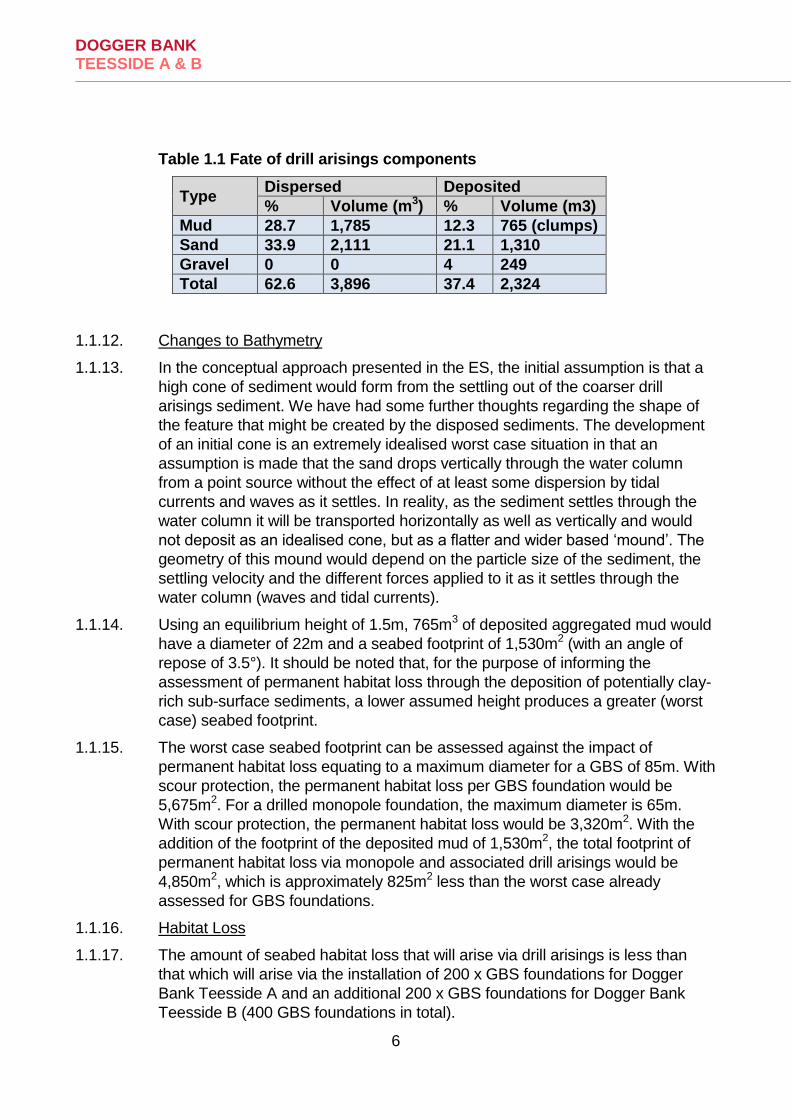
DOGGER BANK TEESSIDE A & B
6
Table 1.1 Fate of drill arisings components
Type Dispersed Deposited
% Volume (m3) % Volume (m3)
Mud 28.7 1,785 12.3 765 (clumps)
Sand 33.9 2,111 21.1 1,310
Gravel 0 0 4 249
Total 62.6 3,896 37.4 2,324
1.1.12. Changes to Bathymetry
1.1.13. In the conceptual approach presented in the ES, the initial assumption is that a
high cone of sediment would form from the settling out of the coarser drill
arisings sediment. We have had some further thoughts regarding the shape of
the feature that might be created by the disposed sediments. The development
of an initial cone is an extremely idealised worst case situation in that an
assumption is made that the sand drops vertically through the water column
from a point source without the effect of at least some dispersion by tidal
currents and waves as it settles. In reality, as the sediment settles through the
water column it will be transported horizontally as well as vertically and would
not deposit as an idealised cone, but as a flatter and wider based ‘mound’. The
geometry of this mound would depend on the particle size of the sediment, the
settling velocity and the different forces applied to it as it settles through the
water column (waves and tidal currents).
1.1.14. Using an equilibrium height of 1.5m, 765m3 of deposited aggregated mud would
have a diameter of 22m and a seabed footprint of 1,530m2 (with an angle of
repose of 3.5°). It should be noted that, for the purpose of informing the
assessment of permanent habitat loss through the deposition of potentially clay-
rich sub-surface sediments, a lower assumed height produces a greater (worst
case) seabed footprint.
1.1.15. The worst case seabed footprint can be assessed against the impact of
permanent habitat loss equating to a maximum diameter for a GBS of 85m. With
scour protection, the permanent habitat loss per GBS foundation would be
5,675m2. For a drilled monopole foundation, the maximum diameter is 65m.
With scour protection, the permanent habitat loss would be 3,320m2. With the
addition of the footprint of the deposited mud of 1,530m2, the total footprint of
permanent habitat loss via monopole and associated drill arisings would be
4,850m2, which is approximately 825m2 less than the worst case already
assessed for GBS foundations.
1.1.16. Habitat Loss
1.1.17. The amount of seabed habitat loss that will arise via drill arisings is less than
that which will arise via the installation of 200 x GBS foundations for Dogger
Bank Teesside A and an additional 200 x GBS foundations for Dogger Bank
Teesside B (400 GBS foundations in total).
DOGGER BANK TEESSIDE A & B
7
1.1.18. A full assessment of habitat loss from the placement of these 400 x GBS
foundations is provided in Chapter 12 of the Dogger Bank Teesside A & B ES
(ref 6.12). Therefore, no further assessment of habitat loss specifically related
to drill arisings is provided here on the basis that these effects will be no greater
(in terms of habitat loss as m2) than those already assessed (and concluded to
result in negligible and/or minor adverse impacts.
1.1.19. Of note to the issue of habitat loss is that following discussions with NE/JNCC
as part of the Dogger Bank Creyke Beck Examination, the effect of habitat loss
from drill arisings (and any foundations) has been agreed to be defined as long-
term temporary habitat loss (assuming that all structures/drill arisings are
removed at the time of decommissioning).
1.1.20. In Chapter 12 of the Dogger Bank Teesside A & B ES, habitat loss via
placement of drill arisings (and foundations), has been assessed as permanent
habitat loss. However, in order to tie in with assessments presented in the
Habitats Regulation Assessment (HRA) report and also in recognition of the
conservation objectives of the site, this effect is now being treated as long-term
temporary habitat loss. This enables the conservation objective of “restore”
selected Annex I habitats in the Dogger Bank cSAC to be met.
1.1.21. Habitat Introduction
1.1.22. As described above in relation to habitat loss, a position has been taken in the
assessment of drill arisings on seabed habitats that these mounds are a direct
analogue for foundations, insomuch that both will result in long-term temporary
habitat loss (although drill arisings will result in less such habitat loss than GBS
foundations).
1.1.23. Whilst this is a sensible approach in assessing (long-term temporary habitat
loss), it is not the most appropriate approach when discussing habitat
introduction. This is because the potential effects on marine ecology from
introducing up to 400 x GBS concrete foundations with associated scour
protection (rock) will differ when compared to the introduction of up to 400 x drill
arising mounds, which will comprise sand, gravel, clay and muds.
1.1.24. The effect on marine ecology from the introduction of up to 400 x GBS
foundations, i.e. colonisation by epifauna of hard substrate, has already been
assessed in Chapter 12 of the Dogger Bank Teesside A & B ES. In terms of
potential effects on marine ecology via the introduction of up to 400 x drill arising
mounds, as detailed above, each individual mound will vary in its mixture of
sand, gravel clay and muds. However, potential colonisation of these mounds
will differ from that predicted on GBS foundations for a number of reasons;
1.1.25. Firstly, the fact the mounds will comprise sands, gravels and muds will mean
that potential colonisation by infaunal species will occur, in addition to potential
colonisation by epifauna. It is not possible to state exactly what form/time period
over which, any such re-colonisation will occur but it is possible to note that for
mounds with the highest proportion of sands, re-colonisation by infaunal
organisms is predicted to occur within months.

DOGGER BANK TEESSIDE A & B
8
1.1.26. This prediction is based on the fact that many of the biotopes recorded in
Dogger Bank Teesside A & B, particularly those classed into VER A and VER B,
contain species that show a high recoverability to both the disturbance that may
arise via deposition of any drill arisings and the subsequent smothering that will
occur.
1.1.27. It should be recognised also that only small proportions of these biotopes will be
affected by these mounds and, therefore, unaffected areas of seabed adjacent
to these mounds will provide a ready source of juvenile larvae and subsequent
recruitment which will, in turn, also assist recovery of the mounds in terms of
benthic communities.
1.1.28. Evidence for such rapid recovery of these biotopes to similar effects exists from
studies of marine aggregate sites of the south coast of the UK (see Newell et al,
20041). Data from benthic monitoring of sites where both physical disturbance
(dredging) and smothering (via screening of sediments) took place, indicated
that following initial suppression of species diversity, abundance and biomass,
recovery of species diversity to within 70-80% of levels in non-affected areas
was achieved within 100 days. Species abundance also recovered within 175
days.
1.1.29. For mounds with higher proportions of muds (which may be deposited in a
consolidated form as “clumps”), and lower proportions of sands, recovery of
infauna will not occur as quickly as described above for mounds with high
proportions of sand. Depending on the exact nature of these mounds, the
proportion of sand may be so low that infaunal communities will not develop,
and instead, epifaunal communities, not dissimilar to those that may develop on
the concrete GBS foundations, may form on these mounds.
1.1.30. In reality, due to each individual drill arising mound comprising a different
proportion of sands, gravels, muds and clays, the exact nature and speed of any
subsequent recovery and re-colonisation by benthic infauna and epifauna will
vary across the site. However, the mounds will support some form of benthic
communities, the majority of which are predicted to be similar or identical to
those that already occur within Dogger Bank Teesside A & B.
1.1.31. In terms of implications for impact assessment, HRA and on-going work on the
application, although Chapter 12 of the Dogger Bank Teesside A & B ES
included the area of these drill arising mounds in the calculations of “temporary
habitat disturbance”, (and discussed the issues of recovery of these mounds in
terms of recolonisation by benthic fauna), it is proposed that to be consistent
with the approach that has been agreed for Dogger Bank Creyke Beck, the area
(m2) of seabed covered by the drill arising mounds are in fact considered as
permanent habitat loss (as per the definition of the ES; although now defined as
“long-term temporary habitat loss” – see earlier section on Habitat Loss for
rationale for this change in terminology).
1 Newell, R.C., Seiderer, L.J., Simpson, N.M and Robinson, J.E. (2004). Impacts of marine aggregate dredging on
benthic macrofauna off the South Coast of the United Kingdom. Journal of Coastal Research, 20, 115-125.

DOGGER BANK TEESSIDE A & B
9
1.1.32. Therefore, even though the mounds will provide habitat for recovery as
described in preceding sections, a very conservative approach has been
adopted in that these mounds have been effectively “written off” as viable habitat
and instead, described as areas of long-term temporary habitat loss.
1.1.33. Reference: RPS. 2012. Dogger Bank Drilling Arisings Study – Teesside A and
B. Technical Note to Forewind, November 2012.
1.2. 5.2 Cable Protection
1.2.1. Natural England requires clarity on how the lengths of cable requiring
protection outlined in the environmental statement have been determined.
1.2.2. As stated in Section 3.10 of Chapter 5 of the ES, cable burial is the preferred
protection technique for cables. However, where burial is impractical or sufficient
depth is not achievable, additional or alternative remedial cable protection
methods may be used. The quantities of remedial cable protection contained
within the Dogger Bank Teesside A & B application are the result of geophysical
and benthic surveys carried out by Forewind during the EIA. These surveys are
not yet sufficient to allow a detailed cable burial and routing plan to be
determined. The exact locations of the remedial cable protection would be
specified later during the detailed design phases of the Dogger Bank Teesside A
& B projects after additional geotechnical surveys have been conducted and the
detailed design of the export cable system has been undertaken.
1.2.3. The final approach to cable burial is based on a combination of factors, including
the cable system design, the available installation vessels and tools, and the
local seabed geology. The final selection of burial tool in particular will require
the existing geophysical data to be ground-truthed against a geotechnical
survey along the cable route. The geotechnical survey will potentially consist of
a large number of boreholes and CPTs in selected locations along the route,
and is necessary to allow the precise soil properties to be determined. These
soil properties will allow the most suitable tool to be selected and this will be a
key factor in determining which areas require remedial cable protection.
1.2.4. The data acquired during the geophysical and benthic surveys was sufficient to
gain an understanding of the seabed conditions in order to identify baseline
conditions and a worst case scenario for use in the EIA. In developing this
understanding Forewind reviewed the geophysical survey data to identify the
likelihood of being able to bury cables in certain areas or where cable burial is
challenging and therefore cable protection is more likely. As a result Forewind
was able to provide a value of cable burial and protection required over the
entire length of the cables, rather than identify specific locations
1.2.5. However, regardless of the location where protection is used the Dogger Bank
Teesside A & B EIA is based upon a worst case assessment. For example, for
an assessment on the effects of sediment transport during the operation phase,
it has been assumed the entire length of the cable is protected in the vicinity of

DOGGER BANK TEESSIDE A & B
10
the most sensitive receptors being assessed. The same approach has been
taken for the other assessments conducted as part of the EIA, for example
where cable burial has been deemed the worst case during construction, it has
been assumed that the entire length of the cable has been buried. The use of
the worst case is consistent with the Rochdale Envelope approach taken by
Forewind. Given that there is a high level of uncertainty as to where the export
cable could potentially be buried, we have assumed that during construction all
of the export cable would be fully buried. This means for the impacts of
suspended sediments during construction of the export cable, the worst case
has been assessed, producing disturbance that would potentially release the
greatest amount of sediment.
1.3. 5.3 The assessment of nearshore sediment transport during operation
1.3.1. Natural England notes that no numerical model was used to assess
nearshore sediment transport. Natural England considers that for a
development of this size with 4 export cables (per project) and the
potential for significant cable protection to be required a standardised
method for assessing sediment transport should be used.
1.3.2. For clarification there are two HVDC export cables per project, four for the
combined Dogger Bank Teesside A & B application.
1.3.3. There is no standardised method for assessing sediment transport. There are a
variety of methods that could be used including numerical modelling and
conceptual analysis. Conceptual analysis was the chosen method used in
assessing nearshore sediment transport in the ES for the following reasons:
• Longshore sediment transport rates are known to be low along this coastline and contained between headlands at Redcar and Saltburn-by-the-Sea, and there would be no effects outside of this zone.
• During operation, the export cable will be buried from the cliffs out to approximately 750m from the cliffs (350m beyond MLWS), and so will have no effect on longshore sediment transport processes.
• During construction, the low longshore sediment transport rates, the
‘closed system’ caused by the headlands, and the nature of the works at the landfall, means that the magnitude of change ‘downdrift’ will be low and temporary.
1.3.4. Recently, modelling of longshore sediment transport rates has been completed
as part of the ongoing Cell 1 Sediment Transport Study. The aim of the study is
to improve understanding of the governing sediment transport mechanisms and
pathways across Coastal Cell 1 (St. Abb’s Head in Scotland to Flamborough
Head in East Riding of Yorkshire).
DOGGER BANK TEESSIDE A & B
11
1.3.5. As part of the study, numerical modelling of longshore sediment transport has
been undertaken at a number of representative transects throughout the Cell.
One of these transects is located at Saltburn-by-the-Sea, just to the east of
Marske-by-the-Sea. At this transect, the longshore sediment transport potential
across the profile under the average annual wave climate has been determined
using the LITDRIFT model. The results are summarised below.
1.3.6. Figures 1.1 and 1.2 present the results from the LITDRIFT modelling, showing
the gross and net longshore sediment transport potential at each transect under
mean high water spring and mean low water spring water levels, respectively.
On each figure:
• the yellow area shows the original shore profile and nearshore bathymetry;
• the brown line shows the gross positive (southerly) sediment transport potential across the shore profile and nearshore bathymetry;
• the red line shows the gross negative (northerly) sediment transport potential across the shore profile and nearshore bathymetry; and
• the green line shows the net sediment transport potential across the shore profile and nearshore bathymetry
1.3.7. Note that the topographic/bathymetric levels (in metres OD) are shown on the
primary y-axis, the sediment transport rate (m3 per metre run) is shown on the
secondary y-axis and the transect chainage (in metres) is shown on the x-axis.

DOGGER BANK TEESSIDE A & B
12
Figure 1.1 Net annual longshore sediment transport (MHWS) at Saltburn-by-the-Sea
Figure 1.2 Net annual longshore sediment transport (MLWS) at Saltburn-by-the-Sea

DOGGER BANK TEESSIDE A & B
13
1.3.8. The gross southerly sediment transport at Saltburn-by-the-Sea is about
1,000m3/year and the gross northerly sediment transport is about 900m3/year.
This results in a minor net southerly sediment transport of approximately
100m3/year. These values clearly show that longshore sediment transport is not
the major factor in shaping the beach morphology along the Saltburn-by-the-Sea
frontage (and by virtue of its proximity to Saltburn-by-the-Sea a similar
behaviour is expected at the Marske-by-the-Sea frontage).
1.4. 5.4 Assessment of Active Zone Transport
1.4.1. Natural England also considers that the current assessment of the active
transport zone (i.e. within the 10m contour) is incomplete. Natural England
questions whether there is any movement of material slightly further
offshore (within the defined active zone 10m contour) which may bypass
this beach area, but still feed other areas further south. In addition Natural
England suggests that the Applicant consults the Shoreline Management
Plan in relation to the sediment transport regime within the area, as this
would provide additional information to confirm the findings from the
physical evidence on the beach.
1.4.2. Forewind are committed to burying the export cable 350m seaward of MLWS,
which relates to approximately 750m seaward of the cliffs at Marske-by-the-Sea
(across the active intertidal zone and shallow subtidal zone). In this 750m zone,
the export cables will have no effect on wave- and tidally-driven coastal
processes. Beyond 350m seaward of MLWS there is the potential for the export
cable to be protected at the seabed, and this potential remedial protection, could
affect the longshore sediment transport processes if placed in the active
transport zone. To investigate the potential effect of remedial protection on the
longshore sediment transport regime, we have defined the active wave-driven
littoral zone using the formula of Houston (1995) which is based on a mean
annual significant wave height (Ḣs):
hin = 6.75 Ḣs
where (hin) is the seaward limit of the active zone or closure depth.
1.4.3. The mean annual wave climate towards the western end of the export cable
corridor is approximately 1.0–1.5m. Taking the higher value as a conservative
approach, the Houston formula yields a wave closure depth in about 10m water
depth, which is approximately 2km offshore from mean low water spring along
the cable route. Consequently, any remedial protection seaward of 2km
offshore would have no effect on wave-driven longshore sediment transport
processes.
1.4.4. Also, the results of the Cell 1 Sediment Transport Study, presented in our
response to question 5.3 above (Section 1.3) show that net longshore sediment

DOGGER BANK TEESSIDE A & B
14
transport is very low (100m3/year) and limited to a zone of around 700m wide
starting at the upper shore. Transport is therefore confined to the intertidal and
shallow nearshore zones. Sediment transport offshore of 700m is less than
100m3/year and remedial protection would therefore have no effect on transport
rates of this very low magnitude.
1.4.5. Reference: Houston, J. R. 1995. Beach-fill volume required to produce specified
dry beach width. Coastal Engineering Technical Note 11-32, U.S. Army
Engineer Waterways Experiment Station, Vicksburg, MS.
1.5. 5.5 The assessment of export cable scour impacts during operation
1.5.1. Natural England notes that no numerical model was used to assess export
cable scour impacts. Natural England considers that for a development of
this size with 4 export cables (per project) and potential for significant
cable protection, a standardised method for scour effects should be used.
1.5.2. For clarification there are two HVDC export cables per project, four for the
combined Dogger Bank Teesside A & B application.
1.5.3. There is no standardised method and no numerical model that can assess scour
around export cables. Indeed, there is very little information available concerning
the issue of scour around the edges of low submerged bunds.
1.5.4. The use of remedial cable protection will most likely be in areas where the
seabed substrate is poor for burial of cables. In these locations, the seabed will
comprise outcropping mudstone, Bolders Bank Formation or Dogger Bank
Formation or a thin layer of sand with these formations sub-cropping. All these
geological units are stiff to hard, and cannot be eroded (or nominally eroded) by
hydraulic scour and therefore act as barriers to erosion.
1.5.5. Given the absence of, or limited amounts of, loose surface sediment in close
proximity to any remedial protection, and the presence of a non-erodible layer at
or close to the seabed, it is anticipated that the volume of sediment that will be
suspended due to scour around the protection would be very small. Hence,
there was no need to include this component in the plume dispersion model
because the volume would be effectively zero compared to the total volume of
scoured sediment around the worst case configuration of 400 6MW conical GBS
structures.
1.6. 5.6 Operational impacts of inter-array cable protection and auxiliary structures
1.6.1. It is not clear how cable protection and auxiliary structures have been
included in the modelled assessments for operational impacts.
1.6.2. In the operational modelling, it is assumed that the cables are buried and no
consideration is given in the models to cable protection because of their buried

DOGGER BANK TEESSIDE A & B
15
nature. Even if cable protection was installed the local change in bathymetry
caused by such a structure would have a negligible effect on the wave and tidal
current regimes, and hence suspended sediment concentration, in their vicinity
(see also the response to question 5.5 (1.5.2 to 1.5.5) above).
1.6.3. Auxiliary structures including platforms, meteorological masts and vessel
moorings have been included in the modelled assessments for operational
effects. Each project layout includes seven platforms (accommodation, collector
and converter), five meteorological masts and ten moorings and they have been
modelled as worst case ‘size-equivalents’ of turbine foundations. For the
meteorological masts and moorings, the worst case equivalent foundation is
considered to be a 4MW conical GBS, which has been applied at each location
where they are present. This approach is considered to be the worst case
because it over-estimates the effect of the meteorological mast foundations and
significantly over-estimates the effect of the moorings. For platform structures,
the worst case equivalent foundation is considered to be a 10MW conical GBS.
1.7. 5.7 Cumulative Operational Impacts of turbine scour protection
1.7.1. Natural England previously asked for post construction scour data of
Teesside Operational wind farm to be added to the assessment (see point
41 of the section 42 consultation submitted by Natural England on 13th
November 2013). Natural England acknowledges that the data is currently
unavailable, but we require confirmation from the Applicant on when the
data will be made available.
1.7.2. The construction of the Round 1 EDF-ER Teesside Offshore Windfarm
(Teesside OWF) has been completed, and so the only cumulative effects would
arise from operation of Teesside OWF with the construction of Dogger Bank
Teesside A & B export cables. However, given that scour protection has been
placed around the Teesside Offshore Windfarm turbine foundations, there will
be no operational sediment plume from the wind farm and hence no cumulative
effect with the Dogger Bank Teesside A & B export cables.
1.7.3. It is assumed that post construction data will be in the process of being collected
by the developer EDF-ER as part of their consent requirements. It is not known
when this data would be available, but it is unlikely to be until completion of one
year of operation.
1.8. 5.13 Interruption to sediment transport pathways within the Dogger Bank SCI
1.8.1. Natural England notes that, at this stage, it is not possible to identify the
position, length and orientation of cable protection. However, Natural
England advises that more detailed information should be provided to
inform the Appropriate Assessment before Dogger Bank Teesside
DOGGER BANK TEESSIDE A & B
16
projects A & B can be consented. Natural England recommends that
within the boundary of the Dogger Bank SCI, cables are buried to an
optimum depth.
1.8.2. Less than 20% of the total length of inter-array cables could potentially be
surface-laid and require remedial protection within the Dogger Bank Teesside A
& B project areas. A worst case of 20% of the total length is therefore
considered. The maximum total length of the inter-array cables in Dogger Bank
Teesside A & B is 1,900km, with a maximum possible protected length of
364km, which could cause a potential barrier to sediment transport across the
Dogger Bank SCI. Any potential remedial protection for the inter-array cables
will have worst case dimensions of 4.5m wide at the base, 0.5m wide at the top,
and 0.7m high.
Forewind confirm that the use of rock for cable and scour protection will always
be minimised to the amount required to meet the objectives of the application in
question, whether it be protection from scour processes, or from activities such
as trawling. Cable burial is the preferred protection technique, since for the
seabed conditions identified at Dogger Bank Teesside A & B, it typically
provides the best protection, at the lowest cost, in the shortest time. The
offshore cables will therefore be buried wherever it is feasible and economic to
do so, with additional or alternative protection measures only applied if
necessary. Forewind has already committed to burial of 80% of inter-array
cables within Dogger Bank Teesside A & B.
1.9. 6.1 Bypassing method for cofferdams
1.9.1. Bypassing method for cofferdams: Natural England notes that sediment
bypassing will be implemented if there is evidence of sediment accretion
to the north-west of the cofferdams coupled with depletion to the south-
east of the cofferdams. Natural England requires further detail on the
expected/standard bypassing method to be undertaken should the agreed
monitoring measures identify that remedial actions are required.
1.9.2. If cofferdams are required at the beach HDD exit points the project mitigation will
include a scheme for monitoring movement of beach material. Should the
monitoring identify evidence of sediment accumulation to the north west of the
cofferdams whilst at the same time beach levels are being depleted to the south
east, works will be undertaken to allow the sediments to bypass from the north
west to the south east.
1.9.3. There are a range of potential methodologies that may be used for the
bypassing of the sediments. Given that the cofferdams would be temporary
structures, present for a relatively short duration, it is probable that the preferred
method would be to transfer the sediment to the south east with the construction
equipment used to excavate the cable beach exit, whereupon they will return to
the existing sediment transport paths.

DOGGER BANK TEESSIDE A & B
17
1.9.4. Prior to any works commencing on the beach a detailed method statement for
the installation and management of the cofferdams will be provided as part of
the Construction Method Statements to the MMO and the Local Authority,
Redcar & Cleveland Borough Council to be approved. The Construction Method
Statement would describe the methodology for sediment bypassing.
1.10. 6.2 Backfilling of cofferdam pits
1.10.1. Natural England requires further clarification on comment 2.28 of the
Applicant’s point by point response to Natural England’s Section 42 of the
Planning Act pre-application Consultation (submitted on 13th November
2013) where it is stated that the “beach sand lacks any cohesion”. Is this
based on site specific geotechnical data? If not, Natural England advises
that surveys of this nature should be carried out and described in a Cable
Burial Management Plan. This document should highlight how the material
will be removed, stored and replaced. Geotechnical surveys will also
confirm the different sand layers and inform the need for a stratified
removal and replacement strategy.
1.10.2. The cofferdam structures would be in the form of a watertight sheet-piled
perimeter, or similar. The cofferdams would be constructed by excavators and
machinery capable of working in the inter-tidal area and brought ashore by
barge from the sea. Excavated material for later backfill may be stored on a
barge, or alternatively stockpiled elsewhere away from the influence of tides or
waves.
1.10.3. Prior to any works commencing on the beach a detailed method statement for
the installation and management of the cofferdams will be provided as part of
the Construction Method Statements to the MMO and the Local Authority,
Redcar & Cleveland Borough Council to be approved. The Construction Method
Statement would describe the methodology for excavation, storage and
backfilling of beach materials.
1.10.4. The statement that beach sand lacks any cohesion is based on general
scientific principles of cohesive processes. Silts and clays are cohesive.
Cohesion mainly results from the presence of platy clay minerals in the
sediment, which are held together by a combination of electrostatic attraction
and surface tension of the water surrounding the particles. Non-cohesive
sediments contain coarser sand and/or gravel particles, which are often more
spherical than cohesive sediments. They lack the physio-chemical interactions
that exist between clay particles, and so are free to move independently. Hence,
the sand on the beach at the landfall lacks cohesion.

DOGGER BANK TEESSIDE A & B
18
1.11. 6.3 Cumulative Operational Impacts of sediment deposition and suspended sediment plumes in a transboundary context
1.11.1. In their point by point response to Natural England’s section 42
consultation (submitted on 13th November 2013), the Applicant states
“there is very little deposition of sediment from the cumulative plume
across the international boundary (maximum of 0.1mm to 0.5mm). In terms
of the suspended sediment concentrations, the exceedance data shows
that the vast majority of the cumulative plume that crosses the
international boundary only exceeds the baseline up to 10% of the time.”
Natural England advises that this statement should be set out within a
clarification note and requires further clarification as to whether the
conclusions made were as a result of the sampling location (i.e. sampling
points situated away from the international boundary).
1.11.2. The conclusions are based on the results of plume dispersion modelling. The
figure in the ES is reproduced below (Figure 1.3) and shows that the
depositional footprint from the sediment plume has minimal interaction with the
seabed across the international boundary.
Figure 1.3 Maximum cumulative operational deposition predicted over the
simulation period of 30 days

DOGGER BANK TEESSIDE A & B
19
2. Chapter 12 Marine and Intertidal Ecology
2.1. 4.36 / 4.37 Natural England’s Position on the Dogger Bank Teesside projects A & B
2.1.1. Natural England’s current position on Dogger Bank Teesside projects A &
B mirrors our current position on for Dogger Bank Creyke Beck project
(section 4.33), although further discussion with the Applicant is welcomed
to determine the extent of impact in combination with the Dogger Bank
Creyke Beck and Dogger Bank Teesside C & D offshore renewables
projects in addition to other plans and projects. It is recognised that
further work for the Dogger Bank Creyke Beck projects impact
assessment is being undertaken and it would be helpful for the Applicant
to provide a clarification note updating the current applications’
assessment once these discussions have been concluded. Natural
England’s outstanding concerns regarding the effects of Dogger Bank
Teesside projects A & B on the Dogger Bank SCI are largely based on the
eventual nature of the disposal mounds. The potential impacts of concern
are:
Habitat loss
Habitat introduction
Changes in topography
Changes in surface sediments
2.1.2. A response on habitat loss and habitat introduction in terms of marine ecological
issues, has been provided in the response produced for Chapter 9, Marine
Physical Processes (1.1.3 to 1.1.33).
2.2. 5.9 Cumulative operational impacts of the introduction of hard substrates into a mainly sedimentary environment:
2.2.1. Section 10.7.2 of the ES concludes that the introduction and colonisation
of new species would be unlikely on the basis of shipwrecks. Section
10.7.3 subsequently concludes no form of cumulative impact between
different projects is predicted. Natural England does not consider these
conclusions to be justified as the increased activity in the area along with
the connectivity provided between operating wind farm would greatly
increase such risk of introduction. Natural England would welcome
further discussions on this subject.
2.2.2. Forewind notes the fact that Natural England do not consider the conclusions
presented in Sections 10.7.2 and 10.7.3 of Chapter 12 of the Dogger Bank
DOGGER BANK TEESSIDE A & B
20
Teesside A & B ES (ref 6.12) to be justified. These conclusions were based on
the best available evidence of colonisation of hard structures in this part of the
southern North Sea and monitoring data from operational UK offshore wind
farms (albeit much closer inshore than Dogger Bank Teesside A & B).
2.2.3. Forewind are happy to discuss this issue further with Natural England.
2.3. 5.10 Biotope Mapping
2.3.1. Natural England has outstanding concerns regarding potential
consistency and comparative issues between the Dogger Bank Creyke
Beck project and the Dogger Bank Teesside A & B projects, particularly
with regard to post-construction monitoring and cumulative impacts.
Natural England welcomes further discussion with the Applicant on this
issue.
2.3.2. See responses 2.4.2 to 2.4.3.
2.3.3. Forewind welcomes further discussion with Natural England on this issue and
intends to provide a technical note on future benthic monitoring.
2.4. 5.11 Cumulative Impacts
2.4.1. In line with the comments above Natural England has outstanding
concerns regarding biotope mapping. Although Appendix D to Chapter 12
is useful in presenting a zonal representation of the biotopes, there is no
zonal representation of the VERs. Natural England advises that it would
be useful if the Applicant could provide a zonal representation of the VERs
to enable a complete representation of the project area.
2.4.2. In response to comments 5.10 and 5.11 (2.3 and 2.4 of this appendix), Forewind
refer Natural England to information provided by Forewind in response to similar
comments raised by Natural England on the Dogger Bank Teesside A & B draft
ES, submitted in October 2013 as part of the second stage of statutory
consultation (in accordance with Sections 42, 47 and 48 of the Planning Act
2008). Forewind’s responses were provided in the format of a point by point
response on 23 March 2014 and are included within Appendix 1, for ease of
reference.
2.4.3. Forewind also request that more specific details be provided by Natural England
with regard the concerns related to “consistency” and “comparative issues”.
With respect to the request for a figure showing the zonal representation of
VER’s, this is attached (inserted below as Figure 2.1 and included as stand-
alone file).

DOGGER BANK TEESSIDE A & B
21

DOGGER BANK TEESSIDE A & B
22
2.5. 5.12 Sample Size
2.5.1. Natural England questions why there is no spatial distribution diagram to
present the section of cable corridor that passes through Tranche A.
Natural England advises that it would be useful for further clarification to
be provided to ensure that this section of the cable corridor has been
adequately assessed.
2.5.2. The figure included in this response (above) shows the spatial distribution of
VER’s within the Dogger Bank Teesside A & B Cable Corridor that passes
through Tranche A. Forewind can confirm that this section of the Export Cable
Corridor has been fully assessed within Chapter 12 of the Dogger Bank
Teesside A & B ES (ref 6.12).
2.6. 6.5 Marine Conservation Zones (MCZs)
2.6.1. Compass Rose and Runswick Bay are two MCZs within the Dogger Bank
Teesside projects A & B study area. Whilst Natural England welcomes the
inclusion of both sites in the Applicant’s assessment, Natural England
considers that in order to future-proof any consent, it is good practice to
treat rMCZs as designated MCZs for the purposes of assessment.
2.6.2. This comment is noted. In Chapter 12 of the Dogger Bank Teesside A & B ES
(ref 6.12), an assessment of potential impacts on these two rMCZs was
presented, albeit not in relation to any conservation objectives for these rMCZs
as these have not been produced to date. When such conservation objectives
for these two rMCZs are produced, Forewind will consider how the proposed
Dogger Bank Teesside A & B projects have the potential to affect these
conservation objectives.
2.7. 6.6 Monitoring of Construction Phase Impacts
2.7.1. Monitoring of construction phase impacts: Natural England is pleased to
note that the Applicant has plans to implement pre and post-construction
monitoring. Natural England would like the Applicant to confirm that this
is in line with the Dogger Bank Creyke Beck project In Principle Monitoring
Plan (IPMP) discussions, for which Natural England should be consulted.
2.7.2. Forewind can confirm that the pre and post-construction monitoring related to
benthic ecology proposed for the Dogger Bank Teesside A & B project is in line
with that proposed within the Dogger Bank Creyke Beck In Principle Monitoring
Plan (IPMP). An IPMP will be produced specifically for Dogger Bank Teesside A
& B in consultation with Natural England.

DOGGER BANK TEESSIDE A & B
23
2.8. 6.5 Loss of Habitat due to scour protection
2.8.1. Natural England welcomes clarifications provided by the Applicant
concerning loss of habitat due to scour protection, in response to our
Section 42 consultation (submitted in 13th November 2013). Natural
England now asks the Applicant to produce these clarifications separately
within a clarification note.
2.8.2. A separate clarification note will be provided to Natural England.
2.9. 6.8 Brittlestars and Ocean Quahog
2.9.1. Brittlestar beds are widespread around the UK, but are uncommon on a
global scale and can play a major role in local ecosystems. Brittlestars
are considered a species of conservation interest and although this
habitat/species is not legally protected, Natural England considers it best
practice to implement a monitoring regime to investigate the impacts that
construction and operation of human activities have on brittlestar beds.
Ocean Quahog are listed on the OSPAR list of threatened species and
Natural England would similarly advise that adverse impacts are
minimised as far as practically possible.
2.9.2. Forewind note these comments related to Brittlestars and Ocean Quahog. As
part of the proposed benthic monitoring associated with the project, a full pre-
construction survey of the Dogger Bank Teesside A & B Export Cable Corridor
(where these species were recorded in EIA characterisation surveys) will be
undertaken which will identify all benthic habitats in the survey area and will also
enable the spatial distribution of these two species to be mapped.
2.9.3. Where practically possible, habitats supporting these species will be avoided by
construction activities. However, avoidance of damage to the habitats that
support these species cannot be guaranteed.

DOGGER BANK TEESSIDE A & B
24
3. Chapter 13 Fish and Shellfish Ecology
3.1. 6.9 Impacts to herring eggs in inshore spawning grounds from burial under sediment:
3.1.1. Natural England welcomes the clarifications provided by the Applicant on
the issue of impacts on herring eggs from sediment plumes and re-
deposition. However, Natural England does not agree with the conclusion
that burial of herring eggs under other eggs can be equated to impacts
from sediment exposure. We would like further discussion with the
Applicant, the MMO and CEFAS on this issue.
3.1.2. In this instance a direct comparison between eggs exposed to sediment
redisposition was perhaps unnecessary. The salient points which can be taken
from the cited literature are:
3.1.3. Eggs present in the bottom layers of spawning mats are likely subject to
reduced oxygen concentrations which may result in a slower rate of
development but there is apparently little difference in mortality between layers
(Parrish et al, 1959, Bowers 1969).
3.1.4. Successful hatching can still occur after exposure to air lasting between 1.5 to 7
hours (Winslade 1971) suggesting tolerance to low dissolved Oxygen
concentrations.
3.1.5. In addition, a number of other research articles highlight a degree of tolerance to
increased suspended sediment concentrations (SSC) / deposition in herring
eggs and larvae:
3.1.6. Messieh et al (1981) found no deleterious effects on herring eggs hatching at
concentrations as high as 7000 mg/l-1.
3.1.7. Kiørboe et al. (1981) established that herring eggs suffered no adverse effects
from continuous exposure to suspended sediment concentrations as high as
300 mg/l and tolerance to short term exposure at concentrations 500 mg/l-1.
3.1.8. Auld and Schubel (1978) found no detectable effect on hatching success of
blueback herring (Alosa aestivalis) at SSC of up to 100 mg/l-1.
3.1.9. It is acknowledged that other authors have suggested exposure to SSCs as low
as 250 mg/l (250 mg/l-1) may lead to retarded development and reduced larval
survival rates (Griffin et al, 2009) and burial under a thin layer of sediment may
result in some egg mortality (Messieh et al, 1981).
3.1.10. The results of coastal process modelling (Chapter 9 of the Dogger Bank
Teesside A & B ES (ref 6.9)) predict that maximum concentrations of
100-200 mg/l-1 will occur during cable installation only at two localised points
along the Dogger Bank Teesside A & B Export Cable, one close to shore and
the other approximately 50km from the coast. Average SSCs along the majority

DOGGER BANK TEESSIDE A & B
25
of the route are expected to be typically less than 100 mg/l-1, gradually reducing
with distance from the Dogger Bank Teesside A & B Export Cable Corridor to
2 mg/l-1 (equivalent to ambient conditions), 32km to the north and 18km south of
the corridor.
3.1.11. As the area of the Flamborough Head herring spawning ground intersected by
the Dogger Bank Teesside A & B cables represents a very small fraction of the
total spawning habitat available (0.84 km2; approximately 0.01%) potential
exposure to the highest sediment concentrations will occur only in localised
areas for a short duration. The wider grounds located to the south of the Dogger
Bank Teesside A&B export cable corridor (the Dogger Bank Teesside A & B
export cables cross the Flamborough grounds at their northern extremity) will
only be exposed to low concentrations that will diminish with increasing distance
from source.
3.2. 6.10 Effects of Cable protection:
3.2.1. Natural England notes that it is not currently possible to define areas
where cable protection is likely to be introduced. Natural England would
like to re-iterate that the preferred option for cable protection is burial to
an optimum depth, particularly in herring spawning areas. Natural England
would welcome further discussion with the Applicant on this if it should
become evident that cable protection may be required within the inshore
herring spawning grounds.
3.2.2. Herring spawning grounds are typically characterised by gravelly substrates. As
such, where the Dogger Bank Teesside A&B export cable corridor transects
herring spawning grounds it is anticipated that the nature of the substrate will
lend itself to cable burial. In this case any disturbance would be localised and
short term. As described in response to 6.9 (3.1.2 to 3.1.11) the spawning area
potentially impacted is very small comprising 0.84 km2, which is equivalent to
0.01% of the total Flamborough head grounds. In the instance that burial to
sufficient depth is not possible and alternative protection methods are necessary
it is likely that this would be required at localised, relatively short sections of the
cable as opposed to along the entire route.

DOGGER BANK TEESSIDE A & B
26
4. Chapter 10 Marine Water & Sediment Quality
4.1. 5.8 Deterioration in water quality due to re-suspension of contaminated sediments along the cable route during construction
4.1.1. Natural England notes that the overall conclusion for the impact of re-
suspension of contaminated sediments is negligible. However, no
information has been presented suggesting that recovery of water and
sediment quality will occur, and if it does, how long it is expected to take.
In addition, given the higher concentrations of contaminants found in
locations nearer the coast, Natural England considers the speed of cable
installation to be an unsatisfactory explanation for a low magnitude of
effect. Natural England considers that the Applicant should present
additional information in support of this assertion. Natural England
welcomes further discussion with the Applicant over this issue.
4.1.2. There are a number of ways in which potential impacts associated with re-
suspension of sediments containing contaminants can be assessed which are
applied depending on the perceived level of risk. The first is a qualitative type
assessment based on the application of Cefas Action Levels and Canadian
Sediment Quality Guidelines. The level of risk using this methodology is
determined on the basis of where the contaminant levels fall against these levels
and the environment/timeframe in/over which they will be released. Additionally,
the background concentrations of contaminants and risk of breaching
Environmental Quality Standards (EQS) is considered. Should these risk
indicators be triggered, then a more quantitative contaminant modelling exercise
could be undertaken which uses numerical modelling to predict numerical water
concentrations and timeframes over which these concentrations will occur. This
is a very expensive and lengthy process and is usually only implemented for
relatively confined areas (such as within estuaries) where levels of
contamination within the sediments are above Cefas Action Level 2 and/or water
quality is already showing elevated levels of a particular contaminant that could
be released by sediment disturbance (i.e. EQS exceedances have occurred or
could occur if the activity is to proceed). The time frame over which the activity
will occur is also an important consideration in determining the requirement for
this type of assessment.
4.1.3. The proposed installation of the cables is not to be undertaken within a confined
area such as within an estuary with little dilution/tidal mixing. Additionally, the
activity will be completed relatively quickly (i.e. a matter of hours) within the
particular area over which installation is occurring. Any plume generated will
therefore quickly disperse thus sediment concentrations released and any
associated contaminants are likely to reach baseline levels relatively quickly.
This is supported by the information presented in Section 6.4 in Chapter 10 of
the Dogger Bank Teesside A & B ES (ref 6.10) which looks more closely at the

DOGGER BANK TEESSIDE A & B
27
modelled outputs within the cable route by extracting time series information.
This information demonstrates that the high levels of suspended solids in the
bottom layer will only exist for 12 hours or so before they begin to return to
baseline conditions. This information is also presented in the associated
Technical Reports produced to support Chapter 9 of the Dogger Bank Teesside
A & B ES (ref 6.9). Finally, whilst concentrations of contaminants indicate levels
of contamination that are generally higher than those at the offshore location,
these levels are still lower than Cefas Action Level 2 at all sites for all
parameters with the exception of one sample at one site for nickel. As a result,
these sediments are unlikely to pose a significant risk to the environment, even if
released over longer periods of time. Overall therefore, an impact of negligible
significance is considered to be the appropriate assessment conclusion.

DOGGER BANK TEESSIDE A & B
28
5. Chapter 14 Marine Mammals
5.1. Marine Mammals
5.1.1. 8.1 The Applicant has made a good attempt at undertaking a cumulative
impact assessment (CIA). It took into consideration projects out-with the
Dogger Bank Zone and included all information currently available.
However, Natural England advises that it should be the regulator’s
responsibility to investigate cumulative impacts on marine mammal
populations as part of Strategic Environmental Assessments. Given the
complexity of CIA assessments for marine mammals, if this is left to
individual developers it will result in numerous CIAs, of variable quality,
using different methods and frameworks to answer the same question.
This adds considerable burden to Regulators and SNCBs and precludes
conclusions with any level of confidence.
5.1.2. Forewind acknowledges and welcomes the recognition from Natural England
that continued strategic discussion will be required and would like to suggest
that developer engagement in such a process could provide valuable input and
should ensure that any solutions do not hinder the delivery of offshore wind in
the UK.
5.1.3. 8.2 Until a strategic CIA is undertaken, Natural England’s advice
addresses the scenarios presented. The CIA shows that between 2016 and
2018 there is a possibility that over 15% of the harbour porpoise North Sea
Management Unit (and up to 10% of North Sea area) could be affected by
disturbance due to pile driving from projects both within and outwith the
Dogger Bank Zone. There is therefore concern in relation to potential
impact on harbour porpoise as both numbers of animals and area affected
represent a considerable proportion of the harbour porpoise management
unit.
5.1.4. Forewind would like to reiterate that the CIA completed within section 10 of
Chapter 14 Marine Mammals of the ES, takes a highly precautionary approach
to assessment. The CIA considers multiple worst case scenarios based on
impacts of disturbance from pile driving noise as presented in the ES for a
number of other offshore wind farm developments. It also considers that all
projects will be constructing at timelines identified in their ES, when a number of
the projects which could be constructing between 2016 and 2018 are yet to
receive consent. Subsequent construction programmes remain highly uncertain
in these as yet unconsented projects, thus leading to a worst case scheduling of
potentially concurrent pile driving activities.
5.1.5. As stated in the response provided in paragraph 5.1.2, Forewind welcomes the
adoption of a strategic approach in relation to the CIA for marine mammals.

DOGGER BANK TEESSIDE A & B
29
Forewind believe that this strategic approach will help to provide more realistic
worst cases in terms of programming and installation methods, and thus provide
a more robust and realistic CIA.
5.1.6. 8.3 Natural England welcomes Appendix C in Appendix 5A Underwater
Noise Modelling Technical Report. This document provides a review of the
current status of noise reduction methods, including alternate
foundations. Indeed, it will be beneficial if the developer makes a
concerted attempt to reduce the acoustic output from pile driving (e.g.
sleeving), to investigate alternative installation methods (e.g. suction
bucket) and to plan activities within the scope of what is proposed to
reduce the potential that they contribute to negative effects on
populations.
5.1.7. Forewind has recently undertaken a market review of piling noise mitigation
technologies, and has concluded that the technologies have not yet matured to
the degree necessary for them to be feasible for roll-out on Dogger Bank. Many
of the technologies used to date are judged to be pre-prototypes, or proof of
concept devices. Although some technologies have been demonstrated on
small and medium sized monopiles, and could now be said to be at prototype or
even early commercial level, we note that further technology developments are
still planned and we do not yet see evidence of fully commercialised solutions.
We also have not identified any deployment with large monopiles and only very
limited capabilities applicable to jacket piles. The experience which has been
gained so far with piling noise mitigation technologies is also not yet applicable
to the conditions at Dogger Bank. This includes a lack of experience in the
distance offshore, the harsh metocean climate, the potential foundation
requirements (such as large diameter monopiles, and jacket piles in general),
and the ‘gigawatt’ scale of the projects.
5.1.8. In order to ensure that low-noise foundation solutions are available as soon as
possible, the Forewind partners, along with many other industry participants, are
actively engaged in a range of major national and international research,
development, and demonstration projects, including:
5.1.9. All Forewind partners are members of the offshore wind accelerator, and thus
are funding a range of other R&D activities, including looking at gravity base
foundations, suction buckets, and piling noise mitigation approaches.
5.1.10. Joint Industry Onshore Validation of Vibrated Piles (VIBRO Project) – RWE is
leading a vibropiling capacity trial within the Offshore Wind Accelerator; primarily
intended to prove the installed performance of monopiles installed using
vibropiling (a quieter piling technique than impact piling) is suitable for offshore
monopile foundations. Other Forewind partners are considering their
participation.
5.1.11. Suction bucket installation trial – Statoil is leading and Statkraft are participating
in a suction bucket installation trial within the Offshore Wind Accelerator,
DOGGER BANK TEESSIDE A & B
30
intended to prove the reliability of suction bucket installation across a range of
ground conditions.
5.1.12. The Forewind partners will continue to monitor the progress of low noise
foundation solutions. It is noted that the foundation consent envelope for Dogger
Bank Teesside A & B has intentionally maintained flexibility, in order to allow the
Dogger Bank Teesside A & B projects to make best use of the current state of
the art in foundation technologies at the time of construction.
5.1.13. However, Forewind will continue to consider new technological approaches as
they advance and would reiterate that a number of foundation options
considered within the Rochdale Envelope do not involve piling and hence may
offer suitable alternative ‘quiet’ foundation options, if selected.
5.1.14. 8.4 Natural England welcomes the Applicant’s commitment to
implementing the JNCC piling guidelines as mitigation and will consult
with the regulator the development of an effective marine mammal
mitigation plan (MMMP) near construction time. Natural England also
recommends that the developers keep a watching brief on the work
carried out under the Offshore Renewables Joint Industry Programme
(ORJIP) on Acoustic Mitigation Devices and any further developments in
relation to mitigation options.
5.1.15. This is acknowledged by Forewind. Forewind will commit to following the
appropriate guidelines at the time of implementing the MMMP, noting that the
guidelines may change between now and the time of construction.
5.1.16. 8.5 Construction programming (siting and timing) at individual wind farm
sites or close clusters of projects should be considered in order to both
minimise total area of disturbance at any one time and reduce total period
of disturbance (acknowledging that some form of trade-off will be
inevitable). We recommend that a strategic overview is taken by the
regulator and SNCBs of concurrent and sequential pile driving in the North
Sea to that effect. Construction programming may need to be considered
across all projects and the Applicant has confirmed their commitment to
work with other developers, alongside Regulators and SNCBs, in order to
reduce cumulative effects as required. The Offshore Wind Developers
Forum (OWDF) could be a potential host for these discussions.
5.1.17. This is acknowledged by Forewind.
5.1.18. 8.6 Natural England also recommends that impact monitoring is
considered and that if deemed appropriate a monitoring plan is developed
by the Applicant in conjunction with regulators and SNCBs. Such
monitoring could aid in validating the conclusions in the ES and reduce

DOGGER BANK TEESSIDE A & B
31
uncertainty around some of the modelling assumptions which would
inform future projects and consenting rounds.
5.1.19. Forewind believe that site specific monitoring would not be an appropriate
measure of any potential change in marine mammal occurrence and distribution
during construction at Dogger Bank Teesside A and Dogger Bank Teesside B.
No significant impacts are predicted when considering Dogger Bank Teesside A
& B in isolation; therefore any impacts from Dogger Bank Teesside A & B alone
are unlikely to be detectable against natural variation within the North Sea. For
example, between the 1995 SCANS and 2005 SCANS II surveys there was a
large redistribution of harbour porpoise from the more northerly areas of the
North Sea, towards the south (Hammond et al. 2013). Such redistribution may
be a result of changes in prey availability, but fisheries by-catch may also have
affected abundance (Hammond et al. 2013). Forewind are committed to the
ORJIP programme, as well as the Disturbance Effects on the Harbour Porpoise
of the North Sea (DEPONS) project. Forewind believes that investment and
contribution to these initiatives will provide much more valuable insights than
could be achieved through site specific monitoring. In addition, should Forewind
no longer participate in DEPONS and/or should DEPONS not deliver outcomes
which are deemed appropriate by Natural England, the In Principle Monitoring
Plan (IPMP) will include provision for Forewind’s own monitoring to occur.
5.1.20. 8.7 The mitigation zone proposed in the Marine Mammal Mitigation
Protocol should reflect those predictions in the ES and cover the
maximum range out to which instantaneous Permanent Threshold Shift
occurs. Natural England looks forward to discussions with the Applicant
on the development of a Marine Mammal Mitigation Plan.
5.1.21. Forewind note that an exclusion zone will be in place out to the range of
instantaneous permanent auditory injury and that the range will be extended out
to 700m if deemed appropriate, at the point of development of the MMMP in
consultation with the appropriate statutory authorities. Forewind has also
committed to a soft start (starting at 10% of the maximum hammer energy) for
30 minutes. All marine mammals are expected to flee from the noise source
once the soft start is initiated and the use of a soft start will reduce the ranges for
potential onset of auditor injury to less than 100m for all marine mammal
species, including harbour porpoise. This is detailed in section 6.1.42 and
section 6.1.43 and Table 6.4 to Table 7.7 of Chapter 14 Marine Mammals of the
ES (ref 6.14).
5.1.22. 8.8 Natural England notes the importance of including the more recent
telemetry data for harbour seal from SMRU. We do recognise that the
inclusion of this data will be dependent upon its availability and therefore
may not be possible to include it in the assessment within the timeframe.
DOGGER BANK TEESSIDE A & B
32
We would like to highlight that once the data is available we will take the
evidence into consideration for future advice on Harbour seal.
5.1.23. This is acknowledged by Forewind.
5.1.24. 8.9 The Applicant has confirmed that a European Protected Species (EPS)
licence application will be completed once the foundation types have been
confirmed. Each EPS licence will require consideration of less noisy
alternatives to piling, the total area of impact, the duration of impact and
the number of animals likely to be affected would need to be clearly
presented.
5.1.25. This is acknowledged by Forewind.
5.1.26. 8.10 Natural England notes that the planned development of renewable
energy in UK waters could involve multiple piling events occurring
concurrently and sequentially across a species’ range, over several years.
This has the potential to have a detrimental impact on the favourable
conservation status of populations of cetacean species occurring in UK
waters. Continued strategic discussion is required between UK Regulators
and SNCBs to consider the wider issues of an EPS licensing framework
across UK waters as a whole.
5.1.27. Forewind acknowledges and welcomes the recognition from Natural England
that continued strategic discussion will be required in the EPS licensing process
and would like to suggest that developer input to such a process could provide
valuable input and should ensure that any solutions do not hinder the delivery of
offshore wind in the UK.
5.1.28. 8.11 Natural England is pleased to have received the Applicant’s Harbour
Porpoise Population Viability Analysis. Natural England considers that the
Applicant does not need to carry out any further work on this matter.
5.1.29. This is acknowledged by Forewind.
5.1.30. References
Hammond P.S., Macleod K., Berggren P., Borchers D.L., Burt L., Cañadas A.,
Desportes G., Donovan G.P., Gilles A., Gillespie D., Gordon J., Hiby L., Kuklik I.,
Leaper R., Lehnert K, Leopold M., Lovell P., Øien N., Paxton C.G.M., Ridoux V.,
Rogano E., Samarraa F., Scheidatg M., Sequeirap M., Siebertg U., Skovq H.,
Swifta R., Tasker M.L., Teilmann J., Canneyt O.V. and Vázquez J.A. (2013).
Cetacean abundance and distribution in European Atlantic shelf waters to inform
conservation and management. Biological Conservation 164, 107-122.