national park service - missouri department of natural ... f«m 10400 united states department of...
TRANSCRIPT
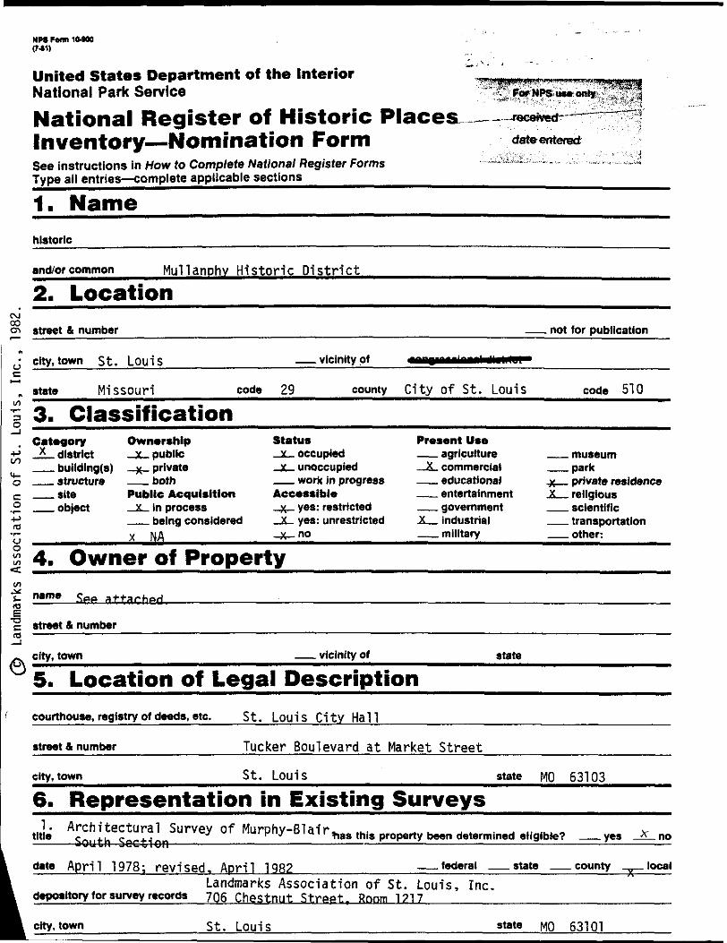
NPS F«m 10400
United States Department of the Interior
National Park Service
National Register of Historic Places
Inventory Nomination FormSee instructions in How to Compfefe National Register Forms
Type all entries complete applicable sections
1. Name__________________
historic ____________________
__.~receivetf"
date entered
and/or common Hullanphv Historic District
2. Location
street & number not tor publication
city,town St. Louis __ vicinity of
state Missouri code 29 county City Of St. Louis code 510
3. ClassificationCategory Ownership_*_ district _x_ public __ bulldlng(s) _x_ private __ structure —— both __ site Public Acquisition __ object X In process
__ being considered
x NA
Status_x_ occupied
X unoccupied —— work in progress Accessible
X yes: restricted x yes: unrestricted
-X-no
Present Use—— agriculture
X commercial —— educational __ entertainment —— government X _ industrial __ military
—— museum __ park _X — private residence -X_ religious __ scientific __ transportation __ other:
4. Owner of Property
SPP attached.
street & number
city, town __ vicinity of
5. Location of Legal Description
courthouse, registry of deeds, etc. St. Louis City Hall
street & number Tucker Boulevard at Market Street
city, town St. Louis state MO 63103
6. Representation in Existing Surveys__________
'"'"' ASouiheScctionSUrVey °f MUrPhy'BUir ^s this property been determined eligible? ——yes ^no
date April 1978; revised. April 1982_______________federal ——state ——county _,,_local
Landmarks Association of St. Louis, Inc. depository for survey records 7Q6 Chestnut Street, Rnnm 1717__________________________
city, town St. Louis 63101
=HR-8-300A
Cll/78)
UNITED STATES DEPARTMENT OF THE INTERIOR
HERITAGE CONSERVATION AND RECREATION SERVICE
NATIONAL REGISTER OF HISTORIC PLACES
INVENTORY - NOMINATION FORM
FOR HCRS USE ONLY
RECEIVED" ; v •;"••:";•,;•
CONTINUATION SHEET
MULLANPHY HISTORIC DISTRICT
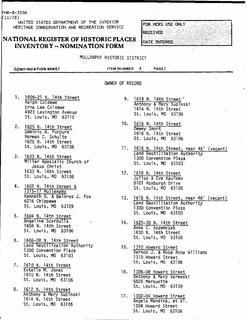
ITEM NUMBER 4 PAGEl
1. 1609-21 N. 14th Street
Ralph Coldewe
Erna Lee Coldewe
4923 Lexington Avenue
St. Louis, MO 63115
2. 1625 N. 14th Street
OWNER OF RECORD
9. 1614 N. 14th Street '
Anthony & Mary Supinski
1414 N. 14th Street
St. Louis, MO 63106
10. 1616 N. 14th Street
Dewev ShortDominic A. Purpura Norman C. Schulte 1625 N. 14th Street St. Louis, MO 63106
3. 1633 N. 14th StreetMiller Apostalic Church of
Jesus Christ 1633 N. 14th Street St. Louis, MO 63106
4. 1602 N. 14th Street & 1315-17 Mullanphy Kenneth D. & Del ores J. Fox 6216 Chippewa St. Louis, MO 63109
5. 1604 N. 14th Street Angelina Scarpulla 1604 N. 14th Street St. Louis, MO 63106
6. 1606-08 N. 14th StreetLand Reutilization Authority 1300 Convention Plaza St. Louis, MO 63103
7. 1610 N. 14th Street Estelle M. Jones 1610 N. 14th Street St. Louis, MO 63106
8. 1612 N. 14th Street Anthony & Mary Supinski 1614 N. 14th Street St. Louis, MO 63106
1616 N. 14th Street St. Louis, MO 63106
11. 1616 N. 14th Street, rear 46' Land Reutilitation Authority 1300 Convention Plaza St. Louis, MO 63103
[vacant)
12. 1618 14th StreetJulius & Eva Kaufman 8101 Roxburgh Drive St. Louis, MO 63105
13. 1618 N. 14th Street, rear 46' (vacant) Land Reutilitation Authority 1300 Convention Plaza St. Louis, MO 63103
14. 1620-30 N. Uth Street Anna C. Kozemczak 1630 N. 14th Street St. Louis, MO 63106
15. 1310 Howard StreetVernon J. & Rose Anna Williams 1310 Howard Street St. Louis, MO 63106
16. 1306-08 Howard Street Anthony & Mary Karwoski 5820 Marquette St. Louis, MO 63139
17. 1302-04 Howard Street Angela Mandina, et al. 1304 Howard Street St. Louis, MO 63106
FHR-8-300A
Cll/78)
UNITED STATES DEPARTMENT OF THE INTERIOR
HERITAGE CONSERVATION AND RECREATION SERVICE
NATIONAL REGISTER OF HISTORIC PLACES
INVENTORY -- NOMINATION FORM
MULLANPHY HISTORIC DISTRICT
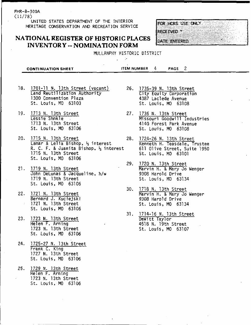
CONTINUATION SHEET ITEM NUMBER PAGE 2
18. 1701-11 N. 13th Street (vacant) Land Reutilization Authority 1300 Convention Plaza St. Louis, MO 63103
26. 1735-39 N. 13th Street City Equity Corporation 4387 Laclede Avenue St. Louis, MO 63108
19. 1713 N. 13th Street Lessie Shnkle 1713 N. 13th Street St. Louis, MO 63106
20. 1715 N. 13th StreetLamar & Lelia Bishop, % interest R. C. F. & Juanita Bishop, % interest 1715 N. 13th Street St. Louis, MO 63106
21. 1719 N. 13th StreetJohn DeLunas & Jacqueline, h/w 1719 N. 13th Street St. Louis, MO 63106
22. 1721 N. 13th Street Bernard J. Kuciejski 1721 N. 13th Street St. Louis, MO 63106
23. 1723 N. 13th Street Helen F. Arning 1723 N. 13th Street
St. Louis, MO 63106
24. 1725-27 N. 13th Street Frank C. King 1727 N. 13th Street St. Louis, MO 63106
25. 1729 N. 13th Street Helen F. Arning
1723 N. 13th Street St. Louis, MO 63106
27. 1736 N. 13th StreetMissouri Goodwill Industries 4140 Forest Park Avenue St. Louis, MO 63108
28. 1724-26 N. 13th StreetKenneth H. Teasdale, Trustee 611 Olive Street, Suite 1950 St. Louis, MO 63101
29. 1720 N. 13th StreetMarvin H. & Mary Oo Wenger 9308 Harold Drive St. Louis, MO 63134
30. 1718 N. 13th StreetMarvin H. & Mary Jo Wenger 9308 Harold Drive St. Louis, MO 63134
31. 1714-16 N. 13th Street DeWitt Taylor 4518 N. 19th Street St. Louis, MO 63107
FHR-8-300A
(11/78)
UNITED STATES DEPARTMENT OF THE INTERIOR FOR HTRS IKE 'ONLY
HERITAGE CONSERVATION AND RECREATION SERVICE W * U
NATIONAL REGISTER OF HISTORIC PLACES DATE EMTERED.INVENTORY -- NOMINATION FORM
MULLANPHY HISTORIC DISTRICT
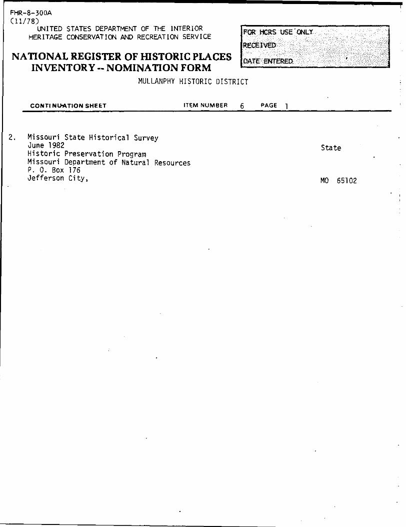
CONTINUATION SHEET ITEM NUMBER 6 pAGE
Missouri State Historical SurveyJune 1982 stateHistoric Preservation ProgramMissouri Department of Natural ResourcesP. 0. Box 176
Jefferson City, M0 65102
7. Description
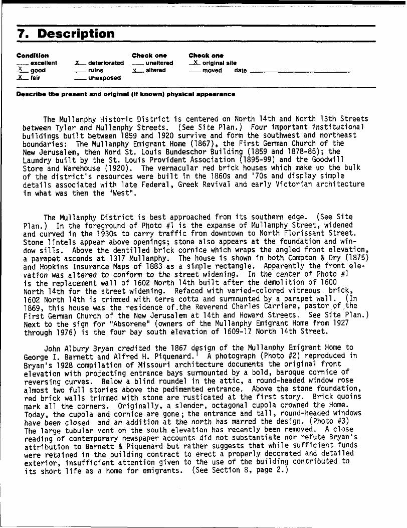
Condition
__ excellentX good
-X_fair
Check one
X _ deteriorated __ unaltered
ruins .X _ altered
__ unexposed
Check one
_X_ original site
Describe the present and original (if known) physical appearance
The Mullanphy Historic District is centered on North 14th and North 13th Streets between Tyler and Mullanphy Streets. (See Site Plan.) Four important institutional buildings built between 1859 and 1920 survive and form the southwest and northeast boundaries: The Mullanphy Emigrant Home (1867), the First German Church of the New Jerusalem, then Nord St. Louis Bundeschor Building (1859 and 1878-85); the Laundry built by the St. Louis Provident Association (1895-99) and the Goodwill Store and Warehouse (1920). The vernacular red brick houses which make up the bulk of the district's resources were built in the 1850s and '70s and display simple details associated with late Federal, Greek Revival and early Victorian architecture
in what was then the "West".
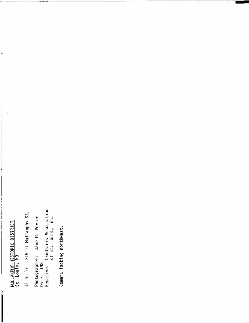
The Mullanphy District is best approached from its southern edge. (See Site Plan.) In the foreground of Photo #1 is the expanse of Mullanphy Street, widened and curved in the 1930s to carry traffic from downtown to North Florissant Street. Stone lintels appear above openings; stone also appears at the foundation and win dow sills. Above the dentilled brick cornice which wraps the angled front elevation, a parapet ascends at 1317 Mullanphy. The house is shown in both Compton & Dry (1875) and Hopkins Insurance Haps of 1883 as a simple rectangle. Apparently the front ele vation was altered to conform to the street widening. In the center of Photo #1 is the replacement wall of 1602 North 14th built after the demolition of 1600 North 14th for the street widening. Refaced with varied-colored vitreous brick, 1602 North 14th is trimmed with terra cotta and surmounted by a parapet wall. (In 1869, this house was the residence of.the Reverend Charles Carriere, pastor of.the
First German Church of the New Jerusalem at 14th and Howard Streets. See Site Plan.) Next to the sign for "Absorene" (owners of the Mullanphy Emigrant Home from 1927 through 1976) is the four bay south elevation of 1609-17 North 14th Street.
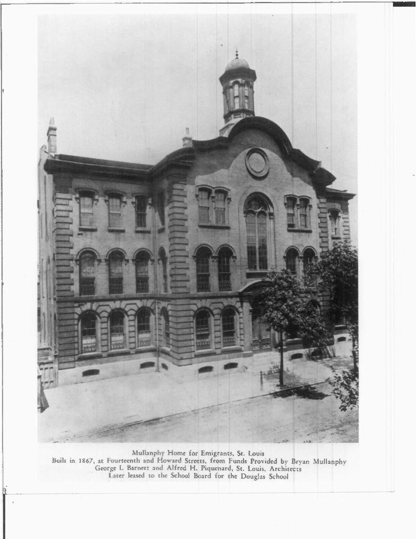
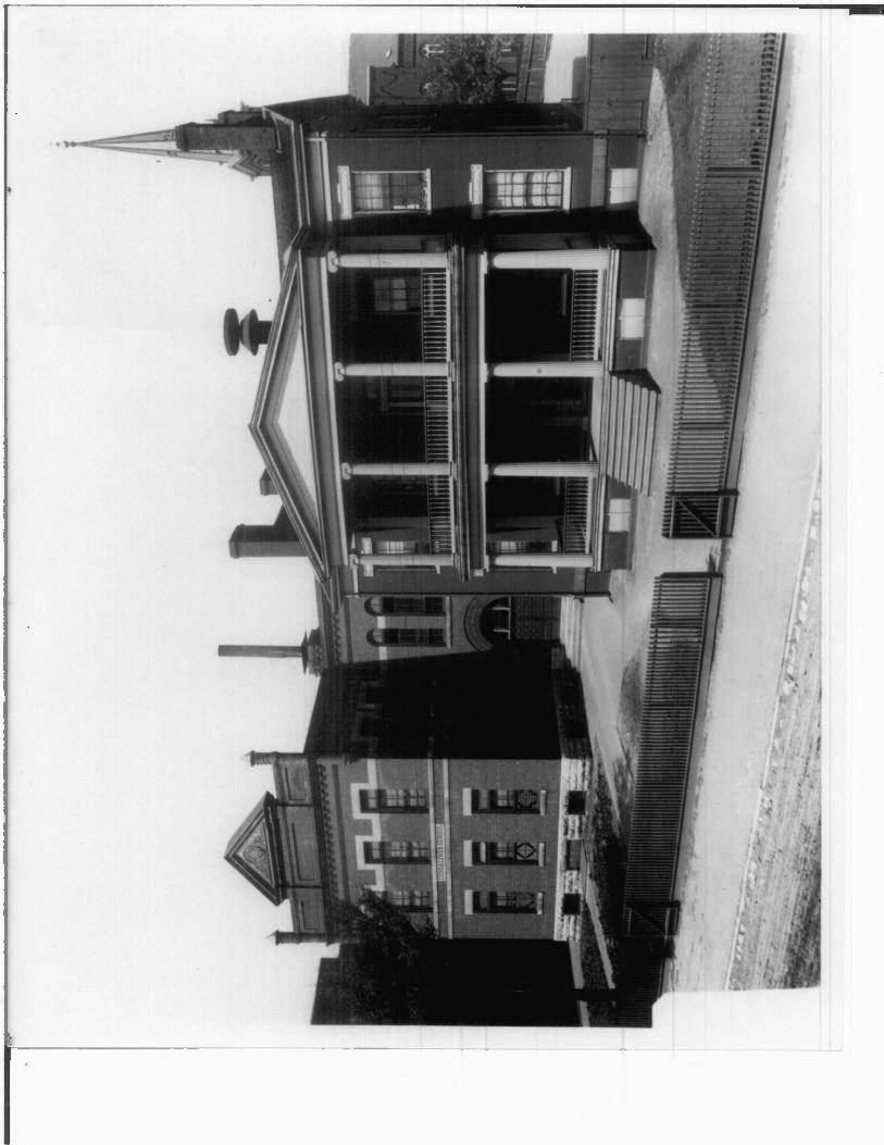
John Albury Bryan credited the 1867 design of the Mullanphy Emigrant Home to George I. Barnett and Alfred H. Piquenard. 1 A photograph (Photo #2) reproduced in Bryan's 1928 compilation of Missouri architecture documents the original front elevation with projecting entrance bays surmounted by a bold, baroque cornice of reversing curves. Below a blind roundel in the attic, a round-headed window rose almost two full stories above the pedimented entrance. Above the stone foundation, red brick walls trimmed with stone are rusticated at the first story. Brick quoins mark all the corners. Originally, a slender, octagonal cupola crowned the Home. Today, the cupola and cornice are gone; the entrance and tall, round-headed windows have been closed and an addition at the north has marred the design. (Photo #3) The large tubular vent on the south elevation has recently been removed. A close reading of contemporary newspaper accounts did not substantiate nor refute Bryan's attribution to Barnett & Piquenard but rather suggests that while sufficient funds were retained in the building contract to erect a properly decorated and detailed exterior, insufficient attention given to the use of the building contributed to
its short life as a home for emigrants. (See Section 8, page 2.)

FHR-8-300A^11 ' 7 P >v j. i; / o ,'
UNITED STATES DEPARTMENT OF THE INTERIOR fQR ,„-„„ USE HERITAGE CONSERVATION AND RECREATION SERVICE
'RECEIVED
DATE ENTERED.NATIONAL REGISTER OF HISTORIC PLACES
INVENTORY -- NOMINATION FORM
MULLANPHY HISTORIC DISTRICT
CONTINUATION SHEET ITEM NUMBER 7____PAGE -|______________________
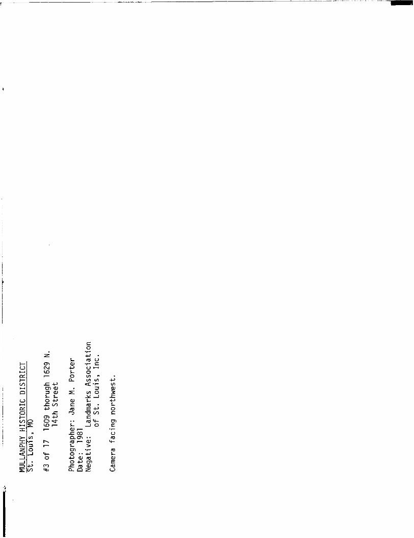
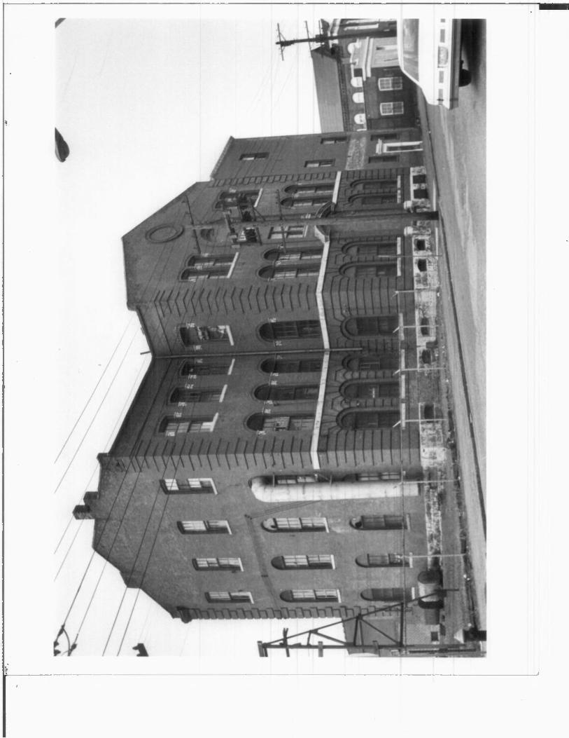
To the north of the Emigrant Home in Photo #3 is a one story red brick building built for four thousand dollars in 1923 as a tin shop for J. W. Srundorf. With
front elevation now painted yellow with white trim, 1625 North 14th Street is presently in use as a woodworking shop. Next door at 1629 North 14th is the red brick building- constructed in 1859 by the First German Church of the New Jerusalem. The original front gable end is visible in Photo #3 and Photo #4 behind the fifteen hundred dollar elevation added by the Nord St. Louis Bundeschor in 1885. Four bays built
to match the original church added at the rear by the Chor shortly after their purchase in 1878 are visible in Photo #4. The second floor with tall round-headed windows was used first for church services and then Chor practice and concerts. Several of those windows have been bricked in or filled with glass blocks as have the first floor windows flanking the front entrance. (First floor windows on side elevations were originally fitted with shutters.) Above the front entrance which has been modified, the three segmentally arched windows are intact. Corbelled brick straps lead to a central pediment supported by brackets. The words "Nord St. Louis Bundeschor 1885" on the pediment have been painted over but are still discernible. A lyre elevated on scrolls above the pediment has been lost.
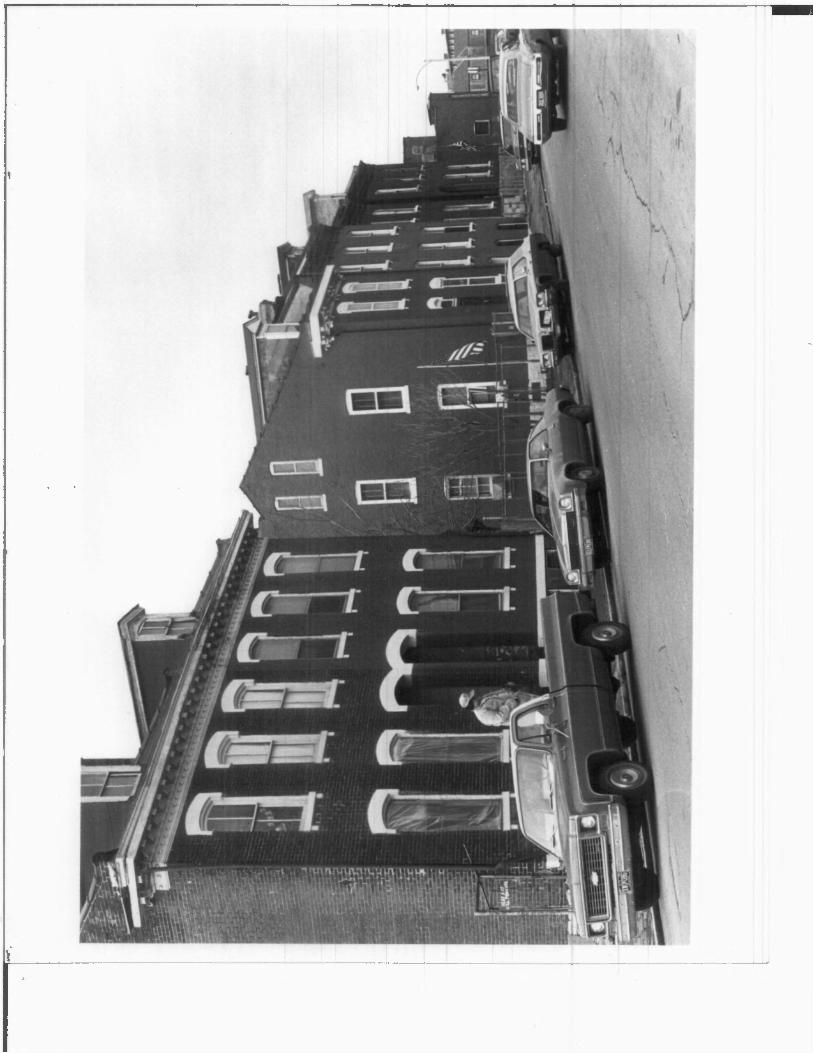
The block-long collection of buildings on North 14th Street facing the former Emigrant Home is an essay on St. Louis vernacular working-class houses built after the Civil War. All of red brick with stone trim, the two story wall they form is penetrated by four gangways or "mouseholes" to allow access from the street to stairs for upstairs units. Built circa 1868, the central passageway at 1608 North
14th Street is at basement level with stone steps leading down from the sidewalk. The north portion of 1608 retains the original wood conrice with dentils and bracket visible at the far right-hand in. Photo #5. Original two-over-two windows are in tact behind boards applied by the City's Land Reutilization Authority (LRA), the present owner. The lots for 1604-06-08 North 14th were purchased by Katie Blomberg for $1,370 in 1866. The family-name appeared at this address in City Directories and deeds until 1916 when names such as Waclaw Kleckowski and Wladyslawa Sitarski replaced the Germanic.
The next portion of the streetscape at 1610-12-14 North 14th presents a three bay, four bay, three bay rhythm. (Photo #5, center) Germans were also the first residents of this row with steep front steps recessed behind the front wall. Flat stone sills and lintels painted white trim window openings; lintels above the front doors are slightly pointed. A narrow gangway is sandwiched between 1612 and 1614 North 14th Street. (Photo #6)
The four family house at 1616-18 North 14th is visible in both Photo #5 and #7 with its sJightly taller second floor and dormers. "Eyebrow" lintels above windows are painted white. A round-arched central gangway is flanked by openings now fitted with storm dooors flush with the front walls. Herr Osterman paid $2,110
for 1616 NBrth 14th in 1870; the City Directory of 1871 listed him as a dentist at that address, an occupation requiring no professional training at that juncture.
Heinrich Hagedorn, a teamster, lived at 1618 North 14th and he and his family were
FHR-8-30QA
UNITED STATES DEPARTMENT OF THE INTERIOR FOR HTB<; IKF 'nwi v
HERITAGE CONSERVATION AND RECREATION SERVICE
RECEIVED
NATIONAL REGISTER OF HISTORIC PLACES DATE .
INVENTORY -- NOMINATION FORM
MULLANPHY HISTORIC DISTRICT
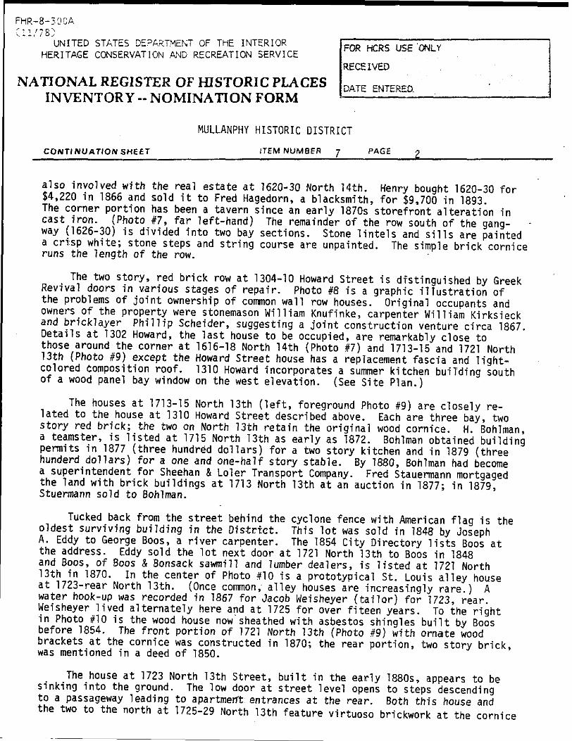
CONTI NU ATION SHEET _________ITEM NUMBER 7____PAGE 2__________________
also involved with the real estate at 1620-30 North 14th. Henry bought 1620-30 for $4,220 in 1866 and sold it to Fred Hagedorn, a blacksmith, for $9,700 in 1893.
The corner portion has been a tavern since an early 1870s storefront alteration in cast iron. (Photo #7, far left-hand) The remainder of the row south of the gang
way (1626-30) is divided into two bay sections. Stone lintels and sills are painted a crisp white; stone steps and string course are unpainted. The simple brick cornice runs the length of the row.
The two story, red brick row at 1304-10 Howard Street is distinguished by Greek Revival doors in various stages of repair. Photo #8 is a graphic illustration of the problems of joint ownership of common wall row houses. Original occupants and owners of the property were stonemason William Knufinke, carpenter William Kirksieck and bricklayer Phillip Scheider, suggesting a joint construction venture circa 1867
Details at 1302 Howard, the last house to be occupied, are remarkably close to those around the corner at 1616-18 North 14th (Photo #7) and 1713-15 and 1721 North
13th (Photo #9) except the Howard Street house has a replacement fascia and light- colored Composition roof. 1310 Howard incorporates a summer kitchen building south of a wood panel bay window on the west elevation. (See Site Plan.)
The houses at 1713-15 North 13th (left, foreground Photo #9) are closely re lated to the house at 1310 Howard Street described above. Each are three bay, two story red brick; the two on North 13th retain the original wood cornice. H. Bohlman, a teamster, is listed at 1715 North 13th as early as 1872. Bohlman obtained building permits in 1877 (three hundred dollars) for a two story kitchen and in 1879 (three hunderd dollars) for a one and one-half story stable. By 1880, Bohlman had become a superintendent for Sheehan & Loler Transport Company. Fred Stauermann mortgaged the land with brick buildings at 1713 North 13th at an auction in 1877; in 1879, Stuermann sold to Bohlman.
Tucked back from the street behind the cyclone fence with American flag is the oldest surviving building in the District. This lot was sold in 1848 by Joseph
A. Eddy to George Boos, a river carpenter. The 1854 City Directory lists Boos at the address. Eddy sold the lot next door at 1721 North 13th to Boos in 1848 and Boos, of Boos & Bonsack sawmill and lumber dealers, is listed at 1721 North 13th in 1870. In the center of Photo #10 is a prototypical St. Louis alley house at 1723-rear North 13th. (Once common, alley houses are increasingly rare.) A water hook-up was recorded in 1867 for Jacob Weisheyer (tailor) for 1723, rear Weisheyer lived alternately here and at 1725 for over fiteen years. To the right
in Photo #10 is the wood house now'sheathed with asbestos shingles built by Boos before 1854. The front portion of 1721 North 13th (Photo #9) with ornate wood brackets at the cornice was constructed in 1870; the rear portion, two story brick was mentioned in a deed of 1850.
The house at 1723 North 13th Street, built in the early 1880s, appears to be sinking into the ground. The low door at street level opens to steps descending
to a passageway leading to apartment entrances at the rear. Both this house and the two to the north at 1725-29 North 13th feature virtuoso brickwork at the cornice

FHR-8-30CA
UNITED STATES DEPARTMENT OF THE INTERIOR
HERITAGE CONSERVATION AND RECREATION SERVICEFOR HCRS USE '
RECEIVED
NATIONAL REGISTER OF HISTORIC PLACES DATE ENTEREO INVENTORY - NOMINATION FORM ——————-
MULLANPHY HISTORIC DISTRICT
CONTINUATION SHEET ITEM NUMBER 7 PAGE 3
with stretchers and headers laid in patterns between bricks set at angles in re- ? cessed panels. The land for 1725-27 North 13th was sold to Meindolph Boedefel for !
$1,200 in 1879; the building permit of April 27, 1881, to Boedefel estimated a ! $4,300 construction cost. The land was part of land owned by Mayor Wimer and i sold to Cornwell Sage, builder, for $3,100 in 1858. !
3 I The girds run amuck at 17X5 North 13th (See Site Plan.) Nothing was built on
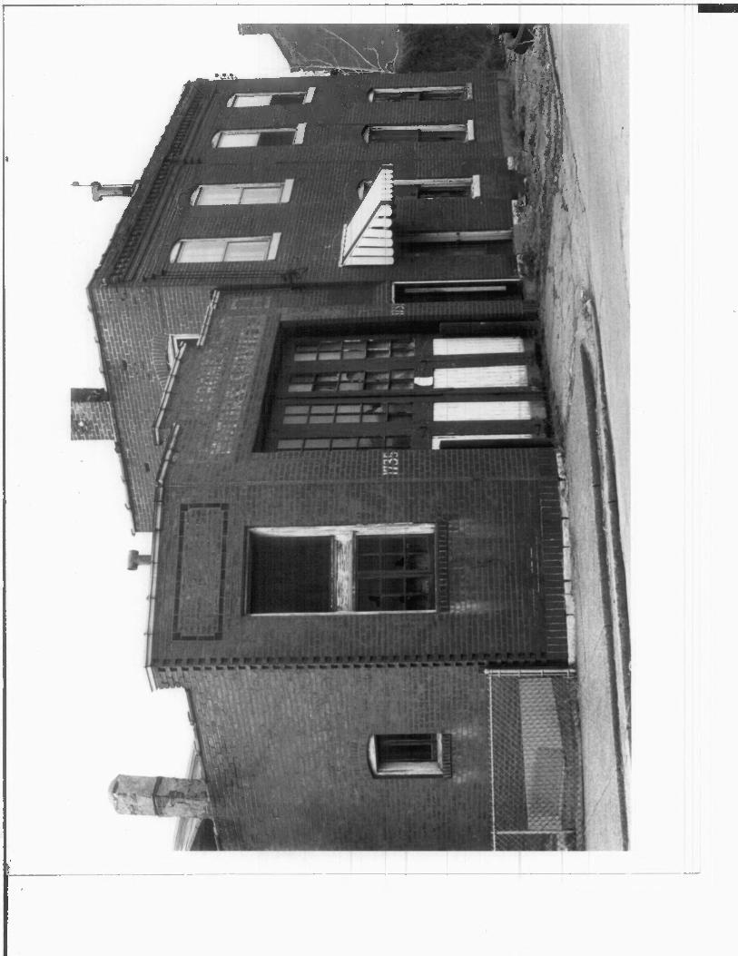
this odd site until a one-story garage of red brick trimmed with terra cotta and I green glazed brick in 1919 (Photo #11) The simple two story red brick building to the north at 1737-39 North 13th was constructed in 1882 as the office and stables of Louis C. Dieckman. A cement block addition at the rear is visible in the fore ground of Photo #10. j
The 1920 Goodwill Industries store and warehouse at 1736 North 13th Street i
(See Site Plan.) was a late addition to the former St. Louis Provident Association charitable complex. (See Section 8, page 3.) Designed by the architectural firm of Hohenshild & Pearce and built at an estimated cost of sixty-nine thousand dollars, ! the two story building of red brick with light gray terra cotta trim consists of '
five bays on North 13th angled to conform to the street (Photo #12) with six bays . :. on Tyler. The corner entrance to the store is marked by a free standing pier faced with brick and banded with terra cotta. The broad segmental arches of both entrances and their jambs are faced with terra cotta. Today, the cornice is missing; all windows are bricked in and the display windows are boarded. The building is now
used as a warehouse by Looseleaf Devices Company located next door at 1726-24 North 13th Street.
The former St. Louis Provident Association laundry building (see Section 8, page 3) at 1726-24 North 13th was built in two identical sections; the first in 1895; its twin in 1899. Now painted white (Photo #12), the one story red brick building originally imitated the traditional forms of the existing vernacular housing stock by repeating the rhythm of arched "mousetrap" doorways and simple fenestration. Subsequent alterations have bricked in the arched entrances and extended the length ; of the northern window to provide a loading dock. Molded brick trims window and door openings, forms a sill course and is also employed in small-scale beaded bands at the cornice. The second of the District's two remaining alley houses is located
at 1718 North 13th Street. Vacant and unbearded, the four bay, two story brick house with dormers is painted a fading white. 1718 (front and rear) North 13th Street I were sold by Ernest Steinkemeyer to Henry Barmeyer in 1875 for thirty-eight hundred \ dollars. The two bay house at the front of the lot is of red brick with flat stone ' lintels, brick cornice and a single dormer. The final house at the edge of the | District at 1714-16 North 13th was sold to Herman Rolf (listed in City Directories I as a teamster and drayman) for $4,750 in 1872. (Rolf constructed an alley house, - now demolished, costing $4,200 in 1883.) 1714-16 N. 1.3th was probably the work of '
FHR-8-300A
(11/78)UNITED STATES DEPARTMENT OF THE INTERIOR
HERITAGE CONSERVATION AND RECREATION SERVICE
RECEIVED
NATIONAL REGISTER OF HISTORIC PLACES
INVENTORY -- NOMINATION FORM
FOR HCRS USE ONLY
DATE ENTERED.
MULLANPHY HISTORIC DISTRICT
CONTINUATION SHEET ITEM NUMBER 7 PAGE 4
the same builder as 1616-18 North 14th Street. The 13th Street house, however, is four bays rather than five and has only a central dormer rather than the pair at 1616-18 North 14th. Visible at the far left-hand in Photo #12, this two story red brick house with stone "eyebrow" lintels painted white is now adjacent to a corner truck park.
FOOTNOTES
George Ingham Barnett (1815-1898) was born in Nottingham, England, and was trained in architecture before his arrival in St. Louis in 1839 at the beginning of the city's period of most rapid growth. His career in St. Louis spanned over forty years and included the design of many important civic and commercial buildings, hotels, churches and houses. Most have been demolished. Barnett usually worked with a partner, often a young man whom he trained. His partner from 1866-72, however, was Albert Piquenard. Born in France, Piquenard came to America in 1848. City Directories list him as a resident of Chicago until his move to Springfield, Illinois, in 1873. The Governor's Mansion in Jefferson City, Missouri, and the similar Blair-Huse House in St. Louis are also products of Barnett's collaboration with Piquenard. John Albury Bryan, Missouri's Contrtbution to American Architecture (St. Louis: St. Louis Architectural Club, 1928), p. 54. —— ———————————————
8. Significance
Period__ prehistoric
__ 1400-1499
__ 1500-1599
__ 1600-1699
__ 1700-1799
_X_ 1800-1 899
_X_1900-
Speclflc dates
Areas of Significance — Check and justify below__ archeology-prehistoric —— community planning —— __ archeology-historic __ conservation —— __ agriculture __ economics __ x architecture __ education ——
__ art —— engineering —— __ commerce —— exploration/settlement —— __ communications __ industry __
—— invention
ca. 1860-ca. 1920 Builder/Architect various
landscape architecture law literature military music philosophy politics/government
x religion __ science __ sculpture _>L social/
humanitarian __ theater —— transportation _X_ other (specify) assimilation
Statement of Significance (In one paragraph)
The Mullanphy District is significant as an architecturally important remnant of St. Louis' domestic architecture built between 1854 and 1880 on the near north side. The District derives additional significance from its association with two early St. Louis Mayors, the establishment of the first German Swedenborgian Church in the city, a German singing society which endured at this location for over sixty years and a concentration of important post-Civil War charitable institutions including the Western Female Guardian Society, the Mullanphy Emigrant Home and the St. Louis Provident Association. In 1920, Trinity Methodist Episcopal Church founded what would become the Goodwill Industries in St. Louis in the District. The edges of the District, however, have been adversely affected in recent years by the shift from private charitable intervention to Federally assisted programs.
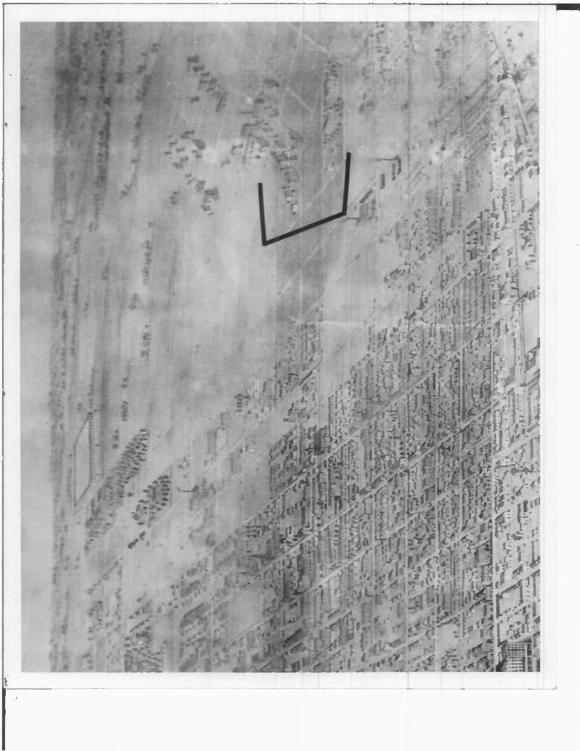
By the 1840 U. S. Census, population in St. Louis had reached almost 16,500 inhabitants. One year later a major expansion of the city limits which included the separate town of North St. Louis brought the total square miles within the city to four and one-half. (See Figure #1.) Although both St. Louis and North St. Louis had been laid out in deference to the circuitous path of the Mississippi River, the collision of grids inherent between those two formal town plans plus topography and idiosyncratic subdivisions by various landowners would combine to produce ". . . city blocks . . . woven together by zigzag or winding streets into a patchwork design which rivals grandmother's crazy quilt in complexity."! The first subdivisons in the Mullanphy District occured during the 1840s~far ahead of actual, development. A large Greek Revival house (circa 1845) and estate owned by lumber merchant Edward Dobyns gained a solitary neighbor to the immediate south when former Mayor John M. Wimer built a house in 1850. Both addresses were often identified by their proximity to the Big Mound on Broadway.2
St. Louis population jumped to 77,860 in 1850 and in 1855 the city limits were once again expanded. Although Wimer served another term as Mayor in 1857-58, a panorama from 1858 documented only a small linear development on North 14th Street running southeast from the 115 foot spire of St. Johannes German Evangelical Church. The Dobyns and Wimer estates were shown on what is now North 12th (Hadley) Street. (Photo #13) But the semi-rural tranquility quickly disappeared; the first institu tional building constructed in the District in 1859 marked the onslaught of two decades of diverse and dense urbanization.
German immigrants, who far outnumbered the Irish-born in 1850 statistics for St. Louis, comprised more than a quarter of the total population and included Catholics, Lutherans, Evangelicals and Free Thinkers. In the early 1850s a society
FHR-8-300A
Cll/78)UNITED STATES DEPARTMENT OF THE INTERIOR
HERITAGE CONSERVATION AND RECREATION SERVICE
NATIONAL REGISTER OF HISTORIC PLACES
INVENTORY - NOMINATION FORM
MULLANPHY HISTORIC DISTRICT
CONTINUATION SHEET__________________ITEM NUMBER 8 PAGE 1___________________
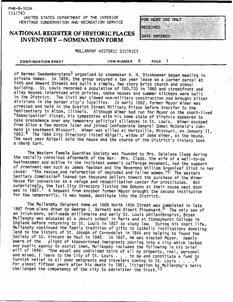
of German Swedenborgians 3 organized by shoemaker H. H. Dickhoener began meeting in private homes. In 1859, the group secured a ten year lease on a corner parcel at 14th and Howard Streets and built a simple, two story brick church and school building. St. Louis recorded a population of 160,733 in 1860 and streetfront and alley houses intermixed with privies, smoke houses and summer kitchens were built in the District. The Civil War slowed non-military construction and brought bitter divisions in the border city's loyalties. In early 1862, former Mayor Wimer was arrested and held in the Gratiot Street Military Prison before transfer to the Penitentiary in Alton, Illinois. Although Wimer had run for Mayor on the short-lived Emancipation" ticket, his sympathies with his home state of Virginia appeared to
take precedence over any temporary political alliances in St. Louis. Wimer escaped from Alton a few months later and joined Confederate General Emmet McDonald's com mand in southwest Missouri. Wimer was killed at Hartsville, Missouri, on January 11, 1863.* The 1864 City Directory listed Abigail, widow of John Wimer, at the house. The next year Abigail sold the house and the course of the District's history took a sharp turn.
The Western Female Guardian Society was founded by Mrs. Gatelana Clapp during the socially conscious aftermath of the War. Mrs. Clapp, the wife of a well-to-do businessman and active in the incipient women's sufferage movement, had the support of prominent men such as James Yeatman and the Reverend William GreenTeaf Eliot in her cause: "the rescue and reformation of degraded and fallen women."5 The Western Sanitary Commission 6 loaned ten thousand dollars toward the purchase of the Wimer House for conversion to a refuge and rehabilitation center for prostitutes. Not surprisingly, the last City Directory listing the Dobyns at their house next door was in 1867.' A bequest from another former Mayor brought the second institution for the temporarily, it was hoped, destitute into the District.
The Mullanphy Emigrant Home .at 1609 North 14th Street was completed in late 1867 from plans drawn by George I. Barnett and Albert Piquenard. 8 The only son of an Irish-born, self-made millionaire and early St. Louis philanthropist, Bryan Mullanphy was educated at a Jesuit school in Paris and at Stoneyhurst College in England before returning to St. Louis in 1827 to study law. During his short life, Mullanphy continued the family tradition of gifts to Catholic institutions donating land to the Sisters of St. Joseph of Carondelet in 1844 and helping to found the ^Society of St. Vincent de Paul in 1845. In 1847, he was elected Mayor. Keenly aware of the plight of impoverished immigrants pouring into a city which lacked any public agency to assist them, Mullanphy included the following in his brief will of 1849: "One equal and undivided third of all my property, real, personal and mixed, I leave to the City of St. Louis ... to be and constitute a fund to furnish relief to all poor emigrants and travelers coming to St. Louis ... .9 For almost fifteen years after his death in 1851, litigation by Mullanphy's heirs challenged the competency of the city to administer the trust.' 0

FHR-8-300A
(11/78)
UNITED STATES DEPARTMENT OF THE INTERIOR
HERITAGE CONSERVATION AND RECREATION SERVICE
NATIONAL REGISTER OF HISTORIC PLACES
INVENTORY -- NOMINATION FORM
MULLANPHY HISTORIC DISTRICT
CONTINUATION SHEET ITEM NUMBER PAGE
A story in the Missouri Republican on January 20, 1867, reported that bids ranging from $36,500 to $25,800 had been opened for the construction of the Mullanphy Emigrant Home at a site at Sixth Street and Gratiot in the near south side. The Missouri Republican reported in September that year that the building was instead under construction on 14th Street and should be completed by the end of the month. The article alluded to but did not specify the difficulty of ob taining a "favorable" location. 11 The low bid this time was twenty-five thousand dollars from a contractor who had not entered the previous round. The Emigrant Home was planned to accomodate 250 persons but questions about interior space were voiced while the building was still under construction:
We certainly cannot accord much praise, however, to the plan . , . in the arrangement of the second and third stories. These are left in large undivided halls, intended, we presume, for the immigrants to sleep in. The builders inform us that bunks will be put on the second story, divided by low partitions open in front. This will not help the matter much and when the building is crowded with immigrants, male and female, it would seem as if the arrange ment of the larger apartments will hardly be conducive to cleanliness or morality.'<-
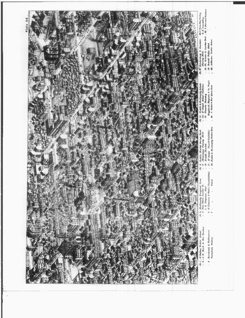
The Big Mound ("Great Earthen Barn") approximately 34 feet high by 158 to 319 feet long, was dismantled in 1869 13—a year before St. Louis population reached 310,869. Douglas Public School (#6 on Plate #45, Photo #16) was built just outside the District at llth and Howard Streets in 1870; in 1871, the Dobyns House was con verted to "Colored School #2"—the largest of the four in St. Louis established for blacks after the Civil War. The former Wimer and Dobyns houses were located just south of #1, the Independent German Evangelical Church, and #2, the Providence Presbyterian Church, on Plate 45 (Photo #15) from Compton & Dry's 1875 perspective. The Mullanphy Emigrant Home was identified by #4 on the upper left-hand corner of Plate 44 (Photo #14) from Compton & Dry and the authors' comments about the Mullanphy Fund included the following: "This fund has been so carefully and economically managed that it has increased to enormous proportions. The Home is a magnificant brick structure on the west side of Fourteenth Street, between Mullanphy and Howard Streets." 14 But as early as 1874, an examining committee for the Mullanphy Fund had found rooms vacant and noted the "cheerless furnishing of the general lobby and inefficient heating system." They also expressed concern that the Home had degener ated into a "refuge for indigent charity seekers." 15 In 1877, only ten years after the Home opened, the Mullanphy Commissioners closed the building and began a policy of paying for immigrants' food and lodging elsewhere. The Home was leased to the School Board from 1879 to 1899. 16
The Nord St. Louis Bundeschor purchased the leasehold for seven hundred dollars from the Swedenborgians in 1878 and added the present front elevation at 1629 North 14th Street. 17 Founded in St. Louis in 1856, the Nord St. Louis Bundeschor performed
FHR-8-300A
Cll/78)UNITED STATES DEPARTMENT OF THE INTERIOR
HERITAGE CONSERVATION AND RECREATION SERVICE
NATIONAL REGISTER OF HISTORIC PLACES
INVENTORY -- NOMINATION FORM
CONTI NU ATION SHEET
MULLANPHY HISTORIC DISTRICT
ITEM NUMBER 8 PAGE 3
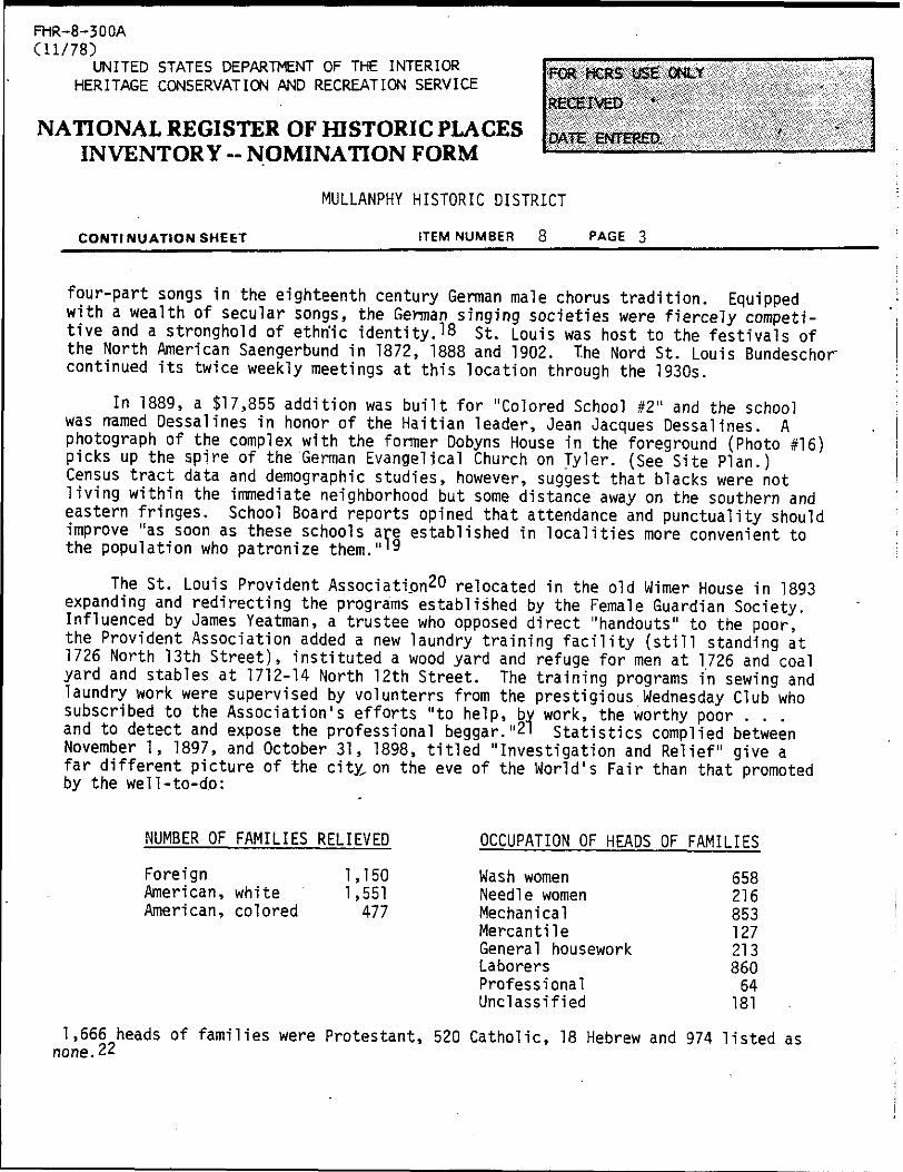
four-part songs in the eighteenth century German male chorus tradition. Equipped with a wealth of secular songs, the German singing societies were fiercely competi tive and a stronghold of ethrfic identity.18 st. Louis was host to the festivals of the North American Saengerbund in 1872, 1888 and 1902. The Nord St. Louis Bundeschor continued its twice weekly meetings at this location through the 1930s.
In 1889, a $17,855 addition was built for "Colored School #2" and the school was named Dessalines in honor of the Haitian leader, Jean Jacques Dessalines. A photograph of the complex with the former Dobyns House in the foreground (Photo f!6) picks up the spire of the German Evangelical Church on Tyler. (See Site Plan.) Census tract data and demographic studies, however, suggest that blacks were not living within the immediate neighborhood but some distance away on the southern and eastern fringes. School Board reports opined that attendance and punctuality should improve "as soon as these schools are established in localities more convenient to the population who patronize them." 19
The St. Louis Provident Association20 relocated in the old Wimer House in 1893 expanding and redirecting the programs established by the Female Guardian Society. Influenced by James Yeatman, a trustee who opposed direct "handouts" to the poor, the Provident Association added a new laundry training facility (still standing at 1726 North 13th Street), instituted a wood yard and refuge for men at 1726 and coal yard and stables at 1712-14 North 12th Street. The training programs in sewing and laundry work were supervised by volunterrs from the prestigious Wednesday Club who subscribed to the Association's efforts "to help, by work, the worthy poor . . . and to detect and expose the professional beggar."21 Statistics complied between November 1, 1897, and October 31, 1898, titled "Investigation and Relief" give a far different picture of the city, on the eve of the World's Fair than that promoted by the well-to-do:
NUMBER OF FAMILIES RELIEVED
Foreign 1,150American, white 1,551American, colored 477
OCCUPATION OF HEADS OF FAHILIES
Wash women Needle women Mechanical Mercantile General housework Laborers Professional Unclassified
65821685312721386064
181
1,666 heads of families were Protestant, 520 Catholic, 18 Hebrew and 974 listed as none.22

FHR-8-300A
(11/78)
UNITED STATES DEPARTMENT OF THE INTERIOR
HERITAGE CONSERVATION AND RECREATION SERVICE
NATIONAL REGISTER OF HISTORIC PLACES
INVENTORY - NOMINATION FORM
MULLANPHY HISTORIC DISTRICT
CONTINUATION SHEET__________________ITEM NUMBER 3 PAGE 4
After the turn of the century, the latest arrivals—the Poles—began renting, then purchasing, many of the houses in the District as the Germans continued to move west. In 1904, the year of the World's Fair, Dessalines School was demolished and replaced - at that site by a new black school. The Provident laundry served as a black nursery from 1917 to 1919 before the building was purchased by Trinity Methodist Episcooal Evangelical Church on Tyler. Their pastor, Thomas E. Greene, was influenced by the Methodist Morgan Memorial charity in Boston founded by Dr. Edgar Helms in 1902. The Methodists built the store and warehouse at the southeast corner of 13th and Tyler in 1920 to expand their program by collecting, refurbishing and selling used clothing and household items. The charity become nonsectarian in 1932 with the transfer of the property to the Goodwill Industries.
A Bond Issue passed in 1923 which widened and rerouted Mullanphy Street in the 1930s to meet West Florissant ("one of the ten great new thoroughfares'^) demolished a number of houses but 1940 figures on population density in St. Louis still showed the neighborhood with the highest density in the city: between eighty and one hundred people per gross acre.'4 It also shared with the Soulard neighborhood the distinc tion of having between sixty and seventy percent of the dwelling units with outside toilets. Rails leading from McKinley Bridge to the new newspaper plants and warehouses on 12th Street in downtown had cut through the District, unfettered by zoning.25 The 1947 Comprehensive Plan announced that "neighborhoods that have become a liability to the city can become an asset only through reconstruction along sound planning principles."26
The Mullanphy District was scheduled for total demolition and industrial ex pansion. The first "slum clearance" had begun in 1940 for nearby 1,658-unit Carr Square Village Public Housing. Large-scale, Federally funded public housing pro jects after World War II cleared vast areas between Cass Avenue and the edge of Downtown; Interstate 70 obliterated links to the Mississippi River. By 1964, St. Johannes at Madison and 14th was a vacant furniture warehouse; the German Evangelical Protestant Church on Tyler had been sold by the Methodists to the True Gospel: Tabernacle congregation; the tiny Provident Presbyterian Church at 1203 Tyler was in use as a cooperage. After the departure of the Nord St. Louis Bundeschor in 1940, the course of a rapidly changing neighborhood may be traced by the chronology of the building's uses until 1964; vacant, Hall, Steam and Electric Appliance Manu facturing, vacant, Letter and Card Personalizing-second floor only, vacant, general storage, Webster Pentecostal Church.
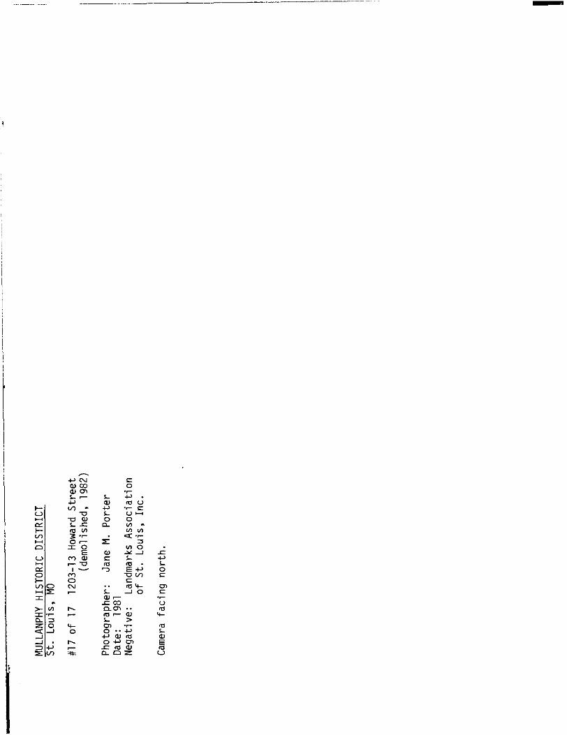
St. Louis experienced almost a decade of demolition by neglect and intent be tween 1964 and 1974; open, big truck parking moved into the large holes at the District's edges (Photo #17). In 1974, Missouri Chapter 353 was used to "blight" a sixty-eight acre section of the near north side for "Cass Industrial Park".27 The second Dessalines School was demolished in 1976.

FHR-8-300A
CU/78)UNITED STATES DEPARTMENT OF THE INTERIOR
HERITAGE CONSERVATION AND RECREATION SERVICE
NATIONAL REGISTER OF HISTORIC PLACES
INVENTORY - NOMINATION FORM
MULLANPHY HISTORIC DISTRICT
CONTI NU ATION SHEET __________________ ITEM NUMBER Q PAGE g _____________________
The Fund which gave the District its most prominent building was plagued by controversy and red tape.28 Tne Mullanphy Home was sold in 1927 to Absorene, manu facturers of wallpaper cleaner. By the late 1930s, the assets of the Fund once !u u?2rat Over a millnon dollars barely produced enough income to pay taxes In the 1950s the renamed Mullanphy Travelers Aid began to receive annual allocations from United Way and today, as part of a national organization, dispenses aid to travelers at the city's Greyhound Bus station.
arpa 3 tandl?a !;ks Association of St. Louis first became interested in the "Murphy-Blair"29 iSfin %5 twenty-five years ago, sponsoring a sold-out bus tour in the summer of 1960. Notes m the back of a guide prepared for the tour reported that Arthur Schwartz, then Chairman of the City Plan Commission, had asked Landmarks to survey and see what ought to be preserved in the neighborhood. A second attempt promoted by Hentage/St._ Louis and the Grace Hill Settlement House to organize a volunteer survey occured in 1970. "War on Poverty" programs, however, took precedence over "°"±"^d F""656™3* ̂ n efforts in an area increasingly deemed dangerous. The first professional architectural survey was not conducted until 1978 after the nationally televised demolition of the fifty acre Pruitt-Igoe Public Housing complex just blocks away. Since that time Landmarks has completed nominations for the Clemens- House complex on Cass Avenue, St. Stanislaus Polish Church on North 20th Street, the SS.tynl & Methodius District (see Architectural* Survey Map) and the St. Liborius Parish complex V1S ible in the distance in Photo #17. A feature story in Landmarks' September 1981 newsletter about the Emigrant Home and the District evoked interest from City Hall in pursuing a National Register nomination. Conservation of the Mullanphy District should help reweave the fragile fabric of the near north side.
FOOTNOTES
F. Thomas, "The Geographic Landscape of Metropolitan St. Louis," 1932, Landmarks Association of St. Louis, Inc., St. Louis, Missouri, p. 18. (Xeroxed.)
2Early surveyors and map makers located over two dozen mounds in the area between Seventh Street, Cass Avenue, the Mississippi River and Delmar Boulevard. The Big Mound was approximately four blocks north of that concentration and was terraced rather than flat or conical-topped. A summer resort called Vauxhall Gardens was built on top of the Big Mound in the 1820s.
3Swedenborgians followed the teachings of Emanuel Swedenborg, Swedish theologian (1688-1772), who founded the Church of the New Jerusalem alluded to in the book of Revelations.
4Wimer is buried in Bellefontaine Cemetery. Cornwell in his St. Louis Mayors: Brief Biographies considered the most important accomplishment of Wimer's second term the organization of a regular, paid Fire Department.
"HR-S-300A
Cll/7!UNITED STATES DEPARTMENT OF THE INTERIOR FOR .._„,. ucE
HERITAGE CONSERVATION AND RECREATION SERVICE
RECEIVED
NATIONAL REGISTER OF HISTORIC PLACES
INVENTORY - NOMINATION FORMDATE ENTERED.
MULLANPHY HISTORIC DISTRICT
CONTINUATION SHEET _______ITEM NUMBER 8____PAGE 6_____________________
5Catelana W. Clapp, "Scrapbook of Miscellaneous Clippings on Women's Sufferage, Soldiers' Orphans Home of St. Louis, Western Guardian Society, etc., 1861-76," Missouri Historical Society, St. Louis, Missouri, p. 4.
60rganized in 1861 to assist with hospital space for casualties from the War, the Western Sanitary Commission raised more than four million dollars during that decade for a wide range of war-related charities. "The•initiatives of the war period became a permanent legacy, as the work of the commission was taken over by private groups or public agenices. For one brief decade, however, there was wide-spread community action that was not to be realized again until the organization of the United Fund-type campaigns in the twentieth century." Selwyn K. Troen and Glen E Holt, eds., St. Louis (New York: New Viewpoints, 1977), p. 104.
7The Wimer House was used as an infirmary for women identified as infected with venereal disease during the brief duration of St. Louis' controversial Social Evil Ordinance passed in 1870. The ordinance was the first in the nation to attempt regulation of prostitution through compulsory registration of houses of prostitution, medical examinations and hospitalization of infected women. The ordinance was opposed both by the feminists who objected to the regulation of only women' and by William Greenleaf Eliot, whose vigorous and successful campaign to repeal the law was based on the ordinance's acceptance of "sin" as inevitable.
8John Albury Bryan, Missouri's Contribution to American Architecture (St. Louis: St. Louis Architectural Club, 1928), p. 54.
'Details about Mullanphy's life and unusual bequest appear in most St. Louis histories. The will was printed in full in the Missouri Republican on June 19, 1851, a few days after his death.
1 Organization of a board to administer the fund was delayed by the War. Bryan Mullanphy's will was challenged in the courts five times; the last attempt was made by his heirs in 1934 when the State Supreme Court upheld the bequest. In 1896, the city itself sued unsuccessfully to divert funds to construct a new hospital to re place one destroyed by a tornado. Alice L. Cochran, "The Saga of an Irish Immigrant Family: The Descendants of John Mullanphy" (Ph.D. dissertation, St. Louis University St. Louis, Missouri, 1958), p. 102.
11 "The Mullanphy House—The New Building Nearly Completed," Missouri Republican, 5 September 1867. ————————————
12 Ibid.
FHR-8-300A
(11/78)UNITED STATES DEPARTMENT OF THE INTERIOR
HERITAGE CONSERVATION AND RECREATION SERVICE
NATIONAL REGISTER OF HISTORIC PLACES
INVENTORY -- NOMINATION FORM
MULLANPHY HISTORIC DISTRICT
CONTINUATION SHEET ITEM NUMBER 3 PAGE
G. Houser reports in a recent article that relics and a diagram of the Big Mound were entered in the Missouri Historical Society's accession book on November 4, 1869. Neither the artifacts nor the diagram have ever been located.
14Camil1e N. Dry and Richard J. Compton, Pictorial St. Louis— 1875 (St. Louis: n.p., 1875; reprint ed. , St. Louis: Harry M. Hagen, 1971), p. 202.
15Daisy LaGrave, "The Bryan Mullanphy Emigrant Relief Fund," 1898, St. Louis Public Library, Municipal Library Collection, St. Louis, Missouri, p. 3.
16Mullanphy School enrolled 287 students the first year the Emigrant Home was leased. In 1897, enrollment had reached 736. The School Board closed the building in the fall of 1899.
17The two organizations apparently shared the building until 1882 when the Church moved to the Presbyterian Church at Tyler and 12th Streets.
18Michael Haydn, organist at the cathedral in Salzburg, is credited with the introduction of secular songs for male chorus in Germany with his publication in 1788, "Male Quartets without Accompaniment'.'.
19Board of Directors of the St. Louis Public Schools, Annual Report (St. Louis: n.p.', 1870-71), p. 90.
9f\iuThe St. Louis Provident Association was founded in 1866.
21st. Louis Provident Association, Annual Report (St. Louis: St. Louis Provident Association, 1894), p. 25.
pp
St. Louis Provident Association, Annual Report (St. Louis: St. Louis Provident Association, 1898), p. 25.
23 City Plan Commission, Comprehensive City Plan, Saint Louis, Missouri (St.
Louis: City Plan Commission, 1947), p. 71.
24 Ibid., p. 15.
25st. Louis' first zoning ordinance of 1918 was held unconstitutional. A watered-down revision, passed in 1926, came too late for older neighborhoods without political influence.
26City Plan Commission, p. 30.
27Boundaries of Cass Industrial Park are O'Fallon, 14th Street, Howard and Tyler and 1/70.

FHR-8-300A
(11/78)
UNITED STATES DEPARTMENT OF THE INTERIOR
HERITAGE CONSERVATION AND RECREATION SERVICE
NATIONAL REGISTER OF HISTORIC PLACES
INVENTORY -- NOMINATION FORM
i^i^iSlSIISs'isllSi
MULLANPHY HI-STORIC DISTRICT
CONTINUATION SHEET ITEM NUMBER 8 PAGE
28An October 4, T930, editorial cartoon in the St. Louis Post-Dispatch by
Daniel Fitzpatrick, "The Weeping Ghost of Bryan Mullanphy," showed aggregated expenses of the fund as $172,498, with only $30,214 spent for aid. Because Mullanphy's be quest consisted entirely of real estate, to generate income the board had to construct and oversee rental property. Sale of land to create investment capital was eventually permitted, but approval by the Board of Aldermen was required for each parcel sold.
29The large area dubbed "Murphy/Blair" was identical to the boundaries which the Grace Hill Settlement House began to describe as its "client" or "home territory".
9. Major Bibliographical References
See attached.
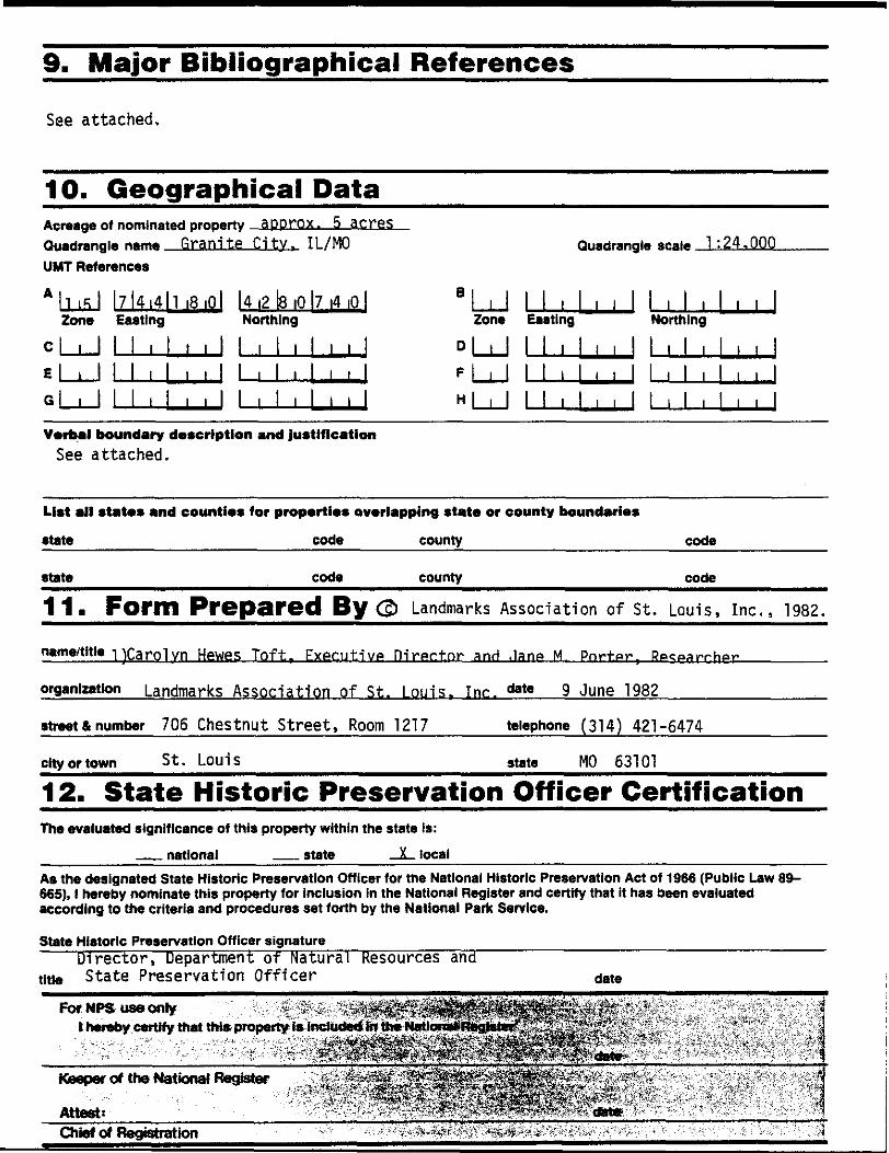
10. Geographical Data
Acreage o» nominated property approx. 5 acres
Quadrangle n«m« Granite City. IL/MO
UMT References
Quadrangle scale 1:24.000
* h is 1Zone
Cl , 1
E ___ 1
Ql , 1
I7l4i4ll iSiOl
Easting
1 1 , 1 , , 1
11,1,,!
1 , 1 , , 1
I4i2ll3|0|7
Northing
1 I 1 1 1
1 i I
1 1 1
, 1
1 |
|4
|
1
I
|0|
jj
r]
jj
1 i 1Zone
D i 1
' ___ 1
Hi i 1
1 1 1Easting
1 1 1
1 1 1
1 1 ,
, , 1 1,1,
Northing
,11,1,1,
i , 1
, , I
, 1 i ! > >
i 1 , 1 i i
Verbal boundary description and justification
See attached.
List all states and counties for properties overlapping state or county boundaries
state ___ __ code county code
state code county code
11s Form Prepared By Landmarks Association of St. Louis, Inc.. 1982.
name/title 1)Caro1vn Hewes Toft, Executive P.1 rer.t.nr anH ,1anp M Pnr-t.ar, Rpcgayrhgr________
organization Landmarks Association of St. Louis. Inc. date 9 June 1982____________
street & number 706 Chestnut Street, Room 1217 telephone (314) 421-6474
city or town St. Louis MO 63101
12. State Historic Preservation Officer Certification
The evaluated significance of this property within the state Is:
__ national __ state _X_ local
As the designated State Historic Preservation Officer for tne National Historic Preservation Act of 1966 (Public Law 89- 665), I hereby nominate this property for Inclusion In the National Register and certify that it has been evaluated according to the criteria and procedures set forth by the National Park Service.
State Historic Preservation Officer signature___________________________________________
Director, Department of Natural Resources and title State Preservation Officer date
For NPS use only ' :"^;;|
I hereby certify that this, property is included in the I
Keeper of the National Register
Attest:
Chief of Registration
FHR-8-300A
(11/78)
UNITED STATES DEPARTMENT OF THE INTERIOR
HERITAGE CONSERVATION AND RECREATION SERVICE
NATIONAL REGISTER OF HISTORIC PLACES
INVENTORY -- NOMINATION FORM
MULLANPHY HISTORIC DISTRICT
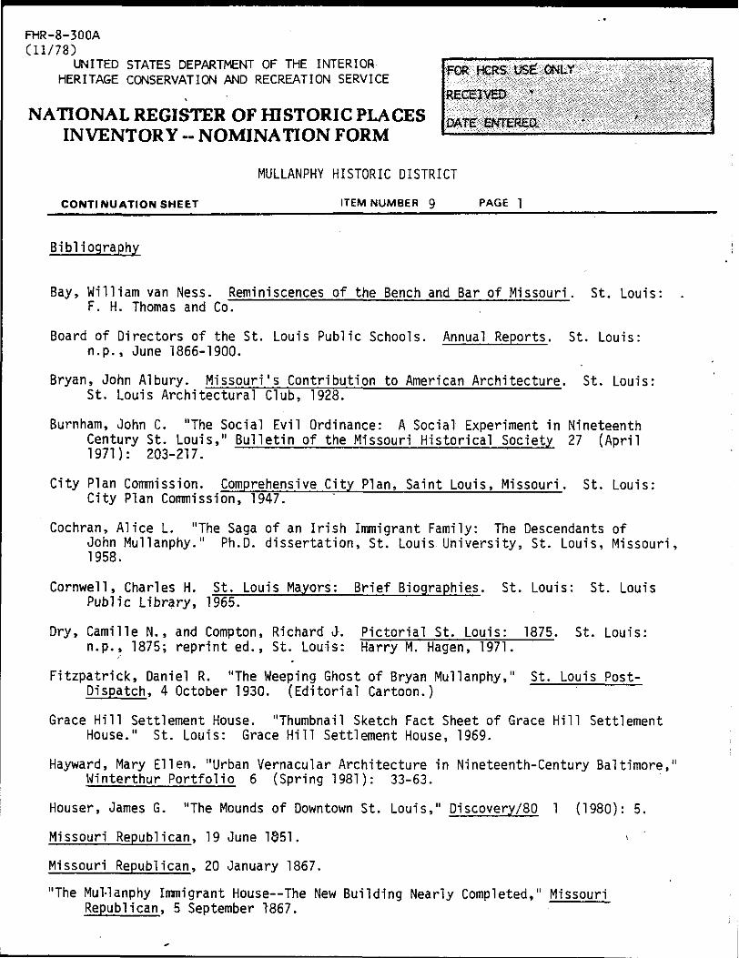
CONTI NUATION SHEET__________________ITEM NUMBER 9_____PAGE 1____________________
Bibliography
Bay, William van Ness. Reminiscences of the Bench and Bar of Missouri. St. Louis: . F. H. Thomas and Co.
Board of Directors of the St. Louis Public Schools. Annual Reports. St. Louis: n.p., June 1866-1900.
Bryan, John Albury. Missouri's Contribution to American Architecture. St. Louis: St. Louis Architectural Club, 1928.
Burnham, John C. "The Social Evil Ordinance: A Social Experiment in Nineteenth Century St. Louis," Bulletin of the Missouri Historical Society 27 (April 1971): 203-217.
City Plan Commission. Comprehensive City Plan, Saint Louis, Missouri. St. Louis: City Plan Commission, 1947.
Cochran, Alice L. "The Saga of an Irish Immigrant Family: The Descendants ofJohn Mullanphy." Ph.D. dissertation, St. Louis University, St. Louis, Missouri, 1958.
Cornwall, Charles H. St. Louis Mayors: Brief Biographies. St. Louis: St. Louis Public Library, 1965.
Dry, Camille N., and Compton, Richard J. Pictorial St. Louis: 1875. St. Louis: n.p., 1875; reprint ed., St. Louis: Harry M. Hagen, 1971.
Fitzpatrick, Daniel R. "The Weeping Ghost of Bryan Mullanphy," St. Louis Post- Dispatch, 4 October 1930. (Editorial Cartoon.)
Grace Hill Settlement House. "Thumbnail Sketch Fact Sheet of Grace Hill Settlement House." St. Louis: Grace Hill Settlement House, 1969.
Hayward, Mary Ellen. "Urban Vernacular Architecture in Nineteenth-Century Baltimore," Winterthur Portfolio 6 (Spring 1981): 33-63.
Houser, James G. "The Mounds of Downtown St. Louis," Discovery/80 1 (1980): 5.
Missouri Republican, 19 June 1851. >
Missouri Republican, 20 January 1867.
"The Mul-lanphy Immigrant House—The New Building Nearly Completed," Missouri Republican, 5 September T867.

FHR-8-300A
(11/78)UNITED STATES DEPARTMENT OF THE INTERIOR
HERITAGE CONSERVATION AND RECREATION SERVICE
NATIONAL REGISTER OF HISTORIC PLACES
INVENTORY -- NOMINATION FORM
MULLANPHY HISTORIC DISTRICT
CONTINUATION SHEET__________________ITEM NUMBER g
Nord St. Louis Bundeschor. Souvenir Program: Goldenes Jubilaum, North St. Louis Bundeschor. St. Louis: Nord St. Louis Bundeschor, 1906.
Siebzigjahriges Jubilaum: North St. Louis Bundeschor, 1856-1926. St.Louis: Nord St. Louis Bundeschor, 1926.
Oelsen, Laure. "George I. Barnett, 1815-1898." M. A. Thesis, University of Missouri, Columbia, 1973.
St. Louis, Missouri. Landmarks Association of St. Louis, Inc. Thomas, Lewis F. "The Geographic Landscape of Metropolitan St. Louis." 1932. (Xerox.)
St. Louis, Missouri. Missouri Historical Society. Pictorial History Department. "Centry Old Dessalines School Building." Unidentified, undated newspaper clipping, [c. 1904].
St. Louis, Missouri. Missouri Historical Society. Clapp, Catelana W. "Scrapbook of Miscellaneous Clippings on Women's Sufferage, Soldiers' Orphans Home of St. Louis, Western Guardian Society, etc., 1861-1876."
St. Louis, Missouri. Missouri Historical Society. Helen J. Clemens Scrpabook, 1860-62.
St. Louis, Missouri. Missouri Historical Society. Mary C. Clemens Collection.
St. Louis, Missouri. Missouri Historical Society. John O'Fallon Collection.
St. Louis, Missouri. Missouri Historical Society. "Roster of Presidents, Board Members and Executives and History of Family and Children's SErvices of Greater St. Louis" 1960. '(Mimeographed.)
St. Louis, Missouri. St. Louis Public Library, Municipal Library Collection.LaGrave, Daisy. "The Bryan Mullanphy Emigrant Relief Fund." 1918. (Typescript.)
St. Louis, Missouri. St. Louis Public Library, Municipal Library Collection. Mullanphy Emigrant Relief Fund Clippings File.
St. Louis, Missouri. St. Louis Public Library, Municipal Library Collection. Mullanphy Emigrant Relief Fund Semi-Annual Report, 1873-1930.
St. Louis Provident Association. Annual Reports. St. Louis: St. Louis Provident Association, 1894, 1896, 1898, 1901 and 1915.
.. Fifty Years of Service: The St. Louis Provident Association, 1860-1910.St. Louis: St. Louis Provident Association, 1910.
FHR-8-300A
(11/78)UNITED STATES DEPARTMENT OF THE INTERIOR
HERITAGE CONSERVATION AND RECREATION SERVICE
NATIONAL REGISTER OF HISTORIC PLACES
INVENTORY - NOMINATION FORM
CONTINUATION SHEET
MULLANPHY HISTORIC DISTRICT
ITEM NUMBER 9 PAGE 3
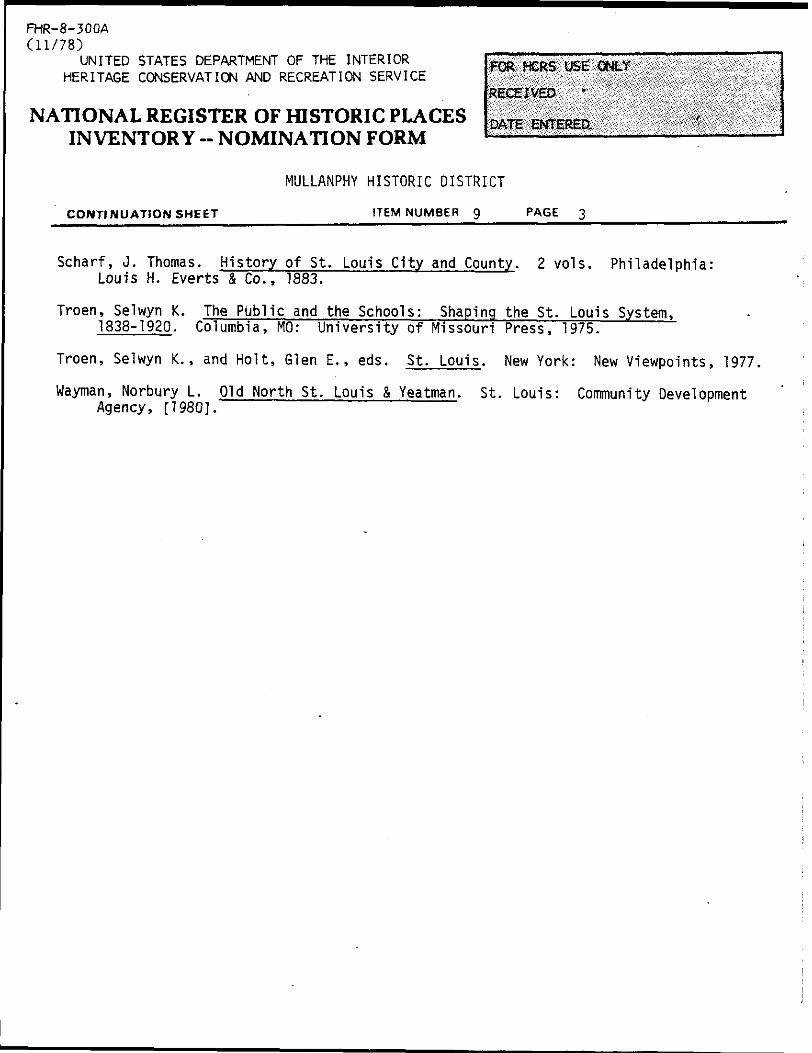
Scharf, J. Thomas. History of St. Louis City and County. 2 vols. Philadelphia: Louis H. Everts & Co., 1883.
Troen, Selwyn K. The Public and the Schools: Shaping the St. Louis System, 1838-1920. Columbia, MO: University of Missouri Press, 1975.
Troen, Selwyn K., and Holt, Glen E., eds. St. Louis. New York: New Viewpoints, 1977.
wayman, Norbury L. Old North St. Louis & Yeatman. St. Louis: Community Development Agency, [1980].

•§•
MULLANPHY HISTORIC DISTRICT St. Louis City, Missouri
S\ U.S.G.S. 7.5
GRANITE CITY,ILL-MO.
UTM Reference:
15/744180/4280740
FHR-8-3COAf 1 1 / T o ~\V 1 1 . / Q J
UNITED STATES DEPARTMENT OF THE INTERIOR
HERITAGE CONSERVATION AND RECREATION SERVICE
RECEIVED
NATIONAL REGISTER OF HISTORIC PLACES DATE ENTERED INVENTORY -- NOMINATION FORM
FOR HCRS USE 'ONLY
MULLANPHY HISTORIC DISTRICT
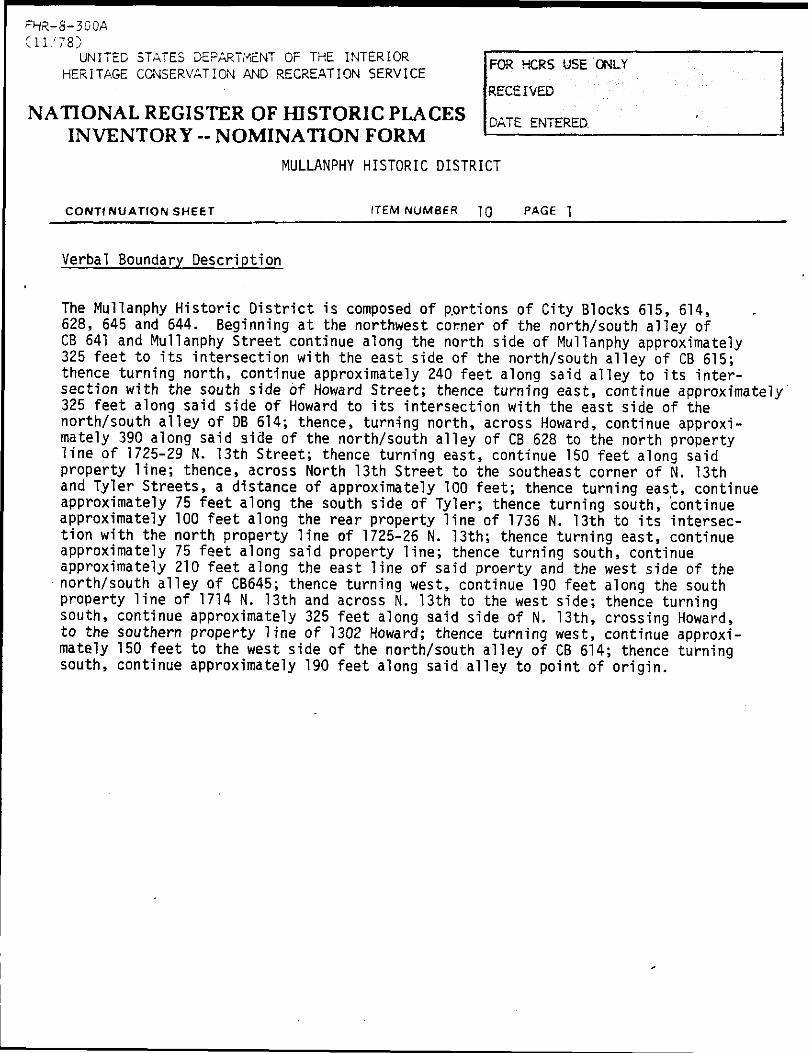
CONTINUATION SHEET ITEM NUMBER 1Q
Verbal Boundary Description
The Mullanphy Historic District is composed of p.ortions of City Blocks 615, 614, 628, 645 and 644. Beginning at the northwest corner of the north/south alley of CB 641 and Mullanphy Street continue along the north side of Mullanphy approximately 325 feet to its intersection with the east side of the north/south alley of CB 615; thence turning north, continue approximately 240 feet along said alley to its inter section with the south side of Howard Street; thence turning east, continue approximately 325 feet along said side of Howard to its intersection with the east side of the north/south alley of DB 614; thence, turning north, across Howard, continue approxi mately 390 along said side of the north/south alley of CB 628 to the north property line of 1725-29 N. 13th Street; thence turning east, continue 150 feet along said property line; thence, across North 13th Street to the southeast corner of N. 13th and Tyler Streets, a distance of approximately 100 feet; thence turning east, continue approximately 75 feet along the south side of Tyler; thence turning south, continue approximately 100 feet along the rear property line of 1736 N. 13th to its intersec tion with the north property line of 1725-26 N. 13th; thence turning east, continue approximately 75 feet along said property line; thence turning south, continue approximately 210 feet along the east line of said proerty and the west side of the north/south alley of CB645; thence turning west, continue 190 feet along the south property line of 1714 N. 13th and across N. 13th to the west side; thence turning south, continue approximately 325 feet along said side of N. 13th, crossing Howard, to the southern property line of 1302 Howard; thence turning west, continue approxi mately 150 feet to the west side of the north/south alley of CB 614; thence turning south, continue approximately 190 feet along said alley to point of origin.

NPS Form 10-900*
aw0MB NU10Z4-C018
Exp. 10-31-84
United States Department of the Interior
National Park Service
National Register of Historic Places
Inventory Nomination Form
Continuation sheetMULLANPHY HISTORIC DISTRICT
RenTnumber 1 I Page 1
2) James M. Denny, Chief, Nominations-Survey and State Contact Person Department of Natural Resources Historic Preservation Program P.O. Box 176 Jefferson City, Missouri 65102
August 1982 314/751-4096

EX
PA
ND
ING
S
T,
LO
UIS
C
ITY
L
IMIT
S
FIG
UR
E
I
•*
MU
LL
AN
PH
Y
DIS
TR
ICT
HO
UT
H
ST
. IO
UI»
MI5
SIS
5IP
/"
MA
f; M
AR
CH
I9
BZ
B
Y
PA
T
HA
YS
B
AE
R.

"'*'•. M_U_L_LA N p_H_Y_
•••^•••••.^••.•.•.,MJ
a
J ^ _ r
l_— J
D«d
1 1 £^ S
HULLANPHY HISTORIC DISTRICT
St.
Louis, MO
#1 of 17
1315-17 Mullanphy St
.
Photographer:
Jane H. Porter
Date:
1981
Negative:
Landmarks Association
of St
. Louis, Inc.
Camera looking northwest.

NULLANPHV HISTORIC DISTRICT St. Louis, MO
#2 of 17 Mullanphy Home forEmigrants, 1609-17 N. 14th Street
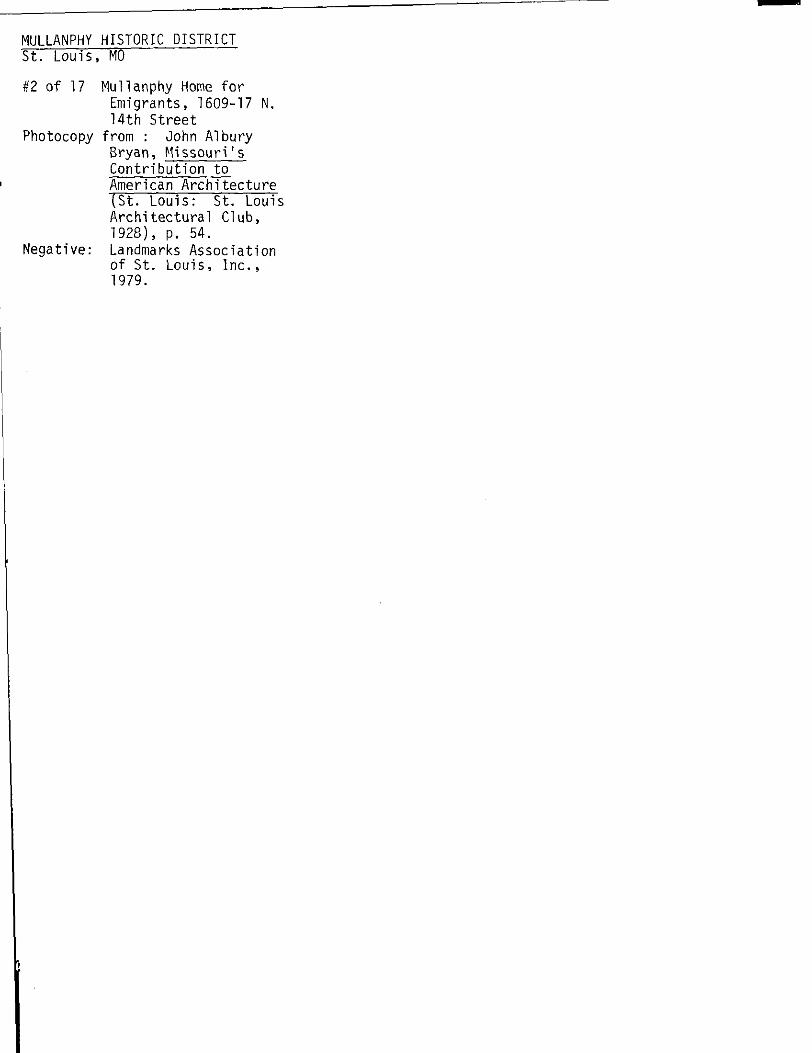
Photocopy from : John A!bury Bryan, Missouri's Contribution to American Architecture (St. Louis:St. Louis Architectural Club, 1928), p. 54.
Negative: Landmarks Association of St. Louis, Inc., 1979.
•sr •
Mullanphy Home for Emigrants, St. LouisBuilt in 1867, .it I ourttcnth and Howard Streets, from Funds Provided by Bryan Mullanphy
George I. Barnett and Alfred H. Piqucnard, St. Louis, ArchitectsLater leased to the School Board for the Douglas School
HULLANPHY HISTORIC DISTRICT
St.
Louis, MO
#3 of 17
1609 thorugh 1629 N.
14th Street
Photographer: Jane M.
Porter
Date:
1981
Negative:
Landmarks Association
of St
. Louis, In
c.
Camera facing northwest.
MULLANPHY HISTORIC DISTRICT
St.
Louis, MO
#4 of 17
Former Church of the
New Jerusalem/Nord
St. Louis Bundeschor
Building, 1629 N.
14th Street
Photographer:
Jane M. Porter
Date:
1981
Negative:
Landmarks Association
of St
. Louis, Inc.
Camera facing southwest; east
(principal) and north elevations.

HULLANPHY HISTORIC DISTRICT
St.
Louis, MO
#5 of 17
1608-26 N. 14th Street
Photographer:
Jane M.
Porter
Date:
1981
Negative:
Landmarks Association
of St. Louis, In
c.
Camera facing northeast.

MULLANPHY HISTORIC DISTRICT St. Louis, MO
#6 of 17 1612 N. 14th Street, Gangway detail
Photographer: Jane M. Porter Date: 1981Negative: Landmarks Association
of St. Louis, Inc.
Camera facing east.

MULLANPHY HISTORIC DISTRICT
St.
Louis, MO
#7 of 17
1628-14 N.
14th Street
Photographer:
Jane M.
Porter
Date:
1981
Negative:
Landmarks Association
of St. Louis, In
c.
Camera facing southeast.
MULLANPHY HISTORIC DISTRICT
St.
Louis, MO
#8 of 17
1302-10 Howard Street
Photographer:
Jane M.
Porter
Date:
1981
Negative:
Landmarks Association
of St
. Louis, In
c.
Camera facing southeast.

MULLANPHY HISTORIC DISTRICT
St.
Louis, MO
19 of 17
1713-35 N. 13th Street
Photographer:
Jane M.
Porter
Date:
1981
Negative:
Landmarks Association
of St.
Louis, Inc.
Camera facing northwest.

HULLANPHY HISTORIC DISTRICT St. Louis, MO————————
#10 of 17 1723 N. 13th Street, rear and rear portion of 1719 N. 13th St.
Photographer: Jane M. Porter Date: 1981Negative: Landmarks Association
of St. Louis, Inc.
Camera facing southeast.


MULLANPHY HISTORIC DISTRICT
St.
Louis, MO
#11
of 17
1735-39 N.
13th Street
Photographer:
Jane M. Porter
Date:
1981
Negative:
Landmarks Association
of St
. Louis, Inc.
Camera facing north.

MULLANPHY HISTORIC DISTRICT
St.
Louis, MO
#12 of 17
1726-14 N.
13th Street
Photographer:
Jane M. Porter
Date:
1981
Negative:
Landmarks Association
of St
. Louis, Inc.
Camera facing southeast.


MULLANPHV HISTORIC DISTRICT
"St. Louis, MO
#13 of 17
"A Bird's-Eye View
of St
. Louis," by
J. T. Palmatry, 1858.
Photocopy & Negative:
Landmarks
Association of St
. Louis, Inc., 1981.
i I
,
"

MULLANPHY HISTORIC DISTRICT
St.
Louis, MO
#14 of 17
Plate #44 from:
Camilla N.
Dry and
Richard J.
Compton,
Pictorial St
. Louis--
1875 (StTLouis:
reprint ed., 1971).
Negative &
Photocopy:
Landmarks
Association of St
.
Louis, In
c.

MULLANPHY HISTORIC DISTRICT
St.
Louis, MO
#15 of 17
Plate #45 from:
Camille N.
Dry and
Richard J.
Compton,
Pictorial St
. Louis--
1875 (St. Louis:
reprint ed., 1971).
Negative &
Photocopy:
Landmarks
Association of St.
Louis, In
c.
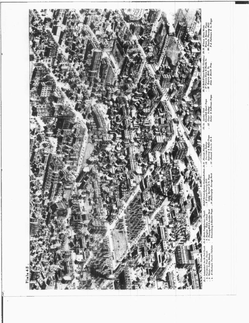

MULLANPHY HISTORIC DISTRICT
St.
Louis, MO
#16 of 17
Dessalines School
Photographer:
Unknown
Date:
Circa 1895
Photocopy & Negative:
Missouri
Historical Society,
1982.
MULLANPHY HISTORIC DISTRICT
St.
Louis, MO
#17 of 17
1203-13 Howard Street
(demolished, 1982}
Photographer:
Jane M. Porter
Date:
1981
Negative:
Landmarks Association
of St
. Louis, In
c.
Camera facing north.
