national ice center the nation’s and the dod’s single inter-agency for operational ice analysis...
TRANSCRIPT
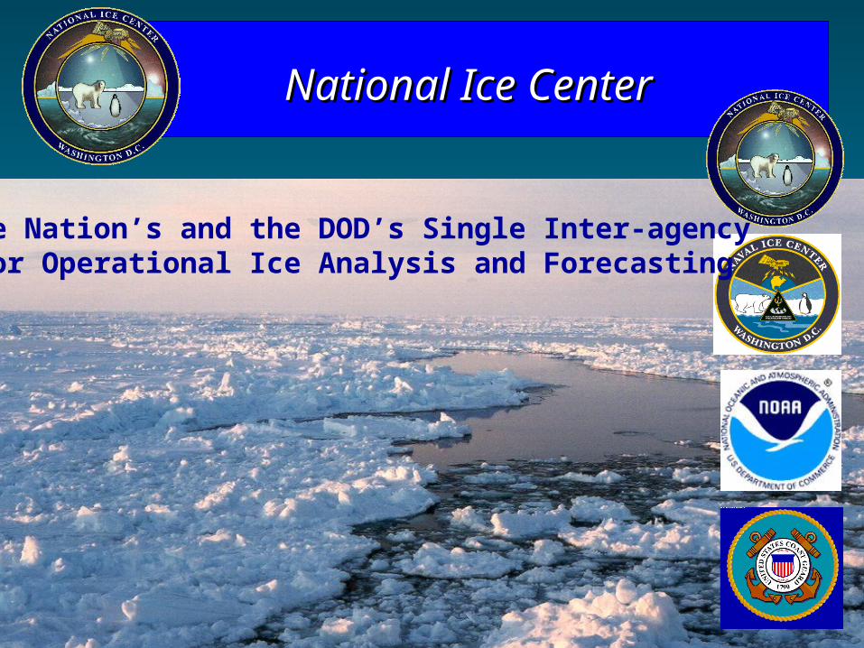
National Ice CenterNational Ice Center
The Nation’s and the DOD’s Single Inter-agency for Operational Ice Analysis and Forecasting
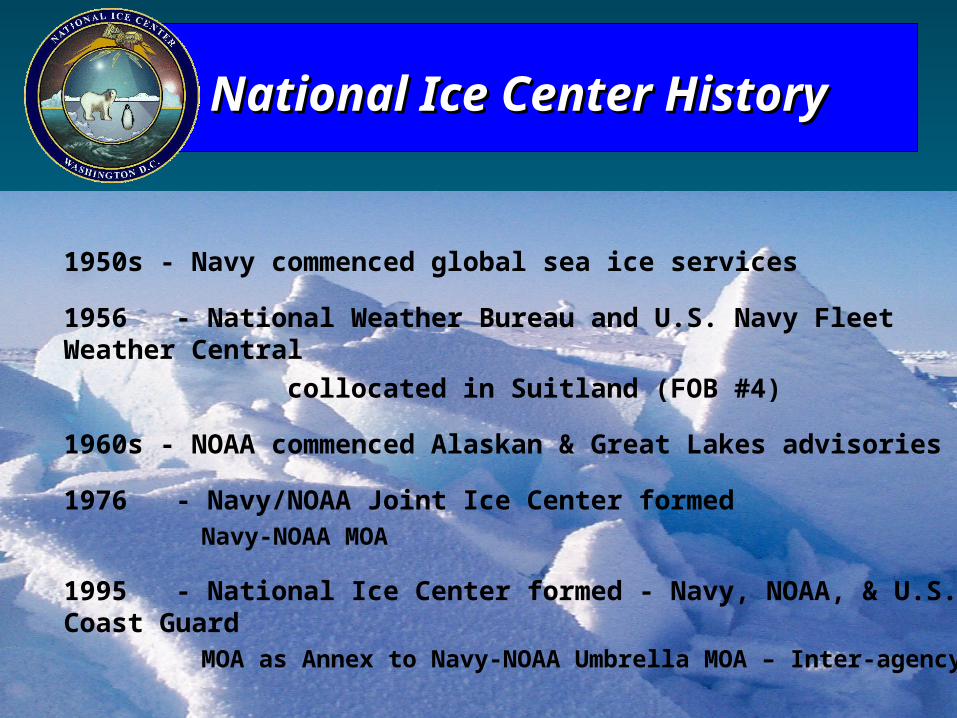
1950s - Navy commenced global sea ice services
1956 - National Weather Bureau and U.S. Navy Fleet Weather Central
collocated in Suitland (FOB #4)
1960s - NOAA commenced Alaskan & Great Lakes advisories
1976 - Navy/NOAA Joint Ice Center formedNavy-NOAA MOA
1995 - National Ice Center formed - Navy, NOAA, & U.S. Coast GuardMOA as Annex to Navy-NOAA Umbrella MOA – Inter-agency
National Ice Center HistoryNational Ice Center History
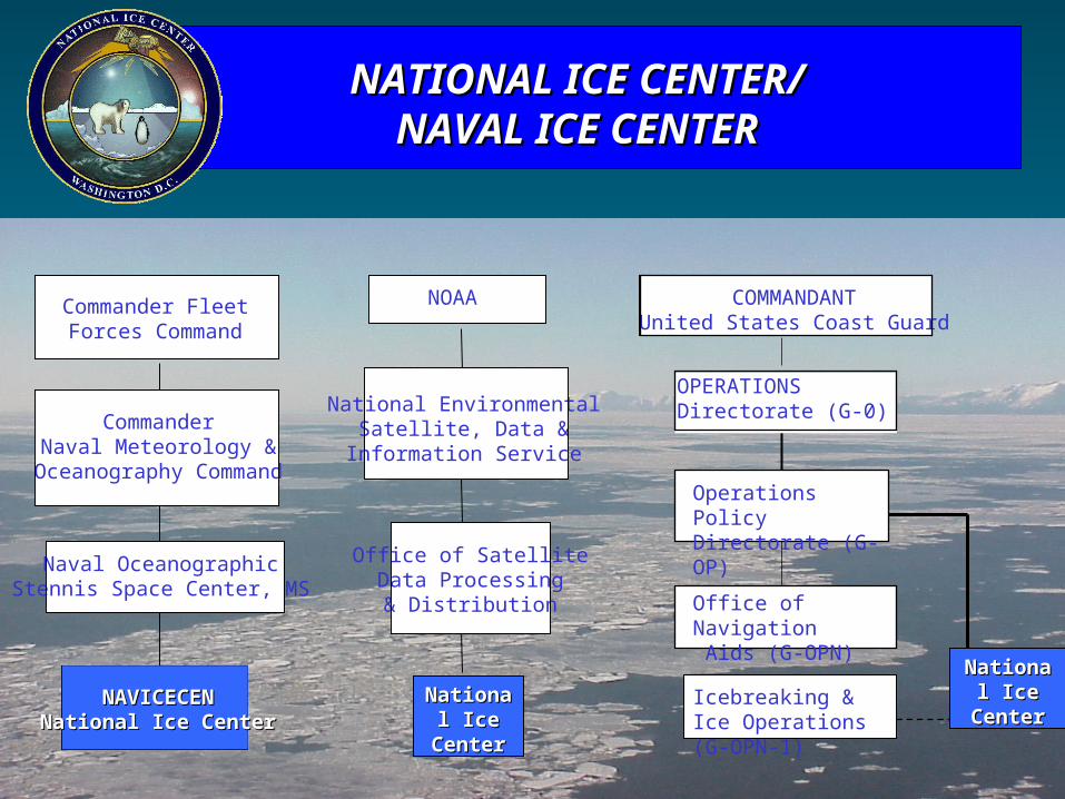
NATIONAL ICE CENTER/NATIONAL ICE CENTER/NAVAL ICE CENTERNAVAL ICE CENTER
NAVICECENNAVICECENNational Ice CenterNational Ice Center
Naval OceanographicStennis Space Center, MS
CommanderNaval Meteorology &
Oceanography Command
Commander Fleet Forces Command
Icebreaking & Ice Operations (G-OPN-1)
Office of Navigation Aids (G-OPN)
Operations PolicyDirectorate (G-OP)
OPERATIONSDirectorate (G-0)
COMMANDANTUnited States Coast Guard
National National Ice CenterIce Center
NOAA
Office of SatelliteData Processing& Distribution
National EnvironmentalSatellite, Data &
Information Service
National National Ice Ice
CenterCenter
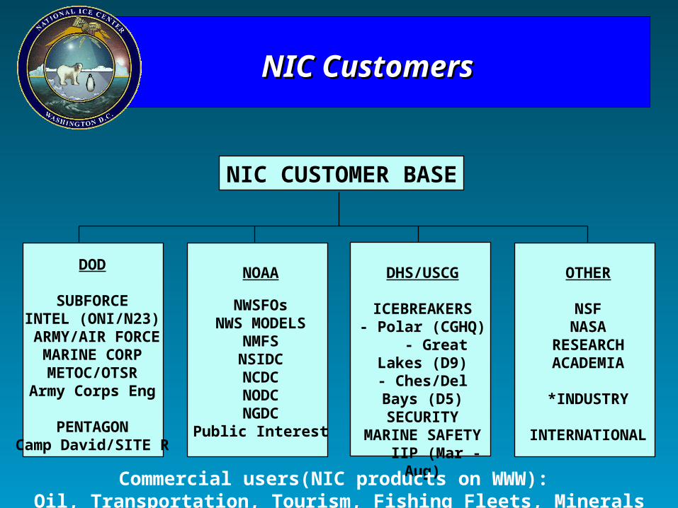
NIC CUSTOMER BASE
DOD
SUBFORCEINTEL (ONI/N23)
ARMY/AIR FORCEMARINE CORPMETOC/OTSR
Army Corps Eng
PENTAGONCamp David/SITE R
NOAA
NWSFOsNWS MODELS
NMFSNSIDCNCDCNODCNGDC
Public Interest
DHS/USCG
ICEBREAKERS- Polar (CGHQ)
- Great Lakes (D9)- Ches/Del Bays (D5)
SECURITYMARINE SAFETY
IIP (Mar -Aug)
OTHER
NSFNASA
RESEARCHACADEMIA
*INDUSTRY
INTERNATIONAL
NIC CustomersNIC Customers
Commercial users(NIC products on WWW): Oil, Transportation, Tourism, Fishing Fleets, Minerals
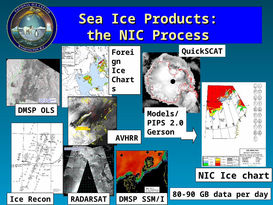
Sea Ice Products:Sea Ice Products:the NIC Processthe NIC Process
DMSP OLS
Ice Recon RADARSAT DMSP SSM/I
NIC Ice chart
80-90 GB data per day
Foreign Ice Charts
QuickSCAT
AVHRR
Models/PIPS 2.0Gerson
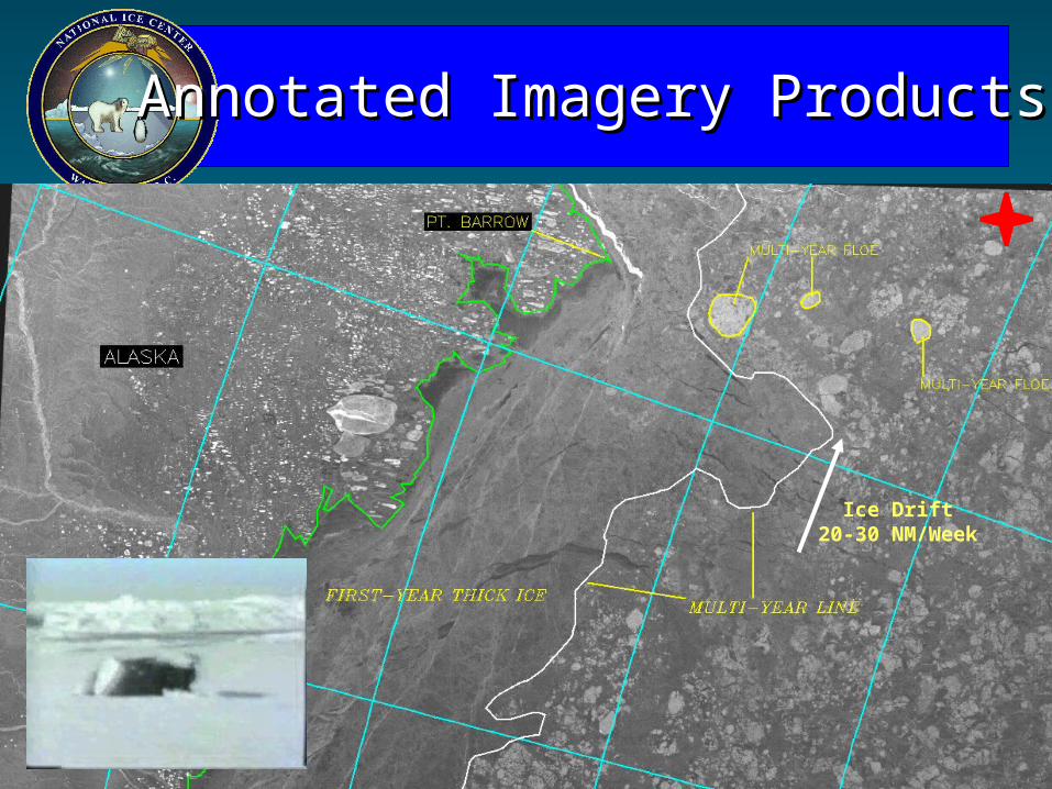
Ice Drift20-30 NM/Week
Annotated Imagery ProductsAnnotated Imagery Products
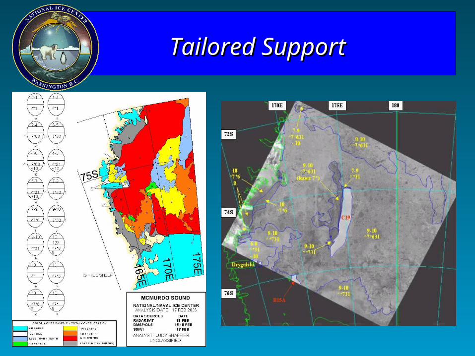
Tailored SupportTailored Support
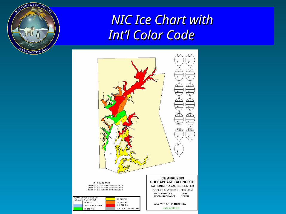
NIC Ice Chart withNIC Ice Chart with Int’l Color Code Int’l Color Code
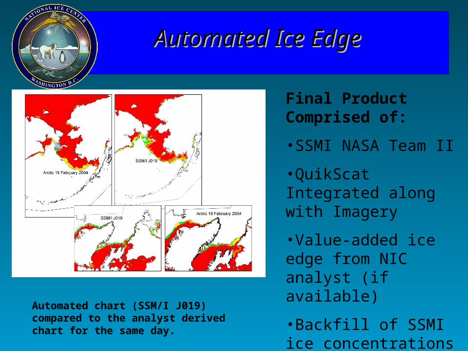
Automated Ice EdgeAutomated Ice Edge
Automated chart (SSM/I J019) compared to the analyst derived chart for the same day.
Final Product Comprised of:
•SSMI NASA Team II
•QuikScat Integrated along with Imagery
•Value-added ice edge from NIC analyst (if available)
•Backfill of SSMI ice concentrations
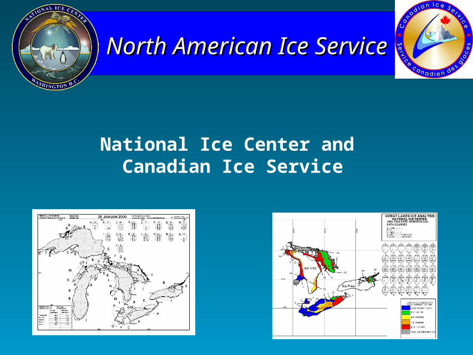
North American Ice ServiceNorth American Ice Service
National Ice Center and Canadian Ice Service

NOAA Satellite Operations Facility
Opening September 2005
Questions?