nass river bridge no. 07773 replacement and approaches ... · pdf filestantec consulting...
TRANSCRIPT

Nass River Bridge No. 07773 Replacement and Approaches Project Hydrotechnical Analysis
Prepared for: British Columbia Ministry of Transportation and Infrastructure
Prepared by: Stantec Consulting Ltd. 500 – 4730 Kingsway Burnaby BC
September 15, 2017
Sign-off Sheet
This document entitled Nass River Bridge No. 07773 Replacement and Approaches Project Hydrotechnical Analysis was prepared by Stantec Consulting Ltd. (“Stantec”) for the account of Ministry of Transportation and Infrastructure (the “Client”). Any reliance on this document by any third party is strictly prohibited. The material in it reflects Stantec’s professional judgment in light of the scope, schedule and other limitations stated in the document and in the contract between Stantec and the Client. The opinions in the document are based on conditions and information existing at the time the document was published and do not take into account any subsequent changes. In preparing the document, Stantec did not verify information supplied to it by others. Any use which a third party makes of this document is the responsibility of such third party. Such third party agrees that Stantec shall not be responsible for costs or damages of any kind, if any, suffered by it or any other third party as a result of decisions made or actions taken based on this document.
Prepared by
(signature)
Michael Trudell, P.Eng.
Reviewed by
(signature)
Matt Wood, P.Eng., CPESC
NASS RIVER BRIDGE NO. 07773 REPLACEMENT AND APPROACHES PROJECT HYDROTECHNICAL ANALYSIS
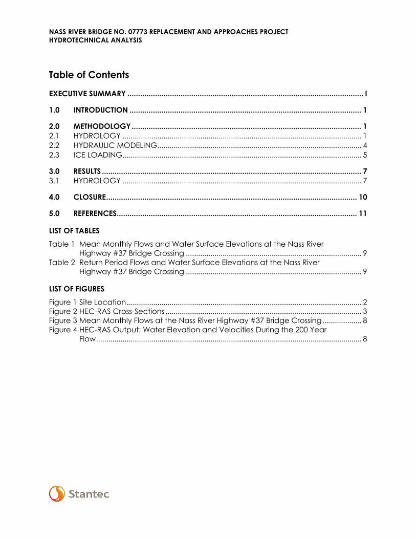
Table of Contents
EXECUTIVE SUMMARY ............................................................................................................... I
1.0 INTRODUCTION ............................................................................................................. 1
2.0 METHODOLOGY ............................................................................................................ 1 2.1 HYDROLOGY ..................................................................................................................... 1 2.2 HYDRAULIC MODELING .................................................................................................... 4 2.3 ICE LOADING ..................................................................................................................... 5
3.0 RESULTS .......................................................................................................................... 7 3.1 HYDROLOGY ..................................................................................................................... 7
4.0 CLOSURE ...................................................................................................................... 10
5.0 REFERENCES ................................................................................................................. 11
LIST OF TABLES Table 1 Mean Monthly Flows and Water Surface Elevations at the Nass River
Highway #37 Bridge Crossing ...................................................................................... 9 Table 2 Return Period Flows and Water Surface Elevations at the Nass River
Highway #37 Bridge Crossing ...................................................................................... 9
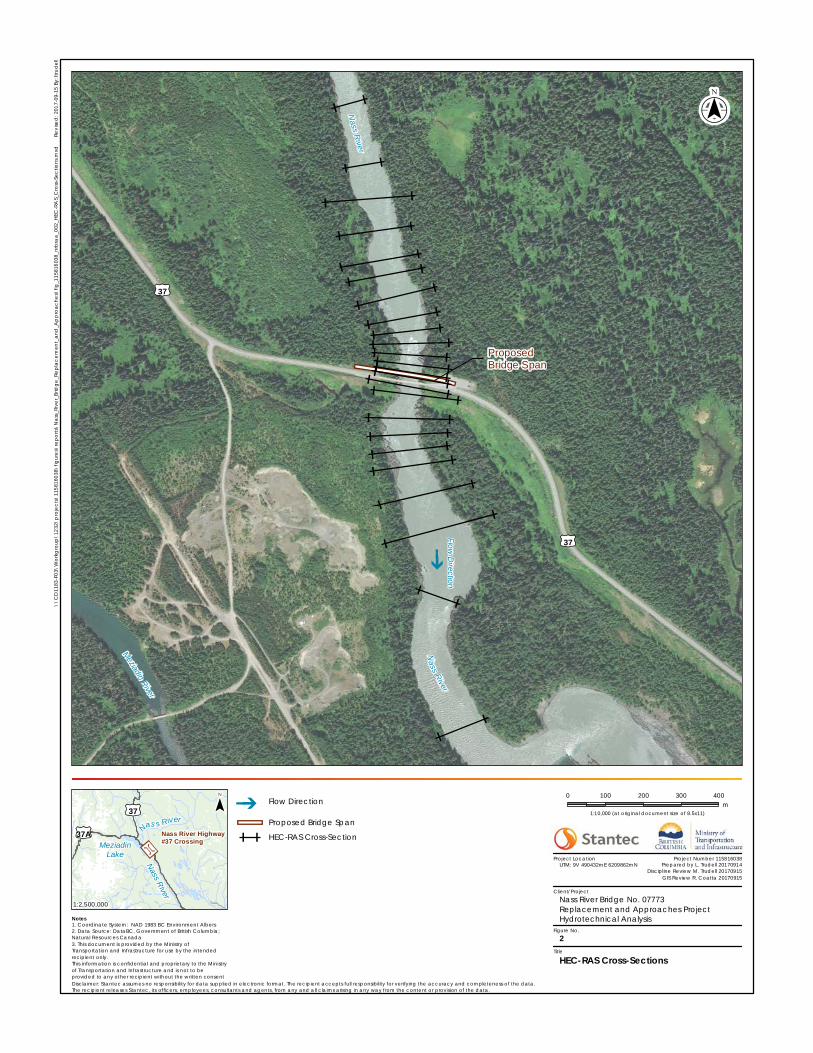
LIST OF FIGURES Figure 1 Site Location ................................................................................................................... 2 Figure 2 HEC-RAS Cross-Sections ................................................................................................ 3 Figure 3 Mean Monthly Flows at the Nass River Highway #37 Bridge Crossing ................... 8 Figure 4 HEC-RAS Output: Water Elevation and Velocities During the 200 Year
Flow .................................................................................................................................. 8
NASS RIVER BRIDGE NO. 07773 REPLACEMENT AND APPROACHES PROJECT HYDROTECHNICAL ANALYSIS
i
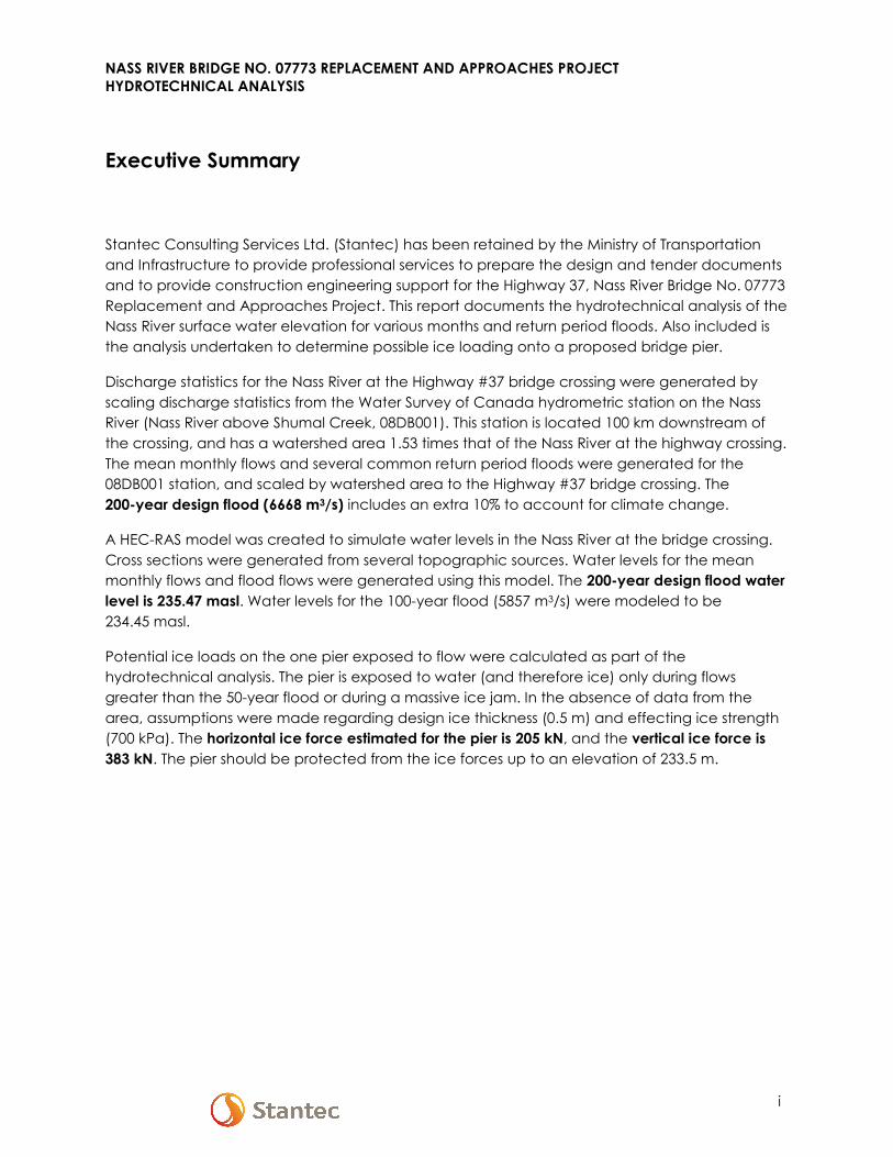
Executive Summary
Stantec Consulting Services Ltd. (Stantec) has been retained by the Ministry of Transportation and Infrastructure to provide professional services to prepare the design and tender documents and to provide construction engineering support for the Highway 37, Nass River Bridge No. 07773 Replacement and Approaches Project. This report documents the hydrotechnical analysis of the Nass River surface water elevation for various months and return period floods. Also included is the analysis undertaken to determine possible ice loading onto a proposed bridge pier.
Discharge statistics for the Nass River at the Highway #37 bridge crossing were generated by scaling discharge statistics from the Water Survey of Canada hydrometric station on the Nass River (Nass River above Shumal Creek, 08DB001). This station is located 100 km downstream of the crossing, and has a watershed area 1.53 times that of the Nass River at the highway crossing. The mean monthly flows and several common return period floods were generated for the 08DB001 station, and scaled by watershed area to the Highway #37 bridge crossing. The 200-year design flood (6668 m3/s) includes an extra 10% to account for climate change.
A HEC-RAS model was created to simulate water levels in the Nass River at the bridge crossing. Cross sections were generated from several topographic sources. Water levels for the mean monthly flows and flood flows were generated using this model. The 200-year design flood water level is 235.47 masl. Water levels for the 100-year flood (5857 m3/s) were modeled to be 234.45 masl.
Potential ice loads on the one pier exposed to flow were calculated as part of the hydrotechnical analysis. The pier is exposed to water (and therefore ice) only during flows greater than the 50-year flood or during a massive ice jam. In the absence of data from the area, assumptions were made regarding design ice thickness (0.5 m) and effecting ice strength (700 kPa). The horizontal ice force estimated for the pier is 205 kN, and the vertical ice force is 383 kN. The pier should be protected from the ice forces up to an elevation of 233.5 m.
NASS RIVER BRIDGE NO. 07773 REPLACEMENT AND APPROACHES PROJECT HYDROTECHNICAL ANALYSIS
Introduction September 15, 2017
cd \\cd1049-f01\workgroup\1158\1158-16038\transportation\report\hydrotechnical\report\rpt_nass_hydrotech_20170915_fin.docx 1
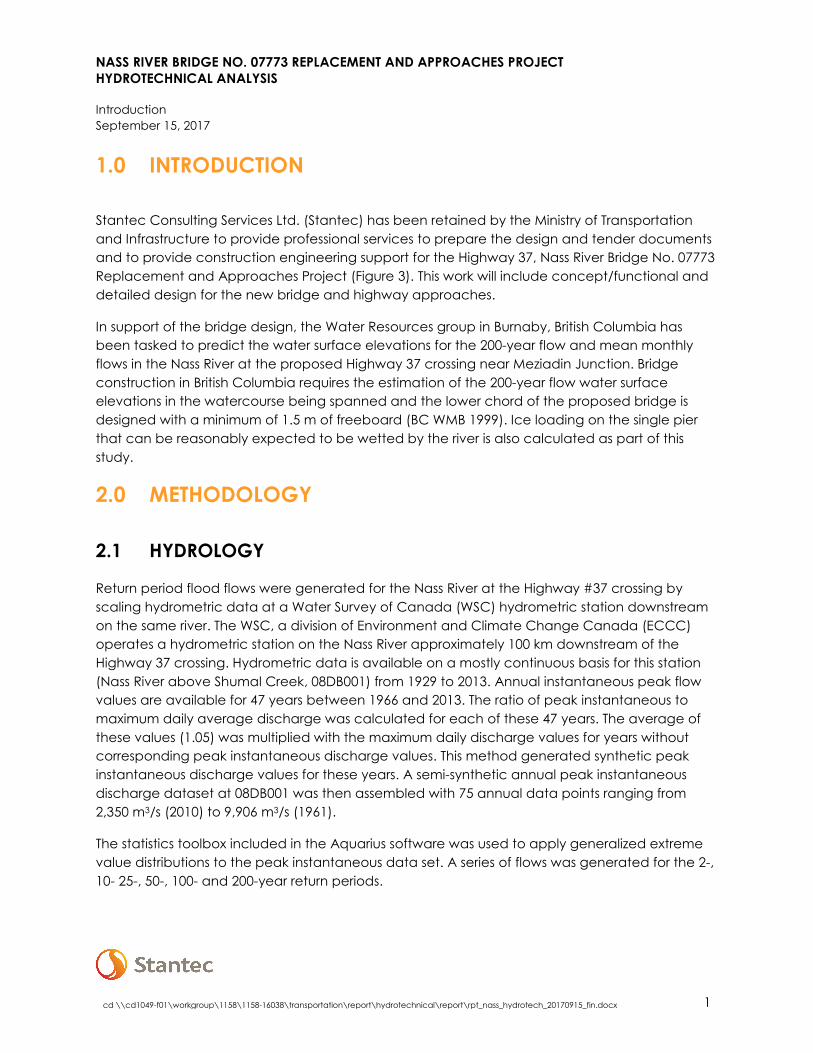
1.0 INTRODUCTION
Stantec Consulting Services Ltd. (Stantec) has been retained by the Ministry of Transportation and Infrastructure to provide professional services to prepare the design and tender documents and to provide construction engineering support for the Highway 37, Nass River Bridge No. 07773 Replacement and Approaches Project (Figure 3). This work will include concept/functional and detailed design for the new bridge and highway approaches.
In support of the bridge design, the Water Resources group in Burnaby, British Columbia has been tasked to predict the water surface elevations for the 200-year flow and mean monthly flows in the Nass River at the proposed Highway 37 crossing near Meziadin Junction. Bridge construction in British Columbia requires the estimation of the 200-year flow water surface elevations in the watercourse being spanned and the lower chord of the proposed bridge is designed with a minimum of 1.5 m of freeboard (BC WMB 1999). Ice loading on the single pier that can be reasonably expected to be wetted by the river is also calculated as part of this study.
2.0 METHODOLOGY
2.1 HYDROLOGY
Return period flood flows were generated for the Nass River at the Highway #37 crossing by scaling hydrometric data at a Water Survey of Canada (WSC) hydrometric station downstream on the same river. The WSC, a division of Environment and Climate Change Canada (ECCC) operates a hydrometric station on the Nass River approximately 100 km downstream of the Highway 37 crossing. Hydrometric data is available on a mostly continuous basis for this station (Nass River above Shumal Creek, 08DB001) from 1929 to 2013. Annual instantaneous peak flow values are available for 47 years between 1966 and 2013. The ratio of peak instantaneous to maximum daily average discharge was calculated for each of these 47 years. The average of these values (1.05) was multiplied with the maximum daily discharge values for years without corresponding peak instantaneous discharge values. This method generated synthetic peak instantaneous discharge values for these years. A semi-synthetic annual peak instantaneous discharge dataset at 08DB001 was then assembled with 75 annual data points ranging from 2,350 m3/s (2010) to 9,906 m3/s (1961).
The statistics toolbox included in the Aquarius software was used to apply generalized extreme value distributions to the peak instantaneous data set. A series of flows was generated for the 2-, 10- 25-, 50-, 100- and 200-year return periods.

"
"
"
"
"
"
"
"
"
"
_̂
CCAANNAADDAAUUSSAA
B CB C A BA B
PacificOcean
Y TY T N W TN W T
Prince Rupert PrinceGeorge
Fort St.John
KamloopsCalgaryBella
CoolaVancouver
Victoria
Edmonton
ProjectLocation
"
"
"
"
"
""
"
"
"
"
"
"
""
"
"
""
!!f
CANADACANADA
USAUSA
Nas s River
PittIsland
PorcherIslandPort
Clements
Hazelton
Granisle
Terrace
PortEdward
FraserLake
MassetKitimat
TelkwaSmithers
Burns Lake
New Hazelton
Houston
PrinceRupert
Kw
ad acha River
Iskut River
Unuk
River
Kechika River
Nilkitkwa River
Gataga River
PaulRi ver
Bulkley
R iver
Stikine Ri ver
Ingenika River
Finlay River
Babin e River
Sh eslay Riv
er
Klapp
anRi
ver
Turn aga inRiv
er
Zymo
etzRiv
er
Tuch
oRi ver
Akie
Riv
er
Frog
River
MessCreek
Na ss River
Bell-Irving River
Beatty Creek Tanzilla
River
Omineca RiverDuti
River
TahltanRiver
Ksi Hlginx
Pitman River
Telkwa River
Skeena River
Swann ell R
iver
Osilinka River
Fox RiverSpats
iziRiver
Sustu t River
PellyCreek
Toad River
KiteenRiver
Mo
rice R iver
Kispiox River
Taylor River
Clore River
Me s ilink aRiver
Tuya
Rive r
Ceda
r Rive
r
Klas tlin e River
Little Klappan River
WillistonLake
BabineLake
StuartLake
FrançoisLake
TrembleurLake
TaklaLake
MoriceLake
ThutadeLake
TchentloLake
BowserLake
£¤16
£¤35
£¤97
£¤37
£¤37A
£¤16
£¤37
Nass River Above Shumal Creek08DB001
Nass RiverHighway #37Crossing
Stewart
DeaseLake
\\CD
1183
-F03\
Wor
kgro
up\1
232\
proje
cts\
1158
1603
8\fig
ures\
repo
rts\N
ass_R
iver_B
ridge
_Rep
lacem
ent_a
nd_A
ppro
ache
s\fig
_115
8160
38_n
rbra
a_00
1_Sit
e_Lo
catio
n.mxd
R
evise
d: 20
17-09
-15 By
: ltrud
ell
($$¯
Disclaimer: Stantec assumes no responsibility for data supplied in electronic format. The recipient accepts full responsibility for verifying the accuracy and completeness of the data. The recipient releases Stantec, its officers, employees, consultants and agents, from any and all claims arising in any way from the content or provision of the data.
0 25 50 75 100km
1:3,000,000 (at original document size of 8.5x11)
1
Project Number 115816038
Nass River Bridge No. 07773Replacement and Approaches ProjectHydrotechnical Analysis
UTM: 9V 490432mE 6209862mN Prepared by L. Trudell 20170914Discipline Review M. Trudell 20170915
GIS Review R. Coatta 20170915
Site Location
Notes1. Coordinate System: NAD 1983 BC Environment Albers2. Data Source: DataBC, Government of British Columbia;Natural Resources Canada3. This document is provided by the Ministry ofTransportation and Infrastructure for use by the intendedrecipient only.This information is confidential and proprietary to the Ministryof Transportation and Infrastructure and is not to beprovided to any other recipient without the written consent
1:50,000,000
Figure No.
Title
Project Location
Client/Project
"City, Town, Village, or DistrictMunicipalityHighwayRoadRailwayInternational BoundaryWatercourseWaterbody
!!f Project Location
""Water Survey of CanadaHydrometric StationFirst Nations ReservePark, Ecological Reserve, orProtected AreaConservancy Area
¯
:
:
::
::
::
::
::
::
:
: :
:
:
:
:
:
:
:
:
:
:
:
:
: :
:
::
::
:
:
::
:
:
::
: :
:
:
a
³³³
Nass River
Nass River
ProposedBridge Span
Meziadin River
£¤37
£¤37Flow Direction
\\CD
1183
-F03\
Wor
kgro
up\1
232\
proje
cts\
1158
1603
8\fig
ures\
repo
rts\N
ass_R
iver_B
ridge
_Rep
lacem
ent_a
nd_A
ppro
ache
s\fig
_115
8160
38_n
rbra
a_00
2_HE
C-RA
S_Cr
oss-S
ectio
ns.m
xd
Rev
ised:
2017
-09-15
By: lt
rude
ll
($$¯
Disclaimer: Stantec assumes no responsibility for data supplied in electronic format. The recipient accepts full responsibility for verifying the accuracy and completeness of the data. The recipient releases Stantec, its officers, employees, consultants and agents, from any and all claims arising in any way from the content or provision of the data.
0 100 200 300 400m
1:10,000 (at original document size of 8.5x11)
2
Project Number 115816038
Nass River Bridge No. 07773Replacement and Approaches ProjectHydrotechnical Analysis
UTM: 9V 490432mE 6209862mN Prepared by L. Trudell 20170914Discipline Review M. Trudell 20170915
GIS Review R. Coatta 20170915
HEC-RAS Cross-Sections
Notes1. Coordinate System: NAD 1983 BC Environment Albers2. Data Source: DataBC, Government of British Columbia;Natural Resources Canada3. This document is provided by the Ministry ofTransportation and Infrastructure for use by the intendedrecipient only.This information is confidential and proprietary to the Ministryof Transportation and Infrastructure and is not to beprovided to any other recipient without the written consent
Figure No.
Title
Project Location
Client/Project
a³³³ Flow Direction
Proposed Bridge Span: : HEC-RAS Cross-Section!!f
Nas s River
Nass River
MeziadinLake
£¤37A
£¤37
Nass River Highway#37 Crossing
1:2,500,000
¯
NASS RIVER BRIDGE NO. 07773 REPLACEMENT AND APPROACHES PROJECT HYDROTECHNICAL ANALYSIS
Methodology September 15, 2017
cd \\cd1049-f01\workgroup\1158\1158-16038\transportation\report\hydrotechnical\report\rpt_nass_hydrotech_20170915_fin.docx 4
The return-period flows at 08DB001 are scaled to the Highway 37 crossing location using the method outlined in Watt et al. (1989). The method is based on the formula below:
𝑄𝑄2 = 𝑄𝑄1 �𝐴𝐴2𝐴𝐴1�𝑛𝑛
Where Q = discharge (m3/s) A = watershed area (km2) n = scaling exponent 1 = related to gauged watershed 2 = related to ungauged watershed
Watt et al. (1989) recommends this method where the ungauged watershed area is within 0.5 to 2.0 times the gauged watershed. The Nass River watershed at the Highway 37 crossing (12,015 km2; BC OGC 2017) is 0.65 times the size of the Nass River watershed at 08DB001 (18,400 km2; ECCC 2017). Eaton et al. (2002) recommend an ‘n’ exponent of 0.75 for watercourses in British Columbia.
The Association of Professional Engineers and Geoscientists of British Columbia mandates that climate change be incorporated into the design of bridges and flood protection measures. The Professional Practice Guidelines—Legislated Flood Assessments in a Changing Climate in BC (APEGBC 2012) document states that “[s]pring floods associated with seasonal snowmelt may become more severe because of more rapid snowmelt, or when a major warm storm occurs over a rapidly melting snowpack. Possible increases of order 10% in extreme spring flood flows are envisaged.” The Nass River hydrograph is dominated by the spring snowmelt freshet. Therefore, 10% is added to the 200-year peak flow to account for possible climate change effects to the Nass River watershed.
The mean monthly flows for the Nass River at the bridge crossing were calculated to determine typical discharge throughout the year. Mean daily discharges for the WSC station 08DB001 are available in a mostly continuous basis from 1929 to 2013. Over this period, daily discharge data were scaled using the same flow scaling methodology used to calculate peak flows (Watt et al. 1989; Eaton et al. 2002). All scaled daily discharge values for a given month were averaged to obtain the mean monthly flow for that month, with the process repeated for each of the 12 months.
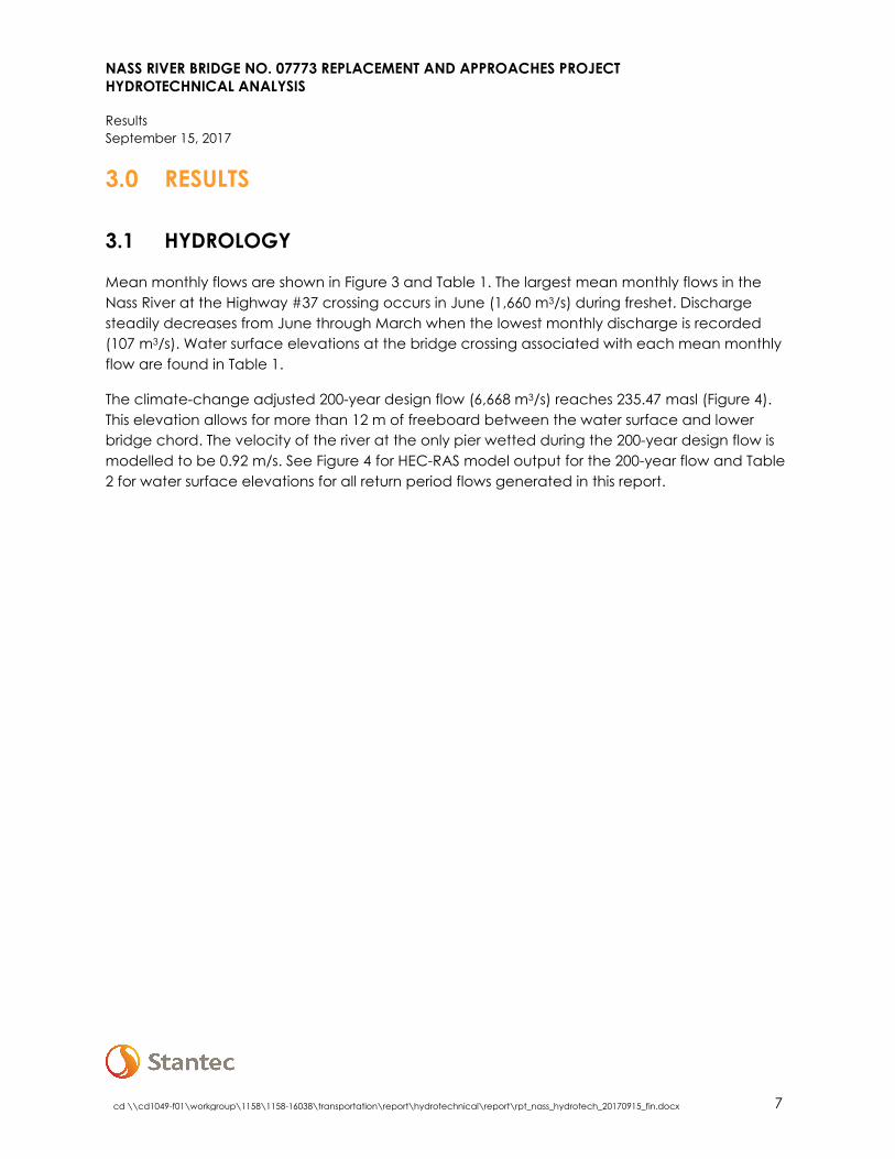
2.2 HYDRAULIC MODELING
The geometry for the model was developed using a combination of LiDAR data sets which were stitched together to produce a digital elevation model (DEM). The following datasets were incorporated into the DEM:
• 0.5 m resolution Bathymetry data for the area 150 m upstream and downstream from the existing bridge provided to Stantec by Terra Remote Sensing Inc.
• 0.5 m resolution Velodyn LiDar scans of the river banks 150 m upstream and downstream of the existing bridge provided to Stantec by Terra Remote Sensing Inc.
• Existing MOTI LiDAR provided to Stantec

NASS RIVER BRIDGE NO. 07773 REPLACEMENT AND APPROACHES PROJECT HYDROTECHNICAL ANALYSIS
Methodology September 15, 2017
cd \\cd1049-f01\workgroup\1158\1158-16038\transportation\report\hydrotechnical\report\rpt_nass_hydrotech_20170915_fin.docx 5
The DEM was used to produce a triangulated irregular network (TIN) layer using ArcGIS. HECGeo-RAS was used to develop the geometry for the HEC-RAS simulation. HECGeo-RAS is a toolbox developed by the US Army Corp of Engineers to develop HEC-RAS geometry files in ArcGIS. Manning’s n values were mapped based on Ortho imagery (provided by the client) with forest cover as 0.1, the channel as 0.04, road surface as 0.015, and bedrock as 0.05. The river channel, banks and flow lines were drawn to create a geometry layer which was exported for use in the HEC-RAS simulation. This was used to map the simulation boundary conditions in HECGeo-RAS (v10.2). The geometry developed in HECGeo-RAS was imported into HEC-RAS for simulation.
Once imported into HEC-RAS, the geometry data was supplemented with additional cross-sections derived from single-beam LiDAR data. These cross-sections provided additional bathymetry profile data outside of the region surveyed by Terra Remote Sensing Inc. The single-beam cross sections extend 500 m upstream and 500 m downstream of the bridge.
Once the cross sections were input in the HEC-RAS model (Figure 4), the proposed bridge deck and pier geometry were coded. It was noted that the cross section profile (TIN) in the vicinity of the right bank of the proposed bridge deviated slightly from the bridge construction drawings. The cross sections were altered to reflect the construction drawings, as this is representative of post-construction conditions.
The 2-, 10-, 25-, 50-, 100- and 200-year return periods flows were input into the model. The reach boundary conditions for the model were set to a normal depth with a slope of 0.011 (1.1%) for the both the upstream and downstream boundaries, based on average bed slope across the study area. A steady flow analysis was performed using a mixed flow regime. To assess the variation in velocity across each cross section profile, 10 flow distribution subsections were added to the channel, and 4 flow distribution subsections were added to both the left and right banks. The model was unable to be calibrated due to a lack of suitable calibrating data.
2.3 ICE LOADING
It is possible that river ice can exert forces onto the proposed pier 1. Anecdotally the Nass River does not freeze up most winters, though it did freeze in 2017. The bench on which pier 1 rests is at approximately 233 m elevation which corresponds to a flood elevation between the 25-year and 50-year events. It is unlikely, though possible that an ice pack in the Nass River can be lifted to an elevation which brings the ice in contact with pier 1. In such a case, the ice can exert horizontal or vertical forces onto the 1.6 m diameter circular pier.

NASS RIVER BRIDGE NO. 07773 REPLACEMENT AND APPROACHES PROJECT HYDROTECHNICAL ANALYSIS
Methodology September 15, 2017
cd \\cd1049-f01\workgroup\1158\1158-16038\transportation\report\hydrotechnical\report\rpt_nass_hydrotech_20170915_fin.docx 6
The horizontal dynamic ice forces on the pier are determined based on the ice failure forces as described in CSA 2014. The ice failure modes include bending (Fb), crushing (Fc), and the bending/crushing transitional (Fcb) forces.
a) Bending force, Fb:
𝐹𝐹𝑏𝑏 = 𝐶𝐶𝑛𝑛 × 𝑝𝑝 × 𝑡𝑡2
where: Cn = 0.5 tan (α + 15⁰), with α= 180⁰ for a vertical column p = effective crushing strength of ice. Assumed 700 kN t = thickness of ice expected to make contact with a pier. Assumed 0.5 m
b) Crushing force, Fc:
𝐹𝐹𝑐𝑐 = 𝐶𝐶𝑎𝑎 × 𝑝𝑝 × 𝑡𝑡 × 𝑤𝑤
where: Ca = √[(5 * t/w) + 1] w = frontal pier width at level of ice where ice is to be split or crushed, 1.6 m
c) Bending/crushing transition force, Fbc:
𝐹𝐹𝑏𝑏𝑐𝑐 = ��𝐶𝐶𝑛𝑛 + √66� ÷ 72� × 𝑝𝑝 × 𝑤𝑤2
No reliable sources have been found which adequately describe river ice in the Nass River or in the region. Drawing from Stantec’s experience in the region, a maximum ice thickness on the Nass River is set to 0.5 m. The effective crushing strength of ice is assumed to be 700 kN. At this strength, ice “breaks up at melting temperature and is somewhat disintegrated” (CSA 2014). In other words, it is assumed that ice on this river is only beginning to break down when freshet occurs. This is a conservative approach as freshet on the Nass River typically occurs in May and June, after ice should have melted in the lower reaches of the river.
When a circular pier is frozen to an ice formation, the vertical forces due to water level fluctuations (Fv) is calculated as per CSA 2014:
𝐹𝐹𝑣𝑣 = 1250 × 𝑡𝑡2 × (1.05 + 0.13 × 𝑅𝑅 ÷ 𝑡𝑡0.75)
where: R = radius of a circular pier, 0.8 m
The results of the ice loading are described in the following section.
NASS RIVER BRIDGE NO. 07773 REPLACEMENT AND APPROACHES PROJECT HYDROTECHNICAL ANALYSIS
Results September 15, 2017
cd \\cd1049-f01\workgroup\1158\1158-16038\transportation\report\hydrotechnical\report\rpt_nass_hydrotech_20170915_fin.docx 7
3.0 RESULTS
3.1 HYDROLOGY
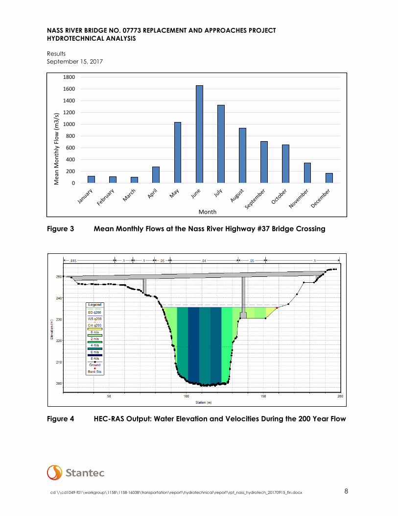
Mean monthly flows are shown in Figure 3 and Table 1. The largest mean monthly flows in the Nass River at the Highway #37 crossing occurs in June (1,660 m3/s) during freshet. Discharge steadily decreases from June through March when the lowest monthly discharge is recorded (107 m3/s). Water surface elevations at the bridge crossing associated with each mean monthly flow are found in Table 1.
The climate-change adjusted 200-year design flow (6,668 m3/s) reaches 235.47 masl (Figure 4). This elevation allows for more than 12 m of freeboard between the water surface and lower bridge chord. The velocity of the river at the only pier wetted during the 200-year design flow is modelled to be 0.92 m/s. See Figure 4 for HEC-RAS model output for the 200-year flow and Table 2 for water surface elevations for all return period flows generated in this report.
NASS RIVER BRIDGE NO. 07773 REPLACEMENT AND APPROACHES PROJECT HYDROTECHNICAL ANALYSIS
Results September 15, 2017
cd \\cd1049-f01\workgroup\1158\1158-16038\transportation\report\hydrotechnical\report\rpt_nass_hydrotech_20170915_fin.docx 8
Figure 3 Mean Monthly Flows at the Nass River Highway #37 Bridge Crossing
Figure 4 HEC-RAS Output: Water Elevation and Velocities During the 200 Year Flow
0
200
400
600
800
1000
1200
1400
1600
1800
Mea
n M
onth
ly F
low
(m3/
s)
Month
NASS RIVER BRIDGE NO. 07773 REPLACEMENT AND APPROACHES PROJECT HYDROTECHNICAL ANALYSIS
Results September 15, 2017
cd \\cd1049-f01\workgroup\1158\1158-16038\transportation\report\hydrotechnical\report\rpt_nass_hydrotech_20170915_fin.docx 9
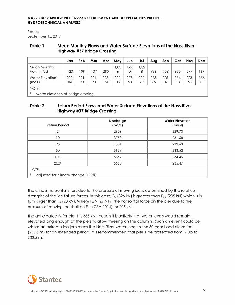
Table 1 Mean Monthly Flows and Water Surface Elevations at the Nass River Highway #37 Bridge Crossing
Jan Feb Mar Apr May Jun Jul Aug Sep Oct Nov Dec
Mean Monthly Flow (m3/s) 120 109 107 280
1,036
1,660
1,328 938 708 650 344 167
Water Elevation1 (masl)
222.04
221.93
221.90
223.24
226.03
227.58
226.79
225.76
225.07
224.88
223.65
222.43
NOTE: 1 water elevation at bridge crossing
Table 2 Return Period Flows and Water Surface Elevations at the Nass River
Highway #37 Bridge Crossing
Return Period Discharge
(m3/s) Water Elevation
(masl)
2 2608 229.73
10 3758 231.58
25 4501 232.63
50 5139 233.52
100 5857 234.45
2001 6668 235.47
NOTE: 1 adjusted for climate change (+10%)
The critical horizontal stress due to the pressure of moving ice is determined by the relative strengths of the ice failure forces. In this case, Fc (896 kN) is greater than Fbc (205 kN) which is in turn larger than Fb (20 kN). Where Fc > Fbc > Fb, the horizontal force on the pier due to the pressure of moving ice shall be Fbc (CSA 2014), or 205 kN.
The anticipated Fv for pier 1 is 383 kN, though it is unlikely that water levels would remain elevated long enough at the piers to allow freezing on the columns. Such an event could be where an extreme ice jam raises the Nass River water level to the 50-year flood elevation (233.5 m) for an extended period. It is recommended that pier 1 be protected from Fv up to 233.5 m.

NASS RIVER BRIDGE NO. 07773 REPLACEMENT AND APPROACHES PROJECT HYDROTECHNICAL ANALYSIS
Closure September 15, 2017
cd \\cd1049-f01\workgroup\1158\1158-16038\transportation\report\hydrotechnical\report\rpt_nass_hydrotech_20170915_fin.docx 10
4.0 CLOSURE
We trust that the information included in this memo meets your requirements. Please do not hesitate to contact the undersigned with any questions.
STANTEC CONSULTING LTD.
Michael Trudell, P.Eng. Matthew Friend, B.Sc. Water Resources Engineer Water Resources Specialist Phone: (604) 412-6041 Phone: (778) 238-1277 [email protected] [email protected] Independent/Technical Review:
Matt Wood, P.Eng., CPESC Senior Water Resources Engineer Phone: (403) 716-8032

NASS RIVER BRIDGE NO. 07773 REPLACEMENT AND APPROACHES PROJECT HYDROTECHNICAL ANALYSIS
References September 15, 2017
11
5.0 REFERENCES
APEGBC (Association of Professional Engineers and Geoscientists of British Columbia). 2012. Professional Practice Guidelines – Legislated Flood Assessments in a Changing Climate in BC.
BC OGC (British Columbia Oil and Gas Commission). 2017. Northwest Water Tool. Available at: http://www.bcwatertool.ca/nwwt/#6/56.068/-126.715.
BC WMB (British Columbia Water Management Branch). Public Safety Section. 1999. Guidelines for Management of food protection works in British Columbia.
CSA (Canadian Standards Association). 2014. Canadian Highway Bridge Design Code.
Eaton, B., M. Church, and D. Ham. 2002. Scaling and regionalization of flood flows in British Columbia, Canada. Hydrological Processes. 16, pp. 3,245–3,263.
ECCC (Environment and Climate Change Canada) 2017. Water Survey of Canada Historical Hydrometric Data. Available at: https://wateroffice.ec.gc.ca/mainmenu/historical_data_index_e.html.