nasa earth science space and information · pdf filenasa earth science . space and information...
TRANSCRIPT
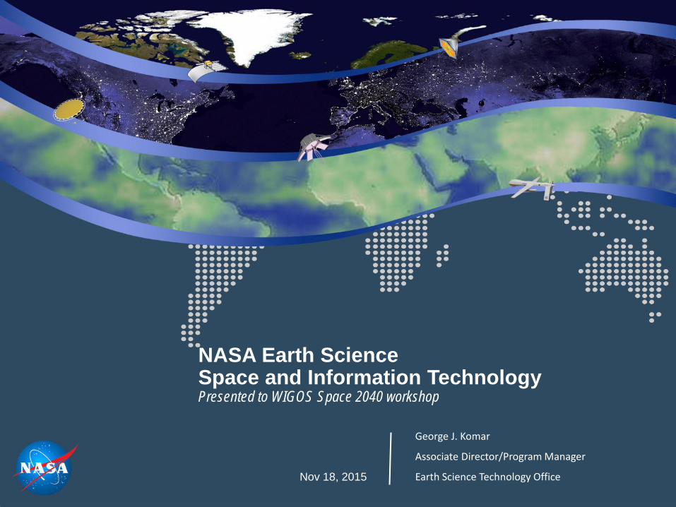
NASA Earth Science Space and Information Technology Presented to WIGOS Space 2040 workshop Nov 18, 2015
George J. Komar
Associate Director/Program Manager
Earth Science Technology Office
NASA Earth Science Strategy
• advance Earth System Science
• deliver societal benefit through applications development and capacity building
• provide essential global spaceborne measurements
• develop and demonstrate technologies for next-generation measurements, and
• complement and coordinate with activities of other agencies and international partners
Maintaining a balanced approach to the program
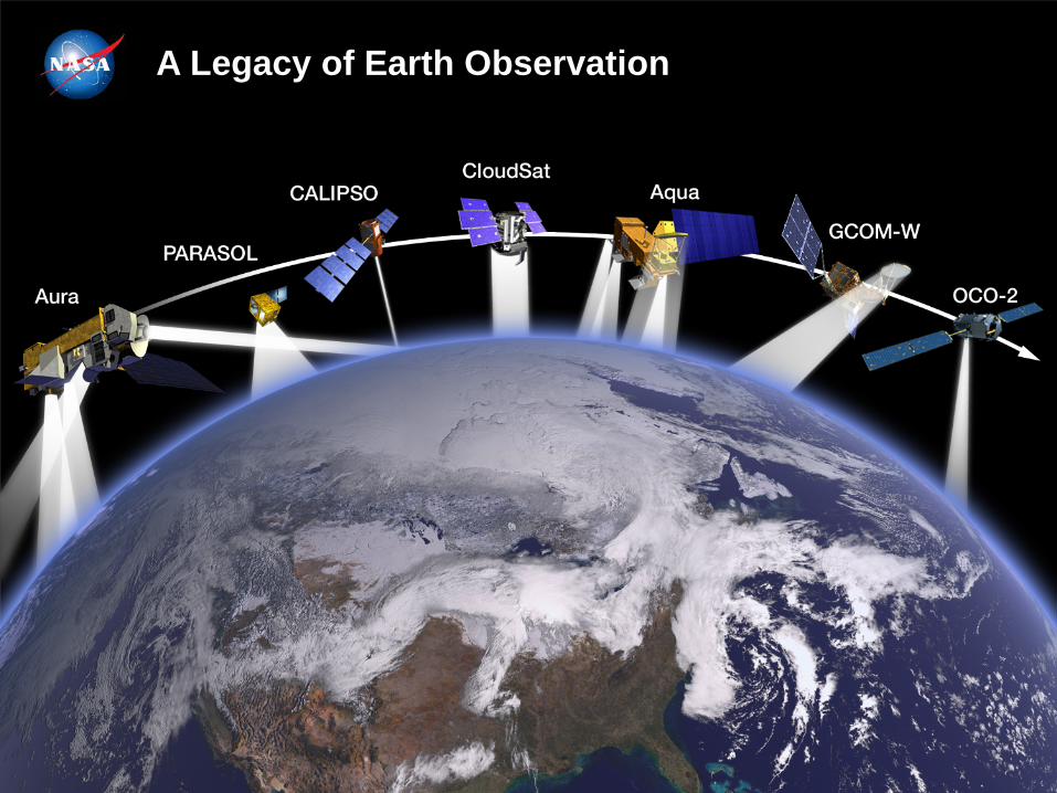
A-Train A Legacy of Earth Observation
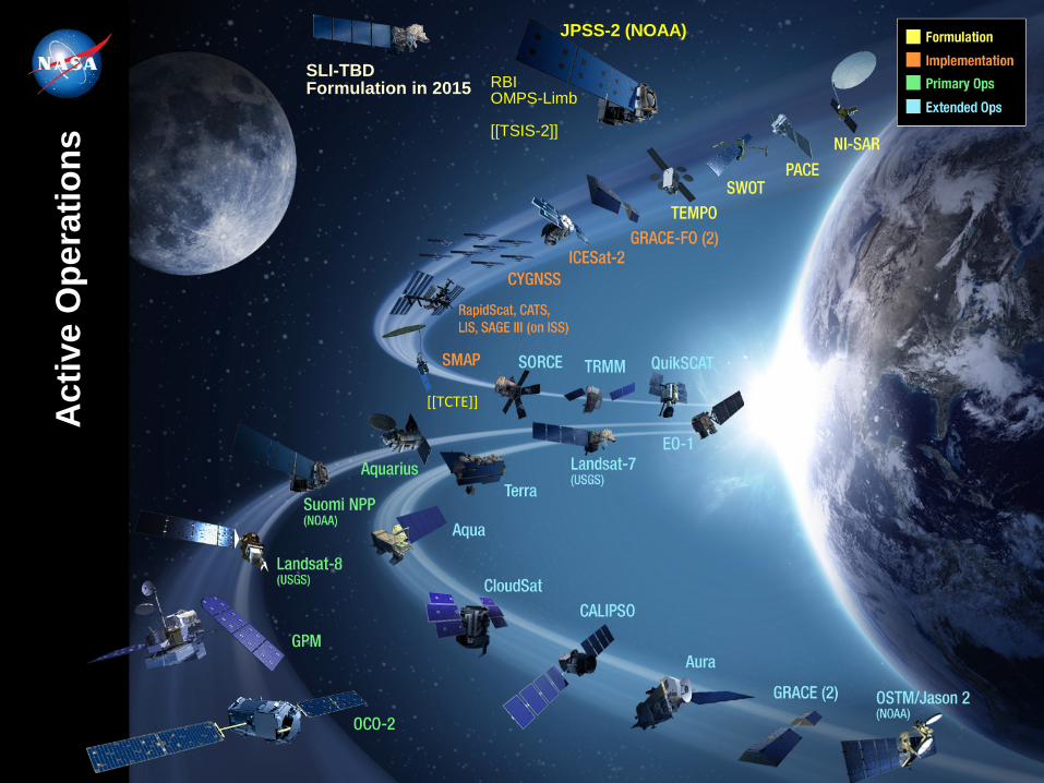
RBI OMPS-Limb [[TSIS-2]]
JPSS-2 (NOAA)
SLI-TBD Formulation in 2015
[[TCTE]] Act
ive
Ope
ratio
ns

Precipitation Temperature and Humidity from GEO Global Air Pollution from GEO Active Sensing of CO2 Three Dimensional Winds Global Atmospheric Composition Surface Topography Ocean Topography Solid Earth Deformation Hyperspectral Imaging Absolute Radiance Next Generation Gravity Soil Moisture Ecosystem Structure Ice and Snow Dynamics and Processes Aerosols and Clouds …
Looking Ahead
Smaller, less resource-intensive instrumentation High-resolution optical and infrared sensors
Next-generation Lidar and Radar Formation flying
Nano-satellites / CubeSats Fractionated spacecraft
Autonomous operations High-resolution ensemble models
Rapid, error-free data transfer ...

Context for Future “New Space” Options
• NASA budgets are highly constrained for the foreseeable future
o NASA Earth Science budget under particular scrutiny, but has remained flat recently
o NOAA has limited budgetary flexibility, driven by requirements for JPSS and need for sustained polar orbiters
o Landsat-9 mission to be a clone of L-8 and at similar cost
• Backlog of missions for NASA from the 2007 Decadal Survey; those executed are costing 2x or more than forecast
• NASA has increasing responsibilities without commensurate budget increases, for continuity missions formerly assigned to NOAA: total solar irradiance, ocean surface topography, ozone profiles, and Earth radiation budget.
Setting the stage for the 2017-2017 Decadal Survey for Earth Science
“New Space” ideas – new players, smaller and less costly platforms (CubeSats), constellations, and hosted payloads – as well as PI-led programs (Venture-class) and
additional use of ISS hold promise to accomplish “more for less.”
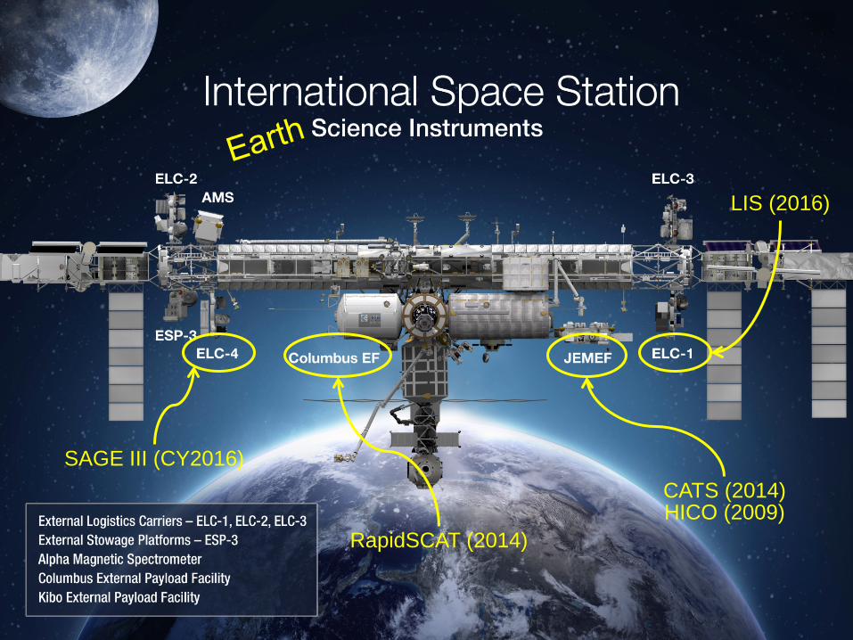
SAGE III (CY2016) CATS (2014) HICO (2009)
RapidSCAT (2014)
LIS (2016)
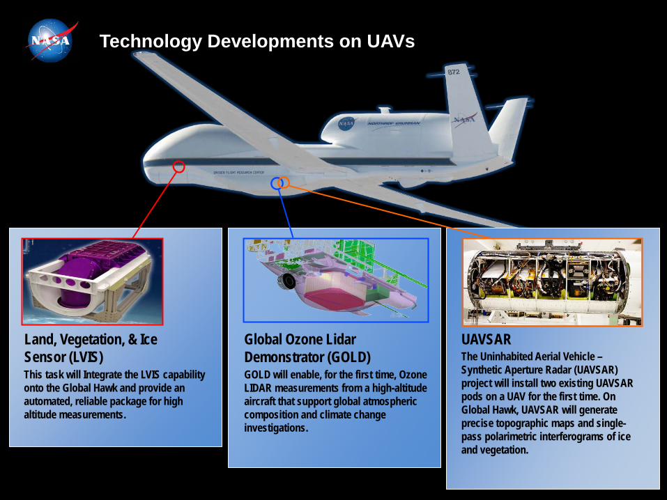
Technology Developments on UAVs
This task will Integrate the LVIS capability onto the Global Hawk and provide an automated, reliable package for high altitude measurements.
Land, Vegetation, & Ice Sensor (LVIS)
GOLD will enable, for the first time, Ozone LIDAR measurements from a high-altitude aircraft that support global atmospheric composition and climate change investigations.
Global Ozone Lidar Demonstrator (GOLD)
UAVSAR The Uninhabited Aerial Vehicle – Synthetic Aperture Radar (UAVSAR) project will install two existing UAVSAR pods on a UAV for the first time. On Global Hawk, UAVSAR will generate precise topographic maps and single-pass polarimetric interferograms of ice and vegetation.

Laser Instruments on the ER-2 and DC-8
Land, Vegetation, & Ice Sensor (LVIS)
Laser altimeter for surface measurements
(Blair, NASA GSFC)
Doppler Aerosol Wind Lidar (DAWN) 2.0 um Coherent Doppler Aerosol Winds (Kavaya, NASA LaRC)
Tropospheric Wind Lidar Technology Experiment (TWiLiTE) UV Direct Detection Molecular Winds (Gentry, NASA GSFC)
High Spectral Resolution Lidar (HSRL-2) with Ozone DIAL Combined aerosol, cloud and ozone measurements (Hostetler / Hair, NASA LaRC)
Multi-Functional Fiber Laser Lidar (MFLL)
CO2, O2, and range measurements (Dobler, NASA LaRC / Dobbs, ITT)
CO2 Sounder Lidar CO2, O2, and range measurements using lasers at 1572 and 765 nm (Abshire, NASA GSFC)

U-Class Satellites Advancing TRLs for Future Earth Science Measurements ESTO InVEST 2012 Program
MiRaTA MIT / MIT-LL
3 Frequency Radiometer and GPSRO
Validate new microwave radiometer and GPSRO
technology for all-weather sounding
RAVAN APL
Vertically Aligned Carbon Nanotubes (VACNTs)
Demonstrate VACNTs as
radiometer absorbing material and calibration standard for total
outgoing radiation
IceCube GSFC
874 GHz submm-Wave radiometer
Validate sub-mm
radiometer for spaceborne cloud ice remote sensing
HARP UMBC
Wide FOV Rainbow Polarimeter
Demonstrate 2-4 km wide
FOV hyperangular polarimeter for cloud & aerosol characterization
LMPC The Aerospace Corporation
Photon Counting InfraRed Detector
Demonstrate linear mode
single photon detector at 1, 1.5, and 2 microns in space
environment
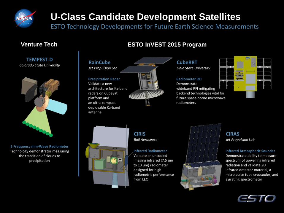
ESTO Technology Developments for Future Earth Science Measurements U-Class Candidate Development Satellites
TEMPEST-D Colorado State University
5 Frequency mm-Wave Radiometer Technology demonstrator measuring
the transition of clouds to precipitation
RainCube Jet Propulsion Lab
CubeRRT Ohio State University
ESTO InVEST 2015 Program Venture Tech
CIRiS Ball Aerospace
CIRAS Jet Propulsion Lab
Infrared Atmospheric Sounder Demonstrate ability to measure spectrum of upwelling infrared radiation and validate 2D infrared detector material, a micro pulse tube cryocooler, and a grating spectrometer
Precipitation Radar Validate a new architecture for Ka-band radars on CubeSat platform and an ultra-compact deployable Ka-band antenna
Radiometer RFI Demonstrate wideband RFI mitigating backend technologies vital for future space-borne microwave radiometers
Infrared Radiometer Validate an uncooled imaging infrared (7.5 um to 13 um) radiometer designed for high radiometric performance from LEO
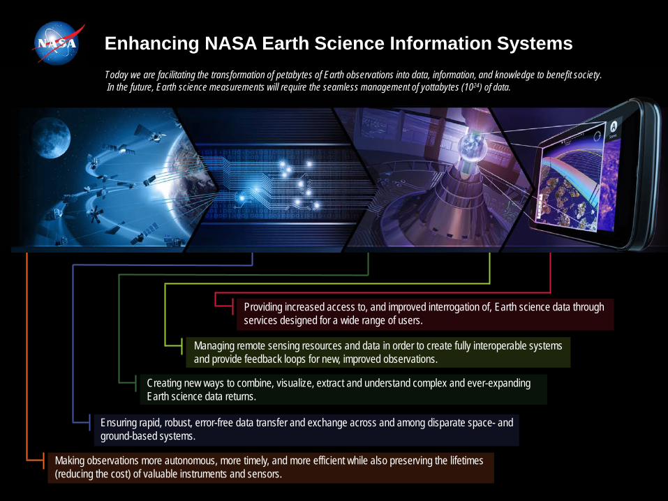
Making observations more autonomous, more timely, and more efficient while also preserving the lifetimes (reducing the cost) of valuable instruments and sensors.
Ensuring rapid, robust, error-free data transfer and exchange across and among disparate space- and ground-based systems.
Creating new ways to combine, visualize, extract and understand complex and ever-expanding Earth science data returns.
Managing remote sensing resources and data in order to create fully interoperable systems and provide feedback loops for new, improved observations.
Providing increased access to, and improved interrogation of, Earth science data through services designed for a wide range of users.
Enhancing NASA Earth Science Information Systems Today we are facilitating the transformation of petabytes of Earth observations into data, information, and knowledge to benefit society. In the future, Earth science measurements will require the seamless management of yottabytes (1024) of data.
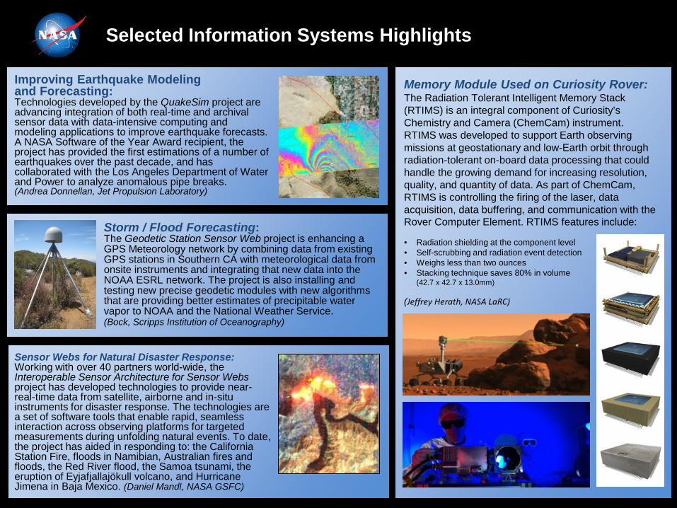
Improving Earthquake Modeling and Forecasting: Technologies developed by the QuakeSim project are advancing integration of both real-time and archival sensor data with data-intensive computing and modeling applications to improve earthquake forecasts. A NASA Software of the Year Award recipient, the project has provided the first estimations of a number of earthquakes over the past decade, and has collaborated with the Los Angeles Department of Water and Power to analyze anomalous pipe breaks. (Andrea Donnellan, Jet Propulsion Laboratory)
Memory Module Used on Curiosity Rover: The Radiation Tolerant Intelligent Memory Stack (RTIMS) is an integral component of Curiosity’s Chemistry and Camera (ChemCam) instrument. RTIMS was developed to support Earth observing missions at geostationary and low-Earth orbit through radiation-tolerant on-board data processing that could handle the growing demand for increasing resolution, quality, and quantity of data. As part of ChemCam, RTIMS is controlling the firing of the laser, data acquisition, data buffering, and communication with the Rover Computer Element. RTIMS features include: • Radiation shielding at the component level • Self-scrubbing and radiation event detection • Weighs less than two ounces • Stacking technique saves 80% in volume
(42.7 x 42.7 x 13.0mm) (Jeffrey Herath, NASA LaRC)
Sensor Webs for Natural Disaster Response: Working with over 40 partners world-wide, the Interoperable Sensor Architecture for Sensor Webs project has developed technologies to provide near-real-time data from satellite, airborne and in-situ instruments for disaster response. The technologies are a set of software tools that enable rapid, seamless interaction across observing platforms for targeted measurements during unfolding natural events. To date, the project has aided in responding to: the California Station Fire, floods in Namibian, Australian fires and floods, the Red River flood, the Samoa tsunami, the eruption of Eyjafjallajökull volcano, and Hurricane Jimena in Baja Mexico. (Daniel Mandl, NASA GSFC)
Storm / Flood Forecasting: The Geodetic Station Sensor Web project is enhancing a GPS Meteorology network by combining data from existing GPS stations in Southern CA with meteorological data from onsite instruments and integrating that new data into the NOAA ESRL network. The project is also installing and testing new precise geodetic modules with new algorithms that are providing better estimates of precipitable water vapor to NOAA and the National Weather Service. (Bock, Scripps Institution of Oceanography)
Selected Information Systems Highlights
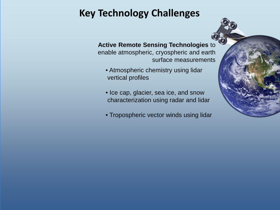
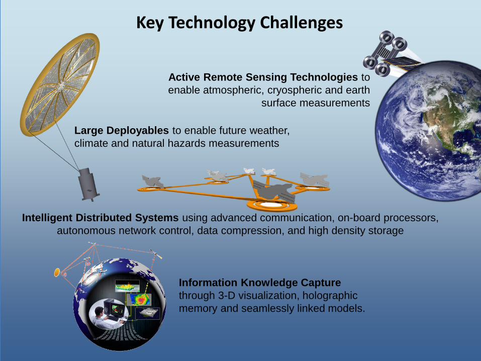
Key Technology Challenges
Active Remote Sensing Technologies to enable atmospheric, cryospheric and earth
surface measurements • Atmospheric chemistry using lidar
vertical profiles • Ice cap, glacier, sea ice, and snow characterization using radar and lidar • Tropospheric vector winds using lidar
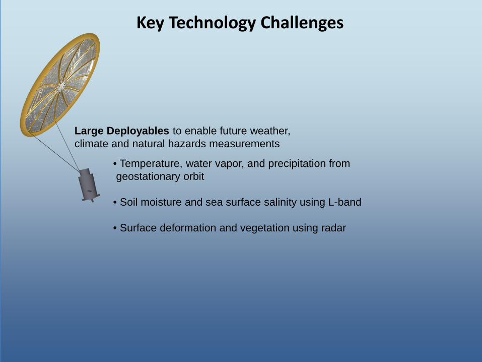
Key Technology Challenges
Large Deployables to enable future weather, climate and natural hazards measurements
• Temperature, water vapor, and precipitation from geostationary orbit • Soil moisture and sea surface salinity using L-band • Surface deformation and vegetation using radar
Key Technology Challenges
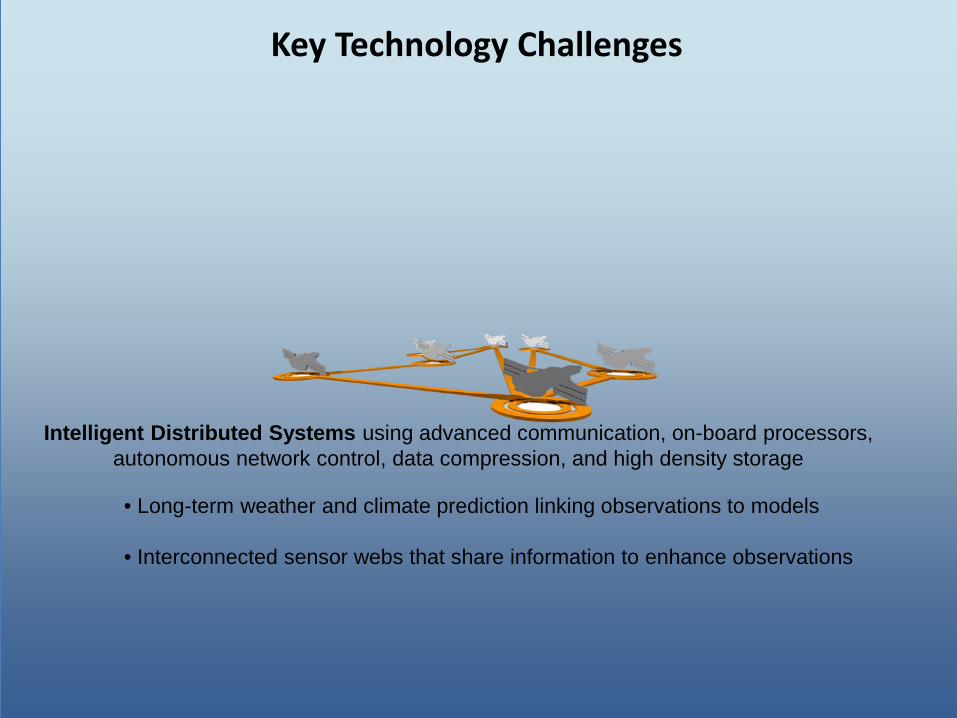
Intelligent Distributed Systems using advanced communication, on-board processors, autonomous network control, data compression, and high density storage
• Long-term weather and climate prediction linking observations to models • Interconnected sensor webs that share information to enhance observations
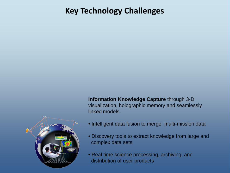
Key Technology Challenges
Information Knowledge Capture through 3-D visualization, holographic memory and seamlessly linked models. • Intelligent data fusion to merge multi-mission data • Discovery tools to extract knowledge from large and complex data sets • Real time science processing, archiving, and distribution of user products
Key Technology Challenges
Active Remote Sensing Technologies to enable atmospheric, cryospheric and earth
surface measurements
Large Deployables to enable future weather, climate and natural hazards measurements
Intelligent Distributed Systems using advanced communication, on-board processors, autonomous network control, data compression, and high density storage
Information Knowledge Capture through 3-D visualization, holographic memory and seamlessly linked models.