mysql 5.7 gis
TRANSCRIPT


Copyright © 2014 Oracle and/or its affiliates. All rights reserved. |
Mapping with MySQL: GIS in MySQL 5.7
Pavan NaikMySQL Eng Team

Copyright © 2014 Oracle and/or its affiliates. All rights reserved. |
Safe Harbor Statement
The following is intended to outline our general product direction. It is intended for information purposes only, and may not be incorporated into any contract. It is not a commitment to deliver any material, code, or functionality, and should not be relied upon in making purchasing decisions. The development, release, and timing of any features or functionality described for Oracle’s products remains at the sole discretion of Oracle.
3
Copyright © 2014 Oracle and/or its affiliates. All rights reserved. |
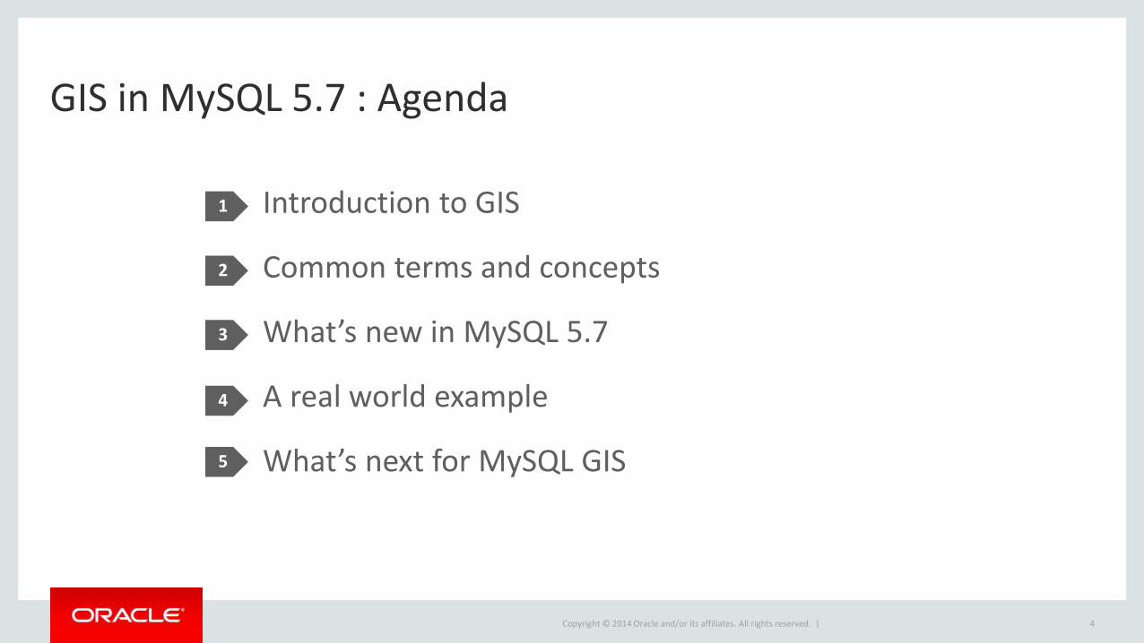
GIS in MySQL 5.7 : Agenda
1
2
3
4
5
Introduction to GIS
Common terms and concepts
What’s new in MySQL 5.7
A real world example
What’s next for MySQL GIS
4

Copyright © 2014 Oracle and/or its affiliates. All rights reserved. |
Introduction to GIS
5

Copyright © 2014 Oracle and/or its affiliates. All rights reserved. |
What is GIS?
• Geographic Information Systems
– Features : graphic spatial representations of real-world physical features• Generally a map of some sort
– Attributes : non-spatial data describing the features• Name/value pairs used to describe a location and to allow for grouping of data
• Data formats– Vector data : points, lines and polygons• Generally what’s used with an RDBMS, such as MySQL
– Raster data : grid matrix containing cells• Generally used for aerial and satellite imagery
6

Copyright © 2014 Oracle and/or its affiliates. All rights reserved. |
What Would I Use it for?
• Location services
–Where is something?
– How do I get from Point A to Point B?
–What are the closest <thing>s to me?
–What are the relevant details of each location or Point?
7
* Source: ESRI

Copyright © 2014 Oracle and/or its affiliates. All rights reserved. |
How Would I Use It?
8
StoreCollect
AnalyzeVisualize
• Collect spatial data
– Free (OSM)
• Store the data
–Within MySQL tables
• Analyze the data– SQL queries are used to analyze the data to derive
meaningful relationships
• Visualize the data
– Provide maps containing the resulting attributes and relationships

Copyright © 2014 Oracle and/or its affiliates. All rights reserved. |
Common Terms and Concepts
9

Copyright © 2014 Oracle and/or its affiliates. All rights reserved. |
Common Terms
• Coordinates
– x,y,z coordinates in planar space (4D is m or measure)
–MySQL currently only supports x,y(2D) coordinates
• Projection– Allows a spheroidal surface to be represented in planar format
– Necessary for creating “flat” or 2D maps from locations on a spheroid
• Coordinate reference system (CRS/SRS/SRID)
– Defines where a POINT—represented by a longitude and latitude coordinate pair—is located on the physical earth and defines its relationship to other POINTs
10

Copyright © 2014 Oracle and/or its affiliates. All rights reserved. |
Data Formats
• Vector
– Points, lines, and polygons
– Position (x,y) is relative in a coordinate system
– Generally used by database servers
– Includes .OSM, .KML, .GeoJSON, …
• Raster
– Cells in a grid matrix, tied to an anchor (e.g. the {1,1} cell)
– Generally used in aerial, satellite, and other imagery
– Includes .jpg, .gif and other pixel based formats
11

Copyright © 2014 Oracle and/or its affiliates. All rights reserved. |
Data Formats
12
Copyright © 2014 Oracle and/or its affiliates. All rights reserved. |
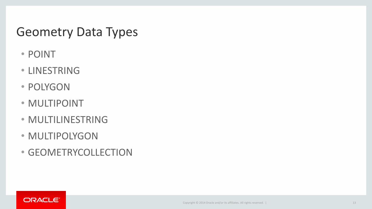
Geometry Data Types
• POINT
• LINESTRING
• POLYGON
• MULTIPOINT
• MULTILINESTRING
• MULTIPOLYGON
• GEOMETRYCOLLECTION
13

Copyright © 2014 Oracle and/or its affiliates. All rights reserved. |
What’s New in MySQL 5.7
14

Copyright © 2014 Oracle and/or its affiliates. All rights reserved. |
Integrating Boost.Geometry
• Replaced custom code
– For geometry representations
– For geometry comparisons
• Provides OGC compliance–With improved performance
• Boost.Geometry contains
– Field and domain experts
– Bustling and robust community
• We’re also Boost.Geometry contributors!– Two full-time developers contributing upstream
15
Copyright © 2014 Oracle and/or its affiliates. All rights reserved. |
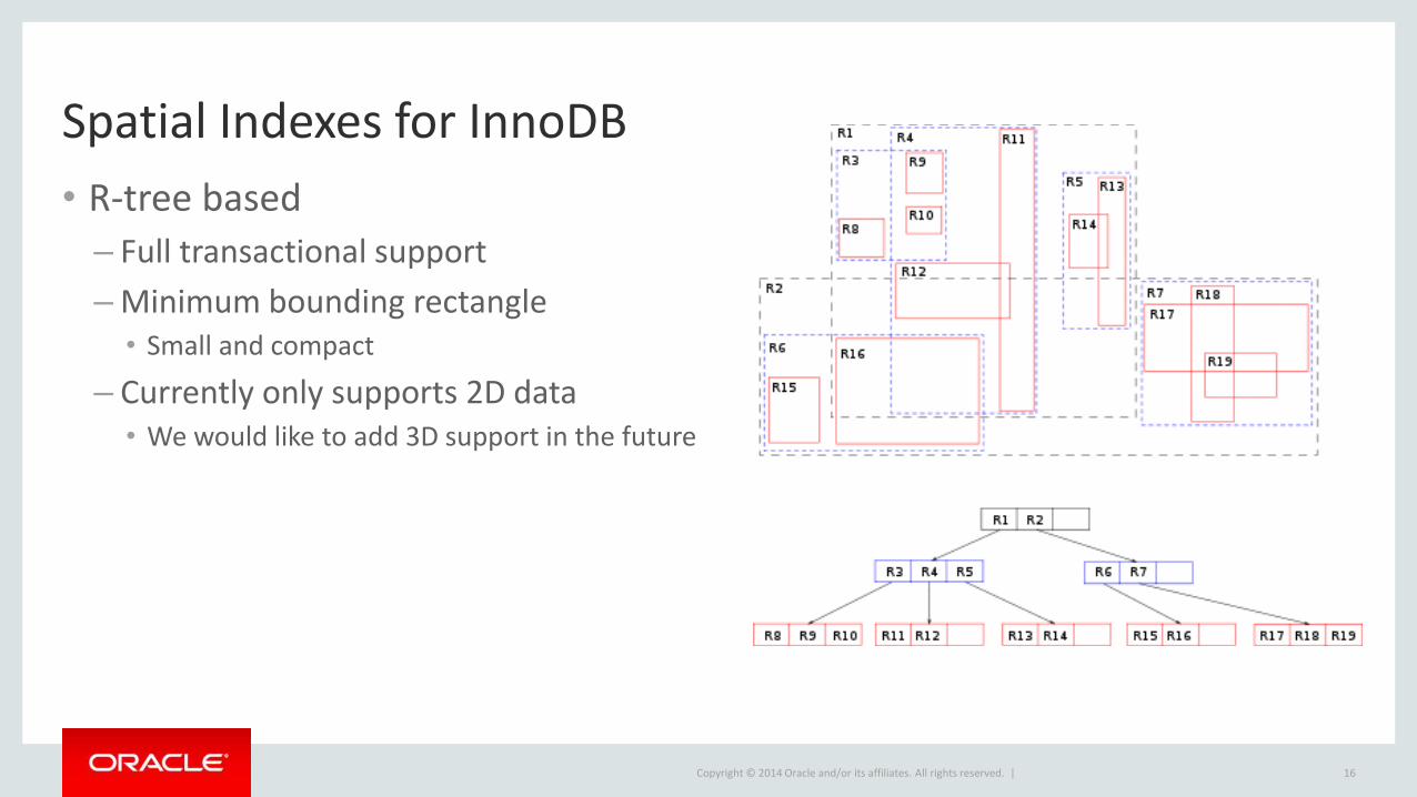
Spatial Indexes for InnoDB
• R-tree based
– Full transactional support
–Minimum bounding rectangle• Small and compact
– Currently only supports 2D data• We would like to add 3D support in the future
16

Copyright © 2014 Oracle and/or its affiliates. All rights reserved. |
Additional Features
• GeoHash
– B-tree indexes on the generated hash values
–Quick lookups for exact matches
• GeoJSON
–Open standard for encoding
geometric/geographical features
17
{"type": "Feature","geometry": {"type": "Point","coordinates": [125.6, 10.1]
},"properties": {"name": "Dinagat Islands"
}}
GeoJSON Example

Copyright © 2014 Oracle and/or its affiliates. All rights reserved. |
A Real World Example
18
Copyright © 2014 Oracle and/or its affiliates. All rights reserved. |
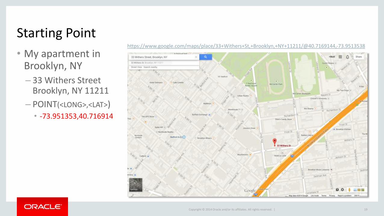
Starting Point
• My apartment in Brooklyn, NY
– 33 Withers Street Brooklyn, NY 11211
– POINT(<LONG>,<LAT>)• -73.951353,40.716914
19
https://www.google.com/maps/place/33+Withers+St,+Brooklyn,+NY+11211/@40.7169144,-73.9513538

Copyright © 2014 Oracle and/or its affiliates. All rights reserved. |
The Application Use Case
• I’m hungry and in the mood for Thai food
–What Thai restaurants are around me?
–What’s the closest one?
– How would I get there?
20

Copyright © 2014 Oracle and/or its affiliates. All rights reserved. |
Getting Some Data In
• Download a NYC OSM extract:
– http://osm-extracted-metros.s3.amazonaws.com/new-york.osm.bz2
• Import the data using a customized OsmDB.pm Perl module
– http://wiki.openstreetmap.org/wiki/OsmDB.pm (original)
– https://www.dropbox.com/s/l17vj3wf9y13tee/osmdb-scripts.tar.gz (customized)• Creates a spatial index on the ‘geom’ column
21
mysql -e "create database nyosm"bunzip2 new-york.osm.bz2./bulkDB.pl new-york.osm nyosm

Copyright © 2014 Oracle and/or its affiliates. All rights reserved. |
The Generated Schema
• http://wiki.openstreetmap.org/wiki/Elements
22
mysql> show tables;+-----------------+| Tables_in_nyosm |+-----------------+| nodes || nodetags || relationmembers || relations || relationtags || waynodes || ways || waytags |+-----------------+
– We’ll focus on nodes and nodetags for our examples
– Nodes
• A point or location
– Nodetags
• Metadata about each location
• name/value pairs

Copyright © 2014 Oracle and/or its affiliates. All rights reserved. |
De-normalizing the Tag Data
• Greatly simplify our query
• Allow for the use of a full-text index
– Also improves performance
23
mysql> alter table nodes add column tags text, add fulltext index(tags);mysql> update nodes set tags=(SELECT group_concat(concat(k, "=", v) SEPARATOR ';') from nodetags where nodetags.id=nodes.id group by nodes.id);

Copyright © 2014 Oracle and/or its affiliates. All rights reserved. |
Final Nodes Table
24
mysql> show create table nodes\G*************************** 1. row ***************************
Table: nodesCreate Table: CREATE TABLE `nodes` (`id` bigint(20) DEFAULT NULL,`geom` geometry NOT NULL,`user` varchar(50) DEFAULT NULL,`version` int(11) DEFAULT NULL,`timestamp` varchar(20) DEFAULT NULL,`uid` int(11) DEFAULT NULL,`changeset` int(11) DEFAULT NULL,`tags` text,UNIQUE KEY `i_nodeids` (`id`),SPATIAL KEY `i_geomidx` (`geom`),FULLTEXT KEY `tags` (`tags`)
) ENGINE=InnoDB DEFAULT CHARSET=latin1

Copyright © 2014 Oracle and/or its affiliates. All rights reserved. |
Creating a Distance Calculation Function
• Various great circle (orthodrome) distance formulas
– Haversine, Spherical Law of Cosines (my choice), …
– http://en.wikipedia.org/wiki/Great-circle_distance
– Necessary for calculating distances between two Geometries• Need goes away when we support Geography Type
25
mysql> CREATE FUNCTION slc (lat1 double, lon1 double, lat2 double, lon2 double) RETURNS doubleRETURN 6371 * acos(cos(radians(lat1)) * cos(radians(lat2)) * cos(radians(lon2) - radians(lon1)) + sin(radians(lat1)) * sin(radians(lat2)));

Copyright © 2014 Oracle and/or its affiliates. All rights reserved. |
Creating a Bounding Box For Our Search
• Utilize the r-tree index by limiting area
– Need to use some additional geographic formulas• http://www.movable-type.co.uk/scripts/latlong.html
26
${origlon} = -73.951368${origlat} = 40.716743${lon1} = ${origlon} + (${distance_in_km}/111)${lat1} = ${origlat} + (${distance_in_km}/111)${lon2} = ${origlon} - (${distance_in_km}/111)${lat2} = ${origlat} - (${distance_in_km}/111)

Copyright © 2014 Oracle and/or its affiliates. All rights reserved. |
Calculating the Results
• Our final query, searching within ~ 10km radius
27
mysql> SELECT id,slc(40.716743, -73.951368, y(geom), x(geom))*1000 as distance_in_meters,tags, ST_AsText(geom)FROM nodesWHERE ST_Contains(ST_Envelope(linestring(point((-73.951368+(10/111)), (40.716743+(10/111))), point((-73.951368-(10/111)), (40.716743-(10/111))))), geom)AND match(tags) against ("+thai +restaurant" IN BOOLEAN MODE)ORDER BY distance_in_meters\G

Copyright © 2014 Oracle and/or its affiliates. All rights reserved. |
Examining the Results
28
*************************** 1. row ***************************id: 888976948
distance_in_meters: 614.4973960877276tags: addr:street=Bedford Avenue;amenity=restaurant;name=Tai
Thai;addr:housenumber=206;phone=7185995556astext(geom): POINT(-73.958637 40.717174)
*************************** 2. row ***************************id: 2178443635
distance_in_meters: 2780.87697408101tags: microbrewery=no;website=http://www.onemorethai.net/;name=One
More Thai;amenity=restaurant;opening_hours=12:00-22:30;cuisine=thai;phone=(212) 228-8858
astext(geom): POINT(-73.983871 40.7210541)*************************** 3. row ***************************
…

Copyright © 2014 Oracle and/or its affiliates. All rights reserved. |
Mapping the Results
29
• From my place
– -73.951353,40.716914
• To Tai Thai
– -73.958637,40.717174
https://www.google.com/maps/dir/40.716914,+-73.951353/40.717174,+-73.958637

Copyright © 2014 Oracle and/or its affiliates. All rights reserved. |
What’s Next for MySQL GIS
30

Copyright © 2014 Oracle and/or its affiliates. All rights reserved. |
Additional Features
• R-tree enhancements
– 3D support
• Improved storage
– Fixed length storage when possible
• Geography types
• Projections
• Additional performance optimizations
• What else would you like to see…? Let us know..!!!
31
Copyright © 2014 Oracle and/or its affiliates. All rights reserved. |
Appendix : Additional Resources
• Manual
– http://dev.mysql.com/doc/refman/5.7/en/spatial-extensions.html
• Community forum
– http://forums.mysql.com/list.php?23
• Boost.Geometry– http://www.boost.org/libs/geometry
• Report GIS bugs and submit feature requests
– http://bugs.mysql.com/
32

Copyright © 2014 Oracle and/or its affiliates. All rights reserved. |
Q&A
33
