muztag glacier velocity extraction based on ... -...
TRANSCRIPT
Muztag Glacier Velocity Extraction Based on the Offsets Derived from SAR images
Liu Guang, Yan shiyong, Ruan zhixin and Li Xinwu
Centre for Earth Observation and Digital Earth(CEODE) Chinese Academy of Sciences (CAS)
ABCC workshop, August 24, 2010, Perth , Australia
Outline
Introduction
Study Area and DatasetsMethodologyResult AnalysisConclusion

Introduction
Glacier or ice sheet is important in function of climate change reflection and sea level changeThe most glaciers overall the world have shown a generalized tendency for retreatAccurate displacement measurements are needed to understand the dynamics of glaciersRemote Sensing is an effective way to study glaciers.

Tibet Plateau
Source: Microsoft Encarta 2008
Tibet PlateauTibet PlateauTibet Plateau

Glacier area change of Tibet Plateau
Glacier Distribution In 2005From China Glacier Catalog
Glacier Distribution In 2005From China Glacier Catalog
Glacier Distribution In
2000
Glacier Distribution In
2000
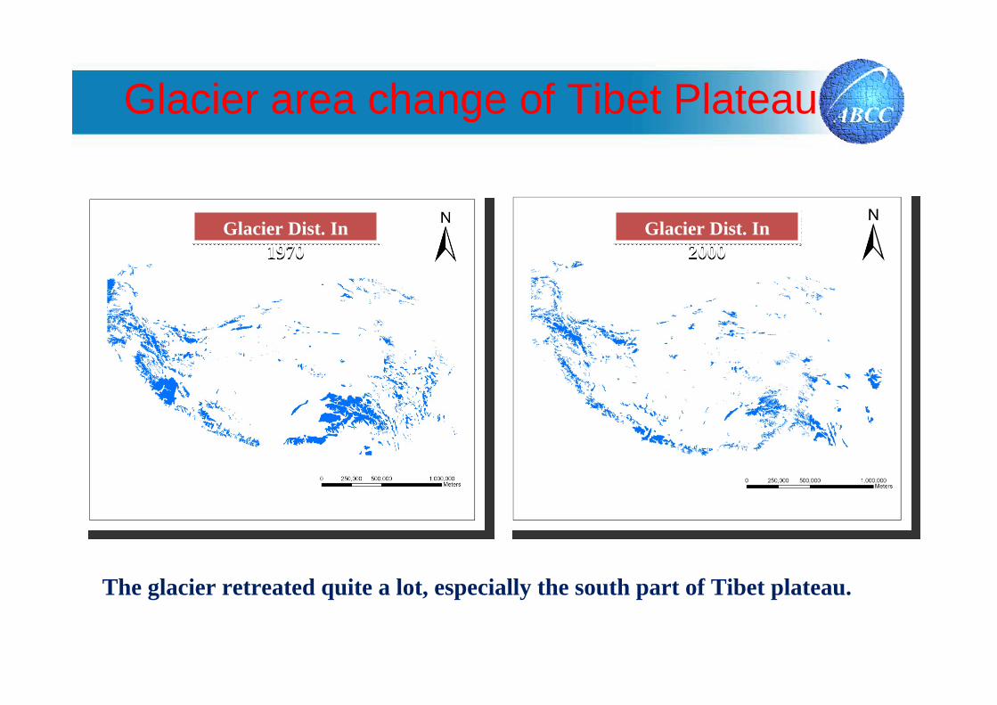
Glacier area change of Tibet Plateau
The glacier retreated quite a lot, especially the south part of Tibet plateau.
Glacier Dist. In 1970
Glacier Dist. In 1970
Glacier Dist. In 2000
Glacier Dist. In 2000

Glacier area change of Tibet Plateau
DecreaseNo changeIncrease
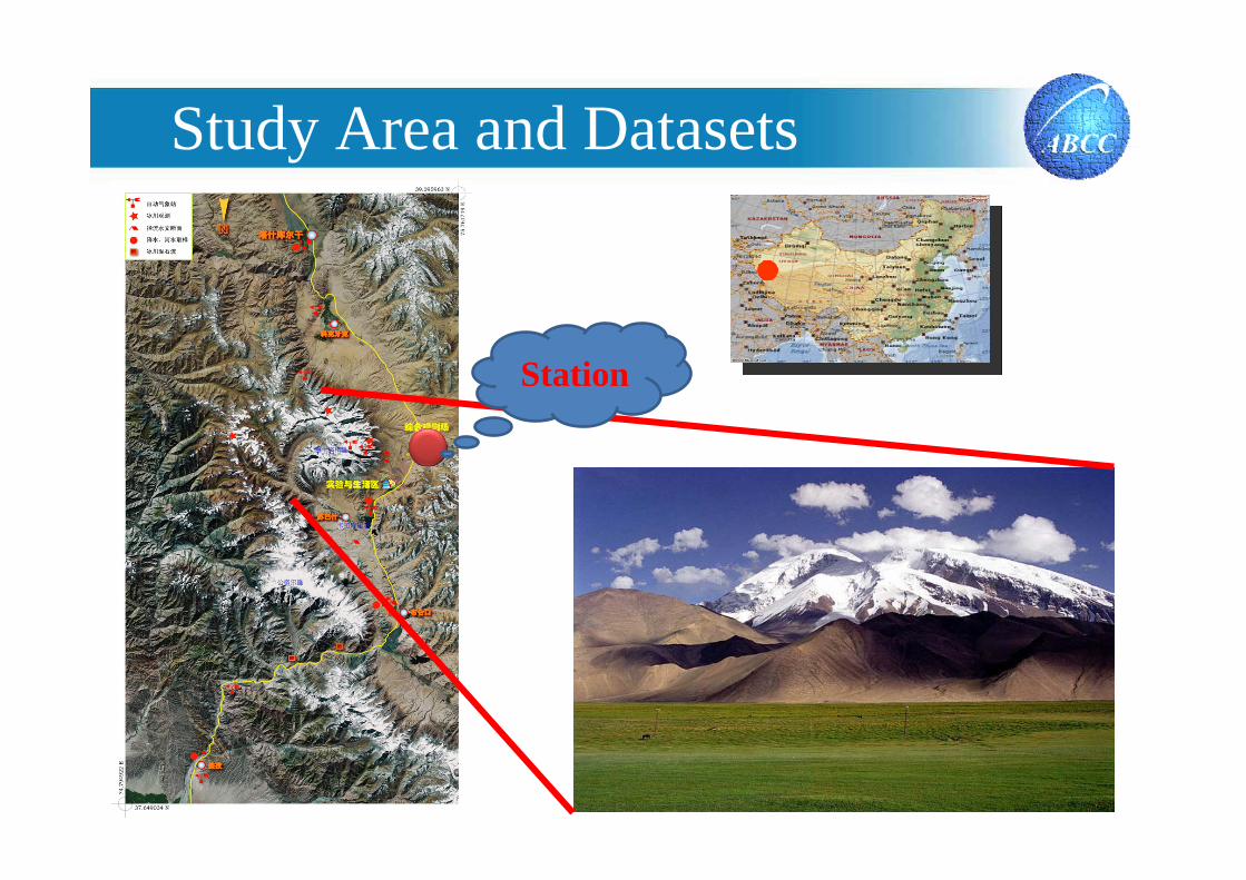
Study Area and Datasets
Station

An Observation on Surface Ablation on the Yangbark Glacier in the M uztag Ata�China, PU jian chen, etc

KekeSai Glacier is about 8 km long, and the change of elevation is about 800 meters of the main body, this cause a rapid movement of the glacier .

300 m
400 m
150 m200 m
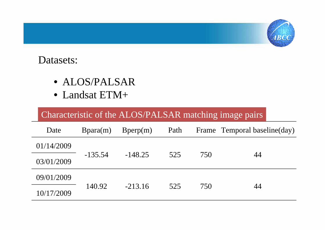
Date Bpara(m) Bperp(m) Path Frame Temporal baseline(day)
01/14/2009-135.54 -148.25 525 750 44
03/01/2009
09/01/2009140.92 -213.16 525 750 44
10/17/2009
Characteristic of the ALOS/PALSAR matching image pairs
Datasets:
• ALOS/PALSAR• Landsat ETM+
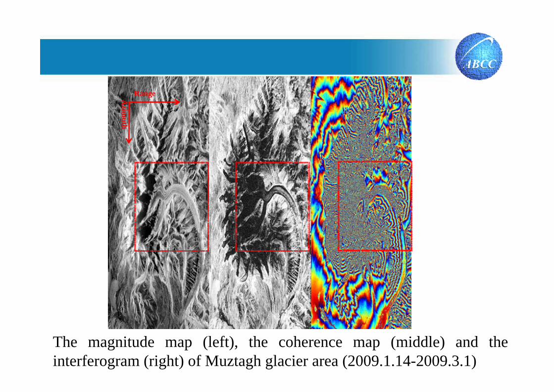
RangeAzim
uth
The magnitude map (left), the coherence map (middle) and the interferogram (right) of Muztagh glacier area (2009.1.14-2009.3.1)

Methodology
Pixel Track MethodPixel Track Method
Glacier Movement EstimationGlacier Movement Estimation

Model Fit Model Fit –– DIADIA MethodMethod
Glacier Movement EstimationGlacier Movement Estimation
Prof.dr. Peter J.G. Teunissen Prof.dr. Peter J.G. Teunissen
Methodology

Azimuth movement Range movement
Result Analysis
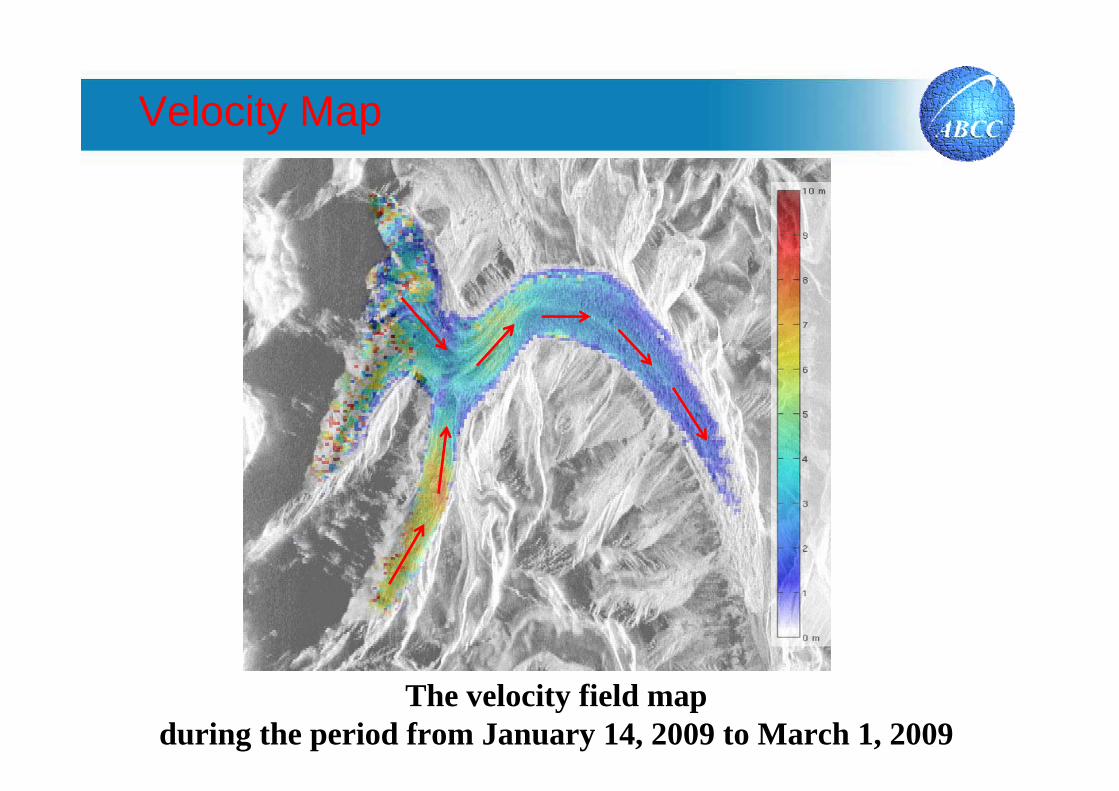
Velocity Map
The velocity field map during the period from January 14, 2009 to March 1, 2009
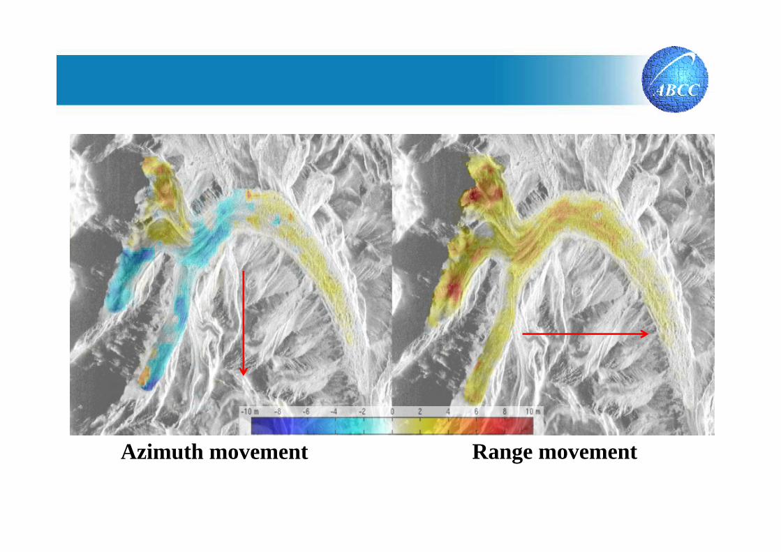
Azimuth movement Range movement

The velocity field map during the period from September 1, 2009 to October 17, 2009
Velocity Map

Velocity Profile
The velocity profile along the glacier surface
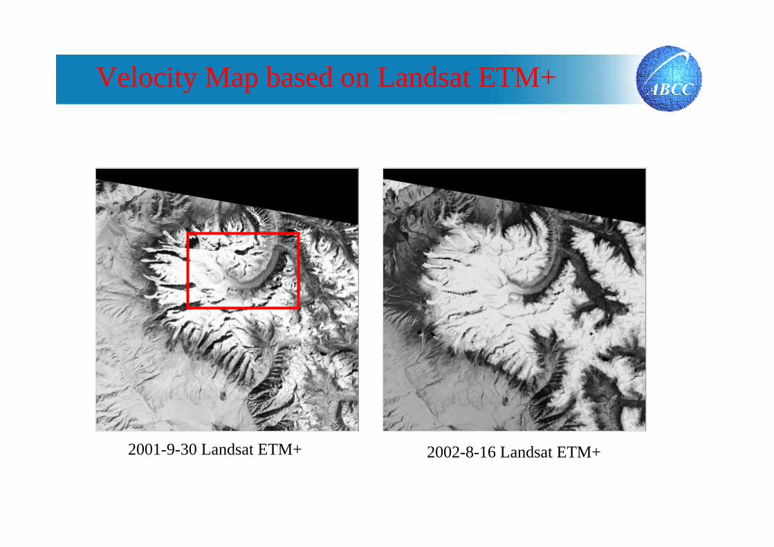
2001-9-30 Landsat ETM+ 2002-8-16 Landsat ETM+
Velocity Map based on Landsat ETM+
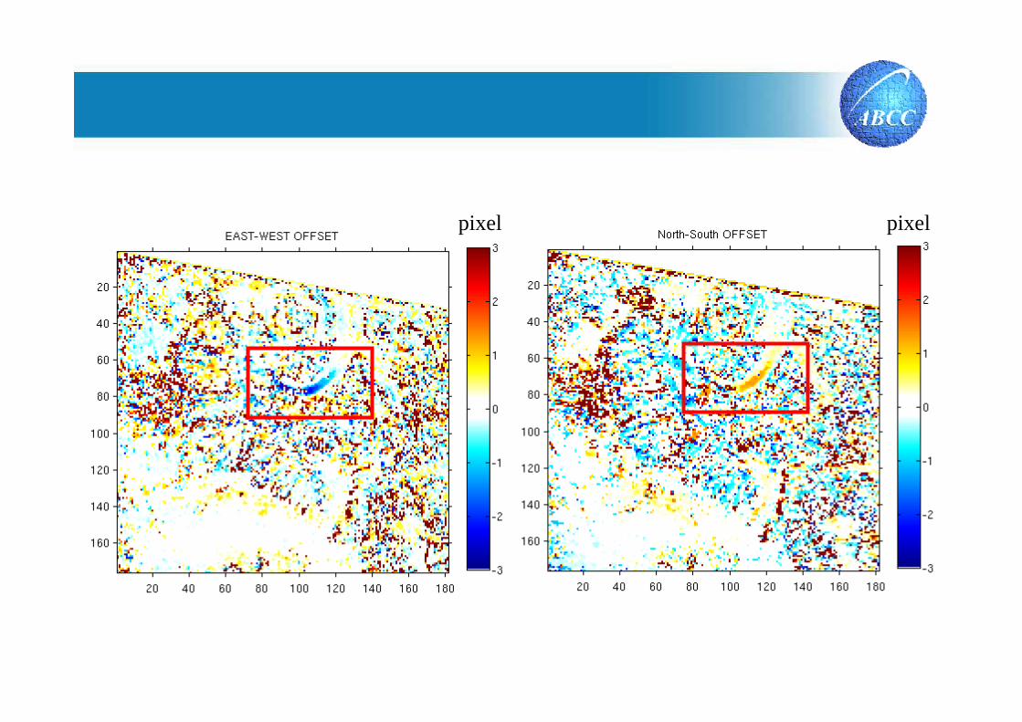
pixel pixel

meter
Conclusion and Future work
Conclusion
The surface motion velocity map of Muztagh glacier can be effectively estimated using SAR and optical remote sensing data,velocity pattern of Kekesai Glacier between SAR and optical data is consistent. In summary, the preliminary result is promising.
Future work
Validation: Muztagh area GPS experimental