missouri springs
TRANSCRIPT
Missouri Springs: Power, Purity and Promise
Missouri Springs:Power, Purity and Promise
By Loring Bullard

Missouri Springs: Power, Purity and Promise 2
© Watershed Press Design by: Kelly Guenther

Missouri Springs: Power, Purity and Promise 3
Missouri Springs:Power, Purity and Promise
By: Loring Bullard
Introduction
Marker at Liberty, Missouri
(Photo by Author)
It is a bragging right that may be as old as land ownership itself. “I have a spring on my place that never runs dry.” The intimation is that of all the springs around, there is some-thing unique—something special—about myspring. Landowners have perhaps always viewed springs differently than nearby creeks. Unlike a creek that arises surreptitiously on the property of others before passing through their land, a spring begins on their property. They can say that they own it. From an unseen, un-obvious source, it literally springs, full blown, from the depths of the earth. A spring can truly be the source of a creek.
This property of springs—their sudden and hitherto unexplainable appearance—adds to their mysterious aura. Among our ancestors, speculation about spring origins formed a rather sizeable body of folklore. While scientists can now explain most of these formerly mystifying properties, the allure of springs remains. People will probably always be intrigued—even mesmerized—by springs. The human attraction to springs is extremely durable. Springs guided the habitation patterns and movements of Native Americans, just as they did the
Missouri Springs: Power, Purity and Promise 4
Introduction
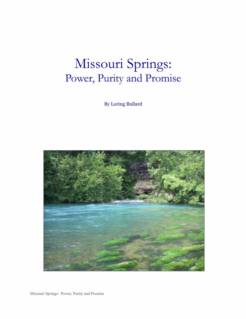
Dillard Mill on Huzzah Creek
(Photo by Author)
later arriving settlers. Indian villages and hunting camps were usually located near perennial springs. One can easily imagine native children squealing in delight with a summertime plunge, just as our own kids would today. Later, European newcomers followed the Indian’s lead, building their cabins near springs, their water supplies and refrigerators. With increasing settlement, business interests eagerly sought perennially flowing springs, particularly to power mills. Unlike streams, springs provided fairly constant flows that in the wintertime were free of machinery-obstructing ice. For decades, springs faithfully turned water wheels or spun metal turbines to grind grain or saw wood. They also supplied feed water for commercial enterprises like tomato canneries, hide tanneries, and distilleries. Thus, springs became the nuclei of a variety of thriving industries, driving the nascent machinery of our prosperity. It was only natural for people to congregate near these hydro-industrial centers. Many settlements grew around mills and springs, as evidenced by the fact that over sixty-five towns in Missouri contain the word spring in their names. Some towns depended on springs for their first
public water supplies. After all, these fortuitous emanations from the earth were considered the purest and most healthful of waters available. Our attraction to springs cannot be accounted for solely by their reliable production of cool water. There is more to it than that. Maybe springs resonate with us as benevolent or even virtuous manifestations of nature—representing new beginnings, fountains of hope, promises kept. They are given to us freely as gifts of what we call good land, demanding nothing in return. We find comfort in the fact that they will be there tomorrow, and the day after that. Day in and day out, for generations, they have satisfied our basic needs, while at the same time refreshing and, at times, inspiring us. Even as our direct dependence upon them has waned, they continue to evoke in us nostalgia of simpler, more leisurely times—swimming in spring-fed creeks and ponds, in numbingly cold water that needled the skin; or picknicking in the

Missouri Springs: Power, Purity and Promise 5
Springs at Work
shade of a lush spring glen, escaping the summer heat, feasting on watermelon and homemade ice cream. This booklet is in no way meant to diminish our sense of wonder or curiosity about springs. Instead, our intended purpose is to answer some questions commonly asked about them: Why is this spring here? Where does the water come from? Why is it so cool? Why are some springs so blue? You will also learn how ill-conceived or uncaring manipulations on the land can sometimes have disastrous consequences for springs—the very objects of our affection. Hopefully, a deeper understand-ing of the workings of springs will helps us to more fully honor, preserve and protect these priceless natural assets. That would be our greatest gift to those who follow us to their everlasting waters.
Springs at Work
The simple fact that springs flow has for centuries stirred the minds of men—set brain turbines to spinning. When the physical aspect of elevation is added, springs not only can flow, they can tumble, cascade or even thunder downward, down to the level of rivers and streams. Flow rates and elevation or “heads” of fall are key factors in putting springs to work—
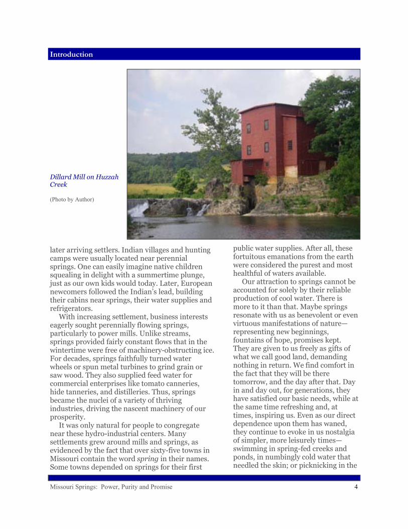
turning a wheel or turbine, for example. Historically, the value of a given spring was largely tied to its capacity to do work. Entrepreneurial zeal led people to assume that the work potential of a spring was its single most important attribute. Scenic and ecological values tended to be ignored or pushed aside. This fact forever changed the Missouri landscape, because springs became magnets for development. Flows were captured and re-directed, outlets modified, openings blasted or excavated. Wood or rock or concrete dams and flumes and diversions intercepted spring branches or crisscrossed their valleys. Sturdy mills were built on nearby rocky prominences. People began to see undeveloped springs as underutilized resources: “All that water, just going to waste!” was a battle cry for the industrious to get into gear and build something of practical use to society. There is nothing inherently wrong with this, of course. People simply saw springs as useful natural amenities—like good timber or productive soil—agents provided for mankind to put to work for his own benefit. Beneficial uses changed and evolved over time. Springs that once
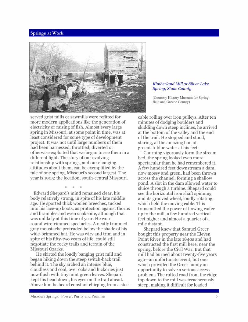
Kimberland Mill at Silver Lake Spring, Stone County
A Spring-fed Stream
(Photo by Author)
Missouri Springs: Power, Purity and Promise 6
Springs at Work
served grist mills or sawmills were refitted for more modern applications like the generation of electricity or raising of fish. Almost every large spring in Missouri, at some point in time, was at least considered for some type of development project. It was not until large numbers of them had been harnessed, throttled, diverted or otherwise exploited that we began to see them in a different light. The story of our evolving relationship with springs, and our changing attitudes about them, can be exemplified by the tale of one spring, Missouri’s second largest. The year is 1905; the location, south-central Missouri.
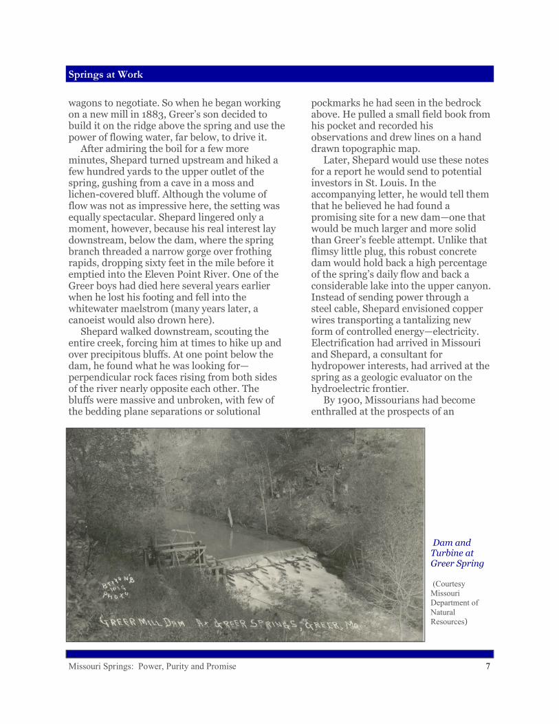
* * * Edward Shepard’s mind remained clear, his body relatively strong, in spite of his late middle age. He sported thick woolen breeches, tucked into his lace-up boots, as protection against thorns and brambles and even snakebite, although that was unlikely at this time of year. He wore round,wire-rimmed spectacles. A neatly trimmed gray moustache protruded below the shade of his wide-brimmed hat. He was wiry and trim and in spite of his fifty-two years of life, could still negotiate the rocky trails and terrain of the Missouri Ozarks. He skirted the loudly banging grist mill and began hiking down the steep switch-back trail behind it. The sky arched an intense blue, cloudless and cool, over oaks and hickories just now flush with tiny mint green leaves. Shepard kept his head down, his eyes on the trail ahead. Above him he heard constant chirping from a steel
cable rolling over iron pulleys. After ten minutes of dodging boulders and skidding down steep inclines, he arrived at the bottom of the valley and the end of the trail. He stopped and stood, staring, at the amazing boil of greenish-blue water at his feet. Churning vigorously form the stream bed, the spring looked even more spectacular than he had remembered it. A few hundred feet downstream a dam, now mossy and green, had been thrown across the channel, forming a shallow pond. A slot in the dam allowed water to sluice through a turbine. Shepard could see the horizontal iron shaft spinning and its grooved wheel, loudly rotating, which held the moving cable. This transmitted the power of flowing water up to the mill, a few hundred vertical feet higher and almost a quarter of a mile distant. Shepard knew that Samuel Greer bought this property near the Eleven Point River in the late 1840s and had constructed the first mill here, near the spring, before the Civil War. But that mill had burned about twenty-five years ago—an unfortunate event, but one which provided the Greer family an opportunity to solve a serious access problem. The rutted road from the ridge top down to the mill was treacherously steep, making it difficult for loaded
Kimberland Mill at Silver Lake Spring, Stone County
(Courtesy History Museum for Spring-field and Greene County)
Missouri Springs: Power, Purity and Promise 7
Springs at Work
Dam and Turbine at Greer Spring
(Courtesy Missouri Department of Natural Resources)
wagons to negotiate. So when he began working on a new mill in 1883, Greer’s son decided to build it on the ridge above the spring and use the power of flowing water, far below, to drive it. After admiring the boil for a few more minutes, Shepard turned upstream and hiked a few hundred yards to the upper outlet of the spring, gushing from a cave in a moss and lichen-covered bluff. Although the volume of flow was not as impressive here, the setting was equally spectacular. Shepard lingered only a moment, however, because his real interest lay downstream, below the dam, where the spring branch threaded a narrow gorge over frothing rapids, dropping sixty feet in the mile before it emptied into the Eleven Point River. One of the Greer boys had died here several years earlier when he lost his footing and fell into the whitewater maelstrom (many years later, a canoeist would also drown here). Shepard walked downstream, scouting the entire creek, forcing him at times to hike up and over precipitous bluffs. At one point below the dam, he found what he was looking for—perpendicular rock faces rising from both sides of the river nearly opposite each other. The bluffs were massive and unbroken, with few of the bedding plane separations or solutional
pockmarks he had seen in the bedrock above. He pulled a small field book from his pocket and recorded his observations and drew lines on a hand drawn topographic map. Later, Shepard would use these notes for a report he would send to potential investors in St. Louis. In the accompanying letter, he would tell them that he believed he had found a promising site for a new dam—one that would be much larger and more solid than Greer’s feeble attempt. Unlike that flimsy little plug, this robust concrete dam would hold back a high percentage of the spring’s daily flow and back a considerable lake into the upper canyon. Instead of sending power through a steel cable, Shepard envisioned copper wires transporting a tantalizing new form of controlled energy—electricity. Electrification had arrived in Missouri and Shepard, a consultant for hydropower interests, had arrived at the spring as a geologic evaluator on the hydroelectric frontier. By 1900, Missourians had become enthralled at the prospects of an

Missouri Springs: Power, Purity and Promise 8
Springs at Work
Greer Spring Main Boil
(Courtesy)
electrical future. The state already had a strong agricultural base, with the demand for apples, strawberries, mules, swine and beef cattle on the increase. Electricity promised to add to the prosperity with labor saving appliances and new jobs in milling, mining and manufacturing. A report from the Missouri School of Engineers in 1901 noted that the state contained an abundance of potential hydropower sites. By 1905, when Shepard inspected Big Ozark Spring (now called Greer Spring), engineers, consultants, speculators, and businessmen were crawling all over Missouri’s backwoods, searching for places to harness the power of flowing water. Shepard’s dam was never built at Greer Spring, possibly preempted by the large one begun on the White River in Taney County in 1911. In the 1920’s the property around Greer Spring was acquired by the Dennig family, who operated it as a sort of guest ranch for many years. But the copious flow of the spring continued to entice outsiders. In 1985 the family patriarch, Louis Dennig, passed away. His heirs seriously considered an agreement with the Anheuser-Busch Corporation, which wanted to bottle and sell about two million gallons
per day of “pure Ozark spring water.” The plan called for two pipelines running from the source, Greer Spring, to the top of the ridge where the bottling plant would be located. Not surprisingly, the plan stirred considerable controversy. Some people thought it was a great idea, boosting the local economy and the creation of jobs. Others considered the very notion a travesty, particularly given the spring’s breathtaking beauty and proximity to and ecological influence on the nearby Eleven Point, a federally protected Wild and Scenic River. In the end, Greer Spring was spared again. Leo Drey, a St. Louis businessman and avid conservationist, stepped in and bought the Dennig property for $4.5 million. He subsequently resold it to the federal government at a reduced rate ($500,000 less). Anheuser-Busch kicked in $500,000, the feds coughed up $3.5 million, and the 6,900 acres
Missouri Springs: Power, Purity and Promise 9
Springs at Work
Steury Spring and Natural Bridge, Greene County
(Courtesy History Museum for Springfield and Greene County)
around Greer Spring became a part of the Mark Twain National Forest, designated as a natural area and special preserve. In retrospect, we shouldn’t unduly criticize Shepard or Anheuser-Busch for eyeing Greer Spring with speculative hunger. That prodigious quantity of clean, cold groundwater issuing directly from the rock almost begs to be “used,” somehow. But there have also long been advocates for preserving natural wonders like Greer Spring in an undeveloped condition. Even in the nineteenth century, when mankind
seemed determined to manipulate and control nature’s powers, a few of Missouri’s citizens argued that our most magnificent natural features deserved some level of benevolent oversight and protection. Luella Owen, one of these early protagonists, was a curly-haired, bright-eyed amateur geologist from St. Joseph. In the 18890’s, she explored and wrote about the caves of the Black Hills and the Ozarks, including Marvel Cave near Branson and Grand Gulf near Koshkonong. She endured a long, bumpy wagon ride from
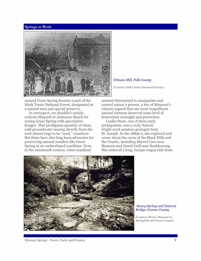
Orleans Mill, Polk County
(Courtesy Polk County Historical Society)

Missouri Springs: Power, Purity and Promise 10
Spring Anatomy
West Plains to Greer Spring, where she was captivated by the spring’s beauty and awesome grandeur. While there, she noticed that rocks were being collected for the intended construction of a larger dam. While recognizing the commercial importance of the mighty spring, she also lamented the loss of “artistic” value that would inevitably result from further damming it. Owen could be characterized as an early eco-tourist. Like many later Missourians, she appreciated the scenic as well as the pragmatic potential of springs. Of course, the dynamic tension between urges to exploit versus efforts to preserve continues today. But the legacy of springs as industrial centers now resides more comfortably with the native scenery, as old mills and dams and ponds have themselves become historic and nostalgic icons. For the most part, springs no longer do works for us. But they continue to provide many other services that are equally valuable.
Spring Anatomy
Missouri’s springs were obviously of great practical
use to its inhabitants—but they were also mysterious. The workings of the underworld held a profound fascination for our forefathers, just as it does for many of us today. Many people find it difficult to believe that springs continue flowing, day after day, between infrequent rainfall events, without some massive additional input of water, such as a distant river, somehow diverted into the system. The frigidity of springs has led many people to believe that their water must originate in lands far to the north—from the Great Lakes, perhaps, or massive glaciers. Some of these notions held sway until the sciences of geology and hydrology began to provide reasonable alternative explanations. But even in the face of scientific evidence, some people remain unconvinced. The Ozarks of southern Missouri boasts one of the highest concentrations of springs in the world,
Round Spring
(Photo by Author)
Missouri Springs: Power, Purity and Promise 11
Spring Anatomy
as well as some of the planet’s most powerfully flowing springs. Big Spring, Missouri’s largest, with an average flow rate of 275 million gallons per day (and measured high flows of over 800), ranks among the top handful of largest single outlet springs in the world. By way of comparison, the entire city of St. Louis uses on average about 125 million gallons of water per day, less than half of the daily flow of Big Spring. How do we account for the impressive numbers and flows of Missouri’s springs? At heart, the answer lies in the unique nature of the land. Springs are products of karst topography; a type of terrain that forms on carbonate bedrock—rocks of oceanic origin that will dissolve in acidic water. Acidity is a key, because limestone and its cousin dolostone, common components of Missouri’s bedrock, wont’ dissolve to any extent in pure water. But as rainwater percolates down through the soil, it comes into contact with carbon dioxide, the gas we exhale with every breath. In the soil, CO2 comes from the breathing of earthworms and insects and millions of other animals. Under higher pressure in the soil than in the atmosphere above it, the gas is forced to dissolve into the downward percolating rainwater, creating a weak carbonic acid solution (the same as in carbonated beverages), which can then eat away at the walls of the cracks in the rock. It is important to realize that percolating
subterranean water only dissolves and enlarges existing openings—it does not create new openings. The downward flowing water follows a pre-existing network of cracks, whether they are vertical fractures through the rocks created by tilting or warping, or bedding planes, horizontal separations between different layers of rock. As water dissolves these cracks wider, more and more water can funnel through, allowing the embryonic spring system to grow. The amount of rock dissolved by large springs is truly prodigious. Jerry Vineyard, co-author of Springs of Missouri, has calculated that Missouri’s largest spring, Big Spring, flowing at an average rate of 275 millions of gallons per day, in that same day dissolves and removes from the underground 175 tons of rock. Over a year’s time that amounts to 640,000 tons, equivalent to the creation of a new cave passage thirty by fifty feet in cross section and a mile long. It could be a slightly unsettling thought to some people that flowing springs have been continuously
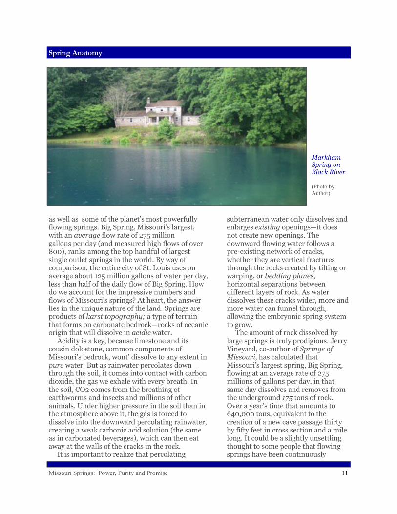
Markham Spring on Black River
(Photo by Author)
Missouri Springs: Power, Purity and Promise 12
Spring Anatomy
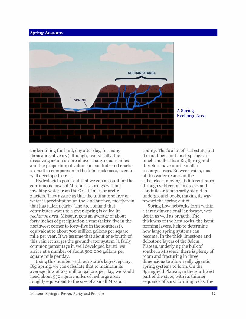
undermining the land, day after day, for many thousands of years (although, realistically, the dissolving action is spread over many square miles and the proportion of volume in conduits and cracks is small in comparison to the total rock mass, even in well developed karst). Hydrologists point out that we can account for the continuous flows of Missouri’s springs without invoking water from the Great Lakes or arctic glaciers. They assure us that the ultimate source of water is precipitation on the land surface, mostly rain that has fallen nearby. The area of land that contributes water to a given spring is called its recharge area. Missouri gets an average of about forty inches of precipitation a year (thirty-five in the northwest corner to forty-five in the southeast), equivalent to about 700 million gallons per square mile per year. If we assume that about one-fourth of this rain recharges the groundwater system (a fairly common percentage in well developed karst), we arrive at a number of about 500,000 gallons per square mile per day. Using this number with our state’s largest spring, Big Spring, we can calculate that to maintain its average flow of 275 million gallons per day, we would need about 550 square miles of recharge area, roughly equivalent to the size of a small Missouri
county. That’s a lot of real estate, but it’s not huge, and most springs are much smaller than Big Spring and therefore have much smaller recharge areas. Between rains, most of this water resides in the subsurface, moving at different rates through subterranean cracks and conduits or temporarily stored in underground pools, making its way toward the spring outlet. Spring flow networks form within a three dimensional landscape, with depth as well as breadth. The thickness of the host rocks, the karst forming layers, help to determine how large spring systems can become. In the thick limestone and dolostone layers of the Salem Plateau, underlying the bulk of southern Missouri, there is plenty of room and fracturing in three dimensions to allow really gigantic spring systems to form. On the Springfield Plateau, in the southwest part of the state, with its thinner sequence of karst forming rocks, the
A Spring Recharge Area

Missouri Springs: Power, Purity and Promise 13
Spring Anatomy
springs are generally smaller. Still, some rather large springs have developed on the Springfield Plateau and thousands of smaller springs dot both the Springfield and the Salem Plateaus. As most people know, springs are generally found in valleys, not on hilltops. The plumbing systems of really big springs develop within thick masses of rock, and therefore these springs drain into some of the deepest valleys in the state. Rivers, as they continually erode downward into the land, increasingly cut into pre-existing spring networks and conduits. It has taken a long time, probably millions of years, for springs as large as Big Spring to form. Over such long time spans, rivers can change course. Cave conduits can collapse and detours be created. The systems are extremely dynamic—ever changing. This ongoing interplay between river downcutting and spring conduit enlargement accounts for the wide variety of sizes and settings of springs that we see today. It also determines why any given spring happens to emerge where it does. Geologists also have an explanation for the constant cool temperatures of springs. Most people would say that Missouri’s springs are cold. Cold, however, is a relative term. Our state’s springs are not ice cold, nor are they as cold as the
average refrigerator. Scientists have found some variation from spring to spring, and season to season, but most hover in the 55 to 60 degree range. Bedrock, being a poor conductor of heat, does not gain or lose heat rapidly, so remains year round at nearly the average annual air temperature, about 58 degrees in Missouri. Water flowing through the ground eventually becomes the same temperature as the surrounding rock. In spite of these explanations, some Missourians continue to insist that spring water comes from the far north. They would challenge anyone wading into a spring branch on a hot summer day to arrive at a different conclusion. People are also amazed at the striking blueness of some of our springs. Scientists explain that this remarkable azure color is due primarily to the depth of water at the spring outlet. Blue Spring, on the Current River, perhaps Missouri’s bluest, is also, at 300 feet, the deepest of those which have been measured.
Ha Ha Tonka Spring
(Photo by Author)
Spring Branch with Jewelweed
(Photo by Author)

Missouri Springs: Power, Purity and Promise 14
Going with the Flow
But subtle variations in hue are also affected by particles in the water and the angle and intensity of sunlight. The fact that this optical phenomenon can be explained by the physics of light and its scattering by particles doesn’t diminish the age old fascination. The sheer intensity of the blue color in certain springs nearly overwhelms human senses, touching neurons deep in the brain that must surely register indescribable beauty.
Going with the Flow
While science has explained a lot about springs, many questions remain about their origins and ages and how they work. One Missourian who has devoted the greater part of his life to unraveling the mysteries of springs is Tom Aley. Tall, lanky, with a long white beard and prominent forehead where he often rests his palm when thinking, Tom can sometimes be found at his home, which also serves as offices for the Ozark Underground Labo-ratory near Protem, Missouri (which is not really near anywhere, Tom likes to say). He speaks slowly, in measured tones, occasionally wrinkling his nose in a nervous tic. He loves to tell stories
about the “old days” when Missouri had a deficit of karst scientists and even the word karst had hardly entered the vernacular. In fact, Tom entered the field through a side door himself. In the late 1950’s, he received a degree in forestry from the University of California at Berkley. He became attracted to forestry, he said, because it was held out as the “premier discipline of renewable resource management,” although in practice, he jokes, it was often regarded as “the profession where you make sawdust.” Knowing that the National Forests had been set aside for both timber and water management, Tom went to work for the Forest Service, hoping from the beginning to incorporate into a forestry career his burning interest in caves and springs. Prior to this time, he suggests, water had been given “short shrift” in forest management. Tom eventually left the Forest
Big Spring
(Photo by Author)
Missouri Springs: Power, Purity and Promise 15
Going with the Flow
Service and went on his own, eventually purchasing Tumbling Creek Cave in southern Missouri in the mid 1960’s, where he planned to establish an unusual research facility—an underground laboratory. But the mortgage left him scratching for income, and he walked into the local Forest Service headquarters in Springfield one day, ready to take any kind of forestry job to support his cave lab project. Unbeknownst to him, during his absence the Forest Service had begun to take watersheds more seriously, and had placed an increased emphasis on forest hydrology. The Service, in fact, was under a Congressional mandate to hire people with professional water expertise, and the agency currently had fourteen openings for hydrologists in the eastern US. Upon hearing that Tom had a forestry background, the Supervisor in Springfield tried to convince him to rejoin the agency. But Tom had just bought the cave, and intended to put down roots in Missouri—roots that would surely find their way into the cave lurking below his rocky, overgrazed
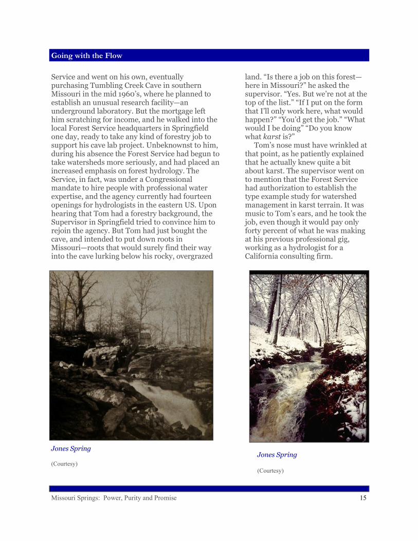
Jones Spring
(Courtesy)
Jones Spring
(Courtesy)
land. “Is there a job on this forest—here in Missouri?” he asked the supervisor. “Yes. But we’re not at the top of the list.” “If I put on the form that I’ll only work here, what would happen?” “You’d get the job.” “What would I be doing” “Do you know what karst is?” Tom’s nose must have wrinkled at that point, as he patiently explained that he actually knew quite a bit about karst. The supervisor went on to mention that the Forest Service had authorization to establish the type example study for watershed management in karst terrain. It was music to Tom’s ears, and he took the job, even though it would pay only forty percent of what he was making at his previous professional gig, working as a hydrologist for a California consulting firm.

Missouri Springs: Power, Purity and Promise 16
Going with the Flow
Tom’s new job was based in Winona, Missouri, where in 1966 he was assigned to the sixteen square mile Hurricane Creek topographic basin. He began driving around his watershed and discovered that only the lowermost mile of the creek, just upstream of its confluence with the Eleven Point River, had any water in it. It was a bit of a conundrum—how do you conduct a water flow study without water? Tom recognized, of course, that Hurricane Creek was a classic losing stream, with most of its flow moving underground a good part of the time. He went to work getting ready for times of flow, supplying the basin with rain gages and weirs to measure surface flows, when they occurred—installing these devices himself, since no technicians were available to help. In his spare time, he even repaired, without authorization, the old mill at Falling Spring (the Forest Service had recently acquired this property), rebuilding the old flume and overshot water wheel. Tom didn’t get much of a lecture about his well-intentioned misdeed, however, other than “that’s not supposed to be the way we do things here.” For their part, the locals applauded the Forest Service for showing some interest in the decaying property and for saving the historic mill from ruin.
Sander Spring,Greene County
(Photo by Author)
Tom decided that he needed to do dye tracing to see where the lost flow of Hurricane Creek went. He studied dye tracing techniques, consulting a United States Geological Survey (USGS) publication from 1906 as well as more recent literature from Yugoslavia, at the time a hotbed of karst research. Dye tracing, he discovered, was not all that simple. First, there is the matter of what dye to use. Of course, any substance composed of particles or pieces small enough to fit through the flow network of a spring could theoretically be used as a tracer. This, in fact, has happened during some rather unscientific experiments, as when people threw cornstalks into the big sinkhole at Grand Gulf and later watched them emerge at Mammoth Spring. Even a spring suddenly becoming muddy right after a sinkhole has collapsed in the

Missouri Springs: Power, Purity and Promise 17
Going with the Flow
vicinity constitutes a sort of trace, confirming an underground connection. Alley Springs on the Jacks Fork River suddenly quit flowing in the 1930’s, a disconcerting event which the locals had never witnessed before. After a few hours, flow resumed, but the water was muddy. Eventually, it was discovered that a sinkhole had collapsed fifteen miles away shortly before the spring ceased flowing. A similar thing happened at Roaring River Spring, in the far southwest part of the state, when the spring became murky after a lake bottom collapsed on the nearby upland. Of course, one doesn’t need a geology degree to make educated guesses about where water lost form the surface might go. Take a look at topographic maps of Missouri and in the Ozarks you will see many streams named “Dry Creek” or “Dry Hollow” or “Dry Fork” and the like. Simple intuition will tell you that streams which rarely contain flow, even after rains, are leaky and many people could put two and two together when they see a flowing spring a fairly short distance away and down gradient from these losing streams. It is deductive tracing, and there is a
Sequiota Spring, Red with Mud after Sinkhole Collapse
(Photo by Author)
fairly good change that it’s correct. To confirm underground connections, scientists have largely settled upon fluorescing dyes, which can be used in small amounts and detected by instruments in the laboratory, avoiding the potential embarrassment of turning springs bright green or red. The water tracing scientist must also make sure that he or she carefully consults geologic maps and monitors any possible outlets for the emergence of tracer dye. This usually means “bugging” many springs and sometimes wells. The bugs (usually charcoal packets) are set in the spring and checked frequently to make sure they have not absorbed dyes even before the tracing experiment begins (some man-made materials, like

Missouri Springs: Power, Purity and Promise 18
Going with the Flow
anti-freeze, can contain the same dyes). Hurricane Creek is a fairly large basin, so Tom knew he would need to monitor springs over a considerable area or the possible reappearance of his dye. He next needed to decide how much dye to use. From his study of maps and the local geology, he suspected that Hurricane Creek’s lost water went to Big Spring, about 18.5 miles to the east as the crow flies. If true, this would mean that water lost from a tributary of the Eleven Point River went under a major surface watershed divide and resurfaced a at spring on the Current River, in a different basin. If Tom was right, this would be a long trace attempt, so he would need a significant amount of dye. Using one of the equations he found in the literature, he calculated that he should use 740 pounds! That seemed like an awful lot, more than he really wanted to dump, and besides, he didn’t even know where he could get his hands on that much dye or whether he could afford to buy it if he found it. Tom started working in small spring systems with tiny amounts of dye to perfect his technique. He used activated carbon samplers to capture and concentrate the dye, so he could use a lot less. The dye would be absorbed in a charcoal packet, washed free of the charcoal in the laboratory, and then detected in the wash water with instruments,
A Cascading Spring
(Photo by Author)
even when invisible to the naked eye. He spent only $60 of Forest Service money on materials that first fiscal year. Finally, he bought ten pounds fluorescein dye and looked for the ideal injection point, which he found at a conspicuous losing section of Hurricane Creek where he could actually hear water roaring underground. This would be like injecting dye directly into a jugular, enhancing the prospects of success. Tom also talked to Jerry Vineyard in Rolla, who agreed to examine his sample packets using the instruments of the Geological Survey. Tom injected the dye and to his satisfaction, the packets collected at Big Spring, when the dye was washed free or eluted from the charcoal, colored the water a bright green. Even before instrumental analysis, he knew he had a positive trace. Soon, newspaper headlines read, “Forest Service Discovers Source of Big Spring.” Tom and his work made the Sunday Features section of the New York Times. The sudden glow of

Missouri Springs: Power, Purity and Promise 19
A Question of Purity
success reflected well on the Forest Service and its hy-drologic work, and didn’t hurt Tom’s career either. Tom proudly recalls that of the twenty special study watersheds in National Forests around the country, several were still in very preliminary stages at the time, but his was “up and running and producing results, and even had an honest-to-goodness hydrologist running it.” Why is it so important to know where Big Spring, or any spring for that matter, gets its water? For one thing, spring water is not always as pure as we would like to believe. Springs can have serious pollution problems, sometimes with significant public health and financial ramifications. Hundreds of Missouri springs, at some point in their histories, have been used for drinking water supplies or supported some type of business—and for the most part, water pollution is bad for business. When springs get polluted, people using or living near them, as well as agencies charged with groundwater protection, want to know where to look for the cause of the problem. Regulations may have been violated, or are too weak to adequately protect groundwater and therefore need to be strengthened. And thoughtful, responsible citizens will want to know how to prevent such a thing from happening again.
A Question of Purity
Nowadays, many people realize that drinking untreated spring water could constitute an unhealthy
Warning Sign at Small Spring, Greene County
(Photo by Author)
practice. It was not always that way, of course. Up until relatively recently, springs were considered the purest sources of water available—much cleaner than streams, akes, or even wells. This commonly held notion of the purity of springs is reflected in a 1910 University of Missouri publication, which informs us that spring water is generally “palatable, wholesome and free from organic impurities” due to “natural filtration in the subterranean strata.” Based on findings about the wide open nature of underground flow systems, scientists would later challenge this assumption. A visit to Tom Aley’s Ozark Underground Laboratory will tend to confirm suspicions about the vulnerability of spring water. When tom is not out consulting on karst issues around the world, he can sometimes be found leading tours of his own cave. He describes for his subterranean visitors how karst works and how caves form and especially, how
Missouri Springs: Power, Purity and Promise 20
A Question of Purity
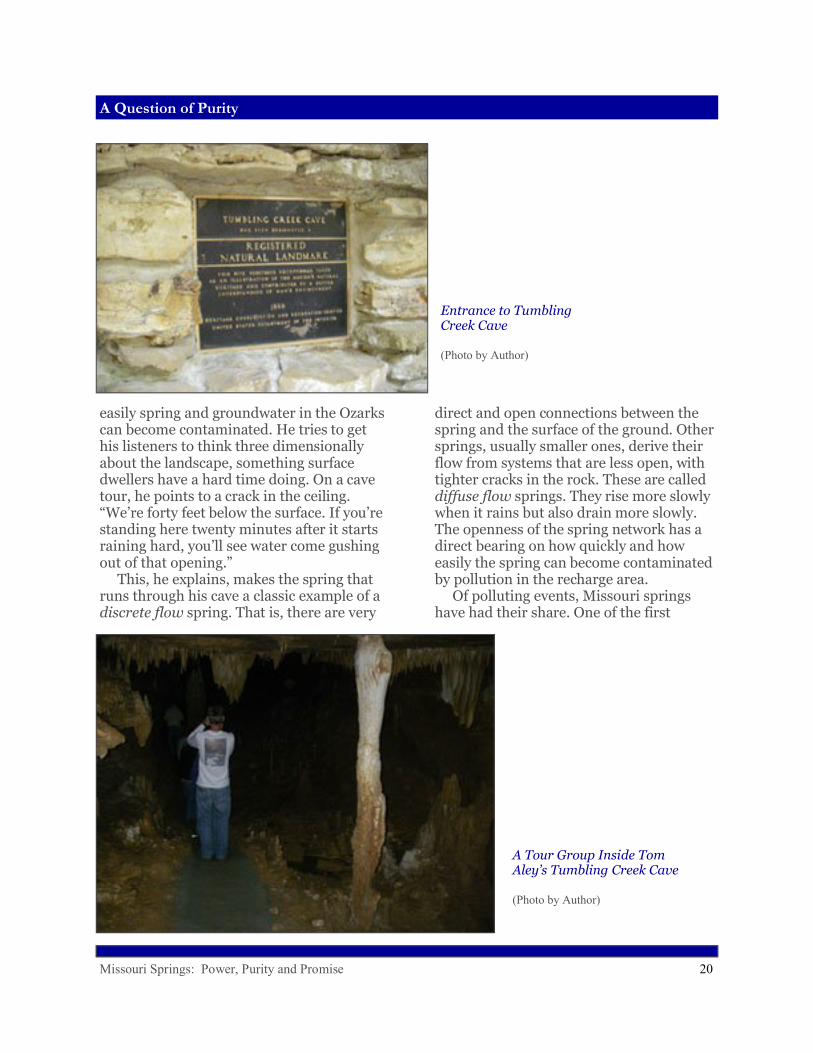
easily spring and groundwater in the Ozarks can become contaminated. He tries to get his listeners to think three dimensionally about the landscape, something surface dwellers have a hard time doing. On a cave tour, he points to a crack in the ceiling. “We’re forty feet below the surface. If you’re standing here twenty minutes after it starts raining hard, you’ll see water come gushing out of that opening.” This, he explains, makes the spring that runs through his cave a classic example of a discrete flow spring. That is, there are very
Entrance to Tumbling Creek Cave
(Photo by Author)
direct and open connections between the spring and the surface of the ground. Other springs, usually smaller ones, derive their flow from systems that are less open, with tighter cracks in the rock. These are called diffuse flow springs. They rise more slowly when it rains but also drain more slowly. The openness of the spring network has a direct bearing on how quickly and how easily the spring can become contaminated by pollution in the recharge area. Of polluting events, Missouri springs have had their share. One of the first
A Tour Group Inside Tom Aley’s Tumbling Creek Cave
(Photo by Author)

Missouri Springs: Power, Purity and Promise 21
A Question of Purity
scientists in Missouri to investigate the contamination of springs was Edward Shepard, the man who explored Greer Spring in 1905. Shepard arrived from the northeastern United States in 1877 to teach geology and chemistry classes at Drury College in Springfield. In 1915, he wrote a book about Greene County in which he noted that sinkholes (funnel or bowl-shaped depressions where soil has slumped into underground solution openings in the bedrock) often appeared in clusters. Shepard deduced, correctly, that sinkholes reflect the presence of fissures underground, with lines of sinkholes and their elongations mirroring the prevailing directions of subterranean fractures. He theorized that cases of typhoid fever in eastern Greene County originated at a cemetery near a cluster of sinkholes. Later scientists would confirm suspected connections like this via dye tracing, a tool Shepard lacked, but his work suggested that in karst terrain, a spring or well could be contaminated from pollution sources a considerable distance away. Another man who has investigated his share of spring pollution, and continues to do so today, is Jim Vandike, an employee with the Missouri Department of Natural Resources. Jim wears a beard and a wide grin and is an
accomplished blacksmith and woodworker. He grew up in northeastern Missouri, in Schuyler County. As a kid he collected glacial erratics, foreign rocks carried down from the north by glaciers during the Ice Age. His interest in geology led him to the South Dakota School of Mines where, as a thesis subject, he decided to focus on the hydrologic properties of water wells in that state. But his Chair detected a lack of enthusiasm for his proposal. “That’s okay. But what do you really want to do?” “Well, I’d really like to do something in karst.”“Then why don’t you?” “I didn’t know I could.” “Look, we have students doing their work in Iran. I think you could at least go to Missouri to study karst.” So with the help of Jerry Vineyard, who agreed to serve on his committee, Jim set up a project to study karst hydrology in the North Fork River basin of south-central Missouri. In 1978, he moved to Dora, Missouri, but soon had a problem. His fellowship ran out, and he needed to find paying work while finishing his project. He had earlier earned a teaching certificate in science and math from Northeast Missouri State in Kirksville, and signed up as a substitute teacher in Dora. When the
Outfall of Fulbright Spring, Greene County
(Photo by Author)
Missouri Springs: Power, Purity and Promise 22
A Question of Purity
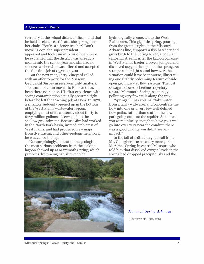
secretary at the school district office found that he held a science certificate, she sprang form her chair. “You’re a science teacher? Don’t move.” Soon, the superintendent appeared and took Jim into his office, where he explained that the district was already a month into the school year and still had no science teacher. Jim was offered and accepted the full-time job at $5,200 a year. But the next year, Jerry Vineyard called with an offer to work for the Missouri Geological Survey in reservoir yield analysis. That summer, Jim moved to Rolla and has been there ever since. His first experience with spring contamination actually occurred right before he left the teaching job at Dora. In 1978, a sinkhole suddenly opened up in the bottom of the West Plains wastewater lagoon, emptying most of its contents, about thirty to forty million gallons of sewage, into the shallow groundwater. Because Jim had worked in the North Fork basin, immediately west of West Plains, and had produced new maps from dye tracing and other geologic field work, he was called to help. Not surprisingly, at least to the geologists, the most serious problems from the leaking lagoon showed up at Mammoth Spring, which previous dye tracing had shown to be
hydrologically connected to the West Plains area. This gigantic spring, pouring from the ground right on the Missouri-Arkansas line, supports a fish hatchery and gives birth to the Spring River, a popular canoeing stream. After the lagoon collapse in West Plains, bacterial levels jumped and dissolved oxygen slumped in the spring. As strange as it might sound however, the situation could have been worse, illustrat-ing one slightly redeeming feature of wide open groundwater flow systems. The lost sewage followed a beeline trajectory toward Mammoth Spring, seemingly polluting very few wells along the way. “Springs,” Jim explains, “take water from a fairly wide area and concentrate the flow into one or a very few well defined flow paths, rather than stuff in the flow path going out into the aquifer. So unless you were unlucky enough to have your well go into over very near the conduit, there was a good change you didn’t see any impact.” In the fall of 1981, Jim got a call from Mr. Gallagher, the hatchery manager at Meramec Spring in central Missouri, who told him that dissolved oxygen levels in the spring had dropped precipitously and the
Mammoth Spring, Arkansas
(Courtesy City-Data. com)

Missouri Springs: Power, Purity and Promise 23
A Question of Purity
fish were getting sick. Fall is normally a fairly quiet time of the year, when water quality doesn’t change much, and there hadn’t been any recent rain. Jim checked with his DNR cohort, Jim Williams, who recalled that a pipeline had ruptured on the Phelps-Dent County line the week before, near the little town of Lake Spring. The old oil pipeline had been converted to carry liquid fertilizer, a mix of ammonium nitrate and urea containing about 32% nitrogen by weight. The product had also been tagged with fluorescein dye, so that a leak would tint any contaminated water a sickly yellowish green. That is exactly what happened. A landowner saw a bright, unnaturally green pool of water in the creek on his farm and immediately called the pipeline company, which responded promptly to repair the leak. The company calculated that about 1,200 gallons of fertilizer had spewed out through a pencil-sized hole in the estimated four to five days before it was discovered. The fertilizer flowed into a pool on Dry Creek, “in a little gaining section of a notoriously losing stream” as Jim described it. The tainted pool was definitely “hot,” contain-ing over 100 milligrams per liter of nitrate, and
The company planned to quickly pump the water onto adjacent fields for fertil-izer. But before they could act, it rained, flushing the nitrate-laden water down-stream into a losing section, where it promptly submerged and traveled at least 12.8 miles underground to Meramac Spring.
Trout in Meramec Spring
(Photo by Author)