minutes of the 15th eac (thermal & coal mining...
TRANSCRIPT

MOM_June_2014(EAC_Coal)
Page 1 of 70
MINUTES OF THE 15th
EAC (THERMAL & COAL MINING PROJECTS) MEETING
HELD ON 27th
– 28th
JUNE, 2014 IN NEW DELHI
The 15th EAC (Thermal & Coal mining projects) Meeting was held on 27
th – 28
th June,
2014 in New Delhi to consider the proposals in coal mining sector. The list of participants of
EAC and the proponents are given at Annexure-1 and 2 respectively.
B. Confirmation of Minutes: The Committee confirmed the minutes of the 14th EAC
meeting held on 27th -28
th March, 2014.
C. The following proposals were considered:
15.1 Moher & Moher Amlori Extension coal blocks project (expansion from 12 MTPA
(normative) and 15 MTPA (peak) to 16 MTPA (Normative) and 20 MTPA (Peak), in area
of 2037 ha; Latitude 240 07’ 18” to 24
0 09’ 27” N and Longitude 82
0 33’ 15” to 82
0 36’ 15” E
[15.39 Km2 (Moher Block – 10.70 Km
2 & Moher Amlohri Extension Block – 4.69 Km
2)] of
M/s Sasan Power Ltd., located at dist. Singrauli, Madhya Pradesh - Expansion (under 7(ii)
of EIA Notification 2006).
15.1.1 The proposal is for expansion (under 7(ii) of EIA Notification 2006) for Moher &
Moher Amlori Extension coal blocks project (expansion from 12 MTPA to 15 MTPA
Normative and 16 MTPA to 20 MTPA Peak, in area -15.39 Km2 (Moher Block – 10.70
Km2 & Moher Amlohri Extension Block – 4.69 Km
2) of M/s Sasan Power Ltd., Dist.
Singrouli, Madhya Pradesh.
15.1.2 The proponent made the presentation and informed that:
i. It is the Open Cast coal mine to which Ministry had granted EC vide letter no. J-
11015/60/2008-IA.II (M) dated 10th December, 2008. Further, TOR granted for
expansion of production capacity vide Letter No. J-11015/03/2013.IA.II (M) dated,
27th
August 2013. However, Project proponent applied for expansion under 7(ii) of
EIA Notification, 2006.
ii. The latitude and longitude of the project are 240 07’ 18” to 24
0 09’ 27” N and 82
0 33’ 15”
to 820 36’ 15” E respectively.
iii. The land usage of the project will be as follows:
Pre-Mining & Post Mining:
Pre-Mining Land use
Forest Land 1198 ha
Settlements 148 ha
Agricultural land 374 ha
Wasteland 317 ha
Total 2037 ha

MOM_June_2014(EAC_Coal)
Page 2 of 70
Post Mining Land Use
Sl.
No. Description
Land Use (Ha)
Plantation Water
Body
Public
Use Total
1 Top Soil Dump 320
320
2 External Waste Dump
3 Excavation (Backfill) 1411 29 1440
4 Road & Drain 15 25 40
5 Built-up Area 92 92
6 Green Belt 62 62
7 Undisturbed Area
(Safety Zone)
83 83
Total 1,891 29 117 2,037
Total Project Area Requirement (ha)
Type Area in ha.
Forest Land 1198.00
Govt. Land 160.64
Private Land 678.36
Total 2037.00
iv. The total geological reserve is 575.0 MT. The mineable reserve 470.43 MT, extractable
reserve is 470.43 MT. The per cent of extraction would be 81.80%.
v. The coal grade is D, E & F. The stripping ratio is 4.03 m3/T. The average Gradient is 3
degree. There will be two seams with thickness ranging from 15.91m to 22.72m.
vi. The total estimated water requirement is 4000 m3/day which of 605 m
3/day water is
Recycled & Net Water Requirement is 3395 m3/day. The initial water requirement being
met from the bore wells. Later on 2770 m3/day of total water requirement will be met
from the aquifer discharges of the mine excavation area. The level of ground water
ranges from 2 m to 18 m. In the core zone, water level varies from 5.252 to 16.09 mbgl.
vii. The Method of mining would be opencast using Shovels and Dumpers; Dragline for
inter parting.
viii. There is one external OB dump with Quantity of 204 Mm3 in an area of 3.2 km
2 with
height of 90 m max above the surface level and two internal dumps with Quantity of
1689.38 Mm3 in an area of 1411 ha.

MOM_June_2014(EAC_Coal)
Page 3 of 70
ix. The final mine void would be in 29 Ha with depth of Less than 40 m and the Total
quarry area is 1440 Ha. Backfilled quarry area of 1411 Ha shall be reclaimed with
plantation. A void of 29 ha at a depth of 290 m (max.) which is proposed to be converted
into a water body
x. The seasonal data for ambient air quality has been documented and all results at all
stations are within prescribed limits.
xi. The life of mine is 29 Years for peak capacity of 20 MTPA and 35 years for normative
capacity of 15 MTPA.
xii. Transportation: Coal transportation from face by dump trucks up to Receiving Pits and
from there to Transfer Point through Belt Conveyors and from there on by OLC to
Power Plant.
xiii. R & R is involved. There are 988 PAFs.
xiv. Cost: Total capital cost of the project is Rs. 432,700 lakhs. CSR Cost Rs. 250 lakhs per
year. R&R Cost Rs. 11,238 lakhs. Environmental Management Cost is Rs. 3796.7 lakhs.
xv. Water body: One nala is originating from eastern part of the plateau & flows towards
west. Two small streams are originating from the central portion of the block & are
flowing towards south-east. These streams discharge into Kachannala which flows in
NW-SE direction & ultimately drains into Govind Ballabh Panth Sagar Reservoir
(Rihand Reservoir) built over Rihand River which is a tributary of Son River. Chingitola
Nala- Flowing S-W, meets to Kachan River; Forest Nala- flowing Southward, meets to
Kachan River; Hawwraha Nala- flowing Southward, meets to Kachan River; Kachan
River meets to Govind Ballabh Pant Sagar
xvi. Flora and Fauna: No prominent grassland ecosystem has been found in the Core and
Buffer zone areas.
xvii. Approvals: Ground water approval obtained on 27.07.2011, Board’s approval obtained
on 11.02.2011. Mining plan has been approved on 02.03.2009 for an ML area of 1539 ha
Mine Closure Plan approval on 06.09.2011.
xviii. Wildlife issues: Wildlife Management Plan (WLMP) has been prepared and enclosed
along with the environmental impact assessment report. WLMP has also been submitted
to the state Govt. for preparation of a Regional wildlife management plan by MP State
Wild Life board, Bhopal. 7 species of mammals are found within the Mining Lease Area
& 13 animals species observed from Buffer Zone.
xix. Forestry issues: Total forest area involved (in ha) for mining 1067.02 ha (991.81 ha
forest land & 72.21 ha revenue forest). FC issued vide letter no. F. No. 8-92/2008-FC
dated 13th November, 2009 for 1067.02 Ha and F. No. 8-91/2008-FC Dated 13
th
November, 2009 dated 133.19 Ha. Moher Reserve Forest, Chokra Protected Forest,
Parari Protected Forest. xx. The forest is characterized by Tropical Mixed Deciduous Forest. The terrestrial floral
species consist of Tropical deciduous tree species, shrubs and dry deciduous grasses. The
main tree species out of 42 large trees, 12 small trees, 20 shrubs, 14 vines in the area.
xxi. There are no National Parks, Biosphere Reserves found in the 10 km Buffer Zone.
xxii. Total afforestation plan shall be implemented covering an area of 1891 ha at the end of
mining. Green Belt over an area of 62 ha. Density of tree plantation 1600 trees/ ha of
plants.
xxiii. There are no court cases/violation pending with the project proponent.
xxiv. EC Compliance report: The Compliance Monitoring Report for Moher and Moher-
Amlohri Extension coal mine has been submitted by the MoEF, Regional Office, Bhopal
vide letter no. 3-11/2009(ENV)/084 dated 20th June 2014. The Committee has noted

MOM_June_2014(EAC_Coal)
Page 4 of 70
that several conditions of earlier EC no. J-J-11015/60/2008-IA-II(M) dated 10th
December, 2008 have been partially complied. The proponent had submitted an action
plan so as to comply with these partly complied conditions and are under progress.
These include the following:
i. Main drain has been de-silted by 15th May 2014. The 8.44 KM of Garland drains
around the working area and OB dump have been completed by 10th June 2014.
ii. Top soil removal, storage & use are successive and periodic activities. Existing
topsoil shall be used for green belt, dump slope and other available place for
stabilization in monsoon of FY 2014-15
iii. Reclamation & vegetation over OB dump shall start after 6th year i.e. 2017-18
& report shall be submitted to the concerned authorities on an yearly basis.
Vegetation of around 600 meter of available final dump slope will be done in the
monsoon of 2014-15. The work order for slope stability study has been awarded
to CIMFR, Dhanbad and the report is expected by November, 2014.
iv. Existing drains have been de-silted & Garland drains around the working area
and OB dump have been completed by 10th June 2014.
v. The western (permanent) side of dump slope is provided with a 600m long
retaining wall for checking run-off and siltation from OB dumps/benches. Other
sides of dump are progressive in nature and retaining wall will be completed as
per the OB dump progression.
vi. Steel cladding and steel roofing of whole structure at transfer points have been
completed by 28thMay 2014 to arrest wind-blown fine coal dust near transfer
points. Dust extraction system has already been completed. Dust Suppression
System fitted earlier shall be rectified by mist cannon by August 2014.
vii. The mode of coal transportation changed from MGR to covered overland
conveyor (OLC). Request to amend the said condition in EC of coal mines as
per the amended condition in the EC of the power plant
viii. Ground water level, quality and quantity is being monitored as per the stipulated
condition and the report has been submitted to the CGWA.
ix. Ground water recharge structures have been constructed in and around the mine
area and soil conservation measures have been taken. Additional artificial
ground water recharge structures and surface water ponds have been identified
for Amlohri and Naugarh villages. These shall be constructed to recharge ground
water, water channels and augment surface water by FY 2015-16. Soil
conservation areas are being identified to take up soil conservation measures.
x. Standards of treated effluent are well within the prescribed limits for discharge.
Copies of analytical reports have been submitted to Madhya Pradesh Pollution
Control Board (MPPCB). The same shall be submitted to the Regional Office,
Bhopal along with water balance. The outlet sample from ETP had also been
tested by MPPCB and the result was found well within standard.
xi. The report covering first 3 years i.e., 2011-2014 shall be submitted to MOEF
and its regional office at Bhopal by December 2014.
xii. The R & R of remaining PAFs (308 nos) of Moher Village is planned to be
completed as per requirement, in phases.
15.1.3 The Committee, after detailed deliberations, sought following information for further
consideration of the project:

MOM_June_2014(EAC_Coal)
Page 5 of 70
i. The Action Plan for non-complied and partly-complied EC conditions, with due
concurrence by the RO, MOEF to be submitted.
ii. Detailed coal linkages to the end users to be submitted.
iii. The response to the show cause notice issued by the SPCB and any legal action
therefrom to be furnished.
iv. The proponent has submitted and agreed that coal transportation to Chintrangana
shall be by conveyor belt of about of 32 Km length.
v. The present proposal is for expansion under 7(ii) of EIA Notification, 2006.
Proponent to clarify whether their application, in response to the TOR granted to
enhance production will be pursued.
vi. Revised mine closure plan to be submitted.
vii. The mode of Coal transportation has been changed from MGR to Over land
conveyor with due permission from MOEF vide letter no. J-13011/15/2006-IA-
II(T) dated 05.02.2013.
viii. The proponent to submit a comparative chart of pollution control measures taken.
ix. Detailed OB handling programme including grassing to be submitted.
x. A status of the garland cannel to be submitted.
xi. Project proponent needs to submit details land use pattern covering total project
area; total mining lease area; total forest land; total forest clearance obtained and
balance forest clearance awaited in a tabulated form.
xii. The proponent to submit an affidavit that no investigation or their matters are
under consideration of the IMG.
xiii. A sub-committee of EAC to make a visit to the coal mining site.
15.2 Baranj OC project (expansion from 2.5 MTPA normative and 3.75 MTPA peak in
an ML area of 1457.20 ha; Latitude N 79°05’47” to N 79°08’28” & Longitude E 20°06’43”
to E20°08’59”) M/s Karnataka EMTA Coal Mines Ltd., located in dist. Chandrapur,
Maharashtra - Expansion under 7(ii) of EIA Notification, 2006.
15.2.1 The proposal is for expansion (under 7(ii) of EIA Notification 2006) of Baranj OC
project (expansion from 2.5 MTPA normative and 3.75 MTPA peak in an ML area of 1457.20
ha) M/s Karnataka EMTA Coal Mines Ltd., Dist. Chandrapur, Maharashtra. The proponent
made the presentation and informed that:
i. The project was accorded EC vide letter no. J-11015/400/2005-IA.II (M) dated 18th
May, 2006 for 2.5 MTPA. Now, project proponent has applied for 50% expansion
under 7(ii) of EIA Notification 2006 in line with the MOEF O.M. No. J-
11015/30/2004-IA.II (M) dated 07.01.2014.
ii. Karnataka Power Corporation Ltd (KPCL) formed a joint venture company,
Karnataka EMTA Coal Mines Limited (KECML), with Emta Coal Limited for
mining of the allotted coal blocks.
iii. Coal Linkage: KPCL proposes to use coal from the Baranj captive coal blocks for
BTPS II in addition to the supply of coal to BTPS I
iv. The latitude and longitude of the project are N 79°05’47” to N 79°08’28”and E
20°06’43” to E20°08’59” respectively.
v. The land usage of the project will be as follows:

MOM_June_2014(EAC_Coal)
Page 6 of 70
Pre-Mining:
Sl. No. Class of Land Area (Ha)
1 Tenancy (Agriculture) Land 1276.21
2 Forest Land 84.40 (Ph-I)
3 Govt. Land 96.59
Total 1457.2 (Ph-I)
Post- Mining & Core Area:
Sl. No. Particulars Area (Ha)
1
Mine Excavation Area
a ) Pit void at end of mine operations 190.0
b ) Internal Backfilled dump area including dump slopes 911 (Ph-I)
2 Mine Infrastructure 6.0
3 Embankment across Konda Nallah 15.0
4 External Dump 240.0
6 Others (including safety zone) 95.2
Total 1457.2 (Ph-I)
LAND USE PATTERN - MINING LEASE AREA
Sl. No. Type of Land Existing 2.5 MTY
(Ha)
50% Incremental i.e.,
3.75 MTY (Ha)
1. Agricultural 1276.21 1276.21
2. Forest 84.40 84.40
3. Waste land 8.72 8.72
4. Grazing 3.07 3.07
5. Surface water bodies 24.21 24.21
6. Others 60.59 60.59
Total 1457.20 1457.20
vi. The total geological reserve is 156.91 MT. The mineable reserve 103.06 MT,
extractable reserve is 103.06 MT. The per cent of extraction would be 80.6 %.
vii. The coal grade is C to D. The stripping ratio is 7.17 Cum/t. The average Gradient is 1 in
4 to 1 in 11. There will be one (Composite Seam with Top Section & Bottom Section))
seams with thickness ranging from 1.25m to 13.24m.
viii. The total estimated water requirement is 948m3/day m3/day. The level of ground water
ranges from 1.86 m to 8.250 m bgl.
ix. The Method of mining would be opencast using Shovel Dumper Mining Technology;
Coal Mining by Surface Miner Technology.
x. There is 2 (Dump – A & Dump – B ) external OB dump with Quantity of 101.68
Mm3(26.80 Mm3(A)+ 74.88 Mm3 (B)) in an area of 70Ha and 170 Ha respectively
with height of 60 meter and 6 internal dump with Quantity of 101.68 Mm3(26.80
Mm3(A)+ 74.88 Mm
3 (B) in an area of 1101 Ha(Phase-I ).
xi. The final mine void would be in 190 Ha. The void will be filled up with re-handled OB
from Dump – A. ha. and the Total quarry area is 1101.00 Ha (Phase-I ). Backfilled

MOM_June_2014(EAC_Coal)
Page 7 of 70
quarry area of 1101.00 Ha (Phase-I) shall be reclaimed with plantation.
xii. The seasonal data for ambient air quality has been documented and all results at all
stations are within prescribed limits.
xiii. The life of mine is 29 Years.
xiv. Transportation: Coal transportation in pit by 100T Rear Dumpers, Surface to Siding
by Through Contractual Trucks and loading to siding by Pay Loaders.
xv. There is R & R involved. There are 1519 PAFs.
xvi. Cost: Total capital cost of the project is Rs. 977.02 crores. CSR Cost Rs. 11.51
crores/year. R&R Cost 128.80 crore. Environmental Management Cost Rs. 48.58
crores.
xvii. Water body: There are three seasonal Nallas within the block. Nala -1 and Nala-2
have already been diverted. Diversion of Nala-3 to be taken up in due course. The main
drainage is through Konda Nala, flowing from North-East to South-West. These
constitute a part of the Wardha River System, which flows in the far South-West of the
Coalfield.
xviii. Approvals: Ground water clearance obtained on No. GSDA/ Sr.Geo/ Chn/ Tech/
KECML/Consent dated 14.12.2005, Board’s approval obtained on 1st July 2011.
Mining plan: Revised Mine Plan (5 MTPA) along with Mine Closure Plan Approved
vide letter no. 13013/18/2004-CA-I(Part) dated 24th August 2011.
xix. Wildlife issues: There are no National Parks, Wildlife Sanctuary, Biosphere Reserves
found in the 10 km buffer zone.
xx. Forestry issues: Total forest area involved 84.41 Ha (Phase-I) for mining. Stage – I
Clearance Obtained. Compliance Report has been sent by Addl. PCCF, Maharashtra to
Inspector General of Forests, Govt. of India vide letter dated 29.3.2014 for Stage-II
Forest Clearance which is pending with Ministry of Environment & Forest..
xxi. Total afforestation plan shall be implemented at the end of mining. Green Belt over an
area of 116.20 ha. Density of tree plantation 2500 trees/ ha of plants.
xxii. No excess production.
xxiii. There are no court cases/violation pending against the project proponent.
xxiv. Public hearing is not applicable as the proposal is under 7(ii) of EIA Notification, 2006.
15.2.2 EC Compliance report: The compliance report to the earlier EC as sent by the Regional
Office of the MoEF, Bhopal vide letter No. 3-30/2006(ENV)10036 dated 10.1.2014 was
deliberated by the EAC. The Committee has noted that the conditions were generally complied
with.
15.2.3 The Committee, after detailed deliberations, recommended the project for granting
Environment Clearance subject to following specific condition also.
i. These specific conditions shall be in addition to the conditions stipulated in earlier
EC no. J-11015/400/2005-IA.II (M) dated 18th May, 2006 for 2.5 MTPA.
ii. No work will be done within the 3 KM as restricted area from the boundary wall of
ordnance factory.
iii. Coal from the Baranj captive coal blocks shall be used for BTPS II in addition to the
supply of coal to BTPS I. KPCL has confirmed it.
iv. The transportation of the coal from the mine to the siding shall be by 25 Tonne trucks.
The silo be used instead of the pay loader so as to minimize the coal dust emission.
v. OB handling programme be continued as per earlier EC.

MOM_June_2014(EAC_Coal)
Page 8 of 70
15.3 Tara (East & West) Coal Block (Expansion from 2 MTPA to 2.5 MTPA in an ML
area of 520.54 ha; Latitude 23°45’30” to 23°47’45” N and Longitude 87°04’00” to
87°07’15” E) of M/s Bengal EMTA Coal Mine Ltd., located at District, Burdwan, West
Bengal – TOR.
The project proponent did not attend the meeting. The proposal was accordingly deferred.
15.4 Durgapur II/Sariya Coal Block (2 MTPA in ML Area of 540.750 ha) opencast
mining of M/s DB Power Limited, located in Villages Taraimar, Bayasi, Medarmar,
Dharam Colony, & Bayasi Colony in District Raigarh, Chhattisgarh – Correction in EC.
15.4.1 The proposal is of Durgapur II/Sariya Coal Block (2 MTPA in ML Area of 540.750 ha)
open cast mining of M/s DB Power Limited, located in Villages Taraimar, Bayasi, Medarmar,
Dharam Colony, & Bayasi Colony in District Raigarh, Chhattisgarh for correction in EC.
15.4.2 The Environment Clearance was granted to the project vide letter no. J-11015/324/2008-
IA-II (M) dated 05.07.2013. Project proponent requested for slight discrepancies and
typographical corrections. The Committee noted and recommended for factual corrections at the
following places.
Sl. No. in
the EC
EC- Information as per Proponent,
General & Specific Conditions.
shall be read as
Para no. 2
Point no.(ii)
The total land requirement is 540.75 ha
of which 290.399 ha is forest land,
238.38 ha is agricultural land, 3.642 ha
is waste land, 0.542 ha is surface water
bodies, and 9.813 ha is others (which
totals 542.776 ha) Mining Plan has been
app- roved by MOC on25.06. 2009.
The total land requirement is 540.75 ha
of which 290.399 ha is forest land,
236.354 ha is agricultural land, 3.642 ha
is waste land, 0.542 ha is surface water
bodies, and 9.813 ha is others (which
totals 540.75 ha) Mining Plan has been
approved by MOC on 25.06.2009.
Para no. 2
point no.
(v.)
Of the total ML area of 540.75 ha,
quarry area would be 517.46 ha and an
estimated 409.10 Mm3 of waste
(including 1.55 Mm3 of topsoil) would
be generated.
Of the total ML area of 540.75 ha,
quarry area would be 517.48 ha and an
estimated 409.10 Mm3 of waste
(including 1.55 Mm3 of topsoil) would
be generated.
Para no. 2
point no.
(xxxiii.)
Of the total Rs 63.56 crores earmarked
for R&R Policy, Rs 7.70 crores is for
Tribal Development Plan (TDP) and Rs
10 crores for CSR. It was informed that
a Committee has been constituted for
implementation and monitoring of CSR.
There are only 21 Tribal PAFs
belonging to Taraimar village, who
require relocation.
Of the total Rs 63.56 crores earmarked
for R&R Policy, Rs 7.70 crores is for
Tribal Development Plan (TDP) and Rs
1.0 crore for CSR. It was informed that
a Committee has been constituted for
implementation and monitoring of CSR.
There are only 21 Tribal PAFs
belonging to Taraimar village, who
require relocation.

MOM_June_2014(EAC_Coal)
Page 9 of 70
Para no. 2
point no.
(xlii.)
The CSR cost would be at Rs. 5/T of
coal with a provision of Rs. 170 lakhs
(capital) and Rs. 100 lakhs (recurring)
would be implemented.
The CSR cost would be at Rs. 5/T of
coal with a provision of Rs 100 lakhs
(capital) and Rs. 100 lakhs (recurring)
would be implemented.
Para no. 2
point no.
(xliii.)
Coal is proposed to be transported by
50-T trucks to linked thermal power
plant of M/s D.B. Power near Kharsia at
a distance of 85km. Coal is to be
transported by road to Robertson’s
Siding at a distance of 65km.
Coal is proposed to be transported by
30-T trucks to linked thermal power
plant of M/s D.B. Power near Kharsia at
a distance of 85km. Coal is to be
transported by road to Robertson’s
Siding at a distance of 65km.
Para no. 4
A point no.
(li.)
A project specific CSR Plan for the
nearby villages of Taraimar, Byasi,
Dharamjaigarh,/Dharam and other
adjoining villages shall be implemented.
Measures /activities under CSR shall
includes strengthening the existing ITI
institutions, establishment of more
cooperatives and SHGs, effective role as
an interface/ link between buyers-sellers
of local produce/goods, implementing a
wide range of skill development and
alternate livelihood schemes particularly
for the SC/ST including tribals and BPL
families, strengthening and adding
wherever necessary health care and
educational facilities are lacking in and
around the project area over the life of
the project. A provision of Rs 170 lakhs
made for CSR for the next 5 years
which includes Rs 10 crore earmarked
for annual expenditure on
developmental activities for the
surrounding villages or an annual
recurring expenditure of Rs.5/tonne of
coal, whichever is higher, which shall
be adjusted according to value of the
rupee until end of mine life, shall be
implemented in a time bound manner.
Provision of annuities of Rs 2500
/month to vulnerable persons found in
and around the project area shall be
made. Details of village-wise activities
under CSR along with the activities and
budgetary provision shall be uploaded
on the company website and the status
of its implementation along with
A project specific CSR Plan for the
nearby villages of Taraimar, Byasi,
Dharamjaigarh,/Dharam and other
adjoining villages shall be implemented.
Measures /activities under CSR shall
include strengthening the existing ITI
institutions, establishment of more
cooperatives and SHGs, effective role as
an interface/ link between buyers-sellers
of local produce/goods, implementing a
wide range of skill development and
alternate livelihood schemes particularly
for the SC/ST including tribals and BPL
families, strengthening and adding
wherever necessary health care and
educational facilities are lacking in and
around the project area over the life of
the project. A provision of Rs 100 lakhs
made for CSR for the next 5 years
which includes Rs 1.0 crore earmarked
for annual expenditure on
developmental activities for the
surrounding villages or an annual
recurring expenditure of Rs.5/tonne of
coal, whichever is higher, which shall
be adjusted according to value of the
rupee until end of mine life, shall be
implemented in a time bound manner.
Provision of annuities of Rs 2500
/month to vulnerable persons found in
and around the project area shall be
made. Details of village-wise activities
under CSR along with the activities and
budgetary provision shall be uploaded
on the company website and the status
of its implementation along with

MOM_June_2014(EAC_Coal)
Page 10 of 70
expenditure thereon and also desired
that a Third party audit of
implementation of CSR shall be done
periodically.
expenditure thereon and also desired
that a Third party audit of
implementation of CSR shall be done
periodically.
15.4.3 The Committee recommended the corrections as stated in 15.4.2 para above.
15.5 Fatehpur East Coal Block (10 MTPA (peak) in a total project area of 1913.208 ha;
Latitude 22°26’42.19” to 22°29’17.25” N and Longitude 83°05’40.72” - 83°08’58.93” E) of
M/s Fatehpur East Coal Private Ltd., located in Mand Raigarh Coalfields, Tehsil
Dharamjaigarh, dist. Raigarh, Chhattisgarh - EC based on TOR granted on 09.02.2012 –
Further Consideration.
15.5.1 The proposal of Fatehpur East Coal Block (10 MTPA (peak) in a total project area of
1913.208 ha includes an ML area of 1728.208 ha) of M/s Fatehpur East Coal Private Ltd.,
Mand Raigarh Coalfields, Tehsil Dharamjaigarh, dist. Raigarh, Chhattisgarh.
15.5.2 The proposal was considered in the 14th EAC held on 27
th -28
th March, 2014. The
Committee after deliberation sought additional information on an affidavit, that there are no
issues pending with IMG of Ministry of Coal vis-à-vis any investigation in the matter; impact of
proposed diversion of the Pawasi Nala; Forest Clearance, Man- elephant conflict; Social impact;
embankment of Mand river; alignment for diversion of Pawasi Nala; possibility of adopting In
Pit Crushing and Conveying system for coal; grazing land;Transportation services; reduce the
void and minimizing the external OB dump; Action Plan in respect of the Capital CSR funds;
discrepancies in water quality data; creation of an Environmental Cell; preservation of the places
with religious sentiment; issues raised in PH and Action Plan along with budget etc. for further
consideration:
15.5.3 The Committee deliberated on the reply submitted by the Proponent. The proponent has
further informed that:
i. An Affidavit has been submitted by Project Proponent on 4th April 2014 comprising
following statements:
a) The five allottees where served with a Show-Cause Notice by the Ministry of Coal
vide their Letter No. 13016/33/2008-CA-I, dated 01/01/2014, (for short “Show Cause
Notice”) stating that as to why allocation of Coal Block be cancelled, inter alia on
unsatisfactory progress of implementation of specified end use plant(s), unsatisfactory
progress in the development of coal mining project & for breach of any of the
conditions of Allocation.
b) Ministry of Coal thereafter issued Letter No. 13016/04/2014-CA-I dated 15th January,
2014 superseding all and any previous Notice issued on the recommendation of the
Inter Ministerial Group (for short “IMG”) or otherwise.
c) Fatehpur East Coal Private Limited has submitted its detailed Reply bearing Letter
No. FECPL/13-14/035 dated 03rd
February, 2014 to the Show Cause Notice,
confirming the fact that it has complied with the Conditions pertaining to Regionally
Explored Block and as such, the Show Cause Notice may be withdrawn.

MOM_June_2014(EAC_Coal)
Page 11 of 70
d) The response submitted by M/s Fatehpur East Coal Private Limited has been
deliberated in the 24tdh meeting of the Inter-Ministrial Group (IMG) under the
Chairmanship of Additional Secretary (Coal) held on 7th and 8
th February 2014.
e) Minutes of the above meeting has been communicated by Ministry of Coal vide their
meeting notice no. 13016/05/2014-CA-I on 21/02/2014.
f) As per the minutes of MOC, Fatehpur East Coal Private Limited is covered in Sl. No.
35 at Pages 18 & 19, which is reproduced as “Therefore, in terms of Para 2(i) (b) of
the Notice, no action is recommended at present. However, continuation of further
development of the Block shall be without any prejudice to the investigation
consequent upon FIR against two of the five Allocatees.”
ii. The five co-allottees are setting up projects with gross total capacity of 5580 MW, which
are at various stages of implementation. Coal from Fatehpur East alone, would not be
sufficient for such capacity. The details of total coal requirement for the EUPs are
mentioned below:
S.No Company Power Plant
Capacity
Total
Requireme
nt (MT)
Coal
from
Block
(MT)
Balance
requirement
through linkage/
e-auction/import
1
Athena Infra projects
Pvt. Ltd. 2X600MW 5.6 2.2 3.4
2
RKM Powergen Pvt.
Ltd. 4X360MW 6.7 2.2 4.5
3 VISA Power Limited 2X600MW 5.6 2.2 3.4
4
JLD Yavatmal Energy
Limited 2X600MW 5.6 2.2 3.4
5 Vandana Vidhyut Ltd. 540MW 2.5 1.2 1.3
Total 5580 MW 26.0 10 16.0
iii. Impact of proposed diversion of the Pawasi Nala: At Present Water from the Pawasi
Nala is not being used by any villages. The proposed diversion will be beneficial for the
villagers of Ududa in respect of irrigation etc. With the diversion of Pawasi Nala there will
not be any adverse impact. The design of Pawasi nala diversion has been examined and
technically approved by WRD, Chhattisgarh Govt. WRD, Dharamjaigarh has reconfirmed
the suitability of design of diversion of Pawasi Nala vide letter dated 19.04.2014.
iv. Forest Clearance: Forest Land will be acquired through Forest Diversion Proposal under
the Forest Conservation Act, 1980. The Forest Clearance application is under process by
DFO. There is no National Park or Wildlife Sanctuary within 10 Km. radius.
v. Man- elephant conflict: The State Forest Dept. vide Letter No. 433 dated 15.04.2014
have stated that presently no elephant corridor has been notified by the Govt. within 15
Km. area of the project. Only stray elephants visiting the Buffer Zone has been reported as
mentioned in Page 93-95 of EIA Report. The Wildlife Conservation Plan as approved by
Chief Wildlife Warden has been submitted to MoEF.
vi. Social Impact: Detailed description of social impact of proposed project and R&R Plan is
discussed in EIA Report between Page 209-251. The R&R Plan has been submitted to
Mineral Resource Dept., Chhattisgarh for approval which will be processed after grant of

MOM_June_2014(EAC_Coal)
Page 12 of 70
Previous Approval of Mining Lease by MoC.
vii. The distance between the Mand River and edge of the Pit will be 160m. The Eastern
Boundary of Fatehpur East block is 60m away from Mand River, having natural
vegetation including Bade Jhar Ke Jungle. The total green belt between the River and the
Mine Pit will be 94m. The embankment will be 36m wide and minimum height 3m. above
HFL. The river facing side would be appropriately stone-pitched.
viii. The proponent has committed the following Action Plan for implementation:
a. Railway line from coal block to proposed Dharamjaigarh station on East
Corridor.
b. Coal Transportation is proposed through railway line of East Corridor being
developed by SPV formed by SECL, GoC and IRCON. MOU executed and DPR
submitted to Indian Railways. Coal transportation to the power plants of Athena,
RKM and Visa to be done by road for initial five years. Dumpers to be checked for
exhaust emissions, and maintained properly (PUC) Minimize re-suspended road
dust generation, roads to be cleaned daily along all the settlements. Noise barriers to
be provided along settlement stretch; use of horns to be prohibited. Measures for
safe driving habits to be employed by way of education, slogans and campaigns.
People residing along the road to be educated on road safety. Ambulance,
emergency medical management centre and blood bank shall be developed as part
of CSR plan of FECPL.
c. The present CHP layout and railway alignment have been modified and the location
of crusher (covered) has been further increased from 200m (present location) to
500m after modification of design. This is the maximum possible distance which
cannot be increased further, on account of site geometry and CHP design
parameters.
d. Transportation services be extended between Ududa & Narkalao villages as a part of
CSR activities in lieu of the existing roads
e. Three kind of OB handling has been proposed viz. In-Pit: Permanent dump within
mining pit and lease boundary; On-Pit: Temporary dump within lease boundary
which is to be re-handled back into In-Pit; Ex-Pit: Permanent dump outside of lease
boundary.
f. Scope of further reducing the void: FECPL initially propose to fill up this void
with the OB of In-Pit dump. Total 134.188 MBCM would be filled up in the 28th to
30th year to reduce the depth of void from 284m to 30m from surface.
g. Further considering EAC’s advice to explore the scope of reducing the void, FECPL
now propose :
h. Further reducing the depth to 20m. from 30m. Thereby the depth of lake would be
only 30-10=20m (reducing floor depth from 284m to 20m, i.e. 264m total
reduction).
i. Preventive measures proposed for reclamation as water reservoir will include:
Reservoir will be gently sloped along its entire periphery; upper benches above the
reservoir will be terraced and stabilised with plantation of native species; Open
edges will be fenced properly with Solar Fencing; Provision of sign boards will be
there.
j. Action Plan: Capital CSR Fund: Peak rated capacity 10 million tonnes expected
to reach by Oct 2019. CSR spending as mentioned in the EAC meeting 12 crores
budget would be: Up to September 2015 : Rs 1 Crore; October 2015 to September
MOM_June_2014(EAC_Coal)
Page 13 of 70
2016 : Rs 1.5 Crore; October 2016 to September 2017 : Rs 2 Crore; October 2017 to
September 2018 : Rs 3 Crore; October 2018 to September 2019 : Rs 4.5 Crore
k. FECPL will create an Environmental Cell comprising of an Ecologist, an
Environmentalist & a Social Scientist so as to monitor and implement the
environmental and social issues.
l. The Wildlife Conservation Plan has been approved by Chief Wildlife Warden vide
Letter dated 12.02.2014. FECPL is committed to follow all stipulations laid down in
the approval.
m. Details of PH vis-à-vis Action Plan has been submitted.
n. Proponent should follow/ implement plan of temporary housing facility for
contractual workers.
15.5.4 The Committee after detailed deliberations recommended the proposal for granting
Environment Clearance subject to following specific conditions also:
i. Proponent should follow/ implement plan of temporary housing facility for contractual
workers.
ii. An Environmental Cell be created comprising of an Ecologist, an Environmentalist & a
Social Scientist so as to monitor and implement the environmental and social issues.
iii. Wildlife Conservation Plan be approved by Chief Wildlife Warden with commitment of
funds as stipulated by Wild life Warden.
iv. The CSR spending shall be Rs. 12 crore as agreed to by the proponent.
v. Reservoir will be gently sloped along its entire periphery.
vi. The upper benches above the reservoir will be terraced and stabilised with plantation of
native species.
vii. Open edges will be fenced properly with Solar Fencing and provision be made for sign
boards.
viii. The depth of lake to be further reduced from 30m to 20m and the floor depth from 284m
to 20m, i.e. 264m total reduction.
ix. Transportation services be extended between Ududa & Narkalao villages as a part of
CSR activities in lieu of the existing roads
x. The proponent shall complete the railway siding by December, 2018. Until that time the
coal transportation shall be by mechanically covered trucks for four years.
xi. The dumpers should be checked for exhaust emissions, and be maintained properly;
Minimize re-suspended road dust generation, roads to be cleaned daily along all the
settlements.
xii. Noise barriers to be provided along settlement stretch; use of horns to be prohibited.
Measures for safe driving habits to be employed by way of education, slogans and
campaigns. People residing along the road to be educated on road safety.
xiii. Ambulance, emergency medical management centre and blood bank shall be developed as
part of CSR plan.
xiv. The proponent shall build temples in order to keep the religious sentiments of the local
inhabitants.
xv. Proponent should follow/ implement plan of temporary housing facility for contractual
workers.
xvi. All the commitments made during the Public Hearing be implemented.
xvii. A sub-Committee of the EAC to visit the site to assess the situation on ground.

MOM_June_2014(EAC_Coal)
Page 14 of 70
15.6 Nawapara UG Expansion (0.18 MTPA to 0.36 MTPA Normative & 0.55 MTPA
Peak in the total Project Area 442.14 ha; Latitude 23012′00″ and 23
014′53″ N and
Longitude 83004′23″ and 83
007′53″ E) of M/s South Eastern Coalfields Ltd. Dist. Surguja,
Chhattisgarh - EC based on TOR granted on 10.11.2009 – Further Consideration.
15.6.1 The proposal is for Nawapara UG Expansion (0.18 MTPA to 0.36 MTPA Normative &
0.55 MTPA Peak in the total Project Area 442.14 ha) of M/s South Eastern Coalfields Ltd., Dist.
Surguja, Chhattisgarh.
15.6.2 The proposal was considered in the 9th EAC meeting held on 20
th -21
st January, 2014.
The Committee sought additional information w.r.t. monitoring of ground water using the
piezometer; details of transportation of coal; feasibility study for having railway siding near the
mine; appropriate action as per the existing OM on violation; Board’s Resolution for not
repeating the violation; detailed action plan on subsidence, transport of coal, CSR and public
hearing; The compliance Report to the EC granted on 07.01.2002 duly vetted by the Regional
Office of the MOEF.
15.6.3 The proponent made the presentation and informed that:
i. Monitoring of Ground water using the piezometer: At Nawapara UG mine, the ground water
monitoring using Piezometer is in practice & is being regularly done & the result recorded in
the bound paged register. The results are as under:
SL
No.
Date
Water level from surface in Mtrs
Pizometer No.1-Near Sub-
station
Pizometer No.2-Near
Fan house
1 04.06.2011 31.20 60.40
2 11.11.2011 25.94 55.15
3 18.02.2012 26.91 57.10
4 09.06.2012 30.59 60.24
5 03.10.2012 26.20 54.55
6 24.03.2013 28.90 57.03
7 22.06.2013 29.62 59.76
8 08.10.2013 25.63 55.51
9 22.01.2014 27.56 56.43
ii. Details of transportation of coal: Coal transportation details are as under:
a. From face to pit top: through belt conveyors.
b. Pit top to Bhatgaon railway siding: By covered trucks.
c. Railway siding to customers by rail( 94%)
d. To different customers by road (06%)
iii. Feasibility of railway siding near the mine: The issue of construction of new Railway
siding nearby railway station Kamalpur situated at a distance of 8.1 km from the mine was
discussed with IRCON International Limited who advised that minimum of 01 (one) rake per
day coal i.e. minimum 4000 tons coal/day is required for feasibility of new railway siding;
Further on this route i.e. Nawapara to Kamalpur, there are 03 villages namely Latori,
Maheshpur & Silfilli & the population being 2400, 1600 & 1450 respectively. This requires

MOM_June_2014(EAC_Coal)
Page 15 of 70
huge R & R; At present there are no other coal mine is situated nearby, which can feed the
siding. Thus for such meager production of coal the construction of new siding is not
feasible.
iv. Violation: The proponent has exceeded production in 2009-2013 which construes violation.
The proponent submitted the Board’s Resolution for not repeating the violation vide letter
no. SECL/BSP/CAD/13-14/614 dated 20.01.2014.
v. Detailed Subsidence prediction report along with impact of subsidence & their management
include the anticipated maximum possible subsidence likely to occur over the mining area
due to extraction of Pasang Seam individually is 2.01mm. The estimated maximum possible
subsidence likely to occur at the end of mine life (i.e. after 23 years of mining) is 2.01mm,
which is likely to take place over the panels 19 of Pasang Seam. In the forest area, the
maximum possible subsidence likely to occur is 2.01mm, which is likely to take place over
the panel no 19 of Pasang Seam. From the estimated subsidence at each grid point,
subsidence contours are drawn alongwith mitigative measures.
vi. The annual CSR fund for project will be Rs 5.00 per tonne of coal production or 5% of
retained profit, whichever is more. CSR activities are as per policy of Coal India Ltd. CSR
activities will be implemented in consultation with district officials. The CSR activities are
proposed to be carried out in consultation with villagers in the study area which will include:
Creation of social assets like educational institution, community hall, temple, market place
playground etc.; Provision for water supply like bore well pumps, hand pumps, wells, ponds
etc.; Provision for roads, culvert, drains etc.; Institution to impart vocational training for
enhancing employability etc.
15.6.4 The compliance report from Regional Office, MOEF, Bhopal has been received vide
letter no. 3-4/2002/(ENV)/633 dated 12.03.2014. The EAC has deliberated on the compliance
report and has noted that the proponent has complied with all the conditions except that it has
partially complied with monitoring of ground water monitoring and plantation programs. The
Committee has asked the proponent to expedite compliance of these conditions. The proponent
has submitted that it has already initiated action stating that two peizometers have been installed
at different locations and regular monitoring is being done; in addition to the amount already
committed for community development, community and eco-developmental work has been
started and awarded total value of Rs. 1.3 crores for the purpose.
15.6.5 The proponent had committed during the Public Hearing, inter alia, provision of several
amenities. It has already initiated action under CSR which include drinking water hand pumps;
Bus stop sheds; Construction of Primary health centre; Rs. 8.342 Lakhs already paid as
compensation to the 09 PAPs, against land acquisition as per R & R policy of State Govt. and
CIL; Fixed water sprinklers (25nos.) have been provided in coal transportation road in mine
premises; Tar road is available for coal transportation; Green belt (2000nos) along the road &
mine premises; proposed for further plantation along the road during next three years;
Employment is given and compensation is already paid as per company norms to the land owner
who’s land is acquired; Peizometer readings for ground water showing the increasing trend of
ground water level; Different development work is taken up every year under CSR as per
company guide line and provisions; In addition to underground settling tanks 08 number of
settling tanks have been constructed at surface for treatment of mine water.
15.6.6 The Committee after detailed deliberations recommended the proposal for granting
Environment Clearance subject to following specific conditions also:

MOM_June_2014(EAC_Coal)
Page 16 of 70
i. Wagon loading shall be through CHP.
ii. Piezometers shall be installed at the same level of bore holes.
iii. MoEF to take appropriate action as per the existing procedures with regard to violation
during FY 2009-10 to 2012-2013 for exceeding production against the stipulated
capacity in the EC dated 7.1.2002.
15.7 Cluster 5 (2 mixed mines – Parbelia & Dubeswari) a total production capacity of
0.485 MTPA (Normative) and 0.63 MTPA (peak) in an ML area of 2970 ha; Latitude 230
38’ N & 230 41’ N and Longitude 86
0 46’ E & 86
0 51’ E ) M/s Eastern Coalfields Ltd.,
located in Raniganj Coalfields district Purulia, West Bengal. EC based on TOR granted on
03.12.2010
15.7.1 The proposal is of Cluster 5 (2 mixed mines – Parbelia & Dubeswari) of a total
production capacity of 0.485 MTPA normative and 0.63 MTPA peak in an ML area of 2970 ha
of M/s Eastern Coalfields Ltd., located in Raniganj Coalfields district Purulia, West Bengal.
15.7.2 Project Proponent informed the Committee the correct capacity as per the application is
0.485 MTPA normative and 0.63 MTPA peak. This correction may be made in the agenda.
15.7.3 The proponent made the presentation and informed that:
i. The project was accorded TOR vide letter no. J-11015/288/2010-IA.II(M) dated 03.12.2010.
Revised TOR letter no. J-11015/288/2010 -IA.II (M) dated 29.02.2012. Extension of TOR
for one year obtained vide letter no. J-11015/288/2010-IA.II (M) dated 11.03.2014.
ii. The latitude and longitude of the project are 230 38’ N & 23
0 41’ N and 86
0 46’ E & 86
0 51’
E respectively.
iii. Total Leasehold Area: 2970.0 Ha. Leasehold area of each mine in ha is as follows:
Name of Mine Production Capacity (MTY) Lease Hold
Area (Ha)
Life of the
mine Normative Peak
Parbelia UG 0.15 0.19 2730 >25 years
Parbelia OC Patch 0.1 0.13 1.5 years
Dubeshwari UG 0.135 0.18 240 > 50 years
Dubeshwari OC Patch 0.1 0.13 2.5 years
Total 0.485 0.63 2970
iv. The land usage of the project will be as follows:
Sl. No. LAND USE Present Land
use (in Ha)
Post Mining Land
use (in Ha)
1 Infrastructure area 320 200
2 Water Bodies 117 117
3 OB Dump and Quarry 0 0
4 Agriculture 1550 1550
5 Plantation 0 455.54

MOM_June_2014(EAC_Coal)
Page 17 of 70
6 Barren Land 814 478.46
7 Village/Basti 120 120
8 Road 49 49
TOTAL 2970 2970
Post Mining Land use of Core Zone (Cluster Area)
S No. Description
Land-use (Ha)
Plantation Water
Body Public use Undisturbed Total
1. Top-soil Dump -
2. Excavation 20.2 - - - 20.2
3. Rail /Road - 49.0 49.0
4. Mine Infrastructure/
Built-up 120.0 200.0 320.0
5. Village/Basti 120.0 120.0
6. Barren / Vacant land 315.34 - 478.46 793.8
7. Water bodies 117.0 117.0
8. Cultivable 1550.0 1550.0
Total 455.54 249.0 2265.46 2970.0
iv. The total geological reserve is 35.93 MT. The mineable reserve 14.37 MT. The coal grade is
B & Sc. Gr.-I.
v. The total estimated water requirement is 1660 m3/day. The level of ground water ranges
from 1.20 m to 9.55 m.
vi. The Method of mining would be Dubeswari UG and proposed OC patch- At present
Dubeswari colliery is working the Hijuli seam (R-VIII) through two inclines No. 1, 2 & 3.
Two districts are running; one depillaring with caving in Panel-P2 and the other depillaring
with stowing in Panel-A. One development section at bottom part of mine is proposed to be
started after completion of the caving panel. After completion of stowing in Panel-A,
depillaring with stowing in Panel-B in the upper part of Panel-A is proposed to be started.
For OC patch, Shovel-Dumper combination has been proposed for both coal extraction and
OB removal 2.Parabelia UG and proposed OC patch- Mine is running one depillaring panel
by caving method with manual loading and one development section with 2 nos. of SDLs.
The present production of the mine is being obtained from one Development district with
SDLs and another manual depillaring panel with caving. For OC patch, Shovel-Dumper
combination has been proposed for both coal extraction and OB removal.
vii. The OC voids are proposed to be completely backfilled after extraction of available coal
reserves and there will be no residual external dump. Total amount of OB to be produced and
subsequently backfilled for both the proposed OC patches is 5.9 Mm3.
viii. The seasonal data for ambient air quality has been documented and all results at all stations
are within prescribed limits.
ix. The life of mine is Parbelia UG >25 years; Parbelia OC Patch 1.5 years; Dubeshwari UG >
50 years; Dubeshwari OC Patch 2.5 years.
x. Transportation: Coal transportation in pit: Underground mine - coal tubs at the faces are
being hauled by Tugger Haulage & Opencast mine - coal is proposed to be transported from
pit to surface depot by tippers, Surface to Siding: Parbelia UG – Coal produced is

MOM_June_2014(EAC_Coal)
Page 18 of 70
transported by endless haulage to hoppers at Parbelia Railway Siding existing near the mine
pits. There is no truck transportation & Parbelia OC Patch – Coal produced will be
transported to Parbelia Railway siding located a 3 kms away. Dubeswari UG & OC – Coal
produced will be transported by covered trucks to Parbelia Railway Siding and loading to
siding: Coal is loaded by pay loaders into railway wagons.
xi. There is no R & R involved. There are no PAFs.
xii. Cost: Total capital cost of the project is Rs. 43.24 Crores (Parbelia colliery – Rs. 33.21
crore; Dubeswari colliery – Rs. 10.03 Crore. Environmental Management Cost (capital cost
Rs. 3.75 crores, Revenue cost Rs 5.40 crores).
xiii. Water body: The drainage is controlled by Damodar River which is the main drainage
channel. Although there is no prominent stream or nallah within the leasehold, the area is
drained by a number of ephemeral streams ultimately discharging into the Damodar River.
xiv. Approvals: Application has been made to CGWA for Ground water clearance.
xv. Mining plan approval: All the existing mines within the cluster are taken over mines after
nationalization. Mine Closure Plan approval obtained in December, 2013.
xvi. Wildlife issues: There are no national Parks, wildlife sanctuary, biosphere reserves found in
the 10 km buffer zone.
xvii. Forestry issues: There is no forest land within the cluster boundary.
xviii. Total afforestation plan shall be implemented covering an area of 455.54 ha at the end of
mining. Density of tree plantation 1600 saplings/ha of plants.
xix. There are no court cases/violation pending with the project proponent.
xx. Public Hearing was held on 26th December, 2013, Parbelia Guest House, Purulia, West
Benga. The issues raised in the PH includes dust emission; noise pollution; drinking
facilities; drainage system; stopping illegal mining in the area etc.
15.7.4 The Committee has noted the correction in capacity as per the application as 0.485
MTPA normative and 0.63 MTPA peak. The agenda stands corrected. The Committee after
detailed deliberations recommended the proposal for granting Environment Clearance subject
to the following specific conditions also:
i. The open cast voids shall be completely backfilled after extraction of available coal
reserves and there shall be no residual external dump.
ii. Total amount of OB to be produced and subsequently backfilled for both the proposed
OC mines.
iii. Coal produced to be transported by covered trucks to Parbelia Railway Siding and
loading to siding: Coal to be loaded by pay loaders into railway wagons.
iv. Total afforestation plan shall be implemented covering an area of 455.54 ha at the end of
mining. Density of tree plantation shall be 1600 saplings/ha of plants.
15.8 Argada Sirka Group Mixed Mines (Argada UG, Sirka OC & Sirka UG) for (1.125
MTPA normative and 1.293 MTPA peak in a total ML area 907.04 ha; Latitude 230 30
’ 00
”.
N to 230 45
’ 00
”N and Longitude 85
0 25
’ 00” E. to 85
0 29
’ 00” E) of M/s Central Coalfields
Ltd. Dist. Ramgarh Jharkhand - EC based on TOR granted on 11.12.2008 - Further
Consideration
15.8.1 The proposal is for Argada Sirka Group Mixed Mines (Argada UG, Sirka OC &Sirka
UG) for (1.125 MTPA normative and 1.293 MTPA peak in a total ML area 907.04 ha) of M/s
Central Coalfields Ltd. Dist. Ramgarh Jharkhand.

MOM_June_2014(EAC_Coal)
Page 19 of 70
15.8.2 The proposal was last considered in 7th EAC meeting held on 12
th -13
th December, 2013
wherein, the Committee after deliberation recommended the project for the EC for the expansion
of the project with one of the specific conditions that details of mine closure plan are submitted.
15.8.3 The proponent had submitted a copy of approved mine closure plan and informed that:
a) Sirka OC, Sirka UG and Argada UG are very old mines.
b) The Mine Plan of Sirka OC was approved in the 10th Meeting of the Board of Directors
of the then “Coal Mines Authority Limited” on 9th August, 1975.
c) Empowered Sub-Committee of CCL Board has approved the EIA/EMP of Argada Sirka
Group of Mines (Argada UG, Sirka OC & Sirka UG) in its 37th meeting (no.2 of 2013)
dated 22.03.2013 which includes the mine /calander plan of Sirka UG and Argada UG
also.
15.8.4 The Committee had reiterated its recommendations for granting EC with the
stipulated conditions made in the 7th EAC meeting held on 12
th -13
th December, 2013.
15.9 Discussion on suggestions of Ministry of Coal on “clusters approach” for Coal
Mining:
15.9.1 Ministry of Coal (MoC) has requested the Ministry of Environment, Forest and Climate
Change with a proposal that permission of Cluster of Coal India Limited Mines be considered for
grant of EC.
15.9.2 The coalfields which may spread over hundreds of square kilometres are subdivided into
a number of blocks depending upon each of operation, administrative control geo-mining
condition, presence of habitat etc. and individual coal projects are opened & operated
simultaneously. This this could be grouped into clusters of CIL mines for grant of Environmental
clearance. The overall impact on air, water, weather, soil and bio-diversity of the region depends
on the individual impact of all the units/projects of the region taken together. The cumulative
impacts on ambient air quality, water quality, soil erosion, wild life, flora & fauna and socio-
economic environment needs to be considered accordingly. Even while determining
Comprehensive Environmental Pollution Index (CEPI), an individual unit/project mine is not
considered rather the whole area zone is taken into account for the purpose.
15.9.3 Thus, the production of the mines may be enhanced with suitable pollution mitigation
measures restricting any increase in pollution levels causing no adverse impact on the
surrounding environment. It is further noted that now there are modern technologies available
for mining which have less adverse impact on environment even for higher production level.
Hence, such technology may be adopted for enhanced production in the cluster. It is also
observed that in some cases, a mine is forced to suspend production once its approved EC
capacity is achieved even though there are units in the same zone/area which are yet to contribute
up to their approved EC capacity. The production of the said mine allowed to continue within
the limits as envisaged in the EIA/EM of the zone. Since the environmental problems are being
faced are of regional nature and not confined to individual mines along, cluster groups/coalfields
of such mines may be identified for monitoring, addressing environmental concerns

MOM_June_2014(EAC_Coal)
Page 20 of 70
comprehensively and ensuring effective co-ordination of environmental control measures within
each cluster. Some of the advantages of grouping the mines in such clusters are as follow:-
i) In case production is hampered in any of the producing unit, the same should be
permitted to be compensated by enhancing production from the other mine while
keeping the overall production limit of the cluster /group within the EC granted for
that particular cluster/group.
ii) Further, as EC is presently being granted for an individual mine, it becomes
redundant after closure of the said mine. But in case of Cluster/Group EC, the
company would be able to open new mines in place of closed ones within the group
and modalities of permission of such replacement mines could be accordingly
formulated.
iii) While granting EC of the cluster of mines, limit of pollution parameters in the area
may be laid down instead of restricting production limit of the cluster mines. It
would facilitate enhancement of production of the cluster/mines by taking additional
pollution mitigating measures to offset the impact of additional production on
environment or suitable environment friendly modern technology in order to keep
the pollution parameters within the permissible limits as prescribed.
15.9.4 Ministry of Coal has, therefore, proposed that the existing mines with approved ECs
may be re-arranged into suitable zones /areas as cluster and their ECs may be treated as
Group EC. An exercise has been carried out in subsidiaries of CIL and subsidiary-wise no. of
cluster is given below:-
S. No. Subsidiary No. of clusters
1 ECL 15
2 BCCL 17
3 CCL 19
4 NCL 02
5 WCL 19
6 SECL 18
7 MCL 04
Total (CIL) 94
15.9.5 The Committee has deliberated in detail on the proposal of the MOC. The
Committee mentioned that the EAC had only suggested in the past in case of mines of
M/s BCCL, a subsidiary of CIL there were 17 numbers of clusters which were
subsequently made and the BCCL had prepared EIA/EMP report for consideration of
EAC. These were subsequently considered by the EAC with due diligence and
recommended for granting EC. The EAC in this process had deliberated on the
comprehensive impact of various pollutants, processes and other factors affecting the
environment. Similarly, M/s Eastern Coalfield Limited had also adopted a cluster
approach for consideration for EC.

MOM_June_2014(EAC_Coal)
Page 21 of 70
15.9.6 It will be prudent to adopt cluster approach for the mines which are situated very
close by so that the cumulative impact of mining on environment could be documented
and that only one Public Hearing for this cluster is held.
15.9.7 The EAC is of the considered view that it is therefore necessary to examine the
cluster of mines, on a case by case basis rather than taking a blanket decision for making
cluster of mines without taking into several factors including the proximity of mines
from one another. Further, taking the past experience of the cluster approach from BCCL
and ECL, the EAC shall be appraised by individual subsidiaries with the proposition of
total number of cluster of mines, including their present position so as to enable the EAC
to take a pragmatic view on the matter.
15.10 Karo OCP 1.5 MTPA in ML area 226.33 for Quarry - I (applied for 3.5 MTPA in an
ML area of 570.25 ha; latitude 23047’02” N to 23
048’38” N and longitude 85
057’27” E to
85058’38” E) of M/s Central Coalfields Ltd., located in Tehsil Bermo, East Bokaro
Coalfields, in village Karo, Amlo, & Baidkaro, Block Bermo, District Bokaro, Jharkhand –
EC based on TOR granted 10.12.2009 – Further Consideration.
15.10.1 The proposal is for Karo OCP (3 MTPA in an ML area of 570.25 ha) of M/s Central
Coalfields Ltd., located in Tehsil Bermo, East Bokaro Coalfields, in village Karo, Amlo, &
Baidkaro, Block Bermo, District Bokaro, Jharkhand. The proponent made the presentation and
informed that:
i. The project was accorded TOR vide letter no. J-11015/319/2009 -IA.II (M) dated
10.12.2009.
ii. There are two blocks: Kaveri block 2 Sq km + Karo I block 3 Sq km. The total mining
lease area 570.25 Ha as per approved mine plan.
iii. The latitude and longitude of the project are 23047’02” N to 23
048’38” N and 85
057’27” E
to 85058’38” E respectively.
iv. The land usage of the project will be as follows:
Pre-Mining:
S No. Present Land use
1 , f s 321.70
2 153.00
3 Mined out area 37.00
4 7.50
5 and others 51.06
Total 570.26

MOM_June_2014(EAC_Coal)
Page 22 of 70
Post- Mining:
S No. Post-mining land use
1 Reclaimed area 266.01
2 Colony & public utility 45.53
3 Green belt 81.58
4 Safety zone converted
to green belt
45.32
5 Water body 131.82
Total 570.26
Core area:
S No. Land use during mining
1 298.06
2 94.77
3 7.26
4 Haul Road 10.60
5 CHP 13.26
6 Colony 14.41
7 Green belt 81.58
8 Nala Diversion 5.00
9 45.32
Total 570.26 ha
v. The total geological reserve is 184.11 MT. The mineable reserve 112.28 MT, extractable
reserve is 112.28 MT.
vi. The coal grade is F & W-IV. The stripping ratio is 0.84. The average Gradient is Quarry 1
(6-10) deg & Quarry 2 (8-10) deg. There will be six seams with thickness ranging upto 2-
29 m.
vii. The total estimated water requirement is 705m3/day. The level of ground water ranges from
1.00 m to 5.40 m.
viii. The Method of mining would be by opencast method of mining with shovel-dumper
combination.
ix. There are 2 external OB dump with Quantity of 33.70 Mbcm in an area of 94.55 ha with
height of External A 30 m & External B 60 m (maximum) above ground level and 2

MOM_June_2014(EAC_Coal)
Page 23 of 70
internal dump with Quantity of 60.83 Mbcm in an area of 115.22 ha.
x. The final mine void would be in 131.82 Ha with depth of 60-70 m. and the Total quarry
area is 298.064 Ha. Backfilled quarry area of 298.064 Ha shall be reclaimed with
plantation. A void of 131.82 ha at a depth of maximum 60-70 m is proposed to be
converted into a water body after mine closure
xi. The seasonal data for ambient air quality has been documented and all results at all stations
are within prescribed limits.
xii. The life of mine is 34 Years.
xiii. Transportation: Coal transportation in pit by Dumpers, Surface to Siding by trucks and
loading to siding by rail to consumers.
xiv. There is R & R involved. There are 160 PAFs.
xv. Cost: Total capital cost of the project is Rs. 96.53 Crores. CSR Cost Rs. 5 per tonne of coal
produced. R&R Cost: Rs. 84 + 429.65 = 513.65 lakhs. Environmental Management Cost
Rs. 3847.33 lakh.
xvi. Water body: The drainage of the block is controlled by two nallas, Amlo and Karo which
cross the area and flow towards south. These nallas ultimately flow into Damodar River
near Bokaro Kargali Colliery.
xvii. Approvals: Ground water clearance to be obtained. Board’s approval obtained on
12/08/2006. Mining plan has been approved on 12/08/2006. Mine Closure Plan approval
on 24/02/2012.
xviii. Wildlife issues: There are no national Parks, wildlife sanctuary, biosphere reserves found in
the 10 km buffer zone.
xix. Forestry issues: Total forest area involved 321.70 ha for mining 77.43 ha forest land
diverted by vide no. F.No.8-22/2003-FC Dated 31st March 2004, Proposal for diversion of
226.67 Ha of forest land has been submitted .stage -I clearance is pending.
xx. Total afforestation plan shall be implemented covering an area of 386.91 ha at the end of
mining. Green Belt over an area of 81.58 ha. Density of tree plantation 2500 trees/ ha of
plants.
xxi. There is no court cases/violation pending with the project proponent.
xxii. Public Hearing was held on 24.05.2007 at officers’ Club, Central Coalfields Limited,
District Bokaro, Jharkhand. The issues raised in the PH includes employment, arrangement
to check pollution, drinking & irrigation facility and proper compensation etc.
15.10.2 The proposal was earlier considered in 23rd
EAC meeting held on 18th-19
th April 2011;
31st EAC meeting held on 29
th-30
th August 2011. The Committee had recommended the project
for EC subject to Stage –I FC.
15.10.3 However, the proponent had submitted that this is an ongoing mine and has two
quarries (Quarry-I and Quarry-II). The mine plan for the entire project having two quarries has
been approved by the Board. The details of the Quarry I and Quarry –II are as follows:
1. The mine has been planned as Quarry-I & Quarry-II.
2. FC for Quarry-I has been granted and Quarry-II FC for is under process.
3. Total land of ML area
Particular Total Forest Non-forest
Total Land 570.26 321.71 248.56
Quarry - I 226.33 77.43 148.90
Quarry - II 343.93 244.28 99.66

MOM_June_2014(EAC_Coal)
Page 24 of 70
Land use during mining of Quarry -I
S.No. Particular Land Requirement of Quarry-I (Ha)
Forest Non-forest Total
1 Quarry 46.69 98.70 145.39
2 External OB dump 21.63 15.44 37.07
3 Haul road 0.00 0.00 0.00
4 CHP 0.00 1.50 1.50
5 Infrastructure 3.93 0.13 4.06
6 Safety zone 5.18 15.72 20.90
7 Colony 0.00 14.41 14.41
8 Land for nala diversion & Road
outside lease 0.00 3.00 3.00
Total 77.43 148.90 226.33
15.10.4 Since, forest clearance for Quarry -I is available and Quarry –II is under progress, the
proponent has requested to grant EC to Quarry –I.
15.10.5 The Committee recommended the proposal for granting EC with the following
specific condition for Quarry –I only which has a life of 34 years and the production capacity of
1.50 MTPA in an ML area of 226.33 ha:
i. No mining shall be carried out in Quarry –II without the appropriate forest clearance.
The proponent should revert back to the EAC for seeking clearance for Quarry-II.
ii. The OB shall be kept on non-forest area which may be used as a temporary measure only
and later on completely re-handled.
15.11 Talabira-II & III Opencast Project (20 MTPA Normative and 23 MTPA Peak in an
area of 1914.063 ha as per revised mine plan (applied for 1926 ha) of M/s Mahanadi
Coalfields Limited, District- Sambalpur, Orissa - EC based on TOR granted on 23.05.2007
- Further consideration.
15.11.1 The proposal is of Talabira-II & III Opencast Project (20 MTPA Normative and 23
MTPA Peak in an area 1926 ha) of M/s Mahanadi Coalfields Limited, District- Sambalpur,
Orissa. The proposal was considered in the 65th EAC- meeting held on 8
th -9
th January, 2013; 2
nd
EAC meeting held on 3rd
-4th October, 2013 and 12
th EAC meeting held on 27
th -28
th February,
2014. The Committee noted that the air quality data are within prescribed standards. However,
desired that the proponent may respond in detail to the issues raised by the NGO.
15.11.2 The proponent has further replied on issues which are as follows:
a) Poor Track Record of MCL: MCL is the only Public Sector Company carrying
out coal mining in Odisha and public desired that MCL should acquire land and
provide R&R and start mining as early as possible.
b) Cumulative Impact Assessment not done: EAC had in its meeting dated 3rd
Oct,
2013 was of the view that Cumulative Assessment shall not be limited to the

MOM_June_2014(EAC_Coal)
Page 25 of 70
proponent’s mine but also shall be extended to all the units in the core and buffer
zone of the mine. However, Cumulative impact assessment study considering other
coal mining and industrial project has already undertaken by CMPDI and the study
is under progress.
c) Forest rights not settled: NOC was issued by the Collector, Jharsuguda and
Collector, Sambalpur after taking all legal procedures under FRA 2006.
d) EIA Provides wrong Information on Wildlife: As per the requirement Flora and
Fauna study has been conducted by the experts of recognized university and also
Forest authorities have recommended the proposal for forest diversion after due
inspection and verification and the project can commence only when FC is granted
by MoEF. Further, there is no Elephant Corridor in the project area.
e) Coal Block under Investigation: The investigation of CBI is under progress.
However, the outcome of the Committees recommendations is subject to the
outcome of the investigation.
15.11.3 The proponent has further informed that:
i. The OM issued by MoEF dated 22nd
March’10 emphasis on submission of EIA/EMP
reports no later than four years from the date of the grant of the TORs, with primary
data not older than three years. The TOR was granted on 23rd
May 2007. Thus, as per
said OM issued by MoEF vide dated 22nd March, 2010 the last date for submission of
EIA/EMP report shall be 23 May’11. The primary data of March-May, 2008 which is
not older than three years at the time of submission of EIA/EMP report. The delay for
the consideration is due to delisting of the project by MoFF from the list of pending
projects on 28th June, 2011 due its categorization under NO-GO area. The decision
to wipe out the NO-GO concept was taken on 20 Sep’2011 and therefore, the delay in
consideration is not a part of any deliberate attempt by the Project Proponent.
ii. Air quality data was generated for one month in November 2013 and was re-submitted
to EAC meeting held on 27th February, 2014 which inferred that there is not much
difference in the air quality of 2008 and 2014 and the values are much below the
permissible limit.
iii. The proponent has applied for 1926 ha area. However as per the revised mine plan, the
total area has become 1914.063 ha as per following :
Pre mining land use
Sl. No. Particulars Forest (Ha.) Non Forest (Ha.) Total Area (Ha.)
1 Mine Excavation 673.210 299.310 972.520
2 Inside Blasting danger zone
a Infrastructure (Road),Mine
office, Conveyor etc.
12.870 17.860 30.730
b External Dump 5.560 137.160 142.720
c Embankment 6.280 6.280
d Area to be developed as green
belt
208.983 107.008 315.991
Total 227.413 268.308 495.721
3 Out side Blasting Danger Zone

MOM_June_2014(EAC_Coal)
Page 26 of 70
a Infrastructure(road, Conveyor,
Railway & SILO, Washery
office, Workshop & Other
utilities etc)
14.610 226.620 241.230
b Embankment 1.020 27.890 28.910
c Other area to be developed as
green belt
117.883 37.958 155.841
d
7.5m safety zone inside lease
boundary
4.051 15.790 19.841
Total 137.564 308.258 445.822
Total mine lease area 1038.187 875.876 1914.063
*Around 373Ha. of non- forest land will be required for colony & R&R site.
Post Mining land use
Sl.
No. Category
Land use in (Ha.)
Plantation Water
body
Dip side slope
and haul road
Undist
urbed
Built
up area Total
1 Mine Excavation 728.98 96.39 147.15 0.000 0.000 972.520
2 Inside Blasting danger
zone
a Infrastructure (road,
mine office, conveyor
etc.)
6.146 0.000 0.000 0.000 24.584 30.730
b External Dump 142.720 0.000 0.000 0.000 0.000 142.720
c Embankment 1.256 0.000 0.000 0.000 5.024 6.280
d Area to be developed as
green belt
315.991
0.000 0.000 0.000 0.000 315.991
TOTAL 466.113 0.000 0.000 0.000 29.608 495.721
3. Outside Blasting
Danger Zone
a. Infrastructure (road,
conveyor, railway &
silo, washery , office,
workshop & other
utilities etc.
48.246 0.00 0.00 0.00 192.984 241.230
b. Embankment 5.782 0.00 0.00 0.00 23.128 28.910
c. Other area to be
developed as green belt
155.841 0.00 0.00 0.00 0.00 155.841
d. 7.5m Safety zone inside
lease boundary
3.968 0.00 0.00 15.873 0.00 19.841
TOTAL 213.837 0.00 0.00 15.873 216.112 445.822
Total Mine Lease
Area
1408.93 96.39 147.15 15.873
245.72 1914.063
iv. The final Forest Clearance is under process and is yet to be received. However it may
please be noted that Forest Diversion proposal is in advance stage and recently on
05.05.14 has been recommended by State Govt. to MoEF.

MOM_June_2014(EAC_Coal)
Page 27 of 70
v. Govt. Odisha vide letter No. 11994, dated 25.07.2007 to MoEF had conveyed the
decision of Govt. of Odisha about withdrawal of the proposal for notification related to
expansion of Sambalpur Elephant Reserves. Thus, the project area does not form a part
of the Sambalpur Elephant Reserves. Further in EIA EMP report mentioned that area
does not belong the migratory corridor of any endangered Wild Lives.
vi. DFO, Jharsuguda (Nodal) while recommending Forest Diversion proposal clearly
mentions that the area proposed for diversion does not fall within any eco-sensitive
zone, national park or sanctuary in Jharsuguda and Sambalpur Forest Division.
vii. HFL line of the Bheden river at the Eastern boundary of Lease area is 200.9 meters
and HFL of Ib river at the Western boundary of Lease area is 200.5 meters and HFL of
Hirakud reservoir at South is 197 meter. The lowest and highest RL of the Lease area
are 192 meter & 286 meter respectively.
viii. However, additionally Stone Peaching with grassing and plantation on the top of the
embankment of the reservoir will also be undertaken to prevent seepage or erosion if
any as suggested by EAC in its meeting of 3 October, 2013.
ix. Details of the control measures suggested to mitigate air pollution at various points
viz. railway, while strengthening of existing road, over the colony road, over coal
transportation road, over Magazine road etc. have been submitted.
x. Coal transportation within lease area will be done by Dumpers and Conveyors upto
Silo and from Silo it will be transported vide railway to its destination. Thus the
Dumper Movement will be restricted to core area only. However, interim
transportation upto a distance of around 12-Km is proposed by road through tarpaulin
covered tippers/dumpers.
xi. SPCB Odisha has taken up a comprehensive carrying capacity study through NEERI.
NOC under Forest Right Act has been issued by Collector, Jharsuguda and Collector,
Sambalpur after taking all legal procedures under FRA 2006.
xii. The Coal Block is under investigation and is a part of the investigation process for all
the coal blocks of the country. The allocation of the Coal Block to one of the JV
partner is under investigation as part of the investigation process currently undergoing.
However, it is submitted that EAC may consider the project based on merit.
15.11.4 The Committee after detailed deliberation recommended the project for granting EC
subject to specific conditions stipulated in earlier meetings and the following additional specific
conditions and subject to the outcome of the investigation of CBI as also the Judgment of the
Hon’ble Supreme Court of India.
i. Additionally Stone Pitching with grassing and plantation on the top of the
embankment of the reservoir shall be undertaken to prevent seepage or erosion
ii. The proponent has to provide flood embankment based on a hydrological study and
approval by the Flood and Irrigation Department.
iii. Approval of the State Govt. for the road transportation of coal from the mine area to
the end users.
iv. Wildlife Management Plan be prepared and approval from the Wildlife Conservation
Board be obtained. The recommendations of the Wildlife Board shall be
implemented in toto.
v. Dumper Movement shall be restricted to core area only. However, interim
transportation upto a distance of around 12-Km is permitted for three years by road
by mechanically covered trucks.

MOM_June_2014(EAC_Coal)
Page 28 of 70
vi. Stone Pitching with grassing and plantation on the top of the embankment of the
reservoir will also be undertaken to prevent seepage or erosion
15.12 Topa Expansion OCP (which includes Pindra OCP), interlinked Coking Coal
Washery project of (Normative 5.25 MTPA to peak 7 MTPA in an ML area of 927.82 ha;
Latitude 23044’08”N & 23
045’11”N and Longitude 85
027’49”E & 85
028’47”E) M/s Central
Coalfields Ltd., located at District, Ramgarh, Jharkhand - TOR.
15.12.1 The proposal is of Topa Expansion OCP, Interlinked Coking Coal Washery project of
(Normative 5.25 MTPA to peak 7 MTPA in an ML area of 927.82 ha M/s Central Coalfields
Ltd., located at District, Ramgarh, Jharkhand. The proponent made the presentation and
informed that:
i. The proponent has submitted that in the revised project report and mine plan for Topa
Expansion OCP that contains both Topa OCP and Pindra OCP. Pindra OCP is an old
existing pre-1994 coal mine.
ii. The project Topa OCP coal mine was accorded EC vide letter no. J-11015/632/2007-
IA.II.(M) dated 31.07.2008.
Particulars
Capacity Area (Ha)
Existing Proposed
Existing Proposed Normative Peak
Topa OCP 1.20 MTPA 5.25 MTPA 7.00 MTPA
577 Ha
927.83 Ha
Pindra Colliery 0.30 MTPA 312 Ha
Topa Washery - 5.25 MTPA 7.00 MTPA -
Topa FBC Power Plant - 100 MW 100 MW -
iii. The latitude and longitude of the project are 23044’08”N & 23
045’11”N and 85
027’49”E &
85028’47”E respectively.
iv. The land usage of the project will be as follows:
Pre-Mining: Total 927.83 Ha. Out of which 309.49 Ha is forest land (0.99 ha will not
be acquired)
Post- Mining: Will be finalized while preparing draft EIA/EMP report.
Particulars PINDRA (Ha) TOPA (Ha) Grand Total (Ha)
Forest
land
Non-
Forest
Sub
Total
Forest
land
Non-
Forest
Sub
Total
Forest
land
Non-
Forest
Total
Quarry 60.29 95.25 155.54 136.91 179.69 316.60 197.2 274.94 472.14
Ext OB
dump
- 107.81 107.81 8.03 80.85 88.88 8.03 188.66 196.69
Infrastructu
re
- - - 61.88 3.50 65.38 61.88 3.50 65.38
Road - - - 5.46 1.80 7.26 5.46 1.8 7.26

MOM_June_2014(EAC_Coal)
Page 29 of 70
Green Belt 10.7 43.5 54.2 15.26 27.53 42.79 25.96 71.03 96.99
Rehabilitati
on
- - - - 3.09 3.09 - 3.09 3.09
Addl area - - - 5.77 38.71 44.48 5.77 38.71 44.48
Safety zone 4.2 13.66 17.86 0.99 22.95 23.94 5.19 36.61 41.80
Total area
Required
(Ha)
75.19 260.22 335.41 234.30 358.12 592.42 309.49 618.34 927.83
SUMMARISED DATA
SN Particulars Topa Block Pindra Block
Total (Quarry-I) (Quarry-II)
1 Quarry Area (Ha) 316.60 155.54 472.14
2 Method of mining OC with Shovel Dumper -
3 Mineable Reserve (MT) 75.53 18.17 93.70
4 Total OB (Mm3) 244.89 88.98 333.87
5 Stripping ratio (m3/T) 3.18 4.90 3.51
6 Nominal Capacity 4.00 1.25 5.25
7 Peak Capacity 5.40 1.60 7.00
8 External Dump Capacity (Mm3) 42.56 42.23 84.79
9 Internal Dump Capacity (Mm3) 202.33 46.75 249.08
10 Average Gradient of seam 1 in 4-12 1 in 3-4 -
11 Seams to be mined XI to III XIII to III -
12 Grade of Coal W-I to G W-I to G -
13 Life of mine (years) 20 17 -
14 Maximum Depth of Quarry (m) 190.00 150.00 -
15 Extent along Strike (at floor
in km)
0.40-1.60 0.70-0.80 ( East)
16 Extent along Strike (at
surface km)
0.70-1.90 0.85-1.05 ( East)
17 Extent along Dip (at floor in
km)
1.40-1.60 0.70-0.80 ( East)
18 Extent along Dip (at surface
in km)
1.60-1.90 0.85-0.95 ( East)
19 Manpower 1403
20 Total Project Area 927.83
Forest Land Requirement 234.30 75.19
Tenancy Land Requirement 214.87 156.13

MOM_June_2014(EAC_Coal)
Page 30 of 70
Government Land
Requirement
143.25 104.09
Forest Land Acquired 94.60 54.79
21 Point of dispatch Siding at 1.5 km
22 Number of PAFs Shifting 150 from
Pindra and
Rabodh
450 from Magardaha,
Banwar and
Ravidastola
v. The total geological reserve is 119.92 MT in Quarry I + 77.86 MT in Quarry II = 197.78
MT.
vi. The mineable reserve 75.53 + 18.17 = 93.70 MT, extractable reserve is 93.70 MT. The per
cent of extraction would be 47.37 %.
vii. The coal grade is WG-IV. The stripping ratio is 3.18 in Quarry I & 4.90 in Quarry II, total
3.51. The average Gradient is Quarry 1 (5-14) deg & Quarry 2 (15-20) deg deg. There will
be ten seams in quarry I and eleven seams in quarry II with thickness ranging from Quarry
1 (0.42 to 13.45) M & Quarry 2 (15-20) m.
viii. The total estimated water requirement is 1800 m3/day. The level of ground water ranges
from 4.69 m to 7.59 m.
ix. The Method of mining would be by opencast method of mining by shovel-dumper
combination with drilling and blasting.
x. There is 3 external OB dump (1 in quarry I & 2 in Quarry II) with Quantity of 42.23
million m3 in Pindra block and 42.56 million m3 in Topa block in an area of 88.88 Ha in
Topa and 104.88 Ha in Pindra with height of 85 m in Quarry I & 55 m and 75 m in Quarry
II above ground level and 2 internal dump (1 in quarry 1 & 1 in quarry II ) with Quantity
of 46.75 million m3 in Pindra block and 202.33 in million m3 in Topa block in an area of
262.96 Ha and 125.98 Ha in Pindra with height of 65 m in Quarry I and 10 m in Quarry II
above ground level.
xi. The final mine void would be in 53.04 Ha in Topa and 29.67 Ha in Pindra with depth of
190 m in Topa and 150 m in Pindra and the Total quarry area is 155.54 Ha in Quarry 1 &
316.60 Ha in Quarry 2. Backfilled quarry area shall be reclaimed with plantation. A void
of area 53.04 ha at a depth of maximum 190 m is proposed to be converted into a water
body after mine closure.
xii. The life of mine is 20 Years.
xiii. Transportation: Coal transportation in pit by Dumpers, Surface to Siding by trucks and
loading to siding by rail to consumers.
xiv. There is R & R involved. There are 450 in Topa and 150 in Pindra PAFs.
xv. Cost: Total capital cost of the project is Rs. 1194.88 Crores. CSR Cost Rs. 5 per tonne of
coal produced. R&R Cost Rs 33.24 Crores. Environmental Management Cost: capital cost
Rs 124 Crore.
xvi. Water body: The drainage of the block is controlled mainly by Bokaro River. There are
several seasonal streams like Chowtha nala, Dhurwa Nala, Naniadana Nala draining the
core zone.
xvii. Approvals: Applied for Ground water clearance. Board’s approval obtained on
02/02/2013. Mining plan has been approved on 02/02/2013. Mine Closure Plan approval
on 23/03//2013 for Topa OCP expansion. The proposal of Topa Expansion OCP (5.25/7.00

MOM_June_2014(EAC_Coal)
Page 31 of 70
MTPA) with Washery (7.00 MTPA) & FBC Power Plant (100 MW) was approved by
CCL Board on 02.02.2013
xviii. Wildlife issues: There are no national Parks, wildlife sanctuary, biosphere reserves found
in the 10 km buffer zone.
xix. Forestry issues: Total forest area involved 308.50 ha for mining. Stage-II clearance has
been granted in Topa Block for 17.3 Ha forest land vide letter number F.No-8-82/90-FC
dated 27.03.1997 & 77.3 Ha forest land vide letter number F.No-8-77/2003-FC dated
30.07.2008 (total 94.60 Ha). Stage-II clearance has been granted in Pindra Block for 54.79
Ha forest land vide letter number F.No-8-68/2003-FC dated 02.11.2004. Balance forest
land for which Stage-1 FC is not available is 159.11 Ha. An application for stage-I
clearance in Topa Block was submitted on 10.07.2008 for 71.58 Ha forest land. The NOC
from DC, Ramgarh is awaited. An application for stage-I clearance in Pindra Block was
submitted on 04.02.2012 for 5.52 Ha forest land. The clearance under ST&OTFD
(Recognition of Forest Rights) Act 2006 is awaited.
xx. Total afforestation plan shall be implemented covering at the end of mining. Green Belt
over an area of 2500 per ha. Density of tree plantation: 2500 nos. /ha.
xxi. There are no court cases/violation pending with the project proponent.
xxii. Particulars of Topa Washery:
Particulars
Annual Capacity (MTPA) 7.0
Process Detail Wet beneficiation method 3 product washery
Proposed washing technology HM cyclone with zero water discharge
Land Requirement 15 Ha
Project Life 30 Years
Linkage Basket linkage
Mode of raw coal transport By Tipping Trucks
Mode of washed coal transport By Belt Conveyor & Rail
Balance of Products Product Annual
Prod. (MT)
Ash%
Clean coal 3.15 18.5
Power coal 1.70 34.0
Rejects 2.15 60.0
Total 7.00 35.0
Washery Rejects Utilisation Through FBC Power Plant (100 MW)
15.12.2 The Committee after detailed deliberations has recommended the project for grant of
TOR with standard TOR for Open Cast Mining and Washery alongwith the following
specific conditions:

MOM_June_2014(EAC_Coal)
Page 32 of 70
i. Justification for converting Underground to Open Cast mining be provided.
ii. Proponent shall submit the forest clearance.
iii. There shall be relocation of OB Dumps.
iv. Diversion of river to be made as per natural topography.
v. The washery shall be wet washery and shall be away from the river and shall
adopt zero discharge concept.
vi. A settling tank for the storm water to be provided.
vii. Necessary clearance for FBC power plant to be obtained from EAC for Thermal
Power Projects.
15.13 Gopal Prasad OCP (15 MTPA in a project area of 1289 ha) of M/s MJSJ Coal Ltd.,
located in Talcher Coalfields, dist. Angul, Orissa. (EC based on TOR granted on
31.12.2008) – Correction of Minutes.
15.13.1 The proposal is of Gopal Prasad OCP (15 MTPA in a project area of 1289 ha) of M/s
MJSJ Coal Ltd., located in Talcher Coalfields, dist. Angul, Orissa. The proposal was considered
5th EAC meeting held on 25th -26
th November, 2013. The Committee recommended the project
for granting environment Clearance. However, project proponent vide letter
CEO/MJSJ/ENV/418 dated 30.12.2013 requested for the following corrections in minutes of the
meeting:
i. Para no. 5.8.4 (x), scheme for employment to may be corrected to 1157 instead of
1620.
15.13.2 The Committee approved the corrections as proposed.
15.14 Ghusick Expansion UGP (from 1.64 MTPA to 2.05 MTPA in an ML area of 898 ha;
Latitude 23o 41’ 07” to 23
o 37’ 37” and Longitude 87
o 01’ 40” to 86
o 59’ 09”) of M/s Eastern
Coalfields Ltd. located at Dist. Burdwan, West Bengal – TOR.
15.14.1 The proposal is of Ghusick Expansion UGP (from 1.64 MTPA to 2.05 MTPA in an ML
area of 898 ha.) of M/s Eastern Coalfields Ltd. located at Dist. Burdwan, West Bengal. The
proponent made the presentation and informed that:
i. The project is for expansion of Underground Mining from 1.64 MTPA to 2.05 MTPA in
an ML area of 898 ha. underground Project within leasehold of existing mines with some
additional area and separate infrastructure. The project has been planned in an area which
encompasses part leasehold of Muslia UG unit of Ghusick (R) Colliery of ECL which is a
working mine without EC since pre - nationalization. 792 Ha out of the existing leasehold of this
mine of 948 Ha will be transferred to the expansion project. Additional mining lease of 84 Ha
falling outside the ECL leasehold will be obtained. Existing capacity of Muslia UG is 0.04 MTY.
The existing mine is part of Cluster No. 9 for which TOR was obtained in Dec, 2011 and
application for EC was made in Feb, 2014 after conduct of PH. The expansion project was
conceived at a later stage i.e. after TOR for Cluster No. 9 had been obtained and work on the
EIA & EMP had begun.
ii. The latitude and longitude of the project are 23o 41’ 07” to 23
o 37’ 37” and 87
o 01’ 40”
to 86o 59’ 09” respectively.

MOM_June_2014(EAC_Coal)
Page 33 of 70
iii. The land usage of the project will be as follows:
Pre-Mining:
Sl. No. Type of land Within Project Area
(ha)
Outside Project
Take
1 Road 15.0 -
2 Rail 3.4 -
3 Builtup Area / Villages 64.0 -
4 Tank 7.8 -
5 Nala 5.8 -
6 Danga / Wasteland / natural vegetation 130.0 -
7 Cultivable / Fallow land 650.0 22.0
TOTAL 876.0 22.0
Post- Mining & Core Area:
Sl. No. Type of land Within Project Area
(ha)
Outside Project
Take
1 Road 3.5
2 Rail 3.4
3 Builtup Area / Villages 55.1 22.0 (Rehab site)
4 Tank 0.8
5 Nala 3.2
6 Danga / Wasteland / natural vegetation 24.0
7 Cultivable / Fallow land 133.0
8 Subsided and reclaimed 653.0
TOTAL 876.0 22.0
iv. The total geological reserve is 106.21 MT. The mineable reserve 58.41 MT, extractable
reserve is 37.68 MT.
v. The coal grade is B-E. The average Gradient is 1 in 12 to 1 in 30. There will be 9 seams
with thickness ranging upto 0.22 - 4.3 m.
vi. The total estimated water requirement is 1000 m3/day (Mine water). The level of ground
water ranges from 1.45 m to 16.10 m.
vii. The Method of mining would be by Underground.
viii. There is neither external nor internal OB dump as it is an underground mine.
ix. The life of mine is > 25 Years.
x. Transportation: Coal transportation in pit by Belt Conveyer, Surface to Siding by trucks
and loading to siding by rail wagons.
xi. There is R & R involved. There are 579 PAFs.
xii. Cost: Total capital cost of the project is Rs. 848.51 Crores. CSR Cost Rs. 5.00 per tonne
during operation stage of mine. R&R Cost (R & R Rs. 68.77 Crore, Land: 101.25 Crore).
Environmental Management Cost (Rs 19.81 per tonne including Mine Closure Cost of Rs
3.82 per tonne). Capital CSR Cost to be Rs.3.4 crores.
xiii. Water body: The Damodar River is the main drainage channel of the area which flows
from west to east and forms the southern boundary of the proposed mine.
xiv. Approvals: Applied for ground water clearance. Board’s approval awaited. Mining plan
yet to be approved. Mine Closure Plan approval: Mine Closure Plan is part of the PR and

MOM_June_2014(EAC_Coal)
Page 34 of 70
will be approved together with the PR. Mine closure plan for the existing Muslia Unit of
Ghusick (R) Colliery has been approved in Dec, 2013.
xv. Wildlife issues: There are no national Parks, wildlife sanctuary, biosphere reserves found
in the 10 km buffer zone.
xvi. Forestry issues: Not Applicable as there is no forest land within the project area
xvii. There are no court cases/violation pending with the project proponent.
15.14.2 The Committee after detailed deliberations has recommended the project for grant of
TOR.
15.15 Cluster –XII of Kapuria UG Mine (2.4 MTPA normative with a peak capacity of
3.12 MTPA in an ML area of 809.60 ha; Latitude 23°44'30" N to 23°46'25" N and
Longitude 86°16'50" E to 86°19'55" E) of M/s Bharat Coking Coal Ltd. located in Jharia
Coalfields, Dist. Dhanbad, Jharkhand – EC based on TOR granted on 26.12.2012.
15.15.1 The proposal is of Cluster –XII of Kapuria UG Mine (2.4 MTPA normative with a peak
capacity of 3.12 MTPA in an ML area of 809.60 ha) of M/s Bharat Coking Coal Ltd located in
Jharia Coalfields, Dist. Dhanbad, Jharkhand .
15.15.2 The proponent made the presentation and informed that:
i. The project was accorded TOR vide letter no. J-11015/184/2012 -IA.II (M) dated
26.12.2012.
ii. The latitude and longitude of the project are 23°44'30" N to 23°46'25" N and 86°16'50" E
to 86°19'55" E respectively.
iii. The land usage of the project will be as follows:
Pre-mining land use of core zone:
Sl. No. Type of land use Pre-mining land use
(in Ha)
1. Road/Rail 26.77
2. Scrubs 218.64
3. Fallow land 47.96
4. Social Forestry 8.70
5. Water Body 15.23
6. Settlements 97.72
7. Barren land 394.58
Total 809.60
Post-mining land use of core zone:
Sl.
No. Description of area
Land use (ha.)
Plantation Water
body
Public
use Undisturbed Total
1 Air Shaft 1 1
2 Project Office, Canteen, Parking etc. 1.18 1.18

MOM_June_2014(EAC_Coal)
Page 35 of 70
3 Monorail 1.12 1.12
4 Longwall sheds & Open storage 5.71 5.71
5 Substation 0.48 0.48
6 Stores, Workshop, etc. 1.05 1.05
7 Filter Bed 0.25 0.25
8 Nitrogen Plant, etc. 1.2 1.2
9 CHP 1 1
10 Internal roads, etc. 1.51 1.51
11 Waste dump 1.5 1.5
12 Washery 4 4
13 Diversion / Laying of Roads 26.86 26.86
14 Plantation 91 91
Total Disturbed 107.19 0 30.67 0 137.86
Area indirectly affected 579.7 579.7
Area untouched 92.04 92.04
Total 686.89 0 30.67 92.04 809.6
iv. The total geological reserve is 146.175 MT. The mineable reserve 123.308 MT,
extractable reserve is 37.49 MT. The per cent of extraction would be 30.40 %.
v. The coal grade is ST-I, ST-II, W-I to W-IV. The stripping ratio is not applicable. The
average Gradient 1 in 4.5 and 1 in 5. The general dip of formation is 10° to 15° with the
exception in southern region in the vicinity of the boundary fault where the seams are
steeply dipping to the extent of even 70° at few places. There will be seven seams with
thickness ranging upto 3.22 - 8.38 m.
vi. The total estimated water requirement is 931 m3/day. The level of ground water ranges
from 2-15 m.
vii. The Method of mining would be by Longwall retreat method with powered supports.
viii. There are neither external nor internal OB dump as it is underground mining.
ix. The seasonal data for ambient air quality has been documented and all results at all
stations are within prescribed limits.
x. The life of mine is 30 Years.
xi. Transportation: Coal produced from the mine will be directly loaded into a CHP at the
incline top. From the CHP at incline top coal will be transported to the proposed Kapuria
Coal Washery linked to the mine by covered by conveyor system of length of 250m.
Washed coal from the washer will be transported by conveyor to the railway siding and
loaded into the wagons by CHP.
xii. There is R & R involved. There are 5453 PAFs.
xiii. Cost: Total capital cost of the project is Rs. 792.83 Crores. CSR Cost: As per the CIL’s
Policy, the company will spend 5% of the retained earning of the previous year subject to a
minimum of Rs. 5/- per tonne of coal production. (Rs. 1.2 crores). R&R Cost Rs. 24315.33
Lakhs. Environmental Management Cost : Initial capital investment - Rs. 2 Crores
approximately while the recurring expenditure during the stage of production is envisaged
as Rs. 83.53 Lakhs per year
xiv. Water body: The Katri Nala and Khudia Nala flow through the cluster and joins Damodar
river in the south of the cluster. Jarian Nala flows along the eastern boundary of the
cluster.
xv. Approvals: Ground water clearance applied is in process, Mining Plan approval is in
process
xvi. Board’s approval: Approved in BCCL Board in 279th Meeting on 03.07.2011 & finally

MOM_June_2014(EAC_Coal)
Page 36 of 70
by Coal India Board in 272th Meeting on 12th August 2011. DPR is approved by BCCL
after the scrutiny of CMPDIL.
xvii. Wildlife issues: There are no national Parks, wildlife sanctuary, biosphere reserves found
in the 10 km buffer zone.
xviii. Forestry issues: No forest area involved for mining.
xix. Flora and Fauna: The mixed flora consists of the following species: - Asan, Karam, Guri,
Sidha, Mahua, Gamhar, Bid, Semal, Piar, Bel, Dhatura, Salai, Kusum, Sisam, Palash etc.
Various kinds of ecosystems were observed from scrub patches, grass lands to man made
agro-ecosystems of crop lands and plantations. Domesticated species like Goat (Capra
aegagrus); Buffalo (Bubalus bubalis); Cow (Bos primigenius); and Dog (Canis lupus
familaris) were found in farm lands and villages.
xx. Green Belt around facilities & roads (20 ha), Facilities (9.69 ha), waste dump (1.5 ha),
washery (4.0 ha) indirectly affected areas (580.7 Ha) and other areas (71 ha) Density of
tree plantation 2500 trees/ ha of plants.
xxi. There are no court cases/violation pending with the project proponent.
xxii. Public Hearing was held on 20.12.2013 at Ruddi Ground, Kapuria, Post Bhela Tand,
district Dhanbad. The issues raised in the PH includes plantation; Provision of water
sprinkling; noise pollution; Employment; Compensation of land ;Free education etc.
xxiii. Cluster-XII consist of one mine named Kapuria UG (2.4 MTPA normative with a peak
capacity of 3.12 MTPA in an ML of 809.60 Ha) only. The leasehold of BCCL is divided
into 17 clusters with 15 clusters in Jharia coalfield and 02 in Raniganj Coalfields based on
environmental rational. Approval of Cluster concept for mines of Jharia Coalfield (clusters
1 to 15) is granted vide File No. J-11015/24/2009-IA.II(M) dated 2-12-2009. Cluster-XII
(Kapuria UG) is under this approval. Though the nomenclature of Cluster-XII didn’t figure
in subject of TOR issued, but has figured in various other pages of TOR. Hence project
name has been Cluster-XII (Proposed Kapuria UG Coal Mine Project).
xxiv. The proponent has submitted that in the TOR condition number (i) it was mentioned that:
“An EIA-EMP report for cluster VI consisting of Kapuria mines consisting 1 UG of
production capacity of 3.12 MTPA with a peak capacity of 7.631 MTPA in a ML area of
809.60 Ha based on the generic structure specified in Appendix III of EIA Notification
2006”. This may be rectified as: An EIA-EMP report for cluster XII consisting of 1 UG
Kapuria mine of production capacity of 2.4 MTPA with a peak capacity of 3.12 MTPA in
a ML area of 809.60 Ha based on the generic structure specified in Appendix III of EIA
Notification 2006.
xxv. Thick green belt shall be developed around proposed washery within the Cluster-XII lease
area and plantation shall be undertaken along NH-32.BCCL is also in process of instituting
Source Apportionment Study which will clearly show sources of background pollution
levels.
xxvi. To monitor effect on groundwater, piezometers shall be installed in bore wells.
xxvii. Further subsidence study shall be taken up with reputed scientific agency like Central
Institute of Mining and Fuel Research (CIMFR) Dhanbad as per stipulation by DGMS.
xxviii. Plantation shall be taken up under environmental head.
xxix. It is clarified that the various CSR works includes education, healthcare water supply etc.
15.15.3 The Committee after detailed deliberations has recommended the project of granting
EC with the following specific conditions:
i. The coal transportation from the mine to the siding shall be by conveyor belt and coal

MOM_June_2014(EAC_Coal)
Page 37 of 70
transportation from to the washery shall be by rail.
ii. Piezometers be installed upto the depth of borehole well to facilitate monitoring ground
water.
iii. Water sprinkler be used for coal dust suppression along the haul roads.
iv. Thick green belt shall be developed around proposed washery within the Cluster-XII
lease area and plantation shall be undertaken along NH-32.BCCL is also in process of
instituting Source Apportionment Study which will clearly show sources of background
pollution levels. Plantation shall be taken up under environmental head.
v. To monitor effect on groundwater, piezometers shall be installed in bore wells.
vi. Further subsidence study shall be taken up with reputed scientific agency like Central
Institute of Mining and Fuel Research (CIMFR) Dhanbad as per stipulation by DGMS.
vii. Various CSR works that will be carried out shall include education, healthcare water
supply etc.
viii. Adequate mitigation measures shall be taken so as to address the subsidence issues.
ix. The project should have ecologist/social scientists to monitor the project.
x. Factual Correction in the ToR letter at condition number may be corrected as (i) An
EIA-EMP report for cluster XII consisting of 1 UG Kapuria mine of production capacity
of 2.4 MTPA with a peak capacity of 3.12 MTPA in a ML area of 809.60 Ha based on
the generic structure specified in Appendix III of EIA Notification 2006.
15.16 Hingula-II OC Expn. Project (Phase-III) (12 MTPA TO 15 MTPA and expansion of ML
area From 544.40 ha to 1870 ha (1741.95 ha of ML area + 128.05 ha ancillary activates;
Latitude 20o56'00" to 20
o58'22" N and Longitude 85
o00'58" to 85
o02'49" E) of M/s
Mahanadi Coalfields Limited in Tehsil Jharsuguda, Dist. Jharsuguda, Odisha - EC based
on TOR dated 11.07.2008 – Further Consideration.
15.16.1 The proposal is of Hingula-II OC Expn. Project (Phase-III) (12 MTPA TO 15 MTPA
and expansion of ML area from 544.40ha to 1741.95ha.) of M/s Mahanadi Coalfields Limited in
Tehsil Jharsuguda, District Jharsuguda, Odisha.
15.16.2 The salient feature of the project is as follows:
i. The project was accorded TOR vide letter no. J-11015/240/2008-IA.II (M) dated
11.07.2008.
ii. The latitude and longitude of the project are 20o56'00" to 20
o58'22" North and 85
o00'58" to
85o02'49" East respectively.
iii. The land usage of the project will be as follows:
Pre-Mining:
Sl.
No
Item For existing
12.0 Mty
Addl. land for incremental
production
Total for 15.0 Mty
1. Quarry excavation 268.78 1140.76* 1409.54
2. Safety zone for 12.0 Mty 173.75 -- Merged with excavation
area of incremental
production.
3. Dump area (external) 17.34 -- Merged with excavation
area of incremental
production.

MOM_June_2014(EAC_Coal)
Page 38 of 70
4. Safety zone for expansion -- 184.25 184.25
5. Infrastructure including
CHP, magazing, etc.
77.10 47.29 124.39
6. Rationalization of project
boundary
7.43 12.34 19.77
7. Diversion of the road -- 4.00 4.00
Mining lease area 544.40 1197.55 1741.95
8. Residential colony 22.00 28.00 50.00
9. Rehabilitation site 43.60 34.45 78.05
Total : 610.00 1260.00 1870.00
Post- Mining:
Post-mining land use
S.
N. Category
Land use (in ha)
Plantation Water
body
Dip side
slope & haul
road
Undisturbed Built-up
area Total
1 Quarry
excavation
1217.74 64.16 127.64 0.00 0.00 1409.54
2 Safety zone for
expansion
34.40 0.00 0.00 149.85 0.00 184.25
3
Infrastructure
including
CHP,
magazing, etc.
24.98 0.00 0.00 0.00 99.41 124.39
4
Rationalisation
of project
boundary
19.77 0.00 0.00 0.00 0.00 19.77
5 Diversion of
Road
0.80 0.00 0.00 0.00 3.20 4.00
Mining Lease
Area
1297.69 64.16 127.64 149.85 102.61 1741.95
6 Residential
colony
10.00 0.00 0.00 0.00 40.00 50.00
7 Resettlement
site
15.60 0.00 0.00 0.00 62.45 78.05
Total 1323.29 64.16 127.64 149.85 205.06 1870.00

MOM_June_2014(EAC_Coal)
Page 39 of 70
Core area :
Sl.
No.
Type of Land Existing
Mty
Addl. land for incremental
production
Total for 15.0
Mty
1. Agricultural 138.98 194.64 333.62
2. Forest -- 435.15 435.15
3. Waste land 391.48 548.25 939.73
4. Grazing 0.00 0.00 0.00
5. Surface water bodies 5.99 8.38 14.37
6. Others 7.95 11.13 19.08
Total for mining lease
area :
544.40 1197.55 1741.95
LAND SHOWING FOREST & NON-FOREST
Sl.
No. Item
For existing 12.0
Mty
Addl. land for
incremental
production
Total for 15.0
Mty
1. Forest -- 435.15 435.15
2. Non-forest 544.40 762.40 1306.80
Within mining lease area 544.40 1197.55 1741.95
3. Forest -- -- --
4. Non-forest 65.60 62.45 128.05
Total : 610.00 1260.00 1870.00
iv. The total mining lease area is 1741.95 ha out of which 1409.54 ha is excavation or quarry
area.
v. The total geological reserve is 777.93 MT. The mineable reserve 553.98 MT, extractable
reserve is 572.01 MT (493.90 Mt as on 01.04.2014) MT. The per cent of extraction would
be 74%.
vi. The coal grade is D to G. The stripping ratio is 1.95. The average Gradient is 20- 40. There
will be 11 seams (Seam-IID to Seam-IX) with thickness ranging upto 31.55 m.
vii. The total estimated water requirement is 4.03 MLD. (Potable: 1.51 MLD, Industrial: 2.52
MLD) m3/day. The level of ground water ranges from 2.56 m to 10.2 m.
viii. The Method of mining would be by Shovel – Dumper in OB surface miner, pay loader &
tipper in coal.
ix. There are two external OB dumps with Quantity of 65.66 Mbcm in an area of 163.00 ha
with height of 65 to 80 meter above the surface level and 1 internal dump with Quantity of
1024.42 Mbcm in an area of 1217.74 Ha.
x. The final mine void would be in 539.54 Ha with depth of 40 m below ground level and the
Total quarry area is 1409.54 Ha. Backfilled quarry area of 870.00 Ha shall be reclaimed
with plantation. A void of 539.54 Ha up-to depth of 40m proposed to be converted into a
water body.
xi. The seasonal data for ambient air quality has been documented and all results at all stations
are within prescribed limits.
xii. The life of mine is 35 years as on 31.03.2014.
xiii. Transportation: Coal transportation in pit by Tippers, Surface to Siding by Pit head to

MOM_June_2014(EAC_Coal)
Page 40 of 70
washery (7.0 Km), Washery to SILO (900 m) - By conveyor and loading to siding by rail
wagon.
xiv. There is R & R involved. There are 1317 PAFs.
xv. Cost: Total capital cost of the project is Rs. 653.55 Crores. Capital CSR Cost Rs. 264 Lacs
and Rs.5/M.T. as annual CSR during operation stage. R&R Cost Rs. 25.93 Crore.
Environmental Management Cost Rs 58.53 crores.
xvi. Water body: Singada Jhor (Nala) is the water body near the project site.
xvii. Approvals: Ground water clearance: NA, as the area is not falling under critical area as
per CGWA. Board’s approval obtained on08.11.2008 by MCL. Mining plan has been
approved by MoC vide Letter no. 43012/(1)/2008-CPAM Dt. 13.04.2009. Mine Closure
Plan approval by MCL Board on 22.06.2011.
xviii. Wildlife issues: There are no national Parks, wildlife sanctuary, biosphere reserves found
in the 10 km buffer zone.
xix. Forestry issues: Total forest area involved 435.15 ha for mining. Forest diversion
proposal (Total area 440.53Ha) submitted vide state serial no. 468 dtd 28.02.2011 Proposal
recommended by DFO Angul on 10.02.2014 after completing all formalities like DGPS
survey & authentication, CA scheme preparation and approval, pallisabha & grant of NOC
by Collector, Angul under FRA 2006 etc. Addl. PCCF (Nodal Officer under FC Act)
recommended the proposal on 22.04.2014.
xx. Total afforestation plan shall be implemented covering an area of 1049.36 ha at the end of
mining. Green Belt over an area of 79.87 ha. Density of tree plantation 2500 trees/ ha of
plants.
xxi. There are no court cases.
xxii. Violation due to excess production during 2003-2007.
xxiii. Public Hearing was held on 10/09/2009 at Gopal Prasad. The issues raised in the PH
includes infrastructure activities; Pollution; Social activities etc.
15.16.3 The proposal was considered in the 43rd
EAC-21st- 22
nd Feb 2012 & 63
rd EAC held
on 17th -18
th December, 2012. The Committee after deliberation sought additional information
such as details of the calendar plan of production and OB generation and dumping external (both
dumps shown separately), internal for existing and expansion incorporating the plan for re-
handling; details of post-mining land use for use of the reclaimed land for productive use such
as agriculture; OB management plan be re-looked to reduce the depth of the final water body to
be 40m depth; list of flora/fauna authenticated by PCCF (WL) or by any recognised institution
that there is no presence of Schedule-I fauna in the study area; west quarry area; to explore other
mining solutions e.g. high wall mining etc. to reduce forest land and other land degradation.
15.16.4 The Committee deliberated on the reply submitted by the Proponent which is as
follows. The proponent has further informed that:
i. Calendar Plan and post mining details have been submitted.
ii. A list of fauna under different schedules of The Wildlife (Protection) Act 1972,
found in the core and buffer zone of the project authenticated by the recognized
Department of Environmental Sciences and the School of Life Sciences,
Sambalpur University, Orissa has been submitted.
iii. High Wall Mining has been done at the high wall side of an opencast mine when
it has reached its economic limits. In opencast mine, the stripping ratio increases
with increase in depth i.e. more overburden has to be removed for extracting one

MOM_June_2014(EAC_Coal)
Page 41 of 70
tonne of coal. When the cost of OB removal crosses the price of coal, the mine
becomes uneconomic. From this final high wall position where coal has become
sterilized, this method of mining can be adopted. In this, in seam tunnels are
driven from surface by remote control continuous miner.
iv. However, this method is not replaceable with opencast as lot of reserve is lost in
pillars and can mine only upto 250 to 400 mts from coal face. Open coal face,
crushed pillars, etc. may also invite danger of fire and subsidence. This method
is not very suitable for multi seam operations with varying band thickness.
15.16.5 The Committee also took note of the compliance report of the RO, MoEF at
Bhubaneswar. The proponent has presented the compliance report.
i. As mentioned against Conditions No. (ii), the internal OB, dumped earlier in certain
portions, has not been properly reclaimed and planted. Some portions of slopes – in
about 1.33 ha of OB dumps however, have not been planted. Project should also
take up plantation on the inactive internal OB dumps which require to be reclaimed
in the de-coaled area of the mine and should be properly terraced and planted.
ii. Mechanical sweepers have not been deployed for clearing dust.
iii. New Piezometers should be installed for monitoring of ground water. It has been
stated that Ground water level as well as quality are regularly monitored. No data
has been provided.
iv. No colony is set up in the project. An ETP of 270 m3 per day capacity is
functioning. Project should increase the capacity of the ETP to cater to the
requirement of the increased capacity of production of the mine for the expansion
project.
v. It was stated that at present about 7 million tons of coal reserve is existing in the
mine which will be excavated by 2014-15. The final mine closure plan has not been
submitted to the ministry for approval and the condition is not complied.
15.16.6 The Committee after detailed deliberations sought following additional information for
further consideration.
i. This being a violation case, MoEF may take appropriate action accordingly.
Details of credible action taken by the State Government on Violation as well as
the Board’s Resolution to be submitted.
ii. Proponent to take clearance from the Wild Life Board.
iii. The internal OB, dumped earlier in certain portions, should be properly reclaimed
and planted.
iv. Project should also take up plantation on the inactive internal OB dumps which
require to be reclaimed in the de-coaled area of the mine and should be properly
terraced and planted.
v. Mechanical sweepers should be deployed for clearing dust.
vi. Piezometers should be installed for monitoring of ground water.
vii. Project should increase the capacity of the ETP to cater to the requirement of the
increased capacity of production of the mine for the expansion project.

MOM_June_2014(EAC_Coal)
Page 42 of 70
viii. The final mine closure plan should be submitted to the Ministry.
ix. Action Plan for Capital CSR t be submitted.
15.17 Chendipeda-Chendipeda-II OCP (Phase-I) (40 MTPA) in an ML area of 848.10 ha
which includes an area of 106.10 ha for a pit head coal washery (40 MTPA), railway
loop and corridor of M/s UCM Coal Company Ltd., Tehsil Chendipeda, dist. Angul,
Orissa – TOR
15.17.1 The proposal is of Chendipeda - Chendipeda-II OCP (Phase-I) (40 MTPA) in an ML
area of 848.10 ha which includes an area of 106.10 ha for a pit head coal washery (40 MTPA),
railway loop and corridor of M/s UCM Coal Company Ltd., Tehsil Chendipeda, dist. Angul,
Orissa. The proponent made the presentation and informed that:
i. It is Joint Venture Project of Uttar Pradesh Rajya Vidyut Utpadan Nigam Ltd.; Chattisgarh
Mineral Development Corporation Ltd and Maharashtra Power Generation Company Ltd.
ii. MoEF granted TOR vide letter No J-11015/253/2010-IA.II (M) dated 31.05.2011 for
Chendipeda-Chendipeda II OCP (Phase-I) and pit-head coal washery of 40 MTPA each.
MoEF extended the validity of TOR vide letter No. J-11015/253/2010-IA.II (M) dated 26th
August 2013 which lapsed on 31st May, 2014. The Project could not progress because of
the delay in grant of administrative approval by Govt. of Odisha. The administrative
approval is the first step for starting any development activity of the project. Therefore,
applied for fresh TOR.
iii. The latitude and longitude of the project :
Coal Block:
A- 21007’55’’ N and 84
052’46’’ E ; B- 21
007’59’’ N and 84
054’59’’ E; C- 21
005’55’’ N
and 84055’00’’E; D- 21
004’30” N and 84
053’14” E; E- 21
005’55” N and 84
052’00” E
Coal Washery:
A- 21002’50’’E and 84
053’57’’ E; and 84
054’25’’ E; 21
003’02’’N and 84
054’30’’;
21002’42’’N and 84
054’29’’ E; 21
002’42’’N and 84
053’57’’ E
iv. The land usage of the project will be as follows:
Pre-Mining:
(Area in Ha.)
Sl. No. Name of the
Village
Govt. Land Private
Land Total Area
Forest Non-
Forest Total
A. Mine Area
TOTAL 437.7960 525.7785 963.5745 1778.4255 2742.0000
B. Infrastructure
Total 22.4742 12.6135 35.0877 71.0615 106.1492
Total Land (A+B) 460.2702 538.3920 998.6622 1,849.4870 2,848.1492
Post- Mining: (area in Ha.)
S.No. Particulars
Forest Non-
Forest
Total
1 Mine Excavation 92.35 711.25 803.60
2 Land required for blasting danger zone 3.95 185.40 189.35
3 External dump (excluding dump area 166.05 1239.54 1405.59

MOM_June_2014(EAC_Coal)
Page 43 of 70
falling in the blasting danger zone).
4
Infrastructure including workshop, project
office, CHP, approach road, railway
corridor, etc.
Initially facilities will be on Coal
bearing area. The facility will be
relocated once reclaimed land is
available.
5 Land Requirement around external Dump 77.95 237.51 315.46
Sub Total 340.00 2373.70 2714.00
Rationalization of the boundaries 28.00 28.00
Total Mine Lease Area 340.30 2401.70 2742.00
B Outside Coal Block
1 Proposed Washery & Conveyor corridor 17.67 60.55 78.22
Total outside Mine Lease Area 17.67 60.55 78.22
Grand Total (A+B) 357.97 2462.25 2820.22*
Core area : (Area in Ha.)
S.No. Particulars Total Remarks
1 Mine Excavation 803.60
A Physically and biologically
reclaimed land (Internal Dump)
303.46
B Void Area 500.14
2 Land required for blasting
danger zone
189.35 Will be used for mining of
Chendipada II coal block.
3 External dump (excluding dump
area falling in the blasting
danger zone).
1405.59 Will be used for mining of
Chendipada II coal block.
5 Land Requirement around
external Dump
315.46 Will be used for mining of
Chendipada II coal block.
6 Rationalization of the boundaries 28.00 Will be used for mining of
Chendipada II coal block.
Total Mine Lease Area 2742.00
B Outside Coal Block
1 Proposed Washery &Conveyor
corridor
78.22 Will be used for mining of
Chendipada II coal block.
Total outside Mine Lease Area 78.22
Grand Total (A+B) 2820.22
v. The total geological reserve is 514.108 Mt (Proved) and 44.877 Mt (Indicated) – 558.985
Mt (For Chendipada I), Indicated -1253.00 Mt (For Chendipada-II). The mineable reserve
Chendipada Block-474.34 MT Chendipada–II Block- 1000.00 Mt (approx.), The per cent
of extraction would be 85 %.
vi. The coal grade is E to G, Average-F. The stripping ratio is 1:2.056. The average Gradient
is 2.6 0. There will be 24 seams with thickness ranging from 1 m to 30 m.
vii. The total estimated water requirement is 9100 cum3/day. (2800cum3 for mine and 6300
cum3/day for Washery).
viii. The Method of mining would be by Shovel – Dumper combination.
ix. There is one external OB dump with Quantity of 296.87 Mbcm in an area of 1405.59 ha

MOM_June_2014(EAC_Coal)
Page 44 of 70
with height of 30 meter and one internal dump with Quantity of 978.82 Mbcm in an area
of 717.28 ha with height of 60 m above ground level (upto 210 m MSL).
x. The final mine void would be in 500.14 Ha with depth of 270 m. and the Total quarry area
is 803.60 Ha. Backfilled quarry area of 303.46 Ha shall be reclaimed with plantation. A
void of 500.14 ha at a depth of 270 m which is proposed to be converted into a water body
xi. The life of mine of Chendipada Block is 20 yrs (including 2 years of Construction period).
xii. Transportation: Coal transportation in pit by Rear Dumper to CHP complex, Surface to
Siding by belt conveyors and loading to siding by railway wagons. IDCO has formed SPV
- “Brahmani Railways Ltd.” for development of common rail corridor in Angul-Talcher
Area. Process of land acquisition has started.
xiii. There is R & R involved. There are 4216 PAFs.
xiv. Cost: Total capital cost of the project is Rs. 5196 Crores (including Coal Washery). CSR
& R & R Cost is Rs. 942 Crores Approx. Environmental Management Cost: Will be
finalized after preparation of EIA/EMP
xv. Water body: Allotted Block boundary being Northern bank of Gounduni Nala, there is no
need of diverting this stream, embankment along the bank is proposed. But another small
stream named Kumbhira flowing from South to North across the property needs to be
diverted after Yr. 8.
xvi. Approvals: Ground water clearance Under Clearance Process, Board’s approval obtained
on 29.04.2011 (By UCM Board). Mining plan has been approved on 4th July 2011. Mine
Closure Plan approval on 4th July 2011.
xvii. Wildlife issues: There are no national Parks, wildlife sanctuary, biosphere reserves found
in the 10 km buffer zone. However, Site specific Wildlife Conservation Plan is under
process.
xviii. Forestry issues: Total forest area involved 483.84 ha (Diversion of 450 ha Applied, 33.74
ha falling in safety zone.) for mining. Application of Forest Diversion Proposal submitted
to CCF (Forest Diversion & Nodal Officer) on 11.03.2013 for the diversion of 450 ha of
Forest Land.
xix. Total afforestation plan shall be implemented at the end of mining. Green Belt over an
area of 67 ha. Density of tree plantation 2500 trees/ ha of plants.
xx. There are no court cases/violation pending with the project proponent.
xxi. Salient Features Of Coal Washery:
Total Rated Capacity 40-MTPA (ROM Coal)
Washery Capacity Four parallel identical modules of 10 MTPA
capacity. Each Module consists of 2 identical
circuits of 5 MTPA
Land Requirement 60.00 ha.
Coal Washing
Technology
Wet Separation by gravity through deployment of
Jig/HM Cyclone
Clean Coal 28.8 MTPA (Ash Content : 32 %)
Coal Rejects 11.2 MTPA (Ash Content : About 70 %)
Shifts per day Three
Power Requirement & 20 MVA from Rengali sub-station, GRIDCO

MOM_June_2014(EAC_Coal)
Page 45 of 70
Source
Water Requirement 6300-m3
/day
Wastewater Generation Closed loop water circuit and zero effluent
discharge envisaged. Process water will be
clarified & circulated back in process for re-use.
Mode of Transport Raw coal transportation to washery complex by
covered belt conveyors. During emergency by
high capacity tipping trucks. Washed coal to silos
by covered belt conveyors. Thereafter to end
users by rail using Rapid Loading System.
Manpower Requirement
(operation Phase)
200
xxii. Disposal of Rejects: Conveying of rejects to 2 nos. of hoppers of 300 Tonne capacity each
for onward use in rejects based power plant.
15.17.2 The Committee after detailed deliberations has recommended the project of granting
standard TOR for the OCP with Washery along with the following specific TORs.
i. The proponent shall submit air quality data which is not more than 3 years old.
ii. Site specific Wildlife Conservation Plan to be prepared and got approved by the State
Government and submitted to the MOEF.
15.18 Bhojudih NLW Coal Washery project of (2 MTPA in an ML area of 15 ha;
Latitude 23037’3” and Longitude 86
028’56”) M/s Bharat Coking Coal Ltd., located at Dist.,
Purulia, West Bengal - TOR
15.18.1 The proposal is of Bhojudih NLW Coal Washery project of (2 MTPA in an ML area of
15 ha) M/s Bharat Coking Coal Ltd., located at Dist., Purulia, West Bengal. The proponent made
the presentation and informed that:
i. It is a new washery project. This will be constructed after dismantling the old washery.
ii. The latitude and longitude of the project are 23037’3” and 86
028’56” respectively.
iii. The land usage of the project: At present 15 Ha land is barren land which will be used for
plant facilities including office etc. and it will be converted to Plantation at the end of the
life of washery.
iv. The total estimated water requirement is 1350 m3/day as make up water & air pollution
control sprinkling,
v. There is no R & R involved. There are no PAFs.
vi. Project life is 18 Yrs.
vii. Transportation: The new railway siding arrangement for receipt of raw coal and
dispatch of washery products i.e. metallurgical coal, washed coal (power) & rejects shall
be developed by BCCL through suitable modification/extension of the existing railway
siding. The fast loading system (3600tph) for loading of metallurgical coal, washed coal
(power) and rejects have been considered. The rejects produced from the proposed
MOM_June_2014(EAC_Coal)
Page 46 of 70
Bhojudih Coal washery will be dispatched to customer through railway by BCCL.
viii. Cost: Total capital cost of the project is Rs. 152.2 Crores. CSR Cost: As per CIL’s policy,
the company will spend 5% of the retained earning of the previous year subject to a
minimum of Rs. 5/- per tonne of coal production. No R&R Cost. Environmental
Management Cost: as per norms.
ix. Water body: The quantity of make-up water required for the proposed washery is about
0.30 MGD. Damodar River flows at a distance of 2.5 Km N.
x. Water Management of Plant: The Washery is based on zero discharge system. Total
makeup water demand is 0.30 MGD which will be met from adjacent Damodar River
water which 2.5 km away. The makeup water will compensate for the loss of moisture
with product and meet the water demand for dust suppression and evaporation losses etc.
The process water from jig & HM cyclone will be clarified in radial thickeners and clear
water will be re-circulated in the plant. The tailings will be routed through slime ponds
and overflow water will be re-circulated in the process.
xi. Water body: The quantity of make-up water required for the proposed washery is about
0.30 MGD. Damodar River flows at a distance of 2.5 Km N.
xii. Water Sprinkling System: Rain Jet Water Sprinkling system of adequate capacity and
number shall be installed at various dust generating operations and loading/ transfer
points.
xiii. Approvals: Board’s approval obtained on 21.09.2013 by BCCL Board.
xiv. Wildlife issues: There are no national Parks, wildlife sanctuary, biosphere reserves found
in the 10 km buffer zone.
xv. Forestry issues: No forest area involved for washery.
xvi. There are no court cases/violation pending with the project proponent.
15.18.2 The Committee after detailed deliberations has recommended the project of granting
standard TOR for the washery with the following specific ToRs:
i. The Washery shall have no coal transportation by road and shall use water from alternate
arrangements and not from underground water.
ii. The proponent shall submit air quality data which is not more than 3 years old.
15.19 Expansion of Surkha (North) Lignite Mine Project (from 3 MTPA to 5 MTPA in
ML of 3672 ha) of M/s Gujarat Mineral Development Corp. Ltd., located in Tehsil Ghogha,
dist. Bhavnagar, Gujarat – Extension of TOR.
15.19.1 The proposal is of Expansion of Surkha (North) Lignite Mine Project (from 3 MTPA to
5 MTPA in ML of 3672 ha) of M/s Gujarat Mineral Development Corp. Ltd., located in Tehsil
Ghogha, dist. Bhavnagar, Gujarat requesting for extension of the validity of ToR.
15.19.2 The TOR was granted to the project 23.03.2012. The proponent informed that since the
mine plan approval was pending with the Ministry of Coal, extension of validity of TOR is
requested.
15.19.3 The Committee has recommended the extension of validity of TOR by one year i.e.
upto 22.03.2015.
*****

MOM_June_2014(EAC_Coal)
Page 47 of 70
Annexure 1
LIST OF PARTICIPANTS IN 15th
EXPERT APPRAISAL COMMITTEE (EAC)
(THERMAL & COAL MINING) MEETING HELD ON 27th -28th
June, 2014
IN NEW DELHI.
Sl. No. List of Members
1. Prof. C.R. Babu Member
2. Dr. T. K .Dhar Member
3. Shri Jawahar Lal Mehta Member
4. Shri N. K. Verma Member
5. Shri G. S. Dang Member
6. Shri P. D. Siwal Member
7. Dr. Shankar Bala Member
8. Dr. Manoranjan Hota Director & Member Secretary
9. Shri. P. R. Sakhare Deputy Director

MOM_June_2014(EAC_Coal)
Page 48 of 70
Annexure 2
LIST OF PROPONENTS PARTICIPATED IN THE 15th
EXPERT APPRAISAL
COMMITTEE (EAC) (THERMAL & COAL MINING) MEETING HELD ON 27th
-28th
June, 2014 ON COAL SECTOR PROJECTS.
15.1 Moher & Moher Amlori Extension coal blocks of M/s Sasan Power Ltd.,
1. Shri Bijan Mishra
2. Shri Bimal Bashu
3. Shri Jagat Paikara
4. Shri Mukund Dongre
5. Shri Shashank Yagrich
6. Shri J. S. Aggarwal
7. Shri Harender Kumar
8. Shri Unnikrishnan
15.2 Baranj OC project of M/s Karnataka EMTA Coal Mines Ltd.,
1. Shri M. R. Kamble
2. Shri T. Sannappa
3. Shri Bikash Mukherjee
4. Shri A. R. Sharma
5. Shri Nirmal Kumar Shah
6. Shri S. C. Chartrjee
7. Shri N. C. Mukharjee
8. Shri Partha Sarathi Roy
15.3 Tara (East & West) Coal Block of M/s Bengal EMTA Coal Mine Ltd.,
Absent
15.4 DurgapurII/Sariya Coal of M/s DB Power Limited,
1. Shri Pankaj Bharadwaj
2. Dr. Marish Sharma
15.5 Fatehpur East Coal Block of M/s Fatehpur East Coal Private Ltd.,
1. Dr. Arvind Kumar
2. Shri R. Srinivasan
3. Shri N. K. Prasad
4. Shri Vikas Aggarwal
5. Shri Amarnath
6. Shri Shiv Shanar Rai
7. Shri Deepak Kumar
8. Shri Swapnendu Maiti
9. Shri Ratnesh Kotiyal

MOM_June_2014(EAC_Coal)
Page 49 of 70
10. Dr. J. K. Moitra
15.6 Nawapara UG Expansion of M/s South Eastern Coalfields Ltd.
1. Shri R. P. Thakur
2. Shri U. T. Kanzarkar
3. Shri Amit Saxena
4. Shri Manoj Kumar
5. Shri D. Srivastava
15.7 Cluster 5 of M/s Eastern Coalfields Ltd.,
1. Shri Ramesh Chandra
2. Shri J. N. Biswal
3. Shri G. Prasad
4. Shri Anand Shekhar
15.8 Argada Sirka Group Mixed Mines of M/s Central Coalfields Ltd.
1. Shri Pushkar
2. Dr. Anindya Sinha
3. Shri P. K. Swin
4. Shri Alok Kumar
5. Shri J. Chakrovarty
6. Shri Soumitra Singh
7. Dr. Manoj Kumar
15.9 Discussion on suggestions of Ministry of Coal on “clusters approach” for Coal
Mining.
15.10 Karo OCP of M/s Central Coalfields Ltd.,
1. Shri P. K. Swin
2. Dr. A. Sinha
3. Shri Alok Kumar
4. Shri J. Chakrovarty
5. Dr. A. Sinha
6. Shri Pushkar
7. Shri Soumitra Singh
8. Dr. Manoj Kumar
15.11 Talabira-II & III Opencast Project of M/s Mahanadi Coalfields Limited,
1. Shri Vinod Kumar
2. Shri D. Srivastava
3. Shri Jitendra Singh
4. Dr. A. K. Samantaray
5. Shri D. Bhattacharya

MOM_June_2014(EAC_Coal)
Page 50 of 70
6. Shri S. K. Bhar
7. Shri S. K. Patel
8. Shri B. P. Mishra
9. Shri P. R. S. Mani
10. Shri Soubhagya K. Tripathy
11. Shri A. T. Tiwary
12. Shri Shambhu Jha
13. Shri Darshan Mishra
15.12 Topa Expansion OCP, Interlinked Coking Coal Washeryproject of M/s Central
Coalfields Ltd.,
1. Shri P. K. Guin
2. Dr. A. Sinha
3. Shri Alok Kumar
4. Shri J. Chakrovarty
5. Dr. A. Sinha
6. Shri Pushkar
7. Shri Soumitra Singh
8. Dr. Manoj Kumar
15.13 Gopal Prasad OCP of M/s MJSJ Coal Ltd.,
1. Shri S. K. Bhar
2. Dr. A. K. Samantaray
3. Shri R. K. Sinha
4. Shri Manish Yadav
5. Shri P. M. Prasad
15.14 Ghusick Expansion UGP of M/s Eastern Coalfields Ltd.
1. Shri Ramesh Chandra
2. Shri J. N. Biswal
3. Shri G. Prasad
4. Shri Anand Shekhar
15.15 Kapuria UG Mine of M/s Bharat Coking Coal Ltd.,
1. Shri D. C. Jha
2. Shri V. K. Sinha
3. Shri S. K. Datta
4. Shri Kumar Rajeev
5. Shri Armit Roy
6. Dr. EVR Raju
15.16 Hingula-II OC Expn. Project (Phase-III) of M/s Mahanadi Coalfields Limited
1. Dr. A. K. Samantaray
MOM_June_2014(EAC_Coal)
Page 51 of 70
2. Shri Jitendra Singh
3. Shri P. M. Prasad
4. Shri A. K. Tiwary
5. Shri D. Bhatter
6. Shri S. K. Bhar
7. Dr. Shambhu Jha
8. Shri manish Yadav
9. Shri R. K. Sinha
10. Shir U. K. Mohanty
15.17 Chendipeda-Chendipeda-II OCP (Phase-I) of M/s UCM Coal Company Ltd.,
1. Shri Pramod Kumar
2. Shri K. K. Jain
3. Shri K. R. Singh
4. Shri N. K. Verma
5. Shri Atul Tiwari
6. Shri Mukesh Chandra
7. Shri Kamran Rizvi
8. Shri H. K. Agarwal
9. Shri Vikram Vyas
10. Shri Uma Shankar
11. Dr. B. Chandra
12. Shri B. S. Sodhi
15.18 Bhojudih NLW Coal Washery project of M/s Bharat Coking Coal Ltd.,
1. Shri D. C. Jha
2. Shri V. K. Sinha
3. Shri S. K. Datta
4. Shri. C. Krishnan
5. Shri Kumar Rajeev
6. Shri Armit Roy
7. Dr. EVR Raju
15.19 Surkha (North) Lignite Mine Project of M/s Gujarat Mineral Development Corp.
Ltd.,
1. Shri B. P. Pati
2. Shri P. K. Samantray
3. Dr. D. A. Panchry
4. Shri. A. G. Pal
****

MOM_June_2014(EAC_Coal)
Page 52 of 70
ANNEXURE-3
GENERIC TOR FOR COAL WASHERY
Based on the presentation made and discussions held, the Committee prescribed the following
TOR:
(i) A brief description of the plant, the technology used, the source of coal, the mode of
transport of incoming unwashed coal and the outgoing washed coal. Specific pollution
control and mitigative measures for the entire process.
(ii) The EIA-EMP report should cover the impacts and management plan for the project of
the capacity for EC is sought and the impacts of specific activities on the environment of
the region, and the environmental quality ?air, water, land, biotic community, etc.
through collection of data and information, generation of data on impacts for the rated
capacity. If the washery is captive to a coal mine/TPP/Plant the cumulative impacts on
the environment and usage of water should be brought out along with the EMP.
(iii) A Study area map of the core zone and 10km area of the buffer showing major
industries/mines and other polluting sources, which shall also indicate the migratory
corridors of fauna, if any and the areas where endangered fauna and plants of medicinal
and economic importance are found in the area. If there are any ecologically sensitive
areas found within the 15km buffer zone, the shortest distance from the National
Park/WL Sanctuary Tiger Reserve, etc should be shown and the comments of the Chief
Wildlife Warden of the State Government should be furnished.
(iv) Collection of one-season (non-monsoon) primary base-line data on environmental
quality ?air (PM10, PM2.5, SOx and NOx), noise, water (surface and groundwater), soil.
(iv) Detailed water balance should be provided. The break-up of water requirement as per
different activities in the mining operations vis-à-vis washery should be given separately.
Source of water for use in mine, sanction of the competent authority in the State
Govt..and examine if the unit can be zero discharge including recycling and reuse of the
wastewater for other uses such as green belt, etc.
(vi) Impact of choice of the selected use of technology and impact on air quality and waste
generation (emissions and effluents).
(vii) Impacts of mineral transportation - the entire sequence of mineral production,
transportation, handling, transfer and storage of mineral and waste, if any, and their
impacts on air quality should be shown in a flow chart with the specific points where
fugitive emissions can arise and the specific pollution control/mitigative measures
proposed to be put in place.
(viii) Details of various facilities to be provided for the personnel involved in mineral
transportation in terms of parking, rest areas, canteen, and effluents/pollution load from
these activities. Examine whether existing roads are adequate to take care of the
additional load of mineral [and rejects] transportation, their impacts. Details of
workshop, if any, and treatment of workshop effluents.
(ix) Impacts of CHP, if any on air and water quality. A flow chart of water use and whether
the unit can be made a zero-discharge unit.
(x) Details of green belt development.
(xi) Including cost of EMP (capital and recurring) in the project cost.
MOM_June_2014(EAC_Coal)
Page 53 of 70
(xiv) Public Hearing details of the coal washery to include details of notices issued in the
newspaper, proceedings/minutes of public hearing, the points raised by the general
public and commitments made in a tabular form. If the Public Hearing is in the regional
language, an authenticated English Translation of the same should be provided.
(xv) Status of any litigations/ court cases filed/pending on the project.
(xvi) Submission of sample test analysis of:
i. Characteristics of coal to be washed- this includes grade of coal and other
characteristics ?ash, S and and heavy metals including levels of Hg, As, Pb, Cr etc.
ii. Characteristics and quantum of washed coal.
iii. Characteristics and quantum of coal waste rejects.
(xvii) Management/disposal/Use of coal waste rejects
(xviii) Copies of MOU/Agreement with linkages (for stand-alone washery) for the capacity for
which EC has been sought.
(xxxvi) Submission of sample test analysis of:
Characteristics of coal to be washed- this includes grade of coal and other characteristics,
ash, S
(xxxviii) Corporate Environment Responsibility:
a) The Company must have a well laid down Environment Policy approved by the
Board of Directors.
b) The Environment Policy must prescribe for standard operating
process/procedures to bring into focus any infringements/deviation/violation of
the environmental or forest norms/conditions.
c) The hierarchical system or Administrative Order of the company to deal with
environmental issues and for ensuring compliance with the environmental
clearance conditions must be furnished.
d) To have proper checks and balances, the company should have a well laid down
system of reporting of non-compliances/violations of environmental norms to
the Board of Directors of the company and/or shareholders or stakeholders at
large.
*****

MOM_June_2014(EAC_Coal)
Page 54 of 70
ANNEXURE -4
GENERIC TOR FOR AN OPENCAST COALMINE PROJECT
(i) An EIA-EMP Report would be prepared for ??.. MTPA rated capacity in an
ML/project area of ??ha based on the generic structure specified in Appendix III of the
EIA Notification 2006.
(ii) An EIA-EMP Report would be prepared for ??. MTPA rated capacity cover the
impacts and management plan for the project specific activities on the environment of
the region, and the environmental quality ?air, water, land, biotic community, etc.
through collection of data and information, generation of data on impacts including
prediction modelling for ???. MTPA of coal production based on approval of
project/Mining Plan for ???MTPA. Baseline data collection can be for any season
except monsoon.
(iii) A map specifying locations of the State, District and Project location.
(iv) A Study area map of the core zone and 10km area of the buffer zone (1: 50,000 scale)
clearly delineating the major topographical features such as the land use, surface
drainage of rivers/streams/nalas/canals, locations of human habitations, major
constructions including railways, roads, pipelines, major industries/mines and other
polluting sources. In case of ecologically sensitive areas such as Biosphere
Reserves/National Parks/WL Sanctuaries/ Elephant Reserves, forests
(Reserved/Protected), migratory corridors of fauna, and areas where endangered fauna
and plants of medicinal and economic importance found in the 15 km area of the
buffer zone should be given.
(v) Land use map (1: 50,000 scale) based on a recent satellite imagery of the study area
may also be provided with explanatory note of the land use. Satellite imagery per se is
not required.
(vi) Map showing the core zone delineating the agricultural land (irrigated and unirrigated,
uncultivable land (as defined in the revenue records), forest areas (as per records),
along with other physical features such as water bodies, etc should be furnished.
(vii) A contour map showing the area drainage of the core zone and 2-5 km of the buffer
zone (where the water courses of the core zone ultimately join the major rivers/streams
outside the lease/project area) should also be clearly indicated as a separate map.
(viii) A detailed Site plan of the mine showing the various proposed break-up of the land for
mining operations such as the quarry area, OB dumps, green belt, safety zone,
buildings, infrastructure, CHP, ETP, Stockyard, township/colony (within and adjacent
to the ML), undisturbed area and if any, in topography such as existing roads,
drains/natural water bodies are to be left undisturbed along with any natural drainage
adjoining the lease /project and modification of thereof in terms of construction of
embankments/bunds, proposed diversion/re-channelling of the water courses, etc.,
approach roads, major haul roads, etc.
(ix) In case of any proposed diversion of nallah/canal/river, the proposed route of
diversion/modification of drainage and their realignment, construction of embankment
etc. should also be shown on the map.
(x) Similarly if the project involves diversion of any road/railway line passing through the
ML/project area, the proposed route of diversion and its realignment should be shown.
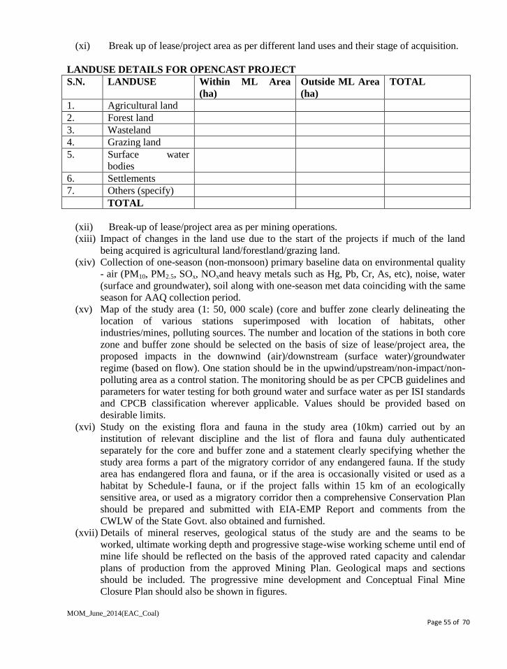
MOM_June_2014(EAC_Coal)
Page 55 of 70
(xi) Break up of lease/project area as per different land uses and their stage of acquisition.
LANDUSE DETAILS FOR OPENCAST PROJECT
S.N. LANDUSE Within ML Area
(ha)
Outside ML Area
(ha)
TOTAL
1. Agricultural land
2. Forest land
3. Wasteland
4. Grazing land
5. Surface water
bodies
6. Settlements
7. Others (specify)
TOTAL
(xii) Break-up of lease/project area as per mining operations.
(xiii) Impact of changes in the land use due to the start of the projects if much of the land
being acquired is agricultural land/forestland/grazing land.
(xiv) Collection of one-season (non-monsoon) primary baseline data on environmental quality
- air (PM10, PM2.5, SOx, NOxand heavy metals such as Hg, Pb, Cr, As, etc), noise, water
(surface and groundwater), soil along with one-season met data coinciding with the same
season for AAQ collection period.
(xv) Map of the study area (1: 50, 000 scale) (core and buffer zone clearly delineating the
location of various stations superimposed with location of habitats, other
industries/mines, polluting sources. The number and location of the stations in both core
zone and buffer zone should be selected on the basis of size of lease/project area, the
proposed impacts in the downwind (air)/downstream (surface water)/groundwater
regime (based on flow). One station should be in the upwind/upstream/non-impact/non-
polluting area as a control station. The monitoring should be as per CPCB guidelines and
parameters for water testing for both ground water and surface water as per ISI standards
and CPCB classification wherever applicable. Values should be provided based on
desirable limits.
(xvi) Study on the existing flora and fauna in the study area (10km) carried out by an
institution of relevant discipline and the list of flora and fauna duly authenticated
separately for the core and buffer zone and a statement clearly specifying whether the
study area forms a part of the migratory corridor of any endangered fauna. If the study
area has endangered flora and fauna, or if the area is occasionally visited or used as a
habitat by Schedule-I fauna, or if the project falls within 15 km of an ecologically
sensitive area, or used as a migratory corridor then a comprehensive Conservation Plan
should be prepared and submitted with EIA-EMP Report and comments from the
CWLW of the State Govt. also obtained and furnished.
(xvii) Details of mineral reserves, geological status of the study are and the seams to be
worked, ultimate working depth and progressive stage-wise working scheme until end of
mine life should be reflected on the basis of the approved rated capacity and calendar
plans of production from the approved Mining Plan. Geological maps and sections
should be included. The progressive mine development and Conceptual Final Mine
Closure Plan should also be shown in figures.

MOM_June_2014(EAC_Coal)
Page 56 of 70
(xviii) Details of mining methods, technology, equipment to be used, etc., rationale for
selection of that technology and equipment proposed to be used vis-à-vis the potential
impacts.
(xix) Impact of mining on hydrology, modification of natural drainage, diversion and
channelling of the existing rivers/water courses flowing though the ML and adjoining the
lease/project and the impact on the existing users and impacts of mining operations
thereon.
(xx) Detailed water balance should be provided. The break up of water requirement for the
various mine operations should be given separately.
(xxi) Source of water for use in mine, sanction of the competent authority in the State Govt.
and impacts vis-à-vis the competing users.
(xxii) Impact of mining and water abstraction use in mine on the hydrogeology and
groundwater regime within the core zone and 10 km buffer zone including
long?termmodelling studies on. Details of rainwater harvesting and measures for
recharge of groundwater should be reflected in case there us a declining trend of
groundwater availability and/or if the area falls within dark/grey zone.
(xxiii) Impact of blasting, noise and vibrations.
(xxiv) Impacts of mining on the AAQ, predictive modelling using the ISCST-3 (Revised) or
latest model.
(xxv) Impacts of mineral transportation ?within and outside the lease/project along with flow-
chart indicating the specific areas generating fugitive emissions. Impacts of
transportation, handling, transfer of mineral and waste on air quality, generation of
effluents from workshop, management plan for maintenance of HEMM, machinery,
equipment. Details of various facilities to be provided in terms of parking, rest areas,
canteen, and effluents/pollution load from these activities.
(xxvi) Details of waste generation ?OB, topsoil ? as per the approved calendar programme, and
their management shown in figures as well explanatory chapter with tables giving
progressive development and mine closure plan, green belt development, backfilling
programme and conceptual post mining land use. OBdump heights and terracing should
based on slope stability studies with a max of 28o angle as the ultimate slope. Sections of
dumps (ultimate) (both longitudinal and cross section) with relation to the adjacent area
should be shown.
(xxvii) Progressive Green belt and afforestation plan (both in text, figures as well as in tables
prepared by MOEF) and selection of species (local) for the afforestation/plantation
programme based on original survey/landuse.
Table 1: Stage-wise Landuse and Reclamation Area (ha)
S.N. Land use Category Present
(1st Year)
5th
Year
10th
Year
20th
year
24th
Year
(end of
Mine life)*
1. Backfilled Area(Reclaimed
with plantation)
2. Excavated Area (not
reclaimed)/void
3. External OB dump Reclaimed
with plantation)
4. Reclaimed Top soil dump
5. Green Built Area

MOM_June_2014(EAC_Coal)
Page 57 of 70
6. Undisturbed area (brought
under plantation)
7. Roads (avenue plantation)
8. Area around buildings and
Infrastructure
TOTAL
110* 110* 110* 110* 110*
* As a representative example
Table 2: Stage-wise Cumulative Plantation
S.N
.
YEAR* Green Belt External
Dump
Backfilled
Area
Others
(Undisturbed
Area/etc)
TOTAL
Area
(ha)
No. of
trees
Area
(ha)
No. of
Trees
Area
(ha)
No. of
Trees
Area
(ha)
No. of
Trees
Area
(ha)
No. of
Trees
1. 1st year
2. 3rd
year
3. 5th year
4. 10th
year
5. 15th year
6. 20th
year
7. 25th year
8. 30th year
9. 34th year
(end of mine
life)
10. 34-37th Year
(Post-mining)
85
* As a representative example
(xxviii) Conceptual Final Mine Closure Plan, post mining land use and restoration of
land/habitat to pre- mining. A Plan for the ecological restoration of the area post
mining and for land use should be prepared with detailed cost provisions. Impact and
management of wastes and issues of rehandling (wherever applicable) and backfilling
and progressive mine closure and reclamation.
Table 3: Post-Mining Landuse Pattern of ML/Project Area (ha)
S.N. Land use during
Mining
Land Use (ha)
1. External OB Dump Plantation Water
Body
Public
Use
Undisturbed TOTAL
2. Top soil Dump
3. Excavation
4. Roads
4. Built up area
5. Green Belt
6. Undisturbed Area
TOTAL 85 110

MOM_June_2014(EAC_Coal)
Page 58 of 70
(xxix) Flow chart of water balance. Treatment of effluents from workshop, township,
domestic wastewater, mine water discharge, etc. Details of STP in colony and ETP in
mine. Recycling of water to the max. possible extent.
(xxx) Occupational health issues. Baseline data on the health of the population in the impact
zone and measures for occupational health and safety of the personnel and manpower
for the mine.
(xxxi) Risk Assessment and Disaster Preparedness and Management Plan.
(xxxii) Integrating in the Env. Management Plan with measures for minimising use of natural
resources - water, land, energy, etc.
(xxxiii) Including cost of EMP (capital and recurring) in the project cost and for progressive
and final mine closure plan.
(xxxiv) Details of R&R. Detailed project specific R&R Plan with data on the existing socio-
economic status of the population (including tribals, SC/ST, BPL families) found in
the study area and broad plan for resettlement of the displaced population, site for the
resettlement colony, alternate livelihood concerns/employment for the displaced
people, civic and housing amenities being offered, etc and costs along with the
schedule of the implementation of the R&R Plan.
(xxxv) CSR Plan along with details of villages and specific budgetary provisions (capital and
recurring) for specific activities over the life of the project.
(xxxvi) Public Hearing should cover the details of notices issued in the newspaper,
proceedings/minutes of public hearing, the points raised by the general public and
commitments made by the proponent should be presented in a tabular form. If the
Public Hearing is in the regional language, an authenticated English Translation of the
same should be provided.
(xxxvii) In built mechanism of self-monitoring of compliance of environmental regulations.
(xxxx) Status of any litigations/ court cases filed/pending on the project.
(xxxxi) Submission of sample test analysis of:
Characteristics of coal - this includes grade of coal and other characteristics ?ash, S and
heavy metals including levels of Hg, As, Pb, Cr etc.
(xxxxii) Copy of clearances/approvals ? such as Forestry clearances, Mining Plan Approval,
NOC from Flood and Irrigation Dept. (if req.), etc. wherever applicable.
(A) FORESTRY CLEARANCE
*****
TOTAL
ML/PROJECT
AREA (ha)
TOTAL
FORESTLAND
(ha)
Date of FC Extent of
forestland
Balance area for
which FC is yet to
be obtained
Status of
appl. for
diversion of
forestland
If more than
one, provide
details of
each FC

MOM_June_2014(EAC_Coal)
Page 59 of 70
ANNEXURE -5
GENERIC TOR FOR AN UNDERGROUND COALMINE PROJECT
(i) An EIA-EMP Report should be prepared for a peak capacity of ????.. MTPA over an
area of ????.. ha addressing the impacts of the underground coalmine project including
the aspects of mineral transportation and issues of impacts on hydrogeology, plan for
conservation of flora/fauna and afforestation/plantation programme based on the generic
structure specified in Appendix III of the EIA Notification 2006.. Baseline data collection
can be for any season except monsoon.
(ii) The EIA-EMP report should also cover the impacts and management plan for the project
specific activities on the environment of the region, and the environmental quality ?air,
water, land, biotic community, etc. through collection of baseline data and information,
generation of baseline data on impacts for ??. MTPA of coal production based on approval
of project/Mining Plan.
(iii) A Study area map of the core zone and 10km area of the buffer zone (15 km of the buffer
zone in case of ecologically sensitive areas) delineating the major topographical features
such as the land use, drainage, locations of habitats, major construction including railways,
roads, pipelines, major industries/mines and other polluting sources, which shall also
indicate the migratory corridors of fauna, if any and the areas where endangered fauna and
plants of medicinal and economic importance are found in the area.
(iv) Map showing the core zone along with 3-5 km of the buffer zone) delineating the
agricultural land (irrigated and unirrigated, uncultivable land (as defined in the revenue
records), forest areas (as per records) and grazing land and wasteland and water bodies.
(v) Contour map at 3m interval along with Site plan of the mine (lease/project area with about
3-5 km of the buffer zone) showing the various surface structures such as buildings,
infrastructure, CHP, ETP, Stockyard, township/colony (within/adjacent to the ML), green
belt and undisturbed area and if any existing roads, drains/natural water bodies are to be
left undisturbed along with details of natural drainage adjoining the lease/project and
modification of thereof in terms of construction of embankments/bunds, proposed
diversion/rechannelling of the water courses, etc., highways, passing through the
lease/project area.
(vi) Original land use (agricultural land/forestland/grazing land/wasteland/water bodies) of the
area. Impacts of project, if any on the landuse, in particular, agricultural
land/forestland/grazing land/water bodies falling within the lease/project and acquired for
mining operations. Extent of area under surface rights and under mining rights.
S.N. ML/Project
Land use
Area under
Surface Rights
(ha)
Area Under Mining
Rights (ha)
Area under
Both (ha)
1. Agricultural land
2. ForestLand
3. Grazing Land
4. Settlements
5. Others (specify)
Area Under Surface Rights

MOM_June_2014(EAC_Coal)
Page 60 of 70
S.N. Details Area (ha)
1. Buildings
2. Infrastructure
3. Roads
4. Others (specify)
TOTAL
(vii) Study on the existing flora and fauna in the study area carried out by an institution of
relevant discipline and the list of flora and fauna duly authenticated separately for the
core and buffer zone and a statement clearly specifying whether the study area forms a
part of the migratory corridor of any endangered fauna. The flora and fauna details
should be furnished separately for the core zone and buffer zone. The report and the list
should be authenticated by the concerned institution carrying out the study and the
names of the species scientific and common names) along with the classification under
the Wild Life Protection Act, 1972 should be furnished.
(viii) Details of mineral reserves, geological status of the study area and the seams to be
worked, ultimate working depth and progressive stage-wise working plan/scheme until
end of mine life should be reflected on the basis of the approved rated capacity and
calendar plans of production from the approved Mining Plan. Geological maps should
also be included.
(ix) Impact of mining on hydrology, modification of natural drainage, diversion and
channelling of the existing rivers/water courses flowing though the ML and adjoining
the lease/project and the impact on the existing users and impacts of mining operations
thereon.
(x) Collection of one-season (non-monsoon) primary baseline data on environmental
quality ? air (PM10, PM2.5, SOx, NOx and heavy metals such as Hg, Pb, Cr, AS, etc),
noise, water (surface and groundwater), soil along with one-season met data.
(xi) Map of the study area (core and buffer zone) clearly delineating the location of various
monitoring stations (air/water/soil and noise ? each shown separately) superimposed
with location of habitats, wind roses, other industries/mines, polluting sources. The
number and location of the stations should be selected on the basis of the proposed
impacts in the downwind/downstream/groundwater regime. One station should be in the
upwind/upstream/non-impact non-polluting area as a control station. Wind roses to
determine air pollutant dispersion and impacts thereof shall be determined. Monitoring
should be as per CPCB guidelines and standards for air, water, noise notified under
Environment Protection Rules. Parameters for water testing for both ground and surface
water should be as per ISI standards and CPCB classification of surface water wherever
applicable.
(xii) Impact of mining and water abstraction and mine water discharge in mine on the
hydrogeology and groundwater regime within the core zone and 10km buffer zone
including long?termmodelling studies on the impact of mining on the groundwater
regime. Details of rainwater harvesting and measures for recharge of groundwater
should be reflected wherever the areas are declared dark/grey from groundwater
development.
(xiii) Study on subsidence, measures for mitigation/prevention of subsidence, modelling
subsidence prediction and its use during mine operation, safety issues.

MOM_June_2014(EAC_Coal)
Page 61 of 70
(xiv) Detailed water balance should be provided. The break up of water requirement as per
different activities in the mining operations, including use of water for sand stowing
should be given separately. Source of water for use in mine, sanction of the competent
authority in the State Govt. and impacts vis-à-vis the competing users should be
provided.
(xv) Impact of choice of mining method, technology, selected use of machinery - and impact
on air quality, mineral transportation, coal handling & storage/stockyard, etc, Impact of
blasting, noise and vibrations.
(xvi) Impacts of mineral transportation ?within and outside the lease/project. The entire
sequence of mineral production, transportation, handling, transfer and storage of
mineral and waste, and their impacts on air quality should be shown in a flow chart with
the specific points where fugitive emissions can arise and the specific pollution
control/mitigative measures proposed to be put in place. Examine the adequacy of roads
existing in the area and if new roads are proposed, the impact of their construction and
use particularly if forestland is used.
(xvii) Details of various facilities to be provided in terms of parking, rest areas, canteen, and
effluents/pollution load from these activities. Examine whether existing roads are
adequate to take care of the additional load of mineral and their impacts.
(xviii) Examine the number and efficiency of mobile/static water sprinkling system along the
main mineral transportation road within the mine, approach roads to the
mine/stockyard/siding, and also the frequency of their use in impacting air quality.
(xix) Impacts of CHP, if any on air and water quality. A flow chart of water use and whether
the unit can be made a zero-discharge unit.
(xx) Conceptual Final Mine Closure Plan along with the fund requirement for the detailed
activities proposed there under. Impacts of change in land use for mining operations
and whether the land can be restored for agricultural use post mining. \
Table 1 Stage-wise Cumulative Plantation
S.N. YEAR* Green Belt External
Dump
Backfilled
Area
Others
(Undisturbed
Area/etc)
TOTAL
Area
(ha)
No.
of
trees
Area
(ha)
No.
of
Trees
Area
(ha)
No.
of
Trees
Area
(ha)
No.
of
Trees
Area
(ha)
No. of
Trees
1. 1st year
2. 3rd
year
3. 5th year
4. 10thyesr
5. 15thyear
6. 20th year
7. 25th year
8. 30th year
9. 34th year
(end of
mine life)
10. 34-37th
Year (Post-
mining)
85* 2,12,500

MOM_June_2014(EAC_Coal)
Page 62 of 70
*As a representative example
(xxi) Occupational health issues. Baseline data on the health of the population in the impact
zone and measures for occupational health and safety of the personnel and manpower
for the mine should be furnished.
(xxii) Details of cost of EMP (capital and recurring) in the project cost and for final mine
closure plan. The specific costs (capital and recurring) of each pollution
control/mitigative measures proposed in the project until end of mine life and a
statement that this is included in the project cost.
(xxiii) Integrating in the Env. Management Plan with measures for minimising use of natural
resources ?water, land, energy, raw materials/mineral, etc.
(xxiv) R&R: Detailed project specific R&R Plan with data on the existing socio-economic
status (including tribals, SC/ST) of the population in the study area and broad plan for
resettlement of the displaced population, site for the resettlement colony, alternate
livelihood concerns/employment for the displaced people, civic and housing amenities
being offered, etc and costs along with the schedule of the implementation of the R&R
Plan.
(xxv) CSR Plan along with details of villages and specific budgetary provisions (capital and
recurring) for specific activities over the life of the project.
(xxvi) Public Hearing should cover the details as specified in the EIA Notification 2006, and
include notices issued in the newspaper, proceedings/minutes of public hearing, the
points raised by the general public and commitments by the proponent made should be
presented in a tabular form. If the Public Hearing is in the regional language, an
authenticated English Translation of the same should be provided.
(xxvii) Status of any litigations/ court cases filed/pending in any Court/Tribunal on the project
should be furnished.
(xxxvii) Submission of sample test analysis of:
(xxxvii) Characteristics of coal - this includes grade of coal and other characteristics ? ash, and
heavy metals including levels of Hg, As, Pb, Cr etc.
(xxxviii) Copy of clearances/approvals ?such as Forestry clearances, Mining Plan
Approval, NOC from Flood and Irrigation Dept. (if req.), etc.
FORESTRY CLEARANCE
******
TOTAL
ML/PROJECT
AREA (ha)
TOTAL
FORESTLAND
(ha)
Date of
FC
Extent of
forestland
Balance area
for which FC is
yet to be
obtained
Status of appl.
for diversion of
forestland
If more
than one,
provide
details of
each FC

MOM_June_2014(EAC_Coal)
Page 63 of 70
ANNEXURE-6
GENERIC TOR FOR AN OPENCAST-CUM-UNDERGROUND COALMINE
PROJECT
(i) An EIA-EMP Report would be prepared for a combined rated capacity of??..MTPA
for OC-cum-UG project which consists of ??. MTPA for OC and ???. MTPA for UG in
an ML/project area of ??ha based on the generic structure specified in Appendix III of
the EIA Notification 2006.
(ii) An EIA-EMP Report would be prepared for ??. MTPA rated capacity cover the impacts
and management plan for the project specific activities on the environment of the
region, and the environmental quality ?air, water, land, biotic community, etc. through
collection of data and information, generation of data on impacts including prediction
modelling for ???. MTPA of coal production based on approval of project/Mining Plan
for ??.. MTPA. Baseline data collection can be for any season except monsoon.
(iii) A map specifying locations of the State, District and Project location.
(iv) A Study area map of the core zone and 10km area of the buffer zone (1: 50,000 scale)
clearly delineating the major topographical features such as the land use, surface
drainage of rivers/streams/nalas/canals, locations of human habitations, major
constructions including railways, roads, pipelines, major industries/mines and other
polluting sources. In case of ecologically sensitive areas such as Biosphere
Reserves/National Parks/WL Sanctuaries/ Elephant Reserves, forests
(Reserved/Protected), migratory corridors of fauna, and areas where endangered fauna
and plants of medicinal and economic importance found in the 15 km area of the buffer
zone should be given.
(v) Land use map (1: 50,000 scale) based on a recent satellite imagery of the study area
may also be provided with explanatory note of the land use. Satellite imagery per se is
not required.
(vi) Map showing the core zone delineating the agricultural land (irrigated and unirrigated,
uncultivable land (as defined in the revenue records), forest areas (as per records),
along with other physical features such as water bodies, etc should be furnished.
(vii) A contour map showing the area drainage of the core zone and 2-5 km of the buffer
zone (where the water courses of the core zone ultimately join the major rivers/streams
outside the lease/project area) should also be clearly indicated as a separate map.
(viii) A detailed Site plan of the mine showing the various proposed break-up of the land for
mining operations such as the quarry area, OB dumps, green belt, safety zone,
buildings, infrastructure, CHP, ETP, Stockyard, township/colony (within and adjacent
to the ML), undisturbed area and if any, in topography such as existing roads,
drains/natural water bodies are to be left undisturbed along with any natural drainage
adjoining the lease /project and modification of thereof in terms of construction of
embankments/bunds, proposed diversion/rechannelling of the water courses, etc.,
approach roads, major haul roads, etc.
(ix) In case of any proposed diversion of nallah/canal/river, the proposed route of
diversion/modification of drainage and their realignment, construction of embankment
etc. should also be shown on the map.
(x) Similarly if the project involves diversion of any road/railway line passing through the
ML/project area, the proposed route of diversion and its realignment should be shown.

MOM_June_2014(EAC_Coal)
Page 64 of 70
(xi) Break up of lease/project area as per different land uses and their stage of acquisition.
LANDUSE DETAILS FOR OPENCAST PROJECT
S.N. LANDUSE Within ML Area
(ha)
Outside ML Area
(ha)
TOTAL
(ha)
1. Agricultural land
2. Forest land
3. Wasteland
4. Grazing land
5. Surface water
bodies
6. Settlements
7. Others (specify)
TOTAL
LANDUSE DETAILS FOR UNDERGROUND PROJECT
S.N. ML/Project
Land use
Area under
Surface Rights
(ha)
Area Under Mining
Rights (ha)
Area under
Both (ha)
1. Agricultural land
2. ForestLand
3. Grazing Land
4. Wasteland
5. Water Bodies
6. Settlements
7. Others (specify)
TOTAL
Area Under Surface Rights
S.N. Details Area (ha)
1. Buildings
2. Infrastructure
3. Roads
4. Others (specify)
TOTAL
(xii) Break-up of lease/project area as per mining operations.
(xiii) Impact of changes in the land use due to the start of the projects if much of the land
being acquired is agricultural land/forestland/grazing land.
(xiv) Collection of one-season (non-monsoon) primary baseline data on environmental
quality - air (PM10, PM2.5, SOx, NOx and heavy metals such as Hg, Pb, Cr, As, etc),
noise, water (surface and groundwater), soil along with one-season met data.

MOM_June_2014(EAC_Coal)
Page 65 of 70
(xv) Map of the study area (1: 50, 000 scale) (core and buffer zone clearly delineating the
location of various stations superimposed with location of habitats, other
industries/mines, polluting sources. The number and location of the stations in both
core zone and buffer zone should be selected on the basis of size of lease/project area,
the proposed impacts in the downwind (air)/downstream (surface water)/groundwater
regime (based on flow). One station should be in the upwind/upstream/non-impact/non-
polluting area as a control station. The monitoring should be as per CPCB guidelines
and parameters for water testing for both ground water and surface water as per ISI
standards and CPCB classification wherever applicable. Values should be presented in
comparison to desirable limits.
(xvi) Study on the existing flora and fauna in the study area (10km) carried out by an
institution of relevant discipline and the list of flora and fauna duly authenticated
separately for the core and buffer zone and a statement clearly specifying whether the
study area forms a part of the migratory corridor of any endangered fauna. If the study
area has endangered flora and fauna, or if the project falls within 15 km of an
ecologically sensitive area, then a comprehensive Conservation Plan should be
prepared and furnished along with comments from the CWLW of the State Govt.
(xvii) Details of mineral reserves, geological status of the study are and the seams to be
worked, ultimate working depth and progressive stage-wise working scheme until end
of mine life should be reflected on the basis of the approved rated capacity and
calendar plans of production from the approved Mining Plan. Geological maps and
sections should be included. The progressive mine development and final mine closure
plan should also be shown in figures.
(xviii) Details of mining methods, technology, equipment to be used, etc., rationale for
selection of that technology and equipment proposed to be used vis-à-vis the potential
impacts.
(xix) Study on subsidence, measures for mitigation/prevention of subsidence, modelling
subsidence prediction and its use during mine operation, safety issues.
(xx) Impact of mining on hydrology, modification of natural drainage, diversion and
channelling of the existing rivers/water courses flowing though the ML and adjoining
the lease/project and the impact on the existing users and impacts of mining operations
thereon.
(xxi) Detailed water balance should be provided. The break up of water requirement for the
various mine operations should be given separately.
(xxii) Source of water for use in mine, sanction of the competent authority in the State Govt.
and impacts vis-à-vis the competing users.
(xxiii) Impact of mining and water abstraction use in mine on the hydrogeology and
groundwater regime within the core zone and 10 km buffer zone including
long?termmodelling studies on. Details of rainwater harvesting and measures for
recharge of groundwater should be reflected in case there us a declining trend of
groundwater availability and/or if the area falls within dark/grey zone.
(xxiv) Impact of blasting, noise and vibrations.
(xxv) Impacts of mining on the AAQ, predictive modelling using the ISCST-3 (Revised) or
latest model.
(xxvi) Impacts of mineral transportation ?within and outside the lease/project along with flow-
chart indicating the specific areas generating fugitive emissions. Impacts of
transportation, handling, transfer of mineral and waste on air quality, generation of
effluents from workshop, management plan for maintenance of HEMM, machinery,

MOM_June_2014(EAC_Coal)
Page 66 of 70
equipment. Details of various facilities to be provided in terms of parking, rest areas,
canteen, and effluents/pollution load from these activities.
(xxvii) Details of waste generation ?OB, topsoil ? as per the approved calendar programme,
and their management shown in figures as well explanatory chapter with tables giving
progressive development and mine closure plan, green belt development, backfilling
programme and conceptual post mining land use. OBdump heights and terracing should
based on slope stability studies with a max of 28o angle as the ultimate slope. Sections
of dumps (ultimate) (both longitudinal and cross section) with relation to the adjacent
area should be shown.
(xxviii) Impact and management of wastes and issues of rehandling and backfilling and
progressive mine closure and reclamation.
(xxix) Flow chart of water balance. Treatment of effluents from workshop, township,
domestic wastewater, mine water discharge, etc. Details of STP in colony and ETP in
mine. Recycling of water to the max. possible extent.
(xxx) Occupational health issues. Baseline data on the health of the population in the impact
zone and measures for occupational health and safety of the personnel and manpower
for the mine.
(xxxi) Risk Assessment and Disaster Preparedness and Management Plan.
(xxxii) Integrating in the Env. Management Plan with measures for minimising use of natural
resources - water, land, energy, etc.
(xxxiii) Progressive Green belt and afforestation plan (both in text, figures as well as in tables
prepared by MOEF given below) and selection of species (local) for the
afforestation/plantation programme based on original survey/landuse.
Table 1: Stage-wise Landuse and Reclamation Area (ha)
S.N. Land use Category Present
(1st Year)
5th
Year
10th
Year
20th
year
24th
Year
(end of Mine
life)*
1. Backfilled Area (Reclaimed
with plantation)
2. Excavated Area (not
reclaimed)/void
3. External OB dump
Reclaimed with plantation)
4. Reclaimed Top soil dump
5. Green Built Area
6. Undisturbed area (brought
under plantation)
7. Roads (avenue plantation)
8. Area around buildings and
Infrastructure
TOTAL
110 110 110 110 110
* Representative case as an example

MOM_June_2014(EAC_Coal)
Page 67 of 70
Table 2: Stage-wise Cumulative Plantation
S.N. YEAR* Green Belt External
Dump
Backfilled
Area
Others
(Undisturbed
Area/etc)
TOTAL
Area
(ha)
No.
of
trees
Area
(ha)
No.
of
Trees
Area
(ha)
No.
of
Trees
Area
(ha)
No. of
Trees
Area
(ha)
No. of
Trees
1. 1st year
2. 3rd
year
3. 5th year
4. 10th year
5. 15th year
6. 20th year
7. 25th year
8. 30th year
9. 34th year
(end of
mine life)
10. 34-37th
Year (Post-
mining)
85
* Representative case as an example
(xxxiv) Conservation Plan for the endangered/endemic flora and fauna found in the study area
and for safety of animals visiting/residing in the study area and also those using the
study area as a migratory corridor.
(xxxv) Conceptual Final Mine Closure Plan, post mining land use and restoration of
land/habitat to pre- mining. A Plan for the ecological restoration of the area post
mining and for land use should be prepared with detailed cost provisions.
Table 3: Post-Mining Landuse Pattern of ML/Project Area (ha)
S.N. Land use during
Mining
Land Use (ha)
1. External OB
Dump
Plantation Water
Body
Public
Use
Undisturbed TOTAL
2. Top soil Dump
3. Excavation
4. Roads
4. Built up area
5. Green Belt
6. Undisturbed Area
TOTAL 85 110
(xxxvi) Including cost of EMP (capital and recurring) in the project cost and for progressive
and final mine closure plan.

MOM_June_2014(EAC_Coal)
Page 68 of 70
(xxxvii) Details of R&R. Detailed project specific R&R Plan with data on the existing socio-
economic status of the population (including tribals, SC/ST, BPL families) found in the
study area and broad plan for resettlement of the displaced population, site for the
resettlement colony, alternate livelihood concerns/employment for the displaced
people, civic and housing amenities being offered, etc and costs along with the
schedule of the implementation of the R&R Plan.
(xxxviii) CSR Plan along with details of villages and specific budgetary provisions (capital and
recurring) for specific activities over the life of the project.
(xxxix) Public Hearing should cover the details of notices issued in the newspaper,
proceedings/minutes of public hearing, the points raised by the general public and
commitments made by the proponent should be presented in a tabular form. If the Public
Hearing is in the regional language, an authenticated English Translation of the same
should be provided.
(xxxx) In built mechanism of self-monitoring of compliance of environmental regulations.
(xxxxi) Status of any litigations/ court cases filed/pending on the project.
(xxxxii) Submission of sample test analysis of:
Characteristics of coal - this includes grade of coal and other characteristics ?ash, S and
heavy metals including levels of Hg, As, Pb, Cr etc.
(xxxxiii) Copy of clearances/approvals ? such as Forestry clearances, Mining Plan Approval,
NOC from Flood and Irrigation Dept. (if req.), etc.
(A) FORESTRY CLEARANCE
TOTAL
ML/PROJECT
AREA (ha)
TOTAL
FORESTLAND
(ha)
Date of FC Extent of
forestland
In the FC
Balance area
for which
FC is yet to
be obtained
Status of appl.
for diversion
of
Balance
forestland
If more
than one,
provide
details of
each FC
Copies of forestry clearance letters (all, if there are more than one)
(A) MINING PLAN APPROVAL
(B) MINING PLAN/PROJECT APPROVAL
Date of Approval of Mining Plan/Project Approval:
Copy of Letter of Approval of Mining Plan/Project Approval
(xxxxiv) Corporate Environment Responsibility:

MOM_June_2014(EAC_Coal)
Page 69 of 70
b) The Company must have a well laid down Environment Policy approved by the
Board of Directors.
c) The Environment Policy must prescribe for standard operating
process/procedures to bring into focus any infringements/deviation/violation of
the environmental or forest norms/conditions.
d) The hierarchical system or Administrative Order of the company to deal with
environmental issues and for ensuring compliance with the environmental
clearance conditions must be furnished.
d) To have proper checks and balances, the company should have a well laid down
system of reporting of non-compliances/violations of environmental norms to
the Board of Directors of the company and/or shareholders or stakeholders at
large.
*******

MOM_June_2014(EAC_Coal)
Page 70 of 70
ANNEXURE-7
GENERAL CONDITIONS AND ADDITIONAL POINTS OF TOR
The following general points should be noted:
(i) All documents should be properly indexed, page numbered.
(ii) Period/date of data collection should be clearly indicated.
(iii) Authenticated English translation of all material provided in Regional languages.
(iv) After the preparation of the draft EIA-EMP Report as per the aforesaid TOR, the
proponent shall get the Public Hearing conducted as prescribed in the EIA Notification
2006 and take necessary action for obtaining environmental clearance under the
provisions of the EIA Notification 2006.
(v) The letter/application for EC should quote the MOEF file No. and also attach a copy of
the letter prescribing the TOR.
(vi) The copy of the letter received from the Ministry on the TOR prescribed for the project
should be attached as an annexure to the final EIA-EMP Report.
(vii) The final EIA-EMP report submitted to the Ministry must incorporate the issues in TOR
and that raised in Public Hearing. The index of the final EIA-EMP report, must indicate
the specific chapter and page no. of the EIA-EMP Report where the specific TOR
prescribed by Ministry and the issue raised in the P.H. have been incorporated. Mining
Questionnaire (posted on MOEF website) with all sections duly filled in shall also be
submitted at the time of applying for EC.
(viii) General Instructions for the preparation and presentation before the EAC of TOR/EC
projects of Coal Sector should be incorporated/followed.
(viii) The aforesaid TOR has a validity of two years only.
The following additional points are also to be noted:
(i) Grant of TOR does not necessarily mean grant of EC.
(ii) Grant of TOR/EC to the present project does not necessarily mean grant of
TOR/EC to the captive/linked project.
(iii) Grant of TOR/EC to the present project does not necessarily mean grant of
approvals in other regulations such as the Forest (Conservation) Act 1980 or the
Wildlife (Protection) Act, 1972.
(iv) Grant of EC is also subject to Circulars issued under the EIA Notification 2006,
which are available on the MOEF website: www.envfor.nic.in
______