memorandum - ncleg.gov
TRANSCRIPT
MEMORANDUM
TO: ENVIRONMENTAL REVIEW COMMISSION
The Honorable Jimmy Dixon, Co-Chairman The Honorable Chuck McGrady, Co-Chairman The Honorable Trudy Wade, Co-Chairman
FROM: Mollie Young, Director of Legislative Affairs
SUBJECT: Coastal Habitat Protection Plan
Pursuant to S.L.1997-400; Section 3.1(f), The Secretary of Environment, Health, and Natural Resources shall report to the Environmental Review Commission and the Joint Legislative Commission on Seafood and Aquaculture within 30 days of the completion or substantial revision of each draft Coastal Habitat Protection Plan. The Environmental Review Commission and the Joint Legislative Commission on Seafood and Aquaculture shall concurrently review each draft Coastal Habitat Protection Plan within 30 days of the date the draft Plan is submitted by the Secretary. The Environmental Review Commission and the Joint Legislative Commission on Seafood and Aquaculture may submit comments and recommendations on the draft Plan to the Secretary within 30 days of the date the draft Plan is submitted by the Secretary.
If you have any questions or need additional information, please contact me by phone at 919-707-8618 or by email at [email protected].
cc: Tom Reeder, Assistant Secretary for Environment, NCDEQ Braxton Davis, Director of Coastal Management, Marine Fisheries, NCDEQ Jennifer McGinnis, ERC Counsel, NCGA
North Carolina Coastal
Habitat Protection Plan Final Draft, May 2016
NC Department of Environmental Quality
Enhancing coastal fisheries through habitat protection and restoration
2
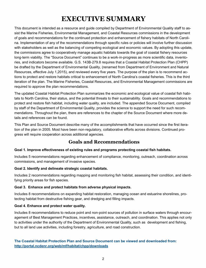
EXECUTIVE SUMMARY
This document is intended as a resource and guide compiled by Department of Environmental Quality staff to as-
sist the Marine Fisheries, Environmental Management, and Coastal Resources commissions in the development
of goals and recommendations for the continued protection and enhancement of fishery habitats of North Caroli-
na. Implementation of any of the recommendations through specific rules or policies will involve further discussion
with stakeholders as well as the balancing of competing ecological and economic values. By adopting this update,
the commissions agree to cooperatively manage aquatic habitats towards the goal of coastal fishery resources
long-term viability. The “Source Document” continues to be a work-in-progress as more scientific data, invento-
ries, and indicators become available. G.S. 143B-279.8 requires that a Coastal Habitat Protection Plan (CHPP)
be drafted by the Department of Environmental Quality, (renamed from Department of Environment and Natural
Resources, effective July 1,2015), and reviewed every five years. The purpose of the plan is to recommend ac-
tions to protect and restore habitats critical to enhancement of North Carolina’s coastal fisheries. This is the third
iteration of the plan. The Marine Fisheries, Coastal Resources, and Environmental Management commissions are
required to approve the plan recommendations.
The updated Coastal Habitat Protection Plan summarizes the economic and ecological value of coastal fish habi-
tats to North Carolina, their status, and the potential threats to their sustainability. Goals and recommendations to
protect and restore fish habitat, including water quality, are included. The appended Source Document, compiled
by staff of the Department of Environmental Quality, provides the science to support the need for such recom-
mendations. Throughout the plan, there are references to the chapter of the Source Document where more de-
tails and references can be found.
This Plan and Source Document describe many of the accomplishments that have occurred since the first itera-
tion of the plan in 2005. Most have been non-regulatory, collaborative efforts across divisions. Continued pro-
gress will require cooperation across additional agencies.
Goals and Recommendations
Goal 1. Improve effectiveness of existing rules and programs protecting coastal fish habitats.
Includes 5 recommendations regarding enhancement of compliance, monitoring, outreach, coordination across
commissions, and management of invasive species.
Goal 2. Identify and delineate strategic coastal habitats.
Includes 2 recommendations regarding mapping and monitoring fish habitat, assessing their condition, and identi-
fying priority areas for fish species.
Goal 3. Enhance and protect habitats from adverse physical impacts.
Includes 8 recommendations on expanding habitat restoration, managing ocean and estuarine shorelines, pro-
tecting habitat from destructive fishing gear, and dredging and filling impacts.
Goal 4. Enhance and protect water quality.
Includes 8 recommendations to reduce point and non-point sources of pollution in surface waters through encour-
agement of Best Management Practices, incentives, assistance, outreach, and coordination. This applies not only
to activities under the authority of the Department of Environmental Quality, such as development and fishing,
but to all land use activities, including forestry, agriculture, and road construction.
The Coastal Habitat Protection Plan and Source Document can be viewed and downloaded from:
http://portal.ncdenr.org/web/mf/habitat/chpp/downloads
3
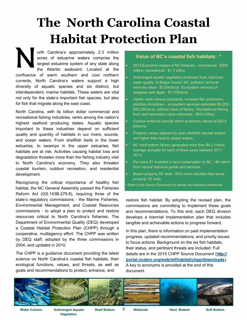
Value of NC’s coastal fish habitats: *
2013 Economic impact of NC fisheries: commercial - $305
million; recreational - $1.7 billion.
Submerged aquatic vegetation produces food, improves
water quality. In Bogue Sound, NC, pollution removal
services value - $3,000/ac/yr. Ecosystem services of
seagrass and algae - $7,700/ac/yr.
Oyster reefs remove pollutants, increase fish production,
stabilize shorelines – ecosystem services estimated $2,200 -
$40,200/ac/yr, without value of fishery. Recreational fishing
from reef restoration value estimated - $640,000/yr.
Coastal wetlands provide storm protection valued at $25.6
billion/yr.
Property values adjacent to open shellfish harvest waters
are higher than next to closed waters.
NC hard bottom fishery generated more than $4.2 million
average annually for each of three years between 2011-
2013.
For every $1 invested in land conservation in NC, ~$4 return
from natural resource goods and services.
Beach property 80’ wide ~35% more valuable than same
property 79’ wide.
* Refer to the Source Document for details and literature references.
orth Carolina’s approximately 2.3 million
acres of estuarine waters comprise the
largest estuarine system of any state along
the Atlantic seaboard. Located at the
confluence of warm southern and cool northern
currents, North Carolina’s waters support a high
diversity of aquatic species and six distinct, but
interdependent, marine habitats. These waters are vital
not only for the state’s important fish species, but also
for fish that migrate along the east coast.
North Carolina, with its billion dollar commercial and
recreational fishing industries, ranks among the nation’s
highest seafood producing states. Aquatic species
important to these industries depend on sufficient
quality and quantity of habitats in our rivers, sounds,
and ocean waters. From shellfish beds in the lower
estuaries, to swamps in the upper estuaries, fish
habitats are at risk. Activities causing habitat loss and
degradation threaten more than the fishing industry vital
to North Carolina’s economy. They also threaten
coastal tourism, outdoor recreation, and residential
development.
Recognizing the critical importance of healthy fish
habitat, the NC General Assembly passed the Fisheries
Reform Act (GS.143B-279.8), requiring three of the
state’s regulatory commissions - the Marine Fisheries,
Environmental Management, and Coastal Resources
commissions - to adopt a plan to protect and restore
resources critical to North Carolina’s fisheries. The
Department of Environmental Quality (DEQ) developed
a Coastal Habitat Protection Plan (CHPP) through a
cooperative, multiagency effort. The CHPP was written
by DEQ staff, adopted by the three commissions in
2004, and updated in 2010.
The CHPP is a guidance document providing the latest
science on North Carolina’s coastal fish habitats, their
ecological functions, values, and threats, as well as
goals and recommendations to protect, enhance, and
restore fish habitat. By adopting the revised plan, the
commissions are committing to implement these goals
and recommendations. To this end, each DEQ division
develops a biennial implementation plan that includes
tangible and achievable actions to progress forward.
In this plan, there is information on past implementation
progress, updated recommendations, and priority issues
to focus actions. Background on the six fish habitats,
their status, and pertinent threats are included. Full
details are in the 2015 CHPP Source Document (http://
portal.ncdenr.org/web/mf/habitat/chpp/downloads).
A key to acronyms is provided at the end of this
document.
Water Column Submerged Aquatic Shell Bottom Wetlands Hard Bottom Soft Bottom
Vegetation
N The North Carolina Coastal
Habitat Protection Plan
4
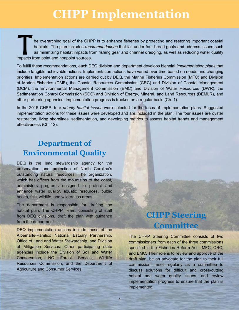
he overarching goal of the CHPP is to enhance fisheries by protecting and restoring important coastal
habitats. The plan includes recommendations that fall under four broad goals and address issues such
as minimizing habitat impacts from fishing gear and channel dredging, as well as reducing water quality
impacts from point and nonpoint sources.
To fulfill these recommendations, each DEQ division and department develops biennial implementation plans that
include tangible achievable actions. Implementation actions have varied over time based on needs and changing
priorities. Implementation actions are carried out by DEQ, the Marine Fisheries Commission (MFC) and Division
of Marine Fisheries (DMF), the Coastal Resources Commission (CRC) and Division of Coastal Management
(DCM), the Environmental Management Commission (EMC) and Division of Water Resources (DWR), the
Sedimentation Control Commission (SCC) and Division of Energy, Mineral, and Land Resources (DEMLR), and
other partnering agencies. Implementation progress is tracked on a regular basis (Ch. 1).
In the 2015 CHPP, four priority habitat issues were selected for the focus of implementation plans. Suggested
implementation actions for these issues were developed and are included in the plan. The four issues are oyster
restoration, living shorelines, sedimentation, and developing metrics to assess habitat trends and management
effectiveness (Ch. 12).
Department of
Environmental Quality
DEQ is the lead stewardship agency for the
preservation and protection of North Carolina’s
outstanding natural resources. The organization,
which has offices from the mountains to the coast,
administers programs designed to protect and
enhance water quality, aquatic resources, public
health, fish, wildlife, and wilderness areas.
The department is responsible for drafting the
habitat plan. The CHPP Team, consisting of staff
from DEQ divisions, draft the plan with guidance
from the department.
DEQ implementation actions include those of the
Albemarle-Pamlico National Estuary Partnership,
Office of Land and Water Stewardship, and Division
of Mitigation Services. Other participating state
agencies include the Division of Soil and Water
Conservation, NC Forest Service, Wildlife
Resources Commission, and the Department of
Agriculture and Consumer Services.
CHPP Implementation
T
CHPP Steering
Committee
The CHPP Steering Committee consists of two
commissioners from each of the three commissions
specified in the Fisheries Reform Act - MFC, CRC,
and EMC. Their role is to review and approve of the
draft plan, be an advocate for the plan to their full
commission, meet regularly as a committee to
discuss solutions for difficult and cross-cutting
habitat and water quality issues, and review
implementation progress to ensure that the plan is
implemented.
5
Division of Water Resources The DWR’s mission is to protect, preserve, enhance, and
manage North Carolina’s surface water and groundwater
resources for the health and welfare of the citizens of North
Carolina and the economic well-being of the state. This division
functions under the rulemaking authority of the EMC.
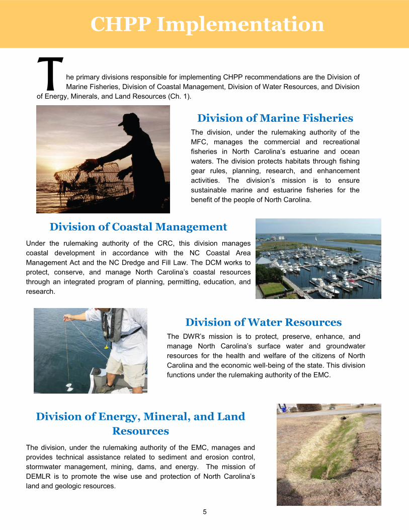
Division of Marine Fisheries The division, under the rulemaking authority of the
MFC, manages the commercial and recreational
fisheries in North Carolina’s estuarine and ocean
waters. The division protects habitats through fishing
gear rules, planning, research, and enhancement
activities. The division’s mission is to ensure
sustainable marine and estuarine fisheries for the
benefit of the people of North Carolina.
Division of Coastal Management
Under the rulemaking authority of the CRC, this division manages
coastal development in accordance with the NC Coastal Area
Management Act and the NC Dredge and Fill Law. The DCM works to
protect, conserve, and manage North Carolina’s coastal resources
through an integrated program of planning, permitting, education, and
research.
Division of Energy, Mineral, and Land
Resources
The division, under the rulemaking authority of the EMC, manages and
provides technical assistance related to sediment and erosion control,
stormwater management, mining, dams, and energy. The mission of
DEMLR is to promote the wise use and protection of North Carolina’s
land and geologic resources.
he primary divisions responsible for implementing CHPP recommendations are the Division of
Marine Fisheries, Division of Coastal Management, Division of Water Resources, and Division
of Energy, Minerals, and Land Resources (Ch. 1). T
CHPP Implementation
6
Implementation Progress
S
Mapping and assessing habitat condition Since 2005, much progress has been
made in submerged aquatic vegetation (SAV) mapping. Through a coordinated partnership of APNEP, DMF, DCM, DWR, and others, the entire coast was mapped in 2007-2008, with portions repeated in 2013 and 2015. A monitoring plan was developed to improve mapping methods in low salinity waters and to allow repeat mapping to evaluate change over time (Ch. 4).
DMF accelerated estuarine shellfish bottom mapping (to a maximum water depth of 15 ft). Mapping is now over 95% complete (Ch. 3).
DCM mapped the coastal estuarine shoreline and shoreline structures such as bulkheads and piers (Ch.8).
DMF has developed and begun a process to identify a subset of strategic habitats, based on their condition and location. This will allow conservation measures to focus on priority areas (Ch. 13).
ubstantial implementation progress has been made over the past ten years, with some positive habitat signs evident. In addition, some fishery species’ populations have rebounded or are showing strong signs of recovery. Examples include spotted seatrout, red drum, gag grouper, black sea bass, oysters, and bay scallops. While this advancement cannot be directly or solely related to habitat improvement, it is a positive indication for management overall. Some examples of implementation success are below (Ch. 1).
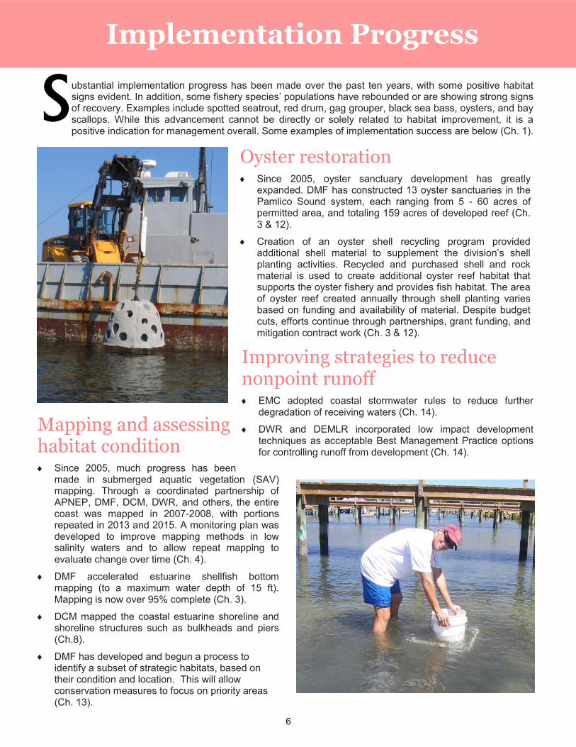
Oyster restoration Since 2005, oyster sanctuary development has greatly
expanded. DMF has constructed 13 oyster sanctuaries in the Pamlico Sound system, each ranging from 5 - 60 acres of permitted area, and totaling 159 acres of developed reef (Ch. 3 & 12).
Creation of an oyster shell recycling program provided additional shell material to supplement the division’s shell planting activities. Recycled and purchased shell and rock material is used to create additional oyster reef habitat that supports the oyster fishery and provides fish habitat. The area of oyster reef created annually through shell planting varies based on funding and availability of material. Despite budget cuts, efforts continue through partnerships, grant funding, and mitigation contract work (Ch. 3 & 12).
Improving strategies to reduce nonpoint runoff EMC adopted coastal stormwater rules to reduce further
degradation of receiving waters (Ch. 14).
DWR and DEMLR incorporated low impact development techniques as acceptable Best Management Practice options for controlling runoff from development (Ch. 14).
7
Managing shorelines
DCM developed sediment criteria for beach nourishment and a Beach and Inlet Management Plan that provides guidelines for ocean beach nourishment to minimize ecological impacts and address socioeconomic concerns (Ch. 8).
DCM has taken several actions to encourage greater use of living shorelines for estuarine shoreline stabilization. Working with DMF, DWR, and other agencies, DCM surveyed living shorelines for success, and agencies worked to simplify the permitting process. Outreach to multiple audiences through workshops, written material, and websites continues (Ch. 8).
Coordination and compliance Regular CHPP Steering Committee meetings and CHPP quarterly permit reviewer meetings have greatly improved collaboration among divisions and problem solving on cross-cutting issues. New compliance positions were established in several divisions through appropriated funds, allowing greater assessment of compliance. However, due to budget shortfalls and resulting staff reductions over the past few years, divisions have maintained compliance monitoring through reorganization, reprioritization, and placing additional responsibilities on staff. (Ch. 1).
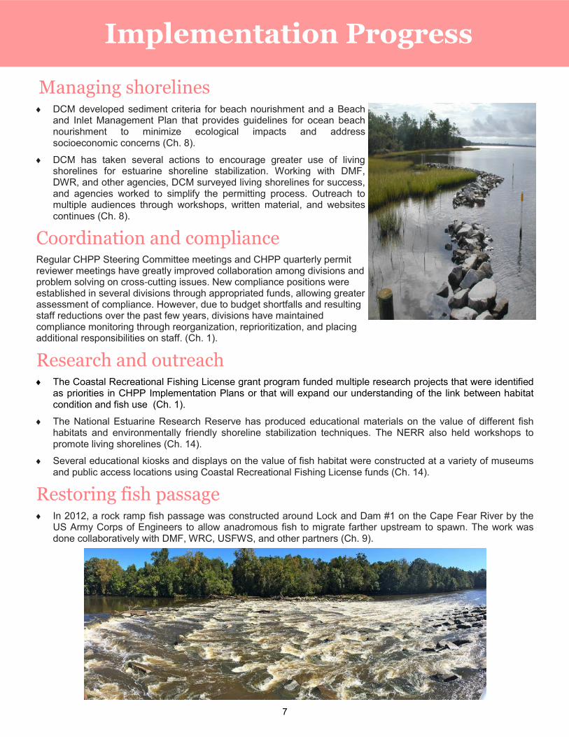
Research and outreach The Coastal Recreational Fishing License grant program funded multiple research projects that were identified
as priorities in CHPP Implementation Plans or that will expand our understanding of the link between habitat condition and fish use (Ch. 1).
The National Estuarine Research Reserve has produced educational materials on the value of different fish habitats and environmentally friendly shoreline stabilization techniques. The NERR also held workshops to promote living shorelines (Ch. 14).
Several educational kiosks and displays on the value of fish habitat were constructed at a variety of museums and public access locations using Coastal Recreational Fishing License funds (Ch. 14).
Restoring fish passage In 2012, a rock ramp fish passage was constructed around Lock and Dam #1 on the Cape Fear River by the
US Army Corps of Engineers to allow anadromous fish to migrate farther upstream to spawn. The work was done collaboratively with DMF, WRC, USFWS, and other partners (Ch. 9).
Implementation Progress
8
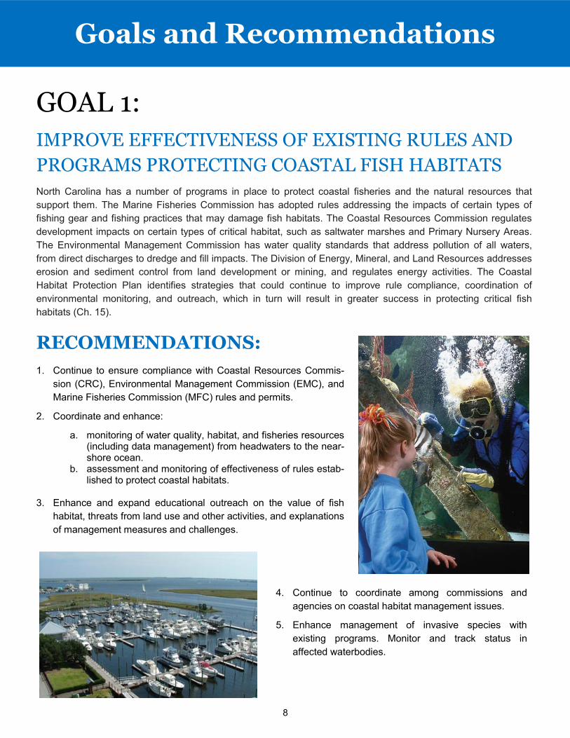
GOAL 1:
North Carolina has a number of programs in place to protect coastal fisheries and the natural resources that
support them. The Marine Fisheries Commission has adopted rules addressing the impacts of certain types of
fishing gear and fishing practices that may damage fish habitats. The Coastal Resources Commission regulates
development impacts on certain types of critical habitat, such as saltwater marshes and Primary Nursery Areas.
The Environmental Management Commission has water quality standards that address pollution of all waters,
from direct discharges to dredge and fill impacts. The Division of Energy, Mineral, and Land Resources addresses
erosion and sediment control from land development or mining, and regulates energy activities. The Coastal
Habitat Protection Plan identifies strategies that could continue to improve rule compliance, coordination of
environmental monitoring, and outreach, which in turn will result in greater success in protecting critical fish
habitats (Ch. 15).
RECOMMENDATIONS:
Goals and Recommendations
IMPROVE EFFECTIVENESS OF EXISTING RULES AND
PROGRAMS PROTECTING COASTAL FISH HABITATS
4. Continue to coordinate among commissions and
agencies on coastal habitat management issues.
5. Enhance management of invasive species with
existing programs. Monitor and track status in
affected waterbodies.
1. Continue to ensure compliance with Coastal Resources Commis-
sion (CRC), Environmental Management Commission (EMC), and
Marine Fisheries Commission (MFC) rules and permits.
2. Coordinate and enhance:
a. monitoring of water quality, habitat, and fisheries resources (including data management) from headwaters to the near-shore ocean.
b. assessment and monitoring of effectiveness of rules estab-lished to protect coastal habitats.
3. Enhance and expand educational outreach on the value of fish
habitat, threats from land use and other activities, and explanations
of management measures and challenges.
9
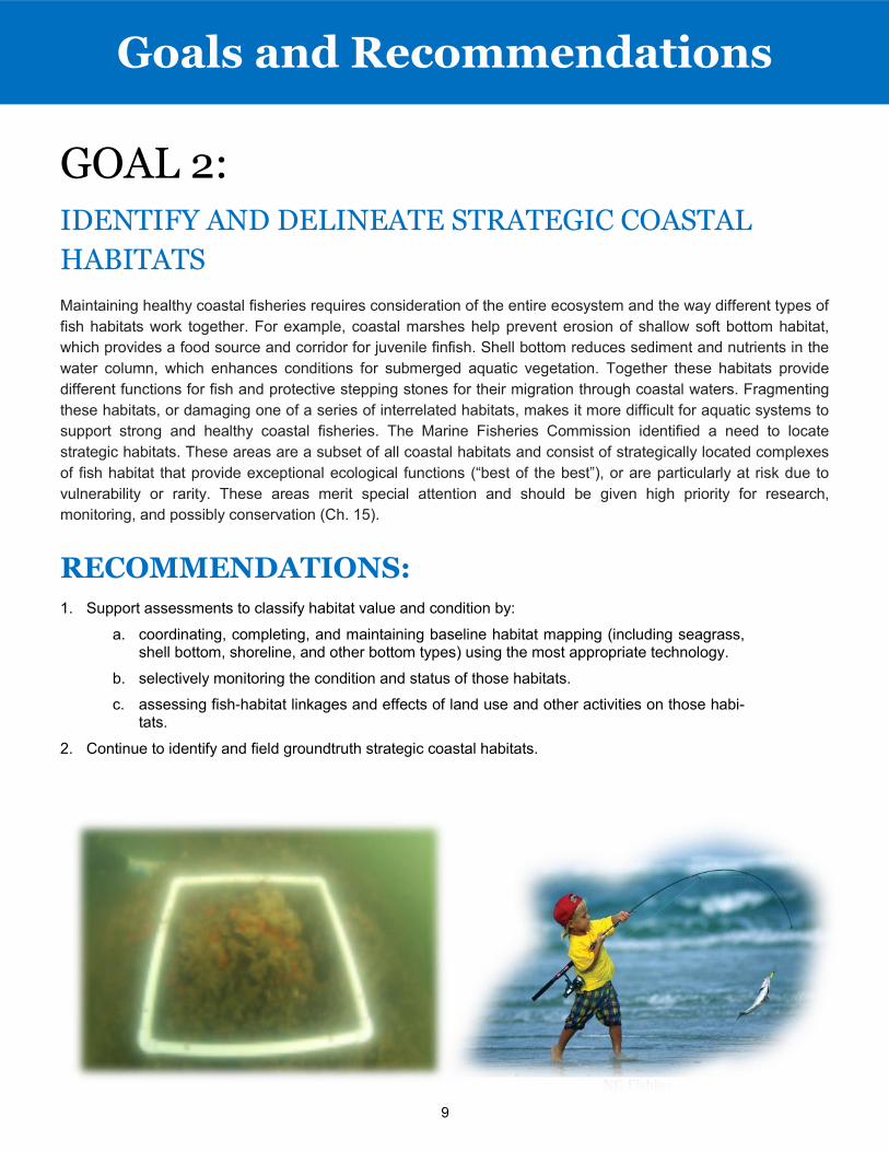
GOAL 2: IDENTIFY AND DELINEATE STRATEGIC COASTAL
HABITATS
Maintaining healthy coastal fisheries requires consideration of the entire ecosystem and the way different types of
fish habitats work together. For example, coastal marshes help prevent erosion of shallow soft bottom habitat,
which provides a food source and corridor for juvenile finfish. Shell bottom reduces sediment and nutrients in the
water column, which enhances conditions for submerged aquatic vegetation. Together these habitats provide
different functions for fish and protective stepping stones for their migration through coastal waters. Fragmenting
these habitats, or damaging one of a series of interrelated habitats, makes it more difficult for aquatic systems to
support strong and healthy coastal fisheries. The Marine Fisheries Commission identified a need to locate
strategic habitats. These areas are a subset of all coastal habitats and consist of strategically located complexes
of fish habitat that provide exceptional ecological functions (“best of the best”), or are particularly at risk due to
vulnerability or rarity. These areas merit special attention and should be given high priority for research,
monitoring, and possibly conservation (Ch. 15).
RECOMMENDATIONS:
1. Support assessments to classify habitat value and condition by:
a. coordinating, completing, and maintaining baseline habitat mapping (including seagrass, shell bottom, shoreline, and other bottom types) using the most appropriate technology.
b. selectively monitoring the condition and status of those habitats.
c. assessing fish-habitat linkages and effects of land use and other activities on those habi-tats.
2. Continue to identify and field groundtruth strategic coastal habitats.
Goals and Recommendations
10
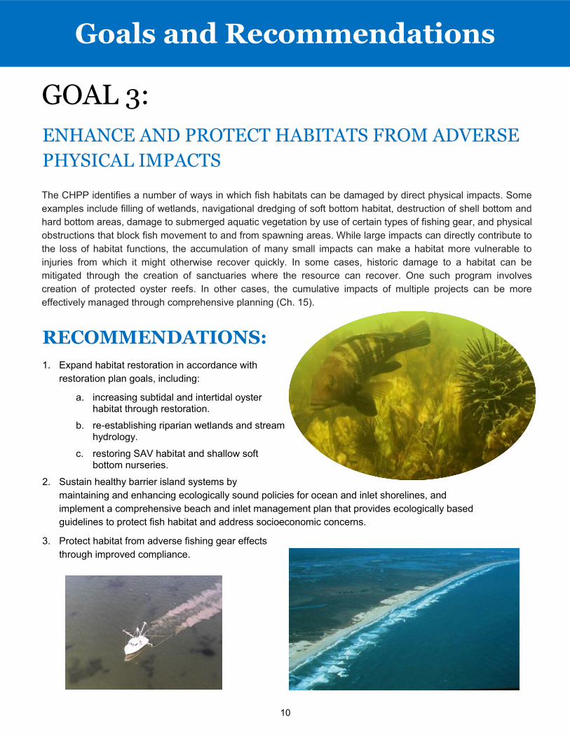
GOAL 3:
The CHPP identifies a number of ways in which fish habitats can be damaged by direct physical impacts. Some
examples include filling of wetlands, navigational dredging of soft bottom habitat, destruction of shell bottom and
hard bottom areas, damage to submerged aquatic vegetation by use of certain types of fishing gear, and physical
obstructions that block fish movement to and from spawning areas. While large impacts can directly contribute to
the loss of habitat functions, the accumulation of many small impacts can make a habitat more vulnerable to
injuries from which it might otherwise recover quickly. In some cases, historic damage to a habitat can be
mitigated through the creation of sanctuaries where the resource can recover. One such program involves
creation of protected oyster reefs. In other cases, the cumulative impacts of multiple projects can be more
effectively managed through comprehensive planning (Ch. 15).
RECOMMENDATIONS:
1. Expand habitat restoration in accordance with
restoration plan goals, including:
a. increasing subtidal and intertidal oyster habitat through restoration.
b. re-establishing riparian wetlands and stream hydrology.
c. restoring SAV habitat and shallow soft bottom nurseries.
2. Sustain healthy barrier island systems by
maintaining and enhancing ecologically sound policies for ocean and inlet shorelines, and
implement a comprehensive beach and inlet management plan that provides ecologically based
guidelines to protect fish habitat and address socioeconomic concerns.
3. Protect habitat from adverse fishing gear effects
through improved compliance.
Goals and Recommendations
ENHANCE AND PROTECT HABITATS FROM ADVERSE
PHYSICAL IMPACTS
11
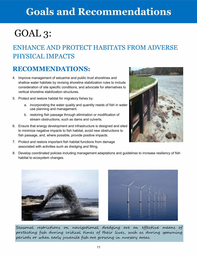
GOAL 3:
RECOMMENDATIONS:
4. Improve management of estuarine and public trust shorelines and
shallow water habitats by revising shoreline stabilization rules to include
consideration of site specific conditions, and advocate for alternatives to
vertical shoreline stabilization structures.
5. Protect and restore habitat for migratory fishes by:
a. incorporating the water quality and quantity needs of fish in water use planning and management.
b. restoring fish passage through elimination or modification of
stream obstructions, such as dams and culverts.
6. Ensure that energy development and infrastructure is designed and sited
to minimize negative impacts to fish habitat, avoid new obstructions to
fish passage, and, where possible, provide positive impacts.
7. Protect and restore important fish habitat functions from damage
associated with activities such as dredging and filling.
8. Develop coordinated policies including management adaptations and guidelines to increase resiliency of fish
habitat to ecosystem changes.
Goals and Recommendations
ENHANCE AND PROTECT HABITATS FROM ADVERSE
PHYSICAL IMPACTS
Seasonal restrictions on navigational dredging are an effective means of
protecting fish during critical times of their lives, such as during spawning
periods or when early juvenile fish are growing in nursery areas.
12
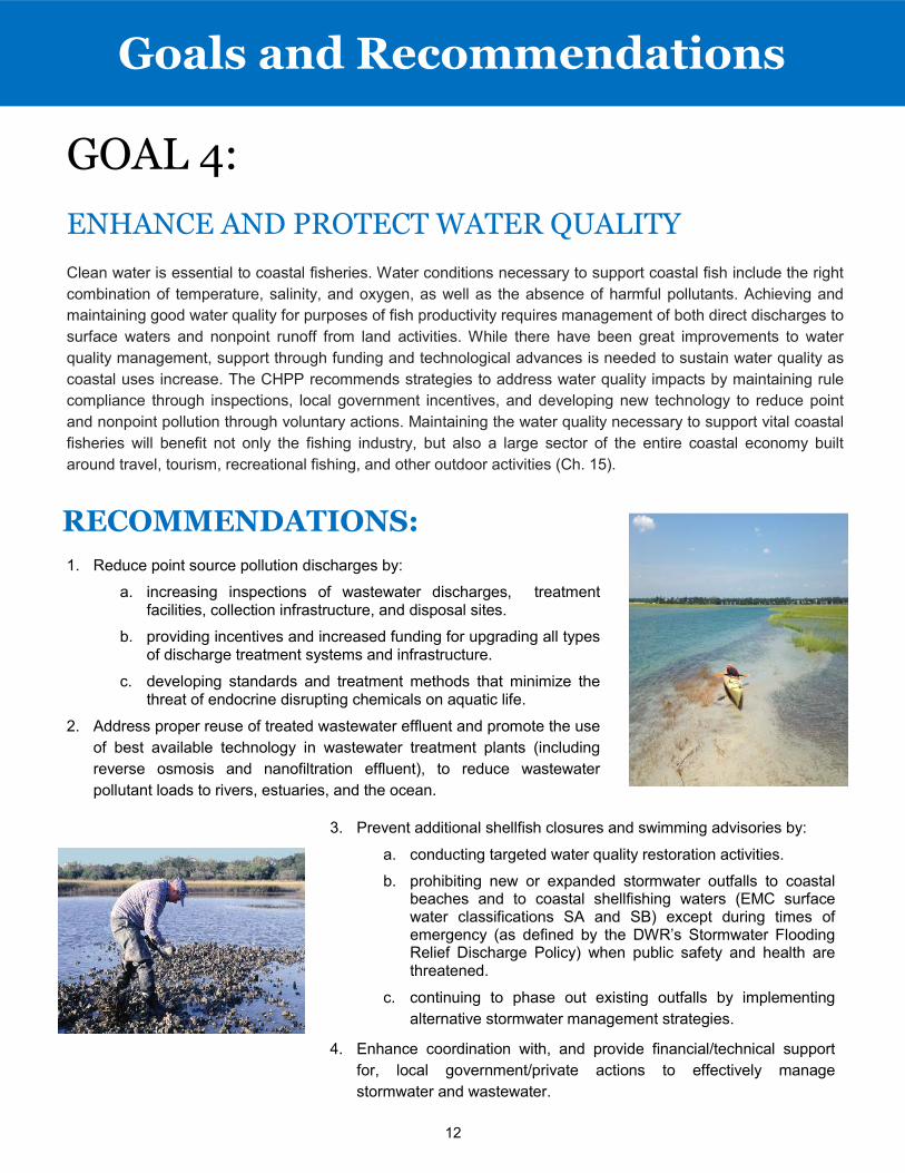
GOAL 4:
ENHANCE AND PROTECT WATER QUALITY
Clean water is essential to coastal fisheries. Water conditions necessary to support coastal fish include the right
combination of temperature, salinity, and oxygen, as well as the absence of harmful pollutants. Achieving and
maintaining good water quality for purposes of fish productivity requires management of both direct discharges to
surface waters and nonpoint runoff from land activities. While there have been great improvements to water
quality management, support through funding and technological advances is needed to sustain water quality as
coastal uses increase. The CHPP recommends strategies to address water quality impacts by maintaining rule
compliance through inspections, local government incentives, and developing new technology to reduce point
and nonpoint pollution through voluntary actions. Maintaining the water quality necessary to support vital coastal
fisheries will benefit not only the fishing industry, but also a large sector of the entire coastal economy built
around travel, tourism, recreational fishing, and other outdoor activities (Ch. 15).
RECOMMENDATIONS:
Goals and Recommendations
1. Reduce point source pollution discharges by:
a. increasing inspections of wastewater discharges, treatment facilities, collection infrastructure, and disposal sites.
b. providing incentives and increased funding for upgrading all types of discharge treatment systems and infrastructure.
c. developing standards and treatment methods that minimize the threat of endocrine disrupting chemicals on aquatic life.
2. Address proper reuse of treated wastewater effluent and promote the use
of best available technology in wastewater treatment plants (including
reverse osmosis and nanofiltration effluent), to reduce wastewater
pollutant loads to rivers, estuaries, and the ocean.
3. Prevent additional shellfish closures and swimming advisories by:
a. conducting targeted water quality restoration activities.
b. prohibiting new or expanded stormwater outfalls to coastal beaches and to coastal shellfishing waters (EMC surface water classifications SA and SB) except during times of emergency (as defined by the DWR’s Stormwater Flooding Relief Discharge Policy) when public safety and health are threatened.
c. continuing to phase out existing outfalls by implementing
alternative stormwater management strategies.
4. Enhance coordination with, and provide financial/technical support
for, local government/private actions to effectively manage
stormwater and wastewater.
13
RECOMMENDATIONS:
5. Continue to improve strategies throughout the river basins to reduce nonpoint pollution and minimize
cumulative losses of fish habitat through voluntary actions, assistance, and incentives, including:
a. improving methods to reduce pollution from construction sites, agriculture, and forestry.
b. increasing on-site infiltration of stormwater.
c. encouraging and providing incentives for implementation of Low Impact Development practices.
d. increased inspections of onsite wastewater treatment facilities.
e. increasing use of reclaimed water and recycling.
f. Increasing voluntary use of riparian vegetated buffers for forestry, agriculture, and development.
g. increasing funding for strategic land acquisition and conservation.
6. Maintain effective regulatory strategies throughout the river basins to reduce nonpoint pollution and minimize
cumulative losses of fish habitat, including use of vegetated buffers and established stormwater controls.
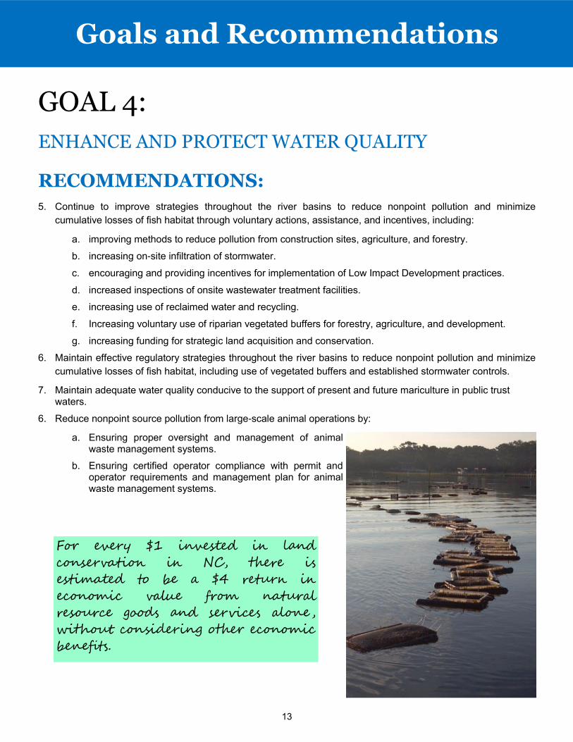
7. Maintain adequate water quality conducive to the support of present and future mariculture in public trust waters.
6. Reduce nonpoint source pollution from large-scale animal operations by:
a. Ensuring proper oversight and management of animal waste management systems.
b. Ensuring certified operator compliance with permit and operator requirements and management plan for animal waste management systems.
GOAL 4:
ENHANCE AND PROTECT WATER QUALITY
Goals and Recommendations
For every $1 invested in land
conservation in NC, there is
estimated to be a $4 return in
economic value from natural
resource goods and services alone,
without considering other economic
benefits.
14
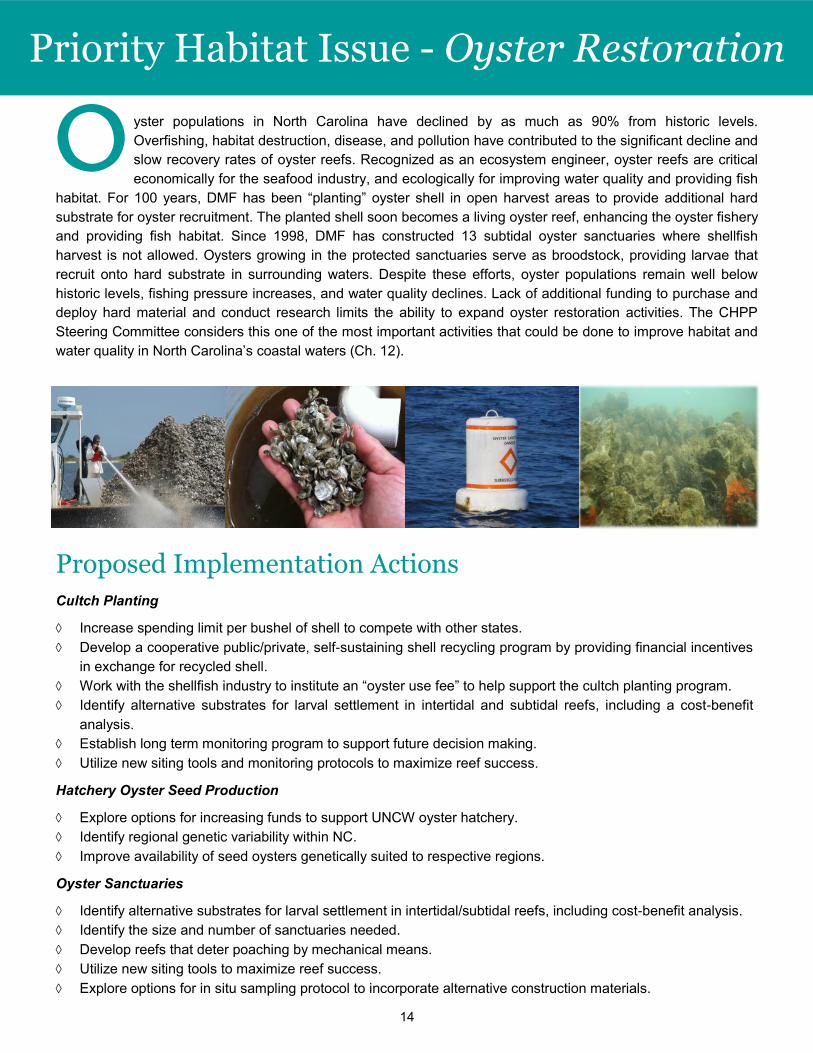
yster populations in North Carolina have declined by as much as 90% from historic levels.
Overfishing, habitat destruction, disease, and pollution have contributed to the significant decline and
slow recovery rates of oyster reefs. Recognized as an ecosystem engineer, oyster reefs are critical
economically for the seafood industry, and ecologically for improving water quality and providing fish
habitat. For 100 years, DMF has been “planting” oyster shell in open harvest areas to provide additional hard
substrate for oyster recruitment. The planted shell soon becomes a living oyster reef, enhancing the oyster fishery
and providing fish habitat. Since 1998, DMF has constructed 13 subtidal oyster sanctuaries where shellfish
harvest is not allowed. Oysters growing in the protected sanctuaries serve as broodstock, providing larvae that
recruit onto hard substrate in surrounding waters. Despite these efforts, oyster populations remain well below
historic levels, fishing pressure increases, and water quality declines. Lack of additional funding to purchase and
deploy hard material and conduct research limits the ability to expand oyster restoration activities. The CHPP
Steering Committee considers this one of the most important activities that could be done to improve habitat and
water quality in North Carolina’s coastal waters (Ch. 12).
Priority Habitat Issue - Oyster Restoration
O
Proposed Implementation Actions
Cultch Planting
Increase spending limit per bushel of shell to compete with other states.
Develop a cooperative public/private, self-sustaining shell recycling program by providing financial incentives
in exchange for recycled shell.
Work with the shellfish industry to institute an “oyster use fee” to help support the cultch planting program.
Identify alternative substrates for larval settlement in intertidal and subtidal reefs, including a cost-benefit
analysis.
Establish long term monitoring program to support future decision making.
Utilize new siting tools and monitoring protocols to maximize reef success.
Hatchery Oyster Seed Production
Explore options for increasing funds to support UNCW oyster hatchery.
Identify regional genetic variability within NC.
Improve availability of seed oysters genetically suited to respective regions.
Oyster Sanctuaries
Identify alternative substrates for larval settlement in intertidal/subtidal reefs, including cost-benefit analysis.
Identify the size and number of sanctuaries needed.
Develop reefs that deter poaching by mechanical means.
Utilize new siting tools to maximize reef success.
Explore options for in situ sampling protocol to incorporate alternative construction materials.
15
Priority Habitat Issues - Living Shorelines
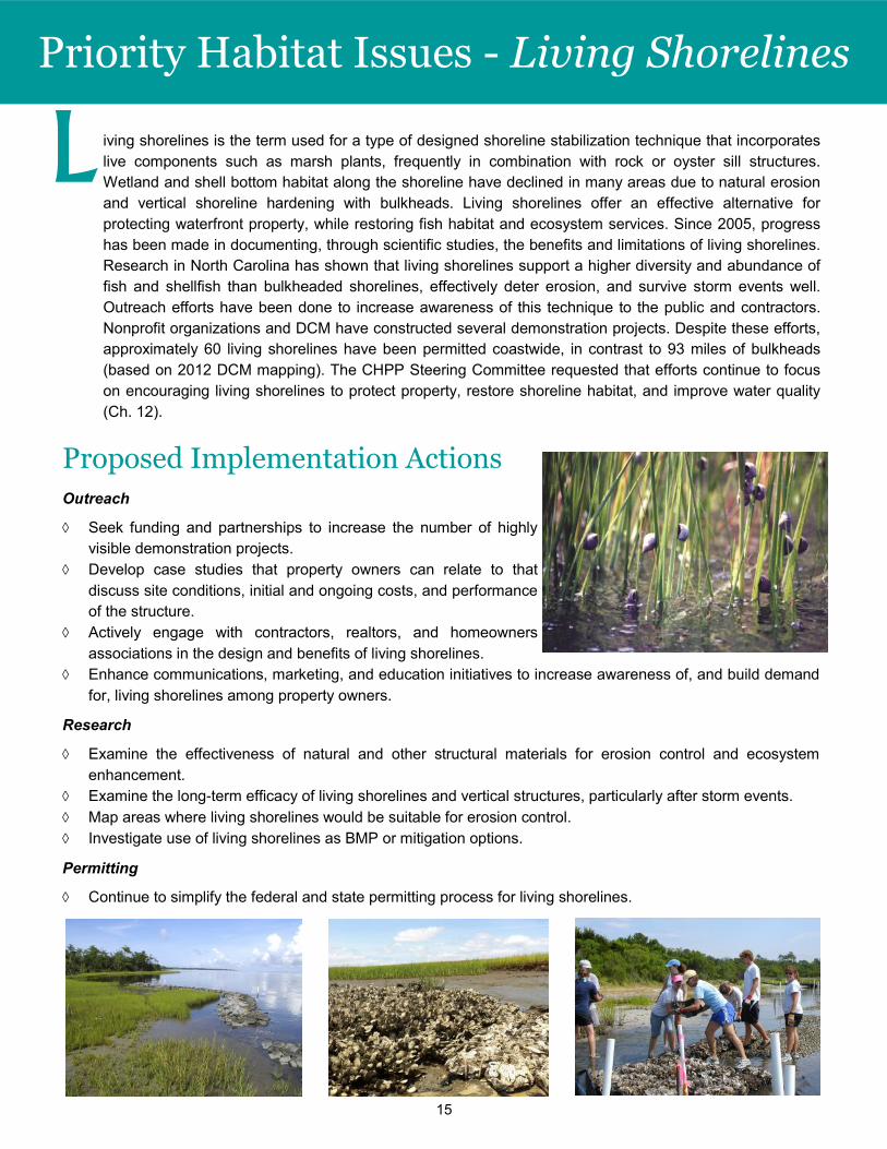
L iving shorelines is the term used for a type of designed shoreline stabilization technique that incorporates
live components such as marsh plants, frequently in combination with rock or oyster sill structures.
Wetland and shell bottom habitat along the shoreline have declined in many areas due to natural erosion
and vertical shoreline hardening with bulkheads. Living shorelines offer an effective alternative for
protecting waterfront property, while restoring fish habitat and ecosystem services. Since 2005, progress
has been made in documenting, through scientific studies, the benefits and limitations of living shorelines.
Research in North Carolina has shown that living shorelines support a higher diversity and abundance of
fish and shellfish than bulkheaded shorelines, effectively deter erosion, and survive storm events well.
Outreach efforts have been done to increase awareness of this technique to the public and contractors.
Nonprofit organizations and DCM have constructed several demonstration projects. Despite these efforts,
approximately 60 living shorelines have been permitted coastwide, in contrast to 93 miles of bulkheads
(based on 2012 DCM mapping). The CHPP Steering Committee requested that efforts continue to focus
on encouraging living shorelines to protect property, restore shoreline habitat, and improve water quality
(Ch. 12).
Proposed Implementation Actions
Outreach
Seek funding and partnerships to increase the number of highly
visible demonstration projects.
Develop case studies that property owners can relate to that
discuss site conditions, initial and ongoing costs, and performance
of the structure.
Actively engage with contractors, realtors, and homeowners
associations in the design and benefits of living shorelines.
Enhance communications, marketing, and education initiatives to increase awareness of, and build demand
for, living shorelines among property owners.
Research
Examine the effectiveness of natural and other structural materials for erosion control and ecosystem
enhancement.
Examine the long-term efficacy of living shorelines and vertical structures, particularly after storm events.
Map areas where living shorelines would be suitable for erosion control.
Investigate use of living shorelines as BMP or mitigation options.
Permitting
Continue to simplify the federal and state permitting process for living shorelines.
16
Priority Habitat Issue - Sedimentation
Proposed Implementation Actions
Determine magnitude and change in sedimentation rates and sources
over time at sufficiently representative waterbodies and regions.
Determine the effect of sedimentation in the upper estuaries on primary
and secondary productivity and juvenile nursery function.
Encourage research for innovative and effective sediment control
methods in coastal river basins.
Encourage expanded use of stormwater BMPs and low impact development (LID) to reduce sediment
loading into estuarine creeks.
Partner with NC Department of Transportation to retrofit road ditches that drain to estuarine waters.
Improve effectiveness of sediment and erosion control programs by:
Encouraging development of effective local erosion control programs to maintain compliance and
reduce sediment from reaching surface waters.
Enhancing monitoring capabilities for local and state sediment control programs (e.g., purchase
turbidity meters and train staff in their use).
Continuing to educate the public, developers, contractors, and farmers
on the need for sediment erosion control measures and techniques for
effective sediment control.
Provide education and financial/
technical support for local and state
programs to better manage sediment
control measures from all land
disturbing activities.
S
In 2014, 6,290 acres were impaired by tur-
bidity for the aquatic life use support clas-
sification in coastal subbasins (DWR 2014
Integrated Report).
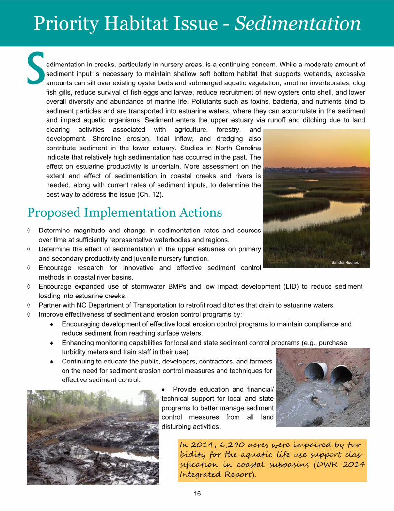
edimentation in creeks, particularly in nursery areas, is a continuing concern. While a moderate amount of
sediment input is necessary to maintain shallow soft bottom habitat that supports wetlands, excessive
amounts can silt over existing oyster beds and submerged aquatic vegetation, smother invertebrates, clog
fish gills, reduce survival of fish eggs and larvae, reduce recruitment of new oysters onto shell, and lower
overall diversity and abundance of marine life. Pollutants such as toxins, bacteria, and nutrients bind to
sediment particles and are transported into estuarine waters, where they can accumulate in the sediment
and impact aquatic organisms. Sediment enters the upper estuary via runoff and ditching due to land
clearing activities associated with agriculture, forestry, and
development. Shoreline erosion, tidal inflow, and dredging also
contribute sediment in the lower estuary. Studies in North Carolina
indicate that relatively high sedimentation has occurred in the past. The
effect on estuarine productivity is uncertain. More assessment on the
extent and effect of sedimentation in coastal creeks and rivers is
needed, along with current rates of sediment inputs, to determine the
best way to address the issue (Ch. 12).
Sandra Hughes
17
Priority Habitat Issue - Developing Metrics
Proposed
Implementation Actions
Develop indicator metrics for monitoring the
status and trends of each of the six habitat
types within North Carolina’s coastal
ecosystem (water column, shell bottom,
SAV, wetlands, soft bottom, hard bottom).
Establish thresholds of habitat quality,
quantity, or extent similar to limit reference
points - or traffic lights - which would initiate
pre-determined management actions.
Develop indicators for assessing fish
utilization of strategic coastal habitats.
Develop performance criteria for measuring
success of management decisions.
Include specific performance criteria in
CHPP management actions where possible.
D eveloping metrics to assess habitat trends
and management effectiveness is the corner-
stone of habitat protection and restoration. Without
them, needed habitat conservation initiatives are
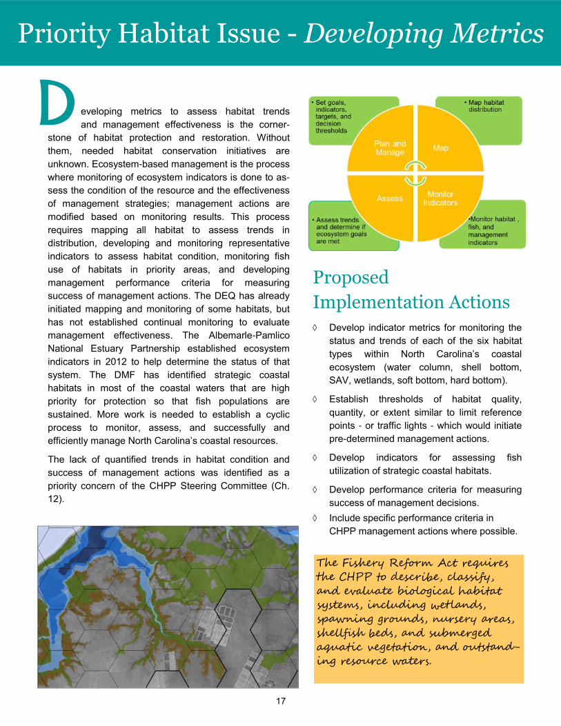
unknown. Ecosystem-based management is the process
where monitoring of ecosystem indicators is done to as-
sess the condition of the resource and the effectiveness
of management strategies; management actions are
modified based on monitoring results. This process
requires mapping all habitat to assess trends in
distribution, developing and monitoring representative
indicators to assess habitat condition, monitoring fish
use of habitats in priority areas, and developing
management performance criteria for measuring
success of management actions. The DEQ has already
initiated mapping and monitoring of some habitats, but
has not established continual monitoring to evaluate
management effectiveness. The Albemarle-Pamlico
National Estuary Partnership established ecosystem
indicators in 2012 to help determine the status of that
system. The DMF has identified strategic coastal
habitats in most of the coastal waters that are high
priority for protection so that fish populations are
sustained. More work is needed to establish a cyclic
process to monitor, assess, and successfully and
efficiently manage North Carolina’s coastal resources.
The lack of quantified trends in habitat condition and
success of management actions was identified as a
priority concern of the CHPP Steering Committee (Ch.
12).
The Fishery Reform Act requires
the CHPP to describe, classify,
and evaluate biological habitat
systems, including wetlands,
spawning grounds, nursery areas,
shellfish beds, and submerged
aquatic vegetation, and outstand-
ing resource waters.
18
orth Carolina’s coastal fish habitats provide crucial functions for the plants and animals living in them.
This diversity of interconnected habitats provides food and shelter in which to reproduce and grow for
a tremendous variety of fish, shellfish, and crustaceans. Protecting and restoring these habitats is es-
sential to the survival of North Carolina’s fisheries.
While poor water quality puts the habitats’ ability to function and support fish populations at risk, physical damage
caused by humans is also a serious threat. Conversion of wetlands by draining, filling, and water control projects
are the major sources of wetland loss in eastern North
Carolina. Shell bottom habitat along our coast has been
decimated by a century of excessive mechanical har-
vests and diseases. More recently, dredging for naviga-
tion channels and marinas, as well as damage from bot-
tom-disturbing fishing gear, threatens remaining shell
bottom and submerged aquatic vegetation habitat and
impedes establishment of those habitats. Submerged
aquatic vegetation is also vulnerable to uprooting by
boat propellers and to shading by docks and piers.
These and other types of physical impacts affect the
ability of fish habitats to sustain fisheries and increase their vulnerability to water quality problems (Ch. 2-7).
Habitat: “a place, or set of places, in which a fish or fish
population finds the physical , chemical , and biological fea-
tures needed for life .”
NC Coastal Habitats
Habitats provide important functions for fish species.
Refuge: shelter for fish at various life stages and a place for plants and animals to attach
Nursery: refuge and foraging habitat suitable for development of juvenile life stages of fish, shellfish, and
crabs
Spawning: conditions that allow adults to reproduce
Foraging: presence and accessibility of food sources
Corridor: connectivity for safe passage among foraging, spawning, and refuge areas
N The CHPP identifies six fish habitats that
need protection or enhancement:
Water Column
Shell Bottom
Submerged Aquatic Vegetation (SAV)
Wetlands
Soft Bottom
Hard Bottom
19
NC Coastal Habitats
The relationship between habitat conditions and populations of fishery species
is complex. In the past, the decline of a particular fish stock was often attributed
to overfishing. We know now that the quality and quantity of fish habitats is
important to healthy fish populations. Habitat loss and degradation make fish
populations more susceptible to overfishing and can cause a delay in recovery,
even after management actions have successfully reduced fishing pressures.
River herring and shortnose sturgeon are examples of species that have not
recovered despite lengthy fishing moratoriums. Thus, the status of fisheries can
be an indicator of impacts to fish habitats. Successful implementation of the
CHPP recommendations is a necessary component for sustaining productive
fisheries for future generations.
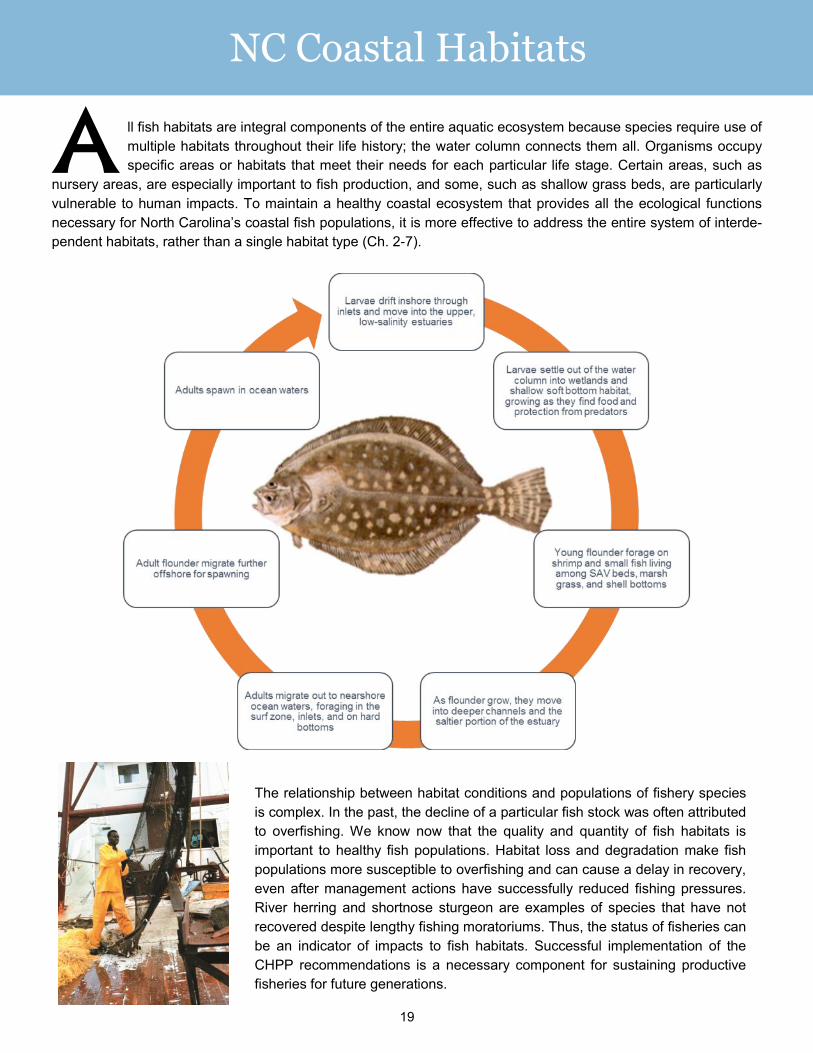
ll fish habitats are integral components of the entire aquatic ecosystem because species require use of
multiple habitats throughout their life history; the water column connects them all. Organisms occupy
specific areas or habitats that meet their needs for each particular life stage. Certain areas, such as
nursery areas, are especially important to fish production, and some, such as shallow grass beds, are particularly
vulnerable to human impacts. To maintain a healthy coastal ecosystem that provides all the ecological functions
necessary for North Carolina’s coastal fish populations, it is more effective to address the entire system of interde-
pendent habitats, rather than a single habitat type (Ch. 2-7).
A
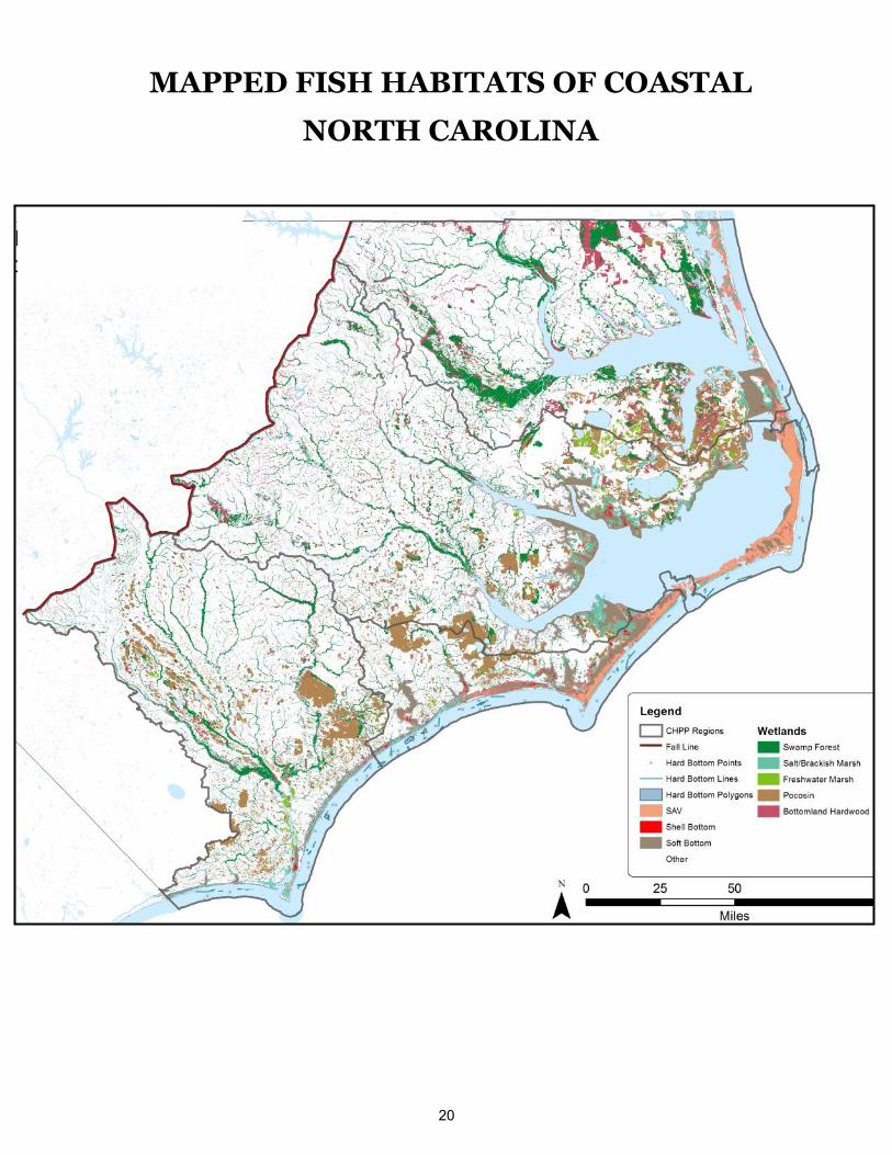
20
MAPPED FISH HABITATS OF COASTAL
NORTH CAROLINA
21
Habitat Profile Water Column Functions
Connects all habitat types
Allows fish to move among habitats
Surrounds and supports aquatic animals and
habitats
How Fish Use the Water Column
Transports eggs, larvae, and oxygen
Nursery area for all fish species
Foraging area for all fish species
Spawning area for all fish species
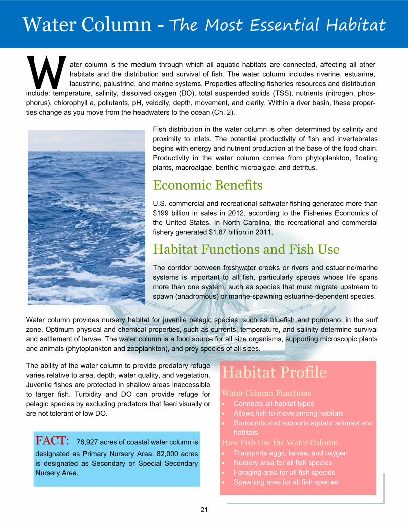
ater column is the medium through which all aquatic habitats are connected, affecting all other
habitats and the distribution and survival of fish. The water column includes riverine, estuarine,
lacustrine, palustrine, and marine systems. Properties affecting fisheries resources and distribution
include: temperature, salinity, dissolved oxygen (DO), total suspended solids (TSS), nutrients (nitrogen, phos-
phorus), chlorophyll a, pollutants, pH, velocity, depth, movement, and clarity. Within a river basin, these proper-
ties change as you move from the headwaters to the ocean (Ch. 2).
W Fish distribution in the water column is often determined by salinity and
proximity to inlets. The potential productivity of fish and invertebrates
begins with energy and nutrient production at the base of the food chain.
Productivity in the water column comes from phytoplankton, floating
plants, macroalgae, benthic microalgae, and detritus.
Economic Benefits
U.S. commercial and recreational saltwater fishing generated more than
$199 billion in sales in 2012, according to the Fisheries Economics of
the United States. In North Carolina, the recreational and commercial
fishery generated $1.87 billion in 2011.
Habitat Functions and Fish Use
The corridor between freshwater creeks or rivers and estuarine/marine
systems is important to all fish, particularly species whose life spans
more than one system, such as species that must migrate upstream to
spawn (anadromous) or marine-spawning estuarine-dependent species.
Water column provides nursery habitat for juvenile pelagic species, such as bluefish and pompano, in the surf
zone. Optimum physical and chemical properties, such as currents, temperature, and salinity determine survival
and settlement of larvae. The water column is a food source for all size organisms, supporting microscopic plants
and animals (phytoplankton and zooplankton), and prey species of all sizes.
The ability of the water column to provide predatory refuge
varies relative to area, depth, water quality, and vegetation.
Juvenile fishes are protected in shallow areas inaccessible
to larger fish. Turbidity and DO can provide refuge for
pelagic species by excluding predators that feed visually or
are not tolerant of low DO.
FACT: 76,927 acres of coastal water column is
designated as Primary Nursery Area. 82,000 acres
is designated as Secondary or Special Secondary
Nursery Area.
Water Column - The Most Essential Habitat
22
All coastal habitats are connected by
water. Clean water is essential to
aquatic life .
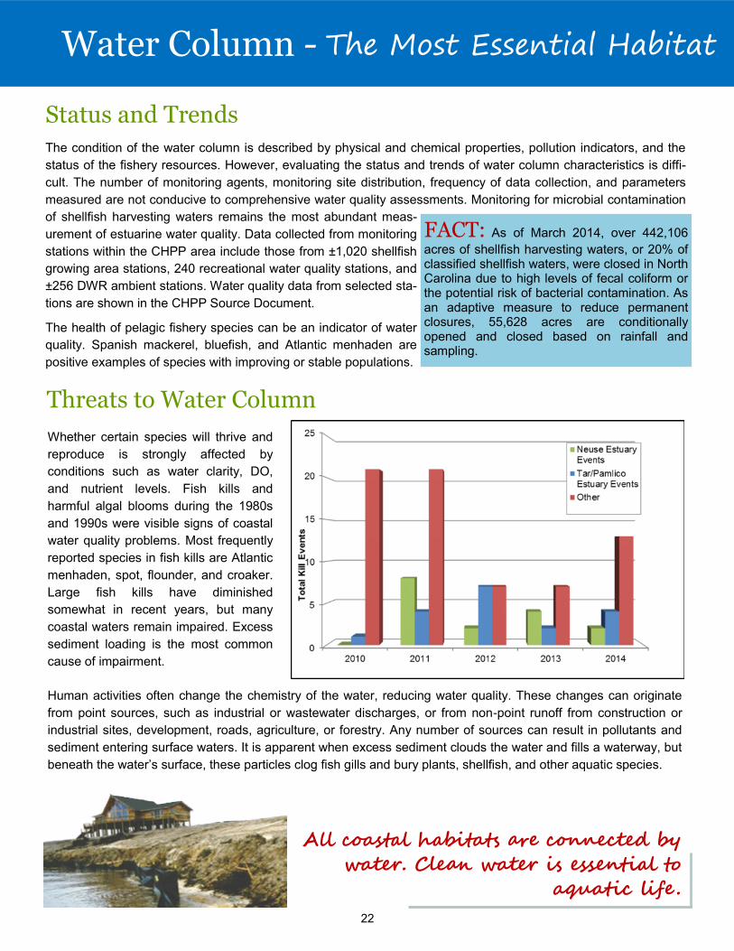
Threats to Water Column
Status and Trends
The condition of the water column is described by physical and chemical properties, pollution indicators, and the
status of the fishery resources. However, evaluating the status and trends of water column characteristics is diffi-
cult. The number of monitoring agents, monitoring site distribution, frequency of data collection, and parameters
measured are not conducive to comprehensive water quality assessments. Monitoring for microbial contamination
of shellfish harvesting waters remains the most abundant meas-
urement of estuarine water quality. Data collected from monitoring
stations within the CHPP area include those from ±1,020 shellfish
growing area stations, 240 recreational water quality stations, and
±256 DWR ambient stations. Water quality data from selected sta-
tions are shown in the CHPP Source Document.
The health of pelagic fishery species can be an indicator of water
quality. Spanish mackerel, bluefish, and Atlantic menhaden are
positive examples of species with improving or stable populations.
FACT: As of March 2014, over 442,106
acres of shellfish harvesting waters, or 20% of classified shellfish waters, were closed in North Carolina due to high levels of fecal coliform or the potential risk of bacterial contamination. As an adaptive measure to reduce permanent closures, 55,628 acres are conditionally opened and closed based on rainfall and sampling.
Water Column - The Most Essential Habitat
Human activities often change the chemistry of the water, reducing water quality. These changes can originate
from point sources, such as industrial or wastewater discharges, or from non-point runoff from construction or
industrial sites, development, roads, agriculture, or forestry. Any number of sources can result in pollutants and
sediment entering surface waters. It is apparent when excess sediment clouds the water and fills a waterway, but
beneath the water’s surface, these particles clog fish gills and bury plants, shellfish, and other aquatic species.
Whether certain species will thrive and
reproduce is strongly affected by
conditions such as water clarity, DO,
and nutrient levels. Fish kills and
harmful algal blooms during the 1980s
and 1990s were visible signs of coastal
water quality problems. Most frequently
reported species in fish kills are Atlantic
menhaden, spot, flounder, and croaker.
Large fish kills have diminished
somewhat in recent years, but many
coastal waters remain impaired. Excess
sediment loading is the most common
cause of impairment.
23
Habitat Functions and Fish Use
Shell bottom is widely recognized as essential fish habitat (EFH) for oysters and other reef-forming mollusks and
provides critical fish habitat for ecologically and economically important finfish, mollusks, and crustaceans. In North
Carolina, over 40 species of fish and crustaceans have been documented to use natural
and restored oyster reefs, including American eel, Atlantic croaker, Atlantic menhaden,
black sea bass, sheepshead, spotted seatrout, red drum, and southern flounder. Oys-
ters are ecosystem engineers that alter current and flows, protect shorelines, and trap
and stabilize large quantities of suspended solids, reducing turbidity by building high
relief structures. The interstitial spaces between and within the shell matrix of oyster
reefs are critical refuges for the survival of recruiting oysters and other small, slow-
moving macrofauna, such as worms, crabs, and clams. Shell bottom is also valuable
nursery habitat for juveniles of commercially and recreationally important finfish, such as
black sea bass, sheepshead, gag grouper, and snappers. Additionally, shell bottom is
important foraging ground for many economically and ecologically important species.
The proximity and connectivity of oyster beds enhances the fish utilization of nearby
habitats, especially SAV. Shell bottom contributes primary production indirectly from
plants on and around it, but it is more important for its high secondary productivity con-
tribution from the biomass of oysters and other macroinvertebrates living among the
shell structure. This in turn supports a high density of mobile finfish and invertebrates, which was found to be more
than two times greater than in marshes, soft bottom, and SAV.
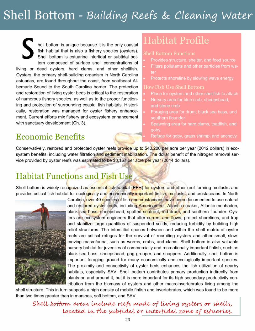
Shell Bottom - Building Reefs & Cleaning Water
hell bottom is unique because it is the only coastal
fish habitat that is also a fishery species (oysters).
Shell bottom is estuarine intertidal or subtidal bot-
tom composed of surface shell concentrations of
living or dead oysters, hard clams, and other shellfish.
Oysters, the primary shell-building organism in North Carolina
estuaries, are found throughout the coast, from southeast Al-
bemarle Sound to the South Carolina border. The protection
and restoration of living oyster beds is critical to the restoration
of numerous fishery species, as well as to the proper function-
ing and protection of surrounding coastal fish habitats. Histori-
cally, restoration was managed for oyster fishery enhance-
ment. Current efforts mix fishery and ecosystem enhancement
with sanctuary development (Ch. 3).
S
Shell bottom areas include reefs made of living oysters or shells,
located in the subtidal or intertidal zone of estuaries.
Economic Benefits
Conservatively, restored and protected oyster reefs provide up to $40,200 per acre per year (2012 dollars) in eco-
system benefits, including water filtration and sediment stabilization. The dollar benefit of the nitrogen removal ser-
vice provided by oyster reefs was estimated to be $3,167 per acre per year (2014 dollars).
Habitat Profile Shell Bottom Functions
Provides structure, shelter, and food source
Filters pollutants and other particles from wa-
ter
Protects shoreline by slowing wave energy
How Fish Use Shell Bottom
Place for oysters and other shellfish to attach
Nursery area for blue crab, sheepshead,
and stone crab
Foraging area for drum, black sea bass, and
southern flounder
Spawning area for hard clams, toadfish, and
goby
Refuge for goby, grass shrimp, and anchovy
24
Shell Bottom - Building Reefs & Cleaning Water
Threats to Shell Bottom
Shell bottom habitat can be damaged by overharvesting, mechanical harvest fishing gear, navigational dredging,
marinas and boating activity. Water quality degradation, especially toxin contamination, sedimentation, and
hypoxia, can cause lethal or sublethal impacts. Shell bottom is occasionally susceptible to diseases and microbial
stressors. The protozoan pathogen Perkinsus marinus, also called
“dermo” has been responsible for major oyster mortalities in North
Carolina. Monitoring of dermo disease by DMF shows a declining trend in
prevalence, with an increasing trend in overall infection.
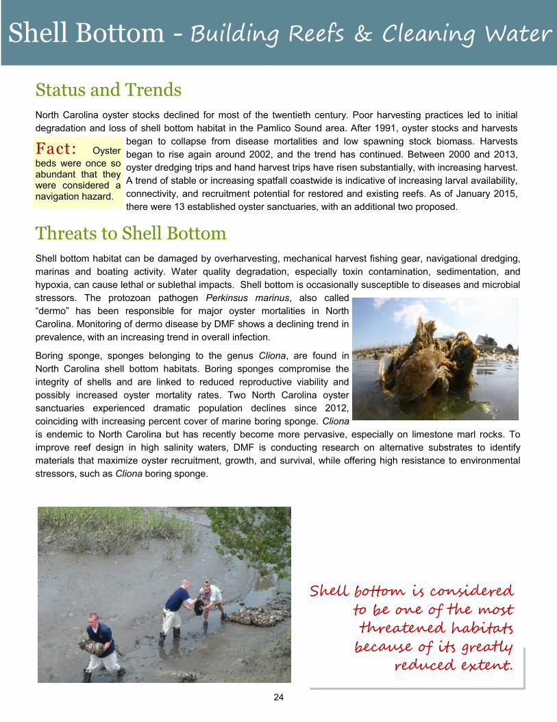
Boring sponge, sponges belonging to the genus Cliona, are found in
North Carolina shell bottom habitats. Boring sponges compromise the
integrity of shells and are linked to reduced reproductive viability and
possibly increased oyster mortality rates. Two North Carolina oyster
sanctuaries experienced dramatic population declines since 2012,
coinciding with increasing percent cover of marine boring sponge. Cliona
is endemic to North Carolina but has recently become more pervasive, especially on limestone marl rocks. To
improve reef design in high salinity waters, DMF is conducting research on alternative substrates to identify
materials that maximize oyster recruitment, growth, and survival, while offering high resistance to environmental
stressors, such as Cliona boring sponge.
Shell bottom is considered
to be one of the most
threatened habitats
because of its greatly
reduced extent.
Status and Trends
North Carolina oyster stocks declined for most of the twentieth century. Poor harvesting practices led to initial
degradation and loss of shell bottom habitat in the Pamlico Sound area. After 1991, oyster stocks and harvests
began to collapse from disease mortalities and low spawning stock biomass. Harvests
began to rise again around 2002, and the trend has continued. Between 2000 and 2013,
oyster dredging trips and hand harvest trips have risen substantially, with increasing harvest.
A trend of stable or increasing spatfall coastwide is indicative of increasing larval availability,
connectivity, and recruitment potential for restored and existing reefs. As of January 2015,
there were 13 established oyster sanctuaries, with an additional two proposed.
Fact: Oyster
beds were once so abundant that they were considered a navigation hazard.
25
SAV - Underwater Gardens
ubmerged aquatic vegetation (SAV) is a fish
habitat dominated by one or more species of
underwater vascular plants that occur in
patches or extensive beds in shallow estuarine waters.
The presence and density of SAV varies seasonally and
inter-annually. A key factor affecting distribution is
adequate light penetration; therefore, SAV occurs in
shallow clear water. Sediment composition, wave energy,
and salinity are also determining factors (Ch. 4).
Economic
Benefits
SAV habitat has a very high
economic value due to the ecosystem services it provides. The estimated value of SAV
and algal beds combined is $7,700/acre/year. This estimate takes into account services
such as seafood production, wastewater treatment, climate regulation, erosion control,
recreation, and others. The value of SAV for denitrification services (wastewater
treatment) is estimated at $3,000/acre/year compared to approximately $400/acre/year
for subtidal soft bottom. With North Carolina having the second largest expanse of SAV
on the east coast, protection and enhancement of this valuable resource should be a
high priority for the state.
S
Due to its stringent water quality requirements, SAV presence
is considered a barometer of water quality.
Habitat Functions and Fish Use
Submerged aquatic vegetation is recognized as essential fish habitat because of five interrelated features –
primary production, structural complexity, modification of energy regimes, sediment and shoreline stabilization,
and nutrient cycling. Water quality enhancement and fish
utilization are especially important ecosystem functions of SAV
relevant to the enhancement of coastal fisheries. Seagrasses
produce large quantities of organic matter. Many fish species
occupy SAV at some point in their life for refuge, spawning,
nursery, foraging, and corridors. SAV is considered essential fish
habitat for red drum, shrimp, and species in the snapper-grouper
complex. Spotted seatrout are also highly dependent on SAV,
and bay scallops occur almost exclusively in SAV beds.
Habitat Profile SAV Functions
Provides refuge for fish and other aquatic animals
Serves as food for fish and waterfowl
Produces dissolved oxygen
Reduces wave energy and limits erosion
Uses nutrients and traps sediments
How Fish Use SAV
Nursery area for blue crab, pink shrimp, and red
drum
Foraging area for spotted sea trout, gag, and
flounder
Spawning area for spotted sea trout, grass shrimp,
and bay scallop
Refuge for bay scallop and hard clam
26
SAV - Underwater Gardens
Status and Trends
There has been a global and national trend of declining SAV habitat, with seagrasses disappearing at rates
similar to coral reefs and tropical rainforests. In North Carolina, SAV loss has not been quantified, but anecdotal
reports indicate that the extent of SAV may have been reduced by as much as 50%, primarily on the mainland
side of coastal sounds. Mapping of SAV has been done by several entities since the 1980s, but often with
different methods, and not coastwide. Comprehensive mapping of SAV habitat in coastal North Carolina was
initiated in 2007 by a joint effort of federal and state agency and academic institutions. In 2013, mapping
protocols for high and low salinity areas was developed so that mapping can be repeated approximately every
five years on a rotational basis among five coastal areas. This mapping, in combination with
sentinel sampling, will allow trends to be assessed. In 2013 high salinity SAV from Currituck
Sound to Bogue Sound were mapped using aerial photography and field groundtruthing. In
Albemarle Sound and Tar-Pamlico River SAV was mapped in 2014-15 using a newly developed
method for low salinity turbid waters with side scan data and low light underwater photography for
groundtruthing. In 2015, SAV south of Bogue Sound was mapped.
While a quantified change analysis is not yet
available, preliminary review of core areas of SAV, such as
behind the Outer Banks in Pamlico Sound and Core Sound,
did not detect large changes since previous imagery for those
areas in 2004. Expansion of SAV has been observed in
Albemarle Sound and south of Bogue Inlet. Bay scallop
abundance in the southern area is increasing in areas of
expanding SAV.
Fact: Over
150,000 acres of SAV were mapped in
coastal North Carolina since
2000.
Threats to SAV
Major threats to SAV habitat are channel dredging and water
quality degradation from excessive nutrient and sediment
loading. Natural events, human activities, and an ever-
changing climate influence the distribution and quality of SAV
habitat. Natural events include shifts in salinity due to drought
and excessive rainfall, animal foraging, storm events, temperature, and disease. Submerged vegetation is
vulnerable to water quality degradation, in particular, suspended sediment and pollutant runoff. Large amounts
of algae and sediment make the water cloudy such that sufficient light cannot reach the plants, reducing their
growth, survival, and productivity. Dredges and boat propellers can also have a direct effect on SAV habitat by
uprooting and destroying the plants.
27
Wetlands - Nature’s Nurseries
etlands are essential breeding, rearing, and feeding grounds for
many species of fish and wildlife. They provide critical ecosys-
tem services that contribute to healthy ecosystems and fisheries
habitat. Coastal wetlands cover 40 million acres in the continen-
tal United States, with 81% in the southeast. Wetlands require the presence of
water at or near the surface and vegetation adapted to wet soils. Wetlands occu-
py low areas, often marking the transition between uplands and submerged bot-
tom, in areas subject to regular or occasional flooding by lunar or wind tides.
Wetlands are vegetated with marsh plants such as cordgrass and black needle
rush, or forested wetland species like sweet gum, cypress, and willows (Ch. 5).
W
Habitat Profile Wetland Functions
Provide refuge and food for fish and other
animals
Filter pollutants
Trap sediments
Shoreline erosion control
Hold and slowly release flood waters
How Fish Use Wetlands
Nursery area for blue crab, shrimp, and
southern flounder, spot, and croaker
Foraging area for spotted sea trout, red
drum, and flounder
Spawning area for river herring, killifish,
and grass shrimp
Refuge for blue crab and grass shrimp
Habitat Functions and Fish Use
Services provided by wetlands include improving the quality of
habitats through water control and filtration; protecting upland
habitats from erosion; providing abundant food and cover for
finfish, shellfish, and other wildlife; and contributing to the econ-
omy. By storing, spreading, and slowly releasing waters, wet-
lands are linked to reduced risk of flooding; wetland loss has
been linked to increased hurricane flood damage. Wetland
communities are among the most productive ecosystems in the
world. The plant matter decays into detritus, where it is export-
ed to other waters and provides food for numerous organisms.
Additionally, wetlands provide food, ideal growing conditions,
and predator refuge for larval, juvenile and small organisms.
The economic benefit of wetlands in providing
flood control, stabilizing shorelines, and trapping
and filtering pollutants has been extensively
studied. By providing flood control and reducing
shoreline erosion, wetlands protect coastal
property. Wetlands also protect property by
deterring shoreline erosion. Studies have shown
that even narrow (7-25m) marsh borders reduce
wave energy by 60-95%. These services explain
why wetland habitat has been linked to reducing
hurricane damage. One study estimated that the
loss of 1 acre of coastal wetlands could result in
a $13,360 loss in gross domestic product
($14,759 in 2014 dollars), and that U.S. coastal
wetlands could provide as much as $23.2 billion/
year (25.63 billion/year in 2014 dollars) in storm
protection services.
Economic Benefits
It is estimated that over 95% of the
finfish and shellfish species commer-
cially harvested in the United States,
and over 90% in North Carolina, are
wetland-dependent. Consequently,
wetlands significantly contribute to
the productivity of North Carolina’s
seafood and fishing industries.
28
Wetlands - Nature’s Nurseries
Status and Trends
The 2015 CHPP Source Document summarizes wetlands within the CHPP region based on two data sources: the
National Land Cover Dataset (NLCD) and the National Wetlands Inventory (NWI). According to the 2011 NLCD,
there were ±3,759,729 acres of woody and emergent herbaceous wetlands within the CHPP regions. This repre-
sents a 2.7% decrease in woody wetlands and an 18.9% increase in emergent herbaceous wetlands since 2001.
During the same time and area, developed land increased approximately 30%. The US Fish and Wildlife Service
(FWS) has produced a NWI since the mid 1970s. The distribution of these wetlands is presented in Table 5.1 of
the 2015 CHPP Source Document. Populations of spotted seatrout and red drum, two wetland-dependent species,
have shown great improvements in the past few years.
Wetland impacts are now regulated by numerous federal and state laws including the US River and Harbors Act,
the US Clean Water Act, the NC Coastal Area Management Act (CAMA), and the NC Dredge and Fill Law,
among others. Wetland filling for development and wetland loss due to erosion and rising water levels are
currently the primary threats. Reduction of vegetated buffers can result in wetland loss and increased stormwater
runoff. Legislative changes increasing thresholds for permitted impacts could contribute to additional freshwater
wetland loss. Mitigation is required for larger wetland
impacts. Offsetting historic wetland loss may now be
possible through opportunities such as wetland
restoration on conservation lands, creating marsh
habitat on unused dredge disposal sites, and
constructing living shorelines.
Fact: Over 95 percent of
the United States’ commercial-ly harvested finfish and shell-fish are wetland dependent.
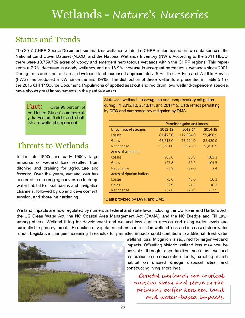
Statewide wetlands losses/gains and compensatory mitigation
during FY 2012/13, 2013/14, and 2014/15. Data reflect permitting
by DEQ and compensatory mitigation by DMS.
*Data provided by DWR and DMS
Threats to Wetlands
In the late 1800s and early 1900s, large
amounts of wetland loss resulted from
ditching and draining for agriculture and
forestry. Over the years, wetland loss has
occurred from dredging conversion to deep-
water habitat for boat basins and navigation
channels, followed by upland development,
erosion, and shoreline hardening.
Coastal wetlands are critical
nursery areas and serve as the
primary buffer between land
and water-based impacts.
Permitted gains and losses
Linear feet of streams 2012-13 2013-14 2014-15
Losses 81,473.0 117,694.0 59,498.9
Gains 48,712.0 78,024.0 22,620.0
Net change -32,761.0 -39,670.0 -36,878.9
Acres of wetlands
Losses 203.6 98.9 102.1
Gains 197.8 59.9 104.5
Net change -5.8 -39.0 2.4
Acres of riparian buffers
Losses 75.6 48.0 56.1
Gains 37.9 21.2 18.2
Net change -37.8 -26.9 -37.9
29
Soft Bottom - The Dynamic Habitat
oft bottom is unconsolidated, unvegetated sediment that occurs in freshwater, estuarine, and marine
systems. Mud flats, sand bars, inlet shoals, and intertidal beaches are specific types of soft bottom.
Grain size distribution, salinity, DO, and flow characteristics affect the condition of soft bottom habitat
and the type of organisms that use it. Soft bottom covers approximately 1.9 million acres. North Caroli-
na’s coast can be divided into geologically distinct northern and southern provinces. In the northern province
(north of Cape Lookout), the seafloor consists of a thick layer of unconsolidated mud, muddy sand, and peat sed-
iments. The low slopes of the bottom result in an extensive system of drowned river estuaries, long barrier is-
lands, and few inlets. The southern province has a thin and variable layer of surficial sands and mud, with under-
lying rock platforms, a steeper sloping shoreline with narrow estuaries, short barrier islands, and numerous inlets
(Ch. 6).
S
Soft bottom includes features
such as mud flats, inlets, shoals,
channel bottoms, and ocean
beaches.
Habitat Functions and Fish Use
Soft bottom is important as a storage reservoir of nutrients, chemicals, and
microbes in coastal ecosystems, allowing for both deposition and
resuspension of nutrients and toxic substances. The surface supports
benthic microalgae, contributing substantial primary production to the
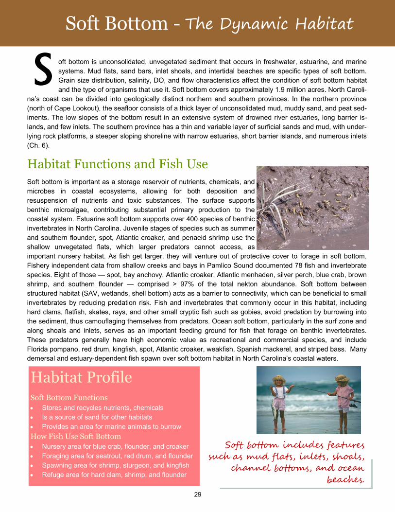
coastal system. Estuarine soft bottom supports over 400 species of benthic
invertebrates in North Carolina. Juvenile stages of species such as summer
and southern flounder, spot, Atlantic croaker, and penaeid shrimp use the
shallow unvegetated flats, which larger predators cannot access, as
important nursery habitat. As fish get larger, they will venture out of protective cover to forage in soft bottom.
Fishery independent data from shallow creeks and bays in Pamlico Sound documented 78 fish and invertebrate
species. Eight of those — spot, bay anchovy, Atlantic croaker, Atlantic menhaden, silver perch, blue crab, brown
shrimp, and southern flounder — comprised > 97% of the total nekton abundance. Soft bottom between
structured habitat (SAV, wetlands, shell bottom) acts as a barrier to connectivity, which can be beneficial to small
invertebrates by reducing predation risk. Fish and invertebrates that commonly occur in this habitat, including
hard clams, flatfish, skates, rays, and other small cryptic fish such as gobies, avoid predation by burrowing into
the sediment, thus camouflaging themselves from predators. Ocean soft bottom, particularly in the surf zone and
along shoals and inlets, serves as an important feeding ground for fish that forage on benthic invertebrates.
These predators generally have high economic value as recreational and commercial species, and include
Florida pompano, red drum, kingfish, spot, Atlantic croaker, weakfish, Spanish mackerel, and striped bass. Many
demersal and estuary-dependent fish spawn over soft bottom habitat in North Carolina’s coastal waters.
Habitat Profile Soft Bottom Functions
Stores and recycles nutrients, chemicals
Is a source of sand for other habitats
Provides an area for marine animals to burrow
How Fish Use Soft Bottom
Nursery area for blue crab, flounder, and croaker
Foraging area for seatrout, red drum, and flounder
Spawning area for shrimp, sturgeon, and kingfish
Refuge area for hard clam, shrimp, and flounder
30
Soft Bottom - The Dynamic Habitat
Soft bottom strongly influences
the water column by the con-
stant cycling of nutrients and
sediments.
Economic Benefits
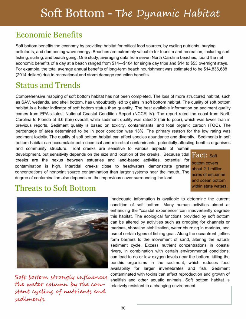
Soft bottom benefits the economy by providing habitat for critical food sources, by cycling nutrients, burying
pollutants, and dampening wave energy. Beaches are extremely valuable for tourism and recreation, including surf
fishing, surfing, and beach going. One study, averaging data from seven North Carolina beaches, found the net
economic benefits of a day at a beach ranged from $14—$104 for single day trips and $14 to $53 overnight stays.
For example, the total average annual benefits of long-term beach nourishment was estimated to be $14,836,688
(2014 dollars) due to recreational and storm damage reduction benefits.
Status and Trends
Comprehensive mapping of soft bottom habitat has not been completed. The loss of more structured habitat, such
as SAV, wetlands, and shell bottom, has undoubtedly led to gains in soft bottom habitat. The quality of soft bottom
habitat is a better indicator of soft bottom status than quantity. The best available information on sediment quality
comes from EPA’s latest National Coastal Condition Report (NCCR IV). The report rated the coast from North
Carolina to Florida at 3.6 (fair) overall, while sediment quality was rated 2 (fair to poor), which was lower than in
previous reports. Sediment quality is based on toxicity, contaminants, and total organic carbon (TOC). The
percentage of area determined to be in poor condition was 13%. The primary reason for the low rating was
sediment toxicity. The quality of soft bottom habitat can affect species abundance and diversity. Sediments in soft
bottom habitat can accumulate both chemical and microbial contaminants, potentially affecting benthic organisms
and community structure. Tidal creeks are sensitive to various aspects of human
development, but sensitivity depends on the size and location of the creeks. Because tidal
creeks are the nexus between estuaries and land-based activities, potential for
contamination is high. Intertidal creeks close to headwaters demonstrate greater
concentrations of nonpoint source contamination than larger systems near the mouth. The
degree of contamination also depends on the impervious cover surrounding the land.
Threats to Soft Bottom
Fact: Soft
bottom covers
about 2.1 million
acres of estuarine
and ocean bottom
within state waters.
Inadequate information is available to determine the current
condition of soft bottom. Many human activities aimed at
enhancing the “coastal experience” can inadvertently degrade
this habitat. The ecological functions provided by soft bottom
can be altered by activities such as dredging for channels or
marinas, shoreline stabilization, water churning in marinas, and
use of certain types of fishing gear. Along the oceanfront, jetties
form barriers to the movement of sand, altering the natural
sediment cycle. Excess nutrient concentrations in coastal
rivers, in combination with certain environmental conditions,
can lead to no or low oxygen levels near the bottom, killing the
benthic organisms in the sediment, which reduces food
availability for larger invertebrates and fish. Sediment
contaminated with toxins can affect reproduction and growth of
shellfish and other aquatic animals. Soft bottom habitat is
relatively resistant to a changing environment.
31
Hard Bottom - Rocks, Reefs, and Wrecks
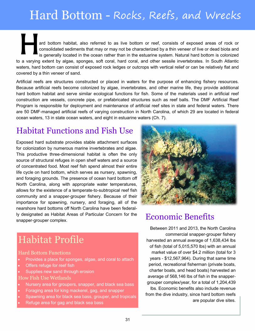
ard bottom habitat, also referred to as live bottom or reef, consists of exposed areas of rock or
consolidated sediments that may or may not be characterized by a thin veneer of live or dead biota and
is generally located in the ocean rather than in the estuarine system. Natural hard bottom is colonized
to a varying extent by algae, sponges, soft coral, hard coral, and other sessile invertebrates. In South Atlantic
waters, hard bottom can consist of exposed rock ledges or outcrops with vertical relief or can be relatively flat and
covered by a thin veneer of sand.
Artificial reefs are structures constructed or placed in waters for the purpose of enhancing fishery resources.
Because artificial reefs become colonized by algae, invertebrates, and other marine life, they provide additional
hard bottom habitat and serve similar ecological functions for fish. Some of the materials used in artificial reef
construction are vessels, concrete pipe, or prefabricated structures such as reef balls. The DMF Artificial Reef
Program is responsible for deployment and maintenance of artificial reef sites in state and federal waters. There
are 50 DMF-managed artificial reefs of varying construction in North Carolina, of which 29 are located in federal
ocean waters, 13 in state ocean waters, and eight in estuarine waters (Ch. 7).
H
Habitat Functions and Fish Use
Exposed hard substrate provides stable attachment surfaces
for colonization by numerous marine invertebrates and algae.
This productive three-dimensional habitat is often the only
source of structural refuges in open shelf waters and a source
of concentrated food. Most reef fish spend almost their entire
life cycle on hard bottom, which serves as nursery, spawning,
and foraging grounds. The presence of ocean hard bottom off
North Carolina, along with appropriate water temperatures,
allows for the existence of a temperate-to-subtropical reef fish
community and a snapper-grouper fishery. Because of their
importance for spawning, nursery, and foraging, all of the
nearshore hard bottoms off North Carolina have been federal-
ly designated as Habitat Areas of Particular Concern for the
snapper-grouper complex.
Habitat Profile Hard Bottom Functions
Provides a place for sponges, algae, and coral to attach
Offers refuge for reef fish
Supplies new sand through erosion
How Fish Use Wetlands
Nursery area for groupers, snapper, and black sea bass
Foraging area for king mackerel, gag, and snapper
Spawning area for black sea bass, grouper, and tropicals
Refuge area for gag and black sea bass
Economic Benefits
Between 2011 and 2013, the North Carolina
commercial snapper-grouper fishery
harvested an annual average of 1,638,434 lbs
of fish (total of 5,015,570 lbs) with an annual
market value of over $4.2 million (total for 3
years - $12,567,964). During that same time
period, recreational fisherman (private boats,
charter boats, and head boats) harvested an
average of 568,146 lbs of fish in the snapper-
grouper complex/year, for a total of 1,204,439
lbs. Economic benefits also include revenue
from the dive industry, since hard bottom reefs
are popular dive sites.
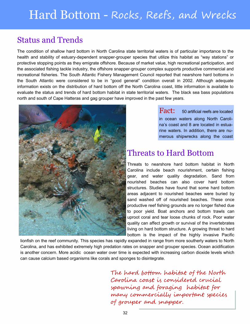
32
Hard Bottom - Rocks, Reefs, and Wrecks
The hard bottom habitat of the North
Carolina coast is considered crucial
spawning and foraging habitat for
many commercially important species
of grouper and snapper.
Status and Trends
The condition of shallow hard bottom in North Carolina state territorial waters is of particular importance to the
health and stability of estuary-dependent snapper-grouper species that utilize this habitat as “way stations” or
protective stopping points as they emigrate offshore. Because of market value, high recreational participation, and
the associated fishing tackle industry, the offshore snapper-grouper complex supports productive commercial and
recreational fisheries. The South Atlantic Fishery Management Council reported that nearshore hard bottoms in
the South Atlantic were considered to be in “good general” condition overall in 2002. Although adequate
information exists on the distribution of hard bottom off the North Carolina coast, little information is available to
evaluate the status and trends of hard bottom habitat in state territorial waters. The black sea bass populations
north and south of Cape Hatteras and gag grouper have improved in the past few years.
Threats to Hard Bottom
Threats to nearshore hard bottom habitat in North
Carolina include beach nourishment, certain fishing
gear, and water quality degradation. Sand from
nourished beaches can also cover hard bottom
structures. Studies have found that some hard bottom
areas adjacent to nourished beaches were buried by
sand washed off of nourished beaches. These once
productive reef fishing grounds are no longer fished due
to poor yield. Boat anchors and bottom trawls can
uproot coral and tear loose chunks of rock. Poor water
quality can affect growth or survival of the invertebrates
living on hard bottom structure. A growing threat to hard
bottom is the impact of the highly invasive Pacific
lionfish on the reef community. This species has rapidly expanded in range from more southerly waters to North
Carolina, and has exhibited extremely high predation rates on snapper and grouper species. Ocean acidification
is another concern. More acidic ocean water over time is expected with increasing carbon dioxide levels which
can cause calcium based organisms like corals and sponges to disintegrate.
Fact: 50 artificial reefs are located
in ocean waters along North Caroli-
na’s coast and 8 are located in estua-
rine waters. In addition, there are nu-
merous shipwrecks along the coast
33
ACRONYM LIST
APNEP: Albemarle-Pamlico National Estuary Partnership
BMPs: Best Management Practices
CAMA: NC Coastal Area Management Act
CHPP: Coastal Habitat Protection Plan
CRC: Coastal Resources Commission
CRFL: Coastal Recreational Fishing License
DACS: Department of Agriculture and Consumer Services
DCM: Division of Coastal Management
DEMLR: Division of Energy, Mineral, and Land Resources
DENR: Department of Environment and Natural Resources
DEQ: Department of Environmental Quality (formerly DENR)
DMF: Division of Marine Fisheries
DMS: Division of Mitigation Services
DO: Dissolved Oxygen
DOT: Department of Transportation
DSWC: Division of Soil and Water Conservation
DWR: Division of Water Resources
EBM: Ecosystem-Based Management
EFH: Essential Fish Habitat
EMC: Environmental Management Commission
EPA: US Environmental Protection Agency
FWS: US Fish and Wildlife Service
LID: Low Impact Development
MFC: Marine Fisheries Commission
NCCR: National Coastal Condition Report
NCFS: NC Forest Service
NLCD: National Land Cover Database
NWI: National Wetlands Inventory
SAFMC: South Atlantic Fishery Management Council
SAV: Submerged Aquatic Vegetation
SCC: Sedimentation Control Commission
SCH: Strategic Coastal Habitats
SWCC: Soil and Water Conservation Commission
TOC: Total Organic Carbon
TSS: Total Suspended Solids
USACE: US Army Corps of Engineers
WRC: Wildlife Resources Commission
For more information or to download the CHPP and Source Document, go to
http://portal.ncdenr.org/web/mf/habitat/chpp/downloads
This document should be cited as follows: NCDEQ (North Carolina Department of Environmental Quality). North Carolina Coastal Habitat Protection Plan. Morehead City, NC. Division of Marine Fisheries; 2016. 33 p.