mapping presented by: lobna m. hammamm by: todd cohen web address: topic number: 4 september 1,...
Post on 20-Dec-2015
214 views
TRANSCRIPT

MappingMapping
Presented By:Presented By:
Lobna M. HammammLobna M. Hammamm
By: Todd CohenBy: Todd Cohen
Web Address:Web Address:
http://www.nptimes.com/Sept04/cyberfrontier.htmlhttp://www.nptimes.com/Sept04/cyberfrontier.html
Topic Number: 4Topic Number: 4
September 1, 2004September 1, 2004
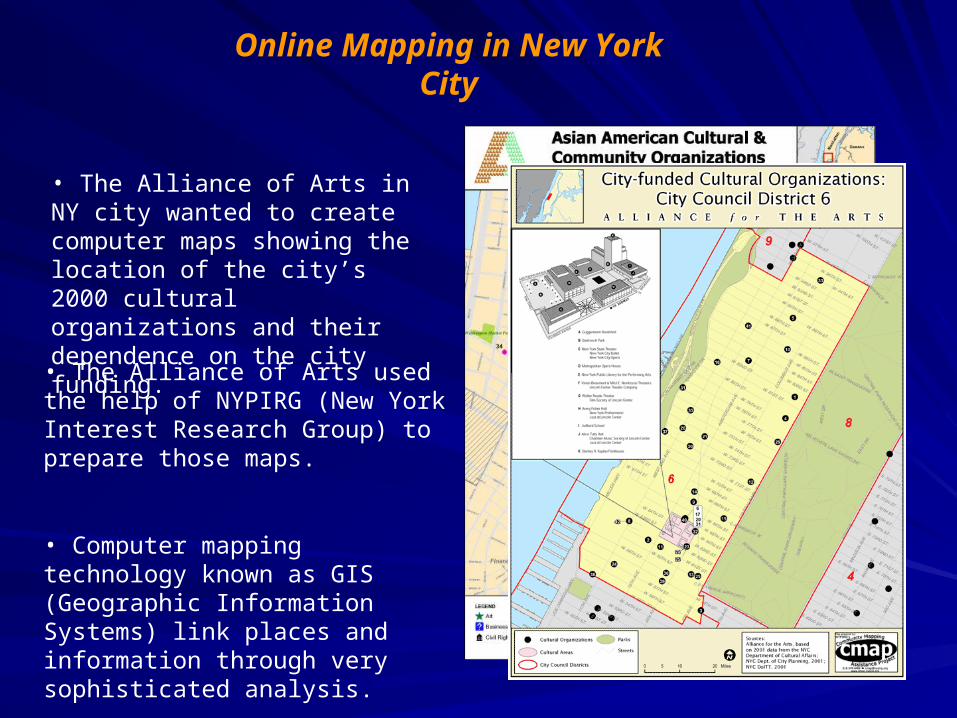
• The Alliance of Arts in NY city wanted to create computer maps showing the location of the city’s 2000 cultural organizations and their dependence on the city funding.
Online Mapping in New York City
• The Alliance of Arts used the help of NYPIRG (New York Interest Research Group) to prepare those maps.
• Computer mapping technology known as GIS (Geographic Information Systems) link places and information through very sophisticated analysis.

• NYPIRG started using GIS in the 1990’s to create visual tools to support its community organizing work on environmental issues.
• New York worried about the impact of the contaminated sites in the big industrial park.
• So, NYPIRG obtained data on the location of the sites and mapped them to show how close they were to homes, parks and playground.
• NYPIRG persuaded New York department of environmental conservation by using the maps to give the sites higher priority for clean up.
Arial viewLand use
IndustryIndustry and Residential
Industrial and Parks
Industrial and Playgrounds

NYPIRG lunched CMAP (Community Mapping Assistance Project) in 1997 to use computer maps for work on a broader range of issues.
CMAP and NY State Council of Art:
1. Developed the cultural map for the Alliance of Arts.
2. Developed the Open Accessible Space Information System (CASIS) to map information about open space resources ranging from community gardens to large parks
where the maps shows the relationship between open space and transportation, demographics, social services and other aspects of life.
Community GardensNYC ParksOpen Spaces and TransportationOpen Spaces and
DemographicsOpen Spaces and Social
Services

• Like CMAP ; Greenbelt Alliance focuses on regional land use planning and conservation.
• Greenbelt Alliance converted maps it had created by hand to digital form.
• Green info program prepared maps where the grant makers used to solicit grant proposals from two groups serving communities where the two problems overlapped significantly.
• Green info helped grant seekers define their own geographic spheres of influence and helped the foundations determine which groups could best address priority needs.