mapping for - cooperative extension mapping panel 1 mapping for foresters some options and...
TRANSCRIPT

Resources‐Resilience‐Renewal‐Restoration 94th Annual Winter Meeting, New England Society of American Foresters March 25‐27, 2014
3/26/2014, Mapping Panel
1
Mapping for Foresters
Some Options and Considerations
Goals
• Many different systems foresters have
• Everyone has different comfort levels with technology
• Many software and hardware options
• Understand your current mapping needs
• Understand your current system
• Think about how technology can improve your mapping system

Resources‐Resilience‐Renewal‐Restoration 94th Annual Winter Meeting, New England Society of American Foresters March 25‐27, 2014
3/26/2014, Mapping Panel
2
Some questions to Ask• What are your mapping needs?
• What are the best tools?
• Do you want one integrated or automated system or separate components to mix and match?
• How will your system change in the future with technology?
• Data Storage and maintenance – Will not talk about but important “GIS is a database that happens to make maps” (Shane Bradt)
Forester Mapping Needs
Inventory / navigation mapping (fieldwork)
Mgmt plan mapping (the product)
Boundary lines Locus Map
Inventory Points Stand Map
Access (roads, trails) Topo Map
Features (notablepoints)
Soils Map
Other… Other…
*Operations map

Resources‐Resilience‐Renewal‐Restoration 94th Annual Winter Meeting, New England Society of American Foresters March 25‐27, 2014
3/26/2014, Mapping Panel
3
What are the best tools?
Inventory /navigation mapping
Mgmt plan mapping
Handheld GPS Desktop program (GIS)
Phone tablet Apps Tablet w/app
Data logger / tablet PC Tablet PC w/program
There is a GPS chip in all of these – it is a GPS
Google EarthWeb Soil Survey (WSS)etc. edited in word
What are the best tools?
• Some considerations
– Hardware, software, hardware‐software combination
– Desktop programs v. phone applications
– Cloud v. local
– Free v. paid
– Ruggedized, weather resistant, battery life
– Cost
– Comfort with technology

Resources‐Resilience‐Renewal‐Restoration 94th Annual Winter Meeting, New England Society of American Foresters March 25‐27, 2014
3/26/2014, Mapping Panel
4
Do you want one integrated (automated)system or separate components to mix and match?
• Hip chain – paper and pen – hand drawn map
• GPS – tally sheet – DNR GPS – NED‐2 – GIS mapping
• GIS inventory layout – DS cruiser on datalogger – GIS mapping
• Tablet PC Inventory‐GIS‐GPS data collection and mapping
How will your system change in the future with technology?
• DNR GPS –
– Minnesota Department of Natural Resources
• Download GPS info and save in multiple formats
• Upload GIS information
– Boundary points
– Inventory points
http://www.dnr.state.mn.us/mis/gis/DNRGPS/DNRGPS.html
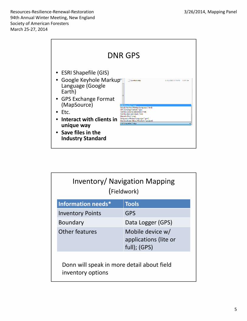
Resources‐Resilience‐Renewal‐Restoration 94th Annual Winter Meeting, New England Society of American Foresters March 25‐27, 2014
3/26/2014, Mapping Panel
5
DNR GPS
• ESRI Shapefile (GIS)• Google Keyhole Markup Language (Google Earth)
• GPS Exchange Format (MapSource)
• Etc.• Interact with clients in unique way
• Save files in the Industry Standard
Inventory/ Navigation Mapping(Fieldwork)
Information needs* Tools
Inventory Points GPS
Boundary Data Logger (GPS)
Other features Mobile device w/ applications (lite or full); (GPS)
Donn will speak in more detail about field inventory options

Resources‐Resilience‐Renewal‐Restoration 94th Annual Winter Meeting, New England Society of American Foresters March 25‐27, 2014
3/26/2014, Mapping Panel
6
Inventory MappingData Collection
Approach Advantages Disadvantages
Handheld GPS & Hand Collection
• Familiarity• Less expensive
• Less automation, more time intensive
Data Loggers / Tablet PC
• Easier to automate• May promote an integrated, seamless collection and mapping process
• More expensive• Tech know‐how• Manufacturer support and longevity(?)
MobileApplications
• Flexibility and options
• May have less functionality
“Mgmt. Plan” Mapping Tools
• What functionality do you need?
• 4 examples
– Recreational user GPS software
– Google Earth
– GIS software
– 3rd party mapping (WSS)
• For many of these options there are paid and free versions with different functionality

Resources‐Resilience‐Renewal‐Restoration 94th Annual Winter Meeting, New England Society of American Foresters March 25‐27, 2014
3/26/2014, Mapping Panel
7
Recreational User GPS SoftwareGarmin MapSource (Basecamp)
Recreational User GPS Software• Application
– Map your points, line, polygons –
– Basic mapping (no legend)
• Considerations
– Fewer layers
– File format may not be industry standard (.shp)
– Fewer analysis tools
– Inexpensive and accessible to users
– Can you get your data out

Resources‐Resilience‐Renewal‐Restoration 94th Annual Winter Meeting, New England Society of American Foresters March 25‐27, 2014
3/26/2014, Mapping Panel
8
Recreational User GPS Software
Google Earth

Resources‐Resilience‐Renewal‐Restoration 94th Annual Winter Meeting, New England Society of American Foresters March 25‐27, 2014
3/26/2014, Mapping Panel
9
Google Earth• Application
– Map your points, line, polygons –
– Basic mapping
• Considerations– Fewer layers
– File format may not be industry standard (.shp)
– Fewer analysis tools
– Free
– Google Pro version with more functionality
KML Tools Project UNH Cooperative Extension
• Calculate area• Create buffers• Create cruise points
ArcMap GIShttp://www.esri.com

Resources‐Resilience‐Renewal‐Restoration 94th Annual Winter Meeting, New England Society of American Foresters March 25‐27, 2014
3/26/2014, Mapping Panel
10
MapWindow GIShttp://www.mapwindow.org
GIS (ArcGIS, MapWindow GIS, etc.)
• Application
– Map your points, line, polygons –
– Advanced mapping
• Considerations
– Infinite possibility
– File format is industry standard (.shp)
– Lots of analysis tools
– Free or expensive version ($1500/yr)
– May get what you pay for…

Resources‐Resilience‐Renewal‐Restoration 94th Annual Winter Meeting, New England Society of American Foresters March 25‐27, 2014
3/26/2014, Mapping Panel
11
Mgmt. Plan MappingApproach Advantages Disadvantages
RecreationalMapping Software
• Cheap• Easy to use
• May not produce all needed maps
• Limitedfunctionality
Mobile / OnlineApplications (e.g. Google Earth, WSS, etc.)
• Easy‐moderatedifficulty
• More/Less Functionality
• Great for certain functions
• May be hard to export maps
• May be clunky to get in mgmt. plan
• May not have legend
GIS • Robust• Customizeanything
• Free version clunky/buggy
• Difficult to learn
Conclusion• How tech savvy are you or do you want to be?
• The more complicated the system the more you should use it.
• What is the functionality that you need? – Use as many or as few applications or approaches as needed
• How will what you use change over time?

Resources‐Resilience‐Renewal‐Restoration 94th Annual Winter Meeting, New England Society of American Foresters March 25‐27, 2014
3/26/2014, Mapping Panel
12
Thank You
• Peter Palmiotto, Antioch University
• Donn Downey, Forest Metrix
• Steve Eisenhaure, UNH woodlands and Natural Areas
• Shane Bradt, UNH Cooperative Extension