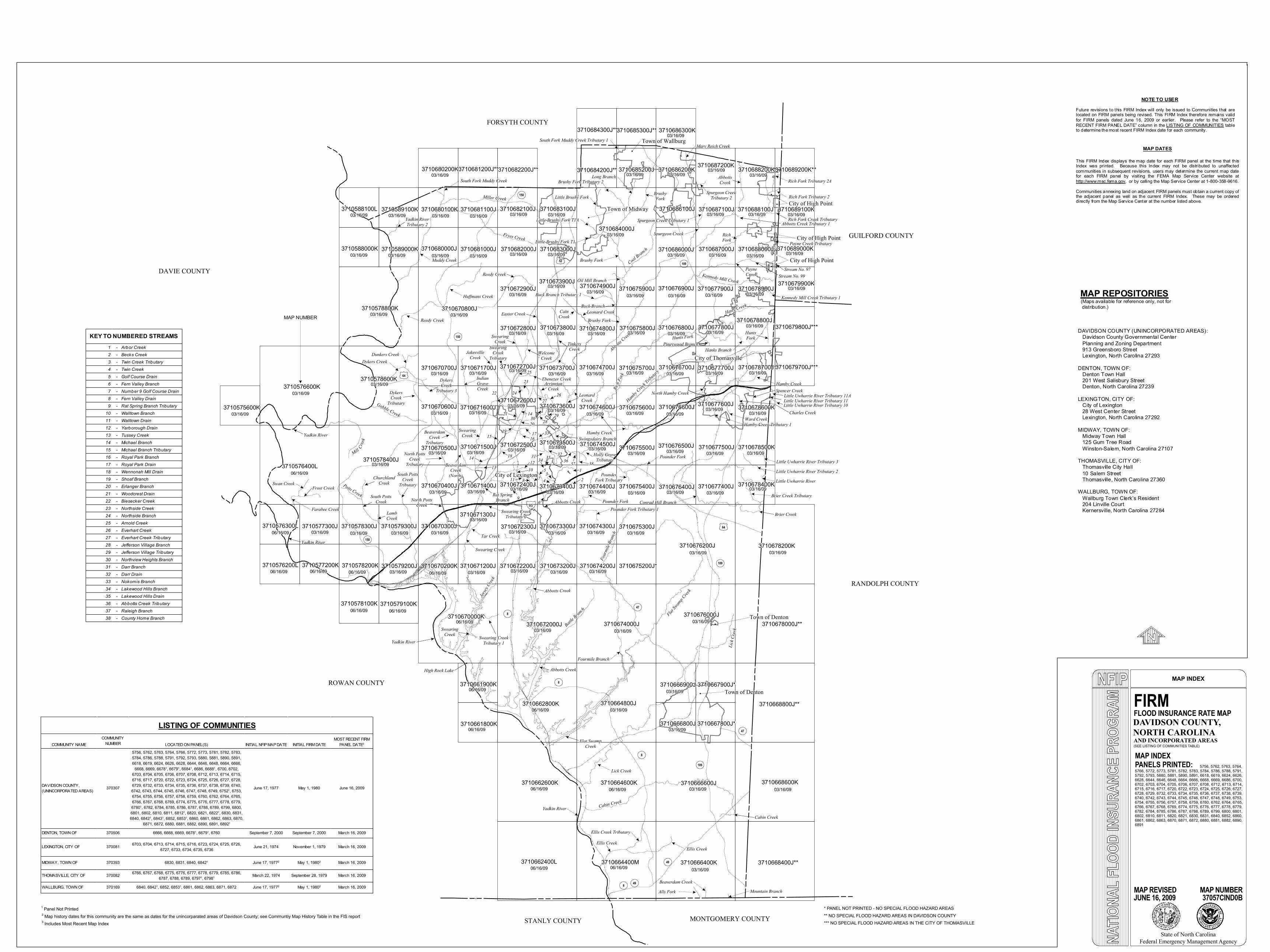
map repositories - north...

1
< MAP NUMBER DAVIDSON COUNTY, NORTH CAROLINA MAP INDEX FIRM FLOOD INSURANCE RATE MAP MAP INDEX (SEE LISTING OF COMMUNITIES TABLE) MAP REVISED MAP NUMBER 37057CIND0B State of North Carolina Federal Emergency Management Agency PANELS PRINTED: 1 Panel Not Printed ** NO SPECIAL FLOOD HAZARD AREAS IN DAVIDSON COUNTY 3710662400L 3710662600K 3710664400M 3710664600K 3710666400K 3710666600J 3710668400J** 3710668600K 3710578100K 3710579100K 3710670000K 3710661800K 3710661900K 3710662800K 3710672000J 3710664800J 3710666800J 3710666900J 3710667800J* 3710667900J* 3710668800J** 3710674000J 3710676000J 3710678000J** 3710575600K 3710576200L 3710576300L 3710576400L 3710577200K 3710577300J 3710578200K 3710578300J 3710578400J 3710579200J 3710579300J 3710670200K 3710670300J 3710670400J 3710670500J 3710670600J 3710671200J 3710671300J 3710671400J 3710671500J 3710671600J 3710672200J 3710672300J 3710672400J 3710672500J 3710672600J 3710673200J 3710673300J 3710673400J 3710673500J 3710673600J 3710674200J 3710674300J 3710674400J 3710674500J 3710674600J 3710675200J* 3710675300J 3710675400J 3710675500J 3710675600J 3710676200J 3710676400J 3710676500J 3710676600J 3710677400J 3710677500J 3710677600J 3710678400K 3710678500K 3710678600K 3710679900K 3710689000K 3710689100K 3710678700J 3710678800J 3710678900J 3710688000J 3710688100J 3710677700J 3710677800J 3710677900J 3710687000J 3710687100J 3710676700J 3710676800J 3710676900J 3710686000J 3710686100J 3710675700J 3710675800J 3710675900J 3710674700J 3710674800J 3710674900J 3710684000J 3710673700J 3710673800J 3710673900J 3710683000J 3710683100J 3710672700J 3710671700J 3710670700J 3710578800K 3710670800J 3710672800J 3710672900J 3710588000K 3710589000K 3710588100L 3710589100K 3710680000J 3710680100K 3710681000J 3710681100J 3710682000J 3710682100J 3710576600K 3710578600K 3710680200K 3710681200J** 3710682200J** 3710684200J** 3710684300J** 3710685200J 3710685300J** 3710686200K 3710686300K 3710687200K 3710688200K 3710689200K** DAVIE COUNTY ROWAN COUNTY STANLY COUNTY MONTGOMERY COUNTY RANDOLPH COUNTY GUILFORD COUNTY FORSYTH COUNTY 3710678200K Alls Fork < Beaverdam Creek < Mountain Branch < Ellis Creek < Ellis Creek Tributary < Yadkin River < Cabin Creek Lick Creek < Flat Swamp Creek Fourmile Branch < Abbotts Creek Abbotts Creek Pounder Fork < Pounder Fork Tributary 1 < Pounder Fork Tributary Pounder Fork < Leonard Creek Abbotts Creek Rich Fork Hamby Creek Tributary Brushy Fork < Buck Branch < Buck Branch Tributary 1 < Oil Mill Branch < Cool Branch Little Brushy Fork < Little Brushy Fork T1 < Little Brushy Fork T1A < Brushy Fork Tributary 2 < Long Branch < South Fork Muddy Creek Tributary 1 < Spurgeon Creek < Spurgeon Creek Tributary 1 < Spurgeon Creek Tributary 2 < Mary Reich Creek < Rich Fork Creek Tributary Hunts Fork Hasty Creek Hanks Branch < Kennedy Mill Creek Kennedy Mill Creek Tributary 1 Rich Fork Tributary 2 < Rich Fork Tributary 2A < Swearing Creek < Swearing Creek Tributary 1 Jersey Creek Tar Creek < Swearing Creek Tributary 2 < Indian Grave Creek < Welcome Creek North Potts Creek South Potts Creek Potts Creek Farabee Creek < Swan Creek < Mill Gobble Creek Dykers Creek < Dykers Creek Tributary Dykers Creek Tributary 3 Dunkers Creek < Reedy Creek < Huffmans Creek < Muddy Creek < Yadkin River Tributary 2 Fryes Creek Miller Creek South Fork Muddy Creek < Hamby Creek < North Hamby Creek < Hamby Creek Tributary 1 < Ward Creek < Charles Creek Spencer Creek Hamby Creek < Little Uwharrie River Tributary 11A Conrad Hill Branch < Brier Creek Tributary < Little Uwharrie River < Little Uwharrie River Tributary 2 < Little Uwharrie River Tributary 3 < - 85 P 150 P 8 P 8 P 49 P 109 P 47 P 47 P 109 P 109 1 64 1 52 1 64 City of Lexington Town of Denton Town of Denton ! ( City of Thomasville City of High Point ! ( ! ( City of High Point ! ( ! ( City of High Point ! ( ! ( Town of Wallburg ! ( 5756, 5762, 5763, 5764, 5766, 5772, 5773, 5781, 5782, 5783, 5784, 5786, 5788, 5791, 5792, 5793, 5880, 5881, 5890, 5891, 6618, 6619, 6624, 6626, 6628, 6644, 6646, 6648, 6664, 6666, 6668, 6669, 6686, 6700, 6702, 6703, 6704, 6705, 6706, 6707, 6708, 6712, 6713, 6714, 6715, 6716, 6717, 6720, 6722, 6723, 6724, 6725, 6726, 6727, 6728, 6729, 6732, 6733, 6734, 6735, 6736, 6737, 6738, 6739, 6740, 6742, 6743, 6744, 6745, 6746, 6747, 6748, 6749, 6753, 6754, 6755, 6756, 6757, 6758, 6759, 6760, 6762, 6764, 6765, 6766, 6767, 6768, 6769, 6774, 6775, 6776, 6777, 6778, 6779, 6782, 6784, 6785, 6786, 6787, 6788, 6789, 6799, 6800, 6801, 6802, 6810, 6811, 6820, 6821, 6830, 6831, 6840, 6852, 6860, 6861, 6862, 6863, 6870, 6871, 6872, 6880, 6881, 6882, 6890, 6891 Battle Branch COMMUNITY NAME COMMUNITY NUMBER LOCATED ON PANEL(S) INITIAL NFIP MAP DATE INITIAL FIRM DATE MOST RECENT FIRM PANEL DATE 3 DAVIDSON COUNTY, (UNINCORPORATED AREAS) 370307 5756, 5762, 5763, 5764, 5766, 5772, 5773, 5781, 5782, 5783, 5784, 5786, 5788, 5791, 5792, 5793, 5880, 5881, 5890, 5891, 6618, 6619, 6624, 6626, 6628, 6644, 6646, 6648, 6664, 6666, 6668, 6669, 6678 1 , 6679 1 , 6684 1 , 6686, 6688 1 , 6700, 6702, 6703, 6704, 6705, 6706, 6707, 6708, 6712, 6713, 6714, 6715, 6716, 6717, 6720, 6722, 6723, 6724, 6725, 6726, 6727, 6728, 6729, 6732, 6733, 6734, 6735, 6736, 6737, 6738, 6739, 6740, 6742, 6743, 6744, 6745, 6746, 6747, 6748, 6749, 6752 1 , 6753, 6754, 6755, 6756, 6757, 6758, 6759, 6760, 6762, 6764, 6765, 6766, 6767, 6768, 6769, 6774, 6775, 6776, 6777, 6778, 6779, 6780 1 , 6782, 6784, 6785, 6786, 6787, 6788, 6789, 6799, 6800, 6801, 6802, 6810, 6811, 6812 1 , 6820, 6821, 6822 1 , 6830, 6831, 6840, 6842 1 , 6843 1 , 6852, 6853 1 , 6860, 6861, 6862, 6863, 6870, 6871, 6872, 6880, 6881, 6882, 6890, 6891, 6892 1 June 17, 1977 May 1, 1980 June 16, 2009 DENTON, TOWN OF 370506 6666, 6668, 6669, 6678 1 , 6679 1 , 6760 September 7, 2000 September 7, 2000 March 16, 2009 LEXINGTON, CITY OF 370081 6703, 6704, 6713, 6714, 6715, 6716, 6723, 6724, 6725, 6726, 6727, 6733, 6734, 6735, 6736 June 21, 1974 November 1, 1979 March 16, 2009 MIDWAY, TOWN OF 370393 6830, 6831, 6840, 6842 1 June 17, 1977 2 May 1, 1980 2 March 16, 2009 THOMASVILLE, CITY OF 370082 6766, 6767, 6768, 6775, 6776, 6777, 6778, 6779, 6785, 6786, 6787, 6788, 6789, 6797 1 , 6798 1 March 22, 1974 September 28, 1979 March 16, 2009 WALLBURG, TOWN OF 370169 6840, 6842 1 , 6852, 6853 1 , 6861, 6862, 6863, 6871, 6872 June 17, 1977 2 May 1, 1980 2 March 16, 2009 LISTING OF COMMUNITIES Creek Swearing Creek Churchland Creek Swearing Creek Fourmile Branch Flat Swamp Creek Lick Creek P 49 P 8 Ellis Creek < Cabin Creek < Brier Creek < P 8 < Frost Creek Yadkin River Yadkin River < < < P 150 Yadkin River < < < < < < High Rock Lake ! ( < < < Lamb Creek < South Potts Creek Tributary < Holly Grove Tributary < North Potts Creek Tributary < < Beaverdam Creek (North) < < Beaverdam Creek Tributary < < < Swearing Creek < Jakesville Creek < Swearing Creek Tributary < Ebenezer Creek < Arrington Creek < Swingsdairy Branch < < Rat Spring Branch < Pineywood Branch < Stream No. 99 < Payne Creek < < Rich Fork < Stream No. 97 < Abbotts Creek < Brushy Fork < < P 150 3710679800J*** 3710679700J*** * PANEL NOT PRINTED - NO SPECIAL FLOOD HAZARD AREAS *** NO SPECIAL FLOOD HAZARD AREAS IN THE CITY OF THOMASVILLE Abbotts Creek < < < Tinkers Creek < < Cain Creek < Leonard Creek Brushy Fork < < Reedy Creek < Easter Creek < Hunts Fork < Payne Creek Tributary < Abbotts Creek Tributary 1 < < < < < Little Uwharrie River Tributary 11 < Little Uwharrie River Tributary 10 < 1 2 3 4 < < < < 5 6 < < 7 8 < < 9 < 10 11 12 < < < 13 14 < < 15 < 16 17 < < 18 < 19 < 20 21 < < 14 < 22 < 23 24 < < 25 < 26 27 < < 30 < 29 28 < < 31 < 32 33 < < 34 35 < < 36 37 < < 38 < 1 - Arbor Creek 2 - Becks Creek 3 - Twin Creek Tributary 4 - Twin Creek 5 - Golf Course Drain 6 - Fern Valley Branch 7 - Number 9 Golf Course Drain 8 - Fern Valley Drain 9 - Rat Spring Branch Tributary 10 - Walltown Branch 11 - Walltown Drain 12 - Yarborough Drain 13 - Tussey Creek 14 - Michael Branch 15 - Michael Branch Tributary 16 - Royal Park Branch 17 - Royal Park Drain 18 - Wennonah Mill Drain 19 - Shoaf Branch 20 - Erlanger Branch 21 - Woodcrest Drain 22 - Biesecker Creek 23 - Northside Creek 24 - Northside Branch 25 - Arnold Creek 26 - Everhart Creek 27 - Everhart Creek Tributary 28 - Jefferson Village Branch 29 - Jefferson Village Tributary 30 - Northview Heights Branch 31 - Darr Branch 32 - Darr Drain 33 - Nokomis Branch 34 - Lakewood Hills Branch 35 - Lakewood Hills Drain 36 - Abbotts Creek Tributary 37 - Raleigh Branch 38 - County Home Branch KEY TO NUMBERED STREAMS Town of Midway ! ( 2 Map history dates for this community are the same as dates for the unincorparated areas of Davidson County; see Communtiy Map History Table in the FIS report ! ( AND INCORPORATED AREAS NOTE TO USER Future revisions to this FIRM Index will only be issued to Communities that are located on FIRM panels being revised. This FIRM Index therefore remains valid for FIRM panels dated June 16, 2009 or earlier. Please refer to the “MOST RECENT FIRM PANEL DATE” column in the LISTING OF COMMUNITIES table to determine the most recent FIRM Index date for each community. MAP DATES This FIRM Index displays the map date for each FIRM panel at the time that this Index was printed. Because this Index may not be distributed to unaffected communities in subsequent revisions, users may determine the current map date for each FIRM panel by visiting the FEMA Map Service Center website at http://www.msc.fema.gov , or by calling the Map Service Center at 1-800-358-9616. Communities annexing land on adjacent FIRM panels must obtain a current copy of the adjacent panel as well as the current FIRM Index. These may be ordered directly from the Map Service Center at the number listed above. 03/16/09 03/16/09 03/16/09 03/16/09 03/16/09 03/16/09 03/16/09 03/16/09 03/16/09 03/16/09 03/16/09 03/16/09 03/16/09 03/16/09 03/16/09 03/16/09 03/16/09 03/16/09 03/16/09 03/16/09 03/16/09 03/16/09 03/16/09 03/16/09 03/16/09 03/16/09 03/16/09 03/16/09 03/16/09 03/16/09 03/16/09 03/16/09 03/16/09 03/16/09 03/16/09 03/16/09 03/16/09 03/16/09 03/16/09 03/16/09 03/16/09 03/16/09 03/16/09 03/16/09 03/16/09 03/16/09 03/16/09 03/16/09 03/16/09 03/16/09 03/16/09 03/16/09 03/16/09 03/16/09 03/16/09 03/16/09 06/16/09 03/16/09 03/16/09 06/16/09 03/16/09 06/16/09 03/16/09 03/16/09 06/16/09 06/16/09 03/16/09 06/16/09 06/16/09 06/16/09 03/16/09 03/16/09 06/16/09 06/16/09 06/16/09 06/16/09 06/16/09 03/16/09 03/16/09 03/16/09 03/16/09 03/16/09 06/16/09 06/16/09 03/16/09 03/16/09 03/16/09 03/16/09 03/16/09 03/16/09 03/16/09 03/16/09 03/16/09 03/16/09 03/16/09 03/16/09 03/16/09 03/16/09 03/16/09 03/16/09 03/16/09 03/16/09 03/16/09 03/16/09 03/16/09 03/16/09 03/16/09 03/16/09 03/16/09 03/16/09 03/16/09 03/16/09 03/16/09 03/16/09 03/16/09 03/16/09 03/16/09 03/16/09 03/16/09 03/16/09 03/16/09 03/16/09 03/16/09 06/16/09 MAP REPOSITORIES (Maps available for reference only, not for distribution.) DAVIDSON COUNTY (UNINCORPORATED AREAS): Davidson County Governmental Center Planning and Zoning Department 913 Greensboro Street Lexington, North Carolina 27293 DENTON, TOWN OF: Denton Town Hall 201 West Salisbury Street Denton, North Carolina 27239 LEXINGTON, CITY OF: City of Lexington 28 West Center Street Lexington, North Carolina 27292 MIDWAY, TOWN OF: Midway Town Hall 125 Gum Tree Road Winston-Salem, North Carolina 27107 THOMASVILLE, CITY OF: Thomasville City Hall 10 Salem Street Thomasville, North Carolina 27360 WALLBURG, TOWN OF: Wallburg Town Clerk’s Resident 204 Linville Court Kernersville, North Carolina 27284 JUNE 16, 2009 3 Includes Most Recent Map Index

Upload: trinhhanh

Post on 10-Dec-2018

217 views

Category:

Documents


0 download

TRANSCRIPT

<

MAP NUMBER

DAVIDSON COUNTY,NORTH CAROLINA

MAP INDEX

FIRMFLOOD INSURANCE RATE MAP

MAP INDEX(SEE LISTING OF COMMUNITIES TABLE)

MAP REVISED MAP NUMBER37057CIND0B

State of North CarolinaFederal Emergency Management Agency

PANELS PRINTED:

1 Panel Not Printed** NO SPECIAL FLOOD HAZARD AREAS IN DAVIDSON COUNTY

3710662400L

3710662600K

3710664400M

3710664600K

3710666400K

3710666600J

3710668400J**

3710668600K

3710578100K 3710579100K3710670000K

3710661800K

3710661900K

3710662800K

3710672000J

3710664800J

3710666800J

3710666900J

3710667800J*

3710667900J*

3710668800J**

3710674000J3710676000J

3710678000J**

3710575600K

3710576200L

3710576300L

3710576400L

3710577200K

3710577300J

3710578200K

3710578300J

3710578400J

3710579200J

3710579300J

3710670200K

3710670300J

3710670400J

3710670500J

3710670600J

3710671200J

3710671300J

3710671400J

3710671500J

3710671600J

3710672200J

3710672300J

3710672400J

3710672500J

3710672600J

3710673200J

3710673300J

3710673400J

3710673500J

3710673600J

3710674200J

3710674300J

3710674400J

3710674500J

3710674600J

3710675200J*

3710675300J

3710675400J

3710675500J

3710675600J

3710676200J

3710676400J

3710676500J

3710676600J

3710677400J

3710677500J

3710677600J

3710678400K

3710678500K

3710678600K

3710679900K

3710689000K

3710689100K

3710678700J

3710678800J

3710678900J

3710688000J

3710688100J

3710677700J

3710677800J

3710677900J

3710687000J

3710687100J

3710676700J

3710676800J

3710676900J

3710686000J

3710686100J

3710675700J

3710675800J

3710675900J

3710674700J

3710674800J

3710674900J

3710684000J

3710673700J

3710673800J

3710673900J

3710683000J

3710683100J

3710672700J3710671700J3710670700J

3710578800K 3710670800J

3710672800J

3710672900J

3710588000K 3710589000K

3710588100L 3710589100K

3710680000J

3710680100K

3710681000J

3710681100J

3710682000J

3710682100J

3710576600K3710578600K

3710680200K3710681200J**3710682200J** 3710684200J**

3710684300J**

3710685200J

3710685300J**

3710686200K

3710686300K

3710687200K 3710688200K3710689200K**

DAVIE COUNTY

ROWAN COUNTY

STANLY COUNTY MONTGOMERY COUNTY

RANDOLPH COUNTY

GUILFORD COUNTY

FORSYTH COUNTY

3710678200K

Alls Fork <

Beaverdam Creek< Mountain Branch

<

Ellis Creek

<

Ellis Creek Tributary

<

Yadkin River<

Cabin Creek

Lick Creek

<

Flat SwampCreek

Fourmile Branch<

Abbotts Creek

Abbotts Creek

Pounder Fork

<

Pounder Fork Tributary 1<

PounderFork Tributary

Pounder Fork

<

LeonardCreek

Abbotts Creek

Rich F

ork

Hamby Creek

Tributary

Brushy Fork <

Buck Branch <

Buck Branch Tributary 1<

Oil Mill Branch <

Cool Branch

Little Brushy Fork

<

Little Brushy Fork T1 <

Little Brushy Fork T1A<

Brushy Fork Tributary 2

<

Long Branch

<

South Fork Muddy Creek Tributary 1

<

Spurgeon Creek <

Spurgeon Creek Tributary 1<

Spurgeon CreekTributary 2

<

Mary Reich Creek

<

Rich Fork Creek Tributary

Hunts Fork

Hasty Creek

Hanks Branch<

Kennedy Mill Creek

Kennedy Mill Creek Tributary 1

Rich Fork Tributary 2

<

Rich Fork Tributary 2A

<

Swearing Creek

<

Swearing CreekTributary 1

Jersey

Creek

Tar Creek

<

Swearing CreekTributary 2

<

IndianGraveCreek

<

WelcomeCreek

North PottsCreek

South PottsCreek

Potts Creek

Farabee Creek

<

Swan Creek<

Mill

Gobble Creek

Dykers Creek<

DykersCreek

Tributary

DykersCreek

Tributary 3

Dunkers Creek

<

Reedy Creek

<

Huffmans Creek

<

Muddy Creek

<

Yadkin RiverTributary 2

Fryes Creek

Miller Creek

South Fork Muddy Creek

<

Hamby Creek <

North Hamby Creek <

Hamby Creek Tributary 1

<

Ward Creek

< Charles Creek

Spencer CreekHamby Creek

<

Little Uwharrie River Tributary 11A

Conrad Hill Branch< Brier Creek Tributary

<

Little Uwharrie River<

Little Uwharrie River Tributary 2

<

Little Uwharrie River Tributary 3

<

-85

P150

P8

P8

P49

P109

P47

P47

P109

P109

164

152

164

City of Lexington

Town of Denton

Town of Denton

!(

City of Thomasville

City of High Point

!(

!(

City of High Point

!(

!(

City of High Point

!(

!(

Town of Wallburg

!(

5756, 5762, 5763, 5764, 5766, 5772, 5773, 5781, 5782, 5783, 5784, 5786, 5788, 5791, 5792, 5793, 5880, 5881, 5890, 5891, 6618, 6619, 6624, 6626, 6628, 6644, 6646, 6648, 6664, 6666, 6668, 6669, 6686, 6700, 6702, 6703, 6704, 6705, 6706, 6707, 6708, 6712, 6713, 6714, 6715, 6716, 6717, 6720, 6722, 6723, 6724, 6725, 6726, 6727, 6728, 6729, 6732, 6733, 6734, 6735, 6736, 6737, 6738, 6739, 6740, 6742, 6743, 6744, 6745, 6746, 6747, 6748, 6749, 6753, 6754, 6755, 6756, 6757, 6758, 6759, 6760, 6762, 6764, 6765, 6766, 6767, 6768, 6769, 6774, 6775, 6776, 6777, 6778, 6779, 6782, 6784, 6785, 6786, 6787, 6788, 6789, 6799, 6800, 6801, 6802, 6810, 6811, 6820, 6821, 6830, 6831, 6840, 6852, 6860, 6861, 6862, 6863, 6870, 6871, 6872, 6880, 6881, 6882, 6890, 6891

Battle Bran

ch

COMMUNITY NAMECOMMUNITY

NUMBER LOCATED ON PANEL(S) INITIAL NFIP MAP DATE INITIAL FIRM DATEMOST RECENT FIRM

PANEL DATE3

DAVIDSON COUNTY, (UNINCORPORATED AREAS) 370307

5756, 5762, 5763, 5764, 5766, 5772, 5773, 5781, 5782, 5783, 5784, 5786, 5788, 5791, 5792, 5793, 5880, 5881, 5890, 5891, 6618, 6619, 6624, 6626, 6628, 6644, 6646, 6648, 6664, 6666,

6668, 6669, 66781, 66791, 66841, 6686, 66881, 6700, 6702, 6703, 6704, 6705, 6706, 6707, 6708, 6712, 6713, 6714, 6715, 6716, 6717, 6720, 6722, 6723, 6724, 6725, 6726, 6727, 6728, 6729, 6732, 6733, 6734, 6735, 6736, 6737, 6738, 6739, 6740, 6742, 6743, 6744, 6745, 6746, 6747, 6748, 6749, 67521, 6753, 6754, 6755, 6756, 6757, 6758, 6759, 6760, 6762, 6764, 6765, 6766, 6767, 6768, 6769, 6774, 6775, 6776, 6777, 6778, 6779, 67801, 6782, 6784, 6785, 6786, 6787, 6788, 6789, 6799, 6800, 6801, 6802, 6810, 6811, 68121, 6820, 6821, 68221, 6830, 6831, 6840, 68421, 68431, 6852, 68531, 6860, 6861, 6862, 6863, 6870,

6871, 6872, 6880, 6881, 6882, 6890, 6891, 68921

June 17, 1977 May 1, 1980 June 16, 2009

DENTON, TOWN OF 370506 6666, 6668, 6669, 66781, 66791, 6760 September 7, 2000 September 7, 2000 March 16, 2009

LEXINGTON, CITY OF 370081 6703, 6704, 6713, 6714, 6715, 6716, 6723, 6724, 6725, 6726, 6727, 6733, 6734, 6735, 6736 June 21, 1974 November 1, 1979 March 16, 2009

MIDWAY, TOWN OF 370393 6830, 6831, 6840, 68421 June 17, 19772 May 1, 19802 March 16, 2009

THOMASVILLE, CITY OF 370082 6766, 6767, 6768, 6775, 6776, 6777, 6778, 6779, 6785, 6786, 6787, 6788, 6789, 67971, 67981 March 22, 1974 September 28, 1979 March 16, 2009

WALLBURG, TOWN OF 370169 6840, 68421, 6852, 68531, 6861, 6862, 6863, 6871, 6872 June 17, 19772 May 1, 19802 March 16, 2009

LISTING OF COMMUNITIES

Creek

SwearingCreek

ChurchlandCreek

SwearingCreek

Fourm

ile Bra

nch

Flat Swam

p Cree

k

Lick C

reek

P49P8

Ellis Creek

<

Cabin Creek

<

Brier Creek

<

P8

<

Frost Creek

Yadkin River

Yadkin River

<

<

<

P150

Yadkin River <

<

<

<

<

<

High Rock Lake!(

<

<

<

LambCreek<

South PottsCreek

Tributary

<

Holly GroveTributary

<North PottsCreek

Tributary<

<

BeaverdamCreek

(North)

<

<

BeaverdamCreek

Tributary<

<

<

SwearingCreek <

JakesvilleCreek

<

SwearingCreek

Tributary<

Ebenezer Creek

<

ArringtonCreek<

Swingsdairy Branch

<

<

Rat SpringBranch

<

Pineywood Branch <

Stream No. 99

<

PayneCreek

<

<

RichFork <

Stream No. 97

<

AbbottsCreek <

BrushyFork

<

<

P150

3710679800J***

3710679700J***

* PANEL NOT PRINTED - NO SPECIAL FLOOD HAZARD AREAS

*** NO SPECIAL FLOOD HAZARD AREAS IN THE CITY OF THOMASVILLE

Abbotts Creek<

<

<

TinkersCreek

<

<

CainCreek < Leonard Creek

Brushy Fork

<

<

Reedy Creek<

Easter Creek<

HuntsFork <

Payne Creek Tributary

<

Abbotts Creek Tributary 1

<<

<<

< Little Uwharrie River Tributary 11

<

Little Uwharrie River Tributary 10

<

12

34

<

<<

<5

6

<

<

78 <

<

9

<

1011

12<

<<

1314

<

<

15 < 1617<

<

18

<

19 <

2021

<

<

14<

22

<

23

24 <

<

25<

2627<

<

30

< 2928

<

<

31 < 32

33

<

<

34 35

<

< 36 37

<

<

38<

1 - Arbor Creek2 - Becks Creek3 - Twin Creek Tributary4 - Twin Creek5 - Golf Course Drain6 - Fern Valley Branch7 - Number 9 Golf Course Drain8 - Fern Valley Drain9 - Rat Spring Branch Tributary

10 - Walltown Branch11 - Walltown Drain12 - Yarborough Drain13 - Tussey Creek14 - Michael Branch15 - Michael Branch Tributary16 - Royal Park Branch17 - Royal Park Drain18 - Wennonah Mill Drain19 - Shoaf Branch20 - Erlanger Branch21 - Woodcrest Drain22 - Biesecker Creek23 - Northside Creek24 - Northside Branch25 - Arnold Creek26 - Everhart Creek27 - Everhart Creek Tributary28 - Jefferson Village Branch29 - Jefferson Village Tributary30 - Northview Heights Branch31 - Darr Branch32 - Darr Drain33 - Nokomis Branch34 - Lakewood Hills Branch35 - Lakewood Hills Drain36 - Abbotts Creek Tributary37 - Raleigh Branch38 - County Home Branch

KEY TO NUMBERED STREAMS

Town of Midway

!(

2 Map history dates for this community are the same as dates for the unincorparated areas of Davidson County; see Communtiy Map History Table in the FIS report

!(

AND INCORPORATED AREAS

NOTE TO USER Future revisions to this FIRM Index will only be issued to Communities that are located on FIRM panels being revised. This FIRM Index therefore remains valid for FIRM panels dated June 16, 2009 or earlier. Please refer to the “MOST RECENT FIRM PANEL DATE” column in the LISTING OF COMMUNITIES table to determine the most recent FIRM Index date for each community.

MAP DATES

This FIRM Index displays the map date for each FIRM panel at the time that this Index was printed. Because this Index may not be distributed to unaffected communities in subsequent revisions, users may determine the current map date for each FIRM panel by visit ing the FEMA Map Service Center website at http://www.msc.fema.gov, or by calling the Map Service Center at 1-800-358-9616. Communities annexing land on adjacent FIRM panels must obtain a current copy of the adjacent panel as well as the current FIRM Index. These may be ordered directly from the Map Service Center at the number listed above.

03/16/09

03/16/09

03/16/0903/16/09

03/16/09

03/16/09 03/16/09

03/16/09

03/16/09

03/16/09 03/16/09

03/16/09 03/16/0903/16/09 03/16/0903/16/09

03/16/09

03/16/09

03/16/09

03/16/0903/16/09

03/16/09 03/16/0903/16/09

03/16/0903/16/0903/16/09 03/16/0903/16/09

03/16/0903/16/0903/16/09 03/16/0903/16/09

03/16/0903/16/0903/16/09 03/16/0903/16/09

03/16/0903/16/0903/16/09 03/16/0903/16/09

03/16/0903/16/09 03/16/0903/16/09

03/16/09

03/16/09 03/16/0903/16/09

03/16/09

03/16/0903/16/0903/16/09

06/16/09 03/16/09

03/16/09

06/16/09

03/16/09

06/16/09

03/16/0903/16/0906/16/09

06/16/09 03/16/09

06/16/09

06/16/09

06/16/09 03/16/0903/16/0906/16/09 06/16/0906/16/09

06/16/09 06/16/09

03/16/09

03/16/09

03/16/0903/16/09 03/16/0906/16/09

06/16/0903/16/09

03/16/0903/16/09

03/16/0903/16/0903/16/09 03/16/09

03/16/0903/16/0903/16/09 03/16/09

03/16/0903/16/09

03/16/09 03/16/09

03/16/0903/16/0903/16/09 03/16/09

03/16/0903/16/09

03/16/0903/16/09

03/16/0903/16/0903/16/0903/16/0903/16/0903/16/09

03/16/0903/16/0903/16/0903/16/0903/16/0903/16/09

03/16/09

03/16/09 03/16/09

03/16/09

06/16/09

MAP REPOSITORIES (Maps available for reference only, not for distribution.) DAVIDSON COUNTY (UNINCORPORATED AREAS): Davidson County Governmental Center Planning and Zoning Department 913 Greensboro Street Lexington, North Carolina 27293 DENTON, TOWN OF: Denton Town Hall 201 West Salisbury Street Denton, North Carolina 27239 LEXINGTON, CITY OF: City of Lexington 28 West Center Street Lexington, North Carolina 27292 MIDWAY, TOWN OF: Midway Town Hall 125 Gum Tree Road Winston-Salem, North Carolina 27107 THOMASVILLE, CITY OF: Thomasville City Hall 10 Salem Street Thomasville, North Carolina 27360 WALLBURG, TOWN OF: Wallburg Town Clerk’s Resident 204 Linville Court Kernersville, North Carolina 27284

JUNE 16, 2009

3 Includes Most Recent Map Index