map reading and navigation. latitude and longitude ► the earth is divided into lots of lines...
TRANSCRIPT

Map Reading and Map Reading and NavigationNavigation

Latitude and LongitudeLatitude and Longitude►The earth is divided into lots of The earth is divided into lots of
lines called lines called latitudelatitude and and longitudelongitude..

Latitude and LongitudeLatitude and Longitude
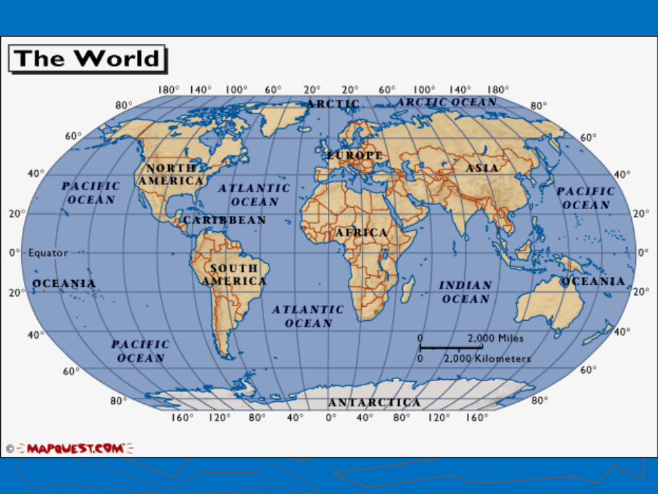
►Longitude lines run north and Longitude lines run north and south.south.
►Latitude lines run east and west. Latitude lines run east and west. ►The lines measure distances in The lines measure distances in
degrees.degrees.
Latitude
Longitude
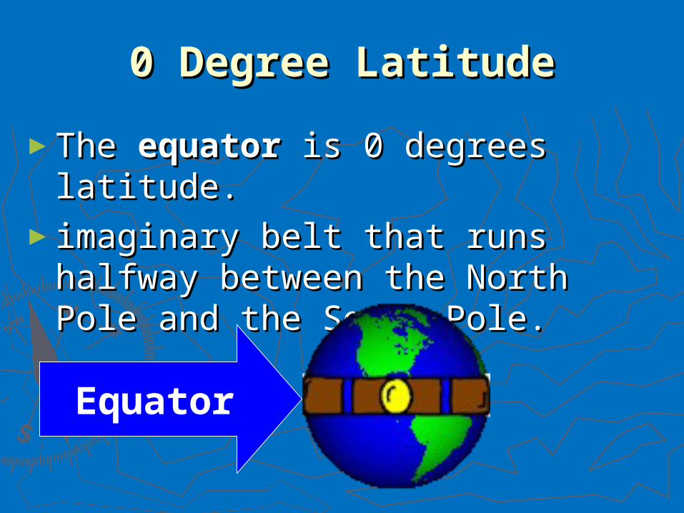
0 Degree Latitude0 Degree Latitude
►The The equatorequator is 0 degrees is 0 degrees latitude. latitude.
►imaginary belt that runs halfway imaginary belt that runs halfway between the North Pole and the between the North Pole and the South Pole.South Pole.
Equator
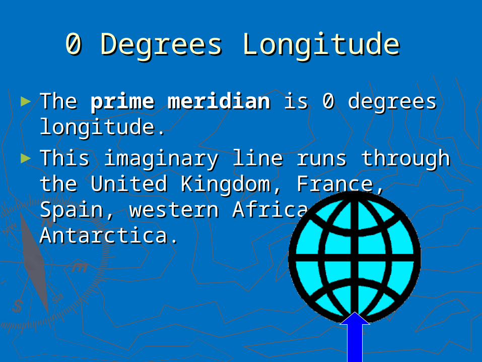
0 Degrees Longitude 0 Degrees Longitude
►The The prime meridianprime meridian is 0 degrees is 0 degrees longitude. longitude.
►This imaginary line runs through the This imaginary line runs through the United Kingdom, France, Spain, United Kingdom, France, Spain, western Africa, and Antarctica.western Africa, and Antarctica.

HemispheresHemispheres
►equator and prime meridian equator and prime meridian divide the world into four divide the world into four hemisphereshemispheres
► north, south, east, and north, south, east, and west. west.


Compass/Compass RoseCompass/Compass Rose►Compass: North, South, Compass: North, South,
East, WestEast, West►Compass Rose: N, NE, E, Compass Rose: N, NE, E,
SE, S, SW, W, NWSE, S, SW, W, NW

ScaleScale►Maps are made to scaleMaps are made to scale►direct connection between a unit direct connection between a unit
of measurement on the map and of measurement on the map and the actual distancethe actual distance

Ancient NavigatorsAncient Navigators
►Did not understand latitude and Did not understand latitude and longitudelongitude
►No maps early onNo maps early on►Relied on the sun and stars to Relied on the sun and stars to
determine positiondetermine position

Ancient Navigational ToolsAncient Navigational Tools►Dead reckoningDead reckoning►Lead lineLead line►Mariner’s compassMariner’s compass►Chip logChip log►SextantSextant►Seagoing chronometerSeagoing chronometer

Topographic MapTopographic Map
►2-D picture of a 3-D Earth2-D picture of a 3-D Earth►Contour line – connects Contour line – connects
elevations of equal heightelevations of equal height►Contour interval – vertical Contour interval – vertical
distance between contour linesdistance between contour lines►Example

Contour LinesContour Lines►Close together = steep Close together = steep
slopeslope►Far apart = gentle slopeFar apart = gentle slope►All maps have a contour All maps have a contour
interval interval ex: a contour interval of ex: a contour interval of
20m means each conntour 20m means each conntour line is 20 m apart line is 20 m apart
►At sea level, elevation is At sea level, elevation is ALWAYS 0ALWAYS 0

Bathymetric MapBathymetric Map►BathymetryBathymetry is from the Greek: bathos is from the Greek: bathos
= deep, and metry = measure= deep, and metry = measure
►A A bathymetric mapbathymetric map shows what the shows what the ocean floor would look like if all the ocean floor would look like if all the water drained outwater drained out
►Basically a reverse topographic mapBasically a reverse topographic map

3-D Gulf of Mexico3-D Gulf of Mexico

2-D Bathymetry2-D Bathymetry

OutOut
What methods do you think we have What methods do you think we have available to map the ocean floor. Why available to map the ocean floor. Why might this be inaccurate?might this be inaccurate?