manila: rich and poor - demographia.com upon his return to the philippines in 1983. ... manila is...
TRANSCRIPT

Manila: Rich and Poor
BASIC INFORMATION: 2005 Similar To Urban Area Population (1) 16,750,000 Osaka-Kobe-Kyoto, Delhi, Cairo Urban Land Area: Square Miles 515 Urban Land Area: Square Kilometers 1,330 Cairo, Delhi, Shenzhen
Population per Square Mile 32,500 Population per Square Kilometer 12,450 Karachi, Lagos, Kolkata
Metropolitan Area Population (2) 19,300,000 Mexico City, Sao Paulo, Osaka-Kobe-Kyoto
(1) Continuously built up area. (2) National Capital Region (NCR) plus the provinces of Bulucan, Cavite, Laguna and Rizal.
16 February 2007
It is always preferable to end the first visit with some affection for an urban area and even a desire to stay longer. This is the feeling that I have had in leaving most urban areas. In only one case was no affection developed for the urban area, which is described in the Kolkata Rental Car Tour. In others, an attraction developed, but there was no reluctance to leave, such as in Mumbai. Manila is in the majority --- an affection was developed and I would have preferred to stay longer. Arriving at Manila’s Ninoy Aquino International Airport evokes a sense of history more than most. The airport is named for Benigno (Ninoy) Aquino, the opposition leader who was assassinated at the airport upon his return to the Philippines in 1983. Events led eventually to stolen election (by President Ferdinand Marcos), his deposition, a peaceful revolution and the installation of Corazon Aquino, wife of Ninoy Aquino as president of the Philippines. The main thoroughfare of the urban area, EDSA (below) was the site of this peaceful revolution and another in 2001.
The Urban Form Manila is located on Luzon Island and the central city of Manila is the capital of the Philippines. The Urban Area: Manila is the world’s 10th largest urban area, with a population of 16,750,000 (2005) and is larger than Los Angeles. The Manila urban area is growing rapidly and is projected to near a population of 20,000,000 by 2015, becoming the 7th largest in the world (very likely passing Mexico City, Sao Paulo and Osaka-Kobe-Kyoto). The urban area covers approximately 515 square miles (1,330 square kilometers) and is one of the most dense large urban areas in the world at 32,500 persons per square mile (12,450 persons per square kilometer). Manila is nearly as densely populated as Kolkata and more than twice as dense as Jakarta (Jabotabek) Manila is ten times as dense as density-envious Portland, Oregon. The National Capital Region: The National Capital Region was established in 1976. It encompasses 17 municipalities, including the central city of Manila. Nearly 9.3 million people
Urban Tours by Rental Car: MANILA 1

live outside Manila in the National Capital Region. The population of the National Capital Region is nearly 10,800,000. The National Capital Region has a population density of 44,000 per square mile (15,500 per square kilometer).
City of Manila: The city of Manila is the capital of the Philippines. It has a population of over 1,500,000 but has been losing population. The city reached a peak population of 1,650,000 in 1995. Nonetheless, Manila remains exceedingly dense, at more than 100,000 persons per square mile (nearly 40,000 persons per square kilometer). Manila is geographically small, covering only 15 square miles (39 square kilometers). Despite its high density, Manila is principally a low-rise city. There are a number of high rise residential buildings, but most of the city’s residential development is one or two stories. The core of Manila is Rizal Park, a long rectangular green space with business and government buildings on three sides. Like most national capitals, Manila has not escaped the visual
desecration of modern architecture. The Philippine Cultural Center (Photograph 52) is an uninspiring slab of exhibiting the usual beauty of faded, dirty concrete by which the architectural trade has all too often expressed its contempt for good taste Quezon City: The largest city in the National Capital Region and the nation is Quezon City, with more than 2,000,000 persons. Quezon City was established by President Manuel Quezon to be the new capital of the Philippines. After achieving independence from the United States, the capital of the Philippines was moved to Quezon City in 1948. Quezon City remained the capital until it was moved back to Manila in 1976 by President Ferdinand Marcos. Quezon City, therefore, may be the only new national capital city that has seen that function abandoned. Outside the National Capital Region: The suburbs outside the National Capital Region have a population of nearly 6,000,000. They are located in Bulucan, Cavite, Laguna and Rizal provinces. These are among the most dense suburbs in the world, with 22,000 persons per square mile (8,500 persons per square kilometer). The Metropolitan Area: The labor market area, or metropolitan area, includes a population of approximately 19,300,000, approximately the same size as Mexico City and Sao Paulo. A number of sources indicate a much smaller population for both the Manila metropolitan and urban areas. This is because some analysts mistake the regional jurisdiction popularly called “Metro Manila” (officially the National Capital Region) for the metropolitan area. Like Toronto’s Municipality of Metropolitan Toronto, Metro Manila is only a part of a much larger metropolitan area. Both the urban area and the metropolitan area extend far outside the boundaries of the National Capital Region or Metro Manila. The metropolitan area includes the provinces of Bulucan, Cavite, Laguna and Rizal (Figure: Manila Metropolitan Area), while the urban area contains parts of these provinces (Table).
Manila Urban Area and Metropolitan Area: 2005
Sector Population Land Area (Square Miles)
Density Land Area (Square
KM)
Density
City of Manila 1,525,000 15 101,276 39 39,103
RIZAL
LAGUNA
BULUCAN
NATIONALCAPITALREGION (METROMANILA)
CAVITE
Manila Metropolitan Area
Urban Tours by Rental Car: MANILA 2
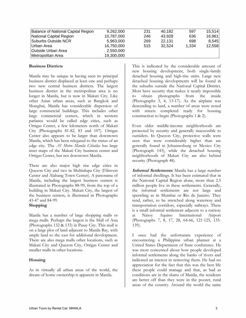
Balance of National Capital Region 9,262,000 231 40,182 597 15,514National Capital Region 10,787,000 246 43,928 636 16,961Suburbs Outside NCR 5,963,000 269 22,131 698 8,545Urban Area 16,750,000 515 32,524 1,334 12,558Outside Urban Area 2,550,000 Metropolitan Area 19,300,000
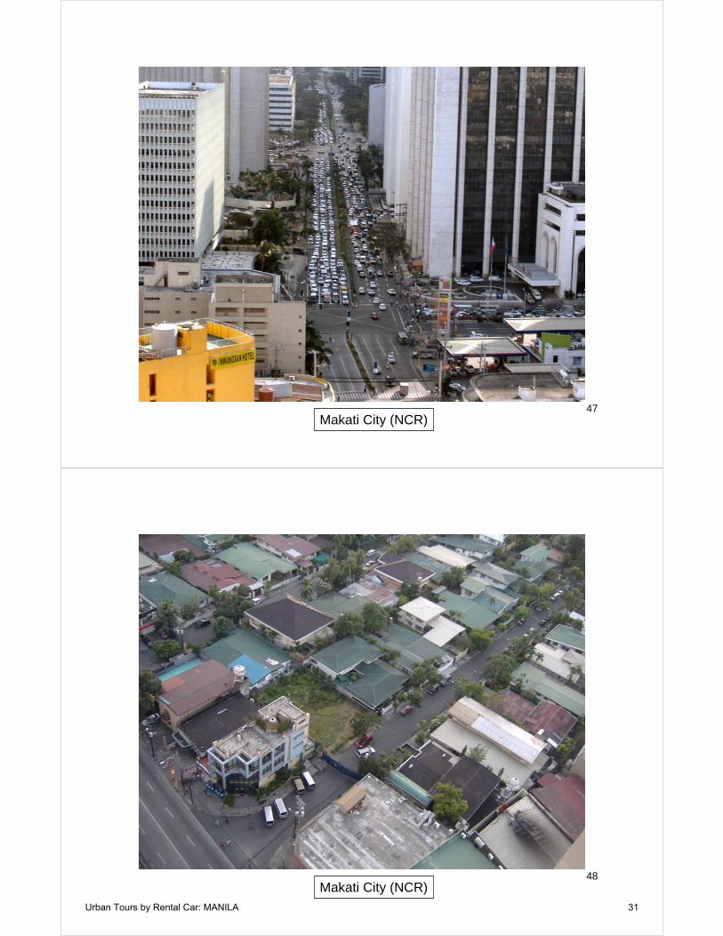
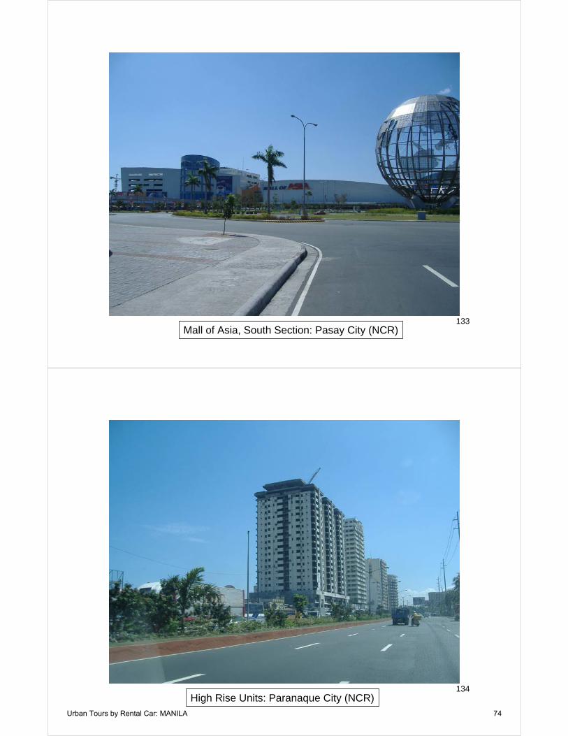
Business Districts Manila may be unique in having seen its principal business district displaced at least one and perhaps two new central business districts. The largest business district in the metropolitan area is no longer in Manila, but is now in Makati City. Like other Asian urban areas, such as Bangkok and Shanghai, Manila has considerable dispersion of large commercial buildings. This includes other large commercial centers, which in western parlance would be called edge cities, such as Ortigas Center, a few kilometers north of Makati City (Photographs 81-82, 83 and 107). Ortigas Center also appears to be larger than downtown Manila, which has been relegated to the status of an edge city. The A1 Metro Manila Citiatlas has large inset maps of the Makati City business center and Ortigas Center, but not downtown Manila. There are also major high rise edge cities in Quezon City and two in Multinlupa City (Filinvest Center and Alabang Town Center). A panorama of Manila, including the largest business centers is illustrated in Photographs 88-99, from the top of a building in Makati City. Makati City, the largest of the business centers, is illustrated in Photographs 43-47 and 84-99. Shopping Manila has a number of large shopping malls or mega malls. Perhaps the largest is the Mall of Asia (Photographs 132 & 133) in Pasay City. This mall is on a large plot of land adjacent to Manila Bay, with ample land to the east for additional development. There are also mega malls other locations, such as Makati City and Quezon City, Ortigas Center and smaller malls in other locations. Housing As in virtually all urban areas of the world, the dream of home ownership is apparent in Manila.
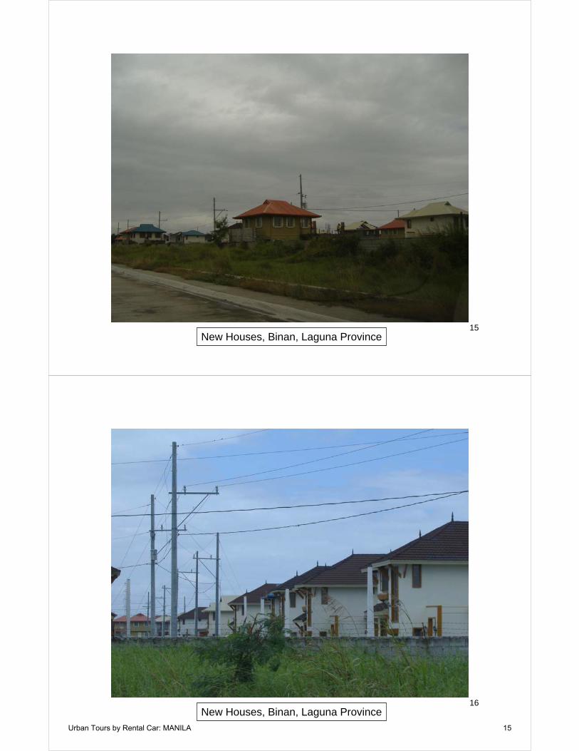
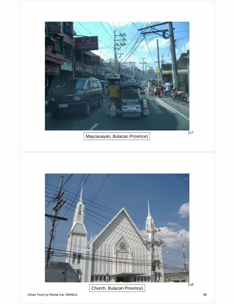
This is indicated by the considerable amount of new housing development, both single-family detached housing and high-rise units. Large new detached housing developments will be found in the suburbs outside the National Capital District. Most have security that makes it nearly impossible to obtain photographs from the inside (Photographs 3, 4, 13-17). As the airplane was descending to land, a number of areas were noted with streets completed ready for housing construction to begin (Photographs 1 & 2). Even older middle-income neighborhoods are protected by security and generally inaccessible to outsiders. In Quezon City, protective walls were seen that were considerably higher than are generally found in Johannesburg or Mexico City (Photograph 143), while the detached housing neighborhoods of Makati City are also behind security (Photograph 48). Informal Settlements: Manila has a large number of informal dwellings. It has been estimated that in the National Capital Region alone, more than 2.5 million people live in these settlements. Generally, the informal settlements are not large and sprawling as in Mumbai or Rio de Janeiro. They tend, rather, to be stretched along waterway and transportation corridors, especially railways. There is a small informal settlement adjacent to a runway at Ninoy Aquino International Airport (Photographs 7, 8, 17, 28, 64-66, 121-125, 135-139). I once had the unfortunate experience of encountering a Philippine urban planner at a United States Department of State conference. He was most concerned about how people developed informal settlements along the banks of rivers and indicated an interest in removing them. He had no appreciation for the fact that this was the best life these people could manage and that, as bad as conditions are in the slums of Manila, the residents are better off than they were in the poorer, rural areas of the country. Around the world the same
Urban Tours by Rental Car: MANILA 3

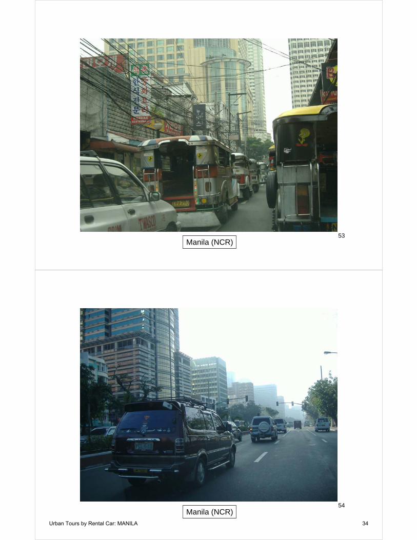
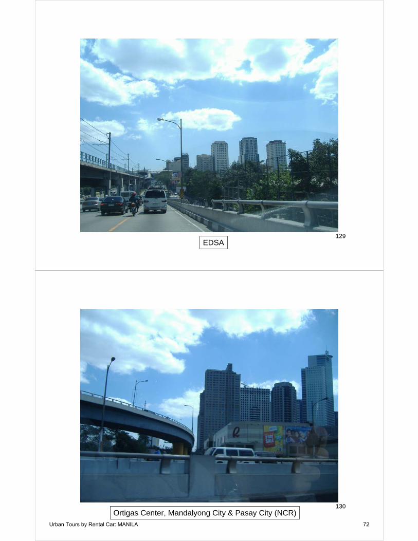
attitude is often found among urban planners. Little matters to them except a one-dimensional view of the city that seeks to obtain architectural gratification and a strange view that it is better for the environment for people to be even more poorly housed. This is a principal difficulty with today’s urban planning fraternity, which seeks design purity at the cost of all other values, including people’s quality of life. Walkable Manila In the northern part of the city of Manila is one of the world’s most walkable neighborhoods (Photographs 71-78). Saturday morning revealed crowds of people walking on the street. There were many motorcycles, tricycles and bicycles. It was clear, however, that this area did not enjoy the affluence that planners like to associate with “walkable neighborhoods” as they market the concept in high-income world nations. Driving in Manila Manila, like Jakarta and Bangkok, has some of the worst traffic congestion in the world (Photographs 1 and 146). There are two principal causes --- its high density (above) and an inadequately planned and designed road system. The traffic is at least as intense as that of Jakarta, though it is likely to get much worse because the share of travel by car at this point is relatively small in Manila. As automobile travel increases, traffic will get much worse because of Manila’s extraordinarily high population density. The so-called “gridlock” that is attributed to some urban areas in the United States or Western Europe is mild by comparison. Manila’s improving affluence is, as in Jakarta, indicated by the substantial share of large sport utility vehicles (especially Japanese brands). There are few freeways.1 The most important is “EDSA” (Epifinio de Los Santos Avenue), which is called “Edsa” (rather than the acronym E-D-S-A) by local citizens. EDSA is really the inner ring road, which begins at Manila Bay to the south of downtown, continues eastward and then turns north, passing by Makati City, Ortigas and Quezon City, where it turns west. Through much of its alignment, especially the north-south section, EDSA is a freeway of from six lanes to ten lanes.
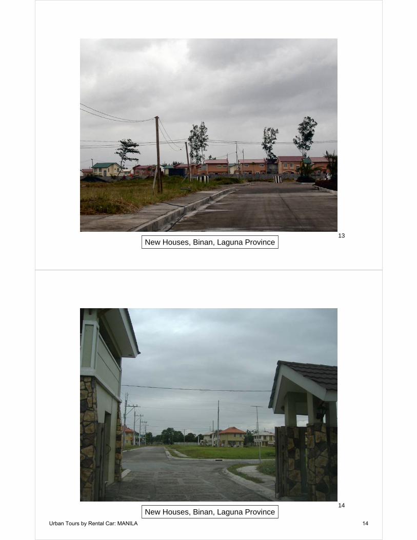
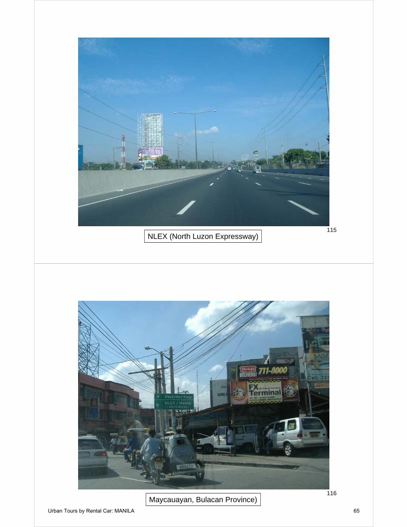
In most areas there is a yellow striped lane on the right that is reserved for buses. EDSA also has the distinction of being a venue for revolution. The peaceful demonstrations that led to the fall of President Ferdinand Marcos in 1986 occurred on EDSA as did the similarly peaceful demonstrations that led to the fall of President Estrada in 2001 (Photographs 108-114, 126-129, 146). The other freeways serve principally a suburban and exurban function. Examples are the North Luzon Expressway (NLEX), which heads north from EDSA into Bulacan province and beyond. NLEX is a tollway of high standards, with eight lanes of traffic for perhaps the first 15 miles, where it is reduced to six lanes. The South Superhighway extends from west of Makati City through the southern part of the National Capital Region, into the suburbs of the province of Laguna and beyond. The Southern Superhighway is also a toll road, with six lanes through most of the National Capital Region, then being reduced to four lanes. A major construction project is underway to expand the six lane configuration further south. The Manila-Cavite Coastal Road is a short freeway, on which tolls are also charged. The coastal road is a continuation of Aguinaldo Boulevard, the coastal highway that runs the city of Manila to Paranaque City. The Manila-Cavite Coastal Road runs to Bacoor, in Cavite province. Manila’s arterial street system and freeway system are poorly planned, suffering from considerable discontinuity and insufficient capacity. Manila Drivers: Manila’s impossible traffic may have imposed a courteous discipline on its drivers. Despite the challenging conditions, comparatively few horns are heard and there is little evidence of aggressive behavior --- probably because the experienced Manila driver realizes that fighting congestion is a hopeless pursuit. On a scale of one to 10, where Japan’s drivers are the most courteous (at 10) and Italy’s the most aggressive (at 1), Filipino drivers rate at least a nine. For any in need of training in defensive driving, Manila is the place to go. If one accepts the inevitable congestion, driving can actually be a relaxing pastime in Manila (especially if you are a tourist with no pressing need to get anywhere fast).
Urban Tours by Rental Car: MANILA 4

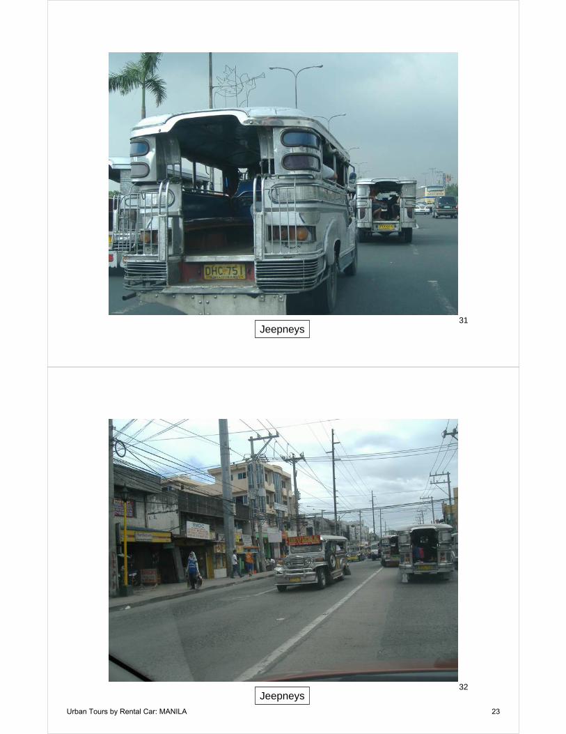
The ultimate was the writer’s planned 45 minute trip of six miles (10 kilometers) from Quezon City to Makati City on a Saturday morning. The first 0.6 miles (one kilometer) took one hour. Fortunately, traffic on ESDA cleared, where it had been constricted to one lane by a working crew, and the scheduled airport departure was not missed. Breathing in Manila Like other large developing world urban areas, Manila has a serious air pollution (smog) problem. This is evident not only from viewing the horizon (Photographs 100-105), but also from the number of people that wear masks to protect themselves from breathing the foul air. The principal difficulty is that, as in all dense urban areas, automobile use is highly concentrated and, in consequence, so is air pollution. Public Transport in Manila: Near Automobile Competitive According to data in the UITP Millennium Cities database (1995), Manila has the highest intensity of public transport service in the world (vehicle miles per square mile of urbanization). This is the result of a markedly different approach to public transport --- the Jeepney (Photographs 29-35). Jeepneys are small public transport vehicles that were originally based upon military jeeps left behind by the United States Army after World War II. Jeepneys are a work of art, intensely decorated by their owner-operators. The Jeepney-Tricycle System: Jeepneys seat up to 19 passengers and provide frequent service along major streets. Manila’s public transport service intensity was approximately twice that of second ranking Hong Kong, 10 times Zurich, 20 times Tokyo, 30 times Paris and 90 times New York. It is estimated that there were 57,000 Jeepneys in the National Capital Region alone in 1999. There is considerable pressure to remove Jeepneys from the streets. Typically, their air pollution levels, lack of air conditioning and the traffic congestion created by so many vehicles are cited. But there is also a sense that Jeepneys are an inferior mode of public transport, especially compared to the so-called “world-class” modes of Metros and light rail. The pollution problem is simply a matter of
technology, though the traffic problem is less easy to solve. Nonetheless, if the jeepneys were removed, there would be even more pressure to expand automobile use, since any replacement public transport system would not be likely to provide the same level of mobility. A professor at a local business school, Dennis Berino, called the jeepney public transport system “unsustainable,” apparently ignoring the fact that it has been sustained now for more than 60 years. His solution was more conventional public transport, of the type that typically serves only urban cores with any frequency (especially metros and light rail) and is characterized by leaving large demand gaps.2 The Jeepney system is supplemented by another relatively unique form of urban transport --- the tricycle, which is similar to an Indian auto-rickshaw or an Indonesian bejaj (Photograph 20). These are motorcycle based vehicles that take up to three riders in side compartments. Tricycles account for nearly as much ridership as buses. It has been estimated that there were 60,000 tricycles serving the National Capital Region in 1996. The combined Jeepney, tricycle system accounted for more than 50 percent of motorized trips in the National Capital Region in 1996. However, despite its lack of political correctness, it seems likely that the Jeepney system with the supplemental tricycles comes the closest to providing automobile competitive mobility of any public transport system in the world. It seems inconceivable that any other form of public transport could provide riders with the frequency and coverage that is provided by the Jeepneys. Surely there are no models at this point. A good starting point would be the establishment of criteria for any replacement system. At a minimum, any replacement system should:
• Provide at least the same level of mobility and access (service frequency and area coverage) for all of the passengers using the present system.
• Impose no greater cost on the public or
passengers than the present system.
Urban Tours by Rental Car: MANILA 5
Metros and Buses: Supplementing the Jeepney-Tricycle System: The public transport literature is filled with suggestions that Manila needs a “world class” public transport system (as referenced above), which means urban rail, especially light rail and metros. In fact, however, such a system can only supplement the Jeepney-Tricycle system, which accounts for at least 70 percent of public transport travel. Manila has three Metro lines, which are operated with light rail type vehicles. Since the system is fully grade separated, it is properly considered as a Metro. The three lines provide access to less than two percent of the urban area (based upon the international standard of a 400 meter or one-quarter square mile walking distance from stations). The covered stations are often dimly lit during the daytime or not lit at all. Ridership is now approximately 800,000 per day, representing slightly more than two percent of trips in the metropolitan region. There is also a publicly sponsored large bus system, which had approximately 10,000 buses in 1996. It, however, charges higher fares and does not provide the service coverage of the Jeepneys. Buses carry about one-third the ridership of Jeepneys, according to a 1996 travel survey. These systems provide conventional public transit mobility in Manila, which leaves most trips outside their scope. The Jeepneys and tricycles, however, combined with the Metro and buses are an
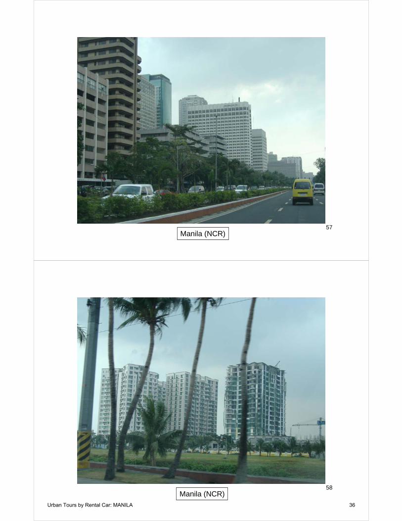
effective public transport system that provides comprehensive mobility throughout the urban area, something generally not available in other major urban areas of the high-income, middle-income or low-income world. The extent to which the Metro and buses improve the effectiveness of the Jeepney-Tricyle system or mobility in general is not known. This is because most research efforts in public transport start from a presumption that Metros and buses are inherently virtuous. In addition, there does not appear to be a useful analysis covering the costs and benefits of these more expensive public transport modes. Manila: Rich and Poor Like all large developing world urban areas, Manila has a large number of poor residents. There are also many middle income and higher income residents. Manila thus gives an impression of both prosperity and poverty. The informal settlements provide a constant reminder of the poverty, riddled as they are throughout the entire community. On the other hand, the high-rise office buildings, high-rise residential buildings and the detached housing developments in the suburbs and exurbs give an impression of prosperity. Manila appears to be making substantial progress and resembles Shanghai or Bangkok much more than, say, Jakarta. Generally, my impression of Manila is that much of it is closer to first world status than Mexico City or Rio de Janeiro, despite being less affluent.
1 In this series, the term freeway refers to any controlled access highway (highway on which there is neither cross-traffic nor signals). A freeway may or may not have tolls. 2 http://www.manilatimes.net/national/2006/june/06/yehey/business/20060606bus13.html.
Urban Tours by Rental Car: MANILA 6

War on the Dream How Anti-Sprawl Policy Threatens the Quality of Life
By Wendell Cox To order: http://www.iuniverse.com/bookstore/book_detail.asp?issbn=0595399487 Summary and Chapter Titles:
http://www.demographia.com/wod1.pdf Urban Tours by Rental Car: About the Series
Urban Tours by Rental Car offers perspectives on urban development obtained by automobile tours through
urban areas. Rental cars are not the favored method for visiting cities, especially those outside one's own country. Instead, tourists and urban planners favor packaged tours or local public transport systems. Both are splendid ways for seeing the city as it used to be --- the very reason for most tourist visits. The historical core areas contain monuments, prime government and religious edifices and quaint neighborhoods that are often centuries old. This is particularly important to tourists from the newer urban areas of the American, Canadian or Australian West, where history extends not far before World War II. It is further understandable that few tourists travel thousands of miles to see the newer suburban areas that look very much like home. But most tourists do not profess to be students of the urban area.
For the urban planner interested in understanding the whole urban area, it is not enough to study the core alone, regardless of its architectural attractiveness, romanticism, history or affirmation of an individually preferred life style. No one, regardless of the depth of their education can develop reliable conceptions from an unrepresentative sample, and urban cores are the very essence of unrepresentative samples. Both public transport and packaged tours miss the larger part --- the expanse of sprawling residential and business development that rings virtually all major urban areas. They may be of little interest to many urban planners, but they should be.
Stripping away regional architectural facades, one might as well be in the suburbs of Phoenix, Portland, Perth or Paris. Here, the automobile is king, because no public transport system has been developed that can effectively serve destinations outside the core (at least at a price any society can afford). While public transport market shares are higher in European suburban areas than in the New World, much of the difference is attributable to lower incomes and less automobile access. Indeed, public transport's principal weakness, lack of automobile competitiveness, is itself a contributing factor to the rising motorization occurring from the suburbs of Copenhagen and Nagoya to the suburbs of Lagos and Mumbai. To oversimplify this phenomenon as being a "love affair with the automobile" is the equivalent of saying that Singaporeans or Brazilians have a love affair with air conditioning. Human beings prefer comfort to discomfort and they prefer free time to time over which they have no control.
It is no wonder that tourists return to the United States thinking that all Paris looks like the second arrondissement (less than one percent does) and that urban planners think all of Milan looks like the architectural treasures that surround the Cathedral. In fact, the sprawling suburbs of Europe, Japan, Canada and Connecticut resemble one another in many ways. For any seeking to study the urban area in its entirety --- not just the favored haunts of core-dwelling elites --- there is no alternative to "getting behind the wheel." Thus, Urban Tours by Rental Car
Urban Tours by Rental Car: MANILA 7

1Preparing for Residential Development: Laguna
2Preparing for Residential Development: Laguna
Urban Tours by Rental Car: MANILA 8
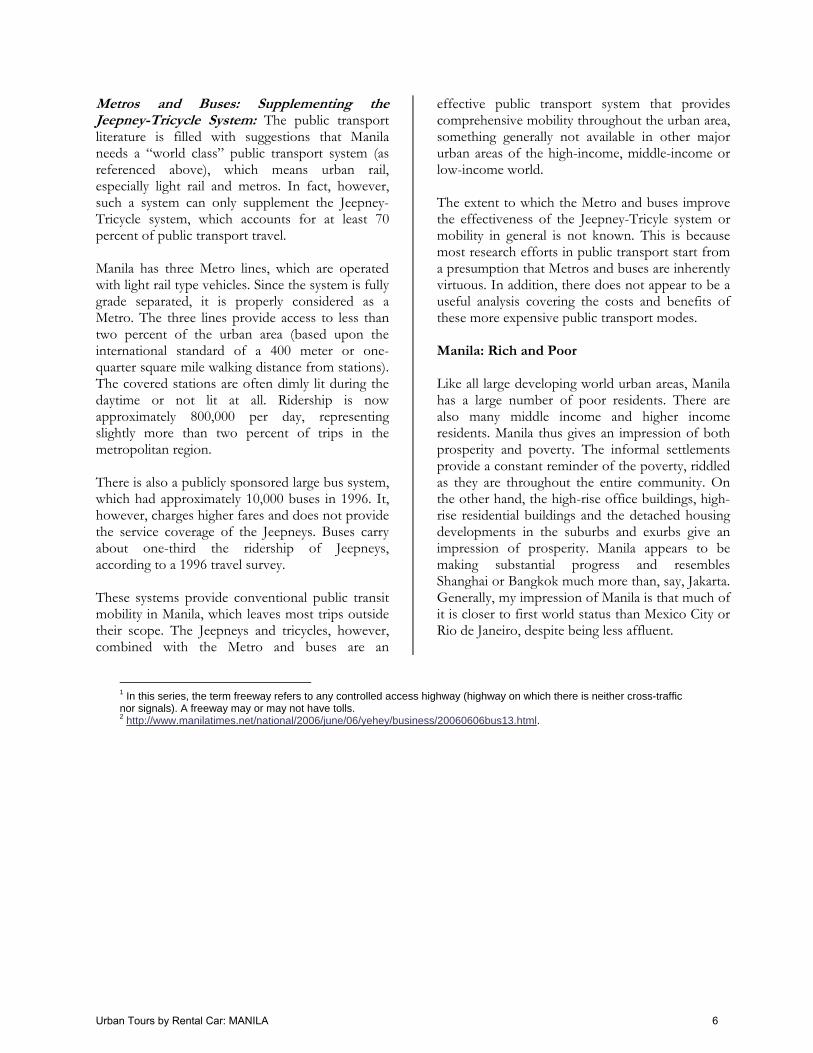
3Preparing for Residential Development: Cavite
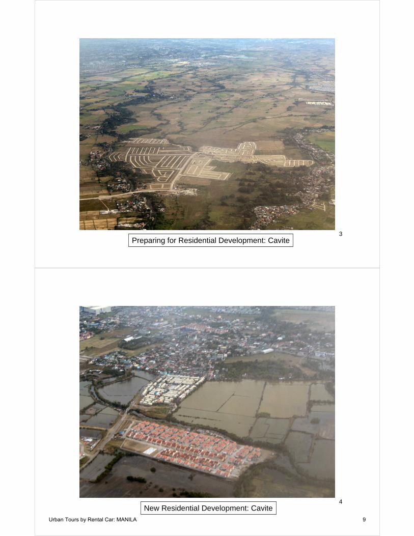
4New Residential Development: Cavite
Urban Tours by Rental Car: MANILA 9

5Cavite (Province)
6Las Pinas (NCR)
Urban Tours by Rental Car: MANILA 10

7Informal Settlements Along Waterway, Las Pinas (NCR)
8Informal Dwellings Adjacent to Airport
Urban Tours by Rental Car: MANILA 11
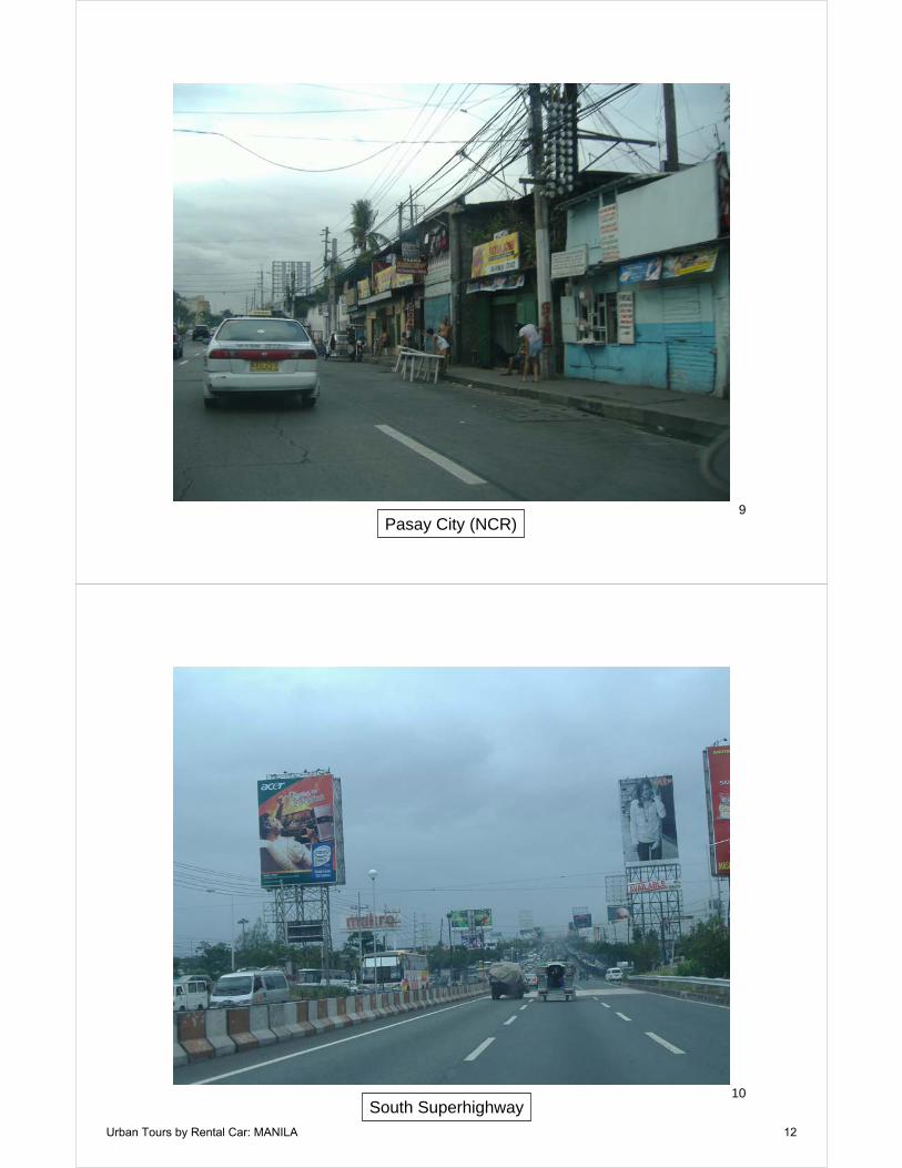
9Pasay City (NCR)
10South Superhighway
Urban Tours by Rental Car: MANILA 12
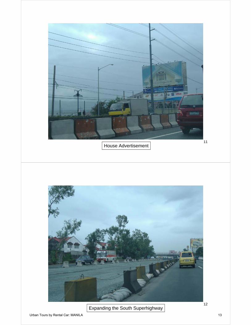
11House Advertisement
12Expanding the South Superhighway
Urban Tours by Rental Car: MANILA 13
13New Houses, Binan, Laguna Province
14New Houses, Binan, Laguna Province
Urban Tours by Rental Car: MANILA 14
15New Houses, Binan, Laguna Province
16New Houses, Binan, Laguna Province
Urban Tours by Rental Car: MANILA 15

17The Philippine Dream: New Houses, Binan, Laguna Province
18San Pedro, Laguna Province
Urban Tours by Rental Car: MANILA 16
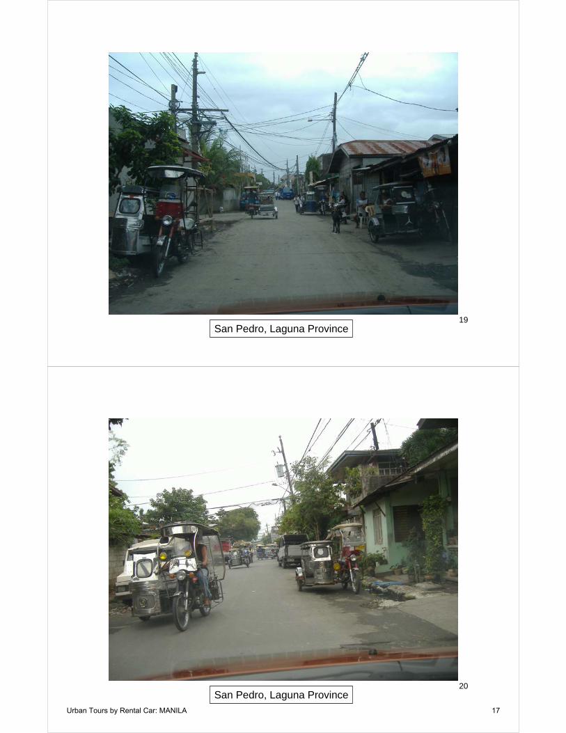
19San Pedro, Laguna Province
20San Pedro, Laguna Province
Urban Tours by Rental Car: MANILA 17

21Informal Settlement Along Highway
22Filinvest Center, Muntinlupa City (NCR)
Urban Tours by Rental Car: MANILA 18

23Filinvest Center, Muntinlupa City (NCR)
24Filinvest Center, Muntinlupa City (NCR)
Urban Tours by Rental Car: MANILA 19

25Alabang Town Center, Muntinlupa City (NCR)
26Alabang Town Center, Muntinlupa City (NCR)
Urban Tours by Rental Car: MANILA 20

27Informal Settlement, Muntinlupa City (NCR)
28Informal Settlement, Muntinlupa City (NCR)
Urban Tours by Rental Car: MANILA 21

29Jeepneys under South Superhighway
30Jeepneys
Urban Tours by Rental Car: MANILA 22
31Jeepneys
32Jeepneys
Urban Tours by Rental Car: MANILA 23

33Jeepneys
34Jeepney
Urban Tours by Rental Car: MANILA 24

35Jeepneys
36Development Along South Superhighway
Urban Tours by Rental Car: MANILA 25

37
Makati City(NCR)
3816 Lane South Superhighway & Skyway: Makati City (NCR)
Urban Tours by Rental Car: MANILA 26

39Makati City (NCR)
40Skyway, Makati City (NCR)
Urban Tours by Rental Car: MANILA 27

41Makati City (NCR)
42Skyway, Makati City (NCR)
Urban Tours by Rental Car: MANILA 28

43Makati City (NCR)
44Makati City (NCR)
Urban Tours by Rental Car: MANILA 29

45Makati City (NCR)
46Makati City, NCR
Urban Tours by Rental Car: MANILA 30
47Makati City (NCR)
48Makati City (NCR)
Urban Tours by Rental Car: MANILA 31

49Makati City (NCR)
50Makati City (NCR)
Urban Tours by Rental Car: MANILA 32

51Manila (NCR)
52Philippine Cultural Center, Manila (NCR)
Urban Tours by Rental Car: MANILA 33
53Manila (NCR)
54Manila (NCR)
Urban Tours by Rental Car: MANILA 34

55Manila (NCR)
56Manila, NCR
Urban Tours by Rental Car: MANILA 35
57Manila (NCR)
58Manila (NCR)
Urban Tours by Rental Car: MANILA 36
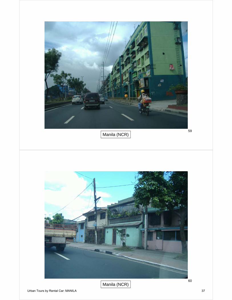
59Manila (NCR)
60Manila (NCR)
Urban Tours by Rental Car: MANILA 37
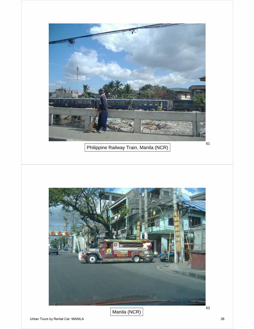
61Philippine Railway Train, Manila (NCR)
62Manila (NCR)
Urban Tours by Rental Car: MANILA 38

63Manila (NCR)
64Informal Settlement Along Railway, Manila (NCR)
Urban Tours by Rental Car: MANILA 39

65Informal Settlement Along Railway, Manila (NCR)
66Informal Settlement Along Railway, Manila (NCR)
Urban Tours by Rental Car: MANILA 40

67Metro Line 1 Station: Manila (NCR)
68Manila (NCR)
Urban Tours by Rental Car: MANILA 41

69Rizal Park, Manila (NCR)
70Jeepney & Metro Line 1, Manila (NCR)
Urban Tours by Rental Car: MANILA 42

71Manila (NCR)
72Manila (NCR)
Urban Tours by Rental Car: MANILA 43

73Manila (NCR)
74Manila (NCR)
Urban Tours by Rental Car: MANILA 44

75Manila (NCR)
76Manila (NCR)
Urban Tours by Rental Car: MANILA 45

77Manila (NCR)
78Manila (NCR)
Urban Tours by Rental Car: MANILA 46

79Quezon City (NCR)
80Quezon City (NCR)
Urban Tours by Rental Car: MANILA 47

81Ortigas Center (NCR)
82Ortigas Center (NCR)
Urban Tours by Rental Car: MANILA 48

83EDSA, Pasig City (NCR)
84Makati City & Ortigas Center (in the distance)
Urban Tours by Rental Car: MANILA 49
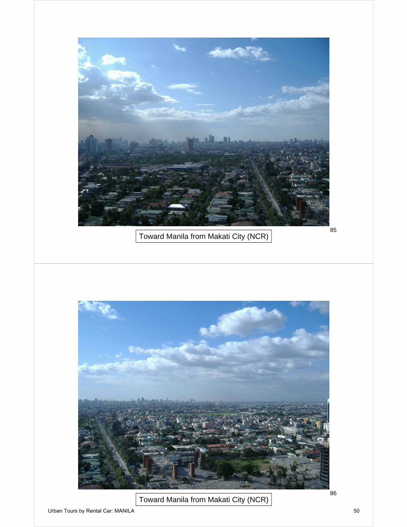
85Toward Manila from Makati City (NCR)
86Toward Manila from Makati City (NCR)
Urban Tours by Rental Car: MANILA 50
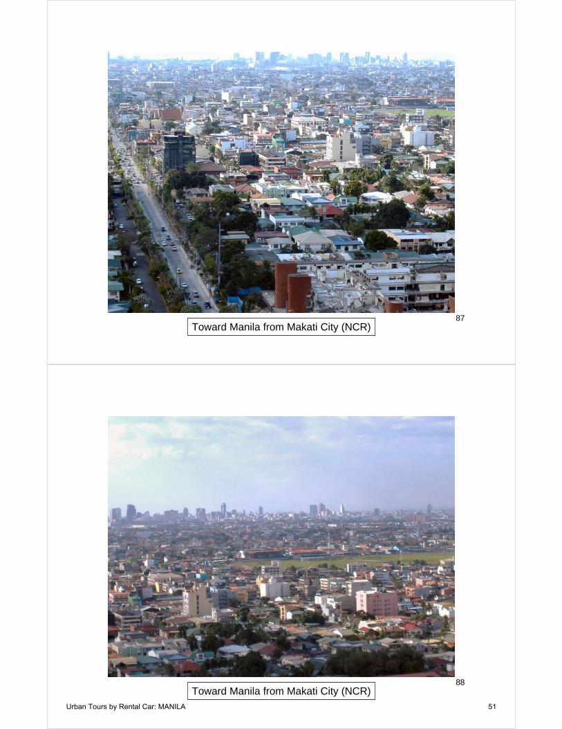
87Toward Manila from Makati City (NCR)
88Toward Manila from Makati City (NCR)
Urban Tours by Rental Car: MANILA 51

89Toward Manila from Makati City (NCR)
90Toward Mandaluyong City from Makati City (NCR)
Urban Tours by Rental Car: MANILA 52
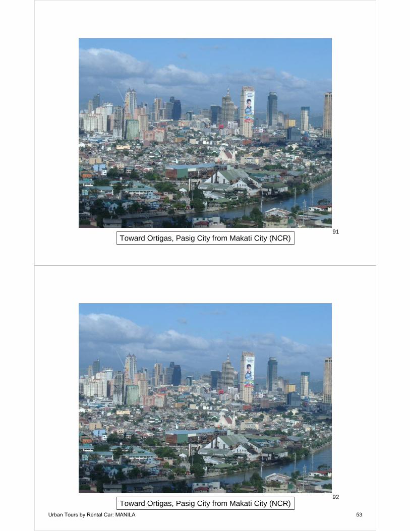
91Toward Ortigas, Pasig City from Makati City (NCR)
92Toward Ortigas, Pasig City from Makati City (NCR)
Urban Tours by Rental Car: MANILA 53

93Toward Ortigas, Pasig City from Makati City (NCR)
94Toward Ortigas, Pasig City from Makati City (NCR)
Urban Tours by Rental Car: MANILA 54
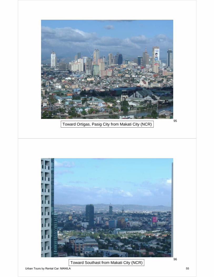
95Toward Ortigas, Pasig City from Makati City (NCR)
96Toward Southast from Makati City (NCR)
Urban Tours by Rental Car: MANILA 55
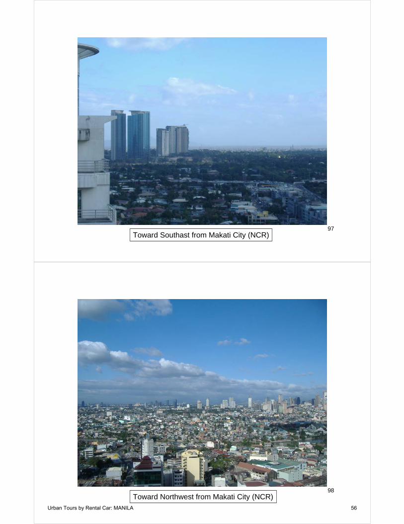
97Toward Southast from Makati City (NCR)
98Toward Northwest from Makati City (NCR)
Urban Tours by Rental Car: MANILA 56
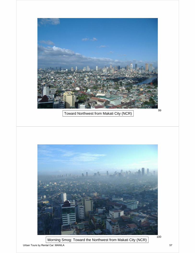
99Toward Northwest from Makati City (NCR)
100Morning Smog: Toward the Northwest from Makati City (NCR)
Urban Tours by Rental Car: MANILA 57
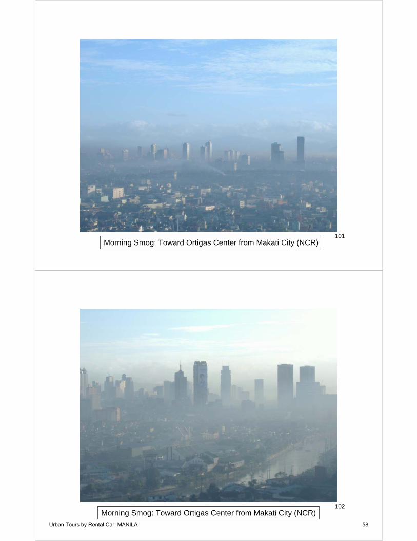
101Morning Smog: Toward Ortigas Center from Makati City (NCR)
102Morning Smog: Toward Ortigas Center from Makati City (NCR)
Urban Tours by Rental Car: MANILA 58

103Morning Smog: Toward Ortigas Center from Makati City (NCR)
104Morning Smog: Toward South, Makati City (NCR)
Urban Tours by Rental Car: MANILA 59

105Morning Smog: Toward Southeast from Makati City (NCR)
106Mandaluyong City (NCR)
Urban Tours by Rental Car: MANILA 60
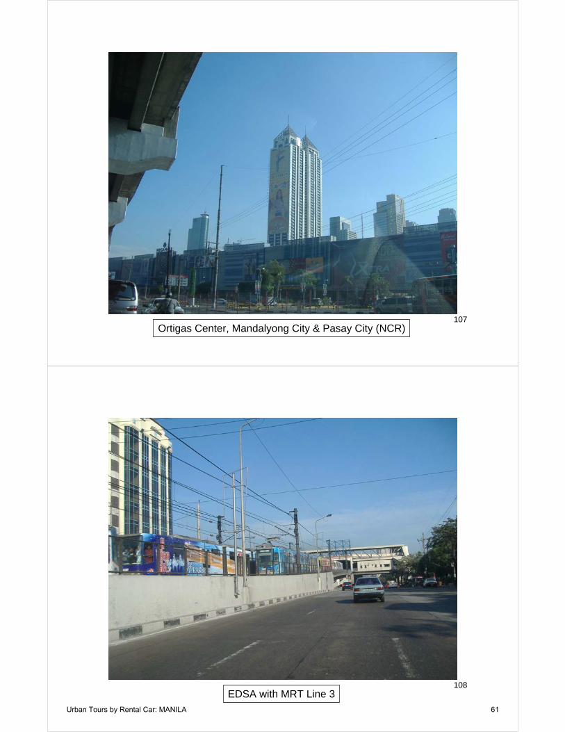
107Ortigas Center, Mandalyong City & Pasay City (NCR)
108EDSA with MRT Line 3
Urban Tours by Rental Car: MANILA 61
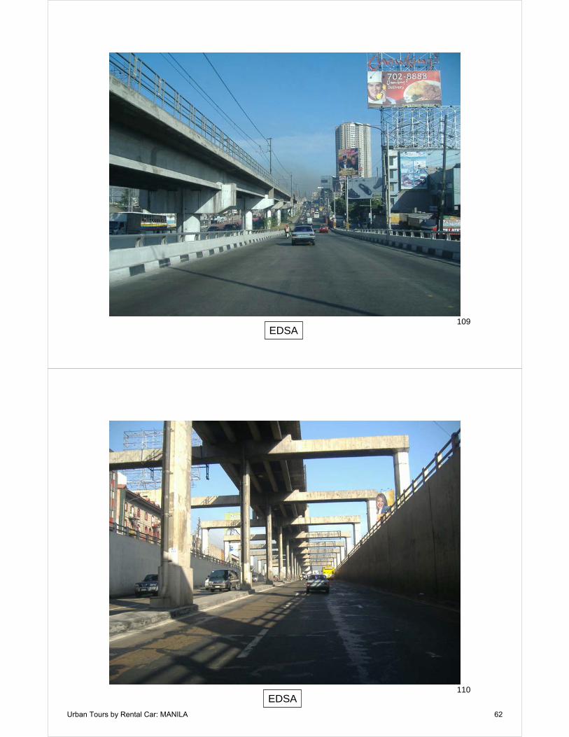
109EDSA
110EDSA
Urban Tours by Rental Car: MANILA 62

111EDSA
112Advertisement for High Rise Residence Building
Urban Tours by Rental Car: MANILA 63
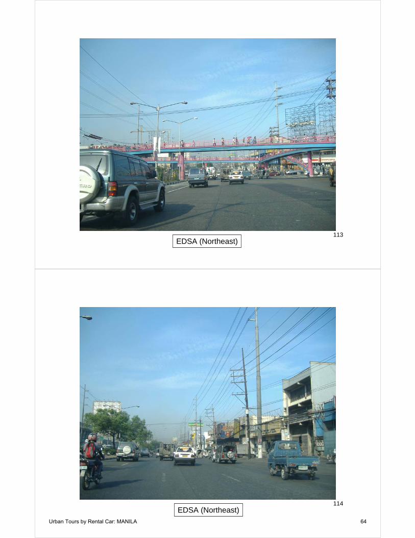
113EDSA (Northeast)
114EDSA (Northeast)
Urban Tours by Rental Car: MANILA 64
115NLEX (North Luzon Expressway)
116Maycauayan, Bulacan Province)
Urban Tours by Rental Car: MANILA 65
117Maycauayan, Bulacan Province)
118Church, Bulacan Province)
Urban Tours by Rental Car: MANILA 66
119Shopping Center, Valenzuela City (NCR)
120Shopping Center, Valenzuela City (NCR)
Urban Tours by Rental Car: MANILA 67

121Informal Settlement along River: Valenzuela City (NCR)
122Informal Settlement along River: Valenzuela City (NCR)
Urban Tours by Rental Car: MANILA 68

123Informal Settlement along River: Valenzuela City (NCR)
124Informal Settlement along River: Valenzuela City (NCR)
Urban Tours by Rental Car: MANILA 69

125Informal Settlement along River: Valenzuela City (NCR)
126EDSA (Northeast)
Urban Tours by Rental Car: MANILA 70

127Church, EDSA
128EDSA with Metro Line 3 Station
Urban Tours by Rental Car: MANILA 71
129EDSA
130Ortigas Center, Mandalyong City & Pasay City (NCR)
Urban Tours by Rental Car: MANILA 72
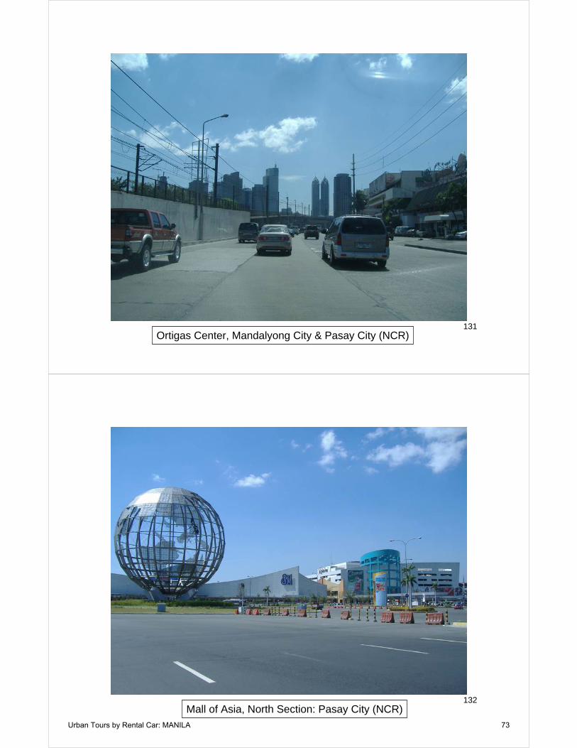
131Ortigas Center, Mandalyong City & Pasay City (NCR)
132Mall of Asia, North Section: Pasay City (NCR)
Urban Tours by Rental Car: MANILA 73
133Mall of Asia, South Section: Pasay City (NCR)
134High Rise Units: Paranaque City (NCR)
Urban Tours by Rental Car: MANILA 74
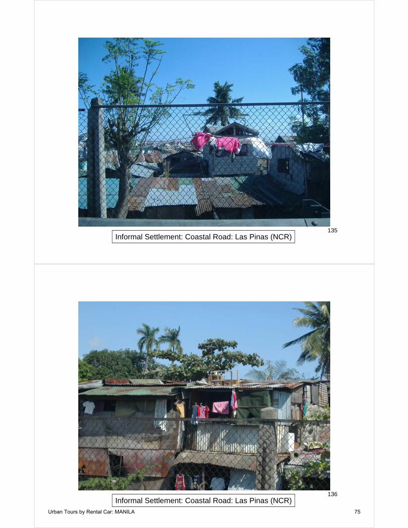
135Informal Settlement: Coastal Road: Las Pinas (NCR)
136Informal Settlement: Coastal Road: Las Pinas (NCR)
Urban Tours by Rental Car: MANILA 75

137Informal Settlement: Coastal Road: Las Pinas (NCR)
138Informal Settlement: Coastal Road: Las Pinas (NCR)
Urban Tours by Rental Car: MANILA 76

139Informal Settlement: Coastal Road: Las Pinas (NCR)
140Transfer Between Metro Lines 1 & 3: Pasay City (NCR)
Urban Tours by Rental Car: MANILA 77

141Makati City (NCR)
142Santo Domingo Church: Quezon City (NCR)
Urban Tours by Rental Car: MANILA 78

143Quezon City (NCR)
144Quezon Memorial: Quezon City(NCR)
Urban Tours by Rental Car: MANILA 79

145Elliptical Road Around Quezon Memorial
146Traffic on EDSA
Urban Tours by Rental Car: MANILA 80

147Quezon City (NCR)
148Manila (NCR)
Urban Tours by Rental Car: MANILA 81

149Manila (NCR)
150Manila (NCR)
Urban Tours by Rental Car: MANILA 82