managing web-based gis for north carolina dept. of ... · arcgis, survey123, editing in agol) by...
TRANSCRIPT

Managing Web-Based GIS
for
North Carolina Dept. of
Transportation
Jeremy Aycock [email protected]
NCDOT, GeoService Solutions Group
Topics
Agenda
• Overview of GO!NC Responsibilities
• Recent Accomplishments
• Current Development Projects
• On the Horizon for NCDOT Web-based GIS
2

What is ?Supporting RPO’s
https://ncdot.maps.arcgis.com
GO!NC Overview
GO! NC = GIS Online at NCDOT
Tools and resources that support
the publishing and sharing of
official NCDOT Geospatial Data
Accessed by the GO! NC
Portal, a web-based portal
through which users can access
NCDOT Geospatial Data

Administration
GO!NC
Publish and manage GeoServices provided by the GIS Unit
Deploy and support GeoServices created and maintained by NCDOT
Business Units
Develop, deploy, and maintain GeoServices to support custom applications
(eg. RoadNC, Road Characteristics Editor)
Support AGOL user accounts for NCDOT
Documentation to support use of services and AGOL (e.g. Collector for
ArcGIS, Survey123, Editing in AGOL)

By the Numbers
GO!NC
1000+ NCDOT employees with active
GO!NC/AGOL accounts
300+ employee accounts added in 2017
200+ layers shared to public
(Map-Image and Feature Service)
100+ WebMaps shared to the public
50+ Contractors actively using GO!NC for
data collection

Current Trends
GO!NC
Training/onboarding NCDOT business units to host and
manage their own GeoServices
Web and Mobile Data Collection
ArcGIS/SharePoint Integration
Geo-enabling NCDOT construction project data
Customized Application Development using WebApp Builder
GP Services, and other GIS/Web tools

Recent Completed Projects
GO!NC
Utilizing ArcGIS Collector for ADA
Curb Ramp Inventory
Using AGOL to Manage NCDOT
Remnant Properties
RoadNC Product Suite creation
(SLD Viewer and analysis tools)

ADA Curb Ramp Inventory
GO!NC
Utilized ArcGIS Collector
for Project
Enabled Field crews with
efficient methods to
survey and report on ADA
compliance for curb ramps
on State Maintained
Roads

ADA Curb Ramp Inventory
GO!NC
Business Requirements
• Ability to perform survey on a mobile device with minimal training
• One synced dataset accessible to both field crew and office staff
• Minimize free-form data entry
• Ability to track edits by user and date
• Reference NC Aerial Imagery, State Maintained Roads, existing intersection
surveys

ADA Curb Ramp Inventory
GO!NC
Business Requirements
• Allow the ability to attach documents and images to features
• Allow users to collect data when disconnected from the internet
• When offline or online, editors must have access to the NCOneMap
orthoimagery
• On-device GPS accuracy acceptable

ADA Curb Ramp Inventory
GO!NC
Components in Solution
• AGOL and Collector
• GO!NC AGOL User Accounts
• AGOL User Group
• AGOL Web Map
• Editable Feature Layer (Curb Ramp Inventory)
• Reference Services
• Orthoimagery Tile Packages
(Side Loaded to Device)

ADA Curb Ramp Inventory
GO!NC
Data Design
• One feature class containing curb ramps and attribute data• Feature class supports attachments
Field DataType Length AliasName Description Domain IsNullable
IndexNumber String 9 IndexNumber Index Number TRUE
RampID String 2 RampID Ramp Identifier RampID TRUE
Compliant Integer 4 Compliant Compliant Compliant TRUE
Improvement String 50 Improvement Improvement Improvement TRUE
RampWidth String 50 RampWidth Ramp Width RampWidth TRUE
Slope String 50 Slope Slope Slope TRUE
Warning String 50 Warning Warning Warning TRUE
Transitions String 50 Transitions Transitions Transitions TRUE
NonObstructed String 50 NonObstructed NonObstructed NonObstructed TRUE
Comment String 255 Comment Comment TRUE
PlanYear String 5 PlanYear Plan Year PlanYear TRUE
FundingSources String 20 FundingSources Funding Sources FundingSource TRUE
CostEstimate Integer 4 CostEstimate Cost Estimate

ADA Curb Ramp Inventory
GO!NC
Data Design• Domains to validate data entry • Subtypes to support an edit template and default values • “Compliant” attribute participates in the subtype definition

NCDOT Remnant Property
GO!NC
• Designed for Right-of-Way staff to keep Remnant Property up to date and perform the data maintenance work independently
• Editing performed in GO!NC/ArcGIS Online using editable Remnant Property Layer and WebMap
• Un-Editable Remnant Property “View” configured for Sharepoint page which consumes a specially configured service (for the list) and separate AGOL web map (for the map display)

NCDOT Remnant Property
GO!NC
Business Requirements – Editing Application
• Designed for non-technical staff to carry out requested tasks
• Editing performed using a map-type interface
• No GIS software installation required for editing
• Application is accessed by more than one user, but restricted to the public
• Ability to able to add, update, and delete remnant property points in the
geospatial data
• Ability to track when, who and what changes are made to the Remnant
property information

NCDOT Remnant Property
GO!NC
Business Requirements – Public View
• Editing layer given ability to support a public facing Remnant
Property SharePoint page map and list
• Data available to the public shall be live
• Data available to the public shall not be editable
• Remnant data viewable by the public will consist of only
properties whose status = “Available”
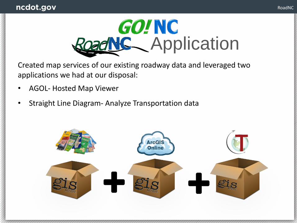
RoadNC
Created map services of our existing roadway data and leveraged two applications we had at our disposal:
• AGOL- Hosted Map Viewer
• Straight Line Diagram- Analyze Transportation data
Application
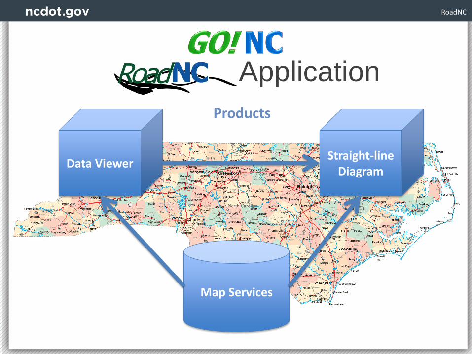
RoadNC
Application
Map Services
Data ViewerStraight-line
Diagram
Products

RoadNC
Map Services
Four map services are used to make RoadNC happen1. Road Events- Characteristics, features, and assets
2. Road Centerlines in gray symbology
3. Road Centerlines in color symbology
4. Road Name Labels
• All data used is from a daily snapshot of our network, road assets, features and characteristics
• Can be used in any client application that supports the use of map services

RoadNC
• Built using an ArcGIS Online Web Map
• Includes the RoadNC map services
• Allows user to inspect NCDOT’s statewide roadway data in a simple to use, straightforward manner
Data Viewer

RoadNC
SLD ViewerData Viewer directly links to our Straight Line Diagram Viewer

RoadNC
SLD Viewer
• Created by Transcend Spatial Solutions
• Customized for NCDOT
• Integrated with RoadNC as well as Google maps and Street View

Current Projects
GO!NC
• Geoservice and AGOL Metadata Standards and Guidelines
• Asset Inventory Projects
• Regional Environmental Modeling
• Road Characteristics Editor
(Roads & Highways Event Editor)
• HiCAMS Project Tracker
• GIS data Clip & Ship

On the Horizon
GO!NC
• GeoEvent Server for real-time location tracking
• Incorporating WebApp Builder for Customized Applications
• Spatial Data Viewer overhaul using AGOL Web App Builder
• GIS Data Portal

Transportation
Any Questions?
Contact Us: