luciad ogc cdb studio · → nato awacs → eurocontrol → ussocom. cyber c2 → joint cyber...
TRANSCRIPT

LUCIAD OGC CDB STUDIOBridge the gap between the GIS and modeling & solutions

AGENDA
1. Company Intro2. Capability Overview→ Visualize OGC CDB→ Create OGC CDB→ Export to GeoPackage
3. Demonstration
COMPANY INTRODUCTION – LUCIAD
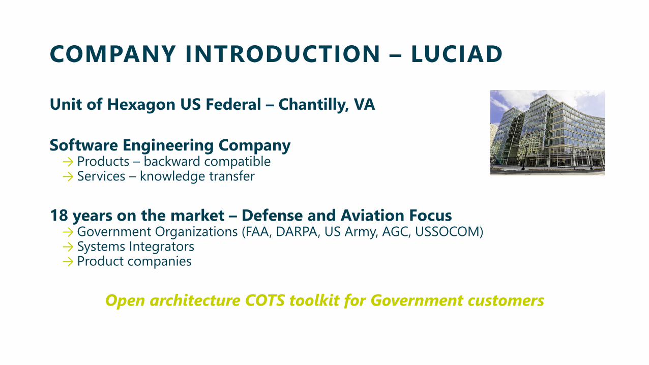
Unit of Hexagon US Federal – Chantilly, VA
Software Engineering Company→ Products – backward compatible→ Services – knowledge transfer
18 years on the market – Defense and Aviation Focus→ Government Organizations (FAA, DARPA, US Army, AGC, USSOCOM)→ Systems Integrators→ Product companies
Open architecture COTS toolkit for Government customers

MULTI-DOMAIN RELEVANCE
Command and Control→ NATO Integrated Command and Control (ICC)→ NATO Air Command and Control System (ACCS)→ NATO Joint Common Operational System (JCOP)→ Thales Raytheon Systems Command View Air→ SITAWARE BMS (20 nations)
Mission Planning/Flight Planning→ Helicopters: NH90 NFH & TTH, Lynx, Panther, Puma→ Fighters: Rafale, Grippen, Tornado, Eurofighter→ E2C Hawkeye, A400M→ FAA AFSS (Lockheed Martin)→ Jeppesen
Intelligence, Surveillance andReconnaissance
→ NATO Geospatial Intelligence Tool (iGeoSIT)→ NATO AGS (Global Hawk) Ground Stations→ Multiple UAV systems and Ground Stations
GIS→ DARPA – TRANSAPPS Program→ NATO iGeoSIT→ UK RAF Overseer
Air Traffic Management & Control → NATO MASE→ Federal Aviation Administration NextGen→ EuroControl
Ballistic Missile Defense→ Extended Air Defense Planning and Tasking Tool (PlaTo)→ Shared Early Warning (SEW)→ Active Layered Theatre Ballistic Missile Defense→ Singapore Missile Defense System
Logistics/Support→ Allied Deployment and Movement System→ NATO LogFS→ NATO XREP→ Airbus VRES
Modeling/Simulation/Training→ NATO Eguermin (Mine Warfare)→ NATO AWACS→ Eurocontrol→ USSOCOM
CYBER C2→ Joint Cyber Command

LUCIAD SOLUTIONS

6
Luci
ad C
omm
erci
al in
Con
fiden
ce
LUCIAD OGC CDB STUDIOBridge the gap between the GIS and modeling & solutions
7
Luci
ad C
omm
erci
al in
Con
fiden
ce
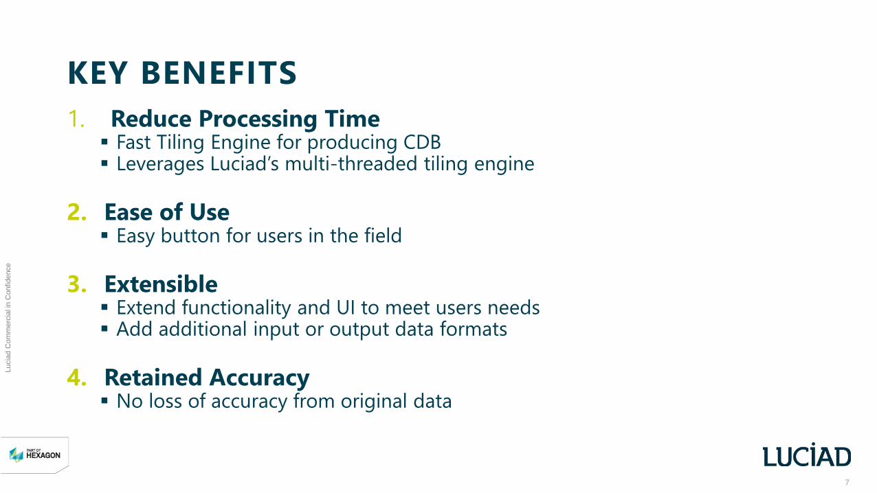
KEY BENEFITS1. Reduce Processing Time Fast Tiling Engine for producing CDB Leverages Luciad’s multi-threaded tiling engine
2. Ease of Use Easy button for users in the field
3. Extensible Extend functionality and UI to meet users needs Add additional input or output data formats
4. Retained Accuracy No loss of accuracy from original data
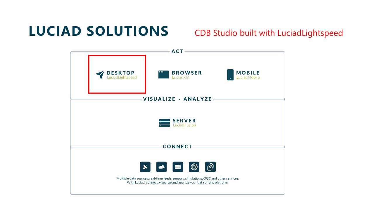
LUCIAD SOLUTIONS CDB Studio built with LuciadLightspeed
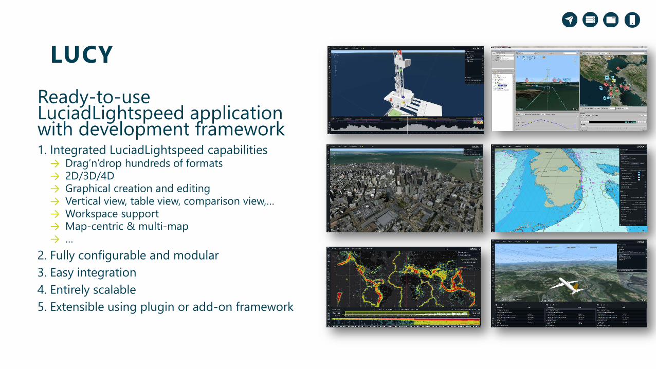
LUCYReady-to-use LuciadLightspeed application with development framework1. Integrated LuciadLightspeed capabilities
→ Drag’n’drop hundreds of formats→ 2D/3D/4D→ Graphical creation and editing→ Vertical view, table view, comparison view,…→ Workspace support→ Map-centric & multi-map→ …
2. Fully configurable and modular3. Easy integration4. Entirely scalable5. Extensible using plugin or add-on framework
10
Luci
ad C
omm
erci
al in
Con
fiden
ce
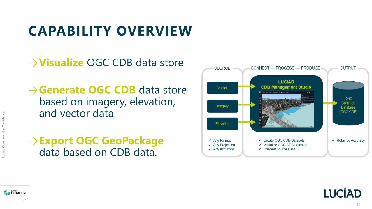
CAPABILITY OVERVIEW
→Visualize OGC CDB data store
→Generate OGC CDB data store based on imagery, elevation, and vector data
→Export OGC GeoPackage data based on CDB data.
11
Luci
ad C
omm
erci
al in
Con
fiden
ce
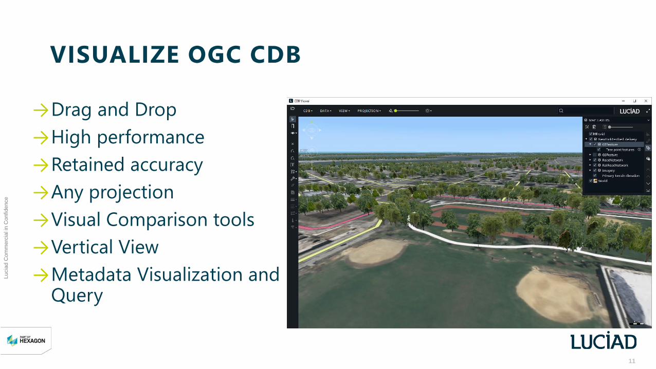
VISUALIZE OGC CDB
→Drag and Drop→High performance→Retained accuracy →Any projection →Visual Comparison tools→Vertical View→Metadata Visualization and
Query

12
Luci
ad C
omm
erci
al in
Con
fiden
ce
VISUALIZE OGC CDB
Elevation→ Dataset 001, Elevation→ 001, 001 Primary Terrain Elevation
Imagery→ Dataset 004, Imagery→ 001, 001 Yearly VSTI→ 003, 001..012 Monthly VSTI→ 004, 001..004 Quarterly VSTI
Vector→ Dataset 100, GSFeatures→ Dataset 101, GTFeatures→ Dataset 102, Geo political features → Dataset 201, Road network→ Dataset 202, Rail Road network→ Dataset 203, Power line network→ Dataset 204, Hydrography network
13
Luci
ad C
omm
erci
al in
Con
fiden
ce
GENERATE OGC CDB
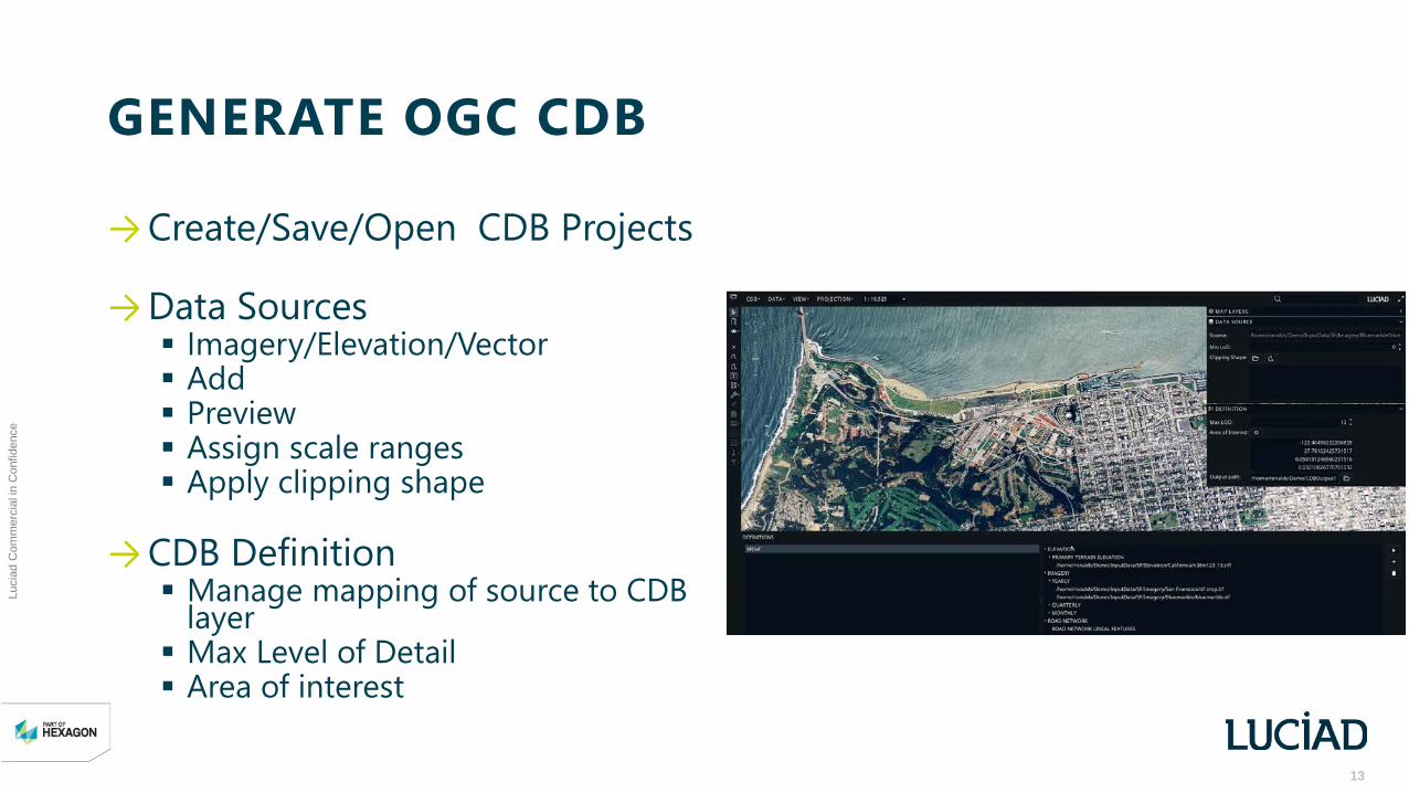
→Create/Save/Open CDB Projects
→Data Sources Imagery/Elevation/Vector Add Preview Assign scale ranges Apply clipping shape
→CDB Definition Manage mapping of source to CDB
layer Max Level of Detail Area of interest
14
Luci
ad C
omm
erci
al in
Con
fiden
ce
EXPORT TO GEOPACKAGE
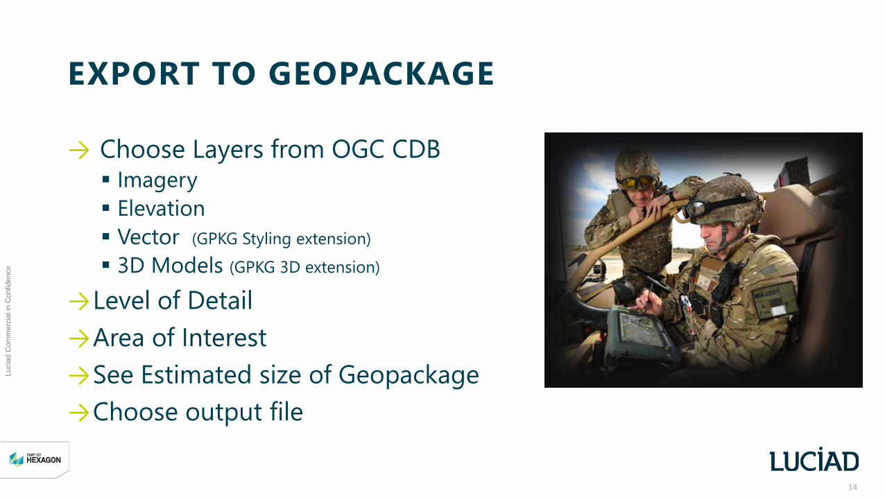
→ Choose Layers from OGC CDB Imagery Elevation Vector (GPKG Styling extension) 3D Models (GPKG 3D extension)
→Level of Detail →Area of Interest →See Estimated size of Geopackage→Choose output file

15
Luci
ad C
omm
erci
al in
Con
fiden
ce
DEMONSTRATION
16
Luci
ad C
omm
erci
al in
Con
fiden
ce
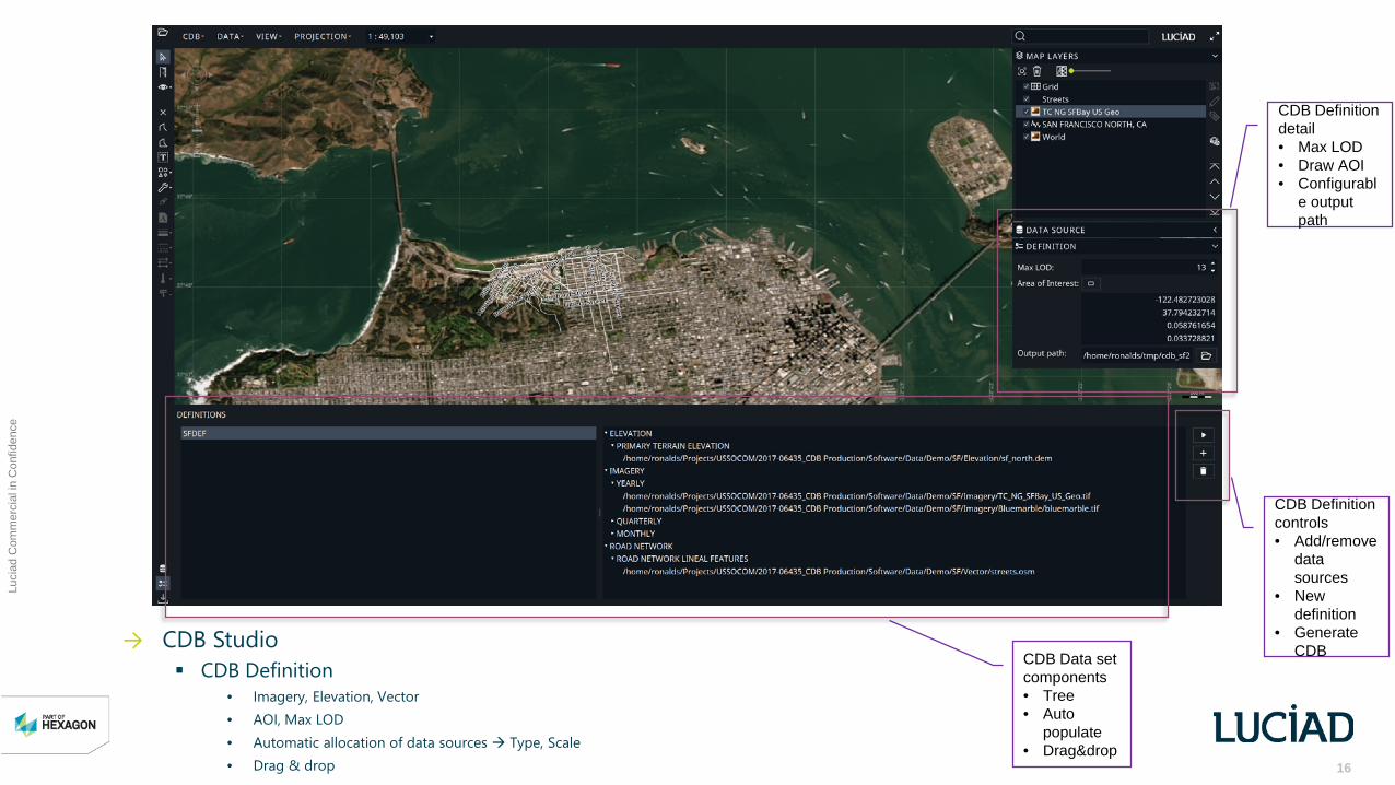
→ CDB Studio CDB Definition
• Imagery, Elevation, Vector• AOI, Max LOD• Automatic allocation of data sources Type, Scale• Drag & drop
CDB Definition detail• Max LOD• Draw AOI• Configurabl
e output path
CDB Data set components• Tree• Auto
populate• Drag&drop
CDB Definition controls• Add/remove
data sources
• New definition
• Generate CDB

17
Luci
ad C
omm
erci
al in
Con
fiden
ce
→ CDB Studio CDB Creation
• Imagery Tiled• Elevation Tiled• Tiled Vector Tiled
• OSM (OpenStreetMap)
Map layers• CDB data
store • Imagery• Elevation• Drag & drop
Validation of generated data• View CDB Imagery• View CDB Elevation• View CDB Vector (in progress)
18
Luci
ad C
omm
erci
al in
Con
fiden
ce
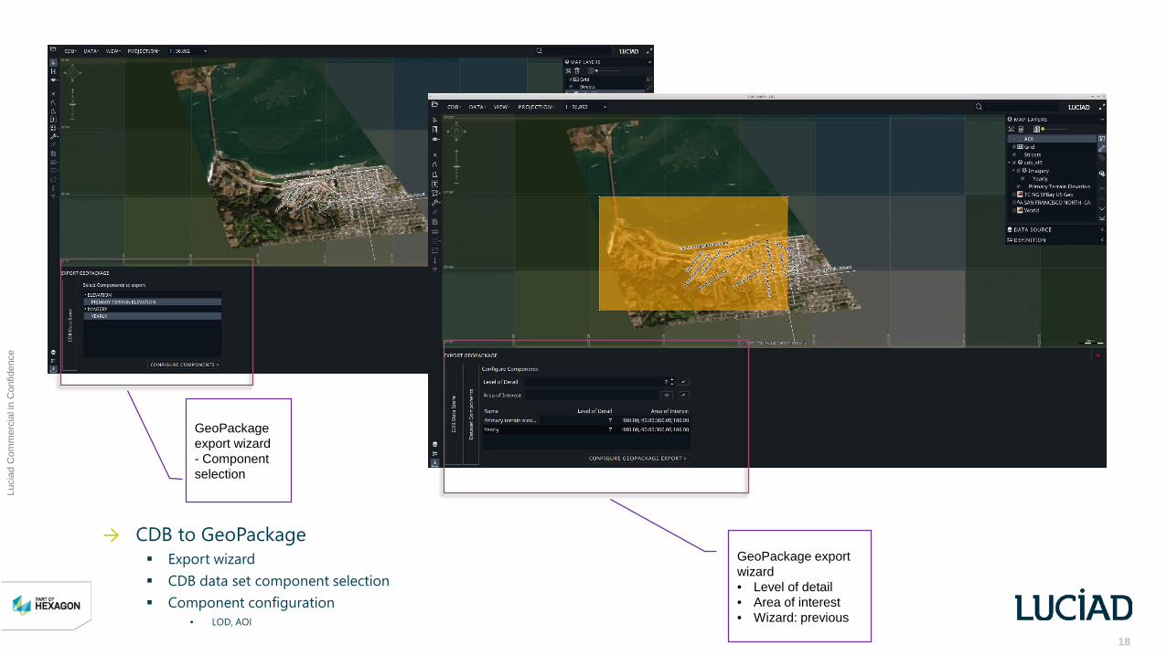
→ CDB to GeoPackage Export wizard CDB data set component selection Component configuration
• LOD, AOI
GeoPackage export wizard- Component selection
GeoPackage export wizard• Level of detail• Area of interest• Wizard: previous