links to national and international cryosphere/hydrology initiatives
DESCRIPTION
by Mike DemuthTRANSCRIPT

Links to National and International Cryosphere/Hydrology Initiatives
Mountain NCE Planning WorkshopJanuary 11-12, 2016
Michael N. DemuthCanadian National RepresentativeWorld Glacier Monitoring Service
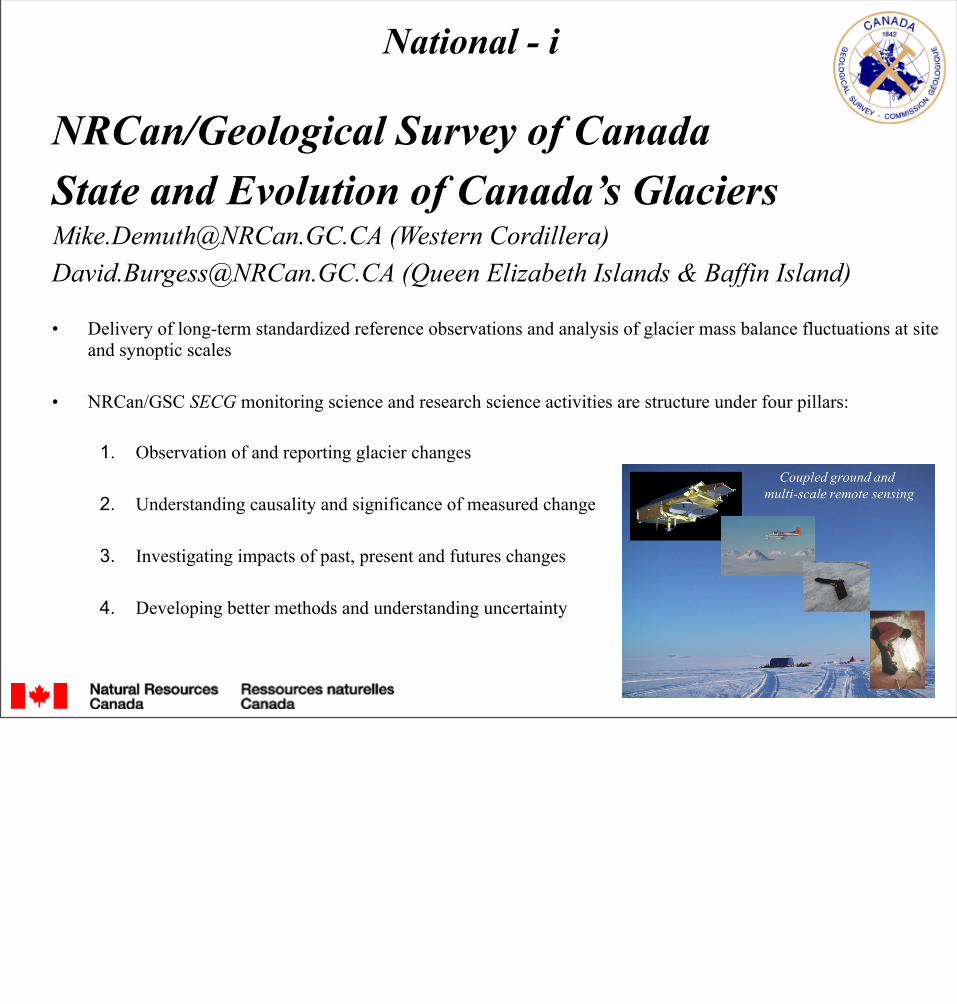
NRCan/Geological Survey of CanadaState and Evolution of Canada’s [email protected] (Western Cordillera)[email protected] (Queen Elizabeth Islands & Baffin Island)
• Delivery of long-term standardized reference observations and analysis of glacier mass balance fluctuations at site and synoptic scales
• NRCan/GSC SECG monitoring science and research science activities are structure under four pillars:
1. Observation of and reporting glacier changes
2. Understanding causality and significance of measured change
3. Investigating impacts of past, present and futures changes
4. Developing better methods and understanding uncertainty
National - i

Rockies-Interior
Coast Mountains seasonal & annual
surface mass balance
5a-10a geodetic
Reference Glacier Mass BalanceObserving Network - Cordillera
KBBI
CI
HB
An
WIR
- unless otherwise noted, NRCan/GSC conducts the observations and analysis:WI – Peyto* and Yoho GlaciersCI – Athabasca and Saskatchewan + whole icefield mass flux divergence (Parks Canada participates in data collection)R – Ram River*BBI – Brintnell-Bologna IcefieldH – Helm*B – Place*An - AndreiK – Kaskawulsh
* original suite of IHD mass balance-hydrology glacier research and observing sites- full metadata is available describing infrastructure and partnerships
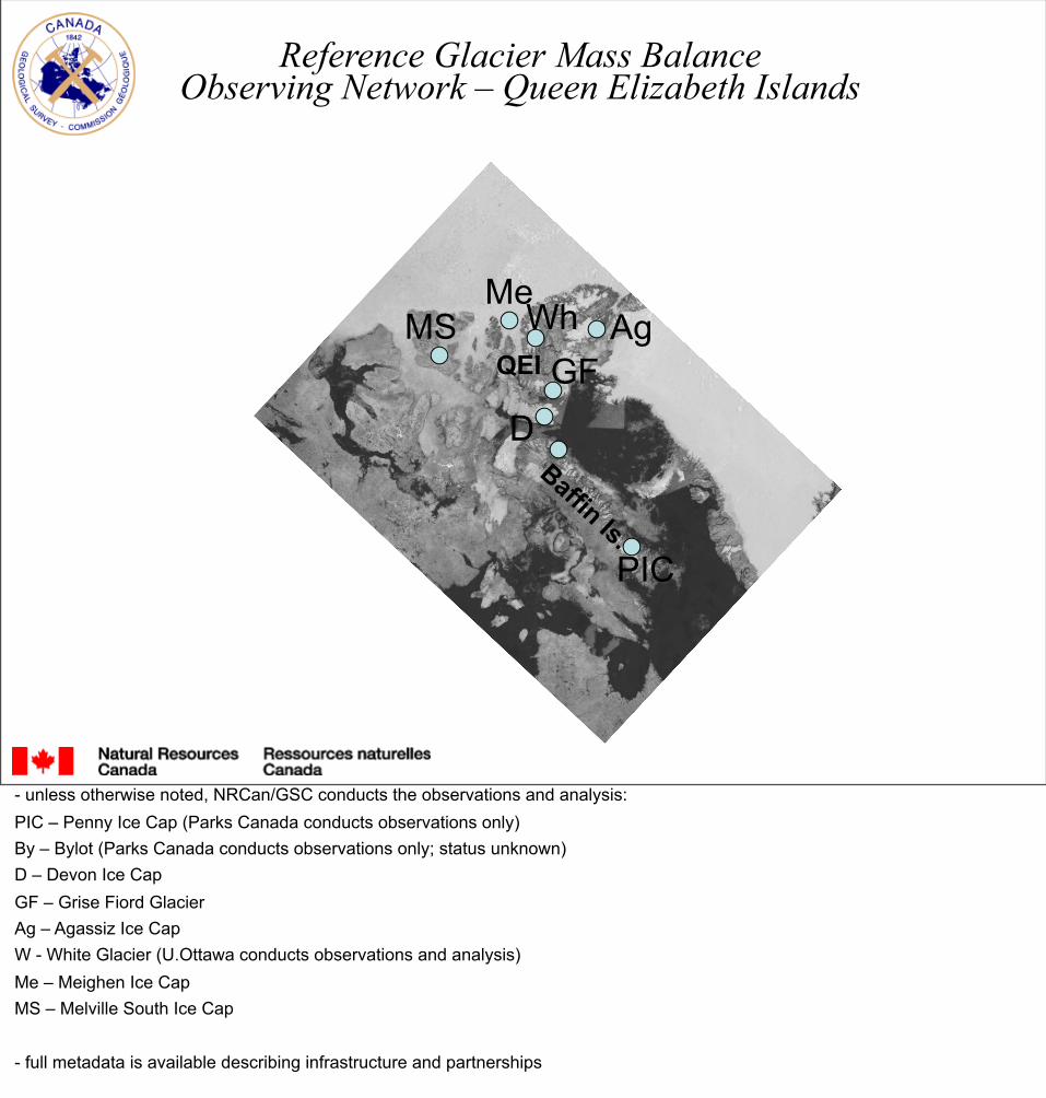
Reference Glacier Mass BalanceObserving Network – Queen Elizabeth Islands
Baffin Is.
QEI
MeWh Ag
GFD
PIC
MS
- unless otherwise noted, NRCan/GSC conducts the observations and analysis:PIC – Penny Ice Cap (Parks Canada conducts observations only)By – Bylot (Parks Canada conducts observations only; status unknown)D – Devon Ice CapGF – Grise Fiord GlacierAg – Agassiz Ice CapW - White Glacier (U.Ottawa conducts observations and analysis)Me – Meighen Ice Cap MS – Melville South Ice Cap
- full metadata is available describing infrastructure and partnerships

EC-Water Cycle Prediction [email protected]
• The “MESH” modelling platform: “MEC Surface Hydrology” couples (on-line or off-line) a 2-D hydrological/hydraulic model (routing), a 1-D surface scheme (redistributes mass & energy) with a 3-D atmospheric model
• Hydrological/hydraulic models can fill gaps, but in the excitement of “glamourous mathematics” the scientific community often lets data collection programs erode. The “reductionist” approach is failing
• As it concerns mountains (hydrological and hydraulic processes are highly variable in space and time), there is a need to address elevation bias in the placement of surface climate and hydrometric measurement networks
National - ii
The following slides are from a workshop on improving weather and water observations in the mountain west (AB, BC)
In Canada’s high Arctic Cordillera, observing biases tend to be coastal (versus inland)

All Climate SitesAll Hydrometric Sites

Climate Sites >1000 mHydrometric Sites >1000 m

Climate Sites >1500 mHydrometric Sites >1500 m

Climate Sites >2000 mHydrometric Sites >2000 m

Climate Hydrometric

International - iInternational Network for Alpine Research Catchment Hydrology (GEWEX)Canadian contact: [email protected]• GEWEX’s INARCH is launched and has broad participation and support from scientists studying mountain
regions around the world.
• OBSERVING - there is an urgent need for mountain observations, data availability, and reduction of measurement uncertainty. INARCH has identified a series of mountain hydrological observatories around the world to address this need and will work to promote more and improved mountain observations. INARCH will organize data publication for mountain hydrological observatories.
• MODELLING - despite the substantial predictive skill shown, there is a need to identify and reduce uncertainty in application of mountain atmospheric, cryospheric and hydrological models using mountain observatories. This will be accomplished by improving the capability and range of downscaling methods to drive models, improving exchange processes with frozen surfaces, and integrating atmospheric, cryospheric and hydrological components to consider impacts of dynamic climate, transient vegetation and changing hydrological and cryospheric storage at various scales.
• PREDICTION - INARCH will explore the changing prospects for mountain hydrology through diagnostic modelling experiments using our instrumented alpine catchments from around the world, paying particular attention to the impact of loss of snow and ice on water resources. This will help quantify and improve the prognostic potential of these models for predicting the water security impacts of global change in mountain regions.
GEWEX = Global Energy and Water Experiment

WMO-Global Cryosphere Watchhttp://globalcryospherewatch.orgCanadian focal point: [email protected]
• Meet evolving cryospheric observing requirements of WMO Members, partners, and the scientific community, by contributing to the WMO Rolling Review of Requirements (RRR) process
• Provide a framework to assess the state of the cryosphere and its interactions within the Earth System
• Enhance the quality of observational data by improving observing standards and best practices for the measurement of essential cryospheric variables
• Improve exchange of, access to, and utilization of observations and products from WMO observing systems and those of its partners
• Foster research and development activities and coherent planning for future observing systems and global observing network optimization
International - ii

Global Climate Observing Systemhttps://www.wmo.int/pages/prog/gcos/GCOS Canadian co-ordinator: [email protected] GTN-Glacier: [email protected] GTN-Permafrost: [email protected]
GCOS is intended to be a long-term, user-driven operational system capable of providing the comprehensive observations required for:
• Monitoring the climate system• Detecting and attributing climate change• Assessing impacts of, and supporting adaptation to, climate variability and change• Application to national economic development• Research to improve understanding, modelling and prediction of the climate system
GCOS addresses the total climate system including physical, chemical and biological properties, and atmospheric, oceanic, terrestrial, hydrologic, and cryospheric components.
International - iii
GTN = Global Terrestrial Network