lep amendment request planning proposal
TRANSCRIPT
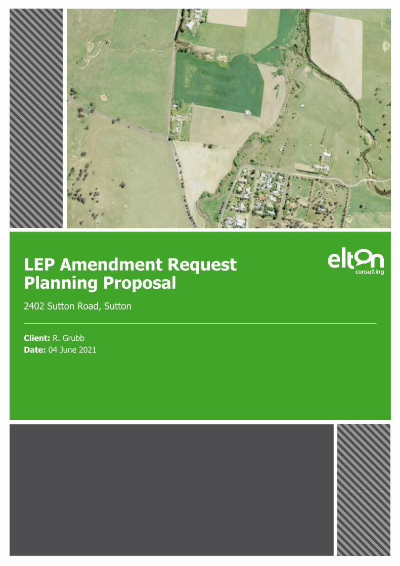
LEP Amendment Request Planning Proposal
2402 Sutton Road, Sutton
Client: R. Grubb
Date: 04 June 2021

www.elton.com.au [email protected] Sydney | Brisbane | Canberra | Darwin | Melbourne | Perth ABN 56 003 853 101
Prepared by Will Pearson and Claire Adams
Reviewed by Liz Densley
Date 4 June 2021
Project Number 18-7968
Version V8 Amended following agency consultation
ELTON CONSULTING
LEP Amendment Request Planning Proposal 2
Contents EXECUTIVE SUMMARY 5
INTRODUCTION 8
Purpose 8
Structure 9
Background 9
SITE ANALYSIS 11
Site Context 11
Site Details 12
Existing development and vegetation 13
Bushfire 13
Flooding and evacuation 13
2.5.1 Groundwater, Watercourses and Riparian Lands 15
Heritage 17
Ecological 18
Demographics 19
2.8.1 Population 19
2.8.2 Employment 19
Housing 21
Infrastructure 22
2.10.1 Transport 22
2.10.2 Utilities 22
STATUTORY PLANNING CONTEXT 23
Yass Valley Local Environmental Plan 2013 23
Zoning 23
Development standards 24
3.3.1 Minimum lot size 24
3.3.2 Building Height 24
3.3.3 Floor Space Ratio 25
3.3.4 Heritage 25
Natural resources provisions 25
3.4.1 Biodiversity protection 25
3.4.2 Groundwater vulnerability 26
3.4.3 Riparian land and watercourses 26
3.4.4 Flooding 26
Other matters 26

ELTON CONSULTING
LEP Amendment Request Planning Proposal 3
THE CONCEPT PLAN 27
PLANNING PROPOSAL 29
OBJECTIVES AND INTENDED OUTCOMES (PART 1) 30
EXPLANATION OF PROVISIONS (PART 2) 31
Amendments to YVLEP 2013 31
JUSTIFICATION (PART 3) 32
Section A - Need for the Planning Proposal 32
Section B - Relationship to the Strategic Framework 34
Section C - Environmental, Social and Economic Impact 42
Section D - State and Commonwealth Interests 44
MAPPING (PART 4) 45
COMMUNITY CONSULTATION (PART 5) 47
PROJECT TIMELINE (PART 6) 48
APPENDICES
A Flora and Fauna Assessment
B Archaeological Due Diligence Assessment
C Land Capability Assessment
D Groundwater Impact Assessment
E Stage 1 Preliminary Site Investigation Report
F Flood Assessment Report
FIGURES
Figure 1 Proposed Concept Plan 6
Figure 2 Proposed Rezoning and Lot Size 7
Figure 3 Site Context 11
Figure 4 Site Map 12
Figure 5 Riparian Lands, Watercourses Map and Groundwater Vulnerability Map 16
Figure 6 Major Site Plantings 18
Figure 7 Sutton UCL 122133 19
Figure 8 Sutton Labour Force 20
Figure 9 Occupation 20
Figure 10 Industry of Employment 21
Figure 11 Sutton Family size 21
Figure 12 Sutton biodiversity mapping 25
Figure 13 Proposed master plan and rezoning option 27
Figure 14 Indicative Lot Layout and PMF flood event 28
Figure 15 Sutton Village Master Plan 32
Figure 16 Current and proposed zoning 45
Figure 17 Current MLS and Proposed MLS 46

ELTON CONSULTING
LEP Amendment Request Planning Proposal 4
TABLES
Table 1 Accompanying documents 9
Table 2 Proposed Rezoning 31
Table 3 Sutton Master Plan Elements 33
Table 4 Consistency with Yass Valley Settlement Strategy 36
Table 5 Consistency with applicable SEPPs 37
Table 6 Consistency with Ministerial Directions 39
Table 7 Indicative Project Timeline 48

ELTON CONSULTING
LEP Amendment Request Planning Proposal 5
Executive Summary This report has been prepared by Elton Consulting to accompany a planning proposal on behalf of R., A. and N.
Grubb to facilitate the redevelopment of land at Lot 1 DP119459 to low density housing.
The planning proposal seeks to amend the Yass Valley Local Environmental Plan 2013 to:
» Rezone the site from RU1 Primary Production and RE1 Public Recreation to R2 Low Density Residential and
E3 Environmental Management.
» Reduce the minimum lot size from 40ha to 2,000m2 (for proposed R2 zone) and 4ha (for proposed E3 zone).
» Amend the Lot Size Map to include the proposed R2 zoned residential land in Sutton with reference to the
application of clause 6.12.
The proposed concept plan is shown in Figure 1, below, and the proposed rezoning is shown in Figure 2, below.
Key features include:
» An indicative layout that demonstrated how the R2 zone may be applied to the site, including the proposed
access point with Sutton Road
» A perimeter of E3 zone absent of any dwellings
» Appropriate lot sizes to accommodate site services such as on-site effluent disposal and site environmental
constraints such as flooding and groundwater sensitivity
The PP has been informed by both local and state strategic planning framework and studies including flood
studies, land use, and settlement strategies, as well as site specific studies.
The report demonstrates that the planning proposal:
» Is consistent with the local and state strategic planning documents
» Is informed by the Sutton Village Master Plan which identified the site’s rezoning potential
» Delivers a residential development that responds to its context, topography and site constraints.
» Provides additional housing in line with demand and infrastructure capacity that will support the controlled
growth of the surrounding area.

ELTON CONSULTING
LEP Amendment Request Planning Proposal 6
Figure 1 Proposed Concept Plan
Source: GRCHydro, 2021

ELTON CONSULTING
LEP Amendment Request Planning Proposal 7
Figure 2 Proposed Rezoning and Lot Size
Source: Edited YVLEP LZN and LSZ Maps (edited)

ELTON CONSULTING
LEP Amendment Request Planning Proposal 8
Introduction
Purpose
This report has been prepared on behalf Mr Ray Grubb to support a proposed amendment to the Yass Valley
Local Environmental Plan (YVLEP) 2013 to facilitate additional housing at 2402 Sutton Road, Sutton (the site) to
enable the expansion of Sutton. The changes will:
» Rezone site from RU1 Primary Production and RE1 Public Recreation to R2 Low Density Residential and E3
Environmental Management.
» Apply minimum lot sizes of 2,000m2 and 4ha respectively.
» Amend the Lot Size Map to show a 2,000m2 MLS (outlined in blue) for the site to which clause 6.12 will
apply.
This report comprises a Planning Proposal (PP) the objective of which is to demonstrate to Council that there is
sufficient planning justification to amend YVLEP as it relates to the site. Specifically, this report:
» Details the proposed provisions of the LEP amendment
» Describes the vision for the site that underpins the LEP amendment, including a concept plan demonstrating
the desired ultimate development outcome for the site
» Provides evidence to support the proposed LEP amendment based on technical planning, economic, urban
design and traffic assessment
» Justifies the proposed LEP amendment against all relevant statutory and strategic planning matters
» Addresses the requirements for the preparation and lodgement of a PP in accordance with the EP&A Act and
associated guides.
The PP is to be read in conjunction with the technical reports/accompanying documents listed in Table 1.
The PP has been prepared in accordance with:
» Section 3.33 of the Environmental Planning and Assessment Act 1979 (EP&A Act)
» A Guide to Preparing Planning Proposals and A Guide to Preparing Local Environmental Plans (Department of
Planning and Infrastructure, 2016)
» Yass Valley Council requirements.
It represents the first stage of the gateway plan making process, which initially seeks Yass Valley Council’s
(Council) support to forward the proposed LEP amendment outlined in the planning proposal to the Department
of Planning and Environment (DPE) for a gateway determination.
The gateway determination will:
» Identify if there is sufficient justification for the planning proposal to proceed
» Enable the public exhibition of the proposal
» Provide a timeframe for completion

ELTON CONSULTING
LEP Amendment Request Planning Proposal 9
Table 1 Accompanying documents
Supporting document Prepared by Date
Appendix A: Flora and Fauna Assessment Griffin Associates Environment January 2019
Appendix B: Archaeological Due Diligence Assessment
Bowen Heritage Management November 2018
Appendix C: Land Capability and Related Issues for Rural Residential Subdivision
Soil and Land Conservation Consulting August 2003, revised January 2019
Appendix D: 2402 Sutton Road, Sutton - Groundwater Impact Assessment
Franklin Consulting Australia Pty Ltd (trading as) Soil and Water
January 2020
Appendix E: Stage 1 Preliminary Site Investigation (Contamination) Wattlegrove PSI
NGH Consulting January 2020
Appendix F: Flood Assessment Report GRC Hydro May 2021
Structure
Section 3.33(2) of the EP&A Act and A Guide to Preparing Planning Proposals sets out the content and structure
required for planning proposals. This report is structured in accordance with these provisions. However, it also
includes introductory information about the site location and context. As such, this report is structured as follows:
» comprehensive details on the subject site and its surrounds
» identification of the Environmental Planning Instruments (EPIs) and broad strategic context of the proposal
» a statement of the objectives and intended outcomes of the re-zoning
» explanation of the provisions that are to be included in the proposed instrument
» thorough justification of the proposal against the questions set out in the above-mentioned guidelines,
demonstrating that the proposal is in the public interest, and is worthy of approval
» identification of the YVLEP 2013 maps which would be amended under the proposal
» details of the community consultation that would be undertaken
» a project timeline detailing anticipated timeframe for the plan-making process.
Background
Much of the area surrounding Sutton is currently zoned RU1 Primary Production, as is the majority of the site
except for a thin section of RE1 Public Recreation zoned land running parallel to McLaughlins Creek. The primary
focus of RU1 land is to allow large scale rural activities e.g. Agriculture to be performed, achieved through the
following zone objectives:
» To encourage sustainable primary industry production by maintaining and enhancing the natural resource base
» To encourage diversity in primary industry enterprises and systems appropriate for the area
» To minimise the fragmentation and alienation of resource lands
» To minimise conflict between land uses within this zone and land uses within adjoining zones
» To protect and enhance the biodiversity of Yass Valley

ELTON CONSULTING
LEP Amendment Request Planning Proposal 10
» To protect the geologically significant areas of Yass Valley
» To maintain the rural character of Yass Valley
» To encourage the use of rural land for agriculture and other forms of development that are associated with
rural industry or that require an isolate or rural location
» To ensure that the location, type and intensity of development is appropriate, having regard to the
characteristics of the land, the rural environment and the need to protect significant natural resources,
including prime crop and pasture land
» To prevent the subdivision of land on the fringe of urban areas into small lots that may prejudice the proper
layout of future urban areas.
The site area is approximately 30 hectares. However, under the YVLEP 2013, the current minimum lot size
applied to the site is 40 hectares. Therefore, it could be considered difficult for a site of this size to achieve
successful outcomes in accordance with the intent of the RU1 zone objectives.
Further, the Sutton Village Master Plan (2017) identified the subject site for potential rezoning to residential use.

ELTON CONSULTING
LEP Amendment Request Planning Proposal 11
Site Analysis This section of the report provides an overview of the site, analysis of site characteristics, as well as
demographics and housing requirements of the area.
Site Context
The site is located in the Southern Tablelands region of southeast NSW, within the Yass Valley Local Government
Area (LGA). It is approximately 1km north of Sutton village, which is the closest settlement to the site. Sutton is a
small village of approximately 250 people. It contains a primary school and limited commercial services, including
a bakery. With the exception of Sutton, surrounding development is predominantly rural and used for agricultural
and grazing purposes.
The site is located on Sutton Road, which connects Gundaroo (approximately 15km north of the site) to
Queanbeyan (approximately 24km south of the site). The site is also strategically located approximately 3 km
from the Federal Highway which provides a direct link to Canberra. It is approximately 9km from the ACT-NSW
border and 22km from Canberra’s central business district.
A site context maps is shown in Figure 3.
Figure 3 Site Context
Source: Google Maps
The Site

ELTON CONSULTING
LEP Amendment Request Planning Proposal 12
Site Details
The site is legally identified as Lot 1 DP119459 and has a street address of 2402 Sutton Road. It has an
approximate area of 30 hectares.
The site has an irregular shape and is roughly triangular. Its narrowest point is to the south, then extending
northward to its broadest part. A narrow semi-rectangular shape protrudes further north to the confluence of
McLaughlins Creek and the Yass River.
The site has the following characteristics:
» The northern boundary is approximately 770m and adjoins a neighbouring rural property
» The eastern boundary is approximately 1.34km and follows the path of McLaughlins Creek to Yass River
» The western boundary is approximately 895m and fronts to Sutton Road.
The shape of site means it does not have a distinct southern boundary.
The site is relatively level with an approximately height of 600m Australian Height Datum (AHD). It slopes slightly
towards the eastern boundary and McLaughlins Creek.
A site map is provided in Figure 4.
Figure 4 Site Map
Source: Sixmaps, 2018

ELTON CONSULTING
LEP Amendment Request Planning Proposal 13
Existing development and vegetation
The site currently hosts numerous structures, most of which are located near the western boundary adjoining
Sutton Road. These structures include two residential dwellings, seven sheds of varying size, sewerage retention,
and various small structures used for agricultural purposes.
Vegetation across the alluvial terrace is primarily introduced grasses for hay-making, with riparian vegetation such
as Crack willow (currently being removed), Robinia, Cumbumgi and Common reed growing in and beside
McLaughlins Creek in the section currently zoned RE1 (Appendix A). There are also a few mature trees (varieties
of Elm, Poplar, Pine, Cyprus and remnants of an orchard) dotted around the site (Appendix A). Topography and
Soils
The site has an approximate elevation of 600m Australian Height Datum (AHD). The general terrain is a broad
open valley, large flood plain and alluvial terrace ground formed through deposits from McLaughlins Creek and
Yass River. The terrain has a gentle slope across the alluvial terrace towards the east, falling away to an area of
active floodplain associated with McLaughlins Creek. The northern boundary of the site contains an un-named
watercourse (referred to as Yass River Tributary #4 in the Sutton Flood Study, 2016) flowing from west to east
into McLaughlins Creek just upstream of the confluence with Yass River. Both the northern section of the site and
the active flood plain along the eastern boundary experience mainstream flooding and are unsuitable for
residential development (Appendix C; WMA Water, 2016).
The site is located in the area mapped as Gundaroo soil landscape in the soil landscape survey of Canberra
1:100,000 sheet (Jenkins, 2000) with two main soil types across the site. A site analysis by Soil and Land
Conservation Consulting (Appendix C) found Red chromosols - highly weathered red coloured subsoils - located
across the alluvial terrace, with a brown coloured loam topsoil to 20cm overlying a light to medium clay subsoil.
These red chromosols have low levels of salinity and an estimated surface infiltration rate in the range of 1.5 to
3m/day with a design effluent irrigation rate of 4mm/day (Appendix C). The soil depth exceeds 1m and subsoils
are free of mottling in the top metre, indicating that they are not prone to seasonally high watertables
(Appendix C). This indicates that the soils could support on-site sewerage treatment systems.
The soils found on the alluvial flats and active floodplain are Stratic rudols and comprise a very dark coloured clay
loam to clay topsoil overlying a yellow coloured clay subsoil. The topsoil has both a high organic content and high
clay content and is prone to cracking when it dries (Appendix C). These areas of the site are not proposed for
residential development but do form part of the area proposed for rezoning to E3 Environmental Management .
Once rezoned, the future subdivision lot layout would ensure E3 zoned lots have sufficient alluvial terrace land
area for both a residential building envelope and on-site sewerage treatment system with buffers.
The site has low soil erosion hazard across the alluvial terrace and is generally in a stable condition, however, due
to the site’s proximity to waterways, sediment detention basins should be constructed during development to
minimise sediment export from the site (Appendix C). The channels of McLaughlins Creek and Yass River display
minor bank erosion and are held together by predominantly exotic shrub and tree species, and would be suitable
for re-vegetation with native species (Appendix A, Appendix C).
Bushfire
No bushfire prone land is identified on or around the site. The closest buffer is approximately 1.2km to the west
of the site.
Flooding and evacuation
Flooding is a key consideration for this planning proposal due to the subject site’s location on the confluence of
McLaughlins Creek and Yass River.
The following information has been extracted from the GRC Hydro Report (Appendix F).

ELTON CONSULTING
LEP Amendment Request Planning Proposal 14
Flood modelling has been undertaken by GRC Hydro using the Sutton Flood Study (WMAwater, 2016)
TUFLOW model as a basis for the modelling analysis. Council also engaged Lyall & Associates to
undertake a cumulative impact assessment of the developed and two already approved developments
(Keir and Cartwright). A concept design which presents an indicative site configuration has been
developed to show how future development of the site can occur in a manner consistent with the
requirements of Section 9.1 Direction 4.3. Key findings of the assessment include:
For Existing Conditions:
» The majority of the site is not mainstream flood affected during the 1% AEP event. During this
event, shallow flows breakout from a tributary to the north of the properties with depths up to 0.2 m
experienced. With the exception of the creek channels, flow conditions are low hazard and classified
as flood fringe;
» A significant portion of the site (~60%) is mainstream flood affected during the PMF by high hazard
flow conditions. The remaining areas of the site are not mainstream flood affected, however, do
experience generally shallow overland flows which breakout from the above-mentioned northern
tributary. There areas are typically affected by low hazard flow conditions.
Implementation of the concept design resulted in:
» Developable areas of the site to be flood free during the 1% AEP event;
» All internal access roads to be situated above the PMF high hazard flood extent;
> Flood impact analysis found that negligible flood impacts are expected in the 1% AEP and PMF
events due to the development. A cumulative impact assessment undertaken by Lyall &
Associates confirmed these findings as well as confirming that “future development within
Sutton would have only a minor impact on flood behaviour”;
> A dam breach analysis study found that the risk to future development at the site due to dam
failure is very low, with developable areas of the site being situated above a conservatively
derived dam breach water level. The analysis found that a full dam breach assessment for the
site is not warranted.
> The impact of climate change on peak flood levels affecting the site was found to minor, with
projected increases in 1% AEP flood levels of ~0.2 m expected for the 2090 planning horizon.
This is below the Flood Planning Level which is the 1% AEP flood level + 0.5 m freeboard;
Flood evacuation has been considered with the following findings:
» Implementation of the concept design results in all developable areas being situated outside the PMF
high hazard extent and approximately 2 m above the 1% AEP flood level. Evacuation during a Yass
River/Mclaughlins Creek extreme flood event would be associated an extremely low probability of
occurrence;
» Internal access roads are situated above the 1% AEP flood level and in the low hazard areas of the
PMF. These roads provide low hazard flood access to Sutton Road as well as areas of refuge outside
of the mainstream PMF extent (see Figure 3 and 4);
» Road design can be developed to ensure that Rising Road access is available for all future lots.
The site’s flood access has been reviewed with the following findings:
» Access from the Site to Sutton and Canberra may be impacted due to flooding of the Sutton Road
crossing of Mclaughlins Creek. Relatively frequent flood events inundate the crossing and cut-off
road access at that location.
» The crossing is identified as a flood risk area in the Sutton FRMS&P. Several flood risk management
measures which aim to manage the risk of flooding of the crossing are identified in the Sutton
Floodplain Risk Management Plan with ‘High Priority’ for implementation. These measures include
replacement of the current crossing with a bridge as well as flood warning signage and automatic

ELTON CONSULTING
LEP Amendment Request Planning Proposal 15
boom gates. Council has a responsibility to implement these measures as the Plan has been
adopted.
» Due to the ‘High Priority’ classification of these risk management measures in the Floodplain
Management Plan, it is expected that the crossing or other mentioned risk management measures
will be implemented in the short term (e.g. 2-5 years), prior to the site being occupied.
Implementation of these measures will reduce the risk associated with flooding of this crossing.
» Two alternate flood access routes have been identified at Mulligans Flat Road and Shingle Hill Way.
New bridge crossings of major watercourses on these access routes will allow for 5% and 0.05%
AEP flood access respectively. Use of these roads during times of flood can provide flood access to
Canberra under most weather conditions. In addition to Canberra, Gundaroo can be accessed during
an emergency, via Sutton Road.
The flood and risk characteristics described above have been considered when addressing Section 9.1
Direction 4.3 Flood Prone Land directives. The analysis has found that rezoning of the site is consistent
with the requirements of directives if the following design requirements are adhered to during future
development of the site:
» Land within the Flood Planning Area is rezoned as E3 Environmental Management , with areas
outside of the Flood Planning Area zoned to R2 Low Density Residential. Sufficient space for
development of all lots is required outside of the Flood Planning Area;
» Development of the site is to achieve, at a minimum, the flooding outcomes described in this report;
» Bulk earthworks should result in an approximately neutral cut/fill ratio within the FPA to minimise
loss of flood storage.
» Internal roads are to be designed to allow for flood free Rising Road access in the 1% AEP event and
low hazard access during extreme events.
The full report has been provide at Appendix F.
2.5.1 Groundwater, Watercourses and Riparian Lands
The whole site is within an area of mapped Groundwater Vulnerability (YVLEP 2013) as shown in Figure 5). This
means clause 6.4 Groundwater Vulnerability of the YVLEP 2013 applies to the site. Development in areas of
groundwater vulnerability must maintain the hydrological functions of key groundwater systems and avoid any
significant adverse environmental impact, particularly the depletion and contamination of groundwater.

ELTON CONSULTING
LEP Amendment Request Planning Proposal 16
Figure 5 Riparian Lands, Watercourses Map and Groundwater Vulnerability Map
Source: NSW Planning Portal (YVLEP 2013 Riparian Lands and Watercourses Map)
Most of the site’s eastern edge is located within a Watercourse as identified within the Riparian Lands and
Watercourses Map – Sheet CL2_005 under the YVLEP 2013 and is subject to Clause 6.5 of the YVLEP. Clause 6.5
also applies to ‘all land that is within 40 metres of the top of the bank of each watercourse on land identified as
“Watercourse” on that map’. Development in these areas must avoid any significant adverse environmental
impact on water quality, stability of banks and bed, habitats and ecological processes. Due to the environmentally
sensitive location adjacent McLaughlin’s Creek and Yass River, on-site effluent disposal systems will be designed
to be consistent with the Sydney Water Catchment’s guideline Designing and Installation of On-site Wastewater
Systems.
The Land Capability Assessment (Appendix C) was updated in 2019 following preparation of the Sutton Flood
Study and Risk Management Plan which identified parts of the site to be impacted by the 1% AEP flood levels.
Appendix C provides consideration of the impact of on-site effluent disposal on groundwater and recommends
specific mitigation measures at Appendix 2 of the Land Capability Assessment).
Due to the location of the site as an area of groundwater vulnerability and the environmentally sensitive location
adjacent McLaughlin’s Creek and Yass River, Yass Valley Council and DPIE requested additional information
regarding potential impacts of on-site effluent disposal on the groundwater system to enable assessment for a
Gateway determination. Accordingly, a Groundwater Impact Assessment was undertaken by Franklin Consulting

ELTON CONSULTING
LEP Amendment Request Planning Proposal 17
Australia Pty Ltd (trading as) Soil and Water (Appendix D) which should be considered as an addendum to the
existing updated report by Soil and Land Conservation.
The Groundwater Impact Assessment found that there is a low potential for the development to impact on
groundwater provided treatment systems proposed at the development stage are effective in minimising the
impact on the groundwater system.
The proposed amendment to the Lot Size Map to include the application of clause 6.12 will ensure that the
consent authority , in considering a development application, is satisfied as to steps taken to avoid contamination
of groundwater.
The clause (as amended)
6.12 Development on certain land in Gundaroo and Sutton in Zone R2 Low Density Residential
(1) This clause applies to land in Zone R2 Low Density Residential and shown edged blue on the Lot Size Map.
(2) Despite any other provision of this Plan, the size of any lot resulting from a subdivision of land to which this
clause applies is not to be less than 5,000 square metres unless the lot is connected to a reticulated sewerage
scheme.
(3) Development consent may be granted to development for the purposes of a dual occupancy on land to which
this clause applies, where the land is not connected to a reticulated sewerage scheme, only if the size of the lot
on which the development is to be carried out is at least 10,000 square metres.
(4) Development consent must not be granted to development on land to which this clause applies unless the
consent authority is satisfied that the development is designed, sited and will be managed to avoid contamination
of groundwater.
The site is located on Sheet LSZ_005F of the Lot Size Map. The map (Sheet LSZ_005F) would also need to be
amended to outline the R2 zone in blue.
This approach is considered suitable in addition to the recommendations outlined in the Groundwater Impact
Assessment (Appendix D).
Heritage
The site itself has no heritage items of Federal, State or Local value as identified within the YVLEP 2013. An
archaeological due diligence assessment has been undertaken for the site to determine the presence of any
potential archaeological deposits (PADs).
The fieldwork for the due diligence assessment was conducted in the 23 November 2014 by Bowen Heritage
Management (Appendix B). It identified a number of archaeological items, including 10 historical sites (i.e.
European sites older than 50 years) and six previously unrecorded Aboriginal archaeological sites, including:
» Two domestic dwellings
» One chicken coop
» Five rural sheds
» One sheep shearing shed
» One grain silo
» Six Aboriginal archaeological sites comprising:
> Three very low-density stone artefact scatters
> Three isolated stone artefacts.

ELTON CONSULTING
LEP Amendment Request Planning Proposal 18
Ecological
The site is not subject to any biodiversity or native vegetation corridors under the YVLEP 2013. The wider Sutton
region supports an array of flora and fauna species, many of which are threatened or protected. In this region a
number of faunal species have been identified including the Golden Sun Moth, Superb Parrot, Key’s Matchstick
Grasshopper, Striped Legless Lizard and Southern Lined Earless Dragon.
Griffin Associates Environment conducted a flora and fauna assessment in December 2014 (Appendix A), which
was updated in January 2019. The assessment determined that “as a result of over 150 years of cropping no
remnant flora of native forest, woodland or natural grassland survives on the site.” Based on the
findings of the assessment it is considered unlikely that the site supports any endangered flora or fauna. Major
site plantings are noted in Figure 6.
Figure 6 Major Site Plantings
Source: Griffin Associated Environment, 2019

ELTON CONSULTING
LEP Amendment Request Planning Proposal 19
Demographics
2.8.1 Population
As of 2016 the Yass Valley LGA had a population of 16,964, making it one of the smallest regional areas in New
South Wales by population. The population is expected to grow by 10,762 people by 2036 thereby creating
demand for 3,985 new dwellings. The estimated residential population of Sutton (See Figure 7) as of 2016 is 252.
Figure 7 Sutton UCL 122133
Within Sutton there is a diverse mix of household composition with the bulk of the village being in either a two-
person or four-person household. The population of Sutton is characterised primarily by middle-aged couple
families, with 53.6 per cent being a couple family with children and 7.2 per cent being one parent family. This is
closely reflected within the age demographics with 27.8% of the population falling under the 40-54 age bracket
and 34.2 per cent within 0-19 years.
2.8.2 Employment
As of 2016, the total workforce of Sutton was 137 people, comprising 67.2 per cent full-time and 23.4 per cent
part-time workers. The total number of unemployed persons is three, with the unemployment rate being
approximately 2.2 per cent. Approximately 44 per cent of Sutton’s population have an education attainment of a
Diploma or higher and the median household income is $2,865 a week. The characteristics of the labour force in
Sutton is shown in Figure 8 below.

ELTON CONSULTING
LEP Amendment Request Planning Proposal 20
Figure 8 Sutton Labour Force
Source: ABS QuickStats Sutton UCL122133
The predominant occupations of the employed population are shown in Figure 9.
Figure 9 Occupation
Source: ABS QuickStats Sutton UCL122133
Employment industries found within Sutton are identified in Figure 10 below. The following industries did not
record any employment for Sutton: administrative and support services; agriculture, forestry and fishing; arts and
recreation services; electricity, gas, water and waste services; financial and insurance services; mining; and
wholesale trade.
92
32
10
3
0 10 20 30 40 50 60 70 80 90 100
Worked full-time
Worked part-time
Away from work
Unemployed
Number of Persons
Labour
Forc
e S
tatu
s
30
28
19
14
12
11
9
3
11
0 5 10 15 20 25 30 35
Managers
Professionals
Technicians and Trades Workers
Sales Workers
Clerical and Administrative Workers
Labourers
Community and Personal Servic Workers
Machinery Operators and Drivers
Other
Number of Persons
Occ
upation

ELTON CONSULTING
LEP Amendment Request Planning Proposal 21
Figure 10 Industry of Employment
Source: ABS QuickStats Sutton UCL122133 – General Community Profile
Housing
The predominant housing typology of Sutton currently consists of ‘separate house’ (96.1 per cent). This is not
dissimilar from the housing stock of Yass Valley LGA as a whole, which consists of 94 per cent separate dwellings.
The only other forms of housing currently available in Sutton is semi-detached dwellings at 3.9 per cent.
The prevalence of separate dwelling housing reflects the desire by Council and residents to maintain a small
village character. The average number of persons per household in Sutton is equal with NSW’s average of 3.1.
Household size is shown in Figure 11. Additionally, the average number of bedrooms per dwelling is 3.5 with
90.1% of all housing stock consisting of either 3 or 4 bedrooms. Only 9.9% of dwellings consist of 2 bedrooms
and there are currently no 1-bedroom dwellings. This reflects a lack in housing diversity, forcing smaller
households to occupy and maintain dwellings that exceed their needs.
Figure 11 Sutton Family size
\ Source: ABS QuickStats Sutton UCL122133 – General Community Profile
3
3
4
4
4
6
7
9
9
9
10
15
39
0 5 10 15 20 25 30 35 40 45
Retail Trade
Transport, Postal and Warehousing
Health Care and Social Assistance
Information Media and Telecommunications
Rental, Hiring and Real Estate Services
Manufacturing
Other Services
Construction
Inadequately described/Not stated
Professional, Scientific and Technical Services
Education and Training
Accommodation and Food Services
Public Administration and Safety
Number of Persons
Indust
ry a
nd E
mplo
ym
ent
0 5 10 15 20 25 30
One
Two
Three
Four
Five
Six or more
Number of Households
Num
ber
of
Pers
ons

ELTON CONSULTING
LEP Amendment Request Planning Proposal 22
Infrastructure
2.10.1 Transport
The site is directly accessibly by Sutton Road which traverses the entire western boundary. This road provides
access north to Gundaroo and forms part of the route to Murrumbateman and Yass. Sutton Road links with the
Federal Highway, providing access to Canberra City Centre (25 minutes) and Sydney (2.45 hours). There are no
nearby regional bus services nor is there a train line that services Sutton.
In pre-Gateway communication, DPIE expressed concern about creating an intersection on a classified Regional
Road (Sutton Road) within a 100km/h speed zone to create a safe and flood free access/egress to future urban
development. The intersection location has been provided as part of a proof of concept and to demonstrate yield.
It is acknowledged that a Traffic Impact Assessment will be required at development application stage. TfNSW
have concurred with this approach.
2.10.2 Utilities
The site has an electricity connection for the existing dwelling. There are no water or sewer connections. Sutton
and surrounds (including the subject site) does not have access to a public sewerage scheme or potable water.
Residents are required to maintain on-site sewage management systems and utilise bore water or rainwater tanks
for the potable water requirements.

ELTON CONSULTING
LEP Amendment Request Planning Proposal 23
Statutory Planning Context The rezoning proposal has been prepared having regard to the existing planning framework set by the YVLEP
2013 as the applicable EPI for the subject site.
Yass Valley Local Environmental Plan 2013
The aims of the YVLEP 2013, which guide the preparation of this PP are as follows:
(a) To establish planning controls that promote sustainable development,
(b) To protect high quality agricultural land and encourage emerging agricultural industries,
(c) To encourage housing diversity,
(d) To promote employment-generating tourism,
(e) To provide for commercial and industrial development,
(f) to encourage the establishment of retail and professional services in urban locations,
(g) to protect and enhance the character of each of the villages in Yass Valley,
(h) To enhance service provision in each of the villages in Yass Valley,
(i) To protect and conserve the cultural heritage and history of Yass Valley,
(j) To protect and enhance the environmental and biodiversity values of Yass Valley
(k) To minimise land use conflicts
This PP gives effect to these objectives.
Zoning
Under the YVLEP 2013 the site is predominantly zoned RU1 Primary Production, with a portion of RE1 Public
Recreation zoned land traversing the eastern boundary with McLaughlins Creek. The objectives of the zones are:
RU1 Primary Production
» To encourage sustainable primary industry production by maintaining and enhancing the natural resource
base.
» To encourage diversity in primary industry enterprises and systems appropriate for the area.
» To minimise the fragmentation and alienation of resource lands.
» To minimise conflict between land uses within this zone and land uses within adjoining zones.
» To protect and enhance the biodiversity of Yass Valley.
» To protect the geologically significant areas of Yass Valley.
» To maintain the rural character of Yass Valley.
» To encourage the use of rural land for agriculture and other forms of development that are associated with
rural industry or that require an isolated or rural location.
» To ensure that the location, type and intensity of development is appropriate, having regard to the
characteristics of the land, the rural environment and the need to protect significant natural resources,
including prime crop and pasture land.
» To prevent the subdivision of land on the fringe of urban areas into small lots that may prejudice the proper
layout of future urban areas.

ELTON CONSULTING
LEP Amendment Request Planning Proposal 24
RE1 Public Recreation
» To enable land to be used for public open space or recreational purposes.
» To provide a range of recreational settings and activities and compatible land uses.
» To protect and enhance the natural environment for recreational purposes.
» To provide for the free passage or temporary storage of storm or floodwaters.
» To identify land that is suitable for future public recreation use and that can be brought into public ownership.
» To ensure the provision of adequate open space to meet the needs of all residents.
Development standards
3.3.1 Minimum lot size
Clause 4.1(2) of YVLEP 2013 sets a minimum lot size (MLS) for the site, as indicated on the associated Minimum
Lot Size Map LSZ_005F. Land zoned RU1 currently has a MLS of 40ha. No MLS is applicable to the RE1 Public
Recreation portion of the site.
Clause 4.2 of the YVLEP 2013 regarding rural subdivision applies to the areas of the site zoned RU1 Primary
Production. This clause states the following:
(1) The objective of this clause is to provide flexibility in the application of standards for subdivision in rural
zones to allow land owners a greater chance to achieve the objectives for development in the relevant zone.
(2) This clause applies to the following rural zones:
(a) Zone RU1 Primary Production,
(b) Zone RU2 Rural Landscape,
(baa) Zone RU3 Forestry,
(c) Zone RU4 Primary Production Small Lots,
(d) Zone RU6 Transition.
Note. When this Plan was made it did not include all of these zones.
(3) Land in a zone to which this clause applies may, with development consent, be subdivided for the purpose of
primary production to create a lot of a size that is less than the minimum size shown on the Lot Size Map in
relation to that land.
(4) However, such a lot cannot be created if an existing dwelling would, as the result of the subdivision, be situated
on the lot.
(5) A dwelling cannot be erected on such a lot
The existing site is approximately 30 hectares and is undersized for the current minimum lot size.
3.3.2 Building Height
Clause 4.3 of the YVLEP 2013 sets a maximum height limit for buildings, with heights shown on an associated
Height of Buildings (HOB) Map.
Neither the subject site, nor Sutton Village has a HOB control.

ELTON CONSULTING
LEP Amendment Request Planning Proposal 25
3.3.3 Floor Space Ratio
Clause 4.4 of the YVLEP 2013 sets a maximum Floor Space Ratio (FSR), with FSRs shown on an associated FSR
Map.
The subject site has no FSR control.
3.3.4 Heritage
Clause 5.10 of the YVLEP 2013 sets controls for heritage items, heritage conservation areas, archaeological sites
and Aboriginal objects or places.
There are no items of Commonwealth, State, or Local heritage listing within the site.
Natural resources provisions
3.4.1 Biodiversity protection
The YVLEP 2013 identifies areas of Biodiversity Protection within the LGA. The YVLEP 2013 ‘Natural Resources –
Biodiversity Map’ shows that there are no areas of ‘Biodiversity’ land located on the site (see Figure 12).
Further, Griffin Associates Environment conducted a flora and fauna assessment in December 2014 (Appendix
A), which was updated in January 2019. The assessment determined that “as a result of over 150 years of
cropping no remnant flora of native forest, woodland or natural grassland survives on the site.” Based
on the findings of the assessment it is considered unlikely that the site supports any endangered flora or fauna.
Figure 12 Sutton biodiversity mapping
Source: YVLEP 2013, 2019 (site outline added)

ELTON CONSULTING
LEP Amendment Request Planning Proposal 26
3.4.2 Groundwater vulnerability
The YVLEP 2013 ‘Groundwater Vulnerability Map’ (Refer Figure 5) indicates that the entire site is subject to
‘Groundwater Vulnerability zoning.
The objectives of this clause are as follows:
(a) to maintain the hydrological functions of key groundwater systems,
(b) to protect vulnerable groundwater resources from depletion and contamination as a result of development.
3.4.3 Riparian land and watercourses
The YVLEP 2013 ‘Riparian land and watercourses’ map (Refer Figure 5) shows a watercourse extending along
most of the eastern boundary, known as McLaughlins Creek.
The objective of this clause is to protect and maintain the following:
(a) water quality within watercourses,
(b) the stability of the bed and banks of watercourses,
(c) aquatic and riparian habitats,
(d) ecological processes within watercourses and riparian areas.
3.4.4 Flooding
The subject site is situated within a Flood Planning Area and includes land at or below the flood planning level. As
such the site is subject to Clause 6.2 Flood Planning of the YVLEP 2013, the objectives of this clause are as
follows:
a. to minimise the flood risk to life and property associated with the use of land,
b. to allow development on land that is compatible with the land’s flood hazard, taking into account projected changes as a result of climate change,
c. to avoid significant adverse impacts on flood behaviour and the environment.
Refer section 2.5 above.
Other matters
The site is not:
» Identified as Bushfire Prone land
» Mapped as either ‘Dryland Salinity’ or ‘High Soil Erodibility’ on the Natural Resources Land Map – Sheet
NRL_005 of the YVLEP 2013
» Mapped as “Water, Waste and Sewerage Buffers” on the Water, Waste and Sewerage Buffer Map – Sheet
CL1_005, YVLEP 2013.

ELTON CONSULTING
LEP Amendment Request Planning Proposal 27
The Concept Plan As noted throughout this report, the existing site comprises a single lot zoned both RU1 Primary Production and
RE1 Public Recreation. At approximately 30 hectares, the site is undersized for the current minimum lot size
applied under the YVLEP 2013. In order to provide residential development opportunities identified in the Sutton
Village Master Plan, an amendment will need to be made to the YVLEP 2013 zoning and MLS to ensure that
smaller lot residential subdivision is permissible on the site. This proposed zoning and MLS is consistent with the
recommendations of Sutton Master Plan, namely proposed rezoning and the proposed minimum lot sizes. The
proposed rezoning is shown in Figure 13.
Figure 13 Proposed master plan and rezoning option
Source: GRC Hydro 2021 and Elton Consulting, 2021
Consideration of flood planning has also influenced lot layout. The indicative lot layout has been prepared in
response to hydraulic categorisation at the 1% AEP consistent with Councils current flood planning level in clause
6.2 of the YVLEP. Proposed rezoning boundaries and indicative lot layouts have been designed to ensure that
sufficient land is available for both a residential building envelope and on-site sewerage treatment system.
Consideration of mounding could be used to accommodate treatment units above the 1% AEP level and effluent
management will be in accordance with NSW Health’s guidelines.

ELTON CONSULTING
LEP Amendment Request Planning Proposal 28
Figure 14 Indicative Lot Layout and PMF flood event
Source: GRC Hydro 2021 (Appendix F)
Final lot layout and lot sizes will be resolved in agreement with the Council during the development application
(DA) phase for the future subdivision. The DA phase will also aim to resolve TfNSW and Rural Fire Services for
road access from Sutton Road, noting additional or reconfigured entrances may be required. The opportunity for
establishment of a pedestrian connection from the subject site to Sutton village will also be considered when
designing the subdivision layout for the DA phase.

ELTON CONSULTING
LEP Amendment Request Planning Proposal 29
Planning Proposal This section of the report provides justification and clarity in terms of the intended outcomes and the strategic
merit of the proposal to enable the determining authority to issue a Gateway determination consistent with
Section 3.33 of the EP&A Act.
In accordance with Section 3.33 of the EP&A Act and ‘A Guide to Preparing Planning Proposals’ (the guidelines),
this section contains the basis of a PP for the YVLEP 2013 amendment. It is comprised of:
» Part 1 – Objectives and intended outcomes
» Part 2 – Explanation of provisions
» Part 3 – Justification
» Part 4 – Mapping
» Part 5 – Community consultation
» Part 6 – Project timeline

ELTON CONSULTING
LEP Amendment Request Planning Proposal 30
Objectives and Intended Outcomes (Part 1) The primary objective of this PP is to amend the YVLEP 2013 to rezone and amend the MLS covering the site in
accordance with the Sutton Master Plan and the Yass Valley Settlement Strategy in order to facilitate future
subdivision to provide a greater diversity of housing choice and accommodate future growth. The intended
outcomes of the PP are to:
» Deliver additional land for residential development
» Retain and enhance key waterways and riparian corridors
» Integrate development with the Sutton village to the south-east

ELTON CONSULTING
LEP Amendment Request Planning Proposal 31
Explanation of Provisions (Part 2) Part 2 of the PP is an explicit statement of how the objectives outlined in Part 1 are to be achieved through an
LEP amendment.
The current zoning on the site prevents residential redevelopment of the site, with a minimum lot size of 40ha. A
rezoning of the site is necessary to create high quality blocks to support the creation of housing as envisaged by
the Sutton Village Master Plan and Yass Valley Settlement Strategy.
Amendments to YVLEP 2013
The PP seeks to achieve the intended outcomes outlined in Part 1 of this report by proposing the following
amendments to the Yass Valley LEP 2013.
It is also proposed that the Land Zoning Map and Lot Size Map be amended as per Table 2. These amendments
are consistent with the Sutton Village Master Plan. Associated mapping is shown in Part 4 of this PP
Table 2 Proposed Rezoning
Map Current Proposed Change
Land Zoning Map (LZN_005F) RU1 Primary Production R2 Low Density Residential
RU1 Primary Production and RE1 Public Recreation
E3 Environmental Management
Clause 6.12 Development on certain land in Gundaroo in Zone R2 Low Density Residential
Development on certain land in Gundaroo and Sutton in Zone R2 Low Density Residential
Minimum Lot Size (LSZ_005F) AB5 40 ha (applies to RU1 only) 2,000m2 for Proposed R2
R2 zoned areas subject to Clause 6.12 edged in blue*
4ha for Proposed E3
*5,000m2 is proposed on the basis that the lots will be unserviced for water and sewerage. It is assumed that the
lot size could be reduced if service connections become available for Sutton.

ELTON CONSULTING
LEP Amendment Request Planning Proposal 32
Justification (Part 3) Part 3 sets out the justification for the PP, against its strategic planning context, considering the environmental,
social and economic impacts of the proposal and the interests of the State and Commonwealth Governments.
In accordance with the guidelines, the level of justification is to be commensurate to the stage in the LEP making
process. At this initial stage of the process, the potential impacts of the proposal must be identified sufficiently to
provide the intent but a comprehensive response is not yet required.
Technical investigations (updated in January 2019 and GRC Hydro in May 2021) have been undertaken for this
site to confirm the principle intent of the rezoning and demonstrate the strategic merit of the proposal.
The guidelines contain a list of questions to consider when demonstrating the justification for a PP. Each of these
questions is addressed below.
Section A - Need for the Planning Proposal
Q1 Is the Planning Proposal a result of any strategic study or report?
Sutton Village Master Plan
The subject site is identified within the Sutton Village Master Plan (2017) as having the potential to rezone to R2
Low Density Residential and E4 Environmental Living in order to provide the opportunity for limited growth of the
existing village. Following consultation with NSW Government agencies, E3 Environmental Management was
deemed to be the preferred zone given the proximity to the watercourse. This is shown in Figure 15. The
proposed rezoning for this PP is justified by the Master Plan and generally follows the proposed rezoning
boundaries.
Figure 15 Sutton Village Master Plan

ELTON CONSULTING
LEP Amendment Request Planning Proposal 33
Source: Sutton Village Master Plan 2017
The Sutton Village Master Plan was developed to provide comprehensive coverage of development objectives and
standards as a result of increasing development pressure placed on the village and surrounds. These objectives
and standards act as a temporary guide in providing certainty and structure until the release of the Yass Valley
Comprehensive Development Control Plan. The following actions and desired outcomes specifically relate to the
site:
Table 3 Sutton Master Plan Elements
ELEMENT ACTION DESIRED OUTCOME
New R2 Low Density Residential Areas for village growth
Identify areas adjacent to existing village in Masterplan
Apply a minimum lot size of 5000 sqm
Achieve consistency with DP&E (2017) recommendation for Gundaroo for non-serviced lots
Provide opportunities for limited growth (up to 150 lots) of Sutton Village consistent with Yass Valley Settlement Strategy
New E3 Environmental Management Zone
Apply environmental zone to reflect site characteristics and allow lot average to accommodate ecological values of land to southeast of village.
Apply a minimum lot size of 2.5 ha
Ensure moderate-high condition Endangered Ecological Community Box-Gum Woodland is retained and conserved.
Source: Sutton Village Master Plan 2017
The Sutton Village Master Plan also includes the following objectives that are relevant to this PP:
Lot Layout
» To provide a range of lot sizes to increase development options and affordability
» To orientate lots to allow optimum solar access for future buildings
» To ensure that subdivision layouts are designed to respond to site characteristics including existing buildings,
vegetation to be retained, drainage and topography
Drainage
» To ensure that subdivision drainage design provides for public safety and asset protection during major
storm events
This PP meets the above objectives. The central and western portions of the site, including most of the frontage
to Sutton Road, are an alluvial terrace and are proposed to be rezoned to R2 Low Density Residential and will
adopt the 2000m2 minimum lot size consistent with the Sutton Village Master Plan. The remaining part of the site
(alluvial flats and channels) is proposed to be rezoned to E3 Environmental Management and will adopt the 4
hectares minimum lot size. The size of lots will ensure that future dwellings can be oriented to allow optimum
solar access. The lot sizes also respond to the topography and drainage of the site. Indicative lot layouts have
been designed in response to flood risk levels.
Yass Valley Settlement Strategy
The Yass Valley Settlement Strategy (YVSS) also makes mention of the potential growth of Sutton more broadly.
This strategy identifies expansion north-west of the village as a beneficial to develop to sustain long-term growth
of the village. This strategy further emphasises the directives of the Master Plan, confirming that limited growth
(less than 150 lots) would be appropriate in this area. The YVSS is also consistent with the directions of the South
East and Tablelands Regional Strategy.

ELTON CONSULTING
LEP Amendment Request Planning Proposal 34
Q2 Is the Planning Proposal the best means of achieving the objectives or intended outcomes, or is there a better way?
In order to achieve the intended development outcomes and consistency with the Sutton Village Master Plan, the
site requires rezoning. The current zoning inhibits development that would meet the objectives identified by Yass
Valley Council’s strategic planning documents. No alternative exists to achieve these objectives without rezoning
the site.
Section B - Relationship to the Strategic Framework
This section of the report supports the PP by demonstrating consistency with the provisions of relevant regional
and sub-regional plans and strategies, as discussed below.
Q3 Is the Planning Proposal consistent with the objectives and actions of the applicable regional, sub-regional or district plan or strategy (including any exhibited draft plans or strategies)?
South East and Tablelands Regional Plan 2036
The South East and Tablelands Regional Plan 2036 (the Plan) sets priorities and provides a direction for regional
planning decisions. It focuses on new housing and growth in strategic locations across the region. It sets in place
line-of-sight land use planning for the region and Yass Valley LGA.
Whilst the Plan is directed at the LGAs that make up the south east and tablelands, there is a strong focus on the
development of the wider region through the consideration and incorporation of the ACT. This Plan represents a
collaborative approach that aligns objectives and outcomes with the strategic planning of Canberra. Through
establishing a ‘borderless region’ that incorporates the ACT and south east and tablelands, an estimated 660,000
people by 2033 will utilise the region for work, recreation and essential services.
Goal 1: A connected and prosperous economy
The current workforce of Sutton consists of 1371 people of which the majority are working full-time. Their
occupations reflect an educated workforce, as does the median weekly incomes for households at $2,8652 in
comparison to NSW’s $1,486. Being within close proximity to Canberra and the rise of ‘smart-work’ Sutton has
capitalised on emerging economic opportunities to promote the area and region.
This PP enables the provision of appropriate and desirable residential development on the site, so that Sutton will
continue to support and maintain its economic security in providing dwellings for professionals, managers and
administrators working in the ACT, consistent with Goal 1 of this Plan.
Goal 2: A diverse environment interconnected by biodiversity corridors
A key component of the Regional Plan focuses on water security issues which are intensified by a changing
climate. Yass Valley Council, in an attempt to contain inappropriate urban sprawl and retain village character, has
identified that Sutton should not secure a water supply from ACT water infrastructure. As such, only limited
development is recommended, as there will be a continued lack of a secure water supply and sewerage treatment
will remain the responsibility of individual landowners. The strategic decision to limit the growth of the existing
village allows for sustainable management of water supplies for potable use, sewerage treatment and bush fire
requirements.
The subject site features no mapped or identified critical habitats. Furthermore, the subject site is not part of any
identified biodiversity corridors. The proposed zoning and size of lots will support improved management of
1 ABS QuickStats Sutton UCL122133 2 ABS QuickStats Sutton UCL122133

ELTON CONSULTING
LEP Amendment Request Planning Proposal 35
McLaughlins Creek and allow sufficient area to establish and manage on site sewerage treatment and water
storage.
Goal 3: Healthy and connected communities
Through Council prescribed strategy and policy, Sutton will retain its unique village character and protect its
heritage value, thereby enhancing the cultural value for the region.
This PP will support and enhance the existing character of Sutton by providing physically contained development
contiguous to the existing village, and allowing for a greater diversity of housing in a well-connected and
established location.
A strong focus of this Plan is to establish a ‘borderless region’, facilitated by an increase in cross-border
connectivity which enhances the access to health, education, goods and services through improvements to
transportation corridors. Sutton and the subject site are in close proximity to the Federal Highway, a national
freight route and key transport corridor between regional centres Canberra and Goulburn. Sutton is therefore in
line to benefit from these improving connections as the Plan aims to finalise and implement cross-border
transport models between the ACT and Yass Valley LGA, amongst others.
By preparing the site for future growth, these transport models can be more accurately developed and ultimately
increase the feasibility of cross-border commutes.
Goal 4: Environmentally sustainable housing choices
An additional 28,500 dwellings will be needed in the region by 2036. Providing the land and the infrastructure to
meet this demand is central to the Plan. New housing must be located to take into account the character,
environmental and agricultural qualities and capacity of the land, with an emphasis on residents’ access to
services, jobs, and transport. Housing supply will be influenced by growth and change in the population across
the region.
The current housing stock of Sutton is predominantly separate housing. Demographic analysis indicates this
housing often comprises four bedrooms, whilst the average household is two persons per dwelling. The proposed
rezoning will mostly result in similar development types. This development outcome is considered consistent with
Goal 4 of the 2036 Plan, to provide additional housing, but is also consistent with the Yass Valley Settlement
Strategy 2036 (2017), which notes that large blocks and detached housing to remain the predominant housing
type of the LGA.
The proposed rezoning will assist in achieving the four goals outlined above as follows:
» The site is directly located on a transport corridor that links it to other nearby towns, Canberra and Sydney
» The current employment demographics for Sutton are more professional/technical than similar nearby towns,
a result of the close connectivity with Canberra
» The environmental and historical significance of Sutton will be retained and enhanced thus contributing to the
cultural value of the region
» Identification of potential habitat corridors for enhancement, and retention of watercourses and riparian land
through appropriate zoning to ensure that substantial ecological values of the site are preserved.
Q4 Is the Planning Proposal consistent with a Council’s local strategy or other local strategic plan?
The PP is consistent with the aims and objectives of Council’s local planning strategies, as discussed below.
Yass Valley Settlement Strategy
The Yass Valley Settlement Strategy (the Strategy) analyses the current role of the settlements within the Yass
Valley LGA. The future role of these settlements is considered in the regional context of NSW, with a focus on the
relationship between these settlements and the ACT. Settlements that are within commuting distance to
Canberra, such as Yass, Murrumbateman, Sutton, and Gundaroo are well placed to benefit from the economic
opportunities and growth of the ACT.

ELTON CONSULTING
LEP Amendment Request Planning Proposal 36
Through the Strategy, a number of themes have been developed that aim to achieve development which
sustainably integrates environmental, social and economic factors within the best interest for each of the
settlements and the region as a whole. These themes and their relationship with the PP are discussed in detail in
Table 4 below.
Table 4 Consistency with Yass Valley Settlement Strategy
Themes Consistency of the PP
Environmentally, socially and economically sustainable settlements
This Strategy identifies opportunities, recommendations and considerations that must be addressed in order to ensure sustainable development and reflect the unique character of the settlements. The proposed rezoning takes into consideration the environmental sensitivity of the land, especially in regards to flooding, groundwater sensitivity and riparian land. As such, residential uses will be restricted to ensure these development constraints are managed and areas of sensitivity are protected. The social and economic functions of the village are retained and enhanced by the PP which is appropriately located to constrain sprawl and allow Sutton to grow in a logical, orderly and considered manner. The physical characteristics of the site allows Yass River Tributary #4 to form a spatial separation between the proposed residential neighbourhood and existing agricultural land uses which in turn reduces the potential for land use conflict.
Growth will be focused on existing towns and villages and settlement expansion, rather than isolated site land release or cross border sprawl
The Strategy identifies the site within an area as being beneficial for long-term growth of the village. The contiguous nature of the site, adjacent to the existing village and accessed from Sutton Road, represents an ideal location for the future growth of the village and forms the basis of the PP.
Water security is essential for growth
Water security is a key component of this Strategy, as with all other strategies and plans relating to the region. It is identified within the Strategy that any substantial increase to the population of the village without an alternate reticulated water supply will have serious consequences for the existing residents as well as agricultural operations. This PP will allow limited, contiguous growth and individual landowners will be expected to manage their own water supply sufficient for potable use and landscaping requirements.
Establish, strengthen and enhance the role, function and character of settlements
The current role, function and character of the settlement has typically been to serve agricultural purposes through the surrounding Primary Production zoning and to maintain characteristics of a small, rural village. Although this is the case for many settlements in the Yass Valley Region, there is a distinct difference in Sutton. The employment demographics differ greatly to that of the other settlements, attributed to its close proximity with the ACT. This proximity, coupled with the demand for dormitory suburbs, establishes Sutton as an ideal and desirable location for limited growth which further enhances its role as a rural setting for professionals and technical workers based in the ACT, Queanbeyan, Goulburn and Yass.
Consistency with the South East and Tablelands Regional Plan 2036
As outlined above in Section B - Question 3, the PP is considered to be consistent with the South East and Tablelands Regional Plan 2036.
The Tablelands Regional Community Strategic Plan 2016-2030
The Community Strategic Plan was prepared in conjunction with Upper Lachlan Shire and Goulburn Mulwaree
councils outlines five strategic pillars: Environment; Economy; Community; Infrastructure; and Civic Leadership.
Each pillar includes long term goals, implementation strategies and performance targets.
This PP is consistent with the Community Strategic Plan, particularly with regards to maintaining the rural
character of the region and balancing growth. The proposed rezoning will enable a subdivision land which is

ELTON CONSULTING
LEP Amendment Request Planning Proposal 37
consistent with the limited future growth intent for Sutton. Limited growth will help sustain the economic and civic
viability of village life but is respectful to its existing character of Sutton.
Q5 Is the Planning Proposal consistent with the applicable State Environmental Planning Policies?
The PP considers the State Environmental Planning Policies (SEPPs) which are applicable for the proposed urban
development of the site, as identified in Table 5. SEPPs which not applicable to this site are not included.
Table 5 Consistency with applicable SEPPs
Applicable SEPP Assessment
SEPP No 55—Remediation of Land
SEPP 55 establishes state-wide planning controls for the remediation of contaminated land. Clause 8 states that land must not be rezoned unless contamination has been considered and, where relevant, land has been appropriately remediated.
SEPP 55 does not preclude the rezoning of contaminated lands, but contains strict controls to ensure:
» Land is investigated if contamination is suspected
» Land is not developed if it is unsuitable for a proposed
use because it is contaminated
» (if the land is unsuitable) remediation takes place
before the land is developed
» (if remediation is to take place) remediation complies
with standards.
SEPP 55 also makes remediation permissible across the State and defines when consent is required.
Consistent
The site was used as a Lucerne Farm between 1987 and 2018 and accommodates two residential dwellings, agricultural buildings and a historically used sheep wash (Jetting Plant).
A Preliminary Site Investigation (Contamination) (PSI) was undertaken by NGH Consultants (Appendix E) identified contaminants of potential concern including Asbestos, Heavy Metals, OCPS, OPPs and Carbamates. The soil samples returned with no exceedances above the criteria, however the site inspection and limited sampling and analysis program identified asbestos across the surficial soils adjacent the two residential properties which were both also constructed of asbestos containing material. The PSI concluded that the site can be made suitable for the proposed land use if the recommended asbestos removal is completed. NGH determined that a Stage 2 Detailed Site Investigation (DSI) is not required for this site.
The PSI also noted the presence of asbestos containing materials in the existing dwelling son site. It recommended remediation of asbestos is to take place before the land is developed, to relevant SafeWork NSW standard.
SEPP Primary Production and Rural Development (2019)
This SEPP aims to do the following:
The aims of this Policy are as follows—
(a) to facilitate the orderly economic use and development of lands for primary production,
(b) to reduce land use conflict and sterilisation of rural land by balancing primary production, residential development and the protection of native vegetation, biodiversity and water resources,
(c) to identify State significant agricultural land for the purpose of ensuring the ongoing viability of agriculture on that land, having regard to social, economic and environmental considerations,
(d) to simplify the regulatory process for smaller-scale low risk artificial waterbodies, and routine maintenance of artificial water supply or drainage, in irrigation areas
Consistent
The site is undersize for the current zone and is not State significant agricultural land.
The proposal seeks to provide future opportunities for a rural lifestyle, taking into account the site’s environmental constraints and potential land use conflicts.
The site has been identified as an area for future urban growth of the Sutton Village and does not pose any impact on the uses of surrounding sites Generation of additional lots with riparian rights is proposed to be prevented by the minister under the Regulation.

ELTON CONSULTING
LEP Amendment Request Planning Proposal 38
Applicable SEPP Assessment
and districts, and for routine and emergency work in irrigation areas and districts,
(e) to encourage sustainable agriculture, including sustainable aquaculture,
(f) to require consideration of the effects of all proposed development in the State on oyster aquaculture,
(g) to identify aquaculture that is to be treated as designated development using a well-defined and concise development assessment regime based on environment risks associated with site and operational factors.
SEPP (Exempt and Complying Development Codes) 2008
Seeks to provide for exempt and complying development in certain local government areas that have not provided for those types of development through a local environmental plan.
Consistent
Codes may be utilised in future to carry out exempt or complying works, subject to meeting the requirements of this SEPP.
SEPP (Infrastructure) 2007
SEPP (Infrastructure) 2007 (the ISEPP) outlines the planning provisions for infrastructure works and facilities across NSW, or development that would impact on existing or future infrastructure.
This policy aims to facilitate the effective delivery of infrastructure across the State along with providing for consultation with relevant public authorities during the assessment process. The SEPP supports greater flexibility in the location of infrastructure and service facilities along with improved regulatory certainty and efficiency.
Consistent
The Planning Proposal does not contain provisions that conflict or obstruct the application of the ISEPP.
The proposal is not meet the criteria for traffic generating development under Schedule 2 or require the consideration of any clauses in Subdivision 2 Development in or adjacent to road corridors and road reservations.
Q6 Is the Planning Proposal consistent with applicable Ministerial Directions?
The PP gives consideration to the relevant Ministerial Directions issued under Section 9.1 of the EP&A Act. The
Minister for Planning issues Local Planning Directions that councils must follow when preparing a planning
proposal. The directions cover the following categories:
» employment and resources
» environment and heritage
» housing, infrastructure, and urban development
» hazard and risk
» regional planning
local plan making.
Table 6 Consistency with Ministerial Directions provides information for consideration with regard to the
consistency of the PP with the relevant ministerial directions.

ELTON CONSULTING
LEP Amendment Request Planning Proposal 39
Table 6 Consistency with Ministerial Directions
Section 9.1 Directions Assessment
1. Employment and Resources
1.2 Rural Zones
This direction applies when a relevant planning authority prepares a planning proposal that will affect land within an existing or proposed rural zone (including the alteration of any existing rural zone boundary).
Justified inconsistency
The proposal will rezone an existing RU1 Primary Production zone to partly R2 Low-Density Residential and the remainder E3 Environmental Management. The block is currently undersize for the current RU1 zone.
This is justified by both the Yass Valley Settlement Strategy and Sutton Village Master Plan which identify the site specifically for rezoning to residential as detailed above.
1.5 Rural Lands
This direction applies when a relevant planning authority prepares a planning proposal that:
(a) will affect land within an existing or proposed rural or environment protection zone (including the alteration of any existing rural or environment protection zone boundary), or
(b) changes the existing minimum lot size on land within a rural or environment protection zone.
Consistent
The subject land is classified as a rural and environmental protect zone. This PP is considered consistent with the Ministerial Direction 1.5 because the lot size does not meet the minimum lot size under the current Yass Valley LEP 2013 and could be considered undersized to support primary agricultural purposes.
The proposed rezoning of this PP is consistent with the direction of the Sutton Village Master Plan which is a Council-endorsed strategic plan.
2. Environment and Heritage
2.1 Environment Protection Zones
This direction applies when a relevant planning authority prepares a planning proposal.
Consistent
It is noted that this Ministerial Direction applies when a relevant planning authority prepares a planning proposal.
The PP does not seek to reduce the environmental protection standards affecting the site.
2.3 Heritage Conservation
This direction applies when a relevant planning authority prepares a planning proposal.
The objective of this direction is to conserve items, areas, objects and places of environmental heritage significance and indigenous heritage significance.
Justified inconsistency
There are no items of Commonwealth, State, or local heritage listing within the site.
The rezoning area is not listed as an Aboriginal place on the Aboriginal Places and State Heritage Register.
As detailed in Section 2.6 an Archaeological due diligence assessment for the site has been completed, identifying archaeological items. 10 historical sites were identified including six previously unrecorded Aboriginal archaeological sites.
Existing provisions in the YVLEP and legislation including the Heritage Act and National Parks and Wildlife Act will be utilised to manage the conservation and/or disturbance of these relics. This will be addressed further as the planning proposal progresses. Refer Section 2.6 for further information.
2.6 Remediation of Contaminated Land
The objective of this direction is to reduce the risk of harm to human health and the environment by
Consistent Refer section Q5 above and reference to Appendix E.

ELTON CONSULTING
LEP Amendment Request Planning Proposal 40
Section 9.1 Directions Assessment
ensuring that contamination and remediation are considered by planning proposal authorities.
3. Housing, Infrastructure and Urban Development
3.1 Residential Zones
This direction applies when a relevant planning authority prepares a planning proposal that will affect land within:
(a) an existing or proposed residential zone (including the alteration of any existing residential zone boundary),
(b) any other zone in which significant residential development is permitted or proposed to be permitted.
Consistent
The proposal seeks to rezone the land for residential development to address existing and future housing needs. The proposal will provide additional housing in close proximity to the village centre and open space.
The proposed development will make efficient use of existing infrastructure, such as electricity and telecommunications. The site does not have access to a public sewerage scheme or potable water. The proposed minimum lot size is sufficient to accommodate on-site disposal of sewage on each individual new lot, and new dwellings will be required to construct a suitably sized rainwater tank (approximately 100,000L) to meet potable water requirements. Accordingly, the proposed development seeks to minimise the potential impacts of housing on the environment.
3.4 Integrating Land Use and Transport
This direction applies when a relevant planning authority prepares a planning proposal that will create, alter or remove a zone or a provision relating to urban land, including land zoned for residential, business, industrial, village or tourist purposes.
Consistent
The proposed site for rezoning is within close proximity to the village centre, jobs and services.
The objectives of this direction have limited applicability due to the nature of the region. Being a small rural town without public transport and freight routes and most objectives do not apply. The PP is still considered to be consistent with this direction.
Hazard and Risk
4.3 Flood Prone Land
This direction applies when a relevant planning authority prepares a planning proposal that creates, removes or alters a zone or a provision that affects flood prone land.
Justified inconsistency
Under the Sutton Floodplain Risk Management Plan and Study 2016 prepared by WMA Water for Yass Valley Council, the entire site is identified as a ‘Flood Planning Area’ (FPA), therefore this Direction applies.
The PP is inconsistent with Clause 5 of Direction 4.3 because it proposes the rezoning of land within a flood planning area from a rural (RU1) to a residential (R2 and E3) zone. The PP is also inconsistent with Clause 6 c) “…a significant increase in the development of that land.”
However, the PP is consistent with Clause 9 which states:
“A planning proposal may be inconsistent with this direction only if the relevant planning authority can satisfy the Director-General (or an officer of the Department nominated by the Director-General) that:
a) the planning proposal is in accordance with a floodplain risk management plan prepared in accordance with the principles and guidelines of the Floodplain Development Manual 2005, or

ELTON CONSULTING
LEP Amendment Request Planning Proposal 41
Section 9.1 Directions Assessment
b) the provisions of the planning proposal that are inconsistent are of minor significance. “
The PP is in accordance with the Sutton Floodplain Risk Management Study and Plan – Yass Valley Council (WMA Water, 2016), which was prepared in accordance with the FDM 2005, and includes controls to mitigate development impacts on flood behaviour and reduce losses and liabilities for private owners and occupiers as well as the public (Council).
The PP will not contain provisions that allow or permit outcomes listed in Clause 6 (with the exception of 6c) and Clause 7 of this Direction. Although the proposed development is a significant increase from the current rural use, the proposed density is appropriate to the flood risk level and is justified by the Sutton Floodplain Risk Management Study and Plan. The inconsistency with Clause 5 is therefore of minor significance.
For further justification for the rezoning, please refer to the Flood Assessment Report prepared by GRC Hydro (Appendix F) submitted as part of the supporting documentation.
5. Regional Planning
5.10 Implementation of Regional Plans
This direction applies to land to which a Regional Plan has been released by the Minister for Planning. Planning proposals must be consistent with a Regional Plan released by the Minister for Planning.
Consistent
As outlined above in Section C – Question 3, the PP is considered to be consistent with the applicable regional plan – South East and Table Lands Regional Plan 2036.
6. Local Plan Making
6.1 Approval and Referral Requirements
This direction applies to all relevant planning authorities, and when a relevant planning authority prepares a planning proposal.
Consistent
This purpose of this direction is to ensure that planning proposals minimise the inclusion of provisions that require additional consultation or referral to a Minister or public authority.
Consultation will generally occur following Gateway Determination.
6.2 Reserving Land for Public Purposes
This direction seeks to facilitate the provision of public services and facilities by reserving land for public purposes, and facilitate the removal of reservations of land for public purposes where the land is no longer required for acquisition.
Consistent
The site currently has a strip of zoning adjacent to McLaughlins Creek that is zoned RE1 Public Recreation.
This section of RE1 zoning is currently in private ownership and is part of a longer extension along the creek’s alignment. It is understood that Council does not intend to acquire or maintaining the RE1 area.
Therefore, it’s rezoning to E3 Environmental Management does not pose any adverse impacts due to the ongoing tenure of the land.
6.3 Site Specific Provisions Consistent
The PP aims to enact the zoning recommendations of the Sutton Master Plan and Settlement Strategy to

ELTON CONSULTING
LEP Amendment Request Planning Proposal 42
Section 9.1 Directions Assessment
The objective of this direction is to discourage unnecessarily restrictive site-specific planning controls.
facilitate future subdivision. No site-specific planning controls have been identified.
Section C - Environmental, Social and Economic Impact
Q7 Is there any likelihood that critical habitat or threatened species, populations or ecological communities, or their habitats, will be adversely affected as a result of the proposal?
A Flora and Fauna Assessment prepared by Griffin Associates Environment (Appendix A) in has been prepared
to examine the current ecological condition of the subject site. The assessment concluded, there are no identified
critical habitats or threatened species that reside on the subject site. This is due to the current and historic use of
the site for agricultural purposes which has resulted in significant land clearing and disturbance of natural habitat.
The site is predominantly utilised for the cultivation of lucerne hay. Other vegetation is non-native, comprising
landscape plantings around the existing dwelling and associated out buildings. Plantings include deciduous trees
such as Lombardy poplars (Populus nigra) and elms (Ulmus procera) and coniferous trees such as Monterey
cypress (Cupressus macrocarpa) and Monterey pine (Pinus radiata).
Therefore, the site’s current state with no identified critical habitats or threatened species, is not expected to be
adversely affected by this PP.
Q8 Are there any other likely environmental effects as a result of the planning proposal and how are they proposed to be managed?
An assessment of issues such as land capability, physical characteristics, archaeological due diligence,
groundwater and flooding have been undertaken for the site. These have produced recommendations and
outcomes that have been included within the PP and it is considered that are appropriately managed.
Requirements for a site specific DCP will be discussed with Council following the Gateway determination, and may
cover issues including but not limited to traffic management, lot boundaries and setbacks.
Heritage
The archaeological due diligence report identified six previously recorded Aboriginal cultural heritage sites (all
stone artefact sites) and three Potential Archaeological Deposits (PADs). If the Aboriginal sites cannot be avoided
during development of the proposed subdivision, the report recommends that an artefact collection and sub-
surface test excavation. The requirement for additional investigations will be discussed with Council in the post-
Gateway Determination phases.
Riparian impacts
The Planning Proposal creates three E3 zoned lots along the frontage of McLaughlins Creek.
The additional waterfront lots are not considered to have unreasonable impact to McLaughlins Creek because the
building envelopes will be located in the R2 zone. The creek runs dry during the summer months, and the type of
proposed residential land use is not expected to draw water from the creek. Further, by creating three lots, rather
than a single lot of approximately 11ha, the likelihood of conducting any significant horticultural activity that could
benefit from drawing water from McLaughlins Creek is reduced.
On-site effluent management is of significant importance for the site given its flood-prone nature and
groundwater sensitivity mapping. Treatment units will be appropriately selected to reflect the environmental
conditions of the site, noting the flood prone nature of the land and recommendations from the Appendix D.
Further, all lots have been designed to enable on-site effluent management outside the watercourse buffers
(100m form McLaughlins Creek and 40m from the draining line along the north of the property). For example, the
use of mounding could be used to accommodate treatment units above the 1% MOF level. Appendix D directly

ELTON CONSULTING
LEP Amendment Request Planning Proposal 43
addresses the considerations included in Section 6.4 Groundwater Vulnerability within the YVLEP 2013, and
recommends specific measures to mitigate the potential impacts of on-site effluent disposal. There is low
potential for the development to impact on groundwater provided the recommended mitigating measures are
implemented.
Contamination
A Preliminary Site Investigation (Contamination) identified contaminants of potential concern including Asbestos,
Heavy Metals, OCPS, OPPs and Carbamates. Laboratory testing of soil samples and fragments of suspected
asbestos containing material (ACM), was undertaken, including two intra-laboratory duplicate samples for quality
assurance. The results of the limited soil sampling and analysis program were compared against the National
Environmental Protection Measure 2013 (NEPM) Health Investigation Levels (HIL) for HIL-A, HIL- B and HIL- C
land uses. Contaminant detections in all soil samples were less than all HIL land use criteria.
However, the fragments sampled for ACM were positive for Chrysotile asbestos and amosite asbestos. The
asbestos is located across the surficial soils adjacent the two existing residential dwellings on the site. The
proposed mitigation is removal by a qualified SafeWork NSW licensed of both ACM residential dwellings onsite,
including an emu-pick of all surficial fragments across the site and other ACM present in the other remaining
structures prior to demolition. An Asbestos Clearance Certificate of the asbestos removal by a qualified SafeWork
NSW Licensed Asbestos Assessor (LAA) to certify that all asbestos on site has been removed safety and
adequality off-site.
Traffic
Site access is proposed from Sutton Road at the southwest of the site, within the existing 60km/h zone.
The site is expected to yield approximately 29 dwellings (subject to a development application). Vehicle
movements associated with this number of dwellings is considered inconsequential to the surrounding road
network. The internal road network serving the proposed subdivision and its connection to Sutton Road has been
provided to demonstrate the site specific merit of the proposal through a concept plan. The current connection
point to Sutton Road provides adequate sight distances and is above the flood planning level. As noted, the final
intersection design and treatment will be delivered through the development application.
Q9 Has the planning proposal adequately addressed any social and economic effects?
Social Effects
The site has been chosen in order to provide additional housing in response to the Sutton Village Master Plan.
Through providing a contiguous residential area that immediately adjoins Sutton Road, the site represents an ideal
location for sustainable the long-term growth of Sutton. Future residents will be located within easy reach of the
existing public primary school, community hall and bakery to participate in village life.
The Yass Valley Settlement Strategy and Master Plan both indicate that the village character of Sutton will be
retained. The moderate population increase associated with this PP is not expected to comprise this character.
Economic Effects
The current PP is for the rezoning of RU1 Primary Production Land and RE1 Public Recreation to a combination of
R2 Low-Density Residential and E3 Environmental Management. This proposal is unlikely to have any significant
economic impact, although the moderate population increase could help support existing local business in the
Sutton village. There is potential the proposed subdivision would produce a number of jobs during the
construction phase. The housing also supports the attraction and retention of workers who commute to the ACT
and in turn support the economy of the region.

ELTON CONSULTING
LEP Amendment Request Planning Proposal 44
Section D - State and Commonwealth Interests
Q10 Is there adequate public infrastructure for the Planning Proposal?
As described within the PP, as development progresses, upgrades to utility services will be required to meet
demand. Electricity, telecommunications and gas requirements for the development will be discussed with Council
during DA development.
A large focus of Council strategies is the necessity to secure sufficient water supply to match demand, further
emphasised by the ACT Government’s decision to not provide water infrastructure in this area. Given the proposal
is for limited, contiguous growth it is expected that a secure water supply sufficient for potable and bushfire
requirements could be secured in the future. For the purposes of this proposal however, the future development
will provide for on-site storage of potable water supplies and on-site storage and treatment of effluent.
The Yass Valley Settlement Strategy and Sutton Village Master Plan both acknowledge the lack of community
support/interest in a centralised sewerage system for Sutton. Therefore, it is anticipated that proposed lots in the
PP will have on-site sewerage management system for individual lots. On-site disposal of effluent will meet the
requirements of the Council, as informed by state and national standards. Consistent with the requirements of
NSW Health, the proposed MLS for this subdivision are considered of a sufficient size to accommodate effluent
irrigation. The location and design of treatment units will be appropriately selected to reflect the environmental
conditions of the site, noting the flood prone nature of the land. More detailed, site-specific effluent management
will be prepared as part of future development applications for the construction of dwellings, as determined by
Council.
Q11 What are the views of state and Commonwealth public authorities consulted in accordance with the Gateway determination?
Council has initiated consultation with the relevant government agencies in respect to this proposal. The key
issues related to the manner in which the flooding is addressed, general arrangement of the site to ensure flood
free building opportunities and evacuation.
The issues have been addressed in the undated documentation provided by GRC Hydro and attached. No further
consultation ahead of a Public Exhibition is required.

ELTON CONSULTING
LEP Amendment Request Planning Proposal 45
Mapping (Part 4) Part 4 of the PP contains clear and accurate mapping depicting relevant aspects of the PP.
The subject PP at present has only prepared mapping for the proposed land use zoning and MLS. As a result of this
PP, it is anticipated that Land Zoning Map – Sheet LZN_005F and Lot Size Map – Sheet LSZ_005F of the YVLEP
2013 will be amended. The current and proposed land uses zones are shown in Figure 16 below.
Figure 16 Current and proposed zoning
Amendments to the Lot Size Map is shown below in Figure 17, overleaf.

ELTON CONSULTING
LEP Amendment Request Planning Proposal 46
Figure 17 Current MLS and Proposed MLS
Source: Extract MLS Map (edited)
Note that the Lot size map will also be amended to include a blue line as indicated above.

ELTON CONSULTING
LEP Amendment Request Planning Proposal 47
Community Consultation (Part 5)
The gateway determination will specify the community consultation requirements that must be undertaken on the
planning proposal. This will include the timeframe for exhibition.
It is expected that the planning proposal will be publicly exhibited for 28 days.

ELTON CONSULTING
LEP Amendment Request Planning Proposal 48
Project Timeline (Part 6) Part 6 of the PP aims to set an indicative timeframe for the progress of the PP through the plan making process.
An estimated project timeline for the rezoning is predicted to be 6 months given the work and engagement that
has been undertaken to date. The accelerated timeframe is consistent with the DPIE program to improve the
efficiency and timeframes for all planning proposal across the state.
Table 7 Indicative Project Timeline
Stage Estimated timing
Consideration by Council of PP Completed
Agency Consultation Completed
Referral to DP&E for Gateway Determination May 2021
Anticipated commencement date (Gateway Determination) June 2021
Formal exhibition/community consultation and agency consultation June/July 2021
Timeframe for consideration of submissions and PP post exhibition July/August 2021
Timeframe for submission to DP&E to finalise LEP following endorsement by Council September 2021
Anticipated date the relevant planning authority (RPA) will make the plan October 2021
Anticipated date the RPA will forward to the DP&E for notification October 2021

ELTON CONSULTING
LEP Amendment Request Planning Proposal
A Flora and Fauna Assessment

ELTON CONSULTING
LEP Amendment Request Planning Proposal
B Archaeological Due Diligence Assessment

ELTON CONSULTING
LEP Amendment Request Planning Proposal
C Land Capability Assessment

ELTON CONSULTING
LEP Amendment Request Planning Proposal
D Stage 1 Preliminary Site Investigation Report

ELTON CONSULTING
LEP Amendment Request Planning Proposal
E Flood Assessment Report

ELTON CONSULTING
LEP Amendment Request Planning Proposal