lawrence-douglas county regional its architecture update
TRANSCRIPT
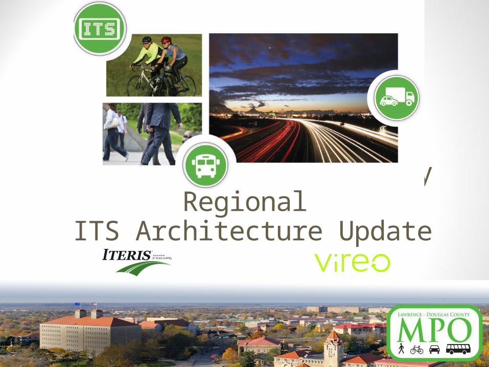
Lawrence-Douglas County Regional
ITS Architecture Update

Today’s Agenda
10:00 Greet and Welcome 10:05 Workshop Business 10:15 What is ITS?10:30 Breakout Groups11:10 Review of Breakout Discussions11:50 Wrap UpNOON Post-workshop
The project team will be available after the workshop for further discussion.

Meet Your Project TeamTodd GirdlerProject Manager
L-DC MPO
Project Team
Consultant Project Manager
Matt Weatherford
Architecture Update Team
Mike Malone, PE, PTOEDerek Nieveen
Stakeholder Outreach
Triveece Penelton,AICP
Region Stakeholders
Consultant Senior Advisor
Jeff Brummond

The Region’s ITS Vision
The Region will use Intelligent Transportation Systems to provide cost-effective and practical technologies that enhance the safety, capacity, operations and evaluation of the area's modes of transportation.

The Region’s ITS Goals1. Integrate efficient and effective ITS into the Region’s
transportation planning and project development.2. Improve information sharing among the region’s
transportation agencies and with the public.3. Increase the safety and security of all modes of
transportation through improved infrastructure monitoring and emergency management.
4. Improve the utilization of existing facilities and infrastructure.5. Improve the ability to evaluate and measure the
performance of the transportation network through the effective use of technology.

Today’s Objectives
• Define Intelligent Transportation Systems and their applications.
• Discuss how the region currently uses ITS.• Learn what your transportation needs are. • Share how stakeholders can stay involved in
this project.

Lawrence- Douglas County Regional ITS Architecture Update
What is ITS?

Intelligent Transportation Systems (ITS)The use of information and communications technologies to meet transportation needs

What is ITS in Lawrence?
Roadway Management
Transit Systems
Emergency Management
Traveler Information
Maintenance & Construction
Electronic Toll

Roadway Management• Signal Control and Coordination• Traffic Monitoring• Signal Preemption for
Emergency Vehicles

Traveler Information• Dynamic Message Signs• Kansas 511• Websites

Transit Systems• Transit Vehicle Tracking• Demand Response Transit
Operations• Internet Trip Planning• Security Cameras
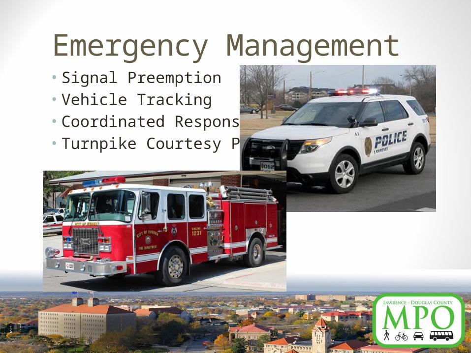
Emergency Management• Signal Preemption• Vehicle Tracking• Coordinated Response• Turnpike Courtesy Patrols

Maintenance and Construction
• Maintenance Vehicle Tracking• Flood Monitoring• Maintenance Event Information
Sharing

Electronic Toll Collection• Kansas Turnpike Authority

What Is an ITS Architecture?
• Framework for Integrating Transportation Systems • Identifies:
• Organizations• Systems Operated • Functions Performed• Communications• Information Exchanged
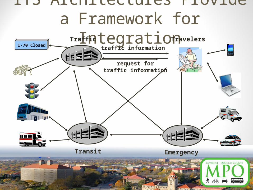
ITS Architectures Provide a Framework for Integration
traffic information
request fortraffic information
Travelers
EmergencyTransit
TrafficI-70 Closed

Why Build an ITS Architecture?
• To structure the region’s technology plans.• To avoid redundancy in systems.• To ensure cost-effective technology deployment.• To identify opportunities to share information.• To satisfy federal requirements for ITS expenditures.

What Is the Stakeholder Role?
• Represent groups who operate and use the transportation network.• All modes, all travel purposes
• Identify the Region’s needs.• Breakout exercise
• Identify strategies to address those needs.• Follow-up discussion

Stakeholders• Lawrence• Eudora, Lecompton, Baldwin
City• Douglas County• KDOT District/Area and HQ• Transit• Commerce • Emergency Responders• Schools• Advocacy Groups
• Advisory Committees• Kansas University • Kansas Turnpike Authority• Trucking• Railroads• FTA• FHWA• Broadband providers and
the media

What You’ve Told Us:Very Familiar with ITS
9%
Somewhat Familiar
53%
Not Familiar36%
Unsure2%

What You’ve Told Us:
Car or Van83%
Truck2%
Bus/Pedestrian/Bike
7%
Multiple Modes8%
Primary Mode of Travel
What You’ve Told Us:
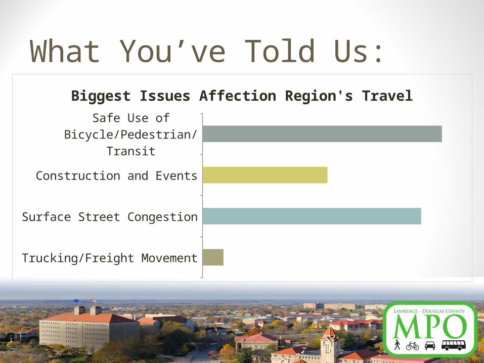
Trucking/Freight Movement
Surface Street Congestion
Construction and Events
Safe Use of Bicycle/Pedestrian/Transit
Biggest Issues Affection Region's Travel

What You’ve Told Us:
Real-time Traffic Information
Signal Synchronization
Message Signs for Detours, Weather, Incidents
Multi-modal Traveler Information
Emergency Response and Motorist Assistance
Speed and Volume Sensors
Potential ITS Strategies

Meeting Your NeedsExisting
Inventory Needs
New Services Provided by ITS to Address Needs
System
FunctionsRoles &
Responsibilities
ITS Projects
Stakeholder Input
Gaps

Lawrence-Douglas County Regional ITS Architecture Update
Breakout Groups
Exercise #1 – Mark Up the Maps• Black Marker for Trucking and Freight.• Red Marker for Congestion at
Intersections and Corridors.• Blue Marker for Bicycle, Pedestrian and
Transit.• Green Marker for Weather-related and/or
Construction Issues.

Exercise #1 – Mark Up the Maps• Spend 30 minutes marking map with
issues.• Spend 10 minutes using post-it notes to
identify the locations that could most benefit from ITS.

Lawrence-Douglas County Regional ITS Architecture Update
Review of Breakout Groups

Lawrence-Douglas County Regional ITS Architecture Update
Wrap-up

Next Steps• Inventory Existing ITS.• Prioritize Needs.• Identify ITS Services to Address Needs.• Design Projects That Include Those ITS
Services.

Project Deliverables• Tech Memo 1 – Stakeholders, Inventory and
Needs (December 19)• Tech Memo 2 – ITS Strategies, ITS Services
(February 20, 2015)• Architecture (April 3, 2015)• Strategic Deployment Plan (May 5, 2015)• Next Workshop (April 2015)• Project Completion (May 2015)
Project Web Sitewww.lawrenceks.org/mpo
• Project Announcements• Project Deliverables• Link to Needs Survey• Turbo Architecture Output• Questions and Comment Links

Project ContactsTodd GirdlerMPO Senior Transportation Planner – L-DC MPOPhone: 785-832-3155Email: [email protected]
Matt WeatherfordProject Manager - IterisPhone: 720-898-0265Email: [email protected]
Triveece Penelton, AICPCity Planner – VireoPhone: 816-777-3038Email: [email protected]