landscape pattern- higher level constraints. recall from hierarchy topic reading that at different...
TRANSCRIPT

LANDSCAPE PATTERN- HIGHER LEVEL CONSTRAINTS
Recall from hierarchy topic reading that at different levels in a hierarchy, a variable
influencing a process at a focal level may or may not change, but a shift in relative
importance of variables occurs

• Level of focus constrained by higher level variables
• Lower level variables often explanatory
• E.g., leaf litter decomposition from last week.
• (What is constraint? What are explanatory components?)
From Turner, Gardner, and O’Neill 2001

From Urban et al. 1987

Climate definition -- composite, long-term weather of a region, that acts as the primary control for ecosystem distribution as source of energy and water (Bailey 1995).
• Response to latitude - variation in solar energy- controls both temperature and moisture distribution.
• Different temporal scale than weather, e.g., daily fluctuations
Higher spatial level than microclimate, e.g., N and S sides of hill

From Bailey 1998
CLIMATIC REGIME - pattern of diurnal and seasonal fluxes of energy and moisture.

LANDFORM - Next level down in hierarchy of constraints
• Modifies, is modified by, climate
• Provide the template for disturbance and biotic responses.
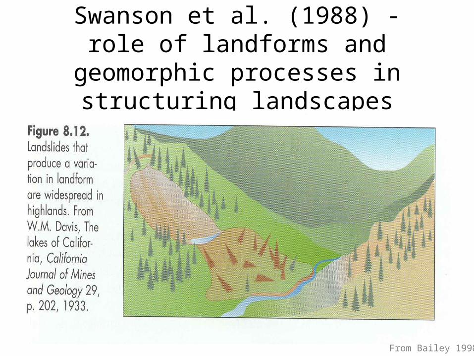
Swanson et al. (1988) - role of landforms and geomorphic processes in structuring
landscapes
From Bailey 1998
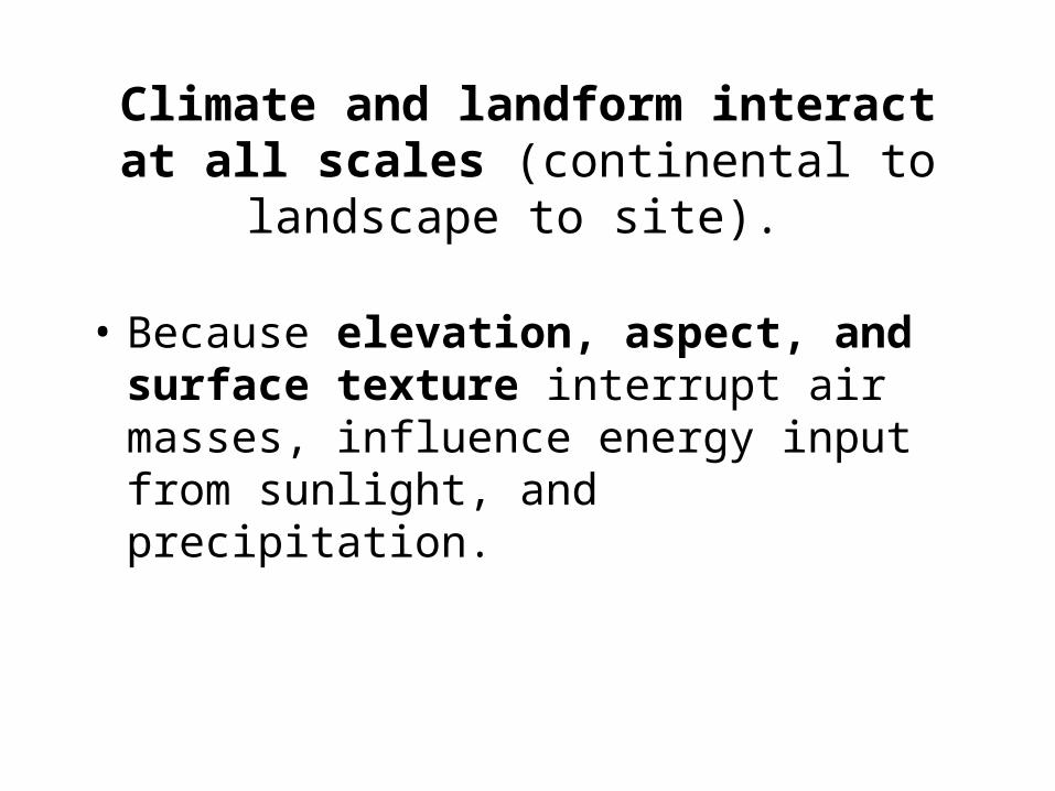
Climate and landform interact at all scales (continental to landscape to site).
• Because elevation, aspect, and surface texture interrupt air masses, influence energy input from sunlight, and precipitation.

(e.g., Greater insolation on south slopes causes warmer sites, greater
evapotranspiration).
From Bailey 1998
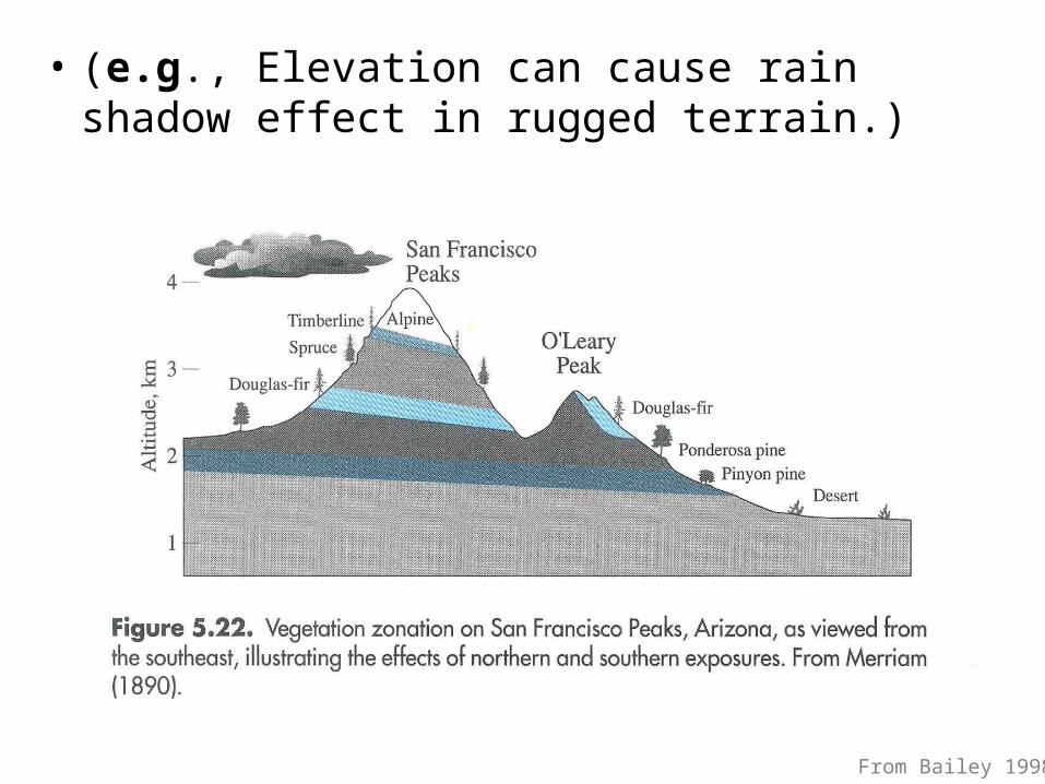
• (e.g., Elevation can cause rain shadow effect in rugged terrain.)
From Bailey 1998

(e.g., Elevation can cause rain shadow effect in rugged terrain.)
From Bailey 1998

Landforms interact with climate, increase, decrease susceptibility to
disturbance. (Constraining lower levels).
• e.g., sheltering/exposing forest to windthrow,
• greater vulnerability of ridges to fire ignition, or
• barriers to fire spread.

• Landforms also play role in water movement and concentration, and soil development differences.
• Topography and gravitational movement of water, and evapotranspiration create a toposequence or catena of soils.

- Weathering of rock and movement of particles down slope results in deeper, finer textured soils.
- Greater water holding capacity; productivity.- Greater organic matter development, movement
down, continues to build soil.
From Bailey 1998

Climate controls biota, soils, resulting ecosystem pattern
From Bailey 1998

Climate controls several large scale processes -
• Hydrologic cycle
• Landforms and erosion cycles
• Plant/animal life cycles and distributions
• Fire and wind disturbance regimes

Hydrologic cycle
• Pattern of precipitation and evapotranspiration.
• e.g., pattern of annual streamflow varies in diff. climate regions depending on seasonality of precipitation, temperature, evaporation, transpiration by plants.
Landforms and erosion cycles
• e.g., Erosion rates vary with rock type, but also whether climate supports soil development, adequate moisture for vegetative cover.

Plant/animal life cycles and biogeographic distribution
• Life cycles - e.g., periods of activity, dormancy, reproduction, adjust to seasonal patterns of precipitation/moisture

Fire and wind disturbance regimes
• e.g., amount of plant productivity, frequency and seasonality of dryness influence type of fire regime.
• Western ponderosa pine - frequent, low intensity ground fires, trees survive.
• e.g., boreal forest - infrequent fires, but intense, crown fires, stand initiating.

• Whittaker (1952, 1953) sampled vegetation across a range of montane habitats, spanning elevation and aspect differences; microclimatic- landform controlled.
• Found that species responded individualistically to changing environment.
• But communities could be discerned within environmental space defined by elevational and aspect gradients.

From Whittaker 1956

• Similar to what John Curtis and students were doing here at same time across S. Wisconsin.
• Not strong topographic gradient here, but sites along moisture/nutrient gradient.
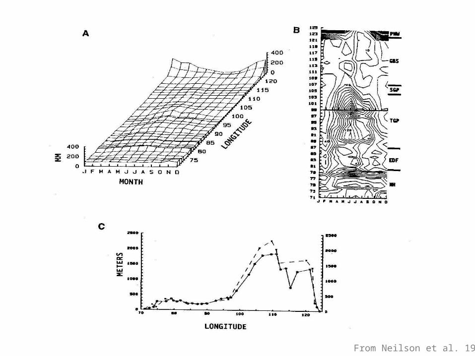
Neilson et al. series of papers (1983, 1986, 1987, 1992)- examined large-scale regional and continental climate data
spatially and temporally.
• Used weather station transects across U.S. and major biomes with characteristic composition and physiognomy.
• Plotted monthly 30 yr. mean temperature and precipitation.
Converted to contour diagrams.

From Neilson et al. 1992
From Neilson et al. 1992

From Neilson et al. 1992
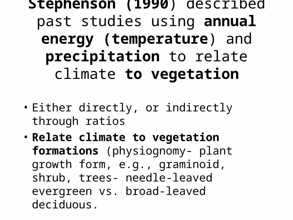
Stephenson (1990) described past studies using annual energy
(temperature) and precipitation to relate climate to vegetation
• Either directly, or indirectly through ratios
• Relate climate to vegetation formations (physiognomy- plant growth form, e.g., graminoid, shrub, trees- needle-leaved evergreen vs. broad-leaved deciduous.

• Many used potential evapotranspiration-
• Given climate and energy (annual temp.) available at a site, evaporative water loss assuming complete plant cover and unlimited water available.
• Assumes temp. and precip. independent- does not distinguish well between climates with similar annual energy and moisture, but different seasonal distribution.
– e.g., PNW and NE U.S.- similar, but different vegetation.

- Stephenson used WATER BALANCE- actual evapotranspiration and deficit.
• ACTUAL EVAPOTRANSPIRATION- evaporative loss with prevailing energy and available, not unlimited, water.
and DEFICIT (diff. of potential andactual evapotranspiration).
• Climate as sensed by plants- interaction of energy and water in the environment.

From Stevenson 1990

• Below large scale geomorphology or landform levels,
• Landscape position has been shown to be important in causing pattern in many different systems, many systems with relatively little relief.

• Lakes in a toposequence in northern Wisconsin (Kratz et al. 1991).
• Great Plains grasslands (Sala et al. 1988; Woodmansee 1990 in Zonneveld and Forman;
• Arctic tundra terrestrial toposequenceShaver et al. in Turner and Gardner 1991).

• Bogs and patterned peatlands in cool temperate regions are another example of a large, complex landscape system that is controlled by close climate and landform interaction, with a major role played by above and below ground hydrology.
• Most simply, small bogs are wetlands. Like other wetlands- within upland matrix- water table at or near surface.
• Landform controlled at this simple level, assuming relatively constant climate.
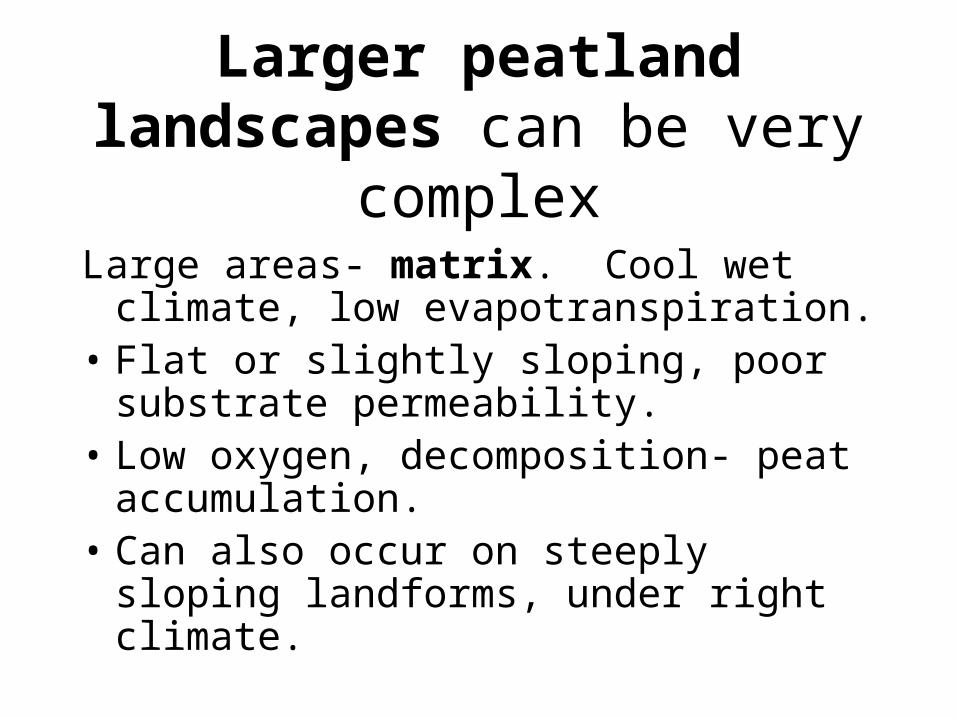
Larger peatland landscapes can be very complex
Large areas- matrix. Cool wet climate, low evapotranspiration.
• Flat or slightly sloping, poor substrate permeability.
• Low oxygen, decomposition- peat accumulation.
• Can also occur on steeply sloping landforms, under right climate.

• Ombrotrophic bogs - low pH, largely on woody peat, low nutrient availability, largely atmospheric inputs of water and nutrients.
• Minertrophic bogs or fens - groundwater inputs, higher nutrient avail. and pH.
• Large differences on within-peatland formations, species composition.

From Glaser

• David Foster found similar patterns in Labrador peatlands, as well as biological mechanisms responsible for development of finer scale patterns of open water over time, within the bog vegetation.
• This finer scale pattern was different than that in Minnesota.
• Presumably because of greater seasonal drying in Minnesota which affects an entire flat peatland.
• More constant moisture in Labrador allows development of finer-scale heterogeneity caused by differential peat accumulation and vegetation degradation.

• Foster and King (1986) studied forest vegetation pattern in Labrador, looking at climate and landform interactions.
• Studied fire and physiography role in distribution of paper birch forest patches within matrix of spruce-fir.
• Found nearly all birch forest patches on steep slopes of ridges with high moisture.
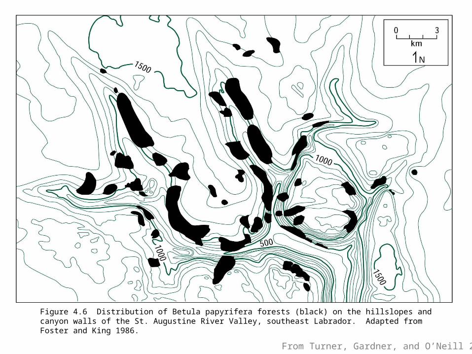
From Turner, Gardner, and O’Neill 2001
Figure 4.6 Distribution of Betula papyrifera forests (black) on the hillslopes and canyon walls of the St. Augustine River Valley, southeast Labrador. Adapted from Foster and King 1986.

• Foster and Boose (1992)- related study in New England used GIS to analyze correlates of severe hurricane damage to forests.
• Found slope and aspect highly correlated with increasing damage.
• As well as tree height and species composition.• Damaged stands 3% in topographically protected
sites, 31% intermediate, 66% exposed.• Damage increased linearly with tree height.

• Eric Grimm (1984) studied Big Woods of SE Minnesota
• Region of mesic forest within oak/prairie transition
• Historically puzzling location for elm, maple, basswood
• Found no correlation of pre-European vegetation with climate gradient
• Landform (fire breaks), and soils most important.

We will look in more detail at research examining ecosystem processes that relate to landscape and
landform pattern a little later in the course.
From Bailey 1998