journal of san diego history: rancho tia juana grant the journal of san diego history the rancho...
TRANSCRIPT

30
T H E J O U R N A L O F S A N D I E G O H I S T O RY
THE RANCHO TÍA JUANA
(TIJUANA) GRANT
■by
Antonio Padilla Corona
(Translated by Paul Bryan Gray)
This article will explore the early history of the Rancho Tía Juana from a grant toSantiago Argüello Moraga in 1829 down to its disposition in a lawsuit settledby his heirs in 1889. The name of the ranch is derived from an indigenous
Kumeyaay word, Tihuan, which has been given various meanings.1 Early sources,including the grant itself, refer to the place as Tía Juana, Tía Juan, Tijuan, andTehuan, but these names were replaced in modern times by Tijuana, a spelling closerto the area’s original designation and which will be used herein.
The Rancho Tijuana was one of the grants awarded by Governor José MaríaEcheandía to retired soldiers as a reward for their military service.2 Such grants werepart of a political and economic process that began slowly in Alta California afterSpanish settlement in 1769. The number of grants increased dramatically during theMexican period, especially after secularization of the missions when more landbecame available. Of the twenty-five grants distributed before Mexico gained inde-pendence in 1821, none was in San Diego. The first three grants, issued to retiringSan Diego Presidio soldiers José Maria Verdugo, Juan José Domínguez, and ManuelNieto in 1784 were located near the newly-founded Pueblo of Los Angeles. The firstgrant in the San Diego area—Rancho de los Peñasquitos—was made to PresidioCommandant Francisco María Ruiz in 1823.3 During the first years of Spanish domi-nation in California, the Mission San Diego de Alcalá controlled vast areas of landsuitable for raising cattle. The Presidio held similar land as well. Eventually, as thePresidio declined, its soldiers sought land grants in order to form ranches throughoutthe region.4 From 1822 to 1846, more than 670 grants were made, including the onemade on March 24, 1829, awarding Rancho Tijuana to Santiago Argüello.5
Santiago Argüello Moraga was born in 1792 in Monterey, Alta California. He wasthe son of José Darío Argüello, a prominent figure in California politics for manyyears,6 and María Ignacia Moraga, a niece of pioneer soldier José Joaquin Moraga. In1810, Santiago married María del Pilar Ortega in Santa Barbara, a union that pro-duced fifteen children. The first five children were born in Santa Barbara, the rest inSan Diego where Santiago held several military positions, including that of lieutenantand commander of the San Diego Company. He was later a collector of customs andan alcalde, or mayor of San Diego.7
The original documents for the concession of Rancho Tijuana have not beenlocated. Nevertheless, the existence of the grant is confirmed by reference to it in later
Antonio Padilla Corona is a researcher and professor at the Instituto de Investigaciones Históricas(Institute of Historic Research), at the Autonomous University of Baja California in Tijuana. Padilla Coronais the author of the book, Inicios Urbanos en el norte de Baja California: Ideas e Influencias 1821-1906 (UrbanBeginnings in the North of Baja California: Ideas and Influences 1821-1906) (1998) as well as several articlesand monographs about Baja California history.

31
sources. One of the oldest writings relatedto Rancho Tijuana is a confirmation of thegrant issued by Governor Pío Pico in1846. It described the boundaries ofRancho Tijuana in an imprecise manner:
Don Santiago Argüello, a Mexican by birth, haspetitioned for the benefit of himself and hisfamily, certain land known as “Tía Juana” bor-dered on the north by Mesa del Arroyo de LaCruz, on the south by Aguaje de la Nopaleranear the hollow of La Olla, on the east byDatilar, and on the west by Posa de los Adobes.Said land has been held by him since eighteenhundred and twenty-nine by virtue of a lawfulgrant from Governor José María Echeandía. Hisentitlement to the grant has been satisfactorilyproven and is hereby confirmed.8
At a later point, the document indi-cated that the extent of the grant was seissitios de ganado mayor.9
The northern boundary in the abovedescription, Mesa del Arroyo de la Cruz, isnow known as Mesa de Otay. Aguaje de laNopalera, the old southern limit, ispresently called Aguaje de la Tuna.However, the east and west sides ofRancho Tijuana, Datilar and Posa de losAdobes, cannot be located in moderntimes since these terms no longer have anygeographic significance in the region. It isimpossible to determine the originalboundaries of Rancho Tijuana due to theantiquated description in Pico’s confirma-tion.
A document that confirms the date ofthe grant and gives some idea of where theoriginal ranch house was located is a transcription by one of Hubert Howe Bancroft’sassistants in 1877. Together with his employees, Bancroft devoted much time duringthe late nineteenth century in gathering records concerning California’s Mexican peri-od. When he could not acquire an original, he had a copy made. The item in questionreads as follows:
1829 Mar. 24 San Diego
Governor Echeandía—Provisional concession of title to the site of Tia Juana in favorof the Lieutenant of the San Diego Presidio Company, Santiago Argüello, subject tothe approval of the Supreme Government, not to exceed 2 _ square leagues.10
This document presents virtually no information about the land subject to thegrant. However, an annotation on it written in 1877 by one of Bancroft’s aides gives
T H E R A N C H O T I A J U A N A G R A N T
Santiago E. Argüello ©SDHS #80:4571
Signature of Santiago Argüello petitioning grant ofRancho Milijo lying adjacent to “el de la Tijuan” April20, 1833. MS. Arguello Estates. Doc. Box l. SanDiego County Law Library.

32
T H E J O U R N A L O F S A N D I E G O H I S T O RY
us a clue to locating one of the ranch houses. The annotation states:…the dividing line at the border passed through Rancho Tijuana, and it is said thatin 1857 the line traversed an adobe house leaving part of it in the United States andpart of it in Mexico.
February 1877.
The March 24, 1829 record and its 1877 annotation permits us to make twoobservations. One has to do with the size of the grant and the other with locating aranch house on the property.
The 1829 document limits the grant to two and one half square leagues, theequivalent of 4,387.5 hectares. Nevertheless, the confirmation signed by Pío Pico in1846 speaks of the grant as six “sitios de ganado mayor” about 10,530 hectares.11 Thedifference between these numbers is 6,142.5 hectares. The discrepancy was probablycaused by one of Bancroft’s people transcribing the 1829 document as “2 _ squareleagues” rather than “2 _ leagues square.” If the latter expression had been used, thearea of the grant would have been something more than 10,000 hectares, about equalto the size of the grant set forth in Pico’s 1846 confirmation.
Although the 1829 document does not describe the boundaries of the grant, theannotation added by Bancroft’s assistants confirms that one of the ranch houses wassituated right on the international border.
Some years ago a sketch was found in the Mission San Juan Capistrano archivesentitled “Diseño de Ti-Juan con arreglo de la posesión y título, 1827.”12 It appears to be amap of the grant given to Santiago Argüello by Governor Echeandía. Its authenticitycould be questioned since most such “diseños,” or maps of land grants were an inte-gral part of official government records. In this unusual instance, a diseño of Rancho
Diseño de Ti-Juan con arreglo de la posesión y título, 1827. Mission San Juan Capistrano archives.
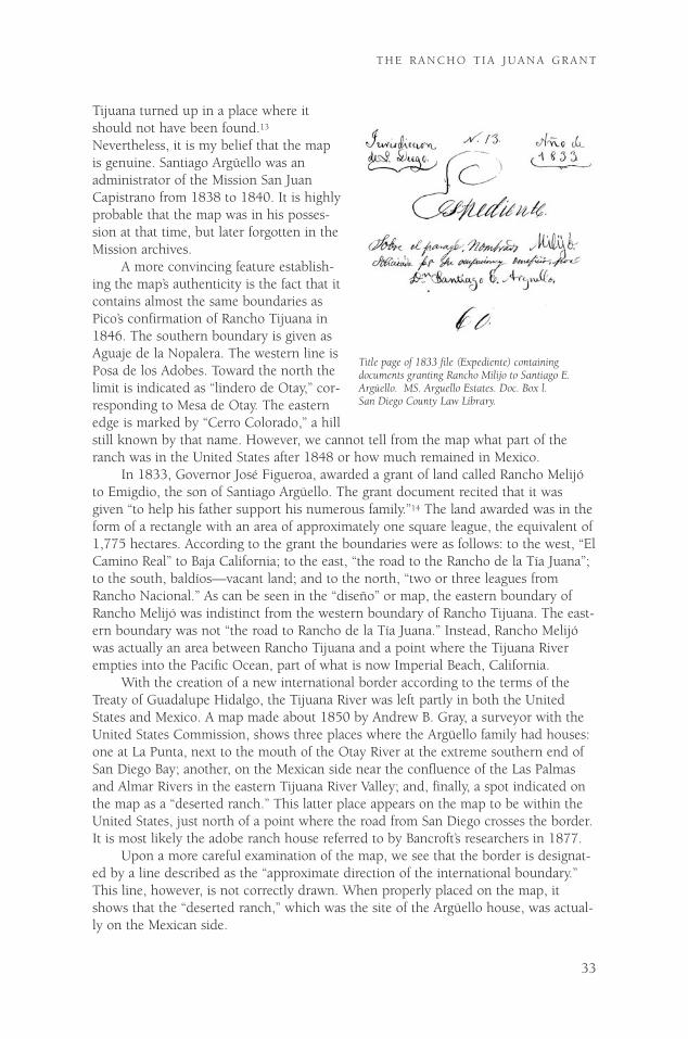
Tijuana turned up in a place where itshould not have been found.13
Nevertheless, it is my belief that the mapis genuine. Santiago Argüello was anadministrator of the Mission San JuanCapistrano from 1838 to 1840. It is highlyprobable that the map was in his posses-sion at that time, but later forgotten in theMission archives.
A more convincing feature establish-ing the map’s authenticity is the fact that itcontains almost the same boundaries asPico’s confirmation of Rancho Tijuana in1846. The southern boundary is given asAguaje de la Nopalera. The western line isPosa de los Adobes. Toward the north thelimit is indicated as “lindero de Otay,” cor-responding to Mesa de Otay. The easternedge is marked by “Cerro Colorado,” a hillstill known by that name. However, we cannot tell from the map what part of theranch was in the United States after 1848 or how much remained in Mexico.
In 1833, Governor José Figueroa, awarded a grant of land called Rancho Melijóto Emigdio, the son of Santiago Argüello. The grant document recited that it wasgiven “to help his father support his numerous family.”14 The land awarded was in theform of a rectangle with an area of approximately one square league, the equivalent of1,775 hectares. According to the grant the boundaries were as follows: to the west, “ElCamino Real” to Baja California; to the east, “the road to the Rancho de la Tía Juana”;to the south, baldíos—vacant land; and to the north, “two or three leagues fromRancho Nacional.” As can be seen in the “diseño” or map, the eastern boundary ofRancho Melijó was indistinct from the western boundary of Rancho Tijuana. The east-ern boundary was not “the road to Rancho de la Tía Juana.” Instead, Rancho Melijówas actually an area between Rancho Tijuana and a point where the Tijuana Riverempties into the Pacific Ocean, part of what is now Imperial Beach, California.
With the creation of a new international border according to the terms of theTreaty of Guadalupe Hidalgo, the Tijuana River was left partly in both the UnitedStates and Mexico. A map made about 1850 by Andrew B. Gray, a surveyor with theUnited States Commission, shows three places where the Argüello family had houses:one at La Punta, next to the mouth of the Otay River at the extreme southern end ofSan Diego Bay; another, on the Mexican side near the confluence of the Las Palmasand Almar Rivers in the eastern Tijuana River Valley; and, finally, a spot indicated onthe map as a “deserted ranch.” This latter place appears on the map to be within theUnited States, just north of a point where the road from San Diego crosses the border.It is most likely the adobe ranch house referred to by Bancroft’s researchers in 1877.
Upon a more careful examination of the map, we see that the border is designat-ed by a line described as the “approximate direction of the international boundary.”This line, however, is not correctly drawn. When properly placed on the map, itshows that the “deserted ranch,” which was the site of the Argüello house, was actual-ly on the Mexican side.
33
T H E R A N C H O T I A J U A N A G R A N T
Title page of 1833 file (Expediente) containing documents granting Rancho Milijo to Santiago E.Argüello. MS. Arguello Estates. Doc. Box l. San Diego County Law Library.

34
T H E J O U R N A L O F S A N D I E G O H I S T O RY
The above conclusion is corroborated by a map called “Plan of the Rancho ofMelijó” drawn about 1850.15 It was used by the Argüello family in litigation againstthe United States for possession of Rancho Melijó’s lands located north of the border.The map, drawn with exactitude, identifies the Argüello adobe as an “old house inruins” and places it in Mexico.
On this same map one can observe for the first time a kind of boundary betweenRancho Melijó and Rancho Tijuana. Nevertheless, the line between them is not clear.This situation, as in many other cases, was the result of Mexicans never preciselydefining the boundaries of their ranches in California. At the time there was no needfor it. This defect would eventually cause Emigdio Argüello to lose his property lyingwithin United States territory.16
On the Mexican side, Santiago Argüello was forced to defend his possession ofRancho Tijuana against a decree promulgated by President Ignacio Comonfort onMarch 10, 1857.17 The decree represented an effort by authorities in central Mexico tonullify previous transfers of vacant lands in Baja California by local officials actingwithout approval from the national government. The measure required a review of allland titles on the peninsula to determine their validity.
Santiago Argüello successfully underwent a government audit of his title.Afterwards, he received official confirmation of his ownership in 1861 from BenitoJuárez, president of the republic. The government review of his title failed to mentionthe boundary lines of Rancho Tijuana or those of adjacent land owners. It merelyidentified the size of the ranch as being six “sitios de ganado mayor,” the same asPico’s previous confirmation in 1846.18
In the following year, 1862, Santiago Argüello died without leaving a will. Hisfailure to provide for the distribution of his estate provoked disagreements and con-frontations between his numerous descendants who claimed conflicting ownershiprights to his ranch property. For many years a climate of uncertainty and hostility pre-vented his heirs from fully enjoying the extensive property.
Meantime, the “ley Juárez,” was issued by the central government in 1863, whichrestricted the size of land grants to a maximum of three “sitios de ganado mayor.”19
This new limitation undoubtedly induced Doña Pilar Ortega, the widow of Argüello,to sell three sitios de ganado mayor, one-half of the Rancho Tijuana, to her sonIgnacio for 700 pesos in 1870.20 In this way, the entire ranch of six sitios de ganadomayor was kept within the family. It is not known why Ignacio Argüello was favoredby being selected as the sole purchaser. This transaction would result in protests andcompeting claims by other heirs, as we shall see.
In 1879, Doña Pilar Ortega de Argüello had to undertake additional proceedingsto insure title to the ranch. At this time, she obtained from the then president ofMexico, Porfirio Díaz, a new concession of title.21 A part of the document with specialsignificance is as follows:
…it having been established by various laws of the Republic, especially the law of July 22, 1863that undeveloped lands are property of the nation, and in consideration of the fact that PilarOrtega, on behalf of herself and other heirs and persons interested in the ranch called “La TíaJuana,” has claimed the ranch before the Comisión de Baldíos de La Baja California, said land hav-ing an area of ten thousand five hundred thirty-three hectares, and seventy-six decameters; theadjoining landowners being Lino López, Jesús María Machado and Joaquín Machado, according toa map and documents filed with the Secretaría de Fomento…22
It can be observed from the above that title was issued for land considered unde-veloped and without a previous owner. In addition, it includes 10,530 hectares, the

35
T H E R A N C H O T I A J U A N A G R A N T
original area of the ranch. Argüello’s descendants would later utilize the title as anargument to disavow the sale of half the ranch Doña Pilar Ortega de Argüello made toher son. It should be noted that the area of the land was expressed for the first time inhectares, units derived from the metric system. In previous titles issued by Pío Picoand Benito Juárez, the dimensions of the ranch were described in terms of the oldmeasurement “sitios de ganado mayor.” The document also sets forth the names ofadjacent landowners to the east and south of Rancho Tijuana.23 Finally, it should benoted that the title was awarded by President Porfirio Díaz to Pilar Ortega de Argüelloon August 6, 1879, even though she had died earlier on February 7 of the sameyear.24
During the 1880s, the Mexican government began a policy of encouraging for-eign corporations to colonize and exploit vast areas of undeveloped land in BajaCalifornia. With a view toward opening the peninsula to international investors, theadministration of President Porfirio Díaz awarded an enormous concession of land in1886 to a company headed by Luis Hüller, a naturalized Mexican citizen of Germanorigin.25 Rancho Tijuana was part of the area placed under control of Hüller’s compa-ny. Somewhat earlier, the ranch had arguably reverted to the public domain since theArgüellos had failed to improve the property as required by contracts they had madewith the national government.
Fortunately for the Argüello family, Hüller’s enterprise did not claim dominionover Rancho Tijuana. The company was involved with economic problems elsewherein the peninsula that diverted its attention from the border region. Nevertheless, thethreat of Hüller’s company motivated the Argüello family to seek a declaration of theirrights in Rancho Tijuana.
The Argüellos were aware that north of the border, southern California was expe-riencing a boom in the sale of subdivided lands. During the late 1880s a spirit ofspeculation induced by the boom spread to Baja California, especially Ensenada. Landprices dramatically increased on both sides of the border. The Argüello family becameconvinced that the time had come to lay aside their differences concerning RanchoTijuana and take advantage of its sudden increase in value.
The first act of the Argüellos was to file a declaration in the district court pre-pared by the heirs of Pilar Ortega de Argüello, who had earlier died without a will.26
For legal reasons, the heirs named José Antonio Argüello as their representative andcustodian of the property at issue. José Antonio was the only living son of SantiagoArgüello. The other heirs mentioned in the court declaration were grandchildren.Before accepting his role as representative, José Antonio requested that an inventorybe made of the estate. A meeting of the family was held for this purpose onSeptember 3, 1888, at the Tijuana custom house.27
The documents presented by the heirs in court to prove their entitlement to theranch consisted of the deed given to Pilar Ortega de Argüello by President PorfirioDíaz, dated August 6, 1879, a certificate of ownership issued by the territorial districtjudge on March 3, 1886, and a plat of the land drawn by M. G. Wheeler duringJanuary 1870, which was approved by a surveyor, Ismael Sánchez, on June 3, 1883.
The inventory of the estate was apparently ready for completion when JoséAntonio Argüello and the other claimants were unexpectedly confronted by RicardoRamírez, an attorney acting on behalf of the heirs of Ignacio Argüello, who purchasedone-half of the ranch from his mother in 1870. Ramírez made the following con-

36
T H E J O U R N A L O F S A N D I E G O H I S T O RY
tention in open court:…that the land presented for inclusion in the inventory was not the property of doña María delPilar Ortega de Argüello before her death since she had sold it to her son, Ignacio Argüello, andtherefore it is requested that it be excluded from the inventory.
Given the circumstances, the judge suspended the proceedings and the taking ofan appraisal until the claim presented by Ramírez was resolved.
Toward the end of that same month of September 1888, José Antonio Argüello as“provisional executor” of Pilar Ortega de Argüello’s estate appeared in the Ensenadacourthouse to answer the allegations of the attorney, Ricardo Ramírez. José Antoniodenied the legal validity of the documents offered to prove a sale by Doña Pilar of“three leagues” of Rancho Tijuana to her son, Ignacio Argüello.
In order to demonstrate the impropriety of Ramírez’ contentions, José Antonioshowed what he considered to be the “authentic documents.” He first presented con-firmation of the land grant to his father, Santiago Argüello, signed by Pió Pico in 1846and ratified by President Benito Juárez on June 1, 1861. José Antonio explained thatthis grant was subject to certain conditions such as requirements that it be inhabitedand cultivated by the grantee. He indicated that such conditions were imposed bylaws established August 12, 1768, August 18, 1824, and November 21, 1828. Sincethese conditions were never met, “the comisionado de terrenos baldíos, Cayetano E.Treviño, declared that the grant to his father was void.” Pilar Ortega de Argüello wasforced to recognize that she no longer had the grant inherited from her husband.
However, the resilient Argüello family was not done with Rancho Tijuana. DoñaPilar soon gave her son, Ignacio Argüello, a power of attorney so that he and the otherheirs could attempt to regain the property. Acting as attorney-in-fact for this mother,Ignacio Argüello applied for a new grant of the vacant Rancho Tijuana and anotheropportunity to comply with conditions for its development imposed by Mexican law.The request was favorably received as demonstrated by a document from PresidentDíaz on August 6, 1879 awarding Pilar Ortega de Argüello a new grant of RanchoTijuana.
Based on the foregoing, José Antonio Argüello argued in court that the docu-ments of title and sale dating from 1870, which were the foundation of the case pre-sented by the heirs of Ignacio Argüello, were void and of no effect since the grant of1879 conferred a new and different title on Pilar Ortega de Argüello that wiped out allprevious interests. By the time of the court proceedings in September 1888, owner-ship of the grant was entirely based on the title of 1879, and not on a right of succes-sion to the interest of the deceased Santiago Argüello. The sale by Doña Pilar to herson Ignacio Argüello in 1870 preceded issuance of the new grant and therefore anyownership she conferred on her son was terminated when the old grant was declaredvoid. José Antonio also pointed out that beyond the invalidity of any transaction pre-ceding 1879, his mother was only one of ten heirs to Santiago Argüello’s estate andcould not have conveyed more than a one-tenth interest in Rancho Tijuana to her son,Ignacio.
In addition to the evidence given by José Antonio, which he considered sufficientto nullify any rights arising from the sale of 1870, he added another argument hethought established fraud in the sale. He stated:
The alleged sale made by my mother to Ignacio Argüello has the signature of ‘Pilar Ortega’ but shedid not know how to write. This proves not only the invalidity of their claims, but also the falsityof the evidence on which they are based.
The documents presented by José Antonio Argüello and his interpretation of

them seem to correctly invalidate the claims based on the sale to his brother Ignacio.However, his contention that his mother could not have signed the document of saleto Ignacio because she did not know how to read and write seems doubtful since it isstrongly contradicted by a statement of Manuel Clemente Rojo in 1879.28
In the above year, Manuel Clemente Rojo wrote a biographical sketch of MaríaPilar Ortega de Argüello. It was requested by Hubert Howe Bancroft, who was com-piling a history of the region with the help of persons who had participated in it. Incorrespondence exchanged with Thomas Savage, one of Bancroft’s employees, Rojomade the following remark:
Doña Pilar was a very distinguished person. Although she was born in the year 1794, she knewhow to read and write, an extraordinary accomplishment in her time, putting her half a centuryahead of her contemporaries. It is said that up until 1848, those in Alta California did not wanttheir children to read and write ‘in order for them not to be corrupted by reading and writing loveletters’29
We are more inclined to accept Rojo’s belief that Doña Pilar was literate than JoséAntonio’s contrary statement in court. Rojo enjoyed a reputation in the region as aperson interested in historical accuracy. Bancroft had good cause to trust his credibili-ty. Moreover, Rojo had no motive to misrepresent Doña Pilar’s ability to read andwrite.
The claims of Ignacio Argüello’s heirs were eventually recognized by José Antonioand those he represented. Together, they decided to divide the land into two sections.
37
T H E R A N C H O T I A J U A N A G R A N T
Portion of a document signed by Governor Pío Pico and Secretary José Matias Moreno June 15, 1846, approving theconcession made in favor of Citizen Santiago Arguello of the place named TiaJuana (del paraje nombradoTiaJuana). Ms. Centro de Investigaciones Históricas.
38
T H E J O U R N A L O F S A N D I E G O H I S T O RY
Each faction of the Argüello family would receive a separate portion. In order todivide the ranch, the heirs would retain Ricardo Orozco, an engineer who played amajor role in planning the initial urbanization of Tijuana.
Orozco had earlier arrived in the region as a government-appointed “inspector decolonias.” He was charged with reviewing the activities of foreign companies contract-ed to develop the area and to see that they were complying with requirementsimposed by the administration of President Díaz.30 His professional activities soonbecame known to the Argüellos who hired him to appraise and divide Rancho Tijuanawith a view toward ending their dispute.
When Orozco accepted his assignment, he was in a position to significantly affectthe birth of urban Tijuana. Prior to this time, the value of land was necessarily deter-mined solely by its suitability for agriculture and cattle raising. However, such criteriafor the land’s value were about to end with Tijuana’s approaching urban development.A new era was arriving in which land prices would rise to previously unknown levels.This phenomenon was largely a reflection of spectacular economic growth occurringin adjacent southern California.
In order to measure and appraise Rancho Tijuana, Orozco prepared the firstknown modern map of it. The drawing used measurements based on the metric sys-tem to show that it was comprised of 10,533 hectares. Curiously, the map placedRancho Tijuana entirely on Mexican soil and ignored previous indications that it waspartly north of the international border. As can be observed on his map, Orozco limit-ed the northern edge to the United States border without stating a reason for doingso, then traced the remaining boundaries toward the south.
Orozco’s approach was rational and practical. He proceeded to divide the ranchinto two unequal parts, but he explained in his report that each section had the samecommercial value “according to market conditions.”31
Orozco believed the land contained two valuable features: its proximity to theinternational border and a flowing spring of sulfurous water at Agua Caliente. Even atthis early date, the spring was a great tourist attraction because of its supposed cura-tive properties.32 In this regard, Orozco realized that if he divided the property intosymmetrical parts, both of the land’s most desirable assets would be located in thenorthern half, thereby diminishing the value of the southern part. The solution hedevised was to create a dividing line between the two sections so that the spring waslocated in the southern part. In that way, each portion of the land contained animportant asset and was commercially equal in value to the other.
Another manifestation of Orozco’s rational method in dealing with the property,and something very much in vogue during the first years of Porfirio Díaz’ presidency,was his introduction of the metric system to Baja California, a product of the Frenchrational spirit.33 At that time it was common in Mexico to use Spanish colonial formsof measurement, especially in Baja California due to its isolation from the capital.Colonial expressions of size included “sitio de ganado mayor” when describing thearea of large ranches.
The French metric system of weights and measures was established in Mexico bya decree of December 10, 1882. A similar law took effect March 15, 1857, but wasnever carried out in practice. Another statute dated August 2, 1863 had also called forutilizing the modern metric system in topographical measurements.34 As an engineer,Orozco dedicated a considerable part of his report to the Argüellos explaining his useof the metric system. He even included a table of equivalents between the antiquated

Spanish colonial system, English forms of measurement, and the modern French met-ric system.
In 1889, after continuous negotiations between the Argüellos in which RicardoOrozco and local authorities participated, an agreement was reached putting an end tothe litigation between the family members. In January of that year, the ranch wasdivided into two parts. The southern portion was awarded to the heirs and successorsof Ignacio Argüello who had acquired three sitios de ganado mayor by purchase fromhis mother. The northern part was distributed to José Antonio Argüello and thedescendants of his other brothers.
Subsequently, a portion of the land was set aside as a proposed town site. (Figure6) A vertical line was drawn dividing the area of the future town into two sections. Inthe same way that the ranch was divided, each group of relatives was assigned rough-ly equal areas of the town site. The eastern half went to José Antonio and the heirsassociated with him, while the western half was assigned to the heirs of IgnacioArgüello.35
The settlement between the two factions of the Argüello family was approved bythe court on July 6, 1889, and it was declared on July 11 that their agreement was“based on the map presented by the expert Ricardo Orozco” showing the sections ofthe ranch assigned to each group of heirs as well as the agreed distribution of the pro-posed township.36 By virtue of this arrangement, the court declared that its proceed-ings were terminated.37
On two later occasions, a group of heirs calling themselves the “northernArgüellos” gathered at the Ensenada courthouse. The object of the first meeting was toallocate between them certain subdivided lots that were part of the western half of theproposed town site.38 The second time was for the purpose of assigning sections ofthe northern Rancho Tijuana to individual heirs.39
In this manner the problems surrounding the Rancho Tijuana grant in the firstphase of its history were ended. The settlement of the Argüello family dispute estab-lished conditions favoring the development of a little town that would become themodern city of Tijuana.
NOTES
■1. Leland Fetzer, San Diego County Place Names A to Z (San Diego: Sunbelt Publications, Inc., 2005), 148.
2. José María Echeandía, Lt. Col. of Engineers, was governor of the Californias from November 1825 toJanuary 1831.
3. See Iris H. W. Engstrand, “California Ranchos: Their Hispanic Heritage,” Southern California Quarterly,LXVII (Fall 1985), 281-290; Ivy Belle Ross, “The Confirmation of Spanish and Mexican Land Grantsin California,” Master’s Thesis, University of California, 1928; and for legal aspects of such conces-sions Iris H. W. Engstrand “Land Grant Problems in the Southwest: The Spanish and MexicanHeritage,” New Mexico Historical Review, 53 (October 1978), 317-336.
4. For a comprehensive study of the concessions granted by each of the Spanish and Mexican governorsin California, see Rose Hollenbaugh Avina, “Spanish and Mexican Land Grants in California,” Master’sThesis, University of California, 1932.
5. Ralph G. Lounsbury, “Mexican Land Claims in California,” California Indians (New York: GarlandPublishing Inc., 1974), 4:15.
39
T H E R A N C H O T I A J U A N A G R A N T
6. José Darío Argüello was born in Querétaro, México in 1753. He married María Ignacia Moraga in1780 in the state of Sonora. He was the Commandant of the Presidio of San Francisco, interim gover-nor of Alta California 1814-1815 and last governor of Baja California under Spanish rule (1815-1822). Pablo L. Martínez, Guía Familiar de Baja California, 1700-1900, Ed. Baja California (México D.F., 1965), 943.
7. Hubert Howe Bancroft, History of California (San Francisco, The History Company, 1885), 2:702.
8. Documentos concernientes a México, 1846-1890 (M-M,1874) Bancroft Library at the University ofCalifornia Berkeley, microfilm copy in the Instituto de Investigaciones Históricas, UniversidadAutónoma de Baja California, México (IIH-UABC), 104(R.7).
9. Six sitios de ganado mayor are equal to 10,530 hectares. Bancroft’s History of California mentions that“in ’29 he obtained the Tia Juana rancho, in ’41 the Trabuco, and in ’46 the S. Diego mission estate.”Also that “[H]e died at Tia Juana, on the frontier, in ’62, and his widow soon ater ’78.” Bancroft,History of California, 2:702.
10. Jefe político José María Echeandía, 24 de marzo de 1829, San Diego, Sitio de la Tia Juana, BancroftLibrary, California Land Grant Papers, microfilm of the Archivos Españoles in the National ArchivesAnd Records Administration in Washington, D.C., microfilm C-1, 87, roll 4.
11 One league = 5 000 varas = 4,190 meters
One square league = 1,755 hectares
One hectar = 2.471 acres
2 1/2 square leagues = 4,387.5 hectares
6 sitios de ganado mayor = 10,530 hectares
10,530 hectares = 26,019.53 acres
The difference between 2_ leagues and six sitios de ganado mayor is 10,530 - 4 387.5 = 6,142.5hectares.
12. A copy of the “diseño” was given to the Instituto de Investigaciones Históricas, Universidad Autónomade Baja California, Tijuana, by William O. Hendricks, Director of the Sherman Library and Gardens,Corona del Mar, California.
13. The Bancroft Library at Berkeley has nine microfilm rolls of all the expedients granting concessions bythe Spanish and Mexican governments in California. There is also a roll of microfilm of the “diseños”that by law had to be included in the “expedients.” However, the “diseño” for Rancho Tía Juana is miss-ing.
14. Jurisdicción de San Diego, 1833. Expediente sobre el paraje nombrado Melijó, solicitado para su ocu-pación y beneficios por Don Santiago Emigdio Argüello, núm. 60. Bancroft Library, California LandGrant Papers, Land Case 91 SD, Melijó Grant, microfilm C-A 300. A copy of these papers can befound in the San Diego County Law Library along with a series of later documents concerning theArgüello family as late as 1870.
15. Plano del Rancho Melijó, circa 1850. Bancroft Library, California Land Grant Papers. Land Case 91 SD.
16. The loss of Emigdio Argüello’s land rights was one of many examples of old Mexican ranchers losingtheir properties in California. See Leonard Pitt, The Decline of the Californios (Berkeley: University ofCalifornia Press, 1968).
17. Decreto del 10 de marzo de 1857 in Francisco F. de la Maza, Código de Colonización y Terrenos Baldíosde la República Mexicana, años de 1451 a 1892 (México, D.F.: Oficina Tipográfica de la Secretaría deFomento, 1893, 659-60.
18. Confirmación por el presidente Benito Juárez del título expedido por Don Pío Pico, 1861. AGN,Dirección General de Gobierno, 2128(45) 20650, t. I, caja 64, exp. 8/2, IIH-UABC.
19. Ley del 20 de julio de 1863, De la Maza, Código de Colonización, 729-35.
20. Registration of a sale contract by Don Ignacio Argüello regarding half of Rancho Tijuana, 1881.Registro Público de la Propiedad de Ensenada inscription August 24, 1881.
21. Title for the Rancho “La Tia Juana” granted by the president Porfirio Díaz, to Señora Pilar Ortegaviuda de Argüello, 1879. Documentos concernientes a México, 1846-1890 (M-M, 1874) Bancroft Library,and microfilm copy in the IIH-UABC (R.7).
22. Ibid., 31
23. The adjoining landowners were Lino López, Jesús María Machado and Joaquín Machado. Lino Lópezwas a son of José López. In 1822, his father and uncle requested a concession to the San YsidroAjolojol Ranch, east of Rancho Tijuana. Jesús María and Joaquín Machado, were sons of the originalproprietor of the El Rosarito Ranch, south of Tijuana.
40
T H E J O U R N A L O F S A N D I E G O H I S T O RY
24. Manuel Clemente Rojo, “Apuntes históricos de la Baja California,” reprinted in Fuentes documentalespara la historia de Baja California, with an introduction and notes by David Zárate Loperena (Mexicali:Universidad Autónoma de Baja California, 1987), 42.
25. President Porfirio Díaz granted the title to the property of Rancho Tijuana to “Luis Hüller andCompany,” 1886. Registro Público de la Propiedad de Ensenada, inscription 59, partida 59, foja 138,t. III, secc. 1.
26. List of heirs in the estate of Doña Pilar Ortega, widow of Argüello, first inscription in the Book ofJudicial Resolutions October 15, 1888.
27. Intestate Judgment of Doña Pilar Ortega de Argüello. Sección Segunda. Juzgado de Primera Instanciadel Partido Norte de la Baja California, sección de inventarios, 1888.
28. Manuel Clemente Rojo, “Apuntes históricos,” 43.
29. Rojo, “Apuntes históricos,” 43.
30. Manuel Sánchez Facio, Informe relativo a la visita de inspección practicada a las colonias de BajaCalifornia, 1888. Archives of the Secretaría de Relaciones Exteriores, México, sección 3, caja 4, expe-diente 5, foja 3.
31. Measurement and evaluation of the Tijuana tract by Ricardo Orozco. 1889. AGN, Dirección General deGobierno, 2382(30) 24554, vol. II, box 70, exp. 20/1, IIH-UABC.
32. John E. Baur, The Health Seekers of Southern California, 1870-1900 (San Marino: The HuntingtonLibrary, 1959), 108.
33. The French philosophy of positivism was promoted by the Mexican government of President PorfirioDíaz. See Leopoldo Zea, El Positivismo en México: Nacimiento, Apogeo y Decadencia (México: Fondo deCultura Económica, 1984) and Gabino Barreda, La educación positivista en México (México: Ed. Porrúa,1978).
34. Wistano, Legislación, 738-59.
35. This transaction ended the lawsuit in the case of Doña Pilar Ortega, widow of Argüello, 1889. RegistroPúblico de la Propiedad de Ensenada, Libro de Sentencias, inscription number 3, fojas 8-18, January30, 1889.
36. Ibid. Acceptance of the previous agreement, July 6, 1889.
37. Final document in the Estate of Doña Pilar Ortega, widow of Argüello, 1889. Registro Público de laPropiedad de Ensenada, Libro de Sentencias, inscription number 3, fojas 8-18, January 30, 1889.
38. Division of the Town of Zaragoza situated in the Rancho Tijuana, 1889. Documentos concernientes aMéxico, 1846-1890 (M-M, 1874) Bancroft Library, and microfilm copy in the IIH-UABC, 108 (R.7).
39. Division of the northern part of the Rancho Tijuana between the heirs of the intestate, Doña Pilar Ortega, widow of Argüello. Registro Público de la Propiedad de Ensenada, inscription number 91, fojas 165-177, vol. II de la section I, October 3, 1890.
41
T H E R A N C H O T I A J U A N A G R A N T