john day basin partnership - confederated tribes of the
TRANSCRIPT

John Day Basin Partnership
Strategic Action Plan
Prepared by:
John Day Basin Partnership
Version and Date:
Version 4.0, June 29, 2018

John Day Basin Strategic Action Plan, Version 3.0, September 15, 2017 Draft Page ii
Acknowledgements
The John Day Basin Partnership Strategic Action Plan represents the dedicated work of many individuals,
organizations, and funders. In particular, we would like to thank participants in the John Day Basin
Partnership and the members of the Partnership’s Working Groups that offered countless hours in the
crafting this plan. We acknowledge the vital contribution of the authors of the existing basin plans,
assessments, studies, and other materials that greatly informed this document. Special thanks to
Sustainable Northwest, Cramer Fish Science, and the Bonneville Power Administration for assisting with
this effort. Finally, we offer our deep appreciation to those who generously funded this effort: Oregon
Watershed Enhancement Board, Meyer Memorial Trust, Oregon Community Foundation, the Bella Vista
Foundation, and the Confederated Tribes of the Warm Springs Reservation of Oregon.
Contributors
This strategic action plan was developed by the John Day Basin Partnership, its Steering Committee, three
Subbasin Working Groups, a Technical Working Group, and hired consultants.
Partners in the John Day Basin Partnership include the following organizations:
Blue Mountain Forest Partners
Blue Mountain Land Trust
Bonneville Power Administration
Burns Paiute Tribe
Confederated Tribes of the Umatilla Indian Reservation
Confederated Tribes of the Warm Springs Reservation of Oregon
Gilliam County Soil & Water Conservation District
Gilliam East John Day Watershed Council
Grant Soil & Water Conservation District
Mid John Day-Bridge Creek Watershed Council
Monument Soil & Water Conservation District
North Fork John Day Watershed Council
Oregon Department of Agriculture
Oregon Department of Fish & Wildlife
Oregon Department of Parks & Recreation
Ritter Land Management Team
Sherman County Soil & Water Conservation District
South Fork John Day Watershed Council
The Freshwater Trust
The Nature Conservancy
Trout Unlimited
U.S. Department of Agriculture, Forest Service, Malheur National Forest
U.S. Department of Agriculture, Forest Service, Umatilla National Forest
U.S. Department of Agriculture, Forest Service, Wallow-Whitman National Forest
U.S. Department of Agriculture, Natural Resource Conservation Service

John Day Basin Strategic Action Plan, Version 3.0, September 15, 2017 Draft Page iii
U.S. Department of Interior, Bureau of Land Management
U.S. Department of Interior, Bureau of Reclamation
U.S. Department of Interior, Fish & Wildlife Service
Wheeler County Soil & Water Conservation District
Members of the John Day Partnership Steering Committee:
Adrienne Averett, Oregon Department of Fish and Wildlife
Damon Brosnan, U.S. Department of Agriculture, Natural Resource Conservation Service
Amy Charette, Confederated Tribes of the Warm Springs Reservation of Oregon
Mike Lambert, Confederated Tribes of the Umatilla Indian Reservation
Tony Malmberg, The Freshwater Trust
Kathy Ramsey, U.S. Forest Service
Amy Stiner, South Fork John Day Watershed Council
Herb Winters, Gilliam County Soil & Water Conservation District (formerly with Wheeler SWCD)
Participants in the Lower John Day River Working Group (attended at least three meetings):
Christina Kirwan, Gilliam County Soil & Water Conservation District (co-lead)
Debra Bunch, Mid John Day-Bridge Creek Watershed Council (co-lead)
Damon Brosnan, Natural Resource Conservation Service
Amy Charette, Confederated Tribes of the Warm Springs Reservation of Oregon
Jamie Cleveland, Bonneville Power Administration
Christie Coelsch, Natural Resource Conservation Service
Theresa DeBardelaben, Oregon Department of Agriculture
Hannah Fatland, Gilliam East John Day Watershed Council
Allen Gillette, Confederated Tribes of the Warm Springs Reservation of Oregon
Sue Greer, Oregon Watershed Enhancement Board
Roger Lathrop, Gilliam County Soil & Water Conservation District
Smita Mehta, Oregon Department of Environmental Quality
Steve Parrett, Oregon Department of Water Resources
Brian Posewitz, WaterWatch of Oregon
Bill Potter, City of Fossil
Judy Potter, Wheeler County Soil & Water Conservation District
Rita Rattray, Gilliam County Cattlemen’s Association
Scott Stusi, Sherman County Soil & Water Conservation District
Spencer Sawaske, The Freshwater Trust
Ken Thiemann, Oregon Department of Water Resources
Kayla Von Borstel, Sherman County Watershed Council
Tawnya Williams, Sherman County Soil & Water Conservation District
Herb Winters, Wheeler County Soil & Water Conservation District
Participants in the North and Middle Fork John Day Working Group (attended at least three meetings):
Bryan Vogt/Steve Ussery (retired), Monument Soil & Water Conservation District (co-lead)
Brad Lathrop, Umatilla National Forest (co-lead)
John Day Basin Strategic Action Plan, Version 3.0, September 15, 2017 Draft Page iv
Kim Ryals, Upper North Fork John Day Watershed Council (co-lead)
Adrienne Averett, Oregon Department of Fish & Wildlife
Patti Hudson, Ritter Land Management Team
Mike Lambert, Confederated Tribes of the Umatilla Indian Reservation
Sharon Livingston, Landowner
Kathy Ramsey, U.S. Forest Service—Umatilla National Forest
Erik Rook, Monument Soil & Water Conservation District
Maria Snodgress, Oregon Department of Agriculture
Bryan Vogt, Monument Soil & Water Conservation District
Lorraine Vogt, Natural Resource Conservation Service
John Zakrajsek, Confederated Tribes of the Umatilla Indian Reservation
Participants in the Upper John Day River and South Fork John Day Working Group (attended at least three
meetings):
Amy Charette, Confederated Tribes of the Warm Springs Reservation of Oregon (co-lead)
Steve Namitz, Malheur National Forest (co-lead)
Mark Croghan, U.S Bureau of Reclamation
Allen Gillette, Confederated Tribes of the Warm Springs Reservation of Oregon
Jason Kehrberg, Grant Soil & Water Conservation District
Jason Kesling, Burns Paiute Tribe
Mike Lambert, Confederated Tribes of the Umatilla Indian Reservation
Tony Malmberg, The Freshwater Trust
Dwayne Meadows, Trout Unlimited
Wendy Neal, Confederated Tribes of the Warm Springs Reservation of Oregon
Maria Snodgress, Oregon Department of Agriculture
Amy Stiner, South Fork Watershed Council
Lorraine Vogt, Natural Resource Conservation Service
Trevor Watson, Oregon Department of Fish & Wildlife
Mark Webb, Blue Mountain Forest Partners
Tracy Wylie, Oregon Department of Fish & Wildlife
John Zakrajsek, Confederated Tribes of the Umatilla Indian Reservation
Members of the John Day Partnership Technical Working Group:
Adrienne Averett, Oregon Department of Fish & Wildlife
Damon Brosnan, Natural Resource Conservation Service
Amy Charette, Confederated Tribes of the Warm Springs Reservation of Oregon
Theresa DeBardelaben, Oregon Department of Agriculture
Brad Lathrop, U.S. Forest Service—Umatilla National Forest
Levi Old, Trout Unlimited
Erik Rook, Monument Soil & Water Conservation District
Brent Smith, Oregon Department of Fish & Wildlife
Spencer Sawaske, The Freshwater Trust
John Day Basin Strategic Action Plan, Version 3.0, September 15, 2017 Draft Page v
Kyle Sullivan, Grant Soil & Water Conservation District
Ian Tattam, Oregon Department of Fish & Wildlife
Bryan Vogt, Monument Soil & Water Conservation District
Lorraine Vogt, Natural Resource Conservation Service
Herb Winters, Wheeler County Soil & Water Conservation District
John Zakrajsek, Confederated Tribes of the Umatilla Indian Reservation
Outreach Committee
Patti Hudson, Ritter Land Management Team
Christina Kirwan, Gilliam County Soil & Water Conservation District
Mike Lambert, Confederated Tribes of the Umatilla Indian Reservation
Valeen Madden, North Fork John Day Watershed Council
Nick Smith, Confederated Tribes of the Warm Springs Reservation of Oregon
Fundraising Committee
Levi Old, Trout Unlimited
Amanda Martino, Blue Mountain Land Trust
Amy Stiner, South Fork John Day Watershed Council
Meg Bailes, The Freshwater Trust
Bryan Vogt, Monument Soil & Water Conservation District
Kristen Walz, North Fork John Day Watershed Council
John Zakrajsek, Confederated Tribes of the Umatilla Indian Reservation
Consultants:
Sustainable Northwest, Portland, Oregon
Cramer Fish Sciences, Seattle, Washington
Photo Credits
Cover page
NRCS Oregon/Flickr, https://flic.kr/p/cmod9A
Kenji Sekine/Flickr, https://flic.kr/p/oxJMAR
Jason W. Lacey/Flikr, https://flic.kr/p/vhQH9x
Photo: BLM/Flickr, https://flic.kr/p/ipq8FT

John Day Basin Strategic Action Plan, Version 3.0, September 15, 2017 Draft Page vi
Contents
1. Introduction .........................................................................................................................................................1
2. Basinwide Goals and Outcomes ...................................................................................................................5
3. Vision, Purpose, Principles, and Scope .....................................................................................................6
4. Logic Model ..........................................................................................................................................................8
5. Governance ...........................................................................................................................................................10
6. Profile of the Focus Area .................................................................................................................................22
7. Restoration Need ...............................................................................................................................................33
8. Focal Species and Habitats .............................................................................................................................36
9. Restoration Approach ......................................................................................................................................37
10. Preliminary Subbasin Goals, Objectives, and Actions .........................................................................39
11. Prioritization Process and Results..............................................................................................................45
12. Final SMART Goals, Objectives and Actions...........................................................................................47
13. Fundraising, Costs, and Value .......................................................................................................................48
14. Project Review, Scoring, and Ranking .......................................................................................................50
15. Evaluating Success ...........................................................................................................................................54
16. Adaptive Management .....................................................................................................................................54
17. Sustainability .......................................................................................................................................................56
18. Citations and Links ............................................................................................................................................57
Appendices
Appendix A—John Day Partnership Fact Sheet
Appendix B—John Day Basin Partnership Memorandum of Understanding, 7/25/16
Appendix C—John Day Basin Partnership Operations Manual, Version 4.0, Approved 8/24/16
Appendix D—Subbasin Goal-Objective-Action Setting Results Developed by the Lower John Day, Upper
John Day-South Fork John Day, and North Fork and Middle Fork John Day Subbasin Working Groups
Appendix E—John Day Basin Atlas Prioritization Results (Prioritization results available December 2018)
Appendix F—Plan Implementation Costs and Return on Investment (Available November 2018)
Appendix G—Partnership Project Proposal Form (Project Proposal form available November 2018)
Appendix H—Partnership Capital Project Scoring Form—DRAFT
Appendix I—Partnership Non-Capital Project Scoring Form—DRAFT

John Day Basin Strategic Action Plan, Version 3.0, September 15, 2017 Draft Page vii
Figures
Figure 1—John Day River Basin Map
Figure 2—Multi-scale Strategic Action Plan Development Process
Figure 3—Logic Model
Figure 4—John Day Basin Partnership Governance Structure
Figure 5—John Day Basin 4th and 5th-level Hydrological Unit Map
Figure 6—John Day Basin Temperature 303(d) Listings
Figure 7—Tribal Aboriginal Use Areas
Figure 8—National Forests in the John Day River Basin
Figure 9—Adaptive Management Process
Tables
Table 1—Existing Plans Used as Major Source Material for this Strategic Action Plan
Table 2—Role for Various Tasks
Table 3—Types of Partnership and Project Roles
Table 4—Prospective John Day Partnership Roles from Niche Exercise
Table 5—Physical Land and Water Use Stressors that Degraded Watershed Conditions
Table 6—Limiting Factors for Native Fish
Table 7—Limiting Factors for Mule Deer
Table 8—Focal Species
Table 9—Habitat Conditions For Focal Species
Table 10—Priority Lower John Day River Goals, Objectives, and Actions
Table 11— Priority Upper John Day River/Upper South Fork Goals, Objectives, and Actions Priority
Table 12— North and Middle Fork John Day River Goals, Objectives, and Actions
Table 13—Total Plan Implementation Costs (Available December 2018)
Table 14—Potential Sources of Implementation Funds (Available December 2018)
Table 15—Total Plan Implementation Value (Available December 2018)
Table 16—Weighted Average Capital Project Scoring Approach
Table 17—Weighted Average Non-Capital Project Scoring Approach
Table 18—Evaluating Success: Baselines and Milestones
Table 19—SMART objectives, actions, and metrics
Table 20— Long-term Quantitative Maximum Summer Water Temperature Metrics

John Day Basin Strategic Action Plan, Version 3.0, September 15, 2017 Draft Page viii
Definitions
Adaptive Management The iterative, systematic acquisition and assessment of information to
inform management decisions over time.
Basin or Basinwide All areas within the John Day River catchment (HUC 170702).
Capacity Partner staffing to undertake work toward attainment of Partnership
outcomes.
High impact projects Projects that deliver measurable, lasting positive impact upon the
ecological, economic, and/or cultural well-being of the basin.
High quality habitat Functioning habitats, refugia, and designated refuge and natural areas.
Hydrologic Unit Code A way of identifying drainage basins in a nested arrangement from largest
(1st level: region) to smallest (6th field: subwatershed).
Landscape-Scale Planning Collaboratively plan, finance, and manage projects with significant
ecological, economic, and social conservation value to achieve specific
objectives across interconnected landscapes.
Logic Model Links specific activities in a causal (if-then) chain toward specific
outcomes.
Capital project A project that involves design and physical installation and maintenance.
Partner Participant in the John Day Basin Partnership that have signed the
Partnership’s Memorandum of Understanding.
Partnership John Day Basin Partnership.
Protection An action that directly protects high quality intact habitat from future
degradation, including physical actions upstream, upland , or elsewhere in
the watershed or contractual actions like agreements and easements.
Non-capital project A project that involves support for partner capacity, financial
management, data collection or analysis, research, or public outreach.
Resilience Landscapes that have a wide variety of characteristics that enable them to
maintain function in the face of change.
Ridge-to-ridge Planning and projects that span an entire catchment, including in-stream,
riparian, and upland areas in public and private ownership.
.
John Day Basin Strategic Action Plan, Version 3.0, September 15, 2017 Draft Page ix
Definitions (continued)
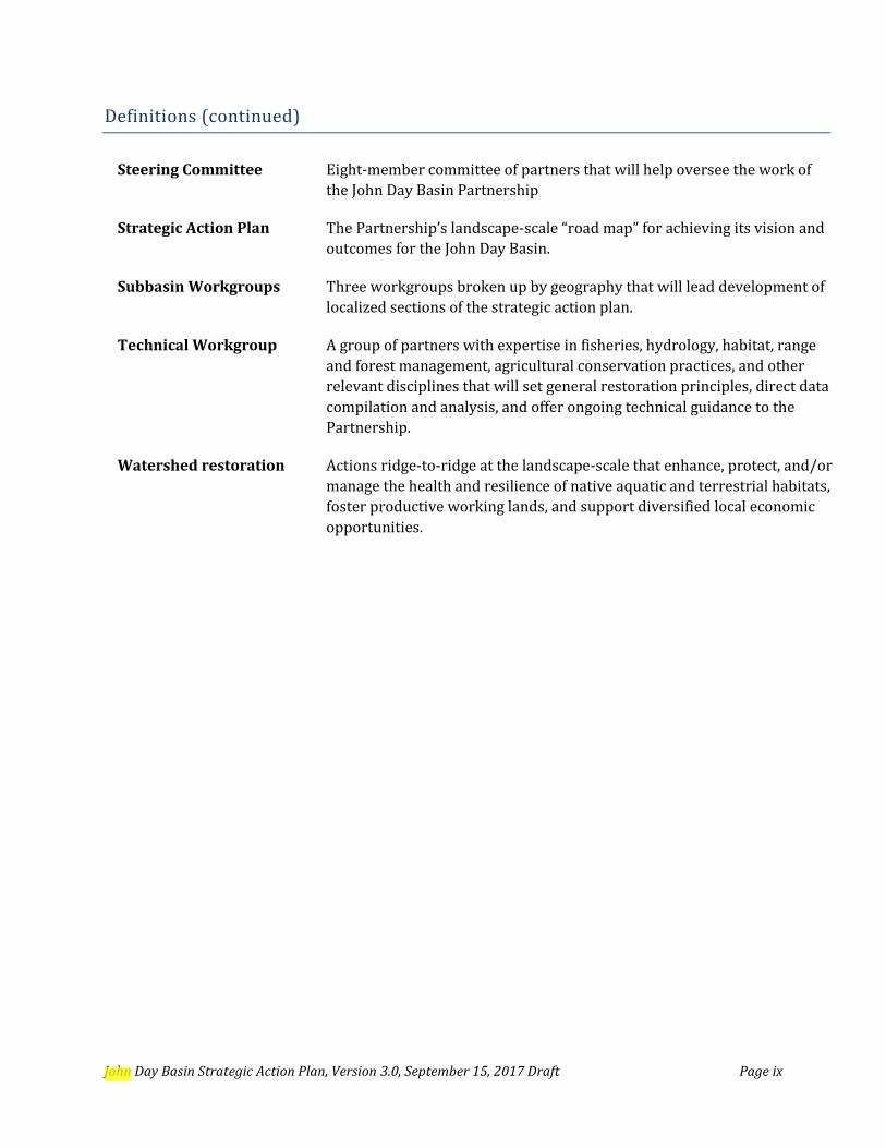
Steering Committee Eight-member committee of partners that will help oversee the work of
the John Day Basin Partnership
Strategic Action Plan The Partnership’s landscape-scale “road map” for achieving its vision and
outcomes for the John Day Basin.
Subbasin Workgroups Three workgroups broken up by geography that will lead development of
localized sections of the strategic action plan.
Technical Workgroup A group of partners with expertise in fisheries, hydrology, habitat, range
and forest management, agricultural conservation practices, and other
relevant disciplines that will set general restoration principles, direct data
compilation and analysis, and offer ongoing technical guidance to the
Partnership.
Watershed restoration Actions ridge-to-ridge at the landscape-scale that enhance, protect, and/or
manage the health and resilience of native aquatic and terrestrial habitats,
foster productive working lands, and support diversified local economic
opportunities.

John Day Basin Strategic Action Plan, Version 3.0, September 15, 2017 Draft Page x
Acronyms and Abbreviations
AWQMAP Agricultural Water Quality Management Area Plans
BiOp Biological Opinion
BLM U.S. Bureau of Land Management
BOR U.S. Bureau of Reclamation
BPA Bonneville Power Administration
cfs Cubic feet per second
CTUIR Confederated Tribes of the Umatilla Indian Reservation
CTWSRO Confederated Tribes of the Warm Springs Reservation of Oregon
ESA Endangered Species Act
ESU Evolutionarily Significant Unit
FWS U.S. Fish and Wildlife Service
GIS Geographic Information System
HUC hydrologic unit code
ISWR in-stream water right
JAR juvenile-to-adult ratios
LWD large woody debris
MOU Memorandum of Understanding
NGO Non-governmental organization
NMFS National Marine Fisheries Service
NRCS Natural Resources Conservation Service
NPCC Northwest Power and Conservation Council
ODA Oregon Department of Agriculture
ODEQ Oregon Department of Environmental Quality
ODF Oregon Department of Forestry
ODFW Oregon Department of Fish and Wildlife
OWEB Oregon Watershed Enhancement Board
SWCD Soil and Water Conservation District
SS/D spatial structure and diversity
TMDL Total Maximum Daily Load
USFS U.S. Forest Service
VSP viable salmonid population
WC watershed council
WQMP Water Quality Management Plan

John Day Basin Partnership Strategic Action Plan, Version 3.0, September 15, 2017 Draft Page 1
1. Introduction
A. Background
The John Day River Basin (“basin” or “the John Day”) in northeast Oregon is home to native aquatic
fish species and habitat of state significance, small rural communities whose economy is centered
on agriculture and natural resources, and exceptional historical and cultural riches. A basin map is
provided as Figure 1. This 8,100 square mile river basin is one of the most important undammed
river systems in the West and hosts two of the last remaining intact wild anadromous fish
populations in the Columbia River System. Much of the John Day’s aquatic habitat is addressed in
federal and state conservation plans and is designated a priority for recovery by the Oregon
Watershed Enhancement Board’s (OWEB) Focused Investment Program. Encompassing nearly
8,100 square miles, the basins has a population of 11,000. Agriculture covers nearly 2 million acres
and generates almost $140 million a year annually; while over the last ten years natural resource
restoration work has generated $36 million in economic output. The basin is home to three Native
American Tribes with treaty rights for fishing, hunting, and gathering and dozens of close-knit rural
communities.
For more than two decades a variety of government agencies, foundations, tribes, and private
landowners have invested in the region, while local organizations have worked collaboratively to
deliver important improvements in basin health. Nevertheless, native fish populations and habitat
quality are well below historic levels. Restoration practitioners seeking to accelerate recovery and
reach the basin’s full potential face a significant challenge: existing funding falls far short of what is
needed to achieve their individual and collective goals for the John Day. The spatial structure and
diversity of important aquatic resources, new academic research, and the emerging funding
approach of government and private philanthropists supports the holistic landscape-scale
approach that will be employed in this plan.
The John Day Basin Partnership (“Partnership’) first formed in September 2014 around the shared
belief that jointly creating and executing a more comprehensive and coordinated basinwide
strategic action plan was the best way to reach a common vision and bring in the additional
sustained funding needed to substantially increase the pace, scale, and impact of watershed
restoration in the basin. The Partnership’s general fact sheet, executed Memorandum of
Understanding (MOU), and approved Operations Manual and that describe its beliefs and operations
are provided as Appendix A, B, and C, respectively. For this effort “watershed restoration” is taken to
mean actions taken ridge-to-ridge at the landscape scale that enhance, protect, and/or manage the
health and resilience of native aquatic and terrestrial habitats, foster productive working lands, and
support diversified economic opportunities for local communities. The Partnership believes
strongly that the ecological needs defined in existing environmental plans can be addressed in
harmony with the economic, social, and cultural needs of people of the John Day.
This John Day Basin Strategic Action Plan (“action plan”) serves as a road map for realizing the
Partnership’s ambitious vision of a healthier and more resilient basin. It will complement existing
basin plans, programs, and policies while focusing on actions that are within the specific expertise
and ability to be undertaken by the Partnership and its member organizations. This plan was built
from the “bottom-up” compiling local perspectives through three local Subbasin Working Groups,

John Day Basin Partnership Strategic Action Plan, Version 3.0, September 15, 2017 Draft Page 2
data compilation and analysis by a Technical Working Group and hired consultants, and input of
peer reviewers and the public. This final action plan offers a comprehensive of background on the
basin, identifies priority actions, the cost and value of those actions, and processes for sustaining
progress toward the Partnerships goals, objectives, and desired outcomes from the basin to the
site-specific scale.
B. Strategic Action Plan Development Process
This action plan was developed over 17 Partnership meetings and ~50 workgroup meetings by a
diverse group of 29 partner organizations and other participants from across the basin. The action
plan was developed using the following seven (7) general steps:
1. Set Partnership goals and governance. The Partnership deliberately created its vision, purpose,
principles, goals, outcomes, governance structure, and related documentation (i.e., Operations
Manual, MOU) necessary to achieve a high-performing Partnership. See Section 5 of this
document for more details.
Figure 1: John Day River Basin Map (NPCC, 2005)

John Day Basin Partnership Strategic Action Plan, Version 3.0, September 15, 2017 Draft Page 3
2. Landscape-scale coverage. The Partnership built upon the Oregon Watershed Enhancement
Board (OWEB) strategic action planning template to develop an action plan for the entire
John Day Basin (OWEB, 2015). The action plan is fully integrated at the landscape-scale, in
that the planning process was inclusive and considered the needs of diverse watershed
stakeholders, recognized the critical balance between ecosystem, economic, and community
health, and appreciated how activities on the land from ridge-to-ridge impact aquatic and
terrestrial systems (Manitoba Watershed Stewardship, Undated). Additional sections were
added that describe the Partnership’s restoration approach, prioritization strategy, and
project selection process. While this action plan covers the entire basin, action planning and
subsequent prioritization will also take place at the subbasin, watershed, and individual
action/project scale. See Figure 2 for a depiction these spatial scales.
Figure 2: Multi-Ecosystem Spatial Scales
3. Common components of plan based on existing information. The Partnership compiled and
reviewed existing natural resource management information on the John Day Basin and
incorporated facts, concepts, data, and analysis into a draft action plan. The full Partnership
focused on development of the “common,” non-technical parts of the plan that apply across
the basin (i.e., introduction, basinwide outcomes, governance, focus area profile, restoration
need, project selection, costs and value, evaluating success, adaptive management, and
sustainability). Wherever possible, existing information that was still current was applied to
avoid duplication in this new planning process. For example, much of Section 6 that
provides a profile of the focus area was adapted from the John Day Subbasin Revised Draft
Plan (NPCC, 2005), Oregon’s Middle Columbia Steelhead Conservation and Recovery Plan
(NMFS, 2009; Carmichael and Taylor, 2010), John Day River Basin Total Maximum Daily
Load and Water Quality Management Plan (ODEQ, 2010), and the CTWSRO John Day River
Watershed Restoration Strategy (CTWSRO, 2015). Table 1 lists the 25 existing plans that
were main sources of material for this action plan.
John Day Basin-scale Planning5.4 million acres
Subbasin-scale PlanningLower John Day: 2.4 million acresNorth and Middle Fork: 1.7 million acresUpper John Day: 1.4 million acres
Watershed-scale Prioritization 40,000-250,000 ac (5th-6th level HUC)
Reach/Site-level Project List

John Day Basin Partnership Strategic Action Plan, Version 3.0, September 15, 2017 Draft Page 4
Table 1: Existing Plans Used as Major Source Material for this Strategic Action Plan
1) Oregon Department of Fish & Wildlife. 2003. Native Fish Conservation Policy.
2) Oregon Department of Fish & Wildlife (eds. Carmichael and Taylor). 2010. Conservation and Recovery Plan for Oregon Steelhead Populations in the Middle Columbia River Steelhead Distinct Population Segment.
3) U.S. Fish & Wildlife Service. 2015. Mid-Columbia Recovery Unit Implementation Plan for Bull Trout (Salvelinus confluentus).
4) Oregon Department of Fish & Wildlife. 2016. The Oregon Conservation Strategy.
5) Oregon Department of Environmental Quality. 2010. John Day River Basin TMDL and Water Quality Management Plan.
6) Oregon Department of Agriculture, Lower John Day Local Advisory Committee. 2015. Lower John Day Basin Agricultural Water Quality Management Area Plan.
7) Oregon Department of Agriculture, Middle John Day Local Advisory Committee. 2015. Middle John Day Basin Agricultural Water Quality Management Area Plan.
8) Oregon Department of Agriculture, North and Middle Fork John Day Local Advisory Committee. 2015. North and Middle John Day Basin Agricultural Water Quality Management Area Plan.
9) Oregon Department of Agriculture, Upper John Day River Local Advisory Committee. 2015. Upper Main Stem and South Fork John Day Basin Agricultural Water Quality Management Area Plan.
10) Oregon Department of Fish & Wildlife. Janaury 2011. Oregon Mule Deer Initiative Plan.
11) Confederated Tribes of the Warm Springs Reservation of Oregon. 2015. John Day River Watershed Restoration Strategy.
12) Confederate Tribes of the Umatilla Indian Reservation. 2008. First Foods Policy and Umatilla River Vision.
13) Confederated Tribes of the Umatilla Indian Reservation, 2015. North Fork John Day Fisheries Enhancement Project’s Strategy.
14) Umatilla Indian Reservation. March 2016. Final Camas Creek Oregon Geomorphic Assessment and Restoration Opportunities.
15) Confederated Tribes of the Umatilla Indian Reservation. 2017. Desolation Creek Geomorphic Assessment and Action Plan
16) Columbia River Inter-Tribal Fish Commission. 2011. Tribal Pacific Lamprey Plan for the Columbia River Basin.
17) Ritter Land Management Team. October 2015. Strategic Action Plan,
18) U.S. Bureau of Land Management. 2015. John Day Basin Record of Decision and Resource Management Plan.
19) U.S. Forest Service. 2014. Blue Mountains National Forests Proposed Revised Land Management Plan.
20) U.S. Fish & Wildlife Service. 2015. Recovery Plan for the Coterminous United States Population of Bull Trout.
21) U.S. Fish & Wildlife Service. 2012. Conservation Agreement for Pacific Lamprey.
22) U.S. Fish & Wildlife Service. 2012. Pacific Lamprey Assessment and Template for Conservation Measures.
23) U.S. Department of Agriculture, Forest Service. 2007 Revision. Pacific Northwest Region Aquatic Restoration Strategy.
24) U.S. Department of Commerce, National Marine Fisheries Service. 2009. Middle Columbia River Steelhead Distinct Population Segment ESA Recovery Plan.
25) Northwest Power and Conservation Council. 2005. John Day Subbasin Revised Draft Plan.

John Day Basin Partnership Strategic Action Plan, Version 3.0, September 15, 2017 Draft Page 5
4. Technical components of plan based on new data and analysis. Three Subbasin Workgroups
made up of partners operating in the subbasin developed preliminary goals, objectives, and
actions. The Technical Working Group made up of partners with technical expertise from
across the basin, with the assistance of hired consultants, set the restoration approach and
refined the Subbasin Working Group goal-setting work to prioritize areas and actions
where they should take place (at the 4th-6th field HUC based on available data and
restoration progress as of 2018) to maximize impact and resilience. See Section 5 for more
on Working Groups, Section 10 on restoration approach, Section 11 for prioritization, and
finally Section 12 for the final SMART (Specific, Measurable, Attainable, Relevant and
Timely) objectives and actions that will be pursued under this plan.
5. Plan revision based on internal and external review. The action plan is currently a working
draft as several basin-scale data analyses components (e.g., Atlas upland habitat goal
setting; restoration economic analysis) are in-development and will be completed in late
2018. This working draft was developed in response to several rounds of review and
comment by the Partnership Working Groups, Steering Committee, and Partnership
members. The final action plan will be distributed for external review (technical peer and
general public).
6. Cost and value of plan. The final SMART goals, objectives, actions will be assessed as
described in Section 13 to develop a cost and value (return on investment) of fully executing
the plan. This analysis is under development and scheduled for completion in late 2018.
Section 13 and associated sections of the SAP will be revised to incorporate this new
information.
The action plan will remain a “living document” that will be adapted as new data are developed,
projects are completed, and lessons are learned. The plan will be reviewed annually and a full
update considered every five (5) years. Monitoring, adaptive management, and sustainability
are further discussed in Sections 15 -17.
2. Basinwide Goals and Outcomes
The basinwide goals to be pursued by the Partnership are provided below. Note that more localized goals are developed by the Subbasin Working Groups.
1. Generate increased partner cooperation, project prioritization, and joint fundraising among diverse interests in the John Day River Basin.
2. Conduct public outreach on watershed restoration that is taking place and its value to the community.
3. Annually increase funding for watershed restoration and resultant completion of more high impact projects that meet ecological and local community needs at the landscape scale.
4. Develop plans, new information, and adapt strategy as needed to ensure strong progress toward outcomes.
The specific outcomes to be pursued by the Partnership are listed below.

John Day Basin Partnership Strategic Action Plan, Version 3.0, September 15, 2017 Draft Page 6
1. Sustainable financial resources secured by 2025 that enable full execution of the strategic action plan.
2. Positive economic impact on local communities attributable to the work of the Partnership by 2025.
3. A majority of the local community understands watershed restoration progress and its value by 2025.
4. Summer base flows met per the strategic action plan in high priority watersheds by 2030.
5. Water quality standards met per the John Day River Basin TMDL in high priority watersheds by 2030.
6. Passive and active habitat restoration implemented that addresses primary limiting factors and restores ridge-to-ridge ecosystem functions and processes in high priority watersheds by 2035.
7. Long-term trend of increasing fish populations per local, state, federal, and tribal plans by 2040.
8. Fish populations that allow for greater harvest potential by 2040.
3. Vision, Purpose, Principles, and Scope
A. Vision
A John Day Basin with clean water and healthy watersheds sufficient to provide for the
ecological, economic, and cultural well-being of the basin.
B. Purpose
The John Day Basin Partnership’s unifying purpose is to bring together stakeholders from across the basin with the common interest of restoring and maintaining our watersheds to maximize their ecological, economic, social, and cultural benefits. We apply deep knowledge of the basin, best available science, and cooperative planning and fundraising to empower more actions that establish healthy and resilient native habitats, working landscapes, and local communities for future generations.
C. Guiding Principles
The eight guiding principles for execution of the vision and purpose are:
1. Local leadership. The knowledge and commitment of local people is essential to achieving healthy and resilient native habitats and working landscapes.
2. Collaboration. Decision-making must integrate management goals of both private and public lands.
3. Fundraising. Joint planning and fundraising at the basin-scale can help deliver the long-term funding necessary to achieve outcomes.
4. Science. The best available science and technology will be applied to all decisions and actions.
5. Voluntary Efforts. Proactive, voluntary restoration is preferable to mandated or emergency action.

John Day Basin Partnership Strategic Action Plan, Version 3.0, September 15, 2017 Draft Page 7
6. Ecological and Socioeconomic Balance. The needs of the natural environment must be balanced with the economic, social, and cultural needs of rural communities.
7. Scale. A holistic “ridge-to-ridge” approach to restoration is vital to meeting the long-term needs at the landscape scale.
8. Adaptive management. Persistent monitoring and adaptation is essential to realizing lasting change.
D. Scope
The focus area for this action plan is the entire 8,100 square mile John Day River Basin. Additional
details about the focus area are provided in Section 6. There is a more than twenty-year history of
joint planning and financial investment in watershed restoration that helps native aquatic habitat
and local communities across many organizations in the basin. The John Day community and its
restoration practitioners are quite tightknit and most partners have worked closely together
before. The majority of public planning efforts to date are keyed to a specific John Day subbasin
(e.g., agricultural water quality plans), species (e.g., ESA recovery plans), treaty resource (e.g., tribal
restoration strategies), land use (e.g., federal land management plans, aquatics strategy), or limiting
factor (e.g., John Day Basin TMDL). Oregon’s Conservation Strategy (ODFW, 2016) and the John
Day Subbasin Revised Draft Plan (NPCC, 2005) summarize many of these issues. All of this work to
date significantly advanced the understanding of the needs and health of the basin.
The Partnership believes strongly that the best way to achieve its ambitious vision is to develop a
more coordinated and comprehensive plan that emulates and builds upon existing work by looking
more holistically at the challenges, solutions, and opportunities for the basin. The Partnership used a
blind survey, facilitated processes in two Partnership meetings, and direct discussions with existing
funders of restoration work in the basin to thoughtfully consider alternatives and make the collective
decision to focus on the John Day basin as a whole.
This chosen approach is bolstered by the fact that the diversity in spatial structure of our focal
species and habitats are both affected by a variety of local historic and ongoing influences that cross
land use, watershed, and political boundaries basinwide (NPCC, 2005; NMFS, 2009; Carmichael and
Taylor, 2010; ODFW, 2011; CTWSRO, 2015; ODFW, 2016). Thus, a wide focus is needed to prioritize
areas for restoration that pose the greatest need and potential for ecological and community lift.
Further, landscape-scale plans can be more readily designed to address future change and related
stressors, including climate change, urbanization, fire, habitat fragmentation, and pests (USFS,
2009; Tilman, 2012). Finally, this method is very much in line with recent work of river ecosystem
academia and large landscape restoration funders who are increasingly calling for restoration
practitioners to undertake a more holistic and coordinated approach to ensure work is carried out
as effectively and cost-effectively as possible (Palmer, 2006; OWEB, 2015).
The breakdown of land ownership in the basin is roughly: 61% private, 38% federal, and 1% state
(CTWSRO, 2015). All the major federal land managers (the Forest Service manages 83% of federal
lands in the basin) and the primary organizations that engage with private agricultural landowners
in the region (54% of the basin is agricultural land) are partners in this endeavor. Representatives
of these entities sit on the Steering Committee and the Working Groups that helped develop this

John Day Basin Partnership Strategic Action Plan, Version 3.0, September 15, 2017 Draft Page 8
action plan. Overall, the private, public, and non-government organization (NGO) interests are well
represented in the Partnership.
The Partnership currently has 29 partner organizations and an average of over 30 individuals
attending each Partnership meeting, representing nearly every major geography and natural
resource stakeholder in the region and hundreds of paid and thousands of volunteer in-kind hours
to date. There is very clearly expertise and commitment in place to address the entire John Day
basin.
4. Logic Model
The Partnership has created a logic model to accompany this action plan. A logic model is a kind of
flow chart that connects inputs and actions along a causal “if-then” chain that leads to the desired
basinwide goals and outcomes. In other words, if action ‘x’ ’is undertaken, then outcome ‘y’ is
achieved. Funders are now regularly requiring these models to provide a visual depiction and
associated timeline of the connection between proposed actions and desired outcomes. The
partnership’s current logic model includes:
Challenges: the problem the effort is working to overcome.
Inputs: essential pre-conditions and invested resources.
Activities: specific actions taken.
Outputs: immediate results that can be measured.
Goals: Broad statement that describes the desired impact (shorter term).
Outcomes: Specific statement of future state (long-term).
The partnership’s current logic model is provided as Figure 3. Note that this logic model will be
updated as necessary as projects are completed, goals, objectives, and outcomes evolve, new
metrics are developed, and as more resources are brought to bear to execute the action plan.

John Day Basin Partnership Operations Manual, Version 3.0, September 15, 2017 Draft Page 9

John Day Basin Partnership Strategic Action Plan, Version 4.0, June 25, 2018 Draft Page 10
5. Governance
A. Memorandum of Understanding
1. Governance Document
The Partnership has decided not to pursue 503(c)3 status or become a membership organization.
The group also does not plan to hire staff or acquire a physical office. However, as a pre-condition of
applying for and accepting money from most funders, the Partnership must come together formally
in some manner. Therefore, the Partnership has decided to use a Memorandum of Understanding
(MOU) that documents the shared beliefs that unify the group, including its function, vision,
purpose, and guiding principles. The MOU is provided as Appendix B.
2. Formal Partners
Those organizations that sign the MOU will be considered “formal partners” or “partners.” The MOU applies to organizations when taking part in Partnership activities and otherwise acting on behalf of the Partnership. For the purposes of this MOU, a formal partner refers to an individual government, tribal, non-government organization, or businesses that has signed this MOU. In the case of organizations and businesses it is the organization or business entity itself that is the partner, not individual employees or contractors for the organization or business. Further, organizations need not be physically located within basin boundaries to be a partner, but they must have documented interest in improving the health and resilience of the basin. Means to document interest include, but are not limited to, mission/vision statements, grant agreements, existing or planned projects, and/or partnerships with organizations located in the basin. To respect the autonomy of each organization, it is at the sole discretion of each organization to decide who within their organization signs the MOU.
Based on considerable discussion and the near consensus of Partnership participants to date, individual landowners may not sign the MOU and join the Partnership or serve on the Steering Committee. The perspective of the Partnership is that Soil & Water Conservation Districts, Watershed Councils, and landowner organizations represent the interests of landowners. The Partnership Operations Manual makes clear that landowners and other members of the public are welcome at all Partnership meetings, and their ability to become formal partners could be reevaluated at a later date.
Lastly, all formal partners are expected to adhere to the meeting rules described in the Operations Manual and avoid any of the actions described in Subsection 5C below that can lead to involuntary removal from the Partnership.
3. MOU Amendment or Termination.
The MOU may be amended or terminated by a three-quarters vote of the Partnership. Similarly, a new formal partner may be added to the MOU at any time after January 31, 2016 by (1) providing written notice to all members of the Partnership’s current Steering Committee and (2) an affirmative vote of three-quarters of the partners.
A partner may voluntarily withdraw from this MOU by providing written notice to the Partnership’s Steering Committee.

John Day Basin Partnership Strategic Action Plan, Version 4.0, June 25, 2018 Draft Page 11
A partner may be involuntarily removed from the MOU with cause through a four-step process.
1. A partner must bring forward an organization to the Steering Committee for consideration for removal (the identity of the organization/person bringing the nomination will be kept private);
2. The Steering Committee will formally determine if any one of the following pre-conditions are met that provide cause for removal vote by the Partnership:
Failure to attend a Partnership or Working Group meeting for one (1) year without providing a written justification deemed acceptable by a majority vote of the Steering Committee;
Actions while working on behalf of the Partnership that are grossly inconsistent with the Partnership’s vision, purpose, function, and guiding principles as determined through a majority vote of the Steering Committee;
Repeated failure to comply with the terms of contracts entered into with the Partnership; or
Actions during Partnership-affiliated meetings or events that are determined to be inconsistent with meeting rules and generally accepted public decorum as determined through a majority vote of the Steering Committee.
3. The Steering Committee will notify the partner and let them know their removal from the Partnership will be scheduled for a vote of the full Partnership. At that time, the partner under consideration for removal may request the ability to speak with the Steering Committee or full Partnership prior to the vote.
4. If the Steering Committee determines consideration for removal is justified, a partner can be removed by an affirmative vote of three-quarters of the partners.
Partnership decisions, including changes to the MOU, will be effective as described in Subsection 5G below.
4. Outreach to Potential New Partners
Amy Charette of the Confederated Tribes of the Warm Springs Reservation of Oregon solicited
interest in forming a John Day Partnership in May 2014. An inclusive list of local and regional
stakeholders was included in that initial invitation and is attached to the Operations Manual. Many
of the organizations on this list have become formal partners by signing the Partnership MOU. After
January 31, 2016, partners that want to invite new organizations to pursue joining the Partnership
are encouraged to bring the name of the organization to the full Partnership for discussion. This is
especially important for organizations that may have a divisive history in the basin or with existing
partners. This extra step will ensure clear expectations for the new organization and Partnership
from the beginning. New organizations may become formal partners per the process described in
Subsection 5A.3 above.
B. Operations Manual
The Partnership has developed and formally approved a detailed Operations Manual that provides
the procedures, rules, and forms that cover the day-to-day operation of the organization. The
manual is provided as Appendix C.

John Day Basin Partnership Strategic Action Plan, Version 4.0, June 25, 2018 Draft Page 12
C. Organizational Structure.
1. Structure
The Partnership will rely upon a “Steering Committee” of eight (8) partners to oversee actions delegated to them by the Partnership. The group will also utilize Working Groups to accomplish some tasks. The Partnership will depend in large part on the individual partner organizations to voluntarily fill the roles necessary to meet the Partnership vision and desired outcomes. Roles are discussed further in Subsection 5D. Figure 4 below and the remainder of this subsection defines the Partnership’s governance structure.
2. Steering Committee
The Partnership will utilize an eight (8) member elected Steering Committee of partners that will oversee decisions and other actions specifically delegated to them by a vote of the full Partnership. The committee will be made up of two categories of members:
1. Organizational Types. One representative of the six “types” of organizations that participate in the Partnership will be included on the Committee, which includes Soil and Water Districts, Watershed Councils, conservation groups, Tribes, state agencies, and federal agencies. Representatives of each organization type shall nominate someone from their type to serve on the Committee. The Partnership will vote on the nominees per procedures laid out in Subsection 5G.
2. At Large. Up to two (2) at-large representatives will be elected beginning after July 1, 2016. These members may come from any organization type. Partners may volunteer or nominate others for the Committee. The Partnership will vote on at-large members, and such a member will only be seated if they achieve a super-majority of votes as described in Subsection 5G.
The members of the first iteration of the committee seated in June 2015 volunteered or were suggested by active participants in the Partnership. Subsequent committees assembled after July 2015 will require a majority vote of the Partnership.
The goal is to create a committee that meets the following criteria:
28 individual
partner
organizations that
have signed MOU
Lower
River
Working
Group
North/Middle
Fork Working
Group
Upper River-
South Fork
Working Group
Technical
Working
Group
Figure 4: John Day Partnership Governance Structure
Proposal
Committee
Outreach
Working
Group

John Day Basin Partnership Strategic Action Plan, Version 4.0, June 25, 2018 Draft Page 13
1. Made up of partners that signed the MOU,
2. Have committed to participate actively in committee efforts,
3. Offers balance based on interests and geography, and
4. Includes organizations and individuals that work and/or reside in the region.
The responsibilities of the committee will be the following:
1. Represent the interests of the organization type they are representing and the broader Partnership, not their own organization or individual interests.
2. Assist the Partnership facilitator in designing Partnership and Working Group meetings,
3. Review draft Partnership documents (e.g., manuals, fact sheets, plans, proposals),
4. Determine if a decision should be put to majority vote of the Partnership,
5. Oversee all Partnership grant proposals and awards,
6. Evaluate and score project proposals if insufficient partner volunteer come forward to form a Funding Evaluation Committee for an individual funding opportunity,
7. Resolve any ties in project ranking,
8. Oversee development and adaptive management of the strategic action plan, and
9. Hold quarterly coordination phone calls.
After the first Steering Committee seated in July 2015, all future committees will be elected by a majority vote of the Partnership. The term of Steering Committee membership will be two (2) years. Existing members may seek another term, and there are no term limits at this time. The Partnership may stagger seating of new Committee members to avoid a wholesale change of participants at one time. Any member that departs the Committee will be replaced as soon as possible through a nomination or volunteer and a majority vote of the Partnership. A temporary proxy for a Committee member will be allowed with the majority approval of the organization type that the member represents and written notice to the entire Steering Committee.
Partnership Coordinator (Tentative, pending voting results)
In June 2018, the Partnership is voting to decide on whether or not to add a Coordinator position to its’ organizational structure in response to the expansion of its’ operating structure since 2014. The proposed purpose of the Coordinator is to serve an integral role as a liaison between the Steering Committee and the Working Groups/Committees to ensure that Partnership activities are meeting scheduled deadlines and proposed outcomes, and formal reports are compiled and submitted to funding entities in a timely manner. This section will be updated as soon as the voting results are available (~July 2, 2018).
3. Working Groups and Committees
The Partnership has decided to use Working Groups to address tasks that can be more efficiently accomplished with a smaller number of people or those with specific expertise or interests. The standing Working Groups/Committees are the (1) Subbasin Working Groups, (2) Technical Working Group, (3) Outreach Committee, and (4) Fundraising Committee. Further, ad hoc Working
John Day Basin Partnership Strategic Action Plan, Version 4.0, June 25, 2018 Draft Page 14
Groups to take on short-term tasks are also expected. Working Group members need not have signed the MOU and there will be no term limit.
In the event that a Working Group is unable to complete its assigned roles in a timely and effective manner, it will be the responsibility of the Partnership to assume any tasks left uncompleted.
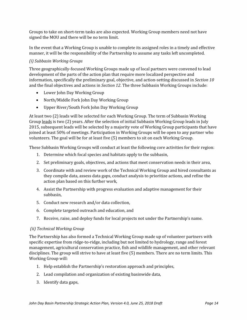
(i) Subbasin Working Groups
Three geographically-focused Working Groups made up of local partners were convened to lead development of the parts of the action plan that require more localized perspective and information, specifically the preliminary goal, objective, and action-setting discussed in Section 10 and the final objectives and actions in Section 12. The three Subbasin Working Groups include:
Lower John Day Working Group
North/Middle Fork John Day Working Group
Upper River/South Fork John Day Working Group
At least two (2) leads will be selected for each Working Group. The term of Subbasin Working Group leads is two (2) years. After the selection of initial Subbasin Working Group leads in July 2015, subsequent leads will be selected by a majority vote of Working Group participants that have joined at least 50% of meetings. Participation in Working Groups will be open to any partner who volunteers. The goal will be for at least five (5) members to sit on each Working Group.
These Subbasin Working Groups will conduct at least the following core activities for their region:
1. Determine which focal species and habitats apply to the subbasin,
2. Set preliminary goals, objectives, and actions that meet conservation needs in their area,
3. Coordinate with and review work of the Technical Working Group and hired consultants as they compile data, assess data gaps, conduct analysis to prioritize actions, and refine the action plan based on this further work,
4. Assist the Partnership with progress evaluation and adaptive management for their subbasin,
5. Conduct new research and/or data collection,
6. Complete targeted outreach and education, and
7. Receive, raise, and deploy funds for local projects not under the Partnership’s name.
(ii) Technical Working Group
The Partnership has also formed a Technical Working Group made up of volunteer partners with specific expertise from ridge-to-ridge, including but not limited to hydrology, range and forest management, agricultural conservation practice, fish and wildlife management, and other relevant disciplines. The group will strive to have at least five (5) members. There are no term limits. This Working Group will:
1. Help establish the Partnership’s restoration approach and principles,
2. Lead compilation and organization of existing basinwide data,
3. Identify data gaps,

John Day Basin Partnership Strategic Action Plan, Version 4.0, June 25, 2018 Draft Page 15
4. Select appropriate models for prioritization, and
5. Refine the action plan as needed based on analysis and comment, including prioritization of actions set by Subbasin Working Groups.
6. Hire consultants as needed to support data compilation, analysis, and review. and
7. Otherwise advise on technical issues as they arise.
(iii) Outreach Committee
The Partnership formed an Outreach Committee of volunteer partners to develop an outreach plan and associated documents to engage, inform, and seek feedback from partner Boards, Councils, and management, local and regional stakeholders, landowners, and the public. The Committee received an OWEB capacity grant in 2017 to develop a media toolkit and expand the Committee’s ability to document Partnership progress, coordinate with local landowners and stakeholders, and develop Partnership education and outreach tools.
(iv) Fundraising Committee
The Partnership formed a Fundraising Committee of volunteer partners to support the Steering Committee in: determining fundraising goals, identifying prospective funding sources, coordinating with Partnership members to identify sources of financial support (cash and in-kind services), and developing grant applications and project budgets.
(iv) Proposal Committee
The Partnership will form an ad hoc Proposal Committee when (1) a partner notifies the Steering Committee of a grant opportunity and (2) the Steering Committee determines that the opportunity is consistent with the Partnership’s guiding principles and strategic action plan. Based on the short notice and turnaround provided for some funding opportunities, the Steering Committee may need to field grant ideas and form Proposal Committee’s between quarterly Partnership meetings. The Proposal Committee will both develop proposals and review partner projects seeking funding if the proposal is ultimately funded. The Committee will include the proposed submitter, fiscal agent, and/or main contact and volunteer partners with expertise necessary to aid the effort. Partners who will be seeking project funding from an individual grant may not participate on that grant’s Proposal Committee. Finally, if insufficient volunteers come forward to form an evaluation committee for a funding opportunity, the Steering Committee will fill this role. Note that the Subbasin Working Groups will assume the Steering Committee role for projects conducted in their geography that are not submitted under the name of the Partnership. Fundraising is further discussed in Section 13.
(v) Ad hoc Working Groups
The Partnership may form ad hoc Working Groups to address specific short-term issues and opportunities to advance the Partnership’s work in achieving its’ goals,
(vi) Facilitator
The Partnership has chosen to use an outside facilitator to assist with Partnership operation. Sustainable Northwest is currently (2018) proving these services through a contract provided by the Warm Springs Tribes. If the FIP grant is awarded to the John Day Partnership, a part-time project coordinator will then be hired and take on management of the award and ongoing

John Day Basin Partnership Strategic Action Plan, Version 4.0, June 25, 2018 Draft Page 16
facilitation. The facilitator’s duties will be assigned by the Steering Committee and may include but not limed to:
1. Meetings. Organize and conduct Partnership convenings, Partnership Working Groups and
other groups as assigned by the Steering Committee. Meeting support may include pre-
meeting research and attendee interviews, agenda and presentation development, meeting
logistics, large and small group facilitation, and meeting notes.
2. Writing. Complete drafts and coordinate revision of strategic action plans, governance
documents, standard operating procedures, grant reports, and other technical and
organizational documents.
3. Fundraising. Identify new funding opportunities, draft and oversee revisions of Partnership
and partner grant proposals and budgets.
4. Diplomacy. Lead multi-party processes, offer one-on-one coaching, and provide shuttle
diplomacy among diverse basin constituencies, including Partnership members, agency staff,
funders, and other stakeholders to ensure high-performing groups and continued momentum.
5. Records. Maintain all written materials online.
(vii) Roles for Various Tasks
Table 2 below distinguishes who is the lead for various tasks between the Partnership and Working Groups. Roles include Lead, Refine, Review, or Oversee.
Table 2: Roles for Various Tasks
Tasks Subbasin WGs Technical WG Partnership
Ensure all activities under the name of the
Partnership are consistent with the mission,
MOU, Operations Manual, action plan.
Lead
Develop organizational governance
procedures and documents. Review Lead
Select focal species/habitats. Lead Oversee
Determine most appropriate plans and data
to consider. Review Lead Oversee
Set preliminary subbasin goals, objectives,
and actions for action plan. Lead Refine Oversee
Define restoration approach. Review Lead Oversee
Select models and prioritize actions. Review Lead Review
Develop final SMART goals, objectives, and
actions Co-lead Co-lead Review

John Day Basin Partnership Strategic Action Plan, Version 4.0, June 25, 2018 Draft Page 17
Table 2: Roles for Various Tasks
Tasks Subbasin WGs Technical WG Partnership
Develop final action plan Review Review Lead
Decide whether to pursue a grant under the
Partnership’s name Lead
Decide whether to pursue a grant under a
Subbasin Working Group’s name Lead Oversee
Deploy and manage monies raised by
Partnership Review Lead
Deploy and manage monies raised by
workgroup Lead Oversee
Conduct Outreach Co-lead Co-lead
4. Main contact
The Partnership will request a formal partner(s) to volunteer as the main contact for individual
grants. In certain circumstances, decisions regarding the main contact for a Partnership grant may
be vetted through the voting process. In general, it is expected that the main contact will work with
the fiscal agent of the individual funding source to lead distribution of grant funds and otherwise
oversee grant execution.
D. Roles
1. Role identification
A niche exercise completed by the Partnership confirmed that partner organizations have the
desire and expertise to take on all key roles needed to fulfill the organization’s vision; this includes
operation of the Partnership and implementation of capital and non-capital projects funded
through the Partnership. Depending on the partner, they may be compensated for their work
through capacity grants and/or in-kind services. There is no intention for the Partnership itself to
hire staff, conduct field projects itself, or otherwise overlap with any roles already fulfilled by
partners. When volunteers or specific expertise are not available or an outside voice is most
appropriate, the group may consider hiring consultants as funding allows (e.g., facilitator, fiscal
agent, data collection and analysis). Table 3 defines the different types of Partnership and project
roles.
Table 3: Types of Partnership and Project Roles
Partnership Role
Description Project Role Description
Partnership Governance
Partners may serve on the Steering Committee and Working Groups.
Landowner Recruitment
Identify, cultivate, match with funding, and sign-up landowners for projects.
Facilitator Organize, manage, and record Partnership and Working Group meetings.
Funder Provide funding for individual on-the-ground or outreach projects.

John Day Basin Partnership Strategic Action Plan, Version 4.0, June 25, 2018 Draft Page 18
Table 3: Types of Partnership and Project Roles
Partnership Role
Description Project Role Description
Main Contact(s) Serve as the main contact for the Partnership for specific grants.
Technical Assistance
Provide ongoing assistance on technical matters and track and share new research.
Fiscal Administrator
Accept and distribute grant funds, manage contracts with consultants, track match, and reporting.
Project Design Create project-specific drawings and plans.
Strategic Action Planning
Participate in strategic action plan development and adaptation.
Permitting Assist landowners with project permits.
Project Review and Selection
Review, score, and rank projects to receive funding raised by the partnership.
Project Management
Oversee contractor work.
Technical Assistance
Provide ongoing assistance on technical matters and track/share new research.
Project Implementation
Field installation of projects.
Fundraising Prospect research and proposal writing. Monitoring Confirm project installed and maintained as promised.
Outreach Develop and share materials with stakeholders, funders, elected officials, and the public.
Outreach Develop and share materials with landowners, elected officials, and the public.
2. Role assignment
Table 4 lists current partners, their experience, prospective primary roles, and the typical number of employees from each partner that attend Partnership meetings. The most appropriate niches and roles are generally standardized for each type of organization, and known to the Partnership for individuals currently employed by them. Because the Partnership is relatively new and roles are evolving, all partners and their potential roles are provided. As the Partnership matures and further niche identification takes place tied to individual funding opportunities a more refined definition of roles may be created.
Table 4: Prospective John Day Partnership Roles From Niche Exercise
Partner* Applicable Experience Anticipated Roles FTEs
FEDERAL GOVERNMENT
U.S. Bureau of Land
Management
Grazing, Natural Resource
Management, Noxious
Weeds
Partnership Governance, Action
Planning, Permitting, Technical
Assistance.
1
U.S. Bureau of
Reclamation
Water Management, Flow Project Design, Technical Assistance. 1
U.S. Fish & Wildlife
Service
Fish and Wildlife
Management
Permitting, Funder, Technical
Assistance. 1

John Day Basin Partnership Strategic Action Plan, Version 4.0, June 25, 2018 Draft Page 19
Table 4: Prospective John Day Partnership Roles From Niche Exercise
Partner* Applicable Experience Anticipated Roles FTEs
U.S. Forest Service—
Malheur
Forests, Fire, Wildlife
Conservation, Public Lands
Planning.
Partnership Governance, Action
Planning, Technical Assistance. 1
U.S. Forest Service—
Umatilla
Forests, Fire, Wildlife
Conservation, Public Lands
Planning.
Partnership Governance, Action
Planning, Technical Assistance. 1
U.S. Forest Service-
Wallowa Whitman
Forests, Fire, Wildlife
Conservation, Public Lands
Planning.
Action Planning, Technical Assistance.
1
U.S. Natural Resource
Conservation Service
Agriculture, Agricultural
Conservation Practice,
Farm Bill.
Project Design, Technical Assistance
Funder. 2
Bonneville Power
Administration (BPA)
BPA Funding Programs Funder and Permitting. 1
TRIBES
Confederated Tribes of
the Umatilla Indian
Reservation
Fisheries, Tribal Funding
Programs, GIS Mapping,
Cultural Protection.
Partnership Governance, Action
Planning, Technical Assistance,
Funder, Project Implementation,
Monitoring.
1
Confederated Tribes of
the Warm Springs
Reservation of Oregon
Fisheries, Tribal Funding
Programs, Cultural
Protection.
Partnership Governance, Action
Planning, Technical Assistance,
Funder, Project Implementation,
Monitoring.
3
Burns Paiute Tribe Fisheries, Tribal Funding
Programs, Cultural
Protection.
Action Planning, Technical Assistance,
Funder, Project Implementation,
Monitoring.
1
STATE AGENCY
Oregon Dept of Fish &
Wildlife
Fish and Wildlife
Management, Data
Collection.
Partnership Governance, Project
Design, Monitoring, Permitting,
Funder.
2
Oregon Dept of Parks &
Recreation
Outdoors Recreation,
Wildlife Management.
Action Planning, Project
Implementation 1
Oregon Dept of State
Lands
Wetland law and regulation. Permitting. 1
Oregon Dept of
Agriculture
Water Quality on private
agricultural lands.
Technical Assistance, Action Planning. 1
SOIL & WATER CONSERVATION DISTRICTS
Gilliam County SWCD Relationships with
landowners, Agricultural
Partnership Governances, Landowner
Recruitment, Technical Assistance, 2

John Day Basin Partnership Strategic Action Plan, Version 4.0, June 25, 2018 Draft Page 20
Table 4: Prospective John Day Partnership Roles From Niche Exercise
Partner* Applicable Experience Anticipated Roles FTEs
Conservation Practice,
Watershed restoration.
Project Design, Project
Implementation.
Grant SWCD Relationships with
landowners, Agricultural
Conservation Practice,
Upland aspen, Watershed
restoration.
Fiscal Administrator, Landowner
Recruitment, Technical Assistance,
Project Design, Project
Implementation.
2
Monument SWCD Relationships with
landowners, Agricultural
Conservation Practice,
Watershed restoration
Partnership Governances, Landowner
Recruitment, Technical Assistance,
Project Design, Project
Implementation.
2
Sherman County SWCD Relationships with
landowners, Agricultural
Conservation Practice,
Watershed restoration.
Partnership Governances, Landowner
Recruitment, Technical Assistance,
Project Design, Project
Implementation.
1
Wheeler County SWCD Relationships with
landowners, Agricultural
Conservation Practice,
Watershed restoration.
Partnership Governances, Landowner
Recruitment, Technical Assistance,
Project Design, Project
Implementation.
1
WATERSHED COUNCILS
Gilliam East John Day
WC
Watershed restoration,
Relationships with local
community.
Fiscal Administration, Project Design,
Project Implementation Outreach. 1
Mid John Day-Bridge
Creek WC
Watershed restoration,
Relationships with local
community.
Fiscal Administration, Project Design,
Project Implementation Outreach. 1
North Fork John Day WC Watershed restoration, Flow,
Relationships with local
community.
Fiscal Administration, Project Design,
Project Implementation Outreach. 1
South Fork John Day WC Watershed restoration,
Ecosystem monitoring,
Aspen, Relationships with
local community
Project Design, Project
Implementation, Monitoring,
Outreach. 1
CONSERVATION GROUPS
Blue Mountain Land
Trust
Watershed restoration,
Land Protection
Action Planning, Technical Assistance,
Fundraising, Project Design, Project
Implementation, Monitoring
1
Sustainable Northwest Facilitation, Organizational
Development, Technical
Writing.
Facilitator, Technical Assistance,
Strategic Action Planning, Fundraising. 1
The Freshwater Trust Flow, Mapping, Ecosystem Partnership Governances, Action 2

John Day Basin Partnership Strategic Action Plan, Version 4.0, June 25, 2018 Draft Page 21
Table 4: Prospective John Day Partnership Roles From Niche Exercise
Partner* Applicable Experience Anticipated Roles FTEs
monitoring, Water
purchase.
Planning, Technical Assistance,
Monitoring
Trout Unlimited Fisheries, Water Use
Efficiency.
Project Design, Project
Implementation, Monitoring. 1
PRIVATE
Ritter Land Management
Team
Relationships with
landowners, Forests, Fire,
Watershed Restoration,
Private lands.
Landowner recruitment, Technical
Assistance, Action Planning, 1
Notes: (1) Partners in black serve more than one subbasin and those in red primarily serve the Lower River, those in green
primarily serve the North/Middle Fork, and those in blue primarily serve the Upper River/South Fork.
(2) Project Prioritization is included in ‘Action Planning.’
(3) Project Management is included in ‘Project Implementation.’
(4) Partnership Fundraising may be undertaken by any partner depending on the specific opportunity.
(5) FTE refers to the number of Full Time Employees that routinely participate in Partnership efforts.
E. Fiscal Administration
New monies brought in by the Partnership must be managed according to the Partnership’s
Operations Manual, funder requirements, and applicable laws. Further, resources must be
administered efficiently to maintain relationships, effectively leverage other funding, and ensure
progress toward achievement of outcomes. Fiscal administration will include a variety of tasks,
including:
1. Receipt of outside funds,
2. Execution of contracts with funders, partners, and consultants,
3. Distribution of funds to partners and consultants,
4. Tracking of match and in-kind contributions,
5. Reporting to funders, and
6. Ensuring compliance with Partnership, funder, and government policies.
It is preferable for a partner to take on the fiscal administrator or “fiscal agent” role to keep monies
raised in the basin. It is expected that a partner will volunteer to serve as the fiscal agent for specific
funding opportunities. If more than one partner volunteers to manage finances for a particular
grant, one partner will be selected by a majority vote of the Partnership. Note that there should be
no need for ongoing fiscal management duties for the Partnership as long as it continues not to have
staff, dues paying membership, or a physical office.
F. Contracts

John Day Basin Partnership Strategic Action Plan, Version 4.0, June 25, 2018 Draft Page 22
The fiscal agent will execute and manage all contracts. The Partnership does not expect to hold any
contracts; all contracts will be directly between funders and partners, and partners and hired
contractors. A template contract for hiring contractors is in the Partnership Operations Manual.
Some Partnership decisions will require a formal vote. The following decisions will always be subject to a vote:
1. Addition or removal of partners from the MOU,
2. Election of partners to the Steering Committee,
3. Election of Working Group leads,
4. Approval to submit a proposal under the Partnership’s name.
5. Selection of a fiscal agent for a funding opportunity if more than one partner is interested in filling this role,
6. Provision of matching funds or a letter of support for a project not funded by the Partnership,
7. Revision of standard capital and non-capital project evaluation criteria included in Section 14, and
8. Other votes may be called by a member of the Steering Committee if in their judgment there is significant disagreement on a particular issue.
The following rules apply to all voting:
Each partner organization that signed the MOU will receive one vote.
The individual that signed the MOU will be considered the voting party unless the organization assigns temporary or permanent voting authority to another party as described in the Operations Manual.
A quorum of the Partnership shall be required for all votes. A quorum shall consist of 2/3 of the partners signed on to the MOU at the time of the vote. An approved proxy is considered part of the quorum.
At least thirty (30) days’ notice will be provided for all votes.
Voting will be conducted by submission of ballots via email to a pre-assigned Steering Committee member or a virtual process deemed appropriate by the Steering Committee.
There will be two types of votes: policy and people. All votes that do not involve the specific name of an individual will be considered policy votes. Person votes are those votes that will be using a party’s name (e.g., voting on Steering Committee members). Individual policy votes and aggregate results of person votes will be public.
Partners may abstain from a particular vote.
A majority vote of the full Partnership will be used for most decisions. However, a three-quarters super-majority vote will be required to amend the MOU. In other words, instead of a majority like other votes, support of three-quarter of voters is required for an amendment to advance. Specific amendments include: (i) adding a partner to the MOU after January 31, 2016, (ii) involuntarily removing a partner after November 1, 2015, (iii) altering specific terms of the MOUS, or (iv)

John Day Basin Partnership Strategic Action Plan, Version 4.0, June 25, 2018 Draft Page 23
terminating the MOU in its entirety. The specific conditions under which partners may be added or removed from the MOU are described in Subsection 5A.3 . With one exception, changes to the MOU will be effective thirty (30) days after the Steering Committee’s receipt of the affirmative vote results. The exception is that involuntary removal of the partner will take effective immediately after an affirmative vote.
6. Focus Area Profile
This action plan covers the entire John Day River Basin (HUC 170702). The John Day’s spatial
extent, topography, and soil diversity fosters a variability of climate and land cover that enables it
to support a unique variety of natural resources and people. Further details on the current
geography, water resources, biotic systems, local communities, and economy are provided in this
section. Much of this information is excerpted or adapted from the existing planning documents
that cover the entire basin, including the Oregon Middle Columbia River Steelhead Conservation
and Recovery Plan (Carmichael and Taylor, 2010) John Day Subbasin Plan (NPCC, 2005), the John
Day River Watershed Restoration Strategy (CTWSRO, 2015), John Day Basin Total Maximum Daily
Load (TMDL) and Water Quality Management Plan (WQMP)(ODEQ, 2010), Oregon’s Conservation
Strategy (ODFW 2016), the Bureau of Land Management (BLM) Resource Management Plan (BMP,
2015), and the Blue Mountains National Forests Plan (Forest Service, 2014), and John Day Subbasin
Revised Draft Plan (NPCC, 2005).
The Partnership’s basinwide prioritization process and Initiative Areas for native fish habitat and
upland habitat are described in Sections 10-12.
A. Context
Historical descriptions indicate that the John Day River was once a relatively stable and healthy
river. However, watershed conditions in the John Day Basin have changed significantly over the
past 150 years (NPCC, 2005). A myriad of water and land use practices, from mining to livestock
grazing to riverine habitat degradation to invasive species, have contributed to these changes.
These disturbances have impaired water quality in hundreds of stream miles, degraded riparian
corridors and disconnected floodplains, reduced biodiversity, and fish populations, and changed the
structure and function of upland habitats (NPCC, 2005; Carmichael and Taylor, 2010; ODEQ, 2010).
In spite of these past disturbances, basin conditions have improved over the last twenty years and it
continues to support strong wild runs of anadromous salmonids and a wide assemblage of resident
wildlife. Watersheds that drain federal lands are healthier now and private landowners applying
best agricultural and watershed health practices have recovered formerly degraded streams and
human-impacted uplands (NPCC, 2005). The public and private landowners have greatly
accelerated efforts to work in accord with restoration goals. While progress has been made, more
work is needed to achieve the ambitious vision and outcomes of the Partnership.
B. Physical Geography
The John Day Basin is the fourth largest drainage basin in Oregon, encompassing nearly 8,100
square miles in northeastern Oregon (CTWSRO, 2015). It is bound by the Columbia River to the
north, the Blue Mountains to the east, the Aldrich Mountains and Strawberry Range to the south, and

John Day Basin Partnership Strategic Action Plan, Version 4.0, June 25, 2018 Draft Page 24
the Ochoco Mountains to the west (NPCC, 2005). Elevations range from 9,000 feet in the Strawberry
Range to 200 feet at the Columbia River confluence (CTWSRO, 2015).
The John Day system contains a diverse network of tributaries that cover 500 river miles. The John
Day itself is the third largest undammed river in the western United States (CTWSRO, 2015). The
river flows generally northwest for 284 miles from its origin in the Blue Mountains before draining
into the Columbia River (NPCC, 2005). The mainstem John Day River begins in the Strawberry
Mountains in the Malheur National Forest. The largest tributary is the North Fork, which originates
in the Wallowa-Whitman National Forest in the Blue Mountains (NPCC, 2005). The North Fork
flows westerly for 112 miles and joins the mainstem near Kimberly. The Middle Fork originates
south of the North Fork in the Blue Mountains of the Malheur National Forest, flows westerly for 75
miles, and merges with the North Fork above Monument (NPCC, 2005). The South Fork originates
in the Malheur National Forest and flows 60 miles north until it merges with the mainstem near
Dayville. Upon merging into the mainstem at Kimberly, the John Day River travels through deep
canyons to the Columbia River (NPCC, 2005).
These major rivers are low in gradient through much of their length. Valleys tend to be trough-
shaped, with steep slopes separating narrow riparian areas from uplands. The narrow and
sometimes meandering valleys often limit channel migration and sinuosity (ODEQ, 2010). The
North Fork is distinctive, having a more slender and steep-walled valley with greater discharge
than the mainstem at their confluence. The Lower River Subbasin has a plateau form, broken by the
sinuous valley of the mainstem and its steep-walled tributaries (ODEQ, 2010). Much of the North
Fork Subbasin is a plateau as well. The Middle Fork and Upper River drainage include the few areas
of wide riparian meadow complexes in the basin, though both are interspersed with confined
reaches and narrow valley floors (ODEQ, 2010). The South Fork drainage area is included in the
Upper River Subbasin, though in character it is different from the upper mainstem and its other
tributaries. It is the largest upper subbasin tributary and has a much narrower valley than the
mainstem (ODEQ, 2010). Much of the South Fork valley is trough or v-shaped, with a large mid-
section of coniferous riparian area and a relatively arid upper watershed. This contrasts with most
upper basin streams, which become increasingly steep, forested, and wet with increasing elevation
(ODEQ, 2010).
The John Day Basin is characterized by diverse landforms ranging from loess-covered plateaus in
the lower sections to alpine peaks in the headwaters. Rock assemblages include masses of oceanic
crust, marine sediments, volcanic materials, ancient river and lake deposits, and recent river and
landslide deposits (NPCC, 2005). Major geologic events shaping the subbasin include volcanic
eruptions, uplifting, faulting, and erosion. Columbia River basalts are the dominant rocks at
elevations below 4000 feet. Igneous rocks are exposed in the higher reaches of the basin, while the
Lower River subbasin exposures are primarily extrusive rocks, ash, and wind-blown loess. (NPCC,
2005)
C. Water Resources
The basin is divided into four subbasins (4th-level HUC) and 43 watersheds (5th-level HUC). The
subbasins include the North Fork John Day (1800 square miles), Middle Fork John Day (810 square
miles), Upper John Day (2140 square miles), and Lower John Day (3150 square miles). The Upper
John Day Subbasin includes the upper mainstem and the South Fork John Day River. The Lower John

John Day Basin Partnership Strategic Action Plan, Version 4.0, June 25, 2018 Draft Page 25
Day Subbasin includes the middle and lower mainstem (NPCC, 2005). The subbasins, while differing
substantially in terms of elevation, climate and soil, do have characteristics in common. In much of
the basin, channel morphology is strongly influenced by valley form, alluvial fans, and large terraces
(ODEQ, 2010). Figure 5 offers a depiction of subbasins and watersheds (NPCC, 2005).
Figure 5: John Day Basin 4th and 5th-level Hydrological Unit Map (NPCC, 2005)
The basin is drained by 500 miles of rivers and streams. Most water comes from the basin’s
headwaters, primarily in the form of melting snow. The North and Middle Forks provide 60% of the
flow to the main stem (NPCC, 2005). Groundwater provides much of the base flow for the Lower
River in the summer. Precipitation occurs primarily between November and March, with the lower

John Day Basin Partnership Strategic Action Plan, Version 4.0, June 25, 2018 Draft Page 26
elevations receiving less than 12 inches per year and the upper elevations getting up to 50 inches
(NPCC, 2005).
Discharge from the free-flowing river system is highly variable from peak to low flows. Peak flows
occur from March through May, while low flows typically occur from August through October (NPCC,
2005). Peak flows can account for 70% of the annual discharge (ODA—Middle John Day, 2012).
Flood events occur in December and January which can result in extreme runoff (ODA—Lower John
Day, 2011). From year to year peak flows can vary from 300 to 700%. The hydrologic curve has
shifted from historic times, with peak flow higher than the past and late season flows more
diminished due to reduced soil infiltration and riparian and in-channel storage (NPCC, 2005). Flow
data is available dating to 1904, with a mean annual discharge into the Columbia River of 2000 cubic
feet per second (NPCC, 2005). The vast majority of the irrigation comes from surface waters of the
main stem and its tributaries, so agriculture can play a major role in modifying local and regional
hydrology (ODEQ, 2010).
The John Day’s rivers and streams now exceed water quality standards and are therefore included
on the state’s Clean Water Act 303(d) list for temperature, bacteria, dissolved oxygen,
sedimentation, and biological criteria. Elevated water temperature related to fish health is the
primary water quality limiting factor in the basin (ODEQ, 2010). A map of streams on the 303(d) list
for temperature is provided as Figure 6. Most water quality problems in the basin stem from
vegetation removal, stream relocation, livestock grazing, timber harvesting, water withdrawals for
irrigation, and historical mining and dredging (NPCC, 2005). Stressors and restoration needs are
further described in Section 7.
Figure 6: John Day Temperature 303(d) Listings (ODEQ, 2010)
The North Fork has the best water quality with most streams considered to be in relatively good
condition, with the exception of late summer elevated water temperatures that exceed water
quality standards (NPCC, 2005). The Middle Fork has satisfactory water quality, with elevated
summer water temperature the most serious problem. The Upper River and South Fork have fair

John Day Basin Partnership Strategic Action Plan, Version 4.0, June 25, 2018 Draft Page 27
water quality, with high water temperatures in the summer, and turbidity in the winter/spring
being the leading issues (NPCC, 2005). In the Lower River, elevated temperature and total
phosphorus, increased biological oxygen demand, and fecal coliform limit water quality in the late
summer when flows are lowest (NPCC, 2005).
Beneficial uses in the John Day that water quality standards are seeking to protect include domestic
water supply, industrial water supply, irrigation, livestock watering, fish and aquatic life, wildlife
and hunting, fishing, boating, water contact recreation, and aesthetic. Standards are set based on
the most sensitive beneficial use. In this case, temperature and dissolved oxygen standards are
based on salmon and trout, and the bacteria standard is based on water contact recreation (ODEQ,
2010). TMDL implementation for these standards is underway.
D. Biotic Systems
The John Day Basin supports unique and rich biodiversity. The variety of landform, elevation, and
climate in the Blue Mountains and adjacent private lands result in a unique diversity of plants and
animals, including 250 wildlife species (Forest Service, 2014). Since most of the basin is in federal
or private ownership, actions on these lands will be vital to addressing selected focus species and
habitats. A complete discussion of terrestrial wildlife is provided in Oregon’s Conservation Strategy
(ODFW, 2016), Oregon’s Mule Deer Initiative (ODFW, 2011), and the John Day Subbasin Revised
Draft Plan (NPCC, 2005).
Oregon Conservation Strategy Habitats that lie within the basin include: aspen woodlands, late
successional mixed conifer forests, ponderosa pine woodlands, grasslands, sagebrush habitats,
wetlands, natural lakes, and flowing water and riparian habitats (ODFW, 2016b). The present plant
communities differ from the original flora found in the basin due to the long list of challenges
discussed in more detail in Section 7. Today the basin’s dominant vegetation depends on
topographic position, ranging from coniferous forest (ponderosa pine, lodgepole pine, Douglas fir,
white fir) at higher elevations to perennial grassland at middle elevations to desert shrub-steppe at
lower elevations. The basin supports four ESA-listed threatened and endangered plants: South Fork
John Day milkvetch (Astragalus diaphanus var. diurnus, Threatened), Arrow-leaf thelypody
(Thelypodium eucosmum, Threatened), Lawrence's milkvetch (aka Laurent's milkvetch, Astragalus
collinus var. laurentii, Threatened), and Northern wormwood (Artemisia campestris var.
wormskioldii, Endangered) (Data.Oregon.Gov, 2014). Riparian corridors are largely degraded and a
moderate amount of wetlands have been lost (NPCC, 2005). These areas are usually flooded during
part of the growing season and completely dry during mid to late summer. Land has been converted
to grazing and dry-land wheat at mid-elevation and irrigated agriculture in the floodplain (NPCC,
2005). Noxious weeds and undesirable native plants are the greatest threat to native rangelands
and recovery of healthy watersheds in the basin (ODA—Lower John Day, 2011).
Central to the John Day’s aquatic ecosystem are the anadromous salmonids (CTWSRO, 2015). The
river system supports one of the most significant anadromous fish runs in the Columbia Basin
(NPCC, 2005). The basin still supports the strongest wild runs of spring Chinook and ESA-listed
summer steelhead in the Columbia River drainage. It nurtures four different species of naturally
reproducing native salmonids (USFS, 2014). The Lower John Day also supports fall Chinook salmon,
and anadromous Pacific lamprey are present throughout the basin (CTWSRO, 2015). Pacific
lamprey play an important ecological and cultural in the region (Close, 2012). Other important fish

John Day Basin Partnership Strategic Action Plan, Version 4.0, June 25, 2018 Draft Page 28
species include ESA-listed bull trout, westslope cutthroat trout, and interior redband trout
(resident O. mykiss). It is estimated that there are 27 species of fish, including 17 native species, in
the basin (ODA—Lower John Day, 2011). Further details on the current abundance of summer
steelhead, spring Chinook, bull trout, and Pacific lamprey are offered below.
Presently, summer steelhead is the most widely distributed salmonid species, seasonally occupying
most tributaries and mainstem habitats in the John Day basin. Spawning and rearing distribution
occurs in the mainstem, lower mainstem tributaries downstream of the North Fork confluence, in
the North, Middle, and South Fork channels and tributaries, and in the John Day River and
tributaries upstream of the North Fork confluence (CTWSRO, 2015). However, Mid-C summer
steelhead remain ESA-listed as threatened in the John Day basin and throughout the species’
distribution due to past and current factors that continue to limit their viability (NMFS, 2009;
Carmichael and Taylor, 2010; NMFS, 2016). The John Day River summer steelhead major
population group (MPG) is one of four MPGs in the Middle Columbia River Steelhead Distinct
Population Segment (Mid-C steelhead DPS) and the only MPG wholly within Oregon. Primary
threats to John Day Summer Steelhead MPG viability include mainstem Columbia River
hydrosystem facilities and operations and degraded tributary habitat. There are no hatcheries in
the John Day, resulting in the John Day River MPG being the only wild summer steelhead MPG in the
Mid-C Steelhead DPS. The John Day River summer steelhead MPG includes five populations: the
Lower Mainstem, North Fork, Middle Fork, South Fork, and Upper Mainstem (NMFS 2009;
Carmichael and Taylor 2010). Populations are the primary units of recovery and the Oregon Middle
Columbia River Steelhead Conservation and Recovery Plan outlines priority management actions
and action areas within each population for coordinated, habitat protection and restoration
(Carmichael and Taylor, 2010; ODFW, 2012). Ongoing monitoring (e.g., Bare et al., 2017; MFIMW,
2017) and life-cycle model development (McHugh et al., 2017) are critical tools for informing the
current status of steelhead life-stage limitations, the contributing limiting factors, and restoration
approaches that will maximize ecological uplift for steelhead and co-benefit species. See Sections 7,
8, 11, and 12.
Although Middle Columbia spring Chinook are not ESA-listed, the three John Day populations are
designated Oregon sensitive species (ODFW 2016b). Spring Chinook distribution is slightly more
confined to mainstem habitats and larger tributaries compared to steelhead, although juvenile
Chinook migrate into cool-water tributaries during summer months. Spring Chinook primarily
spawn in the upper mainstem, in the Middle Fork above Armstrong Creek, and the North Fork
about the mouth of Camas Creek (CTWSRO, 2015). In the Middle Fork John Day, high water
temperatures and low stream flows have resulted in significant spring Chinook fish kills in recent
summers (2007, 2013, and 2015). See Sections 7, 8, 11, and 12.
ESA-listed as threatened in 1999, bull trout are distributed across 12 populations throughout
headwater streams of the North Fork, Middle Fork, and upper mainstem core habitat areas (USFWS,
2015). Spawning and rearing of bull trout is highly fragmented now because of poor habitat quality
(CTWSRO, 2015; USFWS, 2015). Adult and subadult bull trout migrate seasonably among North
Fork tributaries for rearing and foraging. In the upper mainstem, adult and subadults may head
downstream seasonally to near the town of John Day. Bull trout in the Middle Fork are believed to
be limited to Clear Creek, Granite Boulder Creek, and Big Creek Watersheds (CTWSRO, 2015;
USFWS, 2015). The US Fish and Wildlife Service released the final Recovery Plan for the

John Day Basin Partnership Strategic Action Plan, Version 4.0, June 25, 2018 Draft Page 29
Coterminous United States Population of Bull Trout (Salvelinus confluentus) in 2015. The bull trout
recovery implementation plan for the Middle Columbia Recovery Unit, including the John Day, is
currently in development by federal, state, and tribal co-managers to identify priority recovery
actions and locations within the unit; implementation plan development is scheduled for
completion by the end of 2018. Information from the implementation plan will be incorporated
into the SAP as it becomes available. See Sections 7, 8, and 11.
Pacific lamprey populations continue to decline despite or, in some cases, due to measures taken to
protect and restore salmonid species. Counts of adult Pacific lamprey at Bonneville dam have
declined from an estimated 1,000,000 in the 1960’s and 1970’s to approximately 20,000 in current
years (CRITFC, 2011). Populations measured at the John Day Dam since 2000 average 9000, with a
decline from 27,000 in 2000 to 1,700 in 2010. In the Upper John Day, North Fork, Middle Fork, and
Lower John Day, lamprey are critically imperiled, with adult populations generally ranging from 50-
1000, a 50-70% short-term decline (USFWS, 2011). Oregon’s Snake, Columbia and Coastal Oregon
Conservation Plan for Lampreys: Pacific Lamprey (Entosphenus tridentatus), Pacific Brook Lamprey
(Lampetra pacifica), Western Brook Lamprey (L. richardsoni), and Western River Lamprey (L.
ayresii) is currently in development. Future versions of the Partnership’s Strategic Action Plan will
incorporate updated information from the lamprey plan as it becomes available. See Sections 7, 8,
and 11.
Further, all three Pacific Northwest freshwater mussel genera are represented in the John Day
River system. The Western Ridged Mussel (Gonidea angulata) and the Floaters (Anodonta spp.)
occur in lower gradient reaches, and the Western Pearlshell (Margaritifera falcata) occurs in faster
flowing reaches (Brim Box et al. 2006). Healthy populations of freshwater mussels can be a large
portion of the benthic biomass in a river system, increasing nutrient recycling, retention, and
storage, biotic coupling from the benthos to pelagic environment, biofiltration, and an increase of
substrate stability (reviewed in Vaughn, 2017). Numerous species benefit from these services; for
example increased growth rates of juvenile pacific lamprey in the presence of Western Pearlshell
mussels (Limm and Power, 2011). As sessile filter feeders, mussels are vulnerable to habitat
degradation and system alterations. Sedimentation, pollution, altered fish communities, altered
flow patterns, river impoundments are some of the threats to healthy mussel populations (Bogan
1993, BrimBox and Mossa 1999, Haag and Williams 2014).
Freshwater mussels in the order Unionoida are among the most imperiled freshwater fauna in the
world (Bogan 1993, reviewed in Haag and Williams 2014) with ~65% of mussel species considered
imperiled in the United States. Western mussel species declines are similar. The Western Ridged
Mussel and Winged Floater (Anodonta californiensis/nuttaliana) are Vulnerable, and the Western
Pearlshell is considered Near Threatened, based on categories of extinction risk in the IUCN Red
List. Evaluation by the Xerces Society shows a 43% range reduction for the Western Ridged Mussel,
though survey data is patchy and population reductions are likely more extensive (Xerces Society).
The John Day system has, in places, remained a stronghold of mussel abundance and diversity,
though substantial mussel declines have been noted in recent years. This system remains an
important system for conservation of western mussel species.

John Day Basin Partnership Strategic Action Plan, Version 4.0, June 25, 2018 Draft Page 30
With populations below historic levels, many fish species are now listed at the federal and/or state
level (Table 8). Mid-Columbia summer steelhead and bull trout were ESA-listed as threatened in
1998 and 1999, respectively (NMFS 2009; Carmichael and Taylor, 2010; USFWS, 2015). Summer
steelhead, bull trout, and westslope cutthroat trout are listed as sensitive-critical species by the
State of Oregon (ODFW, 2016a). Pacific lamprey are a federal species of concern and an Oregon
sensitive species. Spring Chinook (John Day SMU) and western brook lamprey are Oregon sensitive
species (Table 8 of this plan; ODFW, 2016).
Over the last century, the integrity and health of habitats in the John Day have been severely
degraded. This is a cause of population declines for all native salmonids and the Pacific lamprey.
Stream corridors in some areas have been simplified, fragmented, and disconnected from
floodplains, creating poor habitat for native fish (CTWSRO, 2015). These stressors are further
discussed in Section 7.
Nevertheless, certain aspects of watershed function have been restored through a combination of
federal, state, tribal, local, and private efforts. Improved scientific understanding of species needs,
watershed management, and conservation practice has delivered benefits (NPCC, 2005). Habitat
quality is variable depending on the degree to which native habitats have been impacted—for the
good or bad—by human activities. All told, the absence of dams, sparse population, high quality
habitat in the headwaters, and greater participation in conservation programs by private
landowners, has enabled large areas of the basin to retain excellent future restoration potential.
D. Population, Ownership, Land Use, and Culture
The John Day Basin has been used by Native Americans for gathering and harvesting fish and game
for thousands of years. Figure 7 displays the aboriginal use area for basin tribes. In the mid-19th-
century, homesteads and ranches were established along the fertile bottomlands of river corridors
where water was available for agriculture (CTWSRO, 2015). Fur trading and gold mining stimulated
early European settlement (BLM, 2006). Other early land uses included wheat farming in the Lower
River Subbasin, ranching and haying throughout, and logging in the upper elevation forests. Small
communities were established along the river to provide goods and services for mines, homesteads,
and ranches (NPCC, 2005).
Today, the basin is overwhelmingly rural with a small population (Travel Oregon, 2018). The basin
boundary overlaps ten rural Counties, with Grant County being the most populated. The total
population of the basin is very small, less than 11,000 (ODEQ, 2010). This population is spread
between scattered ranches and home sites, small towns of 100 to 500 people built around a school
or post office, and larger towns of over 500 people that generally serve as county seats, are home to
government offices, and/or sustain service-oriented businesses. Many of these towns were
historically sawmill towns (NPCC, 2005). There are seventeen incorporated cities, all with
population under 2000, with John Day, Prairie City, and Condon the largest (ODEQ, 2010). The
declining timber industry, closure of saw mills, and the lack of new industrial opportunities have
led to a declining and aging population (ODEQ, 2010; BLM, 2006).
Figure 7: Tribal Aboriginal Use Areas

John Day Basin Partnership Strategic Action Plan, Version 4.0, June 25, 2018 Draft Page 31
Land ownership in the basin is roughly 61% private, 38% federal (approximately 30% Forest
Service and 8% BLM), and 1% state (CTWSRO, 2015). Private ownership is substantial in the basin.
Private lands make up 91% of the Lower River Subbasin, 78% of the middle river, 42% of the
Middle Fork, 38% of the North Fork, 48% of the Upper River Subbasin, and 16% in the South Fork
drainage. Ownership has been relatively static for the last decade. The basin is 45% forested, 54%
rangeland and agriculture, <1% urban. Mixed uses commonly take place on BLM lands. There is also
a trend toward fragmentation of large private land holdings. Historic and present mining,
transportation, and recreation uses are dispersed across the region (ODEQ, 2010).
The Forest Service manages much of the higher elevations, with the basin overlapping four National
Forests--the Umatilla, Wallowa-Whitman, Malheur and Ochoco, totaling 5.5 million areas. Figure 8
shows these Blue Mountain forests (USFS, 2014). The complex geologic history of this region
including floods, volcanic eruptions, landslides, and erosion has shaped the landscape within the
national forests into a unique combination of landforms and vegetative patterns. The area is known
for extreme variations in elevations (USFS, 2014). The combination of geology and topography
produces a distinctive mix of dense, heavily-forested slopes interspersed with open, rugged
herblands. Deep volcanic ash soils contribute to productive forest stands and herblands that
provide forage (USFS 2014). Local ranchers graze cattle on these herblands during late spring,
summer, and early fall. Native Americans continue to practice traditional hunting, gathering, and
religious activities in the forests. Sparse, scattered stands of ponderosa pine and junipers dot areas

John Day Basin Partnership Strategic Action Plan, Version 4.0, June 25, 2018 Draft Page 32
of shallow, rocky soils. The national forests provide the backdrop and scenic byways for
communities and visitors that value the striking views and scenery they offer (USFS, 2014).
Figure 8: National Forests in the John Day River Basin (USFS, 2014)
Private forestlands are concentrated in pine and lower elevation mixed-conifer stands. They consist
of a mix of large forest industry holdings, smaller private woodlots managed for timber and forage
production, and recreational properties managed for hunting uses (ODEQ, 2010). Mid-elevation
grasslands and shrub-steppe plant communities are primarily in private ownership, with cattle

John Day Basin Partnership Strategic Action Plan, Version 4.0, June 25, 2018 Draft Page 33
grazing being the predominant land use, though dry land wheat farming does occur. Recreation is
also an increasingly common on these types of private lands (ODEQ, 2010).
In the larger river corridors and associated floodplains and terraces, irrigated agriculture (grass,
alfalfa, grain hay) is widespread. Riparian areas are typically managed as part of agricultural
operations, and many have been altered by water diversions, channelization, and vegetation
changes (ODEQ, 2010). An increasing number of riparian areas are being managed with an
emphasis on protecting fish and wildlife values and water quality (ODEQ, 2010). Much of the near-
stream land along the lower mainstem, and portions of the South Fork and the North Fork are
managed by BLM for grazing and recreation (ODEQ, 2010).
Large portions of the basin are dedicated preservation and recreation areas. The Wilderness Areas
include the Forest Service managed North Fork John Day Wilderness, Strawberry Wilderness, Black
Canyon Wilderness, and Bridge Creek Wilderness, and the BLM managed Spring Basin(ODEQ,
2010). The National Park Service manages the John Day Fossil Beds National Monument. The
CTWSRO owns or manages over 38,000 acres for fish and wildlife conservation. The Nature
Conservancy owns the Dunstan Homestead Preserve on the Middle Fork. State-owned land includes
wildlife management areas (Bridge Creek Phillip W. Schneider, and Moon Creek Wildlife Areas) and
state parks (Bates, Cottonwood Canyon, Clyde-Holliday, and Ukiah-Dale Forest) (ODEQ, 2010).
Four segments of the John Day River system are designated as State Scenic Waterways, which
restricts development and other activities within the scenic corridor (ODEQ, 2010). They include:
John Day River mainstem from Tumwater Falls upstream to Parrish Creek,
North Fork John Day River from near Monument upstream to the North Fork John Day
Wilderness boundary,
Middle Fork John Day River from its confluence with the North Fork John Day River
upstream to the Crawford Creek Bridge, and
South Fork John Day River from the north boundary of the Phillip W. Schneider Wildlife
Management Area to County Road 63.
Three segments of the John Day River system totaling 249 miles were designated as Federal Wild
and Scenic Rivers (ODEQ, 2010). The segments include:
Lower John Day River mainstem from Tumwater Falls upstream to Service Creek,
North Fork John Day River from Camas Creek upstream to the headwaters, and
South Fork John Day River from Smokey Creek upstream to the Malheur National Forest
Boundary.
The John Day Basin also has human factors unique to the region that require close consideration as
this action plan is pursued. These factors include the involvement of two Native American Tribes
(Warm Springs and Umatilla), a strong reliance on natural resources for the economic base, a high
percentage of economically distressed communities, and the high percentage and ecological
significance of privately owned land within the subbasin. The ultimate success of this plan will
depend on understanding and respecting the need to balance ecological and socioeconomic factors
(CTWSRO, 2015).
E. Local Economies

John Day Basin Partnership Strategic Action Plan, Version 4.0, June 25, 2018 Draft Page 34
The economy of the basin was built around its natural resources. Mining remained a significant
activity well into the early 20th century (NPCC, 2005). As mining declined, ranching became the
lifeblood of commerce for the next 50 years. Dry-land wheat farming eventually supplanted
ranching in the southern Columbia Plateau. The timber industry began in the 1930s, with large-
scale logging continuing on public and private lands up to the 1980s. The modern economy
developed around these three resource-dependent pursuits. In 2012, Grant, Wheeler, Gilliam, and
Sherman Counties had 1.9 million acres in agriculture that generated a market value of products
sold of $138 million. Market value in these counties has increased since 2007 by an average 43%
(Business Oregon, 2015). Logging continues today at a much reduced extent, and mining is minimal
(BLM, 2006).
While the region still relies on the production of food and forest products, the economy has
diversified and now depends heavily on the government, energy (predominately wind), and service
sectors. Counties within the I-84 corridor particularly benefit from more diverse economic
opportunities (BLM, 2006). While dwarfed by state increases in employment, total employment in
Grant and Wheeler counties increased by 19% between 1970 and 2003, largely due to increases in
service (52%) and government (33%) employment. These increases have largely offset decreases
in forest product manufacturing and farm related employment (BLM, 2006).
The government not only provides employment, but the significant amount of public lands in the
basin provide a boost to the economy by generating products of value to households at no or
relatively low cost. These products include livestock, wood products, fuel wood, Christmas trees,
wood posts, and sand and gravel (BLM, 2006; USFS, 2014).
More recently, the basin has worked to become more of a recreation and tourist destination. Many
small businesses cater to tourists, and a substantial number of traditional ranches in the subbasin
have become fee hunting preserves (NPCC, 2005). Hunting, fishing, boating, camping, wildlife
observation, photography, hiking, swimming, fossil hunting, and scenic viewing on public and eased
private lands are among the most common recreational activities (NPCC, 2005). Salmon alone are
worth $1 billion to Oregon’s sport fishing and tourism industry (Fears, 2015). Grant County is
internationally known for an extensive depository of fossils from the Cenozoic Era (BLM, 2006).
The John Day Fossil Beds National Monument has a significant impact on the economy of the region,
drawing 156,000 per year and bringing $6.5 million into the local economy of nearby towns
(Darling, 2014).
Restoration activities also increasingly contribute positively to the local economy. They create
short-term jobs, retain expenditures locally, and serve as a long-term investment in natural
resources (Hibbard, M and S. Lurie, 2012; Nielsen-Pincus, M and C. Moseley, 2010; University of
Oregon, 2013; Ecotrust, 2014). Over 90 cents of every dollar spend on ecological restoration
projects stays in the state, and over 80 cents stays in the county where the project is located
(Hibbard, M and S. Lurie, 2006). Further, every dollar spent on restoration work indirectly
generates an average of $2.10-$2.40 in spending within the county (Nielsen-Pincus and Moseley,
2010). From 2001 to 2010 restoration projects in Grant, Wheeler, and Gilliam counties created an
estimated 239 jobs and $36 million in economic output (CTWSRO, 2015).
Expansion of the economy is limited by the small population, isolation from major cities, and
limited transportation infrastructure (NPCC, 2005). Seven of the ten basin counties are designated
John Day Basin Partnership Strategic Action Plan, Version 4.0, June 25, 2018 Draft Page 35
as economically distressed—Wasco, Morrow, and Sherman counties are not. (Upper John Day River
AQWMAP, 2011). Local economies are heavily influenced by federal management decisions due to
the considerable amount of federal lands in the basin (North and Middle Fork John Day AQWMAP,
2011). Many communities have been hard hit by sawmill closures and the decline in forestry jobs
over the last forty years. Few new industrial opportunities have come along to replace these lost
jobs (NPCC, 2005). The economic conditions contribute to a larger demographic shift. Young
families have left the area due to lack of economic opportunity, while retirees and other new
emigrants in search of rural living move into the area. This has resulted in an increase in average
age, declines in school enrollment, and challenges providing public services (NPCC, 2005). Further,
land values are increasing faster than commodity prices, limiting the opportunity for the expansion
and/or generational transfer of agricultural operations. Consolidation and new technology that
created greater efficiency have reduced overall agricultural employment. An increasing portion of
the private land is owned by absentee landowners interested in recreation, land speculation, and
retirement (NPCC, 2005).
Despite these economic challenges, the basin remains home to tightknit communities with a strong
connections to place. Local communities and residents are pursuing new economic opportunities at
the same time they continue to actively pursue more watershed-protective agricultural practice and
restorative forest harvests. New opportunities include tourism, recreation, value-added agricultural
products (including specialty beef), value-added forest products (such as juniper products and
crafts), and telecommunications.
7. Restoration Need
The John Day is one of the most extraordinary regions of the Pacific Northwest. The basin is rich in
natural resources, wild fisheries, small communities, native cultures, and unmatched viewsheds.
Native aquatic ecosystems are at the heart of the John Day. The Basin supports the last remaining
wild runs of spring Chinook salmon and summer steelhead that are relatively free of hatchery
influence within the Columbia River Basin and the mainstem John Day is the third longest free-
flowing river in the continental United States. It sustains an agricultural, tourism, and restoration
economy that generates nearly $200 million per year and is home to two Federally-recognized
tribes.
Historical descriptions indicate that the John Day River was once a relatively stable river with good
summer stream flows and water quality, heavy riparian cover, and rich aquatic and terrestrial
wildlife assemblages (NPCC, 2005; Carmichael and Taylor, 2010). Streambanks were covered with
dense growths of aspen, poplar, and willow; cottonwood galleries were thick and wide; and beaver
were very abundant. Large spring and fall Chinook salmon migrations and numerous beaver
sightings indicated that the system contained a high degree of in-stream habitat diversity.
Terrestrial habitat was noted to have been dominated by native bunchgrasses and sagebrush
(NPCC, 2005).
Basinwide adult steelhead abundance estimates suggest a pre-European settlement population of
70,000 fish. The most recent 10-year population estimates suggest an average adult spawner
escapement of 8,675 steelhead (Bare et al., 2017). Historic adult spring Chinook abundance

John Day Basin Partnership Strategic Action Plan, Version 4.0, June 25, 2018 Draft Page 36
estimates suggest a historic population of 40,000 fish, while the most recent 10-year adult
estimates suggest a spawning escapement of 4,082 spring Chinook (Bare et al., 2017). While the
knowledge of historic populations is incomplete, the current abundance of bull trout in the basin is
very low (CTWSRO, 2015; USFWS 2015). Within the Middle Fork subbasin, six of nine bull trout
populations are classified as extinct, and in the upper mainstem two of the four populations are
extinct. Estimates of abundance throughout the basin suggest that no single population exceeds 100
reproductive adults, and all of the populations combined do not exceed 1000 reproducing adults.
Past and present land and water use practices that degrade vital instream, riparian, and floodplain
habitats, and associated watershed processes and functions have led to these declines in fish
populations (Carmichael and Taylor, 2010; CTWSRO, 2015; USFWS, 2015; MFIMW, 2017). The most
notable human-induced pressures are compiled in Table 5. Additionally, increased stream
temperatures and flow regime alterations associated with climate change are projected to
significantly reduce habitat availability, basinwide, for ESA-listed summer steelhead and bull trout,
and spring Chinook (Carmichael and Taylor, 2010; Isaak et al., 2012; Ruesch et al. 2012; Halofsky
and Peterson, eds., 2017). Conservation and restoration actions that increase habitat connectivity
(lateral, longitudinal, vertical; thermal and hydrologic) may reduce species’ physiological stress and
minimize the impacts of climate change on John Day River salmonids (Ruesch et al. 2012; Beechie et
al., 2013; Halofsky and Peterson, eds., 2017).
Table 5: Physical Land and Water Use Stressors that Degraded Watershed Conditions
Placement of physical obstructions instream Removal of riverine and wetland water storage
Modification of channel morphology Introduction of noxious weeds
Reduced surface/aquifer flows to streams Overgrowth of undesirable native species (juniper)
Introduction of non-native aquatic species Road construction and lack of maintenance
Removal of riparian vegetation Logging
Livestock grazing Mining
Lowlands converted to crop production Fire suppression
Irrigation water withdrawal Uncontrolled recreational activities
Stream channelization
Recovery plans, conservation plans, and watershed assessments conducted throughout the basin
were used to define limiting factors for our focal species (Carmichael and Taylor, 2010; ODFW,
2011; CTWSRO, 2015; USFWS, 2015; ODFW, 2016). These changes have resulted in a cascade of
negative ecosystem consequences from ridgetop to ridgetop within the John Day basin.
The hydrologic cycle of the entire John Day Basin has been altered, as evidenced by increased
runoff, higher peak flows, reduced in-channel storage, groundwater recharge, and soil moisture
capture, and lower late-season flows. Land use changes combined with consequent hydrologic
alterations has resulted in marked stream channel instability such as channel widening, down-
cutting, vertical cut banks, and excessive gullies (NPCC, 2005; Carmichael and Taylor, 2010).
Riparian areas have been removed and stream corridors have been simplified, fragmented, and
disconnected from the floodplain. The health of upland habitats that drain to riverine areas have

John Day Basin Partnership Strategic Action Plan, Version 4.0, June 25, 2018 Draft Page 37
also suffered (NPCC, 2005; Carmichael and Taylor, 2010). Overgrazing in some areas has caused
them to become increasingly fragmented, simplified in structure, and infringed on or dominated by
non-native plants. Further, a history of fire suppression has created overly-dense forest stands that
are susceptible to insects, disease, juniper encroachment, and catastrophic stand replacement fires
that cause reduce instream flow and pollute headwater streams (NPCC, 2005; Carmichael and
Taylor, 2010). Combined, these human practices and resultant conditions have reduced habitat for
key life history stages, blocked migration, reduced flows, increased water temperatures, induced
fish kills, and otherwise prevented basin fisheries from reaching closer to historic levels.
Salmonid populations in the John Day Basin have clearly defined ecological limiting factors in existing plans that must be overcome in order to improve species health. These seven (7) freshwater habitat limiting factors are provided in Table 6 (NMFS, 2009; Carmichael and Taylor, 2010; CTWSRO, 2015USFWS 2015).
Table 6: Freshwater Habitat Limiting Factors for John Day Basin Salmonids (NMFS 2009; Carmichael and Taylor, 2010; CTWSRO, 2015; USFWS, 2015)
Factor Description Life Stages Affected
1. Degraded floodplain connectivity and function
Loss, impairment or degradation of floodplain connectivity; access to previously available habitats (seasonal wetlands, off channel habitat, side channels); and a connected and functional hyporheic zone. Includes reduced overwinter habitat and channel habitat.
Egg-to-smolt survival, smolt migration, adult migration, pre-spawning.
2. Degraded channel structure and complexity
Loss, impairment or degradation of channels; a suitable distribution of riffles and functional pools; functional amounts and sizes of large woody debris or other channel structure. Includes reduced summer rearing habitat, degraded spawning habitat, reduced diversity and structure, inadequate quantity or depth of pools, loss of side and braided channels.
Egg-to-smolt survival, smolt migration, adult migration, pre-spawning.
3. Degraded riparian areas and large woody debris recruitment
Loss, degradation or impairment of riparian conditions important for production of food organisms and organic material, shading, bank stabilizing by roots, nutrient and chemical mediation, control of surface erosion, and production of large-sized woody material.
Egg-to-smolt survival, smolt migration, adult migration, pre-spawning.
4. Altered flow and other hydrologic processes
Changes in the hydrograph that alter the natural pattern of flows over the seasons, causing inadequate flow, scouring flow, or other flow conditions that inhibit the development and survival of salmonids.
Egg-to-smolt survival, smolt migration, adult migration, pre-spawning.
5. Degraded water quality
Degraded or impaired water quality due to abnormal temperature, or levels of suspended fine sediment, dissolved oxygen, nutrients from agricultural runoff, heavy metals, pesticides, herbicides and other contaminants,
Egg-to-smolt survival, smolt migration, adult migration, prespawning.
6. Altered sediment routing
Altered sediment routing leading to an overabundance of fine-grained sediments, excess of course-grained sediments, inadequate course-grained sediments and/or contaminated sediment. Includes excessive fine sediment that reduces spawning gravel or increases embeddedness.
Egg-to-parr survival.

John Day Basin Partnership Strategic Action Plan, Version 4.0, June 25, 2018 Draft Page 38
Table 6: Freshwater Habitat Limiting Factors for John Day Basin Salmonids (NMFS 2009; Carmichael and Taylor, 2010; CTWSRO, 2015; USFWS, 2015)
Factor Description Life Stages Affected
7. Impaired fish passage
The total or partial human-caused blockage to previously accessible habitat that eliminates or decreases migration ability or alters the range of conditions under which migration is possible. This may include seasonal or periodic total migration blockage. Includes dams, culverts, seasonal push-up dams, unscreened diversions, and entrainment in irrigation diversions.
Smolt migration, adult migration, and juvenile upstream migration due to thermal blockage or water availability.
Limiting factors for Pacific lamprey in the Columbia system include many of the same factors listed
for salmonids above, including main stem and tributary passage, floodplain degradation, lack of
complex habitat, degraded water quality, water diversions for irrigation, and small population
effects (USFWS, 2012; USFWS, 2011; Columbia Tribes, 2011).
Native terrestrial wildlife are also an important part of the region’s ecosystem, including mule deer
sage grouse, elk, and migratory birds. Mule deer is an especially good indicator of upland health.
Historically, the region has sufficient winter and summer forage (shrubs) and habitat (aspen) to
support a healthy population of mule deer. Degradation of native plant communities that provide
food and cover, as well as other limiting factors listed in Table 7 below have resulted in a decline in
populations (ODFW, 2011.).
Table 7: Limiting Factors for Mule Deer (ODFW, 2011)
Factor Description
1. Inadequate forage habitat for mule deer
Removal or degradation of native plant communities (shrub and aspen) by invasives (cheatgrass), Juniper and other conifer encroachment, and disturbance by ATVs.
2. Predation Predation by cougars is a problem.
3. Changing weather patterns
Shifts between heavy rain and drought and severe winters.
4. Poaching Taking of deer outside of appropriate season.
As noted throughout this document, projects undertaken on public and private land have
successfully overcome limiting factors and restored certain aspects of ecosystem function.
Meanwhile the absence of dams, sparse population, high quality habitat in the headwaters, and
growing participation in conservation programs by private landowners offer great potential to
more fully address these conservation needs at the ecological system-scale and reach the outcomes
sought by this action plan. The species and habitats targeted by this action plan are described in
Section 8, while preliminary and final goals, objectives, and actions chosen to restore the ecosystem
are detailed in Section 10 and 12.
8. Focal Fish and Wildlife Species, Habitats, and Conservation Targets
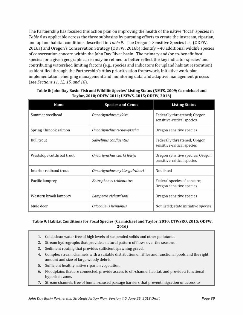
John Day Basin Partnership Strategic Action Plan, Version 4.0, June 25, 2018 Draft Page 39
The Partnership has focused this action plan on improving the health of the native “focal” species in
Table 8 as applicable across the three subbasins by pursuing efforts to create the instream, riparian,
and upland habitat conditions described in Table 9. The Oregon’s Sensitive Species List (ODFW,
2016a) and Oregon’s Conservation Strategy (ODFW, 2016b) identify ~40 additional wildlife species
of conservation concern within the John Day River basin. The primary and/or co-benefit focal
species for a given geographic area may be refined to better reflect the key indicator species’ and
contributing watershed limiting factors (e.g., species and indicators for upland habitat restoration)
as identified through the Partnership’s Atlas prioritization framework, Initiative work plan
implementation, emerging management and monitoring data, and adaptive management process
(see Sections 11, 12, 15, and 16).
Table 8: John Day Basin Fish and Wildlife Species’ Listing Status (NMFS, 2009; Carmichael and
Taylor, 2010; ODFW 2011; USFWS, 2015; ODFW, 2016)
Name Species and Genus Listing Status
Summer steelhead Oncorhynchus mykiss Federally threatened; Oregon
sensitive-critical species
Spring Chinook salmon Oncorhynchus tschawytscha Oregon sensitive species
Bull trout Salvelinus confluentus Federally threatened; Oregon
sensitive-critical species
Westslope cutthroat trout Oncorhynchus clarki lewisi Oregon sensitive species; Oregon
sensitive-critical species
Interior redband trout Oncorhynchus mykiss gairdneri Not listed
Pacific lamprey Entosphenus tridentatus Federal species of concern;
Oregon sensitive species
Western brook lamprey Lampetra richardsoni Oregon sensitive species
Mule deer Odocoileus hemionus Not listed; state initiative species
Table 9: Habitat Conditions for Focal Species (Carmichael and Taylor, 2010; CTWSRO, 2015; ODFW,
2016)
1. Cold, clean water free of high levels of suspended solids and other pollutants.
2. Stream hydrographs that provide a natural pattern of flows over the seasons.
3. Sediment routing that provides sufficient spawning gravel.
4. Complex stream channels with a suitable distribution of riffles and functional pools and the right
amount and size of large woody debris.
5. Sufficient healthy native riparian vegetation.
6. Floodplains that are connected, provide access to off-channel habitat, and provide a functional
hyporheic zone.
7. Stream channels free of human-caused passage barriers that prevent migration or access to

John Day Basin Partnership Strategic Action Plan, Version 4.0, June 25, 2018 Draft Page 40
thermal refugia.
8. Uplands with natural functions and processes, site appropriate native plant communities like
sage-steppe, aspen, and dry forest species, and human activities that enable healthy lowlands.
Description of the Partnership’s restoration approach is provided in Section 9. Identification of the
specific actions to restore these focal species and habitats are discussed in Sections 10-12.
9. Restoration Approach
The Partnership will use an integrated watershed approach to pursue long-term restoration of the John Day Basin. With the assistance of the Technical Workgroup, the Partnership has established ten (10) principles that will apply to the development and application of this action plan.
1. Integrate existing local plans and perspectives. Information from existing plans, strategies,
and assessments will be used as the foundation upon which the action plan will be built. The
plan will be created from the “bottom-up” starting with local plans and perspectives that will
be refined based on new quantitative research and analysis undertaken by the Partnership.
2. Landscape-scale basis. Watershed restoration will include actions at the ‘landscape-scale’ that
enhance, protect, and/or manage the health and resilience of native aquatic and terrestrial
habitats, foster productive working lands, and support diversified economic opportunities.
Planning will start broad at the large landscape-scale, and then will be systemically narrowed
to priority actions and geographies based local subbasin perspective and modeling.
Landscape scale refers to collaborative planning, financing, and management of projects with
significant ecological, economic, and social conservation value to achieve specific objectives
across interconnected landscapes (Forest Service, 2009; Palmer, 2006 and 2008). The
Partnership believes that the health of local ecosystems and communities are strongly
interrelated, so planning activities must the need and impact of actions on natural resources
and people. This regional view will be especially important to achieving and sustaining goals
as the John Day system likely becomes more spatially and temporally dynamic in the future
(Hobbs, 2014; Holling, 1973; Reeves, 1995).
3. Ridge-to-ridge scope. Actions will be undertaken across private and public lands from “ridge-
to-ridge,” including the streams, riparian areas, and uplands. Activities on the land and water
clearly impact each other in the John Day (e.g., Juniper is an example), so employing this scope
is essential.
4. Multi-spatial scale planning and restoration. The scale of restoration planning and
implementation must match the scale of the problem. For example, rebuilding anadromous
fish populations requires restoration of habitats spanning entire watersheds because the life
cycles of these fishes cover this expanse. This is a difficult principle to follow at times because
most restoration actions are at the reach to site scale (Beechie, 2010). Thus, our restoration
planning will be pursued across spatial scales. Outcomes were set at the basin scale; goals,
objectives, and actions will be set at the subbasin scale; actions and geographies prioritized at
the watershed scale; and projects selected for funding at the site scale.
5. Impact across temporal scales. The action plan will advocate quick fix projects that deliver
immediate results upon project completion and projects that take many years to restore

John Day Basin Partnership Strategic Action Plan, Version 4.0, June 25, 2018 Draft Page 41
natural processes to create a mosaic of projects that will under taken per this plan within the
next 25 years.
6. Restoration of natural processes. Restoration efforts will focus on the root cause of watershed
problems, rather than the symptoms. To accomplish this, this will necessitate addressing
limiting factors that are barriers to the return of critical natural processes (e.g., habitat
connectivity, sediment and hydrologic regimes, riparian functions) that allow watersheds to
continue to function in response to future changes (Beechie, 2010; Palmer, 2008; Reeves,
1995). Stated another way, the ultimate goal for an individual project may not be a return to
historical conditions—it may be returning sufficient long-term processes to support the focal
species.
7. Prioritization. Prioritized restoration has ecologically out-performed opportunistic
restoration (Lawrence, 2014). Recognizing that the placement of projects highly impacts their
success (“the right project at the right place”) and that restoration funding needs continue to
far outpace supply, we will compile and analyze existing data using a version of the
Bonneville Power Administration’s Atlas program modified by the Technical Working Group
to sense impacts on upland health (riparian areas, cropland, range, forest). Atlas is a dynamic
tool for identifying and prioritizing habitat restoration projects. Its premise is that restoration
funds should be prioritized based on biological benefit, and that restoration programs should
be able to demonstrate that the right work is implemented in the right place. Socioeconomic
factors, like landowner willingness and cost (bang for the buck), are also factored into the
analysis. The Partnership will use the modified Atlas to first prioritize where to pursue work
and second to choose what restoration/protection actions to pursue in prioritized
geographies to maximize progress toward the outcomes desired by the Partnership.
8. Best possible site conditions. Project sites will be assessed to determine the best possible, site-
capable conditions for the individual site. There is no advanced expectation that projects must
achieve “heritage” conditions on a given site.
9. Project scoring and ranking. The Partnership will use a transparent “decision support system”
to score and rank capital and non-capital projects for funding (Beechie, 2008; Cipollini, 2005;
Snake River Salmon Recovery Committee, 2004; Lewis, 1996). A decision support system uses
a simple score sheet in which important values for each project (e.g., location in a high priority
watershed, number of focal species benefited, amount of matching funds delivered, positive
socioeconomic impacts on community) are assigned weighted scores and the total score is
used to rank projects (Beechie, 2008). Section 14 further describes the project scoring and
ranking approach.
10. Monitoring and adaptive management. Individual techniques and projects will be monitored at
the appropriate spatial and temporal scale to assess effectiveness and guide adaptation.
Obtaining sufficient funds to design and implement sound monitoring protocols for practices
funded under this plan will be a priority. Short-term monitoring will be useful to adjust
practice, and monitoring of 10 years or more is often required to detect a response in the
watershed that informs revision of the broader action plan (Roni, 2002). See Section 15 and
Section 16 for details.

John Day Basin Partnership Strategic Action Plan, Version 4.0, June 25, 2018 Draft Page 42
10. Preliminary Goals, Objectives, and Actions
The three Subbasin Working Groups met in the fall-winter of 2016-2017 to develop a set of
interrelated ecological and socioeconomic goals, objectives, and actions to achieve the Partnership’s
basinwide long-term outcomes called out in Section 2. During the workgroup exercise, the following
definitions applied:
Goal: Broad, general statement that describes the desired impact of a project. A goal may
have many subordinate objectives.
Objective: Concise and time-specific statement of measurable planned results that represent
progress toward fulfillment of goals.
Action: The precise type of conservation activity, practice, or strategy that will be employed
to help meet a given objective.
Each group met over several meetings, starting with an open and broad process to collect ideas,
which were then qualified or narrowed to some degree based on whether (1) the Partnership can
impact achievement of the objective-action, (2) they are a priority in an existing plan, and (3)
landowners have been willing to pursue them in the past. Note that since this stage encouraged open
brainstorming, the distinction between the objective and the action or actions to help achieve the
objective can be murky. Section 12 further clarifies what is an objective and what is an action.
The full results are provided in Appendix D. Tables 10-12 below provide a summary of the “highest”
ranked results for each subbasin. Note that determining highest ranked was a challenge as nearly all
listed results could be important for an individual site. When reviewing the output from the
subbasin working groups and tables below the commonality across subbasins and the
interconnections from the stream to riparian to uplands and human communities are very evident.
Differences are similarly explainable based on the mix of geographic position in the basin,
private/public land, dominant crop/vegetation, experience with different actions, and other factors.
These preliminary aquatic habitat and upland habitat results were then refined based on the Atlas
prioritization process described in Section 11 to create the more discrete SMART goals, objectives,
and actions called out in Section 12. The healthy economies and communities’ results continue to
inform the Partnership’s Outreach Committee activities, Communication Plan development (Section
18), and sustainability discussions.
Table 10: Highest Ranked Objectives and Actions by Goal for the Lower John Day Subbasin
Goal 1: Healthy streams and riparian areas that benefit ecology and community.
Objectives Actions
1. Increase stream flows during critical times. 1. Create plan that balances in- and out-of-stream needs.
2. Manage Juniper and weeds.
3. Pursue irrigation efficiency.
2. Reduce stream temperature at critical times. 1. Install buffers for shade.
2. Increase flow via actions under Objective #1.
3. Protect important cold water habitat.
4. Manage grazing and plant recovery periods.

John Day Basin Partnership Strategic Action Plan, Version 4.0, June 25, 2018 Draft Page 43
Table 10: Highest Ranked Objectives and Actions by Goal for the Lower John Day Subbasin
3. Enhance fish passage/reduce entrapment. 1. Fix culverts.
2. Repair, replace, and move diversions that stop passage.
3. Install fish screens.
4. Fix head cuts.
4. Increase site-capable vegetation (or vegetation that meets the ecological site description)
1. Pursue native riparian plantings.
2. Manage weeds, non-natives, and Juniper.
3. Manage grazing periods and plant recovery.
5. Restore connection to floodplain. 1. Riparian plantings for wood recharge.
2. Management changes in floodplain.
3. Protect aquatic/riparian areas.
4. Install beaver dams.
Goal 2: Healthy uplands (Crop, Range and Forest Lands) that benefit ecology and community.
Objectives Actions
1. Increase site-capable vegetation (or vegetation that meets the ecological site description).
1. Pursue native riparian plantings.
2. Manage weeds, non-natives, and Juniper.
3. Remove merchantable weed/Juniper..
2. Improve soil retention. 1. Pursue annual grass control.
2. Manage Juniper.
3. Undertake critical area planting.
3. Improve soil health. 1. Pursue conservation tillage.
2. Install cover crops and residue management.
3. Avoid monoculture.
4. Reduce runoff into streams. 1. Install livestock fencing/off-stream water.
2. Manage grazing and plant recovery periods.
3. Install new buffers.
Goal 3: Healthy economy and community that support sustainable resource management and those that live, work, or visit the region.
Objectives Actions
1. More dependable flow for out-of-stream use. 1. Upland storage.
2. Juniper removal.
3. Irrigation efficiency. 4. Planning and study.
2. Increase communication about restoration progress and value
1. Outreach via existing events and avenues.
2. Use new storytellers.
3. Utilize social media.
3. Quantify the benefits and value of restoration. 1. Compile existing data and case studies.
2. Pursue new independent study focused on John Day.
4. More outreach about new production technologies and practices to improve profitability and sustainability.
1. Cast studies.
2. Workshops.
3. Peer-to-peer learning opportunities.

John Day Basin Partnership Strategic Action Plan, Version 4.0, June 25, 2018 Draft Page 44
Table 11: Highest Ranked Objectives and Actions by Goal for the
Upper John Day River and South Fork John Day Subbasin
Goal 1: Healthy streams and riparian areas that benefit ecology and community.
Objectives Actions
1. Increase stream flows during critical times. 1. Create plan that balances in- and out-of-stream needs.
2. Pursue irrigation efficiency.
3. Secure more water in-stream via transactions.
4. Reconnect floodplain.
2. Greater land protection 1. Pursue working lands easements.
3. Reduce stream temperature (water quality) at critical times.
1. Increase low via actions under Objective #1
2. Protect important cold water habitat.
3. Store water in-stream.
4. Manage grazing and plant recovery periods.
4. Stream channels with desired attributes (complexity).
1. Protect important cold water habitat.
2. Channel redesign with proper width-depth.
3. Reconnect floodplain.
4. Proper sediment regimes.
5. Enhance fish passage/reduce entrapment. 1. Remove/replace barriers.
2. Fix culverts.
3. Repair, replace, and move diversions that stop passage.
4. Install fish screens.
6. Increase site-capable vegetation (or vegetation that meets the ecological site description).
1. Install livestock fencing/off-stream water.
2. Pursue native riparian plantings.
3. Treat weeds, non-natives, and Juniper.
4. Enact grazing and vegetative management plans.
7. Improved fuel management 1. Pursue non-commercial thinning.
2. Install fuel breaks.
3. Prescribed fire.
4. Planned grazing of fine fuels.
Goal 2: Healthy uplands (Crop, Range and Forest Lands) that benefit ecology and community.
Objectives Actions
1. Increase site-capable vegetation (or vegetation that meets the ecological site description).
1. Pursue native riparian plantings.
2. Manage weeds, non-natives, and Juniper.
3. Manage to achieve natural stocking of trees.
2. Reduce runoff from uplands. 1. Restore wetland meadows to store water in ground.
2. Livestock fencing/off-stream water.
3. Fix incised/eroding channels.
4. Manage Juniper and weeds.
3. Improve soil loss. 1. Erosion and sediment control on access roads.
2. Pursue annual grass control.
3. Manage Juniper and weeds.
4. Plant native vegetation in critical areas.
Goal 3: Healthy economy and community that support sustainable resource management and those that live,

John Day Basin Partnership Strategic Action Plan, Version 4.0, June 25, 2018 Draft Page 45
Table 11: Highest Ranked Objectives and Actions by Goal for the
Upper John Day River and South Fork John Day Subbasin
work, or visit the region.
Objectives Actions
1. Maintain strong partnerships across the basin. 1. Continue to strengthen the Partnership.
2. Communicate the work of the Partnership and other collaborations to the public.
2. Increase communication about collaborative restoration progress and value
1. Develop plain language case studies.
2. Creatively engage existing, absentee, and new landowners, trade groups, and local thought-leaders.
3. Protect and respect tribal and rural community heritage.
1. Engage local leaders early in project development.
2. Target actions to important tribal trust species and first foods.
3. Pursue proactive, more efficient culture resource planning.
4. Quantify the benefits and value of restoration. 1. Compile existing data and case studies.
2. Pursue new independent study focused on John Day.
Table 12: Highest Ranked Objectives and Actions by Goal for the
North Fork and Middle Fork John Day Subbasin
Goal 1: Healthy streams and riparian areas that benefit ecology and community.
Objectives Actions
1. Improve natural flow regime to increase flows during critical periods for salmonids, hydrological connectivity and watershed resiliency.
1. Forest stand improvement to decrease interception of snowfall and increase infiltration.
2. Improve water storage including wetlands, wet meadow, and/or beaver restoration.
3. Improve irrigation efficiencies.
2. Restore and/or protect physical, geomorphic, and ecological processes.
1. Restore channel morphology.
2. Install instream structures, including beaver restoration.
3. Increased fish passage.
1. Identify and remove or replace physical barriers (culverts and barriers).
2. Improve instream flow and wter quality to reduce temperature barriers to fish passage.
4. Reduced water temperature, sediment, and nutrient pollution to improve overall water quality.
1. Protect, install, maintain vegetated banks, filter strips, and riparian plantings.
2. Increase groundwater storage, floodplain connectivity, etc.
3. Improve road condition and maintenance to reduce sediment input to stream, including road decommission and relocation.
5. Improve riparian corridor management and protection.
1. Develop and implement improved grazing management plans, including appropriate fence set-back.
2. Protect all riparian areas.
3. Adopt easements and install buffers.
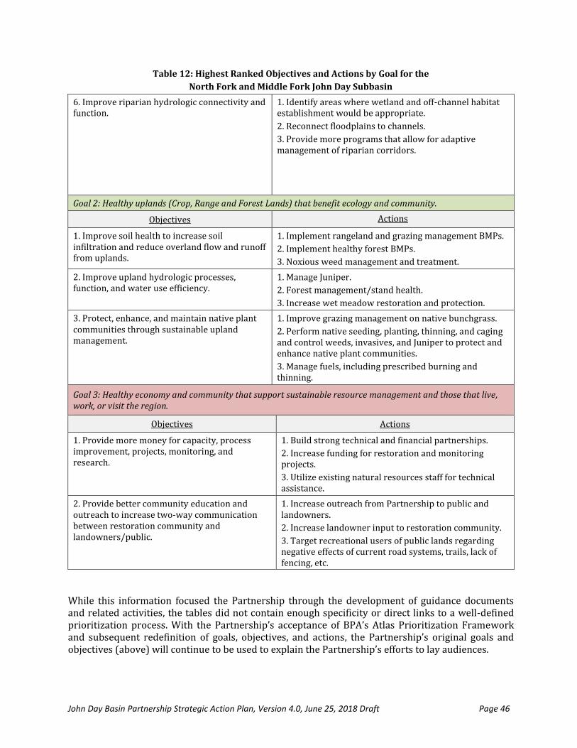
John Day Basin Partnership Strategic Action Plan, Version 4.0, June 25, 2018 Draft Page 46
Table 12: Highest Ranked Objectives and Actions by Goal for the
North Fork and Middle Fork John Day Subbasin
6. Improve riparian hydrologic connectivity and function.
1. Identify areas where wetland and off-channel habitat establishment would be appropriate.
2. Reconnect floodplains to channels.
3. Provide more programs that allow for adaptive management of riparian corridors.
Goal 2: Healthy uplands (Crop, Range and Forest Lands) that benefit ecology and community.
Objectives Actions
1. Improve soil health to increase soil infiltration and reduce overland flow and runoff from uplands.
1. Implement rangeland and grazing management BMPs.
2. Implement healthy forest BMPs.
3. Noxious weed management and treatment.
2. Improve upland hydrologic processes, function, and water use efficiency.
1. Manage Juniper.
2. Forest management/stand health.
3. Increase wet meadow restoration and protection.
3. Protect, enhance, and maintain native plant communities through sustainable upland management.
1. Improve grazing management on native bunchgrass.
2. Perform native seeding, planting, thinning, and caging and control weeds, invasives, and Juniper to protect and enhance native plant communities.
3. Manage fuels, including prescribed burning and thinning.
Goal 3: Healthy economy and community that support sustainable resource management and those that live, work, or visit the region.
Objectives Actions
1. Provide more money for capacity, process improvement, projects, monitoring, and research.
1. Build strong technical and financial partnerships.
2. Increase funding for restoration and monitoring projects.
3. Utilize existing natural resources staff for technical assistance.
2. Provide better community education and outreach to increase two-way communication between restoration community and landowners/public.
1. Increase outreach from Partnership to public and landowners.
2. Increase landowner input to restoration community.
3. Target recreational users of public lands regarding negative effects of current road systems, trails, lack of fencing, etc.
While this information focused the Partnership through the development of guidance documents and related activities, the tables did not contain enough specificity or direct links to a well-defined prioritization process. With the Partnership’s acceptance of BPA’s Atlas Prioritization Framework and subsequent redefinition of goals, objectives, and actions, the Partnership’s original goals and objectives (above) will continue to be used to explain the Partnership’s efforts to lay audiences.

John Day Basin Partnership Strategic Action Plan, Version 4.0, June 25, 2018 Draft Page 47
The Partnership’s goals and objectives were restated through the development of a prioritization process using the BPA’s Atlas framework beginning in 2017 (Section 11) in response to more detailed analysis of the Partnership’s three priority Aquatic Habitat Initiative subbasins. Given the Atlas framework’s degree of analysis, spatial specificity, and adaptability it will become the Partnership’s primary tool for guiding future aquatic and upland habitat restoration efforts in the John Day River Basin and as such goals, objectives and related actions and evaluation metrics will be defined under the document. These may be modified over time as the Atlas framework and resulting prioritization schedule is considered a living document and therefore responsive to new information and completed restoration actions.

John Day Basin Partnership Strategic Action Plan, September 15, 2017 Draft Page 48
11. Prioritization Process and Results
Prioritized restoration continues to ecologically out-perform opportunistic restoration (Lawrence,
2014). The Partnership chose BPA’s Atlas tool as their prioritization framework for determining
where and what actions to pursue to most cost-effectively provide the maximum biological benefit
for focal fish and terrestrial species and associated habitat. The Atlas tool built upon and refined the
preliminary subbasin objective and action-setting discussed in Section 10 to create the
prioritization maps in Appendix G and final SMART goals, objectives, and actions in Section 12.
Atlas is a collaborative, evidence-based, dynamic tool for identifying and prioritizing habitat
restoration projects. Its premise is that restoration funds should be prioritized based on biological
benefit, and that restoration programs should be able to demonstrate that the right work is
implemented in the right place (BPA, 2015; BPA 2018). Atlas is a comprehensive and rigorous
process that is traditionally a fish-focused tool. For the Partnership, it was carefully modified to
prioritize the placement and impact of actions across the landscape from ridge-to-ridge, including
uplands (croplands, range, forest, etc.). The Atlas strategic action framework will be actively
managed by local partners to
Atlas can help to answer the following types of questions (BPA, 2015):
What types of restoration actions are needed and where should they be implemented on the
landscape to address high priority limiting factors?
What is the group of stakeholders that will deliver the strategy?
Did the restoration make a difference based on evaluation?
Are there changes necessary to better meet goals and outcomes?
The Partnership’s Atlas tool was developed via a collaborative process between BPA, the
Partnership’s Technical Working Group, and other local experts over 7 meetings from the summer
2017 to the late winter of 2018. The basin was broken up into 15 sub-watersheds by combining the
43 ten-digit hydrologic units that share similar ecological characteristics. These areas became the
geographic boundaries for the Atlas analysis. Further, Fish and Upland Subgroups were formed to
identify how best to adapt Atlas for the desired ridge-to-ridge application. The following ten (10)
step-wise process was utilized to build the John Day Atlas:
1. Convening. Convened BPA, the Technical Working Group, and additional local experts with
knowledge of the best available data and on-the-ground information on the focal species
and habitat.
2. Data Compilation. Fish and Upland Subgroups with specific expertise in these areas were
assembled to offer empirical data and local knowledge on the presence or absence of
species and habitat. Cramer Fish Sciences was contracted to assemble and distribute all
John Day Basin GIS data to the partnership (stored on ArcGis Online; Cramer Fish Sciences,
2017; Appendix E).
3. Limiting Factors Assessment. The subgroups reviewed data for each species/habitat to
identify what factors are limiting growth and survival. Five activities were performed by
the technical working group.

John Day Basin Partnership Strategic Action Plan, September 15, 2017 Draft Page 49
a. Determine fish periodicity within each Subwatershed = the time, in months and
weeks, that each fish species (spring Chinook, summer steelhead, bull trout, Pacific
lamprey) and life stage (adult immigration, holding, spawning,
incubation/emergence, summer rearing, winter rearing, juvenile emigration) spend
in each Subwatershed. The areas with the greatest number of species and life stages
are considered core production areas (strong holds) from which to expand and
increase the distribution of the population.
b. Determine limiting life stage within each Subwatershed = how each fish species and
life stage currently utilizes the Subwatershed and the priority rating of the life
stage(s) that is (are) currently limiting the productivity, abundance, and distribution
of the population
c. Determine limiting habitat factors within each Subwatershed = identification and
ranking of the factors that currently limit the productivity, abundance, and
distribution of the species and life stages rated above.
d. Determine limiting habitat factors within each Subwatershed = identification and
ranking of the factors that currently limit the productivity, abundance, and
distribution of the species and life stages rated above.
e. Determine restoration actions within each Subwatershed = identification and
ranking of the restoration actions to best address the limiting factors and benefit the
life stages rated above.
4. Geographic Prioritization. Based on this assessment, sub-watersheds were prioritized for
action based on restoration potential. Six variables were assessed for each sub-watershed

John Day Basin Partnership Strategic Action Plan, September 15, 2017 Draft Page 50
(3 aquatic and 3 upland), using best available data, and then cumulative scores were
calculated for aquatic and upland restoration potential.
a. Determine geomorphic potential within each Subwatershed (aquatic) = ability to
physically affect change (implement the restoration actions prioritized within a
Subwatershed) within a given location based on a variety of physical factors,
including stream size, gradient, and lateral confinement.
b. Determine geomorphic potential within each Subwatershed (upland) = Ability to
physically affect change (implement the restoration actions prioritized) with a given
subwatershed based on a variety of physical factors, including soil productivity,
precipitation, elevation, aspect, and slope.
c. Determine current habitat condition within each Subwatershed (aquatic) = areas
with poor condition may require a large investment for little change, areas with
excellent condition may need protection instead of restoration actions, and areas in
the fair to good range may benefit the most from restoration actions.
d. Determine current habitat condition within each Subwatershed (upland) = Areas
with "Fair" and "Good" habitat ratings, based on the soil productivity, vegetation
composition, precipitation, and air temperature, provide the most opportunity for
improvement. Areas with "Poor" habitat ratings require significant investment for
minimal improvement, and areas with "Excellent" ratings provide little opportunity
for enhancement beyond the current condition.
e. Determine future habitat condition within each Subwatershed (aquatic) = areas that
are predicted to have limited or no flow and high water temperatures may not be
the most viable, long term restoration investment.
f. Determine future habitat condition within each Subwatershed (upland) = This
variable will be rated based on projected air temperature and precipitation
information.
g. Calculate cumulative score each Subwatershed = based on the priority ratings for
periodicity, limiting life stage, geomorphic potential, current habitat condition, and
future habitat condition mentioned above.
5. Action
Mapping. Specific
restoration actions
were identified and
mapped in these
prioritized areas
based on the
characteristics and
condition of the
landscape, land use
and ownership, and

John Day Basin Partnership Strategic Action Plan, September 15, 2017 Draft Page 51
restoration potential. The mapping activity focused on creating GIS polygon boundaries
called restoration opportunity areas. The restoration actions within the opportunity areas
are evaluated and scored based on the critical limiting factors addressed, natural process
restoration potential (e.g., Beechie et al., 2010), and climate change resiliency potential (e.g.,
Beechie et al., 2013). For the aquatic actions the polygons were restricted to the floodplain
and uplands actions out of the floodplain. The action mapping has been completed on three
of the fifteen Atlas watersheds (OWEB FIP Initiative Areas) for aquatic restoration actions
(see tables below and Section 12). The uplands action mapping has not begun at this point.
However, the uplands actions will be automated by a GIS analysis associated with each
upland restoration action. Please see Basin-wide Atlas completion schedule below. The end
products will be reviewed by each subbasin group and the technical working group. See
Appendix G for the current summary of Atlas actions.
6. Feasibility. The Partnership’s three Subbasin Working Groups considered the information
collected in the objective and action-setting described in Section 10 and other up-to-date
local perspectives to add feasibility factors, including landowner willingness, partner/local
expertise to implement, whether the action is a priority in an existing plan, and other social
issues (e.g., risk/uncertainty, compliance and permitting, design and construction costs).
This step is pending completion of the basinwide action mapping (see schedule below).
7. Project List. Based on evaluation of biological and social data, a list of potential projects
(geography+action) is created that provide the greatest biological benefit. Local partners
volunteer to be “opportunity leads” to coordinate and implement the high priority projects.
The basinwide project list is still a work in progress (see schedule below). However,
partners have already identified feasible restoration opportunities in the Aquatic Habitat
Initiative Areas action mapping and a preliminary project list is in development.
8. Evaluation Results. Project monitoring per Section 15 will provide feedback on the
effectiveness of the prioritization process and resulting projects in delivering cost-effective
progress toward Partnership goals and outcomes.
9. Adaptive Management. Since the Atlas is dynamic it can be updated as knowledge evolves
about species distribution and productivity in a particular area or when sufficient habitat
has been restored to provide biological benefit to a critical life stage. The goal is to ensure
the most beneficial projects are always on the list and queued for implementation.
Restoration decisions can be continuously informed by science and the needs of the focal
species to ensure the best investment of available funds.
10. Final Project Selection. The final step is to decide which projects to pursue from the list
based on number and value of project opportunities, need for specific actions based on
SMART goals in Section 12, and available funding.
To date, Atlas has been completed in seven Columbia Basin watersheds in Idaho and Oregon,
including the Catherine Creek watershed and the Upper Grande Ronde watersheds of northeast
Oregon (Roni et al., 2018). These efforts in the Upper Grande Ronde-Catherine Creek will inform
the Partnership’s implementation of the tool.
In sum, the objectives of Atlas include (BPA, 2015; BPA, 2018; Roni et al., 2018):
Increase collaboration between local restoration and research/monitoring practitioners.

John Day Basin Partnership Strategic Action Plan, September 15, 2017 Draft Page 52
Use of best available science (from existing plans, assessments, monitoring data) to inform
restoration at the local level.
Alignment of restoration priorities within a watershed.
Implement strategic habitat improvement actions to address high priority limiting factors.
Accountability and increase return on financial investments.
Potential to leverage additional investments.
Provide a systematic and transparent approach for future monitoring and adaptive
management.
Basin-wide Atlas development is in progress and scheduled for completion in late 2018/early 2019.
The proposed schedule for completion is:
John Day Basin-Wide Atlas
Development Schedule
Jul.
2018 Aug. Sept. Oct. Nov. Dec. Jan
2019 Feb. Mar.
Finalize Aquatic Habitat Initiative Areas
Project Identification (3 watersheds)
Aquatic Action Mapping (12 watersheds)
Upland Action Mapping (15 watersheds)
Finalize Feasibility Rankings (all
watersheds)
Finalize Project Lists (all watersheds)
Revise Aquatic Habitat Initiative Work
Plan, if needed
Develop Upland Habitat Initiative Work
Plan & Monitoring Framework
Atlas Results To-Date
Under the Atlas Framework the Partnership has thus far completed opportunity, restoration, and periodicity rankings for the three highest priority areas (Butte-Thirty Mile Creeks, Upper Middle Fork of the John Day River, and Upper North Fork of the John Day River). One area was chosen as a focus area for each of the Partnership’s subbasin work groups (see Section 10). The resulting list of restoration opportunities, actions, and aquatic species periodicity were reconciled with expected evaluation of success (Section 15) and the Partnership’s Adaptive Management process (Section 16) to produce listed goals and objectives (Table 10) and restoration actions tied to evaluation metrics (Tables 11.1 to 11.3) for the 2018 FIP application process. Given the FIP’s relatively short three biennium period and potential for realizing or ascertaining decreasing trends for in-stream water temperature and increasing trends for summer instream flow evaluation metrics specific to these objectives have not been identified. Rather they will be evaluated as part of individual restoration or monitoring efforts. Considering the potential number of potential restoration actions, high, medium, and low restoration priorities, and large number of evaluation metrics action evaluation metrics in Tables 11.1 – 11.3 were simplified to fit within existing or proposed monitoring protocols to most efficiently inform the Partnership’s Adaptive Management protocols.

John Day Basin Partnership Strategic Action Plan, September 15, 2017 Draft Page 53
Table 10. Goals and Objectives identified for the John Day Partnership’s 2018 Aquatic Habitat Initiative.
Priority Basin
Goal Objective
Butte-Thirty Mile Creeks
Increasing trend in summer steelhead
total freshwater productivity by 2025.
- Increasing trend in linear stream miles of juvenile steelhead summer rearing habitat by 2025.
- Decreasing trend in summer instream water temperature by 2025.
- Increasing trend in summer instream flow by 2025.
Upper Middle Fork of the John Day River
Increasing trend in summer steelhead
and spring Chinook total freshwater
productivity by 2025.
- Increasing trend in linear stream miles of juvenile summer steelhead and spring Chinook summer rearing habitat by 2025.
- Decreasing trend in summer instream water temperature by 2025.
- Increasing trend in summer instream flow by 2025.
Upper North Fork of the John Day
River
Increasing trend in summer steelhead
and spring Chinook total freshwater
productivity by 2025.
- Increasing trend in linear stream miles of juvenile summer steelhead and spring Chinook summer rearing habitat by 2025.
- Decreasing trend in summer instream water temperature by 2025.
- Increasing trend in summer instream flow by 2025.
Restoration actions (Table 11.1 – 11.3) for the three highest priority areas listed as high and medium priority were extracted from the Atlas Prioritization tool’s for display here. Low priority actions weren’t included as they can be incorporated into high or medium priority actions (i.e. restore banklines with LWD (low ranking) and large wood placement (high ranking) in the N. Fk. John Day River Basin) or the actions are independent of high or medium priorities and require 10 - 20 years, to improve population productivity, abundance, and distribution (i.e. channel modification in Butte-Thirtymile Creeks).
Table 11.1. Restoration actions and related evaluation metrics for the Butte-Thirtymile Creeks priority area.
Restoration Action Action Evaluation Metrics
Protect land & water (easement, acquisition)
increased juvenile habitat extent & quality Restore floodplain topography & vegetation
Beaver restoration management
Riparian fencing increased juvenile growth, survival, and production
Riparian buffer strip, planting
increased juvenile habitat extent & quality
Install off-stream water source
Thinning or removal of understory (juniper in riparian)
Barrier or culvert replacement/ removal
Road decommissioning or abandonment
Table 11.2. Restoration actions and related evaluation metrics for the North Fork John Day Headwaters
priority area.
Restoration Action Action Evaluation Metrics
Protect land & water (Easement, Acquisition)
increased juvenile habitat extent & quality
Channel Reconstruction
Restore floodplain connection & vegetation
Side/off-channel habitat restoration (including beaver restoration management)

John Day Basin Partnership Strategic Action Plan, September 15, 2017 Draft Page 54
Riparian restoration & management increased juvenile growth, survival, and production
Riparian buffer strip, planting
increased juvenile habitat extent & quality
Dam removal; barrier or culvert replacement/ removal; diversion screening
LWD placement
Acquire instream flow (lease, purchase)
Improve thermal refugia (e.g., spring reconnection, other)
Improve water management; irrigation system efficiency
Reduce point source impacts
Road decommissioning or abandonment; road grading/drainage improvements
Table 11.3. Restoration actions and related evaluation metrics for the Upper Middle Fork John Day priority area.
Restoration Action Action Evaluation Metrics
Protect land & water (easement, acquisition)
increased juvenile habitat extent & quality
Restore channel form; reconnect meanders
Remove, setback, breach levees
Restore floodplain topography & vegetation
Restore secondary (non-perennial) channel habitats
Beaver restoration management
Riparian fencing increased juvenile growth, survival, and production
Riparian buffer strip, planting
increased juvenile habitat extent & quality
Thinning or removal of understory (juniper in riparian)
Dam removal; barrier or culvert replacement/ removal; diversion screening
LWD placement
Acquire instream flow (lease, purchase)
Improve thermal refugia (e.g., spring reconnection, other)
Improve water management; irrigation system efficiency
Reduce point source impacts
Road decommissioning or abandonment; road grading/drainage improvements
Examples of how goals, objectives, and actions translate to evaluation metrics and an effective monitoring schedule are;
- Riparian Buffer Strip and Planting actions for Butte-Thirtymile Creeks priority area – Monitoring will occur to identify increases in juvenile salmonid habitat and quality through the use of site census on five year intervals using a SolMetric SunEye.
- The Dam Removal; Barrier or Culvert Replacement/Removal; Diversion Screening actions for the North Fork John Day Headwaters and Upper Middle Fork John Day Priority areas -

John Day Basin Partnership Strategic Action Plan, September 15, 2017 Draft Page 55
Monitoring will compare the spatial distributions of steelhead redds before and after an action is implemented.
The analysis, maps, project lists, and other results that form the output from the Partnership’s Atlas
are provided in Appendix G.

John Day Basin Partnership Strategic Action Plan, September 15, 2017 Draft Page 56
12. Aquatic and Upland SMART Goals, Objectives, and Actions
As described in previous sections of this plan, the Partnership leveraged existing recovery plans,
assessments, monitoring data, and BPA’s Atlas process to define SMART goals and objectives to
achieve the basinwide socio-ecological outcomes described in Section 2. Per OWEB’s Strategic
Action Plan Guidance (OWEB, 2015), “SMART goals and objectives are Specific, Measurable,
Achievable, Results-oriented, and Time-based”. The Partnership has two (2) core initiatives that it is
developing SMART goals objectives, and actions for:
o Aquatic Habitat for Native Fish; and
o Upland Habitat for Site-Capable Vegetation and Native Wildlife.
The Initiatives’ goal-objectives-actions represent “working benchmarks” and will be revised to
reflect new ecological and restoration effectiveness data generated through the Atlas Prioritization
Tool, Partnership’s Structured Restoration-Monitoring Implementation Framework, and
complementary tools and datasets (e.g., John Day summer steelhead life cycle model, Middle Fork
Intensively Monitored Watershed, Columbia River Habitat Monitoring Program, NRCS Regional
Conservation Partnership Program (RCPP) projects’ data, The Freshwater Trust’s Heat Source
modeling effort, basinwide beaver restoration assessment tool (BRAT), etc.).
A. Aquatic Habitat for Native Fish
As of June 2018, Atlas prioritization for native fish has been completed for the Partnership’s three
Aquatic Habitat Initiative areas (representing Phase 1 of SAP implementation): (1) Butte-Thirtymile
Creeks; (2) North Fork John Day Headwaters; and (3) Upper Middle Fork John Day. While all John
Day Basin native fish species are of conservation and cultural importance to the Partnership’s
members and basin stakeholders, Middle Columbia River summer Steelhead are the primary
Initiative indicator species with spring Chinook and redband trout as secondary indicator (co-
benefit) species of the Partnership’s conservation and monitoring actions (OWEB 2014). Specific
summer steelhead goals (i.e., population viability criteria; ESA-delisting and broad-sense recovery
goals), objectives, and actions are outlined in Oregon’s Middle Columbia Steelhead Conservation and
Recovery Plan (NMFS, 2009; Carmichael and Taylor, 2010; ODFW, 2012). The following outcomes,
goals, objectives, and actions are consistent with the high priorities specified in the Mid-C steelhead
recovery plan, and reflect monitoring evidence (Bare et al. 2017; McHugh et al. 2017; MFIMW 2017)
and technical input during the Atlas process on the current status of restoration gaps. Atlas aquatic
habitat prioritization is in development for the remainder of the John Day basin (i.e., the watersheds
outside the Initiative Areas) and is scheduled for completion in December 2018.
OUTCOME 1: Long-term trend of increasing fish populations per local, state, federal, and
tribal plans by 2040.
SMART GOAL 1.1: Increasing trend in total freshwater productivity of summer steelhead
(indicator species) and spring Chinook (co-benefit species; where applicable) in the Initiative
areas (Butte-Thirtymile Creeks, North Fork John Day Headwaters, and Upper Middle Fork
John Day) by 2025.
Monitoring evidence strongly indicates that high stream temperatures and low instream flow
conditions are the primary factors limiting rearing habitat availability and freshwater productivity
of John Day River summer steelhead and spring Chinook populations (Bare et al. 2017; MFIMW

John Day Basin Partnership Strategic Action Plan, September 15, 2017 Draft Page 57
Working Group 2017). Consequently, the highest priority for summer steelhead and spring Chinook
viability within the John Day River Basin (HUC 170702) is measurably improving juvenile summer
rearing habitat – i.e., instream temperature and flow – through conservation actions and long-term
monitoring actions which promote adaptive management and salmonid resilience to climate change
(Carmichael and Taylor 2010; Beechie et al. 2013; NMFS 2016; McHugh et al. 2017). Per the
recovery plan and supported by recent research and monitoring results, the conservation actions
that are most likely to improve instream temperature, natural flow regimes, and extent of juvenile
rearing habitat for Mid-C steelhead and Initiative co-benefit species include, but are not limited to:
– Restoring floodplain connectivity and channel hydrology via beaver dam analog installation
(Carmichael and Taylor 2010; Bowes et al. 2016; MFIMW Working Group 2017);
– Protecting and increasing riparian vegetation development and shading (Carmichael and
Taylor 2010; Justice et al. 2017; see Figure 5 in MacFarlane et al. (2017) for riparian
departure indices for the John Day Basin; McHugh et al. 2017; MFIMW Working Group
2017); and
– Targeting cold-water input sources for protection and habitat improvements, and coupling
instream (e.g., large wood addition) and riparian conservation actions to maximize the
ecological effectiveness (MFIMW Working Group 2017) of conservation actions.
SMART objectives, actions, and metrics specific to aquatic habitat for native fish will increase trends
in total freshwater productivity and benefit summer steelhead trout and spring Chinook salmon
through a comprehensive and coordinated approach to restoration by increasing the linear extent of
juvenile rearing habitat (Objective 1A1, Table 19). Through the protection of existing quality
habitats and implemented actions, improvement or reestablishment of physical and biological
process upon which heathy ecosystems are based, and improving instream flows during sensitive
periods, the Partnership’s cumulative efforts, as identified by monitoring and data analysis, will
reflect expectations for Objective 1B1 as identified in Table 19. Over time the longer term effects of
the Partnership’s actions are expected to reduce summer water temperatures within the three
highest priority basins Table 20.
Table19. Objective 1A1: Coordinate with willing landowners to establish an increasing trend in the
linear extent (e.g., linear stream miles) of juvenile summer steelhead and spring Chinook (where
applicable) rearing habitat in the Initiative areas (Butte-Thirtymile Creeks, North Fork John Day
Headwaters, and Upper Middle Fork John Day) by 2025.
ACTIONS1
N.B. The metrics presented here will be updated through future iterations of the Atlas prioritization & FIP Initiative implementation processes.
Butte-
Thirtymile
Creeks
Action
Metrics2
North Fork
John Day
Headwaters
Action
Metrics2
Upper
Middle
Fork John
Day
Action
Metrics2
Action
Evaluation
Metrics
BACI
Effectiveness
Monitoring3
Action 1A1: Protect land and water (i.e., ecological processes and high quality habitats) by 2025.
H: (1) water, (2) land, (3)
land
H: (1) water, (2) land, (3)
land
H: (1) water, (2) land, (3)
land
increased juvenile habitat
extent & quality
sub/population productivity monitoring
Action 1A2: Reconnect floodplain topography, vegetation, and function (lateral connectivity) by 2025.
M –see 4th cell
H: (1) 2 miles, (2) 7 miles, (3) 6
H: (1) 2 miles, (2) 7 miles, (3) 6
increased juvenile habitat
sub/population productivity monitoring

John Day Basin Partnership Strategic Action Plan, September 15, 2017 Draft Page 58
miles miles extent & quality
Action 1A3: Increase riparian plant communities through fencing, planting, installing off-channel water, and/or invasive species control by 2025.
H: (1) 2 miles, 10 dev; (2) 5 miles, 15 dev; (3) 5
miles, 5 dev
H: (1) 5 miles, (2) 5 miles, (3) 5
miles
H: (1) 2 miles, (2) 5 miles, (3) 5
miles
increased juvenile habitat
extent & quality;
increased juvenile growth,
survival & production
SolMetric SunEye census
surveys at 5 year intervals;
sub/population productivity monitoring
Action 1A4: Improve channel connectivity and complexity through beaver restoration management and large wood placement (vertical connectivity) by 2025.
H: (1) 2 miles, (2) 7 miles, (3) 6
miles
M-H: (1) 2 miles, 18
structures; (2) 5 miles, 9
structures; (3) 5 miles, 9
structures
H: (1) 2 miles; 18
structures; (2) 7 miles;
9 structures; (3) 6 miles; 9 structures
increased juvenile habitat
extent & quality
sub/population productivity monitoring
Action 1A5: Increase physical connectivity to high quality habitats by removing/replacing fish passage barriers (longitudinal connectivity) by 2025
H: (1) 1 barrier, (2) 2 barriers,
(3) 1 barrier
M-H: (1) 1 barrier, (2) 2 barriers, (3)
2 barriers
H: (1) 1 barrier, (2) 2 barriers,
(3) 2 barriers
increased juvenile habitat
extent & quality
Compare spatial
distribution of steelhead
redds pre/post action
Action 1A6: Increase water quantity and quality by leasing or purchasing instream flow by 2025
H: see 1st cell
H: see 1st cell H: see 1st
cell
increased juvenile habitat
extent & quality
sub/population productivity monitoring
1- The actions in this table are identified as high priorities actions in the Mid-C steelhead recovery plan and Atlas prioritization process for
the three Initiative areas. As identified in the recovery plan and Atlas process, additional actions may be applicable for a given priority
area and/or specific project site to improve habitat quantity and quality for summer steelhead and spring Chinook. Refer to Section 11
of this Plan, Appendix G (Atlas Results), and the Implementation FIP Work Plan (OWEB grant application for the complete list of high
and medium priority actions, and associated Mid-C steelhead recovery plan actions and monitoring approach.
2- Action Priority H- High, M- Medium; Biennium (1), (2), (3); Water/Land refers to conservation easements; Miles = linear stream miles;
Dev = water developments; Structures = large wood structures
3- BACI = Before-After-Control-Impact monitoring design; See the June 2018 JDBP OWEB Implementation Grant for a detailed summary of
the Structured Restoration-Monitoring Implementation Framework hypotheses and methods and Section 11-Prioritization, Section15-
Evaluating Success and Section 16-Adaptive Management for an overview of the iterative, evaluation and adaptation process.
Table 20. Long-term Quantitative Maximum Summer Water Temperature Metrics to Improve Summer Steelhead and Spring Chinook Freshwater Productivity and Population Viability in the John Day River Basin Butte-Thirtymile Creeks North Fork John Day
Headwaters Upper Middle Fork John
Day South Fork and Upper
Mainstem John Day Reduce maximum daily
summer stream temperature (°C) at long-term temperature logger locations by 7% by 2040.
Reduce maximum daily summer stream temperature (°C) at the mouth of Desolation Creek 5%
by 2040.
Reduce maximum daily summer stream temperature (°C) 7% by
2040 at the Dog Creek USGS Gauge (UMJD) and OWRD Gauge at rkm 10 on SFJD.
B. Upland Habitat for Site-Capable Vegetative Communities and Native Wildlife (in
development)
The Partnership’s three Subbasin Work Groups and Technical Work Group identified upland habitat
restoration as a priority restoration need throughout the John Day Basin. Preliminary high priority
upland goals, objectives, and actions identified by the subbasin workgroups are summarized in

John Day Basin Partnership Strategic Action Plan, September 15, 2017 Draft Page 59
Appendix D. The Technical Work Group is currently developing the basin-wide upland habitat
SMART goals, objectives, and actions through the Atlas prioritization process. Atlas prioritization for
upland habitat, including scoping and mapping of restoration actions, is scheduled for completion by
December 2018 (see Atlas development schedule in Section 10). Once the Atlas process is
completed, an Uplands Habitat Initiative Work Plan and Monitoring Framework can be developed
and integrated with the Aquatic Habitat Initiative Work Plan and Monitoring Framework.
C. Stakeholder Outreach
Stakeholder outreach for healthy economies, communities, and sustainable natural resources is also
a high priority for evaluating success and achieving the Partnership’s socio-economic goals. This
priority is described further in Section 13 – Fundraising, Costs, and Value; Section 15 – Evaluating
Success; and Section; and Section 18 – Communication Plan.

John Day Basin Partnership Strategic Action Plan, September 15, 2017 Draft Page 60
13. Fundraising, Costs, and Value
The biggest threat to the successful restoration of the John Day basin is not a lack of viable solutions
or willingness to act; it is a lack of funding. Currently around $2 million per year comes to the basin
for watershed restoration work. The Bonneville Power Administration, Natural Resource
Conservation Service, Forest Service, Oregon Dept of Fish & Wildlife, and Oregon Watershed
Enhancement Board have been vital supporters. With these funds, excellent progress has been
made over the last 20 years increasing in-stream water quality, restoring critical fish and wildlife
habitat, and improving the health and sustainability of farms, ranches, and forests. However,
substantially more funding, especially private funds to leverage existing public sources, will be
needed to fully achieve the vision and desired outcome of this action plan. The Partnership
estimates that existing annual funding must roughly double to $4 million to the meet current
demand.
Additionally, the return on investment of these restoration funds is without question significant
based on studies in other basins, yet is largely unquantified in the John Day. Knowing the value of
the work conducted is vital to achieving the economic and community goals of this plan, specifically
the desire to build local understanding of restoration progress and its value to the community.
Restoration helps avert costs to address polluted drinking water, flooding, crumbling stream
corridors, fire, and failing agricultural operations. On revenue side, actions can increase economic
output from agriculture, property value, recreation and tourism, restoration-based businesses, and
delivery of non-market ecosystem goods and services. All told, recent studies show that
investments in watershed conservation pay out $2-$27 for every $1 invested depending on the
activity.
An estimate of funding needs, basic fundraising strategy, and a projected return on investment for
full implementation of this action plan is provided below.
A. Funding Needs
The Technical Working Group reviewed current literature, considered existing methods and tools,
and enlisted the assistance of to develop the estimated costs to achieve the SMART goals, objectives,
actions presented in Section 12. Regional conservation professionals and economists were
consulted to develop estimated capital project costs. Non-capital costs (staff capacity, outreach,
monitoring, etc.) required to deliver high quality projects are also included. Note that these costs
are estimates that Partnership expects to refine as specific actions and projects are pursued under
this action plan. Detailed cost analysis is provided under Appendix H.
B. Fundraising Strategy
Once the action plan is in place, a primary function of the Partnership will be fundraising,
prioritizing projects for funding, and distributing those funds to execute the plan. Large landscape
restoration academia and funders are increasingly calling for restoration practitioners to undertake
a more holistic and integrated approach to ensure work is carried out as efficiently and cost-
effectively as possible (Palmer, 2006; OWEB, 2015). Thus, the Partnership will leverage cumulative
partner competencies and pursue joint fundraising around a single plan. Raised funds will be used
for:

John Day Basin Partnership Strategic Action Plan, September 15, 2017 Draft Page 61
o Capacity: Partners work in support of the Partnership,
o Consultants: Hire outside consultants to offer facilitation or technical assistance,
o Project Implementation: Project installation and maintenance,
o Project Follow-up: Data collection and analysis, adaptation, and outreach.
Effort will be made to ensure that as much funding as possible is dedicated to capital project
implementation. All Partnership-focused fundraising will be carefully coordinated to ensure it is net
additive, that is, it does not pull existing funding from partner organizations.
The fundraising strategy the Partnership will pursue involves the following seven steps:
1. Research viable government, foundation, and individual donor funding opportunities to
develop and maintain a current and diversified list of potential funding sources.
2. Any partner may notify the Steering Committee of a potential grant opportunity.
3. The Steering Committee will approve the proposal and form an ad hoc Proposal Committee
if it is determined that the opportunity is consistent with the Partnership’s guiding
principles and strategic action plan. Proposal Committees are discussed in Subsection 5c.
Note that proposals submitted by Subbasin Working Groups not under the name of the
Partnership and proposals submitted by individual partners do not require Steering
Committee approval.
4. Once approved, the Proposal Committee will designate a fiscal agent and main contact (they
may be the same person).
5. The Proposal Committee will next draft a proposal package using the templates provided in
the Partnerships Operations Manual.
6. The full Partnership will be given an opportunity to review and comment upon the draft
submittal. A minimum of five (5) business days shall be provided for Partnership review.
7. The fiscal agent and/or main contact will collect any necessary signatures, letters of
support, and finalize the proposal package.
8. As appropriate and possible, effort will be made to obtain formal support from local elected
officials for all proposals.
9. The proposal will be submitted by the fiscal agent and/or main contact.
The Partnership may develop a more detailed fundraising strategy in the future.
C. Value of Plan Implementation
The Technical Working Group reviewed current literature, considered existing methods and tools,
and enlisted the assistance of experts with the Natural Resource Conservation Service, and Oregon
State University to develop the project return on investment of full implementation of this action
plan. Regional conservation professionals, scientists, and a NRCS economist.] were used to create
these numbers. Note that this estimated return is an estimate that the Partnership expects to refine
as specific actions and projects are pursued under this action plan. The detailed cost analysis is
provided under Appendix H.

John Day Basin Partnership Strategic Action Plan, September 15, 2017 Draft Page 62
14. Project Review, Scoring, and Ranking
One of the most important tasks of any Partnership is the distribution of jointly raised funds. There
must be a transparent, consistent, and fair process to preclude competition amongst partners and
retain belief in the shared value of the Partnership. The Partnership will use what’s called a
“decision support system” to score and prioritize capital and non-capital projects for funding
(Beechie, 2008).
A. Capital Projects.
Capital projects will involve design and installation of on-the-ground conservation practice. The following seven step project evaluation, scoring, and ranking process will be utilized for capital projects:
1. RFP. The fiscal agent and the Funding Advisory Committee will lead development of an RFP to distribute funding raised by the Partnership. The RFP for capital projects will request information that includes the project name, partners, location, historical or heritage information that provides project context, specific problem and associated restoration goals/objectives, restoration actions and design to be used, proposed outcomes and metrics, monitoring approach, landowner involvement, stakeholder support, schedule, budget and match, risks, and all required attachments (e.g., maps, photos). An example RFP for capital projects may be developed and attached to this manual at a later date.
2. Project Initial Screening. The proposal recipient listed in the RFP will forward the proposal to the Funding Evaluation Committee formed for this specific opportunity who will then review the proposals and confirm that the project meets the three pre-conditions below.
a. It is consistent with an established goal, objective, or action identified for the subbasin in which it is located and the specific funding opportunity,
b. Does the project address the root cause of the problem or is treating a symptom or symptoms sufficiently effectively in advancing progress toward Partnership goals, and
c. The owner and/or manager of the land where the project will take place have provided appropriate written documentation that they support the project.
Projects that do not meet these pre-conditions will not be further considered.
3. Initial Review. Projects that meet the minimum criteria will be reviewed for responsiveness to the RFP and technical soundness. The project will be specifically checked to ensure appropriate action sequencing is undertaken. Written feedback will be developed by the Funding Evaluation Committee for each proposal. Note that partners may not participate in the evaluation of their own project.
4. Applicant Response to Evaluation and Re-Submittal. Initial proposals deemed inadequate may respond to feedback from the Funding Evaluation Committee and resubmit a revised proposal. A site visit or discussion with the Funding Evaluation Committee can be requested by the applicant at this time. Note that a project must pass initial screening and be deemed complete and technically sound before it will be scored. The premise is to ensure project intent, landowner involvement, and technical merits are sound before a project undergoes scoring.

John Day Basin Partnership Strategic Action Plan, September 15, 2017 Draft Page 63
5. Project Scoring and Ranking. Funding Evaluation Committee members will score and rank qualifying project proposals using the Partnership Capital Project Scoring Form provided as Attachment H. Projects will be scored using the criteria and weighting described in Table 16. Applicants cannot score their own projects. The Funding Evaluation Committee will use scores to rank the projects in numerical order from 1 (top choice) to however many projects were evaluated. Note that some criteria in Table 15 and the attached form may not apply to certain projects. The Partnership may revise the criteria and corresponding form (or develop completely new criteria and forms) as necessary for each funding opportunity (e.g., to align scoring criteria with funding entity review and/or deliverables requirements). Partners will approve any revised criteria or forms by a majority vote.
Table 16: Weighted Average Capital Project Scoring Approach
Criteria Criteria Type Description Weight
Location in a high priority watershed identified in the strategic plan.
Yes or No The project will take place within one or more of the prioritized 5th level HUCs.
20 pts
Number of listed and/or focal
species enhanced and/or amount of landscape enhanced, created, or managed for such species.
Number Total number of species with life history use enhanced and/or measurable habitat quantity/quality.
20 pts
Matching funds. Number
Amount of additional funding the project bring into the basin for the project; a measure of project readiness, partner diversity, and support.
15 pts
Socioeconomic impact. Number and
judgment
Numbers: Dollars paid to in-basin
contractors, jobs currently supported by the lands being treated, acres permanently protected, acres of tribal trust lands impacted, and/or basin citizens reached.
Judgment: Estimate of short and long-term economic, social, cultural, aesthetic, and non-market impacts of the project..
15 pts
Certainty of success. Yes or No
The project employs a proven
technique instead of an untried technique without established design and performance standards.
10 pts
Plans and dedicated funding in place for project maintenance, monitoring, and adaptation.
Yes or No Documentation is present that plans and funding are in place for long-term project oversight.
10 pts
Qualifies as “exceptional” project.
Judgment
Project offers exceptional risk
mitigation and/or resilience improvement or protection for high quality habitat based on the judgment of the reviewer.
10 pts

John Day Basin Partnership Strategic Action Plan, September 15, 2017 Draft Page 64
6. Final Project Selection. The Steering Committee will work down the list until available funding is exhausted. If there is a tie at the end of allocated funding the final decision will be made by a majority vote of the Steering Committee. Note that applicants whose project was not funded will have the option to have their project scored in the next funding opportunity without repeating steps 1-4 (unless the project changes or the funding opportunity requires it).
7. Funds Distribution. Partners whose projects were selected will work directly with the fiscal agent to establish a formal contract with the Partnership that lays out the terms of funding.
B. Non-Capital Projects.
The process used to solicit and evaluate non-capital projects that support partner capacity, data collection or analysis, research, monitoring, or public outreach will generally follow the same approach used for capital projects. Different procedures include: (1) instead of landowner willingness, project pre-screening will confirm the applicant is a formal partner and (2) all non-capital projects will be scored based on the separate set of criteria described in Table 17.
Note that based on the variety of non-capital project types, some criteria in Table 17 and the attached form may not apply to certain projects. The Steering Committee may revise the criteria and corresponding form (or develop completely new criteria and forms) as necessary for each funding opportunity. Partners will approve any revised criteria or forms for an individual funding opportunity by a majority vote.
Table 17: Weighted Average Non-Capital Project Scoring Approach
Criteria Criteria Type Description Weight
Proposal completeness Yes/No Proposals not containing the mandatory information identified in the RFP will be rejected.
n/a
Proposal suitability Judgment
Quality and clarity of the approach that will be used to meet the project duties, deliverables, and timeline.
50 pts
Demonstrated experience and success Judgment Staff expertise, qualifications, and past performance as they apply to the scope of work requested.
50 pts
Commitment to partnership Number
Judgment
Attendance for the entirety of Partnership meetings, including working group meetings, and/or commitment of cash or in-kind matching funds.
25 pts
Cost and value Number
Judgment
Salary, expenses, and value compared to other proposals and standard market rates.
25 pts

John Day Basin Partnership Strategic Action Plan, September 15, 2017 Draft Page 65
15. Evaluating Success
The Partnership will use the help of regional experts, the Strategic Action Plan and the science-
driven ATLAS tool to select projects and guide our path towards conservation success. The
Partnership’s members will implement projects to achieve our Basinwide Goals and Outcomes
(Section 2), and our SMART Goals, Objectives, and Actions (Section 12). These outreach, capacity-
building, and conservation efforts will be assessed at the project and watershed scale.
To evaluate success, the Partnership will use the adaptive management approach outlined in
Section 16. This approach, and the recently created John Day ATLAS tool, lean on decades of
learnings from restoration, monitoring and research in the John Day Basin and beyond. The
Partnership will use existing data, professional judgment, and monitoring to establish baseline
conditions to judge progress towards basin-wide and sub-basin conservation targets. Appropriate
milestones will be set to allow for an assessment of progress at our annual Partnership meeting.
Yearly changes in Partnership operation and plan implementation will be undertaken based on
compliance with milestones and any ancillary considerations, with a reevaluation of the Strategic
Action Plan every five years. Baselines and milestones are provided in Table 18.
Capital and non-capital projects funded by the Partnership will be required to set project metrics,
pursue monitoring at the project-level, and adapt as needed during the term of funding. Monitoring
will not need to be overly complicated, but it must provide enough sound information that allows
for determining if goals are being met (CTWSRO, 2015). The Partnership will systematically assess
a sample of projects determined at the time of funding award to gauge effectiveness. In most cases,
monitoring will be performed over the longest time frame possible to ensure enough data is
collected to capture variability and form actionable conclusions.
Both the evaluation of success and the effective communication of the findings will continue to be a
core piece of Partnership operation. For example, the recent report provided by the project leaders
of the Middle Fork Intensively Monitored Watershed (MFIMW) shared their findings from a ten
year look at the Middle Fork system. To share this information with regional partners, the
document’s authors provided a presentation and Q & A session with the Partnership and a lessons-
learned summary report. This report is an example of partners working together to evaluate
conservation success on both a project and watershed scale. The partners have a keen interest in
learning from the past to inform the future. Communication is key to this process and the
Partnership’s ability to convene and provide a forum to share project learnings and planning,
makes the process of evaluating success and adapting for the future, an integral part of the
Partnership’s process.

John Day Basin Partnership Strategic Action Plan, September 15, 2017 Draft Page 66
Table 18: Baselines and Milestones
SMART Goal Baseline Monitoring Effectiveness Monitoring
Action 1A1 – Protect land and
water
Documentation of actions in
AGOL platform database.
Update AGOL database
annually to track addition or
loss of land and water
protection actions.
Action 1A2 – Reconnect
floodplain topography,
vegetation, and function
Existing channel topography
data in champmonitoring.org.
Replicate topography surveys
and extend onto the floodplain.
Use shallow groundwater wells
to monitor lateral hydraulic
connectivity.
Action 1A3 – Increase riparian
plant communities through
fencing, planting, installing off-
channel water, and/or invasive
species control
Existing habitat survey data in
champmonitoring.org, and
other project specific
monitoring.
SolMetric SunEye census of
riparian shading in project
areas at 5-year intervals.
Action 1A4 – Improve channel
connectivity and complexity
through beaver restoration
management and large wood
placement
Existing channel topography
data in champmonitoring.org,
and AQI survey database
provide baseline.
Replicate topography and AQI
surveys in treated areas at 5
year intervals.
Action 1A5 – Increase physical
connectivity to high quality
habitats by
removing/replacing fish
barriers
Steelhead and Chinook redd
distribution GIS layer provides
baseline adult distribution.
Juvenile Chinook and Steelhead
distribution also available.
Use repeat surveys post-
project at yearly intervals to
check for adult or juvenile
range expansion following
barrier removals.
Action 1A6 – Increase water
quantity and quality by leasing
or purchasing instream flow
USGS discharge gauges in MFJD
and NFJD, level loggers in
Thirtymile Creek.
Temperature data stored in
NorWest and MFIMW database.
Continue to support yearly
USGS and local discharge
monitoring. Continue yearly
temperature logger operation
at long-term monitoring sites.

John Day Basin Partnership Strategic Action Plan, September 15, 2017 Draft Page 67
16. Adaptive Management
Adaptive management is widely recognized as absolutely essential to the long-term success of any
natural resource and community revitalization effort. Adaptive management can be defined as the
iterative, systematic acquisition and assessment of information to inform management decisions
over time. The large and complex ecosystems addressed in this plan are dynamic in both space and
time, so corresponding adaptation of strategies will be essential (Reeves, 1995). Further, adaptive
management will be especially critical looking into the future as managers respond to the uncertain
impacts of climate change on our cold water focal species and systems (Green et al, 2015, Lawler et
al, 2009; Seavy et al, 2009.). An illustration of a standard adaptive management process is provided
as Figure 8.
Figure 8: Adaptive Management Process (CTWSRO, 2015)
To facilitate adaptive management, the Partnership will proceed under the operational premise
that restoration actions represent our best current working hypotheses about how we can
influence the parameters of interest (e.g., cool water rearing habitat, upland mule deer habitat). We
are using Bonneville Power’s ‘Atlas’ as a tool to form and prioritize our initial restoration
hypotheses. The Atlas process is a multi-criteria decision analysis used to prioritize projects with
existing data. The Partnership will collect a standardized set of metrics for each restoration
hypothesis (refer to the example of the data capture template in the 2018 OWEB Implementation
FIP application), which will allow quantitative evaluation of the progress through a results chain
approach. A results chain evaluates completion of objectives on short time scales (several years in

John Day Basin Partnership Strategic Action Plan, September 15, 2017 Draft Page 68
this case), en route to achievement of long-term conservation targets (referred to as “Goals” in the
FIP application) (CMP, 2013; Margoluis et al., 2013).
To ensure sufficient time and resources for conducting results chain analyses, ODFW has proposed
a structured implementation and monitoring schedule to add a temporal component and “check-
in’s” to the Partnership’s work. Under a structured implementation plan, implementation in, for
instance, the Middle Fork action area would be very intense during 2019-2021. During and
following implementation, monitoring would continue with high intensity until 2024 (ODFW will
monitor fish-in and fish-out, as well as juvenile and habitat metrics). The following year (2025)
would see reduced monitoring effort to dedicate staff time for analysis and results chain evaluation.
During the “learning” years, the Partnership can test the short term objectives in each results chain,
such as stream temperature, physical habitat, and juvenile fish survival. These periodic “learning”
years are essential in this plan to ensure the time necessary for thorough feedback and course
corrections to management actions on the way to our long-range goal of harvestable salmonid
populations by 2040.
The Partnership itself represents a form of “adaptive governance” that supports the integration of
diverse stakeholders for collaborative environmental management that incorporates adaptive
management within the management system (Figure 8; Chaffin et al., 2014). Progress towards
biological objectives (shorter term targets measured to track progress toward the goal or
conservation target), partner input, and/or outside peer review will be used to assess whether this
action plan is truly driving progress toward our goals. The Steering Committee will lead the process
for the action plan, while partners implementing individual projects will be responsible for project
adjustments. This evaluation will help the Partnership and project leads determine if adjustments
are necessary to assure better performance.
The action plan will be refined periodically based on performance and new scientific data, technologies, policies, laws, and other realities. This action plan will be reviewed annually and considered for a full update every five (5) years.
17. Sustainability
Lasting recovery of the closely linked native fisheries, habitat, and local economies in the John Day
Basin will take generations. The life span of this action plan as designed in 2018 is intended to be
about 25 years with sufficient updates. The outcomes this action plan are intended to be achieved
within the roughly next 10 to 25 years. Sustaining Partnership unity and restoration momentum
over these time periods will be challenges that must be planned for and handled proactively from
the beginning. Here are seven (7) steps that should be taken to maintain a strong Partnership and
consistent progress over time:
1. Develop a strong, self-directed Partnership with a solid governance structure, identity, and
base of local ownership that does not rely upon specific individuals or an outside parties to
maintain momentum,
2. Maintain wide open communication within the Partnership to avoid misunderstandings and
conflicts that fracture relationships and stymie progress,
3. Create ambitious, yet realistic outcomes, goals, objectives, and actions,

John Day Basin Partnership Strategic Action Plan, September 15, 2017 Draft Page 69
4. Foster relationships with funding bodies that understand the importance of local leaders
and organizational capacity in complex restoration efforts,
5. Maintain diverse funding sources that include public and private sources,
6. Obtain at least one significant (6-figure) long-term (5-10 years) source of funding for
Partnership capacity and project implementation.
7. Commit to long-term monitoring and adaptive management to ensure the Partnership and
its action plan are truly delivering on promised outcomes through the approximately 25-
year life of the plan.

John Day Basin Partnership Strategic Action Plan, September 15, 2017 Draft Page 70
18. Communication Plan
1. Introduction
The communication plan is an iterative process providing a framework of communication within the Partnership, both internally and externally, outlined and guided by the Partnership structure and defined roles and responsibilities, and governance documents in support of overall basinwide goals and outcomes. In order to achieve the Partnerships long-term goals and outcomes, the Partnership recognizes the complexity of stakeholder interests within the John Day Basin and the importance that continued local landowner and public support and involvement are critical to continued effectiveness. The communication plan is intended to identify, assess, and address the wide range of interests in development and implementation of the SAP and provide a consistent Partnership message fostering conservation and community values; local outreach, communication and control; landowner participation and input; and support Partnership sustainability and resiliency.
2. Goals
The communication plan provides governing framework and guidance in meeting two primary basinwide goals (SAP; Section 2):
5. Generate increased partner cooperation, project prioritization, and joint fundraising among diverse interests in the John Day River Basin.
6. Conduct public outreach on watershed restoration that is taking place and its value to the community.
3. Communication Plan and Audience
The communication plan was developed and included within the governing documents of the Partnership and outlines internal and external communications and target audience (Appendix C; Partnership Operations Manual).
A. External Communications
Potential external target audiences for the Partnership include potential funders, local elected officials, and others to build knowledge and subsequent support for the efforts of the Partnership. To maximize the consistency and impact, any outreach and public relations effort will use standardized Partnership outreach materials, such as the fact sheet provided as Appendix A or subsequently developed materials, and all communications will be coordinated through quarterly discussion at Partnership meetings.
At this time there are no plans for the Partnership to engage directly with landowners. Formal partners that already fill the Landowner Recruitment role identified in Section 5 (SAP; Governance) will continue to do so as one of their roles for the Partnership.
All Partnership meetings will always open to members of the public. Further effort will be made to educate the public on the work of the Partnership and the progress and value of watershed restoration in the region
John Day Basin Partnership Strategic Action Plan, September 15, 2017 Draft Page 71
B. Internal Communications
The partnership will maintain internal communications through quarterly full partnership meetings, quarterly Steering Committee phone calls, periodic Working Group meetings, recording of meeting notes, and a Partnership Dropbox and BaseCamp folder.
4. Communication Implementation Strategy
The Partnership recognizes that continued public and landowner support and involvement are critical to continued effectiveness and ultimate success, and approved and formed an Outreach Working Group in June, 2017 to develop an outreach strategy for public engagement. The Outreach Working Group is made up of a broad representation and backgrounds from the Partnership including representatives from the Steering Committee and individual Subbasin Working Groups (Figure 4). The primary purpose of the Outreach Working Group is to support the Partnership with design, development, and facilitation of a public relations and communication campaign including 1) identifying target audiences, what to tell them, and how to reach them, 2) create a simple, do-able short term outreach plan, and 3) begin to plan long-term continued outreach for both the SAP itself and activities by Partners to meet broader community outreach goals and objectives developed by subbasin working groups and summarized in Section 10 Goal 3.
The Outreach Working Group has identified and segmented our target audiences, drafted talking
points, and compiled a list of external and internal communications methods and materials
through which to thread the Partnership’s messages. Proposed content centers on user-friendly
terminology, emphasizing responsiveness to local needs, potential expansion of available
funding and on-the-ground impact, through shared community values. The following is a list of
external and internal documents completed for Partnership outreach:
A. External Communication Documents
a. Partnership talking points
b. PowerPoint presentation for Partner Boards, funders, landowners, and similar
audiences
c. Partnership brochure developed and modifiable for Partner boards, funders, and
similar audiences; and landowners, customizable by individual subbasin working
groups
d. Press release template for local media, tied to website launch & public meeting
e. Article and pitch for statewide media
B. Internal Communication Documents
a. Simple graphic chart and timeline organized by audience, when to reach out, and
how
b. Sharable, updatable, google spreadsheet of outreach audiences organized by
i. Subbasin Working Groups
ii. When to reach out (before, during, or after final SAP)
iii. Who should reach out
iv. The key message and ask

John Day Basin Partnership Strategic Action Plan, September 15, 2017 Draft Page 72
5. Evaluation
The Committee will catalog and track the communications campaign via an online, sharable spreadsheet. The spreadsheet will list target audiences, audience type, mode of outreach, when and where, message shared, any “ask” made of audience and outcome or need for follow-up communications. The Partnership recognizes that two-way flow in information is critical to partner adoption and support of our SAP. The communication campaign will continuously seek audience feedback, following through and demonstrating that partner concerns and suggestions will be incorporated into our work as it evolves.

Bare, C. M., K. B. DeHart, J. J. Rogers, T. M. Jones, I. A. Tattam, and J. R. Ruzycki. 2017. Escapement and Productivity
of Steelhead and Spring Chinook Salmon in the John Day River, 2016 Annual Report, Bonneville Power
Administration Project 1998-016-00, {74 Electronic Pages}.
Beechie, T. et al. 2008. Setting River Restoration Priorities: a Review of Approaches and a General Protocol for
Identifying and Prioritizing Actions. North American Journal of Fisheries Management: 28:891-905.
Beechie, T., Sear, D., Olden, J., Pess, G., Buffington, J., Moir, H., Roni, P., and M. Pollock. 2010. Process-based
Principles for Restoring River Ecosystems. Bioscience 60: 209-222.
http://bioscience.oxfordjournals.org/content/60/3/209.full.pdf+html.
Beechie, T., Imaki, H., Greene, J., Wade, A., Wu, H., Pess, G., Roni, P., Kimball, J., Stanford, J., Kiffney, P., and N. Mantua.
2013. Restoring Salmon Habitat for a Changing Climate. River Research and Applications 29(8): 939-960.
http://www.wastormwatercenter.org/files/library/restoring-salmon-habitat-for-changing-climate.pdf
Bogan, Arthur E. "Freshwater bivalve extinctions (Mollusca: Unionoida): a search for causes." American Zoologist
33.6 (1993): 599-609. https://academic.oup.com/icb/article-pdf/33/6/599/6053784/33-6-599.pdf.
BPA (Bonneville Power Administration). 2015. “Fact Sheet: The Atlas Framework—Prioritizing habitat restoration
projects that provide the best value for Columbia River Basin fish.” DOE/BP-4711, August 2015.
BPA (Bonneville Power Administration). 2018. Atlas Evidence Based Prioritization Framework Summary
Document. Provided by D. Kaplowe on May 25, 2018.
Bouwes, N., Weber, N., Jordan, C.E., Saunders, W.C., Tattam, I.A., Volk, C., Wheaton, J.M., and M.M. Pollock. 2016.
Ecosystem experiment reveals benefits of natural and simulated beaver dams to a threatened population of
steelhead (Oncorhynchus mykiss). Scientific Reports, 6, Article Number: 28581.
https://www.nature.com/articles/srep28581.pdf
Box, Jayne Brim, and Joann Mossa. "Sediment, land use, and freshwater mussels: prospects and problems." Journal
of the North American Benthological Society 18.1 (1999): 99-117.
https://www.jstor.org/stable/1468011?seq=1#page_thumbnails_tab_contents.
Box, Jayne Brim, et al. "Freshwater mussels (Bivalvia: Unionoida) of the Umatilla and Middle Fork John Day rivers
in eastern Oregon." Northwest Science 80.2 (2006): 95.
https://www.researchgate.net/publication/228372846_Freshwater_mussels_Bivalvia_Unionoida_of_the_Umatilla_
and_Middle_Fork_John_Day_Rivers_in_Eastern_Oregon.
Bonneville Power Administration. 2013a. Escapement and Productivity of Summer Steelhead and Spring Chinook
Salmon in the John Day River, 2012 Annual Report. BPA Project# 1998-016-00.
Bonneville Power Administration. 2013b. The Integrated Status and Effectiveness Monitoring Program: John Day
Sub-Basin Pilot Project, Annual Report 2011-2012. BPA Project# 2003-00-17.
Business Oregon. 2015. Distressed Areas in Oregon, 2015. Accessed June 8, 2015:
www.oregon4biz.com/Publications/Distressed-List/.
Carmichael, R.W. and B.J. Taylor, eds. 2010. Conservation and Recovery Plan for Oregon Steelhead Populations in
the Middle Columbia River Steelhead Distinct Population Segment. Oregon Department of Fish and Wildlife, La
Grande, Oregon. {1,243 Electronic Pages}.
http://www.dfw.state.or.us/fish/crp/docs/mid_columbia_river/Oregon_Mid-C_Recovery_Plan_Feb2010.pdf
Chaffin, B.C. et al. 2014. A decade of adaptive governance scholarship: synthesis and future directions. Ecology and
Society 19: 56. www.ecologyandsociety.org/vol19/iss3/art56/.
Cipollini, K. A. et al. 2005. Planning for restoration: a decision analysis approach to restoration. Restoration Ecology
13:460–470.

Close, D. A. et al. 2002. The ecological and cultural importance of a species at risk of extinction, pacific lamprey.
Fisheries 27(7):19- 25.
Columbia River Inter-Tribal Fish Commission. 2011. Tribal Pacific Lamprey Plan for the Columbia River Basin.
http://www.critfc.org/wp-content/uploads/2012/12/lamprey_plan.pdf.
Confederated Tribes of the Umatilla Indian Reservation. 2015. North Fork John Day Fisheries Enhancement Project’s
Strategy.
Confederated Tribes of the Warm Springs Reservation of Oregon. 2015. John Day River Watershed Restoration
Strategy.
Confederated Tribes of the Warm Springs Reservation of Oregon. 2014. Letter from Amy Charette, CTWSRO to
Oregon Watershed Enhancement Board re: OWEB Board Priority Consideration for the Focused Investment
Partnership Program. October 10, 2014. www.oregon.gov/OWEB/Pages/FIP-Proposed-Priorities.aspx.
Conservation Measures Partnership (CMP). 2013. Open Standards for the Practice of Conservation, Version 3.0.
http://cmp-openstandards.org/wp-content/uploads/2017/06/CMP-OS-V3.0-Final-minor-update-May-2107.pdf
Cramer Fish Sciences. 2017. John Day Basin Partnership Resiliency and Prioritization Analysis. Prepared for Grant
County SWCD on behalf of the John Day Basin Partnership.
Darling, D. (2014, March 13th). John Day Fossil Beds Bring in Millions. The Bulletin.
www.bendbulletin.com/localstate/environment/1877414-151/john-day-fossil-beds-bring-in-millions#
Ecotrust. 2014. Oregon’s Restoration Economy: Investing in Natural Assets for the Benefit of Communities and
Salmon. Accessed July 17, 2015. www.ecotrust.org/media/WWRI-Restoration-Economy-Brochure.pdf.
Ecotrust. 2003. Development and Application of Anchor Habitat Approaches to Salmon Conservation: A synthesis of
data and observations from the Napa watershed, California. www.icarenapa.org/docs/steelheadfinal.pdf.
Fears, D. (2015, July 30th). As salmon vanish in the dry Pacific Northwest, so does Native heritage. The Washington
Post. www.washingtonpost.com/national/health-science/as-salmon-vanish-in-the-dry-pacific-northwest-so-does-
native-heritage/2015/07/30/2ae9f7a6-2f14-11e5-8f36-18d1d501920d_story.html.
Gilliam Soil & Water Conservation District. 2003. Hay Creek/Scott Canyon Watershed Assessment.
https://nrimp.dfw.state.or.us/web%20stores/data%20libraries/files/Watershed%20Councils/Watershed%20Co
uncils_186_DOC_Hay%20Creek%20WSC%20assessment.pdf.
Gilliam East John Day Watershed Council. 2006. Thirty Mile Creek Watershed Assessment.
https://nrimp.dfw.state.or.us/web%20stores/data%20libraries/files/OWEB/OWEB_929_2_Thirtymile%20Creek
%20WS%20Assess%20pt1of3.pdf.
Gilliam Soil & Water Conservation District/Gilliam John Day East Watershed Council. Undated. Rock and Longrock
Creeks Watershed Assessment.
https://nrimp.dfw.state.or.us/web%20stores/data%20libraries/files/OWEB/OWEB_1013_2_Pages%20from%20
ABR_Rock%20and%20Lonerock%20Creeks%20Watershed%20Assessment%20part%201.pdf.
Grant Soil & Water Conservation District. 2003. Upper South Fork of the John Day River Watershed Assessment.
www.usfjdwc.com/files/103363856.pdf
Green, O.O et al. 2015. Barriers and bridges to the integration of social-ecological resilience and law. Frontiers in
Ecology and the Environment 13(6): 332-337.
Haag, Wendell R., and James D. Williams. "Biodiversity on the brink: an assessment of conservation strategies for
North American freshwater mussels." Hydrobiologia 735.1 (2014): 45-60.

Halofsky, J.E., and D.L. Peterson, eds. 2017. Climate change vulnerability and adaptation in the Blue Mountains. Gen.
Tech. Rep. PNW-GTR-939. Portland, OR: U.S. Department of Agriculture, Forest Service, Pacific Northwest Research
Station. 331 p. https://www.fs.fed.us/pnw/pubs/pnw_gtr939.pdf
Hibbard, M. and S. Lurie. 2012. Creating socioeconomic measures for community based natural resource
management: a case from watershed stewardship organizations. Journal of Environmental Planning and
Management 55 (4): 525–544.
Hobbs, R. J. et al. 2014. Managing the whole landscape: historical, hybrid, and novel ecosystems. Front Ecol Environ
12 (10): 557-564.
http://ir.library.oregonstate.edu/xmlui/bitstream/handle/1957/54972/KennedyPatriciaFisheriesWildlifeManagi
ngWholeLandscape.pdf?sequence=1.
Hollings, C.S. et al. 1973. Resilience and Stability of Ecological Systems. Annual Review of Ecology and Systematics
4: 1-23. www.zoology.ubc.ca/bdg/pdfs_bdg/2013/Holling%201973.pdf.
Isaak, D.J. et al. 2012. Climate change effects on stream and river temperatures across the northwestern US from
1980-2009 and implications for salmonid fishes. Climatic Change 113: 499-524.
www.fs.fed.us/rm/pubs_other/rmrs_2012_isaak_d003.pdf.
Justice C., S.M. White, D.M. McCullough, D.S. Graves, and M.R. Blanchard. 2017. Can stream and riparian restoration
offset climate change impacts to salmon populations? Journal of Environmental Management 188:212–217.
Lawler, J.J. et al. 2009. Climate Change Adaptation Strategies for Resource Management and Conservation Planning.
The Year in Ecology and Conservation Biology, Annual New York Academy of Sciences 1162:79-98.
http://courses.washington.edu/cfr590/pdfs/Lawler.2009.pdf.
Lawrence, D.J. et al. 2014. The interactive effects of climate change, riparian management, and a non-native
predator on stream-rearing salmon. Ecological Applications 24: 895-912.
http://depts.washington.edu/oldenlab/wordpress/wp-
content/uploads/2014/06/EcologicalApplications_2014b.pdf.
Lewis, C. A. et al. 1996. Considerations of scale in habitat conservation and restoration. Canadian Journal of
Fisheries and Aquatic Sciences. 53(Supplement 1):440–445.
Limm, Michael P., and Mary E. Power. "Effect of the western pearlshell mussel Margaritifera falcata on Pacific
lamprey Lampetra tridentata and ecosystem processes." Oikos 120.7 (2011): 1076-1082.
Macfarlane, W.W., Gilbert, J.T., Jensen, M.L., Gilbert, J.D., Hough-Snee, N., McHugh, P.A., Wheaton, J.M., and S.N.
Bennett. 2017. Riparian vegetation as an indicator of riparian condition: detecting departures from historic
condition across the North American West. Journal of Environmental Management, 202: 447-460.
Manitoba Watershed Stewardship. Undated. Integrated Watershed Management Planning: what you should know
before starting. Province of Manitoba, Manitoba Watershed Stewardship, Watershed Planning and Programs
Section. www.gov.mb.ca/waterstewardship/iwmp/documentation/iwmp_brochure_web_version.pdf.
Margoluis, R., Stem, C., Swaminathan, V., Brown, M., Johnson, A., Placci, G., Salafsky, N. and I. Tilders. 2013. Results
chains: a tool for conservation action design, management, and evaluation. Ecology and Society, 18(3):22.
https://www.ecologyandsociety.org/vol18/iss3/art22/
McHugh, P.A., Saunders, W.C., Bouwes, N., Wall, C.E., Bangen, S., Wheaton, J.M., Nahorniak, M., Ruzycki, J.R., Tattam,
I.A., and C.E. Jordan. 2017. Linking models across scales to assess the viability and restoration potential of a
threatened population of steelhead (Oncorhynchus mykiss) in the Middle Fork John Day River, Oregon, USA.
Ecological Modelling, 355:24-38.
Middle Fork IMW Working Group. 2017. Middle Fork John Day River Intensively Monitored Watershed Final
Summary Report. https://digital.osl.state.or.us/islandora/object/osl:103500/datastream/OBJ/view

NMFS (National Marine Fisheries Service). 2009. Middle Columbia River Steelhead Distinct Population Segment
ESA Recovery Plan. NMFS Northwest Region, Portland, Oregon. {3,224 Electronic Pages}.
http://www.westcoast.fisheries.noaa.gov/protected_species/salmon_steelhead/recovery_planning_and_implemen
tation/middle_columbia/middle_columbia_river_steelhead_recovery_plan.html
Nielsen-Pincus, M. and C. Moseley. 2013. The economic and employment impacts of forest and watershed
restoration. Restoration Ecology 21(2): 207-214.
Northwest Power and Conservation Council. 2005. John Day Subbasin Revised Draft Plan.
www.nwcouncil.org/fw/subbasinplanning/johnday/plan.
Northwest Power and Conservation Council. 2007. Climate Change Impacts on Columbia River Basin Fish and
Wildlife. Independent Scientific Advisory Board. www.nwcouncil.org/fw/isab/isab2007-2.
North Fork John Day Watershed Council. 2011. North and Middle Fork John Day River 7th Field Restoration
Prioritization.
www.academia.edu/1378996/North_Fork_John_Day_River_Watershed_Restoration_Plan_Demeter_Design.
North Fork John Day Watershed Council. December 2011. Fox Creek Assessment. http://nfjdwc.org/nfjdwcmedia/Fox-
Restoration-Plan-FINAL.pdf
O’Brien, G.R. and J. Wheaton. 2015. River Styles Report for the Middle Fork John Day Watershed, Oregon.
Prepared for Eco Logical Research and the Bonneville Power Administration. Utah State University,
Ecogeomorphology and Topographic Analysis Lab, Logan, Utah. {215 Electronic Pages}.
http://www.riverstyles.com/middle-fork-john-day-river-styles-report-usa/
Oregon Department of Agriculture, Middle John Day Local Advisory Committee. Revised 2012. Middle John Day
Basin Agricultural Water Quality Management Area Plan.
www.oregon.gov/oda/programs/NaturalResources/Pages/AgWaterQuality.aspx.
Oregon Department of Agriculture, Lower John Day Local Advisory Committee. 2011. Lower John Day Basin
Agricultural Water Quality Management Area Plan.
www.oregon.gov/oda/programs/NaturalResources/Pages/AgWaterQuality.aspx.
Oregon Department of Agriculture, North and Middle Fork John Day Local Advisory Committee. Revised 2011.
Middle John Day Basin Agricultural Water Quality Management Area Plan.
www.oregon.gov/oda/programs/NaturalResources/Pages/AgWaterQuality.aspx.
Oregon Department of Agriculture, Upper John Day River Local Advisory Committee. Revised 2011. Upper Main
Stem and South Fork John Day Basin Agricultural Water Quality Management Area Plan.
www.oregon.gov/oda/programs/NaturalResources/Pages/AgWaterQuality.aspx.
Oregon Department of Environmental Quality. 2010. John Day River Basin Total Maximum Daily Load and Water
Quality Management Plan. www.epa.gov/waters/tmdldocs/John Day TMDLandWQMPFINAL.pdf.
Oregon Department of Fish & Wildlife. 2003. Native Fish Conservation Policy.
http://dfw.state.or.us/fish/CRP/nfcp.asp.
Oregon Department of Fish & Wildlife. 2006. Phillip W. Schneider Wildlife Management Area Plan.
www.dfw.state.or.us/wildlife/management_plans/wildlife_areas/docs/pw_schnieder_wa_mgmt_plan.pdf
Oregon Department of Fish & Wildlife. 2011. Oregon Mule Deer Initiative.
www.dfw.state.or.us/resources/hunting/big_game/mule_deer/docs/Mule_Deer_Mgmt_Plan_Final.pdf.
ODFW (Oregon Department of Fish and Wildlife). 2012. Oregon Middle Columbia Recovery Plan Implementation
Toolkit Guidance Document and Population-Specific Implementation Summary Spreadsheets. Prepared by A.W.
Averett. Oregon Department of Fish and Wildlife, East Region, La Grande, Oregon.
http://www.dfw.state.or.us/fish/CRP/mid_columbia_river_plan.asp
Oregon Department of Fish and Wildlife. 2016a. Oregon Sensitive Species List. Oregon Department of Fish and
Wildlife, Salem, Oregon.
https://www.dfw.state.or.us/wildlife/diversity/species/docs/2016_Sensitive_Species_List.pdf
Oregon Department of Fish and Wildlife. 2016b. Oregon Conservation Strategy. Oregon Department of Fish and
Wildlife, Salem, Oregon. http://oregonconservationstrategy.org/
Oregon Watershed Enhancement Board, 2014. Components of a Strategic Action Plan for participation in the
Focused Investment Program. www.oregon.gov/OWEB/docs/FIP/2015_FIP_SAP_Template.pdf.
Oregon Department of Forests. 2003. Salmon Anchor Habitats Strategy for Northwest Oregon State Forests.
www.oregon.gov/odf/state_forests/docs/management/ip/13_sah_and_app_a.pdf.
Palmer, M.A. 2008. Reforming Watershed Restoration: Science in Need of Application and Applications in Need of
Science. Estuaries and Coasts (32) 1-17.
www.palmerlab.umd.edu/Publications/Palmer_2008_Reforming_watershed_restoration_Est_&_Coasts.pdf.
Palmer, M.A. and J.D. Allan. 2006. Restoring rivers. Policy Recommendations to Enhance Effectiveness of River
Restoration. National Academy of Sciences Journal: Issues in Science and Technology 22: 40-48.
www.palmerlab.umd.edu/docs/Palmer_and_Allan_Federal_Policy_And_Restoration_IST_2006.pdf.
Reeves, G.H., et al. 1995. A Disturbance-Based Ecosystem Approach to Maintaining and Restoring Freshwater
Habitats of Evolutionary Significant Units of Anadromous Salmonids in the Pacific Northwest. American Fisheries
Society Symposium 17: 334-339. www.fs.fed.us/pnw/pubs/journals/reeves-disturbance-based-ecosystem.pdf.
Resource Specialists. 2011. Mountain Creek Watershed Reach Evaluation. Prepared for the Wheeler Soil and
Water Conservation District. 25 pp. http://www.wheelerswcd.org/content/mountain-creek-reach-evaluation
Ritter Land Management Group. October 2015. Strategic Action Plan.
www.ritterlmt.com/uploads/6/7/8/9/67899115/final_ritter_strategic_action_plan_10-16-2015.pdf.
Roni, P. et al. 2002. A Review of Stream Restoration Techniques and a Hierarchical Strategy for Prioritizing
Restoration in Pacific Northwest Watersheds. North American Journal of Fisheries Management 22: 1-20.
www.crab.wa.gov/librarydata/research_and_reference_material/environmental/020923streamrestoretechpnw.p
df.
Roni, P., Anders, P.J., Beechie, T.J., and D.J. Kaplowe. 2018. Review of Tools for Identifying, Planning, and
Implementing Habitat Restoration for Pacific Salmon and Steelhead. North American Journal of Fisheries
Management, 38(2):355-376.
Ruesch, A.S., Torgersen, C.E., Lawler, J.J., Olden, J.D., Peterson, E.E., Volk, C.J., and D.J. Lawrence. 2012. Projected
climate‐induced habitat loss for salmonids in the John Day river network, Oregon, USA. Conservation Biology,
26(5):873-882.
Seavy, N.E. et al. 2009. Why Climate Change Makes Riparian Restoration More Important than Ever:
Recommendations for Practice and Research. Ecological Restoration 27(3): 330-338.
https://watershed.ucdavis.edu/pdf/Seavy_etal_2009_Ecological_Restoration.pdf.
Snake River Salmon Recovery Committee. 2004. 2004 Lead entity habitat protection and restoration strategy: Snake
River region. Asotin County Conservation District, Clarkston, Washington.
The Freshwater Trust. 2017. John Day Basin Flow Restoration Strategy.
https://www.dropbox.com/s/sbgd4sxft61rsca/2017%20John%20Day%20Strategy%20TFT.docx?dl=0
Tilman, P. and D. Siemann. 2012. Advancing Landscape-Scale Conservation: An Assessment of Climate Change-
Related Challenges, Needs, and Opportunities for the North Pacific Landscape Conservation Cooperative. National

Wildlife Federation. www.nwf.org/pdf/Global-Warming/Advancing%20Landscape-
Scale%20Conservation%20in%20the%20NPLCC_Final.pdf.
Travel Oregon. 2018. John Day River Territory Community Success Stories. Accessed June 21, 2018.
http://industry.traveloregon.com/industry-resources/destination-development/community-success-
stories/john-day-river-territory-community-success-stories/
University of Oregon, Institute for a Sustainable Environment. 2010. Economic and Employment Impacts of Forest
and Watershed Restoration in Oregon. Ecosystem Workforce Program Working Paper No. 24.
www.habitat.noaa.gov/partners/toolkits/restorationjobs/national/economic_reports/economic_and_employment
.pdf.
USDA (U.S. Department of Agriculture). 2012. 2012 Census of Agriculture. Accessed June 8, 2015:
www.agcensus.usda.gov/Publications/2012/Online_Resources/County_Profiles/Oregon/.
USFS (U.S. Department of Agriculture, Forest Service). 2014. Blue Mountains National Forests Proposed Revised
Land Management Plan. www.fs.usda.gov/detail/wallowa-
whitman/landmanagement/planning/?cid=stelprdb5247447.
USFS (U.S. Department of Agriculture, Forest Service). 2009. Landscape Scale Conservation in the Northeast and
Midwest: A Position Paper from the Three Mission Areas of the USDA Forest Service: Eastern Region, Northeastern
Area, and Northern Research Station and the Northeastern Association of State Foresters.
www.na.fs.fed.us/stewardship/pubs/conservation/landscale_conservation.pdf.
USFS (U.S. Department of Agriculture, Forest Service). 2008a. Granite Creek Watershed Action Plan.
http://www.fs.usda.gov/Internet/FSE_DOCUMENTS/stelprdb5284092.pdf.
USFS (U.S. Department of Agriculture, Forest Service). 2008b. Camp Creek Watershed Action Plan.
www.fs.usda.gov/Internet/FSE_DOCUMENTS/stelprdb5284079.pdf.
USFS (U.S. Department of Agriculture, Forest Service). 2007. Pacific Northwest Region Aquatic Restoration Strategy.
www.fs.usda.gov/Internet/FSE_DOCUMENTS/fsbdev2_025441.pdf.
USFS (U.S. Department of Agriculture, Forest Service). 2004. Characterizing Meadow Vegetation With Multitemporal
Landsat Thematic Mapper Remote Sensing. Research. NotePNW-RN-544.
http://www.fs.fed.us/pnw/pubs/pnw_rn544.pdf.
USFS (U.S. Department of Agriculture, Forest Service). September 1995. Wall Creek Watershed Action Plan.
BLM (U.S. Department of Interior, Bureau of Land Management). 2015. John Day Basin Proposed Resource
Management Plan and Final Environmental Impact Statement.
www.blm.gov/or/districts/prineville/plans/johndayrmp/jdbdocuments.php.
BOR (U.S. Department of the Interior, Bureau of Reclamation). 2005. Extension of Natural Flow Data in the Upper
John Day River Basin.
BLM (U.S. Department of Interior, Bureau of Land Management). 2006. Chapter 3. People Today in the John Day
Basin. John Day Resource Management Plan—Analysis of the Management Situation and Preliminary Public
Involvement. www.blm.gov/or/districts/prineville/plans/johndayrmp/files/JDB/AMS/CH3-socioeconomic.pdf.
BOR (U.S. Department of the Interior, Bureau of Reclamation). 2009. Geomorphology and Hydraulic Model Analysis
of the Oxbow Conservation Area, Middle Fork John Day River, Grant County, Oregon. Report No. SRH-2009-20
http://www.usbr.gov/pn/fcrps/ce/oregon/oxbow/geormorph051509.pdf.
BOR (U.S. Department of Interior, Bureau of Reclamation). 2006. Instream Flow Assessment Selected Stream
Segments-John Day and Middle Fork John Day River Sub-basins.
http://www.usbr.gov/pn/fcrps/ce/oregon/middlefork/flowstudy.pdf.

BOR (U.S. Department of Interior, Bureau of Reclamation). 2008. Middle Fork and Upper John Day River Tributary
Assessments—Grant County, Oregon.
http://www.usbr.gov/pn//fcrps/habitat/projects/johnday/reports/tributary-assmt/midfortk-jdas2008.pdf.
USFWS (U.S. Department of Interior, U.S. Fish & Wildlife Service). 2015. Recovery Plan for the Coterminous United
States Population of Bull Trout (Salvelinus confluentus).
https://www.fws.gov/pacific/bulltrout/pdf/Final_Bull_Trout_Recovery_Plan_092915.pdf.
USFWS (U.S. Fish & Wildlife Service). 2012. Conservation Agreement for Pacific Lamprey.
www.fws.gov/pacific/fisheries/sphabcon/lamprey/pdf/Pacific_Lamprey_CI.pdf.
USFWS (U.S. Fish & Wildlife Service). 2011. Pacific Lamprey (Entosphenus tridentatus) Assessment and Template for
Conservation Measures.
www.fws.gov/columbiariver/publications/USFWS_Pacific_Lamprey_Assessment_and%20_Template_for_Conserva
tion_Measures_2011.pdf.
USFWS (U.S. Fish and Wildlife Service). 2017. Pacific Lamprey 2017 Regional Implementation Plan for the Mid-
Columbia Regional Management Unit.
https://www.fws.gov/pacificlamprey/Documents/RIPs/2017.06.23%20Mid-ColumbiaRIP.pdf
Vaughn, Caryn C. "Ecosystem Services Provided By Freshwater Mussels." Hydrobiologia in press. (2017).
Watershed Sciences, LLC. 2003. Aerial surveys in the John Day River Basin: Thermal infrared and color videography.
Preliminary report to Oregon State University and U. S. Bureau of Reclamation.
Wheeler County Soil & Water Conservation District. 2013. Bridge Creek Watershed Assessment.
https://nrimp.dfw.state.or.us/web%20stores/data%20libraries/files/OWEB/OWEB_1106_2_Bridge%20Creek%2
0Watershed%20Assessment,%20p1-28.pdf.
Wheeler County Soil & Water Conservation District. 2006. Butte Creek Watershed Assessment. Final Report.
https://nrimp.dfw.state.or.us/web%20stores/data%20libraries/files/Watershed%20Councils/Watershed%20Co
uncils_611_2_Butte%20Creek%20Watershed%20Assess_FINAL.pdf.
Xerces Society for Invertebrate Conservation, “Western Freshwater Mussels” http://xerces.org/western-
freshwater-mussels. Accessed May 2017.
Appendix A
John Day Basin Partnership Fact Sheet
[AVAILBLE SEPARATELY]

Appendix B
John Day Partnership Memorandum of Understanding
[AVAILBLE SEPARATELY]

Appendix C
John Day Basin Partnership Operations Manual
[AVAILBLE SEPARATELY]

John Day Basin Partnership Strategic Action Plan, Version 3.0, September 15, 2017 Draft Page 10
Appendix D
Subbasin Goal-Objective-Action Setting Results Developed by the Lower John
Day, South Fork and Upper John Day, and North Fork and Middle Fork John Day
Subbasin Working Groups


Appendix G
Prioritization Results
[PRIORITIZATION RESULTS AVAILABLE DECEMBER 2018]

Appendix H
Plan Implementation Costs and Value
[AVAILABLE DECEMBER 2018]

Appendix I
Partnership Project Proposal Form
[AVAILABLE DECEMBER 2018]
Appendix J
Partnership Capital Project Scoring Form - DRAFT

Page 1 of 4
John Day Basin Partnership
Capital Project Scoring Form – DRAFT
Project Name:
Project Applicant:
Scored By:
Date:
Criteria Score Points
1. Located in a high priority watershed
identified in the strategic action plan. Yes. (20 points)
No. (o points)
Comments:
2. Number of focal species enhanced
and/or amount of landscape protected,
enhanced, created, or managed.
>1 species or > x stream miles/acres. (20 points)
1 species or > x stream miles/acres. (10 points)
No focal species or < x stream miles/acres. (0 points)
Comments:
3. Matching funds. 100% match. (20
points)
25%- <100% match.
(10
points)
No match. (0 points)
Comments:

Page 2 of 4
John Day Basin Partnership
Capital Project Scoring Form – DRAFT
Project Name:
Project Applicant:
Scored By:
Date:
Criteria Score Points
4. Socioeconomic impact. >$x paid to in-basin contractors,
>x jobs supported by lands treated,
>x acres contractually protected,
>x acres tribal trust lands impacted, and/or
>x basin citizens reached
(10 points)
No hard numbers. Best professional
judgment estimate of short and long-term
economic, social, cultural, aesthetic, and
non-market impacts (explain below).
(5points)
No numbers or qualitative impact. (o points)
Comments:
5. Certainty of success--employs a proven
technique with established design and
performance standards approved for use
by ODFW, BPA, NRCS, or NMFS, or similar.
Yes. (10 points)
Unproven practice with relatively design
and performance standards. (5 points)
Untested practice without standards. (0 points)
Comments:
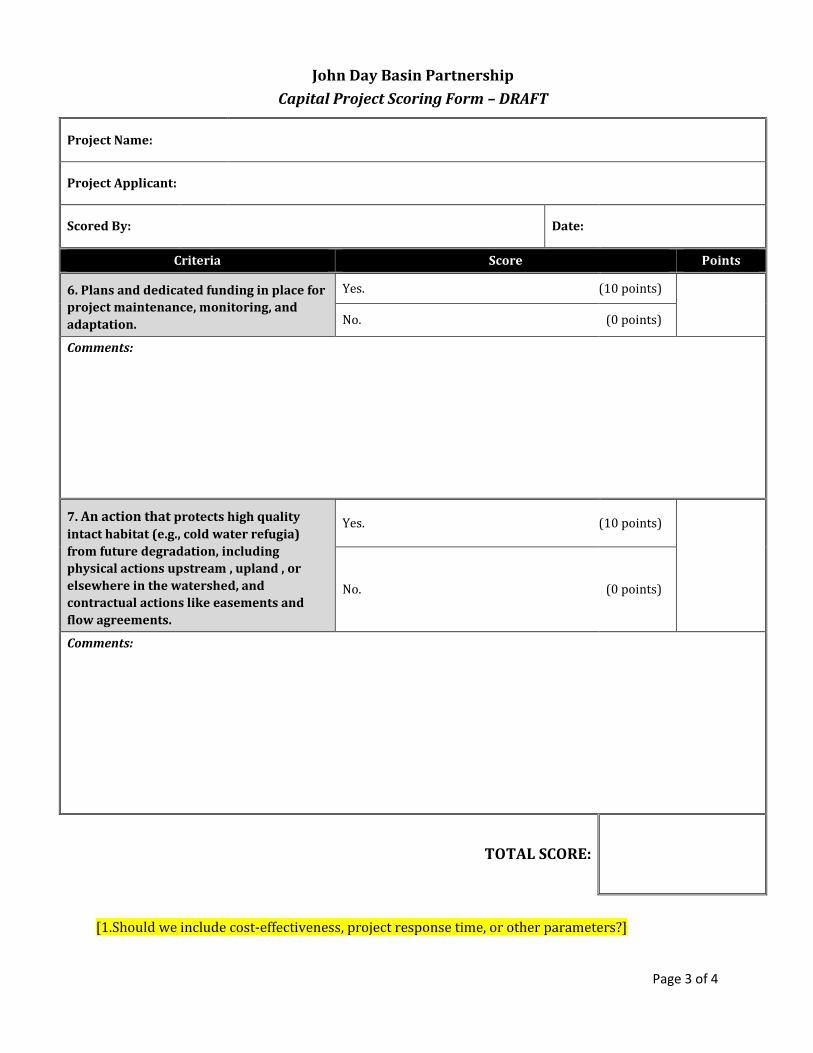
Page 3 of 4
John Day Basin Partnership
Capital Project Scoring Form – DRAFT
Project Name:
Project Applicant:
Scored By:
Date:
Criteria Score Points
6. Plans and dedicated funding in place for
project maintenance, monitoring, and
adaptation.
Yes. (10 points)
No. (0 points)
Comments:
7. An action that protects high quality
intact habitat (e.g., cold water refugia)
from future degradation, including
physical actions upstream , upland , or
elsewhere in the watershed, and
contractual actions like easements and
flow agreements.
Yes. (10 points)
No. (0 points)
Comments:
TOTAL SCORE:
[1.Should we include cost-effectiveness, project response time, or other parameters?]

Page 4 of 4
John Day Basin Partnership
Capital Project Scoring Form
Project Name:
Project Applicant:
Scored By:
Date:
Additional Comments:

Appendix K
Partnership Non-Capital Project Scoring Form - DRAFT

John Day Basin Partnership
Non-Capital Project Scoring Form - DRAFT
Project Name:
Project Applicant:
Scored By:
Date:
Criteria Score Points
1. Consistent with organizational mission
and expertise and/or advances
documented need.
Strong proven organizational commitment
and expertise in project area and directly
advances need.
(40
points)
Part of organizational mission, sufficient
expertise in project area, and generally
consistent with documented need.
(20
points)
Lack of organizational commitment,
expertise, and/or need for effort. (0 points)
Comments:
2. Located in a high priority watershed
identified in the strategic action plan.
Takes place entirely in priority
watershed(s).
(30
points)
Partially in a priority watershed(s). (20
points)
Does not take place in priority
watershed(s). (0 points)
Comments:

John Day Basin Partnership
Non-Capital Project Scoring Form - DRAFT
Project Name:
Project Applicant:
Scored By:
Date:
Criteria Score Points
3. Matching funds. >50% match. (10
points)
25%- <50% match. (5 points)
No match. (0 points)
Comments:
4. Socioeconomic impact. Significant number of citizens reached
and/or impact on long-term economic,
social, and cultural health of the basin.
(10
points)
Modest citizen reach and socioeconomic
impact. (5 points)
No numbers or qualitative impact. (o points)
Comments:
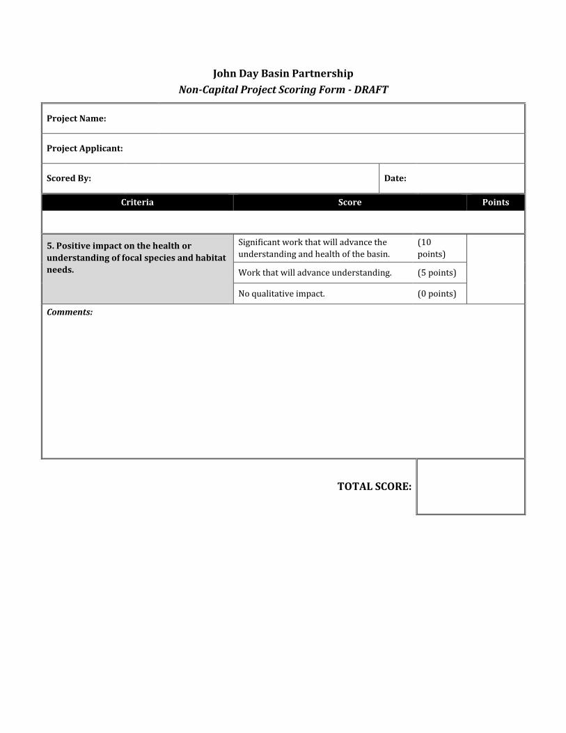
John Day Basin Partnership
Non-Capital Project Scoring Form - DRAFT
Project Name:
Project Applicant:
Scored By:
Date:
Criteria Score Points
5. Positive impact on the health or
understanding of focal species and habitat
needs.
Significant work that will advance the
understanding and health of the basin.
(10
points)
Work that will advance understanding. (5 points)
No qualitative impact. (0 points)
Comments:
TOTAL SCORE:

John Day Basin Partnership
Non-Capital Project Scoring Form
Project Name:
Project Applicant:
Scored By:
Date:
Additional Comments: