itc news 2012-3 · 2018-08-01 · itc news issue 2012-3 1 content 3 9 18 22 24 cover deforestation...
TRANSCRIPT

itc newsalumni magazine faculty of geo-information science and earth observationuniversity of twente
issue 2012-3
opening academic programme
greetings from
refresher course mozambique
lulc and hydrology


ITC News Issue 2012-3 1
Content3
9
18
22
24
cover Deforestation and related environmental degradation is one of the key issues in Myanmar.
MainFeatures
3 Opening Academic Programme 2012-2013
6 Refresher Course Mozambique
educationnews
8 International summer semester 2012
9 Regional workshop Land Administration
researchnews
11 LuLC and Hydrology
Projectnews
14 Flood Risk Management
announceMents
15 Honours Awarded to George Vosselman
events
18 Guest Lecture Nigeria
19 world urban Forum
21 GIsTDA Thailand
visits
22 Thai study Visit
23 GreetinGsFroM...
LiFeaFteritc
24 My Academic Journey
26 Alumni meet Thimphu
27 Alumni meet Melbourne
28 Letter to the editor

Issue 2012-3 ITC News2
IntroduCtion
Virtually yours, Janneke Kalf Jorien Terlouw Managing Editor Editor
colofon
ITC NEWS is published quarterly by ITC, Enschede, the Netherlands.
Managing EditorJanneke Kalf
EditorJorien Terlouw
EditingJanice Collins
Design&PrePressComposer DTPserviceHenk Scharrenborg
PrintingZalsman Zwolle B.V.
Correspondence toManaging EditorITC NewsPO Box 2177500 AE EnschedeThe NetherlandsPhone +31 (0)53 487 44 11Fax +31 (0)53 487 45 54E-mail [email protected]
ISSN1389 9368
The views expressed by the contributors do not necessarily reflect those of ITC.
September saw the official opening of the ITC Academic Year, which “true to tradition was held in the Grote Kerk in the Oude Markt in Enschede”. Also true to tradition, you will find a report of the occasion in this, the third issue of 2012 of ITC News (see page 3). At the ceremo-ny an especially warm welcome was extended to the 130 new stu-dents who had travelled from all the corners of the Earth, leaving homes, work and family, to study at ITC. Many of our readers will be able to identify with these students as they listened to the speakers − with feelings of expectation, excitement, enthusiasm … perhaps mixed with a goodly dose of trepidation.
But when it comes to the quest for new knowledge and skills, they are in good company. Others have trodden this path before them, and turning to page 24 you will find a very honest account of one student’s experiences, and is accompanied by quotations from several ITC alum-ni (page 27). The message is highly encouraging: considerable rewards lie at the end of the sometimes rocky academic path!
In these days of rapidly advancing technology, lifelong learning can start at an early age. Pupils at Outspan Primary School in Bwaise, in Kampala, Uganda, are learning how to collect meteorological data and, in so doing, gaining awareness of the increasing effects of climate change (page 14). Perhaps the day will come when one of these very pupils will sit in the Grote Kerk!
Education is one of ITC’s core activities, another is research. ITC is leading an interdisciplinary study examining the land use, land cover and hydrology of the Lake Naivasha Basin in Kenya, and the article featured on pages 11 comes well supplied with facts and figures to provide a complete picture.
So the new Academic Year officially opened on 27 September. But what of the preceding weeks? Lazy hazy days of summer? Well, no, not quite … in fact not at all as far as ITC was concerned. An August conference in Nigeria (18), a summer school in Korea (8), the world’s premier conference on cities in Italy (20) and a refresher course in Mozambique on sustainable biofuel production(6) are among the topics to be found in this issue. So plenty to choose from, plenty to read; perhaps it’s time to begin …

n Thursday 27 september ITC celebrated the official opening of its Academic Year. At the opening ceremony, which true to tradition was held in the Grote Kerk in the Oude Markt in enschede, the black gowns of the professors presented a striking contrast to the traditional, usually colourful, clothing of the new international students.
ITC News Issue 2012-3 3
main features
o
openingacademicProgramme2012-2013
Joost Bruijsters [email protected]
At the beginning of the ceremony Professor Tom Veldkamp, dean of ITC, welcomes all those present, including the ambassadors of Kenya and Nigeria, and especially the 130 new students hailing from 40 different countries. Veldkamp begins his story with the history of ITC, which has changed name no less than five times during its 60-year existence – owing, among other things, to advancing technology and the merger with the University of Twente. According to Veldkamp, one thing has not changed over all the years: “Education is the core of our institute. You, the students, are our most valuable asset and product.”
Veldkamp begins his welcoming speech with the changing role of science in society. No longer are scientists automatically believed purely on the basis of their function. And scientists must increas-ingly compete with all kinds of “self-styled experts”. What’s more, society increasingly expects unequivocal answers – with-out the uncertainties that go hand in hand with science. As an example of this trend, Veldkamp cites the Italian seismologists that had to answer to the judge because they had been unable to predict the earthquake in l’Aquila. According to Veldkamp, it is now in particular, when science is under a magnifying glass, that

Dr Jennifer Dungan: “It is an honour that I may deliver the opening lecture today. Never before have I given a lecture in a church, so this is a new experience for me.”
Issue 2012-3 ITC News4
it is extremely important for scientists to be honest. That’s why he alerts the students to the code of conduct for scientific integrity established in 2004. “This applies not only to me but also to you. Together we have the duty to maintain or even regain the confi-dence in scientific independence.” Keywords for this code, which apply to all researchers at a Dutch university, are scrupulousness, reliability, verifiability, impartiality and independence. “ITC will teach you how you must act according to this code of conduct.”
Student Association BoardAfter Veldkamp’s speech of welcome, Albert Anning Agyapon-gon, on behalf of the ITC Student Association Board, welcomes the students. “Education is often called the key to success, but success is not something you achieve just like that. It demands motivation and dedication. Anning Agyapong gives the new students a few tips to enable them to complete their study suc-cessfully: work hard, focus on the right things and use your time efficiently.”
According to Anning Agyapong, because many students are far from home, family and friends, homesickness is lurking − cer-tainly for those who have left their homeland for the first time to study abroad. “Living far from home is not always easy. You will be faced with all kinds of challenges and problems.” However, Anning Agyapong points out to the students that they are not alone in this. “I have made fantastic friends at ITC. ITC can be a home away from home.”
AwardsAfterwards it is time to present two awards. Veldkamp first presents the ITC Research Award. This award, for the best scien-tific article by an ITC doctoral candidate of the past year, goes to Claudia Pittiglio, who together with colleagues developed a method to identify so-called transit corridors of African elephants over a large area and a long time. After presentation of this award, Dr Yijian Zeng receives the prestigious WMO Research Award for Young Scientists from Dr Deon Terblanche, director of the Atmospheric Research and Environmental Branch of WMO.
First LectureAfter a musical intermezzo it is time for the Schemerhorn lecture, named after the founder of ITC. This lecture, which is also the first lecture for the new students, is delivered this year by Dr Jennifer Dungan of the NASA Ames Research Center in the United States. “It is an honour that I may deliver the opening lecture today. Never before have I given a lecture in a church, so this is a new experience for me.” Dungan begins her lecture with a photo of the Earth that was taken in 1968 during the Apollo 8 mission. According to the researcher, images of this type changed our perspective of the Earth. “For the first time we could see the world as a small, isolated and vulnerable place.”
For Dungan there was also an image that had a great influence on her life. She tells that, while working as a research assistant conducting research into ecosystems, she was confronted with a satellite image of deforestation in Brazil. As a researcher she was familiar with the deforestation there, but the fact that you could now reflect this not in figures but in a simple picture changed a good deal for Dungan. It inspired her to work in the field of re-mote sensing.
In her lecture Dungan looks back on the original goals of NASA’s “Mission to Planet Earth” and considers what has been achieved. “The idea behind this programme was to monitor the Earth and, so doing, view the Earth as a complete system.” Within the programme, various Landsat satellites monitored over a long period 24 facets of the Earth: from season-linked forest fires to the presence of sea ice, and from the surface temperature of seawater to the presence of dust in the atmosphere. With the aid of extremely detailed animations and video films of part of these areas, Dungan shows the information that the research has delivered. And that turns out to be a great deal! Thanks especially to the long duration of the programme and the huge quantity of collected data, Dungan is capable of identifying different trends.
After the Schemerhorn lecture, Veldkamp thanks everyone for attending and the ceremony comes to an end. In the old market-place the new students, generally clothed in the traditional dress of their country of origin, pose together for the camera. After-wards it is time for the closing reception in the Muziekcentrum.

ITC Research Award for Claudia Pittiglio WHO Research Award for Dr Yijian Zeng
New students, generally clothed in the traditional dress of their country of origin, pose together for the camera
Prof Tom Veldkamp, dean of ITC Albert Anning Agyapongon, ITC Student Association Board
ITC News Issue 2012-3 5
arly september 2012, ITC conducted the Nuffic refresher course on integrated planning with modern spatial analysis techniques for sustainable biofuel production. The course was hosted at the GIs Information Centre at the universidade Catolica, Beira, Mozambique. Here a group of 20 participants from Mozambique, Zambia, Tanzania, Namibia, ethiopia, uganda and Zimbabwe worked on mapping land cover changes and other aspects related to sustainability of biofuel cropping.
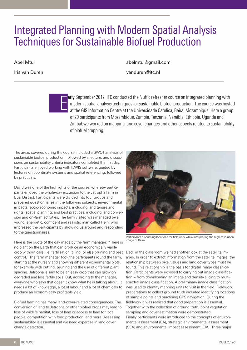
Participants discussing locations for fieldwork while interpreting the high-resolution image of Beira
Issue 2012-3 ITC News6
e
The areas covered during the course included a SWOT analysis of sustainable biofuel production, followed by a lecture, and discus-sions on sustainability criteria indicators completed the first day. Participants enjoyed working with ILWIS software, guided by lectures on coordinate systems and spatial referencing, followed by practicals.
Day 3 was one of the highlights of the course, whereby partici-pants enjoyed the whole-day excursion to the Jatropha farm in Buzi District. Participants were divided into four groups and prepared questionnaires in the following subjects: environmental impacts; socio-economic impacts, including land tenure and rights; spatial planning; and best practices, including land conver-sion and on-farm activities. The farm visited was managed by a young, energetic, confident and realistic man called Hein, who impressed the participants by showing us around and responding to the questionnaires.
Here is the quote of the day made by the farm manager: “There is no plant on the Earth that can produce an economically viable crop without care, i.e. fertilization, tilling, or else pruning and pest control.” The farm manager took the participants round the farm, starting at the nursery and showing different experimental plots, for example with cutting, pruning and the use of different plant spacing. Jatropha is said to be an easy crop that can grow on degraded and less fertile soils. But, according to the manager, everyone who says that doesn’t know what he is talking about. It needs a lot of knowledge, a lot of labour and a lot of chemicals to produce an economically profitable yield.
Biofuel farming has many land-cover-related consequences. The conversion of land to Jatropha or other biofuel crops may lead to loss of wildlife habitat, loss of land or access to land for local people, competition with food production, and more. Assessing sustainability is essential and we need expertise in land cover change detection.
Back in the classroom we had another look at the satellite im-ages. In order to extract information from the satellite images, the relationship between pixel values and land cover types must be found. This relationship is the basis for digital image classifica-tion. Participants were exposed to carrying out image classifica-tion − from downloading an image and density slicing to multi-spectral image classification. A preliminary image classification was used to identify mapping units to visit in the field. Fieldwork preparations to collect ground truth included identifying locations of sample points and practising GPS navigation. During the fieldwork it was realized that good preparation is essential. Together with the collection of ground truth, point vegetation sampling and cover estimation were demonstrated.Finally participants were introduced to the concepts of environ-mental assessment (EA), strategic environmental assessment (SEA) and environmental impact assessment (EIA). Three major
integratedPlanningwithModernspatialanalysistechniquesforsustainableBiofuelProduction
Abel Mtui [email protected]
Iris van Duren [email protected]

GPS navigation and land cover mapping on the beach in front of the university
The plantation manager explains how Jatropha grows. This was the oldest plot, with shrubs about four years old.
Participants discussing the location of the sample plot and the link between satellite image characteristics and land cover in reality
Participants were driven round the plantation, which was some 15 thousand hectares. Note that the municipality of Enschede is 14.2 thousand hectares − so the plantation is really huge!
ITC News Issue 2012-3 7
components are important, namely: the biophysical environment, the social-cultural environment, and economic and institutional capacity.
To summarize and communicate the course findings to a wider audience, participants were split into three groups. Group 1 defined and explained sustainability criteria, Group 2 explained the importance and procedure of land cover mapping, and Group 3 had to convince policy makers and planners to execute SEA for bio-energy. Further reading material and a presentation template were provided, and several in-depth group discussions resulted in a critical mass and good output for the final presentation.
One of these in-depth discussions stemmed from the guest lecture given by Mr Paulo Bene on planning and gender issues in rural development. Many of the participants from abroad were
curious to compare the Mozambican situation with their own situation back home.
And now we come to the final presentation by the three groups. It was a fantastic event in the presence of invited government officials and broadcasters from a local television station. A day earlier our organizer from the GIS Information Centre, Antonio dos Anjos Luis, had been interviewed by a radio station.
The course participants were extremely dedicated to their work, and all issues dealt with during the course were compiled on DVDs, which were then handed out to participants for reference when implementing the acquired knowledge. Apart from the knowledge on integrated planning with modern spatial analysis techniques for sustainable biofuel production, the course pro-vided an excellent opportunity for networking.
The summer of 2012 marked the fifth International summer semester (Iss) at sungkyunkwan university (sKKu) in seoul, Korea. ITC staff members Dr Mark Zuidgeest and Dr Johannes Flacke of the Department of urban and Regional Planning and Geo-information Management were invited to join the distinguished faculty teaching at the Iss.
Issue 2012-3 ITC News8
internationalsummersemester2012atsungkyunkwanuniversityinseoul,Korea
Johannes Flacke [email protected]
Pieter Stek [email protected]
Mark Zuidgeest [email protected]
EduCation neWs
Since 2008 Sungkyunkwan University, celebrating its 613th anniversary this year, has organized a summer school around current and multidisciplinary themes related to culture, business and technology in a global perspective. This year’s theme was “Sustainable Global Values: Conver-gence, Divergence and Collaboration”. The summer school is composed of tracks on innovation leadership, business strategies and marketing, governance in a multipolar world, continuity and transition in contem-porary society, and many more interesting topics offered in 31 different courses by 23 faculty members from various disciplines and countries. The basic idea behind the courses is to inspire students’ academic initiative to gain some insights into current scientific debates and topics that are prob-ably a little outside their normal curriculum.
The four-week programme (28 June to 25 July) was attended by over 1400 students from all over the world, but mostly from Korea, China, Singapore, Switzerland, Malaysia, France, Hong Kong and Vietnam. Mark Zuidgeest and Johannes Flacke jointly taught a morning class on Climate Change: Science, Technology and Policy and an afternoon class on Sustainable Urban Development in Asia. The morning class on climate change issues covered topics concerning the vulnerability of cities and their populations to climate change, and the means to adapt and mitigate climate change through urban planning and sustainable transport development. The afternoon class on sustainable urban development in Asia discussed the current problems and challenges of large urban agglomerations in Asian cities nowadays and how to respond to them. The class had a close look at recent municipal policies for a safe and sustainable Seoul and looked at planning for sustainable and equitable urban transport systems in large Asian cities.
Study field trips, a global forum and other extracurricular activities, such as an inter-national food festival and musical perform-ances, were organized after classes to make the ISS a special event for the students. Besides teaching, Mark Zuidgeest also gave a seminar on cycling research at the Korea Transport Institute in Seoul. After-wards opportunities for collaborating in research projects were discussed. The Netherlands can learn a lot from Korea’s integrated public transport system, while Korea would like to learn from our cycling infrastructure.
It was a great pleasure to be part of the ISS. SKKU’s facilities are world-class, which made teaching a summer school almost like a summer vacation!
With the support of the ITC-uT uNu school for Land Administration studies, the fourth regional workshop of the eastern Africa Academic Network of Land Administration took place in Kampala, uganda, on 16 and 17 July 2012.
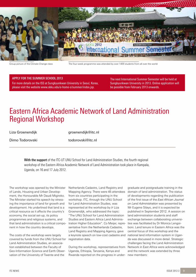
Group picture of the Climate Change class The four-week programme was attended by over 1400 students from all over the world
ITC News Issue 2012-3 9
APPLY FOR THE SUMMER SCHOOL 2013
Formoredetailsontheissatsungkyunkwanuniversityinseoul,Korea,pleasevisitthewebsitewww.skku.edu/e-home-s/summer/index.jsp.
thenextinternationalsummersemesterwillbeheldatsungkyunkwanuniversityin2013.onlineapplicationwillbepossiblefromFebruary2013onwards.
The workshop was opened by the Minister of Lands, Housing and Urban Develop-ment, the Honourable Mr Daudi Migireko. The Minister started his speech by stress-ing the importance of land for growth and development. He underlined that land is a critical resource as it affects the country’s economy, the social set-up, its policy programmes and religious systems, and that land administration is a critical compo-nent in how the country develops.
The costs of the workshop were largely covered by funds from the UNU School for Land Administration Studies, an associa-tion established between the Faculty of Geo-Information Science and Earth Obser-vation of the University of Twente and the
Netherlands Cadastre, Land Registry and Mapping Agency. There were 45 attendees from six countries participating in the workshop. ITC, through the UNU School for Land Administration Studies, was represented at the workshop by Ir Liza Groenendijk, who addressed the topic: “The UNU School for Land Administration Studies and Eastern Africa Land Adminis-tration Higher Education”. Co Meijer, repre-sentative from the Netherlands Cadastre, Land Registry and Mapping Agency, gave a keynote speech on low-cost cadastre and registration data.
During the workshop, representatives from Uganda, Ethiopia, Tanzania, Kenya and Rwanda reported on the progress in under-
graduate and postgraduate training in the domain of land administration. The status of developments regarding the publication of the first issue of the East African Journal on Land Administration was presented by Mr Eugene Silayo, and it is expected be published in September 2012. A session on land administration students and staff exchange between collaborating universi-ties was facilitated by Dr Monica Lengoi-boni. Land tenure in Eastern Africa was the central focus of this workshop and the national land information system in Ugan-da was discussed in more detail. Strategic challenges facing the Land Administration Network in East Africa were acknowledged and the network was extended by three new members:
easternafricaacademicnetworkofLandadministrationregionalworkshop
Liza Groenendijk [email protected]
Dimo Todorovski [email protected]

Workshop participants, speakers and organizers in front of the workshop venue in Uganda
Cheerful moment during the workshop with Gordon Wayumba (left), representative of the Kenya Polytechnic University College, Liza Groenendijk (centre), and Eugene Silayo (right), representative of the Land Administration Unit, Ardhi University, Tanzania
Issue 2012-3 ITC News10
in2013theworkshopoftheeasternafricaregionalnetworkinLandadministrationwillbeorganizedbytheregionalinstituteofhighereducation(ines),ruhengeri,rwanda,incooperationwiththenationaluniversityofrwanda(nur).
• Institute of Higher Education (INES), Ruhengeri, Rwanda
• The Regional Centre for Mapping of Resources for Development (RCMRD), Nairobi, Kenya
• The National University of Rwanda (NUR).
The Department of Geomatics and Land Management of Makerere University was thanked by all for the excellent organization of the workshop and the social pro-gramme, and for chairing the network in the 2011/2012 period. The network is growing and has become stronger, and this workshop was a reflection of that process. INES, Ruhengeri, has volunteered to be the network chair for the 2012/2013 period. This was accepted by all members.

This study is an integral part of a broader earth Observation Integrated Assessment (eOIA) project for Lake Naivasha Basin. It will contribute to the existing challenges linking Land use and Land Cover (LuLC) dynamics to catchment hydrology and more specifically unravel the understanding of the interface between LuLC/climate and water required to undertake adaptation strategies in Lake Naivasha Basin.
Figure 1 Lake Naivasha Basin showing its main rivers and tributaries
ITC News Issue 2012-3 11
ResearCh neWs
Conflicting Interests?ITC is leading an interdisciplinary study in the Lake Naivasha Basin in Kenya (Figure 1). This basin (3500 km2) is known for its natural beauty, unique geology, wildlife and great ecological value. The lake itself is a protected RAMSAR wetland. It is situated in the Kenyan Rift Valley, approximately 70 km from the capital Nairobi. The area is also of great economic interest. Activities in fishing, agriculture, geothermal power generation and tourism are all growing. With the increasing welfare, domestic water supply and sewage effluent disposal are also increasing. How do these activities affect the hydrology of the lake, and what exactly are the factors affecting the lake levels and water quality?
The water levels of Lake Naivasha in Kenya are known to fluctuate widely between years (Gaudet, 1977; Abiya, 1996; Verschuren et al., 2000). These natural fluctuations, cou-pled with consumption by humans, chang-es in land use/cover over time, and climate variability have led to decrease in the water levels, leading to the shrinking of the lake (Becht and Harper, 2002; Ondimu and Murase, 2007; Otiang’a-Owiti and Oswe, 2007; Olaka et al., 2010; Trauth et al., 2010).
Land Use/Cover ChangesOne of the contributors to the variations in lake level is the land cover. We analysed land use/cover (LULC) changes in the basin from remote sensing images of the last four decades (Figures 2 and 3). These changes are significant: 65% of the basin has been transformed into a different LULC class over the period of 38 years. The area covered with grass (typical of a savannah ecosys-tem) has increased from 27% of the basin in
1973 to 45% in 2011. The increase of grass-land in this period is attributed to decline in bushland of 24% over this period (Table 1). Another part of the bushland has been converted to farmland (1.7%), shrubland (2%), woodland (3%), fallowland (2%), and small areas with buildings, horticulture and forest. Farmland has more than doubled (3.5%) over this period, while mature forest cover has declined by 3%. However, wood-land has seen a growth of 2% in this period.
LanduseandLandcoverandhydrologyofLakenaivasha
Vincent Omondi Odongo [email protected]
Christiaan van der Tol [email protected]

Figure 2 Land use/cover distribution of 1973 (left) and 2011 (right)Figure 3 Lake Naivasha Basin percent LULC cover for years 1973 and 2011
Issue 2012-3 ITC News12
This may be attributed to the increased tree planting campaigns in the basin, mainly by NGOs (e.g. World Wide Fund for Nature, the Green Belt Movement and lately the Imari-sha Naivasha Board). Moreover, the in-creased economic value of timber may have motivated residents to plant trees as a source of income for their livelihood.
The area covered by aquatic vegetation has declined by two-thirds since 1973 (0.6% of the total area). There are two possible causes for this decline. Recent observa-tions showed retreating papyrus vegetation in the northern swamp of Lake Naivasha (Harper and Mavuti, 2004). The aquatic vegetation decline could also be explained by the expansion of informal settlements in the riparian area. Over the years since the early 1980s there has also been an upsurge in built-up areas, horticulture farms around
the lake, and increased irrigation activities, which were minimal in the 1970s.
River Discharge ChangesRiver discharge has undulated over time with minima and maxima runoff coefficient cycles occurring between two to four years (Figure 4). Interestingly, the minima and maxima runoff coefficients show a down-ward and upward trend respectively. This tapered-like pattern suggests that, com-pared with the 1960s and 1970s, during wet years there has been an upward trend in runoff volumes, whereas during drier years the basin has experienced a down-ward trend in runoff volumes. On the other hand, statistical evidence indicates that the average annual precipitation conditions in the basin have remained fairly much the same over the last five decades (Figure 5). However, there is indication of increased
runoff discharges of up to 13% in the long rains seasons (Figure 6), suggesting that the surface conditions have changed, considerably exacerbated by LULC chang-es. However, caution should be taken in interpretations of these results since fur-ther analysis using remote sensing and hydrological models is much better placed to confirm such an interpretation. It would be feasible to examine the evolution of evapotranspiration for the different LULC classes over the period of the changes. These evapotranspiration results, together with the precipitation and runoff results reported here, are proposed to give insight-ful hydrological evidence that goes a long way to providing important information for stakeholders in the basin and can contrib-ute towards improved water governance of Lake Naivasha Basin. This is still an ongo-ing part of this research.
LULC 2011
aquatic vegetation
bush-land
farmland forest grass-land
shrub-land
water wood-land
builtup horticul-ture
irrigation fallow-land
TOTAL (%)
LULC
197
3
aquatic vegetation 0.23 0.10 0.05 0.46 0.03 0.05 0.22 0.13 1.26
bushland 0.00 2.32 1.69 0.20 18.11 1.92 0.01 3.06 0.26 0.19 0.36 1.98 30.08
farmland 0.05 0.83 0.05 1.92 0.23 0.00 0.49 0.00 0.00 0.06 0.05 3.69
forest 0.26 0.54 10.32 2.27 2.09 0.00 0.68 0.00 0.00 0.01 16.18
grassland 0.00 1.96 2.26 1.15 14.91 1.68 0.01 2.90 0.11 0.19 0.28 1.47 26.92
shrubland 0.00 0.41 0.51 1.10 2.44 0.46 0.00 1.97 0.00 0.01 0.07 0.08 7.04
water 0.42 0.02 0.04 0.00 0.20 0.01 3.56 0.08 0.00 0.02 4.35
woodland 0.00 0.58 1.24 0.23 4.49 0.51 0.00 3.15 0.01 0.01 0.04 0.21 10.48
TOTAL (%) 0.65 5.69 7.14 13.05 44.80 6.93 3.63 12.56 0.38 0.40 0.80 3.94 100.00
Table 1: Land use/cover change matrix
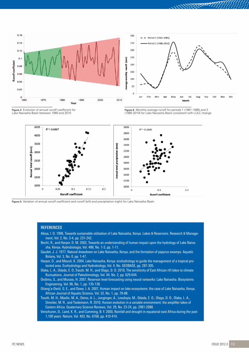
Figure 4 Evolution of annual runoff coefficient for Lake Naivasha Basin between 1960 and 2010
Figure 6 Monthly average runoff for periods 1 (1961-1985) and 2 (1985-2010) for Lake Naivasha Basin consistent with LULC change
Figure 5 Variation of annual runoff coefficient and runoff (left) and precipitation (right) for Lake Naivasha Basin
ITC News Issue 2012-3 13
REFEREnCESabiya,i.o.1996,towardssustainableutilizationofLakenaivasha,Kenya.Lakes&reservoirs.research&Manage-
ment,vol.2,no.3-4,pp.231-242.Becht,r.,andharper,d.M.2002,towardsanunderstandingofhumanimpactuponthehydrologyofLakenaiva-
sha,Kenya.hydrobiologia,vol.488,no.1-3,pp.1-11.Gaudet,j.j.1977,naturaldrawdownonLakenaivasha,Kenya,andtheformationofpapyrusswamps.aquatic
Botany,vol.3,no.0,pp.1-47.harper,d.,andMavuti,K.2004,Lakenaivasha,Kenya:ecohydrologytoguidethemanagementofatropicalpro-
tectedarea.ecohydrologyandhydrobiology,vol.4,no.GeoBase,pp.287-305.olaka,L.a.,odada,e.o.,trauth,M.h.,andolago,d.o.2010,thesensitivityofeastafricanriftlakestoclimate
fluctuations.journalofPaleolimnology,vol.44,no.2,pp.629-644.ondimu,s.,andMurase,h.2007,reservoirlevelforecastingusingneuralnetworks:Lakenaivasha.Biosystems
engineering,vol.96,no.1,pp.135-138.otiang’a-owiti,G.e.,andoswe,i.a.2007,humanimpactonlakeecosystems:thecaseofLakenaivasha,Kenya.
africanjournalofaquaticscience,vol.32,no.1,pp.79-88.trauth,M.h.,Maslin,M.a.,deino,a.L.,junginger,a.,Lesoloyia,M.,odada,e.o.,olago,d.o.,olaka,L.a.,
strecker,M.r.,andtiedemann,r.2010,humanevolutioninavariableenvironment:theamplifierlakesofeasternafrica.Quaternarysciencereviews,vol.29,no.23-24,pp.2981-2988.
verschuren,d.,Laird,K.r.,andcumming,B.F.2000,rainfallanddroughtinequatorialeastafricaduringthepast1,100years.nature,vol.403,no.6768,pp.410-414.

Pupils at Outspan Primary school in Bwaise, a poor, flood-prone neighbourhood in Kampala, uganda, are learning how to collect meteorological data – and, along the way, something about how climate change increasingly will affect their lives. Two times a day they measure the amount of rain that has fallen over the past several hours at their school grounds. They then jot down observations on the duration of the rainfall and its effect in terms of flooding of their school yard.
Issue 2012-3 ITC News14
ProjeCt neWs
The school’s head teacher, Mr Leonard Okokes, is pleased about the pedagogic benefits of the activity. “The collection of rainfall data is important for our education programme. Classes are studying weather changes on a daily basis, and this provides practical lessons to our pupils.” At the same time this hands-on activity is not merely a classroom learning exercise, but rather forms part of a much broader, real-world assessment.
This innovative learning approach is being tested as part of the data collection component of the UN-Habitat-supported Kampala Integrated Flood Management project. The Kampala Capital City Authority (KCCA) recently joined forces with UN-Habitat’s Cities and Climate Change Initiative (CCCI) to gauge that city’s flood risk; this assessment is a first step in helping KCCA to develop a strategy to manage the city’s urgent flooding problem. A diverse team led by the Faculty of Geo-Information Science and Earth Observation (ITC) at the University of Twente in the Netherlands, along with faculty members of Kampala’s Makerere University and a German engineer who specializes in urban hydrology, is implementing the study.
Flooding is an urgent environmental concern in Kampala. Much of the city is built on former wetlands and swampy ground. A high proportion of the urban poor live in these flood-prone areas. In recent years unplanned urbanization, poor management of solid waste which can clog storm sewers, as well as other factors have increased residents’ exposure to flooding and ancillary hazards. These secondary hazards include health issues: over the past 15 years, Kampala has suffered from several disease out-breaks that are at least partly attributable to increased flooding,
and which especially afflict the most vulnerable.
Along with negative effects on health, flooding also interrupts people’s everyday lives. In the case of students and teachers at Outspan Primary School, three heavy rainfall events between April and May 2012 flooded classrooms and left the school grounds temporarily inaccessible. Poverty and a lack of resources underlie the flooding issue. In the future, without a long-term strategy, increased urbanization coupled with climate change may well lead to deteriorating conditions.
The approach taken in the present study reflects a new concep-tual paradigm: Integrated Flood Management (IFM). While little tested to date in cities in developing countries, IFM promises to be a useful approach to help KCCA address its flooding problem. Previous flood management efforts in Kampala focused on a traditional sectorial engineering solution: the development and implementation of a storm-water drainage master plan for the city’s eight major water catchment areas. In a resource-poor city such as Kampala, however, such plans may take decades or more to realize.
The new integrated approach, however, will embrace both “hard” and “soft” solutions in a holistic and cross-sectorial manner. “Soft” measures may well include cost-effective approaches such as community-based early warning systems in flood-prone neigh-bourhoods, and improved land management. Other measures that fall under the rubric of “sustainable drainage systems” (e.g. increasing permeable surfaces, retaining and harvesting rainwa-ter) also may be proposed.
PrimaryschoolsupportsinnovativeapproachtoFloodriskManagementinKampala
Source: UN HABITAT [email protected]

For his significant contribution to photogrammetry and remote sensing as editor-in-chief of the ISPRS Journal of Photogrammetry and Remote Sensing (IJPRs) Professor George Vosselman has been awarded the schwidefsky Medal. On the same occasion − the gala dinner during the XXII congress of the International society of Photogrammetry and Remotes sensing (IsPRs) in Melbourne, Australia, on 31 August − Vosselman and Professor Hans-Gerd Maas, received the Karl Kraus Medal for their editorship of the textbook Airborne and Terrestrial Laser Scanning.
ITC News Issue 2012-3 15
AnnounCements
The project involves analytical and prescriptive work at two spatial levels: a city-wide assessment of the risks of flooding, coupled with a more detailed risk assessment in a representative “hotspot” neighbourhood in that city. The neighbourhood select-ed, Bwaise, picked in large part for the exposure of a poor popula-tion to frequent flooding, was chosen by the project’s steering committee − a group that includes not only the heads of two key KCCA departments, but also a representative of the National Slum Dwellers Federation that is active in Kampala. Mr Joseph Ssemambo, acting director of physical planning at KCCA and chair of the committee, supported the establishment of this body from the outset: “It is a very good idea, especially for community ownership of the project, to [build support for] implementation of the recommendations that will come thereafter.”
As informed by pilot work in Bwaise, the project will result in a proposed city-wide strategy and action plan for IFM in Kampala. This plan will include both policy recommendations as well as other cost-effective steps that the city can take to better manage the risk of floods. Recommendations undoubtedly will include a mix of strategies aimed at linking urban drainage needs with the city’s services, systems, functions, spaces and storm-water flows. Dr Sliuzas, the ITC team leader in Kampala, explained how people in affected neighbourhoods could be motivated to support
implementation of proposals: “It is not easy to trigger residents’ support if measures will only improve lives downstream. But with the price of potable water in Kampala slated to rise in the future, people may begin to understand how, for example, rainwater harvesting can help them to save money they would otherwise spend on piped water for sanitation, washing, and cleaning.”
While the data collected by the pupils of Outspan Primary School will help to underpin the planning process, Dr Sliuzas cautioned that more than one station will be needed around the city in order to have a minimum number of data collection points. As another step in that direction, the ITC team installed an automatic rainfall station at Makerere University campus to collect high-resolution temporal data. As Dr Sliuzas explained: “Establishing weather stations in schools or other public facilities has the advantage that the data collection can be institutionalized, which ensures func-tional, well-maintained stations through which data can be regu-larly collected on an ongoing basis, even after a development project winds up.” At the same time that collecting data is crucial from a technical point of view, such an activity in a community like Bwaise also helps to raise the schoolchildren’s − and the community’s − awareness about crucial environmental issues.(© UN-HABITAT)
honoursawardedtoGeorgevosselmanduringtheXXiiisPrscongress
Janneke Kalf [email protected]

From left to right: Professor Orhan Altan, president of the ISPRS; the recipients of the Karl Kraus Medal, Professor George Vosselman and Professor Hans-Gerd Maas; and representing the Austrian, German and Swiss ISPRS society members, Professors Norbert Pfeifer, Thomas Kolbe, and Konrad Schindler
Issue 2012-3 ITC News16
InTERnATIOnAL SOCIETY FOR PHOTOgRAMMETRY AnD REMOTE SEnSIng
isPrsisaninternationalnGodevotedtothedevelopmentofinternationalcoopera-tionfortheadvancementofknowledge,research,developmentandeducationinthephotogrammetry,remotesensingandspatialinformationsciences,andtheirintegrationandapplication,tocontributetothewellbeingofhumanityandthesustainabilityoftheenvironment.theisPrsmembershipcomprisesnationalorganizationsandprofessionalsocietiesrepresentingover100nationsandregionsacrossallcontinents.Moreinformation:www.isprs.org
AIRBORnE AnD TERRESTRIAL LASER SCAnnIng
writtenbyateamofinternationalexperts,thisbookprovidesacomprehensiveoverviewofthemajorapplicationsofairborneandterrestriallaserscanning.thebookfocusesonprinciplesandmethodsandpresentsanintegratedtreatmentofairborneandterrestriallaserscanningtechnology.Moreinformation:www.whittlespublishing.com/airborne_and_terrestrial_Laser_scanning
ISPRS JOURnAL OF PHOTOgRAMMETRY AnD REMOTE SEnSIng (IJPRS)
theisPrsjournalofPhotogrammetryandremotesensingistheofficialjournaloftheinternationalsocietyforPhotogrammetryandremotesensing(isPrs).thejournalistoprovideachannelofcommunicationforscientistsandprofessionalsinallcountriesworkinginthemanydisciplinesemployingphotogrammetry,remotesensing,spatialinformationsystems,computervision,andotherrelatedfields.thejournalisdesignedtoserveasasourcereferenceandarchiveofadvancementsinthesedisciplines.Moreinformation:www.itc.nl/isprsjournal
The Karl Kraus Medal jury considered that, although written by many different authors, the book Airborne and Terrestrial Laser Scanning highly fulfils all textbook criteria. The chapters have been written by different authors, but the editors (Professor George Vosselman, professor of Geo-Information Extraction with Sensor Systems at Faculty ITC of the University of Twente, and Professor Hans-Gerd Maas, professor of Photogrammetry and Remote Sensing at Dresden University of Technology), made a real and successful effort to combine and edit them to form a complete well-structured textbook. It provides a self-contained introduction to the topic of airborne and terrestrial laser scanning, including all the relevant formulae. It could be used as base literature for respective courses at both bachelor’s and master’s level. Because the focus is on the presentation of methods rather than of systems, it will remain up-to-date for a significant time period. It gives an excellent explanation of the physical and technical aspects of data acquisition and processing. Mathemati-cal formulae have been given where useful and in an accessible style.
The Schwidefsky Medal jury concluded that during George Vosselman’s appointment as editor-in-chief the ISPRS Journal of Photogrammetry and Remote Sensing (IJPRS) has improved in multiple aspects. IJPRS has improved its ISI position in the cat-egory of remote sensing journals, becoming the journal with the third highest impact factor in this category (2.885) and improving values for other citation criteria, such as the five-year impact factor, and total cites of previous years. The number of submitted and published papers has more than doubled in the past four years. This has been assisted by the appointment of additional associate editors. Two special/theme issues per year are pub-lished, strengthening the ties with the scientific work of ISPRS commissions and working groups. Relations with the publisher (Elsevier) have been running smoothly, and although some of the above improvements could have resulted in a corresponding increase in subscription fees, this has not been the case. All the above improvements are to a significant extent due to the dedi-cated and careful work of George Vosselman.

www.geospatialworldforum.org
Total GPS market is expected to reach $26.67 BILLION by 2016 at a CAGR of 23.7% from 2011 to 2016(6)
Department Of Transportation (Caltrans), USA used 3D models for San Francisco-Oakland Bay Bridge and saved several million dollars while maintaining completion date
Global GPS Navigation and LBS market to grow at a CAGR of 50.2 % over the period 2010–2014(3)
Commercial Earth Observation data market is expected to reach $4 billion by 2020(4)
MaStercard’S lI-baSed atm locator delivered an astonishing RoI of 1,152% in the fi rst six months while greatly improving customer service
Global Remote Sensing technologies market expected to reach $12.4 billion by 2017 at CAGR of 6.4%(5)
Iberdrola Ingeniería y Construcción, Spain can now design substations 30% faster than before
GIS/Geospatial software, services and data sales in Europe grew by 10.3% in
2010 to $4.4 billion(3)
Worldwide growth of geospatial applica-tions in the public sector has been grow-
ing at a CAGR of 7.2% for past 8 years(6)
British Telecom saved £23 million over fi ve years as the result of a LI solution
King County Municipality, USA saved approximately $775 million in net benefi t over the 18 year period
Los Angeles Department of Water and Power, USA saved approximately $800,000 annually in research time alone and
reduced plotting time by 40%
Global GIS market to grow at a CAGR of 9.2% over the period 2011-2015 to reach $10.6 billion(2)
Revenues from airborne products is estimated to grow to $3.1 billion by 2017
at a CAGR of 5.5%(5)
BEURS-WORLD TRADE CENTERRotterdam, The Netherlands
of Geospatial TechnologiesJoin us and Explore the True Potential
13-16 May 2013SOURCE(1) GEOSPATIAL WORLD MAGAZINE (2) TECHNAVIO (3) DARATECH (4)
EUROCONSULT (5) BCC RESEARCH (6) MARKETSANDMARKETS
$26.67BILLION
3DMODELS
CAGRof 50.2 %
$4BILLION
1,152%
$12.4BILLION
30%FASTER
$4.4BILLION
$4.4BILLION
£23MILLION
$775MILLION
SAVED$800,000
$10.6BILLION
$3.1BILLION
MONETISINGTHEME
PRACTICES
GEOSPATIAL VALUEAND
Geospatial Industry shall be $100 billion by 2015(1)

Last August the African Regional Centre for space science and Technology education in english (ARCssTee), a uN centre located on the Obafemi Awolowo university (OAu) campus in Ile Ife, Nigeria, held its second regional conference and alumni reunion. The centre is headed by ITC’s first PhD, Dr Joseph Akinyede, and receives students from english-speaking west Africa for postgraduate diploma courses, besides many other activities regarding the dissemination of knowledge on space techniques to the public at large and specifically the youth.
ITC’s first PhD, Dr Joseph Akinyede (left) with current PhD student Adewale Akingbade
Issue 2012-3 ITC News18
Events
The keynote presentation on behalf of ITC was entitled Cross Border Education in Developing Countries: Learning from ITC Experience. The theme of the conference was “Space for the Economic Growth and Prosperity of the African People”. The main message was that, due to the increased demand for talent in our knowledge society, the undiscovered talents in developing countries constitute the main reservoir we have to target for the future. In geological terms, unexplored areas are more likely to have undiscovered resources. In order to tap these undiscovered talents, we need to close the cycle of talent. Latent talent should be (i) discovered, (ii) developed, and (iii) deployed. Or in geologi-cal terms, explore for, invest in, and profit from the hidden talent (see figure). It is important that the cycle is closed (i.e. the young-er generations should be explored by the older generations as, at the same time, they transfer their enthusiasm for science across the generation divide). As global problems need to be countered with global knowledge this harvesting of latent talent will benefit all.Besides the keynote lecture at the ARCSSTEE conference, there was also an opportunity to deliver a guest lecture at the Federal University of Technology in Akure (FUTA). The lecture was pre-sented in two parts, namely: Introduction to ITC and University of Twente and Fossil Fuel Deposit Fires: Occurrence Inventory, Design and Assessment of Instrumental Options. At FUTA the deputy vice-chancellor and several deans attended the lecture, and the university is building up capacity in a Centre for Space Research & Applications (CESRA).
GuestLectureat2ndarcssteeconference
Paul van Dijk [email protected]

The World Urban Forum was established by the united Nations in 2002 as a biennial event to examine one of the most pressing problems facing the world today: rapid urbanization and its impact on communities, cities, economies, policies and climate change.
An ITC alumni meeting was held on the last day
of the conference
Latent talent should be (i) discovered, (ii) developed, and (iii) deployed
In geological terms, explore for, invest in, and profit from the hidden talent
ITC News Issue 2012-3 19
anitcalumnimeetingwasheldonthelastdayoftheconference.about30alumniwerepresent.theoldestalumnuswasdrs.a.a.okpaise(BscPhotogramme-try1971).duringthereceptionandbuffet,anitcalumniassociationwasstartedonthespot,withFranciso.akinluyi(MscappliedGeophysics2001andGeoinfor-matics2008)takingtheleadinitsorgani-zation.
Formoreinformationontheitcalumniassociation,pleasesendanemailtoFranciso.akinluyi([email protected])ortheitcalumnioffice([email protected]).
The entire presentationcanbefoundat:www.itc.nl/about_itc/resumes/vandijk.aspx
There is also some news from the Regional Centre for Training in Aerospace Surveys (RECTAS), which is also located on the AOU campus in Ile Ife. The RECTAS library has been named after Professor Henk Zorn from ITC, who was the first dean of REC-TAS. ITC very much appreciates this ges-ture signifying the longstanding relation between the two institutes!
Today it is by far the world’s premier con-ference on cities. This is largely because it is one of the most open and inclusive gatherings of its kind on the international stage. It brings together all people and groups interested in urban development, from cabinet ministers to slum dwellers, from youth groups to academics, and from business leaders to urban activists. To accommodate the ever-growing numbers
of participants (around 10,000 people register for these events), the forum’s meetings are divided into dialogue ses-sions discussing the main themes; the-matic open debates; networking events; youth, gender, and business assemblies; caucus meetings; special sessions; round-tables; training seminars; and an exciting array of side events, exhibitions and cul-tural events.
The 6th World Urban Forum was held from 1 to 7 September 2012 in Naples, Italy. The theme “The Urban Future” was chosen to remind us all how fast the world is urban-izing. Already more than half the world’s population lives in cities, and projections now show that cities will be home to two-thirds of humanity within the coming 25 years.
aspaceforGeoattheworldurbanForum
Jeroen Verplanke [email protected]

Geospatial pavilion as meeting space
ITC-Esri training event Slum dwellers rally in front of pavilion
Issue 2012-3 ITC News20
ITC has been present at these events since 2006, joining the many meetings, organ-izing training sessions, and hosting at the exhibition. This time ITC was responsible for a training event and the organization of a geospatial pavilion at the exhibition. The idea of establishing a geospatial pavilion came from the limited attention given to geo-information at previous events. To emphasize the relevance of geo-informa-tion and earth observation to the many policy and decision makers present at the forum, a consortium of ITC, Esri and the Joint Research Centre of the European Commission (JRC-Ispra) decided to join forces (www.esri.com/wuf6). A large Geospatial Pavilion was erected at the exhibition to accommodate the three partners, while also allowing space for demonstrations and presentations. The pavilion occupied a central space (an “island” of 72 m2) in one of the exhibition halls. Visitors to the forum exhibition were offered one concentrated and obvious loca-tion for information about geo-information software, training and research in urban planning and development. There were specific mini-seminars held during the day at the pavilion, and a networking event by JRC and a training event by Esri and ITC were organized at different locations.
The training consisted of an overview of state-of-the-art approaches and technolo-gies for mobile data collection and a hands-on demonstration and exercise with ArcGIS online. The 30 participants were encouraged to bring and use their own smartphones and tablet computers for the exercise. Participants moved around the forum grounds to collect spatial data live via ArcGIS Online. The training ended with a visualization and discussion of the col-lected data.
At the forum ITC staff also contributed to the dialogues and discussions regarding the Global Land Tool Network and the Cities and Climate Change Initiative. As
partner in the Habitat Partner University Initiative, ITC staff joined several discus-sions on the Habitat University network, which aims to strengthen cooperation between UN-HABITAT and institutions of higher learning. The Initiative encourages universities to become closer partners with cities and actively engage in problem solving, thus closing the gap between academics and practitioners and encourag-ing collaborative learning. UN-HABITAT will act as a catalyst, facilitating partnerships among universities and other urban stake-holders.
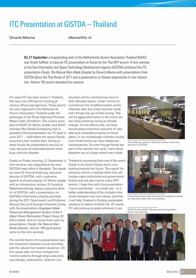
On 21 September a longstanding wish of the Netherlands Alumni Association Thailand (NAAT) was finally fulfilled: to have an ITC presentation on floods for the Thai NFP alumni. A mini-seminar at the Geo-Informatics and space Technology Development Agency (GIsTDA) combined the ITC presentation Floods, The Natural Man-Made Disaster by Dinand Alkema with presentations from GIsTDA about the Thai floods of 2011 and a presentation on Korean experiences in river restora-tion. Almost 100 alumni attended this seminar.
GISTDA staff, NAAT officials and the presenters at the mini-seminar
The audience: almost 100 alumni came to the mini-seminar at GISTDA
Chao Praya flood water entering the restaurant where we had lunch after the mini-seminar
ITC News Issue 2012-3 21
For years ITC has been active in Thailand. We have over 200 alumni working at various offices and agencies. These alumni are well organized in the Netherlands Alumni Association Thailand under the patronage of her Royal Highness Princess Maha Chakri Sirindhorn. The current presi-dent of NAAT, Dr Wicha Jiwalai, and NAAT member Mrs Parida Kuneepong had re-quested a flood presentation by ITC back in June 2011 − well before the severe floods occurred a few months later. Owing to these floods the presentation was put on hold, because all interested alumni were busy with this disaster.
Finally on Friday morning, 21 September, a mini-seminar was organized at the new GISTDA head office in Bangkok. The speak-ers were Dr Anond Snidvong, executive director of GISTDA, with a welcome speech to all participants; Dr Wicha Jiwalai, with an introductory lecture; Dr Surachai Rattanasermpong, deputy executive direc-tor of GISTDA, with a presentation on GISTDA’s information-sharing activities during the 2011 flood event; and Professor Myung Hee Jo of Kyungil University, Korea, with the presentation Integrated Water Resources Management System of the 4 Major Rivers Restoration Project Using 3D GIS in Korea. And of course there was my presentation: Floods, the Natural Man-Made Disaster. Almost 100 participants came to this mini-seminar.
The central theme of my presentation was the interaction between human activities and the natural river system dynamics. On the causal side, we have changed the riverine systems through large-scale land use change, urbanization, reservoir con-
struction and by constraining rivers to their allocated space. Under normal cir-cumstances the modified system works relatively well, but under extreme condi-tions things may go terribly wrong. This will be aggravated when in the future we see more extremes owing to climate change. On the effects side, we have accumulated enormous amounts of valu-able and vulnerable property on flood-plains. In our increasingly complex society even small events can have disastrous consequences. So even though floods are part of the natural river cycle, many flood disasters are to a large extent man-made.
Thailand is recovering from one of the worst floods in its recent history and is now looking towards the future. The search for solutions will be a national effort that will involve many institutions and government bodies and will also involve many NFP alumni. I hope that with this presentation I have contributed – in a small way - to a better understanding of the complex inter-action between man and nature, and that it will help Thailand in finding sustainable solutions to reduce its flood risk. Of course ITC will continue to assist wherever it can.
itcPresentationatGistda–thailand
Dinand Alkema [email protected]

In September 2012 a group of 20 Thai government employees came to the Netherlands for a study visit to learn from Dutch experiences in water management and disaster management. ITC organized a tour through the Netherlands to expose them to the latest developments in coastal and river defence, as well as to new insights into water safety in a changing world.
Issue 2012-3 ITC News22
Visits
Thailand suffers from floods nearly every year. But the floods of October and Novem-ber 2011 were the worst in decades, inundating large parts of the capitol city Bangkok. Industrial areas were flooded, as well as the Thammasat and AIT university campuses, and even Don Muang, the old international airport. It resulted in the fourth costliest disaster in world history, with over US$ 40 billion in damage and more than 800 casualties. And even now Thailand is suffering again from floods.
To avoid a repetition of the 2011 flood disaster, the Thai government has initiated plans to reorganize their water manage-ment system and make Thailand more flood-proof. Part of this initiative is the selection of high-potential young govern-ment employees who have indicated that they want to know more about flood risk management and flood preparedness. The Office of Civil Service Commission (OCSC) asked the Asian Disaster Preparedness Center (ADPC) and ITC to organize a spe-cial workshop for this group, including a study tour to the Netherlands.
The group visited the Netherlands from 2 to 8 September, when they were exposed
to the various components of water safety. Near The Hague they visited the Scheve-ningen Boulevard (an example of multi-purpose sea defence) and the “Sand Engine” to illustrate a paradigm shift in the Dutch approach to coastal engineering: from “building against nature” to “building with nature”. In Rotterdam they were exposed to the ambitious plans of the municipality to make the low-lying city and its harbour flood-proof for the coming century. A visit to Deltares in Delft demon-strated the knowhow of our engineers, which was exemplified by the Maeslant barrier, the enormous flood gates that protect Rotterdam harbour.
Visits to the province of Gelderland, the safety region Midden-Gelderland, the Water Board in Almelo and the Centre for Water Management in Lelystad highlighted the water governance issues in the Nether-lands and how we are preparing ourselves for future challenges such as climate change and land use change. Of course there was a welcome at ITC, where they saw presentations by Professor Jetten and Dr van Westen on disaster risk assessment and by Dr Mannaerts on the latest develop-ments in GeoNetCast.
On their return to Thailand the participants had to work on a small project showing what lessons they had learned from this tour and how they believed it could be implemented in Thailand. From our col-leagues at ADPC, Mr Sisira, Ms Mutarika and Ms Thanyaphat, we heard that the tour was much appreciated by both the partici-pants and OCSC, and that the project presentations were a big success. Hope-fully this tour will be a small spark that has triggered the interest of a new generation of Thai flood managers and will contribute to a safer Thailand.
thaistudyvisittothenetherlands
Dinand Alkema [email protected]
Nanette Kingma [email protected]

Issue 2012-3 23 ITC News
Greetingsfrom…Myanmar
naMe: joan LooijennaMe: Bert toxopeusPurPose:awarenessworkshopeia
andsea,LandusePlanningand
conservation
theworkshopwasjointlyorganizedby
theMinistryofenvironment,conser-
vationandForestry(MoecaF),sun-
tactechnologiesandtheFacultyof
Geo-informationandearthobserva-
tions(itc),universityoftwente
howitstartedon12MarchdrtinMyintanddraungtoeLwin(suntactechnologies),andjoostvandervenandProfessoriesZonneveldvisiteditcforafact-findingmeeting.onemonthlaterwereceivedaninvitationtoco-organizeanawarenesswork-shoponeia.atpresentmany(adhoc)develop-mentsaretakingplaceandarescheduledinMyanmar,althoughnoproperenvironmentalassessmentregulationshavebeensetupasyet.
theworkshoptookplacefrom17to20july2012innayPyitaw,thenewcapitalcityofMyanmar.theworkshopwasopenedbydrMaungMaungthan,itcalumnisandthedirectorofresearchandtrainingfromMoecaF,anddrtinMyintofsuntac.drthanisanitcalumnus,whostillremem-bersthegoodtimeshehadatitc.Forty-twostafffromdifferentministries,nGosandsuntactechnologiesparticipatedintheworkshop.
duringtheworkshopseveralmeet-ingswereorganizedwithdirectorsofMoecaFandalsotheGissectionoftheMinistrywasvisited.theestablishmentandimplementa-tionofGisandremotesensingwasoneoftheinitiativesofdrthanonhisreturnfromhisstudiesatitc.
thedirectorsexpressedtheirseriousinter-estinworkingtogetherwithitconcapacitybuildingthroughtrainingandjointprojects.theideaistoallocateoneortwopilotstudyregionswithdifferentenvironmentalissuesthatneedtobetackledand,withthesup-portofitc,theministrystaffwillbetrainedonthejob.tailor-madetrainingwillalsobeneededtoincreasethetechnicalandscien-tificskillsofthestaffinvolved.
thelastdayoftheworkshopfocusedmainlyontheformulationoffurthertrainingandcapacitybuildingneeds.theparticipantsworkedinsmallergroupsandpresentedtheirfindings.asummaryofthesefindingswassenttoallstaffinvolvedintheorganization.
deforestationandrelatedenvironmen-taldegradationisoneofthekeyissuesinMyanmar.aone-dayfieldvisitwasorganizedtoforestconservationareas
andcommercialteakplantations.

This article gives a brief account of my academic journey during the 1½ years I spent at ITC (from 2004 to 2006), pursuing an Msc degree in Geo-information science and earth Observation at the Department of Natural Resources. I hope it will encourage those who might be facing challenges in the pursuance of their academic qualifications at ITC and provoke those who have successfully made it through ITC to examine the significance of the ITC experience in their lives.
Wizaso Munthali at a national consultative meeting
Issue 2012-3 ITC News24
Life after itC
It’s been just over six years since I left ITC. At the moment of my departure, little did I know that ITC would leave an everlasting impression on my life. My time spent at ITC seems like a dream sometimes, but embedded in this dream are patches of clear unforgettable moments.
In September 2004, packing just enough clothes and necessities, I embarked on my journey to the Netherlands, tears running down my cheeks as I waved goodbye to my loved ones, anxious to start my life as a postgraduate student in Europe.
On my flight I sat next to an elderly Dutch lady and from time to time we engaged in light pleasant conversation. Finally, I was on the last leg of my journey, a train ride to Enschede. This town in the east of the Netherlands would become my home for the next 1½ years.
I was received by a group of Zambians at the Enschede train station and given a student-style dinner, together with three other Zambians with whom I had arrived that same day. We chatted, laughed and discussed ITC study culture in general. That first night in my room at the Dish I wondered what ITC had in store for me.
The honeymoon period was soon over, and for the next 17 months I would dedicate most of my time to academic life like never before, taking time out occasionally to socialize with new-found friends at various social events.
The taught component of my MSc programme generally went well. The turning point came at the thesis proposal development stage. I had never in my life coordinated, planned or executed scientific research at the level that ITC expected of me. I struggled to develop a viable topic, but eventually did so with the assistance of my thesis supervisor. My thesis would focus on beech forest expansion modelling in Majella, Italy. My proposal presentation fell short, leaving me quite distraught. I got my results for my presentation and could not hold back my tears; they were bad. That day, I felt the warmth and care of my classmates as they huddled around to comfort me.
Myacademicjourneyatitc
Wizaso Munthali [email protected]
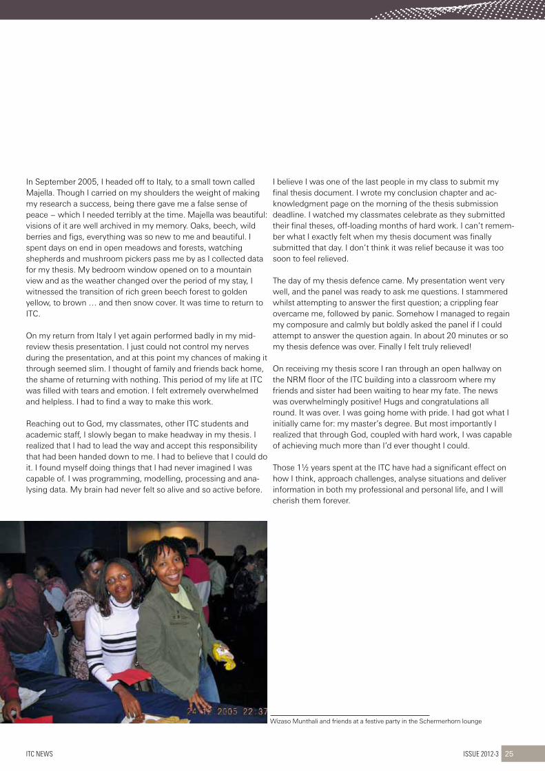
Wizaso Munthali and friends at a festive party in the Schermerhorn lounge
ITC News Issue 2012-3 25
In September 2005, I headed off to Italy, to a small town called Majella. Though I carried on my shoulders the weight of making my research a success, being there gave me a false sense of peace − which I needed terribly at the time. Majella was beautiful: visions of it are well archived in my memory. Oaks, beech, wild berries and figs, everything was so new to me and beautiful. I spent days on end in open meadows and forests, watching shepherds and mushroom pickers pass me by as I collected data for my thesis. My bedroom window opened on to a mountain view and as the weather changed over the period of my stay, I witnessed the transition of rich green beech forest to golden yellow, to brown … and then snow cover. It was time to return to ITC.
On my return from Italy I yet again performed badly in my mid-review thesis presentation. I just could not control my nerves during the presentation, and at this point my chances of making it through seemed slim. I thought of family and friends back home, the shame of returning with nothing. This period of my life at ITC was filled with tears and emotion. I felt extremely overwhelmed and helpless. I had to find a way to make this work.
Reaching out to God, my classmates, other ITC students and academic staff, I slowly began to make headway in my thesis. I realized that I had to lead the way and accept this responsibility that had been handed down to me. I had to believe that I could do it. I found myself doing things that I had never imagined I was capable of. I was programming, modelling, processing and ana-lysing data. My brain had never felt so alive and so active before.
I believe I was one of the last people in my class to submit my final thesis document. I wrote my conclusion chapter and ac-knowledgment page on the morning of the thesis submission deadline. I watched my classmates celebrate as they submitted their final theses, off-loading months of hard work. I can’t remem-ber what I exactly felt when my thesis document was finally submitted that day. I don’t think it was relief because it was too soon to feel relieved.
The day of my thesis defence came. My presentation went very well, and the panel was ready to ask me questions. I stammered whilst attempting to answer the first question; a crippling fear overcame me, followed by panic. Somehow I managed to regain my composure and calmly but boldly asked the panel if I could attempt to answer the question again. In about 20 minutes or so my thesis defence was over. Finally I felt truly relieved!
On receiving my thesis score I ran through an open hallway on the NRM floor of the ITC building into a classroom where my friends and sister had been waiting to hear my fate. The news was overwhelmingly positive! Hugs and congratulations all round. It was over. I was going home with pride. I had got what I initially came for: my master’s degree. But most importantly I realized that through God, coupled with hard work, I was capable of achieving much more than I’d ever thought I could.
Those 1½ years spent at the ITC have had a significant effect on how I think, approach challenges, analyse situations and deliver information in both my professional and personal life, and I will cherish them forever.

In order to maintain the ITC tradition of keeping close contact among alumni, the first alumni gathering was organized on 31 August 2012 at Khorlo, etho-Metho Plaza, in Thimphu, capital of Bhutan. The gathering was attended by approximately 50 ITC alumni, including a few who had studied at other universities in the Netherlands.
The gathering was attended by ap-proximately 50 ITC alumni, includ-ing a few who had studied at other universities in the Netherlands
During the event the Honourable Lyonpo Dorji Wangdi and the all alumni participated in a game of musical chairs and Bhutanese dances
Bhutanese flag
Issue 2012-3 ITC News26
Ms Sangay Wangmo welcomed all alumni, and in particular special guest the Honourable Lyonpo Dorji Wangdi, Minister of Labour and Human Resources and president of the Netherlands Alumni Association of Bhutan. She highlighted this gathering as an opportunity to share professional experiences since studying in the Netherlands. Then, in an interesting opening speech, the Honourable Lyonpo Dorji Wangdi said a few words on the human
resource development required in Bhutan and thanked ITC for its contribution in this respect. Dr Arbind Tuladhar, on the behalf of ITC, thanked the Minister for addressing the critical issues con-cerning the country’s development, and Ms Sangay Wangmo for organizing this event.
During the event the Minister and all the alumni participated in a game of musical chairs and Bhutanese dances. Prizes were given to the winners. At the end of the gathering, Ms Sonam Zangmo thanked all alumni for the success of the event, mentioning that it provided an opportunity for ITC alumni to get to know one an-other and to link up with other Bhutanese alumni associations from the Netherlands.
itcalumniMeetthimphu(Bhutan)
Ms Sangay Wangmo [email protected]
Dr Arbind Tuladhar [email protected]

Some 30 former and current students and staff members attended the gathering and had some lively discussions
ITC News Issue 2012-3 27
Rebar Tahseen ALI (Iraq)−appliedearthsciences(2008-2009)“Beforecomingtoitciwasanassistantgeologist,butsincegainingmydegreeatitcihavebeenpromotedtolecturer.”
Willora Mudiyanselage Mevan Nishntha Kumar BANDARA(sriLanka)−Geoinformatics(2010)“iamnowworkinginthesurveydepartmentofmycountry,sriLanka.asaphotogrammetrictechnician,ifacechallengesinacquiringdatawithgoodaccuracy.iamnowamapmakerandthereforeabletoworkwithGis.FortheveryfirsttimeourdepartmentisbuildingacompleteGisforourgeographicaldata.”
Hari Krishna DHONJU(nepal)−Geoinformatics(2010-2012)“havinganitcdegreemadeitveryeasyformetofindajob,asitcisknowntoproducecompetentandindependentjuniorresearchers.currentlyiamworkingasaGisapplicationdeveloperaticiMod,Khumal-tar,Lalitpur,nepal.”
Madan Kumar KHADKA (nepal)−Geoinformatics(2004)“ihaveanextra,morepowerfuldegreeinGeoinformaticsfromitcthatseparatesmefromotherstaffinmydepartment.itoffersconsiderablescopeandpotentialforthefutureinacountrysuchasnepal,whichisrichinnaturalresourcesandbiodiversity.”
Nino KHELADZE(Georgia)−GovernanceandspatialinformationManagement(2011)“iwouldencourageanystudentswhoarethinkingoflearningmoreaboutthefieldofgeo-informationscienceandearthobservationtostop,lookno
further,andapplytoitc.itisastrongeducationalfacultythatwillgivethemgreatskills−skillsthatwillassisttheminovercomingtheprofes-sionalchallengesintheirfuturecareer.”
Paras SIDIQUI (Pakistan)−Geoinformatics(2010)“asforprospectivestudentsthinkingaboutstudyingatitc,iwouldliketoadvisethemtogoforit,asitcisthebestplaceintheworldforstudiesinremotesensingandGis.”
Al Amin JUMA (Zanzibar,tanzania)−Landadministration(2012)“theLandadministrationprogrammeopenedmymindtoalotofissuesrelatingtolandmanagement,securityandtransparency.iexperiencedthisduringthestudyandresearchoperationsinthefieldwork.thechallengesifacedduringthestudyatitchavegivenmevaluableexperi-encetouseinmywork.thisexperiencehasincreasedmyabilitytoworkwithdatalayersinmappingandsharingtheinformation.”
Elizabeth Olive WUYEP(nigeria)−shortcourseremotesensingandGisforGeologicalexploration(2012)“MycomingtoitcforashorttimereallyexposedmetotheuseofremotesensingandGisinmineralexploration−eventhoughitisatoughplace.studyingatitcmakesonestayfocusedandindependent.talkingaboutremotesensingandGis,itcisbestplacetostudy.istilllookforwardtocomingbackforfurtherstudyatitcbecauseofthehighqualityofeducationthere.”
READ THE FULL STORIES AT www.itc.nl/Pub/study/study-at-itc/Boost-your-career.html
itcalumniMeetMelbourne
Markus Gerke [email protected]
x
whatfellowalumnihavesharedwithus
The XXII ISPRS Congress was held in Melbourne, Australia from 25 August to 1 September. The event combined a scientific conference and an exhibition. Approximately 1,900 researchers, delegates and representatives of companies attended the event. On Thursday 30 August an ITC alumni gathering was organized. Some 30 former and current students and staff members attend-ed the gathering and had some lively discussions.It was nice to meet former students and to see what they are doing now. For instance a Geoinformatics master alumnus is now ISPRS delegate of his home country.In 2016 the ISPRS congress will be hosted by the city of Prague. I am looking forward to see former students and staff there as well.

Geodesy building on Kanaalweg 3 (Delft)
Issue 2012-3 ITC News28
Lettertotheeditor
Dear Editor,
In the summer of 1953 I introduced myself to Professor Schermerhorn at lunchtime (to circumvent Ms Spanjaard!). I had attended lectures for five years, studying geodesy. From September 1953 to July 1954 I studied one floor higher in the Geodesy building on Kanaalweg (Delft). Professor Schermerhorn lived in the left wing above the room hous-ing the photogrammetry instruments. Fred Doyle from the USA was one of the students there at that time, and among the lecturers were Jerie, Hotmer and Volkert. In that short time I was tasked by Professor Schermerhorn with improving the accuracy of the photogram-metry. For this purpose I was allowed to reconstruct the Kelsh plotter using my “Stereo Direct Inverse” system. Professor Schermerhorn advised me to apply for patents. At this time the foundations were being laid for the ITC building, and from the edge of an exca-vated pit Professor Schermerhorn delivered an explanatory speech to the building workers – and they listened!
A few weeks before my final examination at ITC, I went on a study trip across Europe. Professor Schermerhorn had put my name forward to Professor Neumeyer in Vienna, Wild in Heerbrugg, Santoni in Florence and Poivillier in Paris. And so, without an ITC diploma but armed with patents, I embarked on my development career in the field of photogrammetric aerial mapping instruments. After a month at the student workplace in Heerbrugg, I passed the core in Aarau. On the advice of Professor Schermerhorn, there I organized the development of photogrammetric instruments (PG1 with optical projectors, PG2 with mechanical projection, and a PLP for photocopies with suppression of general contrast and heightening of local contrast). These instruments were exhibited during the 1960 ISP congress in London.
In 1957 Professor Schermerhorn came to Aarau at my request to convince the directo-rate to accept my ideas. Afterwards I developed a navigation and camera control system for Swissair Photo, pass filters for photogrammetric cameras, top technology for PG instruments for DMA in St Louis (USA), and analytical plotters for revising existing maps and databases. In 1997 I wound up my international consulting and production company and retired, and since then I have lived with my youngest daughter and her family in Scotland.
I was therefore one of the first students at ITC in statu nascendi. For many years I was in contact with Van der Weele, Jerie, Visser, Makarovic, Zorn, Hempenius and others, mainly at all the ISPRS congresses up to 2000 in Amsterdam!
With kind regards, Henk Yserman

• Topical overviews• News and developments• Expert opinions• Technology
GIM International, the independent and high-quality information sourcefor the geomatics industry, focuses on worldwide issues to bring you thelatest insights and developments in both technology and management.
Mapping the worldStay informed with GIM International – anytime, anywhere
Supporting geoprofessionals in mapping the world
Sign up for your free subscription to the online magazine and weekly newsletter today!
www.gim-international.com
