is 9 complete
TRANSCRIPT

Managing Floodplain Development ThroughThe National Flood Insurance Program
Contents
Orientation
Unit 1. Floods and Floodplain ManagementA. Floods and FloodplainsB. Floodplain DevelopmentC. Floodplain Management
Unit 2. The National Flood Insurance ProgramA. HistoryB. How the NFIP worksC. Roles and ResponsibilitiesD. Community Participation
Unit 3. NFIP Flood Studies and MapsA. NFIP Flood StudiesB. Riverine StudiesC. Coastal Flood StudiesD. Shallow Flooding StudiesE. Approximate StudiesF. NFIP Maps
Unit 4. Using NFIP Studies and Maps A. Using FIS Reports
B. Using the Flood MapsC. Using ProfilesD. Maintaining and Revising NFIP Maps
Unit 5. The NFIP Floodplain ManagementRequirements
A. The NFIP’s RegulationsB. Maps and DataC. Permit RequirementsD. EncroachmentsE. New Buildings in A ZonesF. New Buildings in V ZonesG. Other Requirements
Unit 6. Additional Regulatory MeasuresA. TakingB. State Regulatory StandardsC. Higher Regulatory StandardsD. Flood Hazards of Special ConcernE. Environmental Protection Measures
Unit 7. Ordinance AdministrationA. The OrdinanceB. The AdministratorC. Development PermitsD. InspectionsE. EnforcementF. Appeals, Special Uses, VariancesG. Records
Unit 8. Substantial Improvement andSubstantial Damage
A. Substantial ImprovementB. Substantial DamageC. Exceptions
Unit 9. Flood Insurance andFloodplain Management
A. Flood Insurance PoliciesB. Rating New PoliciesC. The Community Rating SystemD. Coastal Barriers Resources System
Unit 10. Disaster Operations andHazard Mitigation
A. Disaster OperationsB. Hazard MitigationC. Mitigation Assistance Programs
AppendicesA. FEMA Regional OfficesB. State ContactsC. ReferencesD. GlossaryE. NFIP RegulationsF. FEMA FormsG. EMI Courses

Home Study CourseHome Study CourseMarch, 1998March, 1998
Pilot Prepared by French & Associates, Ltd., Park Forest, IllinoisPilot Prepared by French & Associates, Ltd., Park Forest, Illinois

Orientation O-1
ORIENTATION
In this unit
This orientation presents a summary of the home study course:
♦ Its goals and objectives,
♦ How it is organized,
♦ The materials used, and
♦ Where to get help.
Materials used in this unit
♦ Videotape segment, Welcome to the Course
♦ Videocassette player.

Orientation O-2
Contents
A. Introduction ................................................................................................O-3
Course objectives .......................................................................................O-3
B. Course materials ..........................................................................................O-5
Notebook ...................................................................................................O-5
Video segments ..........................................................................................O-6
Flood insurance study and maps .................................................................O-6
Engineer’s scale..........................................................................................O-6
Learning checks..........................................................................................O-6
Supplementary reading materials.................................................................O-7
C. Taking the course ........................................................................................O-8
Course completion .....................................................................................O-8
Continuing education credit ........................................................................O-9
Where to get help .......................................................................................O-9
Video: Welcome to the Course ...................................................................O-9
D. Acknowledgments .....................................................................................O-10

Orientation O-3
A. INTRODUCTION
Responsibility for flood loss reduction is shared by all units of government—local, state and federal—and the private sector.
Fulfilling this responsibility depends on having the knowledge and skills toplan and implement needed floodplain management measures. The fundamentalfloodplain management program that most others are built on is the NationalFlood Insurance Program (NFIP).
The NFIP provides the maps and regulatory basis for local floodplain man-agement. It is also the primary source of insurance protection for floodproneproperties. Its success depends on the people responsible for administering itsmapping, regulatory and insurance aspects.
The purpose of this home study course is to enhance the knowledge andskills of local officials responsible for administering and enforcing local flood-plain management regulations. It is also intended to broaden their understandingof floodplain management strategies that can be applied at the local level.
While any interested person may take this course, it is written specifically forthe local official who is responsible for administering his or her community'sfloodplain management regulations. Thus, references to “you,” the person takingthe course, assume that you are that local official.
COURSE OBJECTIVES
Upon completing the course, you should:
1. Be familiar with flood hazards and how human development interactswith the natural process of flooding.
2. Understand the purpose of the NFIP and your community’s role in it.
3. Understand the basis for flood maps and data.
4. Be able to use floodplain studies and maps to support your floodplainmanagement program.
5. Be able to explain the minimum regulatory requirements of the NFIP.
6. Be familiar with additional regulatory standards that your communitycould adopt.
7. Understand your responsibilities in administering your community’sfloodplain regulations for new construction.
8. Understand how to administer your community’s floodplain regulationsfor repairs and improvements to existing buildings.

Orientation O-4
9. Be familiar with how flood insurance policies are written and how theyrelate to your community’s regulations.
10. Be prepared to administer your floodplain regulations following a disas-ter.
These 10 objectives are the topics of the 10 units in this course.

Orientation O-5
B. COURSE MATERIALS
This is a multimedia course, using a notebook, videotapes and tools such asmaps and an engineer’s scale.
NOTEBOOK
The loose-leaf notebook holds the primary instruc-tional material —ten units—and seven appendices.
In Units 1 and 2, you’ll be introduced to the kinds offloods common to communities in the United States, the concepts behindfloodplain management and the NFIP.
In Unit 3, you’ll learn about the various types of flood data needed to ad-minister a floodplain management program.
Unit 4 discusses how to use the data provided in NFIP studies and maps.
Unit 5 is the first of four units about administering floodplain managementregulations. In Unit 5, you’ll find out about the minimum regulatory require-ments communities must enforce under the NFIP. Unit 6 contains additionalmeasures recommended to help make your regulations more effective and moreappropriate to your local flood conditions and community needs.
Unit 7 discusses the steps needed to administer a floodplain managementordinance, and Unit 8 goes into detail on the special situations of dealing withchanges to existing buildings.
In Unit 9, the relationship between flood insurance and your floodplain man-agement program is reviewed.
Unit 10, the last in the course, reviews the things you need to be ready forfollowing a disaster and how you can make your community’s program moreeffective in reducing flood losses.
The seven appendices provide contacts for assistance, references, technicalterms, and NFIP materials.

Orientation O-6
VIDEO SEGMENTS
Two videotapes, with four segments each, providedetailed information about several topics. They will assist you in understandingthe materials, as well as provide examples of practical situations.
To help you plan when and where to study, the cover page of each unit indi-cates whether it includes one or more video segments.
FLOOD INSURANCE STUDY AND MAPS
The fictitious community of Flood County, USA,has been selected as a sample community for thepurposes of this course.
The Flood Insurance Study and Flood InsuranceRate Map for Flood County provide opportunities to
read and interpret the data in a typical flood insurance study and maps. Thistown provides examples of both coastal and riverine data and maps.
ENGINEER’S SCALE
The clear plastic engineer’s scale isincluded for use in some of the exer-cises in this course. It helps relatedistances on the ground to measure-ment on a map.
LEARNING CHECKS
Learning checks and unit learning exercises appearthroughout the text. Answers to learning checks and exercisesare at the end of each unit.

Orientation O-7
SUPPLEMENTARY READING MATERIALS
Most units include a list of references for supplemen-tary reading to reinforce the text materials or to provideadditional information related to a specific topic.
This course includes two booklets that can be very helpful to you:
♦ Answers to Questions About the National Flood Insurance Program(FIA-2, 1997) provides more details on the NFIP, flood insurance cover-age, and flood insurance maps. It is used to help explain some of thematerial in Units 2 and 9.
♦ Repairing Your Flooded Home (FEMA 234, 1992) explains the stepsbuilding owners should follow after a flood. It is discussed more inUnit 10.
The appendices provide a list of acronyms, definitions of floodplain man-agement terms and other reference materials.

Orientation O-8
C. TAKING THE COURSE
To administer a floodplain management program, you need to know aboutregulations and procedures under the National Flood Insurance Program. Thiscourse is designed to prepare you to serve as administrator.
As you can tell by the size of this volume and accompanying materials, youneed to acquire a daunting amount of information. Most of it is covered in thesepages, as this course is a comprehensive guide to the NFIP and your role asadministrator.
At the outset, you may be discouraged by your grasp of flood insurance andfloodplain management—and the size of this course. That’s to be expected;there’s a lot to know. But there’s also ample time to learn, as this course ismeant to be completed at your pace, not a predetermined rate.
By design, this course will help you learn. Key words and phrases appearwith underlines and they are listed in the glossary in Appendix D. Maps andvideos are provided to illustrate certain points. Each unit has frequent learningchecks and a comprehensive review at the end. Be sure to do all of these – youlearn best when you practice using the materials.
So, sit back, relax—and study as little or as much as you can handle in onesitting. There’s a lot, but if you proceed at your own pace, you’ll do well.
COURSE COMPLETION
Your final step is to submit and pass the final examina-tion. [For the pilot students only:] When you are ready forit, call 708/747-5273 and ask for it. The exam is designedto test how well you learned the material presented in thecourse.
An answer sheet to use in taking the exam is supplied.
Mail the completed answer sheet to the address on the form. Your resultswill be mailed to you within a few weeks. Score seventy five percent or higher,and you will be sent a certificate of completion.

Orientation O-9
CONTINUING EDUCATION CREDIT
Using the International Association of Continuing Education TrainingGuidelines, continuing education credits may be awarded for completion of thiscourse. Interested students may also apply for one semester hour of collegecredit through Lewis and Clark Community College, in association with theFederal Emergency Management Agency’s Emergency Management Institute(EMI).
WHERE TO GET HELP
For help in understanding any of the course content, contact your FEMARegional Office or state flood insurance coordinator.
These offices are listed in Appendices A and B.
For help in obtaining course materials and submitting the final examination,call EMI in Emmitsburg, Maryland, 301-447-1000 or 800-238-3358.
VIDEO: WELCOME TO THE COURSE
This is a good time to review the first video seg-ment, “Introduction to the Course,” by Mike Armstrong,Associate Director of FEMA for Mitigation.
After viewing, stop the tape and return to the text. Do not rewind.

Orientation O-10
D. ACKNOWLEDGMENTS
This home-study course is based on a resident course offered at the Emer-gency Management Institute, course E-273, Managing Floodplain Developmentthrough the National Flood Insurance Program.
French & Associates, Ltd., of Park Forest, Illinois, prepared this course un-der FEMA order EME-97-SA-0424. It is adapted from a home study coursecreated by FEMA Region IV for North Carolina, which was prepared by JamesM. Wright, Nancy B. Sidell, Christy King and Steven Randolph.
Many individuals and organizations helped create this course, particularly:
♦ Tom Boven and Tom Hirt, FEMA, EMI—project management.
♦ Katie Hayden and Elizabeth Lemersal, FEMA Mitigation Directorate,Washington, D.C.—review, guidance and technical assistance.
♦ Prairie Wordsmiths, Urbana, Illinois—editing and design.
♦ The state NFIP coordinating agencies for the following states whosehandbooks and publications proved very helpful: Delaware, Illinois,Maine, Michigan, Minnesota, Missouri, North Carolina, Oklahoma,South Carolina, Washington, Wisconsin, and the Association of StateFloodplain Managers.
♦ The Pennsylvania Department of Community Affairs, which preparedseveral of the original videos that are used in this course.
♦ The Town of Ogunquit, Maine, for its help with the maps.
Illustrations
Except as noted here, all illustrations are from FEMA or French & Associ-ates. Special thanks to Dewberry & Davis for its support in preparing many ofthe figures.
Figure credits: 1-6: Managing Coastal Erosion, p. 31; 1-10: Landslide LossReduction, Colorado Geological Survey, 1989, p. 15; 1-14: Striking a Balance –A Guide to Coastal Processes and Beach Management in Delaware, DelawareDepartment of Natural Resources and Environmental Control, 1985; 1-17:Roanoke Times and World News; 5-17 Berry A. Williams & Associates, Inc.;6-3: Subdivision Design in Flood Hazard Areas, p. 19; 6-5: Planning for HillsideDevelopment, p. 4; 6-6: Environmental Management: A Guide for Town Offi-cials, Maine Department of Environmental Protection, 1992, p. 4.

Floods and Floodplain Management 1-1
UNIT 1:FLOODS AND FLOODPLAINMANAGEMENT
In this unit
Unit 1 lays the groundwork for the course by explaining:
♦ The more common types of floods and floodplains,
♦ How floods affect floodplain development,
♦ The strategies and tools for floodplain management, and
♦ Basic terms used throughout the course.

Floods and Floodplain Management 1-2
ContentsIntroduction ................................................................................................1-4
A. Floods and Floodplains ................................................................................1-5
Riverine Flooding .......................................................................................1-6
Overbank flooding.................................................................................1-8
Flash flooding .......................................................................................1-9
Riverine erosion ....................................................................................1-9
Coastal flooding........................................................................................1-10
Coastal storms.....................................................................................1-10
Coastal erosion....................................................................................1-11
Tsunamis.............................................................................................1-12
Lake flooding ......................................................................................1-12
Shallow Flooding ......................................................................................1-12
Sheet flow ...........................................................................................1-12
Ponding...............................................................................................1-13
Urban drainage....................................................................................1-13
Special Flood Hazards...............................................................................1-13
Closed basin lakes ...............................................................................1-14
Uncertain flow paths ...........................................................................1-14
Dam breaks .........................................................................................1-15
Ice jams...............................................................................................1-16
Mudflow .............................................................................................1-17
Natural and beneficial floodplain functions ...............................................1-17
Natural flood and erosion control ........................................................1-18
Biologic resources and functions .........................................................1-18
Societal resources and functions ..........................................................1-18
Learning Check #1....................................................................................1-20

Floods and Floodplain Management 1-3
B. Floodplain Development ............................................................................1-21
Floodplain development dynamics ............................................................1-21
Riverine floodplains ............................................................................1-21
Watersheds..........................................................................................1-22
Coasts .................................................................................................1-23
Flood damage............................................................................................1-24
Hydrodynamic forces ..........................................................................1-24
Debris impact ......................................................................................1-26
Hydrostatic forces ...............................................................................1-27
Soaking ...............................................................................................1-27
Sediment and contaminants .................................................................1-28
Safety and health hazards ..........................................................................1-29
C. Floodplain Management .............................................................................1-30
Evolution ..................................................................................................1-30
The Unified National Program for Floodplain Management ......................1-31
Strategies and tools..............................................................................1-32
Floodplain Management Strategies............................................................1-32
Strategy 1: Modify human susceptibility to flood damage ...................1-32
Strategy 2: Modify the impact of flooding ...........................................1-33
Strategy 3: Modify flooding itself........................................................1-33
Strategy 4: Preserve and restore natural resources ...............................1-34
Learning Check #2 ....................................................................................1-35
Unit Learning Exercise ...................................................................................1-36
Answers to the learning checks .................................................................1-37
Learning check #1 ...............................................................................1-37
Learning check #2 ...............................................................................1-38
Unit Learning Exercise........................................................................1-40

Floods and Floodplain Management 1-4
INTRODUCTION
Throughout time, floods have altered the floodplain landscape. These areasare continuously shaped by the forces of water—either eroded or built up throughdeposit of sediment. More recently, the landscape has been altered by humandevelopment, affecting both the immediate floodplain and events downstream.
Historically, people have been attracted to bodies of water as places for living,industry, commerce and recreation. During the early settlement of the UnitedStates, locations near water provided necessary access to transportation, a watersupply and water power. In addition, these areas had fertile soils, making themprime agricultural lands.
This pattern of development continued as communities grew. In recent dec-ades, development along waterways and shorelines has been spurred by theaesthetic and recreational value of these sites.
The result has been an increasing level of damage and destruction wrought bythe natural forces of flooding on human development. It is probable that you aretaking this course because your community has experienced some of this. You,yourself, or someone you know may have suffered through a flood and a long,painful and expensive repair and recovery process.
The purpose of this course is to familiarize you with how this problem can becurbed through proper management of how your floodplains are developed.Communities that guide development following the standards of the NationalFlood Insurance Program have seen the results – their new buildings and neigh-borhoods have had less damage and suffering from flooding.
To start this course, we need an orientation into the natural processes offlooding. That is the focus of Section A. Many terms are introduced in this sec-tion, such as watershed and coastal erosion, that are used throughout the course.
Next, we review of the other part of the equation – human development in thepath of that flooding. The final section in this unit discusses the Federal govern-ment’s overall floodplain management effort and the other strategies and toolsthat help prevent and reduce flood damage.

Floods and Floodplain Management 1-5
A. FLOODS AND FLOODPLAINS
Floods are part of the Earth’s natural hydrologic cycle.
The cycle circulates water throughout the environment (Figure 1-1). This pro-cess maintains an overall balance between water in the air, on the surface and inthe ground.
Figure 1-1. The Hydrologic cycle
Sometimes the hydrologic cycle gets outs of balance, sending more water toan area than it can normally handle.
The result is a flood.
A flood inundates a floodplain. There are different types of floodplains andthey are based on they type of flooding that forms them.
Most floods fall into one of three major categories:
♦ Riverine flooding
♦ Coastal flooding
♦ Shallow flooding

Floods and Floodplain Management 1-6
RIVERINE FLOODING
A watershed is an area that drains into a lake, stream or other body of water.Other names for it are basin or catchment area.
Watersheds vary in size. Larger ones can be divided into sub-watersheds.
Figure 1-2 shows a watershed and some of the key terms. The boundary of awatershed is a ridge or divide. Water from rain and snowmelt are collected by thesmaller channels (tributaries) which send the water to larger ones and eventuallyto the lowest body of water in the watershed (main channel).
Channels are defined features on the ground that carry water through and outof a watershed. They may be called rivers, creeks, streams or ditches. They can bewet all the time or dry most of the time.
When a channel receives too much water, the excess flows over its banks andinto the adjacent floodplain. Flooding that occurs along a channel is called river-
ine flooding.
Figure 1-2. Riverine Watershed and Floodplain
What happens in a watershed will affect events and conditions downstream.Terrain helps determine the dynamics of riverine flooding. In relatively flat areas,shallow, slow-moving floodwater may cover the land for days or even weeks.
In hilly and mountainous areas, a flood may come scant minutes after a heavyrain. Such a flash flood gives short notice and moves so fast that it is particularlydangerous to people and property in its path.

Floods and Floodplain Management 1-7

Floods and Floodplain Management 1-8
Overbank flooding
The most common type of flooding in the United States is called overbankflooding (Figure 1-3).
Overbank flooding occurs when downstream channels receive more rain orsnowmelt from their watershed than normal, or a channel is blocked by an ice jamor debris. For either reason, excess water overloads the channels and flows outonto the floodplain.
Overbank flooding varies with the watershed’s size and terrain. One measureof a flood is the speed of its moving water, which is called velocity. Velocity ismeasured in feet per second.
Hilly and mountainous areas have faster moving water, so velocity can pose aserious hazard. In flat areas, the flood may move slowly, making its velocity lessof a hazard.
Terrain may affect how much warning people have that a flood is building.Conditions on a river that drains a large watershed may warn of a pending floodhours or even days before actual flooding. On the other hand, streams in hillyareas may give no warning that a flash flood is about to strike.
Flood depths vary, as do flood durations. Generally, the larger the river, thedeeper the flood and the longer it will last. However, in hilly or mountainousareas with narrow valleys, flooding can be very deep in small watersheds.
Depending on the size of the river and terrain of its floodplain, flooding canlast for days and cover wide areas.
Figure 1-3. Riverine floodplain

Floods and Floodplain Management 1-9
Flash flooding
A severe storm that drops much rainfall in a short time can generate a flashflood. All flash floods strike quickly and end swiftly.
While flash floods occur in all fifty states, areas with steep slopes and narrowstream valleys are particularly vulnerable, as are the banks of small tributarystreams. In hilly areas, the high-velocity flows and short warning time make flashfloods hazardous and very destructive.
In urban areas, flash flooding can occur where impervious surfaces, guttersand storm sewers speed runoff. Flash floods also can be caused by dam failure,the release of ice-jam flooding, or collapse of debris dams.
Flash floods rank first as the cause of flood-related deaths in the United States.In the 1970s, four flash floods in a five-year period killed 570 people. Death tollsassociated with the 1993 Mississippi River flood or hurricanes are in anothercategory because such events build over several days, giving people enough timeto evacuate safely.
♦ In 1972, 118 people died along Buffalo Creek in West Virginia when anembankment made of coal refuse washed out, destroying 546 houses anddamaging as many more.
♦ Weeks later, 236 people died when heavy rain and a dam failure inundatedthe area near Rapid City, South Dakota. Property damage exceeded $100million.
♦ In 1976, heavy rains spawned floods in Colorado’s Big Thompson Can-yon, killing 139 people.
♦ The next year, 77 people died in Johnstown, Pennsylvania, when heavyrain overwhelmed a dam, causing $200 million in damage.
Riverine erosion
River channels change as water moves downstream, acting on the channelbanks and on the channel bottom (the thalweg). This force is made more potentduring a flood, when the river’s velocity increases.
Several features along a river are affected by this flow of water in differentways. A meander is a curve in a channel. On the outside of a meander, the banksare subject to erosion as the water scours against them (Figure 1-4). On the otherhand, areas on the inside of meanders receive deposits of sand and sedimenttransferred from the eroded sites.

Floods and Floodplain Management 1-10
Figure 1- 4. Erosion changes the shape of channels
Properties on the outside ofcurves face a double threat of inunda-tion and undercutting from riverineerosion during floods (Figure 1- 5).
In addition, meanders do not stay inthe same place—they migrate slowlydownstream and across the floodplain,reworking the shape of the channelwithin the floodplain.
Figure 1-5. Riverine erosion can undercut structures
COASTAL FLOODING
Development along the coasts of the oceans, the Gulf of Mexico, and largelakes can be exposed to two types of flood problems not found in riverine areas:coastal storms and coastal erosion. The Pacific and Caribbean coasts face a thirdhazard: tsunamis.
Coastal storms
Hurricanes and severe storms cause most coastal flooding. These include“Nor’easters,” which are severe storms on the Atlantic coast with winds out of thenortheast.

Floods and Floodplain Management 1-11
Persistent high wind and changes in air pressure push water toward the shore,causing a storm surge which can raise the level of a large body of water by severalfeet. Waves can be highly destructive as they move inland, battering structures intheir path.
On open coasts, the magnitude of a flood varies with the tides. An increase inthe level of the ocean during high tide will flood larger areas than a storm thatstrikes during low tide.
Major coastal storms can significantly change the shape of shoreline land-forms, making sandy coastal floodplains particularly unstable places fordevelopment.
Wind and waves shape sand dunes, bluffs and barrier islands. Because theselandforms provide natural buffers from the effects of a storm, their preservation isimportant to the protection of inland development.
Coastal erosion
Long-term coastal erosion isanother natural process thatshapes shorelines. It is a com-plex process that involvesnatural and human-inducedfactors. The natural factorsinclude sand sources, sand sizeand density, changes in waterlevel, and the effects of waves,currents, tides and wind. Thesefactors determine whether ashoreline will recede or accrete.
Human activity—such asconstruction of groins or sea-walls, the dredging of channelsand placement of sandbags—also can contribute to coastal ero-sion by altering the naturalsystems that transport sand.
Figure 1-6. This area of the Marylandshore shows how erosion can move orremove entire islands over a period asshort as 40 years.

Floods and Floodplain Management 1-12
Tsunamis
Another hazard along the coast is a tsunami, a large wave often called a “tidalwave” even though tides and tsunamis are not related. Caused by an underwaterearthquake or volcano, a tsunami is a pressure wave that can raise water levels asmuch as 15 feet.
In the open ocean, a tsunami’s wave may be only a few feet high. Because thewave’s energy extends from the surface to the bottom, that energy is compressedas the wave approaches shallow water, creating higher, more life-threateningwaves (Figure 1-7).
Tsunamis usually occur in the Pacific Ocean, but they have caused floods inthe Caribbean. Because they can happen on a clear day and are not related to
storms, they can catch many people unawares.
Figure 1- 7. Tsunami waves increase in shallower water.
Lake flooding
Lake shores can flood in ways similar to ocean coasts. Along the Great Lakes,severe storms can produce waves and cause shoreline erosion. FEMA is startingto map Great Lakes flooding with the same techniques it uses for ocean coastalflooding.
SHALLOW FLOODING
Shallow flooding occurs in flat areas where a lack of channels means watercannot drain away easily. Shallow flood problems fall into three categories: sheetflow, ponding and urban drainage.
Sheet flow
Where there are inadequate or no defined channels, floodwater spreads outover a large area at a somewhat uniform depth in what’s called sheet flow.

Floods and Floodplain Management 1-13
Sheet flows occur after an intense or prolonged rainfall during which the raincannot soak into the ground. During sheet flow, the floodwaters move downhilland cover a wide area.
Ponding
In some flat areas, runoff collects in depressions and cannot drain out, creatinga ponding effect. Ponding floodwaters do not move or flow away. Floodwaterswill remain in the temporary ponds until they infiltrate into the soil, evaporate orare pumped out.
Ponding is especially a problem in glaciated areas, where glaciers carved outdepressions; in areas where caves and sinkholes are common, and in other areaswhere man-made features, such as roads and railroad embankments, have blockedoutlets.
Urban drainage
An urban drainage system comprises the ditches, storm sewers, retentionponds and other facilities constructed to store runoff or carry it to a receivingstream, lake or the ocean. Other man-made features in such a system includeyards and swales that collect runoff and direct it to the sewers and ditches.
When most of these systems were built, they were typically designed to han-dle the amount of water expected during a 10-year storm. Larger storms overloadthem, and the resulting backed-up sewers and overloaded ditches produce shallowflooding.
Another urban drainage problem occurs in the areas protected by levees. Be-ing in floodplains, they are flat and don’t drain naturally, especially when a leveeblocks the flow to the river.
To drain these areas, channels have been built and pumps installed to me-chanically move the water past the levee. Often, these man-made systems do nothave the capacity to handle heavy rains or intense storms.
SPECIAL FLOOD HAZARDS
The flooding types described so far are the more common types found in theUnited States. There are many special local situations in which flooding or flood-related problems do not fit the national norm.
This section discusses five of those special flood hazards:
♦ Closed basin lakes
♦ Uncertain flow paths.
♦ Dam breaks.

Floods and Floodplain Management 1-14
♦ Ice jams.
♦ Mudflows.
Closed basin lakes
There are two types of closed basin lake:
♦ Lakes with no outlets, like the Great Salt Lake, Utah, Devil’s Lake, NorthDakota, and the Salton Sea, California; and
♦ Lakes with inadequate, regulated or elevated outlets, such as the GreatLakes and many glacial lakes.
Seasonal increases in rainfall cause a closed basin lake’s level to rise fasterthan it can drain. As a result, they are subject to large fluctuations in water surfaceelevation. Floodwaters in closed basin lakes may stay up for weeks, months oreven years.
The long periods of high water make closed basin lake flooding particularlyproblematic. Properties may not be heavily damaged, but they are unusable forlong periods because they are surrounded by—or under—water. Buildings areisolated and septic fields are unusable. Properties are exposed to waves (andsometimes ice) that add to the hazard.
Uncertain flow paths
The section on riverine erosion explained that stream channels change theirlocations gradually or only after very large and rare floods. However, in someareas of the country, every flood may change channels.
For example, in mountainous areas, high-velocity floodwater picks up sedi-ment and rock. At the base of the valley where the slope flattens out, thefloodwater decreases in speed and spreads out, as in a sheet flow, dropping sedi-ment and rock over a fan-shaped area called an alluvial fan.
Figure 1-8 shows how an alluvial fan can have numerous channels. During thenext flood, the channels may be in different locations.
Alluvial fan flooding is more common in the mountainous western states,where there is less ground cover and more opportunity for erosion.
Alluvial fan floods are not as predictable as riverine floods—one never knowswhere the floodwaters will spread out across the fan. Thus, they pose three haz-ards:
♦ Velocity of floodwaters and the debris they carry.
♦ Sediment and debris deposited by the floodwaters.
♦ The potential for the channel to move across the fan during the flood.

Floods and Floodplain Management 1-15
Figure 1-8. This alluvial fan flood caused over $7 million in damage and onedeath
The arid west is subject to another type of flooding that features uncertainflow paths, known as movable bed streams.
When a high-velocity flood runs through an area with sand or loose soil, theerosion and sedimentation can occur so fast that the stream channel can be low-ered, filled in or relocated through processes known as degradation, aggradationand migration. In some cases, these processes may occur simultaneously, or oneprocess may occur in one flood and another process in a later event.
Dam breaks
A break in a dam can produce an extremely dangerous flood situation becauseof the high velocities and large volumes of water released by such a break. Some-times they can occur with little or no warning on clear days when people are notexpecting rain, much less a flood.
Breaching often occurs within hours after the first visible signs of dam failure,leaving little or no time for evacuation. (As noted in the earlier section on flashflooding, three of the four top killer floods in the 1970s were related to the failureof a dam or dam-like structure.)
Dam breaks occur for one of three reasons:
♦ The foundation fails due to seepage, settling or earthquake.
♦ The design, construction, materials or operation were deficient.

Floods and Floodplain Management 1-16
♦ Flooding exceeds the capacity of the dam’s spillway.
Proper design can prevent dam breaks. While dam safety programs can ensurethat new dams are properly designed, there are still many private or locally builtdams that were poorly designed and maintained.
Ice jams
Ice jam flooding generally occurs when warm weather and rain break up fro-zen rivers or any time there is a rapid cycle of freezing and thawing.
The broken ice floats downriver until it is blocked by an obstruction such as abridge or shallow area (Figure 1-9). An ice dam forms, blocking the channel andcausing flooding upstream.
Figure 1-9. Likely Ice Jam Areas
Ice jams present three hazards:
♦ Sudden flooding of areas upstream from the jam, often on clear days withlittle or no warning.
♦ Movement of ice chunks (floes) that can push over trees and crush build-ings (see Figure 1-18).
♦ Sudden flooding of areas downstream when an ice jam breaks. The impactis similar to a dam break, damaging or destroying buildings and structures.

Floods and Floodplain Management 1-17
Mudflow
A mudflow is a type of landslide that occurs when runoff saturates the ground.Soil that is dry during dry weather turns into a liquid solution that slides downhill.They typically cause more damage than clear-water flooding due to the combina-tion of debris and sediment, and the force of the debris-filled water.
FEMA officially defines a “mudslide (i.e. mudflow)” as “a condition wherethere is a river, flow or inundation of liquid mud down a hillside usually as aresult of a dual condition of loss of brush cover, and the subsequent accumulationof water on the ground preceded by a period of unusually heavy or sustainedrain.”
FEMA does not map or have any management or regulatory standards for“mudslides (i.e. mudflows).” What many people view as mudfloods are techni-cally landslides and are not addressed by the NFIP.
Figure 1-10. Mudflows are caused by saturated soil
NATURAL AND BENEFICIAL FLOODPLAIN FUNCTIONS
Floodplain lands and adjacent waters combine to form a complex, dynamicphysical and biological system found nowhere else. When portions of floodplainsare preserved in their natural state, or restored to it, they provide many benefits toboth human and natural systems.
Some are static conditions—such as providing aesthetic pleasure—and someare active processes, such as reducing the number and severity of floods, helpinghandle stormwater runoff and minimizing non-point water pollution. For example,by allowing floodwater to slow down, sediments settle out, thus maintainingwater quality. The natural vegetation filters out impurities and uses excess nutri-ents.

Floods and Floodplain Management 1-18
Such natural processes cost far less money than it would take to build facili-ties to correct flood, stormwater, water quality and other community problems.
Natural resources of floodplains fall into three categories: water resources,living resources and societal resources. The following sections describe eachcategory’s natural and beneficial functions.
Natural flood and erosion control
Over the years, floodplains develop their own ways to handle flooding anderosion with natural features that provide floodwater storage and conveyance,reduce flood velocities and flood peaks, and curb sedimentation.
Natural controls on flooding and erosion help to maintain water quality byfiltering nutrients and impurities from runoff, processing organic wastes andmoderating temperature fluctuations.
These natural controls also contribute to recharging groundwater by promot-ing infiltration and refreshing aquifers, and by reducing the frequency andduration of low surface flows.
Biologic resources and functions
Floodplains enhance biological productivity by supporting a high rate of plantgrowth. This helps to maintain biodiversity and the integrity of ecosystems.
Floodplains also provide excellent habitats for fish and wildlife by serving asbreeding and feeding grounds. They also create and enhance waterfowl habitats,and help to protect habitats for rare and endangered species.
Societal resources and functions
People benefit from floodplains through the food they provide, the recrea-tional opportunities they afford and the scientific knowledge gained in studyingthem.
Wild and cultivated products are harvested in floodplains, which are enhancedagricultural land made rich by sediment deposits. They provide open space, whichmay be used to restore and enhance forest lands, or for recreational opportunitiesor simple enjoyment of their aesthetic beauty.
Floodplains provide areas for scientific study and outdoor education. Theycontain cultural resources such as historic or archaeological sites, and thus pro-vide opportunities for environmental and other kinds of studies.

Floods and Floodplain Management 1-19
These natural resources and functions can increase a community’s overallquality of life, a role that often has been undervalued. By transforming stream andriver floodplains from problem areas into value-added assets, the community canimprove its quality of life.
Parks, bike paths, open spaces, wildlife conservation areas and aesthetic fea-tures are important to citizens. Assets like these make the community moreappealing to potential employers, investors, residents, property owners and tour-ists.
Figure 1-11 Floodplains offer recreation and aesthetic benefits.

Floods and Floodplain Management 1-20
LEARNING CHECK #1
1. This unit describes a number of types of floods. Which types occur in yourcommunity?
2. What are the three most common types of flooding?
3. Which type of flooding has accounted for the most flood-related deaths inrecent history?
4. What is a “meander?”
5. What’s the major cause of coastal flooding?
6. What causes a tsunami?
7. List the five types of special flood hazards covered in this course. Does yourcommunity have any of these?
8. List at least three benefits that floodplains, in a relatively undisturbed condi-tion, actually contribute or could contribute to your community.

Floods and Floodplain Management 1-21
B. FLOODPLAIN DEVELOPMENT
Throughout time, floods have altered the floodplain landscape. These areasare continuously shaped by the forces of water—either eroded or built up throughdeposit of sediment. More recently, the landscape has been altered by humandevelopment, affecting both the immediate floodplain and events downstream.
Historically, people have been attracted to bodies of water as places for living,industry, commerce and recreation. During the early settlement of the UnitedStates, locations near water provided necessary access to transportation, a watersupply and water power. In addition, these areas had fertile soils, making themprime agricultural lands.
This pattern of development continued as communities grew. In recent dec-ades, development along waterways and shorelines has been spurred by theaesthetic and recreational value of these sites.
Because floodplains have attracted people and industry, a substantial portionof this country’s development is now subject to flooding. Floodplains account foronly seven percent of the nation’s total land area. However, they contain a tre-mendous amount property value. It is estimated that there are 8 – 12 millionhomes in our floodplains.
Two problems result from floodplain development:
♦ Development alters the floodplain and the dynamics of flooding.
♦ Buildings and infrastructure are damaged by periodic flooding.
FLOODPLAIN DEVELOPMENT DYNAMICS
Human development can have an adverse impact on floods and floodplains.Three types of problems are reviewed here.
Riverine floodplains
The most obvious impact of development on riverine flooding comes withmoving or altering channels or constructing bridges and culverts with smallopenings. Construction and regrading of the floodplain can obstruct or divertwater to other areas. Levees and dikes are the best known examples of this, buteven small construction projects have an impact (Figure 1-12).

Floods and Floodplain Management 1-22
Filling obstructs flood flows, backing up floodwaters onto upstream and adja-cent properties. It also reduces the floodplain’s ability to store excess water,sending more water downstream and causing floods to rise to higher levels. Thisalso increases floodwater velocity.
Figure 1-12. Effects of development on a riverine floodplain
Watersheds
Development in riverinewatersheds affects therunoff of stormwater andsnowmelt. Buildings andparking lots replace thenatural vegetation whichused to absorb water. Whenrain falls in a natural set-ting, as much as ninetypercent of it will infiltratethe ground; in an urbanizedarea, as much as ninetypercent of it will run off(Figure 1-13).
Figure 1-13. Effects of development on stormwater runoff. (Data for Northeastern Illinois)

Floods and Floodplain Management 1-23
Urban features alter flood dynamics as well. Storm sewers and more efficientditches that come with urban drainage systems speed flood flows. The result ofurbanization is that there is more runoff in the watershed and it moves faster,increasing flooding downstream. Thus, a 10-year storm may produce the runoffequivalent of a 25-year storm, overloading the man-made drainage system.
Urbanization also changes the timing of flows along the tributaries. If onesubwatershed develops faster than another, the flood will leave sooner than it usedto, possibly arriving at the main channel at the same time as the peak arrives fromanother tributary, causing increased flooding downstream.
Coasts
Coastal development similarly affects the dynamics of coastal flooding. Re-moving the sand from beaches and dunes removes the natural barrier built up byflood forces over the years and exposes inland areas to increased risk of flooding.
Coastal erosion is affected by construction of navigation channels, breakwa-ters, and jetties, and mining of sand. Often construction of barriers, seawalls, oreven sandbag walls to protect buildings from flooding or erosion has an adverseaffect on properties at the end of the walls where erosion is accelerated.
Figure 1-14. Jetties to protect a navigation inlet affectsand accumulation and erosion.

Floods and Floodplain Management 1-24
FLOOD DAMAGE
Floodplains are home to nearly 10 million households. In an average year,floods kill 150 people and cause over $3 billion in property damage. Nationally,average annual flood losses continue to increase.
Floods can hurt or kill people, and damage property, in several ways. Knowingthe impact of a potential hazard—and guarding against it—is integral to adminis-tering a floodplain management program.
As a floodplain management administrator, you need to be knowledgeableabout the five main causes of flood damage:
♦ Hydrodynamic forces
♦ Debris impact
♦ Hydrostatic forces
♦ Soaking
♦ Sediment and contaminants
Hydrodynamic forces
Moving water creates a hydrodynamic force which can damage a building’swalls in three ways (see Figure 1-15):
♦ Frontal impact,as water strikesthe structure.
♦ Drag effect, aswater runsalong the sidesof a structure.
♦ Eddies ornegative pres-sures, createdas water passesthe down-stream side.
Figure 1-15. Hydrodynamic forces on a building.

Floods and Floodplain Management 1-25
The speed of moving water is called velocity, a force that is measured in feetper second. The faster water moves, the more pressure it puts on a structure andthe more it will erode stream banks and scour the earth around a building’s foun-dation.
Floodwaters moving faster than 5 feet per second comprise a high-velocityflood, requiring special design considerations for buildings, roads, bridges andother manmade structures in its path.
Figure 1-16. Beaches are particularly susceptible toundermining of foundations due to velocity flows.
While velocity is one factor in determining the potential harm of a flood, thetotal impact of moving water is related to the depth of the flooding. Studies haveshown that deep water and low velocities can cause as much damage as shallowwater and high velocities.
People are more susceptible to damage than buildings: Studies have shownthat it doesn’t take much depth or velocity to knock a person over. Thus, no areaswith moving floodwater can be considered safe for walking (Figure 1-17).
A car will float in only two feet of moving water, which is one reason floodskill more people trapped in vehicles than anywhere else. Often victims put them-selves in perilous situations by ignoring warnings about travel or mistakenlythinking that a washed-out bridge is still open.

Floods and Floodplain Management 1-26
Figure 1-17. Even shallow floodwaters can stop carsand wash people off their feet
Debris impact
Debris also increases the hazard posed by moving water. Floodwaters can andwill pick up anything that will float—logs, lumber, ice, even propane tanks andvehicles (Figure 1-18). Moving water will also drag or roll objects that don’t float.All of this debris acts as battering rams that can knock holes in walls.
Figure 1-18. Ice floes and other large items of debris can crush a house

Floods and Floodplain Management 1-27
Hydrostatic forces
The weight of standing water puts hydrostatic pressure on a structure. Thedeeper the water, the more it weighs and the greater the hydrostatic pressure.
Because water is fluid, it exerts the same amount of pressure sideways (lateralpressure) as it does downward. As water gets deeper, it exerts more lateral pres-sure than shallow water.
Most walls are not built to withstand lateral pressure. Studies and tests haveshown that the lateral force presented by three feet of standing water can beenough to collapse the walls of a typical frame house.
Basement walls and floors are particularly susceptible to damage by hydro-static pressure. Not only is the water deeper, a basement is subjected to thecombined weight of water and saturated earth. Water in the ground underneath aflooded building will seek its own level – resulting in uplift forces that can breaka concrete basement floor (Figure 1-19).
Figure 1-19. This basement floor broke from hydrostatic pressure
Soaking
When soaked, many materials change their composition or shape.
Wet wood will swell, and if it is dried too fast it will crack, split or warp. Ply-wood can come apart. Gypsum wallboard will fall apart if it is bumped before itdries out. The longer these materials are wet, the more moisture they will absorb.

Floods and Floodplain Management 1-28
Soaking can cause extensive damage to household goods. Wooden furnituremay get so badly warped that it can't be used. Other furnishings, such as uphol-stery, carpeting, mattresses and books, usually are not worth drying out andrestoring. Electrical appliances and gasoline engines won't work safely until theyare professionally dried and cleaned.
Sediment and contaminants
Many materials, including wood and fiberglass or cellulose insulation, absorbfloodwater and its sediment. Even if allowed to dry out, the materials will stillhold the sediment, salt and contaminants brought by the flood. Simply letting aflooded house dry out will not render it clean—and it certainly will not be ashealthy a place as it was before the flood.
Few floods, especially those that strike inland, have clear floodwater, and sothey leave a mess made of natural and man-made debris. Stormwater, snowmeltand river water pick up whatever was on the ground, such as soil, road oil, andfarm and lawn chemicals. If a wastewater treatment plant upstream was inun-dated, the floodwaters will likely include untreated sewage.
Especially in the arid west and coastal areas, flooding can leave large amountsof sand, sediment and debris (Figure 1-20) that require major cleanup efforts.After the water recedes or evaporates, these sediments are left on and in a build-ing, and its contents.
Figure 1-20. Debris flows can completelyfill a house with sediment

Floods and Floodplain Management 1-29
SAFETY AND HEALTH HAZARDS
Floods pose a variety of hazards as they build, crest and subside. At differentpoints in the life of a flood, people are displaced, damage occurs and finally acleanup can begin. Disruption of normal public utilities and the presence of flooddebris and damage can produce safety and health hazards.
When utilities are damaged, hazards arise. Electrocution is the second mostfrequent cause of flood deaths, claiming lives in a flooded area that is carrying alive current created when electrical components short. Floods also can damagegas lines, floors and stairs, creating secondary hazards such gas leaks and unsafestructures. If the water system loses pressure, a boil order may be issued to protectpeople and animals from contaminated water.
Fire can be a result of too much water: floods can break gas lines, extinguishpilot lights, and short circuit electrical wiring – causing conditions ripe for a fire.Fire equipment may not be able reach a burning building during high water.
Floods bring and leave health hazards in the form of animal carcasses, gar-bage and ponds that can become breeding grounds for germs and mosquitoes.Any flooded items that come in close contact with people must be thrown out,including such things as food, cosmetics, medicines, stuffed animals and babytoys. Clothes and dishes need to be washed thoroughly.
Mold, mildew and bacteria grow in damp, flooded areas. One health hazardoccurs when heating ducts in a forced-air system are not properly cleaned fol-lowing inundation. When the furnace or air conditioner is turned on, thesediments left in the ducts are circulated throughout the building and breathed inby the occupants.
Flooding, especially repetitive flooding, takes a toll on people's mental health.Stress comes from facing the loss of time, money, property and personal posses-sions such as heirlooms. This is aggravated by fatigue during cleanup and anxietyover lost income, health risks and damage to irreplaceable items.
Children and the elderly are especially susceptible to stress from the disrup-tion of their daily routines.

Floods and Floodplain Management 1-30
C. FLOODPLAIN MANAGEMENT
The strategies and tools available to prevent problems and protect people anddevelopment from flooding have been developed over many years. A short historyof U.S. policy on floodplain management will help explain their evolution.
EVOLUTION
The federal government got involved in floodplain management in the 1800s,when it had an interest in maintaining the navigability of rivers to facilitate inter-state commerce. The great Mississippi River flood of 1927 led the federalgovernment to become a major player in flood control.
As defined by the Flood Control Acts of 1928 and 1936, the role of govern-ment agencies was to build massive flood control structures to control the greatrivers, protect coastal areas and prevent flash flooding. The 1936 act aloneauthorized construction of some 250 projects for both flood control and reliefwork.
Until the 1960’s, such structural flood control projects were seen as the pri-mary way to reduce flood losses. Public policy emphasized that flood losses couldbe curbed by controlling floodwater with structures, such as dams, levees andfloodwalls. But people began to question the effectiveness of this single solution.Disaster relief expenses were going up, making all taxpayers pay more to providerelief to those with property in floodplains. Studies during the 1960s concludedthat flood losses were increasing, in spite of the number of flood control structuresthat had been built.
One of the main reasons structural flood control projects failed to reduce floodlosses was that people continued to build in floodplains. In response, federal, stateand local agencies began to develop policies and programs with a “non-structural”emphasis, ones that did not prescribe projects to control or redirect the path offloods. Since the 1960s, floodplain management has evolved from heavy relianceon flood control, or structural measures, to one using a combination of manytools.
The creation of the National Flood Insurance Program in 1968 was a landmarkstep in this evolution. The NFIP:
♦ Established an insurance program as an alternative to disaster relief.
♦ Distributed responsibility for floodplain management to all levels of gov-ernment and the private sector.
♦ Set a national standard for regulating new development in floodplains.
♦ Began a comprehensive floodplain mapping program.

Floods and Floodplain Management 1-31
Also during the 1960s and 1970s, interest increased in protecting and restoringthe environment, including the natural resources and functions of floodplains.Coordinating flood-loss reduction programs with environmental protection andwatershed management programs has since become a major goal of federal, stateand local programs.
As a result of this evolution, we no longer depend solely on structural projectsto control floodwater. U.S. floodplain policies are now multi-purpose and result ina mix of solutions to suit many situations. Consequently, administrators like youhave several non-structural flood protection measures at their disposal. Theyinclude:
♦ Regulations to prohibit development in high-hazard areas.
♦ Building codes requiring flood-resistant construction for new buildings infloodprone areas.
♦ Acquisition and relocation of buildings in high hazard areas.
♦ Modifying or retrofitting existing buildings.
♦ Installing flood warning systems.
♦ Controlling stormwater runoff.
♦ Providing self-help advice to property owners.
THE UNIFIED NATIONAL PROGRAM FOR FLOODPLAINMANAGEMENT
To coordinate the efforts of the many government programs that can affectflooding or floodplain development, Congress created the Unified National Pro-gram for Floodplain Management under the National Flood Insurance Act of1968.
The Unified National Program sets forth a conceptual framework for coordi-nating the floodplain management efforts of federal, state and local agencies aswell as private parties.
The program is coordinated by a Federal Interagency Floodplain ManagementTask Force made up of federal agencies that are involved in flooding, or withdevelopment that can be affected by flooding.
The Task Force defines “floodplain management” as “a decision-making pro-cess that aims to achieve the wise use of the nation’s floodplains.” “Wise use”means both reduced flood losses and protection of the natural resources andfunctions of floodplains.

Floods and Floodplain Management 1-32
Where floodplain development is permitted, floodplain management results indevelopment and construction measures that minimize the risk to life and propertyfrom floods and the risk to the floodplain’s natural functions posed by humandevelopment.
Strategies and tools
The Task Force has identified four floodplain management strategies for re-ducing the human economic losses from flooding as well as minimizing the lossesof natural and beneficial floodplain resources. Each strategy is supported by anarray of tools which are summarized in the rest of this section.
Many of the tools can be used in more than one strategy.
In most cases, a combination of these tools is needed to reduce risks and pro-tect natural resources and functions. Because floodplain management is a process,there is no one “best” set of tools or one single “wise use” of the floodplain.
The important message from this definition of floodplain management is toconsider all the options and account for both the hazard and the natural valuesbefore developing or implementing any action that will change the floodplain.
FLOODPLAIN MANAGEMENT STRATEGIES
Strategy 1: Modify human susceptibility to flood damage
Reduce disruption by avoiding hazardous, uneconomic or unwise use offloodplains.
Tools include:
♦ Regulating floodplain use by using zoning codes to steer developmentaway from hazardous areas or natural areas deserving preservation, estab-lishing rules for developing subdivisions, and rigorously followingbuilding, health and sanitary codes.
♦ Establishing development and redevelopment policies on the design andlocation of public services, utilities and critical facilities.
♦ Acquiring land in a floodplain in order to preserve open space and perma-nently relocate buildings.
♦ Elevating or floodproofing new buildings and retrofitting existing ones.
♦ Preparing people and property for flooding through forecasting, warningsystems and emergency plans.
♦ Restoring and preserving the natural resources and functions of flood-plains.

Floods and Floodplain Management 1-33
Strategy 2: Modify the impact of flooding
Assist individuals and communities to prepare for, respond to and re-cover from a flood.
Tools include:
♦ Providing information and education to assist self-help and protectionmeasures.
♦ Following flood emergency measures during a flood to protect people andproperty.
♦ Reducing the financial impact of flooding through disaster assistance,flood insurance and tax adjustments.
♦ Preparing post-flood recovery plans and programs to help people rebuildand implement mitigation measures to protect against future floods
Strategy 3: Modify flooding itself
Develop projects that control floodwater.
Tools include:
♦ Building dams and reservoirs that store excess water upstream from de-veloped areas.
♦ Building dikes, levees and floodwalls to keep water away from developedareas.
♦ Altering channels to make them more efficient, so overbank flooding willbe less frequent.
♦ Diverting high flows around developed areas.
♦ Treating land to hold as much rain as possible where it falls, so it can in-filtrate the soil instead of running off.
♦ Storing excess runoff with on-site detention measures.
♦ Protecting inland development with shoreline protection measures that ac-count for the natural movement of shoreline features.
♦ Controlling runoff from areas under development outside the floodplain.

Floods and Floodplain Management 1-34
Strategy 4: Preserve and restore natural resources
Renew the vitality and purpose of floodplains by reestablishing and main-taining floodplain environments in their natural state.
Tools include:
♦ Floodplain, wetlands and coastal barrier resources or land use regulations,such as zoning, can be used to steer development away from sensitive ornatural areas.
♦ Development and redevelopment policies on the design and location ofpublic services, utilities and critical facilities.
♦ Land acquisition; open space preservation; permanent relocation of build-ings; restoration of floodplains and wetlands, and preservation of naturalfunctions and habitats.
♦ Information and education to make people aware of natural floodplain re-sources and functions and how to protect them.
♦ Tax adjustments to provide a financial initiative for preserving lands or re-storing lands to their natural state.
♦ Beach nourishment and dune building to protect inland development bymaintaining the natural flood protection features.

Floods and Floodplain Management 1-35
LEARNING CHECK #2
1. What two problems result from floodplain development?
2. What does watershed development do to flooding?
3. What is one of the problems with constructing seawalls to protect buildingsfrom flooding or erosion?
4. What are the five main causes of flood damage?
5. Standing water as little as feet deep can collapse the walls of a framehouse.
6. What are some of the safety and health hazards that accompany floods?
7. Prior to the 1960’s what was the primary way to reduce flood losses?
8. What is the Unified National Program for Floodplain Management’s defini-tion of “floodplain management?”
9. What are the two primary goals of floodplain management?

Floods and Floodplain Management 1-36
UNIT LEARNING EXERCISE
1. What areas are conducive to flash flooding?
2. Is erosion only a threat in coastal areas?
3. What is “ponding?”
4. Are plants and animals the only beneficiaries of the “natural and beneficialfunctions” of floodplains?
5. What does filling in a floodplain do?
6. Does moving sand and sand dunes affect flooding?
7. Hydrodynamic forces are caused by ______________ water and hydrostaticforces are caused by ______________ water.
8. List three materials or household items that are particularly susceptible toflood damage by soaking.
9. What are examples of non-structural flood protection measures?
10. What are the Unified National Program for Floodplain Management’s fourmain floodplain management strategies?

Floods and Floodplain Management 1-37
ANSWERS TO THE LEARNING CHECKS
Learning check #1
1. This unit describes a number of types of floods. Which types occur in yourcommunity?
Depends on the community
2. What are the three most common types of flooding?
Riverine, coastal, shallow
3. Which type of flooding has accounted for the most flood-related deaths inrecent history?
Flash flooding.
4. What is a “meander?”
It’s a curve or turn in a river channel.
5. What’s the major cause of coastal flooding?
Storm surge.
6. What causes a tsunami?
Underwater earthquakes or volcanoes.
7. List the five types of special flood hazards covered in this course. Does yourcommunity have any of these?
— Closed basin lakes
— Uncertain flow paths
— Dam breaks
— Ice jams
— Mudflows
If your community has one or more of these hazards, you should become fa-miliar with their natural processes and the appropriate regulatory measuresdiscussed in Unit 6.
8. List at least three benefits that floodplains, in a relatively undisturbed condi-tion, actually contribute or could contribute to your community.
Although this depends on the community, there are a large number of benefitsthey could potentially provide.

Floods and Floodplain Management 1-38
Learning check #2
1. What two problems result from floodplain development?
— Development alters the floodplain and the dynamics of flooding.
— Buildings and infrastructure are damaged by periodic flooding.
2. What does watershed development do to flooding?
The increase in impervious surface results in increased runoff and higherflood levels.
3. What is one of the problems with constructing seawalls to protect buildingsfrom flooding or erosion?
It can accelerate erosion on properties at the end of the wall.
4. What are the five main causes of flood damage?
— Hydrodynamic forces
— Debris impact
— Hydrostatic forces
— Soaking
— Sediment and contaminants
5. Standing water as little as feet deep can collapse the walls of a framehouse.
Three feet
6. What are some of the safety and health hazards that accompany floods?
— Disruption of public utilities
— Electrocution
— Contamination of water supplies
— Fire
— Animal carcasses, garbage and ponds that can become breeding groundsfor germs and mosquitoes.
— Mold, mildew and bacteria that grow in damp, flooded areas
— Contaminated air from dirty heating ducts
— Stress and mental health problems.
7. Prior to the 1960’s what was the primary way to reduce flood losses?
Structural flood control projects

Floods and Floodplain Management 1-39
8. What is the Unified National Program for Floodplain Management’s defini-tion of “floodplain management?”
“A decision-making process that aims to achieve the wise use of the nation’sfloodplains.”
9. What are the two primary goals of floodplain management?
— To reduce the loss of life, disruption, and damage caused by floods
— To preserve and restore the natural resources and functions of floodplains

Floods and Floodplain Management 1-40
Unit Learning Exercise
1. What areas are conducive to flash flooding?
— Hilly areas with steep slopes and narrow valleys
— Urban areas with large amounts of impervious surfaces and storm sewers
— Areas downstream of dams or subject to ice jams
2. Is erosion only a threat in coastal areas?
No. Riverine erosion can move stream channels and undercut structures.
3. What is “ponding?”
Where stormwater runoff collects in depressions and cannot drain out.
4. Are plants and animals the only beneficiaries of the “natural and beneficialfunctions” of floodplains?
No. People benefit from floodplains through the food they provide, the rec-reational opportunities they afford and the scientific knowledge gained instudying them. Floodplains also recharge groundwater supplies and their fil-tering actions help improve water quality.
5. What does filling in a floodplain do?
Filling reduces the floodplain’s ability to store excess water, sending morewater downstream and causing floods to rise to higher levels.
6. Does moving sand and sand dunes affect flooding?
Yes, it may remove a natural barrier that protects inland properties.
7. Hydrodynamic forces are caused by ______________ water and hydrostaticforces are caused by ______________ water.
Moving, standing
8. List three materials or household items that are particularly susceptible toflood damage by soaking.
— Wood
— Gypsum wallboard
— Furniture and upholstery
— Carpeting
— Mattresses
— Books
— Electrical appliances
— Gasoline engines
Floods and Floodplain Management 1-41
9. What are examples of non-structural flood protection measures?
— Regulations to prohibit development in high-hazard areas.
— Building codes requiring flood-resistant construction for new buildings infloodprone areas.
— Acquisition and relocation of buildings in high hazard areas.
— Modifying or retrofitting existing buildings.
— Installing flood warning systems.
— Controlling stormwater runoff.
— Providing self-help advice to property owners.
10. What are the Unified National Program for Floodplain Management’s fourmain floodplain management strategies?
— Modify human susceptibility to flood damage
— Modify the impact of flooding
— Modify flooding itself
— Preserve and restore natural resources

National Flood Insurance Program 2-1
UNIT 2:THE NATIONAL FLOODINSURANCE PROGRAM
In this unit
Unit 2 introduces the National Flood Insurance Program:
♦ How it evolved,
♦ How it works,
♦ The roles of the state and local partners participating in theNFIP
♦ The community’s obligations to the program.
Materials needed for this unit
♦ Videotape segment, Regulating FloodplainDevelopment
♦ Videocassette player
Additional information can be found in An-swers to Questions about the National FloodInsurance Program, questions 1 – 20.
National Flood Insurance Program 2-2
ContentsA. History .........................................................................................................2-3
B. How the NFIP Works ...................................................................................2-6
Mapping......................................................................................................2-6
Insurance.....................................................................................................2-7
Regulations .................................................................................................2-8
Learning Check #1......................................................................................2-9
C. Roles and Responsibilities ..........................................................................2-10
The community role ..................................................................................2-10
Video: Regulating Floodplain Development.............................................2-10
The state role.............................................................................................2-11
The federal role.........................................................................................2-11
D. Community Participation............................................................................2-13
Joining the NFIP .......................................................................................2-13
Compliance...............................................................................................2-14
Reclassification under the
Community Rating System..................................................................2-14
Probation.............................................................................................2-15
Suspension ..........................................................................................2-15
Sanctions for non-participation..................................................................2-16
Learning Check #2....................................................................................2-17
Unit Learning Exercise ...................................................................................2-18
Answers to the learning checks .................................................................2-19
Learning check #1 ...............................................................................2-19
Learning check #2 ...............................................................................2-20
Unit Learning Exercise........................................................................2-21

National Flood Insurance Program 2-3
A. HISTORY
Historically, people at risk from flooding could only hope for help from theirneighbors and charitable organizations in the event of a flood.
Government assistance varied from community to community, and flood in-surance was scarce. During the 1920s, the insurance industry concluded that floodinsurance could not be a profitable venture because the only people who wouldwant flood coverage would be those who lived in floodplains.
Since they were sure to be flooded, the rates would be too high to attract cus-tomers.
During the 1960s, Congress became concerned with problems related to thetraditional methods of dealing with floods and flood damage—construction ofstructural projects and federal disaster assistance. Both were proving to be quiteexpensive, with no end in sight.
Congress concluded that:
♦ Although Federal flood programs were funded by all taxpayers, they pri-marily helped only residents of floodplains.
♦ Flood protection structures were expensive and could not protect every-one.
♦ People continued to build and live in floodplains, thus still risking disaster.
♦ Disaster relief was both inadequate and expensive.
♦ The private insurance industry could not sell affordable flood insurancebecause only those at high risk would buy it.
In 1968, Congress passed the National Flood Insurance Act to correct some ofthe shortcomings of the traditional flood control and flood relief programs. Theact created the National Flood Insurance Program (NFIP) to:
♦ Transfer the costs of private property flood losses from the taxpayers tofloodplain property owners through flood insurance premiums.
♦ Provide floodplain residents and property owners with financial aid afterfloods, especially smaller floods that do not warrant federal disaster aid.
♦ Guide development away from flood hazard areas.
♦ Require that new and substantially improved buildings be constructed inways that would minimize or prevent damage in a flood.
Congress charged the Federal Insurance Administration (which at that timewas in the Department of Housing and Urban Development) with responsibilityfor the program.

National Flood Insurance Program 2-4
Participation in the NFIP grew slowly. In 1972, Hurricane Agnes devastated awide area of the eastern United States. Disaster assistance costs were the highestever, leading Congress to examine why the NFIP was so little used. Investigatorsfound that few communities had joined the NFIP—there were fewer than 100,000flood insurance policies in force nationwide.
To remedy this, the Flood Disaster Protection Act was passed in 1973, re-quiring that buildings located in identified flood hazard areas have floodinsurance coverage as a condition of federal aid or loans from federally-insuredbanks and savings and loans, and as a condition for receiving federal disasterassistance. These “sanctions” for non-participation, which are detailed later in thisunit, make it hard for any community that wants federal assistance for propertiesin floodplains to avoid joining the NFIP.
The 1973 Act spurred participation in the program dramatically. By the end ofthe decade, more than 15,000 communities had signed on and about two millionflood insurance policies were in effect.
In 1979, the Federal Insurance Administration (FIA) and the NFIP were trans-ferred to the newly created Federal Emergency Management Agency (FEMA).During the early 1980’s, FIA worked to reduce the program’s dependence on itsauthority to borrow from the Federal Treasury. Through a series of rate increasesand other adjustments, the program has been self-supporting since 1986. TheNFIP is funded primarily through premium income, which pays all administrativeand mapping costs as well as claims.
Since 1973, the program has been amended several times. The most importantchanges came under the National Flood Insurance Reform Act of 1994 which finetuned various aspects of the program, such as authorizing the Community RatingSystem, increasing the maximum amount of flood insurance coverage, and estab-lishing a grant program for mitigation plans and projects.
The Reform Act and the initiation of a flood insurance advertising campaignknown as “Cover America” boosted sales of flood insurance policies again. Bythe end of 1997, there were 3.8 million flood insurance policies in force.
Also by the end of 1997, the number of participating communities exceeded19,000 out of 22,000 with identified floodplains. As shown in Figure 2-1, thegreatest growth occurred in the late 1970’s, after the provisions of the 1973amendments took effect.

National Flood Insurance Program 2-5
Figure 2-1. NFIP community participation
0
5000
10000
15000
20000
25000
1968
1970
1972
1974
1976
1978
1980
1982
1984
1986
1988
1990
1992
1994
1996

National Flood Insurance Program 2-6
B. HOW THE NFIP WORKS
The NFIP is based on a mutual agreement between the Federal Governmentand the community. Federally guaranteed flood insurance is made available inthose communities that agree to regulate development in their mapped flood-plains. If the communities do their part in making sure future floodplaindevelopment meets certain criteria, FEMA will provide flood insurance for prop-erties in the community.
Because most communities with a known flood problem are in the NFIP, thiscourse does not cover how a community applies to join. However, it does explainthe three basic parts to the NFIP—mapping, insurance, and regulations. As dis-cussed below, these three parts are interconnected and mutually supportive.
MAPPING
FEMA has prepared a floodplain map and developed flood hazard data formost communities in the country. The maps and data are used for several pur-poses:
♦ Communities, states and Federal agencies use them as the basis for theregulating new floodprone construction,
♦ Insurance agents use the when rating flood insurance policies, and
♦ Lenders and Federal agencies used them to determine when flood insur-ance must be purchased as a condition of a loan or financial assistance.
FEMA has issued two kinds of maps:
♦ The first map received for most communities was called a Flood HazardBoundary Map (FHBM). This just showed the boundaries of the flood-plain using approximate methods.
♦ Most communities have had their FHBMs replaced by a Flood InsuranceRate Map, or FIRM. A FIRM usually includes a Flood Insurance Studywith flood elevations and other hazard information needed to better protectnew construction from flood damage.
Buildings that pre-date the FIRM are treated differently than buildings builtafter the flood hazard was made public on the FIRM. These existing structures arecalled “pre-FIRM” buildings, while new construction is called “post-FIRM.”
The flood insurance rates for post-FIRM buildings are based on how protectedthey are from the mapped hazard. Therefore, both the NFIP’s regulations andinsurance coverage depend on the accuracy and utility of the maps.
The NFIP’s maps and flood studies are covered in depth in Units 3 and 4.

National Flood Insurance Program 2-7
INSURANCE
Every building located in a participating community may be covered by aflood insurance policy—even buildings not located in a mapped floodplain. Cov-erage is for damage by a “flood.”
A flood is defined by the NFIP as
A “general and temporary condition of partial or complete inundationof normally dry land areas from:
(1) “The overflow of inland or tidal waters or
(2) “The unusual and rapid accumulation or runoff of surface watersfrom any source.”
The official definition also includes additional technical terms for mudflowsand erosion.
Flood insurance premiums for post-FIRM buildings are based on the degree offlood protection they are provided. Therefore, it is very important for communi-ties to ensure that new buildings in the floodplain are constructed properly.
The flood insurance premium rates for pre-FIRM buildings are subsidized bythe NFIP. Owners of these policies do not pay “actuarial” rates, i.e., rates basedon the true risk the building is exposed to.
No matter whether a building is pre-FIRM or post-FIRM, with flood insur-ance, owners of floodprone properties pay more of their share toward flood relief.And, they get claims paid when needed.
The NFIP has paid out over $8 billion in flood insurance claim payments forbig and small floods (see Figure 2-2). Insurance provides relief for all floods,including those not large enough or severe enough to warrant federal disaster aid.
LOUISIANA STORM 5/95 $582 MILLIONHURRICANE HUGO 9/89 $374 MILLIONNOR’EASTER 2/92 $338 MILLIONMIDWEST FLOOD 6/93 $260 MILLIONMARCH STORM 3/93 $208 MILLIONHOUSTON FLOODS 10/94 $192 MILLIONHURRICANE ANDREW 8/92 $163 MILLION
Figure 2-2. Largest claims paid by the NFIP
Flood insurance and its relation to construction regulations are discussed inmore detail in Unit 9.

National Flood Insurance Program 2-8
REGULATIONS
The NFIP underwrites flood insurance coverage only in those communitiesthat adopt and enforce floodplain regulations that meet or exceed NFIP criteria.Buildings built in accordance with these regulations have a lower risk of floodingand can be insured at lower rates.
The community’s floodplain regulations are designed to ensure that newbuildings will be protected from the flood levels shown on the FIRM and thatdevelopment will not make the flood hazard worse. Over time, exposure to flooddamage should be reduced, as the stock of older pre-FIRM buildings is replacedby post-FIRM buildings. Eventually a community should have only post-FIRMbuilding’s subject to little or no flood damage.
The NFIP construction regulations focus on protecting insurable buildings, butthey also provide a degree of protection to other types of development. Thesecriteria are detailed in Unit 5.
Floodplain regulations are often controversial and difficult to enforce. Manypeople want the freedom to build what they want without government controls. Insome areas, they may not be aware they need a local permit to build.
As a result of public opposition, a community may be inclined to not fully en-force all of the provisions of its ordinance, which puts its participation in theNFIP in peril. If the community does not fulfill its NFIP obligations to the federalgovernment and allows construction in violation of its regulations, three thingscan happen:
♦ New buildings will be built subject to flood damage
♦ Insurance on an improperly constructed building may be very expensive.
♦ FEMA can impose sanctions on the community, to encourage it to correctits floodplain management program. The sanctions are discussed in Sec-tion D.

National Flood Insurance Program 2-9
LEARNING CHECK #1
1. What are the objectives of the NFIP?
2. What are the three basic parts of the NFIP?
3. Who uses NFIP maps?
4. What should happen to buildings in NFIP communities over time?

National Flood Insurance Program 2-10
C. ROLES AND RESPONSIBILITIES
The National Flood Insurance Program is founded on a mutual agreementbetween the federal government and each participating community. Local, stateand federal governments, and private insurance companies must share roles andresponsibilities to meet the goals and objectives of the NFIP.
The community’s role is of paramount importance. Residents and propertyowners can get flood insurance only if the community carries out its responsibili-ties.
THE COMMUNITY ROLE
A community is a governmental body with the statutory authority to enact andenforce development regulations. These governmental bodies vary form state tostate, but can include cities, towns, villages, townships, counties, parishes, specialdistricts, states and Indian nations.
The community enacts and implements the floodplain regulations required forparticipation in the NFIP. The community’s measures must meet regulations setby its state, as well as NFIP criteria. The NFIP requirements are covered in Unit5.
A participating community commits itself to:
♦ Issuing or denying floodplain development/building permits.
♦ Inspecting all development to assure compliance with the local ordinance.
♦ Maintaining records of floodplain development.
♦ Assisting in the preparation and revision of floodplain maps.
♦ Helping residents obtain information on flood hazards, floodplain mapdata, flood insurance and proper construction measures.
VIDEO: REGULATING FLOODPLAINDEVELOPMENT
Before proceeding, view the second video segment,Regulating Floodplain Development. About 10 minutes
long, this segment provides an overview of community responsibilities under theNFIP.

National Flood Insurance Program 2-11
The segment is part of a series produced by the Commonwealth of Pennsylva-nia. There are some references to Pennsylvania agencies and governmental units,but they should not detract from the information’s usefulness elsewhere.
When done, do not rewind the tape unless you want to review the material.
THE STATE ROLE
Each governor has selected a state coordinating agency for the NFIP. Whilethe role of this agency varies from state to state, it usually includes:
♦ Ensuring that communities have the legal authorities necessary to adoptand enforce floodplain management regulations.
♦ Establishing minimum state regulatory requirements consistent with theNFIP.
♦ Providing technical and specialized assistance to local governments.
♦ Coordinating the activities of various state agencies that affect the NFIP.
Most states participate in the Community Assistance Program (CAP). UnderCAP, NFIP funds are available on a 75 percent / 25 percent cost share to help thestate coordinating agency provide technical assistance to communities and tomonitor and evaluate their work. The telephone numbers of the state coordinatingagencies are listed in Appendix B.
States also participate in the NFIP by establishing and enforcing floodplainmanagement regulations for state-owned properties. This can be done throughlegislation, but more often has been done through a governor’s executive order.
THE FEDERAL ROLE
The Federal Emergency Management Agency (FEMA) administers the NFIPthrough its Regional Offices, Mitigation Directorate and Federal Insurance Ad-ministration.
The ten FEMA Regional Offices each have a Mitigation Division which coor-dinates the NFIP with states and communities. Each FEMA regional office coversfour to eight states and territories. Together they work with more than 19,000participating communities. A list of the regional offices, their addresses and thestates they cover appears in Appendix A.
The Regional Offices are responsible for:
♦ Assisting the state NFIP coordinating agencies.
♦ Assessing community compliance with the minimum NFIP criteria.
♦ Advising local officials responsible for administering the ordinance.

National Flood Insurance Program 2-12
♦ Answering questions from design professionals and the public.
♦ Helping review and adopt new maps and data.
♦ Providing information and training on the flood insurance purchase re-quirements.
The Mitigation Directorate in Washington, D.C., sets national policy forfloodplain regulations, researches floodplain construction practices and adminis-ters the flood hazard mapping program. The Directorate has mapped more than100 million acres of flood hazard areas nationwide and designated some six mil-lion acres of floodways along 40,000 stream and river miles.
The Federal Insurance Administration (FIA), located in Washington, D.C.,administers the insurance portion of the program. It sets flood insurance rates,establishes coverage, monitors applications and claims, and markets flood insur-ance.
The FIA has established the NFIP as a self-supporting program. All NFIP ex-penses, including mapping and administrative costs, are paid through insurancepremiums and fees from map revision requests.
Most applications and claims are processed by private insurance companiesthrough an arrangement with the FIA called the Write-Your-Own Program. TheFIA also contracts for agent training and other assistance through regional insur-ance offices. They can be reached through the FEMA Regional Offices.

National Flood Insurance Program 2-13
D. COMMUNITY PARTICIPATION
The NFIP is based on a cooperative agreement between the community andFEMA. FEMA can only make flood insurance available in those communities thatagree to regulate future development in the floodplain.
JOINING THE NFIP
Participation in the NFIP is voluntary. There is no Federal law that requires acommunity to join, although some states have requirements. However, as dis-cussed later in this section, a nonparticipating community faces sanctions, such asloss of Federal aid for insurable buildings in the floodplain. These make partici-pation a very important decision for many communities.
To join, a community must adopt a resolution of intent to participate and co-operate with FEMA. The community agrees to “maintain in force…adequate landuse and control measures consistent with the [NFIP] criteria” and to:
(i) Assist the Administrator in the delineation of the floodplain,
(ii) Provide information concerning present uses and occupancy of the floodplain,
(iii) Maintain for public inspection and furnish upon request, for the determina-tion of applicable flood insurance risk premium rates within all areas havingspecial flood hazards, elevation and floodproofing records on new construction,
(iv) Cooperate with agencies and firms which undertake to study, survey, map,and identify flood plain areas, and cooperate with neighboring communities withrespect to the management of adjoining flood plain areas in order to prevent ag-gravation of existing hazards;
(v) Notify the Administrator whenever the boundaries of the community havebeen modified by annexation or the community has otherwise assumed or nolonger has authority to adopt and enforce flood plain management regulations fora particular area.
The community must also adopt and submit a floodplain management ordi-nance that meets or exceeds the minimum NFIP criteria. These criteria areexplained in Unit 5 of this course.
As shown in Figure 2-1, most communities joined in the 1970’s. At that timethey were provided with a Flood Hazard Boundary Map which showed only theapproximate boundaries of the floodplain. Generally, they entered the “Emer-gency Phase” whereby their regulatory responsibilities were limited because ofthe limited flood hazard data provided on the map.

National Flood Insurance Program 2-14
Participating communities receive a Flood Insurance Rate Map (FIRM) andmost get a Flood Insurance Study with more detailed flood hazard data. After aperiod to review and appeal the draft map and study, the community is given sixmonths to adopt the new data in a more comprehensive ordinance.
The FIRM takes effect at the end of the six month period. If the ordinance hasbeen adopted in time, the community is converted to the “Regular Phase” on thatdate. That is also the date that differentiates “pre-FIRM” buildings from “post-FIRM buildings.”
If the ordinance is not adopted in time, the community is suspended from theNFIP. The FIRM still goes into effect on the same date and is used by lenders andFederal agencies for determining where loans can be issued and federal assistancecan be provided.
As of the end of 1997, 99% of the NFIP communities were in the RegularPhase.
COMPLIANCE
The community’s floodplain management program and permit records are re-viewed periodically by the FEMA Regional Office or state NFIP coordinatingagency. Either agency may inspect records as part of a community assistance visit(CAV) or community assistance contact (CAC).
If a community doesn’t uphold its part of the agreement and fails to ade-quately enforce its floodplain management regulations, FEMA has recoursethrough three approaches:
♦ Reclassification under the Community Rating System
♦ Probation
♦ Suspension from the program
Reclassification under theCommunity Rating System
The Community Rating System (CRS) provides a dis-count in the flood insurance premiums for properties incommunities that participate in the CRS. The CRS is ex-plained in Unit 9, Section C.
CRS Communities that are deemed to no longer be in full compliance with theNFIP requirements can be reclassified to Class 10. Should that happen, residentswould lose their CRS flood insurance premium discounts.

National Flood Insurance Program 2-15
Probation
Probation represents formal notification to the community that FEMA regardsthe community’s floodplain management program as non-compliant with theNFIP criteria.
Prior to imposing probation, FEMA provides the community a 90-day writtennotice and lists specific deficiencies and violations. It also notifies all policyholders of the impending probation, telling them that an additional $50 premiumwill be charged on policies sold or renewed during the probation period. Theobjective of this surcharge is to bring the policy holders’ attention to the fact thattheir community is not compliant and failure to correct the problems may lead tosuspension.
The community has 90 days to avoid this sanction by correcting deficienciesand remedying identified violations. Probation may be continued for up to oneyear after the community corrects all program deficiencies. This ensures that thecommunity has truly changed its ways and become compliant and that all policiesholders are advised of the situation when their policies are renewed.
Suspension
If, after a period of probation, a community fails to remedy its program defi-ciencies, it will be suspended from the NFIP. Suspension means the community isno longer in the NFIP. It is subject to the sanctions for non-participation that areexplained in the next section.
FEMA grants a community 30 days to show why it should not be suspendedand then gives it a 30-day suspension letter. FEMA may also conduct a written ororal hearing before suspension takes effect.
A community can automatically be suspended if, following due notice, itfailed to adopt revisions to its floodplain ordinance in response to flood maprevisions or amended minimum NFIP criteria.
A community suspended under the NFIP may apply to the FEMA RegionalOffice for reinstatement by submitting the following:
♦ A local legislative or executive measure reaffirming the community’s in-tent to comply with the NFIP criteria.
♦ Evidence that all program deficiencies have been corrected.
♦ Evidence that any violations have been remedied to the maximum extentpossible.
FEMA may reinstate the community to full program status, bring it to a pro-bationary status, or withhold reinstatement for up to one year after a satisfactorysubmission from the community.

National Flood Insurance Program 2-16
SANCTIONS FOR NON-PARTICIPATION
A community that does not join the NFIP, has withdrawn from the program,or is suspended from it faces the following sanctions:
♦ Flood insurance will not be available. No resident will be able to purchasea flood insurance policy.
♦ If the community withdraws or is suspended, existing flood insurancepolicies will not be renewed.
♦ No Federal grants or loans for development may be made in identifiedflood hazard areas under programs administered by Federal agencies suchas HUD, EPA, and SBA.
♦ No Federal disaster assistance may be provided to repair insurable build-ings located in identified flood hazard areas for damage caused by a flood.
♦ No Federal mortgage insurance or loan guarantees may be provided inidentified flood hazard areas. This includes policies written by FHA, VA,and others.
♦ Federally insured or regulated lending institutions, such as banks andcredit unions, must notify applicants seeking loans for insurable buildingsin flood hazard areas that:
-- There is a flood hazard and
-- The property is not eligible for Federal disaster relief.
These sanctions can be severe on any community with a substantial number ofbuildings in the floodplain. Most communities with a flood problem have joinedthe NFIP and are in full compliance with their regulatory obligations.

National Flood Insurance Program 2-17
LEARNING CHECK #2
1. What types of governmental bodies are considered to be “communities” bythe NFIP?
2. What office is the sate coordinating agency for your community?
3. Which FEMA office works directly with communities?
4. What is the Write Your Own Program?
5. When a community applies to join the NFIP, what must it submit?
6. What are the sanctions if a community does not participate in the NFIP?

National Flood Insurance Program 2-18
UNIT LEARNING EXERCISE
1. Where does most of the money come from to pay the expenses of the NFIP?
2. How many communities currently participate in the NFIP?
3. What is a “pre-FIRM” building.
4. Is there any relation between how a community regulates new constructionand flood insurance rates?
5. List two things your community committed itself to when it joined the NFIP.
6. Insurance companies set flood insurance rates and coverage rules. True orfalse?
7. What can FEMA do to encourage a community to adequately enforce itsfloodplain management regulations?
8. What are the sanctions if a community is suspended from the NFIP?

National Flood Insurance Program 2-19
ANSWERS TO THE LEARNING CHECKS
Learning check #1
1. What are the objectives of the NFIP?
The National Flood Insurance Act created the National Flood Insurance Pro-gram (NFIP) to:
— Transfer the costs of private property flood losses from the taxpayers tofloodplain property owners through flood insurance premiums.
— Provide floodplain residents and property owners with financial aid afterfloods, especially smaller floods that do not warrant federal disaster aid.
— Guide development away from flood hazard areas.
— Require that new and substantially improved buildings be constructed inways that would minimize or prevent damage in a flood.
2. What are the three basic parts of the NFIP?
— Mapping
— Insurance
— Regulations
3. Who uses NFIP maps?
— Communities, states and Federal agencies use them as the basis for theregulating new floodprone construction,
— Insurance agents use the when rating flood insurance policies, and
— Lenders and Federal agencies used them to determine when flood insur-ance must be purchased as a condition of a loan or financial assistance.
4. What should happen to buildings in NFIP communities over time?
Over time, exposure to flood damage should be reduced, as the stock of olderpre-FIRM buildings is replaced by post-FIRM buildings. Eventually a com-munity should have only post-FIRM building’s subject to little or no flooddamage.

National Flood Insurance Program 2-20
Learning check #2
1. What types of governmental bodies are considered to be “communities” bythe NFIP?
These governmental bodies vary from state to state, but can include cities,towns, villages, townships, counties, parishes, special districts, states and In-dian nations with the statutory authority to enact and enforce regulations.
2. What office is the sate coordinating agency for your community?
See Appendix B.
3. Which FEMA office works directly with communities?
The ten Regional Offices.
4. What is the Write Your Own Program?
An arrangement whereby private insurance companies write National FloodInsurance policies.
5. When a community applies to join the NFIP, what must it submit?
— A resolution of intent to “maintain in force…adequate land use and con-trol measures” and to cooperate with FEMA
— Its adopted floodplain management ordinance.
6. What are the sanctions if a community does not participate in the NFIP?
— Flood insurance will not be available. No resident will be able to pur-chase a flood insurance policy through the NFIP.
— If the community withdraws or is suspended, existing flood insurance poli-cies will not be renewed.
— No Federal grants or loans for development may be made in identifiedflood hazard areas under programs administered by Federal agenciessuch as HUD, EPA, and SBA.
— No Federal disaster assistance may be provided to repair insurablebuildings located in identified flood hazard areas for damage caused by aflood.
— No Federal mortgage insurance or loan guarantees may be provided inidentified flood hazard areas. This includes policies written by FHA, VA,and others.
— Federally insured or regulated lending institutions, such as banks andcredit unions, must notify applicants seeking loans for insurable buildingsin flood hazard areas that:
— There is a flood hazard and
— The property is not eligible for Federal disaster relief.

National Flood Insurance Program 2-21
Unit Learning Exercise
1. Where does most of the money come from to pay the expenses of the NFIP?
Premium income. The NFIP has been self-supporting since 1986.
5. How many communities currently participate in the NFIP?
More than 19,000
6. What is a “pre-FIRM” building.
A building built before the effective date of the community’s Flood InsuranceRate Map.
7. Is there any relation between how a community regulates new constructionand flood insurance rates?
Yes. Buildings built in accordance with the community’s regulations have alower risk of flooding and can be insured at lower rates.
8. List two things your community committed itself to when it joined the NFIP.
— Issuing or denying floodplain development/building permits.
— Inspecting all development to assure compliance with the local ordinance.
— Maintaining records of floodplain development.
— Assisting in the preparation and revision of floodplain maps.
— Helping residents obtain information on flood hazards, floodplain mapdata, flood insurance and proper construction measures.
9. Insurance companies set flood insurance rates and coverage rules. True orfalse?
False. Flood insurance rates and coverage rules are set by FEMA’s FederalInsurance Administration.
7. What can FEMA do to encourage a community to adequately enforce itsfloodplain management regulations?
— If the community is in the Community Rating System, it can reclassify it toa Class 10 (no insurance premium discount).
— The community can be put on probation.
— The community can be suspended.
8. What are the sanctions if a community is suspended from the NFIP?
The same as for nonparticipation (see question 6, Learning Check 2). Suspen-sion means the community is no longer a participant in the NFIP.

Flood Studies and Maps 3-1
UNIT 3:NFIP FLOOD STUDIES AND MAPS
In this unit
This unit describes the flood data, studies, and maps that the NationalFlood Insurance Program provides to communities to assist them in carryingout their floodplain management program. It reviews:
♦ Flood study and map terminology,
♦ How flood studies are prepared along riverine floodplains,
♦ How flood studies are prepared on coastal floodplains, and
♦ How the NFIP maps display the study data.
Materials needed for this unit
♦ Flood Insurance Study, Flood County, USA and Incorporated Areas
♦ Flood Insurance Rate Map, Flood County, USA and IncorporatedAreas

Flood Studies and Maps 3-2
ContentsA. NFIP Flood Studies ........................................................................................................ 3-4
Flood study terminology .............................................................................................. 3-4The base flood ......................................................................................................... 3-4The 100-year flood .................................................................................................. 3-5Special Flood Hazard Area and Base Flood Elevation.............................................. 3-5Identifying floodprone areas .................................................................................... 3-6Flood Insurance Study ............................................................................................. 3-8Flood County, USA and Incorporated Areas ............................................................ 3-9Learning Check #1 ................................................................................................ 3-10
B. Riverine studies ............................................................................................................ 3-11Hydrology.................................................................................................................. 3-11
Cross sections........................................................................................................ 3-12Hydraulics ............................................................................................................. 3-14Flood profile.......................................................................................................... 3-15Floodplain map...................................................................................................... 3-18Floodway analysis ................................................................................................. 3-19Learning Check #2 ................................................................................................ 3-22
C. Coastal flood studies..................................................................................................... 3-23Storm surge................................................................................................................ 3-23
Waves .................................................................................................................. 3-23Hydraulic analysis ................................................................................................. 3-24Coastal high hazard area ........................................................................................ 3-25Coastal floodplain map .......................................................................................... 3-26
D. Shallow flooding studies............................................................................................... 3-27E. Approximate Studies..................................................................................................... 3-28
Learning Check #3 ................................................................................................ 3-29F. NFIP Maps.................................................................................................................... 3-30
General map features ................................................................................................. 3-30Map Index ............................................................................................................. 3-31Title block ............................................................................................................. 3-31Map revision date .................................................................................................. 3-31Map scales and north direction............................................................................... 3-32Elevation reference marks...................................................................................... 3-32FIRM Zones .......................................................................................................... 3-33Flood Hazard Boundary Map (FHBM) .................................................................. 3-34Flood Insurance Rate Map (FIRM) — old format (Pre 1986)................................. 3-35Flood Boundary and Floodway Map (Floodway Map) – Old format (Pre 1986)..... 3-36Flood Insurance Rate Map — new format (Since 1986)......................................... 3-37
Partial Map Inititives Format (1992) .......................................................... 3-39FIRMs with Coastal and lake floodplains............................................................... 3-39Coastal FIRMs....................................................................................................... 3-39Coastal Barrier Resources System.......................................................................... 3-39Lakes..................................................................................................................... 3-40Shallow flooding FIRMs........................................................................................ 3-41

Flood Studies and Maps 3-3
FIRMs with flood protection projects……………… ............................................. 3-41Countywide FIRMs ............................................................................................... 3-42Digital FIRMs ....................................................................................................... 3-44Digital Flood Insurance Rate Map (DFIRM).......................................................... 3-44Digital Flood Insurance Rate Map – Digital Line Graph ........................................ 3-45Q3 Flood Data ....................................................................................................... 3-46Learning Check #4 ................................................................................................ 3-48
Unit Learning Exercise...................................................................................................... 3-50Answers to the learning checks.............................................................................. 3-52Learning Check #1 ................................................................................................ 3-52Learning Check #2 ................................................................................................ 3-53Learning Check #3 ................................................................................................ 3-54Learning Check #4 ................................................................................................ 3-55Unit Learning Exercise .......................................................................................... 3-57

Flood Studies and Maps 3-4
A. NFIP FLOOD STUDIES
FLOOD STUDY TERMINOLOGY
Before describing how flood studies are developed, we first need to introduce some ofthe common terms used in floodplain analysis and in the National Flood InsuranceProgram (NFIP). The following terms are integral for understanding the basis for floodstudies and flood maps:
♦ The base flood,
♦ The 100-year flood,
♦ Special Flood Hazard Area, and
♦ Base Flood Elevation.
The base flood
Floods come in many sizes — with varying degrees of magnitude and frequency.
Rivers and coastlines are expected to flood, as all bodies of water have floodplains.But rivers and coastlines are different, as well; each has its own probability of flooding.Probability is a statistical term having to do with the size of a flood and the odds of thatsize of flood occurring in any year.
For each river, engineers assign statistical probabilities to different size floods. This isdone to understand what might be a common or ordinary flood for a particular riverversus a less likely or a severe flood for that same river.
In order to have common standards, the NFIP adopted a baseline probability calledthe base flood. The base flood is the one-percent annual chance flood. The one-percentannual chance flood is the flood that has a one-percent (one out of 100) chance ofoccurring in any given year. The base flood, which is also informally referred to as the100-year flood, is the national standard used by the NFIP and all Federal agencies for thepurposes of requiring the purchase of flood insurance and regulating new development
The one-percent annual chance flood was chosen as a compromise between a morefrequent flood (such as a 10-percent chance flood), which would permit excessiveexposure to flood risk, and a more infrequent flood (say, a 0.1-percent chance flood),which would be considered an excessive and unreasonable standard.

Flood Studies and Maps 3-5
The 100-year flood
The one-percent annual chance flood is also called the 100-year flood because theinverse of one percent (one divided by one percent or 0.01) equals 100. This calculationgives us the flood’s recurrence interval, in terms of probability, which is 100 years.
The term “100-year flood” is often misconstrued. Commonly, people interpret the100-year flood definition to mean “once every 100 years.” This is wrong. You couldexperience a 100-year flood two times in the same year, two years in a row, or four timesover the course of 100 years. You could also not experience a 100-year flood over thecourse of 200 or more years.
To avoid confusion (and because probabilities and statistics can be confusing), theNFIP uses the term “base flood.” A 100-year base flood is defined as having a one-percent chance of being reached or exceeded in any single year. Thus, the 100-year floodalso is called the “one-percent annual chance flood.”
To restate, “100-year flood” and “base flood” both refer to a flood that has a one-percent chance of occurring in any given year. The terms “base flood,” “100-year flood,”and “one-percent annual chance flood” are often used interchangeably.
Special Flood Hazard Area and Base Flood Elevation
The land area covered by the floodwaters of the base flood is the base floodplain. OnNFIP maps, the base floodplain is called the Special Flood Hazard Area (SFHA).
The SFHA is the area where the NFIP’s floodplain management regulations must beenforced by the community as a condition of participation in the NFIP and the area wherethe mandatory flood insurance purchase requirement applies.
The computed elevation to which floodwater is anticipated to rise during the baseflood is the Base Flood Elevation (BFE).

Flood Studies and Maps 3-6
WHAT ARE THE ODDS OF BEING FLOODED?
The term "100-year flood" has caused much confusionfor people not familiar with statistics. Another way tolook at flood risk is to think of the odds that a 100-yearflood will happen sometime during the life of a 30-yearmortgage—a 26% chance for a structure located in theSFHA.
Chance of Flooding over a Period of Years
Time Flood Size Period 10-year 25-year 50-year 100-year
1 year 10% 4% 2% 1%10 years 65% 34% 18% 10%20 years 88% 56% 33% 18%30 years 96% 71% 45% 26%50 years 99% 87% 64% 39%
Even these numbers do not convey the true floodrisk because they focus on the larger, less frequent,floods. If a house is low enough, it may be subject tothe 10- or 25-year flood. During a 30-year mortgage,it may have a 26% chance of being hit by the100-year flood, but the odds are 96% (nearlyguaranteed) that it will be hit by a 10-year flood.Compare those odds to the only 1-2% chance thatthe house will catch fire during the same 30-yearmortgage.
IDENTIFYING FLOODPRONE AREAS
The National Flood Insurance Act of 1968 directed the Federal InsuranceAdministration (FIA) to:
♦ Identify all floodprone areas within the United States.
♦ Establish flood-risk zones within floodprone areas.
Today, the Federal Emergency Management Agency (FEMA) is responsible forimplementing this directive. FEMA has conducted flood studies and produced variousforms of maps. The flood studies analyze the terrain and the factors that affect floodhazards. This information is used to draw the maps that delineate floodplain boundaries.
The maps and flood studies also show projected flood elevations, flood velocities,floodway dimensions, insurance rating zones, and descriptions of how the study was

Flood Studies and Maps 3-7
conducted and how the maps were prepared. This information is needed for floodinsurance and floodplain management purposes.
All of this information is referred to as a community’s Flood Insurance Study (FIS),which is conducted under standards set by FEMA for the NFIP. FEMA has preparedflood insurance studies for more than 19,000 communities.
In keeping with the directive of the National Flood Insurance Act of 1968, initialflood study and mapping efforts of the NFIP were focused on identifying all floodproneareas within the United States. Flood data and floodplain information from many sources— such as soils mapping, actual high water profiles, aerial photographs of previousfloods, topographic maps, etc. — were used to overlay the approximate outline of thebase (100-year) floodplain for specific stream reaches on available community maps,usually U. S. Geological Survey topographic quadrangle maps.
These documents were referred to as Flood Hazard Boundary Maps and were basedon approximate studies. Most communities used a Flood Hazard Boundary Map whenthey first joined the NFIP.
As money was appropriated by Congress, FEMA performed more detailed studies formany communities, resulting in the publication of Flood Insurance Study reports andFlood Insurance Rate Maps (FIRMs). These studies provide communities with dataneeded to adopt and implement more comprehensive floodplain management measuresand to enter the Regular Phase of the NFIP.
FISs, also referred to as detailed studies, were carried out for developed communitiesand for those areas experiencing rapid growth. FISs contain guidance on understandingthe FIRM as well as information needed for new construction allowed in developing anddeveloped areas.
Today, almost every community in the NFIP has a FIRM, which may containapproximate and/or detailed flood hazard analyses. The areas mapped with approximatestudies are areas where, originally, there was little or no development or expectation ofdevelopment. However, recent development may have created a need for future detailedstudies in these areas.
Flood maps are one of the most vital parts of a floodplain management program, so it isimportant to understand how the maps were created and to be familiar with theinformation that is available within the accompanying flood study.

Flood Studies and Maps 3-8
FLOOD INSURANCE STUDY
When a flood study is completed for the NFIP, the information and maps areassembled into a Flood Insurance Study (FIS). A FIS is a compilation and presentation offlood risk data for specific watercourses, lakes, and coastal flood hazard areas within acommunity.
The FIS report and associated maps delineate the SFHA, designate flood risk zonesand establish base flood elevations. They serve as the basis for rating flood insurance andfor regulating floodplain development and carrying out other floodplain managementmeasures.
The study has three components:
♦ The FIS — Flood Insurance Study report
♦ The FIRM — Flood Insurance Rate Map
♦ Prior to 1986, a separate Flood Boundary and Floodway Map (FBFM) was issuedas a component of the FIS for each community studied.
The FIS report includes:
♦ An appraisal of the community’s floodproblems in a narrative that describes:
-- the purpose of the study,
-- historic floods,
-- the area and flooding sources studied, and
-- the engineering methods employed.
♦ A vicinity map of the community and,occasionally, photographs of historic floods.
♦ Tables summarizing various flood hazard data.
♦ Computed flood profiles for various recurrenceprobabilities, usually the 10-, 50-, 100-, and/or500-year floods.

Flood Studies and Maps 3-9
FLOOD COUNTY, USA AND INCORPORATED AREAS
Included in the course materials are the FIS report and maps for Flood County, USAand Incorporated Areas. This fictitious community was developed to illustrate examplesof both riverine and coastal flood hazards.
This unit uses these documents for Flood County, USA and Incorporated Areas:
♦ The FIS report, and
♦ The FIRM, accompanying Map Index, and panels 25, 38, and 40.
Flood County is subject to flooding from several flooding sources; however, this unitconcentrates on the following three sources:
♦ The Rocky River, which drains from the west, and flows through the Town ofFloodville to the Atlantic Ocean.
♦ Cobb Brook, which flows from the west to the Rocky River.
♦ The Atlantic Ocean.
As you look at Flood County, you may find that some street names do not appear onthe FIRM. This is because flood hazard maps are created to show details related toidentified floodplains. If your community flood maps lack street names, use asupplementary street map to assist you in locating properties accurately.
As you work through this unit, we recommend that you locate similar sections in yourcommunity’s FIS and see how this information pertains to your situation. The outline issimilar for all FISs, so you should be able to locate the same tables and exhibits in thetable of contents.

Flood Studies and Maps 3-10
LEARNING CHECK #1
1. As directed by the National Flood Insurance Act of 1968, FEMA conducts floodstudies in order to determine __________________________ and___________________ .
2. The base flood is a flood that has a ____________________ of occurring in anyyear.
3. The base flood is also called the ________ - year flood.
4. Determine whether the following statements are true or false. Circle T for True and Ffor False.
A 100-year flood will occur only once every 100 years. T F
A 100-year flood could occur two times in one year. T F
The 100-year flood might not occur in a 200-year period. T F
The base flood could occur in two consecutive years in a row. T F
5. On NFIP maps, the base floodplain is called the _____________ _________________________ ___________ . (4 words)
6. BFE is the acronym for __________ __________ _____________ .
7. What are the components of a Flood Insurance Study?

Flood Studies and Maps 3-11
B. RIVERINE STUDIES
Detailed flood studies are conducted differently for different types of flooding, whichare:
♦ Riverine flooding of rivers, streams or other waterways,
♦ Lacustrine flooding of lakes and ponds,
♦ Coastal flooding caused by hurricanes or severe storms, and
♦ Shallow flooding, ponding, and sheet flow.
As you recall from Unit 1, there are other types of flooding, such as alluvial fans, icejams, and mudflows. This unit does not cover how these areas are studied because eachsituation is unique. If your community has these unique hazards, Appendix C lists somereference materials that may be of assistance.
Riverine flooding occurs in rivers, streams, ditches or other waterways that aresubject to overbank flooding, flash floods, and urban drainage system flooding. Riverinestudies involve, among other factors, the collection and analysis of information about theriver’s watershed, the topography or the lay of the land along the river, precipitation, andthe characteristics of the river itself.
HYDROLOGY
In order to determine the depth of flood waters and to determine the size or width offloodplains, engineers must first examine the watershed to determine the amount of waterthat will reach a stream and be carried by the stream during a flood event.
Hydrology, a science dealing with the distribution and circulation of water in theatmosphere, on land surfaces, and underground, is used to determine flood flowfrequencies. The study of a watershed’s behavior during and after a rainstorm is,therefore, hydrology. A hydrologic analysis determines the amount of rainfall that willstay within a watershed — absorbed by the soil, trapped in puddles, etc. — and the rate atwhich the remaining amount of rainfall will reach the stream.
The rainfall that reaches the stream is called runoff. Increased runoff will, in turn,increase flood discharge. Discharge is the amount of water flowing down a stream channel.Discharges are measured in cubic feet per second or cfs. (A cubic foot of water is about 7.5gallons.) Data for this measurement is taken by stream gauges at specified locations along agiven stream also known as gaging stations.
Significant development or other changes in the watershed (both within a communityand any upstream communities) can significantly change the flood discharges. Often, theincrease in impervious areas associated with urbanization causes increase in streamdischarges. In addition, new technical data such as new regional equations, new designstorms, and in some circumstance, increase in the length of gage records, mightsignificantly affect the base discharge estimation.

Flood Studies and Maps 3-12
Runoff amounts and discharge rates vary depending on soil type, ground slope, landuse, and the presence of storm sewers. In general, more runoff occurs on non-vegetatedland, on paved and built-on urban land, and on steeper slopes.
Discharges are estimated by using rainfall and snowmelt data and historical streamrecords or by using regional equations that represent such data. Computer models allowengineers to incorporate numerous watershed characteristics into the hydrologic analyses.Discharge rates also generally increase as the size of a watershed increases.
Upon completion of the hydrologic analysis, engineers have flood discharges forvarious size rainstorms that are measured at different points along a stream, such as at theconfluence with another stream and at the mouth of a tributary stream.
CROSS SECTIONS
All detailed flood studies examine the areas through which floodwater will flow. Thisrequires a determination of ground elevations and obstructions to flow (such as vegetation,buildings, bridges, and other development) for these areas. Accurate data on the channelgeometry and changes in the floodplain are obtained from ground surveys, aerialphotography, or topographic maps.
To locate the true elevations at a site, surveyors have established elevation referencemarks or bench marks that are referenced to a common vertical elevation reference called adatum. The use of a datum ensures uniformity of references to land elevations and avoidsmisinterpretation of flood elevations.
Established reference marks and bench marks with a recorded elevation allowsurveyors to describe the changes in the ground levels or stream characteristics aselevations relative to the referenced datum. They are also used by surveyors to determinethe elevations of buildings that are at risk of flooding.
A cross section is a graphical depiction of the stream and the floodplain at a particularpoint along the stream. It is taken at right angles to the flow of the stream. At each crosssection, the engineer has accurate information on the size and geometry of the channel, theshape of the floodplain, and the changes in the elevation of the ground. A typical surveyedcross section is shown in Figure 3-1.
Cross sections are taken of the floodplain at locations along the stream that arerepresentative of local conditions. Cross sections are taken at each bridge or other majorobstruction and at other locations, depending on how much the stream or adjacentfloodplain conditions change (Figure 3-2). The more changes there are in topography(perhaps steep riverbanks changing to large flat overbank areas), the more cross sectionsare needed to define the floodplain accurately.

Flood Studies and Maps 3-13
Figure 3-1: Surveyed cross section
About Datums and Elevations
During the 1920s, the U.S. government created a network of 21 tidal gages in the U.S. and five inCanada to provide a fixed continental datum that would bring a consistent relationship to allvertical elevation determinations in the U.S. This new datum was known as the Mean Sea Level(MSL) Datum of 1929 and is the base elevation to which all relief features and elevation data arereferenced in the contiguous United States. In 1973, to avoid confusion in many communities thatused a local mean sea level datum, the name was changed to the National Geodetic Vertical Datum(NGVD) of 1929. NGVD is also the datum of reference for the vast majority of FISs.
Most permanent elevation reference marks (or bench marks) are referenced to the NGVD (seeexample). Reference marks are not always brass caps; they can bechiseled squares or other designated markers left by surveyors. The cityor county surveyor or engineer’s office should have a list of bench marksin the community. An ultimate goal of the NFIP is to convert all FISs to anewer standard called the North American Vertical Datum (NAVD) of1988. This latest standard will eliminate inconsistencies caused when theNGVD is not consistent at all 26 tidal stations.
When reporting elevations for structures, cross sections, or topographicmapping, it is very important to note the datum to which the survey isreferenced. Differences between NAVD 88 and NGVD 29 vary by as much as –1.5 feet along theeast coast of southern Florida to + 4.9 feet in the Rocky Mountains of Colorado. Software forconverting between NAVD 88 and NGVD 29 is available from the National Geodetic Survey.
There are now 600,000 permanent benchmarks associated with the NAVD of1988. See Flood Insurance Study: Guidelines and Specifications for StudyContractors, FEMA-37 (1995), for further information.

Flood Studies and Maps 3-14
Figure 3-2: Typical cross section locations
The surveyors and engineers also estimate the roughness factor along the floodplainto determine how fast floodwater will flow through the area. Roughness factors arerelated to ground surface conditions, and they reflect changes in floodwater velocity dueto ground friction. For example, water will flow faster over mowed grass and pavementthan it will over an area covered in bushes and trees, or planted in tall crops.
A portion of the collected survey information is used in the hydrologic analysis, butthe surveyed cross sections and other survey information are the building blocks of thehydraulic analysis and mapping efforts.
HYDRAULICS
Hydraulics, a science that deals with fluids in motion, is used to determine how aquantity of water will flow through a channel or floodplain. For purposes of floodplainanalysis, hydraulics is the study of floodwaters moving through the stream and thefloodplain. Hydraulic analysis combines:
♦ Flood hydrology, or discharges,
♦ The cross section data on how much area there is to carry the flood, and
♦ Stream characteristics — roughness, slope, locations and sizes of structures.
The data are usually processed using a computer model, most commonly HEC-2 orHEC-RAS, which were developed by the U.S. Army Corps of Engineers’ HydrologicEngineering Center.
Changes in hydraulic conditions of a stream usually occur when new bridges, culvertsand road crossings are constructed, and when there are changes in the physicalcharacteristics of the stream. If a bridge or culvert is not properly sized, it can cause floodwaters to back-up, which increases flood levels upstream. Although most bridge openingsand culverts are designed to allow stream flows associated with frequent storm events topass without such backwater effects, they may still cause increase in the base flood

Flood Studies and Maps 3-15
elevation. Therefore, any bridges, culverts, or other road crossings that have beenconstructed since the analyses for the effective FIS and FIRM were completed should beevaluated for their potential effect on the base flood and the associated floodway. Inaddition, any significant changes in the stream channel or floodplain geometry couldaffect the floodplain and floodway. One should always ask the questions: 1) has anyportion of the floodplain been filled? 2) has the stream channel migrated or changedlocation because of significant erosion and/or depositions? 3) have any portions of thestream been channelized, widened, or dredged? 4) have there been significant changes inthe vegetation in the floodplain? Aerial photographs are useful tools in evaluatingchanges in stream channels and floodplains.
The hydraulic study produces determinations of flood elevations, velocities, andfloodplain widths at each cross section for a range of flood flow frequencies (Figure 3-3).These elevations are the primary source of data used by engineers to map the floodplain.
Figure 3-3: Cross section with flood elevations
A FIS typically produces elevations for the 10-, 50-, 100-, and 500-year floods.Water-Surface Elevations (WSEL) for the 10-, 50-, and 500-year floods are typicallyused for other floodplain management purposes. For example, the 10-year flood data maybe used for locating septic systems, the 50-year flood for placing bridges and culverts,and the 500-year for siting critical facilities, such as hospitals or emergency operationfacilities.
FLOOD PROFILE
The hydraulic computer program generates potential flood elevations at each crosssection, but flood elevations at locations between the cross sections need to be

Flood Studies and Maps 3-16
determined as well. This is done by plotting the elevations at the cross sections on agraph and connecting the plotted points. Such a graph is called a flood profile.
Figure 3-4 shows a portion of the flood profile for the Rocky River. The entire profileis found in the back of the Flood County FIS report.
The bottom of the graph (the horizontal axis or x-axis) shows the distance along thestream, which is commonly called stationing. For stationing, you start at the mouth of astream (its point of discharge into a larger body of water) and look upstream. Generally,when profiles are plotted, the slope of the streambed will rise as you read the graph fromleft to right.
River distances are measured in either feet or miles (1mile=5280 feet), or meters andkilometers (1 kilometer=1000 meters). For most profiles, the distance is measured abovethe mouth of the stream or above its confluence (where it meets with another stream). Inthe case of Flood County, the stream distances for the Rocky River are measured abovethe County Boundary.
The left and right sides of the graph (the vertical axis or y-axis) show elevations infeet (NGVD). The legend at the bottom right corner shows the symbol for each floodprofile plotted. Bridges are indicated with an “I” shaped symbol. The bottom of the “I”represents the bridge’s low chord (lowest beam) and the top of the “I” represents the topof the roadway or the top of a solid bridge railing.
Additional information is provided on the profiles, such as corporate limits andconfluences of smaller streams. Profiles also provide a picture of stream characteristics,such as steep sections of the streambed and where restrictive bridge openings causefloodwaters to back up (see the footbridge in Figure 3-4).
By reading a profile, you can determine the flood elevation at any point along thestream. Reading profiles is covered in Unit 4.

Flood Studies and Maps 3-17
Figure 3-4: Rocky River flood profile

Flood Studies and Maps 3-18
FLOODPLAIN MAP
The next step in the mapping process is to transfer the flood elevation data onto a mapshowing ground elevation data. This is called a topographic map or contour map becausepoints with the same elevation are connected by a contour line. The topographic orcontour map is often referred to as the base map.
The most common topographic maps used are produced by the U.S. GeologicalSurvey. Some communities have prepared their own topographic maps and providedthem to FEMA during the study process to improve the accuracy of their floodplainmaps.
The base flood elevations from the cross sections and profiles are plotted on thetopographic map. Floodplain boundary lines are drawn connecting these plotted pointsusing the contour lines as a guide. The completed map illustrates the SFHA (Figure 3-5).
Figure 3-5: The BFEs at the cross sections from the Rocky Riverprofile are used to plot the BFEs on the contour map.
Lines are connected to show the floodplain boundary on a map.
It is important to remember that floodplain map boundaries are only as accurate as thetopographic map on which they are drawn. Since the U.S. Geological Survey topographicquadrangle maps have so small a scale, the SFHA boundaries cannot be preciselymapped. This is important to remember when determining if a building is in or out of thefloodplain, and, therefore, the use of other relevant measurements may be required and isrecommended.
Correlating map features with ground features requires care, because maps do notalways represent exact conditions on the ground. Where there is an apparent discrepancybetween floodplain boundaries shown on a map and actual ground conditions, as the localadministrator, you can use elevation data to resolve the matter by locating the floodelevation on the ground via an elevation survey. This elevation represents the actualextent of flooding for that particular flood.

Flood Studies and Maps 3-19
Figure 3-6: Floodway cross section and map
Note: Banks, lending institutions and others who must read the FIRM to determine ifflood insurance is required must go by the map. They cannot make on-siteinterpretations based on data other than the FIRM. However, they may recommend thatthe property owner submit a request for a map revision or map amendment so the mapcan be officially changed to reflect the more accurate data (see Unit 4, Section D).
FLOODWAY ANALYSIS
The final step in preparing most riverine flood studies is to produce the floodwayanalysis, which identifies where encroachment by development will increase floodelevations significantly and worsen flood conditions.
The floodway is the stream channel and that portion of the adjacent floodplain thatmust remain open to permit passage of the base flood. Floodwaters generally are deepestand swiftest in the floodway, and anything in this area is in the greatest danger during aflood. FEMA has mapped designated floodways in more than 8,000 communities.
The remainder of thefloodplain is called the floodfringe (Figure 3-6), where watermay be shallower and slower.NFIP minimum standardsprovide that other areas outsidethe boundaries of the floodwaycan be developed without furtheranalysis. Consequently, mostcommunities permit developmentin the flood fringe if thedevelopment is elevated orotherwise protected to the baseflood level (or any higher state orlocal standards). Development inthe floodway is allowed if it canbe demonstrated that no rise inthe base flood elevation willoccur. It is recommended,however, that floodwaydevelopment be discouraged oreven prohibited because of the
hazardous nature of this area.

Flood Studies and Maps 3-20
A floodway analysis determines the boundaries of the floodway using these floodplainmanagement concepts:
♦ Continued development in the floodplain will likely further obstruct flood flows,which will back water up or divert it to other properties.
♦ Properties on both sides of a river or stream should be treated equitably. Thedegree of obstruction permitted now for one should be permitted in the future forthe other.
♦ Property owners should be allowed to develop their land, provided they do notobstruct flood flows, cause damage or create a nuisance to others. (A communitymay allow development in the flood fringe that cumulatively increases the BFE,but NFIP regulations specify that such total increases cannot exceed one foot atany point along the stream. Some states or communities have more restrictivestandards that must be met.)
A floodway analysis is done with a computer program that can make the necessarycalculations of the effects of further development. Beginning at both edges of thefloodplain, the computer model starts “filling” the floodplain. This “squeezes” thefloodwater toward the channel and causes the flood level to rise. At the point where thisprocess reaches a one foot rise, the floodway boundaries are drawn (Figure 3-7).
Figure 3-7: Computer floodway analysis
The floodway boundaries at each cross section are transferred to the topographic orcontour map that shows the SFHA boundaries. The plotted points are connected to showthe floodway and flood fringe on the floodplain map.
Not every cross section will show an exact one-foot rise. Topographic conditions andthe need to “smooth out” the floodway line will result in some cross sections havingincreases of less than one foot.
Allowing flood heights to rise up to one foot is a compromise standard. Prohibitingany rise in flood heights would prohibit most types of new development or

Flood Studies and Maps 3-21
redevelopment. On the other hand, allowing development to cause significant increases inflood heights can cause great problems for others.
States and communities may use a more restrictive standard for delineating afloodway. Some may allow only a 0.5-foot or 0.1-foot rise in the base flood elevation inthe floodway analysis. This results in wider floodways and less area in the flood fringe.
A floodway analysis should be prepared with close coordination between themodeling engineer and those who are responsible for community planning and floodplainmanagement.
The number of possible floodway configurations is almost limitless. Therefore, inchoosing a regulatory configuration, the interests of individual property owners and thecommunity as a whole must be weighed.

Flood Studies and Maps 3-22
LEARNING CHECK #2
1. For purposes of a riverine flood study, ______________ is the study of thedistribution and circulation of water in the environment, and ______________ is thestudy of fluids in motion and how water will flow through the channel.
2. The rate at which runoff (an amount of water) flows downstream is called the flood______________ .
3. What probable effect does increase in urbanization within a community or upstreamof it have on the stream discharges within that community?
4. What consequence on flood water level of a stream would usually occur when abridge is constructed over a stream?
5. To locate the true elevations at a site, surveyors have established ______________________________ marks also known as _______________ marks.
6. Cross sections describe the of the floodplain.
7. What is the datum used for your FIS, FIRM, and profiles?
8. Flood profiles are developed by plotting the flood elevations at the __________________________ and connecting the plotted points.
9. To make a floodplain map, the base flood elevations are plotted on a _____________map or a _____________ map.
10. The ______________ is defined as the stream channel and that portion of theadjacent floodplain that must remain open to permit passage of the base flood.
11. A floodway analysis conducted to the minimum NFIP standard allows the fringe to beobstructed until the base flood level is increased by how much?

Flood Studies and Maps 3-23
C. COASTAL FLOOD STUDIES
Coastal flood studies are conducted for communities along the Atlantic and PacificOceans, the Gulf of Mexico, the Great Lakes, and the Caribbean Sea. Coastal studies areused to establish a base flood and an SFHA, but they may also designate a coastal highhazard area (V Zone).
Note that coastal communities, particularly counties, may also have riverinefloodplains with designated floodways.
STORM SURGE
Most coastal floods are caused by coastal storms, usually hurricanes and northeasters.Such storms bring air pressure changes and strong winds that “pile” water up against theshore in what is called a storm surge.
A computer simulation of a coastal storm is developed based on data from paststorms. Such data include wind speeds, wind direction, and air pressure from historicalhurricanes and northeasters. The resulting surge elevations are then calibrated usinghistorical information so the probabilities for each event can be determined.
The coastal storm surge computer program produces stillwater flood elevations — theelevations of various coastal floods, not including waves. The computer model iscalibrated by reproducing the observed historical stillwater elevations. The programdetermines the stillwater elevation from these historical data.
WAVES
In addition to storm surge, wave action is an important aspect of coastal storms.Wind-driven waves produce velocities and impacts that may cause significant structuraldamage. The coastal flood study analyzes how high the wave crest elevation will beabove the stillwater elevation as water is driven onshore.
When waves hit the shore, water is moving with such force that it keeps travelinginland. This is called wave runup, when land areas that are higher than the stillwaterelevation are flooded (Figure 3-8). Wave setup is defined as the additional elevation ofthe water surface over normal surge elevation caused by onshore mass transport of thewater by wave action. Wave set-up is a function of deepwater wave height and duration.

Flood Studies and Maps 3-24
Figure 3-8: Wave runup
HYDRAULIC ANALYSIS
As with riverine studies, a coastal hydraulic analysis determines where moving watergoes. Using similar surveying techniques as in a riverine study, the coastal flood engineersurveys transects instead of cross sections.
A transect shows the elevation of the ground both onshore and offshore. The groundelevation data are used by computer programs to determine the expected height of thewave crests and runup above the storm surge.
A transect schematic is shown in Figure 3-9. A transect location map appears on page11 of Flood County’s FIS report. This map shows where the transects were measured.
Figure 3-9. Transect schematic
Mean

Flood Studies and Maps 3-25
Underwater topography, called bathymetry, and the shapes and locations of coastalislands, headlands, estuaries, harbors, and other coastal features are also taken intoconsideration in determining flood elevations.
The official BFE is the stillwater elevation plus wave runup, or the wave crestelevation, whichever is greater. The resulting BFE can be many feet higher than thestillwater elevation.
Obstructions such as dunes or buildings break the waves, dissipating wave energy sothat wave height and BFEs are reduced as you go inland. Figure 3-9 shows that as watermoves inland, the waves break and the base flood elevation (including wave effects) isreduced while the stillwater elevation stays the same.
COASTAL HIGH HAZARD AREA
Waves pack a lot of power. Much more destructive than standing or slow-movingwater, their power increases dramatically with their height. For the purposes of the NFIP,the flood study identifies the coastal high hazard area as that most hazardous part of thecoastal floodplain, due to its exposure to wave effects. This is typically the area betweenthe shoreline and the most landward of the following points:
♦ where the computed wave heights for the base flood are three feet or more,
♦ the inland limit of the primary frontal dune, or
♦ where the eroded ground profile is three feet below the computed runup elevation.
The three-foot wave height threshold was selected because a three-foot wavegenerally carries enough energy to break a wall panel away from a floor to which it hasbeen nailed.
These areas are designated as V Zones, where the “V” stands for “velocity waveaction.” V Zones are subject to more stringent regulatory requirements and a differentflood insurance rate structure because they are exposed to an increased degree of risk.Coastal flood areas not within the coastal high hazard area are mapped as A Zones (seeFigure 3-9).

Flood Studies and Maps 3-26
COASTAL FLOODPLAIN MAP
After gathering stillwater elevation and wave height data at the transects, the coastalflood engineer then transfers the elevation data to the best available topographic map.Flood elevations between transects are interpolated, taking local topography intoconsideration.
Flood County FIRM number 99009C, Panel 0040 D, shows a coastal floodplain forthe Atlantic Ocean coastline. Note that south of Flower Street, the V Zone boundariesmeander along the shoreline, and the BFEs decrease over a relatively wide space from 14feet to 12 feet (above NGVD, or roughly sea level). Landward of the Zone VE (EL 12)boundary, the zones change to Zone AE, with BFEs decreasing from 11 feet to 10 feetNGVD. These wider flood zones are typical of gradually varying topography on barrierisland beaches or marshland.
In contrast, the V Zone boundaries between Flower Street and Public Way arenarrower and roughly parallel to the shoreline, with BFEs decreasing rapidly from 14 feetto 13 feet NGVD. Note also that the area directly landward of the Zone VE (EL 13) isdesignated Zone AO (Depth 2’), signifying shallow flooding of 2 feet NGVD or less.This situation often occurs when a substantial dune line or flood protection structureexists along the shoreline.

Flood Studies and Maps 3-27
D. SHALLOW FLOODING STUDIES
For the NFIP, shallow flooding is defined as flooding with an average depth of one tothree feet in areas where a clearly defined channel does not exist. Shallow flooding canexist in any of the following situations:
♦ Ponding: In flat areas, water collects or “ponds” in depressions.
♦ Sheet flow: In steeper areas where there are no defined channels or on flat plains,water will spread out over the land surface.
♦ Urban drainage: Local drainage problems can be caused where runoff collects inyards or swales or when storm sewers back up.
♦ Coastal flooding: Wave runup will send water inland over flat areas or overdunes. Often it may collect or pond behind an obstruction which keeps it fromdraining back into the ocean.
For the purposes of the NFIP, shallow flooding is distinguishable from riverine orcoastal flooding because it occurs in areas where there is no channel or identifiable flowpath.
Shallow flooding is mapped based on historic flood experiences and a study of thetopography. In some areas, the techniques used for riverine studies are used. The resultwill either be a BFE or a base flood depth (in feet above the ground). A shallow floodingstudy usually produces data for the base flood, but not for the 10-year or other floods.
On Flood County’s FIRM, there is a small area upstream of Argyle Way, on Panel0038, that is shown as “Zone AO (Depth 2’),” indicating that the base flood depth is twofeet above the ground. Therefore, it is a sheet flow area. Sheet flow areas (which usuallyhave depths established) are AO Zones, and ponding areas (which have BFEsestablished) are usually designated AH Zones on a FIRM.

Flood Studies and Maps 3-28
E. APPROXIMATE STUDIES
Detailed studies are expensive — a riverine study typically costs $5,000 to $10,000per mile of stream that is to be mapped — so it is not cost effective to perform a detailedstudy in watersheds where there is little or no development and none is anticipated, suchas in rural areas.
Therefore, some NFIP maps show floodplains that were mapped using approximatestudy methods. Flood data and floodplain information from a variety of sources — suchas soils mapping, actual high water profiles, aerial photographs of previous floods, andtopographic maps — were used to overlay the approximate outline of the base floodplainfor specific stream reaches on available community maps, usually U.S. GeologicalSurvey topographic quadrangle maps.
In addition, many flooding sources have been studied by other Federal, State, or localagencies. Some of these studies do not meet the NFIP standards for a FIS, but oftencontain valuable flood hazard information, which may be incorporated into the NFIPmaps as approximate studies. Those types of studies typically cover developed ordeveloping areas. They often contain flood elevation profiles that can be used as “bestavailable data” for floodplain management purposes.

Flood Studies and Maps 3-29
LEARNING CHECK #3
1. What causes storm surge?
2. What is wave runup?
3. Instead of cross sections, coastal flood engineers survey ____________ .
4. The BFEs for coastal studies are the __________ ___________ plus the ________________________________________ .
5. The most hazardous part of the coastal floodplain is the ________________________ ___________ area, which is shown on the map as a ____ Zone.
6. What differentiates shallow flooding from riverine flooding?
7. Flood studies that do not identify BFEs are called __________ ______________ .

Flood Studies and Maps 3-30
F. NFIP MAPS
This section will explain how flood hazards and flood insurance zones are depictedon NFIP maps. The Flood County, USA and Incorporated Areas maps will be referencedwherever possible. As this information is presented, look for similar types of maps ormap features on your community’s maps.
Maps published with an FIS are:
♦ The Flood Insurance Rate Map (the FIRM), which is published in an old format instudies prepared before 1986 and a new format in studies prepared after 1986.
♦ The Flood Boundary and Floodway Map (the FBFM or Floodway Map), which wasincluded in studies prepared before 1986.
Again, since 1986, the Flood Boundary and Floodway Map information has beenincorporated into the Flood Insurance Rate Map.
The maps allow you to identify SFHAs, determine the location of a specific propertyin relation to the SFHA, determine the BFE at a specific site, locate regulatoryfloodways, and identify undeveloped coastal barriers where flood insurance is notavailable.
The flood maps, particularly the FIRMs, come in many formats because of themapping of additional hazards, the need for more regional flood maps, and the increaseduse of computer generated maps. Several general features are included on all maps.
Originally, the FIRMs were designed for use by insurance agents and lenders. TheFloodway Maps were created for use by local floodplain managers and administrators.For all studies conducted since 1986, the FIRM contains both the flood insurance ratezones and floodways.
GENERAL MAP FEATURES
Flood maps are either flat or Z-fold. Flat maps are on 11-inch-by-17-inch “ledger”size paper. Z-fold maps are on larger pages and get their name from the way they arefolded.
Your student packet includes the FIRM panels for Flood County, USA andIncorporated Areas, which are Z-fold maps.
All flood maps are prepared with general features or elements that may include anindex, a legend (or key to map), a title block, community name and number information,panel or map number information, an arrow pointing north on the map, and effective dateor revision date information.
Many communities, especially counties, are geographically too large to fit on onemap or panel at a usable scale. Maps for these communities are divided into two or more

Flood Studies and Maps 3-31
panels with unique panel numbers. Whenever a community requires more than one panel,a Map Index for both the FIRM and Floodway Map is prepared.
In this section, we will discuss the Map Index, elevation reference marks, and mapscales and direction. Other map features will be presented as we discuss FIRMs andFloodway Maps.
MAP INDEX
The Map Index shows the community’s boundaries, highlighting prominent featuressuch as major highways, railroads, and streams. The map index shows how thecommunity is displayed on the various panels.
Flood County’s Map Index shows that the county’s FIRM has three panels, 0025,0038, and 0040. In cases where panels have no identified flood hazard areas (or nofloodways on a Floodway Map), they are not printed. Note that panel 0030 D was notprinted, as is indicated on the index by an asterisk (*).
The number of panels that have been printed for a particular community appears inthe title block (“Panels Printed: 25, 38, 40).
Title block
The title block is the lower right portion of the opened map for both the Map Indexand the FIRM panels. The FIRM panel title block includes:
♦ the community’s name -- Flood County, USA and Incorporated Areas,
♦ the six-digit community identification number or map number -- 99009C,
♦ the panel number, such as “0025,” “0038,” or “0040,”
♦ a map panel suffix – “D,” which indicates the number of revisions that have beenmade (e.g., “D” is the fourth publishing of that panel), and
♦ a map effective or revision date – “August 19, 1998.”
Map revision date
The date in the title block shows the map’s most recent revision. As changes occurwithin a community that result in a change in flood elevations or floodplain delineations,FEMA republishes only the Map Index and the changed map panels. Any revised panelsare given a new map revision date and a new suffix letter.
Once the panels are issued to the community, the date on the panel is referred to asthe effective date. Some communities have map panels with different effective dates. TheMap Index lists the current effective date for the most recently revised panel of a FIRMor of the FIRM itself, if all panels were revised.
With each revision comes a new panel suffix. Note that Flood County’s panels werelast revised in 1998 and have the suffix “D.”

Flood Studies and Maps 3-32
Map scales and north direction
Different scales may be used for a single community with more than one panel. As anexample, the map scale on the Flood County FIRM Panel 0038 is 1 inch = 500 feet (oneinch equals 500 feet), and the scale of panel 40 is 1 inch = 1,000 feet.
Different scales are used on FIRM and Floodway Maps, depending on the size of themapped area for a community and the base map that is used.
An arrow pointing north is shown on all maps, including the map index. For FIRMsand Floodway Maps, the north direction arrow is located near the map scale. The northdirection on the maps may be “turned” tomaximize the mapped area that can be shownon a panel and to minimize the number of panels.To ensure correct orientation and accurate use ofthe FIRM, it is very important to pay attentionto the direction of the north arrow on the panel.
Elevation reference marks
Elevation reference marks are located on FIRMs and Floodway Maps. For these twotypes of maps, locations are identified with a small “x” and the designation “ERM” or“RM” simply followed by a reference mark number. For the newer Digital FIRMs(DFIRMs), locations are identified with a small “x” and the designation “ERM” or “RM”followed by the panel number and the number of the reference mark. Descriptions of themarks, including their elevations, appear either on FIRM panels, on Floodway Maps, orin the FIS text. Note that some ERM and RM descriptions may appear on a different mappanel than the mark itself due to space limitations.
ERMs and RMs are important sites. They provide a ground elevation reference forsurveyors to start from when they determine theelevation of a building, a cross, section, ortopography for a site. Occasionally, an ERMcannot be found as described on the FIRM orFloodway Map because new construction or someother change in the area has obliterated themonument. In these instances, the nextclosest ERM may be used. Alternatively,USGS, USC&GS, or NGS bench marks, which are marked on most USGS 7.5 minuteseries topographic maps, may be used.
FIRM Zones
FIRMs show different floodplains with different zone designations. These areprimarily for insurance rating purposes, but the zone differentiation can be very helpfulfor other floodplain management purposes. The more common zones are listed in Figure3-10.

Flood Studies and Maps 3-33
Zone A The 100-year or base floodplain. There are six types of A Zones:
A The base floodplain mapped by approximate methods, i.e., BFEs arenot determined. This is often called an unnumbered A Zone or anapproximate A Zone.
A1-30 These are known as numbered A Zones (e.g., A7 or A14). This is thebase floodplain where the FIRM shows a BFE (old format).
AE The base floodplain where base flood elevations are provided. AEZones are now used on new format FIRMs instead of A1-A30 Zones.
AO The base floodplain with sheet flow, ponding, or shallow flooding.Base flood depths (feet above ground) are provided.
AH Shallow flooding base floodplain. BFEs are provided.
A99 Area to be protected from base flood by levees or Federal FloodProtection Systems under construction. BFEs are not determined.
AR The base floodplain that results from the decertification of apreviously accredited flood protection system that is in the process ofbeing restored to provide a 100-year or greater level of floodprotection.
Zone V andVE
V The coastal area subject to a velocity hazard (wave action) whereBFEs are not determined on the FIRM.
VE The coastal area subject to a velocity hazard (wave action) whereBFEs are provided on the FIRM.
Zone B andZone X(shaded)
Area of moderate flood hazard, usually the area between the limits of the 100-year and 500-year floods. B Zones are also used to designate base floodplainsof lesser hazards, such as areas protected by levees from the 100-year flood, orshallow flooding areas with average depths of less than one foot or drainageareas less than 1 square mile.
Zone C andZone X(unshaded)
Area of minimal flood hazard, usually depicted on FIRMs as above the 500-year flood level. Zone C may have ponding and local drainage problems thatdon’t warrant a detailed study or designation as base floodplain. Zone X is thearea determined to be outside the 500-year flood and protected by levee from100-year flood.
Zone D Area of undetermined but possible flood hazards.
Figure 3-10: Flood Insurance Rate Map ZonesNote that the special Flood Hazard Area (SFHA) includes only A and V Zones.

Flood Studies and Maps 3-34
FLOOD HAZARD BOUNDARY MAP (FHBM)
FHBMs (Figure 3-18) were initially prepared to provide flood maps to manycommunities in a short period of time. They were made in the 1970s and early 1980swithout benefit of detailed studies or hydraulic analyses for nearly all floodpronecommunities in the nation (over 21,000). They were intended for interim use in mostcommunities until more detailed studies could be carried out.
FHBMs are still being used where detailed Flood Insurance Studies have not beenprepared or cannot be justified. They are to be used for floodplain management, inconjunction with other local studies and other available data.
On the FHBM, the SFHA is designated as a shaded area labeled “Zone A,” and nobase flood elevations are given (see Figure 3-18).
Figure 3-18: Flood Hazard Boundary Map
In some cases, FEMA simply converted the FHBM to a FIRM by issuing a letter to thecommunity stating that the FHBM shall be considered a FIRM. In those cases, thecommunity was instructed to line out FHBM on the map’s title box and write in FIRM.

Flood Studies and Maps 3-35
FLOOD INSURANCE RATE MAP (FIRM) — OLD FORMAT (PRE1986)
The FIRM is used to generally determine:
♦ Whether a property is in the floodplain.
♦ The flood insurance zone that applies to the property.
♦ The approximate base flood elevation (BFE) at the site.
Date: Several dates may be listed in the FIRM legend, including:
♦ Initial Identification — date of the first Flood Hazard Boundary Map (FHBM).
♦ Any dates of revisions to the FHBM that have occurred since the initialidentification.
♦ Flood Insurance Rate Map Effective — the date of the initial or first FIRM. Thisis the date used to determine whether a building is “pre-FIRM” or “post-FIRM.”
♦ Flood Insurance Rate Map Revisions — dates of subsequent revisions to theFIRM.
The FIRM also will show:
Base (100-year) floodplain or SFHA: Designated by the dark-shaded areas(Insurance Zones A, A1–A30, A99, AO, AH, AR, V, V1–V30).
500-year floodplain: Designated by the lighter-shaded areas (Insurance Zone B).
Base Flood Elevation (BFE): The water surface elevation of the base flood at thatpoint of the stream is denoted in whole numbers by wavy lines running across thefloodplain. Coastal Zones within the area of 100-year tidal flooding, as well as some AHZones, may have BFE lines, and some lake AE Zones have the base flood elevation notedin parentheses beneath the zone designations.
Zone break line: The thin white line separates flood insurance rate zones within the100-year floodplain.
Approximate floodplain areas: The 100-year floodplain areas are delineated usingapproximate methods. No BFEs are shown in approximate floodplain areas; these areasare classified as (unnumbered) A Zones.
An example of an approximate floodplain may be found in the upper left corner ofFlood County FIRM Panel 0040, on Rocky River. The detailed study does not extendupstream of cross section K. Note that there are no cross sections or BFEs shown in thisA Zone, which extends onto Panel 0025.

Flood Studies and Maps 3-36
FLOOD BOUNDARY AND FLOODWAY MAP (FLOODWAY MAP) –OLD FORMAT (PRE 1986)
The Flood Boundary and Floodway Map is also known as the FBFM or, simply, theFloodway Map. The Floodway Map shows how the floodplain is divided into thefloodway and flood fringe where streams are studied in detail. They also show generalfloodplain areas where floodplains have been studied by approximate methods.
Floodway Maps have these features:
Title block: Includes the community name, county name, panel number, communitynumber, and the map date. The panel numbers may be different from the FIRM panelnumbers.
Map scale: The Floodway Map may have the same or a different scale than theFIRM for the same community.
Cross section line: These lines represent the location of some of the surveyed crosssections used in the computer model of the stream for calculating 100-year floodelevations. These cross sections can be used to relate a specific point on the FloodwayMap to the flood profile and floodway data table.
Floodway: The 100-yearfloodplain has been divided into twoareas, the floodway and the floodfringe. The white area adjacent toand including the channel is thefloodway. The shaded area is thefringe.
One problem with this methodof delineating floodways is thatsometimes people confuse the whitefloodway with the white arearepresenting land that is free fromflooding. Also, because thefloodway is mapped separately,often property owners, lenders, real estate agents, and others do not have easy access tothe Floodway Maps and do not know of the severe flood hazard associated with thefloodway.
FISs published since 1986 have corrected this problem — they do not have separateFIRM and Floodway Maps. Floodways are delineated on the newer FIRMs as adiagonally hatched area (see Figures 3-11 and 3-12).
Note that no BFEs or flood zone names are shown on the Floodway Map.
The floodway is usually wider in flatter, wider floodplains and narrower in steeperareas where floodplains are narrower.

Flood Studies and Maps 3-37
If a map panel area does not include any detailed study streams or floodways, aFloodway Map will not be printed; only a FIRM panel will be printed. Because coastalstudies do not have floodways, all of the data needed are shown in the FIS report and onthe FIRM.
Flood fringe: The fringe is shown as a shaded area outside of the floodway but stillwithin the 100-year floodplain.
500-year floodplain: More lightly shaded areas adjacent to, but outside of, the 100-year floodplain delineate the 500-year floodplain for streams studied in detail.
Approximate floodplain areas: The 100-year floodplain areas are determined usingapproximate methods. The boundaries of the approximate floodplain on the FloodwayMap are shown as dashed lines.
FLOOD INSURANCE RATE MAP — NEW FORMAT (SINCE 1986)
Flood maps have been redesigned over the years since the first FISs were prepared inthe late 1960s, making them easier to use. A new format for FIRMs was introduced in1986 that includes:
♦ Floodways and other floodplain management information, such as cross sections, thatwere previously provided on separate Flood Boundary and Floodway Maps(Floodway Maps). (Except in a few instances, Floodway Maps are no longer beingprepared.)
♦ Simplified flood insurance zone designations. The previous Zones A1-A30 and V1-V30 were replaced by the designations AE and VE; Zones B and C were replaced byZone X. The 500-year floodplain is still shown as “shaded” portions of Zone X.
Figure 3-11 shows the legend for the new FIRM format. Figure 3-12 is an example ofa new format FIRM with a floodway. With these changes, the FIRMs are more easilyused by community officials for floodplain management, by lenders to determine theneed for flood insurance, by insurance agents to rate policy applications, and by landsurveyors, engineers, property owners and others to determine flood hazards in a givenlocation. The Flood County, USA and Incorporated Areas map uses the newer format.

Flood Studies and Maps 3-38
Figure 3-11: New format FIRM legend

Flood Studies and Maps 3-39
Figure 3-12: Floodway in new FIRM format
Partial Map Initiatives FIRM
In some cases, it is more cost efficient for FEMA to update and print only a portion ofthe total FIRM and FBFM panels for a community in the new format. This is referred toas Partial Map Initiatives FIRM. Here, instead of printing the entire set of separate FIRMand FBFM panels for the community, only those panels affected by the revision elementsare combined into the new format FIRM panel. To clarify this for the community, theFBFM index would show that those FBFM panels were no longer printed and that thefloodway mapping information would appear on the new format FIRM showing thatsame area. The FIS report would also indicate on the Notice to User Page thecombination of FIRM and FBFM panels and the differentiation between the old and newformat zone labeling.
FIRMS WITH COASTAL AND LAKE FLOODPLAINS
Coastal FIRMs
Coastal areas include the shores of the Atlantic and Pacific Oceans, the Gulf ofMexico and the Caribbean Sea, and inlets subject to tides. They also include theshorelines of the Great Lakes.
Coastal high hazard areas subject to flooding and wave action of three feet or moreare designated as V Zones. The number in parentheses after or below the V Zonedesignation is the BFE. There are several V Zones on Panel 0040 of Flood County FIRM.
Coastal Barrier Resources System
Undeveloped portions of coastal barrier islands and similar land forms in the CoastalBarrier Resources System (CBRS) — such as coastal mainland along the shore of theGreat Lakes, along bays, inlets, or estuaries — have been identified and included onapplicable map panels. They are called COBRA areas, established by the Coastal BarrierResources Act of 1982 and the Coastal Barrier Improvement Act of 1990.
The Acts provide protection to COBRA areas by prohibiting most expenditures offederal funds including the provision of flood insurance or new and substantiallyimproved buildings in the mapped area. The restrictions are covered in more detail inUnit 9, Section D.

Flood Studies and Maps 3-40
The designations for these undeveloped coastal barriers depend on when they weredesignated by the acts; therefore, not all COBRA areas have the same date of designation.Examples of the three different screens used on the FIRM are shown in the legend forFlood County FIRM Panel 0040. The prohibition date is indicated for each COBRA zoneon the FIRM. It should be noted that although FEMA shows COBRA areas on its FIRMs,only Congress can authorize a revision to their boundaries.
Flood County has an extensive COBRA area, which appears on FIRM Panels 0038and 0040. Note that the designation and delineation of CBRS units are not directly relatedto the floodplain.
Lakes
Most lakes have a BFE, shown in parentheses below the flood zone, that has beenrounded off to the nearest whole number (see Figure 3-13). The actual BFE, to thenearest tenth of a foot, can be obtained from the FIS report. However, many long lakes,especially reservoirs, have a higher BFE at the upstream end than at the outfall. Thesetypes of lakes and reservoirs have BFEs shown with wavy lines, the same as riverineBFEs. They also appear on the stream profiles in the FIS report.
Figure 3-13: FIRM with lake floodplainWhere studies have been carried out for lakes and reservoirs, information on BFEs is
contained in Section 3.0 of the FIS report. A Summary of Stillwater Elevations table isprovided in the FIS report (Figure 3-14). Note that the actual BFEs to the nearest one-tenth of a foot appear in the table, but the BFE on the FIRM is shown in parenthesesrounded to the nearest whole number. For the most accurate BFE, use the “100-year floodelevation” from the table, not the FIRM. For a shortcut method, you can add 0.4 foot tothe elevation shown on the FIRM. This will get you an elevation at least as high as thenumber shown in the table.

Flood Studies and Maps 3-41
FLOODING SOURCE ELEVATION (ft. NGVD)AND LOCATION 10-YEAR 50-YEAR 100-YEAR 500-YEAR
STONE LAKEEntire shoreline within Flood County 7.0 9.0 10.2 12.8
Figure 3-14: Summary of stillwater elevations for a lake
SHALLOW FLOODING FIRMS
Under the NFIP, ponding or sheet flow constitutes shallow flooding, which is mappedbased on historic flood experiences and study of the topography.
An example of a shallow flooding area is on the Flood County FIRM, panel 0038,upstream of Argyle Way, in an area marked “Zone AO (Depth 2’).” Also, Panel 0040shows an area where wave runup overtops and ponds behind a seawall, berm, or otherfeature that keeps the water from flowing back to the ocean.
We don’t know how high the base flood is in relation to sea level in Flood County“Zone AO (Depth 2’).” However, we do know that the base flood should be no deeperthan two feet above the ground.
FIRMS WITH FLOOD PROTECTION PROJECTS
Some FIRMs may show areas protected from flooding by the 100-year flood becauseof the presence of a levee, concrete dike, floodwall, seawall, or other structure. Theseareas are usually designated as shaded Zone X and marked with the following note:
THIS AREA PROTECTED FROM THE 100-YEAR FLOOD FROM (FloodingSource Name) BY LEVEE, DIKE, OR OTHER STRUCTURE SUBJECT TOFAILURE OR OVERTOPPING DURING LARGER FLOODS.
This is an indication that the flood protection structure has either been evaluated andfound to meet all of the NFIP requirements for flood control structures, or has beencertified by a Federal agency with levee design responsibility as having been adequatelydesigned and constructed to provide protection from the 100-year flood.
Floodways will be delineated at the landside toe of a levee that is recognized asproviding 100-year flood protection.
A levee that provides a lower level of protection, and that is not certified or does notmeet the requirements for levees, may be shown on the FIRM, and flood elevations arecomputed as if the levee did not exist.

Flood Studies and Maps 3-42
COUNTYWIDE FIRMS
The Flood County FIS report and FIRM covers the unincorporated areas of FloodCounty and all incorporated areas within Flood County. Therefore, it is referred to as acountywide FIRM. Countywide FIRMs show flood hazard information for all geographicareas of the county, including other jurisdictions such as villages, towns, and cities.
Previously, FHBM, FIRM and FBFM maps were prepared separately for eachjurisdiction. County FIRMs, for example, showed the flood hazards identified only in theunincorporated areas of the county and did not show any flood information inside thecorporate limits of a municipality. In countywide mapping, once the countywide map isproduced, all of the identified flood hazard areas within the boundaries of the county areshown on one set of maps along with all floodway information maps (see section titledFlood Insurance Rate Map—New Format).
The countywide FIRM format has a number of advantages, and one in particular isthat the user can see the relationship and simultaneous effect of each floodplain on anumber of communities. In addition, FIRMs do not need to be updated when municipalboundaries change. Although boundaries might change, communities will continue tofind the flood hazard information they need on the same countywide FIRM.
Figure 3-15 shows the title block of a countywide FIRM panel. The title block liststhe communities mapped on that panel and their six-digit NFIP community ID numbers.The FIRM panel has a map number with five digits consisting of the NFIP-assigned statenumber as the first two digits and the NFIP-assigned county number as the next threedigits followed by the letter “C,” which stands for “countywide,” and then the four digitpanel number and suffix. Do not confuse the map panel number with the communitynumber.
All previous map dates for each floodprone community in a countywide FIS arelocated on the community map history Table (Figure ).The initial FIRM date for eachcommunity is shown on the FIRM index. These are the “post-FIRM” dates for insurancerating. Don’t confuse them with the effective date of the latest FIRM panel, which isshown in the title block.

Flood Studies and Maps 3-43
Figure 3-15: Title block of countywide FIRM panel

Flood Studies and Maps 3-44
DIGITAL FIRMS
The conversion of FIRMs to a digital format has many benefits. For example, theycan be revised and updated easily with just a few keystrokes, and they can beincorporated in the community’s mapping system and tied in with other geographicinformation systems, such as the zoning map.
Users must bear in mind that the simple conversion of FIRMs to a digital format doesnot inherently improve the engineering quality of the product. Many of the samedifficulties with interpretation of flood risk data — and the requirement that users applysound judgment in methods selected for decision making and map interpretation —remain unchanged.
FEMA charges a fee for all digital FIRM data products. Any questions regardingthese products may be directed to:
Federal Emergency Management AgencyMap Service CenterP.O. Box 1038Jessup, Maryland 20794-1038
Phone: 800/358-9616Fax: 800/358-9620Internet: http://www.fema.gov
Digital Flood Insurance Rate Map (DFIRM)
The FIRM for Flood County, USA andIncorporated Areas is actually a DigitalFlood Insurance Rate Map, or DFIRM. Thisis because it is a more recent publication,created with new digital methods; however,whether the maps are new DFIRMs orconventional FIRMs, they are still generallyreferred to as FIRMs. The DFIRM iscomprised of all digital data required tocreate the hardcopy FIRM. These datainclude base map information, graphics, text,shading, and other geographic and graphicdata. An example of a hardcopy paperDFIRM is shown in Figure 3-16.
Figure 3-16: Hardcopy DFIRM

Flood Studies and Maps 3-45
The majority of DFIRMs are produced in a countywide format, where all floodhazards for the county and incorporated communities are shown on one set of maps. Itcan be used for floodplain management purposes in a manner similar to other flood maps,but it can also be combined with other digital map information to create new informationfor planning purposes. DFIRMs are also produced for single jurisdictions whenproducing a countywide map would not be cost effective.
DFIRMs are subject to community review and approval. They are, therefore, theofficial basis for implementing the community’s NFIP regulations. This, in essence, canbe said of all FIRMS.
Digital Flood Insurance Rate Map – Digital Line Graph
The Digital Flood Insurance Rate Map - Digital Line Graph (DFIRM-DLG) isintended to be the primary means of transferring flood-risk data depicted on FIRMs toGeographic Information Systems (GIS). GISs are computer-based map systems thatallow the user to keep a map updated easily and to correlate geographic information withother data, such as tax records on properties.
The Digital Flood Insurance Rate Map - Digital Line Graph (DFIRM-DLG) is adatabase created by extractingcertain flood risk data from theDFIRM. The DFIRM-DLG doesnot include base mapinformation, nor does it includegraphic data required to create ahardcopy FIRM.
Communities whose digitalbase mapping files were used asthe base map for the DFIRM willfind that they may easily use theDFIRM-DLG files fordetermination of flood zones andfor enforcement of regulations. Agraphic image of a DFIRM-DLGis shown in Figure 3-17.
The digital data capturedfrom the hardcopy DFIRMconsists of FEMA hydrography(location of water bodies), floodhazard zones, BFEs, cross-section locations, and elevation referencemarks.
Figure 3-17: Graphic image of aDFIRM-DLG

Flood Studies and Maps 3-46
All lines and area features in DLG files are encoded with one or more seven-digitattribute codes that provide the user with detailed information about the features. FEMAintends to make the DFIRM-DLG available on CD-ROM compatible with InsuranceServices Office (ISO) 9660 standards.
With many commercially available GIS software packages, DLG data can be directlyconverted into vector data usable within the GIS environment. Third-party conversionsoftware is also available that will convert DLG data to other proprietary GIS formats.
The DFIRM-DLG, when coupled with digital base map files or the local communitydigital base, can be used in a GIS to determine whether a structure is located within anSFHA. It should be noted that if a GIS is used to determine that a structure is within ornear an SFHA, and a different base map source was used to generate the hardcopyDFIRM, the determination should be confirmed by referencing the printed hardcopyDFIRM.
Q3 Flood Data
In the Q3 Flood Data Product, FEMA has developed a graphical representation ofcertain features of the FIRM. The Q3 Flood Data are in three formats that are usable withdesktop mapping and GIS software packages. These formats are:
♦ Digital Line Graph
♦ ARC/INFO
♦ MapInfo
Q3 Flood Data are created by digitally capturing certain key features from the currenteffective paper FIRMs. These features are converted into area features in one countywidedata layer. The following vectorized (lines and areas) data features are included:
♦ SFHA and 500-year floodplain,
♦ Flood insurance zone designations,
♦ Floodway boundaries (if available),
♦ COBRA zones,
♦ Political boundaries,
♦ Community/map panel identification numbers,
♦ Boundaries between FIRM panels, and
♦ U.S. Geological Survey 7.5 minute (1:24,000 scale) quadrangle neatlines.
Several features are not included. They are:
♦ Hydrographic features,
♦ Base flood elevations,

Flood Studies and Maps 3-47
♦ Cross section lines,
♦ Roads, road names or address ranges, and
♦ Elevation reference mark locations and elevations.
Q3s were developed to support insurance-related activities and are designed toprovide guidance and a general proximity of the location of SFHAs. Unlike DFIRMs,Q3s do not replace paper FIRMs as the legal document.
The data are not suitable for applications such as detailed site design anddevelopment plans or flood risk determinations. They cannot be used to determineabsolute delineations of floodplain boundaries, but instead should be seen as portrayingzones of uncertainty and possible risks associated with flooding.
Q3 Flood Data incorporate map revisions and letters of map revision and amendment.However, they do not correct for edge-matching errors, overlaps, etc., that were in theoriginal paper FIRMs.
FEMA has produced Q3s for almost 900 counties nationwide. They are organized bycounty and contain data from all existing paper FIRM panels for the incorporated andunincorporated areas of the county.
Q3 Flood Data are available on CD-ROM from the FEMA Map Service Center. Youcan access the list of Q3 counties on the Internet and download sample data, datastandards, and other Q3 information (http://www.fema.gov).

Flood Studies and Maps 3-48
LEARNING CHECK #4
1. Prior to 1986, the maps published with an FIS were the ___________ and the___________ .
2. Since 1986, the map published with an FIS is the ________________.
3. Is your community’s FIRM a flat or Z-fold map?
4. How many panels does your FIRM have?
5. What is the map scale of your FIRM?
6. What does an elevation reference mark look like on a FIRM?
7. What is an AO Zone?
8. What is the FIRM effective date for your community?
9. How is a floodway shown on the Flood Boundary and Floodway Map?
10. How is a floodway shown on the new format FIRM?
11. A Zone C on an old format FIRM is shown as a Zone ____ on the new format FIRM.
12. COBRA stands for ______________ ______________ ____________________________ .
13. What communities’ floodplains are shown on a countywide FIRM?

Flood Studies and Maps 3-49
14. Floodways are shown along the ______________ toe of a levee on the FIRM.
15 Areas behind recognized levees are designated as _____________ ______________.

Flood Studies and Maps 3-50
UNIT LEARNING EXERCISE
1. The base flood elevation is the elevation of the ____ - year flood or the ___ % annualchance flood.
2. The Special Flood Hazard Area or SFHA is what the ______________ floodplain iscalled on FEMA maps.
3. The SFHA is shown on a FIRM as a Zone that begins with the letter ___ or ___ .
4. What are the components of a Flood Insurance Study?
5. List three things that a FIRM is used to determine.
6. _________________ is the study of a watershed’s behavior during and after a storm.
7. Surveyors reference elevation to a common ______________ .
8. Most permanent FIS elevation reference marks are referenced to what datum?
9. A hydraulic study uses the hydrology, cross section information, and streamcharacteristics to determine the flood ______________ .
12. Cross sections are shown on which map?
13. Flood profiles are used to determine what?

Flood Studies and Maps 3-51
14. In riverine situations, the floodplain is divided into two separate parts for floodplainmanagement purposes. These parts are the _____________ and the_______________.
15. Based on the minimum NFIP standard, if the flood fringe were completely filled, howhigh could the base flood elevation go up?
16. What FIRM zone has wave heights greater than three feet?
17. Instead of using a base flood elevation, some shallow flooding areas are defined usinga base flood _________ .
18. An approximate study shows the base ____________________ but does not show thebase flood ______________ .
19. How many digits are there in the NFIP community identification number?
20. What is an AH Zone?
21. What was the problem with the way the floodway was shown on the old format FloodBoundary and Floodway Maps?
22. The new format FIRMs include:
a. ____________________________________________________
b .____________________________________________________
23. Do Q3 Flood Data show base flood elevations if they are available?

Flood Studies and Maps 3-52
ANSWERS TO THE LEARNING CHECKS
Learning Check #1
1. As directed by the National Flood Insurance Act of 1968, FEMA conducts floodstudies in order to determine __________________________ and___________________ .
floodprone areas and flood risk zones
2. The base flood is a flood that has a ____________________ of occurring in anyyear.
one percent chance
3. The base flood is also called the ________ - year flood.
100-year
4. Answer the following questions (circle T for True and F for False):
A 100-year flood will occur only once every 100 years. T F
A 100-year flood could occur two times in one year. T F
The 100-year flood might not occur in a 200-year period. T F
The base flood could occur two consecutive years in a row. T F
F T T T
5. On NFIP maps, the 100-year floodplain is called the __________________________ ____________ ___________ .
Special Flood Hazard Area
6. BFE is the acronym for __________ __________ _____________ .
base flood elevation
7. What are the components of a Flood Insurance Study?
The FIS — Flood Insurance Study report
The FIRM — Flood Insurance Rate Map
The Flood Boundary and Floodway Map, which is included in studies preparedbefore 1986 (Since 1986, floodways are shown on the FIRM)

Flood Studies and Maps 3-53
Learning Check #2
1. For purposes of a riverine flood study, ________________ is the study of thedistribution and circulation of water in the environment, and _____________ is thestudy of fluids in motion and how water will flow through the channel.
Hydrology, hydraulics
2. The rate at which runoff flows downstream is called the flood ______________ .
discharge
3. What probable effect does increase in urbanization within a community or upstreamof it have on the stream discharges within that community?
Stream discharges usually will increase as a consequence to the increase inurbanization within a community or upstream of it.
4. What consequence on flood water level of a stream would usually occur when abridge is constructed over a stream?
A hydraulic analysis is always required to determine the effect of any bridgeconstruction over a stream. However, construction over a stream is considered anobstruction to the flow and therefore may increase the flood water level upstream ofthe construction.
5. To locate the true elevations at a site, surveyors have established ______________________________ marks also known as _______________ marks.
elevation reference, bench
6. Cross sections describe the of the floodplain.
shape
7. What is the datum used for your community’s flood insurance study, FIRM, andprofiles?
Depends on the community. Check the Legend or Key to your FIRM.
8. Flood profiles are developed by plotting the flood elevations at the __________________________ and connecting the plotted points.
cross sections
9. To make a floodplain map, the base flood elevations are plotted on a _____________map or a _____________ map.
topographic or contour
10. The ______________ is defined as the stream channel and that portion of theadjacent floodplain that must remain open to permit passage of the base flood.
floodway
11. A floodway analysis conducted to the minimum NFIP standard allows the fringe to beobstructed until the base flood level is increased by how much?
one foot

Flood Studies and Maps 3-54
Learning Check #3
1. What causes storm surge?
Storms that bring air pressure changes and strong winds that “pile” water up againstthe shore
2. What is wave runup?
When waves hit the shore, water moves with such force that it keeps traveling inlandhigher than the stillwater flood level.
3. Instead of cross sections, coastal flood engineers survey ____________ .
transects
4. The BFEs for coastal studies are the __________ ___________ plus the ____________________ .
stillwater elevations, wave runup
5. The most hazardous part of the coastal floodplain is the ________________________ ___________ area, which is shown on the map as a ____ Zone.
coastal high hazard, V
6. What differentiates shallow flooding from riverine flooding?
Shallow flooding is distinguishable from riverine or coastal flooding because itoccurs in areas where there is no channel or identifiable flow path.
7. Flood studies that do not identify BFEs are called __________ ______________ .
approximate studies

Flood Studies and Maps 3-55
Learning Check #4
1. Prior to 1986, the maps published with an FIS are the ___________ and the___________ .
old format FIRM, FBFM or Floodway Map
2. Since 1986, the map published with an FIS is the _________________ .
new format FIRM
3. Is your community’s FIRM a flat or Z-fold map?
Depends on the community.
4. How many panels does your FIRM have?
Depends on the community.
5. What is the map scale of your FIRM?
Depends on the community.
6. What does an elevation reference mark look like on a FIRM?
Locations are identified with a small “x” and the designation “ERM” or “RM”followed by a number.
7. What is an AO Zone?
The area subject to sheet flow, ponding, or shallow flooding.
8. What is the FIRM effective date for your community?
Depends on the community. This is the date of the first FIRM for your community. Itis an important date to know as it determines whether buildings are considered pre-FIRM or post-FIRM. If you are unsure of the date, contact your FEMA RegionalOffice or State NFIP Coordinator.
9. How is a floodway shown on the Flood Boundary and Floodway Map?
It’s the white area adjacent to and including the channel.
10. How is a floodway shown on the new format FIRM?
It is a shaded area with diagonal lines.
11. A Zone C on an old format FIRM is shown as a Zone ____ on the new format FIRM.
Zone X

Flood Studies and Maps 3-56
12. COBRA stands for ______________ ______________ ____________________________ .
Coastal Barriers Resources Act
13. What communities’ floodplains are shown on a countywide FIRM?
All the communities in the county, even those currently not in the NFIP.
14. Floodways are shown along the ____________ toe of a levee on the Firm.
landside
15. Areas behind recognized levees are designated as ____________ ___________.
Shaded Zone X

Flood Studies and Maps 3-57
Unit Learning Exercise
1. The base flood elevation is the elevation of the ____ - year flood or the ___ % annualchance flood.
100, 1
2. The Special Flood Hazard Area or SFHA is how the ______________ floodplain isshown on FEMA maps.
base flood
3. The SFHA is shown on a FIRM as a Zone that begins with the letter ___ or ___ .
A or V
4. What are the components of a Flood Insurance Study?
— Flood Insurance Study report
— Flood Insurance Rate Map
— Flood Boundary and Floodway Map for studies conducted prior to 1986. Instudies conducted since 1986, the floodway data are shown on the FIRM andthere is no separate Flood Boundary and Floodway Map.
5. List three things that a FIRM is used to determine.
— Whether a property is in the floodplain
— The flood insurance zone that applies to a property
— The approximate BFE at a site
6. _____________ is the study of a watershed’s behavior during and after a storm.
hydrology
7. Surveyors reference elevation to a common ______________ .
datum
8. Most permanent FIS elevation reference marks are referenced to what datum?
National Geodetic Vertical Datum or NGVD
9. A hydraulic study uses the hydrology, cross-section information, and streamcharacteristics to determine the flood ______________ .
elevations (also velocities and floodplain widths)

Flood Studies and Maps 3-58
10. Cross sections are shown on which map?
Floodway Map
New format FIRM
11. Flood profiles are used to determine what?
Flood elevations along a river or a stream between cross sections
12. In riverine situations, the floodplain is divided into two separate parts for floodplainmanagement purposes. These parts are the _____________ and the_______________.
floodway, flood fringe
13. Based on the minimum NFIP standard, if the flood fringe were completely filled, howhigh could the base flood elevation go up?
one foot
16. What FIRM zone has wave heights greater than three feet?
V Zone
17. Instead of using a base flood elevation, some shallow flooding areas are defined usinga base flood _________ .
depth
18. An approximate study shows the base ____________________ but does not show thebase flood ______________ .
Floodplain, elevation
19. How many digits are there in the NFIP community identification number?
They always have six digits. This is important to avoid confusion with the five-digitcountywide FIRM Number. The community identification number does not include thepanel number and other numbers that appear near it on the FIRM title block.
20. What is an AH Zone?
Shallow flooding base floodplain with base flood elevations.
21. What was the problem with the way the floodway was shown on the old format FloodBoundary and Floodway Maps?
The white area looked like it was a C Zone outside the floodplain. Also, people whohad only a FIRM did not know of the floodway hazard.

Flood Studies and Maps 3-59
22. The new format FIRMs include:
a. floodways and floodplain management information
b. simplified flood insurance zones
23. Do Q3 Flood Data show base flood elevations if they are available?
No. They are designed primarily to determine if a property is in or out of the SFHA.

Using NFIP Studies and Maps 4-1
UNIT 4:USING NFIP STUDIES AND MAPS
In this unit
This unit covers how to use the materials introduced in Unit 3:
♦ How to find and use the data provided in a Flood Insurance Study
♦ How to find a site on a flood map
♦ How to obtain flood elevations from a profile
♦ How to keep the maps and data up-to-date over the years
Materials needed for this unit
♦ Videotape segment: How to Use NFIP Data
♦ Video cassette player
♦ Flood Insurance Study, Flood County, USA, and Incorporated Areas
♦ Flood Insurance Rate Map, Flood County, USA, and IncorporatedAreas
♦ Engineer’s scale
Additional information can be found in Answers toQuestions About the National Flood InsuranceProgram, questions 81 – 95.

Using NFIP Studies and Maps 4-2
ContentsA. Using FIS Reports ...................................................................................................4-3
FIS report contents ...........................................................................................4-3Using flood data and tables ...............................................................................4-4
Flood discharges ...................................................................................4-4Floodway Data Table ............................................................................4-5
Coastal and lake elevations ...............................................................................4-6Relating report data to maps and profiles ..........................................................4-7Learning Check #1 ...........................................................................................4-9
B. Using the Flood Maps............................................................................................ 4-10Video: How to Use NFIP Data ....................................................................... 4-10Locating a site ................................................................................................ 4-10Determining stationing ................................................................................... 4-11Base Flood Elevations from maps................................................................... 4-12Locating the floodway boundary..................................................................... 4-13Learning Check #2 ......................................................................................... 4-15
C. Using Profiles ........................................................................................................ 4-16Profile features ............................................................................................... 4-16Determining Base Flood Elevations ................................................................ 4-17
Profiles ............................................................................................... 4-17Other types of floodplains ................................................................... 4-18Relating flood elevations to the ground ............................................... 4-18
Relating profiles to maps ................................................................................ 4-19Learning Check #3 ......................................................................................... 4-20
D. Maintaining and Revising NFIP Maps ................................................................... 4-21Ordering maps ................................................................................................ 4-21Changing NFIP maps...................................................................................... 4-21Types of changes ............................................................................................ 4-23Maps and letters ............................................................................................. 4-24Requesting map changes................................................................................. 4-26Learning Check #4 ......................................................................................... 4-27
Unit Learning Exercise............................................................................................... 4-28Answers to the learning checks....................................................................... 4-30
Learning Check #1.............................................................................. 4-30Learning check #2............................................................................... 4-31Learning Check #3.............................................................................. 4-32Learning check #4............................................................................... 4-33Unit Learning Exercise........................................................................ 4-34

Using NFIP Studies and Maps 4-3
A. USING FIS REPORTS
The majority of Flood Insurance Study (FIS) reports use the same outline andnumbering system. In this section, we will highlight the report’s contents; explore thereport’s data, tables, and profiles; and describe how they are related to the FloodInsurance Rate Map (FIRM) and Floodway Map.
The most important reason for using a FIS report, in conjunction with a FloodwayMap and/or a FIRM, is to determine whether or not a site is located in a Special FloodHazard Area (SFHA), a V Zone, and/or a floodway, and to determine the Base FloodElevation (BFE).
Important: Because the elevation determinations for riverine or coastal floodplains aretypically used to establish flood elevations for construction in SFHAs and other purposes,accuracy is critical. You may want to have another person double check yourdeterminations before using them in the permit application process.
FIS REPORT CONTENTS
The Flood County FIS report cover has an outline map. Note that the location ofFlood County is pinpointed on the outline map.The date of the FIS and the communityidentification numbers are also indicated on thecover page.
Section 1.0 of all FIS reports states the purposeof the FIS, authority of and acknowledgments byits authors, and coordination steps taken during thepreparation of the study.
Section 2.0 provides background informationon the community, its flood problems, which areaswere studied, and what flood protection measuresare in effect.
Section 3.0 discusses the engineering methodsused. Section 3.1 covers the hydrologic analysis —how much water will flow through the floodplain during peak floods. Section 3.2describes the hydraulic analysis — how high the water will get. Development of thisinformation was described in Unit 3.
Section 4.0 discusses how the flood map was prepared from flood data for floodplainmanagement applications. Section 4.1 covers mapping the floodplain boundaries —where the water will go. If the study included a floodway determination, Section 4.2describes the floodway study and mapping. Section 4.0 also includes the Floodway DataTable. How to interpret and use these and other data is covered later in this unit.

Using NFIP Studies and Maps 4-4
Section 5.0 covers data related to flood insurance, some of which you will not need touse. This section can be a useful reference, as it describes the flood insurance zonesidentified on the map.
Completing the FIS report are the following four sections: Section 6.0, FloodInsurance Rate Map; Section 7.0, Other Studies; Section 8.0, Location of Data; and,Section 8.0, Bibliography and References.
Most riverine FIS reports include flood profiles as an exhibit at the end of thedocument. Coastal analyses include a map of transect locations and tables containing datarelating the transects to the stillwater and base flood elevations. The Flood County FISreport has both.
USING FLOOD DATA AND TABLES
Flood discharges
Turn to Table 3, Summary of Discharges, in Section 3.1 on page 9 of the FloodCounty FIS report. An excerpt from that table is shown below (Figure 4-1).
Figure 4-1: Flood County, FIS Report Table 3 - Summary of Discharges
Figure 4-1 (Table 3 – Summary of Discharges) summarizes the peak amount of waterdischarge for various flood frequencies at locations within the study area. The hydrologicstudy procedures for arriving at these amounts were discussed in Unit 3, Section B. Thesizes of the drainage areas (watersheds) contributing to the water runoff producing thefloods are also shown in the table.
The 100-year flood discharge for Cobb Brook at its confluence with the Rocky Riveris 1,080 cubic feet per second (cfs). This means that during the peak of the base or 100-year flood 1,080 cubic feet of water will pass this point each second.
Those administering the local ordinance may never have a need for these data. Theyare, however, important in making subsequent calculations of flood elevations as part ofthe hydraulic engineering study.
TABLE 3 - SUMMARY OF DISCHARGES
FLOODING SOURCE DRAINAGE AREA PEAK DISCHARGES (cfs) AND LOCATION (sq. miles) 10-YEAR 50-YEAR 100-YEAR 500-YEAR
COBB BROOK At the confluence with the Rocky River 4.2 560 910 1,080 1,550

Using NFIP Studies and Maps 4-5
Floodway Data Table
The Floodway Data Table in Section 4.2 of the FIS report presents data from thehydraulic analysis (Table 6, page 17 in the report). Part of this table is reproduced below(Figure 4-2).
Figure 4-2: Flood County, USA, FIS Report Table 6 - Floodway Data
All numbers in the table are calculated at each floodplain cross section. The first twocolumns under “Flooding Source” identify the stream name and the cross sections used inthe FIS, and the distance of the given cross section from some reference point, usually themouth of the flooding source, a corporate limit, or a county boundary. The footnotes atthe bottom of the Floodway Data Table identify this reference point.
The locations of these cross sections are shown on the accompanying FIRM andFlood Profile (unless otherwise indicated on the Floodway Data Table). Cross-section Aof the Rocky River is approximately 500 feet below (or downstream of) Glebe Way. Youcan find cross-section A on FIRM panel 38. It is the line that crosses the Rocky River andhas the letter “A” in a hexagon at each end.
Remember that a floodway’s width usually is not symmetrical; it varies with thetopography at each cross section. The next three columns (“Floodway”) provide data ateach cross section. At cross-section A, on the Rocky River, the floodway is 115 feetwide. This means that from the floodway boundary on one side of the stream of this crosssection to the floodway boundary on the other side of the stream is 115 feet. This isuseful for double-checking the width of the floodway portrayed on the FIRM.
Figure 4-3 is a representation of the description of cross-section A given in Table 6.

Using NFIP Studies and Maps 4-6
Figure 4-3: Representation of cross-section A of the Rocky River
The area of the floodway here is 1,233 square feet. This is the cross sectional area ofthe floodway below the elevation of the base flood at this location (the shaded area ofFigure 4-3). It is used to determine water velocity. The average or mean velocity of thebase flood in the floodway is 6.1 feet per second.
Of the last four columns under “Base Flood Water Surface Elevation,” you should beconcerned only with the first one, “Regulatory,” which provides the regulatory floodelevation. This is equivalent to the 100-year flood elevation or BFE. The other columnsdepict the increase in water-surface elevation if the floodplain is encroached upon so thatthe water-surface elevation is increased no more than 1 foot. This amount ofencroachment is used to define the floodway width. Notice that at no cross section is theincrease more than 1.0 foot, in accordance with NFIP standards.
COASTAL AND LAKE ELEVATIONS
Coastal flood elevations. Table 4, Transect Descriptions, on page 12 in the FISreport for Flood County, shows the stillwater elevations and the maximum wave crestelevations of 100-year flood events along the coast.
Coastal regulatory flood elevations include the increase due to wave height.Therefore, use the BFE from the FIRM, not the stillwater elevations in the table.
The base flood elevations on the FIRM are rounded to the nearest foot, which meansthat if a base flood elevation was actually 8.3 feet, it would show as 8 feet on the FIRM.To correct for this, the recommended rule of thumb is to add 0.4 foot to the rounded BFEon the FIRM. This makes sure that the regulatory elevation you use will be high enough.
For the coast, use the base flood elevation from the FIRM (plus 0.4 foot), not thetable.
Lake flood elevations. On inland lakes and reservoirs, the FIS generally does notinclude the effects of waves. For these areas, information on base flood elevations iscontained in Section 3.0 of the FIS report, and data is presented in a table titled Summaryof Stillwater Elevations. Note that in this table the BFE is shown to the nearest one-tenth

Using NFIP Studies and Maps 4-7
of a foot, but the BFE shown in parentheses on the FIRM is rounded to the nearest wholenumber (Figure 3-13).
For lakes and reservoirs, use the base flood elevation from the table, not the FIRM.
RELATING REPORT DATA TO MAPS AND PROFILES
Unit 3 described the data that are developed and used in preparing an FIS for acommunity. Each set of data is used for calculations needed to produce additional datafor the FIS.
The data contained in the FIS report are consistent with those found on theaccompanying profiles and FIRM. For example, the base flood water-surface elevationsat each identified cross section can be found in the Floodway Data Table, read from theflood profiles, and interpolated from the FIRM. Within the limits of map accuracy, youshould obtain the same answer regardless of which source you use.
In the same way, the distances between cross sections, or their distance from somereference, can be found using any or all of the above data sources. Again, the answersshould be about the same.
The elevations of the computed profiles contained in the FIS report are used withground elevation data to determine the limits of the various zones shown on the FIRM.Again, flood elevations can be determined at any location along the studied stream usingeither the flood profiles or the FIRM. All the data fit one another. If obvious mistakes arefound, please advise the FEMA Regional Office.
Note: Due to the limited detail and large scale of the base maps used for mostFIRMs, much interpolation between contour lines is done in mapping the floodplainboundaries. This is why you may find discrepancies when actual ground elevations aresurveyed: the maps are just the best available graphic representations of the BFEs.
Here’s the order of precedence for identifying the BFE at a particular location:
♦ The most accurate BFEs are found in the Floodway Data Table (for a riverinefloodplain) and the Summary of Stillwater Elevations table (for a lake). These BFEsare listed to 0.1 foot. However, the Floodway Data Table is only good for sites on ornext to a cross section.
♦ The next most accurate source of elevation data is the profile. This plot of the cross-section data is difficult to read accurately.
♦ The least accurate source of elevation data for a riverine floodplain is the FIRM.BFEs are rounded to the nearest whole foot. However, the FIRM is the only source ofbase flood elevations for coastal floodplains and AO and AH Zones.

Using NFIP Studies and Maps 4-8
BFEs take precedence if there is a dispute between the BFE and the boundaries of theSFHA shown on the maps. As a local permit administrator, you can make your decisionsbased on the most accurate source of data.
It must be noted that banks (and others who must read the FIRM to determine if flood insuranceis required) must go by the map. They cannot make on-site interpretations based on data otherthan the FIRM. However, they may recommend that the property owner submit a request for aLetter of Map Revision based on Fill (LOMR-F) or a Letter of Map Amendment (LOMA) so themap can be officially changed to reflect the more accurate data (see Unit 4, Section D).
Again, only FEMA can amend or correct the maps. Discrepancies should be broughtto FEMA’s attention through a request for a map change, such as a Letter of MapAmendment (LOMA) (see Section D in this unit).
Reading and using flood profiles, the last set of data contained in a Flood InsuranceStudy report, will be covered in Section C of this unit.

Using NFIP Studies and Maps 4-9
LEARNING CHECK #1
Using what you have learned so far, use the FIS report and FIRM for Flood County,USA to answer the following questions.
1. What is the base flood discharge on the Rocky River just upstream of WellingtonRoad?
2. What is the 10-year peak discharge for Cobb Brook?
3. How many cross sections were surveyed for Cobb Brook?
4. What is the width of the floodway for the Rocky River at cross-section G?
5. What is the flood elevation at cross-section G of the Rocky River that you woulduse for regulating new construction?
6. What is the best source of base flood elevation data for regulatory purposes for acoastal floodplain?
7. In which FIRM Zone is Site F located?
8. What is the regulatory base flood elevation at Site F?

Using NFIP Studies and Maps 4-10
B. USING THE FLOOD MAPS
VIDEO: HOW TO USE NFIP DATA
Before proceeding, view the third video segment, How to UseNFIP Data. About 18 minutes long, this segment introducesmaterial contained in subsequent sections of this unit.
The segment is part of a series produced by the Commonwealthof Pennsylvania. There are some references to Pennsylvania agencies and governmentalunits, but they should not detract from the information’s usefulness elsewhere.
When done, do not rewind the tape unless you want to review the material.
The video segment provides instructions for:
♦ Locating a site
♦ Determining mileage or stationing
♦ Identifying the BFE on the map
♦ Locating the floodway boundary
This information will allow you to use the flood profiles printed in the FIS report tomake a determination of the BFE to within one-tenth of a foot. (Remember that the floodprofiles printed in the FIS report provide the BFE of a site to the tenth of a foot, while themaps provide the BFE rounded to a whole foot.)
We will use examples from the Flood County flood maps to illustrate these steps usedto read maps and profiles.
LOCATING A SITE
How easily you can locate a site on an NFIP map will depend on your familiarity withproperties in the community and with the scale of the flood maps.
For our exercise purposes here, the general location of the sites are shown on theFlood County Map Index. The site is adjacent to the Rocky River, just downstream of thecorporate limits of Floodville. (Remember to check your north arrow. The top of the mapis not always north.)
To locate a site, follow these steps:
The steps for a site in Flood County are shown in italics. The general location of the sitesare shown on the Flood County Map Index. Site A is close to Floodville Lake.

Using NFIP Studies and Maps 4-11
♦ If your community has more than one map panel, use the map index to determinewhich panel to use. Use map landmarks —highways, streets, or streams —to find thesite on the index.
The Map Index for Flood County shows the site adjacent to FloodvilleLake on panel 38.
♦ Find the area containing Floodville Lake on the map panel. Be sure the map panel isthe most recent one — compare its suffix letter with the suffix letter for that panel onthe current Map Index. Remember, in many communities, panels will have differenteffective dates due to revisions that do not affect the whole community.
Floodville Lake is shown at the top right side of panel 38.
♦ If there is an asterisk on the panel number, either no flood hazard has been identifiedin that area or it is entirely one flood zone and the panel was not printed.
See panel 30 on the Map Index for Flood County as an example.
♦ Locate the site as accurately as possible. Use a detailed street or road map as well asthe tax appraiser’s plat map to identify the property boundaries, if necessary. You willprobably have to obtain the distance on the ground between the site and one or moreidentifiable points, such as the centerline of a road or street, a bridge, or some otherfeature on the map. Locate these points on the flood map.
Site A is bounded to the north by Good Place, to the south by Kalef Lane,beginning 200 feet west of Barclay Lane and extending west for 200 feet.
♦ Convert the distances to the map scale and plot the site on the map. (The videoexplains this process in more detail. If necessary, go back and review this segmentagain.)
Flood County FIRM panel 38 has a scale of 1 inch = 500 feet. This meansyou should use the “50” scale on the engineer’s scale provided with thiscourse. Example: If you read a length of 5 on the scale, this would beequivalent to 500 feet on the map.
DETERMINING STATIONING
In order to identify the BFE at a development site, the stream stationing for the sitemust be determined. The stationing of a site will allow us to read the flood profiles. Insome cases stationing may be referred to as mileage.
♦ Locate Site B on the Flood County FIRM that shows cross sections. Identify whichlabeled cross sections are nearest to your site, both upstream and downstream.
Site B is near Glebe Way adjacent to the Rocky River. It is locatedapproximately 100' south of the southern portion of Glebe Way andapproximately 350' west of the intersection of Foley Drive and Chris

Using NFIP Studies and Maps 4-12
Drive. Follow the steps in the previous discussion to locate this site on theFlood County FIRM.
♦ Check the map scale used for the panel. The scale is in the map legend or key.
For Flood County panel 38 the map scale is 1 inch = 500 feet.
Use an engineer’s scale to measure the distance along thestream from the site to the nearest cross section, following allbends and curves of the stream. It would be worthwhile tomeasure the distances to both cross sections to check accuracy.
Site B is approximately 650' downstream of cross-section B andapproximately 300' upstream (north) of cross-section A, East of the RockyRiver.
♦ If the stationing is based on mileage, convert these distances to miles by dividing by5,280. In the case of Flood County, the stationing is based on feet.
When converting to miles, we lose a little accuracy. Rounding thenumbers, our site is 0.12 mile downstream of cross-section B and 0.06mile upstream of cross-section A.
Keep these numbers in mind; they will be used shortly. This approach will also workby measuring from another point that shows up on the profile, such as a bridge orconfluence with another stream.
BASE FLOOD ELEVATIONS FROM MAPS
BFEs are shown on the FIRMs as whole numbers. For AE Zones, or coastal and lakefloodplains, use the BFE printed in parentheses below the flood zone designation. Nointerpolation is necessary. The same holds true for AH Zones with whole number baseflood elevations.
The base flood elevation for properties in the vicinity of the Rocky River at theconfluence of Cobb Brook is 10 feet (NGVD or above mean sea level).
For other numbered AE Zones, read the BFE from the nearest wavy “base floodelevation line.” Refer to the map legend or key if you are unsure of the line markings.
For the Site B example, the base flood elevations on the FIRM, are marked“10,” above and below the site. If the site fell between the base floodelevations of 10 and 11, such as the area north of Site B between Glebe Wayand Martling Way along the Rocky River, we could interpolate to find acorrect base flood elevation based on the distance of the site from the baseflood elevation lines. We could also locate the site on the profile based on howfar upstream or downstream it is from cross-section A or B. Lastly, we could

Using NFIP Studies and Maps 4-13
chose the higher base flood elevation, (e.g., 11) to best ensure protection fromflooding.
Zone A areas indicate approximate floodplain boundaries. No detailed study has beenperformed to determine base flood elevations in these areas.
There are no base flood elevations in AO Zones with base flood depths. Instead, theequivalent flood protection level is the number of feet shown in parentheses after the“Zone AO.” This is not an elevation above sea level, it is the depth of flooding measuredabove ground level. The zones are also described in the Flood County FIS report Section5.0, page 18, Insurance Applications.
West of the intersection between Barclay Lane and Argyle Way on FIRM panel 38is a small Zone AO (Depth 2 feet). The base flood elevation for a site in this zonewould be two feet above the grade of any adjacent building.
LOCATING THE FLOODWAY BOUNDARY
If the site is at a surveyed cross section, floodway width data from the Floodway DataTable may be used as a more accurate measure than field and map measurements.Remember that the width listed in the table is the distance from the floodway boundaryon one side of the stream to the floodway boundary on the other side of the stream.
If the floodway width measured on the map at that site is at a cross section, the mapshould be used because it is the floodway officially adopted by the community. If there isa significant difference between the map width at the site and the closest cross sectionwidth in the Floodway Data Table, contact the FEMA Regional Office for aninterpretation.
Most sites won’t fall conveniently on a cross section, so here are the steps using themap as shown in the video:
♦ Locate Site C on the map and select the correct engineer’s scale for the map scale.
Site C is located between Floodville Lake and Barclay Lane on Flood County FIRMpanel 38. It is approximately 1,130 feet upstream of Argyle Way, and approximately 230feet east of the intersection of Good Place and Barclay Lane.
Using the engineer’s scale, measure the distance from thefloodway boundary to a nearby feature on the ground. Forstreets, use the center of the street, both on the map and on theground.
The floodway boundary is approximately 105 feet from the intersection of Barclay Laneand Good Place.

Using NFIP Studies and Maps 4-14
♦ If any portion of the building site, proposed grading, fill, bridge, or other obstructionis determined to be within the floodway, the floodway provisions of your ordinancealso apply.
♦ Site C falls inside of the floodway.

Using NFIP Studies and Maps 4-15
LEARNING CHECK #2
1. How many feet does one inch on Flood County FIRM panel 38 represent?
2. How many feet does one inch on Flood County FIRM panel 25 represent?
3. Using Flood County FIRM panel 40 and the engineer’s scale, what is the width ofthe floodway at cross-section F on the Rocky River?
4. Using the Floodway Data Table, what is the floodway width at cross-section F onthe Rocky River?
5. Using FIRM panel 40 and the engineer’s scale, what is the distance betweencross-sections F and G on the Rocky River?
6. What is the distance between cross-sections F and G on the Rocky Riveraccording to the Floodway Data Table?
7. Site C is within the Town of Floodville. How high is the base flood elevation atSite C?
8. What is the regulatory base flood elevation at cross-section D on the RockyRiver?
9. RM 40-2 is located on panel 40 near the intersection of South Road and DairyRoad. How far is RM 40-2 from the closest SFHA?
10. Site E is on panel 25 at the western limit of Cedar Hill Road just north of DeanLake. What is the base flood elevation at Site E?
11. A 50' x 50' building is located 200 feet south of RM 40-2 on panel 40. Is it in thefloodway?

Using NFIP Studies and Maps 4-16
C. USING PROFILES
As discussed in Unit 3, Section B, a flood profile is a graph of computed floodelevations at the floodplain cross sections. It can be used to determine elevations offloods of various frequencies at any location along the studied stream.
PROFILE FEATURES
Four flood levels are typically shown on the flood profile fold-out sheets at the backof the FIS report: the 10-, 50-, 100-, and 500-year (10%, 2%, 1%, and 0.2%) floods. Onlythe 100- and 500-year floods are used for compliance with NFIP standards; the others areuseful for other floodplain management applications, such as septic system design andlocation, bridge and culvert design, urban stormwater management, and selecting sites forcritical facilities.
In addition to the flood elevation lines, FIS profile sheets contain:
♦ a plot of the stream bed elevation,
♦ the locations of the cross sections used in the FIS and shown on the FIRM (a letterwithin a hexagon),
♦ the locations of roads, and
♦ culverts and bridges (usually depicted as a large “I”).
The data are plotted on a grid to facilitate their interpretation. With few exceptions,the large grid squares are one inch on each side and are divided into 10 squares in bothdirections. This grid pattern makes taking measurements much easier.
Refer to the profile for Cobb Brook at the back of the Flood County FIS report. Thebottom, or x-axis, shows the distance along the river in feet upstream of the confluencewith the Rocky River. For this profile, each large square is 200 feet and each little squareis 20 feet.
The left side, or y-axis, shows the elevation in feet NGVD. Each large squarerepresents 10 feet and each small square is 1.0 foot. Be aware that profiles in other FISreports may have different scales.
Figure 4-5 shows a sample of the data that are plotted on the profile shown for CobbBrook in Flood County. Before you look at it, measure the distance (in feet) and baseflood elevations from the profile for cross-sections A, B, and C.

Using NFIP Studies and Maps 4-17
Cross section Feet aboveconfluence with
Rocky River
100-YearFlood elevation
A 1,080 10.14B 1,880 23.8C 2,600 31.1
Figure 4-5: Plotted Data, Flood Profile 01P, Cobb Brook
DETERMINING BASE FLOOD ELEVATIONS
Profiles
Here are the steps shown in the video to determine the BFE for a site using the floodprofiles in the FIS report:
♦ Using the FIRM, locate features near the site that appear on the profile, such as abridge or cross section.
We’ll work with the Rocky River profile at Site D, just south of thefootbridge. The footbridge is located on Flood Profile 04P, at a pointapproximately 21,700 feet above the county boundary.
♦ Follow the stationing procedures described in the previous section to determine thesite’s distance from a cross section or other feature that appears on the profile.
Site D is north of the Rocky River, approximately 850 feet upstream ofcross-section J and approximately 3,600 feet downstream of cross-sectionK. The footbridge also appears on the profile.
♦ Find the feature(s) on the flood profile for that stream.
The footbridge is located between cross-sections J and K. These crosssections are shown on Flood Profiles 04P and 05P at stream distances of20,850 and 25,360.
♦ Check the scale used for the profile, and, using the engineer’s scale, measure thedistance from the feature(s) to the site.
You can use the “50” scale on the engineer’s scale, or you cancount squares. At this scale, each little square is 50 feet, so Site Dis approximately 17 little squares upstream (right) of cross-section J.
♦ Find the site’s location on the appropriate flood profile line and read the elevation onthe y-axis. You can count squares or use the engineer’s scale. Don’t forget, the scaleon the y-axis is different from the x-axis scale.

Using NFIP Studies and Maps 4-18
For the Rocky River profile, you may find it easiest to use the “50” scaleon the y-axis because it is five feet to the inch.
♦ Find where the site intersects the profile. Draw a straight line to the left or right edgeof the graph.
The second line down is the base (100-year) flood profile. Read the floodelevation off either the left or right edge of the page. At Site D, the baseflood elevation is 13.8 feet. Check the 10-, 50-, and 500- year elevationsand see if you get: 11.3, 12.7 and 15.3, respectively.
Note how this produces a more accurate number than interpolatingbetween the two wavy lines on the FIRM. Instead of guessing the elevationof the site between the BFE lines, we can tell that it is 13.8.
♦ A surveyor can establish the flood elevation at the site so the owner or builder willknow how high the base flood elevation is predicted to be.
A surveyor can either shoot 13.8 feet at the site or shoot any elevation andtell the owner how high the base flood is in relation to the mark.
Be sure to check each profile’s scale before you use it. On Flood Profile 02P in theFIS report for Flood County, the x-axis scale is 1 inch = 500 feet and the y-axis scale is 1inch = 5 feet. Flood Profile 01P covers steeper terrain and the y-axis is at a scale of (1inch = 10) feet (each little square represents one foot).
Other types of floodplains
In coastal floodplains (AH Zones) and areas of sheet flow (AO Zones), the base floodelevation is listed in parentheses below the zone designation on the FIRM. Use thatelevation because there is no profile for these zones. Except for lake floodplains withstillwater elevation tables to 0.1 foot, the FIRM is the most accurate source for base floodelevations.
Relating flood elevations to the ground
If the site is clearly outside the boundary of the base floodplain, as with Site A, nofloodplain regulations apply unless the site adjoins the SFHA and surveyed groundelevations are below the base flood elevation.
If it cannot be determined whether the site is in or out of the floodplain, additionalinformation and/or investigation will be needed. In this instance, ground elevation andlowest floor elevations of any structures will be needed for the site, so one who wishes toapply for a Letter of Map Amendment (LOMA) of Letter of Map Revision based on Fill(LOMR-F) may need to hire a surveyor.

Using NFIP Studies and Maps 4-19
A field visit by the local administrator or designee and measurements on the groundmay also be required. The actual site elevations are compared to the base flood elevation,read from the FIS flood profiles, for that location.
If the site elevations are above the base flood elevation, the site is outside thefloodplain and the applicant should be advised about the map amendment/revisionprocess. If they are lower, it is within the floodplain and subject to the provisions of theordinance.
It must be noted that banks (and others who must read the FIRM to determine if flood insuranceis required) must go by the map. They cannot make on-site interpretations based on data otherthan the FIRM. However, they may recommend that the property owner submit a request for aLOMR-F or LOMA so the map can be officially changed to reflect the more accurate data (seeUnit 4, Section D).
RELATING PROFILES TO MAPS
Base flood elevations shown on the FIRM are directly related to elevation data shownon the flood profiles. Within the limits of map accuracy, you should obtain the sameelevation whether you use the map or profile.
However, the flood profiles should always be used to determine flood elevationsalong rivers and streams.
If you find obvious mistakes or discrepancies between the tables, profiles, and FIRM,contact the FEMA Regional Office.
From reading the profile in Section C of this Unit, Determining Base FloodElevations, we determined the base flood elevation to be 13.8 feet. From reading theFIRM, we can only establish that the base flood elevation for Site D should be between13 and 14 feet.
These computations show that the FIRM and the FIS report profile are consistent andprovide a double check to make you comfortable with your determination.

Using NFIP Studies and Maps 4-20
LEARNING CHECK #3
1. What is the base flood elevation for the Rocky River at cross-section C:
a. Using the flood profiles in the FIS report?b. Using the Floodway Data Table?c. If these numbers are different, which BFE should you use?
2. An “I” symbol is plotted 1,910 feet upstream of the confluence with the RockyRiver on Flood Profile 01P. What does this symbol represent?
3. Is the footbridge upstream or downstream from the limit of detailed study?
4. Using Flood Profile 03P, determine the BFE on the Rocky River for a site that is520 feet downstream of Fox Croft Drive.
5. How far is the Fox Croft Drive bridge from cross-section D on the Rocky River?
6. A developer proposes to place a structure 625 feet (0.12) miles upstream from theMartling Way Bridge adjacent to the Rocky River (FIRM panel 38). Using theflood profiles, tell the developer how high the structure would have to be elevatedto be above the base flood elevation as well as the 500-year flood elevation.
7. A particular site is 750 feet upstream of Argyle Way adjacent to the Rocky River(FIRM panel 38). What is the base flood elevation here?

Using NFIP Studies and Maps 4-21
D. MAINTAINING AND REVISING NFIP MAPS
NFIP maps are vital to effective enforcement of your floodplain managementresponsibilities. They are also key to accurate flood insurance rating and fairdeterminations of the flood insurance purchase requirement.
As the primary repository for NFIP maps, it is important that the community maintainadequate copies and keep them updated. You should have at least one master map thatincludes all the changes, annexations, map revisions, etc.
It is also important that you keep copies of old, revised maps. They provide ahistorical record of what was known and the basis of what was required in the past. Forexample, a property may not have been shown in the SFHA on an old FIRM, so therewere no building requirements. If that property is later flooded, you will need to show theold map as the basis for the community’s action.
Similarly, people who purchased flood insurance based on the FIRM zone in effect atthe time are entitled to keep that FIRM zone as the basis for their rates. You will be doingyour citizens a valuable service if you have a copy of an old FIRM.
ORDERING MAPS
Additional copies of your community’s FIS report, FIRM, and Floodway Map can beordered by calling 1-800-358-9616. The toll-free map distribution center number isstaffed Monday through Friday from 8 a.m. to 8 p.m. Eastern Standard Time.
Requests may be faxed to 1-800-358-9620, or mailed to:
Map Service CenterP.O. Box 1038Jessup, MD 20794-1038
Maps are provided at no charge to local government officials. The FIS report andFloodway Maps must be specifically requested, or only the FIRMs will be sent.
Be prepared to give your Community Identification Number.
CHANGING NFIP MAPS
No map is perfect and no flood situation is static. From time to time, FEMA,communities, or individuals may find it necessary for a FIRM or Floodway Map to beupdated, corrected, or changed.
Common reasons why a map may need to be changed include:

Using NFIP Studies and Maps 4-22
To correct non-flood-related features, such as a change in the community’s corporatelimits. The local government should send the correct information to its FEMARegional Office. However, the community does not need a new map if it hasannexed an area that is shown on an adjacent community's FIRM. It can regulatefloodplain development using that FIRM and flood data.
Since it is expensive to reprint and redistribute flood maps, corporate boundary changesare usually made only when maps are revised for new or better flood data. Oneway to minimize the need for such changes is for a municipality to adopt theadjacent community’s FIRM. This would clarify the regulatory flood data fornewly annexed properties and areas in the community’s extraterritorialjurisdiction.
To include better ground elevation data. As noted earlier, maps do not alwaysrepresent site-specific ground elevations. If there is better information on naturalground elevations, the applicant may apply to have the map reflect the bettertopographic information.
To reflect changes in ground elevations in the floodplain. If there has been asubstantial change in ground elevation — for example, fill has been placed in thefloodplain to raise building sites above the base flood elevation — the applicantmay request a map change to reflect the new ground information.
To revise flood data. A request may be made to revise the existing study, based on anew flood study. The applicant must demonstrate that the original study was inerror or that the new study is based on more accurate or better technical data.
To submit new flood data. When a flood study is prepared for a development in anunnumbered A Zone, the data can be submitted to FEMA for later incorporationinto the FIS or revised FIRM.
To reflect a flood control project. If a new levee, reservoir, or channel modificationaffects the flow of the base flood, the community must request that the map berevised to reflect the new conditions or new (lower) base flood elevations. Themap cannot be changed until the project is constructed and/or operating.
It is important to note that many small projects, such as channel clearing or retentionbasins in new subdivisions, do not have a measurable effect on the base flood and,therefore, do not warrant a map change. The request for a change needs to be carefullyprepared by an engineer who knows FEMA’s flood study guidelines.
It must be remembered that a community participating in the NFIP is obligated by itsagreement with FEMA to submit new or revised map information when it becomesavailable. Section 65.3 of the NFIP regulations states:

Using NFIP Studies and Maps 4-23
A community's base flood elevations may increase or decrease resulting from physicalchanges affecting flooding conditions. As soon as practicable, but not later than sixmonths after the date such information becomes available, a community shall notify[FEMA] of the changes by submitting technical or scientific data…
Another point to keep in mind is that lenders, insurance agents, and communitiesmust use the published flood maps. Lenders are affected by changes in a FIRM as theyenforce the mandatory flood insurance purchase requirements. Communities are affectedby changes in a FIRM and a Floodway Map as they enforce floodplain managementregulations.
Consequently, uniform procedures have been established for requesting andadministering map changes.
TYPES OF CHANGES
FEMA has four approaches to changing NFIP maps: restudies, limited mapmaintenance projects, amendments, and revisions. Requests for a restudy, amendment, orrevision must be approved or made by the community, since they affect the localfloodplain management program.
A restudy is a new Flood Insurance Study for some or all of the community. Forexample, FEMA may decide to conduct a restudy where development in a smallwatershed has substantially changed stormwater runoff conditions over the 15 or 20 yearssince the original FIS was completed. Or a restudy may be needed where growth isoccurring along streams without base flood elevations.
A limited map maintenance project (LMMP) is a small-scale restudy that is limited insize and cost. It is frequently used for studies in unnumbered A Zones.
A map revision is used for other cases, including:
♦ scientifically based challenges to the flood elevations
♦ to incorporate new data that become effective after the construction of a flood controlproject
♦ to reflect fill placed in the floodplain after the flood study currently in effect wascompleted
♦ to change the floodplain or floodway boundaries
♦ to include new flood data
An amendment is used to remove an area that was inadvertently included in theSFHA. Often the ground is higher than depicted on the base map used for the FIRM. Thistypically happens because of the problem of accurately locating the floodplain boundary

Using NFIP Studies and Maps 4-24
on a topographic map. For example, more detailed ground elevation data can be used toamend a FIRM to show a property that is higher than the BFE to be outside the SFHA.
FEMA will make map amendments based on the information submitted by theapplicant. Unlike the three other types of changes, an amendment doesn’t challenge theFIS or FIRM; it simply removes certain areas or buildings from the SFHA because theyare higher than the base flood elevation.
MAPS AND LETTERS
FEMA uses two methods to make flood map changes.
The first is to actually change the map and publish new copies. Here the effective dateof a map is changed. A restudy or limited map maintenance project will generally resultin a new map. Sometimes revisions and amendments result in a reprinted map. However,republishing the map can be expensive and is done only if the change affects a large area.
The other method is to issue a letter that describes the map change. FEMA does thiswhen the revision can be adequately described in writing or through use of a small,annotated map panel, such as when only one lot or building is affected.
There are two types of Letters of Map Change (LOMC): a Letter of Map Revision, orLOMR, and a Letter of Map Amendment, or LOMA. The terms relate to the map changesdescribed in the previous section. A “LOMR-F” refers to a LOMR based on new fill inthe floodplain.
Because such a letter officially amends or revises the effective NFIP map, it is apublic record that the community must maintain. Any LOMC should be noted on thecommunity’s master flood maps and filed by panel number in an accessible location.
If provided with a legal description of the land area above the BFE, FEMA can issuea LOMC for only a portion of the parcel. Or, a LOMC might state that only a specificallydescribed portion (i.e. the front 70 feet with the exception of any recorded easements), isremoved from the SFHA. However, the LOMC might then also state that portions of therest of the property remain within the SFHA, subject to all floodplain managementregulations.
NFIP maps are not changed based on proposed projects. However, an applicant mayrequest a Conditional Letter of Map Revision (CLOMR) or a Conditional Letter of MapRevision based on Fill (CLOMR-F) based on proposed plans. A Conditional Letter ofMap Amendment (CLOMA) can be requested for a vacant lot. These conditional lettersinform the builder and others (such as the bank financing the project) that when theproject is completed, it will qualify for a LOMR, LOMR-F, or LOMA. A LOMR,LOMR-F, or LOMA will still be required to officially change the NFIP map.

Using NFIP Studies and Maps 4-25
A processing fee is charged for LOMRs, CLOMRs , LOMR-Fs, and CLOMR-Fs andCLOMAs. There is no fee for requesting a LOMA.
An example of a LOMA is in Figure 4-6. For this site, the owner supplied the surveydata needed to show that the lowest grade adjacent to his house was higher than the baseflood elevation shown on the FIRM. Because the request affects only one property, aletter can be issued that describes the property and the type of map change (“This letteramends the above-referenced NFIP map to remove the structure from the SFHA.”).

Using NFIP Studies and Maps 4-26
Figure 4-6: First page from a Letter of Map Amendment

Using NFIP Studies and Maps 4-27
REQUESTING MAP CHANGES
If you want a restudy or a limited map maintenance project, call your FEMARegional Office or State NFIP coordinator and ask about the procedures.
If you want a map changed to reflect a new study that has already been done or toreflect better ground elevation data, use one of the following FEMA forms.
MT-1: Letter of Map Amendment (LOMA)Conditional Letter of Map Amendment (CLOMA)Letter of Map Revision (Based on Fill) (LOMR-F)Conditional Letter of Map Revision (Based on Fill) (CLOMR-F)
MT-2: Letter of Map Revision (LOMR)Conditional Letter of Map Revision (CLOMR)Physical Map Revision
MT-EZ: Letter of Map Amendment (LOMA) for a single lot Letter of Map Revision (Based on Fill) (LOMR-F) for a single lot
The MT-EZ is the shortest and simplest of the three forms. A copy is included inAppendix F. This is the form that would be used to request a LOMA like the one inFigure 4-6. A land surveyor is needed to certify the elevation data. Appendix F alsoincludes a handout that explains the map change policies to property owners.
The building elevation certification requires some information not normally requiredon a FEMA Elevation Certificate, specifically, the lowest elevation on the parcel. Thisrequirement is in addition to the lowest grade adjacent to the structure (including attacheddecks) and the lowest floor elevation (including the garage, crawlspace, or basement).
If the garage, crawlspace, or basement floor is below the base flood elevation and thebuilding was built on fill that was placed in an identified SFHA, FEMA cannot issue aLOMA or LOMR.
Except for the MT-EZ, requests for map changes should be completed by a qualifiedengineer or surveyor. The most common reason that a map change request is notcompleted is that the applicant did not submit adequate technical data to validate thechange.
Note that a bank still has the prerogative to require the purchase of a flood insurance policy on abuilding that has been removed from the SFHA. The bank can require flood insurance as acondition of the loan in order to protect its investment in the property. For example, lenders inFlorida typically still require flood insurance coverage for structures determined to be in shadedZone X or Zone B.
Filled, umimproved land can be removed from SFHA on only the basis of the filledelevation, if no construction of a structure has begun when the request is submitted toFEMA.
Additional information on map changes can be found in Answers to Questions Aboutthe National Flood Insurance Program, questions 81 – 95.

Using NFIP Studies and Maps 4-28
LEARNING CHECK #4
1. What office is the primary repository for your FIS, FIRM, or Floodway Map?
2. How do you get more copies of your FIRM?
3. What are the four types of map changes?
4. Mrs. Murphy says she has a survey that shows that her house is higher than theflood level. What type of map change should she request?
5. For what locations on her property will Mrs. Murphy need elevation data?
6. A builder wants to get a bank loan to develop an area. His plans are to fill somelow spots and get all the building sites out of the floodplain. His banker will notgrant a loan for the project unless she is reassured that the FIRM will be changedwhen the project is finished. What type of map change should the builder request?
7. When can filled land be removed from the SFHA?

Using NFIP Studies and Maps 4-29
UNIT LEARNING EXERCISE
1. Using the Flood Insurance Study for Flood County, USA and Incorporated Areas:
2. What is the community number for the unincorporated areas of Flood County?
3. What is the best map to use to determine if a property is in the SFHA?
4. What is the best map to use to determine if a property is in a floodway?
5. What is the effective date of the Flood County FIRM?
6. Is the Flood County FIRM in the old format or new format?
7. Look at the Flood County FIRM Index. Why is there no FIRM panel for thenorthwest corner of the county?
8. If you measured a distance on the ground as 500 feet, how many inches would itbe on the Flood County FIRM panel 25?
9. How many miles of stationing would there be if you measured a distance betweentwo cross sections as 1,050 feet?
10. Marge’s house is located at Site F on Flood County FIRM panel 40. How far isher house from the boundary of the nearest coastal barrier?
11. Examining the Atlantic Coastline, what is the highest wave crest elevation shownon the FIRM?
12. What FIRM panel is RM 38-1 on?

Using NFIP Studies and Maps 4-30
13. What is the base flood elevation at the location given orally?
14. If a surveyor wanted to locate RM 38-1 on the ground, what would he or she lookfor?
15. How high above sea level is RM 40-1?
16. A site is located at the point formed by the intersection of Glebe Way and FoleyDrive between Foley Drive and the Rocky River.
17. On which FIRM panel is the site?
18. In which FIRM zone is the site?
19. What is the base flood elevation at the site?
20. The property is in which of the following? (Check those that apply.)____ 100-year floodplain____ 100-year floodway____ 500-year floodplain____ Coastal High Hazard Area____ Designated coastal barrier
21. A site is on the banks of Cobb Brook, 100 feet west of Tullamore Lane bridge.
a. On which FIRM panel is the site?b. In which FIRM zone is the site?c. What is the base flood elevation at the site using the FIRM?d. What is the base flood elevation at the site using the profile?
22. A vacant lot near Site D was recently purchased. The new owners ask for yourhelp in locating the best spot to build a new house. The FIRM shows the entireproperty in the SFHA. You are handy with a transit, so you survey the proposedbuilding site during a visit to the property. You find that the building site is abovethe BFE. The owners want you to inform their bank so they won’t have to buyflood insurance. What do you say?
23. When the Flood County FIS was completed, the watershed of the Rocky Riverwas relatively undeveloped. Over the last 15 years, there has been a lot of newconstruction throughout this small watershed. The Town Engineer says that thebase flood elevations are probably out of date and underestimate the true floodhazard. What can you do to attempt to get your FIRM updated?

Using NFIP Studies and Maps 4-31
ANSWERS TO THE LEARNING CHECKS
Learning Check #1
1. What is the base flood discharge on the Rocky River just upstream of WellingtonRoad?2,610 cubic feet per second (cfs). See Table 3 on page 9 of the Flood County FISreport. This is a tough question if you forgot that the base flood is the same as the100-year flood.
2. What is the 10-year peak discharge for Cobb Brook?560 cfs. See Figure 4-1 or Table 3 on page 9 of the Flood County FIS report.
3. How many cross sections were surveyed for Cobb Brook?3; cross-sections A through C
4. What is the width of the floodway for the Rocky River at cross-section G?230 feet
5. What is the flood elevation at cross-section G of the Rocky River that you woulduse for regulating new construction?11.6 feet. Don’t forget to use the “regulatory” base flood water-surface elevation.
6. What is the best source of base flood elevation data for regulatory purposes for acoastal floodplain?The FIRM
7. In which FIRM Zone is site F?VE
8. What is the regulatory base flood elevation at site F?13.4 feet, NGVD (13 feet from the FIRM plus 0.4 foot to make sure that theregulatory elevation will be high enough)

Using NFIP Studies and Maps 4-32
Learning Check #2
1. How many feet does one inch on the Flood County FIRM panel 38 represent?500 feet
2. How many feet does one inch on the Flood County FIRM panel 25 represent?2,000 feet
3. Using the Flood County FIRM panel 40 and the engineer’s scale, what is thewidth of the floodway at cross-section F on the Rocky River?Approximately 250 feet
4. Using the Floodway Data Table, what is the floodway width at cross-section F onthe Rocky River?270 feet
5. Using the FIRM panel 40 and the engineer’s scale, what is the distance betweencross-sections F and G on the Rocky River?Approximately 700 feet (0.13 mile) measured along the stream channel.
6. What is the distance between cross-sections F and G on the Rocky Riveraccording to the Floodway Data Table?668 feet (0.13 mile)
7. Site C is within the Town of Floodville. How high is the base flood elevation atSite C?11 feet
8. What is the regulatory base flood elevation at cross-section D on the RockyRiver?11.2 feet
9. RM 40-2 is located on panel 40 near the intersection of South Road and DairyRoad. How far is RM 40-2 from the closest SFHA?Approximately 500 feet to Zone AE to the south.
10. Site E is on panel 25 at the western limit of Cedar Hill Road just north of DeanLake. What is the base flood elevation at Site E?We don’t know. It’s an approximate A Zone.
11. A 50’ x 50’ building is located 200 feet south of RM 40-2 on panel 40. Is it in thefloodway?No, it is not because the floodway boundary is approximately 600 feet south ofRM 40-2.

Using NFIP Studies and Maps 4-33
Learning Check #3
1. What is the base flood elevation for the Rocky River at cross-section C:a. Using the flood profiles in the FIS report?
11.0 feet
b. Using the Floodway Data Table?10.9 feet
2. If these numbers are different, which BFE should you use?The BFE provided in the Floodway Data Table is more accurate.
3. An “I” symbol is plotted 1,910 feet upstream of the confluence with the RockyRiver on Flood Profile 01P. What does this symbol represent?A footbridge
4. Is the footbridge upstream or downstream from the limit of detailed study?Downstream
5. Using Flood Profile 03P, determine the BFE on the Rocky River for a site that is520 feet downstream of Fox Croft Drive.11.4 feet. On profile 03P, 5,200 feet is one inch from the x-axis. The site isapproximately one inch to the left of the “I” symbol for the Fox Croft Drivebridge.
6. Using Flood Profile 03P, determine how far the Fox Croft Drive bridge is fromcross-section D of the Rocky River.1,980 feet, or 0.38 mile
7. A developer proposes to place a structure, 625 feet (0.125 miles) upstream fromthe Martling Way bridge adjacent to the Rocky River (FIRM Panel 38). Usingthe flood profiles, tell the developer how high the structure would have to beelevated to be protected from the base flood elevation and the 500-year floodelevation.For the base flood, the structure should be elevated above 10.8 feet NGVD. Forthe 500-year flood, it should be elevated above 11.8 feet NGVD.
8. A particular site is 750 feet upstream of Argyle Way adjacent to the Rocky River(FIRM panel 38). What is the BFE here?11.2 feet NGVD as seen on Flood Profile 03P.
Using NFIP Studies and Maps 4-34
Learning Check #4
1. What office is the primary repository for your FIS, FIRM, and/or Floodway Map?Depends on the community, but it is a local community office.
2. How do you get more copies of your FIRM?Call or send a mail or fax request to the Map Service Center in Jessup, Maryland.
3. What are the four types of map changes?A restudy is a new Flood Insurance Study for some or all of the community.
A limited map maintenance project (LMMP) is a small-scale restudy that islimited in size and cost.
An amendment is used to remove an area that was inadvertently included in theSFHA.
A map revision is used for all other cases.
4. Mrs. Murphy says she has a survey that shows that her house is higher than theflood level. What type of map change should she request?A Letter of Map Amendment (LOMA) is the appropriate way to remove a singlelot from the SFHA based on elevation data.
5. For which locations on her property will Mrs. Murphy need elevation data?The elevation of the lowest grade adjacent to the building.
6. A builder wants to get a bank loan to develop an area. His plans are to fill somelow spots and get all the building sites out of the floodplain. His banker will notgrant a loan for the project unless she is reassured that the FIRM will be changedwhen the project is finished. What type of map change should the builder request?A Conditional Letter of Map Revision based on fill (CLOMR-F).
7. When can filled land be removed from the SFHA?Only when construction of a structure has not begun at the time the request issubmitted to FEMA.

Using NFIP Studies and Maps 4-35
Unit Learning Exercise
1. Using the Flood Insurance Study for Flood County, USA and Incorporated Areas:
2. What is the community number for the unincorporated areas of Flood County?990099
3. What is the best map to use to determine if a property is in the SFHA?FIRM
4. What is the best map to use to determine if a property is in a floodway?FIRM
5. What is the effective date of the Flood County FIRMAugust 19, 1998
6. Is the Flood County FIRM in the old format or new format?New format
7. Look at the Flood County FIRM Index. Why is the FIRM not printed for thenorthwest corner of the county?There is no SFHA on this panel. The area covered by panel 0030 D is in Zone C.
8. If you measured a distance on the ground as 500 feet, how many inches would itbe on Flood County FIRM panel 25?The scale of panel 25 is 1"=2,000'. 500 feet would be 0.25 inches.
9. How many miles of stationing would there be if you measured a distance betweentwo cross sections as 1,050 feet?
10. About 0.2 mile. 1,050 feet / 5,280 feet per mile = 0.198 miles, rounded to 0.2.11. Marge’s house is located at Site F on Flood County FIRM panel 0040. How far is
her house from the boundary of the nearest coastal barrier?Approximately 2,900 feet.
12. Examining the Atlantic Coastline, what is the highest wave crest elevation shownon the FIRM?14 feet
13. What FIRM panel is RM 38-1 on?0038 D
14. What is the base flood elevation at the location given orally?The answer depends on location given.

Using NFIP Studies and Maps 4-36
15. If a surveyor wanted to locate RM 38-1 on the ground, what would he or she lookfor?A chiseled square in the southwest corner of northwest wing wall of Argyle WayBridge over the Rocky River. See the Elevation Reference Marks legend on the leftborder of FIRM panel 38.
16. How high above sea level is RM 40-1?16.54 feet NGVD.
17. A site is located at the point formed by the intersection of Glebe Way and FoleyDrive between Foley Drive and the Rocky River.
18. On which FIRM panel is the site?0038 D
19. In which FIRM zone is the site?Zone AE
20. What is the base flood elevation at the site?10 feet
21. The property is in which of the following? (Check those that apply.)____ 100-year floodplain yes____ 100-year floodway no____ 500-year floodplain yes(If it’s in the 100-year floodplain, it’s in the 500-year floodplain too.)____ Coastal High Hazard Area no (it’s not in the V Zone)____ Designated coastal barrier no
22. A site is on the banks of Cobb Brook, 100 feet west of Tullamore Lane bridge.23. On which FIRM panel is the site?
0038 D
24. In which FIRM zone is the site?
Unshaded Zone X
25. What is the base flood elevation at the site using the FIRM?
No BFEs in Zone X.
26. What is the base flood elevation at the site using the profile?There are no profiles for Zone X.

Using NFIP Studies and Maps 4-37
27. A vacant lot near Site D was recently purchased. The new owners ask for yourhelp in locating the best spot to build a new house. The FIRM shows the entireproperty in the SFHA. You are handy with a transit, so you survey the proposedbuilding site during a visit to the property. You find that the building site is abovethe BFE. The owners want you to inform their bank so they won’t have to buyflood insurance. What do you say?It must be noted that banks (and others who must read the FIRM to determine ifflood insurance is required) must go by the map. They cannot make on-siteinterpretations based on data other than the FIRM. However, they mayrecommend that the property owner submit a request for a letter of map revisionor map amendment to FEMA so the map can be officially changed to reflect themore accurate data.
28. When the Flood County FIS was completed, the watershed of the Rocky Riverwas relatively undeveloped. Over the last 15 years, there has been a lot of newconstruction throughout this small watershed. The Town Engineer says that thebase flood elevations are probably out of date and underestimate the true floodhazard. What can you do to attempt to get your FIRM updated?Request a restudy or a limited map maintenance project from FEMA.

NFIP Requirements 5-1
UNIT 5:THE NFIP FLOODPLAINMANAGEMENT REQUIREMENTS
In this unit
Unit 6 reviews more restrictive standards that may be required orrecommended for your community. Units 7 through 10 provide guid-ance on how to administer a program that fulfills the requirementsspelled out in this unit.
This unit reviews the NFIP standards for floodplain development,including:
♦ What maps, base flood elevations and other flood data must beused,
♦ When permits are required,
♦ Ensuring that new development does not cause increasedflooding elsewhere,
♦ Standards to ensure that new buildings will be protected fromthe base flood, and
♦ Additional requirements for certain types of development.
Materials used in this unit
♦ Videotape segments: Federal and State Flood-plain Management Requirements and two of the BestBuild series
♦ Video cassette player

NFIP Requirements 5-2
ContentsA. The NFIP’s Regulations ...............................................................................5-4
44 CFR .......................................................................................................5-4
Community types ........................................................................................5-6
Video: Federal and State Floodplain Management Requirements ...............5-7
B. Maps and Data .............................................................................................5-8
NFIP maps and data ....................................................................................5-8
When FIRM and ground data disagree ........................................................5-9
Regulating Approximate A Zones .............................................................5-10
Small developments ............................................................................5-11
Larger developments ...........................................................................5-12
Draft revised NFIP data ............................................................................5-14
Advisory flood hazard data .......................................................................5-15
Learning Check #1....................................................................................5-16
C. Permit Requirements ..................................................................................5-17
Development permit..................................................................................5-17
Building permits..................................................................................5-18
Small projects......................................................................................5-18
Permits from other agencies ......................................................................5-19
D. Encroachments...........................................................................................5-21
Regulatory Floodways...............................................................................5-21
Encroachment review................................................................................5-21
Streams without floodway maps................................................................5-24
Allowable increases in flood heights .........................................................5-25
Learning Check #2....................................................................................5-27
E. New Buildings in A Zones..........................................................................5-28
Video: Best Build: Constructing in a Riverine Floodplain .........................5-28
Buildings...................................................................................................5-28
Elevation...................................................................................................5-29
Fill ......................................................................................................5-29
Piles, posts, piers or columns...............................................................5-30
Walls or crawlspace.............................................................................5-30
How high?...........................................................................................5-31
Elevation Certificate............................................................................5-32

NFIP Requirements 5-3
Enclosures.................................................................................................5-32
Openings .............................................................................................5-33
Use......................................................................................................5-35
Floodproofing ...........................................................................................5-36
How high?...........................................................................................5-38
Basements.................................................................................................5-39
Anchoring .................................................................................................5-40
Flood-resistant material .............................................................................5-40
Accessory structures..................................................................................5-41
Manufactured homes .................................................................................5-42
Elevation .............................................................................................5-42
Anchoring ...........................................................................................5-43
Recreational vehicles.................................................................................5-44
AO and AH Zones.....................................................................................5-44
A99 and AR Zones....................................................................................5-45
Learning Check #3 ....................................................................................5-46
F. New Buildings in V Zones ..........................................................................5-47
Video: Best Build: Constructing a Sound Coastal Home ...........................5-47
Building location.......................................................................................5-47
Elevation on piles or columns....................................................................5-48
Wind and water loads ..........................................................................5-49
Certification ........................................................................................5-50
Breakaway walls .......................................................................................5-50
G. Other Requirements ...................................................................................5-53
Subdivisions..............................................................................................5-53
Water and sewer systems...........................................................................5-53
Watercourse alterations .............................................................................5-54
Learning Check #4 ....................................................................................5-56
Unit Learning Exercise ...................................................................................5-57
Answers to the learning checks .................................................................5-61
Learning check #1 ...............................................................................5-61
Learning check #2 ...............................................................................5-63
Learning check #3 ...............................................................................5-65
Learning check #4 ...............................................................................5-67
Unit Learning Exercise........................................................................5-68

NFIP Requirements 5-4
A. THE NFIP’S REGULATIONSFor a community to participate in the National Flood Insurance Program, it
must adopt and enforce floodplain management regulations that meet or exceedthe minimum NFIP standards and requirements. These standards are intended toprevent loss of life and property, as well as economic and social hardships, thatresult from flooding.
The NFIP standards work – as witnessed during floods in areas where build-ings and other developments are in compliance with them. Nationwide each year,NFIP-based floodplain management regulations help prevent more than $700million in structural damage.
This unit focuses on the minimum NFIP criteria. In some instances, more re-strictive state standards may exist, and they must also be met by communities inthe NFIP. They are the subject of the next unit.
44 CFR
The NFIP requirements can be found in Chapter 44 of the Code of FederalRegulations (44 CFR). Revisions to these requirements are first published in theFederal Register, a publication the Federal Government uses to disseminate rules,regulations and announcements.
Most of the requirements relative to your community’s ordinance are in Parts59 and 60. These are included in Appendix E along with the mapping regulationsof Parts 65 and 70.
Figure 5-1 shows how the regulations are organized. The sections are referredto in shorthand, such as 44 CFR 60.1—Chapter 44, Code of Federal Regulations,Part 60, Section 1. In this course, excerpts are shown in boxes:
44 CFR 59.2(b) To qualify for the sale of federally-subsidized flood insurance acommunity must adopt and submit to the Administrator as part of its application,flood plain management regulations, satisfying at a minimum the criteria set forthat Part 60 of this subchapter, designed to reduce or avoid future flood, mudslide(i.e., mudflow) or flood-related erosion damages. These regulations must includeeffective enforcement provisions.
As noted in Unit 2, when your community joined the NFIP, it agreed to abideby these regulations. When your community’s FIRM was published, it had tosubmit its ordinance to FEMA to ensure that it met these requirements.

NFIP Requirements 5-5
Part 59—General Provisions
Subpart A—General
59.1 Definitions59.2 Description of program59.3 Emergency program59.4 References
Subpart B—Eligibility Requirements
59.21 Purpose of subpart59.22 Prerequisites for the sale of flood insurance59.23 Priorities for the sale of flood insurance under the regular program59.24 Suspension of community eligibility
Part 60—Criteria for Land Management and Use
Subpart A—Requirements for Flood Plain Management Regulations
60.1 Purpose of subpart60.2 Minimum compliance with flood plain management criteria60.3 Flood plain management criteria for floodprone areas
(a) When there is no floodplain map(b) When there is a map, but not flood elevations(c) When there are flood elevations(d) When there is a floodway mapped(e) When there is a map with coastal high hazard areas
60.4 Flood plain management criteria for mudslide (i.e., mudflow)-prone areas60.5 Variances and exceptions60.6 Revisions of criteria for flood plain management regulations60.7 Definitions
Subpart B—Requirements for State Flood Plain Management Regulations
Subpart C—Additional Considerations in Managing Flood-Prone, Mudslide (i.e.,Mudflow)-Prone, and Flood-Related Erosion-Prone Areas
Figure 5-1. 44 CFR Parts 59 and 60
Many state NFIP coordinators have prepared model flood damage preventionordinances to assist communities in meeting the NFIP requirements, so it is likelythat your community adopted an ordinance based on the state model.
NOTE: Periodically, the NFIP regulations are revised to incorporate new requirements orclarify old ones. These changes are published in the Federal Register. Some revisionsrequire local ordinance amendments. Your community may or may not have made theamendments needed to stay updated. Before you complete this unit, you should checkwith your state NFIP coordinator or FEMA Regional Office to verify that your ordinance iscurrently in full compliance with the latest NFIP requirements.

NFIP Requirements 5-6
COMMUNITY TYPES
NFIP regulations identify minimum requirements that communities must ful-fill to join and stay in the program. The requirements that apply to a particularcommunity depend on its flood hazard and the level of detail of the data FEMAprovides to the community. The specific requirements are in Section 60.3, andapply to communities as follows:
♦ 60.3(a) FEMA has not provided any maps or data.
♦ 60.3(b) FEMA has provided a map with approximate A Zones
♦ 60.3(c) FEMA has provided a FIRM with base flood elevations
♦ 60.3(d) FEMA has provided a FIRM with base flood elevations and a mapthat shows a floodway
♦ 60.3(e) FEMA has provided a FIRM that shows coastal high hazard areas(V Zones)
Two important notes:
The NFIP requirements are minimums. As noted in 44 CFR 60.1(d), “Anyfloodplain management regulations adopted by a State or a community which aremore restrictive than the criteria set forth in this part are encouraged and shall takeprecedence.”
These requirements are cumulative. A 60.3(c) community must comply withall appropriate requirements of sections 60.3(a) and (b). For example, 60.3(a) in-cludes basic requirements for subdivisions and utilities that are not repeated in thelater sections. All communities in the NFIP must comply with these subdivisionand utility requirements.
For example, a 60.3(c) community must use the base flood elevations pro-vided on the FIRM. If that community has an approximate A Zone without a BFE,it must comply with the requirements of 60.3(b) for that area.
The rest of this unit explores the requirements of 44 CFR 60.3. It is organizedby subject matter, so it will not correspond with the sections in 44 CFR. Whereappropriate, the specific section numbers are referenced.
You should be able to identify where the requirements discussed in this unitappear in your ordinance. If you cannot find a specific reference or if you are notcomfortable with your ordinance’s regulatory language, contact your state NFIPcoordinator or FEMA Regional Office. FEMA and your state will expect you toenforce these minimum requirements as agreed to. If you don’t think your ordi-nance language is clear or up to date, you should consider an amendment to re-move any doubt.

NFIP Requirements 5-7
This unit covers the minimum requirements for participation in the NFIP. Asnoted, communities are encouraged to enact regulatory standards that exceedthese minimums and that are more appropriate for local conditions.
The Community Rating System (CRS) is a part of theNFIP that rewards communities that implement programsthat exceed the minimums. It is explained in more detail inUnit 9, Section C. Where provisions that can receive CRScredit are mentioned in this course, they are highlighted withthe CRS logo.
VIDEO: FEDERAL AND STATE FLOODPLAINMANAGEMENT REQUIREMENTS
This 19 minute segment summarizes much of the mate-rial contained in this unit. Some of the items discussed, such
as substantial improvements and variances, are discussed in later units.
The segment is part of a series produced by the Commonwealth of Pennsylva-nia. There are some references to Pennsylvania agencies and governmental units,but they should not detract from the information’s usefulness in other jurisdic-tions.
After viewing the segment, return to the text. You may rewind the tape.

NFIP Requirements 5-8
B. MAPS AND DATA
Flood maps and flood data were discussed in Units 3 and 4. This sectionbuilds on that information, covering the NFIP requirements as to when and how acommunity must use those maps and data.
Basic rule #1: You must use the latest maps and flood data published byFEMA.
NFIP MAPS AND DATA
A community must adopt and enforce floodplain management regulationsbased on data provided by FEMA (44 CFR 60.2(h)). This includes the floodplainboundaries, base flood elevations, FIRM zones and floodway boundaries shownon your current Flood Insurance Rate Map, Flood Boundary Floodway Mapand/or Flood Insurance Study.
44 CFR 60.2(h): The community shall adopt and enforce flood plain manage-ment regulations based on data provided by the [Federal Insurance] Administra-tor. Without prior approval of the Administrator, the community shall not adoptand enforce flood plain management regulations based upon modified data re-flecting natural or man-made physical changes.
This requirement does not prevent a community from adopting and enforcingregulations based on data more restrictive than that provided by FEMA. For ex-ample, a community may want to regulate to an historical flood which was higherthan the BFEs shown on the FIRM. However, such data must be approved by theFEMA Regional Office before it is used.
This requirement also does not prevent a community from using other techni-cal data to identify and regulate floodprone areas not shown on FEMA maps. Forexample, many cities and urban counties map and regulate areas on small tribu-tary streams that are not shown on the FIRM.
The community always has a say in what the latest maps and data should be.FEMA will send you proposed revisions to the official FIRM and you will havetime to review them and submit your comments to FEMA before they are pub-lished. If you disagree with the FEMA data, then you should submit a request fora map revision as noted in Unit 4, Section D, Maintaining and Revising NFIPMaps.
Annexations: If a property is in a recently annexed area that does not show upon your community’s map, use the county’s map and base flood elevations(BFEs) to determine the flood protection requirements. In fact, you should for-mally adopt the county’s FIRM in your ordinance to strengthen your basis forregulating areas not currently shown on your FIRM.

NFIP Requirements 5-9
Exceptions: The basic rule does not cover every situation. Four occasionswhere a community may vary from the data provided by FEMA are:
♦ When the FEMA data disagree with ground elevations.
♦ When the FEMA data are insufficient. This occurs in approximate AZones where base flood elevations and floodway boundaries are not pro-vided with the FIRM.
♦ When FEMA has provided draft revised data.
♦ When FEMA provides “advisory” flood hazard data.
These situations are discussed below.
Note: these situations only apply to the use of flood data for floodplain manage-ment purposes. Insurance agents and lenders must use the current FIRM whensetting insurance rates and determining whether flood insurance is required. If aperson wants to vary from the current FIRM to obtain different premium rates orto not have to purchase a flood insurance policy, the FIRM must be officially re-vised or amended.
WHEN FIRM AND GROUND DATA DISAGREE
The BFEs published in the Flood Insurance Study set the level for flood pro-tection purposes. The maps are a graphic portrayal of that information.
Since FEMA usually does not have detailed topographic mapping to use inpreparing the flood maps, the flood boundaries are interpolated. This can result ininaccuracies in drawing the boundaries on the map.
The BFE in relation to the actual ground elevation sets the floodplain limitsfor regulatory purposes. When ground surveys show that a development site isabove the BFE, you should record the data and issue the permit. Then, if the de-veloper or owner wants the property removed from the Special Flood HazardArea designation, he or she can request a Letter of Map Amendment.
It is up to them to apply for a map change, not you. The procedure is dis-cussed in Unit 4, Section D.
Conversely, if site surveys show that areas considered outside the 100-yearfloodplain on published maps are in fact below the BFE, you should require pro-tection of new buildings to the BFE. Even though a site may be technically out-side the mapped SFHA, you are not doing future occupants any favors by ignor-ing the known flood hazard.

NFIP Requirements 5-10
REGULATING APPROXIMATE A ZONES
The second occasion where you may vary from the data provided by FEMA isin approximate A Zones. Approximate A Zones are those areas not studied by thedetailed hydrologic/hydraulic methods. These areas are shown as “unnumbered Azones” on the FIRM and “approximate 100-year flood zones” on the FloodBoundary Floodway Map. The FIS will not contain specific base flood elevationsfor approximate study areas nor will there be a floodway/fringe designation on theFBFM.
44 CFR 60.3(b) When the Administrator has designated areas of special floodhazards (A zones) by the publication of a community's FHBM or FIRM, but hasneither produced water surface elevation data nor identified a floodway or coastalhigh hazard area, the community shall:…
(3) Require that all new subdivision proposals and other proposed developments(including proposals for manufactured home parks and subdivisions) greater than50 lots or 5 acres, whichever is the lesser, include within such proposals baseflood elevation data;
(4) Obtain, review and reasonably utilize any base flood elevation and floodwaydata available from a Federal, State, or other source, including data developedpursuant to paragraph (b)(3) of this section, as criteria for requiring that new con-struction, substantial improvements, or other development in Zone A on thecommunity's FHBM or FIRM meet the standards …
Regulating development in approximate or unnumbered A Zones is one of thetougher jobs you’ll face, especially in counties that have large areas of suchzones. 44 CFR Section 60.3(b)(4) requires that you make every effort to use anyflood data available in order to achieve a reasonable measure of flood protection.Further, many states and local ordinances require a base flood elevation before apermit can be issued for any development.
Here are some tips in obtaining data needed for unnumbered A Zones. Which-ever method you use, be sure to record on the permit records where the flood ele-vation came from. This will help you be consistent with future development in thesame area.
♦ Check with your state NFIP coordinator. Some states have regulations orguidance on how to obtain regulatory data. Some have repositories of dataor may help conduct a new study.
♦ Check with local flood control, sanitary or watershed districts. Like stateagencies, they may have their own programs for developing new flooddata.
♦ If a body of water forms a boundary between two communities, the com-munity on the other side may have a detailed study. Such base flood dataare valid for both sides of a body of water.

NFIP Requirements 5-11
♦ Ask the U.S. Army Corps of Engineers, U.S. Department of Agricul-ture/Natural Resources Conservation Service, or U.S. Geological Survey ifthey have knowledge of any flood studies, unpublished reports, or anydata that may pertain to the area in question.
♦ If the property is along a stream that is near state highway structures suchas bridges or culverts, the state highway department may have done aflood study to properly size the structure.
♦ If the property is on a river with a power-generating dam, the dam ownermay have had to conduct a study for federal licensing.
♦ See if your engineer or the developer will conduct a study to calculateBFEs.
Data obtained from one of these other sources should be used as long as they:
♦ Reasonably reflect flooding conditions expected during the base flood,
♦ Are not known to be technically incorrect, and
♦ Represent the best data available.
The FEMA publication Managing Floodplain Development in ApproximateZone A Areas: A Guide for Obtaining and Developing Base (100-Year) FloodElevations provides information on a number of methodologies for developingBFEs in approximate A zones. These methodologies range from detailed methodsthat produce BFEs and perform floodway analyses similar to those developed fora Flood Insurance Study to simplified methods that can be used in isolated areaswhere more costly studies cannot be justified.
If your community has approximate A Zones that are likely to be developed,you should get a copy of this document and have your engineer review it. (Theguide includes the Quick-2 software for computing flood elevations.)
Small developments
If the project is an isolated building, such as a single-family home in an unde-veloped area, it may not make economic sense to conduct a study to determine theBFE. In these cases, you may want to use a less expensive alternative to deter-mine the flood protection level.
There are two possibilities:
♦ Use historical records or the flood of record (the highest known flood levelfor the area). It may be that a recent flood was close to the base flood. Ifrecords of the recent flood can be used, base your regulatory flood eleva-tions on them (or add a foot or two to the historical flood levels to providea margin of error). Before you do this, get a second opinion from yourstate NFIP coordinator, FEMA Regional Office or other agency that is fa-miliar with the flood data you want to use.

NFIP Requirements 5-12
♦ Require protection to at least five feet above grade.
These methods are not as good as requiring protection to a BFE. However,they may be more appropriate for small projects. The second approach will resultin lower flood insurance rates than if the building had no protection, but the ratesare not as favorable as they would be if a BFE were calculated. Examples of thepossible rates are discussed in Unit 9, Section B.
Larger developments
You are encouraged to discuss the flood hazard as early as possible in discus-sions with subdividers and developers of large areas. If a subdivision of plannedunit development will be partially in the floodplain, there may be ways to avoidbuilding in the flood hazard area, which can save the developer the cost of a floodstudy.
44 CFR 60.3(b)(3): [Communities must] Require that all new subdivision propos-als and other proposed development (including proposals for manufacturedhome parks and subdivisions) greater than 50 lots or 5 acres, whichever is thelesser, include within such proposals BFE data.
Any subdivision that meets this threshold must be evaluated to determine ifthe proposed site is in an approximate A Zone and whether BFEs are required. IfBFEs are required, the developer must conduct the required study (the commu-nity, state or other agency may provide assistance). While the study must provideBFEs, you may want to require a floodway delineation and inclusion of other dataneeded to ensure that the building sites will be reasonably safe from flooding.
BFE data are required for the affected lots in the subdivisions shown in Figure5-2 and Figure 5-3. Figure 5-2 shows a 76-lot subdivision with several lots clearlyaffected by an approximate Zone A area. The subdivision depicted in Figure 5-3is only 12 lots, but BFEs are required because the subdivision covers more thanfive acres and clearly shows buildable sites affected by an approximate Zone Aarea.
Figure 5-2: Proposed 76-lot subdivision

NFIP Requirements 5-13
Figure 5-3: Proposed 6.7-acre subdivision
In Figure 5-4, the entire approximate Zone A area is to be left as open space.If the planned subdivision shows the floodplain is contained entirely within anopen space lot, it may not be necessary to conduct a detailed engineering analysisto develop BFE data.
Figure 5-4: Proposed 76-lot subdivision
44 CFR 65.3: As soon as practicable, but not later than six months after the datesuch information becomes available, a community shall notify the Administratorof [map] changes by submitting technical or scientific data in accordance with thispart.
When a developer prepares a detailed flood study in an approximate A Zone,you must submit the new flood information to FEMA within six months. Thecommunity can pass that cost on to the developer by requiring that he or she sub-mit of a Letter of Map Revision as a condition of approving the development.

NFIP Requirements 5-14
CRS credit is provided if BFEs, floodways and related regu-latory data are provided in areas not mapped by the NFIP.This credit can be found in Activity 410, Section 411, of theCRS Coordinator’s Manual or the CRS Application.
DRAFT REVISED NFIP DATA
The third situation where a community may vary from the official FEMA datais when FEMA has sent some preliminary data to the community for review.Communities are required to “reasonably utilize” the data from a draft or prelimi-nary FIRM or flood insurance study.
Four scenarios are possible:
♦ Where the original FIRM shows an A or V Zone with no BFEs: Use thedraft information. In the absence of other elevation or floodway data, thedraft information is presumed to be the best available.
♦ Where the original FIRM shows an AE or VE Zone with a BFE or flood-way and the revision increases the BFE or widens the floodway: The draftrevised data should be used. However, if the community disagrees withthe data and intends to appeal, the existing data can be presumed to bevalid and may still be used until the appeal is resolved.
♦ Where the original FIRM shows an AE or VE Zone with a base flood ele-vation or floodway and the revision decreases the BFE or shrinks thefloodway: The existing data should be used. Because appeals may changethe draft data, the final BFE may be higher than the draft. If you were toallow new construction at the lower level as shown in the draft, the ownerswill have to pay higher flood insurance premiums.
♦ Where the original FIRM shows a B, C or X Zone: NFIP regulations donot require that the draft revised data be used. However, you are encour-aged to use the draft data to regulate development, since these areas aresubject to a flood hazard.
If the community intends to appeal preliminary data, it must be done duringthe official appeals period. Otherwise, you will have to wait for the new map tobecome official and submit a request for a map amendment or revision.
For more information on this issue, see Use of Flood Insurance Study (FIS)Data As Available Data, FEMA Floodplain Management Bulletin 1-98.
CLOMRs: The above four scenarios are also relevant for a Conditional Letterof Map Revision or CLOMR. Note the conditional part of a CLOMR. A CLOMRprovides that if a project is constructed as designed, the BFEs can be revised ormodified (or the property in question can be removed from the SFHA) AFTER theas-built specifications are submitted AND the final LOMR is issued.

NFIP Requirements 5-15
A permit should not be based on a lower BFE proposed by a CLOMR untilthe final LOMR is issued. However, you can issue a permit for that part of thework not dependent on the changes that will result from the LOMR and conditionthe full permit upon receipt of the final LOMR.
ADVISORY FLOOD HAZARD DATA
Sometimes FEMA issues advisory data after a major flood where it was foundthat the FIRM and/or flood insurance study underestimated the hazard. This in-formation is provided so communities can ensure that reconstructed buildings areprotected from the true hazard, not the one shown on the FIRM.
When you receive such advisory information, you should “reasonably utilize”it. If your community agrees with the information, the ordinance should be re-vised to adopt it. If it disagrees with the data, you should be ready to explain whythe community is not requiring construction and reconstruction to be protected.You and your community are not helping residents if you allow them to rebuildwithout protection from a known hazard.
For more information on this issue, see Use of Flood Insurance Study (FIS)Data As Available Data, FEMA Floodplain Management Bulletin 1-98.

NFIP Requirements 5-16
LEARNING CHECK #1
1. What publication has the NFIP requirements for communities?
2. Most of the requirements relative to your community’s ordinance are in 44CFR Parts ____ and ____ .
3. Does your ordinance comply with the latest NFIP requirements?
4. Which part of 44 CFR 60.3 covers the requirements for areas with a FIRM,but no base flood elevations?
5. What is “Basic rule #1” for using maps and data?
6. What map do you use if recently annexed areas do not show up on your com-munity’s FIRM?
7. If you find information that shows the ground to be higher than the BFE, can abank use that data when determining whether a flood insurance policy must bepurchased?
8. Site E is in the approximate A Zone of Dean Lake. A developer wants to builda small commercial building on a 3 acre site. Where do you get a base floodelevation for Site E?
9. A developer downstream of Dean Lake wants to build a 40 acre subdivisionthat crosses Ireland Creek. You need a base flood elevation before you reviewthe plans. What options do you tell the developer he has?
10. A restudy was performed on the Josias River. The preliminary study will notbe final for another five months. It shows a new BFE at Site N that is two feethigher than the BFE in your current FIS. Which one do you use to determinethe flood protection level for a new home at Site N?

NFIP Requirements 5-17
C. PERMIT REQUIREMENTS
Permits are required to ensure that proposed development projects meet therequirements of the NFIP and your ordinance. Once a person applies for a permit,you can review the plans and make sure the project complies.
Basic rule #2: A permit is required for all development in the SFHA shownon your FIRM.
The first step, therefore, is to get people to apply for a permit.
DEVELOPMENT PERMIT
44 CFR 59. Definitions: "Development" means any man-made change to im-proved or unimproved real estate, including but not limited to buildings or otherstructures, mining, dredging, filling, grading, paving, excavation or drilling opera-tions or storage of equipment or materials.
The NFIP requirements are keyed to “development” in the floodplain. “De-velopment” means “any man-made change to improved or unimproved real es-tate.” This includes, but is not limited to:
♦ Construction of new structures
♦ Modifications or improvements to existing structures
♦ Excavation
♦ Filling
♦ Paving
♦ Drilling
♦ Driving of piles
♦ Mining
♦ Dredging
♦ Land clearing
♦ Grading
♦ Permanent storage of materials and/or equipment
♦
NFIP Requirements 5-18
44 CFR 60.3(a)(1) [“60.3(a) communities” that do not have a FIRM must] Requirepermits for all proposed construction or other development in the community, in-cluding the placement of manufactured homes, so that it may determine whethersuch construction or other development is proposed within flood-prone areas;
If you are a 60.3(a) community, you do not have a FIRM. Consequently, youmust require a permit for all development projects throughout your community.
You must review each project’s location to determine if it has a flood risk. If itdoes, the best way to protect a new building from flood damage is to obtain a BFEfor the site and require that the building be elevated or protected to or above thatBFE.
Building permits
Most communities have long had a system for issuing building permits, butfew have a permit system for “development.” Regulating all development infloodplains is essential because fill or other material can obstruct flood flows justas structures can.
Because a “building permit” often covers only construction or modificationsof buildings, this course uses the term “development permit.” You should checkyour permit system to ensure that in the floodplain, permits are being required forALL projects that meet the definition of development, not just “building” projects.Make sure you regulate the following in addition to the tradition building projects:
♦ Filling and grading.
♦ Excavation, mining and drilling.
♦ Storage of materials.
♦ Repairs to a damaged building that do not affect structural members.
♦ Temporary stream crossings
♦ Activities by other government agencies, such as roads, bridges and schoolbuildings
If your building permit system does not require permits for these activities,you need to revise your system, enact a new type of “development permit” or oth-erwise ensure that people apply for a permit for these non-building projects.
Small projects
You have some discretion to exempt obviously insignificant activities fromthe permit requirement, such as planting a garden, farming, putting up a mailboxor erecting a flagpole. You may also want to exempt routine maintenance, such aspainting or reroofing.

NFIP Requirements 5-19
The key is whether the project will present a new obstruction to flood flows,alter drainage or have the potential to be a substantial improvement. These deter-minations can only be made by the permit official, not the builder, so make sureyour exemptions are clear. There should be no possibility of a misunderstandingresulting in construction of a flood flow obstruction or a substantial improvementwithout a permit.
Some communities specifically exempt small projects in their ordinances.This is the recommended approach, as it avoids challenges that the permit officialarbitrarily decides what projects need permits. Check with your state coordinatingagency and/or FEMA Regional Office before you do this. You may be able to ex-empt projects (other than filling, grading or excavating) valued at less than, say,$500.
PERMITS FROM OTHER AGENCIES
44 CFR 60.3(a)(2) requires all NFIP communities to ensure that other federaland state permits have been obtained. You should not issue your local permit untilyou are certain that the other agencies’ requirements are met.
Some communities allow their permit officials to issue the local permit on thecondition that other required permits are obtained. However, this is not as effec-tive as holding the local permit until the applicant can show that the other agen-cies have issued or will issue their permits.
Otherwise, the project may get under way before you are sure that it meets alllegal requirements.
To implement this requirement, you’re encouraged to develop a list of whatpermits are required in your jurisdiction. Your state NFIP coordinator should beable to help.
These development activities may require a state permit:
♦ Construction in the coastal zone.
♦ Construction in floodways or other designated areas.
♦ Stream crossings or projects that affect navigable rivers.
♦ Installation of septic systems.
♦ Subdivision standards or subdivision plat or lot filing requirements.
♦ Manufactured housing (mobile home) park or tie-down requirements.
♦ Public health facilities, such as hospitals and nursing homes.
♦ Alteration of sand dunes.
♦ Operating a landfill or hazardous materials storage facility.

NFIP Requirements 5-20
The more common federal regulations that may require a permit include:
♦ U.S. Army Corps of Engineers Section 404—permits for wetlands filling
♦ U.S. Army Corps of Engineers Section 10—permits for work in navigablewaterways
♦ U.S. Coast Guard—permits for bridges and causeways that may affectnavigation.
♦ U.S. Fish and Wildlife Service—consultations required under Sections 7and 10 of the Endangered Species Act of 1973.
You should also check with your county; sewer, sanitary or flood control dis-trict; water management district; and any other local or regional agency that mayregulate certain types of development in the floodplain.

NFIP Requirements 5-21
D. ENCROACHMENTS
Once a permit application is received and the proposed project is ready for re-view, the next job is to ensure that the project will not impose flood problems on
other properties.
Basic rule #3: Development must not increase the flood hazard on otherproperties.
This is more of a concern in riverine situations where a project may dam ordivert flowing water onto other properties or increase flood flows downstream. Toprevent this, communities adopt floodways to designate those areas where floodflows are most sensitive to changes brought by development.
Communities must regulate development in these floodways to ensure thatthere are no increases in upstream flood elevations. For streams and other water-courses where FEMA has provided BFEs, but no floodway has been designated,the community must review developments on a case-by-case basis to ensure thatthese increases do not occur.
REGULATORY FLOODWAYS
44 CFR 59.1 Definitions: "Regulatory floodway" means the channel of a river orother watercourse and the adjacent land areas that must be reserved in order todischarge the base flood without cumulatively increasing the water surface ele-vation more than a designated height.
As explained in Unit 3, Section B, the floodway is the central portion of a riv-erine floodplain needed to carry the deeper, faster moving water. Buildings,structures and other development activities—such as fill—placed within thefloodway are more likely to obstruct flood flows, causing the water to slow downand back up, resulting in higher flood elevations.
A floodway map is included with most riverine Flood Insurance Studies. Thecommunity officially adopts its “regulatory floodway” in its floodplain manage-ment ordinance.
ENCROACHMENT REVIEW
All projects in the regulatory floodway must undergo an encroachment reviewto determine their effect on flood flows and ensure that they do not cause prob-lems. Development projects in the flood fringe by definition do not increase floodheights above the allowable level, so encroachment reviews are not needed.

NFIP Requirements 5-22
44 CFR 60.3(d)(3): [In the regulatory floodway, communities must] Prohibit en-croachments, including fill, new construction, substantial improvements, andother development within the adopted regulatory floodway unless it has beendemonstrated through hydrologic and hydraulic analyses performed in accor-dance with standard engineering practice that the proposed encroachment wouldnot result in any increase in flood levels within the community during the occur-rence of the base flood discharge.
The objective of this requirement and the floodplain management ordinance toensure that the floodway is reserved to do its natural job: carrying floodwater. Thepreferred approach is to avoid all development there.
Once your community adopts its floodway, you must fulfill the requirementsof 44 CFR 60.3(d). The key concern is that each project in the floodway must re-ceive an encroachment review, i.e., an analysis to determine if the project will in-crease flood heights or cause increased flooding downstream. Note that the regu-lations call for preventing ANY increase in flood heights. This doesn’t mean youcan allow a foot or a tenth of a foot – it means zero increase.
Projects, such as filling, grading or construction of a new building, must bereviewed to determine whether they will obstruct flood flows and cause an in-crease in flood heights upstream or adjacent to the project site.
Projects, such as such as grading, large excavations, channel improvements,and bridge and culvert replacements, should also be reviewed to determinewhether they will remove an existing obstruction, resulting in increases in floodflows downstream.
Your community may conduct the encroachment review, or you may requirethe developer to conduct it. Most local permit officials are not qualified to makean encroachment review, so most require that this be done by an engineer at thedeveloper’s expense.
As the permit reviewer, it is the community’s job to ensure that an activitywill not cause a problem. You have two options for doing this: For every projectyou could require the applicant’s engineer to certify that there will be no rise inflood heights or you can make the determination for minor projects.
Encroachment certification: To ensure that the encroachment review is doneright, you may want to require the developer to provide an encroachment certifi-cation. This is often called a “no-rise” certification because it certifies that the de-velopment project will not affect flood heights. An example of a form developedby the North Carolina state coordinating agency is shown in Figure 5-5.
The certification must be supported by technical data, which should be basedon the same computer model used to develop the floodway shown on the commu-nity's map.

NFIP Requirements 5-23
“NO-RISE” CERTIFICATION
This is to certify that I am a duly qualified registered professional engineer li-censed to practice in the State of
It is further to certify that the attached technical data supports the fact thatproposed (Name of Development) will not impact the 100-year floodelevations, floodway elevations, or floodway widths on (Name of Stream) at published sections in the Flood Insurance Study for (Name of Community) dated (Study Date)and will not impact the 100-year flood elevations, floodway elevations, or flood-way widths at unpublished cross-sections in the vicinity of the proposed devel-opment.
Attached are the following documents that support my findings:
Date:
Signature:
Title: {SEAL}
Figure 5-5: Example no-rise certification
Although your community is required to review and approve the encroach-ment review, you may request technical assistance and review from the FEMARegional Office or state NFIP Coordinator. If this alternative is chosen, you mustreview the technical submittal package and verify that all supporting data are in-cluded in the package before sending it to FEMA.
Minor projects: Some projects are too small to warrant an engineering studyand the certification. Many of these can be determined with logic: a sign post ortelephone pole will not block flood flows. A driveway, road or parking lot atgrade (without any filling) won’t cause a problem, either.
Building additions, accessory buildings, and similar small projects can be lo-cated in the conveyance shadow. This is the area upstream and downstream of anexisting building or other obstruction to flood flows. Flood water is alreadyflowing around the larger obstruction, so the addition of a new structure will notchange existing flood flow.

NFIP Requirements 5-24
Determining the limits of the conveyance shadow is illustrated in Figure 5-6.Small structures located completely within the shadow can be permitted withoutthe engineering analysis needed for a no-rise certification.
Note: Just because a small structure can be located in the conveyance shadow,it is still preferable to keep all development out of the floodway. Don’t forget: allbuildings must be elevated or otherwise protected from the base flood.
Figure 5-6. Determining the conveyance shadow
STREAMS WITHOUT FLOODWAY MAPS
If your community is subject to 44 CFR Section 60.3(c), you have a FIRMwith base flood elevations but no mapped floodway. The following applies to you.
44 CFR 60.3(c)(10): [Communities must] Require until a regulatory floodway isdesignated, that no new construction, substantial improvements, or other devel-opment (including fill) shall be permitted within Zones A1-30 and AE on thecommunity's FIRM, unless it is demonstrated that the cumulative effect of theproposed development, when combined with all other existing and anticipateddevelopment, will not increase the water surface elevation of the base flood morethan one foot at any point within the community.
For the purposes of administering your ordinance, you should treat the entireriverine floodplain as a floodway. You should require the same encroachmentcertification to ensure that a development project will not obstruct flood flows andcause increased flooding on other property. This approach is recommended for allother riverine floodplains without a mapped floodway.
In riverine floodplains where no floodway has been designated, the reviewmust demonstrate that the cumulative effect of the proposed development, whencombined with all other existing and anticipated development:

NFIP Requirements 5-25
♦ Will not increase the water surface elevation of the base flood more thanone foot at any point within the community, and
♦ Is consistent with the technical criteria contained in Chapter 5 (HydraulicAnalyses) of the Flood Insurance Study: Guidelines and Specifications forStudy Contractors, FEMA-37, 1995.
This review must be required for all development projects that may create aone-foot increase in flood flows, such as bridges, road embankments, buildingsand large fills.
Note: In some states, floodways are mapped based on allowing flood heightsto increase by less than one foot. In those states, the encroachment certificationmust be based on that more restrictive state standard, not the FEMA standard thatallows a one-foot rise.
ALLOWABLE INCREASES IN FLOOD HEIGHTS
In some situations, it may be in the public interest to allow increase in floodheights greater than those allowed under the NFIP regulations.
For example, it would be hard to build a flood control reservoir without af-fecting flood heights. Because a dam would have a major impact on flood heights,there needs to be a way to permit such projects, especially those that are intendedto reduce flooding.
However, when the project will change the flood level, maps must be changedto reflect the new hazard.
44 CFR 60.3(d)(4) Notwithstanding any other provisions of § 60.3, a communitymay permit encroachments within the adopted regulatory floodway that would re-sult in an increase in base flood elevations, provided that the community first ap-plies for a conditional FIRM and floodway revision, fulfills the requirements forsuch revisions as established under the provisions of § 65.12, and receives theapproval of the Administrator.
If your community proposes to permit an encroachment in the floodway or thefloodplain that will cause increases in the BFE in excess of the allowable level,you’re required to apply to the FEMA Regional Office for conditional approval ofsuch action prior to permitting the project to occur.
As part of your application for conditional approval, you must submit:
♦ A complete application and letter of request for conditional approval of achange in the FIRM or a Conditional Letter of Map Revision (CLOMR),along with the appropriate fee for the change (contact the FEMA RegionalOffice for the fee amount).

NFIP Requirements 5-26
♦ An evaluation of alternatives which, if carried out, would not result in anincrease in the BFE more than allowed, along with documentation as towhy these alternatives are not feasible.
♦ Documentation of individual legal notice to all affected property owners(anyone affected by the increased flood elevations, within and outside ofthe community) explaining the impact of the proposed action on theirproperties.
♦ Concurrence, in writing, from the chief executive officer of any othercommunities affected by the proposed actions.
♦ Certification that no structures are located in areas which would be af-fected by the increased BFE (unless they have been purchased for reloca-tion or demolition).
♦ A request for revision of BFE determinations in accordance with the pro-visions of 44 CFR 65.6 of the FEMA regulations.
Upon receipt of the FEMA conditional approval of the map change and priorto approving the proposed encroachments, you must provide evidence to FEMAthat your community’s floodplain management ordinance incorporates the post-project condition BFEs.

NFIP Requirements 5-27
LEARNING CHECK #2
1. What is basic rule #2 on what needs a permit in the floodplain?
2. Define “development” as the term is used in your ordinance.
3. Does your community only require building permits? If so, does someone whowants to fill a vacant lot need a permit from the community?
4. The State in which Flood County is situated requires a permit from the stateDepartment of Environmental Protection for development on primary sanddunes. A permit applicant wants to build on one near Site F. Department staffinforms you that based on the plans they have seen, they will have to deny thestate permit. Should the Flood County permit officer issue a floodplain devel-opment permit?
5. What is Basic rule #3 as it relates to encroachments in riverine floodplains?
6. An encroachment review should review projects in a floodway for what twothings?
7. A farmer wants to build a dairy barn in the floodway. Will he need to provideyou with a “no-rise” certification before you can issue the permit?
8. The same farmer wants to build a small addition onto his farmhouse (also inthe floodway). Can this be designed so he won’t have to pay for an engineer’sencroachment review?
9. In a riverine AE Zone with a base flood elevation, what must a developershow in order to demonstrate that he is meeting Basic Rule #3?
10. Does your state have a more restrictive standard than allowing flood heights toincrease by one foot?

NFIP Requirements 5-28
E. NEW BUILDINGS IN A ZONES
VIDEO: BEST BUILD: CONSTRUCTING IN ARIVERINE FLOODPLAIN
Before continuing, please view the 23-minute videosegment on construction techniques along rivers and
streams. Called Best Build II: Constructing in a Riverine Floodplain, it is on thesecond videotape included in the course materials. Do not rewind the tape.
Note: The NFIP rules have changed since this video was made. It shows a ga-rage door being used as an opening to allow water under the elevated building.This is no longer allowed – all openings must be permanent or automatic. Allow-able openings could include vents in garage doors, but cannot include doors thatneed a person present to open them.
Basic rule #4: New, substantially improved or substantially damagedbuildings must be protected from damage by the base flood.
BUILDINGS
In this course, the term “building” is the same as the term “structure” in theNFIP regulations. Your ordinance may use either term.
44 CFR 59.1 Definitions: "Structure" means, for flood plain management pur-poses, a walled and roofed building, including a gas or liquid storage tank, that isprincipally above ground, as well as a manufactured home.
The term “building” or “structure” does not include open pavilions, bleachers,carports and similar structures that do not have at least two rigid walls and a roof.
How to determine if a building is substantially improved or substantially dam-aged is discussed in Unit 8. In this unit, consider the term “building” as an all-encompassing term that includes substantial improvements and repairs of sub-stantial damage to a building.
Residential and nonresidential buildings are treated differently. A residentialbuildings must have a higher level of protection—if it is to be built in the flood-plain, it must be elevated above the BFE. Nonresidential buildings, on the otherhand, may be elevated or floodproofed.

NFIP Requirements 5-29
ELEVATION
44 CFR 60.3(c)(2) [Communities must] Require that all new construction andsubstantial improvements of residential structures within Zones A1-30, AE andAH zones on the community's FIRM have the lowest floor (including basement)elevated to or above the base flood level…
In Zones A1-A30, AE and AH, all new construction and substantial improve-ments of residential structures must be elevated so that the lowest floor (includingthe basement) is elevated to or above the BFE. This can be done in one of threeways:
♦ Elevation on fill.
♦ Elevation on piles, posts, piers or columns.
♦ Elevation on walls or a crawlspace.
Fill
NFIP regulations allow fill tobe used, but restrictions apply in
floodways where fill would causean increase in flood heights.
Many communities also limitthe use of fill in the flood fringeto protect flood storage capacity
or require compensatory storage,which is discussed in Unit 6, Sec-
tion C.
Where fill is the method ofchoice, it should be properly
designed, installed in layers andcompacted. Simply adding dirt to
the building site may result indifferential settling over time.
The fill should also beproperly sloped and protectedfrom erosion and scour duringflooding. To provide a factor ofsafety for the building and itsresidents, it is recommended thatthe fill extend 10 – 15 feet beyond the walls
before it drops below the BFE. Figure 5-7. These two new buildings elevated on fill were not damaged by
this 100-year flood.

NFIP Requirements 5-30
Piles, posts, piers or columns
Piles, piers, posts or columns are appropriate where there is deeper floodingand fill is not feasible. Where flooding is likely to have high velocities or to createwaves, elevation with no lower area enclosure is preferred. As illustrated in Fig-ure 5-8, this permits unrestricted flow of floodwater under buildings and causeslittle, if any, impact on flood heights.
Figure 5-8. Elevation on piers
Walls or crawlspace
The third elevation technique is to build on solid walls. In shallower floodingareas, this elevation technique is the same as creating a crawlspace—a foundationof solid walls that puts the lowest floor above the flood level.
When solid walls are used, care must be taken to ensure that hydrostatic orhydrodynamic pressure does not damage the walls. As discussed in Unit 1, Sec-tion B, these water pressures can break a solid wall.
There are two ways to prevent this:
♦ Stem walls can be used on two sides parallel to the flow of water. Theother two sides are kept open (Figure 5-9). This minimizes the obstructionto floodwaters and lessens pressure on the foundation.
♦ The walls can have openings large enough to allow floodwaters to flow inand out, preventing differential pressures on the walls. This is discussed inmore detail in the later section on enclosures.

NFIP Requirements 5-31
Figure 5-9: Building elevated on parallel stem walls.
Figure 5-10: Building elevated on crawlspace with openings.
How high?
NFIP regulations require that the lowest floor of a building must be elevatedabove the BFE. Note three things about this minimum requirement:
1. The term “lowest floor” includes a basement because all usable portions ofa building must be protected from flood damage.

NFIP Requirements 5-32
44 CFR 59.1. Definitions: "Lowest Floor" means the lowest floor of the lowest en-closed area (including basement). An unfinished or flood resistant enclosure, us-able solely for parking of vehicles, building access or storage in an area otherthan a basement area is not considered a building's lowest floor; provided, thatsuch enclosure is not built so as to render the structure in violation of the appli-cable non-elevation design requirements of section 60.3.
2. The minimum requirement is to elevate to the BFE. In the next unit, wewill discuss freeboard, an extra margin of protection that requires the low-est floors to be one or more feet above the BFE.
3. In A Zones, under theminimum NFIP require-ment, the lowest floor ismeasured from the top ofthe floor (Figure 5-11).However, it is recom-mended that buildings onelevated foundations,such as piles or a crawl-space, have supportingbeams or floor joistsabove the BFE to protectthem from flood damage.
Figure 5-11. In A Zones: the top of the floor is the reference level
Elevation Certificate
Because most new buildings built in the floodplain are residences, elevatingthem is one of the most important requirements of the NFIP. To ensure that abuilding is elevated above the BFE, the lowest floor is surveyed and a surveyor’selevation certificate is obtained and kept by the local permit office. This is dis-cussed in more detail in Unit 7, Section G.
ENCLOSURES
Enclosures are areas created by a crawlspace or solid walls below the BFE.They deserve special attention for two reasons:
♦ The walls of enclosed areas are subject to flood damage from hydrostaticand hydrodynamic forces.
♦ People are tempted to convert floodable enclosures into areas that cansustain damage in a flood.
Does an enclosure under an elevated floor just go to waste? It need not.

NFIP Requirements 5-33
NFIP regulations allow certain uses in enclosures below the BFE because they aresubject to minimal flood damage. Three uses are allowed:
♦ building access
♦ vehicle parking
♦ storage.
The floodplain regulation requirements can be easier to accept if owners andbuilders are encouraged to think about the enclosed lower areas as usable space. Ifa building has to be elevated, say, five feet above grade, the owner should be en-couraged to go up eight feet. This allows the lower area to be used for parking—and provides three extra feet of flood protection.
However, if the lower area is enclosed, there is a tendency for the owner toforget about the flood hazard and convert the enclosure to a bedroom or otherfinished room. This must be prevented.
The lower area on an elevated building must be floodable—it must be built offlood-resistant materials (see the next section on what materials are acceptable).Not allowed are finishings such as carpeting, paneling, insulation (both celluloseand fiberglass) and gypsum wallboard (also known as drywall and sheet rock).
Utilities that serve the upper level also must be protected from flood damage.Consequently, a furnace cannot be put in an enclosure unless it is above the BFE.This is explained in more detail in Engineering Principles and Practices forFlood Damage-Resistant Building Support Utility Systems, which is due to bepublished in late 1998.
The lower area must provide access to the upper level. A stairway can easilybe designed that provides access yet is resistant to flood damage. Installing anelevator is tricky, but there are ways to design and install an elevator that will faceminimal flood damage, as explained in Elevator Installation for Buildings Lo-cated in Special Flood Hazard Areas, FIA-TB-4, FEMA 1993.
Openings
As noted in Unit 1, solid walls can collapse if floodwaters get too deep. Toprevent this, the enclosure must have openings to allow floodwaters to enter andleave, thus automatically equalizing hydrostatic flood forces on the walls.
You can be sure the openings are adequate by using one of two methods.
The first method is to require the builder to have the design certified by a reg-istered professional engineer or architect.

NFIP Requirements 5-34
44 CFR 60.3(c)(5) [Communities must] Require, for all new construction andsubstantial improvements, that fully enclosed areas below the lowest floor thatare usable solely for parking of vehicles, building access or storage in an areaother than a basement and which are subject to flooding shall be designed toautomatically equalize hydrostatic flood forces on exterior walls by allowing forthe entry and exit of floodwaters. Designs for meeting this requirement must ei-ther be certified by a registered professional engineer or architect or meet or ex-ceed the following minimum criteria: A minimum of two openings having a totalnet area of not less than one square inch for every square foot of enclosed areasubject to flooding shall be provided. The bottom of all openings shall be nohigher than one foot above grade. Openings may be equipped with screens, lou-vers, valves, or other coverings or devices provided that they permit the auto-matic entry and exit of floodwaters.
The second method is to have the design meet or exceed the following threecriteria:
1. The bottom of the openings must be no higher than one foot above grade(see Figure 5-12).
2. The openings should be installed on at least two walls of the enclosure toensure that at least one will work if others get blocked or plugged.
3. Provide a minimum of two openings having a net area of not less than onesquare inch for every square foot of enclosed area that is subject to flood-ing. If the area of the enclosure is 1,000 square feet, the area of the open-ings combined must total at least 1,000 square inches.
A standard crawlspace vent for block walls is 8” x 16” or 128 squareinches (see Figure 5-12). To determine how many would be needed, di-vide the square footage of the floor area by 128.
Example 1: 1,280 square foot house = 10 10 vents will be needed 128 square inches/vent
Example 2: 2,000 square foot house = 15.62 16 vents will be needed 128 square inches/vent
Openings may be equipped with screens, louvers, valves or other coverings ordevices to keep animals out of the enclosure. However, any covering must permitthe automatic flow of floodwater in both directions.
The opening sizes in the previous examples and in Figure 5-12 are based onstandard crawlspace vents, which most building codes require to be installed in acrawlspace for ventilation purposes. Often these are located close to the floor inorder to circulate air around the floor joists.

NFIP Requirements 5-35
Figure 5-12. Opening location in solid foundation wall
Such vents are well above the ground in an elevated house and would notmeet the NFIP requirement that the bottom of the opening be within one foot ofgrade. However, NFIP requirements and building codes can be satisfied by thesame vents if they meet the three criteria listed above.
Garage doors cannot be used to satisfy this requirement because they do notpermit the automatic flow of floodwaters. However, garage doors may have ventsin them that meet the above criteria.
Openings are not required for stem wall foundations that have been backfilledfor pouring of a concrete floor slab.
For further guidance, refer to Openings in Foundation Walls, FIA-TB-1(FEMA 1993).
Use
Enclosed areas must be floodable and used only for parking vehicles, storageor entry to a living area—uses that are subject to little flood damage.
The type of storage permitted in an enclosed lower area should be limited tothat which is incidental and accessory to the principal use of the structure. For in-stance, if the structure is a residence, the enclosure should be limited to storage oflawn and garden equipment, snow tires, and other low damage items which can beconveniently moved to the elevated part of the building.
The interior portion of an enclosed area should not be partitioned or finishedinto separate rooms, except to enclose storage areas.

NFIP Requirements 5-36
If a building is elevated eight feet or more, regulating the use of the enclosurepresents special problems. Over time, the owner may forget the flood hazard andwant to convert the floodable area into a finished room. Such an action would in-crease the flood damage potential for the building and violate the conditions ofthe building permit.
However, because the room is hidden behind walls, it can be very hard for thepermit office to catch such a conversion. You should carefully check new build-ing plans for signs, such as roughed in plumbing and sliding glass doors, that in-dicate that the owner may expect to finish the area in the future.
One way to help prevent conversions is to have the owner sign a nonconver-sion agreement. An example developed by the North Carolina State NFIP Coordi-nator is in Figure 5-13.
FLOODPROOFING
Nonresidential buildings must be elevated or floodproofed. If they are ele-vated, they must meet the same standards as for residential buildings that werejust reviewed. Elevation is the preferred method because it is more dependable.Elevated commercial and industrial buildings can often be designed so that theycan continue to operate during a flood reducing or eliminating business disrup-tions.
44 CFR 59.1. Definitions: "Flood proofing" means any combination of structuraland non-structural additions, changes, or adjustments to structures which reduceor eliminate flood damage to real estate or improved real property, water andsanitary facilities, structures and their contents.
44 CFR 60.3(c)(3) [Communities must] Require that all new construction andsubstantial improvements of non-residential structures within Zones A1-30, AEand AH zones on the community's firm (i) have the lowest floor (including base-ment) elevated to or above the base flood level or, (ii) together with attendantutility and sanitary facilities, be designed so that below the base flood level thestructure is watertight with walls substantially impermeable to the passage ofwater and with structural components having the capability of resisting hydro-static and hydrodynamic loads and effects of buoyancy;
44 CFR 60.3(c)(4) [Communities must] Provide that where a non-residentialstructure is intended to be made watertight below the base flood level, (i) a reg-istered professional engineer or architect shall develop and/or review structuraldesign, specifications, and plans for the construction, and shall certify that thedesign and methods of construction are in accordance with accepted standardsof practice for meeting the applicable provisions of paragraph (c)(3)(ii) or (c)(8)(ii)of this section, and (ii) a record of such certificates which includes the specificelevation (in relation to mean sea level) to which such structures are floodproofedshall be maintained with the official designated by the community under§59.22(a)(9)(iii);

NFIP Requirements 5-37
This DECLARATION made this ___ day of _______________, 19__, by ______________________________ (“Owner”) having an address at ____________________________ .
WITNESSETH:
WHEREAS, the Owner is the record owner of all that real property located at____________________________ in the City of ______________________ in the County of__________________, designated in the Tax Records as ___________________________.
WHEREAS, the Owner has applied for a permit or variance to place a structure on thatproperty that either (I) does not conform, or (2) may be noncompliant by later conversion, tothe strict elevation requirements of Article _______ Section _______ of the Floodplain Man-agement Ordinance of ______________ (“Ordinance”) and under Permit Number _______
(“Permit”).
WHEREAS, the Owner agrees to record this DECLARATION and certifies and declaresthat the following covenants, conditions and restrictions are placed on the affected property asa condition of granting the Permit, and affects rights and obligations of the Owner and shall bebinding on the Owner, his heirs, personal representatives, successors and assigns.
UPON THE TERMS AND SUBJECT TO THE CONDITIONS, as follows:
1. The structure or part thereof to which these conditions apply is: ___________________________________________________________________________________________ .
2. At this site, the Base Flood Elevation is _______ feet above mean sea level, NationalGeodetic Vertical Datum.
3. Enclosed areas below the Base Flood Elevation shall be used solely for parking of ve-hicles, limited storage, or access to the building. All interior walls, ceilings and floors below theBase Flood Elevation shall be unfinished or constructed of flood resistant materials. Mechani-cal, electrical or plumbing devices shall not be installed below the Base Flood Elevation.
4. The walls of the enclosed areas below the Base Flood Elevation shall be equipped andremain equipped with vents as shown on the Permit.
5. Any alterations or changes from these conditions constitute a violation of the Permitand may render the structure uninsurable or increase the cost for flood insurance. The juris-
diction issuing the Permit and enforcing the Ordinance may take any appropriate legal actionto correct any violation.
6. Other conditions: _________________________________________________
____________________________________________________________________
In witness whereof the undersigned set their hands and seals this _______ day of______________, 19 __.
____________________________ ____________________________ (Seal) Owner
____________________________ ____________________________ (Seal) Witness
Figure 5-13: Example Nonconversion agreement

NFIP Requirements 5-38
For the purposes of regulating new construction, floodproofing is definedmeasures incorporated in the design of the building so that below the BFE:
♦ Walls are watertight (substantially impermeable to the passage of water),
♦ Structural components can resist hydrostatic and hydrodynamic loads andeffects of buoyancy, and
♦ Utilities are protected from flood damage.
Most floodproofing is appropriate only where floodwaters are less than threefeet deep, since walls and floors may collapse under higher water levels.
A registered professional engineer or architect must prepare the building plansand certify the floodproofing measures, preferably using the FEMA Floodproof-ing Certificate form. This is discussed in more detail in Unit 7, Section G.
Floodproofing techniques that require human intervention are allowed butshould be discouraged. Human intervention means that a person has to take someaction before the floodwater arrives, such as turn a valve, close an opening orswitch on a pump. There are many potential causes of failure for these techniques,including inadequate warning time, no person on duty when the warning is issued,the responsible person can’t find the right parts or tools, the person is too excitedor too weak to install things correctly, and/or the electricity fails.
Before you approve plans for a building that relies on human intervention tobe floodproofed, you should make sure that there are plans and precautions tokeep such problems from occurring. Techniques that rely on human interventionshould only be allowed in areas with adequate warning time and in situationswhere there will be someone present who is capable of implementing or installingthe required measures.
More information on floodproofing can be found in FEMA’s Technical Bul-letin 3-93, Non-Residential Floodproofing Requirements and Certification forBuildings Located in Special Flood Hazard Areas (FIA-TB-3. 1993)
How high?
The minimum NFIP requirement is to floodproof a building to the BFE. How-ever, when it is rated for flood insurance, one foot is subtracted from the flood-proofed elevation. Therefore, a building has to be floodproofed to one foot abovethe BFE to receive the same favorable insurance rates as a building elevated to theBFE. Unit 9, Section B, discusses this in more detail.

NFIP Requirements 5-39
BASEMENTS
The definition of the “lowest floor” includes basements and the definition of“basement” includes any floor level below grade.
44 CFR 59.1 Definitions: "Basement" means any area of the building having itsfloor subgrade (below ground level) on all sides.
Note that “walkout basements,” "daylight basements" or "terrace levels" areusually subgrade on only three sides, with the downhill side at or above grade.Thus, they are not considered basements for either floodplain management orflood insurance rating purposes (but they are still the lowest floor of a building forfloodplain management and insurance rating purposes). If these areas are usedonly for parking, access, or storage and they meet other ordinance requirements,they can be regulated as enclosures below an elevated building and not be consid-ered the lowest floor of the building.
On the other hand, cellars, the lower level of a split-level or bi-level house,garden apartments and other finished floors below grade are considered base-ments under NFIP regulations.
Since the lowest floor of a residential building must be above the BFE, theonly way to build a residential basement in the floodplain is if it is elevated andsurrounded by fill. Floodproofed non-residential basement are allowed, though.
A few communities have obtained exceptions to the NFIP regulations that al-low them to permit floodproofed residential basements. The soil types and flood-ing conditions in these communities allow construction of floodproofed base-ments that are not subject to damage by hydrostatic or hydrodynamic forces.
A community may apply for an exception to allow floodproofed residentialbasements if it can demonstrate flood depths are less than five feet, velocities areless than five feet per second, there is adequate warning time for the site and it hasappropriate construction requirements. This exception is explained in 44 CFR60.6(c).
Buildings with floodproofed basements must have their design certified by aregistered engineer or architect and are more difficult to construct than buildingselevated above the BFE. Improperly designed or constructed basements can col-lapse or otherwise fail resulting in major damage to the structure.

NFIP Requirements 5-40
ANCHORING
44 CFR 60.3(a)(3) …If a proposed building site is in a flood-prone area, all newconstruction and substantial improvements shall (i) be designed (or modified)and adequately anchored to prevent flotation, collapse, or lateral movement ofthe structure resulting from hydrodynamic and hydrostatic loads, including theeffects of buoyancy…
Both elevated and floodproofed buildings must be properly anchored to stabi-lize them against flood forces. This means anchoring the building to its founda-tion and ensuring that the foundation won’t move. Therefore, you need to makesure there is adequate protection against hydrostatic and hydrodynamic forces anderosion and scour that can undercut the foundation.
In areas of shallow flooding and low flood velocities, normal constructionpractices suffice. Additional anchoring measures, such as using extra bolts toconnect the sill to the foundation or installing rods to connect the cap to the sill,should be required in three situations:
♦ Where the flood flows faster than five feet per second.
♦ In coastal areas subject to waves and high winds.
♦ In manufactured or mobile homes.
In some areas it may be necessary to use foundations such as piles or pierswhich provide less resistance to floodwaters.
If your community has any of these conditions, you should see if there arestate standards that take these into account, such as state coastal construction ormanufactured housing (mobile home) tie-down regulations. If not, it is recom-mended that the builder’s architect or engineer sign a statement saying the designof the building includes “anchoring adequate to prevent flotation, collapse andlateral movement” during the base flood.
FLOOD-RESISTANT MATERIAL
Whether a building is elevated or floodproofed, it is important that all partsexposed to floodwaters be made of flood-resistant materials (Figure 5-14).
44 CFR 60.3(a) (3) …If a proposed building site is in a flood-prone area, all newconstruction and substantial improvements shall (ii) be constructed with materialsresistant to flood damage…
“Flood-resistant materials” include any building product capable of with-standing direct and prolonged contact with floodwaters without sustaining signifi-cant damage. “Prolonged contact” means at least 72 hours, and “significant dam-age” is any damage requiring more than low-cost cosmetic repair (such as paint-ing).

NFIP Requirements 5-41
♦ Concrete, concrete block or glazed brick
♦ Clay, concrete or ceramic tile
♦ Galvanized or stainless steel nails, hurricane clips and connectors (in areassubject to saltwater flooding)
♦ Indoor-outdoor carpeting with synthetic backing (do not fasten down)
♦ Vinyl, terrazzo, rubber or vinyl floor covering with waterproof adhesives.
♦ Metal doors and window frames.
♦ Polyester-epoxy paint (do not use mildew-resistant paint indoors, espe-cially on cribs, playpens or toys because it contains an ingredient that istoxic)
♦ Stone, slate or cast stone (with waterproof mortar)
♦ Mastic, silicone or polyurethane formed-in-place flooring. Styrofoam in-sulation
♦ Water-resistant glue
♦ Pressure treated (.40 CCA minimum) or naturally decay resistant lumber,marine grade plywood
Figure 5-14: Flood-resistant materials
For further details on flood-resistant material requirements, refer to FEMATechnical Bulletin 2-93, Flood-Resistant Materials Requirements for BuildingsLocated in Special Flood Hazard Areas.
ACCESSORY STRUCTURES
Certain accessory structures may not qualify as “buildings.” For example,open structures, such as gazebos and picnic pavilions that do not have at least tworigid walls, are not “buildings” and do not have to be elevated or floodproofed.
In some cases, low-cost accessory buildings may not have to be elevated ordry floodproofed. These structures would include detached garages, boathouses,small pole barns and storage sheds. Such structures must meet these three re-quirements:
♦ The owner must obtain a variance (contact your FEMA Regional Officeon procedures for this type of variance),
♦ The building has the required openings to allow floodwaters in, and
♦ The building is wet floodproofed.
Wet floodproofing involves using flood-resistant materials below the BFE andelevating things subject to flood damage above the BFE. Items that can be in-

NFIP Requirements 5-42
stalled above the BFE include electrical boxes, switches and outlets. Only theminimum amount of electrical equipment required by code may be located belowthe BFE, and that equipment must be flood damage resistant.
For additional guidance, see Wet Floodproofing Requirements, FIA-TB-7,FEMA 1994, and Engineering Principles and Practices for Flood Damage-Resistant Building Support Utility Systems, (due to be published in late 1998).
MANUFACTURED HOMES
44 CFR 59.1 Definitions: "Manufactured home" means a structure, transportablein one or more sections, which is built on a permanent chassis and is designedfor use with or without a permanent foundation when attached to the requiredutilities. The term "manufactured home" does not include a "recreational vehicle".
A manufactured home includes a building that is transportable, a mobile homeor a “double wide” under the NFIP regulations.
Elevation
Generally, manufactured homes must meet the same flood protection require-ment as “stick built” or conventional housing. Since they are usually residentialbuildings, they must be elevated so the lowest floor is above the BFE.
44 CFR 59.1 Definitions: "Manufactured home park or subdivision" means a par-cel (or contiguous parcels) of land divided into two or more manufactured homelots for rent or sale.
44 CFR 60.3(c)(12) Require that manufactured homes to be placed or substan-tially improved on sites in an existing manufactured home park or subdivisionwithin Zones A-1-30, AH, and AE on the community's FIRM that are not subjectto the provisions of paragraph (c)(6) of this section be elevated so that either (I)the lowest floor of the manufactured home is at or above the base flood eleva-tion, or (ii) the manufactured home chassis is supported by reinforced piers orother foundation elements of at least equivalent strength that are no less than 36inches in height above grade and be securely anchored to an adequately an-chored foundation system to resist floatation, collapse, and lateral movement.
44 CFR Section 60.3(c)(12) allows for a limited exemption to elevating to theBFE in pre-FIRM manufactured housing (mobile home) parks. In such olderparks, a newly placed manufactured home chassis may be elevated only three feetabove grade provided it “is supported by reinforced piers or other foundation ele-ments of at least equivalent strength.”
This exemption does not apply to new manufactured housing (mobile home)parks, expansions to existing parks, to manufactured housing located outside apre-FIRM park, or to repairing or replacing a manufactured home in a pre-FIRMpark substantially damaged by a flood.

NFIP Requirements 5-43
This exemption is a compromise that tries to balance the flood hazard againstthe severe economic impacts on some manufactured home park owners thatwould result if elevation to the BFE were required. The exemption may not benecessary or appropriate for your community, especially if manufactured homeparks are able to meet the requirement to elevate to the BFE. In other areas, theflood hazard may be so severe that the exemption may put lives and property attoo great a risk. Many states have not included this exemption in their model or-dinances and it may not be in your regulations.
Anchoring
44 CFR 60.3(c)(6) …[Manufactured homes must] be elevated on a permanentfoundation … and be securely anchored to an adequately anchored foundationsystem to resist flotation, collapse and lateral movement.
A “permanent foundation” means more than a stack of concrete blocks. Itshould include a below-grade footing capable of resisting overturning, the depthneeds to account for frost depth and expected scour, the footing must be sized ap-propriately for the site’s soil bearing capacity, and the design needs to account forseismic and other hazards.
The following types of permanent foundations should be used:
♦ Reinforced piers,
♦ Posts,
♦ Piles,
♦ Poured concrete walls,
♦ Reinforced block walls, or
♦ Compacted fill.
“Adequately anchored” means a system of ties, anchors and anchoringequipment that will withstand flood and wind forces. The system must work insaturated soil conditions. Usually this means over-the-top or frame tie-downs inaddition to standard connections to the foundation.
Most states have manufactured home tie-down regulations. Check with yourstate NFIP coordinator to see if your state’s regulations also meet the NFIP an-choring standard. If so, you need only make sure that the state requirement is metfor each new manufactured home installed in your floodplain.
If not, see FEMA’s Manufactured Home Installation in Flood Hazard Areas,FEMA-85, for additional guidance on anchoring.

NFIP Requirements 5-44
The anchoring requirement does apply in an existing (pre-FIRM) manufac-tured housing or mobile home park. Even if not elevated above the BFE, theowner must still certify that the anchoring system will still withstand the forces ofa flood over the first floor.
Evacuation: In some areas, there is adequate warning time to remove a manu-factured home from harm’s way. Protecting such property should not be discour-aged, so FEMA allows an evacuated manufactured home to be put back on theoriginal site without having to meet the requirements for siting a new building. Anexisting manufactured home can be returned after an evacuation without beingelevated provided it is not enlarged or altered.
RECREATIONAL VEHICLES
44 CFR 59.1 Definitions: "Recreational vehicle" means a vehicle which is:
(a) built on a single chassis;
(b) 400 square feet or less when measured at the largest horizontal projection;
(c) designed to be self-propelled or permanently towable by a light duty truck;and
(d) designed primarily not for use as a permanent dwelling but as temporary liv-ing quarters for recreational, camping, travel, or seasonal use.
A recreational vehicle placed on a site in an SFHA must:
♦ Meet the elevation and anchoring requirements for manufactured homes,
♦ Be on the site for fewer than 180 consecutive days, OR
♦ Be fully licensed and ready for highway use. “Ready for highway use”means that it is on its wheels or jacking system, is attached to the site onlyby quick disconnect type utilities and has no permanently attached addi-tions.
The purpose of this requirement is to prevent recreational vehicles from beingpermanently placed in the floodplain unless they are as well protected fromflooding as a manufactured home.
AO AND AH ZONES
AO Zones are shallow flooding areas where FEMA provides a base flooddepth. Since there is no BFE, the rules read a little differently.
All new construction and substantial improvements of residential structuresshall have the lowest floor (including basement) elevated above the highest adja-cent grade:

NFIP Requirements 5-45
♦ At least as high as the depth number specified in feet on the community'sFIRM, or
♦ At least two feet if no depth number is specified.
All new construction or substantial improvements of nonresidential structuresshall meet the above requirements or, together with attendant utility and sanitaryfacilities, be floodproofed to the same elevation.
AH Zones are sheet flow areas. In AO and AH Zones, adequate drainagepaths are required around structures on slopes to guide floodwater around andaway from proposed structures. (Requiring this throughout the community is agood idea, as it will prevent local drainage problems from causing surface flood-ing.)
A99 AND AR ZONES
An A99 Zone is an SFHA that will be protected by a Federal flood controlproject that is currently under construction and which meets specified conditions.
An AR Zone is an SFHA that used to be a B, C or X Zone that used to beprotected by an accredited flood control system. The system has been decertifiedbut is in the process of being restored to provide protection to the base flood level.
When the flood control systems are completed or restored, the areas in A99and AR Zones are expected to be remapped and taken out of the SFHA. Untilthen, they are treated as SFHA for insurance purposes and there are some flood-plain management requirements.
A99 and AR Zones are special situations—few exist. If you have one, youshould contact your state NFIP coordinating agency or FEMA Regional Office forguidance on regulatory requirements for you situation.

NFIP Requirements 5-46
LEARNING CHECK #3
1. What does Basic rule #4 say about new buildings in A Zones?
2. Where would elevation on piles or columns be preferred?
3. Can a basement be considered the “lowest floor?”
4. If a residence is elevated above the BFE in an A Zone, where do you measurehow high the building is?
5. What can be allowed under the lowest floor of an elevated building?
6. Mr. Jones shows you plans for a house elevated on a concrete block crawl-space. The area of the crawlspace will be 1,750 square feet.
a. How many standard 8” x 16” vents will be needed?
b. How high can they be above ground level?
c. Can Mr. Jones put his hot water heater in the crawlspace?
7. Mrs. Smith is elevating a house in the AE Zone 8’ above grade. How can youmake sure that the area below the lowest floor won’t be improved, finished orotherwise turned into living space?
8. What three things do you need to check for to ensure that a building is flood-proofed?
9. Can a new home in the flood fringe be floodproofed?
10. What’s the NFIP definition of “basement?”
11. If a building is proposed to be located in a riverine floodplain with flood ve-locities of 12 –15 feet per second, what should you ask the builder to provideto assure you that the building won’t get washed away during a flood?
12. The builder of a house to be elevated on concrete columns wants to use woodfor the stairway. He is concerned that wood will swell and warp if it gets wetduring a flood. Can a portion of the house below the BFE be built of wood?
13. How is a manufactured home outside of a manufactured housing park treateddifferently from a conventional “stick built” home?
14. How is a 600 square foot motor home that is permanently attached to a rein-forced block wall foundation treated differently from a manufactured home?

NFIP Requirements 5-47
F. NEW BUILDINGS IN V ZONES
Zones V1-30, VE and/or V identified on FIRMs designate high hazard areasalong coastlines that are subject to high water levels and wave action from strongstorms and hurricanes. The winds, waves and tidal surges associated with thesestorms cause water of high velocity to sweep over nearby land. Many V Zones arealso subject to erosion and scour which can undercut building foundations.
Basic rule #5: V Zones have special building protection standards in addi-tion to the requirements for A Zones.
This section identifies only those building protection requirements that differfrom the A Zone criteria. Unless mentioned in this section, all A Zone standardsapply for new and substantially improved buildings in V Zones.
VIDEO: BEST BUILD: CONSTRUCTING ASOUND COASTAL HOME
Before continuing, please view the 20-minute videosegment on construction techniques in coastal areas. Called
Best Build I: Constructing a Sound Coastal Home, it is on the second videotapeincluded in the course materials. Do not rewind the tape.
BUILDING LOCATION
New or substantially improved buildings in V Zones cannot be over water.They must be located landward of mean high tide. In fact, it’s best to be as farback from the shore as possible in order to avoid the more dangerous areas subjectto waves and erosion.
Avoid areas of sand dunes and mangroves. Human alteration of sand dunesand mangrove stands within V Zones is prohibited unless it can be demonstratedthat such alterations will not increase potential flood damage.
Both of these natural features are protected against alteration because they areimportant first lines of defense against coastal storms and can do much to reducelosses to inland coastal development.
Generally, you can assume that any removal or other alteration of a sand dunewill increase flood damage. The burden should be placed on the permit applicantto demonstrate that this will not occur. This will require a report by a coastal en-gineer or geologist.

NFIP Requirements 5-48
ELEVATION ON PILES OR COLUMNS
All new construction and substantial improvements to buildings in V Zonesmust be elevated on pilings, posts, piers or columns.
44 CFR 60.3(e)(4) [The community must] Provide that all new construction andsubstantial improvements in Zones V1-30 and VE, and also Zone V if base floodelevation data is available, on the community's FIRM, are elevated on pilings andcolumns so that (i) the bottom of the lowest horizontal structural member of thelowest floor (excluding the pilings or columns) is elevated to or above the baseflood level…
Elevation—on fill, solid walls or crawlspaces—and floodproofing are prohib-ited because these techniques present obstructions to wave action. The force of abreaking wave is so great that these types of foundations would be severely dam-aged, resulting in collapse of the building.
Construction on piles or columns allows waves to pass under the buildingwithout transmitting the full force of the waves to the building’s foundation. Aspecial case is made for installing breakaway walls between the pilings or col-umns, but such walls are not supporting foundation walls.
While fill is not allowed for structural support for buildings within V Zonesbecause of the severe erosion potential of such locations, limited fill is allowed forlandscaping, local drainage needs, and to smooth out a site for an unreinforcedconcrete pad.
How high? Within VZones, the controlling eleva-tion is the bottom of the low-est horizontal structuralmember of the lowest floor.(In comparison, within AZones, the controlling eleva-tion is the top of the lowestfloor.) This is to keep theentire building above the an-ticipated breaking waveheight of a base flood stormsurge.
Figure 5-15: In V Zones, the lowest floor is measured from the bottom of the
lowest horizontal structural member

NFIP Requirements 5-49
Wind and water loads
The design of the supporting foundation must account for wind loads in com-bination with the forces that accompany the base flood. As noted in the video,cross bracing and proper connections are key to this.
44 CFR 60.3(e)(4) …(ii) [The community must ensure that] the pile or columnfoundation and structure attached thereto is anchored to resist flotation, collapseand lateral movement due to the effects of wind and water loads acting simulta-neously on all building components. Water loading values used shall be thoseassociated with the base flood. Wind loading values used shall be those requiredby applicable State or local building standards. A registered professional engi-neer or architect shall develop or review the structural design, specifications andplans for the construction, and shall certify that the design and methods of con-struction to be used are in accordance with accepted standards of practice formeeting the provisions of (e)(4)(i) and (ii) of this section.
Posts of wood, steel, or pre-cast concrete are preferred over block columnsand similar foundations that are less resistant to lateral forces. Pilings are pre-ferred in areas subject to erosion and scour, but it is critical that they be embeddeddeep enough (Figure 5-16).
Figure 5-16: Piles must be embedded well below the scour depth

NFIP Requirements 5-50
Figure 5-17: This house had inadequate pile embedment and cross bracing
Certification
A registered professional engineer or architect must develop or review thestructural design, specifications and plans for the construction, and certify that thedesign and planned methods of construction are in accordance with acceptedstandards of practice for meeting the above provisions.
You must maintain a copy of the engineer’s or architect’s certification in thepermit file for all structures built or substantially improved in the V Zone.
The North Carolina Division of Emergency Management has prepared a V-Zone certification form (Figure 5-18) to ensure that these requirements are met.This is provided as an example. Check with your state NFIP coordinator to see ifyour state has developed a V Zone certification form.
BREAKAWAY WALLS
Any walls below the lowest floor in a building in a V Zone should give wayunder wind and water loads without causing collapse, displacement or other dam-age to the elevated portion of the building or the supporting pilings or columns.
Any enclosed space below the lowest floor must be free of obstruction, orconstructed with nonsupporting breakaway materials such as open wood lattice-work or insect screening. Just as in A Zones, this space is to be used solely forparking of vehicles, building access or storage, and must be constructed of flood-resistant material.

NFIP Requirements 5-51
44 CFR 60.3(e)(5) [The community must] Provide that all new construction andsubstantial improvements within Zones V1-30, VE, and V on the community'sFIRM have the space below the lowest floor either free of obstruction or con-structed with non-supporting breakaway walls, open wood lattice-work, or insectscreening intended to collapse under wind and water loads without causing col-lapse, displacement, or other structural damage to the elevated portion of thebuilding or supporting foundation system. For the purposes of this section, abreakaway wall shall have a design safe loading resistance of not less than 10and no more than 20 pounds per square foot. Use of breakaway walls which ex-ceed a design safe loading resistance of 20 pounds per square foot (either bydesign or when so required by local or State codes) may be permitted only if aregistered professional engineer or architect certifies that the designs proposedmeet the following conditions:
Solid breakaway wall panels are allowed, as are garage doors that meet thesame breakaway requirements.
The area enclosed by solid breakaway walls should be limited to less than 300square feet because:
♦ Flood insurance rates increase dramatically for enclosures larger than 300square feet.
♦ Larger areas encourage conversion to habitable living areas, which are dif-ficult to detect and enforce as violations.
For further information see Coastal Construction Manual, FEMA-55 (1986),and Free-of-Obstruction Requirements for Buildings Located in Coastal HighHazard Areas, FIA-TB-5 (FEMA 1993).

NFIP Requirements 5-52
Figure 5-18: Sample V Zone certification

NFIP Requirements 5-53
G. OTHER REQUIREMENTS
The primary thrust of the NFIP regulations is to protect insurable buildingsand reduce future exposure to flood hazards. However, there are some additionalrequirements that help ensure that the buildings stay habitable and additionalflood problems are not created.
SUBDIVISIONS
As noted in Section B of this unit, once you obtain base flood elevations for asubdivision or other large development, new buildings must be properly elevatedor floodproofed. These developments must also be reviewed to ensure their infra-structure is reasonably safe from flood damage.
44 CFR 60.3(a)(4) [The community must] Review subdivision proposals andother proposed new development including manufactured home parks or subdi-visions, to determine whether such proposals will be reasonably safe from flood-ing. If a subdivision proposal or other proposed new development is in a flood-prone area, any such proposals shall be reviewed to assure that (i) all such pro-posals are consistent with the need to minimize flood damage within the flood-prone area, (ii) all public utilities and facilities, such as sewer, gas, electrical, andwater systems are located and constructed to minimize or eliminate flood dam-age, and (iii) adequate drainage is provided to reduce exposure to flood hazards;
This review applies to subdivisions and other development, such as apart-ments, parks, shopping centers, schools and other projects.
If one is floodprone, the builder should:
♦ Minimize flood damage by locating structures on the highest ground.
♦ Have public utilities and facilities located and constructed so as to mini-mize flood damage.
♦ Provide adequate drainage for each building site.
The site plans of new development and proposed plats for subdivisions canusually be designed to minimize the potential for flood damage while stillachieving the economic goals of the project. For example, lot size could be re-duced and the lots clustered on high ground, with homesites having views of thefloodplain.
WATER AND SEWER SYSTEMS
44 CFR 60.3(a)(5) [The community must] Require within flood-prone areas newand replacement water supply systems to be designed to minimize or eliminateinfiltration of flood waters into the systems; and

NFIP Requirements 5-54
44 CFR 60.3(a)(6) [The community must] Require within flood-prone areas (i)new and replacement sanitary sewage systems to be designed to minimize oreliminate infiltration of flood waters into the systems and discharges from thesystems into flood waters and (ii) onsite waste disposal systems to be located toavoid impairment to them or contamination from them during flooding.
The objective of these requirements is to ensure that a building that is pro-tected from flood damage can still be used after the flood recedes.
In most instances, these criteria can be met through careful system design.Manholes should be raised above the 100-year flood level or equipped with sealsto prevent leakage. Pumping stations should have electrical panels elevated abovethe BFE.
On-site waste disposal systems should be located to ensure they are accessibleduring a flood, and that they will not release contamination in a flood. The firstobjective should be to locate the system outside the flood hazard area, if that isfeasible. At a minimum, an automatic backflow valve should be installed to pre-vent sewage from backing up into the building during flooding.
WATERCOURSE ALTERATIONS
44 CFR 60.3(b)(6) [The community must] Notify, in riverine situations, adjacentcommunities and the State Coordinating Office prior to any alteration or reloca-tion of a watercourse, and submit copies of such notifications to the [Federal In-surance] Administrator;
The community must notify adjacent communities and the appropriate stateagency prior to altering or relocating any river or stream within its jurisdiction.Copies of such notifications must be submitted to the FEMA Regional Office.
44 CFR 60.3(b)(7) [The community must] Assure that the flood carrying capacitywithin the altered or relocated portion of any watercourse is maintained;
Any alteration or relocation of a watercourse should not increase the commu-nity's flood risks or those of any adjacent community. This could happen if thewatercourse's capacity to carry flood flow is reduced because a smaller or less-efficient channel is created, or by modifications to the floodway as a result of theproject.
After altering a watercourse, the developer has created an artificial situationand must assume responsibility for maintaining the capacity of the modifiedchannel. Otherwise, flooding is likely to increase as the channel silts in, meandersor tries to go back to its old location.
For any significant alteration or relocation, you should consider requiring theapplicant to have an engineer certify that the flood-flow carrying capacity ismaintained and that there will be no increase in flood flows downstream.

NFIP Requirements 5-55
Federal and state permits may be required for any alteration or relocation ac-tivity. It is recommended that the community require the submittal and approvalof a CLOMR from FEMA for large-scale proposals (see CLOMR procedures dis-cussion in Unit 4, Section D).

NFIP Requirements 5-56
LEARNING CHECK #4
1. What does Basic rule #5 say about new buildings in V Zones?
2. Can a new building be built in the V Zone elevated on a crawlspace?
3. Where is the lowest floor measured in a V Zone?
4. What’s the best way for a permit official to be sure that a V Zone building willbe adequate to resist the wind and water loads?
5. What’s the best way to deal with those pesky sand dunes in a V Zone devel-opment site?
6. If a subdivider makes sure that all building sites are above the BFE, does heneed to do anything more to meet the NFIP requirements?
7. How can you protect a sewer system from flooding?

NFIP Requirements 5-57
UNIT LEARNING EXERCISE
1. In what part of the Code of Federal Regulations would you find the definitionfor “development.?”
2. Where do I find the NFIP requirements for areas mapped with V Zones?
3. If a community has a FIRM that shows floodways and V Zones, which partsof 44 CFR 60.3 must it abide by?
4. If your community follows the requirements of 44 CFR 60.3(d), does it haveto worry about what’s in 44 CFR 60.3(b)?
5. A building officials finds it easier to read an old flood map prepared on anaerial photograph by the Corps of Engineers. He doesn’t want to use the cur-rent FIRM because it doesn’t show all the buildings and features that thephotograph does. Can he make permit decisions based on the Corps map in-stead of the FIRM?
6. A developer wants to build in an area mapped as an approximate A Zone onIreland Creek. He conducts a detailed flood study which is approved by theTown Engineer. It shows that several lots in the A Zone are actually higherthan the BFE calculated in the study.
a. Can you issue permits for building on those sites and treat them as C Zonesites?
b. Will the buyers of the properties have to buy flood insurance policies?

NFIP Requirements 5-58
7. Joe Deerslayer wants to build a small hunting cabin on a lake in an approxi-mate A Zone. It will be the only building within two miles. There are noknown sources of a base flood elevation. The cabin will cost less than $10,000and he does not want to pay $2,000 for an engineering study to develop aBFE. What can you do to make sure the property is protected from flooding?
8. Will a developer in an approximate A Zone have to prepare a detailed study tocalculate base flood elevations if the development is:
a. 4 acres?
b. 60 lots?
c. Reserving all the SFHA as open space?
9. A restudy was performed on the Rocky River. The preliminary study will notbe final for another five months. It shows a new BFE at Site B that is two feetlower than the BFE in your current FIS. Which one do you use to determinethe flood protection level for a new home at Site A?
10. Does dredging a creek to make it deeper to reduce flood levels need a flood-plain permit?
11. Does replacing an old manufactured home with a new one on the same foun-dation need a permit?
12. If an old manufactured home is replaced with a new one on the same founda-tion, will the new one have to be elevated above the BFE?
13. If a project will involve filling a wetland, is it likely that a federal or statepermit will be needed?
14. A builder wants to put a house in the floodway. How much can his project in-crease the base flood elevation (in feet)?

NFIP Requirements 5-59
15. Will paving a dirt street in the floodway need an engineer’s “no-rise” certifi-cation?
16. A city councilman complains that the NFIP floodway regulations prevent con-struction of a flood control dam that will protect people from flooding. Whatcan you tell him?
17. Does a substantial improvement to an existing building have to meet the samerequirements as construction of a new building?
18. Can a new nonresidential building be built:
a. On fill in the flood fringe?
b. On fill in the floodway?
c. On fill in the V Zone?
d. At grade, but floodproofed in the flood fringe?
e. At grade, but floodproofed in the V Zone?
19. A builder wants to build an apartment building on stem walls parallel to theflow of water with the lowest floor 8’ above grade. Can the lower area be usedas a parking lot?
20. What’s the best record to keep to be sure that a house was elevated highenough?
21. How many standard 8” x 16” vents are needed for a building that will have a2,250 square foot crawlspace?
22. Can the owner store garden tools in a floodable crawlspace?

NFIP Requirements 5-60
23. A business on the Mississippi River wants to build a floodproofed warehousein the flood fringe. The plans are to have the walls built of reinforced concreteup to the BFE. Several garage doors will be open at grade to allow trucks inand out, but the design includes movable shields that can be put in place be-fore floodwaters arrive. There would be no other openings below the BFE.The warehouse will have a 24-hour security force that will be trained on howto install the shields. The design engineer will certify that the building will befloodproofed (with human intervention) up to the base flood elevation. Canyou approve these plans?
24. A builder wants to build a “bi-level” house where the lowest floor is three feetbelow grade. The lowest floor has large windows and includes three bedroomsand a bathroom. Because it is habitable space, the owner does not considerthis a “basement.” Does the NFIP consider this a “basement?”
25. The area below a planned elevated house in the V Zone will have a 260 squarefoot enclosure to house the entryway and storage closets. The builder wants toinsulate the area and finish it with wallboard, wallpaper and carpeting. Hesays it’s OK because the area is under 300 square feet. What do you tell him?
26. Where can you find standards for tying down manufactured homes?
27. A new house is planned to be built in an SFHA marked “Zone AO (depth 3feet).” How high should the lowest floor be?
28. Why are pilings and posts preferred in V Zones?

NFIP Requirements 5-61
ANSWERS TO THE LEARNING CHECKS
Learning check #1
1. What publication has the NFIP requirements for communities?
Chapter 44 of the Code of Federal Regulations
2. Most of the requirements relative to your community’s ordinance are in 44CFR Parts ____ and ____ .
59 and 60
3. Does your ordinance comply with the latest NFIP requirements?
Check with your FEMA Regional Office or State NFIP Coordinator
4. Which part of 44 CFR 60.3 covers the requirements for areas with a FIRM,but no base flood elevations?
44 CFR 60.3(b)
5. What is “Basic rule #1” for using maps and data?
You must use the latest maps and flood data published by FEMA.
6. What map do you use if recently annexed areas do not show up on your com-munity’s FIRM?
The FIRM for the county or the community the property used to be in.
7. If you find information that shows the ground to be higher than the BFE, can abank use that data when determining whether a flood insurance policy must bepurchased?
No. Insurance agents and lenders must use the current FIRM when setting in-surance rates and determining whether flood insurance is required. If a per-son wants to vary from the current FIRM to obtain different premium rates orto not have to purchase a flood insurance policy, the FIRM must be officiallyrevised or amended.
8. Site E is in the approximate A Zone of Dean Lake. A developer wants to builda small commercial building on a 3 acre site. Where do you get a base floodelevation for Site E?
Try these sources (in order of preference):

NFIP Requirements 5-62
— Check with your state NFIP coordinator, local water-related districts, theCorps of Engineers, etc. to see if there are any existing studies.
— It is possible that the highway agency did a study of the stream when theTurnpike bridge was built.
— See if the Town Engineer or the developer’s engineer will conduct a study.
— Use the flood of record plus a margin of protection
9. A developer downstream of Dean Lake wants to build a 40 acre subdivisionthat crosses Ireland Creek. You need a base flood elevation before you reviewthe plans. What options do you tell the developer he has?
— He can conduct a flood study and produce the BFEs at his expense or
— He can set the A Zone aside as open space and not conduct a flood study.
10. A restudy was performed on the Josias River. The preliminary study will notbe final for another five months. It shows a new BFE at Site N that is two feethigher than the BFE in your current FIS. Which one do you use to determinethe flood protection level for a new home at Site N?
The draft revised data should be used unless the community disagrees with thedata and intends to appeal it.

NFIP Requirements 5-63
Learning check #2
1. What is basic rule #2 on what needs a permit in the floodplain?
A permit is required for all development in the SFHA.
2. Define “development” as the term is used in your ordinance.
Your ordinance should have a definition that reads very much like: “’Devel-opment’ means any man-made change to improved or unimproved real estate,including but not limited to buildings or other structures, mining, dredging,filling, grading, paving, excavation or drilling operations or storage ofequipment or materials.”
3. Does your community only require building permits? If so, does someone whowants to fill a vacant lot need a permit from the community?
Depends on the community. If the answer is not “yes,” then you need to reviseyour ordinance and permit procedures.
4. The state in which Flood County is situated requires a permit from the stateDepartment of Environmental Protection for development on primary sanddunes. A permit applicant wants to build on one near Site F. Department staffinforms you that based on the plans they have seen, they will have to deny thestate permit. Should the Flood County permit officer issue a floodplain devel-opment permit?
No. The local permit should not be issued until staff are certain that the otheragencies’ requirements are met. If it is just a question of time and a state per-mit is expected to be issued, a local permit could be issued conditioned onobtaining a state permit. However, if it is clear that the project violates thestate regulations, a local permit should not be issued until the matter is set-tled.
5. What is Basic rule #3 as it relates to encroachments in riverine floodplains?
Development must not increase the flood hazard on other properties.
6. An encroachment review should review projects in a floodway for what twothings?
Whether the project will obstruct flood flows and cause an increase in floodheights upstream or adjacent to the project site and
Whether the project will remove an existing obstruction, resulting in increasesin flood flows downstream.

NFIP Requirements 5-64
7. A farmer wants to build a dairy barn in the floodway. Will he need to provideyou with a “no-rise” certification before you can issue the permit?
Yes
8. The same farmer wants to build a small addition onto his farmhouse (also inthe floodway). Can this be designed so he won’t have to pay for an engineer’sencroachment review?
Yes, if it is located in the conveyance shadow of the farmhouse.
9. In a riverine AE Zone with a base flood elevation, what must a developershow in order to demonstrate that he is meeting Basic Rule #3?
He must conduct an encroachment review that demonstrates that the cumula-tive effect of the proposed development, when combined with all other existingand anticipated development:
— Will not increase the water surface elevation of the base flood more thanone foot at any point within the community, and
— Is consistent with the technical criteria contained in Chapter 5 (HydraulicAnalyses) of the Flood Insurance Study: Guidelines and Specifications forStudy Contractors, FEMA-37, 1995.
10. Does your state have a more restrictive standard than allowing flood heights toincrease by one foot?
Depends on the state. Some states have more restrictive encroachment stan-dards, such as 0.5’ or 0.1’.

NFIP Requirements 5-65
Learning check #3
1. What does Basic rule #4 say about new buildings in A Zones?
New, substantially improved or substantially damaged buildings must be pro-tected from damage by the base flood.
2. Where would elevation on piles or columns be preferred?
In areas where flooding is likely to have high velocities or waves.
3. Can a basement be considered the “lowest floor?”
Yes.
4. If a residence is elevated above the BFE in an A Zone, where do you measurehow high the building is?
At the top of the lowest floor.
5. What can be allowed under the lowest floor of an elevated building?
Only building access, vehicle parking, and storage.
6. Mr. Jones shows you plans for a house elevated on a concrete block crawl-space. The area of the crawlspace will be 1,750 square feet.
d. How many standard 8” x 16” vents will be needed?
14. 1,750 divided by 128 = 13.67, rounded up to 14 vents
e. How high can they be above ground level?
The bottom of the vents must be no higher than one foot above grade.
f. Can Mr. Jones put his hot water heater in the crawlspace?
No. Unless the water heater can be entirely above the BFE.
7. Mrs. Smith is elevating a house in the AE Zone 8’ above grade. How can youmake sure that the area below the lowest floor won’t be improved, finished orotherwise turned into living space?
Require that the lower area must be kept open or require the owner to sign anonconversion agreement (requiring large openings will also help).

NFIP Requirements 5-66
8. What three things do you need to check for to ensure that a building is flood-proofed?
Below the BFE:
— Walls are watertight (substantially impermeable to the passage of water),
— Structural components can resist hydrostatic and hydrodynamic loads andeffects of buoyancy, and
— Utilities are protected from flood damage.
9. Can a new home in the flood fringe be floodproofed?
No. Elevation is the only method allowed for new residential buildings in theSFHA.
10. What’s the NFIP definition of “basement?”
"Basement" means any area of the building having its floor subgrade (belowground level) on all sides.
11. If a building is proposed to be located in a riverine floodplain with flood ve-locities of 12 –15 feet per second, what should you ask the builder to provideto assure you that the building won’t get washed away during a flood?
A statement from an architect or engineer that the design of the building in-cludes “anchoring adequate to prevent flotation, collapse and lateral move-ment” during the base flood.
12. The builder of a house to be elevated on concrete columns wants to use woodfor the stairway. He is concerned that wood will swell and warp if it gets wetduring a flood. Can a portion of the house below the BFE be built of wood?
Yes, provided it is pressure treated (.40 CCA minimum), naturally decay re-sistant lumber or marine grade plywood
13. How is a manufactured home outside of a manufactured housing park treateddifferently from a conventional “stick built” home?
They are both treated the same. They must meet the same construction andelevation requirements.
14. How is a 600 square foot motor home that is permanently attached to a rein-forced block wall foundation treated differently from a manufactured home?
They are both treated the same. They must meet the same construction andelevation requirements.

NFIP Requirements 5-67
Learning check #4
1. What does Basic rule #5 say about new buildings in V Zones?
There are special building requirements in addition to the building protectionrequirements for buildings in A Zones.
2. Can a new building be built in the V Zone elevated on a crawlspace?
No. It can only be elevated on pilings, posts, piers or columns to avoid ob-structions to the wave action.
3. Where is the lowest floor measured in a V Zone?
At the bottom of the lowest horizontal structural member.
4. What’s the best way for a permit official to be sure that a V Zone building willbe adequate to resist the wind and water loads?
Have an engineer certify that the design and planned methods of constructionare in accordance with accepted standards of practice to resist flotation, col-lapse and lateral movement due to the effects of wind and water loads actingsimultaneously on all building components.
5. What’s the best way to deal with those pesky sand dunes in a V Zone devel-opment site?
Don’t touch them. They provide important flood protection by breaking wavesduring coastal storms. If they are to be disturbed, the permit applicant shouldhave an engineer’s or geologist’s report that their removal will not increaseflood damage.
6. If a subdivider makes sure that all building sites are above the BFE, does heneed to do anything more to meet the NFIP requirements?
The subdivider also needs to make sure that:
— All public utilities and facilities, such as sewer, gas, electrical, and watersystems are located and constructed to minimize or eliminate flood dam-age, and
— Adequate drainage is provided to reduce exposure to flood hazards;
7. How can you protect a sewer system from flooding?
Through careful system design. Manholes should be raised above the 100-year flood level or equipped with seals to prevent leakage. Pumping stationsshould have electrical panels elevated above the BFE.

NFIP Requirements 5-68
Unit Learning Exercise
1. In what part of the Code of Federal Regulations would you find the definitionfor “development.?”
44 CFR 59.1 Definitions
2. Where do I find the NFIP requirements for areas mapped with V Zones?
44 CFR 60.3(e)
3. If a community has a FIRM that shows floodways and V Zones, which partsof 44 CFR 60.3 must it abide by?
All parts up through 60.3(e)
4. If your community follows the requirements of 44 CFR 60.3(d), does it haveto worry about what’s in 44 CFR 60.3(b)?
Yes. The requirements are cumulative in Section 60.3.
5. A building officials finds it easier to read an old flood map prepared on anaerial photograph by the Corps of Engineers. He doesn’t want to use the cur-rent FIRM because it doesn’t show all the buildings and features that thephotograph does. Can he make permit decisions based on the Corps map in-stead of the FIRM?
No. The community must use the latest maps and data provided by FEMA. Ifthe other map shows a higher BFE and a larger floodplain, the communitymay adopt it in its ordinance as the regulatory floodplain and exceed theminimum NFIP requirements. The map must be approved by the FEMA Re-gional Office before this is done.
6. A developer wants to build in an area mapped as an approximate A Zone onIreland Creek. He conducts a detailed flood study which is approved by theTown Engineer. It shows that several lots in the A Zone are actually higherthan the BFE calculated in the study.
c. Can you issue permits for building on those sites and treat them as C Zonesites?
Yes, as long as the Town Engineer assures you that the developer’s study
— Reasonably reflects flooding conditions expected during the baseflood,
— Is technically correct, and
— Represents the best data available.

NFIP Requirements 5-69
d. Will the buyers of the properties have to buy flood insurance policies?
Yes, unless a map amendment or Letter of Map Amendment (LOMA) is is-sued by FEMA.
7. Joe Deerslayer wants to build a small hunting cabin on a lake in an approxi-mate A Zone. It will be the only building within two miles. There are noknown sources of a base flood elevation. The cabin will cost less than $10,000and he does not want to pay $2,000 for an engineering study to develop aBFE. What can you do to make sure the property is protected from flooding?
Require that the lowest floor of the cabin be at least five feet above grade.
8. Will a developer in an approximate A Zone have to prepare a detailed study tocalculate base flood elevations if the development is:
d. 4 acres? No
e. 60 lots? Yes
f. Reserving all the SFHA as open space? No
9. A restudy was performed on Rocky River. The preliminary study will not befinal for another five months. It shows a new BFE at Site B that is two feetlower than the BFE in your current FIS. Which one do you use to determinethe flood protection level for a new home at Site B?
When the BFE in the new study is lower than the BFE in the existing study,the existing FIS data should be used until the new study is final.
10. Does dredging a creek to make it deeper to reduce flood levels need a flood-plain permit?
Yes. It is considered development and all development needs a permit.
11. Does replacing an old manufactured home with a new one on the same foun-dation need a permit?
Yes
12. If an old manufactured home is replaced with a new one on the same founda-tion, will the new one have to be elevated above the BFE?
Yes, unless it is in an existing manufactured home park. Then the owner hasthe option of elevating either above the BFE or 36” above grade on rein-forced piers.

NFIP Requirements 5-70
13. If a project will involve filling a wetland, is it likely that a federal or statepermit will be needed?
Yes. The U.S. Army Corps of Engineers requires a Section 404 permit for mostwetland filling activities. A local permit should not be issued until it is clearthat the project does not violate Section 404 rules.
14. A builder wants to put a house in the floodway. How much can his project in-crease the base flood elevation (in feet)?
Zero. A project in a floodway is not allowed to cause any increase in flood-waters.
15. Will paving a dirt street in the floodway need an engineer’s “no-rise” certifi-cation?
No, as long as the grade of the street is no higher than it was before the pav-ing project.
16. A city councilman complains that the NFIP floodway regulations prevent con-struction of a flood control dam that will protect people from flooding. Whatcan you tell him?
The community can apply for a conditional letter of map revision if it can pro-vide the following:
— An evaluation of alternatives which, if carried out, would not result in anincrease in the BFE more than allowed, along with documentation as towhy these alternatives are not feasible.
— Documentation of individual legal notice to all affected property owners(anyone affected by the increased flood elevations, within and outside ofthe community) explaining the impact of the proposed action on theirproperties.
— Concurrence, in writing, from the chief executive officer of any othercommunities affected by the proposed actions.
— Certification that no structures are located in areas which would be af-fected by the increased BFE (unless they have been purchased for reloca-tion or demolition).
— A request for revision of BFE determinations in accordance with the pro-visions of 44 CFR 65.6 of the FEMA regulations.
17. Does a substantial improvement to an existing building have to meet the samerequirements as construction of a new building?
Yes

NFIP Requirements 5-71
18. Can a new nonresidential building be built:
a. On fill in the flood fringe? Yes
b. On fill in the floodway? Probably not. It would be hard to show that thefill does not cause an increase in flood heights.
c. On fill in the V Zone? No
d. At grade, but floodproofed in the flood fringe? Yes
e. At grade, but floodproofed in the V Zone? No
19. A builder wants to build an apartment building on stem walls parallel to theflow of water with the lowest floor 8’ above grade. Can the lower area be usedas a parking lot?
Yes
20. What’s the best record to keep to be sure that a house was elevated highenough?
A FEMA Elevation Certificate. Any surveyor’s or engineer’s record of theelevation of the lowest floor meets the NFIP requirements, but the FEMA formis recommended.
21. How many standard 8” x 16” vents are needed for a building that will have a2,250 square foot crawlspace?
18. 2,250 divided by 128 = 17.57, rounded up to 18.
22. Can the owner store garden tools in a floodable crawlspace?
Yes, if there is enough warning time to move it.
23. A business on the Mississippi River wants to build a floodproofed warehousein the flood fringe. The plans are to have the walls built of reinforced concreteup to the BFE. Several garage doors will be open at grade to allow trucks inand out, but the design includes movable shields that can be put in place be-fore floodwaters arrive. There would be no other openings below the BFE.The warehouse will have a 24-hour security force that will be trained on howto install the shields. The design engineer will certify that the building will befloodproofed (with human intervention) up to the base flood elevation. Canyou approve these plans?
Yes, assuming there is adequate warning time to install the shields, whichthere probably is on the Mississippi River.

NFIP Requirements 5-72
24. A builder wants to build a “bi-level” house where the lowest floor is three feet below grade.The lowest floor has large windows and includes three bedrooms and a bathroom. Because itis habitable space, the owner does not consider this a “basement.” Does the NFIP considerthis a “basement?”
Yes and the lowest floor (i.e., the basement) must be above the BFE.
25. The area below a planned elevated house in the V Zone will have a 260 square foot enclosureto house the entryway and storage closets. The builder wants to insulate the area and finish itwith wallboard, wallpaper and carpeting. He says it’s OK because the area is under 300square feet. What do you tell him?
It’s not OK. Any enclosed space below the lowest floor must be built of flood resistantmaterials and free of obstruction, or constructed with nonsupporting breakaway materialssuch as open wood latticework or insect screening.
26. Where can you find standards for tying down manufactured homes?
Check first to see if there are state regulations. If not, see FEMA’s Manufactured HomeInstallation in Flood Hazard Areas, FEMA-85.
27. A new house is planned to be built in an SFHA marked “Zone AO (depth 3 feet).” How highshould the lowest floor be?
At least 3 feet above the highest adjacent grade.
28. Why are pilings and posts preferred in V Zones?
They can better withstand the wind and water loads.

Additional Regulatory Measures 6-1
UNIT 6:ADDITIONAL REGULATORYMEASURES
In this unit
This unit begins with a discussion of the problem that arises whenregulations are so restrictive they effectively “take” people’s freedomto use their properties.
It then describes some of the more common regulatory approachesthat exceed the NFIP’s minimum standards which result in a betterand more appropriate local floodplain management program. Theseinclude:
♦ State required regulatory standards,
♦ Higher local standards,
♦ Regulations that address special flood hazards, and
♦ Environmental protection regulations.

Additional Regulatory Measures 6-2
ContentsIntroduction ................................................................................................6-4
A. Taking..........................................................................................................6-5
B. State Regulatory Standards...........................................................................6-9
C. Higher Regulatory Standards......................................................................6-11
Location Restrictions ................................................................................6-12
Highly hazardous areas........................................................................6-12
Subdivision design ..............................................................................6-12
Setbacks ..............................................................................................6-14
Manufactured homes ...........................................................................6-15
Natural areas .......................................................................................6-15
Low-density zoning.............................................................................6-15
Building Requirements..............................................................................6-16
Freeboard ............................................................................................6-16
Foundation standards...........................................................................6-17
Safety Requirements .................................................................................6-18
Critical facilities ..................................................................................6-18
Hazardous materials ............................................................................6-19
Dry land access ...................................................................................6-19
Encroachment standards............................................................................6-20
Compensatory storage...............................................................................6-21
Stormwater management...........................................................................6-22
Temporary moratorium .............................................................................6-23
Temporary Moratorium.............................................................................6-23
Learning Check #1....................................................................................6-24

Additional Regulatory Measures 6-3
D. Flood Hazards of Special Concern..............................................................6-25
Coastal erosion..........................................................................................6-25
Regulatory standards ...........................................................................6-25
Tsunamis...................................................................................................6-26
Regulatory standards ...........................................................................6-26
Closed basin lakes.....................................................................................6-27
Regulatory standards ...........................................................................6-27
Uncertain flow paths .................................................................................6-28
Regulatory standards ...........................................................................6-28
Dam breaks ...............................................................................................6-28
Regulatory standards ...........................................................................6-29
Ice Jams ....................................................................................................6-29
Regulatory standards ...........................................................................6-29
Mudflows..................................................................................................6-30
Regulatory standards ...........................................................................6-30
E. Environmental Protection Measures............................................................6-31
Strategies ..................................................................................................6-31
Federal regulations....................................................................................6-32
Wetland protection....................................................................................6-32
Rare and endangered species .....................................................................6-33
On-site sewage disposal ............................................................................6-33
Facilities siting..........................................................................................6-33
Water quality regulations ..........................................................................6-34
Special designations ..................................................................................6-35
Learning Check #2 ....................................................................................6-36
Unit Learning Exercise ...................................................................................6-37
Answers to the learning checks .................................................................6-38
Learning check #1 ...............................................................................6-38
Learning check #2 ...............................................................................6-39
Unit Learning Exercise........................................................................6-40

Additional Regulatory Measures 6-4
INTRODUCTION
44 CFR 60.1(d) The criteria set forth in this subpart are minimum standards forthe adoption of flood plain management regulations by flood-prone… communi-ties. Any community may exceed the minimum criteria under this Part byadopting more comprehensive flood plain management regulations utilizing thestandards such as contained in Subpart C of this part. In some instances, com-munity officials may have access to information or knowledge of conditions thatrequire, particularly for human safety, higher standards than the minimum criteriaset forth in Subpart A of this part. Therefore, any flood plain management regula-tions adopted by a State or a community which are more restrictive than thecriteria set forth in this part are encouraged and shall take precedence.
The NFIP regulatory standards are minimums. They may not be appropriatefor every local situation or unique circumstances.
Therefore, states and communities are encouraged to enact more restrictiverequirements where needed to better protect people and properties from the localflood hazard.
This unit reviews the more common approaches to this.
Many of these more restrictive requirements are eligiblefor credit under the Community Rating System (CRS), aprogram which provides insurance premium discounts topolicyholders in communities with more restrictive flood-plain management programs (see Unit 9, Section C). WhereCRS credit is provided, it is highlighted with this CRSlogo.

Additional Regulatory Measures 6-5
A. TAKING
Why not simply tell people that they can’t build in the floodplain? If we did,we wouldn’t have to worry about new buildings getting flooded and the regula-tions would be simple to administer: Just say “No.”
While this regulatory standard appears desirable, it has one fatal legal prob-lem: It could be a “taking.”
The Fifth Amendment to the Constitution states, “Nor shall property be takenfor public use without just compensation.” The Constitution contains this provi-sion because in England, the king could take property and use it for his ownpurpose—such as quartering troops or hunting— without compensation.
The term “taking” has come to mean any action by a government agency thatrelieves a person of his or her property without payment.
Government agencies possess the authority to acquire privately owned land.Under the power of eminent domain, they can acquire land without the owner’sagreement provided the acquisition clearly is for a demonstrably public purposeand official condemnation proceedings are followed. Some common examples ofeminent domain actions are:
© Purchase of land for roads and public works projects.
© The development of public park land.
© Utility acquisition of rights of way for transmission lines, etc.
Courts have ruled that a taking may occur when the government enacts a law,standard or regulation that limits the use of the land to the extent that the ownerhas been deprived of all of his or her economic interest in using the property.Thus, the government has “taken” the property under a legal provision known asinverse condemnation.
In cases where a court has found a taking, the governmental body has been re-quired to compensate the property owner. Often, though, the regulations areretracted as applied to that property.
Usually, courts undertake a complicated balancing of public and private inter-ests in deciding a taking issue. The courts will consider such factors as:
© Regulatory objectives.
© The harm posed by uncontrollable development.
© Reasonableness of the regulations.
© Severity of the economic impact upon the private property owner

Additional Regulatory Measures 6-6
Figure 6-1. Selected cases of challenges to land use regulations

Additional Regulatory Measures 6-7
Very restrictive floodplain regulations and the regulatory standards of theNFIP have been challenged as a taking in a number of cases. Figure 6-1 summa-rizes important cases challenging the legality or constitutionality of NFIPregulations.
Most NFIP criteria are performance standards that do not prohibit develop-ment of a floodplain site provided the performance standards are met. Forexample, development in the floodway is prohibited only if it increases floodheights. Permit applicants who can find a way to develop in the floodway withoutincreasing the flood problem are permitted to do so. These performance-orientedstandards of the NFIP have never been ruled as a taking. This is highly signifi-cant, given that more than 19,000 communities administer floodplainmanagement ordinances.
Although it may be more costly to build according to the NFIP standards and,in some instances, it may not be economical to develop a property, the perform-ance standard is a valid exercise of the police power because it is based on alegitimate public purpose: preventing flood damage. Floodway requirements inparticular are defensible because they prevent the actions of one property ownerfrom increasing flood damage to his or her neighbors.
The NFIP regulatory criteria have not lost a taking case because they allowany floodprone site to be built on as long as precautions are taken to protect newstructures and neighboring property from flood damage. The owners are notdenied all economic uses of their properties as long as their construction accountsfor the level of hazard.
Some courts have supported regulatory standards that are more restrictive thanNFIP regulations, such as complete prohibitions of new buildings or new resi-dences in the floodway. These cases tied the prohibition to the hazard and theneed to protect the public from hazards created by the development.
Things need to be reasonable. For example, a complete prohibition of devel-opment in a shallow flooding area where there is no velocity may not beconsidered as “reasonable” by a court.
The rationale does not always have to be tied to property damage. For exam-ple, in upholding the State’s prohibition of new buildings in the floodway, theIllinois Supreme Court noted that while buildings could be protected, the residentswould be surrounded by moving water during floods, preventing access by emer-gency vehicles.
“The prohibition takes into consideration not only the concern about pre-venting further flooding, but also the concern about the need to providedisaster relief services and the need for the expenditure of state funds onshelters and rescue services for victims of flooding.” (Beverly Bank v. Illi-nois Department of Transportation, September 19, 1991).

Additional Regulatory Measures 6-8
The lesson is that before your community enacts a regulatory provision thatseverely restricts the use of property, your community’s attorney should reviewthe provision to be sure it will not be overturned as a taking. Regulatory standardsthat are reasonable, tied to the hazard and support public objectives should beupheld.
Additional Regulatory Measures 6-9
B. STATE REGULATORY STANDARDS
All states now allow communities to regulate development to the NFIP stan-dards. Some states also require that their communities regulate to a higherstandard for certain aspects of floodplain management.
This section reviews the more common state requirements. If your ordinancewas based on a state model, you should be compliant with all state requirementsas well as the NFIP standards.
According to a 1995 survey by the Association of State Floodplain Managers(ASFPM), 24 states have some kind of riverine standards more restrictive thanthose of the NFIP. Of those, 10 require that communities regulate to the higherstandard; three states have opted to implement and enforce the higher standarddirectly; and 10 states use a combination of both approaches.
Eight states prohibit buildings or residences from their floodways at least insome areas. Twelve states allow less than the NFIP’s one-foot rise in the flood-way. States are more likely to regulate some or all of the floodways than the floodfringes, because they require more technical expertise than those that apply to thefringe and because the impacts of floodway development are more extensive,often going beyond local corporate limits.
The ASFPM survey found that 32 states have enacted some regulations gov-erning shoreline development. For states with ocean or bay coasts, this regulatoryauthority is usually implemented under the state's coastal zone management pro-gram. All the Great Lakes states have lakeshore regulatory standards or permitprograms, usually administered as part of state shoreland management programs.
Twenty-three states now have standards for their coastal high hazard areasthat exceed those of the NFIP. Sixteen states regulate areas subject to coastalerosion. Sixteen states have regulations or standards to preserve or protect sanddunes and 16 states regulate or set higher standards for lakeshore areas.
Nineteen states have stricter building construction requirements than does theNFIP. The most common additional standard is freeboard (requiring new build-ings to be elevated higher than the base (100-year) flood level). This standard mayapply to all buildings in the floodplain or only to certain types, such as new jails,hospitals, nursing homes, mobile home parks, or hazardous materials facilities.
© Here are some other common state regulatory requirements:
© 25 states either directly regulate the handling and storage of stormwater intheir jurisdictions or establish standards that communities must meet.
© 30 states have regulations or standards for the control of erosion and sediment.

Additional Regulatory Measures 6-10
© 23 have either direct regulations or state standards to restrict or prohibit someor all development within a certain distance from bodies of water.
© 16 of those have setbacks for coastal and/or lakeshore areas.
© 14 states have special rules for areas that lie below dams or are protected bylevees.
© 30 states have adopted measures to regulate hazardous materials in floodplains
© 29 states have special public health standards that apply to floodplains
Twenty-four state governors have issued a directive to their state agencies onfloodplain management. Most of these were implemented to meet the minimumNFIP requirements but many go beyond them. Five states have wetlands policyset by executive order, five have orders on hazard mitigation or disaster recovery,and two states have other resource protection executive orders that affect flood-plains.
For more information on which states have which requirements, see Flood-plain Management 1995: State and Local Programs, Association of StateFloodplain Managers, 1995.

Additional Regulatory Measures 6-11
C. HIGHER REGULATORY STANDARDS
FEMA has established minimum floodplain management requirements forcommunities participating in the NFIP. Communities must also enforce morerestrictive State requirements. However, communities should seriously considerenacting regulations that exceed the minimum state and federal criteria.
In fact, the NFIP requires communities to at least consider additional meas-ures which are found in 44 CFR 60.22, Planning Considerations for FloodproneAreas. They are summarized in Figure 6-2.
(a) The floodplain management regulations adopted by a community for floodprone areas should:(1) Permit only that development of floodprone areas which
(i) is appropriate in light of the probability of flood damage(ii) is an acceptable social and economic use of the land in relation to the hazards in-
volved(iii) does not increase the danger to human life
(2) Prohibit nonessential or improper installation of public utilities and public facilities.(b) In formulating community development goals after a flood, each community shall consider:
(1) Preservation of the floodprone areas for open space purposes(2) Relocation of occupants away from floodprone areas(3) Acquisition of land or land development rights for public purposes(4) Acquisition of frequently flood-damaged structures.
(c) In formulating community development goals and in adopting floodplain management regula-tions, each community shall consider at least the following factors:(1) Human safety(2) Diversion of development to areas safe from flooding(3) Full disclosure to all prospective and interested parties(4) Adverse effects of floodplain development on existing development(5) Encouragement of floodproofing to reduce flood damage(6) Flood warning and emergency preparedness plans(7) Provision for alternative vehicular access and escape routes(8) Minimum retrofitting requirements for critical facilities(9) Improvement of local drainage to control increased runoff(10) Coordination of plans with neighboring community’s floodplain management programs(11) Requirements for new construction in areas subject to subsidence(12) Requiring subdividers to furnish delineations for floodways(13) Prohibition of any alteration or relocation of a watercourse(14) Requirement of setbacks for new construction within V Zones(15) Freeboard requirements(16) Requirement of consistency between state, regional and local comprehensive plans(17) Requirement of pilings or columns rather than fill to maintain storage capacity(18) Prohibition of manufacturing plants or facilities with hazardous substances(19) Requirements for evacuation plans
Figure 6-2: NFIP planning considerations (44 CFR 60.22)

Additional Regulatory Measures 6-12
Some of the more common approaches taken by communities to better regu-late floodplain development are explained in this section.
LOCATION RESTRICTIONS
Where the hazard is so severe that certain types of development should beprohibited, a location restriction provision may be appropriate. Some communi-ties prohibit some or all development in all or parts of their floodplains. Acommon approach is to prohibit particular structures in the floodway or areasexceeding certain flood depths or velocities.
Because this is the most restrictive higher regulatory provision, location re-striction language has to be drafted carefully to avoid a taking challenge.Sometimes, a community can tie transfers of development rights or other benefitsto a development that avoids the flood hazard area. These types of “win – win”situations benefit everyone and reduce the potential for challenging the ordinance.
Highly hazardous areas
Prohibiting development makes sense in high hazard areas, where people areexposed to a life-threatening situation even though buildings could be protectedfrom flood damage. For example, it would be appropriate to prohibit developmentat the apex of an alluvial fan or along a narrow floodplain in a stream valley thatis susceptible to flash flooding.
Subdivision design
Undeveloped land, still in large tracts, offers the best opportunity to limitwhere certain types of development will be located. When a developer wants tosubdivide the land, communities have many tools to arrange the development sothat buildings are kept out of the floodplain. This has two advantages over simplyrequiring the buildings to be protected from flooding:
♦ Buildings aren’t isolated by floodwaters, putting a strain on local emer-gency services to guard them or evacuate or rescue their occupants, and
♦ The neighborhood will have waterfront open space and recreation areas –a valuable amenity in most communities.
A housing development can be clustered, as shown in Figure 6-3, so the de-veloper can sell the same number of homesites as a conventional subdivision.Check your state laws on whether cluster development can be mandated or justencouraged during the subdivision review process.

Additional Regulatory Measures 6-13
Figure 6-3. Clustering can keep buildings out of smaller floodplains(Source: Subdivision Design in Flood Hazard Areas)

Additional Regulatory Measures 6-14
As explained in pages 17-25 of the American Planning Association’s Subdivi-sion Design in Flood Hazard Areas, the planner’s toolbox contains other tools forencouraging developers to avoid floodplains. A density transfer can be used to,say, trade development rights with a flood-free site. Credits or bonuses can begiven to increase the allowable density if the developer puts building sites on highground or does not disturb a wetland.
The planned unit development (PUD) approach offers developers flexibility inplanning the entire area. For example, a PUD may have a cluster developmentwith houses closer together than allowed under normal zoning lot line setbacks.
Subdivision and planning regulations also can mandate that a certain portionof a development be set aside as open space for recreation or stormwater man-agement purposes. Developers find that it is cheaper to put the open space in thefloodplain than to put buildings there that have to incorporate the more expensivefloodplain requirements. Linear parks and greenways that connect the open spaceareas through a community are becoming more and more popular and help sellnew developments.
Setbacks
Setbacks may be used to keep development out of harm’s way. Setback stan-dards establish minimum distances that structures must be positioned—set back—from river channels and coastal shorelines. Setbacks can be defined by verticalheights or horizontal distances.
While floodplain boundaries are defined by vertical measures, horizontal set-backs also provide protection from flood damage, especially in coastal areaswhere the effects of waves decrease further inland.
For coastal shorelines, setback distances act as buffer zones against beach ero-sion. In riverine situations, setbacks prevent disruption to the channel banks andprotect riparian habitat. Such setbacks are frequently created to serve as isolationdistances to protect water quality, and stream and wetland resources.
Setbacks from watercourses have been used to minimize the effect of non-point sources of pollution caused by land development activities, timber harvest-ing and agricultural activities. Solid waste landfills and on-site sewage disposalsystems often are restricted within certain distances of a body of water.
The Community Rating System credits setbacks thatprevent disruption to shorelines, stream channels and theirbanks under Activity 430, Section 431.g.2 in the CRSCoordinator’s Manual and the CRS Application. See alsoCRS Credit for Higher Regulatory Standards for exampleregulatory language.

Additional Regulatory Measures 6-15
Manufactured homes
Many communities have adopted provisions prohibiting the placement ofmanufactured (mobile) homes in the floodway. Check your ordinance. This usedto be a minimum requirement of the NFIP and may still be on your books.
Natural areas
The natural functions and values of floodplains coupled with their hazardousnature have led communities to promote and guide the less intensive use anddevelopment of floodplains. More and more municipalities are requiring thatimportant natural attributes such as wetlands, drainage ways and floodplain areasbe set aside as open space as a condition to approving subdivision proposals.
The Community Rating System provides substantialcredit for preserving floodplain areas as open space. Ifbuildings and filling are prohibited, credit is found underActivity 420 Open Space Preservation, Section 421.a in theCRS Coordinator’s Manual and the CRS Application. If thearea has been kept in or restored to its natural state, morecredit is provided under Section 421.c.
Low-density zoning
When a community prepares its land use plan and zoning ordinance, it shouldconsider what uses and densities are appropriate for floodplains. If buildings arenot prohibited entirely, the community should zone its floodplains for agriculturalor other low-density use to reduce the number of new structures.
For example, it’s better to have a floodplain zoned for agricultural or conser-vation use with a minimum lot size of 20 or 40 acres than to allow four single-family homes to every acre. In some areas, “residential estate” zones with mini-mum lot sizes of two to five acres provide lots large enough that homes can bebuilt out of the floodplain.
Some states have land use planning laws that require local plans before en-acting a zoning ordinance. Some—including Oregon, Florida, New Hampshireand Hawaii—mandate that local plans account for floods and other natural haz-ards.
The Community Rating System provides substantialcredit for zoning floodplains with low-density uses underActivity 430LZ Low Density Zoning in the CRS Coordi-nator’s Manual and the CRS Application.

Additional Regulatory Measures 6-16
BUILDING REQUIREMENTS
Freeboard
Freeboard is an additional height requirement above the base flood elevation(BFE) that provides a margin of safety against extraordinary or unknown risks.This reduces the risk of flooding and makes the structure eligible for a lower floodinsurance rate.
While not required by the NFIP standards, your community is encouraged toadopt at least a one-foot freeboard to account for the one-foot rise built into theconcept of designating a regulatory floodway and the encroachment requirementswhere floodways are not identified.
Other reasons for considering a freeboard are that it:
© Accounts for future increases in flood stages if additional development occursin the floodplain.
© Accounts for future flood increases due to upstream watershed development.
© Acts as a hedge against backwater conditions caused by ice jams and debrisdams.
© Reflects uncertainties inherent in flood hazard modeling, topography, map-ping limitations and floodplain encroachments.
© Provides an added measure of safety against flooding.
© Results in significantly lower flood insurance rates due to lower flood risk.
Freeboard safety factors are common in the design of flood control projectsand floodplain development. Many communities have incorporated freeboardrequirements into the elevation and floodproofing requirements stipulated by theNFIP. Freeboard requirements adopted by communities range from six inches tofour feet.
When constructing a new elevated building, the additional cost of going upanother foot or two is usually negligible. Elevating buildings above the flood levelalso reduces flood insurance costs for current and future owners.
Figure 9-3 shows the insurance rates for a post-FIRM single-family dwelling.Note that the higher the building is above the BFE, the lower the rate. These ratesare based on the true or actuarial cost of insuring a building in the floodplain. Byadding one foot of freeboard above the BFE, the cost for the first layer of cover-age is reduced from 45 cents per $100 of coverage to 26 cents. This shows howthe extra foot reduces the potential for flood damage.

Additional Regulatory Measures 6-17
The Community Rating System credits freeboard underActivity 430, Section 431.a in the CRS Coordinator’s Man-ual and the CRS Application. See also CRS Credit forHigher Regulatory Standards for example regulatory lan-guage.
Foundation standards
Without a safe and sound foundation, an elevated building can suffer damagefrom a flood due to erosion, scour or settling. The NFIP regulations provide per-formance standards for anchoring new buildings and foundation and fillplacement standards for floodproofed buildings and V Zones.
However, the NFIP performance standards do not specify how a buildings’foundations are to be constructed. Especially in areas where an engineer’s certifi-cate is not required by the NFIP regulations, more specific foundationconstruction standards would help protect buildings from flood damage.
One option is to require that a registered professional engineer or architectcertify the adequacy of elevated building foundations and the proper placement,compaction and protection of fill when it is used in building elevation. This is anordinance requirement in the New Orleans area where subsidence threatens somany buildings.
The national model building codes address building foundations and theproper placement, compaction and protection of fill. You and your building de-partment should review how these standards are enforced.
An alternative is to require a specific construction standard, such as requiringthe V Zone standard for new structures in coastal AE and AH Zones. Coastal AEZones are of particular concern, since they are subject to wave action of up tothree feet in height and the NFIP A Zone construction standards do not address
this hazard.
The Community Rating System credits foundation pro-tection under Activity 430, Section 431.b in the CRSCoordinator’s Manual and the CRS Application. See alsoCRS Credit for Higher Regulatory Standards for exampleregulatory language.

Additional Regulatory Measures 6-18
SAFETY REQUIREMENTS
Critical facilities
For some activities and facilities, even a slight chance of flooding poses toogreat a threat. These should be given special consideration when formulatingregulatory alternatives and floodplain management plans.
FEMA defines four kinds of critical facilities:
© Structures or facilities that produce, use or store highly volatile, flammable,explosive, toxic and/or water-reactive materials.
© Hospitals, nursing homes and housing likely to have occupants who may notbe sufficiently mobile to avoid injury or death during a flood.
© Police stations, fire stations, vehicle and equipment storage facilities, andemergency operations centers that are needed for flood response activities be-fore, during and after a flood.
© Public and private utility facilities that are vital to maintaining or restoringnormal services to flooded areas before, during and after a flood.
A critical facility should not be located in a floodplain. Communities oftenprohibit critical or hazardous facilities or uses from the floodway, the V Zone, orthe entire floodplain. While a building may be considered protected from the baseflood, a higher flood or an error on the builder’s or operator’s part could result ina greater risk than the community is willing to accept.
If a critical facility must be located in a floodplain, then it should be designedto higher protection standards and have flood evacuation plans. The more com-mon standards—freeboard, elevation above the 500-year floodplain and elevatedaccess ramps—should be required.
According to Executive Order 11988, federal agencies must meet rigorous al-ternative site evaluations and design standards before funding, leasing or buildingcritical facilities in the 500-year floodplain. Executive Order 11988 is discussedfurther in Section E of this unit.
The Community Rating System credits prohibiting criti-cal facilities or requiring them to be protected from damageby the 500-year flood in Activity 430, Section 431.e in theCRS Coordinator’s Manual and the CRS Application. SeeCRS Credit for Higher Regulatory Standards for exampleregulatory language.

Additional Regulatory Measures 6-19
Hazardous materials
While prohibiting or protecting hazardous materials makes sense, it would bewise to have specific standards in your ordinance. The following lists were takenfrom the Corps of Engineers’ Flood Proofing Regulations. The first is of itemsthat are extremely hazardous or vulnerable to flood conditions so they should beprohibited from the SFHA or even the 500-year floodplain:
AcetoneAmmoniaBenzeneCalcium carbideCarbon disulfideCelluloidChlorineHydrochloric acid
Prussic acidMagnesiumNitric acidOxides of nitrogenPhosphorusPotassiumSodiumSulfur
The following items are sufficiently hazardous that larger quantities theyshould be prohibited in any space below the base flood elevation
Acetylene gas containersStorage tanksLumber /buoyant items
GasolineCharcoal/coal dustPetroleum products
Larger quantities of the following items should be prohibited in any spacebelow the base flood elevation
DrugsFood productsMatches/sulfur products
Soaps/detergentsTires
Dry land access
Fire prevention, evacuation and rescue operations are common emergency re-sponse activities associated with flooding. The effectiveness and success of theseefforts greatly depend on readily available access. However, streets and roads areusually the first things to be inundated in the event of a flood.
To ensure access, some communities have enacted ordinance provisions re-quiring that all roads and other access facilities be elevated to or above the BFE.Some require elevation to within one foot of the BFE so at least fire and rescueequipment can travel on them during a flood.
While some local officials may feel that this approach is too restrictive, it isimportant to note that emergency response personnel die every year attempting torescue flood-stranded citizens. Also, others may die or be seriously injured be-cause they cannot be rescued in time.

Additional Regulatory Measures 6-20
Figure 6-4: Four people died in a 1978 flood in this critical facility.This nursing home in Rochester, Minnesota, was isolated by high velocity floodwaters.
Because there was no dry land access, firefighters could not rescue the occupants.
Naturally, there are some areas with floodplains so extensive that a developercannot be expected to connect his development to high ground. As with all regu-latory standards, you must carefully weigh the local hazard, the regulation’sobjectives, and the costs and benefits of meeting the standard before you draftnew ordinance language.
The Community Rating System has credited dry land ac-cess provisions under Activity 430, Section 431.i in the CRSCoordinator’s Manual and the CRS Application.
ENCROACHMENT STANDARDS
Some states and communities are not comfortable with allowing developmentin the flood fringe to increase flood heights by up to a foot. A one-foot increase inflood heights will increase the potential for flood damage to floodprone buildingsand affect properties that were otherwise not threatened by the base flood. This isespecially true in flat areas where a one-foot increase can extend the floodplainboundary by blocks.
These states and communities require floodway mapping and encroachmentstudies to allow a smaller surcharge, usually 0.5 or 0.1 foot. Twelve states requirethat regulatory maps use a smaller floodway mapping surcharge than the NFIP’sone-foot minimum standard. This results in a wider floodway, but less potentialfor increased flood losses due to future development.

Additional Regulatory Measures 6-21
In Minnesota, one watershed district took another regulatory approach, en-acting regulations that restricted encroachments in the flood fringe to 20 percentof the total floodplain area. In Washington State, some communities treat highervelocity and deeper flood fringe areas as floodways and make development inthose areas comply with the floodway construction standards.
The Community Rating System credits more restrictivefloodway mapping standards under Activity 410 AdditionalFlood Data, Section 411.c in the CRS Coordinator’s Manualand the CRS Application.
COMPENSATORY STORAGE
The NFIP floodway standard in 44 CFR 60.3(d) restricts new developmentfrom obstructing the flow of water and increasing flood heights. However, thisprovision does not address the need to maintain flood storage. Especially in flatareas, the floodplain provides a valuable function by storing floodwaters. Whenfill or buildings are placed in the flood fringe, the flood storage areas are lost andflood heights will go up because there is less room for the floodwaters. This isparticularly important in smaller watersheds which respond sooner to changes inthe topography.
For this reason, some communities adopt more restrictive standards thatregulate the amount of fill or buildings that can displace floodwater in the floodfringe. One simple approach is to prohibit filling and buildings on fill—all newbuildings must be elevated on columns or flow-through crawlspaces.
Check your statutory authority, because in some states buildings are allowedonly if they are on fill. Some communities prefer buildings on fill because itprovides a safe spot above flood levels outside the building walls.
Another approach is to require compensatory storage to offset any loss offlood storage capacity. The developer is required to offset new fill put in thefloodplain by excavating an additional floodable area to replace the lost floodstorage area. This should be done at “hydraulically equivalent” sites—fill put inbelow the 10-year flood elevation should be compensated by removal of soilbelow that elevation elsewhere in the floodplain.
The Community Rating System credits prohibition offill and compensatory storage under Activity 430, Section431.f in the CRS Coordinator’s Manual and the CRS Ap-plication. See CRS Credit for Higher Regulatory Standardsfor example regulatory language.

Additional Regulatory Measures 6-22
STORMWATER MANAGEMENT
A floodplain management program in an urbanizing area must confront theincrease in flood flows caused by development within the watershed. As forests,fields and farms are covered by impermeable surfaces like streets, rooftops andparking lots, more rain runs off at a faster rate. In an urbanized area, the rate ofrunoff can increase fivefold or more.
Changes in the surface drainage system compound this problem. Stormwaterrunoff travels faster on streets and in storm drains than it did under pre-development conditions. As a result, flooding is more frequent and more severe(Figure 1-13). Efforts to reduce the impact of increased runoff that results fromnew development in a watershed are known as stormwater management.
One way to reduce the impact of stormwater from new development is to re-quire the developer to restrict the rate at which the increased runoff leaves theproperty. The developer must build a facility to store stormwater runoff on thesite.
Under stormwater detention, the stored water is held for release at a restrictedrate after the storm subsides. Under stormwater retention, stormwater runoff isheld for later use in irrigation or groundwater recharge, or to reduce pollution.
As an alternative to using a uniform standard for all areas, many communitiesregulate development according to a master plan that analyzes the combinedeffects of existing and expected development on stormwater and flood flows inthe watershed. Such watershed-specific regulations may allow different amountsof runoff for different areas in order to control the timing of increased flows intothe receiving streams.
Instead of requiring developers to build stormwater facilities on-site, a planmay require them to contribute funds for a regional facility. By planning therunoff from entire watersheds, this approach can be more effective in reducingincreases in downstream flooding.
Stormwater management also has water quality aspects, and includes effortsto reduce erosion and the entry of sediment and pollutants into receiving streams.
The Community Rating System credits both water quan-tity and water quality stormwater management regulationsand plans under Activity 450 in the CRS Coordinator’sManual and the CRS Application. See also CRS Credit forStormwater Management for example regulatory language.

Additional Regulatory Measures 6-23
TEMPORARY MORATORIUM
Following a flood, a number of communities have imposed moratoriums onrebuilding in the damaged area, effectively prohibiting floodplain development.Often, temporary measures are put in place after a flood to allow time to plan foracquisition, relocation, or redevelopment of the area, or to install flood controlprojects.
A temporary moratorium should specify when it will be lifted, such as “withinthree months or when the plan is completed, whichever is sooner.” An open endedmoratorium may be viewed by a court as a taking, since the owner has no ideawhen he or she will be allowed to build or rebuild.

Additional Regulatory Measures 6-24
LEARNING CHECK #1
1. What NFIP program recognizes local regulatory standards that are morerestrictive than the minimum NFIP regulations?
2. If a regulatory requirement prohibits an owner from any use of his land, it isreferred to by the legal term ______________ .
3. In how many court cases have the NFIP regulations been overruled as uncon-stitutional?
4. If a state requirement is more restrictive than the NFIP requirements, whichset of rules must a community follow?
5. Does your community’s ordinance have any provisions that are more restric-tive than the minimum NFIP requirements?
6. Name two higher regulatory standards that can be used to encourage buildingsites completely out of the floodplain?
7. What is freeboard?
8. What is the preferred flood protection approach for critical facilities?
9. How does compensatory storage work?
10. What is “stormwater management?”

Additional Regulatory Measures 6-25
D. FLOOD HAZARDS OF SPECIAL CONCERN
The mapping and regulatory standards of the NFIP do not completely addressevery flood problem in the United States. Certain floodplains and flood-relatedhazards are more destructive and harder to map than riverine, coastal and shallowflooding.
Unit 1 introduced these flood hazards, so we won’t discuss them in detailhere. This section reviews the more common regulatory standards appropriate toeach hazard.
In addition to regulations, communities should address these special hazardsin their planning, public information, hazard disclosure and flood warning pro-grams.
More information on these hazards and the CommunityRating System credit for mapping and managing them isfound in CRS Credit for Special Hazard Areas.
COASTAL EROSION
Coastal erosion occurs to properties in the coastal floodplain and to propertieson bluffs above the floodplain. Estimates are that 24 percent of the Atlantic,Pacific, Gulf of Mexico and Great Lakes coasts face significant erosion.
Special erosion rate maps are needed to regulate new construction to protect itfrom coastal erosion. Normally, 30-, 60- or 100-year erosion zones are used.Erosion zones are generally calculated by multiplying the annual rate of erosiontimes the number of years of protection to be provided.
The 30-year erosion zone is the area that will likely erode over the next 30years. It is measured inland from a known point, such as the dune or vegetationline. Erosion zones are “moving targets.” They can change each year as the duneor vegetation line moves inland (or seaward). Erosion rates also vary over theyears, moving at a faster or slower rate than the annual average.
Regulatory standards
There are NFIP regulatory performance standards and planning considerationsfor erosion-prone areas in 44 CFR 60.5 and 60.24, respectively. As with 44 CFR60.3, the NFIP requirements are keyed to the type of hazard data provided byFEMA. Since there are no FEMA erosion-prone maps published yet, there are noNFIP requirements for managing erosion-prone areas. Therefore, Sections 60.5and 60.24 should be viewed as advisory.

Additional Regulatory Measures 6-26
Several states have erosion management requirements. Their typical regula-tory standards include:
© All new buildings must be located landward of the 30-year erosion zone
© All larger buildings must be located landward of the 60-year zone
© Deeper pilings and special foundation provisions
© Traffic restricted on sand dunes and other protective features
For more information, contact your state’s coastal zone management office.See also FEMA’s Coastal Construction Manual.
TSUNAMIS
A tsunami is a wave or series of waves generated at sea or near shore by anearthquake, volcano or landslide. Tsunamis can move as fast as 1,000 kilometersper hour from their point of origin, usually in the Pacific Ocean.
Tsunamis pose two special hazards: a short warning time and very deepflooding.
Tsunamis are hard to recognize at sea but when they reach shallow water, awave builds up. The effect is more like a rise in sea level than a breaking wave. Innarrow areas, where water is concentrated, the resulting water level can be veryhigh, in some areas as much as 20 or 30 feet above normal tides.
Tsunami inundation areas generally are not mapped by FEMA because theyare not considered a normal condition of flooding. However, recent federal-stateefforts have improved the availability of maps and data for the Pacific states. Formore information on tsunami maps, contact your state’s emergency managementor coastal zone management office.
Regulatory standards
The best regulatory approach is to use an estimated tsunami flood level or theBFE, whichever is higher. Keeping new buildings out of the area that lies belowthat elevation, or protecting them from flood damage below that elevation, wouldbe appropriate. If not all new buildings can be prohibited, at least critical facilitiesand/or high-occupancy buildings should be prevented from locating in the areathat will have little advance warning of a flood.
A community should also tie development of a tsunami-prone area to the availability of a warning system. Withoutadequate warning, occupying such an area can be deadly.
See also CRS Credit for Management of Pacific and Car-ibbean Tsunami Hazards.

Additional Regulatory Measures 6-27
CLOSED BASIN LAKES
Two types of lakes pose special hazards to adjacent development:
© Lakes with no outlets, like the Great Salt Lake, Utah, Devil’s Lake, NorthDakota, and the Salton Sea, California; and
© Lakes with inadequate, regulated or elevated outlets, such as the Great Lakesand many glacial lakes.
These are referred to as “closed basin lakes.” Closed basin lakes are subjectto large fluctuations in elevation which can persist for weeks, months or years.
Closed basin lakes were formed in almost every part of the United States:
© Glaciers scoured out lakes in the northern tier of states and Alaska.
© Tectonic action created lakes with no outlets (playas) in the western U.S.
© Channel migration formed oxbow lakes along the Mississippi and other largerivers.
© Sinkhole lakes formed where there are large limestone deposits at or near thesurface and adequate surface water and rainfall to dissolve the limestone.
Regulatory standards
As with tsunamis, the key to regulating these areas is to determine the appro-priate regulatory flood elevation which will likely be higher than the BFE. Theelevation can be determined by studying historical or geological records, or iden-tifying the elevation of the lowest point where water can leave.
Areas lower than the regulatory elevation should have construction standardsthat protect buildings and their occupants from prolonged flooding. Other thanprohibiting new buildings entirely, the best approach is to require:
© Construction of new buildings on fill above the regulatory elevation. The fillshould be engineered and placed to resist wave action.
© Protection of utilities
© Access from dry land.
© Alternatives to septic systems, which won’t work under water.
© Alternatives to on-site wells, which would be polluted when floodwater mixes with ground water.
For more information, see CRS Credit for Management of AreasAdjacent to Closed Basin Lakes and Reducing Losses in HighRisk Flood Hazard Areas: A Guidebook for Local Officials.

Additional Regulatory Measures 6-28
UNCERTAIN FLOW PATHS
This hazard includes alluvial fans and moveable bed streams. They occur inhilly or mountainous areas rich in sediments and where precipitation is not suffi-cient to carry the sediments downstream as rapidly as they accumulate. In theUnited States, these conditions exist primarily in the arid and semi-arid regionswest of the Great Plains, although there are alluvial fans in Alaska and Appala-chia.
Both types of uncertain flow path floodwaters carry large amounts of sedi-ment which can fill in a channel or move it to a new location. Regulatorystandards must address the three components of the hazard: velocity of the water,sediment and debris; the volume and movement of sediment and debris duringfloods; and the potential for channel migration during a flood.
Regulatory standards
A good study may be able to identify the limits of channel migration and re-quire new buildings to be set back from that area. A permit applicant can berequired to prepare such a study.
Otherwise, because the characteristics of the hazard is site-specific, many or-dinances simply require the builder to have an engineer certify that the projectwill be protected. In alluvial fans, a subdivider can be required to install debrisbasins, channels and walls to keep debris and velocity flows away from houses.
For more information, see CRS Credit for Managementof Areas with Uncertain Flow Paths and Reducing Losses inHigh Risk Flood Hazard Areas: A Guidebook for LocalOfficials.
DAM BREAKS
Almost every state has a dam safety office that has identified high hazarddams. The designation is based on both the height of the dam and the amount ofdevelopment at risk downstream.
Should a dam give way, the area covered by the resulting flood downstream iscalled the dam breach inundation area. Dam breach analyses may have been donefor some of the dams upstream of your community, in which case you can obtaina map of the area subject to inundation. (Check with your state dam safety officethat the map was prepared using an approved method.)
Close to the dam, the dam breach inundation area is likely to be larger than thebase floodplain. A regulatory program should encompass such areas outside thebase floodplain. It should also take into account the lack of warning time a dambreak would pose.

Additional Regulatory Measures 6-29
Regulatory standards
Typical measures include:
© Prohibiting construction of buildings in the dam breach inundation area.
© Prohibiting siting of critical facilities in the dam breach inundation area.
© Requiring new buildings to be elevated above the BFE or the dam breachelevation, whichever is higher.
© Requiring dam owners to maintain their facilities.
© Requiring dam owners to establish warning systems if their dams are in dan-ger of failing.
For more information, contact your state dam safety officeor the Association of State Dam Safety Officials, Lexington,Kentucky.
CRS credit for dam failure regulations is provided in Ac-tivity 630 Dam Safety, Section 631.b of the CRSCoordinator’s Manual and the CRS Application.
ICE JAMS
Ice jams form in several ways and at different times in winter and earlyspring. Damage from ice jam flooding often exceeds that of clear water floodingbecause of higher surface elevations, rapid increases in flood elevations andphysical damage caused by moving ice floes.
Regulatory standards
FEMA and the Corps of Engineers have developed an ice jam flood studymethodology (see Appendix 3 of Flood Insurance Study Guidelines and Specifi-cations for Study Contractors). If your community has a study done following thismethodology, you should adopt the results as your regulatory flood elevation.
In the absence of such a detailed study, you should use the historic ice jamflood of record plus a foot or two of freeboard as your building protection level.Other standards should include requiring new buildings to be elevated on engi-neered fill or pilings, and prohibiting new buildings (or at least requiring them tobe on fill) in the floodway or other defined area subject to ice floes.
For more information, contact the Corps of Engineers, which has ice jam ex-pertise in its district offices and its Cold Regions Research and EngineeringLaboratory in Hanover, New Hampshire.

Additional Regulatory Measures 6-30
See also CRS Credit for Management of Areas Subjectto Ice Jam Floods.
MUDFLOWS
Because mudflows may not occur in mapped floodplains, additional mappingmay be required. This requirement can be keyed to steeper slopes or areas withknown unstable soils.
In addition to regulations, communities can undertake public information, firecontrol and other programs to prevent mudflow conditions from developing.
Regulatory standards
If the hazard is not already mapped, developers in the identified areas ofsteeper slopes or unstable soils should be required to prepare flow hazard studies.Here are regulatory measures appropriate for areas with mudflow hazards orpotential:
© Require designs that work with natural flow channels, not cut across them.
© Require engineered foundations on compacted fill or pilings.
© Avoid locating buildings on or below steep slopes.
© Require debris basins, channels and walls to keep the debris away fromhouses.
© Require design, construction and drainage practices that direct runoff anddebris away from unstable areas.
© Enforce grading and cut and fill standards that minimize disruption of naturaldrainage ways (Figure 6-5).
Figure 6-5. Los Angeles County’s hillside grading guidelines.For more information, see Planning for Hillside Development.

Additional Regulatory Measures 6-31
E. ENVIRONMENTAL PROTECTION MEASURES
Flooding may not occur often enough in your area to be viewed as a problemin need of a solution, making it difficult to obtain the public and political supportneeded to carry out local floodplain management measures designed solely toreduce future flood losses.
Support often can be gained by associating flood loss reduction with broadercommunity concerns and goals. A larger constituency for managing the commu-nity’s floodplains can be built if other interests realize that their needs can be metthrough their involvement and support in flood protection. This, in turn, bringsmore resources and expertise into play.
Then, too, designing and packaging funding proposals to meet a number ofcommunity goals can boost your chances of obtaining outside resources. Oneapproach is to tie the need to manage the floodplain to protect your community’seconomic well-being with the need to protect and maintain the natural resourcesand functions of the floodplain. These resources and functions can be of consider-able benefit to the community, a benefit often unrealized or underestimated.
STRATEGIES
Preservation and restoration are the two basic approaches to protecting afloodplain’s natural resources. Preservation strategies focus on strict control orprohibition of development in sensitive or highly hazardous areas. Restorationstrategies focus on actions to improve the quality or functioning of degradedfloodplains.
It is not always possible—or necessary—to make a distinction between thetwo strategies.
Unit 1 contained an overview of the tools that can be used to preserve andprotect a floodplain’s natural and cultural resources. They include:
© Floodplain, wetland and coastal barrier regulations.
© Development and redevelopment policies.
© Land acquisition and preservation.
© Information and education.
© Tax adjustments.

Additional Regulatory Measures 6-32
This section focuses on the development controls and regulatory standardsyou can use to protect natural resources or minimize harm to them. These meas-ures, used by all levels of government, are among the most effective meansavailable for protecting natural resources of floodplains and reducing flood dam-age.
FEDERAL REGULATIONS
Federal regulations and those in many states protect resources by limiting theways, location and extent to which these resources may be modified. Two federalregulations can have far-reaching impact:
© NEPA: When a federal agency proposes to fund a project located in a floodhazard area, the National Environmental Policy Act (NEPA) requires anevaluation of the project’s environmental impact as part of the decision-making process. The evaluation should include the impact on flooding as wellas water and air quality.
© EO 11988: Executive Order 11988 Floodplain Management requires federalagencies to check NFIP maps to see if a proposed project will be in a flood-plain. If one is, the agency must follow an eight-step process to determinewhether there is a feasible alternative to location in the floodplain. If not, theproject must include flood damage reduction measures.
In short, Federal agencies must meet the same or more restrictive developmentstandards as do private property owners under the community’s NFIP regulations.
WETLAND PROTECTION
The federal regulation that local permit officials see most often is the programestablished by Section 404 of the Clean Water Act. Jointly administered by theCorps of Engineers and the U.S. Environmental Protection Agency, the Section404 program regulates the discharge of dredged or fill material into U.S. waters,including adjacent wetlands.
The Section 404(b)(1) guidelines provide extensive environmental criteria forjudging permit applications while emphasizing the need to prevent avoidablelosses of aquatic resources, as well as the need to minimize adverse environ-mental impacts.
All coastal states and many inland states have their own wetlands regulations.Because inland wetlands generally receive less protection than coastal or “tidal”wetlands, many communities establish regulations that are more restrictive thanthe Federal or state programs.

Additional Regulatory Measures 6-33
The desire to reduce the cumulative impacts of wetland losses has led manyjurisdictions to adopt a “no net loss of wetlands” policy. No net loss is addressedeither in terms of acreage or the functional value of the wetlands. Despite theseprograms and other such efforts, as recent as 1989 it was estimated that the coun-try was losing 300,000 – 450,000 acres of wetlands each year.
RARE AND ENDANGERED SPECIES
Undeveloped floodplains may contain habitat for rare and endangered speciesof plants and animals. On the federal level, the Endangered Species Act of 1973directs federal agencies not to undertake or assist projects that would adverselyaffect any endangered species.
The Act also requires an “incidental take permit” when it appears that thehabitat of a rare or endangered species will be “taken” or impacted by a non-federal activity. Communities should coordinate their permit review with thisprogram which is administered by the U.S. Fish and Wildlife Service.
Many states have programs to identify rare and endangered species and to ac-quire or regulate tracts that are home to them. Some states and communities havesensitive areas regulations or a similar approach that protects such habitats.
ON-SITE SEWAGE DISPOSAL
Most states and municipalities regulate the design, location and placement ofon-site sewage systems. Because the objective of such programs is to preventsurface and subsurface contamination, there are many requirements to selecting aproper site and designing a system that will work in a flood.
Less than desirable locations for on-site systems include areas with highgroundwater tables, impervious soils, certain types of porous soils, and the poten-tial for flooding. These characteristics often coincide with floodplains.
Regulations that restrict where septic systems can go often mean that a prop-erty owner cannot build in or near the floodplain.
FACILITIES SITING
Stringent government regulations restrict the siting of critical facilities —haz-ardous waste facilities, nuclear power plants, hospitals, police and fire stations —in a floodplain area.
States and your community also may have siting regulations that discourageor prevent dangerous or hazardous development in floodplain areas. These in-clude storage of hazardous materials, sanitary landfills and related activities.

Additional Regulatory Measures 6-34
WATER QUALITY REGULATIONS
Since the enactment of the Clean Water Act in 1972 and related state legisla-tion, more care is being given to the regulation of direct discharges of pollutantsinto waterways. Federal and state point source regulations focus on wastewatertreatment plants and industrial sites where polluted water is piped to a stream orlake at a single point.
Non-point sources of pollutants are harder to regulate. If stormwater is notcollected and sent to a wastewater treatment plant, it flows directly into a body ofwater. On its way, stormwater collects sediments from soil erosion as well as roadoil, pesticides, lawn treatment chemicals and other pollutants. There is no treat-ment facility to clean this runoff water.
Regulatory approaches for non-point sources include buffer zones or streamsetbacks where there are on-site disposal systems, timber harvesting, tilling ofsoil, mining, or development in general. These requirements are often part of, orcomplement, state or local stormwater management regulations.
Figure 6-6: Buffer strips.Source: Environmental Management: A Guide for Town Officials,
Maine Department of Environmental Protection, 1992

Additional Regulatory Measures 6-35
SPECIAL DESIGNATIONS
Stream corridors often possess special value for an area, region or state. Thesecorridors are given special designations—such as a wild or scenic river—and areafforded an extra level of recognition and protection.
While such programs are not necessarily regulatory in nature, they do encour-age proper planning and land use control, discourage unwanted development, andguide federal and state actions.
The Community Rating System credits preserving areasfor their natural functions under Activity 420 Open SpacePreservation, Section 421.c. Credit for prohibiting criticalfacilities in floodplains and for prohibiting on-site sewagetreatment, landfills and other hazardous use or threats topublic health, is provided in Activity 430 Higher Regulatory
Standards, Sections 431.e and 431.g, respectively. Water quality regulations arecredited in Activity 450 Stormwater management, Sections 451e. and f.

Additional Regulatory Measures 6-36
LEARNING CHECK #2
1. Is your community subject to any of the following flood hazards of specialconcern?
— Coastal erosion
— Tsunamis
— Closed basin lakes
— Uncertain flow paths or alluvial fans
— Upstream dams
— Ice jams
— Mudflows
2. If so, have you enacted any additional regulatory provisions to better protectfuture development from damage?
3. Since there are several federal agencies that regulate wetland development,protect rare and endangered species, etc., is there any need for your commu-nity to consider any additional environmental protection measures?
4. Name three types of regulations that can protect natural resources in yourfloodplains.

Additional Regulatory Measures 6-37
UNIT LEARNING EXERCISE
1. Does the NFIP allow communities to enact more restrictive regulatory stan-dards?
2. Can a floodplain regulation ever prohibit new buildings from a portion of thefloodplain?
3. Name two types of floodprone areas where many communities prohibit devel-opment.
4. What’s the advantage of requiring dry land access if buildings are protectedfrom flooding?
5. How could a developer of an 80-acre subdivision reduce the amount of runoffthat leaves the property during a storm?
6. Do Federal agencies have to meet any floodplain development rules similar tothe NFIP requirements?

Additional Regulatory Measures 6-38
ANSWERS TO THE LEARNING CHECKS
Learning check #1
1. What NFIP program recognizes local regulatory standards that are morerestrictive than the minimum NFIP regulations?
The Community Rating System (CRS)
2. If a regulatory requirement prohibits an owner from any use of his land, it is referredto by the legal term ______________ .
Taking
3. In how many court cases have the NFIP regulations been overruled as unconstitu-tional?
None.
4. If a state requirement is more restrictive than the NFIP requirements, which set ofrules must a community follow?
The more restrictive state requirement.
5. Does your community’s ordinance have any provisions that are more restrictive thanthe minimum NFIP requirements?
Depends on the community.
6. Name two higher regulatory standards that can be used to encourage building sitescompletely out of the floodplain?
— Subdivision design that encourages cluster development on high ground
— Low density zoning that gives owners large lots large enough to avoid smallfloodplains
7. What is freeboard?
An additional height requirement above the base flood elevation that provides amargin of safety against extraordinary or unknown risks.
8. What is the preferred flood protection approach for critical facilities?
Keep them out of the 500-year floodplain. The next best approach is to protect themto the 500-year flood level.
9. How does compensatory storage work?
The developer is required to offset new fill put in the floodplain by excavating an ad-ditional floodable area to replace the lost flood storage area.
10. What is “stormwater management?”
Efforts that reduce the impact of increased runoff that results from new developmentin the watershed.

Additional Regulatory Measures 6-39
Learning check #2
1. Is your community subject to any of the following flood hazards of specialconcern?
— Coastal erosion
— Tsunamis
— Closed basin lakes
— Uncertain flow paths or alluvial fans
— Upstream dams
— Ice jams
— Mudflows
Depends on the community.
2. If so, have you enacted any additional regulatory provisions to better protectfuture development from damage?
Depends on the community.
3. Since there are several federal agencies that regulate wetland development,protect rare and endangered species, etc., is there any need for your commu-nity to consider any additional environmental protection measures?
Probably. Federal programs may not address the particular needs of your lo-cality.
4. Name three types of regulations that can protect natural resources in yourfloodplains.
— Wetland protection regulations
— Habitat protection regulations
— Restrictions on on-site sewage disposal
— Water quality regulations and rules on stormwater runoff (non pointsources of pollution)
— Designating unique or valuable areas for special protection

Additional Regulatory Measures 6-40
Unit Learning Exercise
1. Does the NFIP allow communities to enact more restrictive regulatory stan-dards?
Yes. “.. any flood plain management regulations adopted by a State or acommunity which are more restrictive than the criteria set forth in this partare encouraged and shall take precedence.” (44 CFR 60.1(d))
2. Can a floodplain regulation ever prohibit new buildings from a portion of thefloodplain?
Yes, if the area is sufficiently dangerous and/or there is a clear relationshipbetween the prohibition and protecting the public from the hazard created bythe development.
3. Name two types of floodprone areas where many communities prohibit devel-opment.
— High hazard areas, such as flash flood areas and very deep floodways
— Natural or sensitive areas, such as wetlands
4. What’s the advantage of requiring dry land access if buildings are protectedfrom flooding?
It protects people by allowing them to evacuate when floodwaters come upand allows emergency service vehicles to protect the properties during aflood.
5. How could a developer of an 80-acre subdivision reduce the amount of runoffthat leaves the property during a storm?
Include stormwater detention or retention basins to hold or delay the runofffrom the site.
6. Do Federal agencies have to meet any floodplain development rules similar tothe NFIP requirements?
Yes. The National Environmental Policy Act (NEPA) and Executive Order11988 require Federal agencies to meet the same or more restrictive devel-opment standards.

Ordinance Administration 7-1
UNIT 7:ORDINANCE ADMINISTRATION
In this unit
This unit covers things you need to know to effectively administer your flood-plain management ordinance, including
♦ The legal basis for your ordinance,
♦ The duties and qualifications of the person who administers it,
♦ How to process permits,
♦ Conducting inspections,
♦ Enforcement tools,
♦ Appeals and variances, and
♦ Record keeping.

Ordinance Administration 7-2
ContentsIntroduction.................................................................................................7-4
A. The Ordinance..............................................................................................7-5
Statutory authority.................................................................................7-5
Types of ordinances ....................................................................................7-6
Zoning ordinance...................................................................................7-6
Building codes.......................................................................................7-6
Subdivision regulations .........................................................................7-7
Sanitary regulations...............................................................................7-7
“Stand alone” ordinance ........................................................................7-8
Contents......................................................................................................7-9
B. The Administrator ......................................................................................7-11
Duties .......................................................................................................7-11
Qualifications............................................................................................7-13
Training ....................................................................................................7-14
Liability ....................................................................................................7-15
Learning Check #1 ....................................................................................7-18
C. Development Permits .................................................................................7-20
When a permit is required .........................................................................7-20
Exemptions ...............................................................................................7-22
Permit application form.............................................................................7-22
Application review....................................................................................7-23
Review for completeness...........................................................................7-23
Review for compliance..............................................................................7-26
Application approval or denial...................................................................7-27
Learning Check #2 ....................................................................................7-35
D. Inspections .................................................................................................7-36
First inspection..........................................................................................7-36
Second inspection .....................................................................................7-36
Checking elevations ............................................................................7-37
Third inspection ........................................................................................7-38
Certificate of occupancy ......................................................................7-38
Later inspections .......................................................................................7-38

Ordinance Administration 7-3
Learning Check #3 ....................................................................................7-40
E. Enforcement ...............................................................................................7-41
Voluntary compliance ...............................................................................7-41
Administrative steps..................................................................................7-41
Legal recourses .........................................................................................7-42
Section 1316 .............................................................................................7-43
F. Appeals, Special Uses and Variances ..........................................................7-44
Appeals ...............................................................................................7-44
Special uses.........................................................................................7-44
Variances ............................................................................................7-44
Boards.................................................................................................7-44
Variances ..................................................................................................7-44
NFIP requirements ..............................................................................7-45
Historic buildings ................................................................................7-53
Functionally dependent use .................................................................7-53
Records ...............................................................................................7-54
Learning Check #4 ....................................................................................7-55
G. Records......................................................................................................7-56
Permit file .................................................................................................7-56
Elevation certificate ..................................................................................7-57
Floodproofing certificate ...........................................................................7-58
V Zone certification ..................................................................................7-59
No-rise certification ..................................................................................7-59
Biennial report ..........................................................................................7-60
Learning Check #5 ....................................................................................7-62
Unit learning exercise .....................................................................................7-63
Answers to the learning checks .................................................................7-65
Learning check #1 ...............................................................................7-65
Learning check #2 ...............................................................................7-65
Learning check #3 ...............................................................................7-67
Learning check #4 ...............................................................................7-68
Learning check #5 ...............................................................................7-70
Unit Learning Exercise........................................................................7-72

Ordinance Administration 7-4
INTRODUCTION
Generally, the NFIP does not have specific requirements on how local ordinances should beadministered.
The NFIP does require that the local ordinance be legally enforceable and enforced uni-formly throughout the community (44 CFR 60.1(b)). There are also some record keepingrequirements that assist in verifying community and building compliance with the regulations.
If FEMA finds that a community’s program is not in full compliance with its NFIP obliga-tion, then it may require certain administrative adjustments to the program. How the program isadministered, though, is dependent on the enabling legislation and the community.
This unit, therefore, is primarily a series of recommended administrative procedures. Thoseitems that are NFIP requirements are highlighted in the “44 CFR” regulation boxes.

Ordinance Administration 7-5
A. THE ORDINANCE
This course assumes that your community has a floodplain regulation ordinance in effect.While the course does not provide a model ordinance or ordinance language, it does describe thesignificance of your ordinance, and how to enforce some of its provisions.
If you need to enact or revise your floodplain regulations, contact your state NFIP coordina-tor to see if there is a model appropriate to your state laws and flooding conditions that you coulduse as a foundation for your local ordinance.
Statutory authority
As used in this course, ordinance is the generic term for a law passed by a local government.In some states it is called a “by-law” or some other name.
In all states, the authority to enact an ordinance comes from state law.
Communities are created by their state. Their powers are granted by and limited by state lawor statutory authority, which is also known as enabling legislation. Your state has a specific lawor set of laws authorizing your community to enact and enforce floodplain regulations. That lawprobably sets these parameters:
♦ The purpose and limits of the regulatory authority—for example, your community maynot be able to regulate development projects undertaken by state agencies or public utili-ties.
♦ Minimum regulatory standards—many states mandate a certain building code or flood-way encroachment standard.
♦ Prerequisites for enacting or amending the ordinance—a zoning ordinance may have tobe based on a comprehensive plan or be adopted only after a public hearing.
♦ Requirements for issuing variances or allowing special uses.
♦ Prerequisites for the administering official—the community may have to have a certifiedbuilding official enforce its building code.
Some state laws provide for state oversight of local regulations. In some cases, developersmust apply to the state for a permit. In other cases, they may appeal to the state if they feel thecommunity has not interpreted the regulations correctly.
In most states, local laws are subject to “Dillon’s rule,” named after a judge named Dillonwho ruled in the 19th Century that because local governments are created by state government,they can do only what state laws specifically authorize.
If an action is not authorized by statute, a community cannot do it.

Ordinance Administration 7-6
At one time, some communities did not have the statutory authority to implement the mini-mum NFIP regulatory requirements. FEMA worked with those states, so now all communities(cities and counties) should have all the authority they need to fulfill their NFIP obligations.
In some states, larger communities may be granted home rule. A home rule community isauthorized to do anything that is not prohibited by statute. However, zoning and building lawsare usually specific enough that even home rule communities must follow their provisions.
TYPES OF ORDINANCES
Floodplain regulations are usually found in one of four types of rules: zoning ordinances,building codes, subdivision regulations, sanitary regulations, and “stand alone” ordinances. Eachis explained below.
Zoning ordinance
A zoning ordinance regulates development by dividing the community into zones or districtsand setting development criteria for each district. Two approaches address development infloodprone areas: separate districts and overlay zoning.
In a separate district, the floodplain can be designated as one or more separate zoning dis-tricts that only allow development that is not susceptible to damage by flooding. Appropriatedistricts include public use, conservation, agriculture, and cluster or planned unit developmentsthat keep buildings out of the floodplain, wetlands and other areas that are not appropriate forintensive development.
Overlay zoning adds special requirements in areas subject to flooding. The areas can be de-veloped in accordance with the underlying zone, provided the flood protection requirements aremet. As illustrated in Figure 7-1, there may also be setbacks or buffers to protect stream banksand shorelines or to preserve the natural functions of the channels and adjacent areas.
Building codes
A building code establishes construction standards for new buildings. The code may or maynot set site or location requirements as a zoning ordinance does.
Many communities have adopted one of these national model building codes:
♦ The National Building Code of the Building Officials and Code Administrators (BOCA)has its flood resistant design and construction standards in Chapter 31.
♦ The Standard Building Code of the Southern Building Code Congress International(SBCCI) has a separate standard for flood resistant design and construction which is ref-erenced in Chapter 31 and automatically adopted with the code.
♦ The Uniform Building Code of the International Conference of Building Officials(ICBO) has a separate appendix that must be specifically adopted by reference.

Ordinance Administration 7-7
♦ The One and Two Family Dwelling Code of the Code Administrators and Building Offi-cials (CABO) has no flood resistant design and construction standards but does havedrainage provisions.
Many, but not all, NFIP regulatory requirements appear in parts of these codes. The StandardBuilding Code has a separate section devoted to floodplain management standards.
You should not assume that since your community uses one of these codes that all yourregulatory requirements are covered.
Figure 7-1. Example of overlay zoning
Subdivision regulations
Subdivision regulations govern how land will be divided into single lots. They set construc-tion and location standards for the infrastructure the developer will provide, including roads,sidewalks, utility lines, storm sewers and drainageways.
As noted in Unit 6, Section C, subdivision regulations offer an opportunity to keep buildingsout of the floodplain entirely with cluster developments.
They can also require that every lot have a buildable area above the BFE, include dry landaccess and meet other standards that provide more flood protection than a building code can.
Sanitary regulations
The NFIP’s requirements for water and sewer system protection are sometimes best locatedwith the regulations that set the construction standards for these systems.

Ordinance Administration 7-8
“Stand alone” ordinance
Many, if not most, communities in the NFIP have enacted a separate ordinance that includesall the NFIP regulatory requirements, usually based on a FEMA or state model.
The advantage of doing this is that one ordinance contains all floodplain development stan-dards. Developers can easily see what is required of them, and FEMA and the state can easily seeif your community has adopted the latest requirements.
The disadvantage to a separate ordinance is that it may not be coordinated with other build-ing, zoning or subdivision regulations. Some communities have found that by adopting a standalone model, they adopt standards that are inconsistent or even contrary to the standards in theother regulations. For example, your building code may require crawlspace vents to be high, nearthe floor joists, while the floodplain ordinance requires them to be no more than one foot abovegrade.
If you have a stand alone ordinance, you should review its provisions with all other officesand ordinances that regulate land development and building construction. Make sure that othersknow the floodplain regulations and that there are no internal inconsistencies. For example, afloodplain ordinance administered by the city engineer may not be coordinated with the permitprocess conducted by the building department.

Ordinance Administration 7-9
CONTENTS
Whether your floodplain regulations are in one ordinance or several, they should have theseprovisions:
♦ Purpose: Why was the ordinance adopted? What are its objectives? This provision helpsset the tone for regulatory standards. For example, if the only purpose of the ordinance isto meet the NFIP minimum building requirements, a court may rule that it should nothave higher regulatory standards that protect life safety.
♦ Definitions: What technical terms are needed? Most ordinances have to define terms like“development,” “building,” “base flood elevation” and “lowest floor” in order for theregulations to be clearly understood.
♦ Adoption of flood data: Your community needs to adopt the flood maps, profiles andother regulatory flood data. This provision may need to be amended when new studiesare published or new areas are annexed.
♦ Requirement for a development permit: Your ordinance must have a development permitprocess. Relying on your community’s building code or zoning ordinance permit processmay not be sufficient because those programs may not require permits for all develop-ment, including fill, mining, etc.
♦ Construction standards: This is the meat of the ordinance. It should cover all of the NFIPstandards discussed in Unit 5 and additional regulatory standards required by the state orthat the community deems appropriate. The standards should include provisions for:
♦ Building protection standards (elevation, floodproofing, anchoring)
♦ Standards for manufactured (mobile) homes and manufactured home parks
♦ Construction standards peculiar to the flood zones in your community, such as V, AO,AH and A99
♦ Construction in the floodway and standards for encroachments where floodways are notmapped
♦ Standards for subdivisions
♦ Standards for water and sewer service
♦ Rules on water course alterations
♦ Designation of administrator: The community must officially designate one person re-sponsible for administering the ordinance. This provision may list that person’s duties, asdetailed in the next section.
♦ Appeals process: The regulations need to provide a way for people to appeal or request avariance when they feel that the construction standards are overly harsh or inappropriate.This process should be handled by a separate body, such as a board of appeals or plan-

Ordinance Administration 7-10
ning commission; it should not be left up to the decision of a single person, such as theadministrator.
♦ Enforcement: The ordinance must have enforcement procedures clarifying penalties forviolations. These are usually fines and orders to correct the violation.
♦ Abrogation and greater restriction: This is a legal provision that specifies that the ordi-nance take precedence over less restrictive requirements.
♦ Severability: This is a statement that the individual provisions are separable and if anyone is ruled invalid, it does not affect the rest of the ordinance.

Ordinance Administration 7-11
B. THE ADMINISTRATOR
The state grants communities the police powers to adopt, administer and enforce local codesand regulations, including floodplain regulations. Generally, elected officials delegate authorityfor ordinance administration and enforcement to a subordinate officer.
A local floodplain administrator might be an existing local staff person, such as the buildinginspector, community zoning official, engineer or planner. The community also might contract tohave the job done by the county, regional planning agency, another jurisdiction or authority, or aprivate firm.
Throughout this course, the person designated as responsible for administering the floodplainmanagement ordinance is called “the administrator.” This course also assumes that you are theadministrator, so the terms “you” and “the administrator” are used interchangeably.
DUTIES
In general, the administrator is responsible for ensuring that development activities complywith the floodplain management regulations and other applicable codes and ordinances.
Duties of the administrator vary depending on the kind, size and characteristics of the com-munity. However, certain responsibilities are common to all ordinance administrators. Here is alist of such duties:
Understand the regulations: This is the most important of all of your duties and is the mainsubject of this course. A sound working knowledge of the general and technical provisions ofvarious federal, state and local regulations is essential. You must be able to explain them toothers, to review permit applications for compliance, and to provide adequate interpretations.
Ensure that permits are applied for: Often people do not realize that they need to apply fora permit for a project in the floodplain. You need to ensure that the public is informed as to whenpermits are needed and how they are obtained. Anyone engaged in a development project with-out a permit must be told to stop and apply for one.
Correct violations: You must evaluate complaints, conduct investigations and use legal re-course when necessary to correct violations.
Process permit applications: Your primary role is to review permit applications for compli-ance with applicable local regulations. This involves:
♦ Collecting permit fees, where applicable.
♦ Assessing the accuracy and completeness of the application.
♦ Evaluating site plans, topographic data, building design plans and other technical data.
♦ Identifying deficiencies and devising ways to correct them.

Ordinance Administration 7-12
♦ Issuing or denying the permit.
♦ Helping applicants pursue appeals or requests for variances.
Coordinate with other programs: Responsibility for permit review may reside in or beshared with other offices, such as public works, planning and zoning, code enforcement orhousing departments. Depending on your duties, your may be involved in coordinating permitreviews.
You must advise the applicant of any need for additional local, state or federal permits for theproposed development. Your office could have copies of the permit application forms or adviseapplicants whom to contact.
One of your NFIP responsibilities is to notify adjacent communities and the state NFIP coor-dinating agency prior to any alteration or relocation of a watercourse. You must submit evidenceof such notification to the FEMA Regional Office.
You should also notify adjacent communities of plans for a substantial commercial develop-ment or large subdivision that could affect their flood hazard areas.
Ensure projects are built according to approved permits: You or your staff must performperiodic and timely on-site inspections to confirm visually that development is following theapproved plans. The best way to do this is with a series of inspections at appropriate stages in theconstruction process, as discussed later in this unit. A certificate of use or occupancy is a finalpermit that allows the owner to use the building. It should not be given until a final inspectionconfirms that everything was done according to the approved plans.
Take enforcement actions: When noncompliant activities are uncovered, you must act toresolve the situation. This may involve issuing stop-work orders or other violation notices, coor-dinating enforcement procedures with the community’s attorney, or appearing in court.
Keep records: You should have on hand a sufficient supply of current permit applications,variance requests and other administrative forms. A project file should be kept for each devel-opment permit application.
Maintain and update flood data and maps: As noted in Unit 4, Section D, your commu-nity should maintain an adequate supply of maps showing the regulatory floodplain for youroffice and the public to use. All map corrections and notices of map revisions should be recordedand denoted on administrative maps, with the details kept in an indexed file.
You should also cooperate with federal, state and local agencies, and private firms, under-taking flood studies. You must submit any new floodplain data to the FEMA Regional Officewithin six months of their development. Community staff should review revisions to maps (in-cluding Conditional Letters of Map Revision and Letters of Map Revision) to ensure they meetyour regulations.

Ordinance Administration 7-13
You must notify the FEMA Regional Office and the state within one year of an annexation orwhen your community has assumed or relinquished authority to adopt or enforce floodplainmanagement regulations for a particular area.
44 CFR 59.22(a)(9)(v) Upon occurrence, [the community must] notify the Administrator in writingwhenever the boundaries of the community have been modified by annexation or the communityhas otherwise assumed or no longer has authority to adopt and enforce flood plain managementregulations for a particular area. In order that all FHBMs and FIRMs accurately represent thecommunity's boundaries, include within such notification a copy of a map of the community suit-able for reproduction, clearly delineating the new corporate limits or new area for which thecommunity has assumed or relinquished flood plain management regulatory authority.
You must notify the FEMA Regional Office and the state within six months of physicalchanges that can affect flooding conditions, such as channel modifications or upstream detention.
44 CFR 65.3. A community's base flood elevations may increase or decrease resulting fromphysical changes affecting flooding conditions. As soon as practicable, but not later than sixmonths after the date such information becomes available, a community shall notify the Admin-istrator of the changes by submitting technical or scientific data in accordance with this part.Such a submission is necessary so that upon confirmation of those physical changes affectingflooding conditions, risk premium rates and flood plain management requirements will be basedupon current data.
Update the ordinance: If your community is notified of changes in federal or state lawsand/or regulations that would require changing your floodplain management ordinance, you mustrevise your ordinance within six months.
44 CFR 60.7. From time to time Part 60 may be revised as experience is acquired under theProgram and new information becomes available. Communities will be given six months from theeffective date of any new regulation to revise their flood plain management regulations to complywith any such changes.
Similarly, if you are given new flood data by FEMA, you have six months to update your or-dinance to adopt the data and the regulatory requirements appropriate for that level of data (Unit5, Section A, Community Types relates the level of data to the regulatory requirements).
44 CFR 60.2(a) A flood-prone community … will be given a period of six months from the datethe Administrator provides the data set forth in § 60.3(b), (c), (d), (e) or (f), in which to meet therequirements of the applicable paragraph.
A certified copy of any ordinance revision should be submitted to the FEMA Regional Officeand to the state NFIP coordinating agency promptly after adoption.
QUALIFICATIONS
Your state may set minimum requirements for the person who administers the floodplainmanagement ordinance, such as stipulating that the post be held by a certified building official. A

Ordinance Administration 7-14
few states are encouraging or requiring that the ordinance be administered by a “certified flood-plain manager,” a new certification that may be conferred by your state or the floodplainmanagement association in your state.
In most instances, there are no specific qualifications or prerequisites. This does not meanjust anyone can do any part of the job of administering the ordinance. One of your jobs is tomake sure that the person with the right qualifications helps you. You will probably need helpfrom three other professions:
♦ Some tasks should be conducted by an engineer experienced in hydrologic and hydraulicstudies, such as reviewing a developer’s flood study before you accept new flood eleva-tions.
♦ While the NFIP allows any properly appointed local administrator to complete an eleva-tion certificate, some states require that such work only be done by registered landsurveyors.
♦ You should always consult your community’s attorney before you initiate an enforcementaction.
TRAINING
In many cases, only you will have the expertise needed to administer your ordinance. As theadministrator, you will probably be your community’s primary source of information on:
♦ The basic NFIP requirements.
♦ Additional requirements of your ordinance.
♦ How to use the NFIP maps and regulatory flood data.
♦ How maps are reviewed and revised.
♦ When permits are needed.
♦ Whether a proposed project meets the ordinance’s standards.
♦ Whether a completed project complies with the approved plans.
♦ What records are needed.
♦ How to deal with citizens and builders.
♦ How to deal with violations.
♦ How floodplain development regulations and flood insurance rating are related.
♦ Where citizens and builders can get more information or help.
These topics are not taught at any high school or college. To learn these things you will needadditional training. Here are some ways to get it:
♦ Complete this home study course.
♦ Spend time with the floodplain administrator in a neighboring community.

Ordinance Administration 7-15
♦ Check with the FEMA Regional Office and/or the state NFIP coordinator before you is-sue your first few permits or certificates of occupancy.
♦ Request a Community Assistance Visit whereby a FEMA or state person will visit youand review your procedures.
♦ Attend a workshop put on by your state NFIP coordinator.
♦ Attend a meeting or conference of your state or national floodplain management associa-tion (contact the state coordinator for information about these associations).
♦ If available before you take a certification test, attend a recommended training or re-fresher course.
♦ Attend the Emergency Management Institute.
♦ Visit FEMA’s web site periodically (http://www.fema.gov).
♦ Order and review the publications listed in Appendix C.
The Emergency Management Institute (EMI) in Emmitsburg, Maryland, provides severalcourses related to the administrator’s job. While you would not need to take the resident coursethat has the same name as this one, EMI offers three others that would be helpful:
♦ National Flood Insurance Program/Community Rating System
♦ Digital Hazard Data (how to use digital FIRMs and other data)
♦ Retrofitting Floodprone Residential Buildings
These courses are designed to give you step-by-step practical knowledge and experience. Inaddition, by attending an EMI course you meet other local administrators from around the coun-try from whom you also can learn the ins and outs of floodplain management administration.
EMI courses run Monday through Friday, two to four times a year. They are free for stateand local officials. Generally FEMA will pay transportation to Emmitsburg and will house youin dormitories on campus. For more information, See Appendix G, ask your local emergencymanager, or call EMI at 800/238-3358.
LIABILITY
Ordinance administrators naturally fear they could be sued if a person gets flooded or abuilding is damaged by a flood. Debated nationally for some time, this issue has been studiedextensively by Dr. Jon Kusler, a nationally known attorney in floodplain management law.
Dr. Kusler summarized his most recent findings in Floodplain Management in the UnitedStates: An Assessment Report, Volume 2, prepared for the Federal Interagency Floodplain Man-agement Task Force, 1992.
Excerpts from that report are quoted here. However, your community's legal departmentshould provide more specific guidance.

Ordinance Administration 7-16
♦ Government agencies are generally not liable for flood damage unless the flood wascaused by a government action. “Except in a few instances, governments are not liablefor naturally occurring flood damages. Government has, in general, no duty to constructdams, adopt regulations, or carry out other hazard reduction activities unless required todo so by a statute. It is only where a government unit causes flood damages or increasesnatural flood damages that liability may arise.” (Floodplain Management in the UnitedStates: An Assessment Report, Volume 2, Page 1012)
♦ Liability is based on negligence; a community is well defended by a properly adminis-tered program. “In general, government units are not 'strictly or absolutely' responsiblefor increased flood damages. Liability usually results only where there is a lack of rea-sonable care. ... Where the standard of reasonable care is judicially applied to an activity,the seriousness of foreseeable threat to life or economic damage is an important factor indetermining reasonableness of conduct. In general, the more serious the anticipatedthreat, the greater the care the government entity must exercise. (Floodplain Managementin the United States: An Assessment Report, Volume 2, Page 1013)
♦ Policy or discretionary actions are more defensible than nondiscretionary, ministerial ac-tions. It is better to have clear standards spelled out in the ordinance adopted by yourgoverning board than to leave a lot of interpretation up to the administrator. “As a generalrule, courts do not hold legislative bodies or administrative agencies liable for policy de-cisions or errors in judgment where the legislature or agency exercises policymaking ordiscretionary powers. But they often hold agencies responsible for failure to carry outnondiscretionary duties or for negligence in carrying out ministerial actions.” (Flood-plain Management in the United States: An Assessment Report, Volume 2, Page 1013)
♦ “... from a legal perspective it may be desirable to submit proposed standards ... to acommunity's legislative body (e.g., community council) for debate and approval. Due tothe special way legislative decisions are treated by the courts, legislative judgments, par-ticularly those of a discretionary nature, are less likely to result in a successful liabilitysuit than are agency decisions. Courts generally defer to legislative judgment.” (Flood-plain Management in the United States: An Assessment Report, Volume 2, Page 1017)
♦ Government employees are usually protected from liability suits. “Although governmentsmay be liable for increased flood or drainage losses in a broad range of contexts, gov-ernment employees are usually not personally liable for planning, permit issuance,operation of dams, adoption of regulations or other activities. ... No personal liability re-sults where a government employee acts in good faith, within the scope of his or her job,and without malice. Successful lawsuits for hazard-related damages against governmentemployees under common law theories or pursuant to Section 1983 of the Civil RightsAct are apparently nonexistent.” (Floodplain Management in the United States: An As-sessment Report, Volume 2, Pages 1013 - 1014)
Based on these findings, you can protect yourself from lawsuits by:
♦ Adopting sound and appropriate flood protection standards: Remember, NFIP standardsare minimums. Buildings should not be allowed in a mountainous floodplain with nowarning time and very high velocities, even though the NFIP minimums would allow it.If you know flooding could be or has been higher than the BFE shown on the FIRM, you
Ordinance Administration 7-17
are not doing your residents any favors by allowing them to build buildings exposed to aknown hazard.
♦ Becoming technically competent in the field: You won't be sued if you have ensured thatthe project was properly constructed. There is no grounds for a suit if no one is damagedby flooding: “... 'liability can be avoided if flood damages are avoided.' From a legal per-spective, this is a sound philosophy.” (Floodplain Management in the United States: AnAssessment Report, Volume 2, Page 1017)
♦ Insuring the community: Your community may want to purchase liability insurance orestablish a self-insurance pool or plan to protect itself.
♦ Encouraging property owners to buy flood insurance coverage. If people are compensatedfor any flood losses, they are less likely to file a lawsuit.
♦ Adopting an ordinance provision that exempts the community from liability. Severalstates’ model ordinances have language like the following:
Disclaimer of Liability:
(i) The degree of flood protection required by this ordinance is considered rea-sonable for regulatory purposes and is based on available information derived fromengineering and scientific methods of study.
(ii) Larger floods may occur or flood heights may be increased by man-made ornatural causes.
(iii) This ordinance does not imply that development either inside or outside theSFHA will be free from flooding or damage.
(iv) This ordinance does not create liability on the part of the City or any officer oremployee therefore for any flood damage that results from reliance on this ordinanceor any administrative decision made lawfully thereunder. (Floodplain Management inNortheastern Illinois, Illinois Department of Natural Resources, 1996, p. 56)

Ordinance Administration 7-18
LEARNING CHECK #1
1. Review your floodplain regulations and identify where the following provisions are found.
♦ Purpose statement
♦ Definitions of
— base flood elevation
— building or structure
— development
— floodway
— lowest floor
— substantial improvement
— substantial damage
♦ Adoption of the FIRM or other floodplain map
♦ Adoption of the Flood Insurance Study
♦ Requirement for a permit for all development in the floodplain
♦ Construction standards:
— floodway construction (if applicable)
— encroachment analysis where floodways are not mapped
— building elevation criteria
— floodproofing criteria
— anchoring requirements
— standards for manufactured (mobile) homes
— standards for manufactured home parks
— construction standards in V Zones
— construction standards peculiar to the zones in your community
— standards for subdivisions
— standards for water and sewer service
— rules on water course alterations
♦ Designation of administrator
♦ Duties of the administrator
♦ Appeals process

Ordinance Administration 7-19
♦ Enforcement procedures and penalties
♦ Abrogation and greater restriction
♦ Severability
2. Check your community’s other regulatory ordinances to determine if there are any incon-sistencies between them and your floodplain construction standards.

Ordinance Administration 7-20
C. DEVELOPMENT PERMITS
Once the ordinance is in force, any development or change in land use requires authorization,generally in the form of a permit from the local administrator or agency. This section of Unit 7discusses the permit review process that leads to approval or denial of an application.
This discussion reviews a standard process. It is not a mandatory process, but it does ensurethat all of your NFIP requirements will be met. If your community has a permit process that hasproven successful, you should review this section to see if there are things you would want toadd to your process.
Figure 7-2 shows the permit process that forms the organization for this section. To facilitateyour work, you may want to develop your own checklist. An example developed by the State ofSouth Carolina is at the end of this section in Figure 7-3.
WHEN A PERMIT IS REQUIRED
A permit is required for almost any development-related change to the floodplain, includingbut not limited to:
♦ Construction of new structures
♦ Modifications or improvements to existing structures
♦ Excavation
♦ Filling
♦ Paving
♦ Drilling
♦ Driving of piles
♦ Mining
♦ Dredging
♦ Land clearing
♦ Grading
♦ Permanent storage of materials and/or equipment
While most communities have issued building permits for some time, most usually don’thave a permit system for such a wide range of activities as “development” Regulation of alldevelopment in floodplains is essential because fill or other material can obstruct flood flows justas structures can.
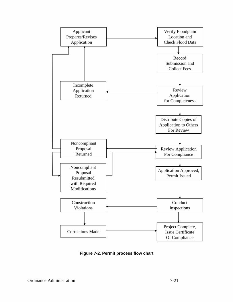
Ordinance Administration 7-21
Figure 7-2. Permit process flow chart
Verify FloodplainLocation and
Check Flood Data
RecordSubmission and
Collect Fees
ReviewApplication
for Completeness
Distribute Copies ofApplication to Others
For Review
Review ApplicationFor Compliance
Application Approved,Permit Issued
ConductInspections
Project Complete,Issue CertificateOf Compliance
ApplicantPrepares/Revises
Application
IncompleteApplication
Returned
NoncompliantProposalReturned
Corrections Made
ConstructionViolations
NoncompliantProposal
Resubmittedwith RequiredModifications

Ordinance Administration 7-22
EXEMPTIONS
Your statutory authority may limit your community’s ability to regulate some development.The most common limitation is over activities by federal agencies, tribal lands, state agencies,other local governments, and public utilities. Check with your state NFIP coordinator to deter-mine what is exempt from a local ordinance.
44 CFR 60.1(b) These regulations must be legally-enforceable, applied uniformly throughout thecommunity to all privately and publicly owned land within flood-prone … areas, and the commu-nity must provide that the regulations take precedence over any less restrictive conflicting locallaws, ordinances or codes.
You cannot exempt activities by your own community government. Just because the publicworks department doesn’t get a permit from the building department does not mean that itdoesn’t have to follow the NFIP rules that govern all development within your statutory author-ity.
If State actions are exempt from your permit authority, your state should have adopted flood-plain management requirements that are comparable to your ordinance. This is usually in theform of a governor’s executive order. Similarly, Federal agency activities are subject to theprovisions of Executive Order 11988 Floodplain Management.
You do have some discretion to exempt obviously insignificant activities from the permit re-quirement—such as planting a garden, farming, putting up a mailbox or erecting a flagpole.Other projects, such as reroofing and replacing siding, will not affect flood flows or be labeledsubstantial improvements See also the discussion on the NFIP’s development permit require-ments in Unit 5, Section C.
Some communities specify exempt projects in their ordinances. Check with your state coor-dinating agency and/or FEMA Regional Office before you do this, because you don’t want toexempt projects that could be considered floodway violations or substantial improvements.
PERMIT APPLICATION FORM
A good administrative form can serve as a checklist for identifying the kinds of informationthat should accompany a permit application.
Your community should have its own permit application form. Figure 7-4, at the end of thissection, is the model form developed by the state of North Carolina. It contains all the requiredinformation for a floodplain development permit application. Your form may be different, butthe review process is the same.
Note: If you use the form in Figure 7-4 to develop your own permit application program, besure to include all other state and local requirements. You may want to include checklists ofitems you will need to look at.
Where a particular activity that is required by the NFIP regulations is mentioned in this unit’stext, the reference to 44 CFR Part 60 is included in brackets (e.g. [44 CFR 60.3(c)(5)]). These

Ordinance Administration 7-23
activities must be included in the permit process in order for the community to remain in fullcompliance with the NFIP.
Forms are a valuable and necessary tool in reviewing development proposals for regulatorycompliance. When designed properly, they can be the most efficient way to get information thatis essential to conducting an effective and thorough review. The forms should be revised periodi-cally to remain current with changes in the floodplain management ordinance and to includepertinent information.
APPLICATION REVIEW
Submission of a development permit application starts the permit process.
Before submitting an application, the prospective applicant often will contact you to obtain acopy of the regulations, locate the proposed site in relation to the NFIP maps, determine floodelevations, or gather procedural and technical information needed to complete the application.
This informal part of the permit process can be important in guiding the applicant to locateand design the development in compliance with local regulations. It also can help the applicant toprepare a complete application, avoiding unnecessary delays at the outset.
Some communities ensure that the permit process will go smoothly by having a formal pre-application meeting with a developer to review a preliminary plan.
REVIEW FOR COMPLETENESS
The application package should contain all the administrative forms, plans, blueprints andtechnical documentation required for you to review the proposed project for regulatory compli-ance. If the application package is incomplete, the review can’t go forward. The applicant shouldbe advised of missing documents and told that the review will not start until the missing docu-ments are submitted.
Some states and communities require that a permit be issued within so many days of receiptof the application. You should not officially “receive” the application or log it in until it has beenreviewed and determined to be complete.
You should review the package in a timely manner. The review should include the followingprocedures:
1. Make sure all administrative forms are completed satisfactorily and properly signed.Scan the administrative forms to ensure that all questions have been answered. If important itemsare left blank or not addressed completely, bring them to the attention of the applicant for com-pletion.
Inaccurate information also should be brought to the attention of the applicant. Your reviewshould be halted until deficiencies are corrected.

Ordinance Administration 7-24
2. Briefly review site plans, grading and excavation plans, and building design plans forcompleteness. Depending on the specificity or detail of the administrative forms, the variousplans that accompany the application will provide the technical data needed for a thorough re-view.
The site plan is a critical component of floodplain development proposals. Such a planshould show:
♦ Location of property lines.
♦ Required set backs lines and easements.
♦ Topographic information, such as contour lines or spot elevations.
♦ Streets.
♦ Watercourses.
♦ Existing and proposed structures.
♦ Proposed building elevations of all new construction and the existing lowest floor forsubstantially improved or substantially damaged structures.
♦ All clearing, filling and other proposed changes to the ground.
♦ Floodway and floodplain boundaries.
♦ Base flood elevations.
♦ In V zones, the line of the mean high tide and Zone V/Zone A boundary; if there is morethan one Zone on the lot, the BFE and boundary locations should be depicted on theplans.
When a plan is prepared by a registered professional architect, engineer or land surveyor, itshould be stamped with the license seal to certify technical accuracy.
3. Ensure that all necessary certifications are included and properly signed. The appli-cant must provide all completed certifications needed for the permit review.
Based on the minimum NFIP requirements, four situations would require the filing of certi-fied documents with the permit application:
♦ Floodway encroachment: If any part of the proposed project is to be located in a desig-nated floodway, the applicant must submit an engineering certification anddocumentation demonstrating that the proposed encroachment would not result in any in-crease in base flood heights. If the project is in a riverine floodplain where no floodwayhas been adopted, the certification would show that there the project will not exceed theallowable increase a flood heights. This certification could be the same as the No-RiseCertification shown in Figure 5-5. [44 CFR 60.3(c)(10) and (d)(3)]
♦ Floodproofed building: In the event a nonresidential structure is to be floodproofed, theapplicant must submit a statement from a registered professional engineer or architect

Ordinance Administration 7-25
certifying that the design and methods of construction meet these standards [44 CFR60.3(c)(4)]. A second, as-built, certificate is also required to be submitted later.
♦ Enclosures below the lowest floor. Unit 5, Section E covered the requirements for open-ings in enclosures. If an applicant designs an enclosure below the lowest floor using analternative to the NFIP standard, a registered professional architect or engineer must cer-tify the design [44 CFR 60.3(c)(5)]. If a full-story enclosure is planned below theelevated lowest floor, you should require the applicant to sign a non-conversion agree-ment such as the one in Figure 5-13.
♦ V Zone construction. An applicant proposing to construct a building in a V zone mustsupply a statement from a registered professional architect or engineer certifying the de-sign and method of construction of the elevated building and the design of breakawaywalls [44 CFR 60.3(e)(4)]. See Figure 5-18 for an example. An as-built certificate is alsorecommended to be submitted later
4. Ensure that all necessary federal and state permits are being obtained. You must re-view the application package to determine whether federal and state permits are necessary [44CFR 60.3(a)(2)]. To help you and the applicant, you might include the agency or program namesas a checklist on your permit application form.
When obtaining federal and state approval takes a long time, you may condition issuance ofyour permit on the applicant’s obtaining such permits later. The applicant should provide docu-mentation to the administrator stating that the required federal and state permits have beenapplied for, and that portion of the project affected by needed permits will not proceed untilthose permits are issued.
For example, getting a Section 404 wetlands permit from the Corps of Engineers may takeseveral months. Under such circumstances, you may issue a local permit with the stipulation thatthe applicant must have submitted all required permits before beginning construction. You canverify this at your first inspection.
5. Submit copies of appropriate parts of the application package to other departmentsfor review. Depending on the type and size of the proposed development and on the regulatoryresponsibilities of other departments or offices in your community, the applicant should submit asufficient number of copies to allow for others’ review.
Here are some departments and agencies who might need to review a portion of the applica-tion:
♦ Building department.
♦ Zoning department.
♦ Engineer’s office.
♦ Health department (septic system approval).
♦ FEMA Regional Office (for assistance in evaluating a no-rise floodway application,change to a floodway delineation or other activity that will result in a map revision).

Ordinance Administration 7-26
♦ State NFIP coordinating agency (state permit requirements, alteration or relocation of awatercourse).
♦ U.S. Army Corps of Engineers (404 permit, technical assistance).
♦ Environmental Protection Agency.
♦ State public health agency (permits for hospitals, nursing homes, etc.).
♦ Natural Resources Conservation Service (impact of subdivisions and other large devel-opment on the natural resources of the area).
♦ Adjacent communities (alteration or relocation of a watercourse).
If your office hasn’t done this already, you should contact these agencies, determine what, ifanything, they need to review, and prepare a checklist for permit applicants that advises them ofthe other approvals that will be needed.
REVIEW FOR COMPLIANCE
Now that you have a complete application package, follow these recommended procedures toverify that the project will meet all of your ordinance requirements.
1. Examine site information. Check the site plan to ensure the that plotted floodplain,floodway, and V Zone boundaries appear accurately plotted. Look for possible obstructions inthe floodway and other potential violations.
Inspect the plan carefully and compare it with the FIRM, floodway map and profile. Incoastal areas, you should determine if the site is in a COBRA zone and so advise the appli-cant/property owner (COBRA zones are explained in Unit 3, Section F and Unit 9, Section D).
Some project sites may be located close to the boundaries of the SFHA. Because the mapscale is small, or it is difficult to pinpoint the project site, you may have trouble determiningwhether the project will be in or out of the SFHA. See Unit 4, Section B, on making floodplainand floodway boundary determinations.
Remember, a floodplain development permit is required only if the planned structure is lo-cated within the SFHA. For example, while the applicant’s property may be located partially inthe SFHA, the proposed structure would be built on land outside the SFHA. In this case, flood-plain regulations would not apply and no special floodplain development permit is needed.However, if clearing, grading, filling, or road or bridge construction associated with erecting thestructure is within the SFHA, a permit is necessary.
Note that while you can use better ground elevation data to determine that a building location isabove the BFE (and therefore outside the SFHA), the property will remain in the SFHA on theFIRM. That means that it is still subject to the flood insurance purchase requirement and therates will be set at SFHA rates. It is the owner’s responsibility to submit a request for a Letter of

Ordinance Administration 7-27
Map Amendment (LOMA) in order to have the FIRM reflect the better data (see Unit 4, Section Dfor more information on LOMAs).
2. Review building plans. If a building site is in the SFHA, all buildings must be protectedto the BFE or higher.
In this course, the term “building” is the same as the term “structure” in the NFIP regulations.Your ordinance may use either term. The terms are reviewed in more detail in Unit 5, Section E.
The application package must include building design plans that show:
♦ The kind and potential use of the structure.
♦ The elevation of the lowest floor.
♦ The type of foundation system.
♦ The existence of any enclosure below the lowest floor, along with electrical and plumb-ing plans for the area, location of openings and materials proposed for use in an enclosurebelow the BFE.
♦ The height to which a nonresidential structure is to be floodproofed and the complete listof floodproofing techniques to be used, with detailed drawings
Any conflict or inconsistency with applicable regulations will require adjustments to thebuilding plans.
3. Have the community’s engineer review engineering documents. As listed previously, depending on the type and location of the structure being proposed, as many as four engineeringdocuments or certifications are needed to show compliance with NFIP requirements concerningfloodway encroachment, floodproofing, enclosures below the lowest floor and V Zone construc-tion.
All engineering documents should be examined by your community’s staff engineer, or aconsulting engineer available to perform reviews, to ensure that acceptable technical standardswere used and that calculations are correct. If your community does not have a staff engineer, thestate NFIP coordinating agency or FEMA Regional Office may be able to help review the data.
APPLICATION APPROVAL OR DENIAL
Once you complete your review of the permit application papers for completeness and tech-nical compliance with the ordinance, a decision on the application is due.
If the proposed development is in compliance with regulations, issue a permit. The per-mit becomes the official authorization from the community allowing the applicant to proceed,based on the information submitted in the application package. A sample permit developed bythe North Carolina state NFIP coordinator is shown in Figure 7-5.
Somewhere in the permit record, such as the approved plans, the application form or thepermit form itself, a record should be kept of the base flood elevation and the required floor

Ordinance Administration 7-28
elevation. There should also be a general statement that all construction will be in accordancewith all codes and ordinances (see Section 1, item 6 in Figure 7-4).
The day a permit is issued is the date of the “start of construction,” provided construction be-gins within 180 days. Used for insurance rating purposes, this date determines what FIRM was ineffect when the building was built, regardless when ground was broken or construction wasfinished.
For regulatory purposes, a permit may be effective or valid for a certain period of time, ac-cording to the standard used in your other regulations. If at the end of this period the project isnot complete, the permit technically expires. However, ordinances routinely provide for thepermit officer to issue written extensions to allow completion of the development under theconditions of the original permit.
If the application is not in compliance with local regulations, the permit should be de-nied. The applicant then can choose to:
♦ Withdraw the permit application.
♦ Redesign the project to bring it into compliance with regulations.
♦ Appeal to the Board of Appeals.
♦ Ask for a variance to the regulations.
While you may not be formally required to disclose the reasons for denying an application, itis good policy to do so in writing. This tells the applicant what areas are noncompliant so that ifhe or she wishes to resubmit the application, appropriate corrections can be made.
Appeals and variances are covered in Section F of this unit. Clarifying the deficiencies forthe applicant also can help reduce the number of appeals of administrative and regulatory deci-sions you make

Ordinance Administration 7-29
Building Permit Number: ________________
Applicant's Name: Owner's Name:
Site Address, Tax #, Parcel #: Address:
Telephone: Telephone:
I. All development - Base Flood Elevation Data provided.
A. The as-built elevation certification from a registered land surveyor or professional engineer has been submitted? � Yes � No
B. The lowest floor elevation is at or above the required lowest floor elevation? � Yes � NoC. Electrical, heating, ventilation, plumbing, air conditioning equipment (including
duct work) and other service facilities are located above BFE or floodproofed? � Yes � No
II. Development in Zones A, AE, A1-A30 and AH.
A. Solid foundation perimeter walls located below BFE.:1. There are at least two (2) openings? � Yes � No2. Square footage of enclosed area subject to flooding ___________3. Square inches of venting required ___________4. Square inches per opening (multiply l by w) ___________5. Number of required vents (3 above divided by 4 above) ___________6. Foundation contains the minimum number of vents? � Yes � No7. The bottom of each opening is no higher than one (1) foot above grade? � Yes � No8. Any cover on openings will permit the automatic flow of floodwaters
in both directions? � Yes � No
B. Base flood elevation and/or floodway data not available or AO Zones:1. The lowest floor is at least three (3) feet above the highest adjacent grade? � Yes � No2. The development meets the setback requirements of the ordinance? � Yes � No3. If 2 above was "no", has a No-Rise Certification been submitted? � Yes � No
Reviewer's Name: ______________ Date reviewed: ___________________
C. Floodway data is provided.1. Did this development encroach in the floodway? � Yes � No2. Do the actual field conditions meet the proposed actions and technical
data requirements? � Yes � No3. If C1 was "yes", has a No-Rise Certification been submitted? � Yes � No
Reviewer's Name: ______________ Date reviewed: ___________________
III. Development in Zones V, VE, and V!-V30, VO (Coastal High Hazard Areas).A. Development location complies with all coastal setback requirements? � Yes � NoB. Structure is securely anchored to pilings or columns and certification by a
registered, professional architect or engineer has been submitted? � Yes � NoReviewer's Name: ________________ Date reviewed: ___________________
C. Walls permitted below the base flood elevation consist of decorative lattice work or, where permitted, are breakaway and have been certified by a registered,professional architect or engineer? � Yes � NoReviewer's Name: ________________ Date reviewed: ___________________
Local Administrator's Signature: ______________________________________Date : _________________
Figure 7-3. Sample permit review checklist(Developed by the South Carolina Department of Natural Resources)

Ordinance Administration 7-30
Figure 7-4a. Sample floodplain development permit application form(Developed by the North Carolina Division of Emergency Management)

Ordinance Administration 7-31
Figure 7-4b. Sample floodplain development permit application form(Developed by the North Carolina Division of Emergency Management)

Ordinance Administration 7-32
Figure 7-4c. Sample floodplain development permit application form(Developed by the North Carolina Division of Emergency Management)

Ordinance Administration 7-33
Figure 7-4d. Sample floodplain development permit application form(Developed by the North Carolina Division of Emergency Management)

Ordinance Administration 7-34
Figure 7-5. Sample permit form

Ordinance Administration 7-35
LEARNING CHECK #2
1. What activities are exempt from regulation under your floodplain ordinance?
2. Does your community have a permit application form that makes sure things like a floodwayencroachment analysis or V Zone certification are not missed?
3. What five items need to be checked to ensure an application for a permit is complete?
4. What departments or offices in your community should review a permit application before itis approved?
5. During your permit review, you find that the applicant’s site plan shows that the ground iscurrently higher than the BFE. Should you continue to treat this as a floodplain developmentpermit?
6. What’s the best way to make sure the applicant’s engineering certifications are sufficient?
7. What are the key items you need to check when reviewing the plans for a new house to bebuilt on pilings in the V Zone?
8. Match the list of proposed projects with the documents that will be needed in order to deter-mine if the project should be built in the floodplain.
— New shopping center parking lot in the floodway— New house in the fringe— New business in the V Zone— Reconstruction of a state highway bridge— New house built over a floodable, but enclosed garage
a. Floodplain development permit applicationb. Site and/or building plansc. Floodway encroachment analysisd. Floodproofing certificatione. Non-conversion agreementf. V Zone certification

Ordinance Administration 7-36
D. INSPECTIONS
You can’t assume that construction and development will proceed as spelled out in the permityou’ve approved. Follow-up conversations and inspections are vital to ensure that the applicantadheres to the permit’s requirements.
Taking a hands-off attitude toward construction can create many problems for both the proj-ect’s owners and your community.
The most effective way to ensure compliance is to inspect the site frequently during con-struction. This is particularly important in the early phases of work on a building because that’swhen errors in relocation or elevation of the lowest floor can be found and corrected. An inspec-tion program also puts builders, developers and property owners on notice that the communitywill insist that projects are completed in compliance with regulations.
We recommend a series of three inspections for every project, especially any project that in-volves construction of a building.
FIRST INSPECTION
Do this inspection before ground is broken. Ideally, this site visit should be after the site isstaked out to allow you to check the plans in relation to the ground and lot boundaries. Withplans in hand, you should determine that the site as identified on the proposed plans is consistentwith actual ground conditions.
Check the following:
♦ The location of the floodplain and floodway boundaries.
♦ Setbacks from lot lines, channel banks, etc.
♦ Floodway encroachments, if applicable.
If the building, filling, etc., as staked out are in violation of the approved plans or of the ordi-nance requirements, you must tell the developer to make revisions.
The project must not be allowed to proceed until you have gone back and verified that it is incompliance.
SECOND INSPECTION
Schedule your second inspection of a project involving a new building or addition to abuilding just before installation of the lowest floor. You need to ensure that the lowest floor willbe built at the height stipulated in the permit application, and that the foundation is the typespecified in the plans.

Ordinance Administration 7-37
The type of foundation dictates your schedule:
♦ If the building is on a slab foundation, the inspection is best done when the forms areplaced. You can check the proposed floor elevation by checking the elevation of the topof the forms. If the forms are high enough, you can approve the pouring the slab.
♦ If the building is on an elevated foundation (crawlspace, piles, etc.), the inspection is bestdone when the foundation is completed. If the top of the foundation is high enough, youcan approve placement of the floor.
♦ If the building is to be floodproofed and the floodproofing technique is easy to identify—such as a reinforced concrete stem wall up to the BFE plus freeboard—this inspectionshould be conducted when that portion of the project is completed.
Making sure a structure is properly elevated is the key to the entire regulatory process. If thisdoesn’t happen, the permit process is pretty much for naught. Therefore, an inspection at thepoint of initial construction, where changes to the height of the foundation can be made withoutmajor difficulty, is best. Once the foundation is poured or laid, it can be very expensive for theproperty owner to changes the building location or the elevation of the lowest floor.
Checking elevations
You can confirm the floor elevation at this stage in one of two ways. First, you can have thebuilder certify the floor elevation. This must be done by a surveyor or engineer.
The alternative approach is to check for yourself:
♦ Before construction or sometimes as part of the first inspection, the developer’s surveyoror your engineer can shoot an elevation reference mark to a nearby stationary object suchas a tree or telephone pole. The mark should be at the same elevation as the height towhich the lowest floor should be elevated.
♦ During the second inspection, you can use a hand level to determine whether the lowestfloor will be as high as the reference mark.
♦ This will give you a rough estimate that the building will be close to the correct elevation. A hand level will not give accurate elevations.
Note: Neither approach relieves the builder of having to provide an as-built elevation orfloodproofing certificate when the project is done. It simply verifies that the building will beelevated or floodproofed to the proper elevation before it is too late to make changes.
During your second inspection, also check:
♦ Whether any fill meets the necessary compaction, slope and protection standards con-tained in your regulations.
♦ The building’s location matches the permit application plans.

Ordinance Administration 7-38
♦ The number and size of crawlspace or enclosure openings.
♦ Whether any part of the project encroaches into the floodway.
♦ In V Zones, get an as-built foundation certification at this time, such as the V Zone certi-fication in Figure 5-18.
THIRD INSPECTION
The third and last inspection is conducted as the project nears completion. The purpose ofthis “final” inspection is to:
♦ Ensure that the foundation and floor elevation has not been altered since the second in-spection.
♦ Obtain an as-built elevation or floodproofing certificate.
♦ Verify that enclosures below the lowest floors have adequate openings.
♦ Ensure that nothing subject to flood damage, such as a furnace or air conditioning unit,has been located below the lowest floor.
♦ Check breakaway walls in V Zones.
♦ Check for floodway encroachments.
♦ Check the anchoring system used in securing manufactured homes.
Certificate of occupancy
After the project passes final inspection, many communities issue a document called a cer-tificate of occupancy, certificate of compliance or use permit.
This certificate allows the owner to move in to the newly constructed building or addition.Usually a new building cannot be sold until the seller has this certificate; some utility companieswill not start service until the certificate is presented.
Before a certificate is completed, you must make sure that all needed documents are receivedand checked. You must have an elevation certificate and the other forms noted in the later sec-tion on record keeping.
LATER INSPECTIONS
Certifying a structure for occupancy is the final step in the permit process. However, theproperty must remain in compliance with your ordinance and the conditions under which thepermit was issued.

Ordinance Administration 7-39
Your office should periodically check to ensure that the property continues to remain incompliance over time. Later inspections are particularly important when a structure contains anenclosure below the lowest floor. Such areas can be easily modified and made into habitablespaces in violation of regulations.
In some states, communities do not have the statutory authority to go onto private property tolook for violations. This can make it hard, if not impossible, to verify whether an enclosed areahas been modified. If this is true in your community, your ordinance should prohibit enclosuresor limit their allowable size to less than 300 square feet. Allow larger enclosures only if theyhave wood lattice or screening so you can tell from the street if changes have been made.

Ordinance Administration 7-40
LEARNING CHECK #3
1. When is the best time to make the first site inspection?
2. When should you make the second inspection of a building on a slab foundation?
3. What are your two options for making sure a new building is high enough before you allowconstruction to proceed after the second inspection?
4. What should you check for during the third inspection?
5. If a project meets all of the ordinance requirements and is built according to the approvedplans, what does the owner get after the final inspection?

Ordinance Administration 7-41
E. ENFORCEMENT
Adequate, uniform and fair enforcement means two things:
♦ All development in a floodplain must have a permit.
♦ All development with a permit must be built according to the approved plans.
In order to ensure that development is meeting these requirements, you must monitor thefloodplain, and where necessary, conduct an inspection of a property. Some permit officials havestatutory limits on where they can go to inspect a potential violation. Be sure to review yourauthority to access onto private property with your attorney.
If you discover development activities without permits or contrary to the approved plans, youmust enforce your ordinance. You have several methods for enforcing your ordinance. Thissection explores these methods.
VOLUNTARY COMPLIANCE
The best approach is to convince the developer that complying with the ordinance is in his orher own best interest. This may take some explanation of the flood hazard and how the rulesprotect the property (or neighboring properties) from that hazard.
If the issue is protection of a building, the flood insurance rate table in Figure 9-3 can showhow expensive insurance could be. Even if the developer is not interested in flood insurance,future owners may want it and probably will be required to purchase it as a condition of a mort-gage or loan.
Should voluntary efforts not work, here are the other compliance tools you have.
ADMINISTRATIVE STEPS
Your first steps in enforcement involve what you can do as an ordinance administrator. Besure to review these with your community’s attorney before you start:
♦ Contact the property owner or building contractor in person or by telephone to explainyour concerns.
♦ Notify the property owner (in writing) of the nature of the violations and what to do tocorrect them.
♦ Post a violation notice on the property.
If a problem is found during construction of a permitted project, you have additional tools:
♦ If the violation is a serious one, or if the problem still exists after a follow-up inspection,you can issue a stop-work order or revoke the permit.

Ordinance Administration 7-42
♦ You can withhold the certificate of occupancy until the problem is corrected. Usuallyutilities will not be turned on or a bank loan will not be closed until the certificate of oc-cupancy is issued.
LEGAL RECOURSES
If your administrative measures do not bring results, go back to your community’s attorneyand discuss the next steps. Your attorney can take the case to court and request two additionalenforcement measures be brought to bear.
You can help the attorney by having complete records of all correspondence and meetingswith the person accused of the violation. You should also identify what section of the ordinancewas violated, when and how, and what was specifically allowed in the approved permit.
You should advise the attorney about what actions can be taken that will bring the projectinto compliance. Depending on the violation, these actions could include removing the building(or other project), retrofitting the building to protect it, applying for a variance, or revising themaps to remove the problem from the floodplain, floodway, V Zone, etc.
Fine. Your ordinance should establish a maximum fine per offense. Usually each day a vio-lation continues is considered a separate offense. This approach encourages a quick remedy tothe problem.
A per-day fine for a summary offense from a local district justice or magistrate can be diffi-cult to get because many courts would believe that such a severe financial penalty does not fit theinfraction. However, the threat of seeking the fine may be sufficient to persuade a propertyowner to remedy the violation.
Recordation. Depending on your statutory authority, you may be able to record the violationin the property’s deed records. This will inform potential purchasers as well as “cloud the deed,”making it hard for the owner to sell the property or the buyer to obtain title insurance. This ap-proach is more appropriate for new developments that are likely to be sold in the near future.
Injunction. An injunction is a court order to stop further noncompliant conduct. A temporaryrestraining order will be issued if the activity can be shown to be a danger to the public and thatimmediate irreparable harm can occur.
Housing court. Dealing with your state or county’s judicial system can be expensive and dif-ficult. Your case has to wait its turn and compete with many cases for attention.
To speed up the enforcement process, some communities enact special enforcement ordi-nances to create a municipal housing court or a building court. This is a local judicial body thathas several advantages:
♦ The judge or administrative judge will be familiar with housing or building code law.
♦ The community has more control over when cases will be heard.

Ordinance Administration 7-43
♦ Such courts usually are less formal. For example, the defendant may not have to have anattorney present.
The establishment of these courts varies by state law. Your attorney or state department oflocal government affairs or housing can provide more information on how it can work in yourcommunity.
SECTION 1316
Section 1316 of the National Flood Insurance Act authorizes FEMA to deny flood insuranceto a property declared in violation of the community’s ordinance.
Section 1316 is used when all other legal means to remedy the violation have been exhaustedand the structure is still noncompliant. Check with your state NFIP coordinator or FEMA Re-gional Office on how 1316 works in your state.
If invoked under Section 1316, denying flood insurance means:
♦ The property may be difficult or impossible to sell.
♦ The market value of the property may fall.
♦ The cost of suffering flood damage without insurance may be too great a risk for theproperty owner.
♦ Lending institutions holding the property’s mortgage may threaten to foreclose.
♦ Any permanent reconstruction will be denied disaster assistance.
In some cases a Section 1316 insurance denial will be sufficient to convince the propertyowner to correct the violation. Section 1316 also has the advantage of limiting any taxpayerliability if the building is damaged by a flood, as the owner will be ineligible for an insuranceclaim and disaster assistance.

Ordinance Administration 7-44
F. APPEALS, SPECIAL USES AND VARIANCES
Generally, procedures for Appeals, special uses and variances are specified by state law.They require judgment calls involving several people, as ordinances typically do not allow onlyone person to decide these issues. Here is when they can occur and how they are usually handled.
Appeals
Ambiguous language or differing interpretations can lead the applicant and permit office todisagree. Your ordinance should have a process for referring these disagreements to a board ofappeals or adjustment which will interpret the ordinance and settle the dispute.
Special uses
Some regulations require that certain situations be given a special review to determine if theyshould be allowed and, if so, whether conditions should be attached to the permit. While theNFIP sets construction standards for all buildings, your community may have decided that resi-dences should not be allowed in a floodway and that nonresidential buildings should be allowedonly if certain conditions are met. Some official body needs to determine if a special use permitor if a conditional permit should be issued.
Variances
Zoning ordinances, building codes and floodplain management regulations cannot be writtento anticipate every imaginable situation. A process for issuing variances gives a builder a way toseek permission to vary from the letter of the rules because of a special situation.
A variance can mean that the minimum standards of the NFIP may not be met by a projectdue to a special local circumstance. Because of this, most of this section is devoted to variances.
Boards
In all three cases, the applicant submits a request to a knowledgeable board of arbiters. Typi-cally, variances and special or conditional use permits are handled by the planning commissionor other body that is responsible for writing and amending the ordinance. Appeals are usuallyhandled by a separate board of appeals or board of adjustments. Sometimes all three processesare handled by the same body and sometimes, especially in smaller communities, that body is thecity council or governing board.
These boards do not have authority to change the ordinance, just to apply or interpret the or-dinance’s provisions. They may or may not have authority to make a final decision. If not, theymake recommendations to the governing board which makes the final decision.
VARIANCES

Ordinance Administration 7-45
A variance is a grant of relief by a community from the terms of a land use, zoning or build-ing code regulation. Because a variance can create an increased risk to life and property,variances from flood elevation or other requirements in the flood ordinance should be rare.
Granting variances is a local decision that must be based on not only NFIP criteria, but alsoon state law and other provisions the community may wish to require. Your community’s reviewboard must consider the fact that every newly constructed building adds to the local govern-ment’s responsibilities and remains a part of the community for the indefinite future.
Variances are based on the general principal of zoning law that they pertain to a piece ofproperty and are not personal in nature. Though standards vary from state to state, in general avariance is granted for a parcel with physical characteristics so unusual that complying with theordinance would create an exceptional hardship to the applicant or surrounding property owners.Those characteristics must:
♦ Be unique to that property and not shared by adjacent parcels.
♦ Pertain to the land, not to any structure, its inhabitants or the property owners.
Characteristics that might justify a variance include an irregularly shaped lot, a parcel withunsuitable soils, or a parcel with an unusual geologic condition below ground level. It is difficult,however, to imagine any physical characteristic that would give rise to a hardship sufficient tojustify issuing a variance to a flood elevation requirement.
Your community should grant variances based only on a structure-by-structure review. Nevergrant variances for multiple lots, phases of subdivisions or entire subdivisions.
NFIP requirements
NFIP regulations do not address appeals, special uses or conditional permits. Follow the pro-cedures used in your zoning ordinance or building code as these are usually prescribed by statelaw.
Because variances may expose insurable property to a higher flood risk, NFIP regulations setguidelines for granting them. The guidelines, which are designed to screen out situations inwhich alternatives other than a variance are most appropriate, appear in 44 CFR 60.6(a). Theyare summarized in Figure 7-6.
A review board hearing a variance request must not only follow procedures given in theNFIP criteria, it must consider the NFIP criteria in making its decision. When the NFIP guide-lines are followed, few situations qualify for a variance.
Good and sufficient cause. The applicant must show good and sufficient cause for a vari-ance. Remember, the variance must pertain to the land, not its owners or residents. Here aresome common complaints about floodplain rules that are NOT good and sufficient cause for avariance:

Ordinance Administration 7-46
♦ The value of the property will drop somewhat.
♦ It will be inconvenient for the property owner.
♦ The owner doesn’t have enough money to comply.
♦ The property will look different from others in the neighborhood.
♦ The owner started building without a permit and now it will cost a lot to bring the build-ing into compliance
Hardship. The concept of unnecessary hardship is the cornerstone of all variance standards.Strict adherence to this concept across the country has limited the granting of variances.
The applicant has the burden of proving unnecessary hardship. Reasons for granting thevariance must be substantial; the proof must be compelling. The claimed hardship must be ex-ceptional, unusual and peculiar to the property involved. Financial hardship, inconvenience,aesthetic considerations, physical handicaps, personal preferences or the disapproval of one’sneighbors do not qualify as exceptional hardships.
The local board must weigh the applicant’s plea of hardship against the purpose of the ordi-nance. Given a request for a variance from floodplain elevation requirements, the board mustdecide whether the hardship the applicant claims outweighs the long-term risk to the owners andoccupants of the building would face, as well as the community’s need for strictly enforcedregulations that protect its citizens from flood danger and damage.
When considering variances to flood protection ordinances, local boards continually face thedifficult task of frequently having to deny requests from applicants whose personal circum-stances evoke compassion, but whose hardships are simply not sufficient to justify deviationfrom community-wide flood damage prevention requirements.

Ordinance Administration 7-47
1. Variances shall not be issued by a community within any designated regulatory floodway if any in-crease in flood levels during the base flood discharge would result;
2. Variances may be issued by a community for new construction and substantial improvements to beerected on a lot of one-half acre or less in size contiguous to and surrounded by lots with existing struc-tures constructed below the base flood level, in conformance with the procedures of paragraphs (a) (3),(4), (5) and (6) of this section;
3. Variances shall only be issued by a community upon...
(i) a showing of good and sufficient cause,
(ii) a determination that failure to grant the variance would result in exceptional hardship to the appli-cant, and
(iii) a determination that the granting of a variance will not result in increased flood height, additionalthreat to public safety, extraordinary public expense, create nuisances, cause fraud on or victimization ofthe public, or conflict with existing local laws or ordinances;
4. Variances shall only be issued upon a determination that the variance is the minimum necessary,considering the flood hazard, to afford relief;
5. A community shall notify the applicant in writing over the signature of a community official that...
(i) the issuance of a variance to construct a structure below the base flood level will result in in-creased premium rates for flood insurance up to amounts as high as $25 for $100 of insurance coverageand;
(ii) such construction below the base flood level increases risks to life and property. Such notificationshall be maintained with a record of all variance actions as required in paragraph (a) (6) of this section.
6. A community shall...
(i) maintain a record of all variance actions, including justification for their issuance, and
(ii) report such variances issued in its annual or biennial report submitted to the [Federal Insurance]Administrator.
7. Variances may be issued by a community for new construction and substantial improvements andfor other development necessary for the conduct of a functionally dependent use provided that...
(i) the criteria of paragraphs (a) (1) through (a) (4) of this section are met, and
(ii) the structure or other development is protected by methods that minimize flood damages duringthe base flood and create no additional threats to public safety.
Figure 7-6: NFIP variance criteria (44 CFR 60.6(a))
These problems can be resolved through other means, even if the alternatives to a varianceare more expensive or complicated than building with a variance, or if they require the propertyowner to put the parcel to a different use than originally intended, or to build elsewhere.

Ordinance Administration 7-48
Here are two examples:
Example 1. A small undeveloped lot is surrounded by lots on which buildings have beenconstructed at grade. The ordinance requires new buildings to be constructed at a level severalfeet above grade.
If the owner were to build a new house, it would look different, Potential buyers would askquestions and find out about the flood problem in the area. If it were built on fill, the lot mightdrain onto the neighbors’ property.
This situation probably would not warrant a variance because the owner does not face an ex-ceptional hardship. Appearance is not a hardship and no action should be taken to hide thehazard from others. There are ways to elevate a building without creating a drainage problem,such as elevating the building on pilings or a crawlspace, or grading the fill to drain away fromadjoining properties.
Example 2. A property owner seeks a variance because he or she would have to spend sev-eral thousand dollars to elevate a house to comply with the ordinance, and several thousand moreto build a wheelchair ramp or an elevator to provide access for a handicapped member of thefamily.
While financial considerations are important to property owners and the needs of a handi-capped person must be accommodated, these difficulties do not put this situation in the categoryof “exceptional hardships” because:
♦ The characteristics that result in the claimed hardship do not pertain to the property butare personal.
♦ A variance is not needed to provide day-to-day access to the building, which can be pro-vided by building a ramp or elevator.
♦ Having a handicapped person occupy a floodprone dwelling raises a critical public safetyconcern.
If a variance is granted and the building is constructed at grade, the handicapped or infirmperson must leave when floodwaters begin to rise, yet he or she may need help to do so. Thisposes an unnecessary danger to the handicapped person and places an extra demand on thecommunity’s emergency services personnel, who may be called upon to rescue the resident inthe event of a flood.
On the other hand, if the building is properly elevated, the handicapped person either can beevacuated or can survive the flood simply by remaining at home safely above the floodwaters.
In effect, the variance would not relieve the property owner of his or her difficulty, but likelyonly postpone and perhaps ultimately increase it. It would not help the community, either, as thebuilding will be susceptible to damage long after the current owners are gone.
It would be more prudent for both the owner and the community if the variance were deniedand the home built at the proper elevation with handicapped access. This would ensure the safety

Ordinance Administration 7-49
of all family members when floodwaters rise, as well as protect the property owner’s and thecommunity’s investment in the property.
Public safety and expense. Flood damage prevention ordinances are intended to help protectthe health, safety, well-being and property of the local citizens. Variances must not create threatsto public safety or nuisances.
Because it would increase damage to other property owners, no variance may be issuedwithin a regulatory floodway that will result in any increase in 100-year flood levels (44 CFR60.6(a)(1)).
Fraud and victimization. Variances must not defraud or victimize the public. Any buildingspermitted below the BFE face increased risk of damage from floods, and future owners of theproperty—and the community—are subject to all the costs, inconvenience, danger and sufferingthat those increased flood damages may bring.
Future owners may purchase the property, unaware that because of a variance, it is subject topotential flood damages and can be insured only at high rates.
Minimum variation necessary. A variance is a request to vary from the rules, not to ignorethem. Any variance should allow only minimum deviation from the local requirements.
For example, even if an applicant can justify not elevating a building above the BFE, the re-view board should not automatically allow the building to be built at grade. The board shouldstill require as much elevation as possible, to provide some flood protection without causingexceptional hardship.
In some instances it may be possible to vary individual provisions of the ordinance withoutreducing the overall level of protection. For example, a well-engineered building might be con-structed in a V Zone on a foundation other than piles or columns.
In considering variances, the review board should use local technical staff expertise and rec-ommendations from the building, planning, zoning or engineering departments. The localtechnical staff should consider varying other requirements in order to provide the needed floodprotection. For example, it may be more appropriate to issue a variance to the front yard setbackrequirement in order to get the building out of the floodway.
Flood insurance rates. While a variance may allow deviation from building standards speci-fied in a local ordinance, flood insurance rates and the flood insurance purchase requirement—which must be enforced by lending institutions—cannot be waived.
This can create severe financial consequences for a property owner, as insurance rates for abuilding built below BFE can be substantially higher than those for elevated buildings. A vari-ance from elevation requirements—the most common kind of variance requested—increases therisk to a building, and that increased risk is reflected in higher annual insurance premiums (Fig-ure 9-3).

Ordinance Administration 7-50
If a variance is requested to construct a building below the BFE, you must notify the appli-cant (in writing) that granting the variance will result in increased flood insurance premium rates,up to $25 per $100 of coverage. In many instances, the variance-induced rates will be so high asto make the building essentially uninsurable because the owners cannot afford the premium. (Inone case, a marine supply store on the Gulf Coast was built 14 feet below BFE in a V zone. Theannual flood insurance premium was $25,000—on a $100,000 building.)
The original owner who applied for a variance may not care, but if approved, the variance’simpact may matter a great deal to subsequent potential owners who cannot afford the property’shigh insurance rates. The result may be owner abandonment; your community could be left witha vacant, flood-damaged and essentially uninsurable building.
Figures 7-7 through 7-12 illustrate the premiums for a single-family home protected to dif-ferent levels. They provide a clear picture of the cost of actuarial post-FIRM flood insurancerates and, therefore, the true risk to which the building is being exposed.
You should give these two pages of illustrations to anyone considering seeking a variance tosave construction costs. A variance may save money in the short term, but over the long run, theowner will pay much more in insurance premiums or, if uninsured, in flood losses.
Note: These premiums are for the purposes of this example. Insurance rates vary, based on lo-cation, date of construction and lowest floor elevation, and must be computed case-by-case. Thepremiums shown for the next series of illustrations were computed based on $100,000 in build-ing coverage.

Ordinance Administration 7-51
Figure 7-7. Pre-FIRM building—1995 insurance rate: $595
Figure 7-8. Pre-FIRM building—substantially damaged by 1997 flood
Figure 7-9. Repaired—variance allowedWith no elevation (7 feet below BFE); actuarial rate: $3,090

Ordinance Administration 7-52
Figure 7-10. Repaired—variance allowedElevated to 2’ below BFE; actuarial rate: $1,140
Figure 7-11. Repaired—elevated to BFE; actuarial rate: $351
Figure 7-12. Repaired—elevated 2 feet above BFE; actuarial rate: $216

Ordinance Administration 7-53
Historic buildings
A variance may be issued for the reconstruction, rehabilitation or restoration of historicstructures if the variance is the minimum necessary to preserve the historic character and designof the structure. “Historic structures” are those listed in the National Register of Historic Placesor the State Inventory of Historic Places, or that contribute to a historic district.
Changes to the structure must not destroy or alter the characteristics that made it an historicbuilding. A certified local historic board or the state historic preservation officer must review andapprove remodeling, renovations and additions before granting a variance. Whatever mitigativemeasures can be taken to reduce future flood damage must be required—such as elevating an airconditioner or using flood-resistant materials.
Many older buildings are not considered historic, so the first thing to check is whetherthe structure proposed for an exemption is historic. Look for it on a list maintained by:
-- The National Register of Historic Places.
-- Federally-certified state programs operated through a state historic preservation offi-cer.
-- A federally-certified local historic preservation board.
Structures are listed in the National Register or on a federally-recognized state or localinventory in one of two ways: as an individual building, or as a primary, secondary, or othercontributing building in a designated historic district.
Structures are either listed or may be eligible to be listed. Only a federally-certified stateor local historic preservation program can make such determinations. Either the state his-toric preservation office or federally-certified local historic preservation board should beconsulted to determine if a structure proposed for the historic exemption is indeed historic.
Figure 7 – 13. Definition of “historic building”
Functionally dependent use
A variance may be issued for new construction, substantial improvements and other devel-opment necessary for the conduct of a functionally dependent use. A functionally dependent useis one that must be located or carried out close to water—such as a docking or port facility nec-essary for the unloading of cargo or passengers, shipbuilding and ship repair.
A functionally dependent use variance could be issued provided that:
♦ There is good and sufficient cause for providing relief from the regulations.
♦ The variance will be the minimum necessary to provide relief.

Ordinance Administration 7-54
♦ The variance does not cause a rise in the 100-year flood level within a regulatory flood-way.
The structure or other development must be protected by methods that minimize flood dam-age, such as elevating mechanical equipment, locating offices above the BFE or using groundfault interrupt electrical circuits.
Records
The community must keep a record of all variances and the rationale for granting them.These are subject to review by FEMA or the state NFIP coordinator during a Community Assis-tance Visit.
The records must include a copy of the written notification to the applicant that the issuanceof a variance to construct a building below the BFE will result in increased flood insurancepremium rates as high as $25 per $100 of coverage, and such construction below the BFE in-creases risk to life and property.
It is recommended that the variance findings, conditions and authorization be recorded in thecounty deed records. This provides a means of permanently notifying future or prospectiveowners about the terms and conditions of the variance.

Ordinance Administration 7-55
LEARNING CHECK #4
1. If a FEMA staff person finds a project in violation of the FEMA NFIP requirements in yourcommunity, who is responsible for correcting the violation?
2. You discover that Mrs. Murphy has ordered five truckloads of fill to raise her back yard inthe floodway. She never asked for a permit. What is the recommended first step to dealingwith this situation?
3. If a project is found underway in the floodplain, what is the first step you should take?
4. What legal recourses do you and your attorney have to bring a violation into compliance?
5. What are the NFIP procedures for submitting an appeal to your Board of Appeals?
6. Mr. Wilson wants to build a new house at grade instead of to the BFE, six feet above grade.You tell him he will need a variance. Which of the following are good and sufficient causesfor granting him a variance?
— An elevated house will look bad
— Mrs. Wilson is old and has trouble with stairs
— It will cost more money than the builder can afford
— The builder has a contract with the bank to have it completed and sold in four months andchanging plans will prevent meeting that deadline.
— No one has ever seen a flood on that site.
7. Mr. Wilson is applying for a variance to build his house below the BFE. What two thingsmust you tell him (in writing)?

Ordinance Administration 7-56
G. RECORDS
Records show what you approved and what you told the developer, forming a “paper trail”needed for administrative or legal proceedings related to development projects. Such records arevital if the project violates your ordinance. They also give future owners information about theproperty.
Records are also checked by FEMA or the state to determine if your community is in fullcompliance with the NFIP.
This section reviews what records you must—or should—keep to meet your community’sobligation to the NFIP.
PERMIT FILE
Your community should have a permit record system that is keyed to a geographical identi-fier (not just a building permit number) such as: street address, lot and block number, township,section and range, or county appraiser’s property ID number.
You should have a file for each permit application. The files should have some indicator onthe folder to show that it is a floodplain permit, such as a different color file folder or file label.
Permit files should contain copies of these items, as appropriate:
♦ The permit application form and all attachments, including the site plan.
♦ All correspondence pertinent to the project.
♦ Flood and floodway data prepared by the developer.
♦ Engineering analyses of floodway encroachments and watercourse alterations.
♦ Special engineering designs for enclosures below the BFE.
♦ In coastal high hazard areas, engineering certifications of designs and construction meth-ods of new and substantially improved buildings.
♦ In coastal high hazard areas, certification of specially designed breakaway walls.
♦ Any variances or appeals proceedings.
♦ Records of inspections of the project while under construction.
♦ Documentation of the “as-built” lowest floor elevation of all new and substantially im-proved buildings.
♦ Certification of the elevation to which any nonresidential building has been floodproofed.
♦ Certificates of compliance or occupancy.
Keeping these records is a requirement to participate in the NFIP; there is no statute of limi-tations as to how long they should be kept. You may want to keep a separate log or record of

Ordinance Administration 7-57
floodplain permits so you can readily retrieve those floodplain projects to show FEMA or thestate NFIP coordinator.
It is not necessary to keep the entire building plans and other documents longer than is re-quired for local code purposes. However, if you allow below-BFE enclosures, your files shouldinclude the ground floor plan of those buildings in case of a future violation issue.
ELEVATION CERTIFICATE
Your permit file needs an official record that shows how high new buildings and substantialimprovements were elevated. This is needed both to show compliance with the ordinance and forthe owner to obtain a flood insurance policy.
There is no mandated form for keeping building elevation records, but we strongly recom-mend that you use FEMA’s Elevation Certificate Form (FEMA Form 81-31). A blank copy is inAppendix F. Note: this form is being revised. A new version is expected by October 1998.
If your community is participating in the Community Rating System, the FEMA form mustbe used for new construction and substantial improvements to existing buildings. Insuranceagents writing flood insurance policies also must use the form to properly rate many types ofbuildings. Accordingly, FEMA encourages communities to use the form to help their residentsobtain flood insurance.
The FEMA form is an eight-page packet. It includes the two-page FEMA Form 81-31, Ele-vation Certificate, and instructions on how to complete it. Additional copies of the packet areavailable in bulk at no cost by calling 800/638-6620, ext. 2 (customer service).
The current version of Form 81-31 is dated August 1996 and has an Office of Managementand Budget (OMB) expiration date of July 31, 1999. Except for the date, it is the same as the1990 and 1993 versions, which can still be used.
There is a software version of the FEMA Elevation Certificate. It can be ordered at no chargeby calling the CRS order number, 317/848-2898. If you use the software version, or keep eleva-tion records on a computer database, you also need to keep the original signed “hard copy” of thesurveyor's certification.
The responsibility for obtaining and filing an elevation certificate rests on the local permit of-ficial. Part or all of the form may be completed by a land surveyor, engineer, architect, or localofficial authorized by ordinance to provide floodplain management information. (Depending onstate law, if you are comfortable with using a transit or level you, as the floodplain ordinanceadministrator, can check the finished elevations and certify them for the record.)
You may give property owners or surveyors blank forms and expect them to complete theentire form. This practice does not relieve local officials in CRS communities from the require-ment to ensure that the forms are complete and accurate. In non-CRS communities, the permit

Ordinance Administration 7-58
official should at least double-check the form to ensure that it is complete and that Sections A, Band D (on property, map and community information) are correct.
Annexations. The FEMA Elevation Certificate form is self-explanatory. One problem ariseswhen a community annexes or extends its planning or regulatory jurisdiction over Special FloodHazard Areas for the unincorporated areas of a county or an adjacent community. Some commu-nities enroll in the NFIP before a Flood Hazard Boundary Map or FIRM has been issued forthem.
Both situations lead to considerable confusion as to flood zone determination, as well asknowing which community number and panel numbers should be used on Elevation Certificatesand other NFIP documents.
Flood zone determination: If the subject property is located within areas annexed from thecounty or within an area of extraterritorial planning jurisdiction, use the county flood maps todetermine the appropriate flood zone.
Community Identification Number: In item 1 of Section B of the FEMA form (“CommunityNumber”), use the municipality’s NFIP ID number once a property is annexed or included in anextraterritorial planning jurisdiction.
Flood Map Panel Number: For property located in annexed areas or in the extraterritorial ju-risdiction, for item 2 of Section B (“Panel Number”), use the entire county ID and panelnumber— “370087 0005,” not just “0005.” For sites within the “area not included,” state “NoNFIP Map.”
FLOODPROOFING CERTIFICATE
Floodproofing means making a building watertight, or substantially impermeable to flood-waters. It is an option only allowed for nonresidential buildings.
Designs for a floodproofed building must account for flood warning time, uses of the build-ing, mode of entry to and exit from the building and the site, floodwater velocities, flood depths,debris impact potential and flood frequency.
FEMA’s Technical Bulletin 3-93, Non-Residential Floodproofing Requirements and Certifi-cation for Buildings Located in Special Flood Hazard Areas, has a detailed discussion on each ofthese considerations.
For insurance rating purposes, the building’s floodproofed design elevation must be at leastone foot above the BFE to receive rating credit. If floodproofed only to the BFE, the flood-proofing credit cannot be used, resulting in higher flood insurance rates.
44 CFR Sections 60.3(B)(5) and (c)(4) require the community to obtain and maintain a reg-istered professional engineer’s certification that a nonresidential building was properlyfloodproofed. You are encouraged to use the one-page FEMA certification form included inAppendix F because it fulfills NFIP insurance rating needs as well as floodplain managementrequirements.

Ordinance Administration 7-59
V ZONE CERTIFICATION
Buildings in coastal high hazard areas or V Zones are subject to a greater hazard than build-ings built in other types of floodplains. Not only do they have to be elevated above the base floodlevel, they must be protected from the impact of waves, hurricane-force winds and erosion.
The NFIP regulations require coastal communities to ensure that buildings built in the VZone are anchored to resist these wind and water loads acting simultaneously.
44 CFR 60.3(e)(4) [The community must] Provide that all new construction and substantial im-provements in Zones V1-30 and VE … are elevated on pilings and columns so that (i) the bottomof the lowest horizontal structural member of the lowest floor (excluding the pilings or columns) iselevated to or above the base flood level; and (ii) the pile or column foundation and structure at-tached thereto is anchored to resist flotation, collapse and lateral movement due to the effects ofwind and water loads acting simultaneously on all building components. Water loading valuesused shall be those associated with the base flood. Wind loading values used shall be those re-quired by applicable State or local building standards. A registered professional engineer orarchitect shall develop or review the structural design, specifications and plans for the construc-tion, and shall certify that the design and methods of construction to be used are in accordancewith accepted standards of practice for meeting the provisions of (e)(4)(i) and (ii) of this section.
While FEMA does not provide a V Zone certification form, Figure 5-18 shows the form de-veloped by the state of North Carolina. Be sure to check with your FEMA Regional Officebefore you use your own version of it.
NO-RISE CERTIFICATION
As discussed in Unit 5, Section D, your ordinance requires that riverine floodplains be free ofencroachments that will cause an increase in flood levels.. Where a floodway has been mapped,construction in the flood fringe is assumed to not be a problem.
You need to document that a project in the floodway—or in a riverine floodplain where thefloodway hasn’t been mapped—will not cause in increase in flood heights. An engineeringanalysis must be conducted before you can issue a permit. Your permit file needs a record of theresults of this analysis, usually in the form of a no-rise certification or an equivalent document.
The engineering or no-rise certification must be supported by technical data and signed by aregistered professional engineer. The supporting technical data should be based on the standardstep-backwater computer model used to develop the 100-year floodway shown on your FIRM orFlood Boundary and Floodway Map and the results tabulated in your Flood Insurance Study.
Although communities are required to review and approve the no-rise submittal, they mayrequest technical assistance and review from the FEMA Regional Office. However, if this alter-

Ordinance Administration 7-60
native is chosen, you must review the technical package and verify that all supporting data, listedin succeeding paragraphs, are included in the package before forwarding it to FEMA.
Figure 5-5 is a sample no-rise certification form developed by the North Carolina NFIP coor-dinating agency . Before using it, check with your state NFIP coordinating agency or FEMARegional Office for additional guidance or requirements.
BIENNIAL REPORT
Every two years, participating communities must complete a form describing the commu-nity’s progress in the previous two years in implementing floodplain management measures [44CFR 59.22]. A copy of a biennial report appears in Figure 7-14.
FEMA sends the one-page form to your chief elected official. It must be completed and re-turned to FEMA within 30 days.
The only way you can complete the biennial report is to have complete and accessible permitrecords. You need to keep track of:
♦ Changes in community boundaries.
♦ Physical or topographical changes that affect flood hazard areas.
♦ Amendments to your floodplain ordinance.
♦ The number of building permits issued in the floodplain.
♦ The number of variances issued.
You also need to be able to tell FEMA:
♦ The number of people and number of buildings in the floodplain.
♦ Whether you would like any floodplain management assistance.

Ordinance Administration 7-61
Figure 7-14. Example Biennial Report

Ordinance Administration 7-62
LEARNING CHECK #5
1. Why should you keep permit records?
2. What records should be kept in your permit file?
3. Who is responsible for ensuring that the elevation certificate is completed correctly?
4. What are the four situations when a record of an engineer's or surveyor’s certification isneeded?
5. A property has been annexed from the county into your city, but the FIRM has not beenrevised to reflect the annexation. What is the NFIP community number that is recorded inItem 1, Section B of the FEMA Elevation Certificate?
6. Is a V Zone Certification needed for a residential building?
7. Where do you get a Biennial Report to send in to FEMA?

Ordinance Administration 7-63
UNIT LEARNING EXERCISE
1. Does your community have formal written permit review procedures to ensurethat a development proposal is properly reviewed and inspected?
2. What are the four situations where a certification will be needed before afloodplain development permit can be issued?
3. A development plan proposes to fill and regrade an area of the fringe to givemost of the lots building sites that are above the BFE. The developer says“then we won’t have the banks telling people my subdivision is in the flood-plain.” What do you tell the developer?
4. What are the key items you need to check when reviewing the plans for a newhouse to be built on a slab foundation on fill in the fringe?
5. You deny an application to build a house in the floodplain because the plansshow a proposed basement 6’ below the BFE. What recourses does the appli-cant have now?
6. What should you check for during the first site inspection?
7. When should you make the second inspection for a building to be elevated ona crawlspace or columns?
8. If you use a level to verify the elevation of a building during the second in-spection, will the builder still need to provide an as-built elevation certificate?
9. When is the best time to see if a crawlspace has adequate openings?

Ordinance Administration 7-64
10. During the second inspection, you find that the builder wants to build thelowest floor three feet below the BFE in order to save on construction costs.What repercussions would the owner face if the community issued a certifi-cate of occupancy for the building and did not pursue any enforcement action?
11. If the third inspection reveals that the builder of an apartment house has madea change to the structure that results in a major violation of your floodplainregulations, what can you do?
12. How can Section 1316 help a local permit official faced with a subdividerwho refuses to build houses in compliance with the floodplain regulations?
13. Can a community grant a variance to allow a project in the floodway that willcause a ½ foot increase in flood heights.
14. Name two situations where special exceptions may be granted for a variance.
15. Permit records should be kept systematically. Your system should be keyed soyou can retrieve permit files by:
16. What are the advantages of using the FEMA Elevation Certificate as a recordof a building’s lowest floor elevation?
17. Can a surveyor sign a Floodproofing Certificate?
18. What is needed to support a No-rise certification?

Ordinance Administration 7-65
ANSWERS TO THE LEARNING CHECKS
Learning check #1
This learning check is a review of where the various NFIP requirements appear inyour own ordinance. There are no correct answers, only the need to make surethat all the items listed in the learning check are covered.
Learning check #2
1. What activities are exempt from regulation under your floodplain ordinance?
Depends on the community. Small projects and activities by other govern-mental agencies may be exempt. Check with your State NFIP Coordinator toverify that any exempt activities are either covered by other regulations or aretoo small to be of concern.
2. Does your community have a permit application form that makes sure thingslike a floodway encroachment analysis or V Zone certification are not missed?
Depends on the community. If not, you’ll find Figure 7-4 very helpful.
3. What five items need to be checked to ensure an application for a permit iscomplete?
— All forms are completed and signed
— Site, grading, building, etc. plans are complete
— All necessary certifications are provided
— All necessary state and federal permits are being obtained
— Copies of the application are forwarded to other departments for review
4. What departments or offices in your community should review a permit appli-cation before it is approved?
Depends on the community. This is a very important procedure to check to besure that a project will meet all of your community’s development require-ments.
5. During your permit review, you find that the applicant’s site plan shows thatthe ground is currently higher than the BFE. Should you continue to treat thisas a floodplain development permit?
You do not have to. It’s still a good idea to encourage the applicant to incor-porate flood protection measures in case a future flood is higher than thepredicted BFE (e.g., don’t build any homes with basements).

Ordinance Administration 7-66
6. What’s the best way to make sure the applicant’s engineering certificationsare sufficient?
Have your community’s engineer review them.
7. What are the key items you need to check when reviewing the plans for a newhouse to be built on pilings in the V Zone?
— The proposed elevation of the lowest floor
— Whether there will be any enclosures below the elevated floor
— The V Zone certification signed by a registered professional architect orengineer.
— The materials used in the area below the BFE.
8. Match the list of proposed projects with the documents that will be needed inorder to determine if the project should be built in the floodplain.
— New shopping center parking lot in the floodway a, b, c
— New house in the fringe a, b
— New business in the V Zone a, b, f
— Reconstruction of a state highway bridge see below
— New house built over a floodable, but enclosed garage a, b, e
g. Floodplain development permit application
h. Site and/or building plans
i. Floodway encroachment analysis
j. Floodproofing certification
k. Non-conversion agreement
l. V Zone certification
The state highway department may be exempt from local regulations. How-ever, it is a good idea to talk to the State NFIP Coordinator to ensure that theproject meets all state floodplain management requirements.

Ordinance Administration 7-67
Learning check #3
1. When is the best time to make the first site inspection?
After the site is staked out and before permanent foundation work has begun.
2. When should you make the second inspection of a building on a slab founda-tion?
When the forms are in place, but before the concrete is poured.
3. What are your two options for making sure a new building is high enoughbefore you allow construction to proceed after the second inspection?
— Have the builder provide an elevation certificate
— Check the elevation yourself during the second inspection
4. What should you check for during the third inspection?
— Ensure that the foundation and floor elevation have not been altered sincethe second inspection.
— Obtain an as-built elevation or floodproofing certificate.
— Verify that enclosures below the lowest floors have adequate openings.
— Ensure that nothing subject to flood damage, such as a furnace or airconditioning unit, has been located below the lowest floor.
— Check breakaway walls in V Zones.
— Check for floodway encroachments.
— Check the anchoring system used in securing manufactured homes.
5. If a project meets all of the ordinance requirements and is built according tothe approved plans, what does the owner get after the final inspection?
A certificate of occupancy, certificate of compliance, use permit or other offi-cial document that allows the building to be occupied or used.

Ordinance Administration 7-68
Learning check #4
1. If a FEMA staff person finds a project in violation of the FEMA NFIP re-quirements in your community, who is responsible for correcting theviolation?
Your local permit official.
2. You discover that Mrs. Murphy has ordered five truckloads of fill to raise herback yard in the floodway. She never asked for a permit. What is the recom-mended first step to dealing with this situation?
Talk to Mrs. Murphy and explain why a permit is needed and why it is impor-tant not to fill in the floodway. You should get voluntary compliance.
3. If a project is found underway in the floodplain, what is the first step youshould take?
Advise the owner to stop work and tell him or her (in writing) what the viola-tion is and what should be done to correct it.
4. What legal recourses do you and your attorney have to bring a violation intocompliance?
— A fine (that can increase for each day the violation continues)
— Recording the violation in the property’s deed records
— A court injunction to stop work
5. What are the NFIP procedures for submitting an appeal to your Board ofAppeals?
There are none, or, more correctly, they are whatever your ordinance speci-fies.
6. Mr. Wilson wants to build a new house at grade instead of to the BFE, six feetabove grade. You tell him he will need a variance. Which of the following aregood and sufficient causes for granting him a variance?
— An elevated house will look bad
— Mrs. Wilson is old and has trouble with stairs
— It will cost more money than the builder can afford
— The builder has a contract with the bank to have it completed and sold infour months and changing plans will prevent meeting that deadline.
— No one has ever seen a flood on that site.
None of these. They do not show an exceptional hardship, they are not uniqueto the property, nor do they pertain to the land, not the owners.

Ordinance Administration 7-69
7. Mr. Wilson is applying for a variance to build his house below the BFE. Whattwo things must you tell him (in writing)?
(i) the issuance of a variance to construct a structure below the base floodlevel will result in increased premium rates for flood insurance up to amountsas high as $25 for $100 of insurance coverage and;
(ii) such construction below the base flood level increases risks to life andproperty.

Ordinance Administration 7-70
Learning check #5
1. Why should you keep permit records?
Records do the following:
— Show what you approved and what you told the developer.
— Form a Apaper trail@ needed for administrative or legal proceedings.
— Give future owners information about the property.
— Are checked by FEMA or the state to determine if your community is infull compliance with the NFIP.
2. What records should be kept in your permit file?
— The permit application form and all attachments, including the site plan.
— All correspondence pertinent to the project.
— Flood and floodway data prepared by the developer.
— Engineering analyses of floodway encroachments and watercourse al-terations.
— Special engineering designs for enclosures below the BFE.
— In coastal high hazard areas, engineering certifications of designs andconstruction methods of new and substantially improved buildings.
— In coastal high hazard areas, certification of specially designed breaka-way walls.
— Any variances or appeals proceedings.
— Records of inspections of the project while under construction.
— Documentation of the Aas-built@ lowest floor elevation of all new andsubstantially improved buildings.
— Certification of the elevation to which any nonresidential building hasbeen floodproofed.
— Certificates of compliance or occupancy.
3. Who is responsible for ensuring that the elevation certificate is completedcorrectly?
The permit official

Ordinance Administration 7-71
4. What are the four situations when a record of an engineer's or surveyor’scertification is needed?
— Elevation certificate: needed for new or substantially improved buildingsthat are elevated in the SFHA
— Floodproofing certificate: needed for new or substantially improved non-residential buildings that are floodproofed.
— V Zone certification: needed for new or substantially improved buildingsin V Zones
— No-rise certification: needed for development projects in floodways (or itsequivalent in riverine floodplains where the floodway has not beenmapped)
5. A property has been annexed from the county into your city, but the FIRM hasnot been revised to reflect the annexation. What is the NFIP community num-ber that is recorded in Item 1, Section B of the FEMA Elevation Certificate?
Your city’s NFIP number. The county NFIP number is entered in Item 2 ofSection B.
6. Is a V Zone Certification needed for a residential building?
Yes. It is needed for all buildings and substantial improvements in the V Zone.
7. Where do you get a Biennial Report to send in to FEMA?
Don’t worry. FEMA sends it to the community every two years.

Ordinance Administration 7-72
Unit Learning Exercise
1. Does your community have formal written permit review procedures to ensurethat a development proposal is properly reviewed and inspected?
The answer should be “yes,” although there is no NFIP requirement forwritten procedures.
2. What are the four situations where a certification will be needed before afloodplain development permit can be issued?
— Floodway encroachment analysis
— Engineer’s certification of floodproofing design
— Non-conversion agreement for enclosed lower areas
— V Zone design certification
3. A development plan proposes to fill and regrade an area of the fringe to givemost of the lots building sites that are above the BFE. The developer says“then we won’t have the banks telling people my subdivision is in the flood-plain.” What do you tell the developer?
While the permit office can use better ground elevation data to determine thata building location is above the BFE (and therefore outside the SFHA), theproperty will remain in the SFHA on the FIRM. That means that it is stillsubject to the flood insurance purchase requirement and the rates will be setat SFHA rates. It is the owner’s responsibility to submit a request for a Letterof Map Amendment (LOMA) in order to have the FIRM reflect the better data.
4. What are the key items you need to check when reviewing the plans for a newhouse to be built on a slab foundation on fill in the fringe?
— The proposed elevation of the lowest floor
— Your building code should also require you to make sure the fill will beproperly compacted and protected from erosion and will not cause localdrainage problems on neighboring properties.
5. You deny an application to build a house in the floodplain because the plansshow a proposed basement 6’ below the BFE. What recourses does the appli-cant have now?
— He can drop the idea and withdraw the application
— He can redesign the house so the lowest floor (including basement) isabove the required flood protection level.
— He can appeal to the Board of Appeals if he thinks you misread or misin-terpreted the requirements
— He can apply for a variance to allow the basement.

Ordinance Administration 7-73
6. What should you check for during the first site inspection?
— The location of the floodplain and floodway boundaries.
— Setbacks from lot lines, channel banks, etc.
— Floodway encroachments, if applicable.
7. When should you make the second inspection for a building to be elevated ona crawlspace or columns?
After the foundation is completed, so you can check if it is high enough beforethe lowest floor is built.
8. If you use a level to verify the elevation of a building during the second in-spection, will the builder still need to provide an as-built elevation certificate?
Yes
9. When is the best time to see if a crawlspace has adequate openings?
During the second inspection, before the floor is built. This will allow thebuilder to install the needed openings with a minimum of disruption to thestructure.
10. During the second inspection, you find that the builder wants to build thelowest floor three feet below the BFE in order to save on construction costs.What repercussions would the owner face if the community issued a certifi-cate of occupancy for the building and did not pursue any enforcement action?
Even though the certificate of occupancy says the owner had a “legal” build-ing, the flood insurance rates would be based on the elevation of the lowestfloor. The annual insurance premium would be very high. A few years of suchpremiums would likely be more expensive than the extra cost of meeting theordinance’s elevation requirement.
11. If the third inspection reveals that the builder of an apartment house has madea change to the structure that results in a major violation of your floodplainregulations, what can you do?
Withhold the certificate of occupancy. (This assumes that you have an ordi-nance that states that utilities cannot be turned on and/or apartments cannotbe rented until the certificate is issued.)
12. How can Section 1316 help a local permit official faced with a subdividerwho refuses to build houses in compliance with the floodplain regulations?
It authorizes FEMA to deny flood insurance to a property declared in viola-tion of the community’s ordinance. Among other things, this will prevent anyfederal assistance or federally-regulated or insured lending institutions fromissuing a loan or mortgage secured by the new homes.

Ordinance Administration 7-74
13. Can a community grant a variance to allow a project in the floodway that willcause a ½ foot increase in flood heights.
No. “Variances shall not be issued by a community within any designatedregulatory floodway if any increase in flood levels during the base flood dis-charge would result…” (44 CFR 60.6(a)1.)
14. Name two situations where special exceptions may be granted for a variance.
Historic buildings and functionally dependent uses.
15. Permit records should be kept systematically. Your system should be keyed soyou can retrieve permit files by:
Geographical identifier, such as street address
16. What are the advantages of using the FEMA Elevation Certificate as a recordof a building’s lowest floor elevation?
— It includes all the data needed for NFIP compliance
— It meets the requirements of the Community Rating System
— It is needed by insurance agents to write a policy.
17. Can a surveyor sign a Floodproofing Certificate?
No, it must be signed by a registered professional engineer.
18. What is needed to support a No-rise certification?
The engineering or no-rise certification must be supported by technical dataand signed by a registered professional engineer. The supporting technicaldata should be based on the standard step-backwater computer model used todevelop the 100-year floodway shown on your FIRM or Flood Boundary andFloodway Map and the results tabulated in your Flood Insurance Study.

Substantial Improvement/Damage 8-1
UNIT 8:SUBSTANTIAL IMPROVEMENT ANDSUBSTANTIAL DAMAGE
In this unit
This unit covers:
♦ The substantial improvement rule – how to regulate major ad-ditions and other improvements to buildings in the floodplain.
♦ The substantial damage rule – how to regulate reconstructionand repairs to buildings that have been severely damaged.
♦ Exceptions to the basic rule for some special cases.

Substantial Improvement/Damage 8-2
ContentsIntroduction ................................................................................................8-3
A. Substantial Improvement..............................................................................8-4
Projects affected..........................................................................................8-4
Post-FIRM buildings .............................................................................8-5
The formula ................................................................................................8-5
Market value .........................................................................................8-6
Substantial improvement examples .............................................................8-9
Example 1. Minor rehabilitation ............................................................8-9
Example 2. Substantial rehabilitation...................................................8-10
Example 3. Lateral addition—residential .............................................8-11
Example 4. Lateral addition—nonresidential .......................................8-12
Example 5. Vertical addition—residential ...........................................8-13
Example 6. Vertical addition—nonresidential......................................8-14
Example 7. Post-FIRM building—minor addition................................8-15
Example 8. Post-FIRM building—substantial improvement ................8-16
Learning Check #1....................................................................................8-17
B. Substantial Damage....................................................................................8-18
Cost to repair.............................................................................................8-18
Substantial damage examples ....................................................................8-20
Example 1. Reconstruction of a destroyed building .............................8-20
Example 2. Substantially damaged structure........................................8-21
Substantial Damage Software....................................................................8-22
Increased Cost of Compliance ...................................................................8-22
C. Exceptions..................................................................................................8-25
Exempt activities.......................................................................................8-25
Historic structures .....................................................................................8-25
Code violations .........................................................................................8-26
Example ..............................................................................................8-27
Learning Check #2....................................................................................8-28
Unit learning exercise .....................................................................................8-29
Answers to the learning checks .................................................................8-31
Learning check #1 ...............................................................................8-31
Learning check #2 ...............................................................................8-33
Unit Learning Exercise........................................................................8-34

Substantial Improvement/Damage 8-3
INTRODUCTION
In previous units we focused on the rules and regulations that prevent or re-duce damage from floods to new buildings. But what happens when the ownerwishes to make an improvement, such as an addition, to an existing building?What if a building is damaged by a fire, flood or other cause?
Basic rule: If the cost of improvements or the cost to repair the damageexceeds 50 percent of the market value of the building, it mustbe brought up to current floodplain management standards.
That means an existing building must meet the requirements for new con-struction.
People who own existing buildings that are being substantially improved willbe required to make a major investment in them in order to bring them into com-pliance with the law. They will not be happy. If the buildings have just beendamaged, they will be financially strapped and your elected officials will want tohelp them, not make life harder for them.
For these reasons, it is easy to see that this basic rule can be difficult to ad-minister. It is also the one time when your regulatory program can reduce flooddamage to existing buildings. That’s why this course devotes this unit to admin-istering the substantial improvements and substantial damage regulations.
In this course, the term “building” is the same as the term “structure” in the NFIPregulations. Your ordinance may use either term. The terms are reviewed inmore detail in Unit 5, Section E.

Substantial Improvement/Damage 8-4
A. SUBSTANTIAL IMPROVEMENT
44 CFR 59.1. Definitions: “Substantial improvement” means any reconstruction,rehabilitation, addition or other improvement to a structure, the total cost of whichequals or exceeds 50 percent of the market value of the structure before the startof construction of the improvement.
This section addresses many clarifications and a few exceptions related tosubstantial improvements.
PROJECTS AFFECTED
All building improvement projects worthy of a permit must be considered.These include:
♦ Remodeling projects.
♦ Rehabilitation projects.
♦ Building additions.
♦ Repair and reconstruction projects (these are addressed in more detail inSection B on substantial damage)
If your community does not require permits for, say, reroofing, minor mainte-nance or projects under a certain dollar amount, then such projects are not subjectto the substantial improvement requirements. However, if you have a larger proj-ect that includes reroofing, etc., then it must include the entire cost of the project.
One problem you may face is a builder trying to sneak through a loophole byapplying for a permit for only part of the job and then later applying for anotherpermit to finish the work. If both applications are together worth more than 50%of the value of the building, the combined project should be considered a substan-tial improvement and subject to the rules.
FEMA requires that the entire improvement project be counted as one. In or-der to help you enforce this, you may want to count all applications submittedover, say, one year as one project. Check with your attorney on whether yourordinance clearly gives you the authority to do this and be sure to spell it out inthe permit papers given to the applicant.
Some communities require that improvements be calculated cumulatively overseveral years. All improvement and repair projects undertaken over a period offive years, 10 years or the life of the structure are added up. When they total 50percent, the building must be brought into compliance as if it were new construc-tion.

Substantial Improvement/Damage 8-5
The Community Rating System credits keeping track ofimprovements to enforce a cumulative substantial improve-ment requirement. It also credits using a lower threshold than50 percent. These credits are found under Activity 430,Section 431.c and d in the CRS Coordinator’s Manual andthe CRS Application. See also CRS Credit for Higher Regu-latory Standards for example regulatory language.
Post-FIRM buildings
The rules do not address only pre-FIRM buildings—they cover all buildings,post-FIRM ones included.
In most cases, a post-FIRM building will be properly elevated or otherwisecompliant with regulations for new construction. However, sometimes a mapchange results in a higher BFE or change in FIRM zone. A substantial improve-ment to a post-FIRM building may require that the building be elevated to protectit from the new, higher, regulatory BFE.
It should be remembered that all additions to a post-FIRM building must beelevated at least as high as the BFE in effect when the building was built. (Youcan’t allow a compliant building to become noncompliant by allowing additionsat grade.) If a new, higher BFE has been adopted since the building was built,additions that are substantial improvements must be elevated to the new BFE.
THE FORMULA
A project is a substantial improvement if:
Cost of improvement project > 50 percent Market value of the building
For example, if a proposed improvement project will cost $30,000 and thevalue of the building is $50,000:
$30,000 = 0.6 (60 percent)$50,000
The cost of the project exceeds 50 percent of the building’s value, so it is asubstantial improvement. The floodplain regulations for new construction applyand the building must meet the post-FIRM construction requirements. If theproject is an addition, only the addition has to be elevated (see the examples laterin this section).
The formula is based on the cost of the project and the value of the building.These two numbers must be reviewed in detail.

Substantial Improvement/Damage 8-6
Project cost
The cost of the project means all structural costs, including
♦ all materials
♦ labor
♦ built-in appliances
♦ overhead
♦ profit
♦ repairs made to damaged parts of the building worked on at the same time
A more detailed list is included in Figure 8-1.
To determine substantial improvement, you need a detailed cost estimate forthe project, prepared by a licensed general contractor, professional constructionestimator or your office.
Your office must review the estimate submitted by the permit applicant. Toverify it, you can use your professional judgment and knowledge of local andregional construction costs, or you can use building code valuation tables pub-lished by the major building code groups. These tables can be used fordetermining estimates for particular replacement items if the type of structure inquestion is listed in the tables.
There are two exemptions to calculating the cost of an improvement or repairproject: 1) improvements to correct code violations and 2) historic buildings.These are explained in more detail later on.
Market value
In common parlance, market value is the price a willing buyer and seller agreeupon. The market value of a structure reflects its original quality, subsequentimprovements, physical age of building components and current condition.
However, market value for property can be different than that of the buildingitself. Market value of developed property varies widely due to the desirability ofits location. For example, two houses of similar size, quality and condition willhave far different prices if one is on the coast, or in the best school district, orcloser to town than the other—but the value of the building materials and laborthat went into both houses will be nearly the same.
For the purposes of determining substantial improvement, market value per-tains only to the structure in question. It does not pertain to the land, landscapingor detached accessory structures on the property. Any value resulting from thelocation of the property should be attributed to the value of the land, not thebuilding.

Substantial Improvement/Damage 8-7
Items to be included
— All structural elements, including:— Spread or continuous foundation footings and pilings— Monolithic or other types of concrete slabs— Bearing walls, tie beams and trusses— Floors and ceilings— Attached decks and porches— Interior partition walls— Exterior wall finishes (brick, stucco, siding) including painting and mold-
ings— Windows and doors— Reshingling or retiling a roof— Hardware
— All interior finishing elements, including:— Tiling, linoleum, stone, or carpet over subflooring— Bathroom tiling and fixtures— Wall finishes (drywall, painting, stucco, plaster, paneling, marble, etc.)— Kitchen, utility and bathroom cabinets— Built-in bookcases, cabinets, and furniture— Hardware
— All utility and service equipment, including:— HVAC equipment— Plumbing and electrical services— Light fixtures and ceiling fans— Security systems— Built-in kitchen appliances— Central vacuum systems— Water filtration, conditioning, or recirculation systems
— Cost to demolish storm-damaged building components--- Labor and other costs associated with moving or altering undamaged building
components to accommodate improvements or additions--- Overhead and profits
Items to be excluded
— Plans and specifications— Survey costs— Permit fees— Post-storm debris removal and clean up— Outside improvements, including:
— Landscaping— Sidewalks— Fences— Yard lights— Swimming pools— Screened pool enclosures— Detached structures (including garages, sheds and gazebos)— Landscape irrigation systems
Figure 8-1. Items included in calculating cost of the project

Substantial Improvement/Damage 8-8
Acceptable estimates of market value can be obtained from these sources:
♦ An independent appraisal by a professional appraiser. The appraisal mustexclude the value of the land and not use the “income capitalization ap-proach” which bases value on the use of the property, not the structure.
♦ Detailed estimates of the structure’s actual cash value—the replacementcost for a building, minus a depreciation percentage based on age andcondition. For most situations, the building’s actual cash value should ap-proximate its market value. Your community may prefer to use actual cashvalue as a substitute for market value, especially where there is not suffi-cient data or enough comparable sales.
♦ Property appraisals used for tax assessment purposes with an adjustmentrecommended by the tax appraiser to reflect market conditions (adjustedassessed value).
♦ The value of buildings taken from NFIP claims data (usually actual cashvalue).
♦ Qualified estimates based on sound professional judgment made by thestaff of the local building department or tax assessor’s office.
Some market value estimates are often used only as screening tools (i.e., NFIPclaims data and property appraisals for tax assessment purposes) to identify thosestructures where the substantial improvement ratios are obviously less than orgreater than 50 percent (i.e., less than 40 percent or greater than 60 percent). Forstructures that fall in the 40 percent to 60 percent range, more precise marketvalue estimates are sometimes necessary.

Substantial Improvement/Damage 8-9
SUBSTANTIAL IMPROVEMENT EXAMPLES
Example 1. Minor rehabilitation
A rehabilitation is defined as an improvement made to an existing structurewhich does not affect the external dimensions of the structure.
If the cost of the rehabilitation is less than 50 percent of the structure’s marketvalue, the building does not have to be elevated or otherwise protected. However,it is advisable to incorporate methods to reduce flood damage, such as use offlood-resistant materials and installation of electrical, heating and air conditioningunits above the BFE.
Figure 8-2 shows a building that had a small rehabilitation project. Central airconditioning was installed and the electrical system was upgraded. The value ofthe building before the project was $60,000. The value of the project was$12,000:
$12,000 = 0.2 (20 percent) The project costs less than 50 percent of the
$60,000 building, so this is not a substantial improvement.
Figure 8-2. Minor rehabilitations use flood-resistant methods and materials.Neither structure would benefit from post-FIRM flood insurance rates because
they are not elevated.
Note: To gauge what happens to flood insurance premiums if a substantiallyimproved building is not brought up to post-FIRM standards, see Figures 7-7through 7-12.

Substantial Improvement/Damage 8-10
Example 2. Substantial rehabilitation
If the rehab costs more than 50 percent of the value of the building, your ordi-nance requires that an existing structure be elevated and/or the basement filled tomeet the elevation standard.
Figure 8-3 shows a building that has been allowed to run down. It’s marketvalue is $35,000. To rehab it will require gutting the interior and replacing allwallboard, built-in cabinets, bathroom fixtures and furnace. The interior doors andflooring will be repaired. The house will get new siding and a new roof. The costof this rehab will be $25,000:
$25,000 = 71.4 percent Because total cost of the project is greater$35,000 than 50 %the rehab is a substantial improvement
Figure 8-3. substantially rehabilitated building elevated above the BFE.In A Zones, elevation may be on fill, crawlspace, columns, etc. In V Zones, only pil-
ings, columns or other open foundations are allowed. The new structure would benefitfrom post-FIRM flood insurance rates.

Substantial Improvement/Damage 8-11
Example 3. Lateral addition—residential
Additions are improvements that increase the square footage of a structure.Commonly, this includes the structural attachment of a bedroom, den, recreationalroom garage or other type of addition to an existing structure.
When an addition is a substantial improvement, the addition must be elevatedor floodproofed, providing that improvements to the existing structure are mini-mal. Figures 8-4 and 8-5 illustrate lateral additions that are compliant.
Depending on the flood zone and details of the project, the existing buildingmay not have to be elevated. The determining factors are the common wall andwhat improvements are made to the existing structure. If the common wall isdemolished as part of the project, then the entire structure must be elevated. Ifonly a doorway is knocked through it and only minimal finishing is done, thenonly the addition has to be elevated.
In A Zones only, if significant improvements are made to the existing struc-ture (such as a kitchen makeover), both it and the addition must be elevated andotherwise brought into compliance. Some states and many communities requirethat both the existing structure and lateral additions be elevated in all cases.
In V Zones, the existing structure always has to be elevated, placed on an en-gineered foundation system, etc., when an addition is proposed that constitutes asubstantial improvement. This is due to the “free-of obstruction” standardwhereby the lower existing structure would obstruct the storm surge, causingdamage to the addition.
Figure 8-4. Lateral additions to a residential building in an A Zone.In V Zones, the entire building must be elevated on pilings, columns or other open
foundations. The structure on the left would not benefit from post-FIRM flood insurancerates because it was not elevated.

Substantial Improvement/Damage 8-12
Example 4. Lateral addition—nonresidential
A substantial improvement addition to a nonresidential building may be eitherelevated or floodproofed. Otherwise, all the criteria for residential buildingsreviewed in Example 3 must be met.
If floodproofing is used, the builder must ensure that the wall between the ad-dition and the original building is floodproofed. Floodproofing is not allowed as aconstruction measure in V Zones.
Figure 8-5. Lateral addition to a nonresidential building in an A Zone.This approach is not allowed in V Zones. The structure would not benefit from post-
FIRM flood insurance rates because the original building was not elevated or flood-proofed.

Substantial Improvement/Damage 8-13
Example 5. Vertical addition—residential
When the proposed substantial improvement is a full or partial second floor,the entire structure must be elevated (Figure 8-6). In this instance, the existingbuilding provides the foundation for the addition. Failure of the existing buildingwould result in failure of the addition, too.
Figure 8-6. Vertical addition to a residential building in a V Zone.The new structure would benefit from post-FIRM flood insurance rates.

Substantial Improvement/Damage 8-14
Example 6. Vertical addition—nonresidential
When the proposed substantial improvement is a full or partial second floor,the entire structure must be elevated or floodproofed (Figure 8-7).
The owner could obtain post-FIRM rates on the building if it is floodproofedto one foot above the BFE and he has a floodproofing certificate signed by aregistered engineer. An optional approach is to elevate the entire building andobtain an elevation certificate.
Figure 8-7. Vertical addition to a nonresidential building in an A Zone.The new floodproofed structure would benefit from post-FIRM flood insurance rates.

Substantial Improvement/Damage 8-15
Example 7. Post-FIRM building—minor addition
ALL additions to post-FIRM buildings are defined as new construction andmust meet the requirements of your floodplain management ordinance regardlessof the size or cost of the addition (Figure 8-8). A small addition to a residentialstructure must be elevated at least as high as the BFE in effect when the buildingwas built.
If a map revision has taken place and the BFE has increased, only additionsthat are substantial improvements have to be elevated to the new BFE.
Figure 8-8. Small additions to post-FIRM buildings must be elevated.

Substantial Improvement/Damage 8-16
Example 8. Post-FIRM building—substantial improvement
Substantial improvements made to a post-FIRM structure must meet the re-quirements of the current ordinance. Figure 8-9 shows a lateral addition madeafter a map revision took place and the BFE was increased.
Figure 8-9. Substantial improvements to post-FIRM buildings must be ele-vated above the new BFE. Nonresidential buildings may be floodproofed

Substantial Improvement/Damage 8-17
LEARNING CHECK #1
1. What is the basic rule on improvements and repairs to existing buildings in thefloodplain?
2. Mrs. Murphy got a permit two months ago to remodel her living room andkitchen. Now she wants a permit to remodel three bedrooms and two bath-rooms. Should you check each of these separately to determine if each projectis a substantial improvement?
3. What is the substantial improvement formula?
4. Which of the following items must be included when calculating the cost ofan improvement project?
— Attached deck
— Plumbing
— Permit fees
— Contractor’s overhead and profit
— Architect’s plans
— Landscaping
— Built-in bookcases
5. What factors are considered when determining market value?
6. What are three good sources for obtaining the market value of a house?
7. Mr. Jones proposes a $50,000 addition to his $80,000 home in the floodplain.Is this a substantial improvement?
8. If Mr. Jones’ project will be a substantial improvement, what do you need tocheck to see if the whole house has to be elevated or just the addition?

Substantial Improvement/Damage 8-18
B. SUBSTANTIAL DAMAGE
44 CFR 59.1. Definitions: "Substantial damage" means damage of any originsustained by a structure whereby the cost of restoring the structure to its beforedamaged condition would equal or exceed 50 percent of the market value of thestructure before the damage occurred.
Two key points:
♦ The damage can be from any cause—flood, fire, earthquake, wind, rain, orother natural or human-induced hazard.
♦ The substantial damage rule applies to all buildings in a flood hazard area,regardless of whether the building was covered by flood insurance.
The formula is essentially the same as for substantial improvements:
Cost to repair > 50 percentMarket value of the building
Market value is calculated in the same way as for substantial improvements.Use the pre-damage market value.
COST TO REPAIR
Notice that the formula uses “cost to repair,” not “cost of repairs.” The cost torepair the structure must be calculated for full repair to the building’s before-damage condition, even if the owner elects to do less. It must also include the costof any improvements that the owner has opted to include during the repair project.
The total cost to repair includes the same items listed in Figure 8-1. As shownin Example 2 below, properly repairing a flooded building can be more expensivethan people realize. The owner may opt not to pay for all of the items needed. Theowner may:
♦ Do some of the work, such as removing and discarding wallboard.
♦ Obtain some of the materials free.
♦ Have a volunteer organization, such as the Mennonites, do some of thework.
♦ Decide not to do some repairs, such as choosing to nail down warpedflooring rather than replace it.

Substantial Improvement/Damage 8-19
The permit office and the owner may have serious disagreements over the to-tal list of needed repairs and their cost, as the owner has a great incentive to showless damage than actually occurred in order to avoid the cost of bringing thebuilding into compliance. Here are four things that can help you:
♦ Get the cost to repair from an objective third-party or undebatable source,such as:
-- A licensed general contractor.
-- A professional construction estimator.
-- Insurance adjustment papers (exclude damage to contents).
-- Damage assessment field surveys conducted by building inspection,emergency management or tax assessment agencies after a disaster.
-- Your office.
Even if your office does not prepare the cost estimate, it needs to reviewthe estimate submitted by the permit applicant. You can use your profes-sional judgment and knowledge of local and regional construction costs.Or, you can use building code valuation tables published by the majorbuilding code groups.
♦ Use an objective system that does not rely on varying estimates of marketvalue or different opinions of what needs to be repaired. The SubstantialDamage Estimator Program discussed later in this section will do this.
♦ Publicize the need for the regulations and the benefits of protecting build-ings from future flooding. A well-educated public won’t argue as much asone that sees no need for the requirement.
♦ Help the owner find financial assistance to meet the extra cost of comply-ing with the code. If there was a disaster declaration, there may be sourcesof financial assistance as discussed in the next unit. If the owner had floodinsurance and the building was substantially damaged by a flood, the newIncreased Cost of Compliance coverage will help (see next section).
Basic rule: Substantial damage is determined regardless of the actual costto the owner. You must figure the true cost of bringing thebuilding back to its pre-damage condition using qualified laborand materials obtained at market prices.

Substantial Improvement/Damage 8-20
SUBSTANTIAL DAMAGE EXAMPLES
Example 1. Reconstruction of a destroyed building
Reconstructions are cases where an entire structure is destroyed, damaged,purposefully demolished or razed, and a new structure is built on the old founda-tion or slab. The term also applies when an existing structure is moved to a newsite.
Reconstructions are, quite simply, “new construction.” They must be treatedas new buildings.
Razed or “totaled” building Reconstruction on with remaining foundation existing foundation
Figure 8-10. A reconstructed house is new construction.This example is for A Zones only. A new building in the V Zone must be elevated on
piles or columns.

Substantial Improvement/Damage 8-21
Example 2. Substantially damaged structure
To determine if a damaged structure meets the threshold for substantial dam-age, the cost of repairing the structure to its before-damaged condition iscompared to the market value of the structure prior to the damage. The estimatedcost of the repairs must include all costs necessary to fully repair the structure toits before-damaged condition.
If equal to or greater than 50 percent of that structure’s market value beforedamage, then the structure must be elevated (or floodproofed if it is nonresiden-tial) to or above the level of the base flood, and meet other applicable localordinance requirements. This is the basic requirement for substantial damage.
Figure 8-11 graphically illustrates the amount of damage that can occur to abuilding flooded only four feet deep. Even though the structure appears sound andthere are no cracks or breaks in the foundation, the total cost of repair can besignificant.
The cost of repair after a flood that simply soaked the building will typicallyinclude the following structural items:
— Remove all wallboard and insulation.— Install new wallboard and insulation.— Tape and paint.— Remove carpeting and vinyl flooring.— Dry floor, replace warped flooring.— Replace cabinets in the kitchen and bathroom.— Replace built-in appliances.— Replace hollow-core interior doors.— Replace furnace and water heater.— Clean and disinfect duct work.— Repair porch flooring and front steps.— Clean and test plumbing (licensed plumber may be required).— Replace outlets and switches, clean and test wiring (licensed
electrician may be required).
Note: See also Figures 7-7 through 7-12 for what happens to flood insurancepremiums if a substantially damaged building is granted a variance and is notbrought up to post-FIRM standards.

Substantial Improvement/Damage 8-22
Figure 8-11. Even slow moving floodwater can cause substantial damage.
SUBSTANTIAL DAMAGE SOFTWARE
FEMA has developed a software program to help local officials make sub-stantial damage determinations. The software is Windows-based and will work onMicrosoft Windows 3.1 and Windows 95. While it is based on Microsoft Access,the software is self-contained and does not require any software in addition toWindows.
The software comes with a manual, Guide on Estimating Substantial DamageUsing the NFIP Residential Substantial Damage Estimator, FEMA 311. Thisincludes a user’s manual and worksheets that allow the calculations to be donemanually.
Contact your FEMA Regional Office for a copy of the software package andhelp in using it. Following a major disaster declaration, training sessions andtechnical assistance may be available.
INCREASED COST OF COMPLIANCE
On June 1, 1997, the NFIP began offering additional coverage to all holders ofstructural flood insurance policies. This coverage is called Increased Cost ofCompliance or ICC.

Substantial Improvement/Damage 8-23
The name refers to cases where the local floodplain management ordinancerequires elevation or retrofitting of a substantially damaged building. Under ICC,the flood insurance policy will not only pay for repairs to the flooded building, itwill pay up to $15,000 to help cover the additional cost of complying with theordinance. This is available for any flood insurance claim and, therefore, is notdependent on the community receiving a disaster declaration.
There are some limitations to ICC:
♦ It’s only available if there was a flood insurance policy on the building be-fore the flood.
♦ It covers only damage caused by a flood.
♦ Claims are limited to $15,000 per structure.
♦ Claims must be accompanied by a substantial damage determination bythe floodplain ordinance administrator.
It should also be mentioned that a portion of the rest of the claim paymentmay help meet the cost of bringing the building up to code. For example, if therewas foundation damage, the regular claim will pay for the cost of repairing orreplacing the foundation. The ICC funds would only be needed for the extra costsof raising the foundation higher than it was before.
In certain cases, an ICC claim can be filed if the building is repetitivelyflooded, sustaining losses of less than 50 percent of the market value each timeand if the total cost of the losses is 50 percent or more during a certain period oftime, provided the community has language in the flood damage ordinance thatimplements the substantial damage rule in these cases.
Figure 8-12 has example ordinance language. This language exceeds theminimum NFIP requirements, but would be needed if you wanted to trigger theICC provision for repetitively damaged buildings.
The Community Rating System credits keeping track ofimprovements to enforce a cumulative substantial im-provement requirement. The 1999 CRS Coordinator’sManual credits the ordinance language in Figure 8-12.These credits are found under Activity 430, Section 431.cin the CRS Coordinator’s Manual and the CRS Application.

Substantial Improvement/Damage 8-24
Option 1
A. Adopt the Following Definition:
“Repetitive Loss” means flood-related damage sustained by a structure on twoseparate occasions during a 10-year period for which the cost of repairs at thetime of each such flood event, on the average, equals or exceeds 25 percent ofthe market value of the structure before the damage occurred.
B. And modify the “substantial improvement” definition as follows:
“Substantial Improvement” means any reconstruction, rehabilitation, addition, orother improvement of a structure, the cost of which equals or exceeds 50 percentof the market value of the structure before the “start of construction” of the im-provement. This term includes structures which have incurred “repetitive loss” or“substantial damage”, regardless of the actual repair work performed.
------------------------------------------------------------------------------------------------------------
Option 2
Modify the Asubstantial damage@ definition as follows:
“Substantial Damage” means damage of any origin sustained by a structurewhereby the cost of restoring the structure to its before damaged condition wouldequal or exceed 50 percent of the market value of the structure before the dam-age occurred. Substantial damage also means flood-related damage sustainedby a structure on two separate occasions during a 10-year period for which thecost of repairs at the time of each such flood event, on the average, equals orexceeds 25 percent of the market value of the structure before the damage oc-curred.
------------------------------------------------------------------------------------------------------------
NOTE 1: Communities need to make sure that these definitions are tied to thefloodplain management requirements for new construction and substantial im-provements and to any other requirements of the ordinance, such as the permitrequirements, in order to enforce this provision.
NOTE 2: An ICC Claim Payment is ONLY made for flood-related damage. Thesubstantial damage part of the definition must still include “damage of any origin”to be compliant with the minimum NFIP Floodplain Management Regulations.
Figure 8-12. Sample ordinance language for ICC repetitive loss definitionsSource: Interim Guidance for State and Local Officials -- Increased Cost of ComplianceCoverage, FEMA, 1997. This language is only needed to trigger an ICC payment for arepetitive loss. No ordinance changes are needed for the ICC coverage for substantialdamage.

Substantial Improvement/Damage 8-25
C. EXCEPTIONS
As explained in previous sections, the substantial improvement and substantialdamage requirements affect all buildings regardless of the reason for the im-provement or the cause of the damage. There are three exceptions to this: exemptactivities, historic buildings and projects required by code.
EXEMPT ACTIVITIES
Certain activities related to making improvements or repairing damagedbuildings do not have to be counted toward the cost of the improvement or re-pairs. These include:
♦ Plans and specifications.
♦ Surveying.
♦ Permit fees.
♦ Demolition or emergency repairs made for health or safety reasons or toprevent further damage to the building.
♦ Improvements or repairs to items outside the building, such as the drive-way, fencing, landscaping and detached structures.
HISTORIC STRUCTURES
Historic structures are exempted from the substantial improvement require-ments subject to the criteria listed below. The exemption can be grantedadministratively if the current NFIP definitions of substantial improvement andhistoric structure are included in your ordinance, or they can be granted through avariance procedure.
In either case, they are usually granted subject to conditions.
If the improvements to a historic structure meet the following three criteriaand are approved by the community, the building will not have to be elevated orfloodproofed. It can also retain its pre-FIRM flood insurance rating status.
1. The building must be a bona-fide “historic structure.” Figure 7-13 hasthe definition that must be followed.
2. The project must maintain the historic status of the structure. If theproposed improvements to the structure will result in it being removed from orineligible for the National Register or federally-certified state or local inventory,then the proposal cannot be granted an exemption from the substantial improve-ment rule.

Substantial Improvement/Damage 8-26
The best way to make such determinations is to seek written review and ap-proval of proposed plans by the local historic preservation board, if it is federally-certified, or by the state historic preservation office. If the plans are approved,you can grant the exemption. If not, no exemption can be permitted.
3. Take all possible flood damage reduction measures. Even though theexemption to the substantial improvement rule means the building does not haveto be elevated to or above BFE, or be renovated with flood-resistant materials thatare not historically sensitive, many things can and should be done to reduce theflood damage potential. Examples include:
♦ Locating mechanical and electrical equipment above the BFE or flood-proofing it.
♦ Elevating the lowest floor of an addition to or above the BFE with thechange in floor elevation disguised externally.
♦ Building the lowest floor of an addition with flood-resistant materials andproviding hydrostatic openings.
CODE VIOLATIONS
The NFIP definition of substantial improvement includes another exemption:
44 CFR 59.1 Definitions: "Substantial improvement" means …. The term doesnot, however, include … Any project for improvement of a structure to correctexisting violations of state or local health, sanitary, or safety code specificationswhich have been identified by the local code enforcement official and which arethe minimum necessary to assure safe living conditions
Note the key words in this exemption: correct existing violations, identifiedby the local official, and minimum necessary to assure safe conditions. Thislanguage was included in order to avoid penalizing property owners who had nochoice but to make improvements to their buildings or face condemnation orrevocation of a business license.
This exemption was intended for involuntary improvements or violations thatexisted before the improvement permit was applied for or before the damageoccurred—for example, a restaurant owner who must remodel and enlarge thekitchen in order to meet current local and state health and safety codes.
You can only exempt the items specifically required by code. For example, ifa single stair tread was defective and had to be replaced, do not exempt the cost ofrebuilding the entire stairway. Similarly, count only replacement in like kind andwhat is minimally necessary. If the owner chooses to upgrade the quality of acode-required item, the extra cost is not exempt from the formula—it’s added tothe true cost of the improvement or repairs.

Substantial Improvement/Damage 8-27
Unfortunately, many property owners and builders pressure local building of-ficial to exclude “code violation corrections” from their voluntary improvementproposals. There are “code violations” in all structures built before the currentcode was enacted. In many cases, those elements must be brought up to code aspart of an improvement project.
This is very different from a code violation citation that forces a propertyowner to correct those violations and make improvements that were otherwise notplanned. The building official must know about and document the violationsbefore or at the time the permit is issued.
Example
A small business in a 40-year old building was damaged by a fire. The build-ing’s pre-fire market value was $100,000. The insurance adjuster and the permitoffice concluded that the total cost to repair would be $45,000.
However, the community’s building code states that whenever an applicantapplies for a permit to modify or improve a building, the building must be broughtup to code. This building would need the following additional work:
♦ Replace unsafe electrical wiring.
♦ Install missing fire exit signs, smoke detectors and emergency lighting.
♦ Widen the front door and install a ramp to make the business accessible tohandicapped and mobility-impaired people.
The total cost of these code requirements would be $8,000. However, sincethese were required by the code before the fire occurred, they would not have tobe counted toward the cost to repair. Based on the basic formula:
$45,000 = 0.45 or 45% The building is not declared.$100,000 substantially damaged
In this example, the building can be repaired without elevating or floodproof-ing. However, the permit office should strongly recommend incorporating floodprotection measures and flood resistant materials in the repair project (as in theexample in Figure 8-2).

Substantial Improvement/Damage 8-28
LEARNING CHECK #2
1. What is the formula for determining substantial damage?
2. What is the basic rule on calculating the cost of the damage?
3. A tornado swept through town and substantially damaged 25 buildings in thefloodplain. How can you help the property owners comply with the floodplainordinance’s substantial damage regulations?
4. Mr. Johnson prepared a list of everything he has to do to repair his floodedhome. Which of the following items are counted toward the cost of repairswhen determining substantial damage? What is the dollar amount that shouldbe counted?
— Clearing broken trees and debris away from the house ($2,500)
— Replacing the warped flooring ($3,000)
— New doors ($1,000) to replace old ones (worth $500)
— Replacing the old kitchen cabinets (valued at $5,000) with custom hard-wood cabinets valued at $15,000.
— New wall to wall carpeting ($1,800)
— New furniture ($12,000)
— New wiring ($2,000) to bring the building up to current code (This is astandard requirement of the community. The building was not cited ashaving a code violation.)
— Permit fee ($500)
— Clean out and test the furnace (done free as a public service by the utilitycompany, but otherwise worth $250 if done by a private contractor)
— New bushes and replacement fence ($1,500)
5. What’s the best way to determine if a building is “historic” and eligible forexemption from the substantial improvement requirement?

Substantial Improvement/Damage 8-29
UNIT LEARNING EXERCISE
1. What kind of projects need a permit so you can check to see if they would besubstantial improvements?
2. A home was built to post-FIRM standards in 1990. The lowest floor waselevated four feet above grade, to the BFE in effect at that time. In 1995, anew FIRM went into effect. The new BFE is now six feet above grade at thatsite.
a. How high would a small (less than substantial) addition have to be ele-vated?
b. How high would a large (substantial) addition have to be elevated?
3. Mrs. Murphy bought her property for $100,000 last year. Is this a good basisfor determining its market value?
4. Based on tax assessor’s records, the market value of 123 Main Street is$75,000. The owner wants to replace the HVAC and plumbing, remodel thekitchen and both bathrooms and convert his basement to a finished familyroom. His total cost is $20,000 for supplies. If a contractor were to do the job,the total cost would be $45,000. However, since he is a handyman and will doall the work himself, the total cost of his project is $20,000. What is your re-sponse?
5. Mrs. Smith wants a new second story that will double the size and value of herhouse. The floor of the new story will be above the BFE. Will the old firstfloor have to be elevated?
6. The substantial damage regulations only apply if the building was damaged bya flood. True or false?

Substantial Improvement/Damage 8-30
7. A flooded property owner has a brother who is a plumbing contractor. Hisbrother’s repair estimate shows the damage at 48% of the building’s value.You think it should be higher. What can you do to prevent an argument overwho’s numbers are right?
8. Mrs. McGillicudy is on a fixed income. Her home was flooded and substan-tially damaged. Her flood insurance policy will pay for the repairs. When toldthat she will also have to elevate her house, she thinks she should apply for avariance due to the financial hardship. What do you tell her?
9. Before the flood, Mr. Johnson had been cited by the community for a codeviolation. The paint on his garage door had been peeling, which was a viola-tion of the local housing maintenance code. Since the flood left mud up to thehigh water line, he decided to repaint the whole house. Can he claim exemp-tion of the cost of the painting because it had been cited as a code violation?

Substantial Improvement/Damage 8-31
ANSWERS TO THE LEARNING CHECKS
Learning check #1
1. What is the basic rule on improvements and repairs to existing buildings in thefloodplain?
If the cost of improvements or the cost to repair the damage exceeds 50 per-cent of the market value of the building, it must be brought up to currentfloodplain management standards.
2. Mrs. Murphy got a permit two months ago to remodel her living room andkitchen. Now she wants a permit to remodel three bedrooms and two bath-rooms. Should you check each of these separately to determine if each projectis a substantial improvement?
No. They should be counted as one project and their total cost combined.
3. What is the substantial improvement formula?
A project is a substantial improvement if:
Cost of improvement project > 50 percent Market value of the building
4. Which of the following items must be included when calculating the cost ofan improvement project?
— Attached deck yes
— Plumbing yes
— Permit fees no
— Contractor’s overhead and profit yes
— Architect’s plans no
— Landscaping no
— Built-in bookcases yes
5. What factors are considered when determining market value?
“The price a willing buyer and seller agree upon.” Factors to consider arethe building’s original quality, subsequent improvements, age and currentcondition.
6. What are three good sources for obtaining the market value of a house?
— An independent appraisal by a professional appraiser.
— Detailed estimates of the structure’s actual cash value (the replacementcost for a building, minus a depreciation percentage based on age andcondition).

Substantial Improvement/Damage 8-32
— Property appraisals used for tax assessment purposes with an adjustmentrecommended by the tax appraiser to reflect market conditions (adjustedassessed value).
— The value of buildings taken from NFIP claims data (usually actual cashvalue).
— Qualified estimates based on sound professional judgment made by thestaff of the local building department or tax assessor’s office.
7. Mr. Jones proposes a $50,000 addition to his $80,000 home in the floodplain.Is this a substantial improvement?
Yes, 50,000 divided by 80,000 = 0.625, more than 50%
8. If Mr. Jones’ project will be a substantial improvement, what do you need tocheck to see if the whole house has to be elevated or just the addition?
Check the extent of work on the common wall and the existing building. If thecommon wall is demolished as part of the project, the existing building andthe addition must be elevated.

Substantial Improvement/Damage 8-33
Learning check #2
1. What is the formula for determining substantial damage?
A building was substantially damaged if:
Cost to repair > 50 percentMarket value of the building
2. What is the basic rule on calculating the cost of the damage?
Substantial damage is determined regardless of the actual cost to the owner.You must figure the true cost of bringing the building back to its pre-damagecondition using qualified labor and materials obtained at market prices.
3. A tornado swept through town and substantially damaged 25 buildings in thefloodplain. How can you help the property owners comply with the floodplainordinance’s substantial damage regulations?
Help the owner obtain financial assistance. Many programs are available af-ter a disaster declaration.
4. Mr. Johnson prepared a list of everything he has to do to repair his floodedhome. Which of the following items are counted toward the cost of repairswhen determining substantial damage? What is the dollar amount that shouldbe counted?
— Clearing broken trees and debris away from the house ($2,500) $0
— Replacing the warped flooring ($3,000) $3,000
— New doors ($1,000) to replace old ones (worth $500) $1,000
— Replacing the old kitchen cabinets (valued at $5,000) with custom hard-wood cabinets valued at $15,000. $15,000
— New wall to wall carpeting ($1,800) $1,800
— New furniture ($12,000) $0 (not part of the structure)
— New wiring ($2,000) to bring the building up to current code (This is astandard requirement of the community. The building was not cited ashaving a code violation.) $2,000
— Permit fee ($500) $0
— Clean out and test the furnace (done free as a public service by the utilitycompany, but otherwise worth $250 if done by a private contractor) $250
— New bushes and replacement fence ($1,500) $0 (not part of the structure)
5. What’s the best way to determine if a building is “historic” and eligible forexemption from the substantial improvement requirement?
See if it’s on an approved list of historic structures (see Figure 7-13)

Substantial Improvement/Damage 8-34
Unit Learning Exercise
1. What kind of projects need a permit so you can check to see if they would besubstantial improvements?
— Remodeling projects.
— Rehabilitation projects.
— Building additions.
2. A home was built to post-FIRM standards in 1990. The lowest floor waselevated four feet above grade, to the BFE in effect at that time. In 1995, anew FIRM went into effect. The new BFE is now six feet above grade at thatsite.
a. How high would a small (less than substantial) addition have to be ele-vated?
To at least four feet above grade.
b. How high would a large (substantial) addition have to be elevated?
To at least six feet above grade.
3. Mrs. Murphy bought her property for $100,000 last year. Is this a good basisfor determining its market value?
It’s a start, but the true market value may be different this year, depending onthe local housing market. You also need to subtract the value of the land,landscaping, and detached structures that would have been in the purchaseprice for the property.
4. Based on tax assessor’s records, the market value of 123 Main Street is$75,000. The owner wants to replace the HVAC and plumbing, remodel thekitchen and both bathrooms and convert his basement to a finished familyroom. His total cost is $20,000 for supplies. If a contractor were to do the job,the total cost would be $45,000. However, since he is a handyman and will doall the work himself, the total cost of his project is $20,000. What is your re-sponse?
The total cost of the project must be the true cost, including the cost of laborand donated materials. This project will be a substantial improvement.
5. Mrs. Smith wants a new second story that will double the size and value of herhouse. The floor of the new story will be above the BFE. Will the old firstfloor have to be elevated?
Yes. The project should be a substantial improvement and the entire buildingwill need to be elevated in this situation.

Substantial Improvement/Damage 8-35
6. The substantial damage regulations only apply if the building was damaged bya flood. True or false?
False, the damage can be from any cause.
7. A flooded property owner has a brother who is a plumbing contractor. Hisbrother’s repair estimate shows the damage at 48% of the building’s value.You think it should be higher. What can you do to prevent an argument overwho’s numbers are right?
Get the cost to repair from an objective third-party or undebatable source,such as:
— A licensed general contractor.
— A professional construction estimator.
— Insurance adjustment papers (exclude damage to contents).
— Damage assessment field surveys conducted by building inspection, emer-gency management or tax assessment agencies after a disaster.
8. Mrs. McGillicudy is on a fixed income. Her home was flooded and substan-tially damaged. Her flood insurance policy will pay for the repairs. When toldthat she will also have to elevate her house, she thinks she should apply for avariance due to the financial hardship. What do you tell her?
Her flood insurance policy has Increased Cost of Compliance coverage thatwill help pay for the cost of meeting the ordinance’s requirement to elevate.Your office may be able to help her find financial assistance to pay for the restof the cost, if needed.
9. Before the flood, Mr. Johnson had been cited by the community for a codeviolation. The paint on his garage door had been peeling, which was a viola-tion of the local housing maintenance code. Since the flood left mud up to thehigh water line, he decided to repaint the whole house. Can he claim exemp-tion of the cost of the painting because it had been cited as a code violation?
No. Only exempt the items specifically required by the citation and what isminimally necessary to comply.
You are now only two short units from finishing thiscourse. If you think you will be ready in a week, callnow for the final examination to be mailed to you.

Flood Insurance 9-1
UNIT 9:FLOOD INSURANCE ANDFLOODPLAIN MANAGEMENT
In this unit
While you are probably not an insurance agent, you should beaware of the close relationship between floodplain management andflood insurance.
This Unit reviews:
♦ What a flood insurance policy covers,
♦ When a policy must be purchased,
♦ How flood insurance rates are determined,
♦ How the Community Rating System can reduce flood insur-ance premiums in communities that doe more than theminimum NFIP regulations, and
♦ The special rules that apply in the Coastal Barriers ResourcesSystem
Materials needed for this unit
♦ Videotape segment, Community Rating System
♦ Video cassette player
Additional information can be found in Answers toQuestions about the National Flood InsuranceProgram, questions 21 - 66.

Flood Insurance 9-2
ContentsA. Flood Insurance Policies...............................................................................9-3
Who’s involved .....................................................................................9-3Coverage.....................................................................................................9-3
Building coverage .................................................................................9-3“Building” defined ................................................................................9-4Contents coverage .................................................................................9-5Basements .............................................................................................9-5Enclosures.............................................................................................9-5Amount of coverage ..............................................................................9-6Waiting period ......................................................................................9-6
The mandatory purchase requirement..........................................................9-6Where it applies ....................................................................................9-7How it Works........................................................................................9-7
B. Rating Buildings...........................................................................................9-9Rating pre-FIRM buildings .........................................................................9-9Rating new buildings.................................................................................9-10
Submit to rate......................................................................................9-11Elevation certificates ...........................................................................9-11Floodproofing .....................................................................................9-11
Rating in Approximate A Zones................................................................9-11Premiums..................................................................................................9-12Learning Check #1....................................................................................9-13
C. The Community Rating System..................................................................9-14Video: NFIP Community Rating System...................................................9-14
Benefits...............................................................................................9-14CRS activities ...........................................................................................9-15
Public information activities ................................................................9-15Mapping and regulation activities. .......................................................9-16Flood damage reduction activities .......................................................9-17Flood preparedness activities...............................................................9-17
Publications ..............................................................................................9-17D. The Coastal Barriers Resources System......................................................9-19
Learning Check #2....................................................................................9-21Unit learning exercise .....................................................................................9-22
Answers to the learning checks .................................................................9-23Learning check #1 ...............................................................................9-23Learning check #2 ...............................................................................9-25Unit Learning Exercise........................................................................9-26

Flood Insurance 9-3
A. FLOOD INSURANCE POLICIES
This section is devoted to flood insurance policies: what’s covered, what’s notcovered, when must a policy be bought, and other rules. This is important infor-mation for the local permit administrator to know because some constructiondecisions affect what is eligible for insurance coverage.
If you have additional questions:
♦ Answers to Questions about the National Flood Insurance Program,questions 21 – 66 covers the topics in this unit.
♦ Local insurance agents should have additional references, includingFEMA’s Flood Insurance Manual.
As noted in Unit 2, 99% of the communities in the NFIP are in the RegularPhase. Only a few communities with minor flood problems are still in the Emer-gency Phase. This section only discusses the Regular Phase provisions. The onlymajor difference is that Emergency Phase policies have lower amounts of cover-age.
Who’s involved
Flood insurance policies are obtained through local property insurance agents.The agents may sell a policy through one of the Write Your Own insurance com-panies or a “direct” policy through FEMA. Both approaches will result in theissuance of a “Standard Flood Insurance Policy” that meets all the requirementsand rates set by FEMA.
If an insured property is flooded, the property owner contacts his or her insur-ance agent. The agent arranges for an adjuster to review the damage and workwith the insured to settle a claim.
Property owners always work through their insurance agents – they do notneed to deal with FEMA.
COVERAGE
Flood insurance coverage is provided for insurable buildings and their con-tents.
Building coverage
Building coverage is for the structure. This includes all things that typicallystay with the building when it changes ownership, including:
♦ Utility equipment, such as a furnace or water heater

Flood Insurance 9-4
♦ Wall-to-wall carpeting
♦ Built-in appliances
♦ Wallpaper and paneling
Ten percent of a residence’s building coverage may apply to a detached ga-rage or carport. Other appurtenant structures must be insured under a separatepolicy.
“Building” defined
A “building” is defined as a walled and roofed structure, including a manu-factured home, that is principally above ground and affixed to a permanent site.This definition has three parts:
♦ “Walled and roofed” means it has in place two or more exterior rigid wallsand the roof fully secured so that the building will resist flotation, collapseand lateral movement.
♦ “Manufactured (mobile) home” is a building transportable in one or moresections, which is built on a permanent chassis and is designed for usewith or without a permanent foundation when attached to the requiredutilities.
♦ “Principally above ground” means at least 51 percent of the actual cashvalue of the structure, including machinery and equipment (but not landvalue), is above ground.
This definition is similar to, but not quite the same as, the definition for“building” or “structure” used for floodplain management and defined in Unit 5,Section E.
The term includes a building in the course of construction, alteration or repair.
Examples of things that are not considered insurable buildings include:
♦ Gas or liquid storage tanks,
♦ A structure with more than 50 percent of its value underground, such as anunderground pumping station, well or septic tank,
♦ Tents,
♦ Tennis and swimming pool bubbles,
♦ Swimming pools,
♦ Fences, docks, driveways,
♦ Open pavilions for picnic tables and bleachers,
♦ Carports with open sides,

Flood Insurance 9-5
♦ Sheds on skids that are moved to different construction sites,
♦ Licensed vehicles, campers and travel trailers (unless permanently at-tached to the site),
♦ A building declared in violation of a state or local law (see Unit 7, SectionE on Section 1316),
♦ Buildings over water or seaward of mean high tide which were built afterOctober 1, 1982, and
♦ Landscaping, crops, and other items outside of a building.
Contents coverage
Contents coverage is for the removable items inside an insurable building. Arenter can take out a policy with contents coverage, even if there is no structuralcoverage.
Certain contents are not insurable. These include:
♦ Animals and livestock,
♦ Licensed vehicles,
♦ Jewelry, artwork, furs and similar items valued at more than $250,
♦ Money or valuable papers, and
♦ Items in a structure that does not qualify as an “insurable building,” suchas garden tools stored in an open carport.
Basements
A basement is a floor that is below grade on all sides. There is limited cover-age for basements:
♦ Building coverage is not extended to wallpaper, carpeting and similar fin-ishings.
♦ The only contents kept in a basement that are covered are washers, dryersand freezers.
Enclosures
There is limited coverage in enclosures below the lowest floor of an elevatedpost-FIRM building (including a manufactured home):
♦ There is no contents coverage in these enclosures.
♦ The only structural coverage is for the required utility connections and thefoundation and anchoring system required to support the building.

Flood Insurance 9-6
It therefore behooves the permit official to ensure that furnaces and otheritems that can be damaged by floodwater are not allowed in a crawlspace or otherenclosure below an elevated lowest floor.
Amount of coverage
Insurance rates for all buildings are based on a two-tiered system: a first or ba-sic layer of coverage and a second or additional layer. The maximum amountsavailable under each layer are shown in Figure 9 -1.
BUILDING COVERAGEBasic
Insurancelimits
Additionalinsurance
limits
TotalInsurance
LimitsSingle-family dwelling $ 50,000 $200,000 $250,0002-4 family dwelling $ 50,000 $200,000 $250,000Other residential $135,000 $115,000 $250,000Nonresidential $135,000 $365,000 $500,000CONTENTS COVERAGEResidential $ 15,000 $ 85,000 $100,000Nonresidential $115,000 $385,000 $500,000
Figure 9-1. Amount of Insurance AvailableNote: This table is for communities in the Regular Phase of the NFIP. If your commu-nity has a Flood Insurance Rate Map and is participating in the NFIP, it is in theRegular Phase. Coverage amounts are as of October 1, 1997.
Waiting period
A 30-day waiting period follows the purchase of a flood insurance policy be-fore it goes into effect.
The objective of this waiting period is to encourage people to keep a policy atall times. FEMA does not want folks to wait for the river to rise before they buytheir coverage. Also, to be on a sound financial basis, the NFIP needs everyone atrisk to pay their share of the premiums.
Many people have found out about the waiting period the hard way. Yourcommunity would be wise to publicize availability of flood insurance so residentscan be protected when a flood comes.
THE MANDATORY PURCHASE REQUIREMENT
The Flood Disaster Protection Act of 1973 added a key requirement to theNFIP: if a community participates in the program, flood insurance is a prerequi-site for receiving money from a federal agency or a federally-supported financialprogram.

Flood Insurance 9-7
Where it applies
The mandatory purchase requirement applies to all forms of federal or feder-ally related financial assistance for buildings located in Special Flood HazardAreas (SFHAs). This requirement affects loans and grants for the purchase, con-struction, repair, or improvement of any publicly or privately owned building inthe SFHA, including machinery, equipment, fixtures, and furnishings contained insuch buildings.
Financial assistance programs affected include loans and grants from agenciessuch as the Department of Veterans Affairs, USDA Rural and Housing Services,Federal Housing Administration, Small Business Administration, and FederalEmergency Management Agency.
The requirement applies to secured mortgage loans from financial institutions,such as commercial lenders, savings and loan associations, savings banks, andcredit unions that are regulated, supervised or insured by Federal agencies such asthe Federal Deposit Insurance Corporation and the Office of Thrift Supervision.
The requirement comes into play if a loan is made, increased, renewed or ex-tended – at any of those steps, the lender must check to see if the building is in anSFHA at that time. For example, a building in an X Zone when the originalmortgage was taken out, would be affected if the area is remapped in the SFHAand the loan is later refinanced.
The requirement also applies to all mortgage loans purchased by Fannie Maeor Freddie Mac in the secondary mortgage market.
How it Works
Before a person can receive a loan or other financial assistance from one ofthe affected agencies or lenders, there must be a check to see if the building is inan SFHA on the Flood Insurance Rate Map (FIRM). It is the agency's or thelender's responsibility to check the FIRM to determine if the building is in anSFHA, although many communities provide assistance.
If the building is in an SFHA, the agency or lender is required by law to re-quire the recipient to purchase a flood insurance policy on the building. Therequirement is for structural coverage equal to the amount of the loan (or otherfinancial assistance) or the maximum amount available, whichever is less.
Note: Many people who were required to get building coverage do not realizethat their contents are not covered unless they voluntarily purchase contentscoverage. A local public information program would help residents by informingthem of this and other basic facts, such as the 30-day waiting period and theavailability of insurance for properties outside the floodplain.

Flood Insurance 9-8
The mandatory purchase requirement does not affect loans or financial assis-tance for items that are not covered by a flood insurance policy, such as vehicles,business expenses, landscaping, and vacant lots.
It does not affect loans for buildings that are not in the floodplain, eventhough a portion of the lot may be floodprone. While not mandated by law, alender may require a flood insurance policy as a condition of a loan for a propertyin any zone on a FIRM.
Flood insurance for your community
As a recipient of federal financial assistance, your community may have beensubject to the mandatory purchase requirement. You should determine ifthere are any insurable buildings in your floodplain. If so, see if they receivedfederal aid in the past. Likely prospects include:
♦ A wastewater treatment plant (which are always located near a body ofwater) which received a grant from the Environmental Protection Agency.
♦ Public housing or neighborhood center funded with help from the De-partment of Housing and Urban Development or the CommunityDevelopment Block Grant.
♦ Any facility that received disaster assistance after a flood or other disasterdeclaration.
Whether there was a requirement to buy insurance or not, you should adviseyour risk manager or other appropriate office about the buildings exposed toflooding. Many agencies find out too late that their “all risk” insurance policiesdon’t cover flooding.
Over the last few years, Congress has taken steps to encourage public agen-cies and private property owners to purchase flood insurance instead ofrelying on disaster assistance for help after a flood. Disaster assistance for apublic building will be reduced by the amount of insurance coverage a com-munity should carry on the building (regardless whether the community iscarrying a policy).
In effect, disaster assistance for public agencies now has a very large de-ductible equal to the insurance policy it should carry. Why wait for thedisaster to be caught short? You should advise the appropriate people of theneed to purchase flood insurance coverage on your community’s buildings.

Flood Insurance 9-9
B. RATING BUILDINGS
The insurance agent calculates the premium for a flood insurance policy on aproperty. The premiums on new buildings are based on the risk of flooding andflood damage. If a building is built incorrectly, the owner may be faced with veryhigh premiums or insufficient coverage. On the other hand, if a building is builtproperly, the owner will pay less than what it costs to insure a pre-FIRM buildingunder the “subsidized” rates.
The two aspects of the NFIP – insurance and regulations – reinforce eachother. How well local floodplain management regulations are enforced affects theflood insurance rates paid by the citizens of your community. Consequently, it isimportant for you to know how flood insurance rates are set for new buildings.
As noted earlier, 99% of the communities in the NFIP are in the RegularPhase. Only a few communities with minor flood problems are still in the Emer-gency Phase. This section only discusses the Regular Phase rates. EmergencyPhase policies are rated similarly to pre-FIRM policies.
RATING PRE-FIRM BUILDINGS
Pre-FIRM buildings are those built before the effective date of your firstFlood Insurance Rate Map (FIRM). This means they were built before detailedflood hazard data and flood elevations were provided to the community and usu-ally before your community enacted comprehensive regulations on floodplainconstruction.
Pre-FIRM buildings can be insured using “subsidized” rates. They are de-signed to help people afford flood insurance even though their buildings were notbuilt with flood protection in mind.
The “subsidy” in the subsidized rate is not funded by taxpayers. It is, in fact,an insurance mechanism called cross-subsidization. The NFIP insurance costs aresupported from flood insurance premiums, so post-FIRM and B, C and X Zonepolicy holders are, in effect, helping their pre-FIRM counterparts obtain afford-able flood insurance coverage.
The pre-FIRM building rates for a single-family house are shown in Figure9-2. They are based on the building type and FIRM zone. The elevation of thebuilding is not counted because most people do not have elevation data on pre-FIRM buildings. If there is an elevation certificate or similar record, then thebuilding can be rated at the post-FIRM rate, if it is lower.

Flood Insurance 9-10
A, AE, A1-A30, D Zones V, VE, V1-V30 Zones B, C, X ZonesBuilding type Building Contents Building Contents Building ContentsNo basement .68/.20 .79/.36 .68/ .51 .79/.90 .31/.09 .50/.16With basement .73/.36 .79/.36 .73/1.29 .79/.90 .36/.19 .58/.31With enclosure .73/.28 .79/.36 .73/. 90 .79/.90 .36/.14 .58/.26Mobile home .68/.20 .79/.35 .68/2.48 .79/.90 .31/.19 .50/.16
Rates are per $100 coverage. The two numbers under each category (Building or Con-tents) reflect the rates for the basic and additional layers of coverage explained in Figure9-2. The FIRM zones designations are explained in Figure 3-10.
Figure 9-2. Rates for pre-FIRM single-family dwellings.
If a pre-FIRM building is substantially damaged or substantially improved, itwill be rerated as a post-FIRM building (determining substantial damage andsubstantial improvement is explained in Unit 8).
RATING NEW BUILDINGS
The premium rates for new or post-FIRM construction are actuarial, meaningthey are based on the known risk the building is exposed to. Post-FIRM rates basethe risk on the elevation of the lowest floor (including the basement) of thebuilding in relation to the base flood elevation or BFE. These rates are shown fora single family residence in Figure 9-3.
Figure 9-3 shows how the rates are dependent on the elevation of the lowestfloor in relation to the BFE. The higher the floor, the lower the rate. A buildingwith the lowest floor at the BFE (“0" in Figure 9-3) benefits from a lower ratethan a pre-FIRM building’s “subsidized” rate: 45 cents per $100 for the first layercompared to 68 cents per $100 for a building in the AE Zone.
Lowest floor AE, A1 - A30 Zones VE, V1 - V30 Zones vs. BFE Building Contents Building Contents
+4 .16/.08 .21/.12 .36 .19+3 .16/.08 .21/.12 .41 .19+2 .18/.08 .21/.12 .53 .27+1 .26/.08 .36/.12 .71 .49 0 .45/.08 .80/.12 .93 .74 -1 1.16/.61 2.02/1.01 1.23 1.07
-2 Submit to rate 1.59 1.51
Notes: AE, A1 - A30 Zone rates are for one floor, no basement. The two numbers reflectthe rates for the basic and additional layers coverage which are explained in Figure 9-1.VE, V1 - V30 Zone rates are for post-FIRM construction after 1981 with no lower obstruc-tion. The rates for the first and second layers of coverage are the same in the V zones.
Figure 9-3. Rates for post-FIRM single family dwellings in the SFHA

Flood Insurance 9-11
Submit to rate
The insurance agent’s rate tables do not cover cases where the building is twoor more feet below the BFE. The agent must send the application to his or hercompany headquarters for a special, individualized rating. This procedure isknown as submit to rate.
Submit to rate premiums on policies that are significantly below the BFE canbe as high as $25,000.
Since a submit-to-rate policy often is an indicator of the property owner’snoncompliance with a community’s regulations, the community’s failure to en-force its regulations, or the result of a variance action, these cases are forwardedto the appropriate FEMA Regional Office for investigation.
Elevation certificates
You can see how important it can be for the owner to have the building prop-erly rated. One of the key tools that helps do this is the elevation certificate. Thisform tells the insurance agent how high the building is and how high the baseflood elevation is. It is discussed in Unit 7, Section G.
Floodproofing
A floodproofed nonresidential building is rated based on the elevation of itslowest floor, unless it is floodproofed to one foot above the BFE. Then, one footis subtracted from the flood protection level. Thus, a building must be flood-proofed to one foot above the BFE in order to get the same rates as a buildingelevated to the BFE.
If a building is only floodproofed to the BFE or lower, this floodproofingcredit cannot be used and it will be rated based on the floor elevation. If the low-est floor is two or more feet below the BFE, it will be a submit to rate.
Buildings that are floodproofed need floodproofing certificates, as explainedin Unit 7, Section G.
RATING IN APPROXIMATE A ZONES
Approximate A Zones are floodplains that are mapped on the FIRM without aBFE. They are discussed in Unit 3, Section E. A post-FIRM building in an ap-proximate A Zone cannot be rated using tables like Figure 9-3.
A post-FIRM single-family home in an approximate A Zone will be subject toa rate of $1.80/1.10 for building coverage and the same rate for contents coverage.This rate is much higher than the rates in Figures 9-2 and 9-3. This can be a realdisincentive for people to buy flood insurance on post-FIRM buildings in ap-proximate A Zones.

Flood Insurance 9-12
There are two ways to obtain lower rates in approximate A Zones. In eithercase, an elevation certificate is needed.
♦ If the community provides a locally developed BFE and the building iselevated to or above that BFE, the rates are comparable to those forbuildings in AE Zones. Communities are encouraged to do this, as ex-plained in Unit 5, Section B.
♦ If there is no base flood elevation from any source, rates can be set basedon the height of the building above its highest adjacent grade. Rates arereduced for buildings 1 foot, 2 feet and 5 or more feet above grade (thehigher the building, the lower the rate). Buildings built at or below gradecan use the submit for rate approach.
PREMIUMS
A policy holder’s total payment is calculated by:
♦ Multiplying the amount of building coverage desired times the rate (doneonce for the basic coverage and again for the additional limits),
♦ Multiplying the amount of contents coverage times the rate desired (doneonce for the basic coverage and again for the additional limits),
♦ Adding the premium for Increased Cost of Construction coverage (whichvaries from $4 to $75, depending on the type of building and FIRM zone.See Unit 8, Section B on ICC coverage),
♦ Adding the expense constant (currently $30 to help cover the cost of writ-ing the policy), and
♦ Adding the Federal policy fee (currently $45 to help pay for administrativecosts, such as floodplain mapping).
People may buy one-year or three-year policies. With a three-year policy, theexpense constant and Federal policy fee are paid only once, saving $150 overthree years.
The rates can vary based on the community’s floodplain management pro-gram. If the community has not properly enforced its floodplain managementordinance, it could be put on probation. Under probation, all policies have anadditional $50 surcharge.
Conversely, a community that has an exemplary programthat includes floodplain management activities above andbeyond the minimum NFIP criteria may apply for a Commu-nity Rating System (CRS) classification. This has reduced theflood insurance premiums in 900 communities by up to 25%.The CRS is explained in more detail in the next section.

Flood Insurance 9-13
LEARNING CHECK #1
1. Where does a property owner go to buy a flood insurance policy?
2. Can I buy a flood insurance policy with building coverage on the following?
— An apartment building
— A septic tank
— An open sided park pavilion
— A motor home
— A boat dock
— A mobile home on a foundation in a mobile home park
— A flower garden
3. What is the maximum amount of contents coverage I can get for a singlefamily dwelling?
4. Can I wait and buy a flood insurance policy after I hear the National WeatherService issue a flood warning?
5. Which of the following programs is likely to require a flood insurance policyas a condition of financial assistance?
— Department of Veterans Affairs mortgage loan guarantees
— HUD Community Development Block Grants
— Federal disaster assistance
— Home improvement loans from a bank participating in FDIC
— Mortgage from a federal credit union
6. Does your local government have flood insurance coverage on the buildings itowns in the floodplain?
7. Do I need an elevation certificate to purchase a flood insurance policy on apre-FIRM building?
8. Is there much of a cost savings on flood insurance if the lowest floor of a post-FIRM building is one foot above the BFE instead of at the BFE?
9. Can I get a good flood insurance rate on a building in an AE Zone that isfloodproofed to the base flood elevation?
10. What’s the best way to get a good flood insurance rate for a new building inan approximate A Zone?

Flood Insurance 9-14
C. THE COMMUNITY RATING SYSTEM
The Community Rating System (CRS) is one of the bestprograms around for encouraging and recognizing broad-based local flood hazard mitigation programs.
The CRS provides a reduction in flood insurance pre-mium rates for communities that implement activities above
and beyond the minimum requirements of the NFIP. The CRS provides credits fora variety of community flood protection activities.
VIDEO: NFIP COMMUNITY RATING SYSTEM
Watch the video segment, NFIP Community Rating Sys-tem. This was prepared by FEMA and copies are available toshow your elected officials or citizen groups.
After viewing the segment, return to the text. You may rewind the tape.
To receive a 5 percent or greater CRS flood insurance premium reduction, acommunity must apply to its FEMA Regional Office. This involves applicationworksheets and presentation of appropriate documentation. The Insurance Serv-ices Office, Inc., (ISO) reviews the application for FEMA. An ISO/CRSSpecialist visits the community and verifies that the activities are being imple-mented as described in the application.
The ISO/CRS Specialist is kept abreast of any changes in the community'sprogram and conducts periodic visits to verify continued implementation.
Benefits
The CRS offers some nonfinancial benefits. First, the community's flood pro-gram would receive recognition from a national evaluation program.
Second, technical assistance in designing and implementing some activities isavailable at no charge from ISO.
Third, the CRS keeps track of the community’s floodplain management pro-gram. If future governing boards consider eliminating a flood-related program orreducing the regulatory requirements for new developments, it could affect thecommunity's CRS status. This may give them second thoughts about reducing thecommunity's flood protection efforts.

Flood Insurance 9-15
A similar system used in fire insurance rating has had a strong impact on thelevel of support local governments give their fire protection programs. In otherwords, the CRS encourages communities to keep their flood programs goingduring times of drought and diminished interest.
CRS ACTIVITIES
The CRS Coordinator's Manual describes the 18 floodplain management ac-tivities credited by the Community Rating System and the documentation requiredto receive credit for each activity. The credits and formulae used to calculatecredits are also included.
The CRS Application provides a simpler summary of the activities and theinitial steps needed to apply for credit.
These activities are divided into four categories, or series:
♦ 300 Public information
♦ 400 Mapping and regulations
♦ 500 Flood damage reduction
♦ 600 Flood preparedness
The activities' credit points can be increased if they are part of a comprehen-sive floodplain management or flood hazard mitigation plan. Special credits areprovided for activities that affect special hazards, such as coastal erosion andalluvial fan flooding, that aren’t reflected in the NFIP mapping or regulatorystandards.
The activities do not all have to be implemented at local expense. Many com-munities can qualify for “uniform minimum credit” whereby a state or regionalagency can apply for a CRS activity that it is implementing on behalf of its com-munities.
Communities can receive credit for retrofitting projects funded by the owners,regulatory programs administered by the state or a regional district, or similarprojects or programs implemented by another agency or organization. Whatcounts to the CRS is what happens in the community, not who does it.
Public information activities
This series credits programs that advise people about the flood hazard, floodinsurance and ways to reduce flood damage. These activities also provide dataneeded by insurance agents for accurate flood insurance rating:

Flood Insurance 9-16
♦ 310 (Elevation Certificates) Maintain FEMA elevation certificates for newconstruction in the floodplain. Keeping certificates after the date of CRS ap-plication is required of all CRS communities.
♦ 320 (Map Information) Respond to inquiries about what FIRM zone a prop-erty is in and publicize this service.
♦ 330 (Outreach Projects) Send information about the flood hazard, floodinsurance and flood protection measures to residents.
♦ 340 (Hazard Disclosure) Advise potential purchasers of floodprone propertyabout the flood hazard or require a notice of the flood hazard.
♦ 350 (Flood Protection Library) The public library maintains references onflood insurance and flood protection.
♦ 360 (Flood Protection Assistance) Give inquiring property owners technicaladvice on how to protect their buildings from flooding and publicize thisservice.
Mapping and regulation activities.
This series credits programs that provide increased protection to new devel-opment. The credit points for the activities in this series are increased for growingcommunities:
♦ 410 (Additional Flood Data) Develop new flood elevations, floodway de-lineations, wave heights or other regulatory flood hazard data for an areathat was not mapped in detail by the flood insurance study; or have theflood insurance study based on a higher state or local standard.
♦ 420 (Open Space Preservation) Guarantee that currently vacant floodplainlands will be kept free from development; additional credit is given for ar-eas still in, or restored to, their natural state.
♦ 430 (Higher Regulatory Standards) Require freeboard; require engineeredfoundations; require compensatory storage; zone the floodplain for mini-mum lot sizes of one acre or larger; have regulations to protect criticalfacilities, or have other standards for new construction that exceed theminimum NFIP requirements.
♦ 440 (Flood Data Maintenance) Keep flood and property data on computerrecords; use better base maps; or maintain elevation reference marks.
♦ 450 (Stormwater Management) Regulate new development throughoutthe watershed to ensure that post-development runoff is no worse than pre-development runoff and/or protects or improves water quality.

Flood Insurance 9-17
Flood damage reduction activities
This series credits programs for areas in which existing development is at risk.There is no CRS credit for new structural flood control measures because greaterreductions in flood insurance rates are provided through the FIRM revision proc-ess.
♦ 510 (Floodplain Management Planning) Prepare, adopt and implement acomprehensive plan that addresses the community’s flood problem, andevaluate and revise the plan annually.
♦ 520 (Acquisition and Relocation) Acquire and/or relocate floodpronebuildings so that they are out of the floodplain.
♦ 530 (Retrofitting) Protect floodprone buildings through elevation, on-sitebarriers, or floodproofing.
♦ 540 (Drainage System Maintenance) Conduct periodic inspections of allchannels and retention basins, and remove debris as needed.
Flood preparedness activities
This series is oriented toward preparing for and responding to a flood due tonatural causes, a levee failure or a dam breach. They are usually coordinated bythe community’s emergency manager:
♦ 610 (Flood Warning Program) Provide early flood warnings to the publicand have a detailed flood response plan keyed to flood crest predictions.
♦ 620 (Levee Safety) Maintain levees that are not reflected on the FIRM asproviding base flood protection.
♦ 630 (Dam Safety) All communities in a state with an approved dam safetyprogram receive credit.
PUBLICATIONS
Even if you are not in the CRS, its publication series can be helpful. It in-cludes the references on ordinance language and planning mentioned in othersections of this course.
CRS publications are free.
A CRS publications order form is on the next page. The key document fornonparticipating communities is the CRS Application. CRS and non-CRS com-munities are welcome to order any of the publications that will assist theirfloodplain management programs.

Flood Insurance 9-18
Community Rating System Publications Order Form
The following publications can be obtained free by folding and mailing this form to Theform can be faxed to the number listed or mailed to Flood Publications, NFIP/CRS, P.O.Box 501016, Indianapolis, IN 46250-1016 or faxing it to 317-848-3578. If you want morethan one copy, call (317) 848-2898.
General and application CRS Coordinator's Manual CRS Application Community Rating System brochures Computerized Calculations for the Community Rating System (3.5” disk) CRS Video (13 minutes) CRS Record Keeping Guidance
Specific activities "Computerized Format for FEMA Elevation Certificates" (3.5" disk) CRS Credit for Drainage System Maintenance CRS Credit for Flood Warning Programs CRS Credit for Outreach Projects CRS Credit for Stormwater Management CRS Credit for Higher Regulatory Standards Example Plans
Special hazards CRS Commentary Supplement for Special Hazards Credit CRS Credit for Management of Alluvial Fan Flood Hazards CRS Credit for Management of Areas Adjacent to Closed Basin Lakes CRS Credit for Management of Areas Adjacent to Moveable Bed Streams CRS Credit for Management of Areas Subject to Land Subsidence CRS Credit for Management of Ice Jam Hazards CRS Credit for Management of Pacific and Caribbean Tsunami Hazards
Please send these publications to:
Name:
Address:
City: State: Zip: :
Community name (if applicable):
NFIP number (if applicable):

Flood Insurance 9-19
D. THE COASTAL BARRIERS RESOURCESSYSTEM
The Coastal Barriers Resources Act of 1982 (COBRA) and later amendments,removed the Federal government from financial involvement associated withbuilding and development in undeveloped portions of coastal areas (including theGreat Lakes). These areas were mapped and designated as Coastal Barrier Re-sources System units or “otherwise protected areas.” They are colloquially calledACOBRA zones.@
Any Federal program which may have the effect of encouraging developmenton coastal barrier islands is restricted by COBRA. These include “any form ofloan, grant, guarantee, insurance, payment, rebate, subsidy or any other form ofdirect or indirect Federal assistance” with specific and limited exceptions. Forexample, Federal disaster assistance is limited to emergency relief – there are noloans or grants to repair or rebuild buildings in COBRA zones.
COBRA also banned the sale of NFIP flood insurance for structures built orsubstantially improved on or after a specified date. For the initial COBRA desig-nations, this date is October 1, 1983. For all subsequent designations, this date isthe date the COBRA zone was identified. COBRA Zones and their identificationdates are shown in the legend of Flood Insurance Rate Maps.
If an owner of a building in a COBRA zone wanted to buy flood insurance, heor she would need a copy of the building permit showing that the building wasproperly built before the designation date and a signed statement from the flood-plain ordinance administrator that it had not been substantially damaged orimproved since then. The insurance agent would provide more information on theformat for this documentation.
The boundaries of the COBRA Zones cannot be revised through the Letter ofMap Amendment or Revision (LOMA/LOMR) process. They can only be revisedby the following:
♦ Congressional action,
♦ Interpretation of boundaries by the U.S. Department of the Interior, Fishand Wildlife Service, or
♦ Cartographic modifications by FEMA to correct errors in the transcriptionof the Department of the Interior maps onto FIRMs.
If an NFIP policy is issued in error in a COBRA zone, it will be cancelled andthe premium refunded. No claim can be paid, even if the mistake is not founduntil a claim is made.

Flood Insurance 9-20
If a grandfathered building with flood insurance is substantially improved orsubstantially damaged, the policy will be cancelled. Determining substantialimprovements and substantial damage is covered in Unit 8.
Banks can only make conventional loans. They are hesitant to do so becauseconventional loans are often sold to the secondary loan market, and that transferwill require flood insurance. While they cannot require flood insurance on newerbuildings in COBRA zones, lenders are required to notify borrowers of the floodhazard and the lack of disaster assistance. Many lenders are reluctant to lendwithout protecting their investment with flood insurance, and private flood insur-ance is not readily available.

Flood Insurance 9-21
LEARNING CHECK #2
1. What are some of the benefits of joining the Community Rating System?
2. Does your community implement any of the 18 activities credited by theCRS?
3. What is a COBRA zone?
4. Can I request a LOMA to get my property out of a COBRA zone?
5. Are there any COBRA zones in Flood County?

Flood Insurance 9-22
UNIT LEARNING EXERCISE
1. Who sets the rates and coverage rules for flood insurance policies, FEMA orprivate insurance companies?
2. What are the two types of flood insurance coverage available?
3. Can I get flood insurance coverage for furniture in a basement?
4. Can a bank require flood insurance for a property outside the SFHA shown onthe latest FIRM?
5. What are the two key factors in rating post-FIRM buildings?
6. How do I know how much a flood insurance policy will cost for a post-FIRMbuilding with the lowest floor four feet below the BFE?
7. How can your community help its residents get lower flood insurance rates?
8. Can a community get CRS credit for activities implemented by a state agencyon behalf of the community?
9. Can non-CRS communities obtain and benefit from CRS publications?
10. RM 38-1 is located near Site A on Flood County’s FIRM. Is RM 38-1 in anSFHA?
11. Is RM 38-1 in a COBRA zone?
12. Mrs. Murphy’s Chowder House was built at the east end of Vassar Road onpanel 38 in 1994. The restaurant got flooded last month. Which of the fol-lowing can help Mrs. Murphy rebuild her damaged restaurant?
— An NFIP flood insurance policy
— A FEMA disaster assistance grant
— A Small Business Administration disaster loan

Flood Insurance 9-23
ANSWERS TO THE LEARNING CHECKS
Learning check #1
1. Where does a property owner go to buy a flood insurance policy?
To any licensed casualty insurance agent.
2. Can I buy a flood insurance policy with building coverage on the following?
— An apartment building yes
— A septic tank no
— An open sided park pavilion no
— A motor home no, unless it’s permanently attached to a foundation
— A boat dock no
— A mobile home on a foundation in a mobile home park yes
— A flower garden no
3. What is the maximum amount of contents coverage I can get for a singlefamily dwelling?
$100,000
4. Can I wait and buy a flood insurance policy after I hear the National WeatherService issue a flood warning?
No. There is a 30-day waiting period before coverage takes effect.
5. Which of the following programs is likely to require a flood insurance policyas a condition of financial assistance?
— Department of Veterans Affairs mortgage loan guarantees yes
— HUD Community Development Block Grants yes
— Federal disaster assistance yes
— Home improvement loans from a bank participating in FDIC yes
— Mortgage from a federal credit union yes
6. Does your local government have flood insurance coverage on the buildings itowns in the floodplain?
Depends on the community. This is an important thing to check because floodinsurance may be the only source of funds to rebuild and repair those build-ings after a flood.

Flood Insurance 9-24
7. Do I need an elevation certificate to purchase a flood insurance policy on apre-FIRM building?
No. However, if you have one that shows the building to be at or above theBFE, you can get a post-FIRM actuarial rate that is lower than the rate forpre-FIRM buildings.
8. Is there much of a cost savings on flood insurance if the lowest floor of a post-FIRM building is one foot above the BFE instead of at the BFE?
Yes. For example, the rate for the first layer of building coverage in an AEZone goes from $.45/$100 coverage to $.26, a savings of over 40%.
9. Can I get a good flood insurance rate on a building in an AE Zone that isfloodproofed to the base flood elevation?
Probably not. Unless the building is floodproofed to at least one foot abovethe BFE, the rate will be based on the elevation of the lowest floor. If the low-est floor is two or more feet below the BFE, it will be a submit to rate.
10. What’s the best way to get a good flood insurance rate for a new building inan approximate A Zone?
Obtain or develop a base flood elevation for the site and require the buildingto be elevated above it.

Flood Insurance 9-25
Learning check #2
1. What are some of the benefits of joining the Community Rating System?
— Residents get reduced flood insurance premiums
— The community's flood program receives recognition from a nationalevaluation program.
— Technical assistance in designing and implementing some activities isavailable at no charge from ISO.
— It encourages the community to maintain its program during times of di-minished interest in flood issues.
2. Does your community implement any of the 18 activities credited by theCRS?
Depends on the community. If your community implements five or more of theactivities listed, it may be worth your while to obtain a copy of the CRS Appli-cation or contact the ISO/CRS Specialist for your area. Call 317/848-2898,your State NFIP Coordinator or your FEMA Regional Office for the nameand phone number of your ISO/CRS Specialist.
3. What is a COBRA zone?
An undeveloped area of the coast designated as part of the Coastal BarriersResources System.
4. Can I request a LOMA to get my property out of a COBRA zone?
No. The U.S. Fish and Wildlife Services can interpret the boundaries andFEMA can correct map errors, but only Congress can change the designation.
5. Are there any COBRA zones in Flood County?
Yes. Panels 38 and 40 of Flood County contain COBRA zones designated in1983 and after 1990.

Flood Insurance 9-26
Unit Learning Exercise
1. Who sets the rates and coverage rules for flood insurance policies, FEMA orprivate insurance companies?
FEMA
2. What are the two types of flood insurance coverage available?
Building and contents coverage
3. Can I get flood insurance coverage for furniture in a basement?
No
4. Can a bank require flood insurance for a property outside the SFHA shown onthe latest FIRM?
Yes. Any lender can require flood insurance wherever it wants (Federal lawdoesn’t give lenders a choice for properties in the SFHA).
5. What are the two key factors in rating post-FIRM buildings?
FIRM Zone and the lowest floor’s elevation in relation to the BFE
6. How do I know how much a flood insurance policy will cost for a post-FIRMbuilding with the lowest floor four feet below the BFE?
The insurance agent has to send information on the building in for a specialindividualized rating known as “submit to rate.”
7. How can your community help its residents get lower flood insurance rates?
Join the Community Rating System
8. Can a community get CRS credit for activities implemented by a state agencyon behalf of the community?
Yes
9. Can non-CRS communities obtain and benefit from CRS publications?
Yes
10. RM 38-1 is located near Site A on Flood County’s FIRM. Is RM 38-1 in anSFHA?
Yes
11. Is RM 38-1 in a COBRA zone?
No

Flood Insurance 9-27
12. Mrs. Murphy’s Chowder House was built at the east end of Vassar Road onpanel 38 in 1994. The restaurant got flooded last month. Which of the fol-lowing can help Mrs. Murphy rebuild her damaged restaurant?
— An NFIP flood insurance policy
— A FEMA disaster assistance grant
— A Small Business Administration disaster loan
None of these programs are available because the building was built in aCOBRA zone two years after it was designated as such.
You are now only one short unit from finishing thiscourse. If you think you will be ready in a week, callnow for the final examination to be mailed to you.

Disaster Operations 10-1
UNIT 10:DISASTER OPERATIONS ANDHAZARD MITIGATION
In this unit
Floodplain managers agree: It’s not if your community will beflooded.
It’s when.
Those who have been hit by a flood or other disaster usually regretthey were unprepared. Whether it’s your house or your community,you can take steps to be ready for the inevitable.
This unit covers three ways to get ready:
♦ Develop a disaster operations/recovery plan so you will beready to respond to a disaster immediately,
♦ Prepare and adopt a hazard mitigation plan, and
♦ Know the sources of assistance to implement your mitigationplan.
Materials needed for this unit
♦ Videotape segment, Flooded Again: “It’s Time tofight Back”
♦ Video cassette player
Repairing Your Flooded Home

Disaster Operations 10-2
ContentsA. Disaster Operations ....................................................................................10-4
Emergency operations .........................................................................10-4
Building condition survey .........................................................................10-5
High water marks ................................................................................10-5
Work maps..........................................................................................10-5
Conduct...............................................................................................10-6
Notice to owners .................................................................................10-6
Permit requirements ..................................................................................10-8
Permit required....................................................................................10-8
Clean up and emergency repairs ..........................................................10-8
Enforcement..............................................................................................10-9
Initial inspection..................................................................................10-9
Posting ................................................................................................10-9
Follow up..........................................................................................10-12
Flooded buildings.............................................................................. 10-12Contractor quality control.................................................................. 10-13Administration .................................................................................. 10-13Permit forms...................................................................................... 10-13Public information............................................................................. 10-14Technical assistance .......................................................................... 10-14Staff assistance.................................................................................. 10-15Learning Check #1 ............................................................................ 10-16

Disaster Operations 10-3
B. Hazard Mitigation.....................................................................................10-17
Video: Flooded Again: “It’s Time to Fight Back” ...................................10-17
Mitigation measures ................................................................................10-17
Prevention .........................................................................................10-18
Property protection ............................................................................10-18
Natural resource protection................................................................10-18
Emergency services...........................................................................10-19
Structural projects .............................................................................10-19
Public information.............................................................................10-20
Mitigation planning.................................................................................10-20
Benefits of planning ..........................................................................10-21
The planning process.........................................................................10-21
Multi-objective management ...................................................................10-22
M-O-M guidelines.............................................................................10-23
Benefits .............................................................................................10-24
C. Mitigation Assistance Programs ...............................................................10-27
Technical assistance ................................................................................10-27
Property owners ......................................................................................10-28
Flood Mitigation Assistance Program......................................................10-29
Planning grants..................................................................................10-29
Project grants ....................................................................................10-30
Disaster assistance...................................................................................10-31
Technical assistance ..........................................................................10-31
Financial assistance ...........................................................................10-32
Learning Check #2 ..................................................................................10-35
Unit learning exercise ...................................................................................10-36
Answers to the learning checks ...............................................................10-37
Learning check #1 .............................................................................10-37
Learning check #2 .............................................................................10-39
Unit Learning Exercise......................................................................10-41

Disaster Operations 10-4
A. DISASTER OPERATIONS
After a disaster you can expect everyone to want you to respondquickly and efficiently, without regard to other priorities. You will have totake on emergency post-disaster responsibilities, often at the expense ofnot performing your normal duties.
In addition, you may, yourself, have suffered damage or loss. So,while you are at work helping others, you may not be getting the help youneed yourself. Add to this the need to be available at least 12 hours a day,with few trained helpers.
There may be pressure from the public and elected officials to waivenormal procedures and regulations in order to help people return to normalas fast as possible. This, in spite of the fact that “back to normal” meanspeople and buildings exposed to the type of flooding that may have causedthe disaster in the first place.
In short, your residents and businesses are primarily concerned withgetting back to normal. Your stress level is high, patience can be low, theenvironment is unfamiliar, and there is never enough time or money.
To help you prepare for this scenario, it is strongly recommended thatyour permit office prepare procedures that will ensure full and fairenforcement of your regulations during this time of stress, confusion andcontroversy.
Emergency operations
Remember, the emergency manager is responsible for disaster andemergency response activities, such as evacuation, rescue, sandbaggingand coordination with the county, state and federal emergencymanagement agencies. Once the disaster proves to be big enough, theemergency manager will open up the Emergency Operations Center(EOC).
You may have a role during the emergency. The permit office usuallyis expected to have a representative in the EOC during the disaster. Whileyou work through this unit, you should meet with the emergency managerto review what he or she expects you to do before, during and after thedisaster.
At some time you will move from the emergency phase to the recoveryphase. That is where this section picks up. You also should review withthe emergency manager what your office needs to be doing to help yourcommunity recover, and at what point you and your staff are free to pursuethe activities covered in this section.

Disaster Operations 10-5
BUILDING CONDITION SURVEY
A building condition survey is conducted to help the permit officemanage time and resources most efficiently. The survey determines:
♦ If any building is so dangerous that it should not be reentered withouta careful inspection.
♦ Which buildings will need a building permit before they can berepaired or reoccupied.
When possible, the building condition survey is done in conjunctionwith the emergency manager’s initial damage assessment. If the areaaffected is relatively small, the survey may be skipped and the permitoffice can immediately begin inspecting damaged buildings.
High water marks
High water marks are very valuable records. They will help residentsrelate the last flood to the regulatory protection level. For example, if theflood was estimated to be two feet below the base flood, people can betold that if they were substantially damaged, they will have to elevate theirhomes at least two feet above the high water marks
High water marks are also important for recording the extent of theflood and adding to the hydrologic record. Someone, usually thecommunity’s engineer, should be responsible for obtaining readings fromstream gauges and other high water marks as they are reported. Usingthese high water marks, the engineer should prepare a flood boundary mapand estimate a flood recurrence interval.
Work maps
You should have work maps of the floodplain that show buildings,addresses and elevation contour lines. They should be sized for use duringthe survey. Made in advance of a disaster, they should be on letter or legalsize paper for easy use in a vehicle.
Before the survey, you should review the work maps for the affectedarea(s) and, using the high water mark data, determine which areas areworst hit. This can be done by plotting known flood boundaries ormatching high water marks to the elevation contour lines.

Disaster Operations 10-6
Any area where the flood crest was two feet or more above thebuildings’ adjacent grade should be outlined on the map and designated asthe first priority for the building condition survey.
Conduct
The building condition survey is conducted from outside all buildings,usually from a vehicle. Depending on the severity and duration offlooding, the survey may be conducted concurrently with the emergencymanager’s initial damage assessment.
On your work maps, code each building with an “A,” “B” or “C” forthe three categories of building condition:
A - Apparently safe: No exterior signs of structural damage. Peoplecan be allowed back in, but they will need building permits for repairs.
B - Building obviously substantially damaged: The flood swept thebuilding away, it has collapsed or it is missing one or more walls. Thebuilding cannot be reoccupied without major structural work.
C - Could be substantially damaged: The building may besubstantially damaged, but such damage is not obvious. Any building withmore than two feet of water over its first floor falls in this category.
When the field work is done, summarize the survey findings and plotthem on a master mitigation map. Use color coding, so areas coded B andC—those that are or may be substantially damaged—will stand out.
Notice to owners
Upon completing the survey, hand-deliver a letter to each propertysurveyed, including those assessed as apparently safe. Each letter shouldinclude the building’s address and, where known, the owner’s name. Asample letter is in Figure 10-1.
Keep copies in the permit office and start a file on each propertydesignated as “B—Building obviously substantially damaged” or “C—Could be substantially damaged.”
With the letter include a copy of the FEMA/Red Cross book,Repairing Your Flooded Home. You can get supplies of them from FEMAor the Red Cross.

Disaster Operations 10-7
If too few copies are available, you may reproduce your own and eveninclude your community’s name on the cover. FEMA and the Red Crossencourage this, as it will make the book more pertinent to local readers.

Disaster Operations 10-8
PERMIT REQUIREMENTS
As soon as possible after the flood, you should contact your state NFIPcoordinator and FEMA Regional Office to review reconstructionregulatory requirements and to see if there are any new guidancedocuments.
Permit required
A permit is needed for each building that will be repaired byremoving, altering or replacing the roof, walls, siding, wallboard, plaster,insulation, paneling, cabinets, flooring, electrical system, plumbing,heating or air conditioning. These repair/reconstruction projects must meetyour building code and flood protection ordinance.
The requirement for a permit cannot be waived, although yourgoverning board may opt to waive permit fees. The board may not amendor ignore the NFIP substantial damage requirement.
Clean up and emergency repairs
You may allow cleanup and temporary emergency repairs to proceedwithout a permit. These include:
♦ Removing and disposing of damaged contents, carpeting, wallboard,insulation, etc.
♦ Hosing, scrubbing or cleaning floors, walls, ductwork, etc.
♦ Covering holes in roofs or walls and covering windows to preventweather from inflicting further damage.
♦ Making the building safe to enter by removing sagging ceilings,shoring up broken foundations, and other actions.
You may want to identify which buildings may need emergency workand review with the owner the benefits of having professional contractorsdo some of it.
Structural alterations—such as removing floors or studs, or replacing afurnace—are not allowed without a permit.
Owners of potentially substantially damaged buildings should beadvised against making major repairs unless the building presents a safetyhazard, because their buildings may be purchased, modified and/ordemolished later.

Disaster Operations 10-9
ENFORCEMENT
You took your first step in enforcing the repair permit requirementwhen you delivered the notices to property owners after the buildingcondition survey and started a file on each property.
Initial inspection
As soon as possible after the notice is delivered, your office shouldinspect each flooded property to review needed repairs and determine if apermit is needed.
Use a checklist to make the inspection quick and consistent. A samplechecklist is shown in Figure 10-2. Give a copy of the completed inspectionto the property owner, along with safety, health and repair information.
Posting
Upon completion of the inspection, you should post the appropriatesign on the front of the building so it is clearly visible from the street.Appropriate colored signs can be obtained in volume from the model codeorganizations. The ones shown here are from the Building Officials andCode Administrators (BOCA).
If the building needs repairs that do notrequire a permit, post “Safe for Occupancy” and“Approved to Connect” (utilities) signs.
If a permit to make repairs is needed, post the “Habitable—RepairsNecessary” sign.
If it is not safe to clean up or work on thebuilding without major structural repairs, post a“Keep Out—Uninhabitable” sign.
Only a representative of the permit office may remove or replace a signafter permits have been issued and repairs are made. The “safe for
occupancy” signs may be removed by the owners in accordance withinstructions issued by the community (for example, the permit office may
want all signs posted until all inspections have been completed).

Disaster Operations 10-10

Disaster Operations 10-11

Disaster Operations 10-12
Follow up
Here are some things to help with enforcement:
♦ As you develop procedures, check with your utility companies andappropriate community utility departments. Advise them of yourenforcement procedures.
♦ If not in place, establish a policy that utilities may not turn serviceback on unless there is an “Approved to Connect” sign posted on thebuilding. This will help greatly in getting people to comply with theregulations after a disaster.
♦ Instruct police and other departments about the permit requirementsand ask them to report to you any construction projects under waywithout posted permit signs.
♦ Within a week of issuing the notices to the owners, visit the notifiedproperties to ensure that the owners are abiding by the requirements.
♦ Keep a master list or map to track your survey, inspection and permitapplication findings.
Flooded buildings
Flooded buildings are harder to inspect that those damaged by othermeans. Much of the damage is hidden behind walls or under floors, so theowner may not recognize the long term effects of water, moisture andmold.
You should require that the wallboard/plaster and insulation beremoved from a flooded building. Once the owner says the framingmembers are dry, conduct an inspection. Check the cleanliness andmoisture content before allowing the walls to be recovered. If the studs aretoo wet, tell the owner to allow them to dry more before they are coveredover.
The best way to measure the level of moisture in wood is with amoisture meter. You can get a moisture meter through woodworkingspecialty companies. It needs to have a probe that can be stuck into thewood.
If the wood’s moisture content exceeds normal levels for your area ofthe country (usually 10% - 15%), it is too wet to be covered by paint orwallboard. Reinspect it later after it is allowed to dry some more. If theowner is anxious to rebuild, make sure he or she has a copy of RepairingYour Flooded Home. Step 4 of that book reviews how to speed up thedrying process.

Disaster Operations 10-13
Contractor quality control
After a disaster, not-so-honest or unqualified contractors offer to helpdisaster victims, sometimes offering cut rates or special deals. Yourcommunity may want to control this by requiring that certain constructionand reconstruction work be done by qualified and licensed people.
If you do license contractors, advise property owners of thisrequirement through the news media. You can also provide handouts ondealing with contractors and what to do in case of a dispute (for somegood language, see Pages 41-43 in Repairing Your Flooded Home).
If you receive a sufficient number of complaints, you should relieve acontractor of his or her license to do business. You also can report badcontractors to state licensing agencies and/or the consumer protectiondivision of the state attorney general’s office.
Your work does not have to be a series of confrontations withcontractors. They can be your best ally when telling a property owner whythings have to be done a certain way. They also can help encourageproperty owners to retrofit and take additional steps to protect themselvesfrom the next flood.
You may want to conduct workshops for contractors on flood repairs,mitigation measures, funding opportunities, etc.
ADMINISTRATION
Permit forms
If a permit is required, the property owner should be given the formsneeded and told what repairs, if any, can proceed before the permit isissued. Keep these forms in the property’s file:
♦ Notice to the owner (Figure 10-1).
♦ Initial inspection checklist (Figure 10-2).
♦ Permit application.
♦ Repair/reconstruction estimate.
♦ Substantial damage worksheets
♦ Inspection records.
♦ FEMA Elevation or Floodproofing Certificate, if the building isrequired to be elevated or floodproofed.
♦ Certificate of occupancy.

Disaster Operations 10-14
Public information
You community should tell residents about the regulatoryrequirements and the need to carefully clean and rebuild. You should issuenews releases and/or distribute materials to advise property owners about:
♦ Activities that need a permit.
♦ Activities that do not need a permit (The language in Figure 10-1could form the basis for a news release.)
♦ The substantial damage rule.
♦ The benefits of Increased Cost of Compliance flood insurancecoverage (see Unit 8, Section B).
♦ The need for licensed contractors, if required in your community.
♦ The information provided in steps 2, 3 and 4 in Repairing YourFlooded Home, such as taking pictures for insurance and disasterassistance claims before throwing things away, how to drain abasement without breaking the walls, and health and safetyprecautions.
♦ The need to include property protection measures as part of repairinghomes or businesses. People need to recognize that “returning tonormal” means returning to a building that is subject to another flood.
Technical assistance
Many technical issues can arise during post-disaster permit operations,but you have many sources of assistance:
♦ Call your state NFIP coordinator and FEMA Regional Office first. Ifthere was a disaster declaration, they may be able to provide technicalassistance staff or workshops to clarify things.
♦ Check with your state building code agency and the model buildingcode organizations for publications and example forms for post-disaster operations.
♦ Ask your local or state health department for site-specific guidance onhow to ensure that a building is fit for reoccupancy, well water isdrinkable, etc.
Most states’ Cooperative Extension Services have post-disastermaterials and can provide advice on technical matters. They are usuallylocated with your land grant university’s agriculture school.
Some communities require that a contractor certify that a building hasbeen properly cleaned. This should be allowed only if the contractor isqualified to do so.

Disaster Operations 10-15
Two organizations certify repair contractors. They can tell you who inyour area are certified and what qualifications they have.
International Institute for Cleaning and Restoration Certification (IICRC)2715 E. Mill Plain Blvd.Vancouver, WA 98661Phone: 360/693-5675
Association of Specialists in Cleaning and Restoration (ASCR)10830 Annapolis Junction RoadSuite 312Annapolis Junction, MD 20701Phone: 301/604-4411
Staff assistance
If the disaster affected many properties, you likely will need morepeople to perform survey and inspection work. Staff assistance can comefrom:
♦ A mutual aid agreement with neighboring communities. There mayalready be some agreements with neighbors on sharing staff from otheroffices. If you don’t have any, work with your emergency manager onprocedures and agreement language.
♦ Other communities willing to offer help; check with your state NFIPcoordinator.
♦ The building officials association, which may know of membersavailable to help.
If there was a disaster declaration, check with your emergencymanager. You may be able to get temporary hires, with part of the costreimbursed through disaster assistance.
Disaster assistance may also reimburse your community for inspectorsto conduct habitability inspections and to determine if buildings aresubstantially damaged.

Disaster Operations 10-16
LEARNING CHECK #1
1. Who is responsible for disaster and emergency response activities in yourcommunity?
2. Is there a written emergency response plan that identifies your department’sduties during and after a disaster?
3. What are the objectives of a building condition survey?
4. What are the three categories of building condition that are determined duringthe building condition survey?
5. What is one of the best guides you can give to owners and residents of floodedbuildings?
6. Can your community waive the requirement for a development permit sopeople can repair their flooded homes more quickly?
7. When you inspect a flooded building to determine if the structure issubstantially damaged, which of the following items should you check?
— Walls and ceiling
— Foundation
— Deck or porch
— Molding and built-in bookcase
— Ductwork
— Water heater
— Kitchen cabinets
8. Does your community or state license contractors or have procedures toprevent “fly by night” unqualified contractors from preying on disastervictims?
9. What sources of assistance are there to help your post-disaster permitoperations?

Disaster Operations 10-17
B. HAZARD MITIGATION
While this course has focused on regulations directed toward newconstruction in the floodplain, most communities are more concernedabout existing flood problems. This section tackles the bigger issue—reducing flood losses and making sure other activities don’t make thingsworse.
Many communities deal with flooding with only one or two activities.Every community in the NFIP regulates new development to make surethings do not get worse. Many communities tackle their local drainageproblems with storm sewer or drainage construction projects.Communities in high hazard areas usually have flood warning andevacuation programs.
However, many communities do not realize how many other floodprotection activities they could implement. Nor to do they know of all theother federal, state, local and private agencies or organizations that canhelp them with a flood problem.
While flooding cannot always be stopped—and in many cases, shouldnot be prevented—flood hazards can be reduced. As their definitionsattest, the words "hazard mitigation" mean taking measures that minimizeor reduce the impacts of flooding on human development.
VIDEO: FLOODED AGAIN: “IT’S TIME TOFIGHT BACK”
Watch the video segment, Flooded Again: “It’s Time toFight Back.” This was prepared by FEMA and copies are
available to show your elected officials or citizen groups. After viewingthe segment, return to the text.
MITIGATION MEASURES
For the purposes of this course, Flood hazard mitigation is defined asall actions that can be taken to reduce property damage and the threat tolife and public health from flooding.”
“All” is the critical word. Each community should consider allpossible measures for mitigating flood hazards, and each communityshould seek support from as many programs and agencies as possible.
Each mitigation measure is appropriate in different situations.Structural flood control projects can be the most efficient way to protectan existing critical facility or a concentration of damage-prone buildings.

Disaster Operations 10-18
But in developing areas, regulations and acquisition make more sense, asthey are inexpensive ways to prevent creation of flood problems.
“All actions” is an all-encompassing definition. To make “all actions”more manageable, flood hazard mitigation measures can be categorizedunder six basic strategies.
Prevention
Preventive measures are designed to keep the problem from occurringor getting worse. They ensure that future development does not increaseflood damage. Preventive measures are usually administered by building,zoning, planning and/or code enforcement offices. They include:
♦ Planning and zoning.
♦ Open space preservation.
♦ Floodplain development regulations.
♦ Stormwater management.
♦ Drainage system maintenance.
♦ Dune and beach maintenance.
Property protection
Property protection measures are used to modify buildings subject toflood damage rather than to keep floodwaters away. Your community mayfind these to be inexpensive measures because often they are implementedby or cost-shared with property owners.
Many of the measures do not affect a building’s appearance or use,making them particularly appropriate for historical sites and landmarks.These measures include:
♦ Acquisition.
♦ Relocation.
♦ Building elevation.
♦ Floodproofing.
♦ Sewer backup protection.
♦ Insurance.
Natural resource protection
Water quality and natural habitats may be improved, and flood lossesreduced, by preserving or restoring natural areas or the natural functions offloodplain and watershed areas.

Disaster Operations 10-19
These activities usually are implemented by environmental or codeenforcement agencies. In addition to these measures, zoning or preservingopen space also can protect natural resources.
♦ Wetland protection
♦ Erosion and sediment control
♦ “Best management practices” for stormwater runoff
Emergency services
Emergency services measures protect people during and after a flood.Most counties and many cities have emergency management offices tocoordinate warning, response and recovery during a disaster. Emergencyservices measures include:
♦ Flood warning.
♦ Flood response.
♦ Critical facilities protection.
♦ Health and safety maintenance.
Structural projects
Structural flood control projects are used to prevent floodwaters fromreaching properties. These measures are “structural” because they involveconstruction of man-made structures to control water flows. There are sixcommon types of projects:
♦ Reservoirs.
♦ Levees/floodwalls/seawalls.
♦ Channel modifications.
♦ Enlarging culverts or bridge openings.
♦ Diversions.
♦ Storm sewers.
♦ Beach nourishment.
Structural projects can be very expensive. Their other shortcomingsinclude:
♦ Disturbing the land and disrupting natural water flows, oftendestroying habitats.
♦ Requiring regular maintenance, which if neglected can have disastrousconsequences.

Disaster Operations 10-20
♦ Being built to a flood protection level that larger floods can exceed,causing extensive damage.
♦ Creating a false sense of security, as people protected by a projectoften believe that no flood will ever reach them.
Public information
Public information activities advise property owners, potentialproperty owners and visitors about the hazards, ways to protect people andproperty from the hazards, and the natural and beneficial functions offloodplains.
Usually implemented by a public information office, they can include:
♦ Map information.
♦ Outreach projects.
♦ Real estate disclosure.
♦ Library.
♦ Technical assistance.
♦ Environmental education.
MITIGATION PLANNING
Different departments in a community may implement activities thatare not coordinated or that may even conflict with one another. Someexamples:
♦ The street department extends or improves streets into thefloodplain—while the planning and zoning office is discouragingdevelopment there.
♦ The public works department straightens ditches and lines them withconcrete to make them more efficient—while the parks department orneighborhood groups promote greenways and natural vegetativeapproaches to bank stabilization.
♦ The engineering office collects valuable data on rainfall and streamlevels—but does not give the emergency manager information topredict the timing or crest of a flood.
♦ Property owners view a swamp as a place to be filled in so it can befarmed or built on—without realizing the wetland's role in absorbingfloodwaters and providing habitat.

Disaster Operations 10-21
Benefits of planning
Floodplain residents and property owners are not always aware ofthings that are being done to protect them from flooding, nor are theyaware of things they can do to protect themselves, or how they cancontribute to community efforts. Developing a flood hazard mitigationplan is one of the best ways to correct these shortcomings.
The objective of planning is to produce a program of activities thatwill best tackle the community's flood problem and meet other communityneeds. A well-prepared plan will:
♦ Ensure that all possible activities are reviewed and implemented sothat the most appropriate and efficient solutions are used to address thelocal flood problem.
♦ Link floodplain management policies to specific activities.
♦ Ensure that activities are coordinated with each other and with othercommunity goals, objectives and activities, preventing conflicts andreducing the costs of implementing individual activities.
♦ Educate residents about the flood hazard, flood loss reductionmeasures, and the natural and beneficial functions of floodplains.
♦ Build public and political support for projects that prevent new floodproblems, reduce flood losses and protect the natural and beneficialfunctions of floodplains.
♦ Fulfill planning requirements for state or federal assistance programs.
♦ Facilitate implementation of floodplain management activities throughan action plan that has specific tasks, staff assignments and deadlines.
A well-prepared plan will guide your community's flood, stormwaterand related activities so that they are implemented more economically andin ways more attuned to the needs and objectives of your community andits residents.
A well-prepared plan also will reduce flood losses and improveprotection of the floodplain's natural and beneficial functions, to thebenefit of both your community and the NFIP.
The planning process
The planning process includes getting input from everyone who hasrelevant information, everyone who is affected by flooding and everyonewho will participate in implementing the plan. It works for all types ofplans, such as those for land use plans, capital improvement,neighborhood redevelopment and hazard mitigation.

Disaster Operations 10-22
A hazard mitigation plan can take many forms, using a variety offormats and organizational styles. The format and organization of a plan isnot what is important.
Dwight D. Eisenhower said, "Plans are worthless. Planning isessential." This simple phrase says it all: The paper document is not asimportant as the process of planning. Because each community isdifferent, each floodplain management plan will be different. However,the process they follow should be similar.
FEMA recommends a 10-step planning process, summarized in Figure10-3. This process provides a framework with which local officials,residents, engineers, technical experts and others can work out the detailsand reach agreement on what should be done to mitigate the flood hazard.
1. Organize to prepare the plan. 2. Involve the public. 3. Coordinate with other agencies. 4. Assess the hazard. 5. Assess the problem. 6. Set goals. 7. Review possible activities. 8. Draft an action plan. 9. Adopt the plan.10. Implement, evaluate and revise.
Figure 10-3. The 10-step mitigation planning process
The 10-step planning process is credited under theCommunity Rating System, Activity 510 FloodplainManagement Planning, in the CRS Coordinator’s Manualand the CRS Application. It is explained in more detail inExample Plans. Plans developed according to this processare a prerequisite for funding under other FEMA programs(see Section C in this unit).
MULTI-OBJECTIVE MANAGEMENT
Because water does not respect property lines or city limits, solutionsto your community’s flood problem will involve not just people whosuffered damage most recently, but also the neighborhood, yourcommunity and even the rest of the watershed.

Disaster Operations 10-23
A single-minded approach will not lead to a solution to a floodproblem. Other interests are out there, and if everyone focuses only on hisor her own concerns, everyone will simply compete—and no one wins.
On the other hand, there is a proven approach to reduce flood lossesand simultaneously address other community concerns. Called multi-objective management or M-O-M, it succeeds because using it buildsalliances among interest groups.
M-O-M uses existing financial and other resources to look at thewhole watershed affecting the flooding problem. In the end, yourcommunity will have coordinated flood loss reduction with reaching someof its other goals and needs. By using M-O-M, solutions to flooding willbe more effective, more sensitive to the environment, have broadersupport, be part of a more comprehensive program and accomplish morethan one objective.
M-O-M guidelines
There is nothing magical about multi-objective management. The ideais to bring together everyone with a concern or problem that has thepotential to affect or be affected by the flood problem. It requirescommunication among groups, and it capitalizes on the help governmentagencies and private organizations offer.
Multi-objective management has six guidelines:
1. Keep the effort locally based. Solutions must be acceptable toresidents, their neighbors and others in the area. They must fit in withother local concerns and goals.
2. Understand the flood problem and its relation to the watershed.The problem is not isolated; neither is it limited to one stream or oneneighborhood. If people think in terms of the whole watershed, they willcome up with more possible solutions—and the solutions will not causeproblems for someone else.
3. Think broadly about possible solutions to reduce the floodproblem. There are more ways to do things than conventional wisdommay suggest. Don't get locked into wanting a floodwall or other single-purpose project without first checking out alternatives.
4. Identify the other community concerns and goals that couldhave a bearing on the flood problem. People who are interested in thoseother concerns should meet and brainstorm possible solutions that canreach more than one of their objectives.

Disaster Operations 10-24
5. Obtain expert advice and assistance from government agenciesand private organizations. Planners should find out what financialassistance and advice are available. They should not put all their eggs inone basket and wait for that big “cure-all” project that may never befunded; there are literally hundreds of programs out there.
6. Build a partnership among the private and public groups andindividuals that can be enlisted to work on the objectives. More mindsand hands mean that better ideas will result, people will be more likely tofollow through, and more people will be available to do the work.
Using the systematic 10-step process will help greatly in developing amitigation plan that coordinates and includes the other communityobjectives and interests. Preparing a written plan helps keep people getorganized, clarifies solutions and formalizes everyone's participation.
Benefits
If you have a flood problem, you may ask, “Why bother with this M-O-M stuff? Why not just stop the flooding?”
This is not as easy as it sounds, especially if you are on a large river.
Structures to "stop" or control floods can be expensive to build andmaintain; take a long time to plan, fund, and build; and can cost more thanthe value of the property they would protect. They may adversely affectother properties, the environment and other people’s plans for the area. Asshown by the Great Flood of 1993, they don't always work, especially if aflood is larger than anticipated.
If you have only one objective—“stop the flooding”—you may spenda lot of time and money on your one problem, in the process creatingproblems for other people. You will be competing with other communitiesthat want funds for expensive structural projects. You will even becompeting with others in your community who have different goals inmind.
The M-O-M approach helps you take charge of your future by lookingat all the things your community needs and seeing how they can becombined with possible ways to reduce flood losses. Your eggs are not allin one basket, you are less dependent on outside agencies, and you havemore sources of funding and technical advice.
With M-O-M, you join forces with other people who are just asdevoted to their goals—be they parks and recreation, economicdevelopment, tourism or environmental education. You can all reach yourobjectives in a cheaper, faster and less disruptive manner by using M-O-

Disaster Operations 10-25
M, and get more permanent, less expensive flood loss reduction than bytrying to control the natural forces that cause floods.
One reason M-O-M gets such good results is that by using it, you treatthe river's floodplain and its watershed as a resource. The floodplain neednot be just a place with a flood hazard; it is also an area that is importantto your community and to plant and animal life.
The M-O-M process makes sure that flood projects don't undermineother community objectives and the need to protect the naturalenvironment.
For more information on M-O-M, see Using Multi-ObjectiveManagement to Reduce Flood Losses in Your Watershed.

Disaster Operations 10-26
Kampsville, Illinois, is a town of 400 residents on the Illinois River. Itsresidents could have continued to endure flooding, wait for a flood controlproject that would not be built, or look for alternative ways to reduce floodlosses.
They chose the third option, and it paid off during the 1993 flood.
After Kampsville was flooded in 1979 and again in 1982, residentsand local officials decided to do something. They knew they would notstop the Illinois River from flooding, and that to build a large enough leveewould require removing many of the buildings they wanted to protect. Sothey began a systematic planning process to review alternative ways toreduce flood losses.
One of the first things they did was ask for help. The IllinoisDepartment of Natural Resources provided staff support, and during aseries of planning meetings, other agencies were invited to explain theirideas and tell how they could help.
It became apparent that the best solution was to purchase andrelocate the worst-hit buildings. Because this would leave the town with alarge open area, folks started talking about what they would do with it.
They also were concerned that they would lose some businesseswhen the floodprone properties were bought out. During this process,they realized that they had to think about more than just flooding; theyhad to consider the future of their town and its economic base. Theyexpanded their planning process to encompass other goals, includingredeveloping the acquired area, designing a park and building a base fortourism.
Taking the plan to various funding sources, Kampsville eventuallyreceived more than $1 million to buy 50 properties and convert floodedand dilapidated buildings to open space. The money was used also toelevate some buildings that were not flooded very deeply, to floodproofthe water treatment plant and to relocate the fire station. A new ferrylanding and all-weather access into town were also built.
Pursuing its other objectives, the village started sponsoring recreationactivities, including an annual celebration that brings in hundreds ofpeople. They now view the riverfront as a resource, not a problem area.
In all, financial assistance was provided by three state agencies, twofederal agencies and the town’s largest employer. Although it took almost10 years to plan, fund and complete, Kampsville’s approach paid offduring the 1993 Midwest flood. The town suffered some damage becausefloodwaters exceeded the base flood elevation, but Kampsville did notmake the news because its damage was relatively minor compared tothat of its neighbors.
Figure 10-4. A M-O-M example

Disaster Operations 10-27
C. MITIGATION ASSISTANCE PROGRAMS
A variety of federal, state, local and private sources offer assistance inmitigation activities. Help is limited only by your community’simagination.
This section reviews the more common programs.
TECHNICAL ASSISTANCE
Help with mitigation planning may be available from a local, regionalor state planning agency or a private organization. For example, theNational Park Service's Rivers, Trails and Conservation AssistanceProgram provides staff support for local planning under certain conditions.If they can't help with the whole thing, they may be able to help with sometricky parts, like providing a facilitator for an all-day community inputworkshop.
Another source of assistance is a private consultant. Planning andengineering firms usually have personnel skilled in the various flood lossreduction measures and the planning process.
These flood-related agencies and organizations may help in providingtechnical assistance or in implementing mitigation activities that benefityour community:
♦ The soil and water conservation district.
♦ Agencies of the U.S. Department of Agriculture that work withwatershed property owners, such as the Natural ResourcesConservation and Cooperative Extension services.
♦ Watershed, stormwater management or flood control districts.
♦ Regional or metropolitan water, sewer or sanitary districts.
♦ The state or county emergency management or civil defense agency.
♦ The state natural resources or water resources agency.
♦ Local watershed councils or associations.
♦ The district office of the U.S. Army Corps of Engineers.
More references and contacts in floodplain management agencies andprograms can be obtained through your state NFIP coordinator (seeAppendix B), the Association of State Floodplain Managers ((608) 274-0123)) and the Floodplain Management Resource Center ((303) 492-6818)).

Disaster Operations 10-28
An excellent source of information is the M.O.M. Resource Directoryprepared jointly by FEMA and the National Park Service. A computerprogram that lists more than 300 government and private programs, theWindows-based software is easy to install and use.
It is available free from:
Rivers, Trails and Conservation AssistanceNational Park ServiceP.O. Box 25287 IMFA-RM-SDenver, CO 80225-0287Phone: (303) 969-2781Fax: 303-987-6676
Assistance on wetlands issues can be obtained by calling the USEPAWetlands Information Hotline at (800) 832-7828.
PROPERTY OWNERS
Many times, a community does not have to look beyond thebeneficiaries of hazard mitigation to find help for a mitigation activity.
For an activity that directly affects a property, such as a retrofittingproject, the owner should be asked to chip in. One example is using theowner’s insurance claim to help pay for a project related to repairing adamaged building. The new Increased Cost of Compliance coverage in theflood insurance policy was specifically created for mitigation purposes. Itis discussed in more detail in Unit 8, Section B.
Owners who recognize that they have a real flood problem are willingto pay a large part of the cost. In one project in Denham Springs,Louisiana, homeowners paid up to $40,000 as the 50/50 match to elevatetheir homes above flood levels. In the Chicago area, some communitiesfound that a rebate for as little as 20 percent or 25 percent of the totalproject cost can be a real motivator to get property owners to implementretrofitting projects. Over 400 projects have been implemented with theowners paying the bulk of the cost.
For more information on these and other local funding sources, see theCorps of Engineers’ Local Flood Proofing Programs.

Disaster Operations 10-29
FLOOD MITIGATION ASSISTANCE PROGRAM
The National Flood Insurance Reform Act of 1994 authorized FEMAto provide grants to states and communities for planning assistance and formitigation projects that reduce the risk of flood damage to structurescovered by flood insurance. The overall goal of the Flood MitigationAssistance (FMA) program is to fund cost-effective measures that reduceor eliminate the long-term risk of flood damage to buildings,manufactured homes and other insurable structures.
FMA will pay 75 percent of the cost of these measures under itsplanning grants, project grants and technical assistance grants. Each statereceives annual funding for planning and project grants. States distributethe planning grants at their discretion, in accordance with each grant’slimitations. All funding applications must go through the state to beaccepted by FEMA.
Technical assistance grants are given to state agencies that provideassistance to communities, so only the other two funding sources arecovered here.
Planning grants
The purpose of a planning grant is to develop or update a FloodMitigation Plan. To be eligible for an FMA project grant, an eligibleapplicant must develop, and have approved by the FEMA regionaldirector, a Flood Mitigation Plan which “will articulate a comprehensivestrategy for implementing technically feasible flood mitigation activitiesfor the area affected by the plan.”
The regulations note that “existing plans, such as those creditedthrough the Community Rating System ... may meet the requirements ofFMA with few or no modifications.”
At a minimum, plans must include these elements, all of which arepart of the 10-step hazard mitigation planning process that was discussedin the previous section:
♦ A description of the planning process and public involvement, whichmay include workshops, public meetings or public hearings.
♦ A description of the existing flood hazard and identification of theflood risk, including estimates of the number and type of structures atrisk, repetitive loss properties and the extent of flood depth anddamage potential.
♦ The applicant's floodplain management goals for the area covered bythe plan.

Disaster Operations 10-30
♦ Identification and evaluation of cost-effective and technically feasiblemitigation actions that were considered.
♦ Presentation of the strategy for reducing flood risks and continuedcompliance with the NFIP, and procedures for ensuringimplementation, reviewing progress and recommending revisions tothe plan.
♦ Documentation of formal plan adoption by the legal entity submittingthe plan.
Project grants
The following types of projects are eligible for funding through FMA,providing they meet all other eligibility criteria:
♦ Acquisition of insured structures and underlying real property in feesimple and easements restricting real property to open space uses.
♦ Relocation of insured structures from acquired or restricted realproperty to nonhazard-prone sites.
♦ Demolition and removal of insured structures from acquired orrestricted real property.
♦ Elevation of insured residential structures in accordance with NFIPstandards.
♦ Elevation or dry floodproofing of insured nonresidential structures inaccordance with NFIP standards.
♦ Other activities that bring an insured structure into compliance withthe NFIP’s floodplain management requirements.
♦ Minor physical flood mitigation projects that reduce localized floodingproblems and do not duplicate the flood prevention activities of otherFederal agencies.
♦ Beach nourishment activities.
To be eligible a project grant, a project must be:
♦ In conformance with the Flood Mitigation Plan. The type of projectbeing proposed must be identified in the plan.
♦ Cost-effective, not costing more than the anticipated value of thereduction in both direct damages and subsequent negative impacts tothe area if future floods were to occur. Both costs and benefits arecomputed using net-present value.
♦ In conformance with federal regulations on floodplain management,protection of wetlands, seismic safety and applicable environmentallaws and regulations.

Disaster Operations 10-31
♦ Technically feasible.
♦ In conformance with the minimum standards of the NFIP.
♦ Located physically in a participating NFIP community that is not onprobation or must benefit such community directly by reducing futureflood damage.
♦
DISASTER ASSISTANCE
If your community is hit by a disaster and the area subsequentlyreceives a presidential disaster declaration, a variety of programs canprovide mitigation assistance. Most of them are authorized by the RobertT. Stafford Disaster Relief and Emergency Act, known as the StaffordAct.
First, a disaster field office will be established under the guidance of astate coordinating officer and a federal coordinating officer. They will besupported by mitigation staff, directed by a deputy federal coordinatingofficer for mitigation and a state hazard mitigation officer.
Two types of help will be provided: technical assistance and financialassistance. The federal-state team will distribute up-to-date materialsabout these programs; this section provides a brief overview of them. Notethat they may be slightly different when implemented in your area in thefuture.
Technical assistance
The disaster assistance staff should be able to spend time with yourcommunity’s mitigation planners. They can review mitigation measures,techniques and funding sources.
One of their prime concerns will be proper regulation duringreconstruction (see Section A of this unit). They can help analyze damageto identify areas prime for acquisition and clearance and help developmitigation plans.
The disaster team may also provide technical assistance to propertyowners. Information on repairing and retrofitting is given through publicmeetings, handouts and news releases. Sometimes mitigation tables are setup in disaster service centers, or separate Reconstruction InformationCenters are opened. They house architects, engineers and other specialistswho can work closely with owners to help design appropriate floodprotection measures.

Disaster Operations 10-32
Financial assistance
FEMA will widely publicize the assistance programs that are madeavailable after a disaster declaration. Three main types of assistance areavailable, each of which can fund mitigation measures:
1. Public/Infrastructure Assistance, formerly known as the PublicAssistance Program, it can provide 75 percent of the cost of repairing orrestoring facilities owned by public agencies and certain private nonprofitorganizations. If an applicant prefers to relocate a facility out of thefloodplain rather than replace it, FEMA will still provide funds, but at areduced share.
FEMA takes the first step in obtaining Public/Infrastructure Assistancefunding by completing a Damage Survey Report (DSR) for each facility.The community should have a representative on each DSR team toprovide local input into the repair or replacement design for damagedfacilities.
The local DSR representative should be aware that this programprovides an opportunity to incorporate hazard mitigation features whilereplacing some damaged property. FEMA can provide funding above andbeyond the cost of repairing or replacing a public facility, if it can bedemonstrated that the proposed mitigation measure is technically feasible,cost-effective and required by a state or local regulation.
Mitigation Example: A flood washes out a culvert that used to backup every time there was a 2-inch rain. FEMA and the state will estimatethe cost to repair or replace it as it was. If someone points out that (1) alarger culvert can save more money than it costs by reducing flooddamage to other properties and (2) floodplain regulations prohibitobstructions in the floodway, then FEMA may share the expense ofreplacing the lost culvert with a larger one.
Similarly, funds from this program can be used to protect or relocatedamaged water and sewer lines, floodproof pumping stations or replacebridges with clear spans.
Insurance note: Public/Infrastructure Assistance grants for publicbuildings are subject to a “deductible.” Under the Stafford Act, Federaldisaster assistance for a flooded public building will be reduced by theamount of flood insurance coverage the community should have on thatbuilding.

Disaster Operations 10-33
It does not matter whether the building is insured; FEMA will stillonly provide assistance for damage that exceeded the level of availableinsurance.
Example: The maximum amount of flood insurance available for anon-residential building is $500,000. Floodville's $2 million city hall isflooded and receives $600,000 in damage. If the city hall is in an SFHA,the disaster assistance program will assume it's insured for $500,000.Federal aid to repair or rebuild the city hall will be 75% of $100,000($600,000 - $500,000).
Floodville will receive $75,000 in disaster assistance for a buildingthat suffered $600,000 in damage. If the city hall was not insured,Floodville's taxpayers are going to have to come up with the balance. If itwas insured, the city will have $575,000 ($500,000 in insurance claim and$75,000 from disaster assistance) toward repairs and reconstruction.
Flood insurance is also a good idea because not every flood warrants aFederal disaster declaration. The moral of the story is to make sure that allpublicly owned buildings subject to flooding have flood insurance.
2. Human services programs provide resources to assist residents andbusiness owners, such as temporary housing, unemployment aid, foodstamps, grants and loans. Many of these were formerly called theIndividual Assistance Program.
Temporary housing can be particularly helpful in providing homes forpeople waiting to find out if their homes can be reoccupied or if they willbe acquired and cleared.
The Individual and Family Grants (IFG) program is designed to helpdisaster victims pay for "unmet needs," such as those that are not fundedby other programs. It is a grant to individuals, usually people who cannotqualify for a loan or cannot get a loan to cover all of their expenses.
Sometimes IFG can be used to fund minor property protectionprojects, such as elevating a furnace, water heater, washer or electricalservice box above the flood level. These grants can be especially useful inareas with lower income or fixed income families that are subject toshallow or basement flooding.
3. Hazard mitigation programs provide financial resources to helpreduce susceptibility to damage from a future disaster. Section 404 of theStafford Act makes money available to assist eligible applicants after aPresidential disaster declaration. Section 404's Hazard Mitigation GrantProgram will pay up to 75 percent of the cost of such mitigation projects.

Disaster Operations 10-34
To be eligible, the projects should be consistent with therecommendations of the state’s mitigation plans and strategies. Projectsmust be shown to be cost-effective, and they may mitigate hazards otherthan the one that caused the disaster.
Eligible projects include acquisition of floodprone properties andreversion to open space, elevation of floodprone buildings and minordrainage improvements.
Traditionally, the program has most often been used to acquirefloodplain properties. In some communities, the property ownersvolunteered to help pay the local share of the cost.
Even if your community did not receive a disaster declaration, youmay be able to receive a Hazard Mitigation Grant. In 1997, FEMA ruledthat the funds could be spent on appropriate projects throughout a statethat received a disaster declaration.

Disaster Operations 10-35
LEARNING CHECK #2
1. What’s a good definition of “flood hazard mitigation?”
2. What are the six basic strategies of flood hazard mitigation measures?
3. What are some of the benefits of preparing a mitigation plan?
4. What are the guidelines of multi-objective management?
5. Where can you get technical help in planning and implementing a mitigationprogram?
6. List some of the sources of financial assistance that are available for amitigation program.
7. Could my community be eligible for a Section 404 Hazard Mitigation Granteven if it did not receive a disaster declaration?

Disaster Operations 10-36
UNIT LEARNING EXERCISE
1. The Building condition survey identifies three categories of buildingcondition. Which two need permits?
2. What type of work may not need a permit after a flood?
3. Once you advise an owner that a permit may be necessary, do you need toinspect the building or can you save time and just wait for a permitapplication?
4. Who can help you make sure people don’t reoccupy damaged buildings beforethey have passed an inspection?
.
5. Can constructing a levee and maintaining sand dunes be considered floodhazard mitigation measures?
6. What’s more important: a plan document or the planning process?
7. Which of the following are benefits of multi-objective management?
— It helps look at all possible solutions
— It coordinates flood issues with other community concerns.
— The cost of implementing programs is shared with others.
— The floodplain and watershed are treated as resources.
8. What are the two types of grants available through the Flood MitigationAssistance Program?
9. If a flood is bad enough to result in a Presidential disaster declaration, whyshould my city need flood insurance policies on the buildings it owns in thefloodplain?

Disaster Operations 10-37
ANSWERS TO THE LEARNING CHECKS
Learning check #1
1. Who is responsible for disaster and emergency response activities in yourcommunity?
Each community may have a different name for the emergency manager. Getto know yours.
2. Is there a written emergency response plan that identifies your department’sduties during and after a disaster?
Depends on the community. There should be one that clearly identifies what isexpected of your office.
3. What are the objectives of a building condition survey?
To determine if any building is so dangerous that it should not be reenteredwithout a careful inspection, and
To determine which buildings will need a floodplain development permitbefore they can be repaired or reoccupied.
4. What are the three categories of building condition that are determined duringthe building condition survey?
— Apparently safe: No exterior signs of structural damage. People can beallowed back in, but they will need building permits for repairs.
— Building obviously substantially damaged: The flood swept the buildingaway, it has collapsed or it is missing one or more walls. The buildingcannot be reoccupied without major structural work.
— Could be substantially damaged: The building may be substantiallydamaged, but such damage is not obvious.
5. What is one of the best guides you can give to owners and residents of floodedbuildings?
Repairing Your Flooded Home
6. Can your community waive the requirement for a development permit sopeople can repair their flooded homes more quickly?
No. You can waive the permit fee, but you must require permits to see if thebuildings could be substantially damaged and subject to your floodplainordinance’s requirements.

Disaster Operations 10-38
7. When you inspect a flooded building to determine if the structure issubstantially damaged, which of the following items should you check?
— Walls and ceiling
— Foundation
— Deck or porch
— Molding and built-in bookcase
— Ductwork
— Water heater
— Kitchen cabinets
All of the above need to be checked because the NFIP considers all of thempart of the building’s structure.
8. Does your community or state license contractors or have procedures toprevent “fly by night” unqualified contractors from preying on disastervictims?
Depends on the community. It’s worth checking out before the disasterhappens.
9. What sources of assistance are there to help your post-disaster permitoperations?
— State NFIP coordinator
— FEMA Regional Office
— State building code agency
— Model building code organization
— Local or state health department
— Cooperative Extension Service
— Other communities willing to provide mutual aid
— Building officials association

Disaster Operations 10-39
Learning check #2
1. What’s a good definition of “flood hazard mitigation?”
All actions that can be taken to reduce property damage and the threat to lifeand public health from flooding.
2. What are the six basic strategies of flood hazard mitigation measures?
— Prevention
— Property protection
— Natural resource protection
— Emergency services
— Structural projects
— Public information
3. What are some of the benefits of preparing a mitigation plan?
Preparing a plan will:
— Ensure that all possible activities are reviewed and implemented.
— Link floodplain management policies to specific activities.
— Ensure that activities are coordinated.
— Educate residents
— Build public and political support
— Fulfill planning requirements for state or federal assistance programs.
— Facilitate implementation of floodplain management activities
4. What are the guidelines of multi-objective management?
— Keep the effort locally based.
— Understand the flood problem and its relation to the watershed.
— Think broadly about possible solutions to reduce the flood problem.
— Identify the other community concerns and goals that could have abearing on the flood problem.
— Obtain expert advice and assistance from government agencies andprivate organizations.
— Build a partnership among the private and public groups and individualsthat can be enlisted to work on the objectives.

Disaster Operations 10-40
5. Where can you get technical help in planning and implementing a mitigationprogram?
— National Park Service’s Rivers, Trails and Conservation AssistanceProgram
— The soil and water conservation district.
— Natural Resources Conservation Service
— Cooperative Extension Service
— Watershed, stormwater management or flood control districts.
— Regional or metropolitan water, sewer or sanitary districts.
— Regional planning commissions and councils of government
— The state or county emergency management or civil defense agency (seeAppendix B).
— The state natural resources or water resources agency.
— Local watershed councils or associations.
— U.S. Army Corps of Engineers.
— Association of State Floodplain Managers.
— Floodplain Management Resource Center
6. List some of the sources of financial assistance that are available for amitigation program.
— Property owners willing to cost share on projects that help them
— FEMA’s Flood Mitigation Assistance Program
— FEMA’s Public/Infrastructure Program
— FEMA’s Human Services programs
— FEMA’s Hazard Mitigation Grant Program
7. Could my community be eligible for a Section 404 Hazard Mitigation Granteven if it did not receive a disaster declaration?
Yes, under a 1997 FEMA ruling, all communities in the state are eligible afterthe disaster declaration.

Disaster Operations 10-41
Unit Learning Exercise
1. The Building condition survey identifies three categories of buildingcondition. Which two need permits?
— Building obviously substantially damaged: The flood swept the buildingaway, it has collapsed or it is missing one or more walls. The buildingcannot be reoccupied without major structural work.
— Could be substantially damaged: The building may be substantiallydamaged, but such damage is not obvious.
2. What type of work may not need a permit after a flood?
Cleanup and temporary emergency repairs
3. Once you advise an owner that a permit may be necessary, do you need toinspect the building or can you save time and just wait for a permitapplication?
As soon as possible after the notice is delivered, your office should inspecteach flooded property to review needed repairs and determine if a permit isneeded.
4. Who can help you make sure people don’t reoccupy damaged buildings beforethey have passed an inspection?
— Make sure that utility companies won’t turn service back on unless there isan “Approved to Connect” sign posted on the building.
— Instruct police and other departments about the permit requirements andask them to report to you any construction projects under way withoutposted permit signs.
— Get the news media to help spread the word on the requirements and whythey are needed.
5. Can constructing a levee and maintaining sand dunes be considered floodhazard mitigation measures?
Yes
6. What’s more important: a plan document or the planning process?
The process.

Disaster Operations 10-42
7. Which of the following are benefits of multi-objective management?
— It helps look at all possible solutions
— It coordinates flood issues with other community concerns.
— The cost of implementing programs is shared with others.
— The floodplain and watershed are treated as resources.
All of these are benefits of M-O-M.
8. What are the two types of grants available through the Flood MitigationAssistance Program?
— Planning grants to help develop or update a flood mitigation plan
— Project grants to implement projects in conformance with the floodmitigation plan
9. If a flood is bad enough to result in a Presidential disaster declaration, whyshould my city need flood insurance policies on the buildings it owns in thefloodplain?
Federal disaster assistance for a flooded public building will be reduced bythe amount of flood insurance coverage the community should have on thatbuilding. It does not matter whether the building is insured; FEMA will stillonly provide assistance for damage that exceeded the level of insurance.
Congratulations. You are now ready to take the finalexamination. Did you call and get it?

FEMA Regional Offices A-1
APPENDIX A:FEMA REGIONAL OFFICES
REGION IConnecticut, Maine, Massachusetts,New Hampshire, Rhode Island, Vermont
FEMA Region I442 J.W. McCormack POCHBoston, MA 02109-4595(617) 223-9651
REGION IINew Jersey, New York, Puerto Rico,Virgin Islands
FEMA Region II26 Federal Plaza, Rm. 1337New York, NY 10278-0002(212) 225-7200
REGION IIIDelaware, District of Columbia, Maryland,Pennsylvania, Virginia, West Virginia
FEMA Region IIILiberty Square Bldg., 2nd Flr.105 S. Seventh St.Philadelphia, PA 19106-3316(215) 931-5512
REGION IVAlabama, Florida, Georgia, Kentucky, Mississippi, NorthCarolina, South Carolina, TennesseeFEMA Region IV3003 Chamblee Tucker RoadAtlanta, GA 30341(770) 853-5400
REGION VIllinois, Indiana, Michigan, Minnesota,Ohio, Wisconsin
FEMA Region V175 West Jackson, 4th Flr.Chicago IL 60604-2698(312) 408-5532
REGION VIArkansas, Louisiana, New Mexico,Oklahoma, Texas
FEMA Region VI800 N. Loop 288Denton, TX 76201-3698(817) 898-5165
REGION VIIIowa, Kansas, Missouri, Nebraska
FEMA Region VII2323 Grand AvenueSuite 900Kansas City, MO 64108-2670(816) 283-7002
REGION VIIIColorado, Montana, North Dakota, South Dakota,Utah, Wyoming
FEMA Region VIIIFederal Center, Bldg. 710Box 25267Denver, CO 80225-0267(303) 235-4830
REGION IXArizona, California, Hawaii, Nevada
FEMA Region IXBuilding 105Presidio of San FranciscoSan Francisco, CA 94129-1250(415) 923-7175
REGION XAlaska, Idaho, Oregon, Washington
FEMA Region XFederal Regional Center130 228th St., S.W.Bothell, WA 98021-9796(425) 487-4677


State Contacts B-1
APPENDIX B:STATE CONTACTS
STATE HAZARD MITIGATION OFFICERS NFIP COORDINATORSAlabama:Debbie PeeryAL Emergency Management Agency5898 County Road 41P.O. Drawer 2160Clanton, AL 35045Phone: 334-353-5742Fax: 334-353-5722
Alabama:Chuck SandersAL Emergency Management AgencyState House, Suite 129P.O. Box 301701Montgomery, AL 36130Phone: 334-353-5716Fax: 334-353-5722
Alaska:Jim MackinAlaska Emergency ServicesP.O. Box 5750Fort Richardson, AK 99505Phone: 907-428-7044
Alaska:Christy MillerDept. of Community and Regional Affairs333 West 4th Avenue, Suite 220Anchorage, AK 99501-2341Phone: 907-269-4567
American Samoa:Ufuti Fa’afetai IeremiaTEMCOOffice of the GovernorPago Pago, AS 96799Phone: 684-633-7345Fax: 684-633-7377
American Samoa:Nicky SalomoniaEconomic Development Planning OfficePago Pago, AS 96799Phone: 684-633-5155Fax: 684-633-4196
Arizona:Barbara CorsetteArizona Emergency Management5636 East McDowell RoadPhoenix, AZ 85008Phone: 602-831-8834Fax: 602-831-6231
Arizona:Terri MillerEngineering DivisionArizona Department of Natural Resources15 South 15th AvenuePhoenix, AZ 85007Phone: 602-417-2400 xt.7200
Arkansas:Terry GrayOffice of Emergency ServicesPO Box 758Hwy 286 SpurConway, AR 72033Phone: 501-329-5601Fax: 501-327-8047
Arkansas:Allison NicholsonLand Resources SpecialistArkansas Soil and Water Conservation Comm.101 East Capital, Suite 350Little Rock, AR 72201Phone: 501-682-3982
California:Paula A. SchultzRisk Management Program ManagerCalifornia Office of Emergency Services1300 Clay Street, Suite 408Oakland, CA 94612Phone:510-286-0821Fax: 510-286-0606
California:Andrew LeeCalifornia Department of Water ResourcesPO Box 942836Sacramento, CA 94236-0001Phone: 916-327-1590

State Contacts B-2
STATE HAZARD MITIGATION OFFICERS NFIP COORDINATORSColorado:Fred SibleyColorado Emergency Management15075 South Golden RoadGolden, CO 80401-3979Phone:303-273-1775Fax: 303-273-1795
Colorado:Brian HydeColorado Water Conservation BoardState Centennial Building, Room 7211313 Sherman StreetDenver, CO 80203Phone: 303-866-3441
Connecticut:Alphonse LetendreDept. of Environmental Protection79 Elm Street, 3rd FloorHartford, CT 06106Phone: 860-424-3706
Connecticut:Scott ChoquetteDept. of Environmental Protection79 Elm Street, State Office BuildingHartford, CT 06106Phone: 860-424-3706
Delaware:Mike PowellDepartment of Natural ResourcesDivision of Soil and Water89 Kings Hwy., PO Box 1401Dover, DE 19903Phone: 302-739-4411Fax: 302-739-6724
Delaware:
Same as Hazard Mitigation Officer
Florida:Charles SpeightsFL Division of Emergency ManagementWilliam E. Sadowski Building2555 Shumard Oak BoulevardTallahassee, FL 32399Phone: 904-413-9960Fax: 904-413-9857
Florida:
Same as Hazard Mitigation Officer
Georgia:Terry LunnGA Emergency ManagementPO Box 18055Atlanta, GA 30316Phone: 404-623-7016Fax: 404-635-7205
Georgia:Collis BrownGA Dept. of Nat. Resources – Env. Protection#7 Martin Luther King Drive, SW Rm. 440Atlanta, GA 30334Phone: 404-657-4497Fax: 404-656-6383
Guam:TBACivil Defense/Guam Emergency ServicesPO Box 2877Agana, GU 96910Phone: 671-475-9600Fax: 671-477-3727
Guam:Benigio PalomoDept. of Public WorksPO Box 2877Agana, GU 96910Phone: 671-411-7567Fax: 671-646-3749
Hawaii:Larry KandaState of Hawaii Dept. of Defense3949 Diamond Head RoadHonolulu, HI 96816-4495Phone: 808-733-4300Fax: 808-737-8197
Hawaii:Manabu TagomoriDept. of Land & Natural ResourcesPO Box 373Honolulu, HI 96809Phone: 808-587-0222Fax: 808-587-0248
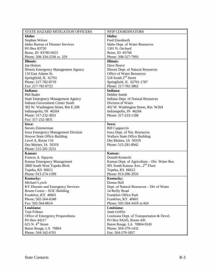
State Contacts B-3
STATE HAZARD MITIGATION OFFICERS NFIP COORDINATORSIdaho:Stephen WeiserIdaho Bureau of Disaster ServicesPO Box 83720Boise, ID 83780-0023Phone: 208-334-2336 xt. 329
Idaho:Fred EisenbarthIdaho Dept. of Water Resources1301 N. OrchardBoise, ID 83706Phone: 208-327-7993
Illinois:Jan HortonIllinois Emergency Management Agency110 East Adams St.Springfield, IL 62701Phone: 217-782-8719Fax: 217-782-8723
Illinois:Dave BoyceIllinois Dept. of Natural ResourcesOffice of Water Resources524 South 2nd StreetSpringfield, IL 62701-1787Phone: 217-782-3862
Indiana:Phil RaderState Emergency Management AgencyIndiana Government Center South302 W. Washington Street, Rm E.208Indianapolis, IN 46204Phone: 317-232-3831Fax: 317-232-3831
Indiana:Debbie SmithIndiana Dept. of Natural ResourcesDivision of Water402 W. Washington Street, Rm. W264Indianapolis, IN 46204Phone: 317-233-1188
Iowa:Steven ZimmermanIowa Emergency Management DivisionHoover State Office BuildingLevel A, Room 116Des Moines, IA 50319Phone: 515-281-3231
Iowa:Bill CappuccioIowa Dept. of Nat. ResourcesWallace State Office BuildingDes Moines, IA 50319Phone: 515-281-8942
Kansas:Frances A. SquyresKansas Emergency Management2800 South West Topeka Blvd.Topeka, KS 66611Phone: 913-274-1399
Kansas:Donald KosteckiKansas Dept. of Agriculture – Div. Water Res.901 South Kansas Ave., 2nd FloorTopeka, KS 66612Phone: 913-296-2933
Kentucky:Michael LynchKY Disaster and Emergency ServicesBoone Center – EOC BuildingFrankfort, KY 40601Phone: 502-564-6348Fax: 502-564-8614
Kentucky:Donna HallDept. of Natural Resources – Div of Water14 Reilly RoadFrankfort Office ParkFrankfort, KY 40601Phone: 502-564-3410 xt.424
Louisiana:Tom FrilouxOffice of Emergency PreparednessPO Box 44217625 N. 4th StreetBaton Rouge, LA 70804Phone: 504-342-6701
Louisiana:Janet GriffinLouisiana Dept. of Transportation & Devel.PO Box 94245, Room 430Baton Rouge, LA 70804-9245Phone: 504-379-1432Fax: 504-379-1857

State Contacts B-4
STATE HAZARD MITIGATION OFFICERS NFIP COORDINATORSMaine:Steven P. BurgessMaine Emergency ManagementSHS #72Augusta, ME 04333-0072Phone: 207-287-4080Fax: 207-289-4079
Maine:W. Louis Sidell, Jr.Office of Comprehensive Plng. & Comm. Devl38 State House Station184 State StreetAugusta, ME 04333Phone: 207-287-8050Fax: (207)-287-6489
Maryland:Evalyn FisherMaryland Emergency ManagementTwo Sudbrook Lane, EastPikesville, MD 21208Phone: 410-486-4422Fax: 410-486-1867
Maryland:Charlie WheelerMD Water ResourcesBuilding E-2, Tawes State Office Building580 Taylor AvenueBaltimore, MD 21401Phone: 410-260-8717Fax: 410-631-3873
Massachusetts:Richard ThibedeauMassachusetts Environmental Management100 Cambridge St.Boston, MA 02202Phone: 617-727-3267
Massachusetts:Richard ZingarelliMA Dept. Env. Mgmt. – Water Resource Div.100 Cambridge StreetBoston, MA 02202Phone: 617-727-3267 xt. 514
Michigan:Doran DuckworthDepartment of State Police, Emerg Mgmt Division4000 Collins RoadPO Box 30636Lansing, MI 84909-8136Phone: 517-333-5045Fax: 517-333-4987
Michigan:George HosekDept. of Environmental QualityLand & Water Management DivisionPO Box 30458Lansing, MI 48909-7958Phone: 517-335-3182
Minnesota:Terri SmithMinnesota Division of Emergency Mgmt.B5- State CapitolSt. Paul, MN 55155Phone: 612-296-0469Fax: 612-296-0459
Minnesota:Joe GibsonMinnesota Dept. of Natural ResourcesDivision of Water500 Lafayette RoadSt. Paul, MN 55155-4032Phone: 612-296-9226
Mississippi:Robert BotelerMississippi Emergency Management AgencyPO Box 45011410 Riverside DriveJackson, MS 39296Phone: 601-352-9033Fax: 601-352-8314
Mississippi:Robert BotelerMississippi Emergency Management AgencyPO Box 45011410 Riverside DriveJackson, MS 39296Phone: 601-352-9033Fax: 601-352-8314
Missouri:Destin FrostMissouri Emergency ManagementPO Box 116Jefferson City, MO 65102Phone: 314-526-9103
Missouri:George RiedelMissouri Emergency ManagementPO Box 116Jefferson City, MO 65102Phone: 573-526-9141

State Contacts B-5
STATE HAZARD MITIGATION OFFICERS NFIP COORDINATORSMontana:Larry AkersMontana Disaster & Emergency ServicesPO Box 4789Helena, MT 59604Phone: 406-444-6911Fax: 406-444-6965
Montana:Karl ChristiansMontana Dept. of Nat. Resources & Conserv.1520 E. 6th AvenueHelena, MT 59620Phone: 406-444-6654
Nebraska:Ralph MedinaNebraska Emergency Management1300 Military RoadLincoln, NE 68508-1090Phone: 402-471-7425Fax: 402-471-7433
Nebraska:Brian DunniganNebraska Nat. Resources Commission301 Centennial Mall SouthLincoln, NE 68509Phone: 402-471-2081
Nevada:Tom ManningNevada State Division of Emergency Mgmt.Capitol Complex2525 South Carson StreetCarson City, NV 89701Phone: 702-687-4240
Nevada:Robert SullyDivision of Water PlanningSuite 1421550 E. College ParkwayCarson City, NV 89706Phone: (702) 687-4240
New Hampshire:Grace M. WalkerNew Hampshire Emergency Management107 Pleasant St.Concord, NH 03301Phone: 603-271-2231Fax: 603-225-7341
New Hampshire:David HaydenNew Hampshire Office of Emergency Management107 Pleasant StreetConcord, NH 03301Phone: 603-271-2231
New Jersey:Anthony S. MangeriNew Jersey Emergency ManagementPO Box 7068 River RoadWest Trenton, NY 08628-0068Phone: 609-538-6009Fax: 609-538-8273
New Jersey:Clark Gilman, P.E.New Jersey Dept. of Environmental ProtectionPO Box CN419Trenton, NJ 08625Phone: 609-292-2296
New Mexico:Bill EwingEmergency Management BureauNew Mexico Dept. of Public SafetyPO Box 16284491 Cerrillos RoadSanta Fe, NM 87504-1628Phone: 505-827-9238Fax: 505-827-3456
New Mexico:Jack PurcellEmergency Management BureauNew Mexico Dept. of Public SafetyPO Box 1628Santa Fe, NM 87504-1628Phone: 505-476-9600Fax: 505-476-5922
New York:John DiNuzzoNew York Emergency ManagementSate Office Campus, Bldg. 22Albany, New York 12226-5000Phone: 518-457-9983
New York:Bill NechmanNew York Dept. of Environmental Conservation50 Wolf Road, Room 330Albany, NY 12233-3507Phone: 518-457-0832

State Contacts B-6
STATE HAZARD MITIGATION OFFICERS NFIP COORDINATORSNorth Carolina:Phillip S. LetsingerNC Division of Emergency Management116 West Jones StreetRaleigh, NC 27603-1335Phone: 919-733-3358Fax: 919-733-0795
North Carolina:Billy R. CameronND Division of Emergency ManagementDept. of Crime Control & Public Safety116 West Jones StreetRaleigh, NC 27603-1335Phone: 919-733-3867
North Dakota:Sean JohnsonNorth Dakota Emergency ManagementFraine Barracks Road, Bldg. 53Bismarck, ND 58502-5511Phone: 701-224-3300Fax: 701-328-2119
North Dakota:Jeff KleinNorth Dakota State Water Commission900 East BoulevardBismarck, ND 59505Phone: 701-328-4898
Northern Mariana Islands:Robert A. GuerreroEmergency Management OfficePO Box 10007Saipan, MP 96950
Northern Mariana Islands:Andrew SmithBuilding Safety DivisionDept. of Public WorksSaipan, MP 96950
Ohio:Pat BeckOhio Emergency Management2855 W. Dublin-Granville RoadColumbus, OH 43235-2712Phone: 614-889-7179 xt.7176Fax: 614-889-7183
Ohio:Cindy CreceliusOhio Dept. of Natural ResourcesFloodplain Management UnitFountain SquareColumbus, OH 46224Phone: 614-265-6754
Oklahoma:Fred W. LiebeOklahoma Civil Emergency ManagementPO Box 53365Oklahoma City, OK 73152Phone: 405-521-2481
Oklahoma:Ken MorrisOklahoma Water Resource Board3800 North Classen BoulevardOklahoma City, OK 73118Phone: 405-530-8800
Oregon:Dennis J. SigristOregon Emergency Management595 Cottage Street, NESalem, OR 97310Phone: 503-896-0239
Oregon:Jim B. KennedyOregon Dept. of Land Conservation & Devel.1175 Court Street, NESalem, OR 97310Phone: 503-378-2332
Pennsylvania:Ronald KillinsPennsylvania Emergency Management AgencyPO Box 3321Harrisburg, PA 17105-3321Phone: 717-651-2001 xt.2145
Pennsylvania:Kerry WilsonDept of Community & Econ. Development318 Forum BuildingHarrisburg, PA 17120Phone: 717-787-7402
Puerto Rico:Mariano Vargas-DiazPuerto Rico Civil DefensePO Box 5127 Puerta Tierra StationSan Juan, PR 00906Phone: 809-724-0124
Puerto Rico:Jose R. Caballero-MercadoVice President, Puerto Rico Planning BoardPO Box 41119San Juan, PR 00940-0085

State Contacts B-7
STATE HAZARD MITIGATION OFFICERS NFIP COORDINATORSRhode Island:Joseph Almeida, Jr.Rhode Island Emergency Management AgencyState House, Room 27Providence, RI 02903Phone:401-421-7333
Rhode Island:Vic J. ParmentierDept. of Administration – Office of Syst. Plng1 Capitol HillProvidence, RI 02809-5872Phone: 401-277-6478
South Carolina:Mr. Bob GrahamSC Emergency Preparedness Division1429 Senate StreetColumbia, SC 29201Phone: 803-734-8020Fax: 803-734-8062
South Carolina:Lisa HollandSouth Carolina Dept. Natural ResourcesDiv. Land Resources & Conservation Districts2221 Devine Street, Suite 222Columbia, SC 29205Phone: 803-734-9100
South Dakota:Shelly PapkaSouth Dakota Emergency Management500 East Capitol Ave.Pierre, SD 57501-5070Phone: 605-773-5053Fax: 605-773-3580
South Dakota:Darrell DvorakDivision of Emergency ManagementSoldiers and Sailors Building500 East CapitolPierre, SD 57501-5070Phone: 605-773-3231
Tennessee:Rose MasseyTEMA Disaster AssistanceExecutive South Office Building1161 Murfreesboro Rd. Suite 217Nashville, TN 37217Phone: 615-741-1345Fax: 615-532-9222
Tennessee:Donald Waller, DirectorTN Dept. of Economic Devel/ Local Planning320 Sixth Avenue N, 6th FloorNashville, TN 37219-5408Phone: 615-741-2211Fax: 615-741-7306
Texas:Wade NofsingerTexas Division of Emergency ManagementPO Box 4087Austin, TX 78773-0001Phone: 512-465-2449Fax: 512-465-2444
Texas:James MaribalTexas Nat. Resource and Conservation Comm.PO Box 13087-MC160Austin, TX 78711-3087Phone: 512-239-4771Fax: 512-239-4770
Utah:Fred E. MayUtah Emergency ManagementState Office Bldg. Room 1110Salt Lake City, UT 84114-0006Phone: 801-538-3758Fax: 801-538-3370
Utah:Judy WatanabeDivision of Comprehensive Emergency MgmtState Office Bldg., Room 1110Salt Lake City, UT 84114Phone: 801-538-3721
Vermont:Ed von TurkovichVermont Emergency Management103 S. Main StreetWaterbury, VT 05671-2001Phone: 802-244-8721
Vermont:Roy GaffneyDiv of Water ResourcesAgency of Environmental Conservation103 S. Main StreetWaterbury, VT 05676Phone: 802-244-6951

State Contacts B-8
STATE HAZARD MITIGATION OFFICERS NFIP COORDINATORSVirginia:Mary CampVirginia Dept. of Emergency Services10501 Trade CourtRichmond, VA 23236Phone: 804-897-6525Fax: 804-897-6526
Virginia:Richard DameronDivision of Soil & Water ConservationDept. of Conservation & Recreation203 Governor St., Suite 206Richmond, VA 23219-2094Phone: 804-371-6135
Virgin Islands:Daisymae Moitt EvansFederal Grants ManagementTerritorial Office of Management & Budget41 Norre Gadet, Emancipation Garden StationSt. Thomas, VI 00802Phone: 809-774-0750
Virgin Islands:Brian TurnballVI Dept. of Planning & Natural ResourcesNisky Center, Suite 231Charotte AmaileSt. Thomas, VI 00802Phone: 809-774-3320
Washington:Martin BestWashington State Emergency ManagementPO Box 40955Olympia, WA 98504Phone: 360-923-4585
Washington:Tim D’AcciCoastal Zone Management, Dept. of EcologyPO Box 47690Olympia, WA 98504-7690Phone: 360-407-6796
Washington, DC:Sandi PerkinsOffice of Emergency Preparedness2000 14th Street N.W., 8th FloorWashington, DC 20009Phone: 202-727-3150Fax: 202-673-2290
Washington, DC:James R. CollierEnvironmental Regulation AdministrationWater Resources Branch2100 Martin Luther King Ave., SEWashington, DC 20020Phone: 202-645-6059
West Virginia:Al LiskoWest Virginia Office of Emergency ServicesState Capitol Building, Rm. EB-80Charleston, WV 25305Phone: 304-558-5380Fax: 304-344-4538
West Virginia:Same as Hazard Mitigation Officer
Wisconsin:Roxanne K. GrayWisconsin Division of Emergency Govt.2400 Wright StreetPO Box 7865Madison, WI 53704Phone: 608-242-3211Fax: 608-242-3248
Wisconsin:Robert WatsonDam Safety & Floodplain Mgmt. SectionWisconsin Dept. of Natural ResourcesPO Box 7921Madison, WI 53707Phone: 608-266-8037
Wyoming:Edward A. WallaceWyoming Emergency Management5500 Bishop Blvd.Cheyenne, WY 82009-3320Phone 307-777-4916Fax: 307-635-6017
Wyoming:Cynthia AngielWyoming Emergency Management5500 Bishop Blvd.Cheyenne, WY 82009-3320Phone: 307-777-4900

References C-1
APPENDIX C:REFERENCES
Most of the documents listed here are available for free. Order FEMA publications by calling800/480-2520 or faxing your order to 301/497-6378.
U.S. Army Corps of Engineers publications can be ordered from:
U.S. Army Corps of EngineersATTN: CECW-PF20 Massachusetts Avenue, NWWashington, DC 20314
Community Rating System publications can be ordered using the order form at the end ofUnit 9.
Other publications can be ordered as noted.
A Unified National Program for Floodplain Management. Federal Interagency FloodplainManagement Task Force. FEMA 248. 1994.
Addressing Your Community’s Flood Problems: A Guide for Elected Officials. Associationof State Floodplain Managers, Inc., joint project with the Federal Interagency FloodplainManagement Task Force. 1996
Alluvial Fans: Hazards and Management. Federal Emergency Management Agency. FEMA-165. 1989
Answers to Questions about Substantially Damaged Buildings. Federal EmergencyManagement Agency. Federal Insurance Administration, National Flood Insurance ProgramCommunity Assistance Series. FEMA 213. 1991
Answers to Questions about the National Flood Insurance Program. Federal EmergencyManagement Agency. FIA 2. 1990
Below-Grade Parking Requirements for Buildings Located in Special Flood Hazard Areas inAccordance with the National Flood Insurance Program. Federal Emergency ManagementAgency. Technical Bulletin 6-93, FIA-TB-6. 1993
Coastal Construction Manual. Federal Emergency Management Agency. FEMA 55. 1986
Code of Federal Regulations: Title 44—Emergency Management and Assistance. Chapter1—Federal Emergency Management Agency. Special Edition of the Federal Register. 1997Order from FEMA. (See also Appendix E)

References C-2
Corrosion Protection for Metal connectors in Coastal Areas for Structures Located inSpecial Flood Hazard Areas in Accordance with the National Flood Insurance Program. FederalEmergency Management Agency. Technical Bulletin 8-96, FIA-TB-8. 1996
CRS Credit for Higher Regulatory Standards. Federal Emergency Management Agency.National Flood Insurance Program/Community Rating System. 1996. To order, see the orderform at the end of Unit 9.
CRS Credit for Stormwater Management. Federal Emergency Management Agency. NationalFlood Insurance Program/Community Rating System. 1996. To order, see the order form at theend of Unit 9.
Design Guidelines for Flood Damage Reduction. Federal Emergency Management Agency.FEMA 15. 1981
Design Manual for Retrofitting Flood-prone Residential Structures. Federal EmergencyManagement Agency. FEMA 114. 1986
Elevated Residential Structures. Federal Emergency Management Agency. FEMA 54. 1984
Elevator Installation for Buildings Located in Special Flood Hazard Areas in Accordancewith the National Flood Insurance Program. Federal Emergency Management Agency.Technical Bulletin 4-93, FIA-TB-4. 1993
Engineering Principles and Practices for Retrofitting Flood Prone Residential Buildings.Federal Emergency Management Agency. FEMA 259. 1995
Example Plans. Federal Emergency Management Agency. National Flood InsuranceProgram/Community Rating System. 1996. To order, see the order form at the end of Unit 9.
Flood Insurance Study Guidelines and Specifications for Study Contractors. FederalEmergency Management Agency. FEMA 37. 1993
Flood Proofing Programs, Techniques and References. U.S. Army Corps of Engineers. 1996
Flood Proofing Regulations. U.S. Army Corps of Engineers, EP 1165-2-314. 1992
Floodplain Management 1995: State and Local Programs. Association of State FloodplainManagers. 1995
Floodplain Management in the United States: An Assessment Report. Federal InteragencyFloodplain Management Task Force. FIA-18. 1992. Order from FEMA.
Floodproofing Non-Residential Structures. Federal Emergency Management Agency. FEMA102. 1986

References C-3
Flood-Resistant Materials Requirements for Buildings Located in Special Flood HazardAreas in Accordance with the National Flood Insurance Program. Federal EmergencyManagement Agency. Technical Bulletin 2-93, FIA-TB-2. 1993
Floods, Floodplains and Folks. National Park Service, Rivers, Trails and ConservationAssistance Program. 1996.
Free-of-Obstruction Requirements for Buildings Located in Coastal High Hazard Areas inAccordance with the National Flood Insurance Program. Federal Emergency ManagementAgency. Technical Bulletin 5-93, FIA-TB-5. 1993
Guidance on Estimating Substantial Damage Using the NFIP Residential SubstantialDamage Estimator. Federal Emergency Management Agency. 1997.
How to Use a Flood Map to Determine Flood Risk for a Property: A Guide for InterestedPrivate Citizens, Property Owners, Community Officials, Lending Institutions, and InsuranceAgents. Federal Emergency Management Agency. FEMA 258. 1995
Interim Guidance for State and Local Officials: Increased Cost of Compliance Coverage.Federal Emergency Management Agency. FEMA-301. 1997
Local Flood Proofing Programs. U.S. Army Corps of Engineers. 1994
Managing Coastal Erosion. National Research Council. 1990
Managing Floodplain Development in Approximate Zone A Areas: A Guide for Obtainingand Developing Base (100-Year) Flood Elevations. Includes the computer program QUICK-2:Computation of Water Surface Elevations in Open Channels, Version 1.0. Federal EmergencyManagement Agency. FEMA 265. 1995
Mandatory Purchase of Flood Insurance Guidelines. Federal Emergency ManagementAgency. FEMA 186. 1997
Manufactured Home Installation in Flood Hazard Areas. Federal Emergency ManagementAgency. FEMA 85. 1985
Mitigation of Flood and Erosion Damage to Residential Buildings in Coastal Areas: Reporton the State of the Art. Federal Emergency Management Agency. FEMA 257. 1994
A Multi-Objective Planning Process for Mitigating Natural Hazards, Federal EmergencyManagement Agency and the National Park Service, 1994
National Flood Insurance Reform Act of 1994, Public Law 103-325. Title V in theCommunity Development and Regulatory Improvement Act of 1994. Order from FEMA
Non-Residential Floodproofing Requirements and Certification for Buildings Located inSpecial Flood Hazard Areas in Accordance with the National Flood Insurance Program. FederalEmergency Management Agency. Technical Bulletin 3-93, FIA-TB-3. 1993

References C-4
Openings in Foundation Walls for Buildings Located in Special Flood Hazard Areas inAccordance with the National Flood Insurance Program. Federal Emergency ManagementAgency. Technical Bulletin 1-93, FIA-TB-1. 1993
Planning for Hillside Development. American Planning Association, PAS Report 466. 1997.Order from the American Planning Association, Publications Office, 122 South Michigan Ave,Suite 1600, Chicago, IL 60603. E-mail: [email protected].
Protecting Floodplain Resources: A Guidebook for Communities. Federal InteragencyFloodplain Management Task Force. FEMA 268. 1996
Reducing Losses in High Risk Flood Hazard Areas: A Guidebook for Local Officials.Association of State Floodplain Managers. FEMA 116. 1987
Repairing Your Flooded Home. Federal Emergency Management Agency and the AmericanRed Cross. ARC 4477 or FEMA 234. 1992
Subdivision Design in Flood Hazard Areas. American Planning Association and FederalEmergency Management Agency, PAS Report 473. 1997. Order from the American PlanningAssociation, Publications Office, 122 South Michigan Ave, Suite 1600, Chicago, IL 60603. E-mail: [email protected].
Use of Flood Insurance Study (FIS) Data as Available Data. Federal EmergencyManagement Agency. Floodplain Management Bulletin 1-98. 1998
User’s Guide to Technical Bulletins. Federal Emergency Management Agency. FIA-TB-0.1993
Using Multi-Objective Management to Reduce Flood Losses in Your Watershed. Associationof State Floodplain Managers, Inc., prepared for the U.S. Environmental Protection Agency.1996
Wet Floodproofing Requirements for Structures Located in Special Flood Hazard Areas inAccordance with the National Flood Insurance Program. Federal Emergency ManagementAgency. Technical Bulletin 7-93, FIA-TB-7. 1993

Glossary D-1
APPENDIX D:GLOSSARY
These technical terms are described in more detail in the unit and section noted.
A Zone: See Zone A.
Accrete: To build up a shoreline by depositing sand, either by nature or human actions. Unit1, Section A.
Actual cash value: The replacement cost for a building, minus a depreciation percentagebased on age and condition. Unit 8, Section A.
Alluvial fan: An area at the base of a valley where the slope flattens out, allowing the flood-water to decrease in speed and spread out, dropping sediment and rock over a fan-shaped area.Unit 1, Section A.
Amendment: A change to a FEMA floodplain map that removes an area that was inadver-tently included in the Special Flood Hazard Area. Unit 4, Section D.
Approximate studies: Flood mapping that shows the approximate outline of the base flood-plain. An approximate study does not produce a base flood elevation. Unit 3, Section A.
B Zone: See Zone B.
Base flood depth: A measurement of the base flood in feet above ground, used for shallowflooding. Unit 3, Section D.
Base flood: The 1% chance or 100-year flood adopted by the NFIP as the basis for mapping,insurance rating, and regulating new construction. Unit 3, Section A.
Basement: Any floor level below grade. Unit 5, Section E.
Base floodplain: The area of water and land inundated during the crest of the base flood. Unit3, Section A.
Basin: See watershed.
Bathymetry: The measurement of depths of water in the ocean or lakes. Unit 3, Section C.
Bench marks: Monuments on the ground that show the elevation of the spot above sea level.Unit 3, Section B.

Glossary D-2
Building: A walled and roofed structure that is principally above ground. The term includesmanufactured homes, mobile homes and gas or liquid storage tanks. In this course, the term isthe same as the term “structure” in the federal regulations (44 CFR 59.1). Unit 5, Section E.
Building condition survey: A windshield survey conducted to obtain a preliminary evaluationof the extent and severity of damage to buildings after a disaster. Unit 10, Section A.
C Zone: See Zone C.
CAP: Community Assistance Program
Catchment area: See watershed.
Cfs: Cubic feet per second, the unit by which discharges are measured (a cubic foot of wateris about 7.5 gallons). Unit 3, Section B.
Channel: Defined landforms that carry water. Unit 1, Section A.
CLOMA: Conditional Letter of Map Amendment.
CLOMR: Conditional Letter of Map Revision.
Closed basin lake: A lake that has either no outlet or a relatively small one, where rainfall cancause the lake’s level to rise faster than it can drain. Unit 1, Section A.
Coastal high hazard area: That part of the coastal floodplain where the wave heights duringthe base flood will be three feet or more. Unit 3, Section C.
COBRA: The Coastal Barrier Resources Act which identified undeveloped portions ofcoastal barriers. Unit 9, Section D and Unit 3, Section F.
Community Assistance Program: A FEMA program that funds state activities that helpcommunities in the NFIP. Unit 2, Section C.
Community Rating System: A program that provides a flood insurance premium rate reduc-tion based on a community’s floodplain management activities. Unit 10, Section D.
Community: A city, county, township, Indian tribe or authorized tribal organization, AlaskaNative village or authorized native organization, or other local government with the statutoryauthority to enact floodplain regulations and participate in the National Flood Insurance Pro-gram. Unit 2, Section C.
Conditional Letter of Map Amendment: A statement that if a project is constructed asplanned, a Letter of Map Amendment can be issued later. Unit 4, Section D.
Conditional Letter of Map Revision: A statement that if a project is constructed as planned, aLetter of Map Revision can be issued later. Unit 4, Section D.

Glossary D-3
Contour map: A map that shows points with the same elevation as connected by a contourline. Unit 3, Section B.
Contour: A line of equal elevation on a topographic (contour) map.
Conveyance shadow: An area upstream or downstream of an existing obstruction to floodflows. Unit 5, Section B.
Cross section: Surveyed information that describes the stream and the floodplain at a par-ticular point along the stream. Unit 3, Section B.
CRS: Community Rating System
Dam breach inundation area: The area flooded by a dam failure. Unit 6, Section D.
Damage Survey Report: A form completed by disaster assistance staff to determine the re-pair and reconstruction needs of public and private nonprofit facilities. Unit 10, Section C.
Datum: A common vertical elevation reference point, usually in relation to sea level. Unit 3,Section B.
Detailed studies: Flood mapping that produces base flood elevations, floodways, and otherpertinent flood data. Unit 3, Section A.
Development: Any man-made change to real estate. Unit 5, Section C.
Discharge: The amount of water that passes a point in a given period of time. Rate of dis-charge is usually measured in cubic feet per second (cfs). Unit 3, Section B.
DSR: Damage survey report.
Elevation reference marks: See bench marks.
Emergency Operations Center: A facility that houses communications equipment that is usedto coordinate the response to a disaster or emergency. Unit 10, Section A.
Eminent domain: Governmental power to acquire a property without the owner’s consent.Unit 6, Section A.
Enabling legislation: State laws that authorize communities to perform governmental activi-ties, such as enacting and enforcing regulations. Unit 7, Section A.
Encroachment review: An analysis to determine if a project will increase flood heights orcause increased flooding downstream. Unit 5, Section D.
EOC: Emergency Operations Center

Glossary D-4
EO 11988: Executive Order 11988 Floodplain Management. A directive by the President thatsets procedures Federal agencies must follow before they take or fund an action in the floodplain.Unit 6, Section E.
FBFM: Flood Boundary Floodway Map. An official map of a community, on which the Fed-eral Insurance Administration has delineated the regulatory floodway. Unit 3, Section F.
FEMA: Federal Emergency Management Agency. Most of the National Flood InsuranceProgram field work and community coordination are done by the 10 FEMA Regional Offices,which are listed in Appendix A.
FHBM: Flood Hazard Boundary Map. The map published by FEMA that delineates the ap-proximate boundary of the floodplain. Unit 3, Section F.
FIA: Federal Insurance Administration. FIA is the part of the Federal Emergency Manage-ment Agency that administers the National Flood Insurance Program.
FIRM: Flood Insurance Rate Map. An official map of a community, on which the FederalInsurance Administration has delineated both the Special Flood Hazard Areas and the riskpremium zones applicable to the community. Unit 3, Section F.
Flash flood: A flood in hilly and mountainous areas that may come scant minutes after aheavy rain. One can also occur in urban areas where pavements and drainage improvementsspeed runoff to a stream. Unit 1, Section A.
Flood: A general and temporary condition of partial or complete inundation of normally dryland areas. Unit 2, Section B.
Flood fringe: The portion of the floodplain lying on either side of the floodway. Unit 3, Sec-tion B
Flood hazard mitigation: All actions that can be taken to reduce property damage and thethreat to life and public health from flooding. Unit 10, Section B.
Flood Insurance Study: A report published by FEMA for a community in conjunction withthe community's Flood Insurance Rate Map. The study contains such background data as thebase flood discharges and water surface elevations that were used to prepare the FIRM.
Flood Mitigation Assistance: A grant program funded by the National Flood Insurance Pro-gram. Unit 10, Section C.
Flood of record: The highest known flood level for the area, as recorded in historical docu-ments. Unit 5, Section B.
Floodplain: Any land area susceptible to being inundated by flood waters from any source.Unit 1, Section A.

Glossary D-5
Floodproofing: Protective measures added to or incorporated in a building that is not ele-vated above the base flood elevation to prevent or minimize flood damage. "Dry floodproofing"measures are designed to keep water from entering a building. "Wet floodproofing" measuresminimize damage to a structure and its contents from water that is allowed into a building.
Floodway: The stream channel and that portion of the adjacent floodplain which must remainopen to permit passage of the base flood. Unit 3, Section B.
FMA: Flood Mitigation Assistance.
Freeboard: A margin of safety added to the base flood elevation to account for waves, de-bris, miscalculations, or lack of data. Unit 6, Section C.
Functionally dependent use: Development that must be located or carried out close to water,e.g., such as a docking or port facility. Unit 7, Section F.
Geographic information system: Computer based map systems that allow the user to keep amap updated easily and to correlate geographic information with other data, such as tax recordson properties. Unit 3, Section F.
GIS: Geographic information system
Hazard Mitigation Grant Program: A FEMA disaster assistance grant that funds mitigationprojects. Unit 10, Section C.
HEC-2: A computer model used to conduct a hydraulic study, which produces flood eleva-tions, velocities and floodplain widths. Unit 3, Section B.
HEC-RAS: A computer model used to conduct a hydraulic study, which produces flood ele-vations, velocities and floodplain widths. Unit 3, Section B.
Home rule: A community authorized to do anything that is not prohibited by statute. Unit 7,Section A.
Human intervention: Actions that must be taken by one or more persons in order for abuilding to be floodproofed before floodwaters arrive. Unit 5, Section E.
Hydrodynamic force: The force of moving water, including the impact of debris and highvelocities. Unit 1, Section B.
Hydrologic cycle: The natural cycle that circulates water throughout the environment tomaintain an overall balance between water in the air, on the surface and in the ground. Unit 1,Section A.
Hydrology: The science dealing with the waters of the earth. A flood discharge is developedby a hydrologic study.

Glossary D-6
Hydrostatic pressure: The pressure put on a structure by the weight of standing water. Thedeeper the water, the more it weighs and the greater the hydrostatic pressure. Unit 1, Section B.
ICC: Increased Cost of Compliance
Ice floe: Large chunks of ice that can cause a great deal of damage when a frozen river orlake begins to melt and break up. Unit 1, Section A.
Ice jam: Flooding that occurs when warm weather and rain break up frozen rivers and thebroken ice floats downriver until it is blocked by an obstruction, creating an ice dam that blocksthe channel and causes flooding upstream. Unit 1, Section A.
IFG: Individual and Family Grants
Increased Cost of Compliance: An additional claim payment made to a flood insurance pol-icy holder to help cover the cost of brining a substantially damaged or repetitively damagedbuilding into compliance with the NFIP construction standards for new buildings. Unit 8, Sec-tion B.
Individual and Family Grants: A disaster assistance grant that helps people with their unmetneeds (i.e., needs not helped by other disaster assistance programs. Unit 10, Section C.
Inverse condemnation: See “taking.” Unit 6, Section A.
ISO: The Insurance Services Office, Inc., an insurance organization that administers theCommunity Rating System for FEMA. Unit 9, Section C.
Lateral pressure: The amount of pressure imposed sideways by standing water. Deeper waterexerts more lateral pressure than shallow water. Unit 1, Section B.
Letter of Map Amendment: An official revision to a FEMA map done by describing theproperty affected. Unit 4, Section D.
Letter of Map Change: A Letter of Map Amendment or a Letter of Map Revision. Unit 4,Section D.
Letter of Map Revision: An official revision to a FEMA map done by describing the propertyaffected. Unit 4, Section D.
Limited Map Maintenance Project: A small-scale restudy of a Flood Insurance Study. Unit 4,Section D.
LOMA: Letter of Map Amendment
LOMR: Letter of Map Revision
Lowest Floor: The lowest floor of the lowest enclosed area (including basement) of a build-ing. Unit 5, Section E

Glossary D-7
Manufactured home: A building that is transportable in one or more sections, built on a per-manent chassis and designed for use with or without a permanent foundation when attached toutilities. It includes mobile homes and “double wides.” Unit 5, Section E.
Market value: The price a willing buyer and seller agree upon. Unit 8, Section A.
Meander: A curve in a river. Unit 1, Section A.
Mitigation Directorate: The FEMA office that sets national policy for the NFIP and admin-isters the mapping program. Unit 2, Section B.
M-O-M: Multi-objective management.
Movable bed streams: A type of flooding that features uncertain flow paths. Unit 1, Sec-tion A.
Mudslide (i.e., mudflow): A condition where there is a river, flow or inundation of liquidmud down a hillside. Unit 1, Section A.
Mudflow: See mudslide.
Multi-objective management: An approach to planning and funding local programs that in-volves a variety of local interests and concerns. Unit 10, Section B.
NEPA: The National Environmental Policy Act, a Federal law that requires agencies toevaluate the environmental impact of a proposed project. Unit 6, Section E.
NGVD: National Geodetic Vertical Datum of 1929, the national datum used by the NationalFlood Insurance Program. NGVD is based on mean sea level. It was known formerly as the"Mean Sea Level Datum of 1929 (MSL)." Unit 3, Section B.
No-rise Certification: A certification by an engineer that a project will not cause a set in-crease in flood heights. Unit 7, Section G.
Non-structural flood protection measures: Administrative tools for controlling flooding andflood damage, including regulations on development, building codes, property acquisition andstructure relocation, and modification of existing buildings. Unit 1, Section B.
Ordinance: The generic term for a law passed by a local government. Unit 7, Section A.
Overbank flooding: Flooding that occurs when downstream channels receive more rain orsnowmelt from their watershed than normal, or a channel is blocked by an ice jam or debris.Excess water overloads the channels and flows out onto the floodplain. Unit 1, Section A.
Planned unit development: A regulatory approach that allows a developer to design the entirearea while individual requirements may be relaxed to allow for open space, mixed land uses, andother variances to traditional zoning rules. Unit 6, Section C.

Glossary D-8
Ponding: Runoff that collects in depressions and cannot drain out, creating a temporary pond.Unit 1, Section A.
Post-FIRM building: For insurance rating purposes, a post-FIRM building was constructedor substantially improved after December 31, 1974, or after the effective date of the initial FloodInsurance Rate Map of a community, whichever is later. A post-FIRM building is required tomeet the National Flood Insurance Program's minimum Regular Program flood protectionstandards.
Pre-FIRM building: For insurance rating purposes, a pre-FIRM building was constructed orsubstantially improved on or before December 31, 1974, or before the effective date of the initialFlood Insurance Rate Map of the community, whichever is later. Most pre-FIRM buildings wereconstructed without taking the flood hazard into account.
Probability: A statistical term having to do with the size of a flood and the odds of that sizeof flood occurring in any year. Unit 3, Section A.
Profile: A graph that shows elevations of various flood events. Unit 3, Section B.
Public/Infrastructure Assistance: A disaster assistance grant that helps public agencies andnonprofit organizations finance repairs and reconstruction. Unit 10, Section C.
PUD: Planned unit development
Q3 Flood Data Product: A graphical representation of certain features of a FIRM in digitalformat. Unit 3, Section F.
Recreational vehicle: A vehicle designed primarily for use as temporary living quarters. Unit5, Section E.
Reconstruction: Building a new structure on the old foundation or slab of a structure that wasdestroyed, damaged, purposefully demolished or razed. The term also applies when an existingstructure is moved to a new site. Unit 8, Section B.
Regular Program: Also called the Regular Phase. The phase of community participation inthe National Flood Insurance Program that begins on the date of the Flood Insurance Rate Mapor when the community adopts an ordinance that meets the minimum requirements of the NFIPand adopts the technical data provided with the FIRM, whichever is later. Nearly all communi-ties participating in the NFIP are in the Regular Program.
Rehabilitation: An improvement made to an existing structure which does not affect its ex-ternal dimensions. Unit 8, Section A.
Restudy: A new Flood Insurance Study for all or part of a community. Unit 4, Section D.
Retrofitting: Retrofitting techniques include floodproofing, elevation, construction of smalllevees, and other modifications made to an existing building or its yard to protect it from flooddamage.

Glossary D-9
Revision: A change to a floodplain map based on new data submitted to FEMA. Unit 4, Sec-tion D.
Riverine: Of or produced by a river. Riverine floodplains have readily identifiable channels.Floodway maps can only be prepared for riverine floodplains. Unit 1, Section A.
Roughness: A measure related to ground surface conditions that reflects changes in flood-water velocity due to ground friction. Unit 3, Section B.
Runoff: Rainfall and snowmelt that reaches a stream. Unit 3, Section B.
SFHA: Special Flood Hazard Area
Sheet flow: Floodwater that spreads out over a large area that does not have defined channelsat a somewhat uniform depth. Unit 1, Section A.
Special Flood Hazard Area: the base floodplain displayed on FEMA maps. It includes the Aand V zones. Unit 3, Section A.
Stafford Act: The Robert T. Stafford Disaster Relief and Emergency Assistance Act of 1988which authorizes FEMA’s current disaster assistance programs and the Hazard Mitigation GrantProgram. Unit 10, Section C.
Stationing: Determining the distance along a stream. Unit 3, Section B and Unit 4, Section B.
Statutory authority: The powers granted to a local government by state law. Unit 7, Sec-tion A.
Stillwater flood elevations show the elevations of various coastal floods, not counting waves.Unit 3, Section C.
Storm surge: Water that is pushed toward shore by persistent high wind and changes in airpressure. The level of a large body of water can rise by several feet. Unit 1, Section A.
Stormwater management: Efforts to reduce the impact of increased runoff that results fromnew development. Unit 6, Section C.
Stormwater detention, Storing stormwater runoff for release at a restricted rate after the stormsubsides. Unit 6, Section C.
Stormwater retention: Storing stormwater runoff for later use in irrigation or groundwaterrecharge, or to reduce pollution. Unit 6, Section C.
Structural flood control: Measures that control floodwaters by construction of barriers orstorage areas or by modifying or redirecting channels. Unit 1, Section C.
Submit to rate: a process used when an insurance agent cannot complete the rate calculationfor a flood insurance policy. The application is sent to FEMA. Unit 9, Section B.

Glossary D-10
Substantial damage: Damage of any origin sustained by a structure whereby the cost of re-storing the structure to its undamaged condition would equal or exceed 50 percent of the marketvalue of the structure before the damage occurred. Unit 8, Section B.
Substantial improvement: Any reconstruction, rehabilitation, addition or other improvementto a structure, the total cost of which equals or exceeds 50 percent of the market value of thestructure before the start of construction of the improvement. The definition of “substantialimprovement” includes buildings that have been repaired after suffering substantial damage. Unit8, Section A.
Taking: Obtaining private property or without compensating the owner. The term also in-cludes reducing the value of private property to such an extent that the owner is deprived of alleconomic interest. Unit 6, Section A.
Thalweg: The bottom of a river channel. Unit 1, Section A.
Topographic map: See contour map.
Transect: a survey of topographic conditions used in coastal flood studies. Unit 3, Section C.
Tsunami: A large wave caused by an underwater earthquake or volcano which can raise wa-ter levels as much as 15 feet. Unit 1, Section A.
V Zone: See "Zone V."
Variance: A grant of relief by a community from the terms of a land use, zoning or buildingcode regulation. Unit 7, Section F.
Velocity: The speed of moving water, a force that is measured in feet per second. Unit 1,Section A.
Watershed,: An area that drains into a lake, stream or other body of water. Unit 1, Section A.
Wave runup occurs when waves hit the shore and water is moving with such force that itkeeps traveling inland. Unit 3, Section C.
Wet floodproof: Protecting a building from flood damage by using flood-resistant materialsbelow the flood level and elevating things subject to flood damage above the flood level. Unit 5,Section E.
Write Your Own: An insurance company that has agreed to sell flood insurance policies onbehalf of the NFIP. Unit 9, Section A.
WYO: Write Your Own.
X Zone: See "Zone X."

Glossary D-11
Zone A: The Special Flood Hazard Area (except coastal V Zones) shown on a community'sFlood Insurance Rate Map. Unit 3, Section F. There are five types of A Zones:
A: SFHA where no base flood elevation is provided.
A#: Numbered A Zones (e.g., A7 or A14), SFHA where the FIRM shows a base flood ele-vation in relation to NGVD.
AE: SFHA where base flood elevations are provided. AE Zone delineations are now usedon new FIRMs instead of A# Zones.
AO: SFHA with sheet flow, ponding, or shallow flooding. Base flood depths (feet abovegrade) are provided.
AH: Shallow flooding SFHA. Base flood elevations in relation to NGVD are provided.
Zone B: Area of moderate flood hazard, usually depicted on Flood Insurance Rate Maps asbetween the limits of the base and 500-year floods. B Zones are also used to designate basefloodplains of little hazard, such as those with average depths of less than 1 foot. Unit 3, Sec-tion F.
Zone C: Area of minimal flood hazard, usually depicted on Flood Insurance Rate Maps asabove the 500-year flood level. B and C Zones may have flooding that does not meet the criteriato be mapped as a Special Flood Hazard Area, especially ponding and local drainage problems.Unit 3, Section F.
Zone D: Area of undetermined but possible flood hazard. Unit 3, Section F.
Zone V: The Special Flood Hazard Area subject to coastal high hazard flooding. There arethree types of V Zones: V, V#, and VE, and they correspond to the A Zone designations. Unit 3,Section F.
Zone X: Newer Flood Insurance Rate Maps show Zones B and C (see above) as Zone X.Unit 3, Section F.

NFIP Regulations E-1
APPENDIX E:NFIP REGULATIONSThis Appendix contains the text of the Code of Federal Regulations (CFR) for the NationalFlood Insurance Porgram: 44 CFR Parts 59, 60, 65 and 70.
PART 59 -- GENERAL PROVISIONS
Subpart A – General
Sec.59.1 Definitions59.2 Description of program59.3 Emergency program59.4 References
Subpart B – Eligibility Requirements
59.21 Purpose of subpart59.22 Prerequisites for the sale of flood insurance59.23 Priorities for the sale of flood insurance under
the regular program59.24 Suspension of community eligibility
Authority: 42 U.S.C. 4001 et seq.; Reorganization PlanNo. 3 of 1978, 43 FR 41943, 3 CFR, 1978 Comp., p.329; E.O. 12127 of Mar. 31, 1979, 44 FR 19367, 3CFR, 1979 Comp., p. 376.Source: 41 FR 46968, Oct. 26, 1976; 44 FR 31177,May 31, 1979; 50 FR 36022, Sept. 4, 1985; 51 FR30306, Aug. 25, 1986; 57 FR 19540, May 7, 1992; 58FR 62424, Nov. 26, 1993; 59 FR 53597, Oct. 25, 1994;62 FR 55715, Oct. 27, 1997, unless otherwise noted.
Subpart A – General
§ 59.1 Definitions.As used in this subchapter."Act" means the statutes authorizing the National FloodInsurance Program that are incorporated in 42 U.S.C.4001-4128."Actuarial rates". see "risk premium rates.""Administrator" means the Federal Insurance Adminis-trator."Agency" means the Federal Emergency ManagementAgency, Washington DC."Alluvial fan flooding" means flooding occurring onthe surface of an alluvial fan or similar landform whichoriginates at the apex and is characterized by high-velocity flows; active processes of erosion, sediment
transport, and deposition; and, unpredictable flowpaths."Apex" means a point on an alluvial fan or similarlandform below which the flow path of the majorstream that formed the fan becomes unpredictable andalluvial fan flooding can occur."Applicant" means a community which indicates adesire to participate in the Program."Appurtenant Structure" means a structure which is onthe same parcel of property as the principal structure tobe insured and the use of which is incidental to the useof the principal structure."Area of shallow flooding" means a designated AO,AH, AR/AO, AR/AH, or VO zone on a community'sFlood Insurance Rate Map (FIRM) with a 1 percent orgreater annual chance of flooding to an average depthof 1 to 3 feet where a clearly defined channel does notexist, where the path of flooding is unpredictable, andwhere velocity flow may be evident. Such flooding ischaracterized by ponding or sheet flow."Area of special flood-related erosion hazard" is theland within a community which is most likely to besubject to severe flood-related erosion losses. The areamay be designated as Zone E on the Flood HazardBoundary Map (FHBM). After the detailed evaluationof the special flood-related erosion hazard area inpreparation for publication of the FIRM, Zone E maybe further refined."Area of special flood hazard" is the land in the floodplain within a community subject to a 1 percent orgreater chance of flooding in any given year. The areamay be designated as Zone A on the FHBM. Afterdetailed ratemaking has been completed in preparationfor publication of the flood insurance rate map, Zone Ausually is refined into Zones A, AO, AH, A1-30, AE,A99, AR, AR/A1-30, AR/AE, AR/AO, AR/AH, AR/A,VO, or V1-30, VE, or V. For purposes of these regu-lations, the term "special flood hazard area" issynonymous in meaning with the phrase "area of spe-cial flood hazard"."Area of special mudslide (i.e., mudflow) hazard" is theland within a community most likely to be subject tosevere mudslides (i.e., mudflows). The area may bedesignated as Zone M on the FHBM. After the de-tailed evaluation of the special mudslide (i.e., mudflow)

NFIP Regulations E-2
hazard area in preparation for publication of the FIRM,Zone M may be further refined."Base flood" means the flood having a one percentchance of being equalled or exceeded in any given year."Basement" means any area of the building having itsfloor subgrade (below ground level) on all sides."Breakaway wall" means a wall that is not part of thestructural support of the building and is intendedthrough its design and construction to collapse underspecific lateral loading forces, without causing damageto the elevated portion of the building or supportingfoundation system."Building". see "structure.""Chargeable rates" mean the rates established by theAdministrator pursuant to section 1308 of the Act forfirst layer limits of flood insurance on existing struc-tures."Chief Executive Officer" of the community ("CEO")means the official of the community who is chargedwith the authority to implement and administer laws,ordinances and regulations for that community."Coastal high hazard area" means an area of specialflood hazard extending from offshore to the inland limitof a primary frontal dune along an open coast and anyother area subject to high velocity wave action fromstorms or seismic sources."Community" means any State or area or political sub-division thereof, or any Indian tribe or authorized tribalorganization, or Alaska Native village or authorizednative organization, which has authority to adopt andenforce flood plain management regulations for theareas within its jurisdiction."Contents coverage" is the insurance on personal prop-erty within an enclosed structure, including the cost ofdebris removal, and the reasonable cost of removal ofcontents to minimize damage. Personal property maybe household goods usual or incidental to residentialoccupancy, or merchandise, furniture, fixtures, machin-ery, equipment and supplies usual to other thanresidential occupancies."Criteria" means the comprehensive criteria for landmanagement and use for flood-prone areas developedunder 42 U.S.C. 4102 for the purposes set forth in Part60 of this subchapter."Critical feature" means an integral and readily identifi-able part of a flood protection system, without whichthe flood protection provided by the entire systemwould be compromised."Curvilinear Line" means the border on either a FHBMor FIRM that delineates the special flood, mudslide(i.e., mudflow) and/or flood-related erosion hazardareas and consists of a curved or contour line that fol-lows the topography."Deductible" means the fixed amount or percentage ofany loss covered by insurance which is borne by theinsured prior to the insurer's liability.
"Developed area" means an area of a community thatis:(a) A primarily urbanized, built-up area that is a mini-mum of 20 contiguous acres, has basic urbaninfrastructure, including roads, utilities, communica-tions, and public facilities, to sustain industrial,residential, and commercial activities, and(1) Within which 75 percent or more of the parcels,tracts, or lots contain commercial, industrial, or resi-dential structures or uses; or(2) Is a single parcel, tract, or lot in which 75 percent ofthe area contains existing commercial or industrialstructures or uses; or(3) Is a subdivision developed at a density of at leasttwo residential structures per acre within which 75percent or more of the lots contain existing residentialstructures at the time the designation is adopted.(b) Undeveloped parcels, tracts, or lots, the combinationof which is less than 20 acres and contiguous on at least3 sides to areas meeting the criteria of paragraph (a) atthe time the designation is adopted.(c) A subdivision that is a minimum of 20 contiguousacres that has obtained all necessary government ap-provals, provided that the actual "start of construction"of structures has occurred on at least 10 percent of thelots or remaining lots of a subdivision or 10 percent ofthe maximum building coverage or remaining buildingcoverage allowed for a single lot subdivision at the timethe designation is adopted and construction of struc-tures is underway. Residential subdivisions must meetthe density criteria in paragraph (a)(3)."Development" means any man-made change to im-proved or unimproved real estate, including but notlimited to buildings or other structures, mining, dredg-ing, filling, grading, paving, excavation or drillingoperations or storage of equipment or materials."Director" means the Director of the Federal Emer-gency Management Agency."Eligible community" or "participating community"means a community for which the Administrator hasauthorized the sale of flood insurance under the Na-tional Flood Insurance Program."Elevated building" means, for insurance purposes, anonbasement building which has its lowest elevatedfloor raised above ground level by foundation walls,shear walls, posts, piers, pilings, or columns."Emergency Flood Insurance Program" or "emergencyprogram" means the Program as implemented on anemergency basis in accordance with section 1336 of theAct. It is intended as a program to provide a first layeramount of insurance on all insurable structures beforethe effective date of the initial FIRM."Erosion" means the process of the gradual wearingaway of land masses. This peril is not per se coveredunder the Program.

NFIP Regulations E-3
"Exception" means a waiver from the provisions of Part60 of this subchapter directed to a community whichrelieves it from the requirements of a rule, regulation,order or other determination made or issued pursuant tothe Act."Existing construction," means for the purposes ofdetermining rates, structures for which the "start ofconstruction" commenced before the effective date ofthe FIRM or before January 1, 1975, for FIRMs effec-tive before that date. "Existing construction" may alsobe referred to as "existing structures.""Existing manufactured home park or subdivision"means a manufactured home park or subdivision forwhich the construction of facilities for servicing the lotson which the manufactured homes are to be affixed(including, at a minimum, the installation of utilities,the construction of streets, and either final site gradingor the pouring of concrete pads) is completed before theeffective date of the floodplain management regulationsadopted by a community."Existing structures" see "existing construction.""Expansion to an existing manufactured home park orsubdivision" means the preparation of additional sitesby the construction of facilities for servicing the lots onwhich the manufacturing homes are to be affixed (in-cluding the installation of utilities, the construction ofstreets, and either final site grading or the pouring ofconcrete pads)."Federal agency" means any department, agency, cor-poration, or other entity or instrumentality of theexecutive branch of the Federal Government, and in-cludes the Federal National Mortgage Association andthe Federal Home Loan Mortgage Corporation."Federal instrumentality responsible for the supervi-sion, approval, regulation, or insuring of banks, savingsand loan associations, or similar institutions" means theBoard of Governors of the Federal Reserve System, theFederal Deposit Insurance Corporation, the Comptrollerof the Currency, the Federal Home Loan Bank Board,the Federal Savings and Loan Insurance Corporation,and the National Credit Union Administration."Financial assistance" means any form of loan, grant,guaranty, insurance, payment, rebate, subsidy, disasterassistance loan or grant, or any other form of direct orindirect Federal assistance, other than general or specialrevenue sharing or formula grants made to States."Financial assistance for acquisition or constructionpurposes" means any form of financial assistance whichis intended in whole or in part for the acquisition, con-struction, reconstruction, repair, or improvement of anypublicly or privately owned building or mobile home,and for any machinery, equipment, fixtures, and fur-nishings contained or to be contained therein, and shallinclude the purchase or subsidization of mortgages ormortgage loans but shall exclude assistance pursuant tothe Disaster Relief Act of 1974 other than assistance
under such Act in connection with a flood. It includesonly financial assistance insurable under the StandardFlood Insurance Policy."First-layer coverage" is the maximum amount ofstructural and contents insurance coverage availableunder the Emergency Program."Flood" or "Flooding" means:(a) A general and temporary condition of partial orcomplete inundation of normally dry land areas from:(1) The overflow of inland or tidal waters.(2) The unusual and rapid accumulation or runoff ofsurface waters from any source.(3) Mudslides (i.e., mudflows) which are proximatelycaused by flooding as defined in paragraph (a)(2) ofthis definition and are akin to a river of liquid andflowing mud on the surfaces of normally dry land areas,as when earth is carried by a current of water and de-posited along the path of the current.(b) The collapse or subsidence of land along the shoreof a lake or other body of water as a result of erosion orundermining caused by waves or currents of waterexceeding anticipated cyclical levels or suddenlycaused by an unusually high water level in a naturalbody of water, accompanied by a severe storm, or by anunanticipated force of nature, such as flash flood or anabnormal tidal surge, or by some similarly unusual andunforeseeable event which results in flooding as de-fined in paragraph (a)(1) of this definition."Flood elevation determination" means a determinationby the Administrator of the water surface elevations ofthe base flood, that is, the flood level that has a onepercent or greater chance of occurrence in any givenyear."Flood elevation study" means an examination, evalua-tion and determination of flood hazards and, ifappropriate, corresponding water surface elevations, oran examination, evaluation and determination of mud-slide (i.e., mudflow) and/or flood-related erosionhazards."Flood Hazard Boundary Map" (FHBM) means anofficial map of a community, issued by the Adminis-trator, where the boundaries of the flood, mudslide (i.e.,mudflow) related "Flood plain management" means theoperation of an overall program of corrective and pre-ventive measures for reducing flood damage, includingbut not limited to emergency preparedness plans, floodcontrol works and flood plain management regulations."Flood plain management regulations" means zoningordinances, subdivision regulations, building codes,health regulations, special purpose ordinances (such asa flood plain ordinance, grading ordinance and erosioncontrol ordinance) and other applications of policepower. The term describes such state or local regula-tions, in any combination thereof, which providestandards for the purpose of flood damage preventionand reduction.

NFIP Regulations E-4
"Flood protection system" means those physical struc-tural works for which funds have been authorized,appropriated, and expended and which have been con-structed specifically to modify flooding in order toreduce the extent of the area within a community sub-ject to a "special flood hazard" and the extent of thedepths of associated flooding. Such a system typicallyincludes hurricane tidal barriers, dams, reservoirs, lev-ees or dikes. These specialized flood modifying worksare those constructed in conformance with sound engi-neering standards."Flood proofing" means any combination of structuraland non-structural additions, changes, or adjustments tostructures which reduce or eliminate flood damage toreal estate or improved real property, water and sanitaryfacilities, structures and their contents."Flood-related erosion" means the collapse or subsi-dence of land along the shore of a lake or other body ofwater as a result of undermining caused by waves orcurrents of water exceeding anticipated cyclical levelsor suddenly caused by an unusually high water level ina natural body of water, accompanied by a severestorm, or by an unanticipated force of nature, such as aflash flood or an abnormal tidal surge, or by somesimilarly unusual and unforeseeable event which resultsin flooding."Flood-related erosion area" or "flood-related erosionprone area" means a land area adjoining the shore of alake or other body of water, which due to the composi-tion of the shoreline or bank and high water levels orwind-driven currents, is likely to suffer flood-relatederosion damage."Flood-related erosion area management" means theoperation of an overall program of corrective and pre-ventive measures for reducing flood-related erosiondamage, including but not limited to emergency prepar-edness plans, flood-related erosion control works, andflood plain management regulations."Floodway". see "regulatory floodway.""Floodway encroachment lines" mean the lines markingthe limits of floodways on Federal, State and local floodplain maps."Freeboard" means a factor of safety usually expressedin feet above a flood level for purposes of flood plainmanagement. "Freeboard" tends to compensate for themany unknown factors that could contribute to floodheights greater than the height calculated for a selectedsize flood and floodway conditions, such as wave ac-tion, bridge openings, and the hydrological effect ofurbanization of the watershed."Functionally dependent use" means a use which can-not perform its intended purpose unless it is located orcarried out in close proximity to water. The term in-cludes only docking facilities, port facilities that arenecessary for the loading and unloading of cargo orpassengers, and ship building and ship repair facilities,
but does not include long-term storage or related manu-facturing facilities."General Counsel" means the General Counsel of theFederal Emergency Management Agency."Highest adjacent grade" means the highest naturalelevation of the ground surface prior to constructionnext to the proposed walls of a structure."Historic Structure" means any structure that is:(a) Listed individually in the National Register of His-toric Places (a listing maintained by the Department ofInterior) or preliminarily determined by the Secretary ofthe Interior as meeting the requirements for individuallisting on the National Register;(b) Certified or preliminarily determined by the Secre-tary of the Interior as contributing to the historicalsignificance of a registered historic district or a districtpreliminarily determined by the Secretary to qualify asa registered historic district;(c) Individually listed on a state inventory of historicplaces in states with historic preservation programswhich have been approved by the Secretary of the Inte-rior; or(d) Individually listed on a local inventory of historicplaces in communities with historic preservation pro-grams that have been certified either:(1) By an approved state program as determined by theSecretary of the Interior or(2) Directly by the Secretary of the Interior in stateswithout approved programs."Independent scientific body" means a non-federaltechnical or scientific organization involved in thestudy of land use planning, flood plain management,hydrology, geology, geography, or any other relatedfield of study concerned with flooding."Insurance adjustment organization" means any organi-zation or person engaged in the business of adjustingloss claims arising under the Standard Flood InsurancePolicy."Insurance company" or "insurer" means any person ororganization authorized to engage in the insurancebusiness under the laws of any State."Levee" means a man-made structure, usually anearthen embankment, designed and constructed in ac-cordance with sound engineering practices to contain,control, or divert the flow of water so as to provideprotection from temporary flooding."Levee System" means a flood protection system whichconsists of a levee, or levees, and associated structures,such as closure and drainage devices, which are con-structed and operated in accordance with soundengineering practices."Lowest Floor" means the lowest floor of the lowestenclosed area (including basement). An unfinished orflood resistant enclosure, usable solely for parking ofvehicles, building access or storage in an area otherthan a basement area is not considered a building's

NFIP Regulations E-5
lowest floor; provided, that such enclosure is not builtso as to render the structure in violation of the applica-ble non-elevation design requirements of section 60.3."Mangrove stand" means an assemblage of mangrovetrees which are mostly low trees noted for a copiousdevelopment of interlacing adventitious roots above theground and which contain one or more of the followingspecies: Black mangrove (Avicennia Nitida); red man-grove (Rhizophora Mangle); white mangrove(Languncularia Racemosa); and buttonwood (Conocar-pus Erecta)."Manufactured home" means a structure, transportablein one or more sections, which is built on a permanentchassis and is designed for use with or without a per-manent foundation when attached to the requiredutilities. The term "manufactured home" does notinclude a "recreational vehicle"."Manufactured home park or subdivision" means aparcel (or contiguous parcels) of land divided into twoor more manufactured home lots for rent or sale."Map" means the Flood Hazard Boundary Map(FHBM) or the Flood Insurance Rate Map (FIRM) for acommunity issued by the Agency."Mean sea level" means, for purposes of the NationalFlood Insurance Program, the National Geodetic Verti-cal Datum (NGVD) of 1929 or other datum, to whichbase flood elevations shown on a community's FloodInsurance Rate Map are referenced."Mudslide" (i.e., mudflow) describes a condition wherethere is a river, flow or inundation of liquid mud downa hillside usually as a result of a dual condition of lossof brush cover, and the subsequent accumulation ofwater on the ground preceded by a period of unusuallyheavy or sustained rain. A mudslide (i.e., mudflow)may occur as a distinct phenomenon while a landslideis in progress, and will be recognized as such by theAdministrator only if the mudflow, and not the land-slide, is the proximate cause of damage that occurs."Mudslide (i.e., mudflow) area management" means theoperation of an overall program of corrective and pre-ventive measures for reducing mudslide (i.e., mudflow)damage, including but not limited to emergency prepar-edness plans, mudslide control works, and flood plainmanagement regulations."Mudslide (i.e., mudflow) prone area" means an areawith land surfaces and slopes of unconsolidated mate-rial where the history, geology and climate indicate apotential for mudflow."New construction" means, for the purposes of deter-mining insurance rates, structures for which the "start ofconstruction" commenced on or after the effective dateof an initial FIRM or after December 31, 1974, which-ever is later, and includes any subsequentimprovements to such structures. For floodplain man-agement purposes, "new construction" means structuresfor which the "start of construction" commenced on or
after the effective date of a floodplain managementregulation adopted by a community and includes anysubsequent improvements to such structures."New manufactured home park or subdivision" means amanufactured home park or subdivision for which theconstruction of facilities for servicing the lots on whichthe manufactured homes are to be affixed (including ata minimum, the installation of utilities, the constructionof streets, and either final site grading or the pouring ofconcrete pads) is completed on or after the effectivedate of floodplain management regulations adopted bya community."100-year flood" see "base flood.""Participating community," also known as an "eligiblecommunity," means a community in which the Admin-istrator has authorized the sale of flood insurance."Person" includes any individual or group of individu-als, corporation, partnership, association, or any otherentity, including State and local governments and agen-cies."Policy" means the Standard Flood Insurance Policy."Premium" means the total premium payable by theinsured for the coverage or coverages provided underthe policy. The calculation of the premium may bebased upon either chargeable rates or risk premiumrates, or a combination of both."Primary frontal dune" means a continuous or nearlycontinuous mound or ridge of sand with relatively steepseaward and landward slopes immediately landwardand adjacent to the beach and subject to erosion andovertopping from high tides and waves during majorcoastal storms. The inland limit of the primary frontaldune occurs at the point where there is a distinct changefrom a relatively steep slope to a relatively mild slope."Principally above ground" means that at least 51 per-cent of the actual cash value of the structure, less landvalue, is above ground."Program" means the National Flood Insurance Pro-gram authorized by 42 U.S.C. 4001-4128."Program deficiency" means a defect in a community'sflood plain management regulations or administrativeprocedures that impairs effective implementation ofthose flood plain management regulations or of thestandards in §§ 60.3, 60.4, 60.5, or 60.6."Project cost" means the total financial cost of a floodprotection system (including design, land acquisition,construction, fees, overhead, and profits), unless theFederal Insurance Administrator determines a given"cost" not to be a part of such project cost."Recreational vehicle" means a vehicle which is:(a) built on a single chassis;(b) 400 square feet or less when measured at the largesthorizontal projection;(c) designed to be self-propelled or permanently tow-able by a light duty truck; and

NFIP Regulations E-6
(d) designed primarily not for use as a permanentdwelling but as temporary living quarters for recrea-tional, camping, travel, or seasonal use."Reference feature" is the receding edge of a bluff oreroding frontal dune, or if such a feature is not present,the normal high-water line or the seaward line of per-manent vegetation if a high-water line cannot beidentified."Regular Program" means the Program authorized bythe Act under which risk premium rates are required forthe first half of available coverage (also known as "firstlayer" coverage) for all new construction and substan-tial improvements started on or after the effective dateof the FIRM, or after December 31, 1974, for FIRM'seffective on or before that date. All buildings, theconstruction of which started before the effective dateof the FIRM, or before January 1, 1975, for FIRMseffective before that date, are eligible for first layercoverage at either subsidized rates or risk premiumrates, whichever are lower. Regardless of date of con-struction, risk premium rates are always required for thesecond layer coverage and such coverage is offeredonly after the Administrator has completed a risk studyfor the community."Regulatory floodway" means the channel of a river orother watercourse and the adjacent land areas that mustbe reserved in order to discharge the base flood withoutcumulatively increasing the water surface elevationmore than a designated height."Remedy a violation" means to bring the structure orother development into compliance with State or localflood plain management regulations, or, if this is notpossible, to reduce the impacts of its noncompliance.Ways that impacts may be reduced include protectingthe structure or other affected development from flooddamages, implementing the enforcement provisions ofthe ordinance or otherwise deterring future similarviolations, or reducing Federal financial exposure withregard to the structure or other development."Risk premium rates" mean those rates established bythe Administrator pursuant to individual communitystudies and investigations which are undertaken toprovide flood insurance in accordance with Section1307 of the Act and the accepted actuarial principles."Risk premium rates" include provisions for operatingcosts and allowances."Riverine" means relating to, formed by, or resemblinga river (including tributaries), stream, brook, etc."Sand dunes" mean naturally occurring accumulationsof sand in ridges or mounds landward of the beach."Scientifically incorrect". The methodology(ies)and/or assumptions which have been utilized are inap-propriate for the physical processes being evaluated orare otherwise erroneous."Second layer coverage" means an additional limit ofcoverage equal to the amounts made available under the
Emergency Program, and made available under theRegular Program."Servicing company" means a corporation, partnership,association, or any other organized entity which con-tracts with the Federal Insurance Administration toservice insurance policies under the National FloodInsurance Program for a particular area."Sheet flow area". see "area of shallow flooding.""60-year setback" means a distance equal to 60 timesthe average annual long term recession rate at a site,measured from the reference feature.Special flood hazard area. see "area of special floodhazard"."Special hazard area" means an area having specialflood, mudslide (i.e., mudflow), or flood-related erosionhazards, and shown on an FHBM or FIRM as Zone A,AO, A1-30, AE, AR, AR/A1-30, AR/AE, AR/AO,AR/AH, AR/A, A99, AH, VO, V1-30, VE, V, M, or E."Standard Flood Insurance Policy" means the floodinsurance policy issued by the Federal Insurance Ad-ministrator, or an insurer pursuant to an arrangementwith the Administrator pursuant to Federal statutes andregulations."Start of Construction" (for other than new constructionor substantial improvements under the Coastal BarrierResources Act (Pub.L. 97-348)), includes substantialimprovement, and means the date the building permitwas issued, provided the actual start of construction,repair, reconstruction, rehabilitation, addition, place-ment, or other improvement was within 180 days of thepermit date. The actual start means either the firstplacement of permanent construction of a structure on asite, such as the pouring of slab or footings, the instal-lation of piles, the construction of columns, or any workbeyond the stage of excavation; or the placement of amanufactured home on a foundation. Permanent con-struction does not include land preparation, such asclearing, grading and filling; nor does it include theinstallation of streets and/or walkways; nor does itinclude excavation for a basement, footings, piers, orfoundations or the erection of temporary forms; nordoes it include the installation on the property of acces-sory buildings, such as garages or sheds not occupied asdwelling units or not part of the main structure. For asubstantial improvement, the actual start of constructionmeans the first alteration of any wall, ceiling, floor, orother structural part of a building, whether or not thatalteration affects the external dimensions of the build-ing."State" means any State, the District of Columbia, theterritories and possessions of the United States, theCommonwealth of Puerto Rico, and the Trust Territoryof the Pacific Islands."State coordinating agency" means the agency of thestate government, or other office designated by theGovernor of the state or by state statute at the request of

NFIP Regulations E-7
the Administrator to assist in the implementation of theNational Flood Insurance Program in that state."Storm cellar" means a space below grade used to ac-commodate occupants of the structure and emergencysupplies as a means of temporary shelter against severetornado or similar wind storm activity."Structure" means, for flood plain management pur-poses, a walled and roofed building, including a gas orliquid storage tank, that is principally above ground, aswell as a manufactured home. "Structure" for insurancecoverage purposes, means a walled and roofed building,other than a gas or liquid storage tank, that is princi-pally above ground and affixed to a permanent site, aswell as a manufactured home on a permanent founda-tion. For the latter purpose, the term includes abuilding while in the course of construction, alterationor repair, but does not include building materials orsupplies intended for use in such construction, altera-tion or repair, unless such materials or supplies arewithin an enclosed building on the premises."Subsidized rates" mean the rates established by theAdministrator involving in the aggregate a subsidiza-tion by the Federal Government."Substantial damage" means damage of any originsustained by a structure whereby the cost of restoringthe structure to its before damaged condition wouldequal or exceed 50 percent of the market value of thestructure before the damage occurred."Substantial improvement" means any reconstruction,rehabilitation, addition, or other improvement of astructure, the cost of which equals or exceeds 50 per-cent of the market value of the structure before the"start of construction" of the improvement. This termincludes structures which have incurred "substantialdamage", regardless of the actual repair work per-formed. The term does not, however, include either:(1) Any project for improvement of a structure to cor-rect existing violations of state or local health, sanitary,or safety code specifications which have been identifiedby the local code enforcement official and which arethe minimum necessary to assure safe living conditionsor(2) Any alteration of a "historic structure", providedthat the alteration will not preclude the structure's con-tinued designation as a "historic structure"."30-year setback" means a distance equal to 30 timesthe average annual long term recession rate at a site,measured from the reference feature."Technically incorrect". The methodology(ies) utilizedhas been erroneously applied due to mathematical ormeasurement error, changed physical conditions, orinsufficient quantity or quality of input data."V Zone". see "coastal high hazard area.""Variance" means a grant of relief by a communityfrom the terms of a flood plain management regulation.
"Violation" means the failure of a structure or otherdevelopment to be fully compliant with the commu-nity's flood plain management regulations. A structureor other development without the elevation certificate,other certifications, or other evidence of compliancerequired in § 60.3(b)(5), (c)(4), (c)(10), (d)(3), (e)(2),(e)(4), or (e)(5) is presumed to be in violation until suchtime as that documentation is provided."Water surface elevation" means the height, in relationto the National Geodetic Vertical Datum (NGVD) of1929, (or other datum, where specified) of floods ofvarious magnitudes and frequencies in the flood plainsof coastal or riverine areas."Zone of imminent collapse" means an area subject toerosion adjacent to the shoreline of an ocean, bay, orlake and within a distance equal to 10 feet plus 5 timesthe average annual long-term erosion rate for the site,measured from the reference feature.[41 FR 46968, Oct. 26, 1976, as amended at 43 FR7140, Feb. 17, 1978. Redesignated at 44 FR 31177,May 31, 1979, and amended at 46 FR 1274, Jan. 6,1981; 47 FR 43061,Sept. 30, 1982; 48 FR 31644, July11, 1983; 48 FR 39068, Aug. 29, 1983; 48 FR 44543and 44552, Sept. 29, 1983; 49 FR 4751, Feb. 8, 1984;49 FR 33655, 33656, Aug. 24, 1984; 49 FR 38119,Sept. 27, 1984; 50 FR 36023, Sept. 4, 1985; 50 FR40007, Oct. 1, 1985; 50 FR 43706, Oct. 29, 1985; 51FR 30306, Aug. 25, 1986; 52 FR 24372, June 30, 1987;53 FR 16276, May 6, 1988; 53 FR 25332, July 6, 1988;53 FR 36975, Sept. 23, 1988; 54 FR 33549, Aug. 15,1989; 54 FR 40005, 40282, Sept. 29, 1989; 57 FR19540, May 7, 1992; 58 FR 62424, Nov. 26, 1993; 59FR 53597, Oct. 25, 1994; 62 FR 55715, Oct. 27, 1997]
§ 59.2 Description of program.(a) The National Flood Insurance Act of 1968 wasenacted by Title XIII of the Housing and Urban Devel-opment Act of 1968 (Pub.L. 90-448, August 1, 1968) toprovide previously unavailable flood insurance protec-tion to property owners in flood-prone areas. Mudslide(as defined in § 59.1) protection was added to the Pro-gram by the Housing and Urban Development Act of1969 (Pub.L. 91-152, December 24, 1969). Flood-related erosion (as defined in § 59.1) protection wasadded to the Program by the Flood Disaster ProtectionAct of 1973 (Pub.L. 93-234, December 31, 1973). TheFlood Disaster Protection Act of 1973 requires thepurchase of flood insurance on and after March 2, 1974,as a condition of receiving any form of Federal or fed-erally-related financial assistance for acquisition orconstruction purposes with respect to insurable build-ings and mobile homes within an identified specialflood, mudslide (i.e., mudflow), or flood-related erosionhazard area that is located within any community par-ticipating in the Program. The Act also requires thaton and after July 1, 1975, or one year after a commu-

NFIP Regulations E-8
nity has been formally notified by the Administrator ofits identification as community containing one or morespecial flood, mudslide (i.e., mudflow), or flood-relatederosion hazard areas, no such Federal financial assis-tance, shall be provided within such an area unless thecommunity in which the area is located is then partici-pating in the Program, subject to certain exceptions.See FIA published Guidelines at § 59.4(c).(b) To qualify for the sale of federally-subsidized floodinsurance a community must adopt and submit to theAdministrator as part of its application, flood plainmanagement regulations, satisfying at a minimum thecriteria set forth at Part 60 of this subchapter, designedto reduce or avoid future flood, mudslide (i.e., mud-flow) or flood-related erosion damages. Theseregulations must include effective enforcement provi-sions.(c) Minimum requirements for adequate flood plainmanagement regulations are set forth in § 60.3 forflood-prone areas, in § 60.4 for mudslide (i.e., mud-flow) areas and in § 60.5 for flood-related erosionareas. Those applicable requirements and standardsare based on the amount of technical information avail-able to the community.[41 FR 46968, Oct. 26, 1976, as amended at 43 FR7140, Feb. 17, 1978. Redesignated at 44 FR 31177,May 31, 1979; 48 FR 44552, Sept. 29, 1983; 49 FR4751, Feb. 8, 1984]
§ 59.3 Emergency program.The 1968 Act required a risk study to be undertaken foreach community before it could become eligible for thesale of flood insurance. Since this requirement resultedin a delay in providing insurance, the Congress, insection 408 of the Housing and Urban DevelopmentAct of 1969 (Pub.L. 91-152, December 24, 1969), es-tablished an Emergency Flood Insurance Program as anew Section 1336 of the National Flood Insurance Act(42 U.S.C. 4056) to permit the early sale of insurance inflood-prone communities. The emergency programdoes not affect the requirement that a community mustadopt adequate flood plain management regulationspursuant to Part 60 of this subchapter but permits insur-ance to be sold before a study is conducted to determinerisk premium rates for the community. The programstill requires upon the effective date of a FIRM thecharging of risk premium rates for all new constructionand substantial improvements and for higher limits ofcoverage for existing structures.[43 FR 7140, Feb. 17, 1978. Redesignated at 44 FR31177, May 31, 1979; 48 FR 44543, Sept. 29, 1983]
§ 59.4 References.(a) The following are statutory references for the Na-tional Flood Insurance Program, under which theseregulations are issued:(1) National Flood Insurance Act of 1968 (Title XIII ofthe Housing and Urban Development Act of 1968),Pub.L. 90-448, approved August 1, 1968, 42 U.S.C.4001 et seq.(2) Housing and Urban Development Act of 1969(Pub.L. 91-152, approved December 24, 1969).(3) Flood Disaster Protection Act of 1973 (87 Stat.980), Pub.L. 93-234, approved December 31, 1973.(4) Section 816 of the Housing and Community Devel-opment Act of 1974 (87 Stat. 975), Pub.L. 93-383,approved August 22, 1974.(5) Pub.L. 5-128 (effective October 12, 1977).(6) The above statutes are included in 42 U.S.C. 4001 etseq.(b) The following are references relevant to the Na-tional Flood Insurance Program:(1) Executive Order 11988 (Floodplain Management,dated May 24, 1977 (42 FR 26951, May 25, 1977)).(2) The Flood Control Act of 1960 (Pub.L. 86-645).(3) Title II, section 314 of Title III and section 406 ofTitle IV of the Disaster Relief Act of 1974 (Pub.L. 93-288).(4) Coastal Zone Management Act (Pub.L. 92-583), asamended Pub.L. 94-370.(5) Water Resources Planning Act (Pub.L. 89-90), asamended Pub L. 94-112 (October 16, 1975).(6) Title I, National Environmental Policy Act (Pub.L.91-190).(7) Land and Water Conservation Fund Act (Pub.L. 89-578), and subsequent amendments thereto.(8) Water Resources Council, Principals and Standardsfor Planning, Water and Related Land Resources (38FR 24778-24869, September 10, 1973).(9) Executive Order 11593 (Protection and Enchance-ment of the Cultural Environment), dated May 13, 1971(36 FR 8921, May 15, 1971).(10) 89th Cong., 2nd Session, H.D. 465.(11) Required land use element for comprehensiveplanning assistance under section 701 of the HousingAct of 1954, as amended by the Housing and Commu-nity Development Act of 1974 (24 CFR § 600.72).(12) Executive Order 11990 (Protection of Wetlands,dated May 24, 1977 (42 FR 26951, May 25, 1977)).(13) Water Resources Council (Guidance for Flood-plain Management)(42 FR 52590, September 30, 1977).(14) Unified National Program for Floodplain Man-agement of the United States Water Resources Council,July 1976.(c) The following reference guidelines represent theviews of the Federal Insurance Administration withrespect to the mandatory purchase of flood insuranceunder section 102 of the Flood Disaster Protection Act

NFIP Regulations E-9
of 1973: Mandatory Purchase of Flood InsuranceGuidelines (54 FR 29666-29695, July 13, 1989).[41 FR 46968, Oct. 26, 1976, as amended at 43 FR7140, Feb. 17, 1978. Redesignated at 44 FR 31177,May 31, 1979; 57 FR 19540, May 7, 1992]
Subpart B – Eligibility Requirements
§ 59.21 Purpose of subpart.This subpart lists actions that must be taken by a com-munity to become eligible and to remain eligible for theProgram.
§ 59.22 Prerequisites for the sale of flood insur-ance.(a) To qualify for flood insurance availability a com-munity shall apply for the entire area within itsjurisdiction, and shall submit:(1) Copies of legislative and executive actions indicat-ing a local need for flood insurance and an explicitdesire to participate in the National Flood InsuranceProgram;(2) Citations to State and local statutes and ordinancesauthorizing actions regulating land use and copies ofthe local laws and regulations cited;(3) A copy of the flood plain management regulationsthe community has adopted to meet the requirements of§§ 60.3, 60.4 and/or § 60.5 of this subchapter. Thissubmission shall include copies of any zoning, building,and subdivision regulations, health codes, special pur-pose ordinances (such as a flood plain ordinance,grading ordinance, or flood-related erosion controlordinance), and any other corrective and preventivemeasures enacted to reduce or prevent flood, mudslide(i.e., mudflow) or flood-related erosion damage;(4) A list of the incorporated communities within theapplicant's boundaries;(5) Estimates relating to the community as a whole andto the flood, mudslide (i.e., mudflow) and flood-relatederosion prone areas concerning:(i) Population;(ii) Number of one to four family residences;(iii) Number of small businesses; and(iv) Number of all other structures.(6) Address of a local repository, such as a municipalbuilding, where the Flood Hazard Boundary Maps(FHBM's) and Flood Insurance Rate Maps (FIRM's)will be made available for public inspection;(7) A summary of any State or Federal activities withrespect to flood plain, mudslide (i.e., mudflow) orflood-related erosion area management within thecommunity, such as federally-funded flood controlprojects and State-administered flood plain manage-ment regulations;
(8) A commitment to recognize and duly evaluateflood, mudslide (i.e., mudflow) and/or flood-relatederosion hazards in all official actions in the areas hav-ing special flood, mudslide (i.e., mudflow) and/orflood-related erosion hazards and to take such otherofficial action reasonably necessary to carry out theobjectives of the program; and(9) A commitment to:(i) Assist the Administrator at his/her request, in his/herdelineation of the limits of the areas having specialflood, mudslide (i.e., mudflow) or flood-related erosionhazards;(ii) Provide such information concerning present usesand occupancy of the flood plain, mudslide (i.e., mud-flow) or flood-related erosion areas as theAdministrator may request;(iii) Maintain for public inspection and furnish uponrequest, for the determination of applicable flood insur-ance risk premium rates within all areas having specialflood hazards identified on a FHBM or FIRM, anycertificates of floodproofing, and information on theelevation (in relation to mean sea level) of the level ofthe lowest floor (including basement) of all new orsubstantially improved structures, and include whetheror not such structures contain a basement, and if thestructure has been floodproofed, the elevation (in rela-tion to mean sea level) to which the structure wasfloodproofed;(iv) Cooperate with Federal, State, and local agenciesand private firms which undertake to study, survey,map, and identify flood plain, mudslide (i.e., mudflow)or flood-related erosion areas, and cooperate withneighboring communities with respect to the manage-ment of adjoining flood plain, mudslide (i.e., mudflow)and/or flood-related erosion areas in order to preventaggravation of existing hazards;(v) Upon occurrence, notify the Administrator in writ-ing whenever the boundaries of the community havebeen modified by annexation or the community hasotherwise assumed or no longer has authority to adoptand enforce flood plain management regulations for aparticular area. In order that all FHBM's and FIRM'saccurately represent the community's boundaries, in-clude within such notification a copy of a map of thecommunity suitable for reproduction, clearly delineat-ing the new corporate limits or new area for which thecommunity has assumed or relinquished flood plainmanagement regulatory authority.(b) An applicant shall legislatively:(1) Appoint or designate the agency or official with theresponsibility, authority, and means to implement thecommitments made in paragraph (a) of this section, and(2) Designate the official responsible to submit a reportto the Administrator concerning the community partici-pation in the Program, including, but not limited to thedevelopment and implementation of flood plain man-

NFIP Regulations E-10
agement regulations. This report shall be submittedannually or biennially as determined by the Adminis-trator.(c) The documents required by paragraph (a) of thissection and evidence of the actions required by para-graph (b) of this section shall be submitted to theFederal Emergency Management Agency, WashingtonDC 20472.[41 FR 46968, Oct. 26, 1976. Redesignated at 44 FR31177, May 31, 1979 and amended at 48 FR 29318,June 24, 1983; 48 FR 44543 and 44552, Sept. 29, 1983;49 FR 4751, Feb. 8, 1984; 49 FR 33656, Aug. 24, 1984;50 FR 36023, Sept. 4, 1985]
§ 59.23 Priorities for the sale of flood insuranceunder the regular program.Flood-prone, mudslide (i.e., mudflow) and flood-relatederosion prone communities are placed on a register ofareas eligible for ratemaking studies and then selectedfrom this register for ratemaking studies on the basis ofthe following considerations.(a) Recommendations of State officials;(b) Location of community and urgency of need forflood insurance;(c) Population of community and intensity of existingor proposed development of the flood plain, the mud-slide (i.e., mudflow) and the flood-related erosion area;(d) Availability of information on the community withrespect to its flood, mudslide (i.e., mudflow) and flood-related erosion characteristics and previous losses;(e) Extent of State and local progress in flood plain,mudslide (i.e., mudflow) area and flood-related erosionarea management, including adoption of flood plainmanagement regulations consistent with related ongo-ing programs in the area.
§ 59.24 Suspension of community eligibility. (a) A community eligible for the sale of flood insur-ance shall be subject to suspension from the Programfor failing to submit copies of adequate flood plainmanagement regulations meeting the minimum re-quirements of paragraphs (b), (c), (d), (e) or (f) of §60.3 or paragraph (b) of § 60.4 or § 60.5, within sixmonths from the date the Administrator provides thedata upon which the flood plain regulations for theapplicable paragraph shall be based. Where there hasnot been any submission by the community, the Ad-ministrator shall notify the community that 90 daysremain in the six month period in order to submit ade-quate flood plain management regulations. Wherethere has been an inadequate submission, the Adminis-trator shall notify the community of the specificdeficiencies in its submitted flood plain managementregulations and inform the community of the amount oftime remaining within the six month period. If, subse-
quently, copies of adequate flood plain managementregulations are not received by the Administrator, nolater than 30 days before the expiration of the originalsix month period the Administrator shall provide writ-ten notice to the community and to the state and assurepublication in the Federal Register under part 64 of thissubchapter of the community's loss of eligibility for thesale of flood insurance, such suspension to becomeeffective upon the expiration of the six month period.Should the community remedy the defect and the Ad-ministrator receive copies of adequate flood plainmanagement regulations within the notice period, thesuspension notice shall be rescinded by the Adminis-trator. If the Administrator receives notice from theState that it has enacted adequate flood plain manage-ment regulations for the community within the noticeperiod, the suspension notice shall be rescinded by theAdministrator. The community's eligibility shall re-main terminated after suspension until copies ofadequate flood plain management regulations have beenreceived and approved by the Administrator. (b) A community eligible for the sale of flood insur-ance which fails to adequately enforce flood plainmanagement regulations meeting the minimum re-quirements set forth in §§ 60.3, 60.4 and/or 60.5 shallbe subject to probation. Probation shall represent for-mal notification to the community that theAdministrator regards the community's flood plainmanagement program as not compliant with NFIP crite-ria. Prior to imposing probation, the Administrator (1)shall inform the community upon 90 days prior writtennotice of the impending probation and of the specificprogram deficiencies and violations relative to the fail-ure to enforce, (2) shall, at least 60 days beforeprobation is to begin, issue a press release to local me-dia explaining the reasons for and the effects ofprobation, and (3) shall, at least 90 days before proba-tion is to begin, advise all policyholders in thecommunity of the impending probation and the addi-tional premium that will be charged, as provided in thisparagraph, on policies sold or renewed during the pe-riod of probation. During this 90-day period thecommunity shall have the opportunity to avoid proba-tion by demonstrating compliance with Programrequirements, or by correcting Program deficienciesand remedying all violations to the maximum extentpossible. If, at the end of the 90-day period, the Ad-ministrator determines that the community has failed todo so, the probation shall go into effect. Probationmay be continued for up to one year after the commu-nity corrects all Program deficiencies and remedies allviolations to the maximum extent possible. Floodinsurance may be sold or renewed in the communitywhile it is on probation. Where a policy covers prop-erty located in a community placed on probation on orafter October 1, 1986, but prior to October 1, 1992, an

NFIP Regulations E-11
additional premium of $25.00 shall be charged on eachsuch policy newly issued or renewed during the one-year period beginning on the date the community isplaced on probation and during any successive one-yearperiods that begin prior to October 1, 1992. Where acommunity's probation begins on or after October 1,1992, the additional premium described in the preced-ing sentence shall be $50.00, which shall also becharged during any successive one-year periods duringwhich the community remains on probation for any partthereof. This $50.00 additional premium shall furtherbe charged during any successive one-year periods thatbegin on or after October 1, 1992, where the precedingone-year probation period began prior to October 1,1992.(c) A community eligible for the sale of flood insurancewhich fails to adequately enforce its flood plain man-agement regulations meeting the minimumrequirements set forth in §§ 60.3, 60.4 and/or 60.5 anddoes not correct its Program deficiencies and remedy allviolations to the maximum extent possible in accor-dance with compliance deadlines established during aperiod of probation shall be subject to suspension of itsProgram eligibility. Under such circumstances, theAdministrator shall grant the community 30 days inwhich to show cause why it should not be suspended.The Administrator may conduct a hearing, written ororal, before commencing suspensive action. If a com-munity is to be suspended, the Administrator shallinform it upon 30 days prior written notice and uponpublication in the Federal Register under Part 64 of thissubchapter of its loss of eligibility for the sale of floodinsurance. In the event of impending suspension, theAdministrator shall issue a press release to the localmedia explaining the reasons and effects of the suspen-sion. The community's eligibility shall only bereinstated by the Administrator upon his receipt of alocal legislative or executive measure reaffirming thecommunity's formal intent to adequately enforce theflood plain management requirements of this subpart,together with evidence of action taken by the commu-nity to correct Program deficiencies and remedy to themaximum extent possible those violations which causedthe suspension. In certain cases, the Administrator, inorder to evaluate the community's performance underthe terms of its submission, may withhold reinstatementfor a period not to exceed one year from the date of hisreceipt of the satisfactory submission or place thecommunity on probation as provided for in paragraph(b) of this section.(d) A community eligible for the sale of flood insurancewhich repeals its flood plain management regulations,allows its regulations to lapse, or amends its regulationsso that they no longer meet the minimum requirementsset forth in §§ 60.3, 60.4 and/or 60.5 shall be suspendedfrom the Program. If a community is to be suspended,
the Administrator shall inform it upon 30 days priorwritten notice and upon publication in the Federal Reg-ister under Part 64 of this subchapter of its loss ofeligibility for the sale of flood insurance. The commu-nity eligibility shall remain terminated after suspensionuntil copies of adequate flood plain management regu-lations have been received and approved by theAdministrator.(e) A community eligible for the sale of flood insurancemay withdraw from the Program by submitting to theAdministrator a copy of a legislative action that explic-itly states its desire to withdraw from the NationalFlood Insurance Program. Upon receipt of a certifiedcopy of a final legislative action, the Administratorshall withdraw the community from the Program andpublish in the Federal Register under Part 64 of thissubchapter its loss of eligibility for the sale of floodinsurance. A community that has withdrawn from theProgram may be reinstated if its submits the applicationmaterials specified in § 59.22(a).(f) If during a period of ineligibility under paragraphs(a), (d), or (e) of this section, a community has permit-ted actions to take place that have aggravated existingflood plain, mudslide (i.e., mudflow) and/or flood re-lated erosion hazards, the Administrator may withholdreinstatement until the community submits evidencethat it has taken action to remedy to the maximum ex-tent possible the increased hazards. The Administratormay also place the reinstated community on probationas provided for in paragraph (b) of this section.(g) The Administrator shall promptly notify the servic-ing company and any insurers issuing flood insurancepursuant to an arrangement with the Administrator ofthose communities whose eligibility has been sus-pended or which have withdrawn from the program.Flood insurance shall not be sold or renewed in thosecommunities. Policies sold or renewed within a com-munity during a period of ineligibility are deemed to bevoidable by the Administrator whether or not the partiesto sale or renewal had actual notice of the ineligibility.[41 FR 46968, Oct. 26, 1976. Redesignated at 44 FR31177, May 31, 1979, and amended at 48 FR 44543and 44552, Sept. 29, 1983; 49 FR 4751, Feb. 8, 1984;50 FR 36023, Sept. 4, 1985; 57 FR 19540, May 7,1992; 59 FR 2755, Jan. 19, 1994; 59 FR 53598, Oct.25, 1994; 62 FR 55715, Oct. 27, 1997]

NFIP Regulations E-12
PART 60 -- CRITERIA FOR LANDMANAGEMENT AND USE
Subpart A –Requirements for Flood PlainManagement Regulations
60.1 Purpose of subpart60.2 Minimum compliance with flood plain man-
agement criteria60.3 Flood plain management criteria for floodprone
areas60.4 Flood plain management criteria for mudslide
(i.e., mudflow)-prone areas60.5 Flood plain management criteria for flood-
related erosion-prone areas60.6 Variances and exceptions60.7 Revisions of criteria for flood plain management
regulations60.8 Definitions
Subpart B — Requirements for State Flood PlainManagement Regulations
60.11 Purpose of this subpart60.12 Flood plain management criteria for State-
owned properties in special hazard areas60.13 Noncompliance
Subpart C — Additional Considerations in Manag-ing Flood-Prone, Mudslide (i.e., Mudflow)-Prone,
and Flood-Related Erosion-Prone Areas
60.21 Purpose of this subpart60.22 Planning considerations for flood-prone areas60.23 Planning considerations for mudslide (i.e., mud-
flow)-prone areas60.24 Planning considerations for flood-related ero-
sion-prone areas60.25 Designation, duties and responsibilities of State
Coordinating Agencies60.26 Local coordination
Subpart A –Requirements for Flood PlainManagement Regulations
Authority: 42 U.S.C. 4001 et seq.; Reorganization PlanNo. 3 of 1978, 43 FR 41943, 3 CFR, 1978 Comp., p.329; E.O. 12127 of March 31, 1979, 44 FR 19367, 3CFR, 1979 Comp., p. 376.Source: 41 FR 46975, Oct. 26, 1976. Redesignated at44 FR 31177, May 31, 1979; 50 FR 36024, Sept. 4,1985; 59 FR 53598, Oct. 25, 1994; 62 FR 55716, Oct.27, 1997, unless otherwise noted.
§ 60.1 Purpose of subpart.(a) The Act provides that flood insurance shall not besold or renewed under the program within a commu-nity, unless the community has adopted adequate floodplain management regulations consistent with Federalcriteria. Responsibility for establishing such criteria isdelegated to the Administrator.(b) This subpart sets forth the criteria developed inaccordance with the Act by which the Administratorwill determine the adequacy of a community's floodplain management regulations. These regulations mustbe legally-enforceable, applied uniformly throughoutthe community to all privately and publicly owned landwithin flood-prone, mudslide (i.e., mudflow) or flood-related erosion areas, and the community must providethat the regulations take precedence over any less re-strictive conflicting local laws, ordinances or codes.Except as otherwise provided in § 60.6, the adequacy ofsuch regulations shall be determined on the basis of thestandards set forth in § 60.3 for flood-prone areas, §60.4 for mudslide areas and § 60.5 for flood-relatederosion areas.(c) Nothing in this subpart shall be construed as modi-fying or replacing the general requirement that alleligible communities must take into account flood,mudslide (i.e., mudflow) and flood-related erosionhazards, to the extent that they are known, in all officialactions relating to land management and use.(d) The criteria set forth in this subpart are minimumstandards for the adoption of flood plain managementregulations by flood-prone, mudslide (i.e., mudflow)-prone and flood-related erosion-prone communities.Any community may exceed the minimum criteriaunder this Part by adopting more comprehensive floodplain management regulations utilizing the standardssuch as contained in Subpart C of this part. In someinstances, community officials may have access toinformation or knowledge of conditions that require,particularly for human safety, higher standards than theminimum criteria set forth in Subpart A of this part.Therefore, any flood plain management regulationsadopted by a State or a community which are morerestrictive than the criteria set forth in this part are en-couraged and shall take precedence.(Reorganization Plan No. 3 of 1978, Executive Order12127)[41 FR 46975, Oct. 26, 1976. Redesignated at 44 FR31177, May 31, 1979, and amended at 48 FR 44552,Sept. 29, 1983; 49 FR 4751, Feb. 8, 1984]
§ 60.2 Minimum compliance with flood plainmanagement criteria. (a) A flood-prone community applying for flood insur-ance eligibility shall meet the standards of § 60.3(a) inorder to become eligible if a FHBM has not been issued

NFIP Regulations E-13
for the community at the time of application. There-after, the community will be given a period of sixmonths from the date the Administrator provides thedata set forth in § 60.3(b), (c), (d), (e) or (f), in which tomeet the requirements of the applicable paragraph. If acommunity has received a FHBM, but has not yet ap-plied for Program eligibility, the community shall applyfor eligibility directly under the standards set forth in §60.3(b). Thereafter, the community will be given aperiod of six months from the date the Administratorprovides the data set forth in § 60.3(c), (d), (e) or (f) inwhich to meet the requirements of the applicable para-graph. (b) A mudslide (i.e., mudflow)-prone community ap-plying for flood insurance eligibility shall meet thestandards of § 60.4(a) to become eligible. Thereafter,the community will be given a period of six monthsfrom the date the mudslide (i.e., mudflow) areas havingspecial mudslide hazards are delineated in which tomeet the requirements of § 60.4(b).(c) A flood-related erosion-prone community applyingfor flood insurance eligibility shall meet the standardsof § 60.5(a) to become eligible. Thereafter, the com-munity will be given a period of six months from thedate the flood-related erosion areas having special ero-sion hazards are delineated in which to meet therequirements of § 60.5(b).(d) Communities identified in Part 65 of this subchapteras containing more than one type of hazard (e.g., anycombination of special flood, mudslide [i.e., mudflow],and flood-related erosion hazard areas) shall adoptflood plain management regulations for each type ofhazard consistent with the requirements of §§ 60.3, 60.4and 60.5.(e) Local flood plain management regulations may besubmitted to the State Coordinating Agency designatedpursuant to § 60.25 for its advice and concurrence.The submission to the State shall clearly describe pro-posed enforcement procedures.(f) The community official responsible for submittingannual or biennial reports to the Administrator pursuantto § 59.22(b)(2) of this subchapter shall also submitcopies of each annual or biennial report to any StateCoordinating Agency.(g) A community shall assure that its comprehensiveplan is consistent with the flood plain managementobjectives of this part.(h) The community shall adopt and enforce flood plainmanagement regulations based on data provided by theAdministrator. Without prior approval of the Admin-istrator, the community shall not adopt and enforceflood plain management regulations based upon modi-fied data reflecting natural or man-made physicalchanges.(Authority: Reorganization Plan No. 3 of 1978, Execu-tive Order 12127)
[41 FR 46975, Oct. 26, 1976. Redesignated at 44 FR31177, May 31, 1979, and amended at 48 FR 29318,June 24, 1983; 48 FR 44552, Sept. 29, 1983; 49 FR4751, Feb. 8, 1984; 50 FR 36024, Sept. 4, 1985; 59 FR53598, Oct. 25, 1994; 62 FR 55716, Oct. 27, 1997]
§ 60.3 Flood plain management criteria for flood-prone areas.The Administrator will provide the data upon whichflood plain management regulations shall be based. Ifthe Administrator has not provided sufficient data tofurnish a basis for these regulations in a particularcommunity, the community shall obtain, review andreasonably utilize data available from other Federal,State or other sources pending receipt of data from theAdministrator. However, when special flood hazardarea designations and water surface elevations havebeen furnished by the Administrator, they shall apply.The symbols defining such special flood hazard desig-nations are set forth in § 64.3 of this subchapter. In allcases the minimum requirements governing the ade-quacy of the flood plain management regulations forflood-prone areas adopted by a particular communitydepend on the amount of technical data formally pro-vided to the community by the Administrator.Minimum standards for communities are as follows:(a) When the Administrator has not defined the specialflood hazard areas within a community, has not pro-vided water surface elevation data, and has notprovided sufficient data to identify the floodway orcoastal high hazard area, but the community has indi-cated the presence of such hazards by submitting anapplication to participate in the Program, the commu-nity shall:(1) Require permits for all proposed construction orother development in the community, including theplacement of manufactured homes, so that it may de-termine whether such construction or otherdevelopment is proposed within flood-prone areas;(2) Review proposed development to assure that allnecessary permits have been received from those gov-ernmental agencies from which approval is required byFederal or State law, including section 404 of the Fed-eral Water Pollution Control Act Amendments of 1972,33 U.S.C. 1334;(3) Review all permit applications to determine whetherproposed building sites will be reasonably safe fromflooding. If a proposed building site is in a flood-pronearea, all new construction and substantial improvementsshall (i) be designed (or modified) and adequately an-chored to prevent flotation, collapse, or lateralmovement of the structure resulting from hydrodynamicand hydrostatic loads, including the effects of buoy-ancy, (ii) be constructed with materials resistant toflood damage, (iii) be constructed by methods andpractices that minimize flood damages, and (iv) be

NFIP Regulations E-14
constructed with electrical, heating, ventilation,plumbing, and air conditioning equipment and otherservice facilities that are designed and/or located so asto prevent water from entering or accumulating withinthe components during conditions of flooding.(4) Review subdivision proposals and other proposednew development including manufactured home parksor subdivisions, to determine whether such proposalswill be reasonably safe from flooding. If a subdivisionproposal or other proposed new development is in aflood-prone area, any such proposals shall be reviewedto assure that (i) all such proposals are consistent withthe need to minimize flood damage within the flood-prone area, (ii) all public utilities and facilities, such assewer, gas, electrical, and water systems are located andconstructed to minimize or eliminate flood damage, and(iii) adequate drainage is provided to reduce exposureto flood hazards;(5) Require within flood-prone areas new and replace-ment water supply systems to be designed to minimizeor eliminate infiltration of flood waters into the sys-tems; and(6) Require within flood-prone areas (i) new and re-placement sanitary sewage systems to be designed tominimize or eliminate infiltration of flood waters intothe systems and discharges from the systems into floodwaters and (ii) onsite waste disposal systems to belocated to avoid impairment to them or contaminationfrom them during flooding.(b) When the Administrator has designated areas ofspecial flood hazards (A zones) by the publication of acommunity's FHBM or FIRM, but has neither producedwater surface elevation data nor identified a floodwayor coastal high hazard area, the community shall:(1) Require permits for all proposed construction andother developments including the placement of manu-factured homes, within Zone A on the community'sFHBM or FIRM;(2) Require the application of the standards in para-graphs (a)(2), (3), (4), (5) and (6) of this section todevelopment within Zone A on the community's FHBMor FIRM;(3) Require that all new subdivision proposals and otherproposed developments (including proposals for manu-factured home parks and subdivisions) greater than 50lots or 5 acres, whichever is the lesser, include withinsuch proposals base flood elevation data;(4) Obtain, review and reasonably utilize any base floodelevation and floodway data available from a Federal,State, or other source, including data developed pursu-ant to paragraph (b)(3) of this section, as criteria forrequiring that new construction, substantial improve-ments, or other development in Zone A on thecommunity's FHBM or FIRM meet the standards inparagraphs (c)(2), (c)(3), (c)(5), (c)(6), (c)(12), (c)(14),(d)(2) and (d)(3) of this section;
(5) Where base flood elevation data are utilized, withinZone A on the community's FHBM or FIRM:(i) Obtain the elevation (in relation to mean sea level)of the lowest floor (including basement) of all new andsubstantially improved structures, and(ii) Obtain, if the structure has been floodproofed inaccordance with paragraph (c)(3)(ii), the elevation (inrelation to mean sea level) to which the structure wasfloodproofed, and(iii) Maintain a record of all such information with theofficial designated by the community under § 59.22(a)(9)(iii);(6) Notify, in riverine situations, adjacent communitiesand the State Coordinating Office prior to any alterationor relocation of a watercourse, and submit copies ofsuch notifications to the Administrator;(7) Assure that the flood carrying capacity within thealtered or relocated portion of any watercourse ismaintained;(8) Require that all manufactured homes to be placedwithin Zone A on a community's FHBM or FIRM shallbe installed using methods and practices which mini-mize flood damage. For the purposes of thisrequirement, manufactured homes must be elevated andanchored to resist flotation, collapse, or lateral move-ment. Methods of anchoring may include, but are notto be limited to, use of over-the-top or frame ties toground anchors. This requirement is in addition toapplicable State and local anchoring requirements forresisting wind forces.(c) When the Administrator has provided a notice offinal flood elevations for one or more special floodhazard areas on the community's FIRM and, if appro-priate, has designated other special flood hazard areaswithout base flood elevations on the community'sFIRM, but has not identified a regulatory floodway orcoastal high hazard area, the community shall:(1) Require the standards of paragraph (b) of this sec-tion within all A1-30 zones, AE zones, A zones, AHzones, and AO zones, on the community's FIRM;(2) Require that all new construction and substantialimprovements of residential structures within ZonesA1-30, AE and AH zones on the community's FIRMhave the lowest floor (including basement) elevated toor above the base flood level, unless the community isgranted an exception by the Administrator for the al-lowance of basements in accordance with § 60.6(b) or(c);(3) Require that all new construction and substantialimprovements of non-residential structures withinZones A1-30, AE and AH zones on the community'sfirm (i) have the lowest floor (including basement)elevated to or above the base flood level or, (ii) togetherwith attendant utility and sanitary facilities, be designedso that below the base flood level the structure is wa-tertight with walls substantially impermeable to the

NFIP Regulations E-15
passage of water and with structural components havingthe capability of resisting hydrostatic and hydrody-namic loads and effects of buoyancy;(4) Provide that where a non-residential structure isintended to be made watertight below the base floodlevel, (i) a registered professional engineer or architectshall develop and/or review structural design, specifi-cations, and plans for the construction, and shall certifythat the design and methods of construction are in ac-cordance with accepted standards of practice formeeting the applicable provisions of paragraph(c)(3)(ii) or (c)(8)(ii) of this section, and (ii) a record ofsuch certificates which includes the specific elevation(in relation to mean sea level) to which such structuresare floodproofed shall be maintained with the officialdesignated by the community under § 59.22(a)(9)(iii);(5) Require, for all new construction and substantialimprovements, that fully enclosed areas below the low-est floor that are usable solely for parking of vehicles,building access or storage in an area other than a base-ment and which are subject to flooding shall bedesigned to automatically equalize hydrostatic floodforces on exterior walls by allowing for the entry andexit of floodwaters. Designs for meeting this require-ment must either be certified by a registeredprofessional engineer or architect or meet or exceed thefollowing minimum criteria: A minimum of two open-ings having a total net area of not less than one squareinch for every square foot of enclosed area subject toflooding shall be provided. The bottom of all openingsshall be no higher than one foot above grade. Open-ings may be equipped with screens, louvers, valves, orother coverings or devices provided that they permit theautomatic entry and exit of floodwaters.(6) Require that manufactured homes that are placed orsubstantially improved within Zones A1-30, AH, andAE on the community's FIRM on sites(i) Outside of a manufactured home park or subdivi-sion,(ii) In a new manufactured home park or subdivision,(iii) In an expansion to an existing manufactured homepark or subdivision, or(iv) In an existing manufactured home park or subdivi-sion on which a manufactured home has incurred"substantial damage" as the result of a flood, be ele-vated on a permanent foundation such that the lowestfloor of the manufactured home is elevated to or abovethe base flood elevation and be securely anchored to anadequately anchored foundation system to resist floata-tion collapse and lateral movement.(7) Require within any AO zone on the community'sFIRM that all new construction and substantial im-provements of residential structures have the lowestfloor (including basement) elevated above the highestadjacent grade at least as high as the depth number
specified in feet on the community's FIRM (at least twofeet if no depth number is specified);(8) Require within any AO zone on the community'sFIRM that all new construction and substantial im-provements of nonresidential structures (i) have thelowest floor (including basement) elevated above thehighest adjacent grade at least as high as the depthnumber specified in feet on the community's FIRM (atleast two feet if no depth number is specified), or (ii)together with attendant utility and sanitary facilities becompletely floodproofed to that level to meet the flood-proofing standard specified in § 60.3(c)(3)(ii);(9) Require within any A99 zones on a community'sFIRM the standards of paragraphs (a)(1) through(a)(4)(i) and (b)(5) through (b)(9) of this section;(10) Require until a regulatory floodway is designated,that no new construction, substantial improvements, orother development (including fill) shall be permittedwithin Zones A1-30 and AE on the community's FIRM,unless it is demonstrated that the cumulative effect ofthe proposed development, when combined with allother existing and anticipated development, will notincrease the water surface elevation of the base floodmore than one foot at any point within the community.(11) Require within Zones AH and AO, adequate drain-age paths around structures on slopes, to guidefloodwaters around and away from proposed structures.(12) Require that manufactured homes to be placed orsubstantially improved on sites in an existing manu-factured home park or subdivision within Zones A-1-30, AH, and AE on the community's FIRM that are notsubject to the provisions of paragraph (c)(6) of thissection be elevated so that either(i) The lowest floor of the manufactured home is at orabove the base flood elevation, or(ii) The manufactured home chassis is supported byreinforced piers or other foundation elements of at leastequivalent strength that are no less than 36 inches inheight above grade and be securely anchored to anadequately anchored foundation system to resist floata-tion, collapse, and lateral movement.(13) Notwithstanding any other provisions of § 60.3, acommunity may approve certain development in ZonesAl-30, AE, and AH, on the community's FIRM whichincrease the water surface elevation of the base flood bymore than one foot, provided that the community firstapplies for a conditional FIRM revision, fulfills therequirements for such a revision as established underthe provisions of § 65.12, and receives the approval ofthe Administrator.(14) Require that recreational vehicles placed on siteswithin Zones A1-30, AH, and AE on the community'sFIRM either(i) Be on the site for fewer than 180 consecutive days,(ii) Be fully licensed and ready for highway use, or

NFIP Regulations E-16
(iii) Meet the permit requirements of paragraph (b)(1)of this section and the elevation and anchoring require-ments for "manufactured homes" in paragraph (c)(6) ofthis section.A recreational vehicle is ready for highway use if it ison its wheels or jacking system, is attached to the siteonly by quick disconnect type utilities and securitydevices, and has no permanently attached additions.(d) When the Administrator has provided a notice offinal base flood elevations within Zones A1-30 and/orAE on the community's FIRM and, if appropriate, hasdesignated AO zones, AH zones, A99 zones, and Azones on the community's FIRM, and has provided datafrom which the community shall designate its regula-tory floodway, the community shall:(1) Meet the requirements of paragraphs (c)(1) through(c)(14) of this section;(2) Select and adopt a regulatory floodway based on theprinciple that the area chosen for the regulatory flood-way must be designed to carry the waters of the baseflood, without increasing the water surface elevation ofthat flood more than one foot at any point;(3) Prohibit encroachments, including fill, new con-struction, substantial improvements, and otherdevelopment within the adopted regulatory floodwayunless it has been demonstrated through hydrologic andhydraulic analyses performed in accordance with stan-dard engineering practice that the proposedencroachment would not result in any increase in floodlevels within the community during the occurrence ofthe base flood discharge;(4) Notwithstanding any other provisions of § 60.3, acommunity may permit encroachments within theadopted regulatory floodway that would result in anincrease in base flood elevations, provided that thecommunity first applies for a conditional FIRM andfloodway revision, fulfills the requirements for suchrevisions as established under the provisions of § 65.12,and receives the approval of the Administrator.(e) When the Administrator has provided a notice offinal base flood elevations within Zones A1-30 and/orAE on the community's FIRM and, if appropriate, hasdesignated AH zones, AO zones, A99 zones, and Azones on the community's FIRM, and has identified onthe community's FIRM coastal high hazard areas bydesignating Zones V1-30, VE, and/or V, the communityshall:(1) Meet the requirements of paragraphs (c)(1) through(c)(14) of this section;(2) Within Zones V1-30, VE, and V on a community'sFIRM, (i) obtain the elevation (in relation to mean sealevel) of the bottom of the lowest structural member ofthe lowest floor (excluding pilings and columns) of allnew and substantially improved structures, and whetheror not such structures contain a basement, and (ii)maintain a record of all such information with the offi-
cial designated by the community under §59.22(a)(9)(iii);(3) Provide that all new construction within Zones V1-30, VE, and V on the community's FIRM is locatedlandward of the reach of mean high tide;(4) Provide that all new construction and substantialimprovements in Zones V1-30 and VE, and also ZoneV if base flood elevation data is available, on the com-munity's FIRM, are elevated on pilings and columns sothat (i) the bottom of the lowest horizontal structuralmember of the lowest floor (excluding the pilings orcolumns) is elevated to or above the base flood level;and (ii) the pile or column foundation and structureattached thereto is anchored to resist flotation, collapseand lateral movement due to the effects of wind andwater loads acting simultaneously on all building com-ponents. Water loading values used shall be thoseassociated with the base flood. Wind loading valuesused shall be those required by applicable State or localbuilding standards. A registered professional engineeror architect shall develop or review the structural de-sign, specifications and plans for the construction, andshall certify that the design and methods of constructionto be used are in accordance with accepted standards ofpractice for meeting the provisions of (e)(4)(i) and (ii)of this section.(5) Provide that all new construction and substantialimprovements within Zones V1-30, VE, and V on thecommunity's FIRM have the space below the lowestfloor either free of obstruction or constructed with non-supporting breakaway walls, open wood lattice-work,or insect screening intended to collapse under wind andwater loads without causing collapse, displacement, orother structural damage to the elevated portion of thebuilding or supporting foundation system. For thepurposes of this section, a breakaway wall shall have adesign safe loading resistance of not less than 10 and nomore than 20 pounds per square foot. Use of breaka-way walls which exceed a design safe loadingresistance of 20 pounds per square foot (either by de-sign or when so required by local or State codes) maybe permitted only if a registered professional engineeror architect certifies that the designs proposed meet thefollowing conditions:(i) breakaway wall collapse shall result from a waterload less than that which would occur during the baseflood; and,(ii) the elevated portion of the building and supportingfoundation system shall not be subject to collapse,displacement, or other structural damage due to theeffects of wind and water loads acting simultaneouslyon all building components (structural and non-structural). Water loading values used shall be thoseassociated with the base flood. Wind loading valuesused shall be those required by applicable State or localbuilding standards.

NFIP Regulations E-17
Such enclosed space shall be useable solely for parkingof vehicles, building access, or storage.(6) Prohibit the use of fill for structural support ofbuildings within Zones V1-30, VE, and V on the com-munity's FIRM;(7) Prohibit man-made alteration of sand dunes andmangrove stands within Zones V1-30, VE, and V onthe community's FIRM which would increase potentialflood damage.(8) Require that manufactured homes placed or sub-stantially improved within Zones V1-30, V, and VE onthe community's FIRM on sites(i) Outside of a manufactured home park or subdivi-sion,(ii) In a new manufactured home park or subdivision,(iii) In an expansion to an existing manufactured homepark or subdivision, or(iv) In an existing manufactured home park or subdivi-sion on which a manufactured home has incurred"substantial damage" as the result of a flood,meet the standards of paragraphs (e)(2) through (7) ofthis section and that manufactured homes placed orsubstantially improved on other sites in an existingmanufactured home park or subdivision within ZonesVI-30, V, and VE on the community's FIRM meet therequirements of paragraph (c)(12) of this section.(9) Require that recreational vehicles placed on siteswithin Zones V1-30, V, and VE on the community'sFIRM either(i) Be on the site for fewer than 180 consecutive days,(ii) Be fully licensed and ready for highway use, or(iii) Meet the requirements in paragraphs (b)(1) and (e)(2) through (7) of this section.A recreational vehicle is ready for highway use if it ison its wheels or jacking system, is attached to the siteonly by quick disconnect type utilities and securitydevices, and has no permanently attached additions. (f) When the Administrator has provided a notice offinal base flood elevations within Zones A1-30 or AEon the community's FIRM, and, if appropriate, hasdesignated AH zones, AO zones, A99 zones, and Azones on the community's FIRM, and has identifiedflood protection restoration areas by designating ZonesAR, AR/A1-30, AR/AE, AR/AH, AR/AO, or AR/A,the community shall:(1) Meet the requirements of paragraphs (c)(1) through(14) and (d)(1) through (4) of this section.(2) Adopt the official map or legal description of thoseareas within Zones AR, AR/A1-30, AR/AE, AR/AH,AR/A, or AR/AO that are designated developed areasas defined in § 59.1 in accordance with the eligibilityprocedures under § 65.14.(3) For all new construction of structures in areaswithin Zone AR that are designated as developed areasand in other areas within Zone AR where the AR flooddepth is 5 feet or less:
(i) Determine the lower of either the AR base floodelevation or the elevation that is 3 feet above highestadjacent grade; and(ii) Using this elevation, require the standards of para-graphs (c)(1) through (14) of this section.(4) For all new construction of structures in those areaswithin Zone AR that are not designated as developedareas where the AR flood depth is greater than 5 feet:(i) Determine the AR base flood elevation; and(ii) Using that elevation require the standards of para-graphs (c)(1) through (14) of this section.(5) For all new construction of structures in areaswithin Zone AR/A1-30, AR/AE, AR/AH, AR/AO, andAR/A:(i) Determine the applicable elevation for Zone ARfrom paragraphs (a)(3) and (4) of this section;(ii) Determine the base flood elevation or flood depthfor the underlying A1-30, AE, AH, AO and A Zone;and(iii) Using the higher elevation from paragraphs(a)(5)(i) and (ii) of this section require the standards ofparagraphs (c)(1) through (14) of this section.(6) For all substantial improvements to existing con-struction within Zones AR/A1-30, AR/AE, AR/AH,AR/AO, and AR/A:(i) Determine the A1-30 or AE, AH, AO, or A Zonebase flood elevation; and(ii) Using this elevation apply the requirements of para-graphs (c)(1) through (14) of this section.(7) Notify the permit applicant that the area has beendesignated as an AR, AR/A1-30, AR/AE, AR/AH,AR/AO, or AR/A Zone and whether the structure willbe elevated or protected to or above the AR base floodelevation. [41 FR 46975, Oct. 26, 1976. Redesignated at 44 FR31177, May 31, 1979, and amended at 46 FR 1274, Jan.6, 1981; 48 FR 44552, Sept. 29, 1983; 49 FR 4751,Feb. 8, 1984; 49 FR 33656, Aug. 24, 1984; 50 FR36024, Sept. 4, 1985; 51 FR 30307, Aug. 25, 1986; 52FR 24372, June 30, 1987; 52 FR 33411, Sept. 3, 1987;53 FR 16276, May 6, 1988; 53 FR 25332, July 6, 1988;54 FR 33550, Aug. 15, 1989; 54 FR 40005, 40283,Sept. 29, 1989; 54 FR 42144, Oct. 13, 1989; 59 FR53598, Oct. 25, 1994; 62 FR 55716, Oct. 27, 1997]
§ 60.4 Flood plain management criteria for mud-slide (i.e., mudflow)-prone areas.The Administrator will provide the data upon whichflood plain management regulations shall be based. Ifthe Administrator has not provided sufficient data tofurnish a basis for these regulations in a particularcommunity, the community shall obtain, review, andreasonably utilize data available from other Federal,State or other sources pending receipt of data from theAdministrator. However, when special mudslide (i.e.,mudflow) hazard area designations have been furnished

NFIP Regulations E-18
by the Administrator, they shall apply. The symbolsdefining such special mudslide (i.e., mudflow) hazarddesignations are set forth in § 64.3 of this subchapter.In all cases, the minimum requirements for mudslide(i.e., mudflow)-prone areas adopted by a particularcommunity depend on the amount of technical dataprovided to the community by the Administrator.Minimum standards for communities are as follows:(a) When the Administrator has not yet identified anyarea within the community as an area having specialmudslide (i.e., mudflow) hazards, but the communityhas indicated the presence of such hazards by submit-ting an application to participate in the Program, thecommunity shall(1) Require permits for all proposed construction orother development in the community so that it maydetermine whether development is proposed withinmudslide (i.e., mudflow)-prone areas;(2) Require review of each permit application to deter-mine whether the proposed site and improvements willbe reasonably safe from mudslides (i.e., mudflows)).Factors to be considered in making such a determina-tion should include but not be limited to (i) the type andquality of soils, (ii) any evidence of ground water orsurface water problems, (iii) the depth and quality ofany fill, (iv) the overall slope of the site, and (v) theweight that any proposed structure will impose on theslope;(3) Require, if a proposed site and improvements are ina location that may have mudslide (i.e., mudflow) haz-ards, that (i) a site investigation and further review bemade by persons qualified in geology and soils engi-neering, (ii) the proposed grading, excavations, newconstruction, and substantial improvements are ade-quately designed and protected against mudslide (i.e.,mudflow) damages, (iii) the proposed grading, excava-tions, new construction and substantial improvementsdo not aggravate the existing hazard by creating eitheron-site or off-site disturbances, and (iv) drainage,planting, watering, and maintenance be such as not toendanger slope stability.(b) When the Administrator has delineated Zone M onthe community's FIRM, the community shall:(1) Meet the requirements of paragraph (a) of this sec-tion; and(2) Adopt and enforce a grading ordinance or regulationin accordance with data supplied by the Administratorwhich (i) regulates the location of foundation systemsand utility systems of new construction and substantialimprovements, (ii) regulates the location, drainage andmaintenance of all excavations, cuts and fills andplanted slopes, (iii) provides special requirements forprotective measures including but not necessarily lim-ited to retaining walls, buttress fills, subdrains, diverterterraces, benchings, etc., and (iv) requires engineeringdrawings and specifications to be submitted for all
corrective measures, accompanied by supporting soilsengineering and geology reports. Guidance may beobtained from the provisions of the 1973 edition andany subsequent edition of the Uniform Building Code,sections 7001 through 7006, and 7008 through 7015.The Uniform Building Code is published by the Inter-national Conference of Building Officials, 50 South LosRobles, Pasadena, California 91101.(Reorganization Plan No. 3 of 1978, Executive Order12127)[41 FR 46975, Oct. 26, 1976. Redesignated at 44 FR31177, May 31, 1979, and amended at 48 FR 44552,Sept. 29, 1983; 49 FR 4751, Feb. 8, 1984]
§ 60.5 Flood plain management criteria for flood-related erosion-prone areas.The Administrator will provide the data upon whichflood plain management regulations for flood-relatederosion-prone areas shall be based. If the Administra-tor has not provided sufficient data to furnish a basis forthese regulations in a particular community, the com-munity shall obtain, review, and reasonably utilize dataavailable from other Federal, State or other sources,pending receipt of data from the Administrator. How-ever, when special flood-related erosion hazard areadesignations have been furnished by the Administratorthey shall apply. The symbols defining such specialflood-related erosion hazard designations are set forthin § 64.3 of this subchapter. In all cases the minimumrequirements governing the adequacy of the flood plainmanagement regulations for flood-related erosion-proneareas adopted by a particular community depend on theamount of technical data provided to the community bythe Administrator. Minimum standards for communi-ties are as follows:(a) When the Administrator has not yet identified anyarea within the community as having special flood-related erosion hazards, but the community has indi-cated the presence of such hazards by submitting anapplication to participate in the Program, the commu-nity shall(1) Require the issuance of a permit for all proposedconstruction, or other development in the area of flood-related erosion hazard, as it is known to the community;(2) Require review of each permit application to deter-mine whether the proposed site alterations andimprovements will be reasonably safe from flood-related erosion and will not cause flood-related erosionhazards or otherwise aggravate the existing flood-related erosion hazard; and(3) If a proposed improvement is found to be in the pathof flood-related erosion or to increase the erosion haz-ard, require the improvement to be relocated oradequate protective measures to be taken which will notaggravate the existing erosion hazard.

NFIP Regulations E-19
(b) When the Administrator has delineated Zone E onthe community's FIRM, the community shall(1) Meet the requirements of paragraph (a) of this sec-tion; and(2) Require a setback for all new development from theocean, lake, bay, riverfront or other body of water, tocreate a safety buffer consisting of a natural vegetativeor contour strip. This buffer will be designated by theAdministrator according to the flood-related erosionhazard and erosion rate, in conjunction with the antici-pated "useful life" of structures, and depending uponthe geologic, hydrologic, topographic and climaticcharacteristics of the community's land. The buffermay be used for suitable open space purposes, such asfor agricultural, forestry, outdoor recreation and wild-life habitat areas, and for other activities usingtemporary and portable structures only.(Reorganization Plan No. 3 of 1978, Executive Order12127)[41 FR 46975, Oct. 26, 1976. Redesignated at 44 FR31177, May 31, 1979, and amended at 48 FR 44552,Sept. 29, 1983; 49 FR 4751, Feb. 8, 1984]
§ 60.6 Variances and exceptions.(a) The Administrator does not set forth absolute crite-ria for granting variances from the criteria set forth in§§ 60.3, 60.4 and 60.5. The issuance of a variance isfor flood plain management purposes only. Insurancepremium rates are determined by statute according toactuarial risk and will not be modified by the grantingof a variance. The community, after examining theapplicant's hardships, shall approve or disapprove arequest. While the granting of variances generally islimited to a lot size less than one-half acre (as set forthin paragraph (a)(2) of this section), deviations from thatlimitation may occur. However, as the lot size in-creases beyond one-half acre, the technical justificationrequired for issuing a variance increases. The Admin-istrator may review a community's findings justifyingthe granting of variances, and if that review indicates apattern inconsistent with the objectives of sound floodplain management, the Administrator may take appro-priate action under § 59.24(b) of this subchapter.Variances may be issued for the repair or rehabilitationof historic structures upon a determination that theproposed repair or rehabilitation will not preclude thestructure's continued designation as a historic structureand the variance is the minimum necessary to preservethe historic character and design of the structure. Pro-cedures for the granting of variances by a communityare as follows:(1) Variances shall not be issued by a communitywithin any designated regulatory floodway if any in-crease in flood levels during the base flood dischargewould result;
(2) Variances may be issued by a community for newconstruction and substantial improvements to be erectedon a lot of one-half acre or less in size contiguous toand surrounded by lots with existing structures con-structed below the base flood level, in conformancewith the procedures of paragraphs (a)(3), (4), (5) and(6) of this section;(3) Variances shall only be issued by a communityupon (i) a showing of good and sufficient cause, (ii) adetermination that failure to grant the variance wouldresult in exceptional hardship to the applicant, and (iii)a determination that the granting of a variance will notresult in increased flood heights, additional threats topublic safety, extraordinary public expense, createnuisances, cause fraud on or victimization of the public,or conflict with existing local laws or ordinances;(4) Variances shall only be issued upon a determinationthat the variance is the minimum necessary, consideringthe flood hazard, to afford relief;(5) A community shall notify the applicant in writingover the signature of a community official that (i) theissuance of a variance to construct a structure below thebase flood level will result in increased premium ratesfor flood insurance up to amounts as high as $25 for$100 of insurance coverage and (ii) such constructionbelow the base flood level increases risks to life andproperty. Such notification shall be maintained with arecord of all variance actions as required in paragraph(a)(6) of this section; and(6) A community shall (i) maintain a record of all vari-ance actions, including justification for their issuance,and (ii) report such variances issued in its annual orbiennial report submitted to the Administrator.(7) Variances may be issued by a community for newconstruction and substantial improvements and forother development necessary for the conduct of a func-tionally dependent use provided that (i) the criteria of(a)(1) through (a)(4) of this section are met, and (ii) thestructure or other development is protected by methodsthat minimize flood damages during the base flood andcreate no additional threats to public safety.(b)(1) The requirement that each flood-prone, mudslide(i.e., mudflow)-prone, and flood-related erosion pronecommunity must adopt and submit adequate flood plainmanagement regulations as a condition of initial andcontinued flood insurance eligibility is statutory andcannot be waived, and such regulations shall be adoptedby a community within the time periods specified in §§60.3, 60.4 or § 60.5. However, certain exceptions fromthe standards contained in this subpart may be permit-ted where the Administrator recognizes that, because ofextraordinary circumstances, local conditions mayrender the application of certain standards the cause forsevere hardship and gross inequity for a particularcommunity. Consequently, a community proposingthe adoption of flood plain management regulations

NFIP Regulations E-20
which vary from the standards set forth in §§ 60.3, 60.4,or § 60.5, shall explain in writing to the Administratorthe nature and extent of and the reasons for the excep-tion request and shall include sufficient supportingeconomic, environmental, topographic, hydrologic, andother scientific and technical data, and data with respectto the impact on public safety and the environment.(2) The Administrator shall prepare a Special Environ-mental Clearance to determine whether the proposal foran exception under paragraph (b)(1) of this section willhave significant impact on the human environment.The decision whether an Environmental Impact State-ment or other environmental document will beprepared, will be made in accordance with the proce-dures set out in 44 CFR Part 10. Ninety or more daysmay be required for an environmental quality clearanceif the proposed exception will have significant impacton the human environment thereby requiring an EIS.(c) A community may propose flood plain managementmeasures which adopt standards for floodproofed resi-dential basements below the base flood level in zonesA1-30, AH, AO, and AE which are not subject to tidalflooding. Notwithstanding the requirements of para-graph (b) of this section the Administrator may approvethe proposal provided that:(1) The community has demonstrated that areas ofspecial flood hazard in which basements will be per-mitted are subject to shallow and low velocity floodingand that there is adequate flood warning time to ensurethat all residents are notified of impending floods. Forthe purposes of this paragraph flood characteristicsmust include:(i) Flood depths that are five feet or less for developablelots that are contiguous to land above the base floodlevel and three feet or less for other lots;(ii) Flood velocities that are five feet per second or less;and(iii) Flood warning times that are 12 hours or greater.Flood warning times of two hours or greater may beapproved if the community demonstrates that it has aflood warning system and emergency plan in operationthat is adequate to ensure safe evacuation of flood plainresidents.(2) The community has adopted flood plain manage-ment measures that require that new construction andsubstantial improvements of residential structures withbasements in zones A1-30, AH, AO, and AE shall:(i) Be designed and built so that any basement area,together with attendant utilities and sanitary facilitiesbelow the floodproofed design level, is watertight withwalls that are impermeable to the passage of waterwithout human intervention. Basement walls shall bebuilt with the capacity to resist hydrostatic and hydro-dynamic loads and the effects of buoyancy resultingfrom flooding to the floodproofed design level, andshall be designed so that minimal damage will occur
from floods that exceed that level. The floodproofeddesign level shall be an elevation one foot above thelevel of the base flood where the difference between thebase flood and the 500-year flood is three feet or lessand two feet above the level of the base flood where thedifference is greater than three feet.(ii) Have the top of the floor of any basement area nolower than five feet below the elevation of the baseflood;(iii) Have the area surrounding the structure on all sidesfilled to or above the elevation of the base flood. Fillmust be compacted with slopes protected by vegetativecover;(iv) Have a registered professional engineer or architectdevelop or review the building's structural design,specifications, and plans, including consideration of thedepth, velocity, and duration of flooding and type andpermeability of soils at the building site, and certify thatthe basement design and methods of construction pro-posed are in accordance with accepted standards ofpractice for meeting the provisions of this paragraph;(v) Be inspected by the building inspector or otherauthorized representative of the community to verifythat the structure is built according to its design andthose provisions of this section which are verifiable.(Reorganization Plan No. 3 of 1978, Executive Order12127)[41 FR 46975, Oct. 26, 1976. Redesignated at 44 FR31177, May 31, 1979, and amended at 48 FR 44543and 44552, Sept. 29, 1983; 49 FR 4751, Feb. 8, 1984;50 FR 36025, Sept. 4, 1985; 51 FR 30308, Aug. 25,1986; 54 FR 33550, Aug. 15, 1989]
§ 60.7 Revisions of criteria for flood plain man-agement regulations.From time to time Part 60 may be revised as experienceis acquired under the Program and new informationbecomes available. Communities will be given sixmonths from the effective date of any new regulation torevise their flood plain management regulations tocomply with any such changes.
§ 60.8 Definitions.The definitions set forth in Part 59 of this subchapterare applicable to this part.

NFIP Regulations E-21
Subpart B — Requirements for State Flood PlainManagement Regulations
§ 60.11 Purpose of this subpart.(a) A State is considered a "community" pursuant to §59.1 of this subchapter; and, accordingly, the Act pro-vides that flood insurance shall not be sold or renewedunder the Program unless a community has adoptedadequate flood plain management regulations consistentwith criteria established by the Administrator.(b) This subpart sets forth the flood plain managementcriteria required for State-owned properties locatedwithin special hazard areas identified by the Adminis-trator. A State shall satisfy such criteria as a conditionto the purchase of a Standard Flood Insurance Policyfor a State-owned structure or its contents, or as a con-dition to the approval by the Administrator, pursuant toPart 75 of this subchapter, of its plan of self-insurance.(Reorganization Plan No. 3 of 1978, Executive Order12127)[41 FR 46975, Oct. 26, 1976. Redesignated at 44 FR31177, May 31, 1979, and amended at 48 FR 44552,Sept. 29, 1983; 49 FR 4751, Feb. 8, 1984]
§ 60.12 Flood plain management criteria forState-owned properties in special hazard areas.(a) The State shall comply with the minimum floodplain management criteria set forth in §§ 60.3, 60.4, and60.5. A State either shall:(1) Comply with the flood plain management require-ments of all local communities participating in theprogram in which State-owned properties are located;or(2) Establish and enforce flood plain managementregulations which, at a minimum, satisfy the criteria setforth in §§ 60.3, 60.4, and 60.5.(b) The procedures by which a state government adoptsand administers flood plain management regulationssatisfying the criteria set forth in §§ 60.3, 60.4 and 60.5may vary from the procedures by which local govern-ments satisfy the criteria.(c) If any State-owned property is located in a non-participating local community, then the State shallcomply with the requirements of paragraph (a)(2) ofthis section for the property.
§ 60.13 Noncompliance.If a State fails to submit adequate flood plain manage-ment regulations applicable to State-owned propertiespursuant to § 60.12 within six months of the effectivedate of this regulation, or fails to adequately enforcesuch regulations, the State shall be subject to suspen-sive action pursuant to § 59.24. Where the State failsto adequately enforce its flood plain management
regulations, the Administrator shall conduct a hearingbefore initiating such suspensive action.(Reorganization Plan No. 3 of 1978, Executive Order12127)[41 FR 46975, Oct. 26, 1976. Redesignated at 44 FR31177, May 31, 1979, and amended at 48 FR 44552,Sept. 29, 1983; 49 FR 4751, Feb. 8, 1984]
Subpart C — Additional Considerations inManaging Flood-Prone, Mudslide (i.e., Mud-
flow)-Prone, and Flood-Related Erosion-ProneAreas
§ 60.21 Purpose of this subpart.The purpose of this subpart is to encourage the forma-tion and adoption of overall comprehensivemanagement plans for flood-prone, mudslide (i.e., mud-flow)-prone and flood-related erosion-prone areas.While adoption by a community of the standards in thissubpart is not mandatory, the community shall com-pletely evaluate these standards.
§ 60.22 Planning considerations for flood-proneareas.(a) The flood plain management regulations adopted bya community for flood-prone areas should:(1) Permit only that development of flood-prone areaswhich (i) is appropriate in light of the probability offlood damage and the need to reduce flood losses, (ii) isan acceptable social and economic use of the land inrelation to the hazards involved, and (iii) does not in-crease the danger to human life;(2) Prohibit nonessential or improper installation ofpublic utilities and public facilities in flood-prone areas.(b) In formulating community development goals afterthe occurrence of a flood disaster, each communityshall consider.(1) Preservation of the flood-prone areas for open spacepurposes;(2) Relocation of occupants away from flood-proneareas;(3) Acquisition of land or land development rights forpublic purposes consistent with a policy of minimiza-tion of future property losses;(4) Acquisition of frequently flood-damaged structures;(c) In formulating community development goals and inadopting flood plain management regulations, eachcommunity shall consider at least the following factors.(1) Human safety;(2) Diversion of development to areas safe from flood-ing in light of the need to reduce flood damages and inlight of the need to prevent environmentally incompati-ble flood plain use;(3) Full disclosure to all prospective and interestedparties (including but not limited to purchasers and

NFIP Regulations E-22
renters) that (i) certain structures are located withinflood-prone areas, (ii) variances have been granted forcertain structures located within flood-prone areas, and(iii) premium rates applied to new structures built atelevations below the base flood substantially increaseas the elevation decreases;(4) Adverse effects of flood plain development on ex-isting development;(5) Encouragement of floodproofing to reduce flooddamage;(6) Flood warning and emergency preparedness plans;(7) Provision for alternative vehicular access and es-cape routes when normal routes are blocked ordestroyed by flooding;(8) Establishment of minimum floodproofing and ac-cess requirements for schools, hospitals, nursing homes,orphanages, penal institutions, fire stations, police sta-tions, communications centers, water and sewagepumping stations, and other public or quasi-publicfacilities already located in the flood-prone area, toenable them to withstand flood damage, and to facilitateemergency operations;(9) Improvement of local drainage to control increasedrunoff that might increase the danger of flooding toother properties;(10) Coordination of plans with neighboring commu-nity's flood plain management programs;(11) The requirement that all new construction andsubstantial improvements in areas subject to subsidencebe elevated above the base flood level equal to expectedsubsidence for at least a ten year period;(12) For riverine areas, requiring subdividers to furnishdelineations for floodways before approving a subdivi-sion;(13) Prohibition of any alteration or relocation of awatercourse, except as part of an overall drainage basinplan. In the event of an overall drainage basin plan,provide that the flood carrying capacity within the al-tered or relocated portion of the watercourse ismaintained;(14) Requirement of setbacks for new constructionwithin Zones V1-30, VE, and V on a community'sFIRM;(15) Requirement of additional elevation above the baseflood level for all new construction and substantialimprovements within Zones A1-30, AE, V1-30, and VEon the community's FIRM to protect against such oc-currences as wave wash and floating debris, to providean added margin of safety against floods having a mag-nitude greater than the base flood, or to compensate forfuture urban development;(16) Requirement of consistency between state, re-gional and local comprehensive plans and flood plainmanagement programs;(17) Requirement of pilings or columns rather than fill,for the elevation of structures within flood-prone areas,
in order to maintain the storage capacity of the floodplain and to minimize the potential for negative impactsto sensitive ecological areas;(18) Prohibition, within any floodway or coastal highhazard area, of plants or facilities in which hazardoussubstances are manufactured.(19) Requirement that a plan for evacuating residents ofall manufactured home parks or subdivisions locatedwithin flood prone areas be developed and filed withand approved by appropriate community emergencymanagement authorities.[50 FR 36025, Sept. 4, 1985; 54 FR 40284, Sept. 29,1989]
§ 60.23 Planning considerations for mudslide(i.e., mudflow)-prone areas.The planning process for communities identified underPart 65 of this subchapter as containing Zone M, orwhich indicate in their applications for flood insurancepursuant to § 59.22 of this subchapter that they havemudslide (i.e., mudflow) areas, should include.(a) The existence and extent of the hazard;(b) The potential effects of inappropriate hillside devel-opment, including(1) Loss of life and personal injuries, and(2) Public and private property losses, costs, liabilities,and exposures resulting from potential mudslide (i.e.,mudflow) hazards;(c) The means of avoiding the hazard including the (1)availability of land which is not mudslide (i.e., mud-flow)-prone and the feasibility of developing such landinstead of further encroaching upon mudslide (i.e.,mudflow) areas, (2) possibility of public acquisition ofland, easements, and development rights to assure theproper development of hillsides, and (3) advisability ofpreserving mudslide (i.e., mudflow) areas as openspace;(d) The means of adjusting to the hazard, including the(1) establishment by ordinance of site exploration,investigation, design, grading, construction, filing,compacting, foundation, sewerage, drainage, subdrain-age, planting, inspection and maintenance standards andrequirements that promote proper land use, and (2)provision for proper drainage and subdrainage on pub-lic property and the location of public utilities andservice facilities, such as sewer, water, gas and electri-cal systems and streets in a manner designed tominimize exposure to mudslide (i.e., mudflow) hazardsand prevent their aggravation;(e) Coordination of land use, sewer, and drainage regu-lations and ordinances with fire prevention, flood plain,mudslide (i.e., mudflow), soil, land, and water regula-tion in neighboring communities;(f) Planning subdivisions and other developments insuch a manner as to avoid exposure to mudslide (i.e.,mudflow) hazards and the control of public facility and

NFIP Regulations E-23
utility extension to discourage inappropriate develop-ment;(g) Public facility location and design requirementswith higher site stability and access standards forschools, hospitals, nursing homes, orphanages, correc-tional and other residential institutions, fire and policestations, communication centers, electric power trans-formers and substations, water and sewer pumpingstations and any other public or quasi-public institutionslocated in the mudslide (i.e., mudflow) area to enablethem to withstand mudslide (i.e., mudflow) damage andto facilitate emergency operations; and(h) Provision for emergencies, including:(1) Warning, evacuation, abatement, and access proce-dures in the event of mudslide (i.e., mudflow),(2) Enactment of public measures and initiation ofprivate procedures to limit danger and damage fromcontinued or future mudslides (i.e., mudflow),(3) Fire prevention procedures in the event of the rup-ture of gas or electrical distribution systems bymudslides,(4) Provisions to avoid contamination of water conduitsor deterioration of slope stability by the rupture of suchsystems,(5) Similar provisions for sewers which in the event ofrupture pose both health and site stability hazards and(6) Provisions for alternative vehicular access and es-cape routes when normal routes are blocked ordestroyed by mudslides (i.e., mudflow);(i) The means for assuring consistency between state,areawide, and local comprehensive plans with the plansdeveloped for mudslide (i.e., mudflow)-prone areas;(j) Deterring the nonessential installation of publicutilities and public facilities in mudslide (i.e., mud-flow)-prone areas.
§ 60.24 Planning considerations for flood-relatederosion-prone areas.The planning process for communities identified underPart 65 of this subchapter as containing Zone E orwhich indicate in their applications for flood insurancecoverage pursuant to § 59.22 of this subchapter thatthey have flood-related erosion areas should include.(a) The importance of directing future developments toareas not exposed to flood-related erosion;(b) The possibility of reserving flood-related erosion-prone areas for open space purposes;(c) The coordination of all planning for the flood-related erosion-prone areas with planning at the Stateand Regional levels, and with planning at the level ofneighboring communities;(d) Preventive action in E zones, including setbacks,shore protection works, relocating structures in the pathof flood-related erosion, and community acquisition offlood-related erosion-prone properties for public pur-poses;
(e) Consistency of plans for flood-related erosion-proneareas with comprehensive plans at the state, regionaland local levels.
§ 60.25 Designation, duties, and responsibilitiesof State Coordinating Agencies.(a) States are encouraged to demonstrate a commitmentto the minimum flood plain management criteria setforth in §§ 60.3, 60.4, and 60.5 as evidenced by thedesignation of an agency of State government to beresponsible for coordinating the Program aspects offlood plain management in the State.(b) State participation in furthering the objectives ofthis part shall include maintaining capability to performthe appropriate duties and responsibilities as follows:(1) Enact, whenever necessary, legislation enablingcounties and municipalities to regulate developmentwithin flood-prone areas;(2) Encourage and assist communities in qualifying forparticipation in the Program;(3) Guide and assist county and municipal public bodiesand agencies in developing, implementing, and main-taining local flood plain management regulations;(4) Provide local governments and the general publicwith Program information on the coordination of localactivities with Federal and State requirements for man-aging flood-prone areas;(5) Assist communities in disseminating information onminimum elevation requirements for developmentwithin flood-prone areas;(6) Assist in the delineation of riverine and coastalflood-prone areas, whenever possible, and provide allrelevant technical information to the Administrator;(7) Recommend priorities for Federal flood plain man-agement activities in relation to the needs of county andmunicipal localities within the State;(8) Provide notification to the Administrator in theevent of apparent irreconcilable differences between acommunity's local flood plain management programand the minimum requirements of the Program;(9) Establish minimum State flood plain managementregulatory standards consistent with those established inthis part and in conformance with other Federal andState environmental and water pollution standards forthe prevention of pollution during periods of flooding;(10) Assure coordination and consistency of flood plainmanagement activities with other State, areawide, andlocal planning and enforcement agencies;(11) Assist in the identification and implementation offlood hazard mitigation recommendations which areconsistent with the minimum flood plain managementcriteria for the Program;(12) Participate in flood plain management trainingopportunities and other flood hazard preparedness pro-grams whenever practicable.

NFIP Regulations E-24
(c) Other duties and responsibilities, which may bedeemed appropriate by the State and which are to beofficially designated as being conducted in the capacityof the State Coordinating Agency for the Program, maybe carried out with prior notification of the Adminis-trator.(d) For States which have demonstrated a commitmentto and experience in application of the minimum floodplain management criteria set forth in §§ 60.3, 60.4, and60.5 as evidenced by the establishment and implemen-tation of programs which substantially encompass theactivities described in paragraphs (a), (b), and (c) of thissection, the Administrator shall take the foregoing intoaccount when:(1) Considering State recommendations prior to imple-menting Program activities affecting Statecommunities;(2) Considering State approval or certifications of localflood plain management regulations as meeting therequirements of this part.[41 FR 46975, Oct. 26, 1976. Redesignated at 44 FR31177, May 31, 1979, and amended at 48 FR 44543and 44552, Sept. 29, 1983; 49 FR 4751, Feb. 8, 1984;51 FR 30309, Aug. 25, 1986]
§ 60.26 Local coordination.(a) Local flood plain, mudslide (i.e., mudflow) andflood-related erosion area management, forecasting,emergency preparedness, and damage abatement pro-grams should be coordinated with relevant Federal,State, and regional programs;(b) A community adopting flood plain managementregulations pursuant to these criteria should coordinatewith the appropriate State agency to promote publicacceptance and use of effective flood plain, mudslide,(i.e., mudflow) and flood-related erosion regulations;(c) A community should notify adjacent communitiesprior to substantial commercial developments and largesubdivisions to be undertaken in areas having specialflood, mudslide (i.e., mudflow) and/or flood-relatederosion hazards.
PART 65 -- IDENTIFICATION AND MAP-PING OF SPECIAL HAZARD AREAS
Authority: 42 U.S.C. 4001 et seq.; Reorganization PlanNo. 3 of 1978, 43 FR 41943, 3 CFR, 1978 Comp., p.329; E.O. 12127 of March 31, 1979, 44 FR 19367, 3CFR, 1979 Comp., p. 376.Source: 41 FR 46987, Oct. 26, 1976; 44 FR 31177,May 31, 1979; 50 FR 32571, Aug. 13, 1985; 51 FR30313, Aug. 25, 1986; 57 FR 19380, May 6, 1992; 57FR 29038, June 30, 1992; 59 FR 53599, Oct. 25, 1994;60 FR 35281, July 6, 1995; 60 FR 62218, Dec. 5, 1995;62 FR 55717, Oct. 27, 1997, unless otherwise noted.
§ 65.1 Purpose of Part.42 U.S.C. 4104 authorizes the Director to identify andpublish information with respect to all areas within theUnited States having special flood, mudslide (i.e., mud-flow) and flood-related erosion hazards. The purposeof this part is to outline the steps a community needs totake in order to assist the Agency's effort in providingup-to-date identification and publication, in the form ofthe maps described in Part 64, on special flood, mud-slide (i.e., mudflow) and flood-related erosion hazards.[48 FR 28278, June 21, 1983]
§ 65.2 Definitions.(a) Except as otherwise provided in this part, the defi-nitions set forth in Part 59 of this subchapter areapplicable to this part.(b) For the purpose of this part, a certification by aregistered professional engineer or other party does notconstitute a warranty or guarantee of performance,expressed or implied. Certification of data is a state-ment that the data is accurate to the best of thecertifier's knowledge. Certification of analyses is astatement that the analyses have been performed cor-rectly and in accordance with sound engineeringpractices. Certification of structural works is a state-ment that the works are designed in accordance withsound engineering practices to provide protection fromthe base flood. Certification of "as built" conditions isa statement that the structure(s) has been built accord-ing to the plans being certified, is in place, and is fullyfunctioning.[51 FR 30313, Aug. 25, 1986]
§ 65.3 Requirement to submit new technical data.A community's base flood elevations may increase ordecrease resulting from physical changes affectingflooding conditions. As soon as practicable, but notlater than six months after the date such informationbecomes available, a community shall notify the Ad-ministrator of the changes by submitting technical orscientific data in accordance with this part. Such asubmission is necessary so that upon confirmation ofthose physical changes affecting flooding conditions,risk premium rates and flood plain management re-quirements will be based upon current data.[41 FR 46987, Oct. 26, 1976. Redesignated at 44 FR31177, May 31, 1979, and amended at 47 FR 43061Sept. 30, 1982. Redesignated at 48 FR 28278, June 21,1983, and amended at 48 FR 44553, Sept. 29, 1983; 49FR 4751, Feb. 8, 1984; 51 FR 30313, Aug. 25, 1986]
§ 65.4 List of communities submitting new tech-nical data.(a) A community has a right to request changes to anyof the information shown on an effective map that does
NFIP Regulations E-25
not impact flood plain or floodway delineations or baseflood elevations, such as community boundary changes,labeling, or planimetric details. Such a submissionshall include appropriate supporting documentation inaccordance with this part and may be submitted at anytime.(b) All requests for changes to effective maps, otherthan those initiated by FEMA, must be made in writingby the Chief Executive Officer of the community(CEO) or an official designated by the CEO. Shouldthe CEO refuse to submit such a request on behalf ofanother party, FEMA will agree to review it only ifwritten evidence is provided indicating the CEO ordesignee has been requested to do so.(c) Requests for changes to effective Flood InsuranceRate Maps (FIRMs) and Flood Boundary and FloodwayMaps (FBFMs) are subject to the cost recovery proce-dures described in 44 CFR part 72. As indicated inpart 72, revisions requested to correct mapping errors orerrors in the Flood Insurance Study analysis are not tobe subject to the cost-recovery procedures.[42 FR 9110, Feb. 14, 1977. Redesignated at 44 FR31177, May 31, 1979; 48 FR 40891, Sept. 12, 1983; 48FR 46991, Oct. 17, 1983; 48 FR 48233, Oct. 18, 1983;49 FR 1702, Jan. 13, 1984; 49 FR 3468, Jan. 27, 1984;49 FR 6495, Feb. 22, 1984; 49 FR 7125, Feb. 27, 1984;49 FR 7382, Feb. 29, 1984; 49 FR 28832, July 17,1984; 49 FR 35775, Sept. 12, 1984; 49 FR 45135,45136, Nov. 15, 1984; 50 FR 5071, 5072, Feb. 6, 1985;50 FR 32570, Aug. 13, 1985; 50 FR 32702, Aug. 14,1985; 50 FR 43707, Oct. 29, 1985; 50 FR 46045, Nov.6, 1985; 50 FR 50789, 50790, Dec. 12, 1985; 51 FR4345, 4346, Feb. 4, 1986; 51 FR 12154, 12155, April 9,1986; 51 FR 17485, May 13, 1986; 51 FR 26548,26549, July 24, 1986; 51 FR 31635, Sept. 4, 1986; 51FR 31951, Sept. 8, 1986; 51 FR 37276, 37277, Oct. 21,1986; 51 FR 40331, Nov. 6, 1986; 52 FR 3239, 3241,Feb. 3, 1987; 52 FR 22323, 22325, June 11, 1987; 52FR 29014, 29015, Aug. 5, 1987; 52 FR 37953, 37955,Oct. 13, 1987; 52 FR 46474, 46475, Dec. 8, 1987; 53FR 5179, 5180, Feb. 22, 1988; 53 FR 28389, 28390,July 28, 1988; 53 FR 31869, Aug. 22, 1988; 53 FR36278, 36279, Sept. 19, 1988; 53 FR 40730, 40731,Oct. 18, 1988; 53 FR 47813, Nov. 28, 1988; 53 FR49883, Dec. 12, 1988; 53 FR 51552, 51553, Dec. 22,1988; 54 FR 5239, 5240, Feb. 2, 1989; 54 FR 8332,Feb. 28, 1989; 54 FR 8541, March 1, 1989; 54 FR12451, March 27, 1989; 54 FR 15409, April 18, 1989;54 FR 22898, May 30, 1989; 54 FR 26746-26748, June26, 1989; 54 FR 31186, 31187, July 27, 1989; 54 FR33897, Aug. 17, 1989; 54 FR 38858, 38859, Sept. 21,1989; 54 FR 43179, Oct. 23, 1989; 54 FR 46249, Nov.2, 1989; 54 FR 47359, 47360, Nov. 14, 1989; 54 FR52940, 52941, Dec. 26, 1989; 55 FR 2839, 2840, Jan.29, 1990; 55 FR 6988, Feb. 28, 1990; 55 FR 8950,March 9, 1990; 55 FR 11915, 11917, March 30, 1990;
55 FR 11816, 11817, May 1, 1990; 55 FR 24088,24090, June 14, 1990; 55 FR 31836, 31837, Aug. 6,1990; 55 FR 35633, Aug. 31, 1990; 55 FR 41083,41084, Oct. 9, 1990; 55 FR 46210, Nov. 2, 1990; 55 FR51420, 51421, Dec. 14, 1990; 56 FR 2859, 2860, Jan.25, 1991; 56 FR 7307, Feb. 22, 1991; 56 FR 14649,14651, April 11, 1991; 56 FR 22654, 22656, May 16,1991; 56 FR 28092, 28094, June 19, 1991; 56 FR32329, July 16, 1991; 56 FR 32330, July 16, 1991; 56FR 34026, 34027, July 25, 1991; 56 FR 41297, 41298,Aug. 20, 1991; 56 FR 46992, 46994, Sept. 17, 1991; 56FR 51336, 51338, Oct. 11, 1991; 57 FR 360, 362, Jan.6, 1992; 57 FR 9056, 9057, March 16, 1992; 57 FR19380, 19382, May 6, 1992; 57 FR 27357, 27359, June19, 1992; 57 FR 29038, June 30, 1992; 57 FR 32900,32901, July 24, 1992; 57 FR 37716, 37717, Aug. 20,1992; 57 FR 41877, 41879, Sept. 14, 1992; 57 FR47788, 47789, Oct. 20, 1992; 57 FR 54306, 54307,Nov. 18, 1992; 57 FR 59304, 59305, Dec. 15, 1992; 58FR 8552, 8553, Feb. 16, 1993; 58 FR 11541, 11543,Feb. 26, 1993; 58 FR 14324, March 17, 1993; 58 FR15092, March 19, 1993; 58 FR 19617, 19619, April 15,1993; 58 FR 29122, May 19, 1993; 58 FR 30124, May26, 1993; 58 FR 32858, 32860, June 14, 1993; 58 FR38304, 38306, July 16, 1993; 58 FR 43804, 43805,Aug. 18, 1993; 58 FR 51016, 51017, Sept. 30, 1993; 58FR 68040, 68042, 68044, 68045, Dec. 23, 1993; 59 FR5728-5730 Feb. 8, 1994; 59 FR 12184, 12186, 12187,March 16, 1994; 59 FR 17713, 17715-17717, April 14,1994; 59 FR 28485, 28486, June 2, 1994; 59 FR 32128,32129, June 22, 1994; 59 FR 33440, 33441, June 29,1994; 59 FR 39973, Aug. 5, 1994; 59 FR 40829, Aug.10, 1994; 59 FR 43054, Aug. 22, 1994; 59 FR 44337,44338, Aug. 29, 1994; 59 FR 49582, Sept. 29, 1994; 59FR 52437, 52439, Oct. 18, 1994; 59 FR 56004, Nov.10, 1994; 59 FR 60720, Nov. 28, 1994; 59 FR 64157,64158, Dec. 13, 1994; 60 FR 4100, 4102, Jan. 20,1995; 60 FR 5586, 5588, Jan. 30, 1995; 60 FR 6403,6404, Feb. 2, 1995; 60 FR 17006, 17007, 17010,17012, 17013, April 4, 1995; 60 FR 26364-26367, May17, 1995; 60 FR 29993, 29996, June 7, 1995; 60 FR34889, 34890, July 5, 1995; 60 FR 38275, July 26,1995; 60 FR 39865, 39868, Aug. 4, 1995; 60 FR 44765,44768, Aug. 29, 1995; 60 FR 46039, 46041-46043,Sept. 5, 1995; 60 FR 54036, 54039, Oct. 19, 1995; 60FR 55467, 55470, Nov. 1, 1995; 60 FR 62333, 62335,Dec. 6, 1995; 60 FR 56250, 56252, 56253, Nov. 8,1995; 61 FR 6559, 6560, 6562, 6565, 6566, 6567, Feb.21, 1996; 61 FR 10469, 10473, March 14, 1996; 61 FR11316, 11317, March 20, 1996; 61 FR 14659, 14662,April 3, 1996; 61 FR 16875, April 18, 1996; 61 FR17251, April 19, 1996; 61 FR 25400, 25403, 25404,May 21, 1996; 61 FR 29488, 29489, June 11, 1996; 61FR 33852, 33855, July 1, 1996; 61 FR 38092, 38093,July 23, 1996; 61 FR 40528, Aug. 5, 1996; 61 FR43678, Aug. 26, 1996; 61 FR 43680, Aug. 26, 1996; 61

NFIP Regulations E-26
FR 46331, Aug. 30, 1996; 61 FR 54566, 54568, Oct.21, 1996; 61 FR 60035, Nov. 26, 1996; 61 FR 60038,Nov. 26, 1996;
§ 65.5 Revision to special flood hazard areaboundaries with no change to base flood eleva-tion determinations.(a) Data requirements for topographic changes. Inmany areas of special flood hazard (excluding V zonesand floodways) it may be feasible to elevate areas withearth fill above the base flood elevation. Scientific andtechnical information to support a request to gain exclu-sion from an area of special flood hazard of a structureor parcel of land that has been elevated by the place-ment of fill shall include the following:(1) A copy of the recorded deed indicating the legaldescription of the property and the official recordationinformation (deed book volume and page number) andbearing the seal of the appropriate recordation official(e.g., County Clerk or Recorder of Deeds).(2) If the property is recorded on a plat map, a copy ofthe recorded plat indicating both the location of theproperty and the official recordation information (platbook volume and page number) and bearing the seal ofthe appropriate recordation official. If the property isnot recorded on a plat map, copies of the tax map orother suitable maps are required to aid FEMA in accu-rately locating the property.(3) If a legally defined parcel of land is involved, atopographic map indicating present ground elevationsand date of fill. FEMA's determination as to whether alegally defined parcel of land is to be excluded from thearea of special flood hazard shall be based upon a com-parison of the ground elevations of the parcel with theelevations of the base flood. If the ground elevationsof the entire legally defined parcel of land are at orabove the elevations of the base flood, the parcel maybe excluded from the area of special flood hazard.(4) If a structure is involved, a topographic map indi-cating structure location and ground elevationsincluding the elevations of the lowest floor (includingbasement) and the lowest adjacent grade to the struc-ture. FEMA's determination as to whether a structureis to be excluded from the area of special flood hazardshall be based upon a comparison of the elevation of thelowest floor (including basement) and the elevation ofthe lowest adjacent grade with the elevation of the baseflood. If the entire structure and the lowest adjacentgrade are at or above the elevation of the base flood, thestructure may be excluded from the area of specialflood hazard.(5) Data to substantiate the base flood elevation. IfFEMA has completed a Flood Insurance Study (FIS),that data will be used to substantiate the base flood.Otherwise, data provided by an authoritative source,
such as the U.S. Army Corps of Engineers, U.S. Geo-logical Survey, U.S. Soil Conservation Service, stateand local water resource departments, or technical dataprepared and certified by a registered professional en-gineer may be submitted. If base flood elevations havenot previously been established, hydraulic calculationsmay also be requested.(6) Where fill has been placed to raise the ground sur-face to or above the base flood elevation and the requestto gain exclusion from an area of special flood hazardincludes more than a single structure or a single lot, itmust be demonstrated that fill will not settle below theelevation of the base flood, and that the fill is ade-quately protected from the forces of erosion, scour, ordifferential settlement as described below:(i) Fill must be compacted to 95 percent of the maxi-mum density obtainable with the Standard Proctor Testmethod issued by the American Society for Testing andMaterials (ASTM Standard D-698). This requirementapplies to fill pads prepared for residential or commer-cial structure foundations and does not apply to filledareas intended for other uses.(ii) Fill slopes for granular materials are not steeperthan one vertical on one-and-one-half horizontal unlesssubstantiating data justifying steeper slopes is submit-ted.(iii) Adequate protection is provided fill slopes exposedto flood waters with expected velocities during theoccurrence of the base flood of five feet per second orless by covering them with grass, vines, weeds, orsimilar vegetation undergrowth.(iv) Adequate protection is provided fill slopes exposedto flood waters with velocities during the occurrence ofthe base flood of greater than five feet per second byarmoring them with stone or rock slope protection.(7) A revision of flood plain delineations based on fillmust demonstrate that any such fill has not resulted in afloodway encroachment.(b) New topographic data. The procedures describedin paragraphs (a) (1) through (5) of this section may bealso followed to request a map revision when no physi-cal changes have occurred in the area of special floodhazard, when no fill has been placed, and when thenatural ground elevations, as evidenced by new topo-graphic maps, more detailed or more accurate thanthose used to prepare the map to be revised, are shownto be above the elevation of the base flood.(c) Certification requirements. The items required inparagraphs (a) (3) and (4) and (b) of this section shallbe certified by a registered professional engineer orlicensed land surveyor. Items required in paragraph(a)(6) of this section shall be certified by the commu-nity's NFIP permit official, a registered professionalengineer, or an accredited soils engineer. Such certifi-cations are subject to the provisions of § 65.2 of thissubchapter.

NFIP Regulations E-27
(d) Submission procedures. All requests shall be sub-mitted to the FEMA Regional Office servicing thecommunity's geographic area or to the FEMA Head-quarters Office in Washington, DC, and shall beaccompanied by the appropriate payment, in accor-dance with 44 CFR part 72.[51 FR 30313, Aug. 25, 1986; 61 FR 46331, Aug. 30,1996; 62 FR 5736, Feb. 6, 1997]
§ 65.6 Revision of base flood elevation determina-tions.(a) General conditions and data requirements.(1) The supporting data must include all the informationFEMA needs to review and evaluate the request. Thismay involve the requestor's performing new hydrologicand hydraulic analysis and delineation of new floodplain boundaries and floodways, as necessary.(2) To avoid discontinuities between the revised andunrevised flood data, the necessary hydrologic andhydraulic analyses submitted by the map revision re-questor must be extensive enough to ensure that alogical transition can be shown between the revisedflood elevations, flood plain boundaries, and floodwaysand those developed previously for areas not affectedby the revision. Unless it is demonstrated that it wouldnot be appropriate, the revised and unrevised base floodelevations must match within one-half foot where suchtransitions occur.(3) Revisions cannot be made based on the effects ofproposed projects or future conditions. Section 65.8 ofthis subchapter contains provisions for obtaining condi-tional approval of proposed projects that may effectmap changes when they are completed.(4) The datum and date of releveling of benchmarks, ifany, to which the elevations are referenced must beindicated.(5) Maps will not be revised when discharges change asa result of the use of an alternative methodology or datafor computing flood discharges unless the change isstatistically significant as measured by a confidencelimits analysis of the new discharge estimates.(6) Any computer program used to perform hydrologicor hydraulic analyses in support of a flood insurancemap revision must meet all of the following criteria:(i) It must have been reviewed and accepted by a gov-ernmental agency responsible for the implementation ofprograms for flood control and/or the regulation offlood plain lands. For computer programs adopted bynon-Federal agencies, certification by a responsibleagency official must be provided which states that theprogram has been reviewed, tested, and accepted bythat agency for purposes of design of flood controlstructures or flood plain land use regulation.(ii) It must be well-documented including source codesand user's manuals.
(iii) It must be available to FEMA and all present andfuture parties impacted by flood insurance mappingdeveloped or amended through the use of the program.For programs not generally available from a Federalagency, the source code and user's manuals must besent to FEMA free of charge, with fully-documentedpermission from the owner that FEMA may release thecode and user's manuals to such impacted parties.(7) A revised hydrologic analysis for flooding sourceswith established base flood elevations must includeevaluation of the same recurrence interval(s) studied inthe effective FIS, such as the 10-, 50-, 100-, and 500-year flood discharges.(8) A revised hydraulic analysis for a flooding sourcewith established base flood elevations must includeevaluation of the same recurrence interval(s) studied inthe effective FIS, such as the 10-, 50-, 100-, and 500-year flood elevations, and of the floodway. Unless thebasis of the request is the use of an alternative hydraulicmethodology or the requestor can demonstrate that thedata of the original hydraulic computer model is un-available or its use is inappropriate, the analysis shall bemade using the same hydraulic computer model used todevelop the base flood elevations shown on the effec-tive Flood Insurance Rate Map and updated to showpresent conditions in the flood plain. Copies of theinput and output data from the original and revisedhydraulic analyses shall be submitted.(9) A hydrologic or hydraulic analysis for a floodingsource without established base flood elevations may beperformed for only the 100-year flood.(10) A revision of flood plain delineations based ontopographic changes must demonstrate that any topo-graphic changes have not resulted in a floodwayencroachment.(11) Delineations of flood plain boundaries for aflooding source with established base flood elevationsmust provide both the 100- and 500-year flood plainboundaries. For flooding sources without establishedbase flood elevations, only 100-year flood plainboundaries need be submitted. These boundariesshould be shown on a topographic map of suitable scaleand contour interval.(12) If a community or other party seeks recognitionfrom FEMA, on its FHBM or FIRM, that an altered orrelocated portion of a watercourse provides protectionfrom, or mitigates potential hazards of, the base flood,the Administrator may request specific documentationfrom the community certifying that, and describinghow, the provisions of § 60.3(b)(7) of this subchapterwill be met for the particular watercourse involved.This documentation, which may be in the form of awritten statement from the Community Chief ExecutiveOfficer, an ordinance, or other legislative action, shalldescribe the nature of the maintenance activities to beperformed, the frequency with which they will be per-

NFIP Regulations E-28
formed, and the title of the local community officialwho will be responsible for assuring that the mainte-nance activities are accomplished.(13) Notwithstanding any other provisions of § 65.6, acommunity may submit, in lieu of the documentationspecified in § 65.6(a)(12), certification by a registeredprofessional engineer that the project has been designedto retain its flood carrying capacity without periodicmaintenance.(b) Data requirements for correcting map errors. Tocorrect errors in the original flood analysis, technicaldata submissions shall include the following:(1) Data identifying mathematical errors.(2) Data identifying measurement errors and providingcorrect measurements.(c) Data requirements for changed physical conditions.Revisions based on the effects of physical changes thathave occurred in the flood plain shall include:(1) Changes affecting hydrologic conditions. Thefollowing data must be submitted:(i) General description of the changes (e.g., dam, diver-sion channel, or detention basin).(ii) Construction plans for as-built conditions, if appli-cable.(iii) New hydrologic analysis accounting for the effectsof the changes.(iv) New hydraulic analysis and profiles using the newflood discharge values resulting from the hydrologicanalysis.(v) Revised delineations of the flood plain boundariesand floodway.(2) Changes affecting hydraulic conditions. The fol-lowing data shall be submitted:(i) General description of the changes (e.g., channeliza-tion or new bridge, culvert, or levee).(ii) Construction plans for as-built conditions.(iii) New hydraulic analysis and flood elevation profilesaccounting for the effects of the changes and using theoriginal flood discharge values upon which the originalmap is based.(iv) Revised delineations of the flood plain boundariesand floodway.(3) Changes involving topographic conditions. Thefollowing data shall be submitted:(i) General description of the changes (e.g., grading orfilling).(ii) New topographic information, such as spot eleva-tions, cross sections grading plans, or contour maps.(iii) Revised delineations of the flood plain boundariesand, if necessary, floodway.(d) Data requirements for incorporating improved data.Requests for revisions based on the use of improvedhydrologic, hydraulic, or topographic data shall includethe following data:
(1) Data that are believed to be better than those used inthe original analysis (such as additional years of streamgage data).(2) Documentation of the source of the data.(3) Explanation as to why the use of the new data willimprove the results of the original analysis.(4) Revised hydrologic analysis where hydrologic dataare being incorporated.(5) Revised hydraulic analysis and flood elevationprofiles where new hydrologic or hydraulic data arebeing incorporated.(6) Revised delineations of the flood plain boundariesand floodway where new hydrologic, hydraulic, ortopographic data are being incorporated.(e) Data requirements for incorporating improvedmethods. Requests for revisions based on the use ofimproved hydrologic or hydraulic methodology shallinclude the following data:(1) New hydrologic analysis when an alternative hy-drologic methodology is being proposed.(2) New hydraulic analysis and flood elevation profileswhen an alternative hyrologic or hydraulic methodol-ogy is being proposed.(3) Explanation as to why the alternative methodologiesare superior to the original methodologies.(4) Revised delineations of the flood plain boundariesand floodway based on the new analysis(es).(f) Certification requirements. All analysis and datasubmitted by the requester shall be certified by a regis-tered professional engineer or licensed land surveyor, asappropriate, subject to the definition of "certification"given at § 65.2 of this subchapter.(g) Submission procedures. All requests shall be sub-mitted to the FEMA Regional Office servicing thecommunity's geographic area or to the FEMA Head-quarters Office in Washington, DC, and shall beaccompanied by the appropriate payment, in accor-dance with 44 CFR part 72.[51 FR 30314, Aug. 25, 1986; 53 FR 16279, May 6,1988; 54 FR 33550, Aug. 15, 1989; 61 FR 46331, Aug.30, 1996; 62 FR 5736, Feb. 6, 1997]
§ 65.7 Floodway revisions.(a) General. Floodway data is developed as part ofFEMA Flood Insurance Studies and is utilized bycommunities to select and adopt floodways as part ofthe flood plain management program required by § 60.3of this subchapter. When it has been determined by acommunity that no practicable alternatives exist torevising the boundaries of its previously adoptedfloodway, the procedures below shall be followed.(b) Data requirements when base flood elevationchanges are requested. When a floodway revision isrequested in association with a change to base floodelevations, the data requirements of § 65.6 shall also be

NFIP Regulations E-29
applicable. In addition, the following documentationshall be submitted:(1) Copy of a public notice distributed by the commu-nity stating the community's intent to revise thefloodway or a statement by the community that it hasnotified all affected property owners and affected adja-cent jurisdictions.(2) Copy of a letter notifying the appropriate Stateagency of the floodway revision when the State hasjurisdiction over the floodway or its adoption by com-munities participating in the NFIP.(3) Documentation of the approval of the revisedfloodway by the appropriate State agency (for commu-nities where the State has jurisdiction over the floodwayor its adoption by communities participating in theNFIP).(4) Engineering analysis for the revised floodway, asdescribed below:(i) The floodway analysis must be performed using thehydraulic computer model used to determine the pro-posed base flood elevations.(ii) The floodway limits must be set so that neither theeffective base flood elevations nor the proposed baseflood elevations if less than the effective base floodelevations, are increased by more than the amountspecified under § 60.3 (d)(2). Copies of the input andoutput data from the original and modified computermodels must be submitted.(5) Delineation of the revised floodway on the sametopographic map used for the delineation of the revisedflood boundaries.(c) Data requirements for changes not associated withbase flood elevation changes. The following data shallbe submitted:(1) Items described in paragraphs (b) (1) through (3) ofthis section must be submitted.(2) Engineering analysis for the revised floodway, asdescribed below:(i) The original hydraulic computer model used to de-velop the established base flood elevations must bemodified to include all encroachments that have oc-curred in the flood plain since the existing floodwaywas developed. If the original hydraulic computermodel is not available, an alternate hydraulic computermodel may be used provided the alternate model hasbeen calibrated so as to reproduce the original watersurface profile of the original hydraulic computermodel. The alternate model must be then modified toinclude all encroachments that have occurred since theexisting floodway was developed.(ii) The floodway analysis must be performed with themodified computer model using the desired floodwaylimits.(iii) The floodway limits must be set so that combinedeffects of the past encroachments and the new floodwaylimits do not increase the effective base flood elevations
by more than the amount specified in § 60.3(d)(2).Copies of the input and output data from the originaland modified computer models must be submitted.(3) Delineation of the revised floodway on a copy of theeffective NFIP map and a suitable topographic map.(d) Certification requirements. All analyses submittedshall be certified by a registered professional engineer.All topographic data shall be certified by a registeredprofessional engineer or licensed land surveyor. Certi-fications are subject to the definition given at § 65.2 ofthis subchapter.(e) Submission procedures. All requests that involvechanges to floodways shall be submitted to the appro-priate FEMA Regional Office servicing thecommunity's geographic area.[51 FR 30315, Aug. 25, 1986]
§ 65.8 Review of proposed projects.A community, or an individual through the community,may request FEMA's comments on whether a proposedproject, if built as proposed, would justify a map revi-sion. FEMA's comments will be issued in the form of aletter, termed a Conditional Letter of Map Revision, inaccordance with 44 CFR part 72. The data required tosupport such requests are the same as those required forfinal revisions under §§ 65.5, 65.6, and 65.7, except as-built certification is not required. All such requests shallbe submitted to the FEMA Headquarters Office inWashington, DC, and shall be accompanied by theappropriate payment, in accordance with 44 CFR part72.[51 FR 30315, Aug. 25, 1986; 61 FR 46331, Aug. 30,1996; 62 FR 5736, Feb. 6, 1997]
§ 65.9 Review and response by the Administra-tor.If any questions or problems arise during review,FEMA will consult the Chief Executive Officer of thecommunity (CEO), the community official designatedby the CEO, and/or the requester for resolution. Uponreceipt of a revision request, the Administrator shallmail an acknowledgment of receipt of such request tothe CEO. Within 90 days of receiving the request withall necessary information, the Administrator shall notifythe CEO of one or more of the following:(a) The effective map(s) shall not be modified;(b) The base flood elevations on the effective FIRMshall be modified and new base flood elevations shallbe established under the provisions of Part 67 of thissubchapter;(c) The changes requested are approved and the map(s)amended by Letter of Map Revision (LOMR);(d) The changes requested are approved and a revisedmap(s) will be printed and distributed;

NFIP Regulations E-30
(e) The changes requested are not of such a significantnature as to warrant a reissuance or revision of the floodinsurance study or maps and will be deferred until suchtime as a significant change occurs;(f) An additional 90 days is required to evaluate thescientific or technical data submitted; or(g) Additional data are required to support the revisionrequest.(h) The required payment has not been submitted inaccordance with 44 CFR part 72, no review will beconducted and no determination will be issued untilpayment is received.[51 FR 30315, Aug. 25, 1986; 61 FR 46331, Aug. 30,1996; 62 FR 5736, Feb. 6, 1997]
§ 65.10 Mapping of areas protected by leveesystems.(a) General. For purposes of the NFIP, FEMA willonly recognize in its flood hazard and risk mappingeffort those levee systems that meet, and continue tomeet, minimum design, operation, and maintenancestandards that are consistent with the level of protectionsought through the comprehensive flood plain man-agement criteria established by § 60.3 of thissubchapter. Accordingly, this section describes thetypes of information FEMA needs to recognize, onNFIP maps, that a levee system provides protectionfrom the base flood. This information must be sup-plied to FEMA by the community or other partyseeking recognition of such a levee system at the time aflood risk study or restudy is conducted, when a maprevision under the provisions of Part 65 of this sub-chapter is sought based on a levee system, and uponrequest by the Administrator during the review of pre-viously recognized structures. The FEMA review willbe for the sole purpose of establishing appropriate riskzone determinations for NFIP maps and shall not con-stitute a determination by FEMA as to how a structureor system will perform in a flood event.(b) Design criteria. For levees to be recognized byFEMA, evidence that adequate design and operationand maintenance systems are in place to provide rea-sonable assurance that protection from the base floodexists must be provided. The following requirementsmust be met:(1) Freeboard.(i) Riverine levees must provide a minimum freeboardof three feet above the water-surface level of the baseflood. An additional one foot above the minimum isrequired within 100 feet in either side of structures(such as bridges) riverward of the levee or wherever theflow is constricted. An additional one-half foot abovethe minimum at the upstream end of the levee, taperingto not less than the minimum at the downstream end ofthe levee, is also required.
(ii) Occasionally, exceptions to the minimum riverinefreeboard requirement described in (b)(1)(i) of thissection may be approved. Appropriate engineeringanalyses demonstrating adequate protection with alesser freeboard must be submitted to support a requestfor such an exception. The material presented mustevaluate the uncertainty in the estimated base floodelevation profile and include, but not necessarily belimited to an assessment of statistical confidence limitsof the 100-year discharge; changes in stage-dischargerelationships; and the sources, potential, and magnitudeof debris, sediment, and ice accumulation. It must bealso shown that the levee will remain structurally stableduring the base flood when such additional loadingconsiderations are imposed. Under no circumstanceswill freeboard of less than two feet be accepted.(iii) For coastal levees, the freeboard must be estab-lished at one foot above the height of the one percentwave or the maximum wave runup (whichever isgreater) associated with the 100-year stillwater surgeelevation at the site.(iv) Occasionally, exceptions to the minimum coastallevee freeboard requirement described in paragraph(b)(1)(iii) of this section, may be approved. Appropri-ate engineering analyses demonstrating adequateprotection with a lesser freeboard must be submitted tosupport a request for such an exception. The materialpresented must evaluate the uncertainty in the estimatedbase flood loading conditions. Particular emphasismust be placed on the effects of wave attack and over-topping on the stability of the levee. Under nocircumstances, however, will a freeboard of less thantwo feet above the 100-year stillwater surge elevationbe accepted.(2) Closures. All openings must be provided withclosure devices that are structural parts of the systemduring operation and design according to sound engi-neering practice.(3) Embankment protection. Engineering analysesmust be submitted that demonstrate that no appreciableerosion of the levee embankment can be expected dur-ing the base flood, as a result of either currents orwaves, and that anticipated erosion will not result infailure of the levee embankment or foundation directlyor indirectly through reduction of the seepage path andsubsequent instability. The factors to be addressed insuch analyses include, but are not limited to: Expectedflow velocities (especially in constricted areas); ex-pected wind and wave action; ice loading; impact ofdebris; slope protection techniques; duration of floodingat various stages and velocities; embankment and foun-dation materials; levee alignment, bends, andtransitions; and levee side slopes.(4) Embankment and foundation stability. Engineeringanalyses that evaluate levee embankment stability mustbe submitted. The analyses provided shall evaluate

NFIP Regulations E-31
expected seepage during loading conditions associatedwith the base flood and shall demonstrate that seepageinto or through the levee foundation and embankmentwill not jeopardize embankment or foundation stability.An alternative analysis demonstrating that the levee isdesigned and constructed for stability against loadingconditions for Case IV as defined in the U.S. ArmyCorps of Engineers (COE) manual, "Design and Con-struction of Levees" (EM 1110-2-1913, Chapter 6,Section II), may be used. The factors that shall beaddressed in the analyses include: Depth of flooding,duration of flooding, embankment geometry and lengthof seepage path at critical locations, embankment andfoundation materials, embankment compaction, pene-trations, other design factors affecting seepage (such asdrainage layers), and other design factors affectingembankment and foundation stability (such as berms).(5) Settlement. Engineering analyses must be submit-ted that assess the potential and magnitude of futurelosses of freeboard as a result of levee settlement anddemonstrate that freeboard will be maintained withinthe minimum standards set forth in paragraph (b)(1) ofthis section. This analysis must address embankmentloads, compressibility of embankment soils, compressi-bility of foundation soils, age of the levee system, andconstruction compaction methods. In addition, de-tailed settlement analysis using procedures such asthose described in the COE manual, "Soil MechanicsDesign. Settlement Analysis" (EM 1100-2-1904) mustbe submitted.(6) Interior drainage. An analysis must be submittedthat identifies the source(s) of such flooding, the extentof the flooded area, and, if the average depth is greaterthan one foot, the water-surface elevation(s) of the baseflood. This analysis must be based on the joint prob-ability of interior and exterior flooding and the capacityof facilities (such as drainage lines and pumps) forevacuating interior floodwaters.(7) Other design criteria. In unique situations, such asthose where the levee system has relatively high vul-nerability, FEMA may require that other design criteriaand analyses be submitted to show that the levees pro-vide adequate protection. In such situations, soundengineering practice will be the standard on whichFEMA will base its determinations. FEMA will alsoprovide the rationale for requiring this additional in-formation.(c) Operation plans and criteria. For a levee system tobe recognized, the operational criteria must be as de-scribed below. All closure devices or mechanicalsystems for internal drainage, whether manual or auto-matic, must be operated in accordance with an officiallyadopted operation manual, a copy of which must beprovided to FEMA by the operator when levee ordrainage system recognition is being sought or whenthe manual for a previously recognized system is re-
vised in any manner. All operations must be under thejurisdiction of a Federal or State agency, an agencycreated by Federal or State law, or an agency of acommunity participating in the NFIP.(1) Closures. Operation plans for closures must in-clude the following:(i) Documentation of the flood warning system, underthe jurisdiction of Federal, State, or community offi-cials, that will be used to trigger emergency operationactivities and demonstration that sufficient flood warn-ing time exists for the completed operation of allclosure structures, including necessary sealing, beforefloodwaters reach the base of the closure.(ii) A formal plan of operation including specific ac-tions and assignments of responsibility by individualname or title.(iii) Provisions for periodic operation, at not less thanone-year intervals, of the closure structure for testingand training purposes.(2) Interior drainage systems. Interior drainage sys-tems associated with levee systems usually includestorage areas, gravity outlets, pumping stations, or acombination thereof. These drainage systems will berecognized by FEMA on NFIP maps for flood protec-tion purposes only if the following minimum criteriaare included in the operation plan:(i) Documentation of the flood warning system, underthe jurisdiction of Federal, State, or community offi-cials, that will be used to trigger emergency operationactivities and demonstration that sufficient flood warn-ing time exists to permit activation of mechanizedportions of the drainage system.(ii) A formal plan of operation including specific ac-tions and assignments of responsibility by individualname or title.(iii) Provision for manual backup for the activation ofautomatic systems.(iv) Provisions for periodic inspection of interior drain-age systems and periodic operation of any mechanizedportions for testing and training purposes. No morethan one year shall elapse between either the inspec-tions or the operations.(3) Other operation plans and criteria. Other operatingplans and criteria may be required by FEMA to ensurethat adequate protection is provided in specific situa-tions. In such cases, sound emergency managementpractice will be the standard upon which FEMA deter-minations will be based.(d) Maintenance plans and criteria. For levee systemsto be recognized as providing protection from the baseflood, the maintenance criteria must be as describedherein. Levee systems must be maintained in accor-dance with an officially adopted maintenance plan, anda copy of this plan must be provided to FEMA by theowner of the levee system when recognition is beingsought or when the plan for a previously recognized

NFIP Regulations E-32
system is revised in any manner. All maintenanceactivities must be under the jurisdiction of a Federal orState agency, an agency created by Federal or Statelaw, or an agency of a community participating in theNFIP that must assume ultimate responsibility formaintenance. This plan must document the formalprocedure that ensures that the stability, height, andoverall integrity of the levee and its associated struc-tures and systems are maintained. At a minimum,maintenance plans shall specify the maintenance activi-ties to be performed, the frequency of theirperformance, and the person by name or title responsi-ble for their performance.(e) Certification requirements. Data submitted to sup-port that a given levee system complies with thestructural requirements set forth in paragraphs (b)(1)through (7) of this section must be certified by a regis-tered professional engineer. Also, certified as-builtplans of the levee must be submitted. Certificationsare subject to the definition given at § 65.2 of this sub-chapter. In lieu of these structural requirements, aFederal agency with responsibility for levee design maycertify that the levee has been adequately designed andconstructed to provide protection against the base flood.[51 FR 30316, Aug. 25, 1986]
§ 65.11 Evaluation of sand dunes in mappingcoastal flood hazard areas.(a) General conditions. For purposes of the NFIP,FEMA will consider storm-induced dune erosion po-tential in its determination of coastal flood hazards andrisk mapping efforts. The criterion to be used in theevaluation of dune erosion will apply to primary frontaldunes as defined in § 59.1, but does not apply to artifi-cially designed and constructed dunes that are not well-established with long-standing vegetative cover, such asthe placement of sand materials in a dune-like forma-tion.(b) Evaluation criterion. Primary frontal dunes will notbe considered as effective barriers to base flood stormsurges and associated wave action where the cross-sectional area of the primary frontal dune, as measuredperpendicular to the shoreline and above the 100-yearstillwater flood elevation and seaward of the dune crest,is equal to, or less than, 540 square feet.(c) Exceptions. Exceptions to the evaluation criterionmay be granted where it can be demonstrated throughauthoritative historical documentation that the primaryfrontal dunes at a specific site withstood previous baseflood storm surges and associated wave action.[53 FR 16279, May 6, 1988]
§ 65.12 Revision of flood insurance rate maps toreflect base flood elevations caused by proposedencroachments.(a) When a community proposes to permit encroach-ments upon the flood plain when a regulatory floodwayhas not been adopted or to permit encroachments uponan adopted regulatory floodway which will cause baseflood elevation increases in excess of those permittedunder paragraphs (c)(10) or (d)(3) of § 60.3 of thissubchapter, the community shall apply to the Adminis-trator for conditional approval of such action prior topermitting the encroachments to occur and shall submitthe following as part of its application:(1) A request for conditional approval of map changeand the appropriate initial fee as specified by § 72.3 ofthis subchapter or a request for exemption from fees asspecified by § 72.5 of this subchapter, whichever isappropriate;(2) An evaluation of alternatives which would not resultin a base flood elevation increase above that permittedunder paragraphs (c)(10) or (d)(3) of § 60.3 of thissubchapter demonstrating why these alternatives are notfeasible;(3) Documentation of individual legal notice to allimpacted property owners within and outside of thecommunity, explaining the impact of the proposedaction on their property.(4) Concurrence of the Chief Executive Officer of anyother communities impacted by the proposed actions;(5) Certification that no structures are located in areaswhich would be impacted by the increased base floodelevation;(6) A request for revision of base flood elevation de-termination according to the provisions of § 65.6 of thispart;(7) A request for floodway revision in accordance withthe provisions of § 65.7 of this part;(b) Upon receipt of the Administrator's conditionalapproval of map change and prior to approving theproposed encroachments, a community shall provideevidence to the Administrator of the adoption of floodplain management ordinances incorporating the in-creased base flood elevations and/or revised floodwayreflecting the post-project condition.(c) Upon completion of the proposed encroachments, acommunity shall provide as-built certifications in ac-cordance with the provisions of § 65.3 of this part. TheAdministrator will initiate a final map revision uponreceipt of such certifications in accordance with Part 67of this subchapter.[53 FR 16279, May 6, 1988]

NFIP Regulations E-33
§ 65.13 Mapping and map revisions for areassubject to alluvial fan flooding.This section describes the procedures to be followedand the types of information FEMA needs to recognizeon a NFIP map that a structural flood control measureprovides protection from the base flood in an area sub-ject to alluvial fan flooding. This information must besupplied to FEMA by the community or other partyseeking recognition of such a flood control measure atthe time a flood risk study or restudy is conducted,when a map revision under the provisions of part 65 ofthis subchapter is sought, and upon request by the Ad-ministrator during the review of previously recognizedflood control measures. The FEMA review will be forthe sole purpose of establishing appropriate risk zonedeterminations for NFIP maps and shall not constitute adetermination by FEMA as to how the flood controlmeasure will perform in a flood event.(a) The applicable provisions of §§ 65.2, 65.3, 65.4,65.6, 65.8 and 65.10 shall also apply to FIRM revisionsinvolving alluvial fan flooding.(b) The provisions of § 65.5 regarding map revisionsbased on fill and the provisions of part 70 of this chap-ter shall not apply to FIRM revisions involving alluvialfan flooding. In general, elevations of a parcel of landor a structure by fill or other means, will not serve as abasis for removing areas subject to alluvial fan floodingfrom an area of special food hazards.(c) FEMA will credit on NFIP maps only major struc-tural flood control measures whose design andconstruction are supported by sound engineering analy-ses which demonstrate that the measures willeffectively eliminate alluvial fan flood hazards from thearea protected by such measures. The provided analy-ses must include, but are not necessarily limited to, thefollowing:(1) Engineering analyses that quantify the dischargesand volumes of water, debris, and sediment movementassociated with the flood that has a one-percent prob-ability of being exceeded in any year at the apex undercurrent watershed conditions and under potential ad-verse conditions (e.g., deforestation of the watershed byfire). The potential for debris flow and sedimentmovement must be assessed using an engineeringmethod acceptable to FEMA. The assessment shouldconsider the characteristics and availability of sedimentin the drainage basin above the apex and on the alluvialfan.(2) Engineering analyses showing that the measureswill accommodate the estimated peak discharges andvolumes of water, debris, and sediment, as determinedin accordance with paragraph (c)(1) of this section, andwill withstand the associated hydrodynamic and hydro-static forces.
(3) Engineering analyses showing that the measureshave been designed to withstand the potential erosionand scour associated with estimated discharges.(4) Engineering analyses or evidence showing that themeasures will provide protection from hazards associ-ated with the possible relocation of flow paths fromother parts of the fan.(5) Engineering analyses that assess the effect of theproject on flood hazards, including depth and velocityof floodwaters and scour and sediment deposition, onother areas of the fan.(6) Engineering analyses demonstrating that floodingfrom sources other than the fan apex, including localrunoff, is either insignificant or has been accounted forin the design.(d) Coordination. FEMA will recognize measures thatare adequately designed and constructed, provided that:evidence is submitted to show that the impact of themeasures on flood hazards in all areas of the fan (in-cluding those not protected by the flood controlmeasures), and the design and maintenance require-ments of the measures, were reviewed and approved bythe impacted communities, and also by State and localagencies that have jurisdiction over flood control ac-tivities.(e) Operation and Maintenance Plans and Criteria. Therequirements for operation and maintenance of floodcontrol measures on areas subject to alluvial fan flood-ing shall be those specified under § 65.10, paragraphs(c) and (d), when applicable.(f) Certification Requirements. Data submitted tosupport that a given flood control measure complieswith the requirements set forth in paragraphs (c) (1)through (6) of this section must be certified by a regis-tered professional engineer. Also, certified as-builtplans of the flood control measures must be submitted.Certifications are subject to the definition given at §65.2.(Approved by the Office of Management and Budgetunder control number 3067-0147.)[54 FR 33551, Aug. 15, 1989]
§ 65.14 Remapping of areas for which local floodprotection systems no longer provide base floodprotection. (a) General.(1) This section describes the procedures to follow andthe types of information FEMA requires to designateflood control restoration zones. A community may beeligible to apply for this zone designation if the Ad-ministrator determines that it is engaged in the processof restoring a flood protection system that was:(i) Constructed using Federal funds;(ii) Recognized as providing base flood protection onthe community's effective FIRM; and

NFIP Regulations E-34
(iii) Decertified by a Federal agency responsible forflood protection design or construction.(2) Where the Administrator determines that a commu-nity is in the process of restoring its flood protectionsystem to provide base flood protection, a FIRM will beprepared that designates the temporary flood hazardareas as a flood control restoration zone (Zone AR).Existing special flood hazard areas shown on the com-munity's effective FIRM that are further inundated byZone AR flooding shall be designated as a "dual" floodinsurance rate zone, Zone AR/AE or AR/AH with ZoneAR base flood elevations, and AE or AH with baseflood elevations and Zone AR/AO with Zone AR baseflood elevations and Zone AO with flood depths, orZone AR/A with Zone AR base flood elevations andZone A without base flood elevations.(b) Limitations. A community may have a flood con-trol restoration zone designation only once whilerestoring a flood protection system. This limitationdoes not preclude future flood control restoration zonedesignations should a fully restored, certified, and ac-credited system become decertified for a second orsubsequent time.(1) A community that receives Federal funds for thepurpose of designing or constructing, or both, the resto-ration project must complete restoration or meet therequirements of 44 CFR 61.12 within a specified pe-riod, not to exceed a maximum of 10 years from thedate of submittal of the community's application fordesignation of a flood control restoration zone.(2) A community that does not receive Federal fundsfor the purpose of constructing the restoration projectmust complete restoration within a specified period, notto exceed a maximum of 5 years from the date of sub-mittal of the community's application for designation ofa flood control restoration zone. Such a community isnot eligible for the provisions of § 61.12. The desig-nated restoration period may not be extended beyondthe maximum allowable under this limitation.(c) Exclusions. The provisions of these regulations donot apply in a coastal high hazard area as defined in 44CFR 59.1, including areas that would be subject tocoastal high hazards as a result of the decertification ofa flood protection system shown on the community'seffective FIRM as providing base flood protection.(d) Effective date for risk premium rates. The effectivedate for any risk premium rates established for ZoneAR shall be the effective date of the revised FIRMshowing Zone AR designations.(e) Application and submittal requirements for designa-tion of a flood control restoration zone. A communitymust submit a written request to the Administrator,signed by the community's Chief Executive Officer, fora flood plain designation as a flood control restorationzone. The request must include a legislative action bythe community requesting the designation. The Ad-
ministrator will not initiate any action to designateflood control restoration zones without receipt of theformal request from the community that complies withall requirements of this section. The Administratorreserves the right to request additional information fromthe community to support or further document thecommunity's formal request for designation of a floodcontrol restoration zone, if deemed necessary.(1) At a minimum, the request from a community thatreceives Federal funds for the purpose of designing,constructing, or both, the restoration project must in-clude:(i) A statement whether, to the best of the knowledge ofthe community's Chief Executive Officer, the floodprotection system is currently the subject matter oflitigation before any Federal, State or local court oradministrative agency, and if so, the purpose of thatlitigation;(ii) A statement whether the community has previouslyrequested a determination with respect to the samesubject matter from the Administrator, and if so, astatement that details the disposition of such previousrequest;(iii) A statement from the community and certificationby a Federal agency responsible for flood protectiondesign or construction that the existing flood controlsystem shown on the effective FIRM was originallybuilt using Federal funds, that it no longer providesbase flood protection, but that it continues to provideprotection from the flood having at least a 3-percentchance of occurrence during any given year;(iv) An official map of the community or legal descrip-tion, with supporting documentation, that thecommunity will adopt as part of its flood plain man-agement measures, which designates developed areas asdefined in § 59.1 and as further defined in § 60.3(f).(v) A restoration plan to return the system to a level ofbase flood protection. At a minimum, this plan must:(A) List all important project elements, such as acquisi-tion of permits, approvals, and contracts andconstruction schedules of planned features;(B) Identify anticipated start and completion dates foreach element, as well as significant milestones anddates;(C) Identify the date on which "as built" drawings andcertification for the completed restoration project willbe submitted. This date must provide for a restorationperiod not to exceed the maximum allowable restora-tion period for the flood protection system, or;(D) Identify the date on which the community willsubmit a request for a finding of adequate progress thatmeets all requirements of § 61.12. This date may notexceed the maximum allowable restoration period forthe flood protection system;

NFIP Regulations E-35
(vi) A statement identifying the local project sponsorresponsible for restoration of the flood protection sys-tem;(vii) A copy of a study, performed by a Federal agencyresponsible for flood protection design or constructionin consultation with the local project sponsor, whichdemonstrates a Federal interest in restoration of thesystem and which deems that the flood protection sys-tem is restorable to a level of base flood protection.(viii) A joint statement from the Federal agency respon-sible for flood protection design or constructioninvolved in restoration of the flood protection systemand the local project sponsor certifying that the designand construction of the flood control system involvesFederal funds, and that the restoration of the flood pro-tection system will provide base flood protection;(2) At a minimum, the request from a community thatreceives no Federal funds for the purpose of construct-ing the restoration project must:(i) Meet the requirements of § 65.14(e)(1)(i) through(iv);(ii) Include a restoration plan to return the system to alevel of base flood protection. At a minimum, this planmust:(A) List all important project elements, such as acquisi-tion of permits, approvals, and contracts andconstruction schedules of planned features;(B) Identify anticipated start and completion dates foreach element, as well as significant milestones anddates; and(C) Identify the date on which "as built" drawings andcertification for the completed restoration project willbe submitted. This date must provide for a restorationperiod not to exceed the maximum allowable restora-tion period for the flood protection system;(iii) Include a statement identifying the local agencyresponsible for restoration of the flood protection sys-tem;(iv) Include a copy of a study, certified by registeredProfessional Engineer, that demonstrates that the floodprotection system is restorable to provide protectionfrom the base flood;(v) Include a statement from the local agency responsi-ble for restoration of the flood protection systemcertifying that the restored flood protection system willmeet the applicable requirements of Part 65; and(vi) Include a statement from the local agency responsi-ble for restoration of the flood protection system thatidentifies the source of funds for the purpose of con-structing the restoration project and a percentage of thetotal funds contributed by each source. The statementmust demonstrate, at a minimum, that 100 percent ofthe total financial project cost of the completed floodprotection system has been appropriated.
(f) Review and response by the Administrator. Thereview and response by the Administrator shall be inaccordance with procedures specified in § 65.9.(g) Requirements for maintaining designation of a floodcontrol restoration zone. During the restoration period,the community and the cost-sharing Federal agency, ifany, must certify annually to the FEMA Regional Of-fice having jurisdiction that the restoration will becompleted in accordance with the restoration planwithin the time period specified by the plan. In addi-tion, the community and the cost-sharing Federalagency, if any, will update the restoration plan and willidentify any permitting or construction problems thatwill delay the project completion from the restorationplan previously submitted to the Administrator. TheFEMA Regional Office having jurisdiction will makean annual assessment and recommendation to the Ad-ministrator as to the viability of the restoration plan andwill conduct periodic on-site inspections of the floodprotection system under restoration.(h) Procedures for removing flood control restorationzone designation due to adequate progress or completerestoration of the flood protection system. At any timeduring the restoration period:(1) A community that receives Federal funds for thepurpose of designing, constructing, or both, the restora-tion project shall provide written evidence ofcertification from a Federal agency having flood pro-tection design or construction responsibility that thenecessary improvements have been completed and thatthe system has been restored to provide protection fromthe base flood, or submit a request for a finding of ade-quate progress that meets all requirements of § 61.12.If the Administrator determines that adequate progresshas been made, FEMA will revise the zone designationfrom a flood control restoration zone designation toZone A99.(2) After the improvements have been completed, certi-fied by a Federal agency as providing base floodprotection, and reviewed by FEMA, FEMA will revisethe FIRM to reflect the completed flood control system.(3) A community that receives no Federal funds for thepurpose of constructing the restoration project mustprovide written evidence that the restored flood protec-tion system meets the requirements of Part 65. Acommunity that receives no Federal funds for the pur-pose of constructing the restoration project is noteligible for a finding of adequate progress under §61.12.(4) After the improvements have been completed andreviewed by FEMA, FEMA will revise the FIRM toreflect the completed flood protection system.(i) Procedures for removing flood control restorationzone designation due to non-compliance with the resto-ration schedule or as a result of a finding thatsatisfactory progress is not being made to complete the

NFIP Regulations E-36
restoration. At any time during the restoration period,should the Administrator determine that the restorationwill not be completed in accordance with the timeframe specified in the restoration plan, or that satisfac-tory progress is not being made to restore the floodprotection system to provide complete flood protectionin accordance with the restoration plan, the Adminis-trator shall notify the community and the responsibleFederal agency, in writing, of the determination, thereasons for that determination, and that the FIRM willbe revised to remove the flood control restoration zonedesignation. Within thirty (30) days of such notice, thecommunity may submit written information that pro-vides assurance that the restoration will be completed inaccordance with the time frame specified in the restora-tion plan, or that satisfactory progress is being made torestore complete protection in accordance with therestoration plan, or that, with reasonable certainty, therestoration will be completed within the maximumallowable restoration period. On the basis of this in-formation the Administrator may suspend the decisionto revise the FIRM to remove the flood control restora-tion zone designation. If the community does notsubmit any information, or if, based on a review of theinformation submitted, there is sufficient cause to findthat the restoration will not be completed as providedfor in the restoration plan, the Administrator shall re-vise the FIRM, in accordance with 44 CFR Part 67, andshall remove the flood control restoration zone desig-nations and shall redesignate those areas as Zone A1-30, AE, AH, AO, or A.[59 FR 53599, Oct. 25, 1994; 62 FR 55717, Oct. 27, ]
§ 65.15 Remapping of areas for which local floodprotection systems no longer provide 100-yearflood protection. (a) General.(1) This section describes the procedures to follow andthe types of information FEMA requires to designateflood control restoration zones. A community may beeligible to apply for this zone designation if the Direc-tor determines that it is engaged in the process ofrestoring a flood protection system that was:(i) Constructed using Federal funds;(ii) Recognized as providing 100-year flood protectionon the community's effective Flood Insurance RateMap; and(iii) Decertified by a Federal agency responsible forflood protection design or construction.(2) Where the Director determines that a community isin the process of restoring its flood protection system toprovide 100-year minimum flood protection, a FloodInsurance Rate Map will be prepared that designates thetemporary flood hazard areas as a flood control restora-tion zone (Zone AR). Existing Special Flood Hazard
Areas shown on the community's effective Flood Insur-ance Rate Map that are further inundated by Zone ARflooding shall be designated as a "dual" flood insurancerate zone, Zone AR/AE or AR/AH with Zone AR baseflood elevations, and AE or AH with base flood eleva-tions and Zone AR/AO with Zone AR base floodelevations and Zone AO with flood depths, or ZoneAR/A with Zone AR base flood elevations and Zone Awithout base flood elevations.(b) Limitations. A community may have a flood con-trol restoration zone designation only once for thepurposes of restoring a given flood protection systemand must complete restoration of the system or meet therequirements of 44 CFR 61.12 within a specified pe-riod, not to exceed ten (10) years from the date ofsubmittal of the community's application for designa-tion of a flood control restoration zone. Thecommunity may not extend this period. The informa-tion specified in this section must be supplied to FEMAby the community as part of its request for designationof a flood control restoration zone.(c) Exclusions. The provisions of these regulations donot apply in a coastal high hazard area as defined in 44CFR 59.1, including areas that would be subject tocoastal high hazards as a result of the decertification ofa flood protection system shown on the community'seffective Flood Insurance Rate Map (FIRM) as provid-ing 100-year protection.(d) Effective date for risk premium rates. The effectivedate for any risk premium rates established for ZoneAR shall be the effective date of the revised FloodInsurance Rate Map showing AR Zone designations.(e) Application and submittal requirements for designa-tion of a flood control restoration zone. A communitymust submit a written request to the Director, signed bythe community's Chief Executive Officer, for a floodplain designation as a flood control restoration zone.The request must include a legislative action by thecommunity requesting the designation. The Directorwill not initiate any action to designate flood controlrestoration zones without receipt of the formal requestfrom the community that complies with all require-ments of this section. The Director reserves the rightto request additional information from the communityto support or further document the community's formalrequest for designation of a flood control restorationzone, if deemed necessary. At a minimum, each re-quest must include the following:(1) A statement whether, to the best of the knowledgeof the community's Chief Executive Officer, the floodprotection system is currently the subject matter oflitigation before any Federal, State or local court oradministrative agency, and if so, the purpose of thatlitigation;(2) A statement whether the community has previouslyrequested a determination with respect to the same

NFIP Regulations E-37
subject matter from the Director, and if so, a statementthat details the disposition of such previous request;(3) A statement from the community and certificationby a Federal agency responsible for flood protectiondesign or construction that the existing flood controlsystem shown on the effective Flood Insurance RateMap was built using Federal funds, that it no longerprovides 100-year flood protection, but that it continuesto provide at least a 35-year level of protection;(4) A statement identifying the local project sponsorresponsible for restoration of the flood protection sys-tem to the 100-year or greater level of flood protection;(5) a copy of a study, performed by a Federal agencyresponsible for flood protection design or constructionin consultation with the local project sponsor, whichdemonstrates a Federal interest in restoration of thesystem and which deems that the flood protection sys-tem is restorable to a 100-year or greater level of floodprotection.(6) A joint statement from the Federal agency responsi-ble for flood protection design or construction involvedin restoration of the flood protection system and thelocal project sponsor certifying that the design andconstruction of the flood control system involves Fed-eral funds, and that the restoration of the floodprotection system will provide 100-year or greater floodprotection;(7) A restoration plan to return the system to a 100-yearor greater level of protection. At a minimum, this planmust:(i) List all important project elements, such as acquisi-tion of permits, approvals, and contracts andconstruction schedules of planned features;(ii) Identify anticipated start and completion dates foreach element, as well as significant milestones anddates;(iii) Identify the date on which "as built" drawings andcertification for the completed restoration project willbe submitted. This date must provide for a restorationperiod not to exceed, ten (10) years from the date ofsubmittal of the community's application for designa-tion as a flood control restoration zone, or;(iv) Identify the date on which the community willsubmit a request for a finding of adequate progress thatmeets all requirements of § 61.12. This date may notexceed ten (10) years from the date of submittal of thecommunity's application for designation as a floodcontrol restoration zone;(8) An official map of the community or legal descrip-tion, with supporting documentation, that thecommunity will adopt as part of its floodplain manage-ment measures, which designates developed areas asdefined in § 59.1 and as further defined in § 60.3(f).(f) Review and response by the Director. The reviewand response by the Director shall be in accordancewith procedures specified in § 65.9.
(g) Requirements for maintaining designation of a floodcontrol restoration zone. During the restoration period,the community and the cost-sharing Federal agencymust certify annually to the FEMA Regional Officehaving jurisdiction that the restoration will be com-pleted in accordance with the restoration plan within thetime period specified by the plan. In addition, thecommunity and the Federal agency will update therestoration plan and will identify any permitting orconstruction problems that will delay the project com-pletion from the restoration plan previously submittedto the Director. The FEMA Regional Office havingjurisdiction will make an annual assessment and rec-ommendation to the Director as to the viability of therestoration plan and will conduct periodic on-site in-spections of the flood protection system underrestoration.(h) Procedures for removing flood control restorationzone designation due to adequate progress or completerestoration of the flood protection system. At any timeduring the restoration period, the community may pro-vide written evidence of certification from a Federalagency having flood protection design or constructionresponsibility that the necessary improvements havebeen completed and that the system has been restored toprovide a minimum 100-year level of protection, ormay submit a request for a finding of adequate progressthat meets all requirements of section 61.12. If theDirector determines that adequate progress has beenmade, FEMA will revise the zone designation from aflood control restoration zone designation to Zone A99.After the improvements have been completed and certi-fied by a Federal agency as providing a minimum 100-year level of protection, FEMA will revise the FloodInsurance Rate Map to reflect the completed floodcontrol system.(i) Procedures for removing flood control restorationzone designation due to non-compliance with the resto-ration schedule or as a result of a finding thatsatisfactory progress is not being made to complete therestoration. At any time during the restoration period,should the Director determine that the restoration willnot be completed in accordance with the time framespecified in the restoration plan, or that satisfactoryprogress is not being made to restore the flood protec-tion system to provide complete flood protection inaccordance with the restoration plan, the Director shallnotify the community and the responsible Federalagency, in writing, of the determination, the reasons forthat determination, and that the Flood Insurance RateMap will be revised to remove the flood control resto-ration zone designation. Within thirty (30) days ofsuch notice, the community may submit written infor-mation that provides assurance that the restoration willbe completed in accordance with the time frame speci-fied in the restoration plan, or that satisfactory progress

NFIP Regulations E-38
is being made to restore complete protection in accor-dance with the restoration plan, or that, with reasonablecertainty, the restoration will be completed within themaximum restoration period, which may not exceed ten(10) years from the date of submittal of the commu-nity's application for designation of a flood controlrestoration zone. On the basis of this information theDirector may suspend the decision to revise the FloodInsurance Rate Map to remove the flood control resto-ration zone designation. If the community does notsubmit any information, or if, based on a review of theinformation submitted, there is sufficient cause to findthat the restoration will not be completed as providedfor in the restoration plan, the Director shall revise theFlood Insurance Rate Map, in accordance with 44 CFRPart 67, and shall remove the flood control restorationzone designations and shall redesignate those areas asZone A1-30, AE, AH, AO, or A.[59 FR 53599, Oct. 25, 1994; 62 FR 55717, Oct. 27,1997]
§ 65.16 Standard Flood Hazard DeterminationForm and Instructions.Section 528 of the National Flood Insurance ReformAct of 1994 (42 U.S.C. 1365(a)) directs that FEMAshall develop a standard form for determining, in thecase of a loan secured by improved real estate or amobile home, whether the building or mobile home islocated in an area identified by the Director as an areahaving special flood hazards and in which flood insur-ance under this title is available. The purpose of theform is to determine whether a building or mobile homeis located within an identified Special Flood HazardArea (SFHA), whether flood insurance is required, andwhether federal flood insurance is available. Use ofthis form will ensure that required flood insurance cov-erage is purchased for structures located in an SFHA,and will assist federal entities for lending regulation inassuring compliance with these purchase requirements.The Standard Flood Hazard Determination Form andaccompanying instructions are found in Appendix A tothis Part.[60 FR 35281, July 6, 1995]
§ 65.17 Review of determinations.This section describes the procedures that shall be fol-lowed and the types of information required by FEMAto review a determination of whether a building ormanufactured home is located within an identifiedSpecial Flood Hazard Area (SFHA).(a) General conditions. The borrower and lender of aloan secured by improved real estate or a manufacturedhome may jointly request that FEMA review a determi-nation that the building or manufactured home islocated in an identified SFHA. Such a request must besubmitted within 45 days of the lender's notification to
the borrower that the building or manufactured home isin the SFHA and that flood insurance is required. Sucha request must be submitted jointly by the lender andthe borrower and shall include the required fee andtechnical information related to the building or manu-factured home. Elevation data will not be consideredunder the procedures described in this section.(b) Data and other requirements. Items required forFEMA's review of a determination shall include thefollowing:(1) Payment of the required fee by check or moneyorder, in U.S. funds, payable to the National FloodInsurance Program;(2) A request for FEMA's review of the determination,signed by both the borrower and the lender;(3) A copy of the lender's notification to the borrowerthat the building or manufactured home is in an SFHAand that flood insurance is required (the request forreview of the determination must be postmarked within45 days of borrower notification);(4) A completed Standard Flood Hazard DeterminationForm for the building or manufactured home, togetherwith a legible hard copy of all technical data used inmaking the determination; and(5) A copy of the effective NFIP map (Flood HazardBoundary Map (FHBM) or Flood Insurance Rate Map(FIRM)) panel for the community in which the buildingor manufactured home is located, with the building ormanufactured home location indicated. Portions of themap panel may be submitted but shall include the areaof the building or manufactured home in question to-gether with the map panel title block, includingeffective date, bar scale, and north arrow.(c) Review and response by FEMA. Within 45 daysafter receipt of a request to review a determination,FEMA will notify the applicants in writing of one of thefollowing:(1) Request submitted more than 45 days after borrowernotification; no review will be performed and all mate-rials are being returned;(2) Insufficient information was received to review thedetermination; therefore, the determination stands untila complete submittal is received; or(3) The results of FEMA's review of the determination,which shall include the following:(i) The name of the NFIP community in which thebuilding or manufactured home is located;(ii) The property address or other identification of thebuilding or manufactured home to which the determi-nation applies;(iii) The NFIP map panel number and effective dateupon which the determination is based;(iv) A statement indicating whether the building ormanufactured home is within the Special Flood HazardArea;

NFIP Regulations E-39
(v) The time frame during which the determination iseffective.[60 FR 62218, Dec. 5, 1995]
PART 70 -- PROCEDURE FOR MAPCORRECTION
Authority: 42 U.S.C. 4001 et seq.; Reorganization PlanNo. 3 of 1978, 43 FR 41943, 3 CFR, 1978 Comp., p.329; E.O. 12127 of March 31, 1979, 44 FR 19367, 3CFR, 1979 Comp., p. 376.Source: 41 FR 46991, Oct. 26, 1976. Redesignated at44 FR 31177, May 31, 1979; 50 FR 36028, Sept. 4,1985; 59 FR 53600, Oct. 25, 1994; 61 FR 46331, Aug.30, 1996; 62 FR 5736, Feb. 6, 1997; 62 FR 55718, Oct.27, 1997, unless otherwise noted.
§ 70.1 Purpose of part.The purpose of this part is to provide an administrativeprocedure whereby the Administrator will review thescientific or technical submissions of an owner or lesseeof property who believes his property has been inad-vertently included in designated A, AO, A1-30, AE,AH, A99, AR, AR/A1-30, AR/AE, AR/AO, AR/AH,AR/A, VO, V1-30, VE, and V Zones, as a result of thetransposition of the curvilinear line to either street or toother readily identifiable features. The necessity forthis part is due in part to the technical difficulty ofaccurately delineating the curvilinear line on either anFHBM or FIRM. These procedures shall not applywhen there has been any alteration of topography sincethe effective date of the first NFIP map (i.e., FHBM orFIRM) showing the property within an area of specialflood hazard. Appeals in such circumstances are sub-ject to the provisions of part 65 of this subchapter.[41 FR 46991, Oct. 26, 1976. Redesignated at 44 FR31177, May 31, 1979, and amended at 48 FR 44553,Sept. 29, 1983; 49 FR 4751, Feb. 8, 1984; 50 FR36028, Sept. 4, 1985; 51 FR 30317, Aug. 25, 1986; 59FR 53600, Oct. 25, 1994; 62 FR 55718, Oct. 27, 1997]
§ 70.2 Definitions.The definitions set forth in Part 59 of this subchapterare applicable to this part.
§ 70.3 Right to submit technical information. (a) Any owner or lessee of property (applicant) whobelieves his property has been inadvertently included ina designated A, AO, A1-30, AE, AH, A99, AR,AR/A1-30, AR/AE, AR/AO, AR/AH, AR/A, VO, V1-30, VE, and V Zones on a FHBM or a FIRM, maysubmit scientific or technical information to the Ad-ministrator for the Administrator's review.
(b) Scientific and technical information for the purposeof this Part may include, but is not limited to the fol-lowing:(1) An actual copy of the recorded plat map bearing theseal of the appropriate recordation official (e.g.County Clerk, or Recorder of Deeds) indicating theofficial recordation and proper citation (Deed or PlatBook Volume and Page Numbers), or an equivalentidentification where annotation of the deed or plat bookis not the practice.(2) A topographical map showing (i) ground elevationcontours in relation to the National Geodetic VerticalDatum (NVGD) of 1929, (ii) the total area of the prop-erty in question, (iii) the location of the structure orstructures located on the property in question, (iv) theelevation of the lowest adjacent grade to a structure orstructures and (v) an indication of the curvilinear linewhich represents the area subject to inundation by abase flood. The curvilinear line should be based uponinformation provided by any appropriate authoritativesource, such as a Federal Agency, the appropriate stateagency (e.g. Department of Water Resources), a CountyWater Control District, a County or City Engineer, aFederal Emergency Management Agency Flood Insur-ance Study, or a determination by a RegisteredProfessional Engineer;(3) A copy of the FHBM or FIRM indicating the loca-tion of the property in question;(4) A certification by a Registered Professional Engi-neer or Licensed Land Surveyor that the lowest gradeadjacent to the structure is above the base flood eleva-tion.[41 FR 46991, Oct. 26, 1976. Redesignated at 44 FR31177, May 31, 1979, and amended at 48 FR 44544and 44553, Sept. 29, 1983; 49 FR 4751, Feb. 8, 1984;50 FR 36028, Sept. 4, 1985; 51 FR 30317, Aug. 25,1986; 53 FR 16280, May 6, 1988; 59 FR 53601, Oct.25, 1994; 62 FR 55719, Oct. 27, 1997]
§ 70.4 Review by the Director.The Administrator, after reviewing the scientific ortechnical information submitted under the provisions of§ 70.3, shall notify the applicant in writing of his/herdetermination within 60 days from the date of receipt ofthe applicant's scientific or technical information thateither the ground elevations of an entire legally definedparcel of land or the elevation of the lowest adjacentgrade to a structure have been compared with the ele-vation of the base flood and that:(a) The property is within a designated A, AO, A1-30,AE, AH, A99, AR, AR/A1-30, AR/AE, AR/AO,AR/AH, AR/A, VO, V1-30, VE, or V Zone, and shallset forth the basis of such determination; or(b) The property should not be included within a desig-nated A, AO, A1-30, AE, AH, A99, AR, AR/A1-30,AR/AE, AR/AO, AR/AH, AR/A, VO, V1-30, VE, or V

NFIP Regulations E-40
Zone and that the FHBM or FIRM will be modifiedaccordingly; or(c) An additional 60 days is required to make a deter-mination.[41 FR 46991, Oct. 26, 1976. Redesignated at 44 FR31177, May 31, 1979, and amended at 48 FR 44553,Sept. 29, 1983; 49 FR 4751, Feb. 8, 1984; 50 FR36028, Sept. 4, 1985; 51 FR 30317, Aug. 25, 1986; 59FR 53601, Oct. 25, 1994; 62 FR 55719, Oct. 27, 1997]
§ 70.5 Letter of Map Amendment.Upon determining from available scientific or technicalinformation that a FHBM or a FIRM requires modifi-cation under the provisions of § 70.4(b), theAdministrator shall issue a Letter of Map Amendmentwhich shall state:(a) The name of the Community to which the map to beamended was issued;(b) The number of the map; (c) The identification of the property to be excludedfrom a designated A, AO, A1-30, AE, AH, A99, AR,AR/A1-30, AR/AE, AR/AO, AR/AH, AR/A, VO, V1-30, VE, or V Zone. [41 FR 46991, Oct. 26, 1976. Redesignated at 44 FR31177, May 31, 1979, and amended at 48 FR 44553,Sept. 29, 1983; 49 FR 4751, Feb. 8, 1984; 50 FR36028, Sept. 4, 1985; 59 FR 53601, Oct. 25, 1994; 62FR 55719, Oct. 27, 1997]
§ 70.6 Distribution of Letter of Map Amend-ment.(a) A copy of the Letter of Map Amendment shall besent to the applicant who submitted scientific or techni-cal data to the Administrator.(b) A copy of the Letter of Map Amendment shall besent to the local map repository with instructions that itbe attached to the map which the Letter of MapAmendment is amending.(c) A copy of the Letter of Map Amendment shall besent to the map repository in the state with instructionsthat it be attached to the map which it is amending.(d) A copy of the Letter of Map Amendment will besent to any community or governmental unit that re-quests such Letter of Map Amendment.(e) [Reserved](f) A copy of the Letter of Map Amendment will bemaintained by the Agency in its community case file.[41 FR 46991, Oct. 26, 1976. Redesignated at 44 FR31177, May 31, 1979, and amended at 48 FR 44544and 44553, Sept. 29, 1983; 49 FR 4751, Feb. 8, 1984]
§ 70.7 Notice of Letter of Map Amendment.(a) The Administrator, shall not publish a notice in theFEDERAL REGISTER that the FIRM for a particularcommunity has been amended by letter determinationpursuant to this part unless such amendment includesalteration or change of base flood elevations establishedpursuant to Part 67. Where no change of base floodelevations has occurred, the Letter of Map Amendmentprovided under §§ 70.5 and 70.6 serves to inform theparties affected.[42 FR 56953, Oct. 31, 1977. Redesignated at 44 FR31177, May 31, 1979; 48 FR 28278, June 21, 1983; 48FR 44544, Sept. 29, 1983; 49 FR 4751, Feb. 8, 1984]
§ 70.8 Premium refund after Letter of MapAmendment.A Standard Flood Insurance Policyholder whose prop-erty has become the subject of a Letter of MapAmendment under this part may cancel the policywithin the current policy year and receive a premiumrefund under the conditions set forth in § 62.5 of thissubchapter.
§ 70.9 Review of proposed projects.An individual who proposes to build one or morestructures on a portion of property that may be includedinadvertently in a Special Flood Hazard Area (SFHA)may request FEMA's comments on whether the pro-posed structure(s), if built as proposed, will be in theSFHA. FEMA's comments will be issued in the formof a letter, termed a Conditional Letter of MapAmendment. The data required to support such re-quests are the same as those required for final Letters ofMap Amendment in accordance with § 70.3, except as-built certification is not required and the requests shallbe accompanied by the appropriate payment, in accor-dance with 44 CFR part 72. All such requests forCLOMAs shall be submitted to the FEMA RegionalOffice servicing the community's geographic area or tothe FEMA Headquarters Office in Washington, DC.[51 FR 30318, Aug. 25, 1986; 61 FR 46331, Aug. 30,1996; 62 FR 5736, Feb. 6, 1997]

FEMA Forms F-1
APPENDIX F:FEMA FORMS
This appendix contains the following FEMA certificates and forms.
♦ FEMA Form 81-31, Elevation Certificate and Instructions
♦ FEMA Form 81-65, Floodproofing Certificate
♦ The National Flood Insurance Program (NFIP) and Your Property
♦ How to Request a Flood Hazard Determination Review from FEMA
♦ FEMA Form MT-EZ, Application Form for Single Residential Lot or StructureAmendments and Revisions to National Flood Insurance program Maps
While some of the forms have passed their expiration dates, they are still current and shouldstill be used.
They may be reproduced for local use.

EMI Courses G-1
APPENDIX G:EMI COURSES
The courses summarized in this appendix are presented one or more times each year atFEMA’s Emergency Management Institute (EMI), located in Emmitsburg, Maryland.
Tuition for these courses is free for state and local government officials and travel stipendsare available. For more information, contact the training office of your state emergencymanagement agency or call EMI at 800/238-3358.