introduction - new jersey · floodplain. a gis analysis using the latest fema preliminary flood...
TRANSCRIPT

U.S. Department of Housing and Urban Development New Jersey Superstorm Sandy Community Development Block Grant- Disaster Recovery Program Neighborhood Community Revitalization Program
8-Step Floodplain Analysis - Executive Order 11988, HUD 24 CFR 55 NCR39451 East Main Street Streetscape Improvements Project, Oceanport Borough
1
Introduction:
This analysis describes the decision-making process performed for the Borough of Oceanport’s East Main Street Streetscape Improvements Project (NCR39451) to comply with Executive Order 11988, Floodplain Management as required by HUD Regulations at 24 CFR Part 55.
The proposed project involves the construction of sidewalks, crosswalks and curbing; installation of new pedestrian lighting and traffic signs; and site work (roadway milling) and electrical work related to these improvements in the Borough of Oceanport.
This streetscape improvement project is located along East Main Street from Lake Avenue to the county bridge over Oceanport Creek. A spur extends approximately 50 feet along Bridgewater Drive to the northeast of its intersection with East Main Street. The area is mixed residential and commercial use, with strip malls, a U.S. Post Office, and a multi-residential housing complex.
Analysis:
The HUD floodplain management decision-making process at 24 CFR Part 55.20 contains eight steps, including public notice and an examination of practicable alternatives.
Step 1: Determine whether the action is located in a 100-year floodplain (or a 500-year floodplain for critical actions).
The proposed project site is partially located in a designated Special Flood Hazard Area “AE” Zone (area of special flood hazard with water surface elevations determined) floodplain as indicated on the Preliminary FEMA Flood Insurance Rate Map (FIRM) Map Number 34025C0184G (Panel 184 of 457), for Monmouth County, effective January 31, 2014 (see Exhibit 1). Areas designated as a Special Flood Hazard Area are those subject to inundation by the 1% annual chance flood (e.g., a 100-year flood), also known as the base flood. (Note: the floodplain map and legend using the NJDEP HUD Environmental Review Tool depicts the floodplain zone as “A”, which is a generalized category that includes FEMA-designated zone “AE” and other non-coastal 100-year floodplain areas).
Under HUD regulations, this project is considered a substantial improvement involving new construction, and therefore is not exempt from the requirements of 24 CFR 55.20 (24 CFR 55.12). An evaluation of direct and indirect impacts associated with construction, occupancy, and modification of the floodplain is required.
Step 2: Notify the public for early review of the proposal and involve the affected and interested public in the decision making process.
An early public notice of proposed activity within the 100-year floodplain was published by DEP on June 26, 2014. The notice was published in the Asbury Park Press and Reporte Hispano and posted at http://www.state.nj.us/dca/divisions/sandyrecovery/pdf/NCR38953,%20NCR39451,%20NCR39452%20Combined%20Early%20Floodplain%20Notice%20English.pdf with the Spanish version at http://www.state.nj.us/dca/divisions/sandyrecovery/pdf/NCR38953,%20NCR39451,%20NCR39452%20Combined%20Early%20Floodplain%20Notice%20Spanish%20final.pdf (see Exhibit 2).
The notice requested comments from the public concerning floodplain and natural resource impacts of the proposed economic revitalization program. The notice also indicated that the NJDEP would

U.S. Department of Housing and Urban Development New Jersey Superstorm Sandy Community Development Block Grant- Disaster Recovery Program Neighborhood Community Revitalization Program
8-Step Floodplain Analysis - Executive Order 11988, HUD 24 CFR 55 NCR39451 East Main Street Streetscape Improvements Project, Oceanport Borough
2
evaluate proposed actions under the program for potential direct and indirect impacts associated with floodplain development and, where practicable, would design or modify proposed actions to minimize potential adverse impacts to lives, property, and natural values within the floodplain. The required 15 calendar days were allowed for public comments and comments were accepted either electronically (www.nj.gov/dep/special/hudnotices/comments.htm) or via written correspondence.
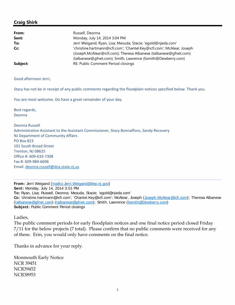
No individual or agency comments were received from the early notice concerning the proposed action (see Exhibit 2).
Step 3: Identify and evaluate practicable alternatives.
Several alternatives to the proposed action within the 100-year floodplain were considered:
Alternative 1: Relocate the Proposed Action Outside of the 100-year floodplain
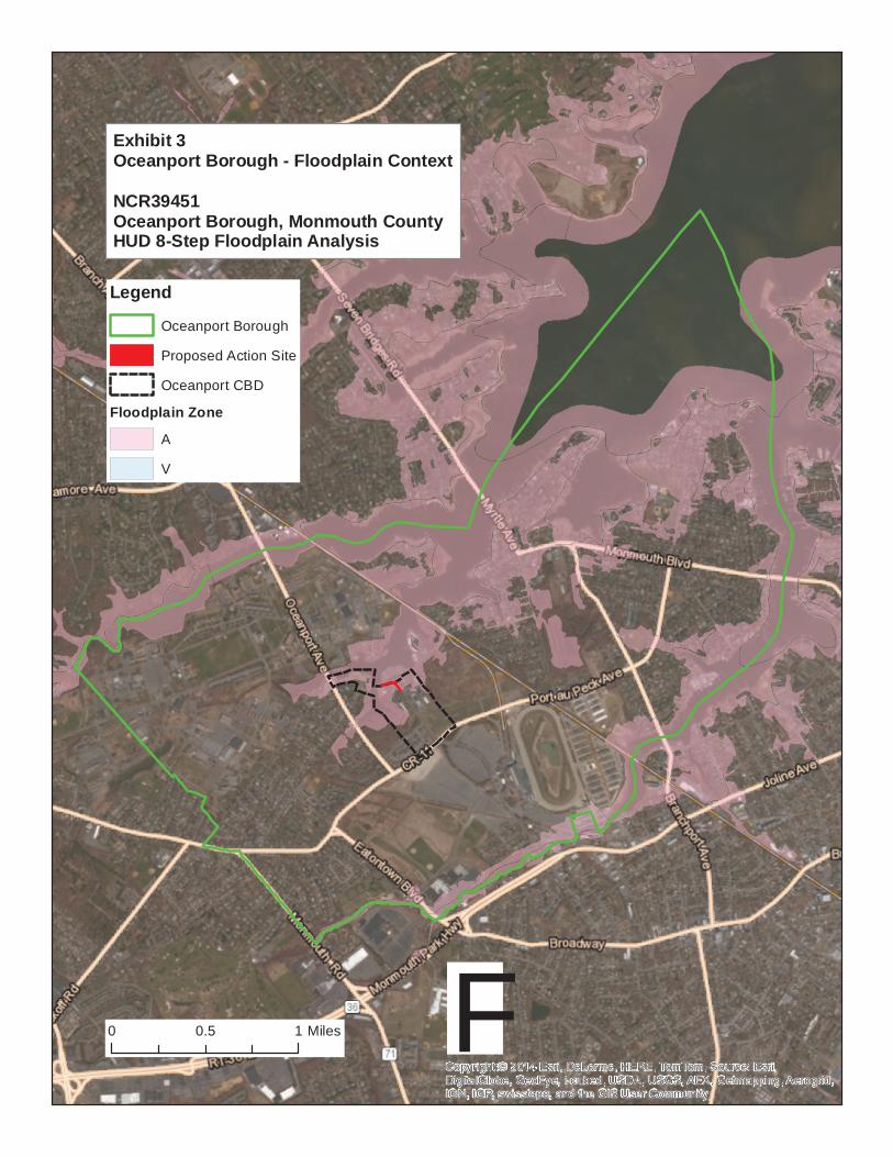
Due to its geography and proximity to the Oceanport, much of Oceanport is within the 100-year floodplain. A GIS analysis using the latest FEMA Preliminary Flood Insurance Rate Map (FIRM) (Exhibit 3) was performed to further characterize land parcels and floodplain designations in Oceanport, and approximately 42% of parcels within the borough are classified as being entirely or partially within the 100-year floodplain (Zones “A” or “V”). Therefore, relocating the proposed project to another available nearby parcel would not necessarily avoid floodplain effects.
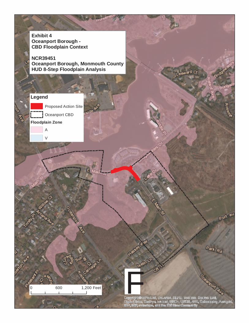
The central business district (CBD) of Oceanport is considered as the land within the borough’s Village Center zoning district (Borough of Oceanport Zoning Map, 1996, http://www.oceanportboro.com/pdf/forms-apps/zoning-map.pdf.). Within this district, 82% of the parcels are entirely or partially within the 100-year floodplain Zone A (Exhibit 4). Most of the land area within the CBD that is not within the 100-year floodplain is found within two large lots that encompass the Maria Gatta Community Park, an approximately 46 acre facility in the northeast quadrant of the East Main Street and Port Au Peck Avenue intersection.
The intent of the project is to assist in the economic revitalization of Oceanport; therefore, alternative locations outside of the CBD would not meet the project intent. Additionally, relocating the project from the proposed location to another portion of the CBD would most likely not avoid floodplain impacts nor contribute to the revitalization of developed and commercially viable portions of the CBD. Previous streetscape improvements have been completed along East Main Street to the south, with the proposed project intended to extend those improvements throughout the remainder of East Main Street within the CBD.
Alternative 2: No Action or Alternative Actions that Serve the Same Purpose
A No Action alternative was considered and rejected because the No Action alternative would not address the post-Sandy economic revitalization needs of Oceanport. Similarly, no alternative actions that would serve the same purpose and would avoid construction within the 100-year floodplain were identified, as a substantial portion of the CBD is within a designated flood hazard area and those areas within the CBD but outside of the floodplain are devoted to public recreational uses.
Superstorm Sandy had a widespread and lasting impact on the economy of New Jersey’s shore communities. The storm caused substantial damage to commercial property and caused short- and long-term business operations losses, thereby negatively affecting overall local and state commerce.

U.S. Department of Housing and Urban Development New Jersey Superstorm Sandy Community Development Block Grant- Disaster Recovery Program Neighborhood Community Revitalization Program
8-Step Floodplain Analysis - Executive Order 11988, HUD 24 CFR 55 NCR39451 East Main Street Streetscape Improvements Project, Oceanport Borough
3
In New Jersey alone, 75% of small businesses were adversely impacted and of those, nearly 19,000 sustained damage of $250,000 or more with total business losses estimated at $8.3 billion as a result of Hurricane Sandy. Restoring economic vitality to New Jersey’s businesses and communities is essential for the State’s long-term economic recovery and revitalization (NJDCA CDBG Action Plan, April 2013). In Oceanport, 223 businesses were physically impacted by the storm and overall damage to the borough (including impacts to private residences, businesses, public buildings and facilities, and emergency services) is estimated to cost $367 million.
Under the Neighborhood and Community Revitalization Program, approximately $10 million is intended to aid economic activity and revitalization in the commercial areas of storm-impacted communities through public facility improvements that increase the attractiveness, vitality, and competitiveness of local economies. Improvements such as streetscape improvements can help retain existing businesses and patrons while helping to attract new or expanded enterprises and customer markets.
The proposed project is located in the Borough’s central business area which includes the Village Center (VC) classification. This district encourages the development of mixed use infill development with strong pedestrian elements (see Exhibit 4).
Step 4: Identify Potential Direct and Indirect Impacts of Associated with Floodplain Development.
While the proposed streetscape revitalization improvements would occur within the 100-year floodplain, the overall design would have minimal effect on potential damage as a result of the flooding.
The project would reconstruct existing sidewalks, crosswalks and curbing and include the addition of street lighting and street signs. The project would result in only an approximate 10% increase in impervious area or floodplain development within the urbanized CBD which would contribute a negligible impact to flood levels.
Overall, construction of the proposed project would not result in significant adverse impacts to flood levels, flood risk, or the flow of flood waters on the project site or surrounding areas. Therefore, the proposed project would be compliant with the National Flood Insurance Act of 1968 (44 CFR § 59) and Executive Order 11988 on Floodplain Management (42 FR 26951).
Step 5: Where practicable, design or modify the proposed action to minimize the potential adverse impacts to lives, property, and natural values within the floodplain and to restore, and preserve the values of the floodplain.
As noted in Step 4, the proposed project would have no significant effect on flood levels or the threat of damage to adjacent properties.
Step 6: Reevaluate the Alternatives.
The proposed action is viewed as the most practicable alternative by avoiding significant adverse impacts to the floodplain in the local vicinity while helping to meet the community’s need for economic revitalization to support local employment and the tourism industry. Relocation of the project to another site within the Highlands Borough CBD would not avoid or further minimize

U.S. Department of Housing and Urban Development New Jersey Superstorm Sandy Community Development Block Grant- Disaster Recovery Program Neighborhood Community Revitalization Program
8-Step Floodplain Analysis - Executive Order 11988, HUD 24 CFR 55 NCR39451 East Main Street Streetscape Improvements Project, Oceanport Borough
4
impacts to the floodplain nor meet the intent of the project. The project, as proposed, would minimize potential hazards to human safety, health, and welfare.
The no action alternative also remains impracticable because it will not satisfy the need for post-Sandy economic revitalization within this substantially impacted community.
Step 7: Determination of No Practicable Alternative
It is our determination that there is no practicable alternative to locating the project in the flood zone. This is due to: 1) the need to revitalize the local economy of Highlands Borough through improvements within the CBD; 2) the lack of alternative locations outside of the 100-year floodplain related to the physical geography of this coastal community; and 3) the limited scope and impact of the proposed project related to impacts on human health, public property, and floodplain values.
A final public notice will be published in accordance with HUD requirements. The final notice will detail the reasons why the project must be located in the floodplain, a list of alternatives considered, and measures taken to minimize adverse impacts and preserve natural and beneficial floodplain values.
Step 8: Implement the Proposed Action
Implementation of the proposed action may require additional local and state permits, which could place additional design modifications or mitigation requirements on the project.

U.S. Department of Housing and Urban Development New Jersey Superstorm Sandy Community Development Block Grant- Disaster Recovery Program Neighborhood Community Revitalization Program
8-Step Floodplain Analysis - Executive Order 11988, HUD 24 CFR 55 NCR39451 East Main Street Streetscape Improvements Project, Oceanport Borough
5
Exhibit 1: Floodplain Map

Copy
right:
© 20
14 Es
ri, De
Lorm
e, HE
RE, T
omTo
m, So
urce:
Esri,
Digit
alGlob
e, Ge
oEye
, i-cu
bed,
USDA
,US
GS, A
EX, G
etmap
ping,
Aerog
rid, IG
N, IG
P, sw
isstop
o, an
d the
GIS
Use
r Com
munit
y
NJDEP
HUD E
nviron
menta
l Revi
ew To
olNe
w Jers
ey De
pt. of
Enviro
nment
al Prot
ection
- HUD
Envir
onme
ntal Re
view T
ool
Flood
plain M
anagem
ent - F
EMA P
relim
inary
FIRM
Appli
cation
ID#:
Area:
NCR3
9451
East M
ain St
reet fr
om La
ke Dri
ve no
rthwe
st to t
he co
unty
bridg
e
0200
100Fe
etF
NCR3
9451
Prelim
inary
FIRM
Zone
sA
V
Munic
ipality
:Bo
rough
of Oc
eanpo
rt
1:1,20
01 in
ch = 1
00 fe
et

U.S. Department of Housing and Urban Development New Jersey Superstorm Sandy Community Development Block Grant- Disaster Recovery Program Neighborhood Community Revitalization Program
8-Step Floodplain Analysis - Executive Order 11988, HUD 24 CFR 55 NCR39451 East Main Street Streetscape Improvements Project, Oceanport Borough
7
Exhibit 2: Early Notice and Public Review

EARLY NOTICE AND PUBLIC REVIEW OF A PROPOSED ACTIVITY IN A 100-YEAR FLOODPLAIN
MONMOUTH COUNTY
June 26, 2014 To: All Interested Agencies, Groups & Individuals This is to give notice that the New Jersey Department of Environmental Protection (NJDEP) on behalf of the Responsible Entity, the New Jersey Department of Community Affairs (NJDCA), has determined that the following proposed actions under the Neighborhood and Community Revitalization Program (NCR) that provides funds for projects that contribute to economic revitalization throughout New Jersey, are located in the 100-year floodplain. NJDEP will be identifying and evaluating practicable alternatives to locating the actions in the floodplain and the potential impacts on the floodplain from the proposed action, as required by Executive Order 11988, in accordance with HUD regulations at 24 CFR 55.20 Subpart C Procedures for Making Determinations on Floodplain Management and Protection of Wetlands. Proposed actions: NCR38953: The proposed project will involve streetscape improvements including new crosswalks, ADA compliant intersections, street trees, street lights, and street furniture along: Bay Avenue from South Street to Valley Avenue and from Washington Avenue to Central Avenue; along Waterwitch Avenue from Bay Avenue to Shore Drive; and along Shore Drive near Waterwitch Avenue in the Borough of Highlands in Monmouth County. NCR38953 is located entirely within the Special Flood Hazard Area Zones "AE (EL 11)" and "AE (EL 12)" Zone floodplains, as shown on Federal Emergency Management Agency (FEMA) Preliminary Flood Insurance Rate Map (FIRM) Panel 88 of 457, Map Number 34025C0088G, revised January 31, 2014.
NCR39451: The proposed project will involve the construction of granite block curb, wide decorative paver sidewalk, and pedestrian crosswalk; the installation of pedestrian lighting and traffic signs; and additional necessary site work and electrical work related to the above improvements along East Main Street from Lake Drive northwest to the county bridge in the Borough of Oceanport in Monmouth County. NCR39451 is located entirely within the Special Flood Hazard Area Zone "AE (EL 8)" Zone floodplain, as shown on Federal Emergency Management Agency (FEMA) Preliminary Flood Insurance Rate Map (FIRM) Panel 184 of 457, Map Number 34025C0184G, revised January 31, 2014.
NCR39452: The proposed project will provide construction of improved parking, street trees, pedestrian-scale street lights, street furniture, bicycle lanes, and the reconstruction of crosswalks on Ocean Avenue from Osborne Place to Rumson Bridge in the Borough of Sea Bright in Monmouth County. NCR39452 is located entirely within the Special Flood Hazard Area Zones "AE (EL 7)" and "AE (EL 8)" Zone floodplains, as shown on Federal Emergency Management Agency (FEMA) Preliminary Flood Insurance Rate Map (FIRM) Panel 201 of 457, Map Number 34025C0201G, revised January 31, 2014.
There are three primary purposes for this notice. First, people who may be affected by activities in floodplains and those who have an interest in the protection of the natural environment should be given an opportunity to express their concerns and provide information about these areas. Second, an adequate public notice program can be an important public education tool. Commenters are encouraged to offer alternative methods to serve the same project purpose, and methods to minimize and mitigate impacts. The dissemination of information and request for public comment about floodplains can facilitate and enhance Federal efforts to reduce the risks associated with the occupancy and modification of these special areas. Third, as a matter of fairness, when the Federal government determines it will participate in actions taking place in floodplains, it must inform those who may be put at greater or continued risk.

Written comments must be received by NJDCA on or before July 12, 2014. NJDCA encourages electronic submittal of comments at http://www.nj.gov/dca/divisions/sandyrecovery/review/. In the alternative, comments may be submitted on paper to: Stacy Bonnaffons, Assistant Commissioner, Sandy Recovery Division, New Jersey Department of Community Affairs, 101 South Broad Street, PO Box 800, Trenton, NJ 08625-0800 by July 12, 2014. The Notice can be viewed at NJDCA during the hours of 9:00 AM to 5:00 PM. Further information can be found on the Department’s web site at http://www.nj.gov/dca/divisions/sandyrecovery/review/. Bob Martin, Commissioner, NJDEP

AVISO ANTICIPADO Y EXPLICACIÓN PÚBLICA DE LA PROPUESTA DE
ACTIVIDAD EN UNA PLANICIE ALUVIAL DE 100 AÑOS
Condado de Monmouth
26 de junio de 2014
A todas las Agencias, Grupos y Personas Interesadas
Esto es para dar aviso de que el Departamento de Protección Ambiental de Nueva Jersey (NJDEP) en nombre
de la entidad responsable, el Departamento de Asuntos Comunitarios de Nueva Jersey (NJDCA), ha
determinado que la siguiente acción propuesta en el marco del Programa de Revitalización de Comunidades y
Vecindarios (NCR), que provee fondo para proyectos que contribuyan a la revitalización económica en Nueva
Jersey, se encuentra en una planicie aluvial de 100 años. NJDEP identificará y evaluará alternativas viables a
la localización de las acciones en la planicie aluvial y los posibles efectos sobre la planicie aluvial de la acción
propuesta, como es requerido por la Orden Ejecutiva 11988, de acuerdo con las regulaciones de HUD, 24 CFR
55.20 Subparte C Procedimientos para hacer determinaciones sobre Gestión de Planicies Aluviales y Protección
de Humedales.
Acción Propuesta:
NCR38953: El proyecto propuesto implica mejoras al paisaje urbano, incluyendo nuevos pasos peatonales,
asegurar que las intersecciones cumplan con los requisitos de ADA, colocar árboles en las calles, alumbrado
público y mobiliario urbano a lo largo de: Bay Avenue desde la South Street a la Valley Avenue y desde la
Washington Avenue a Central Avenue; a lo largo de la Waterwitch Avenue desde Bay Avenue a la Shore
Drive; y a lo largo de Shore Drive cerca de la Waterwitch Avenue en el Borough of Highlands en el Condado
de Monmouth. NCR38953 está totalmente dentro de un Área Especial de Riesgo de Inundación “AE (EL 11)”,
y “AE (EL 12)” Zona de Inundación, como se indica en el Mapa de Tasas de Seguro de Inundación (FIRM) de
la Agencia Federal de Manejo de Emergencia (FEMA), Panel 88 de 457, Mapa Número 34025C0088G revisado
el 31 de enero del 2014.
NCR39451: El proyecto propuesto consiste en la construcción de un bordillo de bloques de granito, amplias
aceras pavimentadas decorativas, y pasos peatonales; la instalación de alumbrado peatonal y señales de tráfico;
y el necesario trabajo adicional e instalaciones eléctricas relacionadas con las mejoras anteriores a lo largo de la
East Main Street desde Lake Drive en el noroeste al puente del condado en el Borough of Oceanport en el
Condado de Monmouth. NCR39451 está totalmente dentro de un Área Especial de Riesgo de Inundación “AE
(EL 8)” Zona de Inundación, como se indica en el Mapa de Tasas de Seguro de Inundación (FIRM) de la
Agencia Federal de Manejo de Emergencia (FEMA), Panel 184 de 457, Mapa Número 34025C0184G revisado
el 31 de enero del 2014.
NCR39452: El proyecto propuesto incluirá la construcción y mejoramiento de estacionamientos, colocar
árboles en las calles, luces peatonales en las calles, mobiliario urbano, carriles para bicicletas y la
reconstrucción de pasos peatonales en la Ocean Avenue desde la Osborne Place a la Rumson Bridge en el

Borough de Sea Bright en el Condado de Monmouth. NCR39452 está totalmente dentro de un Área Especial de
Riesgo de Inundación “AE (EL 7)” y “AE (EL8) Zona de Inundación, como se indica en el Mapa de Tasas de
Seguro de Inundación (FIRM) de la Agencia Federal de Manejo de Emergencia (FEMA), Panel 201 de 457,
Mapa Número 34025C0201G revisado el 31 de enero del 2014.
Hay tres propósitos principales para este aviso. En primer lugar, las personas que puedan verse afectadas por
las actividades en la planicie aluvial y aquellos que tienen un interés en la protección del medio ambiente se le
debe dar la oportunidad de expresar sus inquietudes y proporcionarles información sobre estas áreas. En
segundo lugar, un adecuado programa de notificación pública puede ser una herramienta importante de
educación pública. Se insta a proporcionar comentarios que ofrezcan métodos alternativos para servir el mismo
propósito del proyecto, y métodos para minimizar y mitigar los impactos. La difusión de información y solicitud
de comentarios públicos sobre las planicies aluviales puede facilitar y mejorar los esfuerzos federales para
reducir los riesgos asociados con la ocupación y modificación de estas áreas especiales. En tercer lugar, como
una cuestión de justicia, cuando el gobierno federal determina que participará en las acciones que se realizarán
en lugares dentro de planicies aluviales, se debe informar a quienes puedan quedar expuestos a un riesgo mayor
o continuó.
Los comentarios por escrito deben ser recibidos por NJDCA en o antes del 12 de julio de 2014. NJDCA insta a
presentar los comentarios de manera electrónica en http://www.nj.gov/dca/divisions/sandyrecovery/review/. En
la otra alternativa, los comentarios podrán ser presentados en papel a: Stacy Bonnaffons, Comisionada Adjunta
de la División de Recuperación de Sandy, Departamento de Asuntos Comunitarios de Nueva Jersey, 101 South
Broad Street, P.O. Box 800, Trenton, NJ 08.625-0800 antes del 12 de julio del 2014. Este aviso puede verse en
la sede de NJDCA durante las horario de 9:00 AM a 5:00 PM. Más información puede encontrarse en el sitio
web del Departamento en http://www.nj.gov/dca/divisions/sandyrecovery/review/.
Bob Martin, Comisionado del NJDEP

Af f idavit o f Ac c ur ac y Jun e 2 6 , 2 014
June 26, 2014
This letter is our sworn affidavit that advertisements ordered by Kristen Maines
(Environmental Planner/Project Manager; Gannett Fleming, Inc) for the following public
announcements:
Combined Early Floodplain Notice
was published in Spanish in the June 26/14 edition of Reporte Hispano, New Jersey’s
only Hispanic newspaper with statewide coverage.
Sincerely,
Cara Marcano
Reporte Hispano
609 933 1400
21REPORTE Hispano.comAVISOS LEGALESJunio 26 - Julio 2 de 2014
AVISO ANTICIPADO Y EXPLICACIÓN PÚBLICA DE LA PROPUESTA DE ACTIVIDAD EN UNA PLANICIE ALUVIAL DE 100 AÑOS
Condado de Monmouth
26 de junio de 2014
A todas las Agencias, Grupos y Personas Interesadas
Esto es para dar aviso de que el Departamento de Protección Ambiental de Nueva Jersey (NJDEP) en nombre de la entidad responsable, el Departamento de Asuntos Comunitarios de Nueva Jersey (NJDCA), ha determinado que la siguiente acción pro-puesta en el marco del Programa de Revitalización de Comunidades y Vecindarios (NCR), que provee fondo para proyectos que contribuyan a la revitalización económica en Nueva Jersey, se encuentra en una planicie aluvial de 100 años. NJDEP identificará y evaluará alternativas viables a la localización de las acciones en la planicie aluvial y los posibles efectos sobre la planicie aluvial de la acción propuesta, como es requerido por la Orden Ejecutiva 11988, de acuerdo con las regulaciones de HUD, 24 CFR 55.20 Subparte C Procedimientos para hacer determinaciones sobre Gestión de Planicies Aluviales y Protección de Humedales.
Acción Propuesta:
NCR38953: El proyecto propuesto implica mejoras al paisaje urbano, incluyendo nue-vos pasos peatonales, asegurar que las intersecciones cumplan con los requisitos de ADA, colocar árboles en las calles, alumbrado público y mobiliario urbano a lo largo de: Bay Avenue desde la South Street a la Valley Avenue y desde la Washington Avenue a Central Avenue; a lo largo de la Waterwitch Avenue desde Bay Avenue a la Shore Drive; y a lo largo de Shore Drive cerca de la Waterwitch Avenue en el Borough of High-lands en el Condado de Monmouth. NCR38953 está totalmente dentro de un Área Es-pecial de Riesgo de Inundación “AE (EL 11)”, y “AE (EL 12)” Zona de Inundación, como se indica en el Mapa de Tasas de Seguro de Inundación (FIRM) de la Agencia Federal de Manejo de Emergencia (FEMA), Panel 88 de 457, Mapa Número 34025C0088G revisado el 31 de enero del 2014.
NCR39451: El proyecto propuesto consiste en la construcción de un bordillo de blo-ques de granito, amplias aceras pavimentadas decorativas, y pasos peatonales; la instalación de alumbrado peatonal y señales de tráfico; y el necesario trabajo adicional e instalaciones eléctricas relacionadas con las mejoras anteriores a lo largo de la East Main Street desde Lake Drive en el noroeste al puente del condado en el Borough of Oceanport en el Condado de Monmouth. NCR39451 está totalmente dentro de un Área Especial de Riesgo de Inundación “AE (EL 8)” Zona de Inundación, como se indica en el Mapa de Tasas de Seguro de Inundación (FIRM) de la Agencia Federal de Manejo de Emergencia (FEMA), Panel 184 de 457, Mapa Número 34025C0184G revisado el 31 de enero del 2014.
NCR39452: El proyecto propuesto incluirá la construcción y mejoramiento de esta-cionamientos, colocar árboles en las calles, luces peatonales en las calles, mobiliario urbano, carriles para bicicletas y la reconstrucción de pasos peatonales en la Ocean Avenue desde la Osborne Place a la Rumson Bridge en el Borough de Sea Bright en el Condado de Monmouth. NCR39452 está totalmente dentro de un Área Especial de Riesgo de Inundación “AE (EL 7)” y “AE (EL8) Zona de Inundación, como se indica en el Mapa de Tasas de Seguro de Inundación (FIRM) de la Agencia Federal de Manejo de Emergencia (FEMA), Panel 201 de 457, Mapa Número 34025C0201G revisado el 31 de enero del 2014. Hay tres propósitos principales para este aviso. En primer lugar, las personas que puedan verse afectadas por las actividades en la planicie aluvial y aquellos que tienen un interés en la protección del medio ambiente se le debe dar la oportunidad de ex-presar sus inquietudes y proporcionarles información sobre estas áreas. En segundo lugar, un adecuado programa de notificación pública puede ser una herramienta impor-tante de educación pública. Se insta a proporcionar comentarios que ofrezcan métodos alternativos para servir el mismo propósito del proyecto, y métodos para minimizar y mitigar los impactos. La difusión de información y solicitud de comentarios públicos so-bre las planicies aluviales puede facilitar y mejorar los esfuerzos federales para reducir los riesgos asociados con la ocupación y modificación de estas áreas especiales. En tercer lugar, como una cuestión de justicia, cuando el gobierno federal determina que participará en las acciones que se realizarán en lugares dentro de planicies aluviales, se debe informar a quienes puedan quedar expuestos a un riesgo mayor o continuó.
Los comentarios por escrito deben ser recibidos por NJDCA en o antes del 12 de julio de 2014. NJDCA insta a presentar los comentarios de manera electrónica en http://www.nj.gov/dca/divisions/sandyrecovery/review/. En la otra alternativa, los comentari-os podrán ser presentados en papel a: Stacy Bonnaffons, Comisionada Adjunta de la División de Recuperación de Sandy, Departamento de Asuntos Comunitarios de Nueva Jersey, 101 South Broad Street, P.O. Box 800, Trenton, NJ 08.625-0800 antes del 12 de julio del 2014. Este aviso puede verse en la sede de NJDCA durante las horario de 9:00 AM a 5:00 PM. Más información puede encontrarse en el sitio web del Departa-mento en http://www.nj.gov/dca/divisions/sandyrecovery/review/.
Bob Martin, Comisionado del NJDEP
AVISO DE INTENCIÓN DE SOLICITAR LIBERACIÓN DE FONDOS YAVISO Y EXPLICACIÓN PUBLICA DE UNA ACTIVIDAD PROPUESTA EN UNA
PLANICIE ALUVIAL DE 100 AÑOSCONDADO DE CAPE MAY
26 de junio de 2014
Autoridad de Desarrollo Económico del Estado de Nueva Jersey 36 West State Street PO Box 990Trenton, NJ 08625-0990609-858-6700
Estos avisos deben satisfacer dos requisitos de procedimiento distintos pero relacionados para las actividades que deben ser desarrollados por la Autoridad de Desarrollo Económico del Estado de Nueva Jersey (EDA). De acuerdo con 24 CFR 58.33, y 24 CFR 55.20(b)(1)), el Aviso de Intención de Solicitar Liberación de Fondos (NOI-RROF) y el Aviso y Expli-cación Pública de una Actividad Propuesta en una Planicie Aluvial de 100 años serán publicados simultáneamente con la presentación de la Solicitud de Liberación de Fondos (RROF). Se necesitan los fondos de emergencia debido al desastre declarado por los impactos de la super-tormenta Sandy, que tocó tierra el 29 de octubre de 2012. Como resultado, se han combinado los períodos de comentario para la NOI-RROF y RROF.
SOLICITUD PARA LIBERACIÓN DE FONDOSAlrededor del 28 de junio del 2014, el Departamento de Asuntos Comunitarios entregará una solicitud al Departamento Federal de Vivienda y Desarrollo Urbano de EE. UU. (Department of Housing and Urban Development [HUD]) de liberación de fondos federales en el marco del Pro-grama de Subsidios Globales para el Desarrollo Comunitario (Community Development Block Grant Program [CDBG]) en conformidad con la ley de Apropiaciones de Ayuda para Casos de Desastre de 2013 (Disaster Relief (DR) Appropriations Act of 2013) (Ley pública 113-2, aprobado el 29 de enero de 2013) para el Programa de la Revitalización de la Comunidad y los Vecindarios (Neighborhood and Community Revitalization Program [NCR])]. La EDA espera financiar el proyecto con aproximadamente $999,894 de fondos del NCR.
La información siguiente pertenece a este proyecto:Título del proyecto: Rehabilitación del paisaje urbajo de Sea Isle City (NCR38958)Ubicación: Landis Ave. De la 39th St a la 40th St y de la 41st St. a la 43rd St., Sea Isle City, NJCosto Estimado: $999,894Descripción: El proyecto consiste en la reconstrucción de aceras y pasos de peatones con adoquines decorativos y la instalación de nuevas farolas, bolardos, bancas, soportes para bicicletas y paisajismo a lo largo de dos secciones de Landis Avenue- de 39th St. a 40th St. y de 41st St. a 43rd St.- dentro de la ciudad de Sea Isle en el condado de Cape May.
El programa de la Revitalización de la Comunidad y los Vecindarios (NCR) apoya la recuperación a largo plazo de los pequeños negocios y las comunidades a través de la financiación de proyectos que contribuyan a la revitalización económica a lo largo de Nueva Jersey, pero centrándose en los nueve condados más afectados. El programa de NCR apoya a los proyectos que retienen o contratan a nuevos empleados, contribuyen a la economía del estado, sirven áreas con ingresos bajos o moderados (LMI), crean o mantienen empleos LMI, alivian las zonas insalubres o deterioradas o abordan a necesidades urgentes relacionadas a la supertormenta Sandy. Estos proyectos son comerciales o mixtos, típicamente el desarrollo y la mejora pública o la revitalización de paisajes urbanos.EDA ha determinado que el proyecto propuesto es Excluido Categóricamente SUJETO a las autoridades §58.5 por 24 CFR 58.35(a)(4)(i) [CEST]. Como tal, se ha completado una Lista Legal [Statutory Checklist] para determinar si el proyecto se conforme a las autoridades citadas en 24 CFR§50.4 y 58,5.Información adicional del proyecto se encuentra en el Registro Escrito de Revisión Ambiental (Environmental Review Record [ERR]) el cual se encuentra en el archivo del Departamento de Asuntos Comunitarios de Nueva Jersey, Sandy Recovery Division, 101 South Broad Street, PO Box 800, Trenton, NJ 08625-0800. El documento está disponible para su revisión y puede ser examinado o copiado entre semana desde las nueve (9) del mañana hasta las cinco (5) de la tarde, o puede ser revisado en la siguiente página de la Internet: http://www.nj.gov/dca/divisions/sandyrecovery/review/
AVISO Y EXPLICACIÓN PUBLICA DE UNA ACTIVIDAD PROPUESTA EN UNA PLANICIE ALUVIAL DE 100 AÑOSPor medio de la presente se da aviso de que EDA ha conducido una evaluación tal como es requerido por la Orden Ejecutiva (EO) 11988 de acuerdo con el reglamento HUD del 24 CFR 55.20, Sub parte C: Procedimiento para Formular Resoluciones sobre el Manejo de Planicies de Inundación y Protección de los Humedales. La actividad tiene fondos bajo el Programa NCR bajo (B-13-DS-34-001). El proyecto consiste en la reconstrucción de aceras y pasos de peatones con adoquines decorativos y la instalación de nuevas farolas, bolardos, bancas, soportes para bicicletas y paisajismo a lo largo de dos secciones de Landis Avenue- de 39th St. a 40th St. y de 41st St. a 43rd St.- dentro de la ciudad de Sea Isle en el condado de Cape MayEl proyecto propuesto será construido dentro de una zona designada Área Especial de Riesgo de Inundación Zona “AE” (zona de peligro de inundaciones con una determinada superficie de elevaciones), como se indica en el Mapa de Seguro de Inundación de Tasas Preliminar (FIRM) Mapa Número 3453180001C, efectivo 6 de enero de 1983 y en el Mapa Preliminar Post Sandy de FEMA. Las áreas designadas como Area Especial de Riesgo de Inundación son las que están sujetos a inundaciones con una probabilidad de inundación anual del 1% (ejemplo, planicies aluviales de 100 años), también conocidas como base de inundación.El DCA ha considerado alternativas y métodos de mitigación para minimizar los impactos adversos y para restaurar y preservar los valores naturales y beneficiosos. Una alternativa es reubicar la acción propuesta fuera de la planicie aluvial de 100 años de inundación. Sin embargo, aproximadamente 94% de las parcelas dentro de la ciudad están dentro de la clasificación de encontrarse completamente o parcialmente en una planicie aluvial de 100 años. Aproximadamente el 5% de las parcelas en la ciudad están dentro de la clasificación de encontrarse completamente o parcialmente fuera de una planicie aluvial de 100 años pero susceptible al 0.2 por ciento de peligro de inundación anual (ejemplo inundaciones en 500 años); menos del 1% de las parcelas de la ciudad han sido clasificadas como ubicadas completamente o parcialmente fuera de una planicie aluvial de 100 años y una planicie aluvial de 500 años. Por lo tanto, poner el proyecto propuesto a otra parcela cercana disponible no necesariamente evitará los efectos de inundación. Por lo tanto, reubicar el proyecto propuesto a otra parcela cercana disponible no necesaria-mente evitará los efectos de inundación. La alternativa de No Actuar fue considerada y rechazada porque No tomar ninguna acción no ayudaría a la recuperación económica que necesita Sea Isle City luego del impacto de la supertormenta Sandy. De igual modo, ninguna acción alternativa que sirva para el mismo propósito y evite la construcción dentro de la planicie aluvial de 100 años fue identificada, ya que todo el CBD de la ciudad está dentro de un área designada como en peligro de inundación. El DCA ha reevaluado las alternativas y determinado que su propuesta de acción es la alternativa más viable al evitar los efectos adversos de las planicies aluviales en la vecindad local al tiempo que ayuda a satisfacer las necesidades de la comunidad para la revitalización económica que apoye el empleo local y la industria del turismo. Reubicar el proyecto a otro lugar dentro del CBD de Sea Isle City no evitará o minimizará aún más el impacto de las planicies de inundación ni cumplirá con la intención del proyecto. El proyecto, tal como se propone, minimizará los posibles peligros para la seguridad humana, la salud y el bienestar.
DCA ha determinado que mientras se realizan las mejoras de revitalización del paisaje urbano propuesto dentro de la planicie aluvial de 100 años, el diseño general tendría un efecto mínimo o daño potencial como consecuencia de las inundaciones. El proyecto reemplazaría aceras de concreto con adoquines decorativos e incluye añadir alumbrado público, bolardos, bancas, soportes para bicicletas y paisajismo. El proyecto resultará en ningún cambió en la áreas o construcciones en las zonas de inundación urbanizada del CBD.En general , la construcción del proyecto propuesto no resultarían en impactos significativos adversos para los niveles de inundación, riesgo de inundación o el flujo de aguas de inundación en el área del proyecto o sus alrededores. Por lo tanto, los proyectos propuestos estarían en cum-plimiento con la Ley Nacional de Seguros contra Inundaciones de 1968 (44 CFR § 59) y la Orden Ejecutiva 11988 sobre el Manejo de Planicies de Inundación (42 FR 26951).
COMENTARIOS DEL PÚBLICOCualquier individuo, grupo, o agencia que esté en desacuerdo con esta determinación o que desee comentar sobre este proyecto puede pre-sentar observaciones por escrito a Stacy Bonnaffons, Assistant Commissioner, Sandy Recovery Division, New Jersey Department of Community Affairs, 101 South Broad Street, PO Box 800, Trenton, NJ 08625-0800, o en línea en http://www.nj.gov/dca/divisions/sandyrecovery/review/ y a Tennille Smith Parker, DRS, Acting Division Director, HUD, 451 Seventh Street SW, Washington, D.C. 20410. El DCA considerará todos los comentarios recibidos hasta el 12 de julio del 2014. Comentarios deberían especificar cual Aviso están abordando.LIBERACIÓN DE FONDOS El DCA certifica a HUD (el 28 de junio del 2014) o alrededor de esa fecha) que Richard E. Constable, III, en su calidad de Comisionado del DCA da consentimiento para aceptar la jurisdicción de los tribunales federales si se presenta una acción para imponer responsabilidades en relación con el proceso de análisis medioambiental y que dichas responsabilidades han sido satisfechas. La aprobación de la certificación por parte de HUD satisface sus responsabilidades de conformidad con NEPA y las leyes y autoridades afines, y le permite que DCA use fondos del Programa.OBJECIONES A LA LIBERACIÓN DE FONDOS HUD aceptará objeciones a la liberación de sus fondos y a la certificación del DCA por un período de siete (7) días después de la fecha de entrega prevista o de que se reciba la solicitud (lo que ocurra después) solo si estas se dan sobre las siguientes bases: (a) la certificación no fue realizada por parte de un funcionario del DCA capacitado para certificar; (b) El DCA ha omitido un paso o ha dejado de tomar una decisión o considerar un resultado exigido por las regulaciones de HUD en el CFR 24 Parte 58; (c) quien recibe la subvención ha destinado los fondos o ha incurrido en gastos no autorizados por el CFR 24 Parte 58 antes de que HUD aprobara la liberación de fondos; u (d) otra agencia federal, actuando de conformidad con el CFR 40 Parte 1504, ha enviado un hallazgo por escrito diciendo que el proyecto no es satisfactorio desde el punto de vista de calidad medioambiental. Las objeciones deben prepararse y enviarse de conformidad con los procedimientos requeridos (CFR 24 Parte 58) y deben estar dirigidas a Tennille Smith Parker, DRS, Acting Division Director, HUD, 451 Seventh Street SW, Washington, D.C. 20410. Los objeto-res potenciales deben comunicarse con HUD para verificar cuál es el último día del período de objeciones.
Comisionado Richard E. Constable, IIIDepartamento de Asuntos Comunitarios del Estado de Nueva Jersey
1
Craig Shirk
From: Russell, DeonnaSent: Monday, July 14, 2014 3:04 PMTo: Jerri Weigand; Ryan, Lisa; Mesuda, Stacie; '[email protected]'Cc: '[email protected]'; '[email protected]'; McAlear, Joseph
([email protected]); Theresa Albanese ([email protected]) ([email protected]); Smith, Lawrence ([email protected])
Subject: RE: Public Comment Period closings
Good afternoon Jerri, Stacy has not be in receipt of any public comments regarding the floodplain notices specified below. Thank you. You are most welcome. Do have a great remainder of your day. Best regards, Deonna Deonna Russell Administrative Assistant to the Assistant Commissioner, Stacy Bonnaffons, Sandy Recovery NJ Department of Community Affairs PO Box 823 101 South Broad Street Trenton, NJ 08625 Office #: 609‐633‐7308 Fax #: 609‐984‐6696 Email: [email protected]
From: Jerri Weigand [mailto:[email protected]] Sent: Monday, July 14, 2014 3:01 PM To: Ryan, Lisa; Russell, Deonna; Mesuda, Stacie; '[email protected]' Cc: '[email protected]'; '[email protected]'; McAlear, Joseph ([email protected]); Theresa Albanese ([email protected]) ([email protected]); Smith, Lawrence ([email protected]) Subject: Public Comment Period closings Ladies, The public comment periods for early floodplain notices and one final notice period closed Friday 7/11 for the below projects (7 total). Please confirm that no public comments were received for any of these. Erin, you would only have comments on the final notice. Thanks in advance for your reply. Monmouth Early Notice NCR 39451 NCR39452 NCR38953

2
Ocean Early Notice SBL38623 Atlantic Early Notice NCR39448 Early Notice for Jackabob’s (TO 1027) SBL39373 Final Notice for NCR38958 Sea Isle Jerri Weigand [email protected] 609-633-1498 Sandy Recovery Environmental Review Program 401 East State Street, 7th Floor PO Box 402 Trenton, New Jersey 08625

U.S. Department of Housing and Urban Development New Jersey Superstorm Sandy Community Development Block Grant- Disaster Recovery Program Neighborhood Community Revitalization Program
8-Step Floodplain Analysis - Executive Order 11988, HUD 24 CFR 55 NCR39451 East Main Street Streetscape Improvements Project, Oceanport Borough
18
Exhibit 3: Oceanport Borough‐ Floodplain Context
Copyright:© 2014 Esri, DeLorme, HERE, TomTom, Source: Esri,DigitalGlobe, GeoEye, i-cubed, USDA, USGS, AEX, Getmapping, Aerogrid,IGN, IGP, swisstopo, and the GIS User Community
F
LegendOceanport BoroughProposed Action SiteOceanport CBD
Floodplain ZoneAV
0 10.5 Miles
Exhibit 3Oceanport Borough - Floodplain ContextNCR39451Oceanport Borough, Monmouth CountyHUD 8-Step Floodplain Analysis

U.S. Department of Housing and Urban Development New Jersey Superstorm Sandy Community Development Block Grant- Disaster Recovery Program Neighborhood Community Revitalization Program
8-Step Floodplain Analysis - Executive Order 11988, HUD 24 CFR 55 NCR39451 East Main Street Streetscape Improvements Project, Oceanport Borough
20
Exhibit 4: Oceanport Borough – CBD Floodplain Context
Copyright:© 2014 Esri, DeLorme, HERE, TomTom, Source: Esri,DigitalGlobe, GeoEye, i-cubed, USDA, USGS, AEX, Getmapping, Aerogrid,IGN, IGP, swisstopo, and the GIS User Community
F
LegendProposed Action SiteOceanport CBD
Floodplain ZoneAV
0 1,200600 Feet
Exhibit 4Oceanport Borough - CBD Floodplain ContextNCR39451Oceanport Borough, Monmouth CountyHUD 8-Step Floodplain Analysis
U.S. Department of Housing and Urban Development New Jersey Superstorm Sandy Community Development Block Grant- Disaster Recovery Program Neighborhood Community Revitalization Program
8-Step Floodplain Analysis - Executive Order 11988, HUD 24 CFR 55 NCR39451 East Main Street Streetscape Improvements Project, Oceanport Borough
22
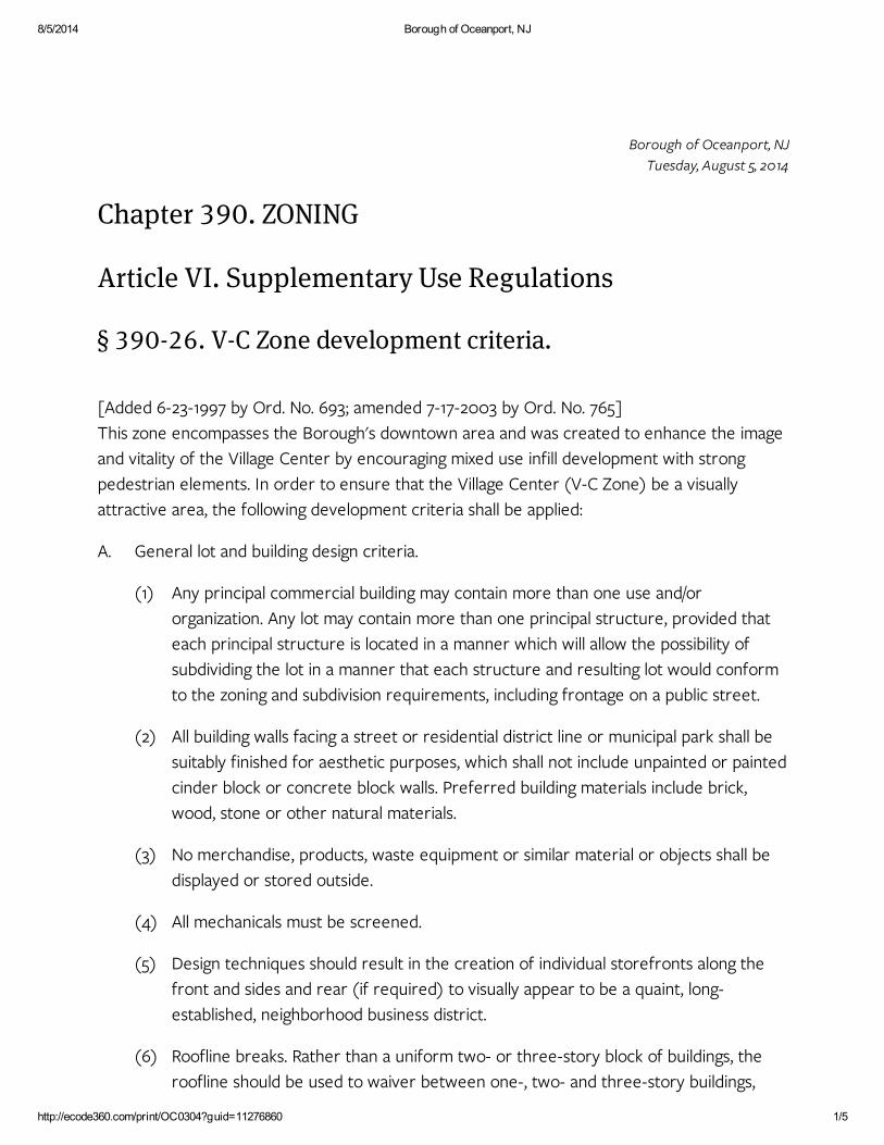
Exhibit 5 – Oceanport Borough Village Center Zoning

NCR 39451
8/5/2014 Borough of Oceanport, NJ
http://ecode360.com/print/OC0304?guid=11276860 1/5
(1)
(2)
(3)
(4)
(5)
(6)
A.
Borough of Oceanport, NJ
Tuesday, August 5, 2014
Chapter 390. ZONING
Article VI. Supplementary Use Regulations
§ 390-26. V-C Zone development criteria.
[Added 6-23-1997 by Ord. No. 693; amended 7-17-2003 by Ord. No. 765]
This zone encompasses the Borough's downtown area and was created to enhance the image
and vitality of the Village Center by encouraging mixed use infill development with strong
pedestrian elements. In order to ensure that the Village Center (V-C Zone) be a visually
attractive area, the following development criteria shall be applied:
General lot and building design criteria.
Any principal commercial building may contain more than one use and/or
organization. Any lot may contain more than one principal structure, provided that
each principal structure is located in a manner which will allow the possibility of
subdividing the lot in a manner that each structure and resulting lot would conform
to the zoning and subdivision requirements, including frontage on a public street.
All building walls facing a street or residential district line or municipal park shall be
suitably finished for aesthetic purposes, which shall not include unpainted or painted
cinder block or concrete block walls. Preferred building materials include brick,
wood, stone or other natural materials.
No merchandise, products, waste equipment or similar material or objects shall be
displayed or stored outside.
All mechanicals must be screened.
Design techniques should result in the creation of individual storefronts along the
front and sides and rear (if required) to visually appear to be a quaint, long-
established, neighborhood business district.
Roofline breaks. Rather than a uniform two- or three-story block of buildings, the
roofline should be used to waiver between one-, two- and three-story buildings,

8/5/2014 Borough of Oceanport, NJ
http://ecode360.com/print/OC0304?guid=11276860 2/5
(7)
(1)
(2)
(3)
(4)
(5)
B.
giving the feel of a streetscape that has evolved over many years.
Architectural styles must be compatible with the "Turn of the Century
Racetrack/Seaside Village" theme. Architectural styles must not be mixed in the same
building. The use of detailing, such as window shutters on upper floors, small-paned
storefront windows and entrance door side windows or decorative framing, is
recommended and encouraged where appropriate to the architectural style. Blank
walls will not be allowed.
Landscaping and lighting.
All portions of the property not utilized by buildings or paved surfaces shall be
landscaped with a combination of fencing, shrubbery, lawn area, ground cover,
contours, existing foliage and the planting of conifers and/or deciduous trees native
to the area in order to either maintain or reestablish the tone of the vegetation in
the area and lessen the impact of the structures and paved areas. The established
grades on any site shall be planned for both aesthetic and drainage purposes. The
grading plan, drainage facilities and landscaping shall be coordinated to prevent
erosion and silting, as well as assuring that the capacity of any natural or man-made
drainage system is sufficient to handle the water generated and anticipated.
Perimeter strips consisting of a landscape screen shall be provided between off-
street parking areas and adjoining properties. The perimeter strip shall be
composed of plants and trees arranged to form both a low-level and a high-level
screen. The high-level screen shall consist of trees planted with specimens of at
least four feet in height and planted at intervals which will provide an overlapping
foliage screen at maturity with a minimum mature height of 15 feet. The low-level
screen shall consist of shrubs or hedges planted at an initial height of not less than
two feet and spaced at intervals of not less than five feet. The low-level screen shall
be placed in alternating rows to produce a more effective barrier. All plants not
surviving two growing seasons after planting shall be replaced. Perimeter strips shall
be a minimum of 10 feet wide and shall be protected by permanent curbing.
Landscaping and buffer plan should be submitted for Planning Board site plan
review showing what will remain and what will be planted, indicating names of plants
and trees and dimensions and approximate time of planting.
There shall be at least one trash and garbage pickup location provided by each
building. It shall be a totally enclosed container located in a manner to be obscured
from view from parking areas, existing residential uses or municipal parks by a
masonry enclosure.
Lighting. For all uses within the district, adequate lighting to ensure safe pedestrian
and vehicular travel shall be provided. The following standards shall apply:
8/5/2014 Borough of Oceanport, NJ
http://ecode360.com/print/OC0304?guid=11276860 3/5
(a)
(b)
(a)
(b)
(c)
(d)
(e)
(6)
(a)
(b)
(c)
(7)
(a)
(8)
Light fixtures shall be Hexagonal Lantern Series L24 luminaire, 175 MH, as
manufactured by Lumec.
Poles shall be R90 Traditional Steel Pole (black), 16 feet high, as manufactured
by Lumec. Pole shall come equipped with 120-V duplex receptacle at top and
double banner arm. Poles and light fixtures shall be spaced at one-hundred-
foot intervals.
Sidewalks.
Sidewalks must be a minimum of 15 feet in width.
Concrete pavers shall be used and shall be 3 1/8 inches in thickness where used
in driveways, roadways and driveway aprons; 2 1/8 inches in thickness where
used in sidewalks having a minimum compressing strength of 8,000 psi; a water
absorption maximum of 5% and shall meet or exceed ASTM Specifications
C936-82.
Subbase in sidewalk areas shall consist of crushed concrete, six inches thick,
topped with one-inch quarry dust. Subbase in driveways, roadways and
driveway aprons shall consist of concrete subbase six inches thick.
The concrete pavers shall be installed tightly together on the bedding course
with joints not exceeding 1/8 inch. Joints shall be filled with sand or quarry dust,
as approved by the Borough Engineer.
Pavers must have a border on all sides.
Granite block curb.
Granite block shall consist of rectangular paving stones, with slit faces and
edges, made from granite complying with ASTM C615, 10 inches tall by four to
five inches deep by six to eight inches wide. The Borough Engineer can supply
manufacturers.
Concrete shall be air-entraining portland cement in accordance with ASTM
Specification C-94, proportioned to have a minimum compressive strength of
4,000 psi at 28 days (AC1318).
Set block to provide six-inch curb face with five-eighths-inch mortar joint
grooved. Construction detail shall be approved by the Borough Engineer.
Signs.
Permits required. No person, firm or corporation shall hereafter erect, reerect,
construct or structurally alter a sign or sign structure without a permit first

8/5/2014 Borough of Oceanport, NJ
http://ecode360.com/print/OC0304?guid=11276860 4/5
[1]:
(b)
(c)
(d)
(e)
(f)
(g)
(h)
(i)
(j)
(k)
(l)
having been issued by the Construction Official. If it appears that the proposed
sign is in compliance with all requirements and laws, the permit shall be issued,
but should the work authorized under the permit not be completed within a
year after the date of issuance, the permit shall become null and void.
All nonconforming signs in effect as of the date of the adoption of this
amendment to the Zoning Ordinance shall be replaced, remodeled or
otherwise brought into conformance or removed within three years of the
effective date of this chapter.[1]
Editor's Note: This ordinance was adopted 7-17-2003.
A nonconforming sign shall not be enlarged or replaced by another
nonconforming sign.
No sign shall be illuminated by or contain flashing, intermittent, rotating or
moving lights. All luminous signs, indirectly illuminated signs, and lighting devices
shall contain only lights emitting light of constant intensity. All bare
incandescent light sources and immediately adjacent reflecting surfaces shall
be shielded from view.
Exposed neon tube in any form is prohibited.
Channel letter signs are prohibited.
Solid backlighted letters are permitted (those lighted by a source concealed by
the letter, reflecting off the surface of the letter).
Signs shall have no symbol, logo or lettering exceeding 18 inches in height.
Only one wall sign per establishment shall be permitted unless the
establishment has frontage on more than one side or two finished fronts.
The total area for wall signage on the first floor shall not exceed two square
feet for each linear foot of the building frontage attributable to the particular
business or businesses which the sign will identify or 100 square feet,
whichever is less.
The total area for wall signage on the second floor shall not exceed one square
foot for each linear foot of the building frontage attributable to the particular
business or businesses which the sign will identify or 50 square feet, whichever
is less.
One awning sign shall be permitted for each window or door of the facade
covered by the awning. Any sign (logo and/or lettering) on an awning shall not
exceed 25% of the exterior surface of the awning. There shall be no other

8/5/2014 Borough of Oceanport, NJ
http://ecode360.com/print/OC0304?guid=11276860 5/5
(m)
(n)
(o)
(p)
(q)
(r)
(s)
(9)
specific restriction on the size or height of the lettering or logo.
All awnings on a structure must be of the same color.
Awnings must be fastened to the facade of the building and not supported
from the ground; awnings shall not extend more than seven feet from the
facade; and no portion of the awning shall be nearer than eight feet to the
ground.
An establishment may have both wall and awning signage.
No window sign shall be affixed to the exterior of the window. All exterior signs
shall be classified as wall signs.
The only window signs permitted are those permanently painted onto the
glass, stating the name of or nature of the business. Said window sign shall not
exceed 30% or 100 square feet, whichever is less, of the area of the window.
No more than three colors should be used and should match either the
background or trim color of the structure the sign serves.
Freestanding signs are prohibited.
Public spaces. To add to the charm of the streetscape, public spaces (parks, greens,
commons, squares, plazas) can enhance the ambiance and add further diversity to
the mix of uses found there. The park area could be used as the focal point of the
neighborhood, providing a haven of rest and relaxation. A fountain, gazebo or clock
or a kiosk that communicates the happenings of the community could be done as a
pocket park.