interpreting and using the ri site specific soil mapping...
TRANSCRIPT

Interpreting and Using the RI Site Specific Soil Mapping Standards and Procedures
Using the New Rhode Island Site Specific Soil Mapping Guide
URI Coastal Institute, Kingston November 15, 2007
Lorraine Joubert, URI Cooperative Extension NEMO

Acknowledgments AuthorDr. Mark Stolt, Associate Professor of Pedology and Soil-Environmental Science, URI NRS Department
ReviewersPeter Fletcher, Consulting Soil ScientistDavid Kalen, NE Onsite Wastewater Training CenterGeorge Loomis, NE Onsite Wastewater Training Ctr. Jim Turenne, USDA NRCSTom Peragallo, Consulting Soil Scientist
EditingLorraine Joubert and Lisa Philo, URI Cooperative Extension NEMO
FundingDeveloped by URI Cooperative Extension under the EPA Block Island and Green Hill Pond Watershed Community Wastewater Demonstration Project with additional support to NEMO from RI HEALTH

Nonpoint Education for Municipal Officials
RI NEMO provides training and technical support to local decision makers in evaluating and
managing impacts of land use on local water resources.
URI NEMO is part of the Cooperative Extension Water Quality Program. Funded by RI HEALTH Office of Drinking Water under the Municipal Capacity Training program and by RI DOT under the Phase II StormwaterEducation and Outreach Program.

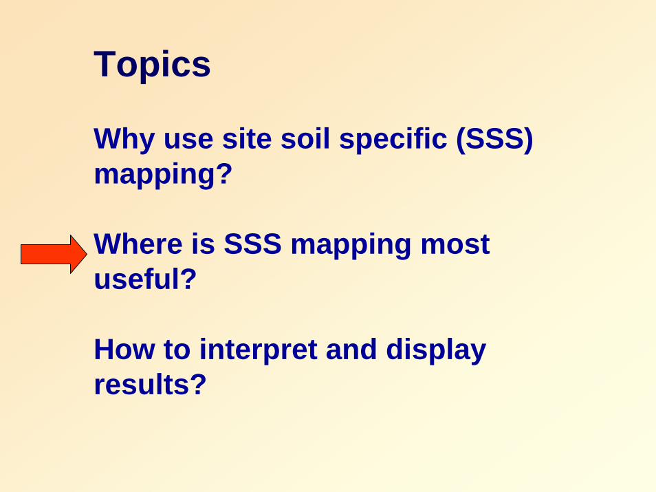
Topics
Why use site soil specific (SSS) mapping?
Where is SSS mapping most useful?
How to interpret and display results?

RI Soil Survey
• Designed for planning.
• Line error plus or minus 40 ft.
• Minimum map unit ¼ acre.
• One soil unit may include several types – complexes and inclusions.
• Urban / filled soils not mapped.Created at 1:15,840
1” = 1,320 ft.
1” = ¼ mile

Soil mapping is required for local land development applications.
RI Soil survey maps commonly used with site plans at 1” = 40 ft or larger.

Why use Site Specific Soil Mapping
• Soil properties and characteristics can be accurately mapped.
• Provides evidence town officials, developers, land owners need to evaluate suitability for development.
• Improve communication among all parties. • Standard method
ensures fairness and consistency.
• Protects project designers by documenting site planning decisions.

Site Specific Soil Mapping applications
• Comprehensive assessment of a parcel for planning and initial site design.
• Siting onsite wastewater treatment systems and stormwater facilities.
• Selection of test sites for more costly and disruptive field investigations.
• Provides better data local board members need to document decisions and prepare findings of fact for difficult sites.
Topics
Why use site soil specific (SSS) mapping?
Where is SSS mapping most useful?
How to interpret and display results?
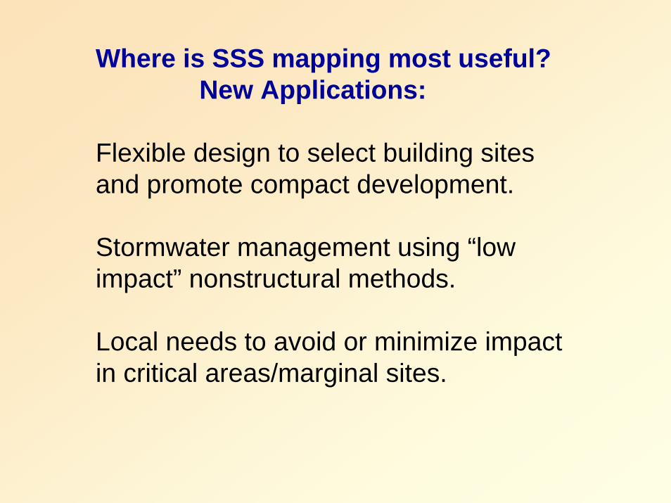
Where is SSS mapping most useful?New Applications:
Flexible design to select building sites and promote compact development.
Stormwater management using “low impact” nonstructural methods.
Local needs to avoid or minimize impact in critical areas/marginal sites.

“Conservation Development is a creative land use technique that allows a community to guide
growth to the most appropriate areas within a parcel of land to avoid impacts to the
environment and to protect the character-defining features of the property.” RIDEM, 2003.
The RI Conservation Development Manual

UndevelopedRIDEM Conservation Development Manual
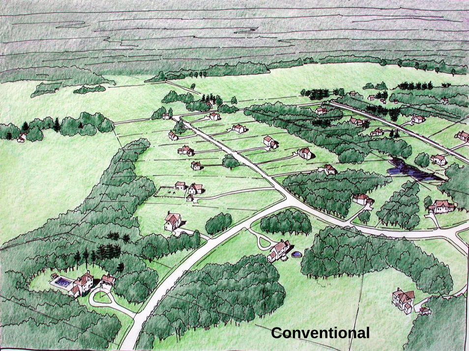
Conventional
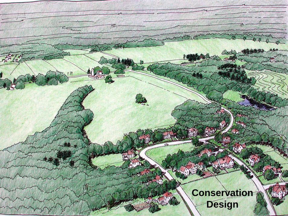
Conservation Design

Undeveloped
The Design process:
1. Analyze the site
2. Designate conservation areas.
3. Locate areas for development.
4. Locate house sites, layout roads, draw lot lines.

The design process emphasizes early site assessment to ID conservation areas
Non-buildable areas – wetlands, regulated buffers, hydric soils, etc.
Partially Constrained - high water tables < 3.5 ft, impermeable layers, slopes > 15%.

New village center Rural conservation development
Design of compact development projects.

Site specific mapping for StormwaterManagement using Low Impact
Development methods
Site specific mapping for StormwaterManagement using Low Impact
Development methods

Jordan Cove subdivision, CT NEMO
Low impact development (LID) “a stormwater management and land development strategy applied at the parcel and subdivision scale that emphasizes conservation and use of on-site natural site features integrated with engineered, small-scale hydrologic controls to more closely mimic predevelopment hydrologic functions.” LID Technical Guidance Manual for Puget Sound. 2005.

Step 1 – Site analysisComprehensive inventory and assessment of on-site and adjacent off-site conditions are the initial steps for implementing low impact development.
Soil Analysis“ LID requires detailed understanding of site soils…for two
primary reasons: 1) LID emphasizes evaporation, storage and infiltration of
stormwater in smaller scale facilities distributed throughout the site; and
2) on sites with mixed soil types, the LID site plan should locate … less permeable soils and preserve and utilize permeable soils for infiltration.
2003 LID guidance manual for Puget Sound

Jordan Cove Traditional subdivision
Jordan Cove traditional subdivision Dr. Michael Dietz, CT NEMO
Conventional lot layout, standard
frontage and setbacks.
Large detention basin.
Closed drainage systemdischarges to

“Low impact” stormwater design
Shared driveways
Cluster layout with small lots, preserved open space
Bioretentioncul-de-sac
Grassed swales
Rain gardens
Pervious roadway
Jordan Cove LID Subdivision. Dr. Michael Dietz, CT NEMO
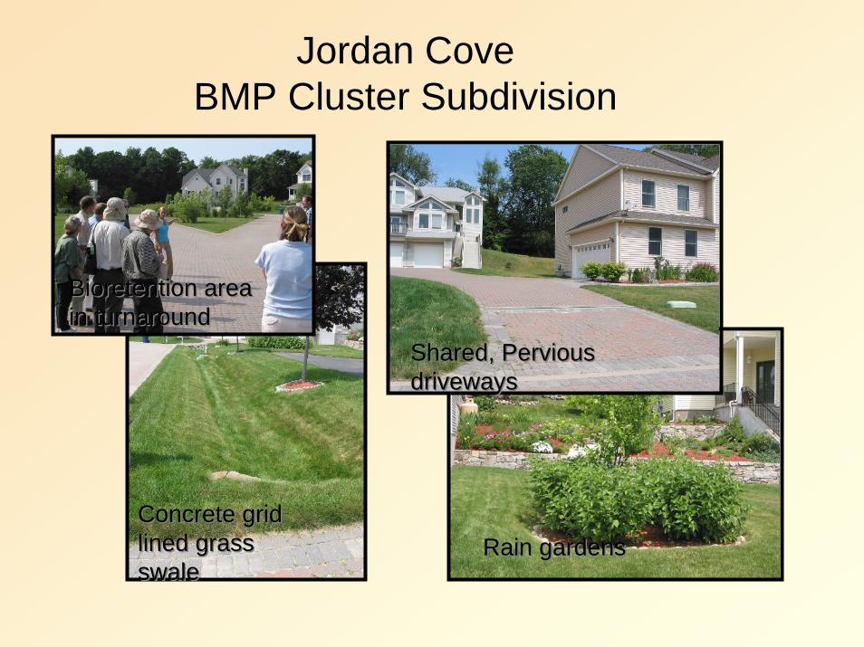
Jordan CoveBMP Cluster Subdivision
Concrete grid lined grass swale
Concrete grid lined grass swale
Bioretention area in turnaroundBioretention area in turnaround
Shared, Pervious drivewaysShared, Pervious driveways
Rain gardensRain gardens

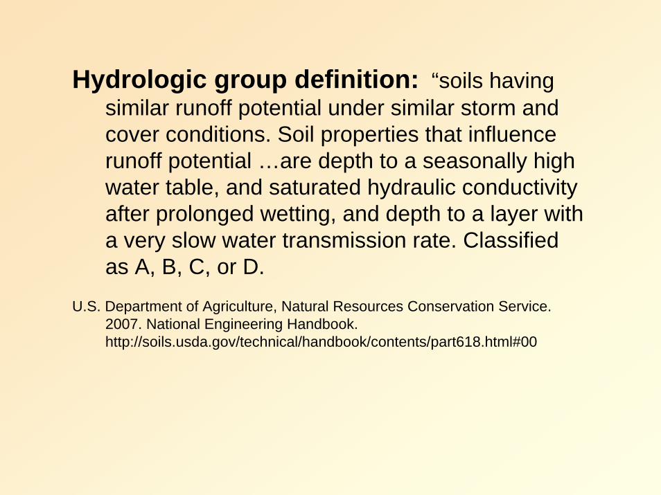
Hydrologic group definition: “soils having similar runoff potential under similar storm and cover conditions. Soil properties that influence runoff potential …are depth to a seasonally high water table, and saturated hydraulic conductivity after prolonged wetting, and depth to a layer with a very slow water transmission rate. Classified as A, B, C, or D.
U.S. Department of Agriculture, Natural Resources Conservation Service. 2007. National Engineering Handbook. http://soils.usda.gov/technical/handbook/contents/part618.html#00
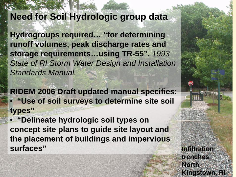
Infiltration trenches, North Kingstown, RI
Need for Soil Hydrologic group data
Hydrogroups required… “for determining runoff volumes, peak discharge rates and storage requirements…using TR-55”. 1993 State of RI Storm Water Design and Installation Standards Manual.
RIDEM 2006 Draft updated manual specifies:• “Use of soil surveys to determine site soil types” • “Delineate hydrologic soil types on concept site plans to guide site layout and the placement of buildings and impervious surfaces”

Where is SSS mapping most useful?New Applications:
Flexible design to select building sites and promote compact development.
Stormwater management using “low impact” nonstructural methods.
Local needs to avoid or minimize impact in critical areas/marginal sites.

Municipal requirements for site assessment and impact avoidance may exceed state minimum standards, particularly on marginal sites and in environmentally critical areas

HydrodrologicSoil Group
ABBCC
C/D
Jamestown Source Water Assessment. 2003. URI Cooperative Extension


The Town of JamestownHigh Groundwater Ordinance Adopted In 2003 to provide local jurisdiction over development on lots with water table < 3 ft. Amended in 2004, 2005 and 2007. Main Focus:•Protect groundwater by denitrification,pathogen or microbiological treatment• Reduce Impervious surface coverage• Provide adequate stormwater controls• Protect wetlands and their buffers• Not to impede groundwater flow
The Town of JamestownHigh Groundwater Ordinance
Development of lots within subdistrict “A” (water table less than 18”) requires a special use permit application to include Site specific soils map of the property.
Additional soil test pits may be required on individual lots.
Town of Jamestown website

The Town of South KingstownZoning Section 504Prohibits location of OWTS within 150 of wetland, except where special use permit is approved. Application requires use of advanced wastewater treatment system and submittal of a Site Specific Soils survey.
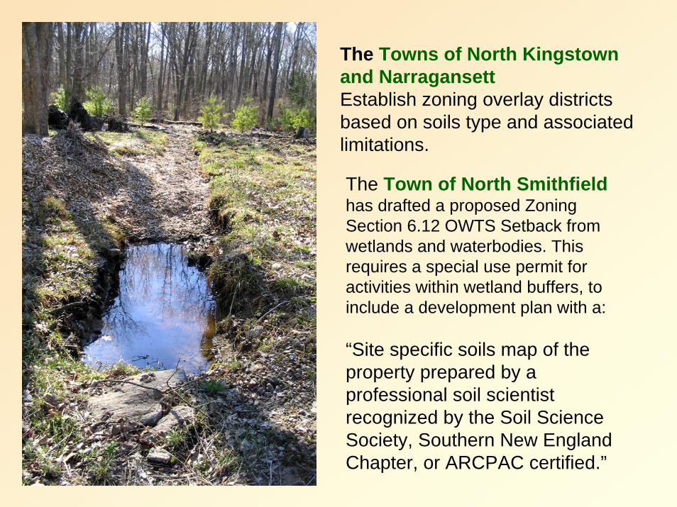
The Towns of North Kingstown and NarragansettEstablish zoning overlay districts based on soils type and associated limitations.
The Town of North Smithfieldhas drafted a proposed Zoning Section 6.12 OWTS Setback from wetlands and waterbodies. This requires a special use permit for activities within wetland buffers, to include a development plan with a:
“Site specific soils map of the property prepared by a professional soil scientist recognized by the Soil Science Society, Southern New England Chapter, or ARCPAC certified.”

Elsewhere in New England…
Site-Specific Soil Mapping Standards have been used in New Hampshire and Vermont since 1999.
In Maine Soil survey report must be prepared by a certified soil scientist. Soil surveys must comply with the Maine Association of Professional Soil Scientists’ Standards for Soil Surveys. Section 11.

Topics
Why use site soil specific (SSS) mapping?
Where is SSS mapping most useful?
How to interpret and display results?

Goal: Interpret soil mapping units and display visually in useful format for local land use decisions.
HydrodrologicSoil Group
ABBCC
C/D
Use combination of soil hydrogroups and water table depth as key features for stormwaterand wastewater management.

HydrodrologicSoil Group
ABBCC
C/D
Jamestown Source Water Assessment. 2003. URI Cooperative Extension

Soil Hydro Group and Water Table Depth (URI)
ABBCC
C/D
Current soil mapping available at DEM interactive map server

Slope Categories may be mapped using site specific contours.
Example slope map developed from USGS topography, Source: Paul Jordan RI DEM, interactive map server

Table 7. Classification matrix for soil parent material, wetness, and restrictive layer classes.
Depth to the SHWTDepth to Restrictive Layer 0” – 12”
(0)>12 – 24”
(1)>24 –36”
(2)>36 – 48”
(3)>48”(4)
Outwash (1)<24” (1) 101 111 121 131 141
24– 48” (2) 102 112 122 132 142
>48” (3) 103 113 123 133 143
Ice Contact Stratified Deposits (2)<24” (1) 201 211 221 231 241
24– 48” (2) 202 212 222 232 242
>48” (3) 203 213 223 233 243
Dense Till (3)<24” (1) 301 311 321 331 341
24 – 48” (2) 302 312 322 332 342
>48” (3) 303 313 323 333 343
Next step – evaluate soil map units and organize into logical rankings.

Next Steps1. URI will accept comments on SSS mapping standards and procedures.
2. Prepare interpretation guide for local officials, planners, other land use decision makers.
3. Conduct additional training and outreach on manual.
4. Revise as necessary based on comments received. makers.

Questions to address in your workshop survey and open discussion
• Do you see applications for SSS mapping?
• In what type of projects or site conditions would SSS mapping would be most useful?
• What are pros / cons of SSS mapping in your work?
• How should we proceed with this?

Thank you for your attention!
www.uri.edu/ce/wq/
Contacts:Lorraine Joubert 401-874-2138 [email protected] Stolt 401-874-2914 [email protected]
University of Rhode Island, Cooperative ExtensionNatural Resources Science, Coastal Institute in Kingston1 Greenhouse Road, Kingston, RI 02881