international collaboration with environment … collaboration with environment canada: road weather...
TRANSCRIPT
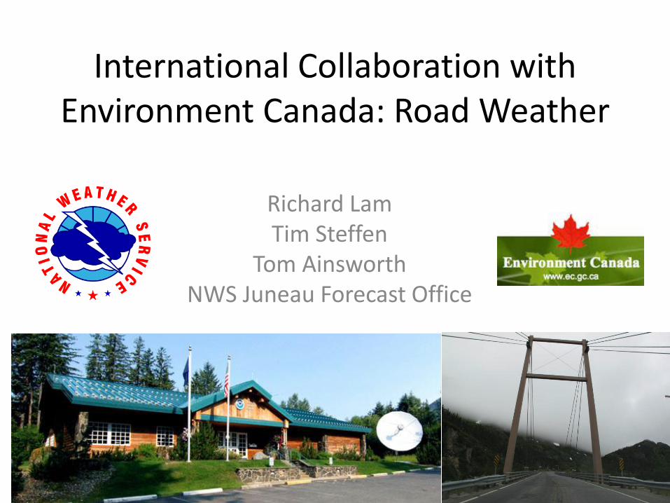
International Collaboration with Environment Canada: Road Weather
Richard Lam Tim Steffen
Tom Ainsworth NWS Juneau Forecast Office

Introduction
• Haines/Klondike Highways
• Forecast Tools
• Collaboration with Environment Canada
• Daily Product Issuance
• Winter Weather Patterns in SE Alaska
• Case Study
• Future Considerations

Area Map
Whitehorse Haines
Junction
Juneau
Skagway
Haines
To Fairbanks
To Anchorage


Klondike Highway
• Starts near Skagway
• Length: 15 miles from Downtown Skagway
• Ends at US/Canada Border (Elevation: 3300 feet)
• Continues into Carcross and connects with Alcan Highway and Whitehorse
• Residents, tourists, fuel and ore trucks
• 150,000 vehicles crossed the border in 2011 (Alaska DOT)
• Peak Season: Summer
Courtesy: Murray Lundberg

Haines Highway
• Starts near Haines
• Length: 44 miles from Ferry Terminal
• Chilkat River Valley: 1 to 2 miles wide
• Ends at US/Canada Border (Elevation: 800 feet)
• Continues into Haines Junction, Yukon and connects with Alcan Highway.
• Residents, travelers, tourists
• 80,000 vehicles crossed the border in 2011 (Alaska DOT)
• Peak Season: Summer
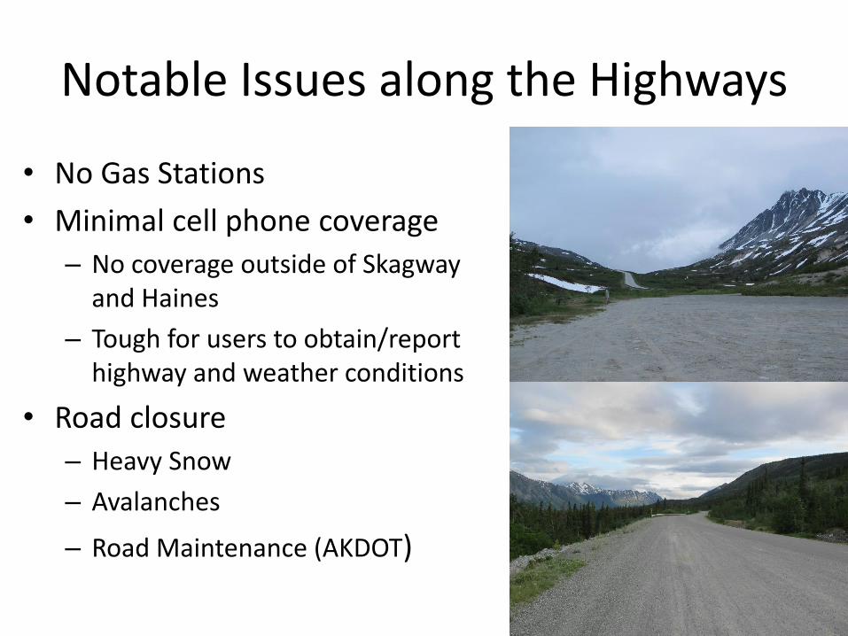
Notable Issues along the Highways
• No Gas Stations
• Minimal cell phone coverage
– No coverage outside of Skagway and Haines
– Tough for users to obtain/report highway and weather conditions
• Road closure
– Heavy Snow
– Avalanches
– Road Maintenance (AKDOT)

Forecast Tools—Weather Observations • ASOS
– Doesn’t report snow accumulation – Report precipitation type – Hourly observations – Visibility snowfall rate
• COOPs and Spotters – Daily observations – Report snow accumulation – Can call them to obtain weather
update
• RWIS – 20 to 30-min observations – Doesn’t report snow accumulation
• SNOTELs – Real-time snow depth

Forecast Tools—Weather Observations
MP 37—Klehini (RWIS)
MP 24—Chilkat River Bridge (RWIS,
USGS)
MP 40—Haines Customs (COOP)
MP 1—Haines Airport (ASOS)
MP0—Downtown
Haines (COOP)

Forecast Tools—Weather Observations Fraser Camp, BC (Wx Obs)
MP 15—White Pass
(RWIS)
MP 0—Skagway Airport (ASOS)
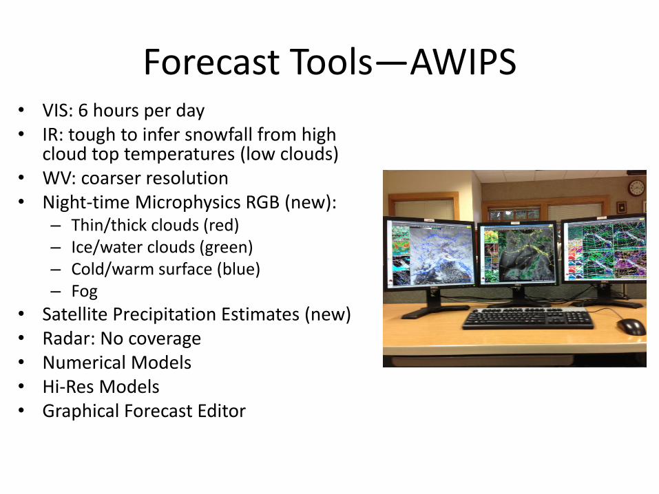
Forecast Tools—AWIPS • VIS: 6 hours per day • IR: tough to infer snowfall from high
cloud top temperatures (low clouds) • WV: coarser resolution • Night-time Microphysics RGB (new):
– Thin/thick clouds (red) – Ice/water clouds (green) – Cold/warm surface (blue) – Fog
• Satellite Precipitation Estimates (new) • Radar: No coverage • Numerical Models • Hi-Res Models • Graphical Forecast Editor

Forecast Tools—Webcams • Provide current weather conditions
• Haines Highway • Downtown Haines (Mile 0) • Chilkat River Bridge (Mile 24) • Klehini (Mile 37)
• Klondike Highway • Downtown Skagway (Mile 0) • White Pass (US/Canada Border) • Fraser Camp (British Columbia)
• Lighting issues in winter
Collaboration
• Intra-office coordination
– Road forecast derived from GFE
– Feedback from long-term and short-term forecasters
• Inter-office coordination with Environment Canada in Vancouver, BC
– Unit Conversion
– Coordination via phone on forecast discrepancies if needed
– Social Media

Product Issuance
• Road Forecasts
– Issued at 6 am, 10 am, and 5 pm Daily
– Klondike Highway (US), South Klondike Highway (Canada)
– Haines Highway (US), Haines Road (Canada)
• Road Observations
– Issued by 9 am Daily
– 15 locations along Klondike and Haines Highways
– Current weather conditions including (snowfall, visibility, winds)

SOUTH KLONDIKE HIGHWAY - SKAGWAY TO WHITE PASS
...WINTER WEATHER ADVISORY FROM 7 AM THIS MORNING TO 10 AM AKDT THURSDAY
NEAR WHITE PASS...
...STRONG WIND FROM LATE THIS EVENING THROUGH THURSDAY MORNING NEAR TAIYA
INLET...
.TODAY...RAIN...MIXED WITH SNOW IN THE MORNING. NEAR WHITE PASS...SNOW. LITTLE
OR NO SNOW ACCUMULATION NEAR SEA LEVEL...RANGING TO 3 TO 5 INCHES NEAR
WHITE PASS. SNOW LEVEL RISING TO 1500 FEET IN THE AFTERNOON. HIGHS AROUND
44...RANGING TO 32 NEAR WHITE PASS. SOUTH WIND 15 TO 25 MPH. GUSTS AROUND 35
MPH NEAR TAIYA INLET DIMINISHING IN THE MORNING.
.TONIGHT...WINDY...RAIN SHOWERS...EXCEPT SNOW SHOWERS NEAR WHITE PASS. SNOW
LEVEL 2900 FEET. SNOW ACCUMULATION 3 TO 5 INCHES NEAR WHITE PASS. LOWS
AROUND 41...RANGING TO 31 NEAR WHITE PASS. SOUTH WIND 25 TO 35 MPH WITH
GUSTS TO AROUND 50 MPH. STRONGEST WINDS NEAR SKAGWAY.
.THURSDAY...WINDY. RAIN LIKELY. NEAR WHITE PASS...SNOW WITH SNOW ACCUMULATION
1 TO 3 INCHES. SNOW LEVEL 2500 FEET. HIGHS AROUND 46...RANGING TO AROUND 35
NEAR WHITE PASS. SOUTHWEST WIND 25 TO 35 MPH.
Road Forecast (US)

SOUTH KLONDIKE HIGHWAY - WHITE PASS TO CARCROSS
...WINTER STORM WARNING IN EFFECT.....
.TODAY...SNOW. AMOUNT 2 INCHES EXCEPT 4 NEAR WHITE PASS. WIND BECOMING
SOUTH 25 MPH. GUSTS TO 45 MPH DEVELOPING NEAR WHITE PASS GIVING REDUCED
VISIBILITY IN BLOWING SNOW. HIGH MIDDLE 30S EXCEPT IN THE UPPER 20S AT WHITE
PASS.
.TONIGHT...PERIODS OF SNOW. AMOUNT 2 TO 4 INCHES EXCEPT 4 TO 6 NEAR WHITE
PASS. WIND SOUTHWEST 20 MPH EXCEPT GUSTING UP TO 45 MPH NEAR WHITE PASS
GIVING REDUCED VISIBILITY IN BLOWING SNOW. TEMPERATURE STEADY NEAR UPPER
TWENTIES EXCEPT NEAR 30 AT FRASER.
.THURSDAY...SNOW ENDING NEAR NOON THEN MAINLY CLOUDY. AMOUNT UP TO 2
INCHES NEAR WHITE PASS. WIND SOUTHWEST 20 MPH. EXCEPT GUSTING TO 45 MPH
NEAR THE PASS GIVING REDUCED VISIBILITY IN BLOWING SNOW. HIGH MIDDLE 40S
EXCEPT MIDDLE 30S AT WHITE PASS.
Road Forecast (Canada)


Winter Weather Regimes in SE Alaska—Northerly Flow
• Strong arctic high over Yukon and Interior Alaska
• Low south of Panhandle
• Dry pattern
• Gusty northerly winds
• Sub-freezing temperatures
• Precondition for winter precipitation
Surface Map
H
L

Winter Weather Regimes in SE Alaska—Southwesterly Flow
• Strong Aluetian low
• Strong North Pacific High
• Strong warm moist advection
• Atmospheric River
• Rain (heavy at times) across Panhandle
• Snow in northern areas if preexisting arctic airmass persists
Surface Map
L
H L

Winter Weather Regimes in SE Alaska—Southeasterly Flow
• Low in Southeast Gulf • Polar high in NW Canada • Warm advection • Moisture advection • Pre-existing cold air in northern
Panhandle • Overrunning stratiform
precipitation • Snow changeover to rain
• Wind shifts • Accumulations highly variable • Juxtaposition of cold air and
moisture
Surface Map
L
H

Winter Weather Regimes in SE Alaska—Cross-Gulf Flow
• Low in NE Gulf • Highs in western Alaska
and NW Canada • Cold air traveling over
warm Gulf waters • Showers and convection • Deformation bands • Heavy snowfall rates • Training precipitation • Surprise snowfall
amounts
Surface Map
L H H
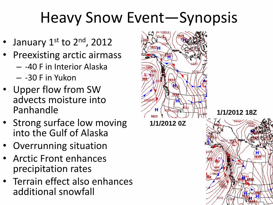
Heavy Snow Event—Synopsis
• January 1st to 2nd, 2012 • Preexisting arctic airmass
– -40 F in Interior Alaska – -30 F in Yukon
• Upper flow from SW advects moisture into Panhandle
• Strong surface low moving into the Gulf of Alaska
• Overrunning situation • Arctic Front enhances
precipitation rates • Terrain effect also enhances
additional snowfall
1/1/2012 0Z
1/1/2012 18Z

Heavy Snow Event—Impacts
10
15
20
25
30
35
40
0Z 6Z 12Z 18Z 0Z 6Z 12Z 18Z
PAHN HHWA2 HHKA2 Freezing Point
Jan 1st, 2012
Jan 2nd, 2012
• Along the Haines Highway
– Temperature remained below freezing for the whole event
– Winds remained calm
• Near Downtown Haines
– Temperatures jumped up to the mid-30s in the overnight hours
– Wind shift to easterly and gusting up to 40 mph
• Haines Customs
– 42” snow
– 2.20” liquid
– 18 F to 28 F
• Downtown Haines
– 16.1” snow
– 1.53” liquid
– 20 F to 36 F
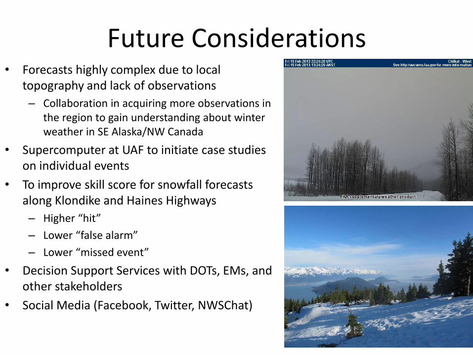
Future Considerations • Forecasts highly complex due to local
topography and lack of observations
– Collaboration in acquiring more observations in the region to gain understanding about winter weather in SE Alaska/NW Canada
• Supercomputer at UAF to initiate case studies on individual events
• To improve skill score for snowfall forecasts along Klondike and Haines Highways
– Higher “hit”
– Lower “false alarm”
– Lower “missed event”
• Decision Support Services with DOTs, EMs, and other stakeholders
• Social Media (Facebook, Twitter, NWSChat)