integration of multiple precipitation estimates for flash flood forecasting reggina cabrera...
TRANSCRIPT
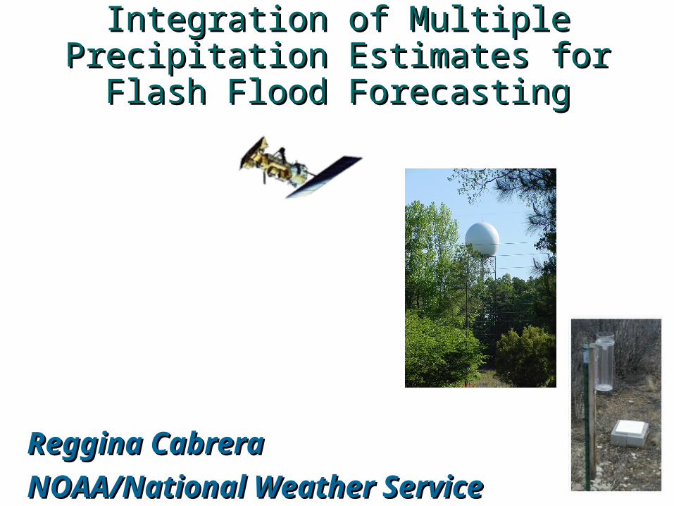
Integration of Multiple Integration of Multiple Precipitation Estimates for Flash Precipitation Estimates for Flash
Flood ForecastingFlood Forecasting
Reggina CabreraReggina Cabrera
NOAA/National Weather ServiceNOAA/National Weather Service

In this presentationIn this presentation
• Multisensor Precipitation Estimates (MPE) and Flash Flood Monitoring and Prediction (FFMP)
• Data sources • Generation and usage of MPE
and FFMP• Limitations• Work in progress

Ideal for Flash Flood WarningIdeal for Flash Flood Warning TOOL that would provide a GOODestimate of precipitation to improvelead-time for Flash Floodwarning
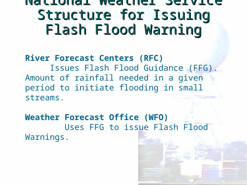
National Weather Service Structure National Weather Service Structure for Issuing Flash Flood Warningfor Issuing Flash Flood Warning
River Forecast Centers (RFC)Issues Flash Flood Guidance (FFG).
Amount of rainfall needed in a given period to initiate flooding in small streams.
Weather Forecast Office (WFO) Uses FFG to issue Flash Flood Warnings.
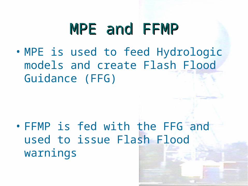
MPE and FFMPMPE and FFMP• MPE is used to feed Hydrologic
models and create Flash Flood Guidance (FFG)
• FFMP is fed with the FFG and used to issue Flash Flood warnings
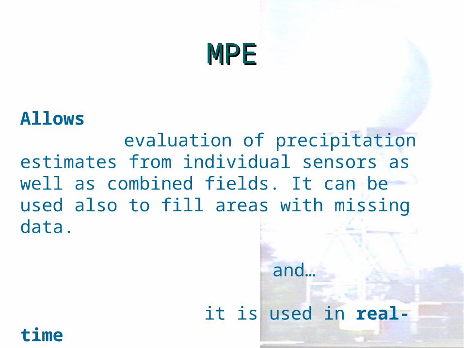
MPEMPE
Allows evaluation of precipitation
estimates from individual sensors as well as combined fields. It can be used also to fill areas with missing data.
and…
it is used in real-time
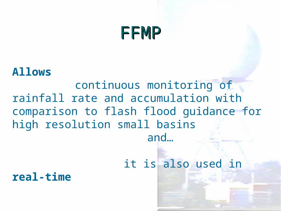
FFMPFFMP
Allows continuous monitoring of rainfall
rate and accumulation with comparison to flash flood guidance for high resolution small basins
and…
it is also used in real-time
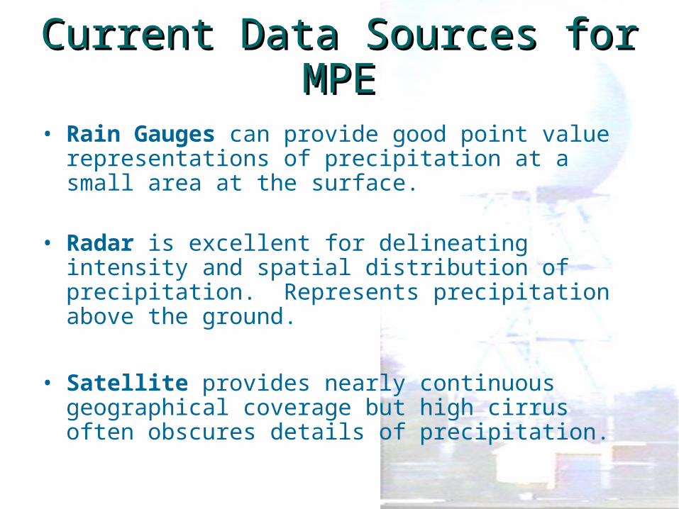
Current Data Sources for Current Data Sources for MPEMPE
• Rain Gauges can provide good point value representations of precipitation at a small area at the surface.
• Radar is excellent for delineating intensity and spatial distribution of precipitation. Represents precipitation above the ground.
• Satellite provides nearly continuous geographical coverage but high cirrus often obscures details of precipitation.
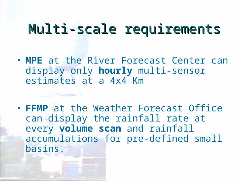
Multi-scale requirementsMulti-scale requirements
• MPE at the River Forecast Center can display only hourly multi-sensor estimates at a 4x4 Km
• FFMP at the Weather Forecast Office can display the rainfall rate at every volume scan and rainfall accumulations for pre-defined small basins.

Satellite Data for Satellite Data for Precipitation EstimatesPrecipitation Estimates
MPE can only display the hourlyHydro-Estimator products fromNESDIS
Local bias correction using gauge datais being evaluated
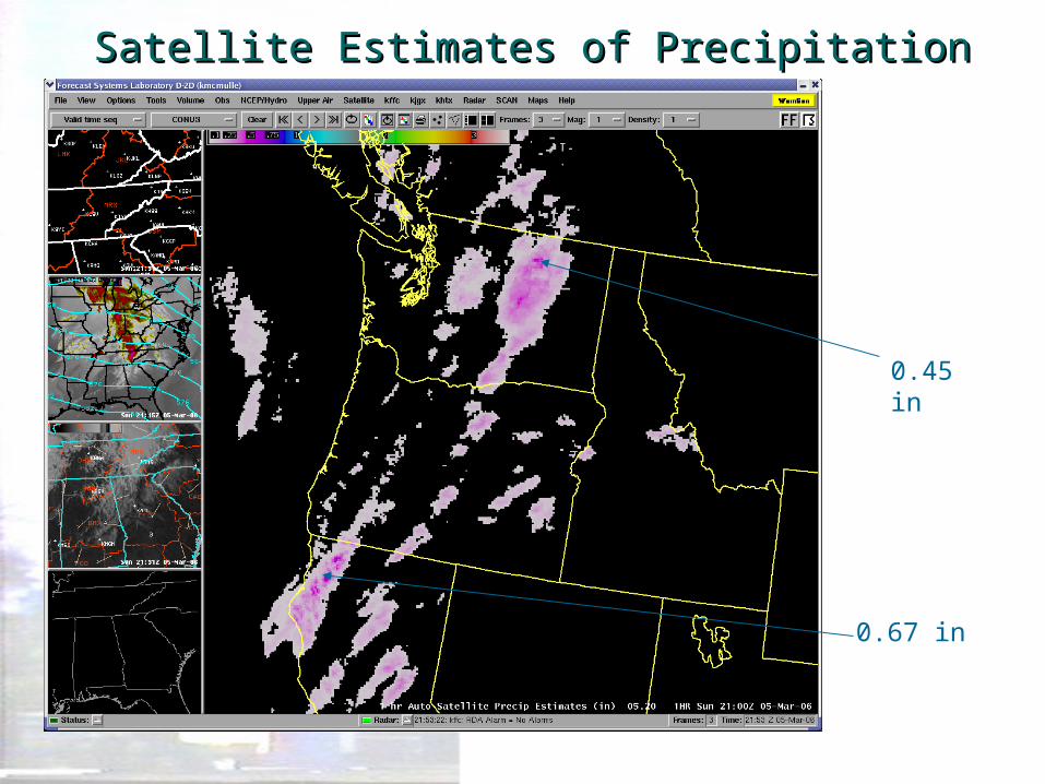
Satellite Estimates of PrecipitationSatellite Estimates of Precipitation
0.45 in
0.67 in
Radar Data for Precipitation Radar Data for Precipitation EstimatesEstimates
• MPE at the River Forecast Center can display only hourly multi-sensor estimates.
• FFMP at the Weather Forecast Office can display the rainfall rate at every volume scan and accumulations
• Radar bias corrections using gauge data is available
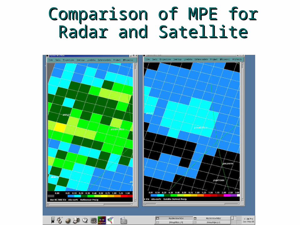
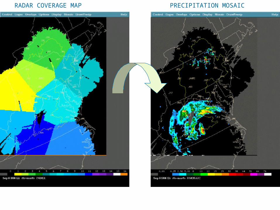
Comparison of MPE for Radar Comparison of MPE for Radar and Satelliteand Satellite
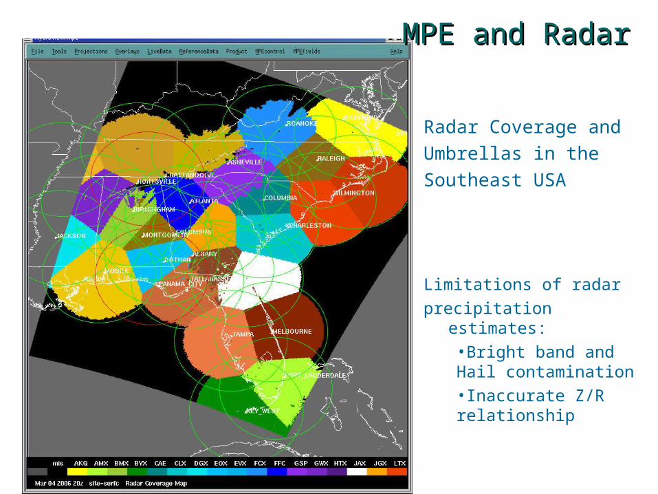
Radar Coverage andUmbrellas in theSoutheast USA
Limitations of radarprecipitation estimates:
•Bright band and Hail contamination•Inaccurate Z/R relationship
MPE and RadarMPE and Radar
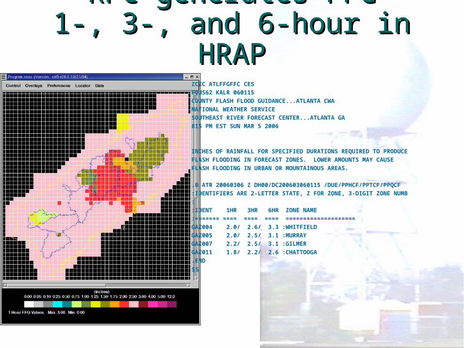
RFC generates FFGRFC generates FFG1-, 3-, and 6-hour in HRAP1-, 3-, and 6-hour in HRAP
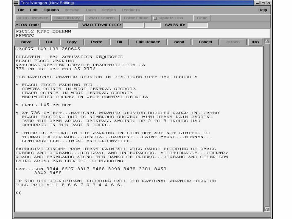
ZCZC ATLFFGFFC CESFOUS62 KALR 060115COUNTY FLASH FLOOD GUIDANCE...ATLANTA CWA NATIONAL WEATHER SERVICE SOUTHEAST RIVER FORECAST CENTER...ATLANTA GA 815 PM EST SUN MAR 5 2006 INCHES OF RAINFALL FOR SPECIFIED DURATIONS REQUIRED TO PRODUCEFLASH FLOODING IN FORECAST ZONES. LOWER AMOUNTS MAY CAUSE FLASH FLOODING IN URBAN OR MOUNTAINOUS AREAS. .B ATR 20060306 Z DH00/DC200603060115 /DUE/PPHCF/PPTCF/PPQCF :IDENTIFIERS ARE 2-LETTER STATE, Z FOR ZONE, 3-DIGIT ZONE NUMB: :IDENT 1HR 3HR 6HR ZONE NAME :======= ==== ==== ==== ==================== GAZ004 2.0/ 2.6/ 3.3 :WHITFIELDGAZ005 2.0/ 2.5/ 3.1 :MURRAYGAZ007 2.2/ 2.5/ 3.1 :GILMERGAZ011 1.8/ 2.2/ 2.6 :CHATTOOGA.END
$$
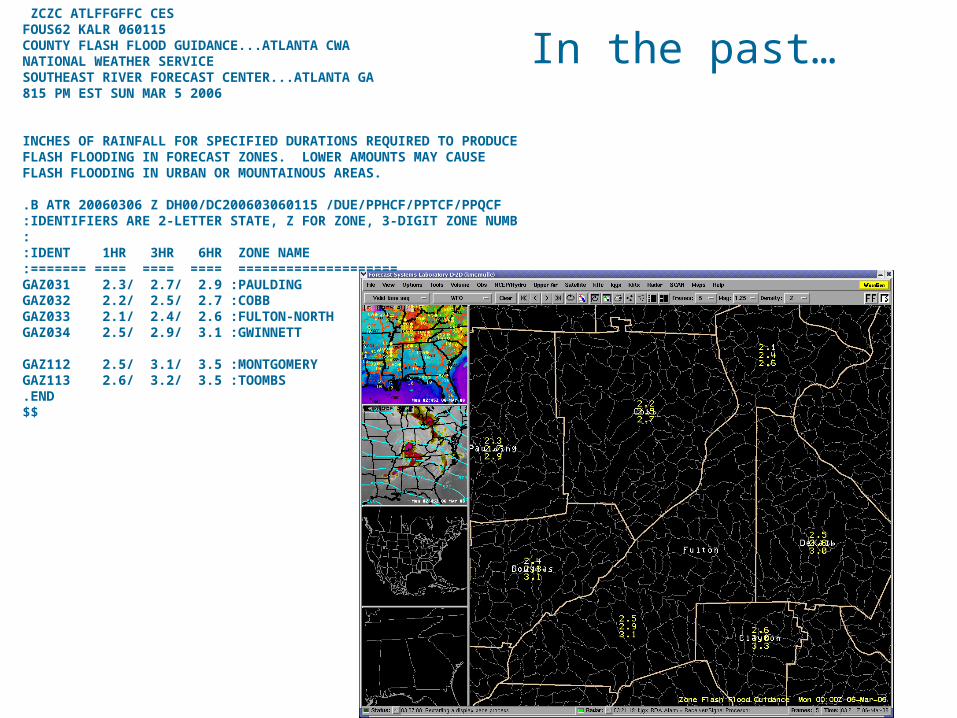
ZCZC ATLFFGFFC CESFOUS62 KALR 060115COUNTY FLASH FLOOD GUIDANCE...ATLANTA CWA NATIONAL WEATHER SERVICE SOUTHEAST RIVER FORECAST CENTER...ATLANTA GA 815 PM EST SUN MAR 5 2006 INCHES OF RAINFALL FOR SPECIFIED DURATIONS REQUIRED TO PRODUCEFLASH FLOODING IN FORECAST ZONES. LOWER AMOUNTS MAY CAUSE FLASH FLOODING IN URBAN OR MOUNTAINOUS AREAS. .B ATR 20060306 Z DH00/DC200603060115 /DUE/PPHCF/PPTCF/PPQCF :IDENTIFIERS ARE 2-LETTER STATE, Z FOR ZONE, 3-DIGIT ZONE NUMB: :IDENT 1HR 3HR 6HR ZONE NAME :======= ==== ==== ==== ==================== GAZ031 2.3/ 2.7/ 2.9 :PAULDINGGAZ032 2.2/ 2.5/ 2.7 :COBBGAZ033 2.1/ 2.4/ 2.6 :FULTON-NORTHGAZ034 2.5/ 2.9/ 3.1 :GWINNETT
GAZ112 2.5/ 3.1/ 3.5 :MONTGOMERYGAZ113 2.6/ 3.2/ 3.5 :TOOMBS.END$$
In the past…
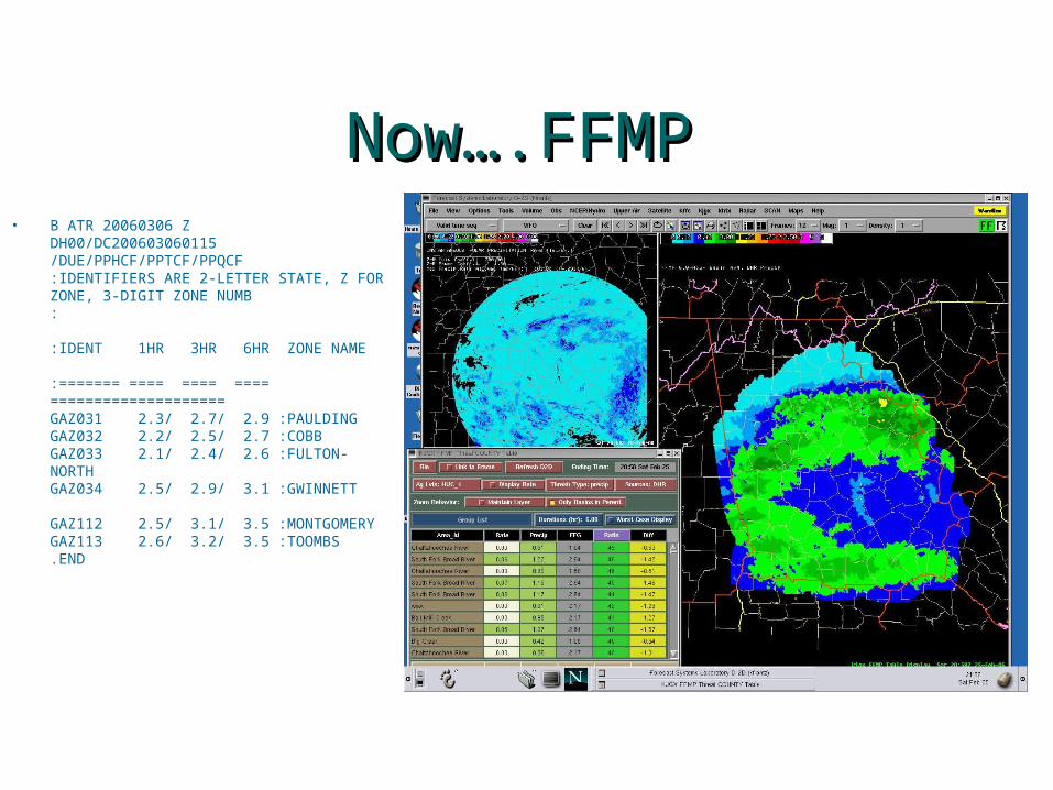
Now….FFMPNow….FFMP• B ATR 20060306 Z
DH00/DC200603060115 /DUE/PPHCF/PPTCF/PPQCF :IDENTIFIERS ARE 2-LETTER STATE, Z FOR ZONE, 3-DIGIT ZONE NUMB: :IDENT 1HR 3HR 6HR ZONE NAME :======= ==== ==== ==== ==================== GAZ031 2.3/ 2.7/ 2.9 :PAULDINGGAZ032 2.2/ 2.5/ 2.7 :COBBGAZ033 2.1/ 2.4/ 2.6 :FULTON-NORTHGAZ034 2.5/ 2.9/ 3.1 :GWINNETT
GAZ112 2.5/ 3.1/ 3.5 :MONTGOMERYGAZ113 2.6/ 3.2/ 3.5 :TOOMBS.END
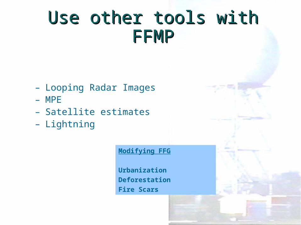
Use other tools with FFMPUse other tools with FFMP
– Looping Radar Images– MPE– Satellite estimates– Lightning
Modifying FFG
UrbanizationDeforestationFire Scars
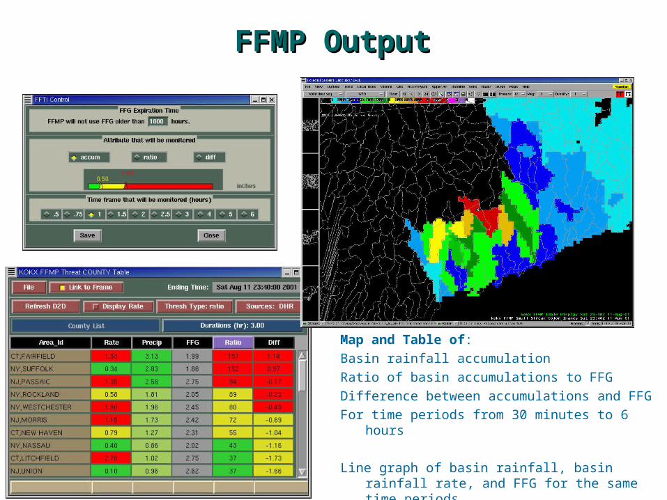
FFMP OutputFFMP Output
Map and Table of:Basin rainfall accumulationRatio of basin accumulations to FFG Difference between accumulations and FFGFor time periods from 30 minutes to 6 hours
Line graph of basin rainfall, basin rainfall rate, and FFG for the same time periods
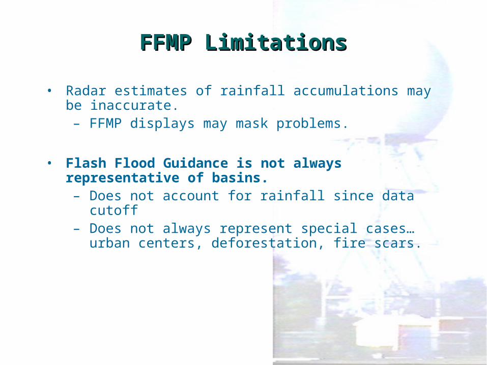
FFMP LimitationsFFMP Limitations
• Radar estimates of rainfall accumulations may be inaccurate.– FFMP displays may mask problems.
• Flash Flood Guidance is not always representative of basins.– Does not account for rainfall since data cutoff– Does not always represent special cases… urban
centers, deforestation, fire scars.
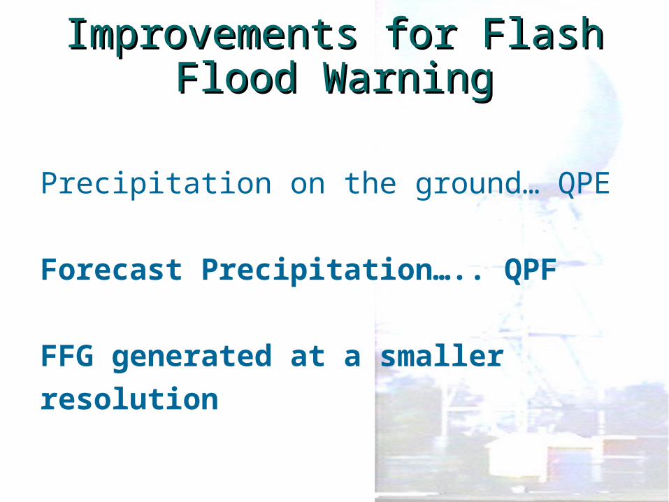
Improvements for Flash Improvements for Flash Flood WarningFlood Warning
Precipitation on the ground… QPE
Forecast Precipitation….. QPF FFG generated at a smallerresolution
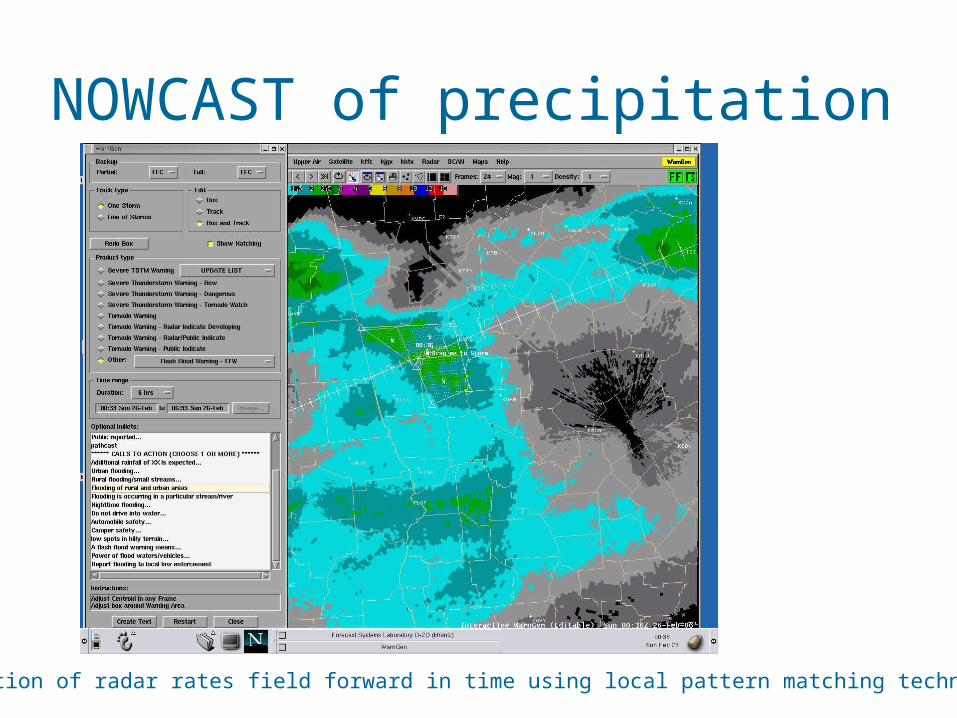
NOWCAST of precipitation
Extrapolation of radar rates field forward in time using local pattern matching technique
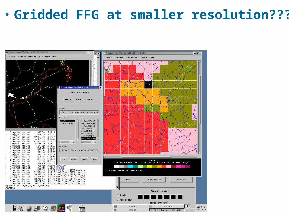
• Gridded FFG at smaller resolution???
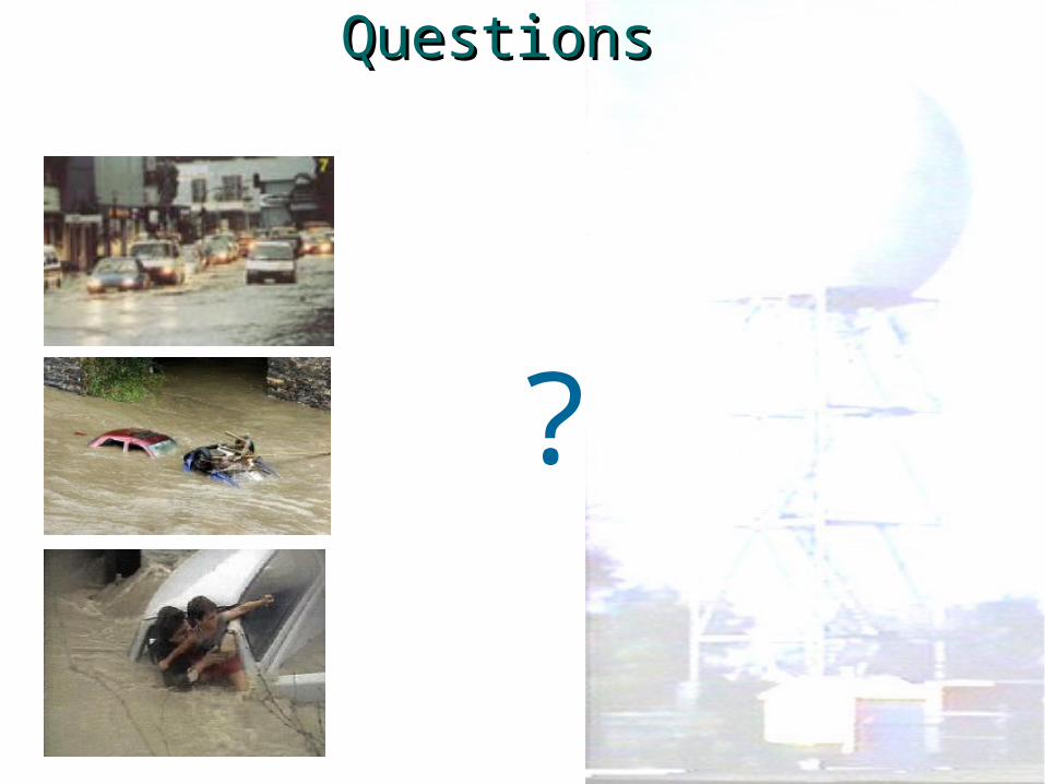
QuestionsQuestions
?
RADAR COVERAGE MAP PRECIPITATION MOSAIC
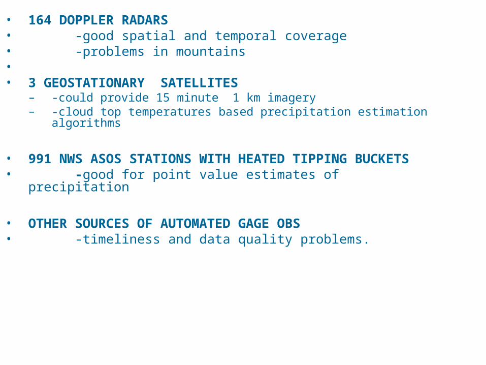
• 164 DOPPLER RADARS • -good spatial and temporal coverage• -problems in mountains•• 3 GEOSTATIONARY SATELLITES
– -could provide 15 minute 1 km imagery – -cloud top temperatures based precipitation estimation
algorithms
• 991 NWS ASOS STATIONS WITH HEATED TIPPING BUCKETS
• -good for point value estimates of precipitation
• OTHER SOURCES OF AUTOMATED GAGE OBS• -timeliness and data quality problems.