integrating inter-disciplinary science data with semantic ... · integrating inter-disciplinary...
TRANSCRIPT

Integrating Inter-disciplinary Science Data with Semantic Mediation
Peter Fox ([email protected])High Altitude Observatory, ESSL/NCAR, Boulder CO
Deborah McGuinnessTetherless World Constellation, Rensselaer Polytechnic Institute
Troy, NYMcGuinness Associates, Stanford, CA
Robert RaskinJPL/NASA, Pasadena, CA
Krishna SinhaVirginia Polytechnic Institute, Department of Geology
Blacksburg, VA
Abstract
We present results of a research effort into the appli-cation of semantic web methods and technologies to ad-dress the challenging problem of integrating data fromheterogeneous sources - in particular from volcanic andatmospheric chemistry data in support of assessing aparticular science question: what are measureable at-mospheric effects of of a volcanic eruption. The intro-duction of formal semantics in our methods and intothe implemented technical infrastructure allows scien-tists to ask measurement based questions and retrieverelevant data rather than issuing instrument and dataproduct specific oriented searches, often requiring verydetailed and customized knowledge that is rarely repli-cable. One of the underlying principles is that scientistsand non-scientists should not be forced to learn complexdetails of the data product naming and schema, otherpeople’s naming vocabularies, schemes and syntax de-cisions and myriad details of differing web site inter-faces. The volcano eruption scenario exemplifies manyof these challenges. In this paper we present the keymethods, knowledge representation requirements, howthe underlying data is associated with the smart searchand integration and comment on extensibility and ap-plicability to other Earth science application areas.
Keywords: informatics, knowledge representation,ontologies, semantic data integration, semantic media-tion
1. Introduction
Increasingly scientists and non-scientists are ad-dressing interesting problems using distributed infor-mation products and data resoures from a variety ofdisciplines.
To ground this work in a relevant and specific exam-ple, we describe a use case as follows: When a volcanoerupts, there is sequence of events and impacts that isdiverse and complex. The characteristics of an erup-tion; size, type and duration all influence the effecton the local, regional, and global atmospheric environ-ment. These effects range from diminished air quality,hazards for human health and ground and air trans-portation to effects on atmospheric composition andradiative blanketing, leading to medium-term climateforcing. The contributions come from the smoke andash, ejected gases, scattering and numerous other pro-cesses. The location of the volcano (latitude and longi-tude) as well as its tectonic setting on land or underseaalso are factors. There are an increasing number of on-line repositories of scientific data information relatedto volcanoes, their present and past activity and bothdirect and proxy measurements of the nature of theirimpact.
While numerous sources of monitoring and ret-rospective data are available which represent mea-surements of the abovementioned quantities they arepresently stored in heterogenous and highly distributedrepositories. To realize the goal of integration of manyof these diverse sources of data to address specific as-pects of the volcano eruption scenarios we need to ad-
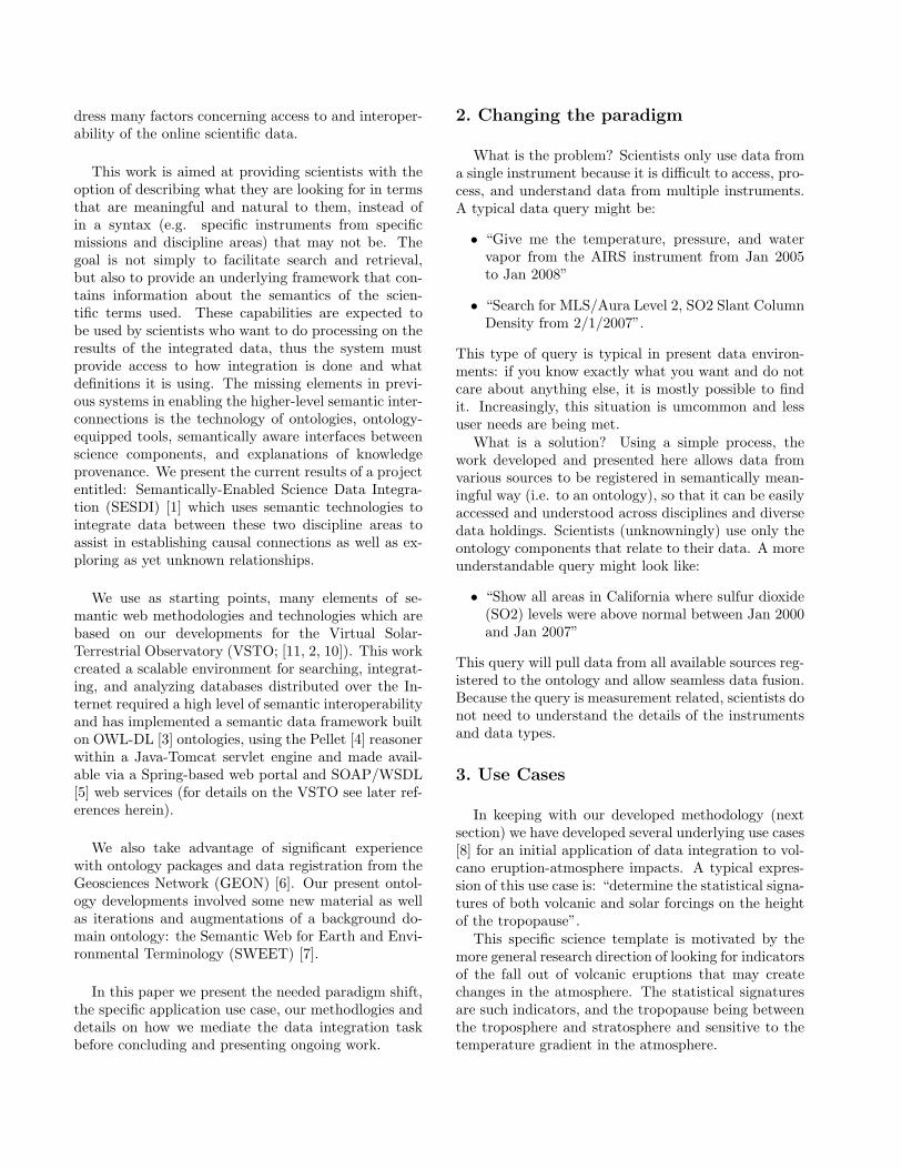
dress many factors concerning access to and interoper-ability of the online scientific data.
This work is aimed at providing scientists with theoption of describing what they are looking for in termsthat are meaningful and natural to them, instead ofin a syntax (e.g. specific instruments from specificmissions and discipline areas) that may not be. Thegoal is not simply to facilitate search and retrieval,but also to provide an underlying framework that con-tains information about the semantics of the scien-tific terms used. These capabilities are expected tobe used by scientists who want to do processing on theresults of the integrated data, thus the system mustprovide access to how integration is done and whatdefinitions it is using. The missing elements in previ-ous systems in enabling the higher-level semantic inter-connections is the technology of ontologies, ontology-equipped tools, semantically aware interfaces betweenscience components, and explanations of knowledgeprovenance. We present the current results of a projectentitled: Semantically-Enabled Science Data Integra-tion (SESDI) [1] which uses semantic technologies tointegrate data between these two discipline areas toassist in establishing causal connections as well as ex-ploring as yet unknown relationships.
We use as starting points, many elements of se-mantic web methodologies and technologies which arebased on our developments for the Virtual Solar-Terrestrial Observatory (VSTO; [11, 2, 10]). This workcreated a scalable environment for searching, integrat-ing, and analyzing databases distributed over the In-ternet required a high level of semantic interoperabilityand has implemented a semantic data framework builton OWL-DL [3] ontologies, using the Pellet [4] reasonerwithin a Java-Tomcat servlet engine and made avail-able via a Spring-based web portal and SOAP/WSDL[5] web services (for details on the VSTO see later ref-erences herein).
We also take advantage of significant experiencewith ontology packages and data registration from theGeosciences Network (GEON) [6]. Our present ontol-ogy developments involved some new material as wellas iterations and augmentations of a background do-main ontology: the Semantic Web for Earth and Envi-ronmental Terminology (SWEET) [7].
In this paper we present the needed paradigm shift,the specific application use case, our methodlogies anddetails on how we mediate the data integration taskbefore concluding and presenting ongoing work.
2. Changing the paradigm
What is the problem? Scientists only use data froma single instrument because it is difficult to access, pro-cess, and understand data from multiple instruments.A typical data query might be:
• “Give me the temperature, pressure, and watervapor from the AIRS instrument from Jan 2005to Jan 2008”
• “Search for MLS/Aura Level 2, SO2 Slant ColumnDensity from 2/1/2007”.
This type of query is typical in present data environ-ments: if you know exactly what you want and do notcare about anything else, it is mostly possible to findit. Increasingly, this situation is umcommon and lessuser needs are being met.
What is a solution? Using a simple process, thework developed and presented here allows data fromvarious sources to be registered in semantically mean-ingful way (i.e. to an ontology), so that it can be easilyaccessed and understood across disciplines and diversedata holdings. Scientists (unknowningly) use only theontology components that relate to their data. A moreunderstandable query might look like:
• “Show all areas in California where sulfur dioxide(SO2) levels were above normal between Jan 2000and Jan 2007”
This query will pull data from all available sources reg-istered to the ontology and allow seamless data fusion.Because the query is measurement related, scientists donot need to understand the details of the instrumentsand data types.
3. Use Cases
In keeping with our developed methodology (nextsection) we have developed several underlying use cases[8] for an initial application of data integration to vol-cano eruption-atmosphere impacts. A typical expres-sion of this use case is: “determine the statistical signa-tures of both volcanic and solar forcings on the heightof the tropopause”.
This specific science template is motivated by themore general research direction of looking for indicatorsof the fall out of volcanic eruptions that may createchanges in the atmosphere. The statistical signaturesare such indicators, and the tropopause being betweenthe troposphere and stratosphere and sensitive to thetemperature gradient in the atmosphere.

Figure 1. Schematic of the events and pro-cesses beginning with a volcanic eruptionand leading to the climate/atmospheric re-sponse.
A schematic of the use case is shown in Fig. 1 whichindicates some of the important terms, concepts, pro-cesses (and eventually underlying data) we need to rep-resent.
4. Methodology
We apply semantic web methodologies in pursuit ofthe above-mentioned objectives. These methods in-clude the development and elaboration of use cases(user scenarios) with significant science/subject matterand data expert involvement. In our project those ex-perts are in volcanoes, plate tectonics and, atmosphericeffects in response to forcings. We convene small work-shop groups along these topic lines and start with usecases and elements of the existing vocabularies and/orontologies where available and develop the knowledgerepresentation using an interactive concept mappingtools (CMAP from IHMC; http://cmap.ihmc.us/coe )that is capable of reading and writing OWL-based on-tologies and provides OWL predicate assistance whenusers are adding relations between concepts (e.g. is-a,has, disjoint, etc.). The starting points going into theseworkshops and their nominal end-points (although notthe end product) are recorded in concept map form asintermediate artifacts.
Our data integration effort depends on machine pro-cessable specifications of the science terms that areused in the disciplines of interest. Based on our startingpoints for ontologies as well as those we are re-suing, we
Semantic Web Methodology andTechnology Development Process
• Establish and improve a well-defined methodology vision forSemantic Technology based application development
• Leverage controlled vocabularies, etc.
Use Case
Small Team,mixed skills
Analysis
AdoptTechnologyApproach
LeverageTechnology
InfrastructureRapid
PrototypeOpen World:
Evolve, Iterate,Redesign,Redeploy
Use Tools
Science/ExpertReview & Iteration
Developmodel/
ontology
Figure 2. Our developed methodology forapplication of semantic web to applications(Fox and McGuinness)
have identified specific ontology modules that neededconstruction in the areas of volcanoes, plate tectonics,atmosphere, and climate. We bring together a smallgroup of domain experts and science ontology expertswith a goal of generating an initial ontology containingthe terms and phrases typically used by these experts.We use our task of researching the impact of volcanoesand global climate to focus the discussions to help de-termine scope and level of granularity.
The overall methodology we employ is denotedschematically in Fig. 2 beginning with use case(s),the small team (eluded to above), analysis of the usecase, modeling and ontology development using avail-able tools and then expert review. After that we adoptsuitable technical approach(es) and specific technicalinfrastructure (leveraging existing work to the extentpossible) and rapidly develop and deploy somethingthat can be tested, evaluated and then iterated upon;revisiting the full methodology cycle.
5. Mediating the Data Integration
The result of applying the methodology up to and in-cluding iteration on the science expert review resultedin the application specific ontology packages indicatedin Figure 4. We show a portion of the key importantconcepts and relations for detection and attribution ofthe present use case in the concept map in Fig. 3.
In relation to climate effects there are atmospherelayers and atmosphere layer boundaries that are partof climate. These concepts have subclasses such as

Figure 3. An excerpt of the most recent ver-sion of the atmosphere/climate concept mapwith specific integration concepts that aremotivated by the use case (detection and at-tribution).
troposphere and tropopause (respectively) and eachhas properties such as lower and upper boundaryheights. In the center of the figure is the concept ofthe Tropopause (which is a atmospheric layer bound-ary) which has at least two properties; lower and upperboundary height, i.e. the signature of volcanic eruptionforcing which is of interest in the use case.
Also of note is the indication that an atmosphericlayers have primary substances, which include atomicconsituents of the atmosphere (carbon, nitrogen, oxy-gen, and so on) as well as aerosols and contaminants- examples are SO2, NOx, ash, etc. We contributednew modules and expanded terms and concepts for theSWEET ontology in the case of the solid earth environ-ment as well as additing relations to the atmosphericconcepts; a key point for our application.
Ultimately, it is compounds such as SO2 concen-tration that are measured and are were the answers(data) to queries such as that given in Section 2 are tobe found.
5.1. Packaging the Ontology and Services
For the ontology development we utilize a modu-lar approach (which is considered best-practice in thesemantic web methodology community). Thus as wedeveloped the classes and sub-classes in the volcano,plate tectonics and atmosphere ontologies, we associ-ated them with one of the ontology modules indicatedin the Fig. 4, which is a schematic of our approachthe present application and indicates how we leverage/import many other ontologies.
Figure 4. High-level concept map indicatinghow a statistical application makes use of thedata, any filters (e.g. restrict attention to geo-chemical measurements or to volcanoes, seelater for details), and the underlying knowl-edge base, i.e. ontologies.
Figure 5. Expanded view of Fig. 4. See textfor details.

Note in Fig. 5, the ontology package directly con-nected to the application contains only the relatingconcepts needed for the data integration and importsfundamental terms and concepts from SWEET, VSTO(for instruments, data, etc.) and GEON (for planetaryspecific concepts). VSTO has a flexible and re-usableontology that we have extended with instrument sub-classes, instances and measured parameters relevant tothe application areas of volcano and climate. We alsoimport modules from solid earth concepts from theGEON project and substantial components from thenewly modularized α-version 2.0 of SWEET (Raskin,private communication; soon to be published). The de-tailed discussion of each of the imported modules willbe presented in a later paper.
5.2. Data Registration
As noted above, the next key element in semanticdata integration is associating the semantic terminol-ogy with the relevant data sources. One of the Geo-sciences Network [6] project’s contributions has been athree step view of registering data [12] to enable dis-covery, access, and integration of heterogeneous dataresources. Such a registration involves associating dis-covery, inventory and item/detail level metadata withthe underlying datasets as a service that may be ac-cessed from a data portal or invoked as a web service.The service generates registration metadata to facili-tate inventorying, discovery, federation and integrationof independent, heterogeneous data resources. Regis-tering a data resource with a registration service doesnot require or imply that the data themselves are storedat a centralized location - though they could be.
The 3-step approach consists of:
1. Metadata Registration, where basic metadataabout a resource is registered with the system.Metadata registration enables discovery of re-sources.
2. Schema registration, where schema elements ofstructured data resources are registered to an on-tology, or a standard schema. Schema registrationcreates an inventory of resources with syntacticand structural descriptions of resources, and per-mits semi-automated integration of data across re-sources.
3. Data Item Registration, where individual data val-ues in a data resources are registered to ontolo-gies. With data item registration it is possible toprovide very powerful data search engines and au-tomated integration of data across heterogeneousresources.
Figure 6. Concept map (ontology) for dataregistration levels 1, 2 (here called level 2 and3) and 3 (here called level 4) of volcanic data.
Our adaptation of this procedure has been imple-mented in a new desktop application called SEDRE -Semantically-Enabled Data Registration Engine. Eachof the three stages is driven by casting the use casestated above in terms of an actual data provider wish-ing to register their data. Most importantly, the waydata prodivers think about their data, i.e. how to clas-sify it according to the three levels, differs between dis-ciplines (e.g. volcano geochemistry and atmosphericchemistry in our example here). To capture these dif-ferences within the SEDRE application we model thediscipline specific registration using a concept model-ing approach which we use to create in declaritve form,a data registration ontology (see Fig. 6). Thus, in-stead of forcing a common and unfamiliar registrationmethod, we may accommodate the differences withinone application. The concept map in Fig. 6 highlightsthe way solid-earth researchers think about classifyingtheir data. E.g. the first level could be Petrology (ora sub-discipline of it), then Rock, and then the type ofRock, and then, the specifics of the data measurement.In our example, it is Geochemical, Gas (NeutralGas),and then the data for SO2. We also use an ontologyfor atmospheric data set (e.g. chemistry) registration(not shown here).
We have registered a series of volcanic geochemistryand atmospheric chemistry data sets. An example ofthe volcano data registration is shown in Figs. 7-8 fora dataset in spreadsheet form from the Kilauea eastrift zone (Hawaii Volcano Observatory). We omit theexample of atmospheric data registration here but ex-amples are MLS (Microwave Limb Sounder) on NASAAURA mission (level 2; swath) and the ESA SCIA-MACHY (SCanning Imaging Absorption SpectroMeterfor Atmospheric CHartographY, also level 2) mission

42
Registering Volcanic Data (1)
Figure 7. Screen capture of initial stage ofvolcano geochemical dataset registration.
data, most often in HDF (Hierarchical Data Format).Figure 7 shows a screen shot of the prepatory phase
where the geosphere registration is selected and adataset in spreadsheet form is loaded into the upperright pane. The upper left features discovery level in-formation such as latitude and longitude. The next setof panes on the left have major elements, the periodictable and compound classes.
Figure 8 shows shows an intermediate screen shotregistration where the SO2 entry has been selectedfrom the major elements pane and associated with therelevant column in the spreadsheet table, also SO2.The entries are visually recorded as the user selectsthem in the middle right pane. In addition, the factthat this is a measured quantity (e.g. as distinct fromproxy, modeled, or inferred) and the units (t/d =tonnes/day = 1000kg/day) are recorded by the user.This greatly assists in later use of the data, especiallyfor data integration and data fusion. Finally, we notethat in this case since the measurements are in-situ, thelatitude and longitude are not explicit in the datasetbut are to be inferred from the volcano name.
5.3. Leveraging the VSTO data framework
The Virtual Solar-Terrestrial Observatory [11, 2, 10]has developed a production semantic data frame-work in support of the solar, solar-terrestrial andspace physics observational communitities. Fig. 9 isschematic of the high-level organization of the VSTOframework applied to the present use case. This fig-ure displays how we have been able to immediately
43
Registering Volcanic Data (2)
• No explicit lat/long data
• Volcano identified by name
• Volcano ontology framework will linkname to location
Figure 8. Screen capture of intermediatestage of volcano geochemical dataset regis-tration.
Instrument
Start/Stop Dates Parameter
SESDI OntologyPacakges
Semantic Filter
Metadata Service
VolcanoMetadata Service
AtmosphericMetadata Service
Data Service
Volcano Data Service
Atmospheric Data Service
Pellet Reasoner
WOVODB
MODISDB
NOVAC File Server
WOVODat RDBMS Server
SCIAMACHY FTP Server
MODIS HTTP Server
ExternalData
Services
Event
Feature
NOVACDB
SCIAMACHY
DB
Figure 9. Schematic of the VSTO data frame-work applied to the current use case. Notethe loading of the SESDI ontology and lever-aging existing distributed data (and whereneeded, metadata) sources.
leverage the VSTO framework (this diagram is a di-rect copy of the VSTO implementation with the solar-terrestrial-specific ontology and data sources replacedby the appropriate volcano and atmospheric ontologiesand data/ catalog sources). The primary addition isthe Feature and Event classes, which are required torepresent volcanoes, and eruptions, for example. Thismeans the software built to support the VSTO applica-tion is re-used with new ontologies loaded and serviceclasses added to communicate with the existing datasources. Note that we also re-use packages from theVSTO ontology, populated with instruments, etc. spe-cific to the domain application (as noted earlier).
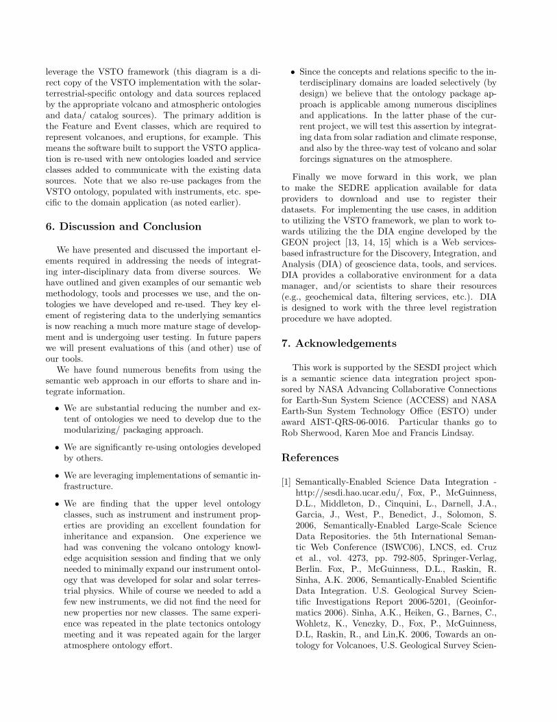
6. Discussion and Conclusion
We have presented and discussed the important el-ements required in addressing the needs of integrat-ing inter-disciplinary data from diverse sources. Wehave outlined and given examples of our semantic webmethodology, tools and processes we use, and the on-tologies we have developed and re-used. They key el-ement of registering data to the underlying semanticsis now reaching a much more mature stage of develop-ment and is undergoing user testing. In future paperswe will present evaluations of this (and other) use ofour tools.
We have found numerous benefits from using thesemantic web approach in our efforts to share and in-tegrate information.
• We are substantial reducing the number and ex-tent of ontologies we need to develop due to themodularizing/ packaging approach.
• We are significantly re-using ontologies developedby others.
• We are leveraging implementations of semantic in-frastructure.
• We are finding that the upper level ontologyclasses, such as instrument and instrument prop-erties are providing an excellent foundation forinheritance and expansion. One experience wehad was convening the volcano ontology knowl-edge acquisition session and finding that we onlyneeded to minimally expand our instrument ontol-ogy that was developed for solar and solar terres-trial physics. While of course we needed to add afew new instruments, we did not find the need fornew properties nor new classes. The same experi-ence was repeated in the plate tectonics ontologymeeting and it was repeated again for the largeratmosphere ontology effort.
• Since the concepts and relations specific to the in-terdisciplinary domains are loaded selectively (bydesign) we believe that the ontology package ap-proach is applicable among numerous disciplinesand applications. In the latter phase of the cur-rent project, we will test this assertion by integrat-ing data from solar radiation and climate response,and also by the three-way test of volcano and solarforcings signatures on the atmosphere.
Finally we move forward in this work, we planto make the SEDRE application available for dataproviders to download and use to register theirdatasets. For implementing the use cases, in additionto utilizing the VSTO framework, we plan to work to-wards utilizing the the DIA engine developed by theGEON project [13, 14, 15] which is a Web services-based infrastructure for the Discovery, Integration, andAnalysis (DIA) of geoscience data, tools, and services.DIA provides a collaborative environment for a datamanager, and/or scientists to share their resources(e.g., geochemical data, filtering services, etc.). DIAis designed to work with the three level registrationprocedure we have adopted.
7. Acknowledgements
This work is supported by the SESDI project whichis a semantic science data integration project spon-sored by NASA Advancing Collaborative Connectionsfor Earth-Sun System Science (ACCESS) and NASAEarth-Sun System Technology Office (ESTO) underaward AIST-QRS-06-0016. Particular thanks go toRob Sherwood, Karen Moe and Francis Lindsay.
References
[1] Semantically-Enabled Science Data Integration -http://sesdi.hao.ucar.edu/, Fox, P., McGuinness,D.L., Middleton, D., Cinquini, L., Darnell, J.A.,Garcia, J., West, P., Benedict, J., Solomon, S.2006, Semantically-Enabled Large-Scale ScienceData Repositories. the 5th International Seman-tic Web Conference (ISWC06), LNCS, ed. Cruzet al., vol. 4273, pp. 792-805, Springer-Verlag,Berlin. Fox, P., McGuinness, D.L., Raskin, R.Sinha, A.K. 2006, Semantically-Enabled ScientificData Integration. U.S. Geological Survey Scien-tific Investigations Report 2006-5201, (Geoinfor-matics 2006). Sinha, A.K., Heiken, G., Barnes, C.,Wohletz, K., Venezky, D., Fox, P., McGuinness,D.L, Raskin, R., and Lin,K. 2006, Towards an on-tology for Volcanoes, U.S. Geological Survey Scien-

tific Investigations Report 2006-5201, p.51 (Geoin-formatics 2006). P. Fox, Deborah L. McGuinness,Rob Raskin, A. Krishna Sinha 2006, Semantically-enabled Science data Integration, Eos Trans. AGU87(36), Jt. Assem. Suppl., Abstract IN42A-02.D.L. McGuinness, A.K. Sinha, P. Fox, R. Raskin,G. Heiken, C. Barnes, K. Wohletz, D. Venezky,K. Lin 2006, Towards a Reference Volcano On-tology for Semantic Scientific Data Integration,Eos Trans. AGU 87(36), Jt. Assem. Suppl., Ab-stract IN42A-03. Peter Fox, Deborah L. McGuin-ness, Rob Raskin, and A. Krishna Sinha 2006,The Technology Behind Data Integration withSemantics. Eos Trans. AGU 87(52), Fall Meet.Suppl., Abstract IN24A-05. Rob Raskin, Peter Fox,Deborah L. McGuinness, and A. Krishna Sinha2006, Semantically-Enabled Science Data Integra-tion: Current Progress. Eos Trans. AGU 87(52),Fall Meet. Suppl., Abstract IN43D-05. McGuin-ness, D. L., Fox, P., Sinha, A. K., and Raskin, R.2007, Semantic Integration of Heterogeneous Vol-canic and Atmospheric Data.: Proceedings of theGeoinformatics Conference, San Diego, CA., May17-18, 2007, USGS Scientific Investigations Report2007-5199, 43-46.
[2] McGuinness, D. L., Fox, P., Cinquini, L., West,P., Garcia, J., Benedict, J. L., and Middleton,D. 2007, The Virtual Solar-Terrestrial Observa-tory: A Deployed Semantic Web Application CaseStudy for Scientific Research. In the proceedings ofthe Nineteenth Conference on Innovative Applica-tions of Artificial Intelligence (IAAI-07). Vancou-ver, British Columbia, Canada, July 22-26, 2007.and AI Magazine, vol. 29, no. 1, 65-76.
[3] Deborah L. McGuinness and Frank van Harme-len. OWL Web Ontology Language Overview.World Wide Web Consortium (W3C) Recom-mendation. February 10, 2004. Available fromhttp://www.w3.org/TR/owl-features/
[4] Pellet - http://www.mindswap.org/2003/pellet/
[5] Christensen, E., Curbera, F., Meredith, G., andWeerawarana, S. Web Services Description Lan-guage (WSDL) 1.1 - W3C Note 15 March 2001.
[6] Keller, G., Seber, D., Sinha, A.K. and Baru, C.2005, The Geosciences Network (GEON): onestep towards building cyberinfrastructure forthe geosciences, European Geophysical Union,Geophysical Research Abstracts, Vol. 7, 05726,2005 SRef-ID: 1607-7962/gra/EGU05-A-05726,http://www.cosis.net/abstracts/EGU05/05726/EGU05-J-05726.pdf, http://www.geongrid.org/
[7] Semantic Web for Earth and Environmental Termi-nologies - http://sweet.jpl.nasa.gov
[8] Cockburn, A., Writing Effective Use Cases,Addison-Wesley, Boston, MA, 2000.
[9] The Concept Mapping Ontology Editor -http://cmap.ihmc.us/coe
[10] Fox, P., McGuinness, D.L., Cinquini, L., West,P., Garcia, J., Benedict, J. and Middleton, D.2007, Ontology-supported Scientific Data Frame-works: The Virtual Solar-Terrestrial ObservatoryExperience, Computers and Geosciences, in press.
[11] P. Fox, D. McGuinness, R. Raskin, A. K. Sinha2007, A Volcano Erupts: Semantically MediatedIntegration of Heterogeneous Volcanic and Atmo-spheric Data, ACM Proceedings of the CyberIn-frastructure: Information Management in eScience(CIMS).
[12] Baru, C., Fox, P. and Lin, K. 2007, The 1-2-3of Data Registration, Earth Science Informatics, inpreparation.
[13] Malik, Z., Rezgui, A., and Sinha, A. K. 2007,Ontologic Integration of Geoscience Data on theSemantic Web, Proceedings of the GeoinformaticsConference, San Diego, CA., May 17-18, 2007, inpress.
[14] Zaki M., A. Rezgui, A. K. Sinha, K. Lin, and A.Bouguettaya 2007, DIA: A Web Services-based In-frastructure for Semantic Integration in Geoinfor-matics, Proceedings of the IEEE ICWS 2007, Ap-plication Services and Industry Track, submitted.
[15] Rezgui, A., Malik, Z., and Sinha, A. K. 2007,DIA Engine: Semantic Discovery, Integration, andAnalysis of Earth Science Data, Proceedings of theGeoinformatics Conference, San Diego, CA., May17-18, 2007, in press.