institutional and technical aspects of measuring and ... · 1994 fnm fm fsec ref cs gnm gm gsec ap...
TRANSCRIPT

Newton Paciornik
Ministry of Science and Technology
General Coordination on Global Climate Change
Institutional and technical aspects of measuring
and monitoring emissions and removals ofInstitutional and technical aspects of measuring and
monitoring emissions and removals of greenhouse gases
from land use and land-use change in Brazil
Washington, 8 November, 2010
FIP – Pilot Country Meeting

Outline
• Estimating CO2 emissions and removals for the LULUCF
sector as part of the Brazilian inventory of anthropogenic
emissions and removals of GHG
• Other programs for measuring and monitoring mitigation
actions
• Plans for the future

Inventory of Anthropogenic emissions by sources and
removals by sinks of GHG
• Part of the National Communication to the UNFCCC
– Initial National Communication – December 2004
– Second National Communication – Just published (in Portuguese) –English and Spanish versions (coming soon)
– Work supported by the GEF
• Coordination and Overall responsibility
– Ministry of Science and Technology (General Coordination on Global Climate Change)
• Participation of many institutions , governmental and non-governmental, universities, private sector (600 institutions, 1,200 experts)
• Public consultation process (last 6 months)
– 18 background reports of the inventory

Inventory of Anthropogenic emissions by sources and
removals by sinks of GHG
• Specifically for LULUCF Sector
– FUNCATE /INPE (National Institute for Space Research)
• Contributions
– Ministry of Environment/IBAMA
– IBGE (National Statistics Institute)
– INPA (National Amazon Research Institute)
– USP/CENA (University of São Paulo)
– EMBRAPA (Ministry of Agriculture)
– BRACELPA (Pulp and Paper Association)

Technical aspects of measuring and monitoring net
anthropogenic GHG emissions from LULUCF
• IPCC Good Practice for LULUCF (2003)
– Relevance of the LULUCF sector for Brazil (75% of the total CO2 net emissions in 1994 (Initial inventory)
– Approach 3 for land representation (spatially explicit land use and land-use change
• Forest land (primary forest, secondary forests, reforestation, selective logging)
• Grassland (native grassland, pasture)
• Cropland (annual and perennial crops)
• Wetlands (natural and reservoirs)
• Settlements
• Other land (dunes, mining)

check
check
429 images
years: 1994, 2002

check
check

check
check
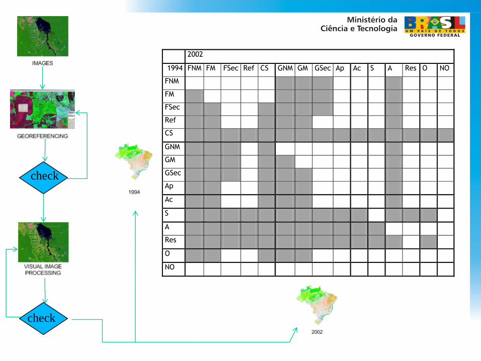
check
check
2002
1994 FNM FM FSec Ref CS GNM GM GSec Ap Ac S A Res O NO
FNM
FM
FSec
Ref
CS
GNM
GM
GSec
Ap
Ac
S
A
Res
O
NO

Technical aspects of measuring and monitoring net
anthropogenic GHG emissions from LULUCF
• Transition matrices between inventory times generated for each biome and for the national territory, identifying
– Areas remaining under a same land category
– Areas converted to other land-use categories
• Need additional information for estimating carbon stock changes for every pool
– living biomass (above and below ground)
– dead organic matter
– soil carbon
Technical aspects of measuring and monitoring net
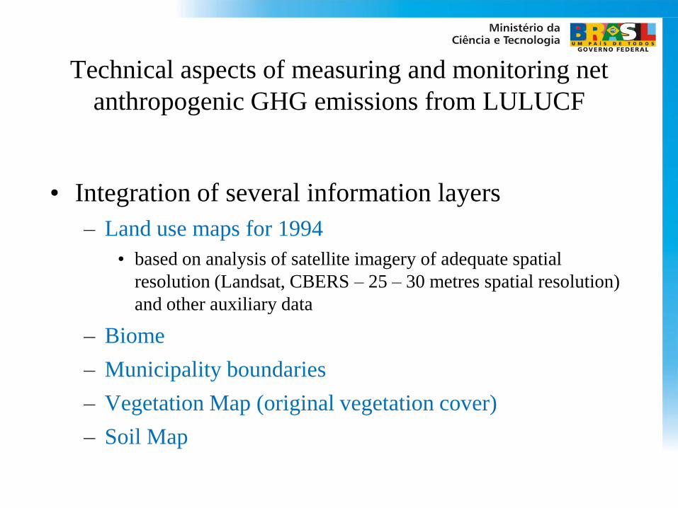
anthropogenic GHG emissions from LULUCF
• Integration of several information layers
– Land use maps for 1994
• based on analysis of satellite imagery of adequate spatial
resolution (Landsat, CBERS – 25 – 30 metres spatial resolution)
and other auxiliary data
– Biome
– Municipality boundaries
– Vegetation Map (original vegetation cover)
– Soil Map

check
check
2002
1994 FNM FM FSec Ref CS GNM GM GSec Ap Ac S A Res O NO
FNM
FM
FSec
Ref
CS
GNM
GM
GSec
Ap
Ac
S
A
Res
O
NO

Technical aspects of measuring and monitoring net
anthropogenic GHG emissions from LULUCF
• Entire territory stratified in 7.5 million polygons
• Carbon stocks and other parameters
– values dependent of land use, land-use change, biome,
vegetation, biomass carbon pool, soil
– Mix of tiers, from use of more complex modeling
approaches to IPCC default values
• Emission estimates can be provided
– per biome
– per municipality
– per land-use category

Results and Further information
• www.mct.gov.br/clima– Segunda Comunicação Nacional do Brasil
0
500.000
1.000.000
1.500.000
2.000.000
2.500.000
1990 1991 1992 1993 1994 1995 1996 1997 1998 1999 2000 2001 2002 2003 2004 2005
Gg
Emissões de CO2
Mudança no Uso da Terra e Florestas Energia Processos Industriais Tratamento de Resíduos

Other Monitoring Programs

Technical aspects of monitoring land-use change
Other programs
• Heavily supported by use of satellite imagery of adequate resolution
– Landsat, CBERS, ALOS, DMC...
– Annual wall to wall assessment of the rate of gross deforestation in the Brazilian Amazonia (approximately 60% of the national territory
– Real time monitoring using satellite imagery of medium spatial resolution (MODIS, 250 meters)
• Georeferenced identification of forest areas with signs of canopy alteration
• Information used by the governmental enforcement agency (IBAMA) to guide their control initiatives

Annual rate of gross deforestation in the
Brazilian Amazonia – 1988 to 2009

Other programs
• Action Plan to Prevent and Control Deforestation in
the Legal Amazonia (PPCDAM)
– Coordinated by the Presidential Staff Office, involving
13 Ministries
– Created in 2004
– Main tool to guide the definition of public policies to
control deforestation in the region
• Action Plan to Prevent and Control Deforestation in
the Cerrado (PPCerrado) - recently created
– 20% of net emissions from LULUCF Sector

Planned future activities
• Estimation of net emisssion from land use and land-use
change for 2010 (1990 for consistent time series)
• To monitor changes in forest cover for all biomes using a
similar approach used for Amazonia and Cerrado
• To monitor forest degradation (non-authorized sellective
logging activities, biomass burning)
• Implement the national forest inventory
• Support and monitoring the sustainable pig iron charcoal
based production program (increase renewable biomass use)

Conclusions
• Methodologies and tools in place for measuring and
monitoring land use and land-use changes
– can be replicated
– can be applied for mitigation projects
• Relies in the availability of satellite images and
carbon stock information
– best results when country specific carbon stock
information is available in a disaggregated manner

http://www.mct.gov.br/[email protected]