improving houston's state of place: the economic case for making houston more walkable
TRANSCRIPT

I have a confession to make.I was asked to come here today because people have come to think of me as the methods girl, a data geek, a methodholic.But actually, I'm a placeoholicMethods, data, definition, rationalism, are just my drugs of choice I use to feed my place addictionI very much embrace the notion thatIf you cannot measure it, it doesn't existbut not for the sake of measurement itself'but for the sake of changing itfor the sake of convincing other people to change itfor the sake of communicating the value of urban designBut I didn't start out this way.
Improving
Houston’s
The Economic Case for Making
Houston more Walkable
TM
Mariela Alfonzo, Ph.D.
Founder, State of Place TM
Research Assistant Professor, NYU
Rice Kinder Institute
April 13th, 2015

This is my hometown - westchester
meeyame
Where my most exhilarating memory is
playing an ersatz game of frogger
as i tightroped down pencil thin
sidewalks
dogging cars as I crossed strip-mall
lined highways masquerading as
streets
all to get to a chicken teriyaki sub.
Growing up in Miami - especially as a
carless teenager sucked.

This was life
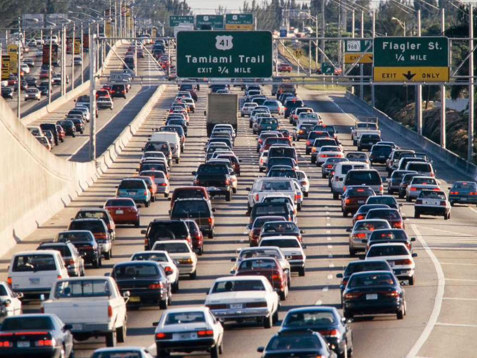
This was work

This was play


So in the end, we identified 241 items
and after reliability testing, 162 ended
up in the original IMI.
It was GREAT! We had done it. We had
measured urban design!
BUT
We had built a tool for measurements
sake.
I’ve since fielded dozens of calls from
researchers and practitioners asking us
how to use this thing – and as the grad
student on the project, I was really the
only one who knew what to do with it!
IRVINE MINNESOTA INVENTORY Page 1
Date 1 2 3 4 5 6 7 8
Time
Observer
Segment #
Answer questions 1-6 based on this end of the segment
Intersection
Neighborhood Identification1. Are there monuments or markers including neighborhood entry
signs that indicate that one is entering a special district or area? 1 yes = 1; no = 0
Street Crossing2a. Consider the places on the segment that are intended for
pedestrians to cross the street. Are these places marked for pedestrian
crossing? Mark N/A if there are no intended places to cross. 2 all = 2; some = 1; none = 0; NA = 8
2b. What type of marking do the crosswalks have? Mark all that
apply. Mark N/A if 2a= 0 or 8
White painted lines 3 yes = 1; no = 0; NA = 8
Colored painted lines 4 yes = 1; no = 0; NA = 8
Zebra striping 5 yes = 1; no = 0; NA = 8
Different road surface or paving (e.g. tiles, colored concrete, marble,
etc) 6
yes = 1; no = 0; NA = 8
Other 7 yes = 1; no = 0; NA = 8
3. Are there curb cuts at all places where crossing is expected to
occur? Mark N/A if there are no intended places to cross.8 all = 2; some = 1; none = 0; NA = 8
4. What type of traffic/pedestrian signal(s)/system(s) is/are provided?
Mark all that apply.
Traffic signal 9 yes = 1; no = 0
Stop sign 10 yes = 1; no = 0
Yield sign 11 yes = 1; no = 0
Pedestrian activated signal 12 yes = 1; no = 0
Pedestrian crossing sign 13 yes = 1; no = 0
Pedestrian overpass/underpass/bridge 14 yes = 1; no = 0
5. For an individual who is on this segment, how safe (traffic wise) do
you think it is to cross the street from this segment? 15
pretty/very safe = 1;
not very safe/ unsafe = 0; cul de sac = 8
6. For an individual who is on this segment, how convenient (traffic
wise) do you think it is to cross the street from this segment?
16
pretty/very convenient =1;
not very/inconvenient= 0;
cul de sac = 8
Answer questions 7-11 while standing at the beginning of the segmentNeighborhood Identification
7. Does the segment have banners that identify the neighborhood? 17 some/a lot = 2; few = 1; none = 0
Street Characteristics
8a. Is this a pedestrianized street? 18 yes = 1; no = 0
8b. Is the street a … 19 one way = 1; two way = 2
9. Is this segment an alley? 20 yes = 1; no = 0
10. How many vehicle lanes are there for cars? (Include turning lanes).
21
six or more = 6; five = 5; four = 4;
three = 3; two = 2; one = 1;
NA (no lanes for car travel) = 8
Views
11a. Is this segment characterized by having a significant open view
of an object or scene that is not on the segment? The view must be a
prominent one. 22
yes = 1; no = 0
11b. How attractive is the open view?
23
attractive = 3; neutral = 2; unattractive =
1; NA (no views) = 8
Begin walking along segment to answer questions 12-6812a. What types of land uses are present on this area? Mark all that
apply.
Residential
Single family home - detached 24 yes = 1; no = 0
Single family home/duplex - attached (2 units or fewer) 25 yes = 1; no = 0
Town home/condo/apartment housing (3 units or more) 26 yes = 1; no = 0
Mobile homes (includes manufactured homes) 27 yes = 1; no = 0
Residential, other 28 yes = 1; no = 0

But even before the ink was dry on the IMI, I met a group of “urban brokers” –
renegades – from Houston that wanted to tell the story of place, or lack of
thereof in their case. They planned to rank several neighborhoods in Houston
based on their sense of place. As the purported methods girl, I asked them how
they planned to do that. They had no clue – they were planning to have a
group of “experts” subjectively judge these places. Enter light bulb moment – so
hey, I have this tool… I was forced to come up with a quick and dirty
methodology – the very first version of my State of Place algorithm (which I’ll get
to later) – to use the IMI to tell a story about neighborhoods' Sense of Place! We
gave each of the 12 neighborhoods grades and everything. In 2005!
Now I really thought I had my eureka moment…we thought this would incite
these neighborhoods to think about Place, to compete on the basis on Place.
But again, this was 10 years ago. Even if we had begun to define the nuts and
bolts of great places
It couldn’t just be about health. It couldn’t just be about sense of place. I STILL
had to show them the money if I wanted them to consider place in the equation.
I realized I had to learn a whole new language – and method. The language of
real estate economics and finance.
I audited a real estate development class, jumped feet first into an intense
relationship with the Urban Land Institute, got countless headaches from trying to
figure out all of the jargon and oh my God, the acronyms. If you think we urban
planners and designers have acronyms. Wow.
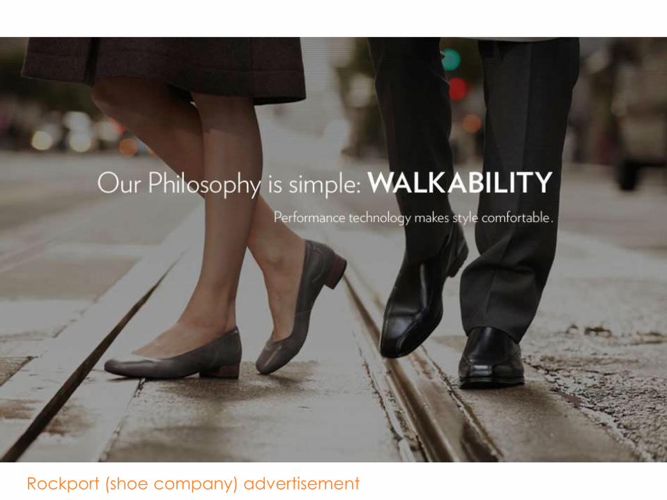
Rockport (shoe company) advertisement
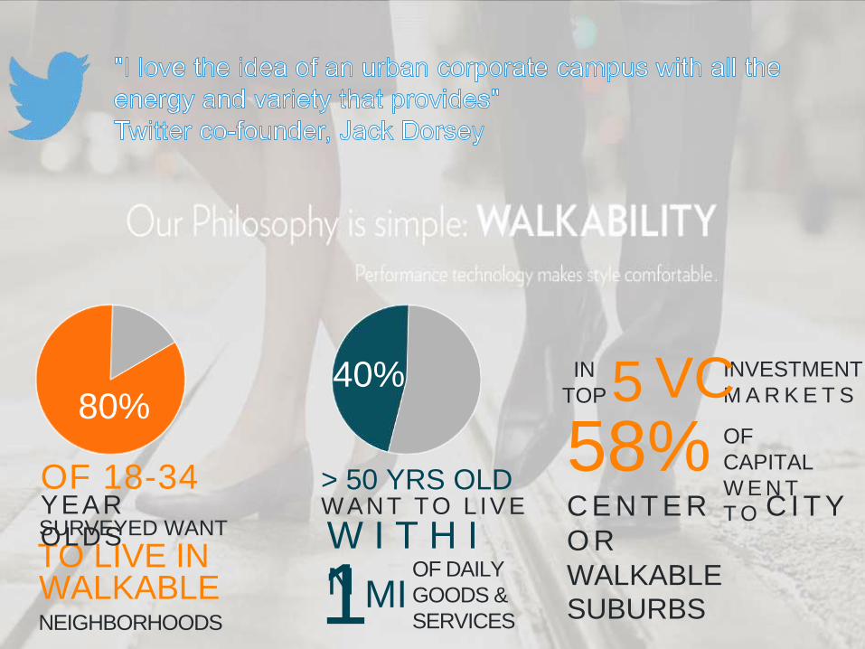
80%
OF 18-34
SURVEYED WANT
TO LIVE INWALKABLENEIGHBORHOODS
YEAR
OLDS
40%
W I T H I
N OF DAILY
GOODS &
SERVICES1
WANT TO L IVE> 50 YRS OLD
MI
5 INVESTMENT
M A R K E T S
58%
IN
TOP VCOF
CAPITAL
W E N T
T OC E N T E R C I T Y
O R
WALKABLESUBURBS

172% Retail Sales
3 YearsDumbo
Brooklyn, NY


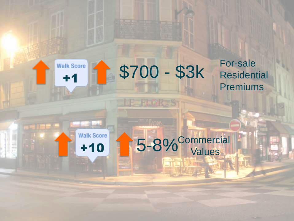
5-8%Commercial
Values
$700 - $3kFor-sale
Residential
Premiums
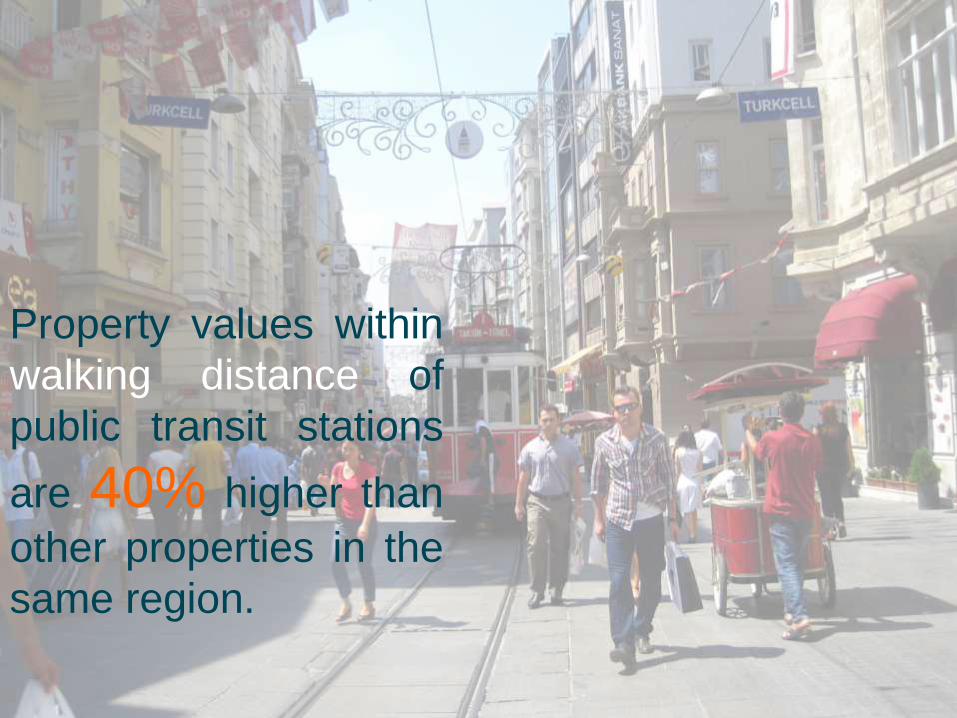
Property values within
walking distance of
public transit stations
are 40% higher than
other properties in the
same region.

Residential values in
walkable neighborhoods
experienced less than
half the average decline
in value from the
housing peak in the mid
2000s

Residential values more stable in walkable neighborhoods
Have experienced less than half the average decline in value from the housing peak
A 10pt increase in Walk Score linked to 5-8% increase in commercial values
A 1pt increase in Walk Score linked to $700-$3000 for-sale residential premiums
Avg. operating cost /yr., Bike: $308
Avg. operating cost/yr. Car: $8,220
Urban mixed-use developments generate 25-59x revenue/acre than suburban counterparts
1% rise in urban sprawl index increases obesity risk by 0.5%
In 2008, medical $$ to treat obesity in US, approx. $147B

Municipal Property Tax Yield (per acre)
in Raleigh, NC, 2011
$2,078
$2,837
$22,175
$26,098
$30,057
$110,461
Walmart
Single-family residential
Crabtree Valley Mall
3-4 story Residential
3 story Office
6 story Mixed-use
Outside central
business district
Within central
business district
Silver, M. (2012). Presentation for the City of Raleigh.

Mixed Use Development vs. Sprawl
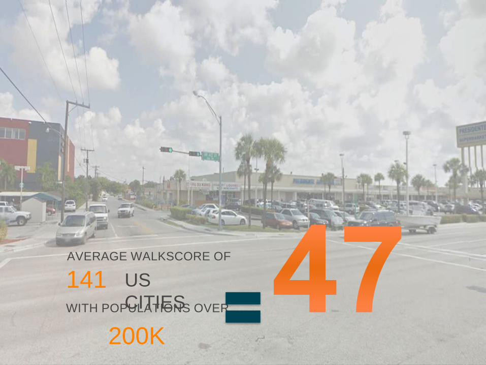
141AVERAGE WALKSCORE OF
US CITIESWITH POPULATIONS OVER
200K


When you aggregate what that means in terms of going from the lowest to the highest level of State of Place, the numbers are quite startling.FISCAL CONSTRAINTS
SETTING PRIORITIES
BUY-IN
POLITICAL WILL
COMMUNITY SUPPORT
MEASURING IMPACT
FROM
HERE
TO
THERE

And then came Brookings! I finally had the opportunity to truly tie built environment features not just to walking, health, sense of place and community, but to economic value. We gathered IMI and real estate data from over 60 neighborhoods in the Washington DC Metro area that were sampled from over 240 neighborhoods along a continuum of walkability, from the auto-dominated exurbs to the highly walkable core. A meta-analyses examining the results of dozens of studies evaluating the relationship between the built environment and walking guided the development of the first official State of Place algorithm – finally! I created a comprehensive index, ranging from 0 to 100, to make sense out of the 162 data points we were gathering with the IMI. I’ll go into that more in just a little bit, but first the real Eureka moment:
BR
OO
KIN
GS
| May 2
012
4
Figure 1. Neighborhoods Included in Study and their Walkability Scores
Very Low
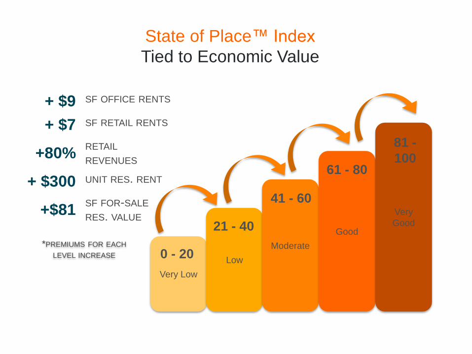
State of Place™ Index
Tied to Economic Value
0 - 20Low
Moderate
Good
Very
Good21 - 40
41 - 60
61 - 80
81 -
100
*PREMIUMS FOR EACH
LEVEL INCREASE
+ $9 SF OFFICE RENTS
+ $7 SF RETAIL RENTS
+80% RETAIL
REVENUES
+ $300 UNIT RES. RENT
+$81SF FOR-SALE
RES. VALUE
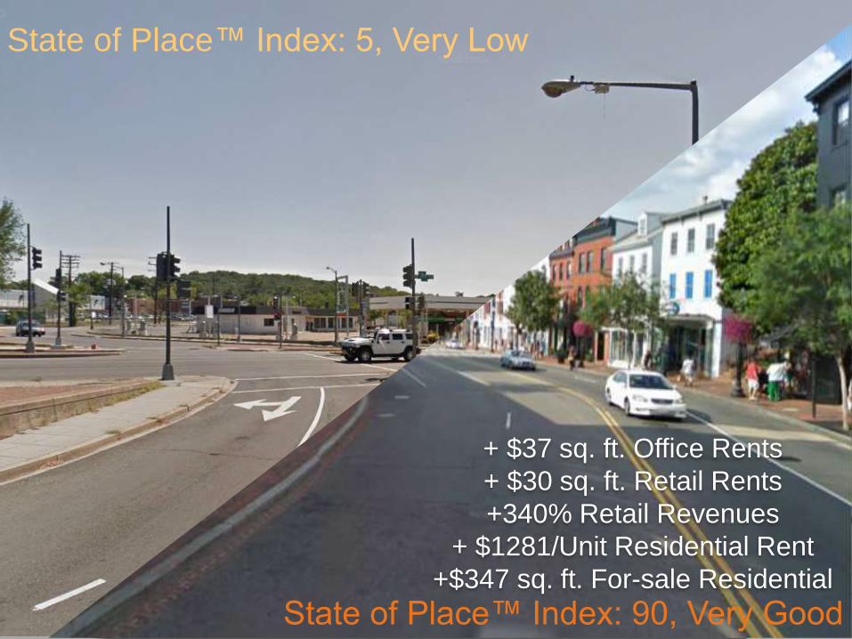
When you aggregate what that means in terms of going from the lowest to the highest level of State of Place, the numbers are quite startling.
+ $37 sq. ft. Office Rents
+ $30 sq. ft. Retail Rents
+340% Retail Revenues
+ $1281/Unit Residential Rent
+$347 sq. ft. For-sale Residential
State of Place™ Index: 90, Very Good
State of Place™ Index: 5, Very Low

And all in all, these premiums have serious implications for economic development in terms of retail and property tax bases
WASHINGTON, DC
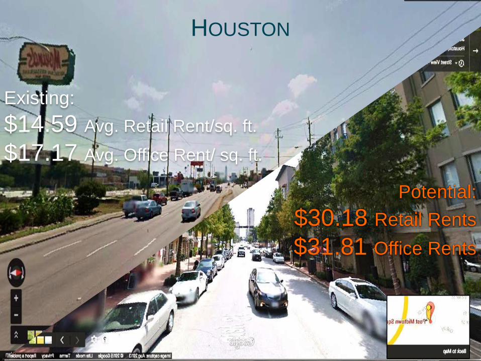
Existing:
$14.59 Avg. Retail Rent/sq. ft.
$17.17 Avg. Office Rent/ sq. ft.
Potential:
$30.18 Retail Rents
$31.81 Office Rents
HOUSTON
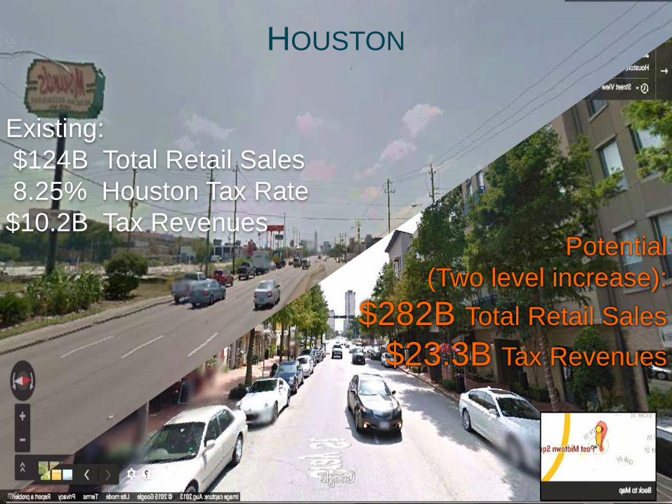
HOUSTON
Existing:
$124B Total Retail Sales
8.25% Houston Tax Rate
$10.2B Tax RevenuesPotential
(Two level increase):
$282B Total Retail Sales
$23.3B Tax Revenues
TM
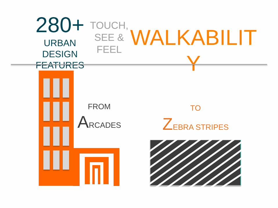
280+URBAN
DESIGN
FEATURES
TOUCH,
SEE &
FEELWALKABILIT
Y
FROM
ARCADES
TO
ZEBRA STRIPES

TRAINING
VIDEO
+
INTERACTIVE
QUIZ
TRAINED COMMUNITY
MEMBERS OR STAFF
COLLECT DATA
MINUTES/B
L O C K
10-15
STATE OF
PLACE APP
SEAMLESSLY
TRANSFERS
DATA TO
SERVERS

0% 20% 40% 60% 80% 100%
DENSITY
FORM
CONNECTIVIT
YPROXIMITY
PARKS & PUBLIC
SPACES
RECREATIONAL FACILITIES
PEDESTRIAN & BIKE
AMENITIESTRAFFIC SAFETY
AESTHETICS
PERSONAL SAFETY
URBAN
FABRIC
DESTINATIONS
HUMAN
NEEDS &
COMFORT
LIVELINESS &
UPKEEP
STATE OF PLACE™ INDEX & PROFILE

For Density, we are measuring building compactness and height, not so much population density – this is particularly important in terms of making it feasible to have enough destinations to walk to within a reasonable walking distance. It can also influence the scale of city – is it for cars or people?
DENSITYCompactness &
Height

Related to that is Urban Form. Here we are measuring streetscape continuity, so we take into account building setbacks, how the building meets the street, the siting of buildings, and the number and width of buildings. This is what I like to call the hugability of a street. If the form is off, a street can feel aloof or it can feel suffocating. You know you’ve achieved the right proportions of setbacks, street width, and building height when it feels like the street is hugging you.
FORMStreetscape
Continuity

CONNECTIVITYAccess &
Barriers
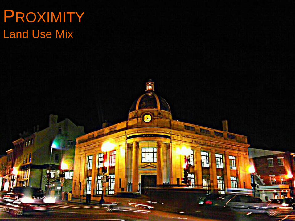
Proximity refers to the diversity of the land use mix – the number of non-residential land uses there are to walk to. So literally, how many of your daily needs, services, and amenities are present within a certain distance of you
PROXIMITYLand Use Mix
Photo Credit Nakeva Corothers
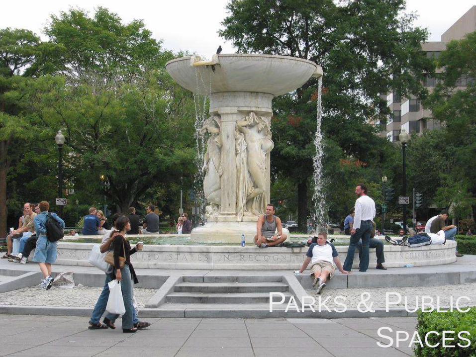
With parks and public spaces, we include the presence hard and soft scape public spaces, as well as their quality and accessibility. These are often the soul and life of neighborhoods, they are the city’s living rooms. Along with museums and monuments, these are the places you bring your friends and families to when they come visit. I can tell a lot about a city based on how people use their public spaces.
PARKS & PUBLIC
SPACESPresence, Quality & Access

We also look at recreational facilities –separately. This is getting a bit more at recreational walking, but the literature found this to be an important determinant for physical activity, so we measure the presence of outdoor and indoor physical activity facilities.
RECREATIONAL
FACILITIES
Photo Credit Bill Cotter

Pedestrian and bike amenities refer to aspects of the built environment that make it comfortable or pleasant to be a pedestrian, so sidewalk presence and quality, seating, bike lane presence and type, street trees, etc. Along with form, these are the features that truly help distinguish car-focused neighborhoods from people-first places – they are the things that make you want to linger…
PEDESTRIA
N
& BIKE
AMENITIES
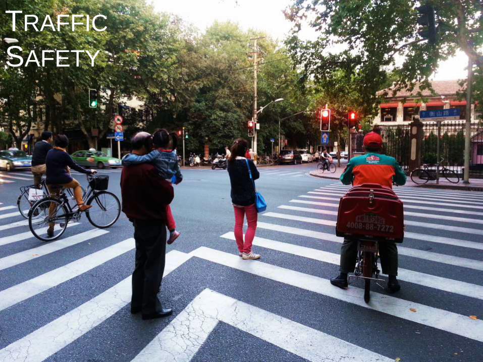
Along with that, we look at traffic safety. Here we are mainly focusing on the quality and safety of the intersection as well as the presence of traffic calming features. These include the presence of curbcuts, crosswalk markings, traffic standards, and on-street parking. These are the features that help manage all of the mobile members of the public realm – people, strollers, bicyclists, scooters, cars, and buses.
TRAFFIC
SAFETY
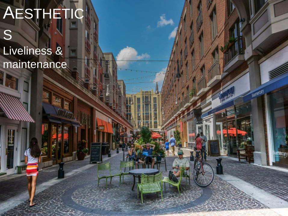
Aesthetics goes beyond the visually pleasing; it also includes aspects of urban design that make places more dynamic and inviting. We look at the transparency of buildings, colors, outdoor dining, street trees, building maintenance, ground floor uses, etc. This is charm, character, the wow factor – the things you’ll most remember about places.
AESTHETIC
SLiveliness &
maintenance
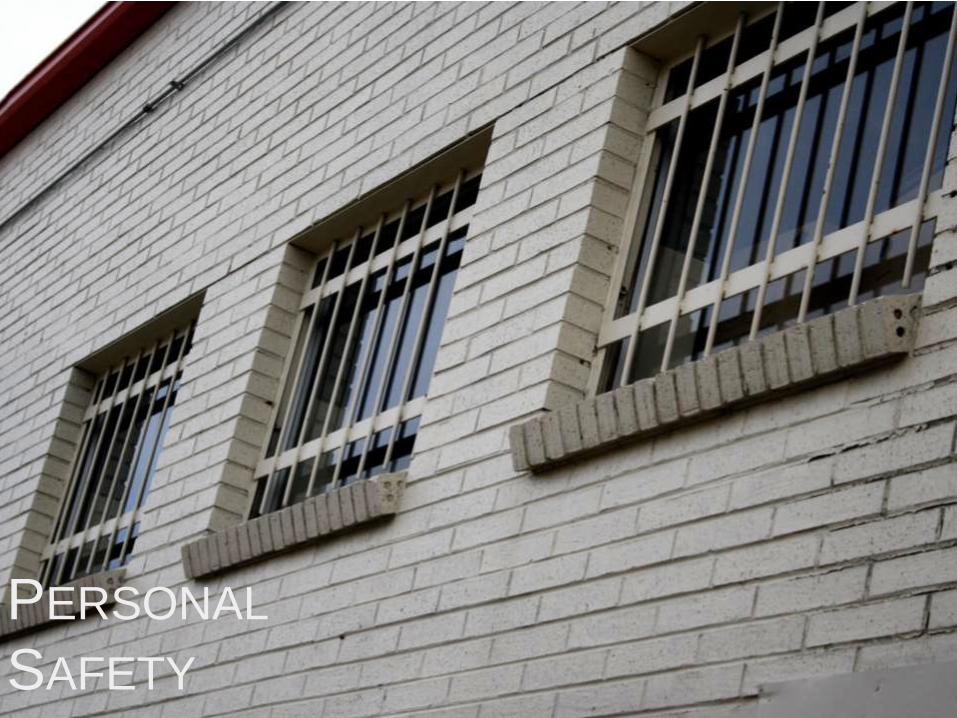
Finally, personal safety refers not to actual crime data but rather the aspects of the built environment that influence our perception of safety – these are called physical incivilities and include features like graffiti, litter, broken windows, abandoned buildings and lighting. These features actually influence walking rates more than the rates of crime incidents.
PERSONAL
SAFETY

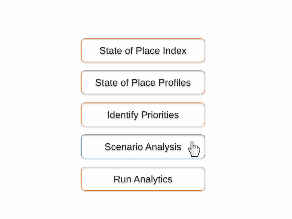
Identify Priorities
State of Place Index
State of Place Profiles
Scenario Analysis
Run Analytics
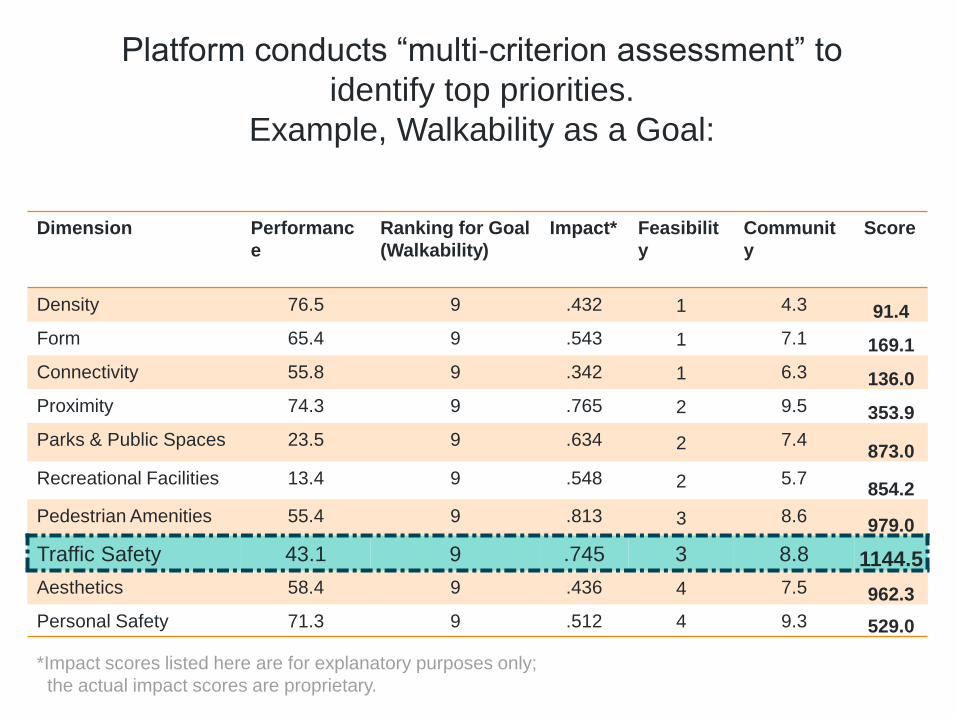
Platform conducts “multi-criterion assessment” to
identify top priorities.
Example, Walkability as a Goal:
Dimension Performanc
e
Ranking for Goal
(Walkability)
Impact* Feasibilit
y
Communit
y
Score
Density 76.5 9 .432 1 4.3 91.4
Form 65.4 9 .543 1 7.1 169.1
Connectivity 55.8 9 .342 1 6.3 136.0
Proximity 74.3 9 .765 2 9.5 353.9
Parks & Public Spaces 23.5 9 .634 2 7.4873.0
Recreational Facilities 13.4 9 .548 2 5.7854.2
Pedestrian Amenities 55.4 9 .813 3 8.6979.0
Traffic Safety 43.1 9 .745 3 8.8 1144.5
Aesthetics 58.4 9 .436 4 7.5 962.3
Personal Safety 71.3 9 .512 4 9.3 529.0
*Impact scores listed here are for explanatory purposes only;
the actual impact scores are proprietary.
Identify Priorities
State of Place Index
State of Place Profiles
Scenario Analysis
Run Analytics
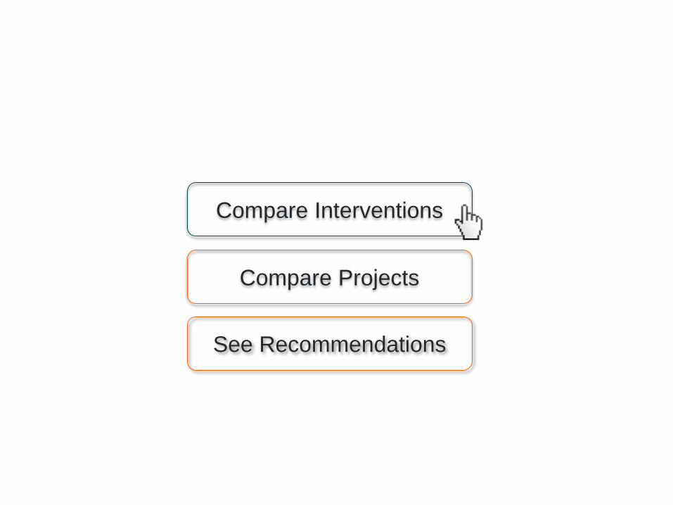
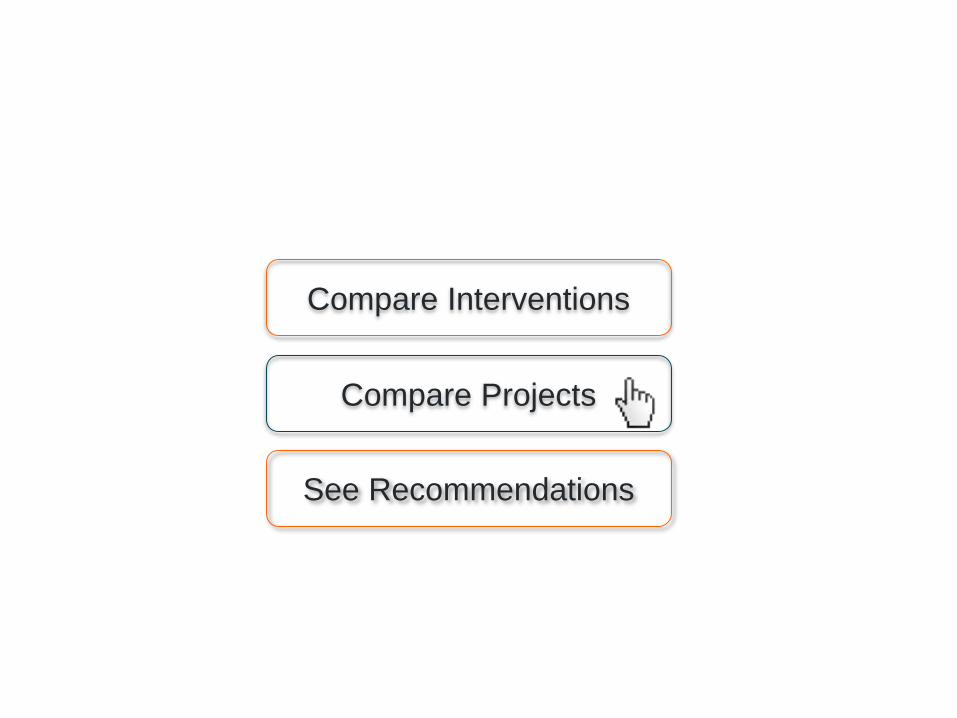
Compare Interventions
See Recommendations
Compare Projects
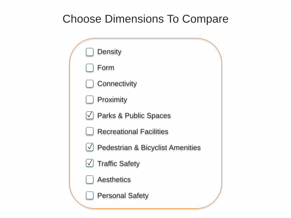
Choose Dimensions To Compare
Density
Form
Connectivity
Proximity
Parks & Public Spaces
Recreational Facilities
Pedestrian & Bicyclist Amenities
Traffic Safety
Aesthetics
Personal Safety
✓
✓
✓

Parks &
Public Spaces
$80,000
Pedestrian & Bicyclist
Amenities
Traffic
Safety
Add Park
Add Plaza
New PlazaPark Maintenance
Arcades
Benches
Sidewalk Buffers
Street Trees
Sidewalk Buffers
Crosswalks
Curbcuts
Midblock Crossing
Pedestrian Countdown
CurbCuts
Enter Project Cost Enter Project Cost
Select Interventions

Com. property tax
For-sale residential
Office rents
Retail rents
Residential rents
Res. property taxes
Vacancy Rates
Retail Rents
Enter Baseline
Select Goal
Calculate Predicted ROI

Parks &
Public Spaces
$80,000
Pedestrian & Bicyclist
Amenities
Traffic
Safety
$300,000 $150,000
$1.09/sf $0.89/sf
Park Maintenance Sidewalk Buffers Curbcuts
$1.43/sf
Predicted ROI: Retail Rents
+4.3% +3.1% +3.7%
Impact on State of Place Index

Parks &
Public Spaces
$80,000
Pedestrian & Bicyclist
Amenities
Traffic
Safety
$300,000 $150,000
$1.09/sf $0.89/sf
Park Maintenance Sidewalk Buffers Curbcuts
$1.43/sf
Predicted ROI: Retail Rents
+4.3% +3.1% +3.7%
Impact on State of Place Index
$1.36/dollar $.03/dollar $.10/dollar
Value for Money: 100k sqft
$109k $89k $143k
Total Value Captured: 100k sqft
Compare Interventions
See Recommendations
Compare Projects

Enter Project Cost Enter Project Cost
Enter Project Information
Neighborhood 1
$1,800,000
Neighborhood 1 Neighborhood 1
Project 1 Project 2 Project 3

Com. property tax
For-sale residential
Office rents
Retail rents
Residential rents
Res. property taxes
Vacancy Rates
Retail Rents
Enter Baseline
Select Goal
Calculate Predicted ROI

Neighborhood 1
$1,800,000
Neighborhood 1 Neighborhood 1
$2,700,000 $2,300,000
$1.43/sf $0.99/sf
Project 1 Project 2 Project 3
$1.56/sf
Predicted ROI: Retail Rents
+6.0% +2.0% +11.0%
Impact on State of Place Index
Map It

We are doing this currently for one of our clients who is managing a $30M equity fund focusing on underserved neighborhoods in Boston. They are using State of Place to help identify which development projects will have the most impact on Place – and ultimately informing which ones they will fund.
Predicted ROI Impact of Proposed Projects

