identification of the property
TRANSCRIPT

Chapter1Identification of
the Property

5
Chapter 1Identification of the Property
Chapter 1 Identification of the Property
1.a CountryJapan
1.b State, Province or RegionNagasaki Prefecture and Kumamoto Prefecture
1.c Name of PropertyHidden Christian Sites in the Nagasaki Region
1.d Geographical coordinates to thenearest second
The property that the Government of Japan hereby nominates forinscription on the World Heritage List, ‘Hidden Christian Sites inthe Nagasaki Region’, is located in the coastal area and remote is-lands in the northwestern part of Kyushu Island of the Japanese Ar-chipelago, which is situated at the eastern edge of East Asia.
The nominated property consists of 12 components, and theirlocations are listed in Table 1-001.

6
Chapter 1Identification of the Property
Table 1-001 The location and area of each component
Idn° Name of the component part Regions / Districts
Coordinatesof the Cen-tral Point
Area of theBuffer Zone
(ha)Map N°
Area of Nom-inated com-
ponent of theProperty (ha)
001
004
002
003
005
006
010
009
008
007
012
011
Remains of Hara Castle
Sakitsu Village in Amakusa
Kasuga Village and SacredPlaces in Hirado(Kasuga Village and Mt. Ya-sumandake)
Kasuga Village and SacredPlaces in Hirado(Nakaenoshima Island)
Shitsu Village in Sotome
Ono Village in Sotome
Villages on Hisaka Island
Egami Village on Naru Island(Egami Church and its Sur-roundings)
Villages on KashiragashimaIsland
Remains of Villages onNozaki Island
Oura Cathedral
Villages on Kuroshima Island
Nagasaki Prefec-ture (Minami-shimabara City)
Kumamoto Prefec-ture (AmakusaCity)
Nagasaki Prefec-ture (Hirado City)
Nagasaki Prefec-ture (Hirado City)
Nagasaki Prefec-ture (NagasakiCity)
Nagasaki Prefec-ture (NagasakiCity)
Nagasaki Prefec-ture (Goto City)
Nagasaki Prefec-ture (Goto City)
Nagasaki Prefec-ture (Shinkamig-oto Town)
Nagasaki Prefec-ture (Ojika Town)
Nagasaki Prefec-ture (NagasakiCity)
Nagasaki Prefec-ture (SaseboCity)
N 32°37′44″E 130°15′16″
N 33°20′22″E 129°26′38″
N 33°22′25″E 129°27′52″
N 32°18′44″E 130°1′33″
N 32°50′42″E 129°42′2″
N 32°51′53″E 129°41′9″
N 33°11′13″E 129°7′46″
N 33°0′44″E 129°10′58″
N 32°47′26″E 128°52′48″
N 32°48′8″E 128°54′14″
N 33°8′21″E 129°32′13″
N 32°44′3″E 129°52′12″
1,181.60
1,934.27
152.14
479.25
198.22
1,824.40
934.76
228.48
3,589.98
1,581.65
47.68
Figure 1-005
Figure 1-007
Figure 1-009
Figure 1-011
Figure 1-013
Figure 1-017
Figure 1-019
Figure 1-023
Figure 1-021
Figure 1-015
Figure 1-025
48.48
320.50
2.96
1.28
35.07
58.09
704.75
111.48
94.11
3,732.72
458.99
0.91
5,569.34 12,152.43Total area (in hectares)

7
Chapter 1Identification of the Property
0°
15° S
30°
45°
45°
60°
75°
60°
15° N
30°
75°
15° W 10°5°E 25° 50° 35°40° 65°55° 80°70° 95°85° 110°100° 125°140°155°170° W175°115° 130° 145° 160°
40002000km
0
°75
°60
°45
°30
N°° 15
°0
°60
°45
°30
S°° 15
0
E°5 W°15°75
°60
km
2000
4000
°55°40°25°10 115°100°85°70 °160°145°130°115 175 °175 W°° 170 °155 °140 °125 °110 °95 80 ° °65 °35°50Figure 1-001 World map indicating the location of Japan
Japan
Nagasaki PrefectureKumamoto Prefecture
1000500km
0
napaJ
eferPotomamuKtceferPikasagaN
erutce
erut
10000km
500
00
Figure 1-002 Map indicating the location of Nagasaki Prefecture, Kumamoto Prefecture, and Japan
Japan
130°115°100° 145° 160°
30°
40°
20°
50°

8
Chapter 1Identification of the Property
Kagoshima
Prefecture
NagasakiPrefecture
Saga
Prefecture
KumamotoPrefecture
Miyazaki
Prefecture
Oita
Prefecture
Fukuoka
Prefecture
10050km
0
SagaaSaga
Prefecture
Fukuokka
Prerefefeccturere
Fukuoka
Prefecture
rPrefectur
Prefecmm
eNagasakiPrereffectturereNagasaki
ctct
P ef temm
Saga
Prerefefectctur
Saga
P fectureKumamoPreeefeectuKumamoK amoK amoK
ure
re
Prefecturere
Prefectu
ooreoo
ree
otoureeotooo P
Miyazaki
Prereffectcturere
Miyazaki
Oitta
Prereffectctu
Oita
ee
ure
e
urere
P efecture
Pre
Pre ecfee
Kaa
Prre
Ka
Pre ecfeePrreefefecttu
efecture
re
goshima
efeffectcturere
ur
goshima
reurere
0
km
50 100
Figure 1-003 Map indicating the relevant location on Kyusyu Island
130° 132°
34°
32°
30°

Figure 1-004 Map indicating the location of the nominated property and buffer zones
1.e Maps and plans, showing the boundaries of the nominated property and buffer zone
9
Chapter 1Identification of the Property

10
Chapter 1Identification of the Property

11
Chapter 1Identification of the Property
32°37’32°37’
32°38’32°38’
32°39’32°39’
32°40’32°40’
130°
16’
130°
16’
130°
15’
130°
15’
130°
14’
130°
14’
Nominated propertyNominated property Buffer zoneBuffer zone
scale = 1/30,000scale = 1/30,000
130°
144’
130°
15’
130°
16’
1
3232°4°4400’
1
32322°°3399’
32322°°3388’
N o m i n at te te d p ro ro p e rt rty ty
s c a l e = 1 /3 /3 0 , 0 0 0
32322°37’°37377’
B u uff ffe fe r z o n e
Figure 1- 005 Map indicating the extent of the nominated property and buffer zone (Created based on thedigital map of the Geospatial Information Authority of Japan (GSI).)
001 Remains of Hara Castle

12
Chapter 1Identification of the Property
001 Remains of Hara Castle
Figure 1-006 Map indicating the extent of the Remains of Hara Castle

13
002, 003 Kasuga Village and Sacred Places in Hirado
Chapter 1Identification of the Property
33°19’
33°20’33°20’
33°21’33°21’
33°23’33°23’
33°22’33°22’
129 °
29’
129°
29’
129 °
28’
129°
28’
129 °
27’
129°
27’
129 °
26’
129°
26’
33°19’Nominated propertyNominated property Buffer zoneBuffer zone
scale = 1/40,000scale = 1/40,000
0 0.4 0.8 1.2 1.6 2.0 (km)0 0.4 0.8 1.2 1.6 2.0 (km)
1229°9°°
2266’
12299°°
27277’
12299°°
2288’
1229°9°°
2299’
1
1
1
33333°°23’233’
1
33333°°22’22’2’
33°21’33°21’3°°211’
33°20’33°20’3°°2200’
te te
s s
N o m i n at ate e d p ro ro p e rt rty y
s c a l e = 1 /4 /4 0 , 0 0 0
0 0 0.4 4 0 1.2 1.6 2.0 (km). 8 2.0 (km) 1.2 1.6 2.0 (km) . 1.6 2.0 (km) .2 1.6 2.0 (km) 1.6 2.0 (km) 1.6 2.0 (km) 1.6 2.0 (km)
33°19’33°19’3°19’°19’9B u ff ffe fe r z o n e
1.6 2.0 (km) 1.6 2.0 (km) 1.6 2.0 (km) 1.6 2.0 (km) 1.6 2.0 (km) 1.6 2.0 (km) 1.6 2.0 (km) 1.6 2.0 (km)
Figure 1- 007 Map indicating the extent of the nominated property and buffer zone (Created based on thedigital maps of the GSI.)

14
Chapter 1Identification of the Property
002, 003 Kasuga Village and Sacred Places in Hirado
Figure 1-008 Map indicating the extent of Kasuga Village and Sacred Places in Hirado

15
Chapter 1Identification of the Property
004 Sakitsu Village in Amakusa
scale = 1/20,000
32°18’32°18’
32°19’32°19’
32°20’32°20’
130 °
02’
130°
02’
130 °
01’
130°
01’
0 0.2 0.4 0.6 0.8 1.0 (km)
scale = 1/20,000
0 0.2 0.4 0.6 0.8 1.0 (km)
Nominated property Buffer zone
13300°°
011’
13300°°
02022’
32322°°2200’
32°19’32°19’2°19’°199’
s
0
c a l e = 1 /2 /2 0 , 0 0 00
0 . 2 0 . 4 0 . 6 0 . 8
N o m i n at ate e d p ro ro p e rt rty ty
32°18’32°18’2°18’°188’
1 . 0 ( k m )
B u ff ffe fe r zo o n e
Figure 1-009 Map indicating the extent of the nominated property and buffer zone (Created based on the dig-ital maps of the GSI.)

16
Chapter 1Identification of the Property
004 Sakitsu Village in Amakusa
Figure 1-010 Map indicating the extent of Sakitsu Village in Amakusa
0 20 40 60 80 100 (m)
scale = 1/2,000N
Nominated property
Site of the house of village headmen fromthe Yoshida family(present precincts of Sakitsu Church)
Site of the house of village headmen fromthe Yoshida family(present precincts of Sakitsu Church)
Site of a house of Hidden Christian leaders Site of a house of Hidden Christian leaders
Sakitsu Suwa ShrineSakitsu Suwa Shrine
Site of the former Sakitsu Church(Site of the convent)
Site of the former Sakitsu Church(Site of the convent)
17
Chapter 1Identification of the Property
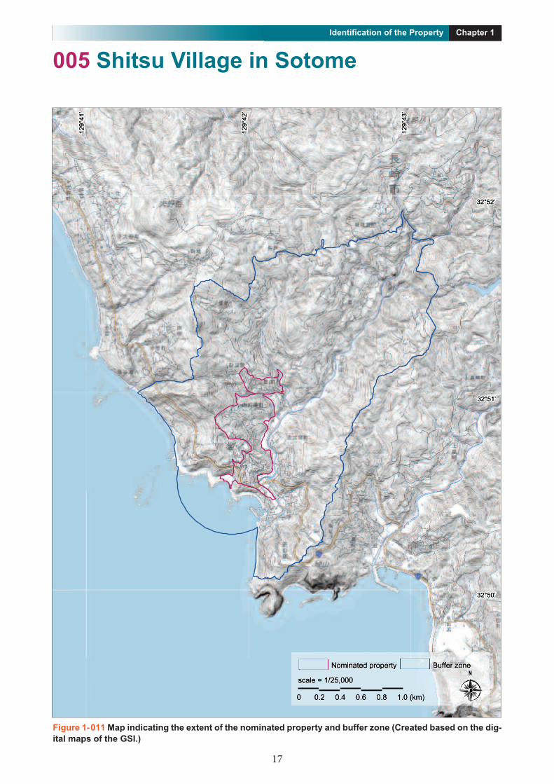
005 Shitsu Village in Sotome
ComponentComponent Buffer zoneBuffer zone
scale = 1/30,000scale = 1/30,000
Nominated propertyNominated property Buffer zoneBuffer zone
scale = 1/25,000scale = 1/25,000
32°50’32°50’
32°51’32°51’
32°52’32°52’
129 °
43’
129°
43’
129°
42’
129°
41’
129°
41’
0 0.2 0.4 0.6 0.8 1.0 (km)0 0.2 0.4 0.6 0.8 1.0 (km)
129°
42’
12299°
44141’
12299°
442422’
1229°
4 49°°
43433’
4
32322°°52’522’
32322°°51’1’
32°500’
s c
0
N o m i n a ate te d p ro ro p e rt rty tyo in
c a l e = 1 /2 /2 5 , 0 00 0
0.8 1.0 (km) 0.8 1.0 (km) 0.8 1.0 (km)0 0.4 0.6 0.8 1.0 (km). 0.8 1.0 (km)2 0.8 1.0 (km) 0 0.8 1.0 (km) . 0.8 1.0 (km) 4 0.8 1.0 (km) 0 0.8 1.0 (km) . 0.8 1.0 (km) 6 0.8 1.0 (km) 0.8 1.0 (km) 0.8 1.0 (km) 0.8 1.0 (km) 0.8 1.0 (km) 0.8 1.0 (km) 0.8 1.0 (km)
B u uff ffe fe r zo o n e
32322°°5500’
0.8 1.0 (km) 0.8 1.0 (km)
Figure 1-011 Map indicating the extent of the nominated property and buffer zone (Created based on the dig-ital maps of the GSI.)

18
Chapter 1Identification of the Property
005 Shitsu Village in Sotome
Figure 1-012 Map indicating the extent of Shitsu Village in Sotome

19
Chapter 1Identification of the Property
006 Ono Village in Sotome
scale = 1/20,000scale = 1/20,000
32°51’32°51’
32°52’32°52’
32°53’32°53’
129°
41’
129°
41’
129°
42’
129°
42’
0 0.2 0.4 0.6 0.8 1.0 (km)0 0.2 0.4 0.6 0.8 1.0 (km)
Nominated property Buffer zone
2299°44
141’
32322°°53533’
2299°44
2422’
12
12
3322°552’
32322°°52522’
s
0
c ca l e = 1 /2 /2 0 , 0 00 0
0 0. 2 0 0.4 .4 0 0. 6 0 0. 8
N o m i n at ate e ed p ro ro p e rt rty ty
( (k km) ) 1 . 0
B u uff ffe fe r z o n e
32°51’32°51’2°51’°51’1’
Figure 1-013 Map indicating the extent of the nominated property and buffer zone (Created based on the dig-ital maps of the GSI.)

20
Chapter 1Identification of the Property
006 Ono Village in Sotome
Figure 1-014 Map indicating the extent of Ono Village in Sotome

21
Chapter 1Identification of the Property
007 Villages on Kuroshima Island
scale = 1/100,000scale = 1/100,000
33°11’33°11’
33°10’33°10’
33°09’33°09’
33°07’33°07’
33°08’33°08’
33°06’33°06’
129°
33’
129°
33’
129°
32’
129°
32’
129°
31’
129°
31’
129°
30’
129°
30’
129°
29’
129°
29’
129°
34’
129°
34’
Nominated propertyNominated property Buffer zoneBuffer zone
scale = 1/50,000scale = 1/50,000
0 0.4 0.8 1.2 1.6 2.0 (km)0 0.4 0.8 1.2 1.6 2.0 (km)
99°°229
’
99°°330
’
99°°3232
’
99°°311
’
99°°3333
’
99°°34344
’
1229
1229
1229
1229
1229
33°11’33°11’3°11’11’
1229
33333°100’
33°09’33°09’3°09’°009’9’
333°08’3°08’°088’
33°07’33°07’3°07’°0707’7’
33°08’33°08’3°08’°008’8’
s c ca l e =
0 0 .
N o m i n at ate e ed p ro ro p e rt rty ty
= 1 /5 /5 50 , 0 0 0
4 0 . 8 1 . 2 1 . 6 2 . 0 ( k m )
33°06’33°06’3°06’°006’6’B u ff ffe fe r zo o n e
( )
Figure 1-015 Map indicating the extent of the nominated property and buffer zone (Created based on the dig-ital maps of the GSI.)

22
Chapter 1Identification of the Property
007 Villages on Kuroshima Island
Figure 1- 016 Map indicating the extent of the Villages on Kuroshima Island

23
Chapter 1Identification of the Property
008 Remains of Villages on Nozaki Island
ComponentComponent Buffer zoneBuffer zone
scale = 1/30,000scale = 1/30,000
Nominated propertyNominated property Buffer zoneBuffer zone
scale = 1/40,000scale = 1/40,000
33°09’33°09’
33°10’33°10’
33°11’33°11’
33°12’33°12’
33°13’33°13’
129°
09’
129°
09’
129°
08’
129°
08’
129°
07’
129°
07’
129°
06’
129°
06’
0 0.4 0.8 1.2 1.6 2.0 (km)0 0.4 0.8 1.2 1.6 2.0 (km)
99°°0066
’
99°°07077
’
99°°0088
’
99°°0099
’
1229
1229
1229
3333°133’
1229
3333°122’
3333°11’
3333°100’
s ca ca l
0
N o m i n at ate e d p ro ro p e rt rty ty
l e = 1 /4 /4 40 , 0 00 0
0 4 0 8 1 2 1 6 2
B u ff ffe fe r zo o n e
2 0 ( (k km) ) 33333°°009’ 0 0 0.4 4 0 0. 8 1 . 2 1 . 6 2 2 . 0 ( (k km) ) 3333 009
Figure 1-017 Map indicating the extent of the nominated property and buffer zone (Created based on the dig-ital maps of the GSI.)

24
Chapter 1Identification of the Property
008 Remains of Villages on Nozaki Island
Figure 1-018 Map indicating the extent of the Remains of Villages on Nozaki Island

25
Chapter 1Identification of the Property
009 Villages on Kashiragashima Island
ComponentComponent Buffer zoneBuffer zone
scale = 1/30,000scale = 1/30,000
Nominated propertyNominated property Buffer zoneBuffer zone
scale = 1/30,000scale = 1/30,000
32°59’32°59’
33°00’33°00’
33°01’33°01’
129°
12’
129°
12’
129°
11’
129°
11’
129°
10’
129°
10’
0 0.2 0.4 0.6 0.8 1.0 (km) 0 0.2 0.4 0.6 0.8 1.0 (km)
12299°
1100’
12299°
11’
12299°
1122’
33°01’33°01’3°01’°01’1’
33°00’33°00’3°00’°00’00’0’
N o m i n at ate e d p ro ro p e rt rty tyin
s c ca l e = 1 /3 /3 30 , 0 0 0
0 0.2 0 . 4 0 . 6 0 . 8 1 . 0 ( k m )
B u ff ffe fe r zo o n eu
32°59’32°59’2°59’°59’59’9’
)
Figure 1-019 Map indicating the extent of the nominated property and buffer zone (Created based on the dig-ital maps of the GSI.)

26
Chapter 1Identification of the Property
009 Villages on Kashiragashima Island
Figure 1-020 Map indicating the extent of the Villages on Kashiragashima Island

27
Chapter 1Identification of the Property
010 Villages on Hisaka Island
scale = 1/100,000scale = 1/100,000
32°52’32°52’
32°50’32°50’
32°48’32°48’
32°46’32°46’
32°44’32°44’
32°42’32°42’
32°40’32°40’
128°
48’
128°
48’
128°
50’
128°
50’
128°
52’
128°
52’
128°
54’
128°
54’
128°
56’
128°
56’
Nominated propertyNominated property Buffer zoneBuffer zone
scale = 1/100,000scale = 1/100,000
4488’
5500’
550 52522’
54544’
3232°°52522’5566’
12288°
44
12288°
5122
85
12288°°
5
12288°
5
3232°°5500’
12288°
5
3232°4°4488’
3232°44466’
3232°4°4444’
s sc a l
N o m i n at ate e ed p ro ro p e rty rty y
e = 1 / 1 0 0 , 0 00 0
3232°4°42422’
B u ff ffe fe r zo o n e
3232°4°4400’
Figure 1-021 Map indicating the extent of the nominated property and buffer zone (Created based on the dig-ital maps of the GSI.)

28
Chapter 1Identification of the Property
010 Villages on Hisaka Island
Figure 1-022 Map indicating the extent of the Villages on Hisaka Island

29
Chapter 1Identification of the Property
011 Egami Village on Naru Island (EgamiChurch and its Surroundings)
ComponentComponent Buffer zoneBuffer zone
scale = 1/30,000scale = 1/30,000
Nominated propertyNominated property Buffer zoneBuffer zone
scale = 1/20,000scale = 1/20,000
32°51’32°51’
32°52’32°52’
128°
55’
128°
55’
128°
54’
128°
54’
0 0.2 0.4 0.6 0.8 1.0 (km)0 0.2 0.4 0.6 0.8 1.0 (km)
12288°°
54544’
12288°°
5555’
32°52’32°52’2°52’°5252’2’
32°51’32°51’2°51’°511’
s
0
N o m i n at ate e d p ro ro p e rt rty ty
c ca l e = 1 /2 /2 0 , 0 0 00
0 . 2 0 . 4 0 . 6 0 . 8
B u ff ffe fe r zo o n eB
( k m ) 1 . 0
Figure 1- 023 Map indicating the extent of the nominated property and buffer zone (Created based on thedigital maps of the GSI.)

30
Chapter 1Identification of the Property
011 Egami Village on Naru Island (Egami Church and its Surroundings)
Figure 1- 024 Map indicating the extent of Egami Village on Naru Island (Egami Church and its Surround-ings)

31
Chapter 1Identification of the Property
012 Oura Cathedral
Figure 1- 025 Map indicating the extent of the nominated property and buffer zone (Created based on thedigital maps of the GSI.)

32
Chapter 1Identification of the Property
Figure 1-026 Map indicating the extent of the Oura Cathedral
012 Oura Cathedral

33
Chapter 1Identification of the Property
1.f Area of nominated property (ha.) and proposedbuffer zone (ha.)
Area of nominated property: 5,569.34 haBuffer zone 12,152.43 haTotal 17,721.77 ha